E17 3EW - 2 bedroom maisonette for sale in Nash House, Prospect Hill,…
View on Property Piper
2 bedroom maisonette for sale in Nash House, Prospect Hill, Walthamstow, London, E17
Property Details
- Price: £350000
- Bedrooms: 2
- Bathrooms: 1
- Property Type: undefined
- Property SubType: undefined
Brochure Descriptions
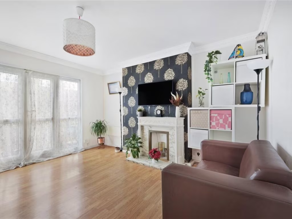
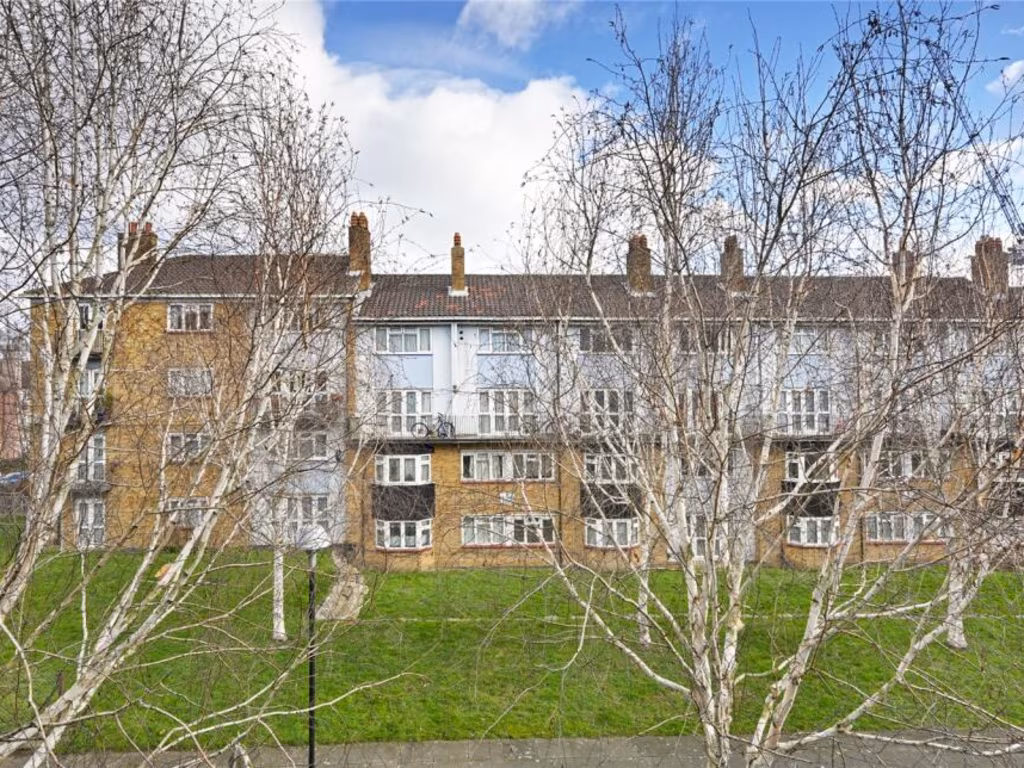
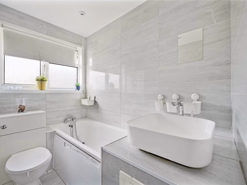
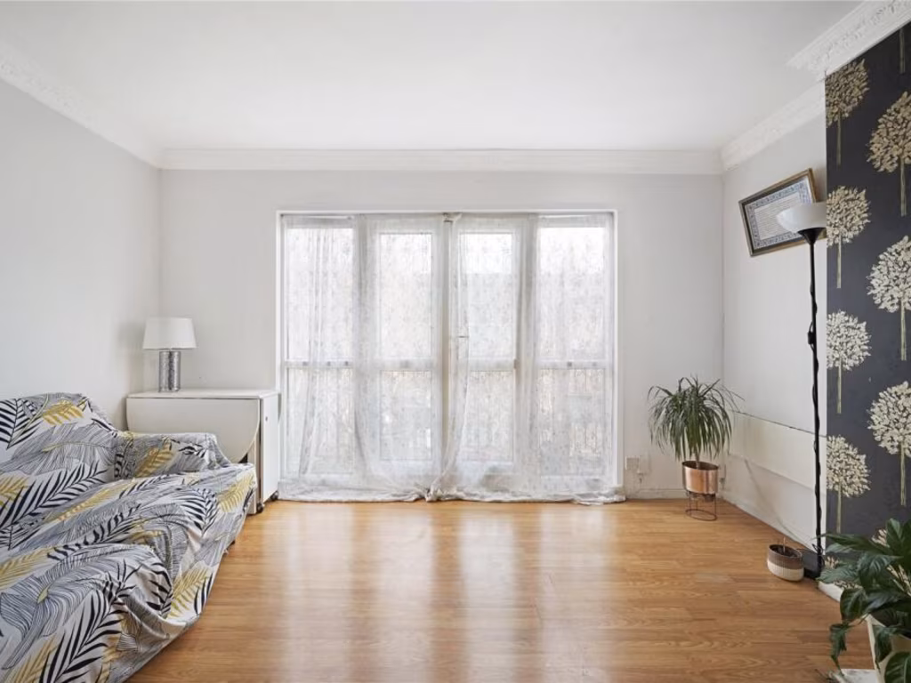
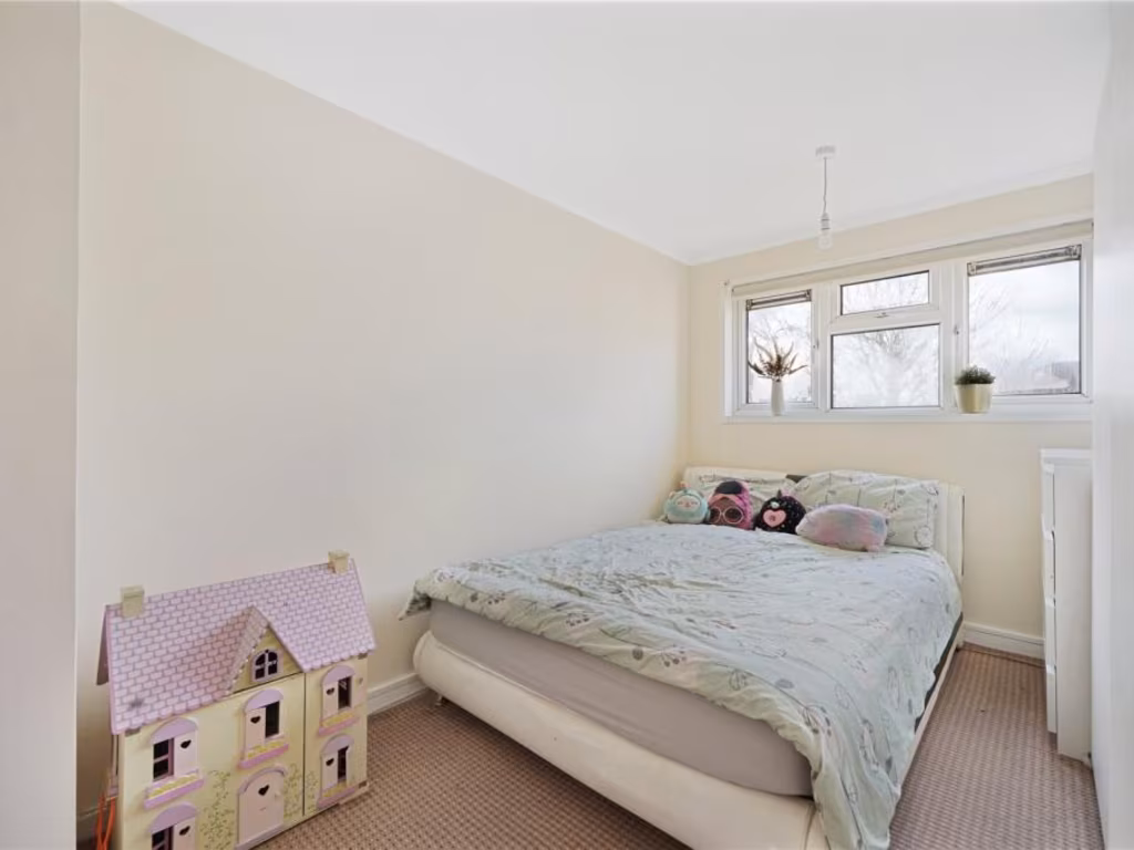
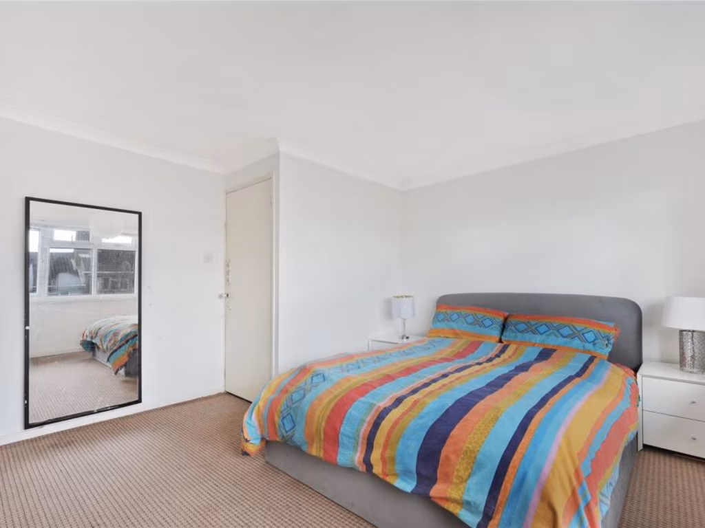
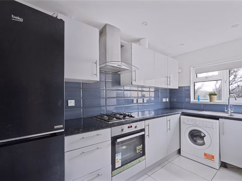
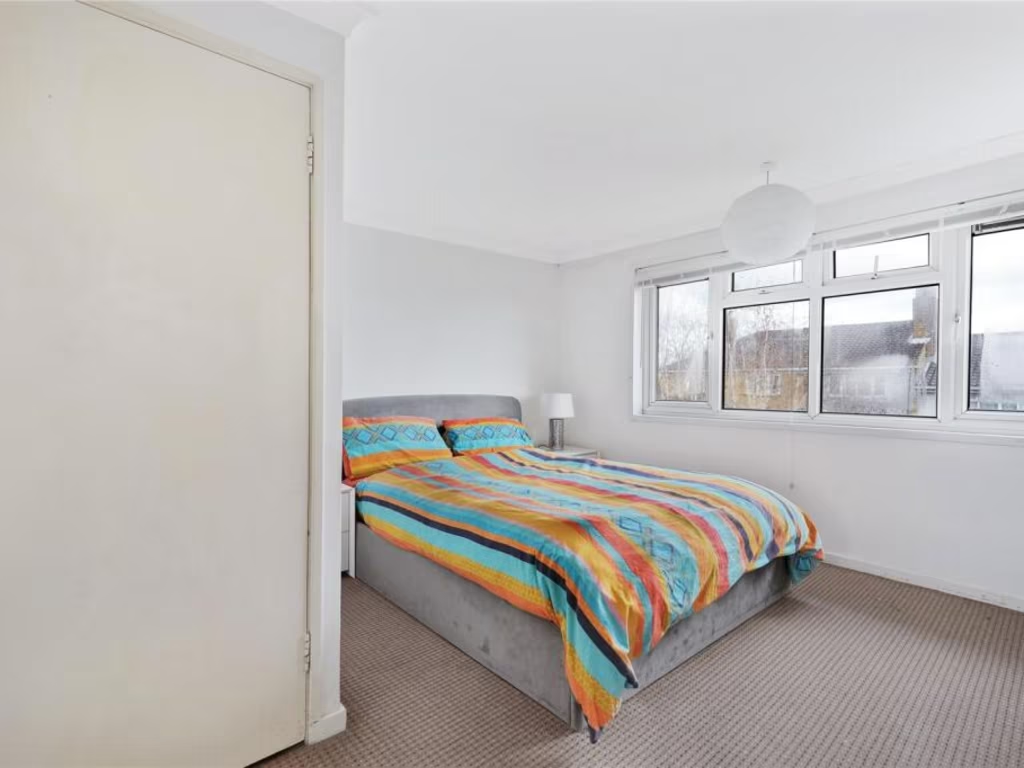
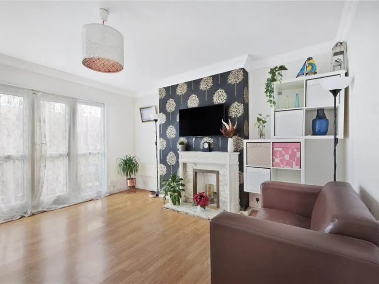
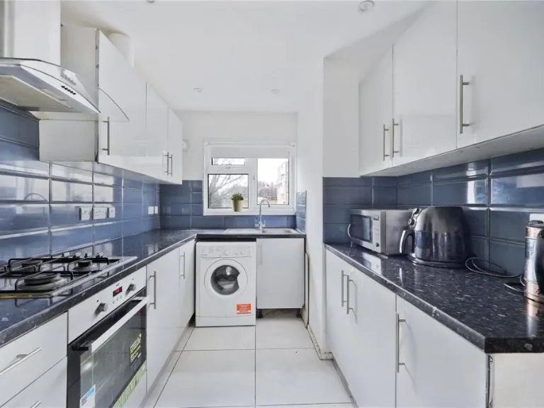
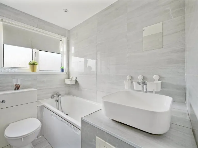
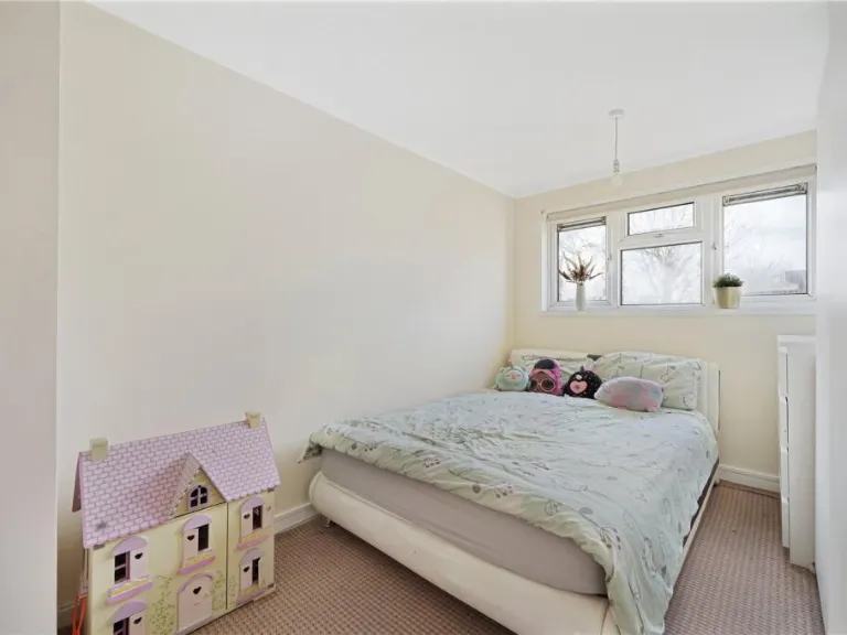
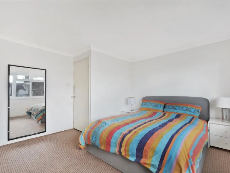
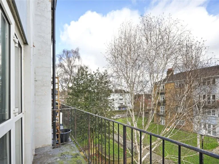
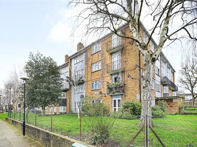
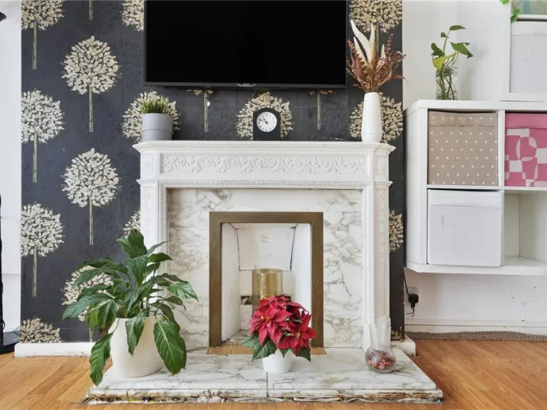
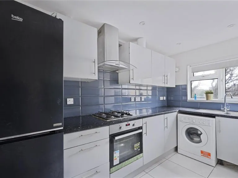
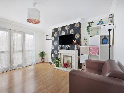
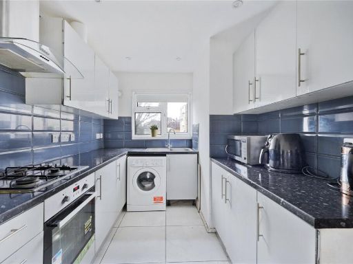
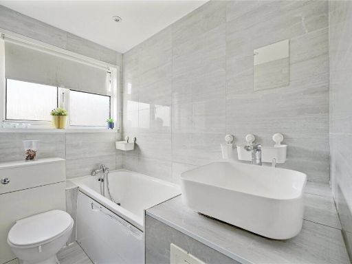
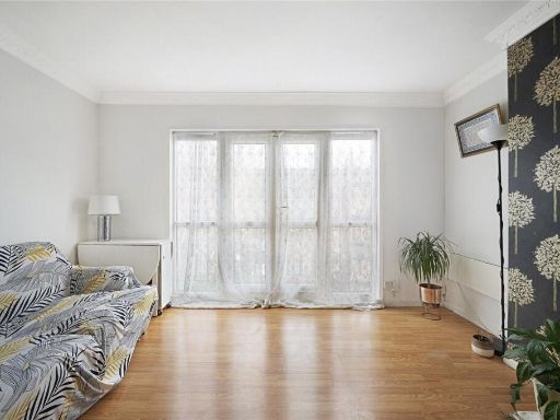
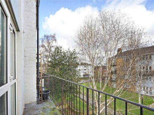
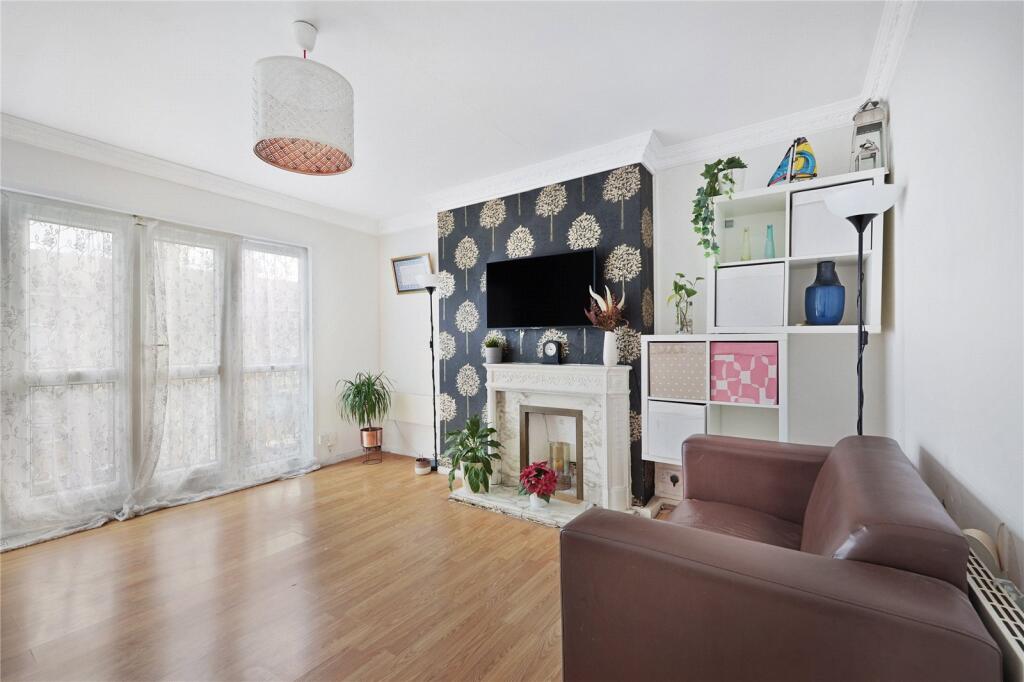
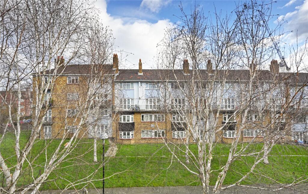
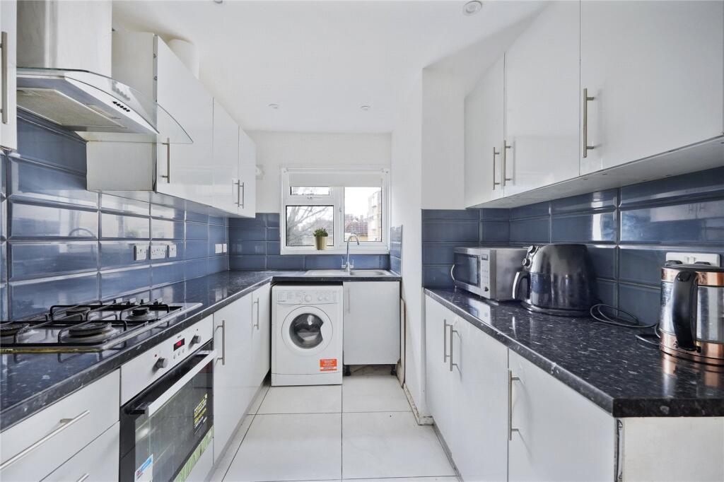
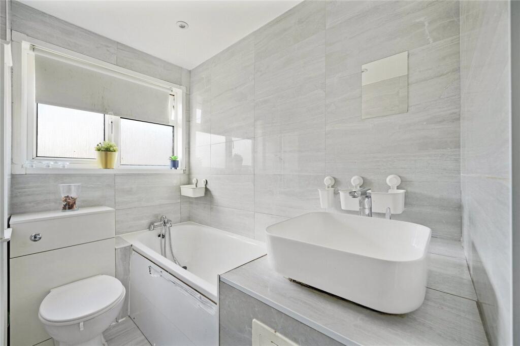
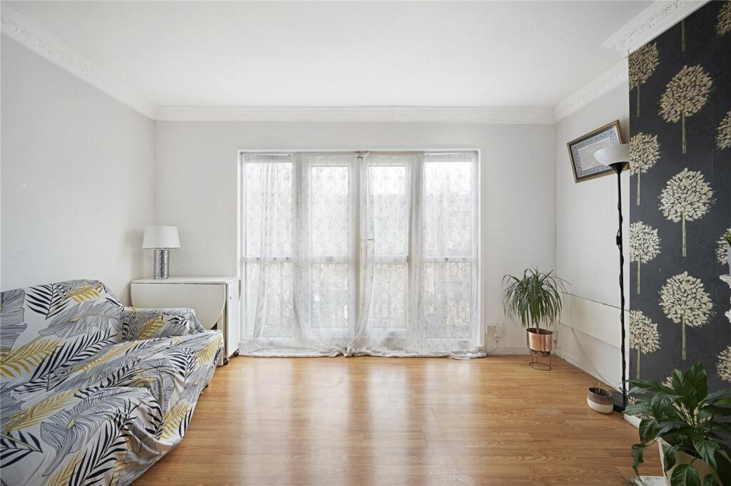
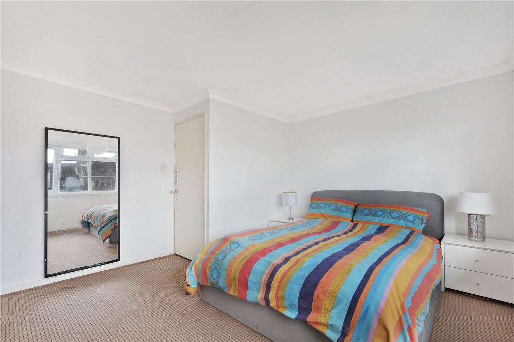
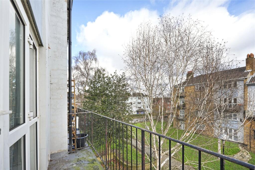
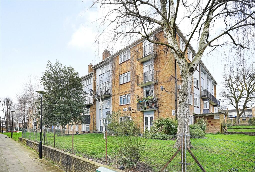
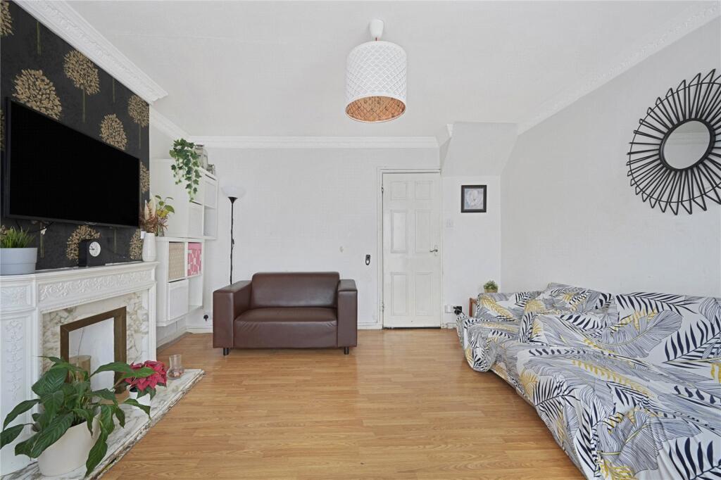
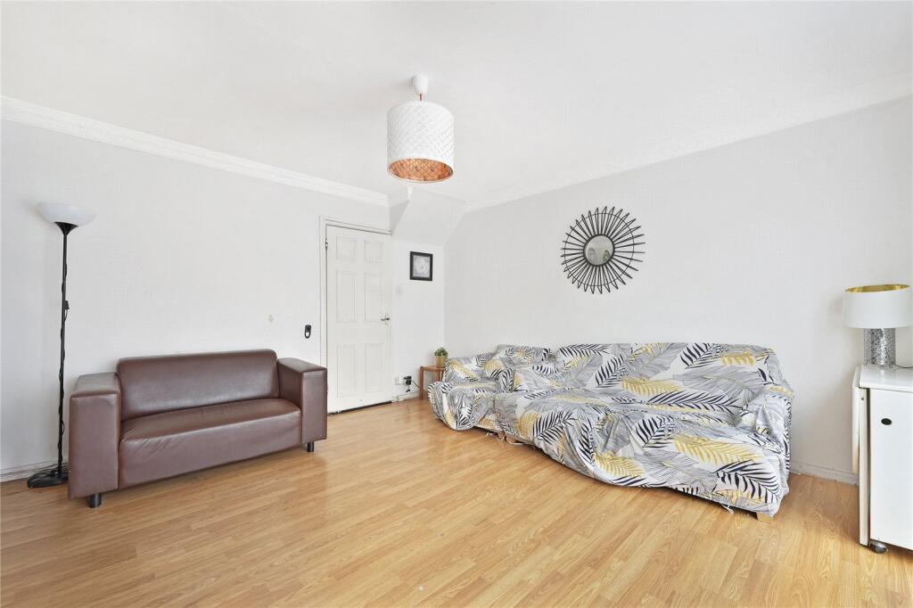
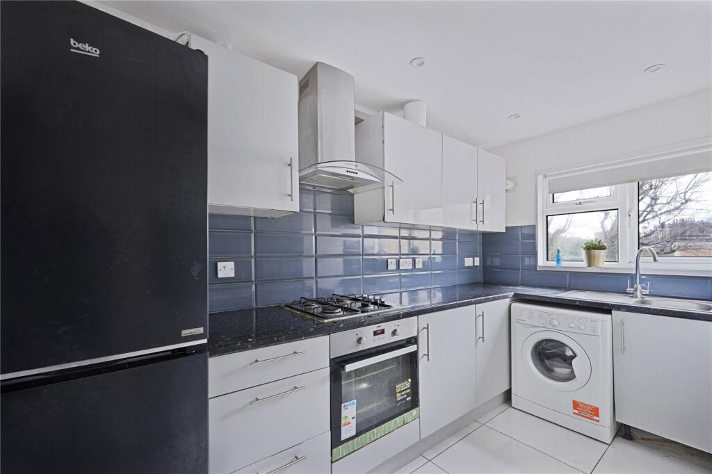
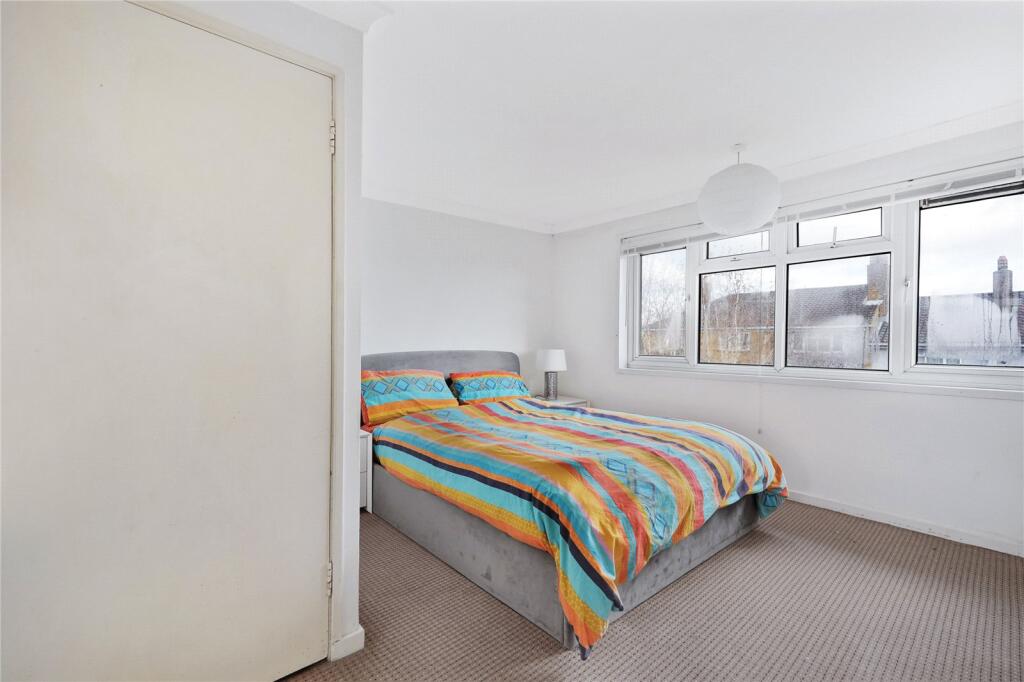
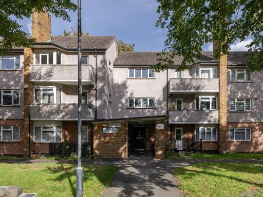
- This upper floor leasehold maisonette offers a blend of modern and comfortable living. It features a spacious living room with large windows allowing ample natural light to enhance the room's brightness, complemented by well-maintained wood flooring. The modern kitchen is equipped with sleek cabinetry and integrated appliances, providing a stylish culinary space. The bathroom is elegantly finished with contemporary fixtures and a clean aesthetic. The property is situated within a well-kept residential block, surrounded by communal green space, offering pleasant views of the neighboring trees and pathway. The living spaces are of average size, contributing to the cozy ambiance of an urban family home.
Image Descriptions
- living room contemporary
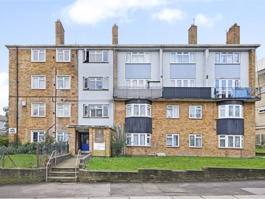
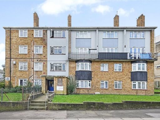
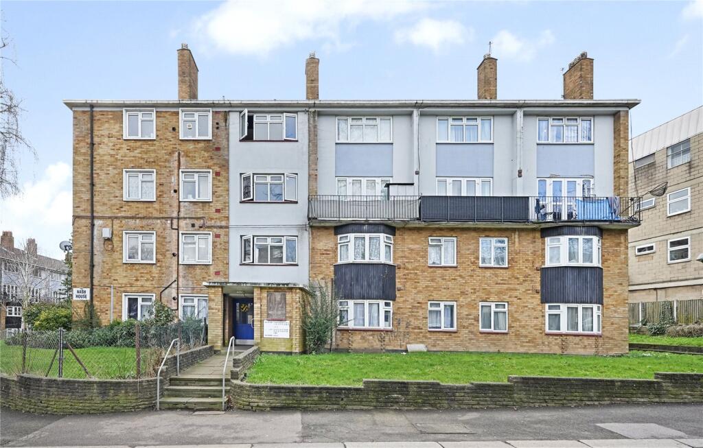
- apartment block mid-20th century
Floorplan Description
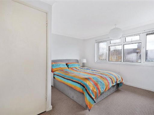
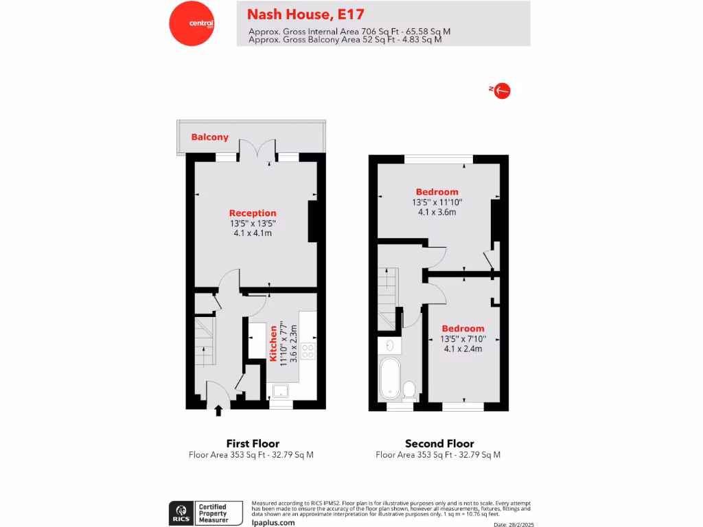
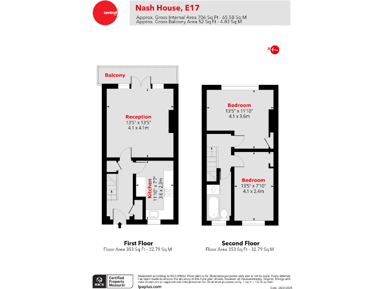
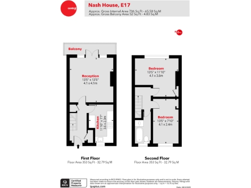
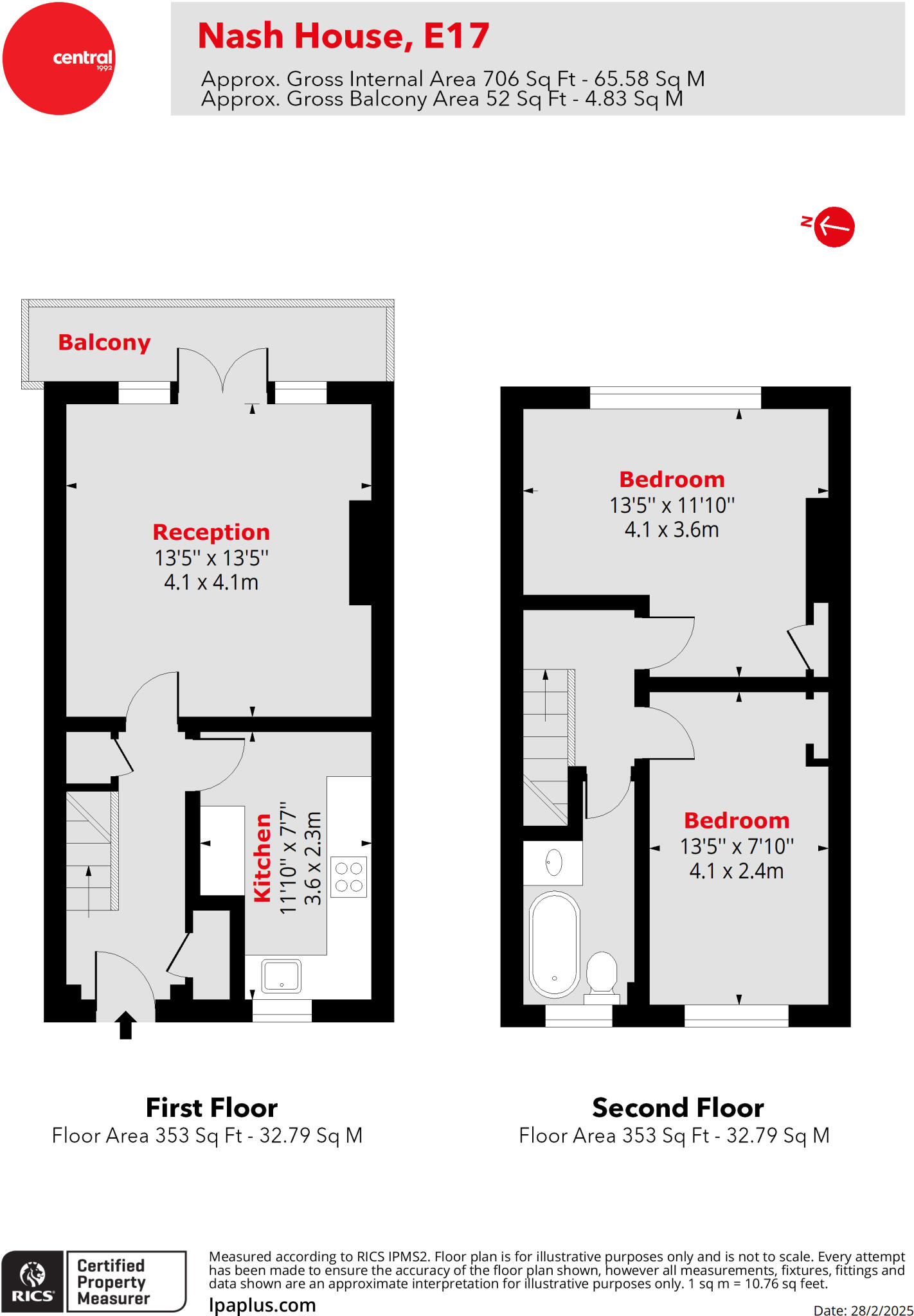
- A two-story property with a reception area, two bedrooms, a kitchen, and a balcony.
Rooms
- Balcony:
- Reception: Large
- Kitchen: Average
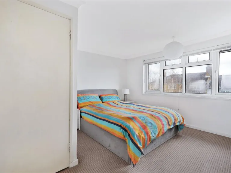
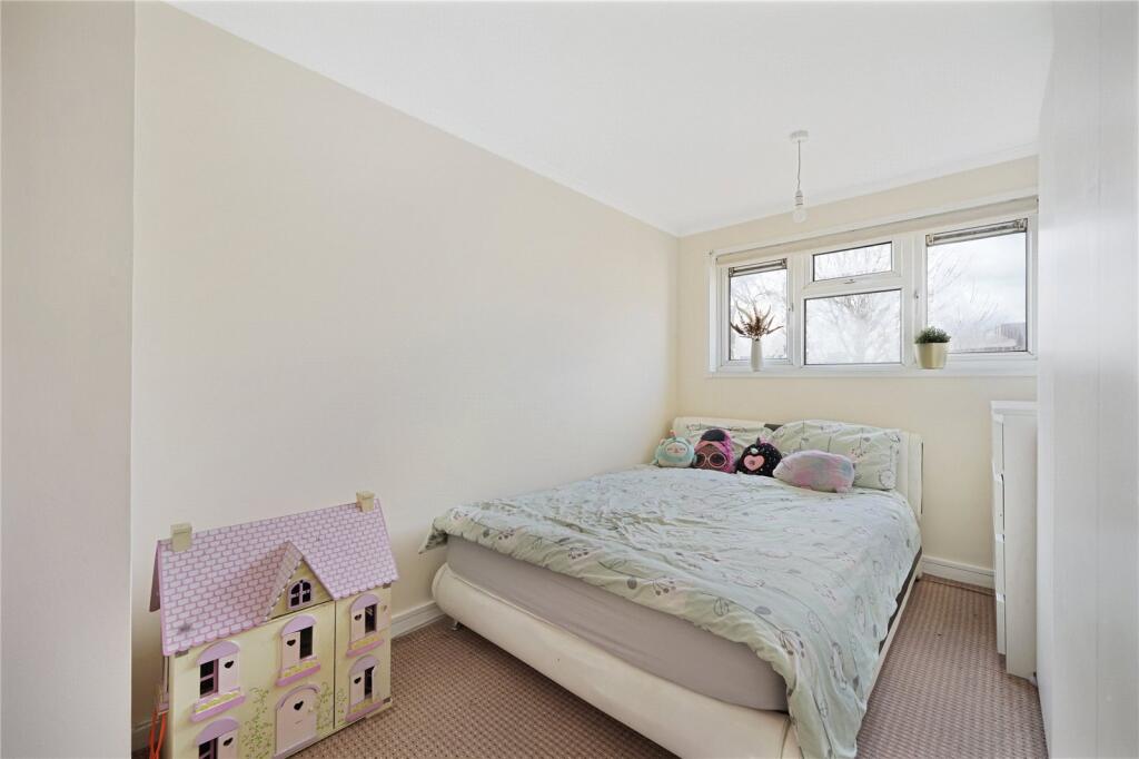
- Bedroom: Large
- Bedroom: Average
Textual Property Features
Detected Visual Features
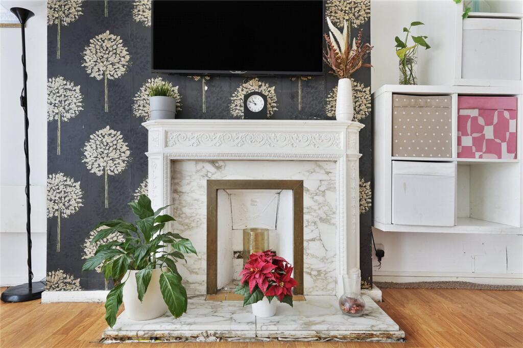
- contemporary
- living room
- laminate flooring
- decorative fireplace
- natural light
- modern
- wallpaper feature wall
- crown molding
- apartment
- mid-20th century
- brick exterior
- residential block
- urban
- multifamily
- apartment block
EPC Details
- Fully double glazed
- Cavity wall, as built, no insulation (assumed)
- Electric storage heaters
- Low energy lighting in 89% of fixed outlets
- (another dwelling below)
Nearby Schools
- Gwyn Jones Primary School
- Barclay Primary School
- George Mitchell School
- St Joseph's Catholic Junior School
- Thomas Gamuel Primary School
- Edinburgh Primary School
- Greenleaf Primary School
- The Woodside Primary Academy
- The Winns Primary School
- Frederick Bremer School
- Walthamstow Montessori School
- Thorpe Hall Primary School
- Roger Ascham Primary School
- Walthamstow Primary Academy
- Forest School
- St Mary's CofE Primary School
- Holy Family Catholic School
- South Chingford Foundation School
- Selwyn Primary School
- Mission Grove Primary School
- Henry Maynard Primary School
- Walthamstow Academy
- Leytonstone School
- Walthamstow School for Girls
- Emmanuel Community School
- Our Lady and St George's Catholic Primary School
- Chapel End Infant School and Early Years Centre
- Chapel End Junior Academy
Nearest General Shops
- Id: 8659341079
- Tags:
- Name: The Green Room
- Shop: furniture
- TagsNormalized:
- Lat: 51.5885018
- Lon: -0.0048981
- FullGeoHash: gcpvrzkkvcg8
- PartitionGeoHash: gcpv
- Images:
- FoodStandards: null
- Distance: 369
,- Id: 8659341075
- Tags:
- Name: Biba Brown’s Boutique
- Shop: hairdresser
- TagsNormalized:
- Lat: 51.5884333
- Lon: -0.0048744
- FullGeoHash: gcpvrzkkqkvr
- PartitionGeoHash: gcpv
- Images:
- FoodStandards: null
- Distance: 368.1
,- Id: 8659341072
- Tags:
- Name: Biba Brown’s
- Shop: hairdresser
- TagsNormalized:
- Lat: 51.5883876
- Lon: -0.0048585
- FullGeoHash: gcpvrzkknu3n
- PartitionGeoHash: gcpv
- Images:
- FoodStandards: null
- Distance: 367.5
}
Nearest Grocery shops
- Id: 2080487461
- Tags:
- Addr:
- City: London
- Country: GB
- Housenumber: 795
- Postcode: E17 4JD
- Street: Forest Road
- Suburb: Walthamstow
- Level: 0
- Name: Bilge Food and Wine
- Shop: convenience
- Source:
- Source:addr:postcode: FHRS Open Data
- TagsNormalized:
- Lat: 51.5910562
- Lon: -0.0082159
- FullGeoHash: gcpvrzf58tcv
- PartitionGeoHash: gcpv
- Images:
- FoodStandards: null
- Distance: 426.3
,- Id: 205896842
- Tags:
- Addr:
- City: London
- Country: GB
- Housenumber: 90-92
- Postcode: E17 3HX
- Street: Wood Street
- Suburb: Walthamstow
- Building: yes
- Fhrs:
- Id: 514444
- Local_authority_id: 376
- Name: Food Hall Wood Street
- Shop: supermarket
- Source:
- TagsNormalized:
- Lat: 51.5887503
- Lon: -0.0045481
- FullGeoHash: gcpvrzkwq00d
- PartitionGeoHash: gcpv
- Images:
- FoodStandards: null
- Distance: 401.6
,- Id: 199384219
- Tags:
- Addr:
- Country: GB
- Housenumber: 25-27
- Street: Shernhall Street
- Building: yes
- Name: Shernhall Market
- Shop: convenience
- TagsNormalized:
- Lat: 51.5872919
- Lon: -0.0079916
- FullGeoHash: gcpvrz4jvb1n
- PartitionGeoHash: gcpv
- Images:
- FoodStandards: null
- Distance: 133.6
}
Nearest Religious buildings
- Id: 23167561
- Tags:
- Amenity: grave_yard
- Name: St Mary's Churchyard
- Religion: christian
- TagsNormalized:
- grave yard
- church
- christian
- Lat: 51.5853077
- Lon: -0.0114122
- FullGeoHash: gcpvrwzdnn66
- PartitionGeoHash: gcpv
- Images:
- FoodStandards: null
- Distance: 251.6
,- Id: 9441771
- Tags:
- Name: Church Lane
- Network: London Buses
- Operator: Transport for London
- Public_transport: stop_area
- Public_transport:version: 2
- Type: public_transport
- TagsNormalized:
- Lat: 51.5859318
- Lon: -0.0072285
- FullGeoHash: gcpvryftzddj
- PartitionGeoHash: gcpv
- Images:
- FoodStandards: null
- Distance: 245.4
,- Id: 205684
- Tags:
- Name: Church Hill Road
- Naptan:
- StopAreaCode: 490G00005267
- StopAreaType: GPBS
- Verified: no
- Public_transport: stop_area
- Type: public_transport
- TagsNormalized:
- Lat: 51.5862647
- Lon: -0.0121312
- FullGeoHash: gcpvrwzpv2dr
- PartitionGeoHash: gcpv
- Images:
- FoodStandards: null
- Distance: 196.2
}
Nearest Airports
- Id: 121158889
- Tags:
- Aerodrome: continental
- Aeroway: aerodrome
- Fhrs:
- Authority: City of London Corporation
- Iata: LCY
- Icao: EGLC
- Name: London City Airport
- Operator: London City Airport Limited
- Ref: LCY
- Website: https://www.londoncityairport.com/
- Wikidata: Q8982
- Wikipedia: en:London City Airport
- TagsNormalized:
- airport
- continental airport
- Lat: 51.5042658
- Lon: 0.0539987
- FullGeoHash: u10j10p64702
- PartitionGeoHash: u10j
- Images:
- FoodStandards: null
- Distance: 10243.7
,- Id: 14001268
- Tags:
- Access: yes
- Aerodrome: international
- Aerodrome:type: public
- Aeroway: aerodrome
- Alt_name: London Heathrow
- Alt_name_2: London Heathrow Airport
- Ele: 25
- Iata: LHR
- Icao: EGLL
- Int_name: Heathrow Airport
- Name: London Heathrow Airport
- Note: area still approx
- Old_name: London Airport
- Operator: Heathrow Airport Limited
- Rank_aci:
- Ref: LHR
- Short_name: Heathrow
- Type: multipolygon
- Website: https://www.heathrow.com/
- Wikidata: Q8691
- Wikipedia: en:Heathrow Airport
- TagsNormalized:
- airport
- international airport
- Lat: 51.4677522
- Lon: -0.4547736
- FullGeoHash: gcpsv9kv7h2h
- PartitionGeoHash: gcps
- Images:
- FoodStandards: null
- Distance: 33525.7
}
Nearest Leisure Facilities
- Id: 1042772481
- Tags:
- TagsNormalized:
- Lat: 51.5861736
- Lon: -0.007632
- FullGeoHash: gcpvryfrnptp
- PartitionGeoHash: gcpv
- Images:
- FoodStandards: null
- Distance: 206.8
,- Id: 597408914
- Tags:
- TagsNormalized:
- Lat: 51.5876337
- Lon: -0.0127144
- FullGeoHash: gcpvrxnxxxzm
- PartitionGeoHash: gcpv
- Images:
- FoodStandards: null
- Distance: 195.2
,- Id: 199148574
- Tags:
- TagsNormalized:
- Lat: 51.586086
- Lon: -0.0099013
- FullGeoHash: gcpvryby9r3j
- PartitionGeoHash: gcpv
- Images:
- FoodStandards: null
- Distance: 143
,- Id: 196684519
- Tags:
- Leisure: pitch
- Source: survey
- Sport: basketball
- TagsNormalized:
- pitch
- leisure
- basketball
- sports
- Lat: 51.5876721
- Lon: -0.0116913
- FullGeoHash: gcpvrxprzx46
- PartitionGeoHash: gcpv
- Images:
- FoodStandards: null
- Distance: 126.8
,- Id: 196684518
- Tags:
- Leisure: playground
- Source: survey
- TagsNormalized:
- Lat: 51.5878031
- Lon: -0.0113721
- FullGeoHash: gcpvrxr8xp82
- PartitionGeoHash: gcpv
- Images:
- FoodStandards: null
- Distance: 111.2
}
Nearest Tourist attractions
- Id: 8588659878
- Tags:
- Addr:
- Housenumber: 1
- Street: Hoe Street
- Name: One Hoe Street
- Tourism: gallery
- TagsNormalized:
- Lat: 51.5899765
- Lon: -0.0174195
- FullGeoHash: gcpvrxem6hej
- PartitionGeoHash: gcpv
- Images:
- FoodStandards: null
- Distance: 593.5
,- Id: 23941901
- Tags:
- Addr:
- City: London
- Country: GB
- Housenumber: 2
- Postcode: E17 9NH
- Street: Vestry Road
- Building: yes
- Name: Vestry House Museum
- Tourism: museum
- Website: https://vestryhousemuseum.org.uk/
- Wikidata: Q7923505
- Wikipedia: en:Vestry House Museum
- TagsNormalized:
- Lat: 51.5840585
- Lon: -0.0128874
- FullGeoHash: gcpvrwwdgtqq
- PartitionGeoHash: gcpv
- Images:
- FoodStandards: null
- Distance: 421.6
,- Id: 2252043061
- Tags:
- Addr:
- City: London
- Country: GB
- Housename: Ravenswood Industrial Estate
- Postcode: E17 9HQ
- Street: Shernhall Street
- Suburb: Walthamstow
- Unit: Unit 12
- Email: info@godsownjunkyard.co.uk
- Name: God's Own Junkyard
- Opening_hours: Fr-Sa 11:00-21:00; Su 11:00-18:00
- Phone: +44 20 8521 8066
- Tourism: gallery
- Website: http://godsownjunkyard.co.uk
- TagsNormalized:
- Lat: 51.5839873
- Lon: -0.0082331
- FullGeoHash: gcpvryd480hy
- PartitionGeoHash: gcpv
- Images:
- FoodStandards: null
- Distance: 394
}
Nearest Hotels
- Id: 38162947
- Tags:
- Addr:
- City: London
- Housenumber: 5
- Postcode: E4 8ST
- Street: Walthamstow Avenue
- Suburb: Chingford
- Brand: Holiday Inn Express
- Brand:wikidata: Q5880423
- Brand:wikipedia: en:Holiday Inn Express
- Building: yes
- Building:levels: 4
- Fhrs:
- Id: 514256
- Local_authority_id: 18913
- Name: Holiday Inn Express
- Source:
- Tourism: hotel
- TagsNormalized:
- Lat: 51.6030665
- Lon: -0.0195222
- FullGeoHash: gcpvxd1c9hg1
- PartitionGeoHash: gcpv
- Images:
- FoodStandards: null
- Distance: 1866.9
,- Id: 409020835
- Tags:
- Addr:
- City: London
- Country: GB
- Housenumber: 131-133
- Postcode: E17 8DQ
- Street: Markhouse Road
- Suburb: Walthamstow
- Building: yes
- Fhrs:
- Id: 514185
- Local_authority_id: 159
- Name: The Commongate Hotel
- Source: survey
- Source:addr:postcode: FHRS Open Data
- Tourism: guest_house
- Website: http://www.commongatehotel.co.uk
- TagsNormalized:
- common
- hotel
- guest house
- tourism
- Lat: 51.5763801
- Lon: -0.0296588
- FullGeoHash: gcpvrm4qhyhg
- PartitionGeoHash: gcpv
- Images:
- FoodStandards: null
- Distance: 1831.4
,- Id: 3875170
- Tags:
- Addr:
- City: London
- Housenumber: 543
- Postcode: E10 7EB
- Street: Lea Bridge Road
- Suburb: Leyton
- Brand: Ibis
- Building: commercial
- Building:levels: 3
- Fhrs:
- Name: Ibis Styles London Leyton Hotel
- Source:
- Tourism: hotel
- Type: multipolygon
- TagsNormalized:
- Lat: 51.5733555
- Lon: -0.0150119
- FullGeoHash: gcpvrsthd4q2
- PartitionGeoHash: gcpv
- Images:
- FoodStandards: null
- Distance: 1597.8
}
Tags
- contemporary
- living room
- laminate flooring
- decorative fireplace
- natural light
- modern
- wallpaper feature wall
- crown molding
- apartment
- mid-20th century
- brick exterior
- residential block
- urban
- multifamily
- apartment block
Local Market Stats
- Average Price/sqft: £666
- Avg Income: £54800
- Rental Yield: 4.2%
- Social Housing: 23%
- Planning Success Rate: 78%
AirBnB Data
- 1km average: £102/night
- Listings in 1km: 26
Similar Properties
 2 bedroom flat for sale in Chingford Road, Walthamstow, E17 — £350,000 • 2 bed • 1 bath • 696 ft²
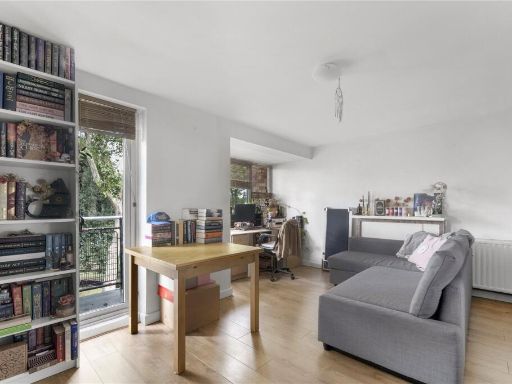 2 bedroom flat for sale in The Drive, Walthamstow, London, E17 — £375,000 • 2 bed • 1 bath • 763 ft²
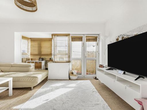 2 bedroom apartment for sale in Boyden House, Shernhall Street, London, E17 — £390,000 • 2 bed • 1 bath • 786 ft²
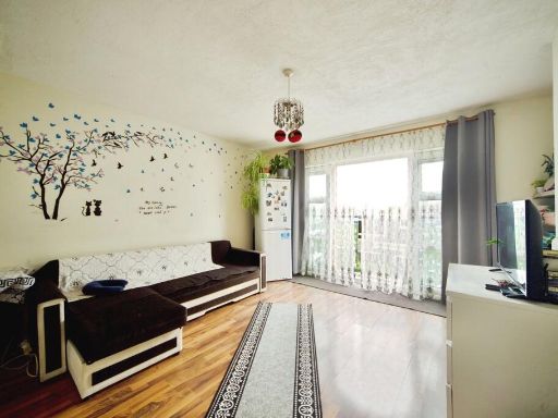 2 bedroom flat for sale in Attlee Terrace, Prospect Hill, London, E17 — £350,000 • 2 bed • 1 bath • 688 ft²
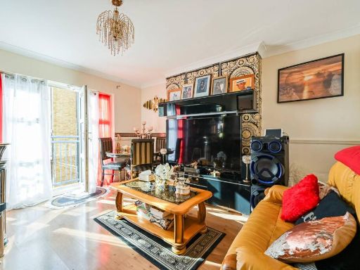 2 bedroom flat for sale in Attlee Terrace, Prospect Hill, Walthamstow, London, E17 — £400,000 • 2 bed • 1 bath • 692 ft²
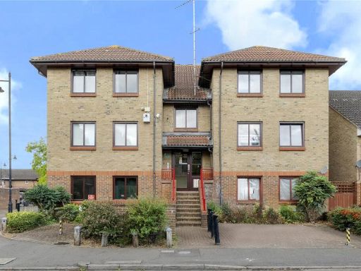 2 bedroom flat for sale in Colchester Road, Walthamstow, London, E17 — £375,000 • 2 bed • 1 bath • 643 ft²
Meta
- {
"@context": "https://schema.org",
"@type": "Residence",
"name": "2 bedroom maisonette for sale in Nash House, Prospect Hill,…",
"description": "",
"url": "https://propertypiper.co.uk/property/0c591ef7-c787-46e0-8d01-233eb0650347",
"image": "https://image-a.propertypiper.co.uk/fb8bcfdb-1084-4f92-9a6f-0d94c9c85a8e-1024.jpeg",
"address": {
"@type": "PostalAddress",
"streetAddress": "NASH HOUSE FLAT 31 PROSPECT HILL LONDON",
"postalCode": "E17 3EW",
"addressLocality": "Waltham Forest",
"addressRegion": "Walthamstow",
"addressCountry": "England"
},
"geo": {
"@type": "GeoCoordinates",
"latitude": 51.587371843999584,
"longitude": -0.009920506393870264
},
"numberOfRooms": 2,
"numberOfBathroomsTotal": 1,
"floorSize": {
"@type": "QuantitativeValue",
"value": 706,
"unitCode": "FTK"
},
"offers": {
"@type": "Offer",
"price": 350000,
"priceCurrency": "GBP",
"availability": "https://schema.org/InStock"
},
"additionalProperty": [
{
"@type": "PropertyValue",
"name": "Feature",
"value": "contemporary"
},
{
"@type": "PropertyValue",
"name": "Feature",
"value": "living room"
},
{
"@type": "PropertyValue",
"name": "Feature",
"value": "laminate flooring"
},
{
"@type": "PropertyValue",
"name": "Feature",
"value": "decorative fireplace"
},
{
"@type": "PropertyValue",
"name": "Feature",
"value": "natural light"
},
{
"@type": "PropertyValue",
"name": "Feature",
"value": "modern"
},
{
"@type": "PropertyValue",
"name": "Feature",
"value": "wallpaper feature wall"
},
{
"@type": "PropertyValue",
"name": "Feature",
"value": "crown molding"
},
{
"@type": "PropertyValue",
"name": "Feature",
"value": "apartment"
},
{
"@type": "PropertyValue",
"name": "Feature",
"value": "mid-20th century"
},
{
"@type": "PropertyValue",
"name": "Feature",
"value": "brick exterior"
},
{
"@type": "PropertyValue",
"name": "Feature",
"value": "residential block"
},
{
"@type": "PropertyValue",
"name": "Feature",
"value": "urban"
},
{
"@type": "PropertyValue",
"name": "Feature",
"value": "multifamily"
},
{
"@type": "PropertyValue",
"name": "Feature",
"value": "apartment block"
}
]
}
High Res Floorplan Images
Compatible Floorplan Images
FloorplanImages Thumbnail