DG2 8EY - Land for sale in Land At Greenmerse Farm, Dumfries, Dumfrie…
View on Property Piper
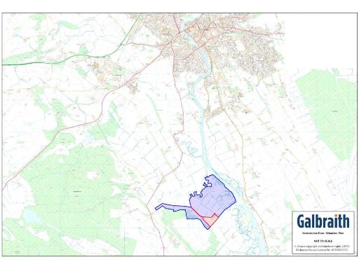
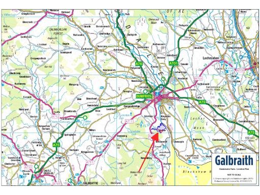
Land for sale in Land At Greenmerse Farm, Dumfries, Dumfries and Galloway, DG2
Property Details
- Price: £1400000
- Bedrooms: 1
- Bathrooms: 1
- Property Type: undefined
- Property SubType: undefined
Brochure Descriptions
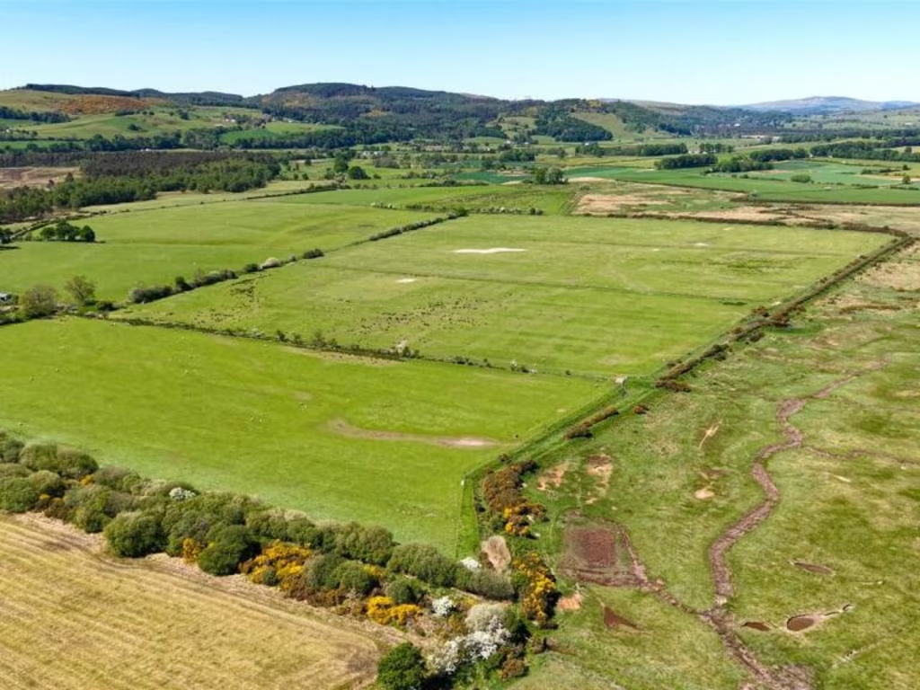
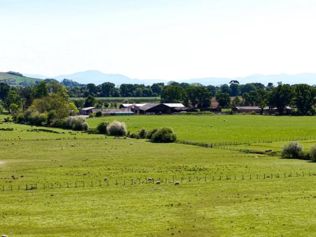
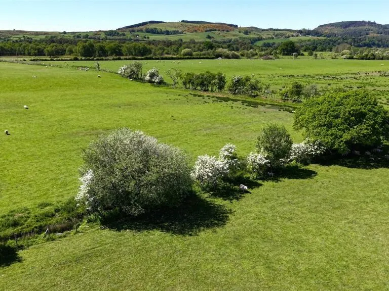
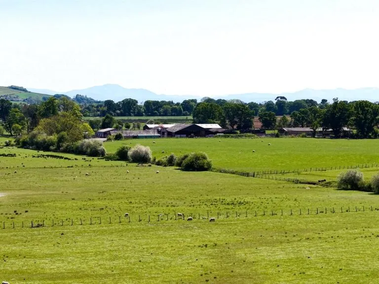
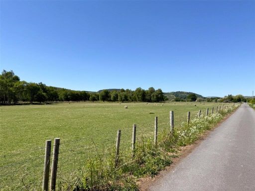
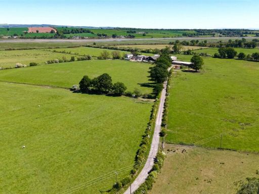
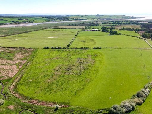
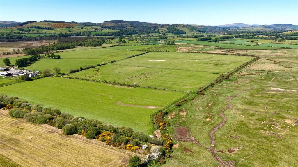
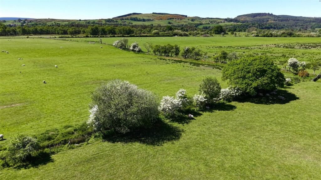
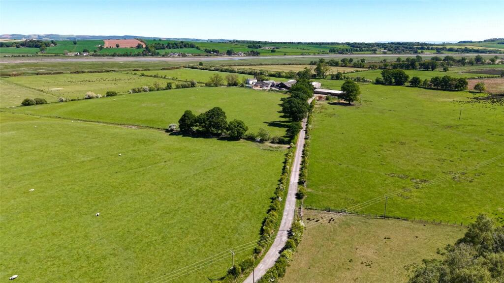
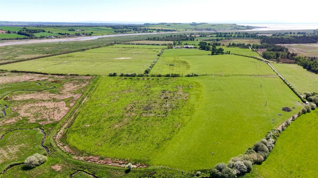
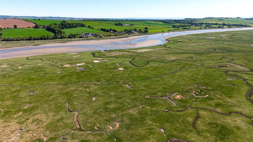
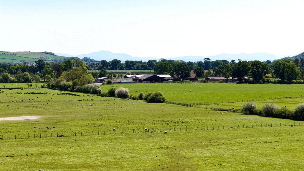
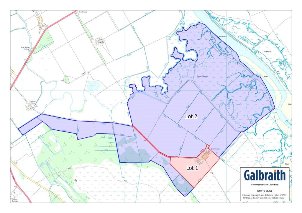
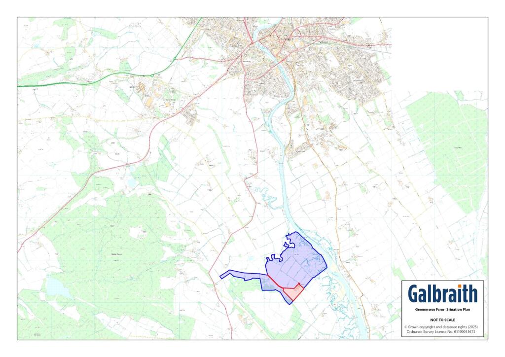
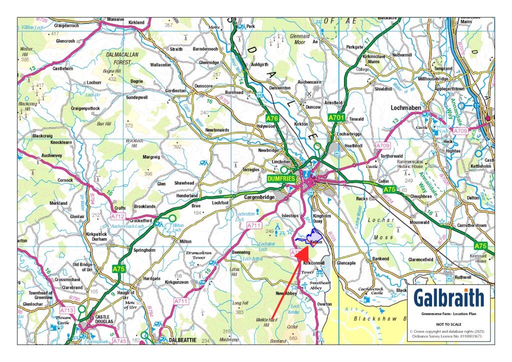
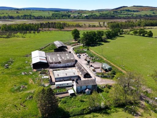
- This vast agricultural property offers significant space for both farming and residential purposes. The estate comprises various large outbuildings and barns, ideal for livestock or storage. The surrounding lands appear extensive, providing ample grazing area, bordered by vibrant hedgerows and commanding views of rolling countryside stretching towards the horizon. The main property is a robust stone structure with potential for a spacious family home or farm management office, maintaining its rustic charm. Overall, the property offers a blend of rural functionality and expansive space, suitable for extensive farming or development into a sizeable countryside residence.
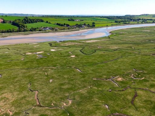
- The property is a sprawling farm with expansive agricultural land and multiple outbuildings suitable for farming and storage. It features a central farmyard area with large barn structures, likely used for livestock or equipment. The surrounding fields are vast and lush, extending towards a distant view of rolling hills and possibly a river, indicating potential for crops or grazing livestock. The overall property size is large, offering ample space for both residential and agricultural use. The terrain is slightly sloped with verdant greenery, creating a serene and picturesque rural setting.
- The property is a sprawling farm situated amidst lush green fields. It comprises several large barns and outbuildings constructed with metal and wooden roofs, suited for agricultural use. The setting is rural and serene, surrounded by expansive pastures which indicate that the farm includes substantial grazing land. The property overlooks a wooded area as well as expansive open countryside, offering picturesque views that are both tranquil and idyllic. The farm layout appears extensive, suggesting a large property overall, capable of supporting significant agricultural activities.
Textual Property Features
Detected Visual Features
- land
- greenfield
- pasture
- agricultural use
- investment
- development
- rural
- landscape
- field
- countryside
- scenic
- open land
Nearest Bars And Restaurants
- Id: 746662405
- Tags:
- Amenity: pub
- Building: yes
- Name: Troqueer Arms
- TagsNormalized:
- Lat: 55.0627031
- Lon: -3.6104515
- FullGeoHash: gcv3jzfgqru4
- PartitionGeoHash: gcv3
- Images:
- FoodStandards: null
- Distance: 5064.2
,- Id: 527903827
- Tags:
- Amenity: pub
- Name: The Mount Sydney Pub
- TagsNormalized:
- Lat: 55.0626243
- Lon: -3.5939353
- FullGeoHash: gcv3npygp1ps
- PartitionGeoHash: gcv3
- Images:
- FoodStandards: null
- Distance: 5019
,- Id: 746662406
- Tags:
- Amenity: pub
- Building: yes
- Name: Normandy Bar
- TagsNormalized:
- Lat: 55.0604022
- Lon: -3.6080569
- FullGeoHash: gcv3jzkwn4vu
- PartitionGeoHash: gcv3
- Images:
- FoodStandards: null
- Distance: 4791.1
,- Id: 355673772
- Tags:
- Amenity: cafe
- Name: New Abbey Tearooms
- TagsNormalized:
- Lat: 54.9801612
- Lon: -3.6196285
- FullGeoHash: gcv2v8u68sck
- PartitionGeoHash: gcv2
- Images:
- FoodStandards: null
- Distance: 4357.3
,- Id: 289790450
- Tags:
- Addr:
- City: Dumfries
- Postcode: DG1 4SU
- Street: Kingholm Road
- Amenity: restaurant
- Building: yes
- Email: angela@theswandumfries.co.uk
- Name: The Swan
- Opening_hours: Mo-Sa 12:00-20:30; Su 12:00-20:00; Tu off
- Phone: +441387 253 756
- Website: https://www.theswandumfries.co.uk/
- Wheelchair: yes
- TagsNormalized:
- Lat: 55.047149
- Lon: -3.6047933
- FullGeoHash: gcv3jvp0fhr6
- PartitionGeoHash: gcv3
- Images:
- FoodStandards: null
- Distance: 3303.5
}
Nearest General Shops
- Id: 1637749432
- Tags:
- Addr:
- City: Dumfries
- Housenumber: 43
- Postcode: DG1 4HA
- Street: Calside Road
- Brand: Nisa
- Brand:wikidata: Q16999069
- Brand:wikipedia: en:Nisa (retailer)
- Name: Nisa
- Note: not 24hrs
- Opening_hours: Mo-Su 06:00-21:00
- Shop: supermarket
- TagsNormalized:
- Lat: 55.0621424
- Lon: -3.5828429
- FullGeoHash: gcv3nrz01xq9
- PartitionGeoHash: gcv3
- Images:
- FoodStandards: null
- Distance: 5064.8
,- Id: 453423702
- Tags:
- Amenity: cafe
- Name: The Shed
- Shop: bicycle
- TagsNormalized:
- Lat: 55.0203753
- Lon: -3.6439093
- FullGeoHash: gcv3j04sfv26
- PartitionGeoHash: gcv3
- Images:
- FoodStandards: null
- Distance: 2851.1
,- Id: 1904540105
- Tags:
- Amenity: post_office
- Name: Glencaple Shop
- TagsNormalized:
- Lat: 55.0034308
- Lon: -3.572447
- FullGeoHash: gcv2ytnd5ywm
- PartitionGeoHash: gcv2
- Images:
- FoodStandards: null
- Distance: 2333.6
}
Nearest Grocery shops
- Id: 746697722
- Tags:
- Brand: Farmfoods
- Brand:wikidata: Q5435841
- Brand:wikipedia: en:Farmfoods
- Building: yes
- Contact:
- Website: https://www.farmfoods.co.uk/store-finder.php?branch_code=291
- Name: Farmfoods
- Opening_hours:
- Url: https://www.farmfoods.co.uk/store-finder.php?branch_code=291
- Shop: frozen_food
- Wheelchair: no
- TagsNormalized:
- farmfoods
- frozen food
- food
- shop
- Lat: 55.0697601
- Lon: -3.6191773
- FullGeoHash: gcv3m9hse53f
- PartitionGeoHash: gcv3
- Images:
- FoodStandards: null
- Distance: 5934.8
,- Id: 7601077313
- Tags:
- Name: Jan de Vries
- Shop: health_food
- TagsNormalized:
- health
- health food
- food
- shop
- Lat: 55.0702815
- Lon: -3.6121583
- FullGeoHash: gcv3mc1xwse9
- PartitionGeoHash: gcv3
- Images:
- FoodStandards: null
- Distance: 5913.8
,- Id: 747383239
- Tags:
- Brand: Spar
- Brand:wikidata: Q610492
- Brand:wikipedia: en:Spar (retailer)
- Building: yes
- Name: Spar
- Shop: convenience
- TagsNormalized:
- Lat: 55.0651076
- Lon: -3.5979725
- FullGeoHash: gcv3q0k190j3
- PartitionGeoHash: gcv3
- Images:
- FoodStandards: null
- Distance: 5283.6
}
Nearest Supermarkets
- Id: 98147332
- Tags:
- Addr:
- Postcode: DG1 2SH
- Street: Brooms Road
- Brand: Morrisons
- Brand:wikidata: Q922344
- Brand:wikipedia: en:Morrisons
- Building: yes
- Contact:
- Website: https://my.morrisons.com/storefinder/170
- Designation: Dumfries
- Name: Morrisons
- Shop: supermarket
- Source: OS_OpenData_StreetView
- Wheelchair: yes
- TagsNormalized:
- Lat: 55.0688234
- Lon: -3.6006806
- FullGeoHash: gcv3q0fp4h9z
- PartitionGeoHash: gcv3
- Images:
- FoodStandards: null
- Distance: 5696.5
,- Id: 98150802
- Tags:
- Addr:
- Postcode: DG1 2DZ
- Street: Brooms Road
- Brand: Lidl
- Brand:wikidata: Q151954
- Brand:wikipedia: en:Lidl
- Building: yes
- Designation: Dumfries
- Name: Lidl
- Operator: Lidl
- Shop: supermarket
- Source: OS_OpenData_StreetView
- TagsNormalized:
- Lat: 55.0664377
- Lon: -3.6032658
- FullGeoHash: gcv3q081jzfr
- PartitionGeoHash: gcv3
- Images:
- FoodStandards: null
- Distance: 5436.1
,- Id: 206322229
- Tags:
- Addr:
- Housename: Troqueer Mount
- Postcode: DG2 7DF
- Street: Troqueer Road
- Building: yes
- Name: Co-op
- Shop: supermarket
- TagsNormalized:
- Lat: 55.0604738
- Lon: -3.6081594
- FullGeoHash: gcv3jzkweb1r
- PartitionGeoHash: gcv3
- Images:
- FoodStandards: null
- Distance: 4799.7
}
Nearest Religious buildings
- Id: 97680949
- Tags:
- Amenity: place_of_worship
- Denomination: church_of_scotland
- Name: Troqueer Parish Church
- Religion: christian
- Source: OS_OpenData_StreetView
- Wikidata: Q17796053
- TagsNormalized:
- place of worship
- church
- church of scotland
- parish
- christian
- Lat: 55.0595027
- Lon: -3.6072977
- FullGeoHash: gcv3jzm0zg5y
- PartitionGeoHash: gcv3
- Images:
- FoodStandards: null
- Distance: 4686.3
,- Id: 193155715
- Tags:
- Amenity: place_of_worship
- Building: church
- Religion: christian
- Source: Bing
- TagsNormalized:
- place of worship
- church
- christian
- Lat: 54.9775528
- Lon: -3.6184467
- FullGeoHash: gcv2v8m5knds
- PartitionGeoHash: gcv2
- Images:
- FoodStandards: null
- Distance: 4614.8
,- Id: 97674416
- Tags:
- Amenity: place_of_worship
- Building: yes
- Denomination: church_of_scotland
- Name: Crichton Memorial Church
- Religion: christian
- Wikidata: Q17570207
- TagsNormalized:
- place of worship
- church
- church of scotland
- christian
- Lat: 55.0509081
- Lon: -3.5939213
- FullGeoHash: gcv3njwyz944
- PartitionGeoHash: gcv3
- Images:
- Q17570207-1
- Q17570207-2
- Q17570207-3
- Q17570207-4
- Q17570207-5
- Q17570207-6
- FoodStandards: null
- Distance: 3720.6
}
Nearest Medical buildings
- Id: 97948267
- Tags:
- Amenity: doctors
- Building: yes
- Contact:
- Phone: +441387246282
- Website: http://www.gillbraemedicalpractice.co.uk
- Drive_through: no
- Healthcare: doctor
- Name: Gillbrae Medical Practice
- TagsNormalized:
- doctor
- doctors
- health
- healthcare
- Lat: 55.0640263
- Lon: -3.5867686
- FullGeoHash: gcv3q2h5nnrr
- PartitionGeoHash: gcv3
- Images:
- FoodStandards: null
- Distance: 5225.4
,- Id: 97948291
- Tags:
- Amenity: hospital
- Emergency: no
- Healthcare: hospital
- Name: Nithbank Hospital
- TagsNormalized:
- Lat: 55.062271
- Lon: -3.6025804
- FullGeoHash: gcv3npb8vz32
- PartitionGeoHash: gcv3
- Images:
- FoodStandards: null
- Distance: 4971.4
,- Id: 97674405
- Tags:
- Amenity: hospital
- Building: yes
- Name: Cree Day Hospital
- Source: OS_OpenData_StreetView
- TagsNormalized:
- Lat: 55.0535886
- Lon: -3.5966522
- FullGeoHash: gcv3nnhyruv8
- PartitionGeoHash: gcv3
- Images:
- FoodStandards: null
- Distance: 4005.9
,- Id: 404594322
- Tags:
- Amenity: hospital
- Emergency: no
- Healthcare: hospital
- Name: Midpark Hospital
- Operator: NHS Dumfries and Galloway
- Operator:type: public
- Operator:wikidata: Q6954127
- Wikidata: Q19586076
- Wikipedia: en:Midpark Hospital
- TagsNormalized:
- Lat: 55.051495
- Lon: -3.589031
- FullGeoHash: gcv3nmfd1w2x
- PartitionGeoHash: gcv3
- Images:
- FoodStandards: null
- Distance: 3827.2
}
Nearest Leisure Facilities
- Id: 1074570653
- Tags:
- Building: yes
- Leisure: fitness_centre
- Name: Solway Fitness
- Phone: 07827933305
- Website: https://www.solwayfitness.co.uk/
- TagsNormalized:
- fitness
- fitness centre
- leisure
- Lat: 55.0449317
- Lon: -3.6165813
- FullGeoHash: gcv3jsw7zwcx
- PartitionGeoHash: gcv3
- Images:
- FoodStandards: null
- Distance: 3229.5
,- Id: 1022927240
- Tags:
- TagsNormalized:
- Lat: 55.0460488
- Lon: -3.5998369
- FullGeoHash: gcv3nhfdmxpp
- PartitionGeoHash: gcv3
- Images:
- FoodStandards: null
- Distance: 3163.6
,- Id: 1022927241
- Tags:
- TagsNormalized:
- Lat: 55.0449443
- Lon: -3.6029275
- FullGeoHash: gcv3nh8kj9qd
- PartitionGeoHash: gcv3
- Images:
- FoodStandards: null
- Distance: 3048.8
,- Id: 290244216
- Tags:
- Leisure: pitch
- Sport: basketball
- TagsNormalized:
- pitch
- leisure
- basketball
- sports
- Lat: 55.0033078
- Lon: -3.56965
- FullGeoHash: gcv2yv09mpsp
- PartitionGeoHash: gcv2
- Images:
- FoodStandards: null
- Distance: 2476.9
,- Id: 605370731
- Tags:
- TagsNormalized:
- Lat: 55.0043776
- Lon: -3.5693734
- FullGeoHash: gcv2yv0zex4k
- PartitionGeoHash: gcv2
- Images:
- FoodStandards: null
- Distance: 2416.3
}
Nearest Tourist attractions
- Id: 7325791360
- Tags:
- Name: Marthrown of Mabie
- Operator: Marthrown of Mabie
- Toilets:
- Tourism: camp_site
- Website: https://www.marthrownofmabie.com
- TagsNormalized:
- Lat: 55.0271919
- Lon: -3.6578089
- FullGeoHash: gcv3hc2kwu5c
- PartitionGeoHash: gcv3
- Images:
- FoodStandards: null
- Distance: 3870
,- Id: 8149648791
- Tags:
- Name: Kirkconnell House
- Tourism: guest_house
- TagsNormalized:
- Lat: 54.9965013
- Lon: -3.5961433
- FullGeoHash: gcv2y5v3gfch
- PartitionGeoHash: gcv2
- Images:
- FoodStandards: null
- Distance: 2355.3
,- Id: 523402027
- Tags:
- Name: Howmans Farmhouse B&B
- Tourism: guest_house
- TagsNormalized:
- Lat: 55.0084863
- Lon: -3.5710742
- FullGeoHash: gcv2ytzxevn4
- PartitionGeoHash: gcv2
- Images:
- FoodStandards: null
- Distance: 2073.5
}
Nearest Hotels
- Id: 97674410
- Tags:
- Brand: Holiday Inn
- Brand:wikidata: Q2717882
- Brand:wikipedia: en:Holiday Inn
- Building: yes
- Name: Holiday Inn
- Tourism: hotel
- TagsNormalized:
- Lat: 55.0521952
- Lon: -3.5934938
- FullGeoHash: gcv3njzq390b
- PartitionGeoHash: gcv3
- Images:
- FoodStandards: null
- Distance: 3865.7
,- Id: 341040529
- Tags:
- Building: yes
- Name: Mabie House
- Tourism: hotel
- Website: https://www.mabiehousehotel.co.uk/
- TagsNormalized:
- Lat: 55.0205867
- Lon: -3.6444709
- FullGeoHash: gcv3j04njsv8
- PartitionGeoHash: gcv3
- Images:
- FoodStandards: null
- Distance: 2889.3
,- Id: 523401998
- Tags:
- Name: The Nith Hotel
- Tourism: hotel
- TagsNormalized:
- Lat: 55.0027429
- Lon: -3.5733326
- FullGeoHash: gcv2ysvypq6j
- PartitionGeoHash: gcv2
- Images:
- FoodStandards: null
- Distance: 2345.5
}
Tags
- land
- greenfield
- pasture
- agricultural use
- investment
- development
- rural
- rural
- landscape
- field
- countryside
- scenic
- open land
Local Market Stats
- Average Price/sqft: £143
- Planning Success Rate: 95%
Similar Properties
 Land for sale in Greenmerse Farm, Dumfries, Dumfries and Galloway, DG2 — £1,795,000 • 3 bed • 1 bath • 25900 ft²
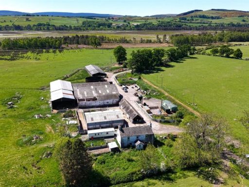 Land for sale in Greenmerse Smallholding, Dumfries, Dumfries and Galloway, DG2 — £395,000 • 3 bed • 1 bath • 25900 ft²
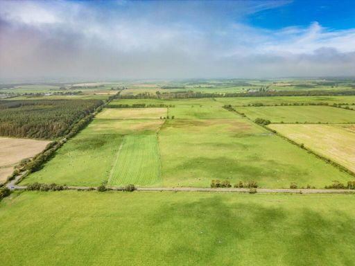 Land for sale in Land At Cummertrees, Cummertrees, Annan, DG12 — £650,000 • 1 bed • 1 bath
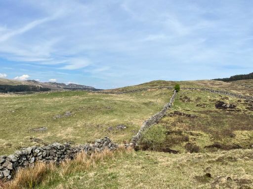 Land for sale in Mark Farm, Creetown DG8 — £1,250,000 • 1 bed • 1 bath
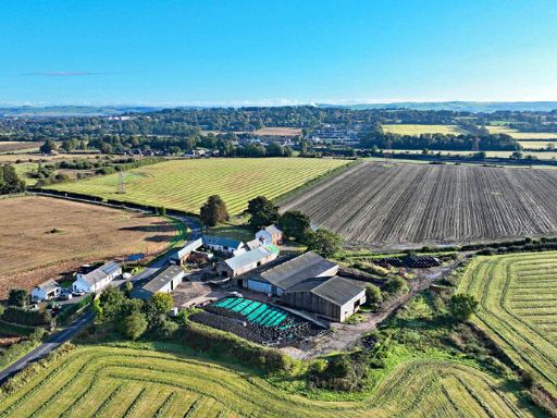 Farm land for sale in Nethertown Farm, New Abbey Road, DG2 8ER, DG2 — £1,600,000 • 4 bed • 1 bath
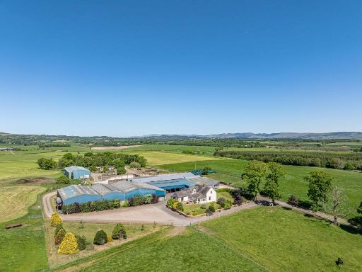 Land for sale in Lot 3 Gillrigg, Lochmaben, Lockerbie, DG11 — £1,250,000 • 1 bed • 1 bath
Meta
- {
"@context": "https://schema.org",
"@type": "Residence",
"name": "Land for sale in Land At Greenmerse Farm, Dumfries, Dumfrie…",
"description": "",
"url": "https://propertypiper.co.uk/property/c97f41aa-e45f-450d-99f9-d1d4dbaf8e73",
"image": "https://image-a.propertypiper.co.uk/83cf32f2-d36a-4cd4-b4b1-cafa865040bf-1024.jpeg",
"address": {
"@type": "PostalAddress",
"streetAddress": "Land At Greenmerse Farm, Dumfries, Dumfries and Galloway, DG2",
"postalCode": "DG2 8EY",
"addressLocality": "Dumfries and Galloway",
"addressRegion": "Dumfries and Galloway",
"addressCountry": "Scotland"
},
"geo": {
"@type": "GeoCoordinates",
"latitude": 55.01759831060725,
"longitude": -3.5994483408877627
},
"numberOfRooms": 1,
"numberOfBathroomsTotal": 1,
"offers": {
"@type": "Offer",
"price": 1400000,
"priceCurrency": "GBP",
"availability": "https://schema.org/InStock"
},
"additionalProperty": [
{
"@type": "PropertyValue",
"name": "Feature",
"value": "land"
},
{
"@type": "PropertyValue",
"name": "Feature",
"value": "greenfield"
},
{
"@type": "PropertyValue",
"name": "Feature",
"value": "pasture"
},
{
"@type": "PropertyValue",
"name": "Feature",
"value": "agricultural use"
},
{
"@type": "PropertyValue",
"name": "Feature",
"value": "investment"
},
{
"@type": "PropertyValue",
"name": "Feature",
"value": "development"
},
{
"@type": "PropertyValue",
"name": "Feature",
"value": "rural"
},
{
"@type": "PropertyValue",
"name": "Feature",
"value": "rural"
},
{
"@type": "PropertyValue",
"name": "Feature",
"value": "landscape"
},
{
"@type": "PropertyValue",
"name": "Feature",
"value": "field"
},
{
"@type": "PropertyValue",
"name": "Feature",
"value": "countryside"
},
{
"@type": "PropertyValue",
"name": "Feature",
"value": "scenic"
},
{
"@type": "PropertyValue",
"name": "Feature",
"value": "open land"
}
]
}