DG8 7ES - Land for sale in Mark Farm, Creetown DG8
View on Property Piper
Land for sale in Mark Farm, Creetown DG8
Property Details
- Price: £1250000
- Bedrooms: 1
- Bathrooms: 1
- Property Type: undefined
- Property SubType: undefined
Brochure Descriptions
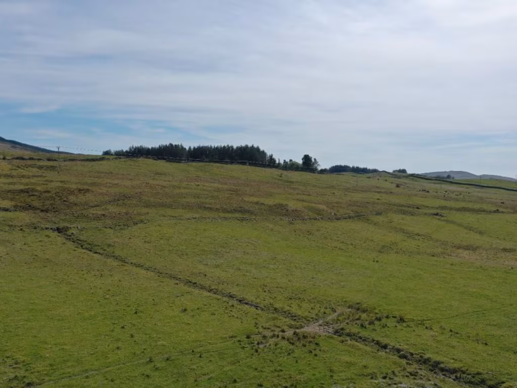
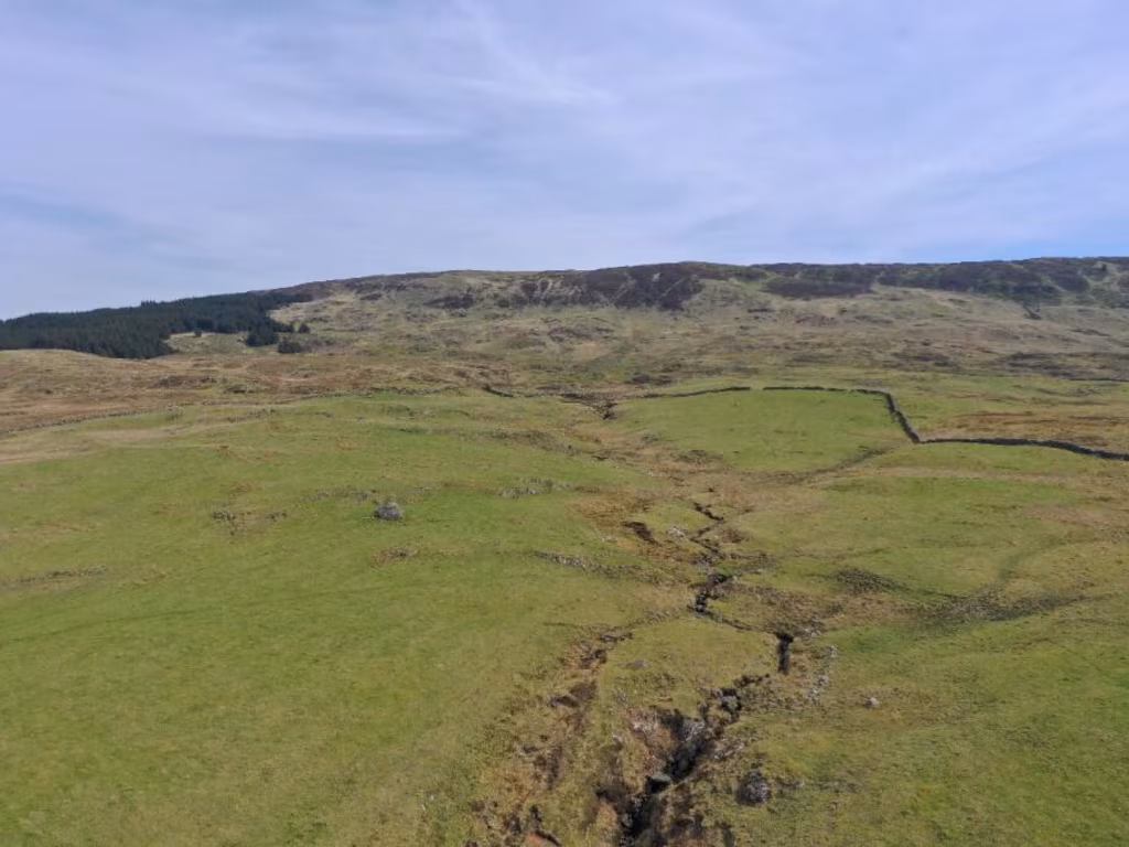
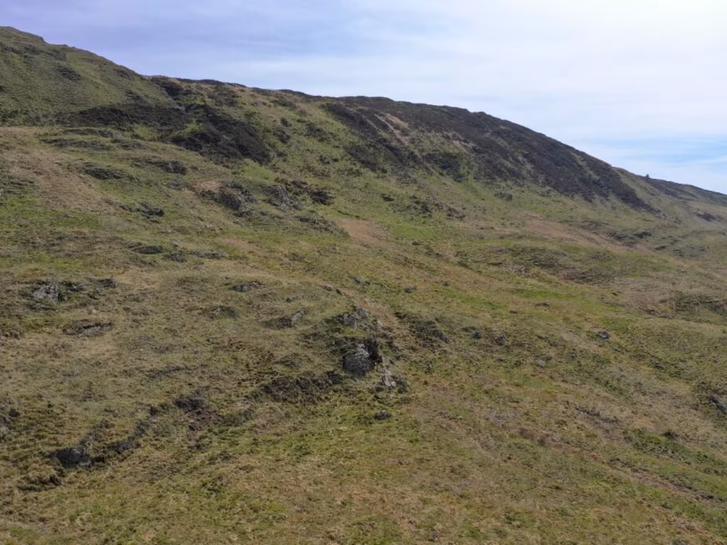
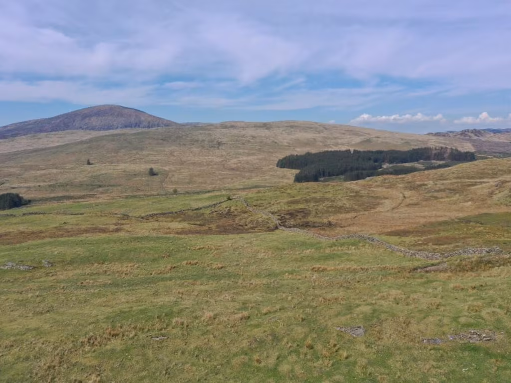
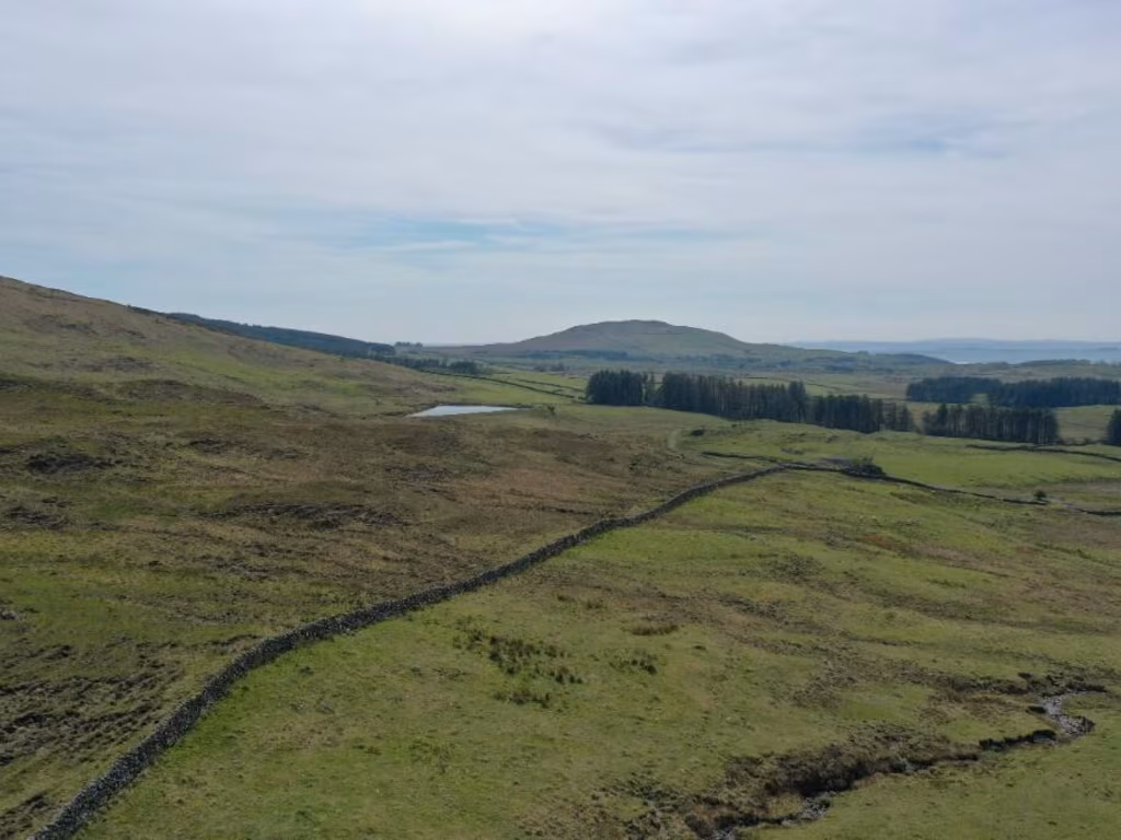
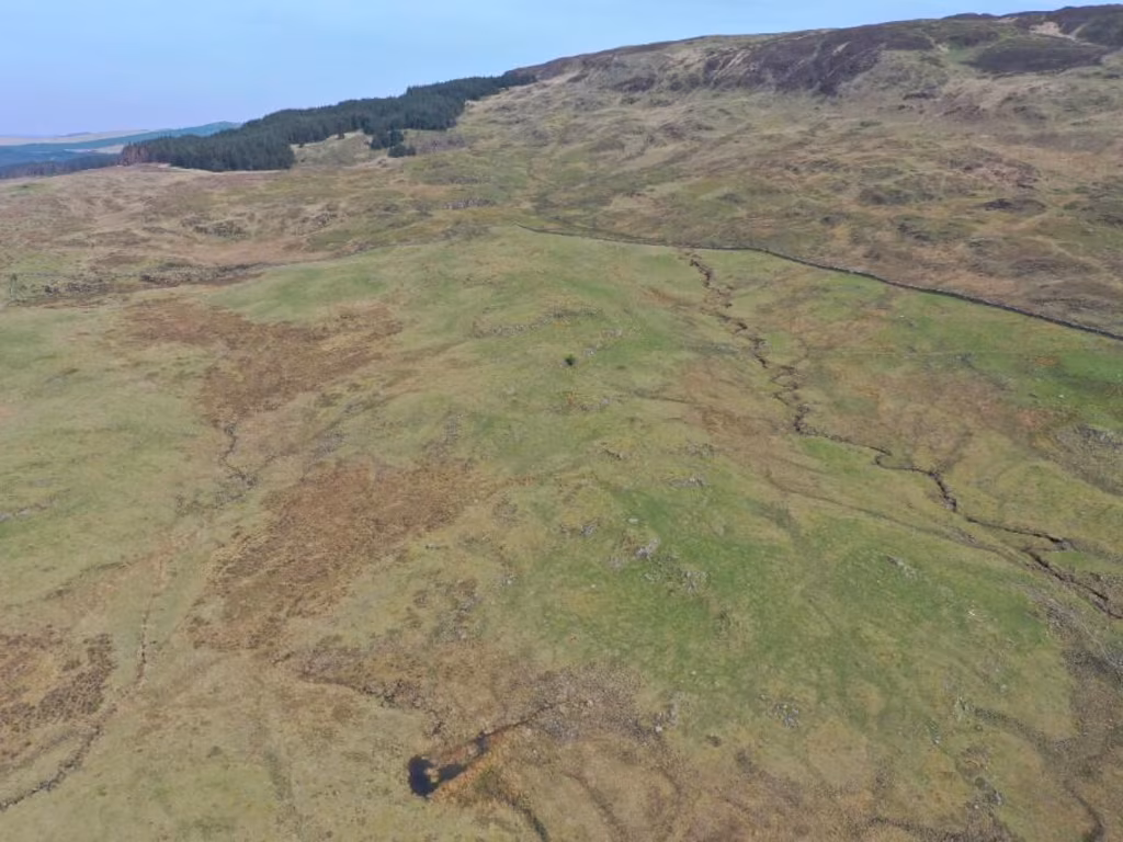
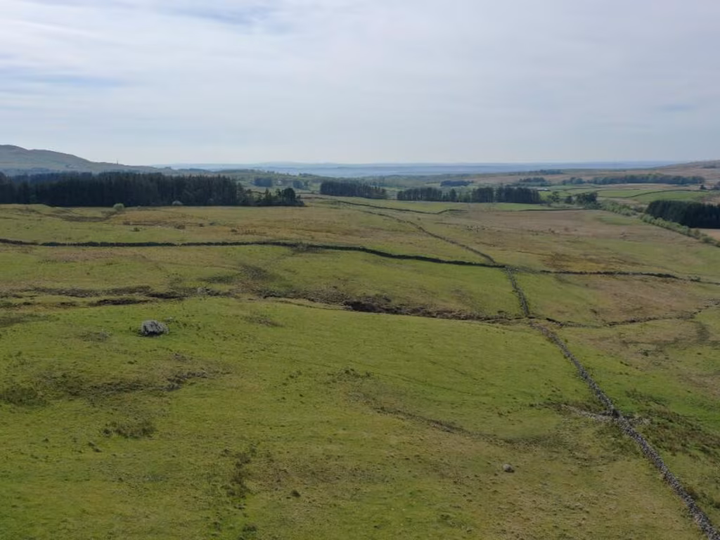
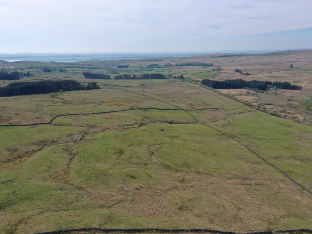
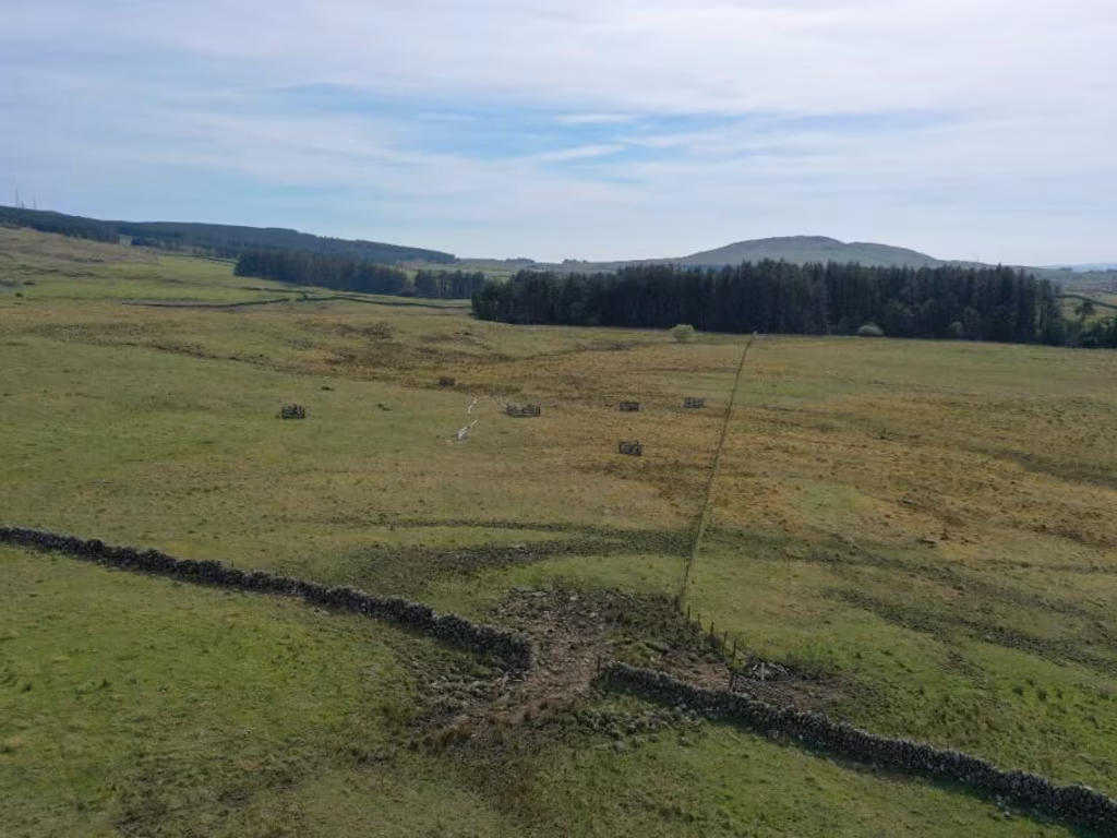
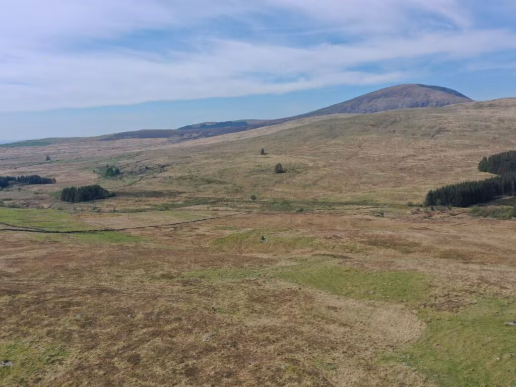
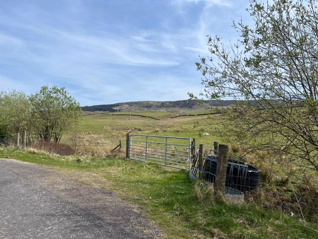
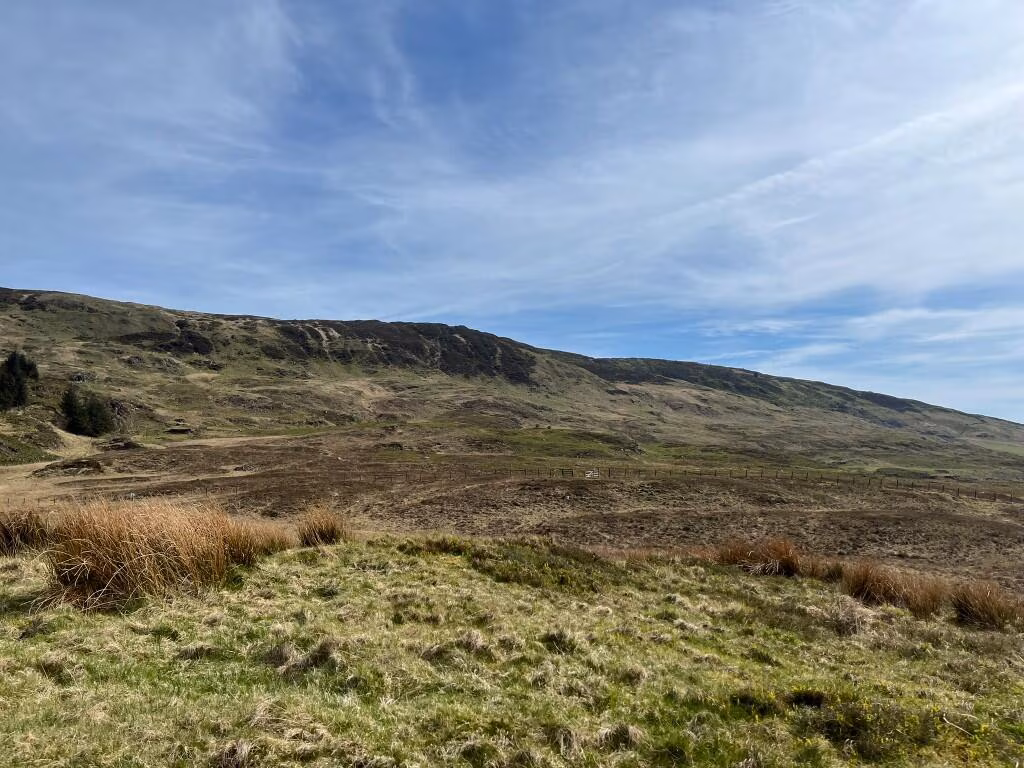
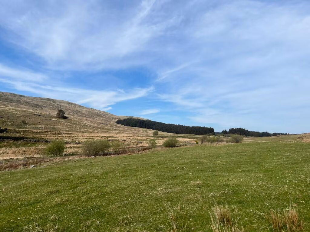
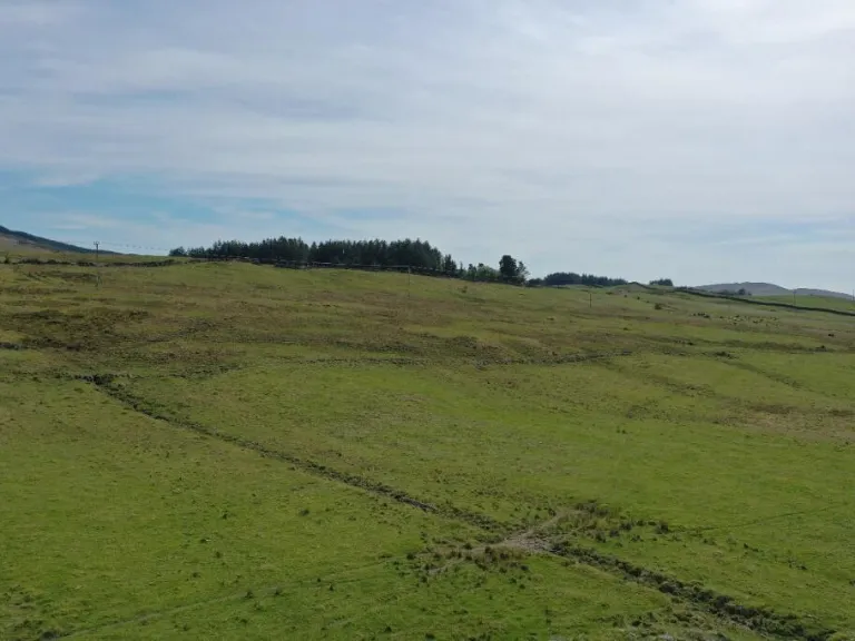
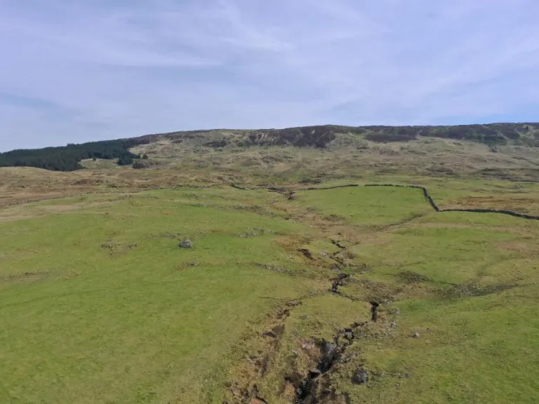
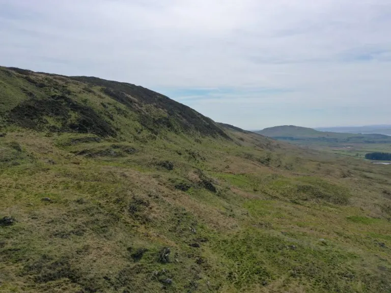
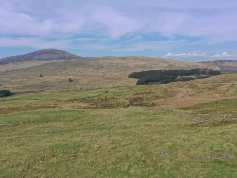
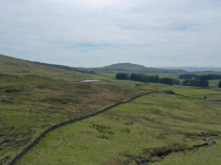
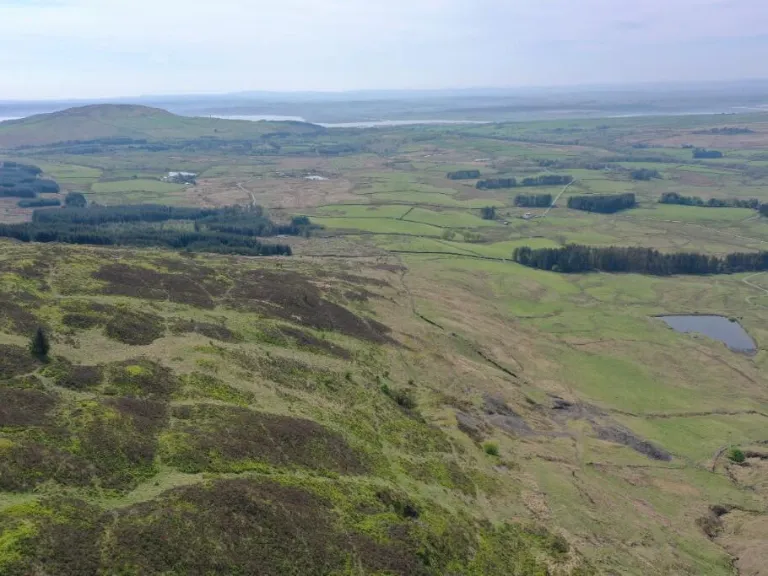
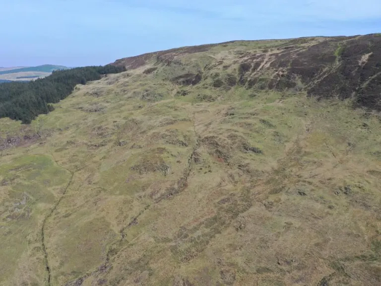
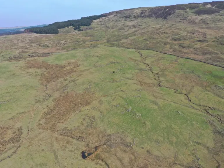
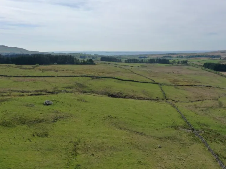
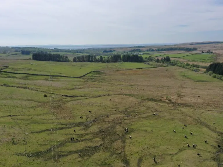
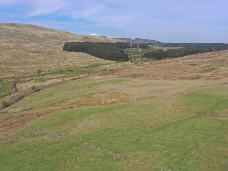
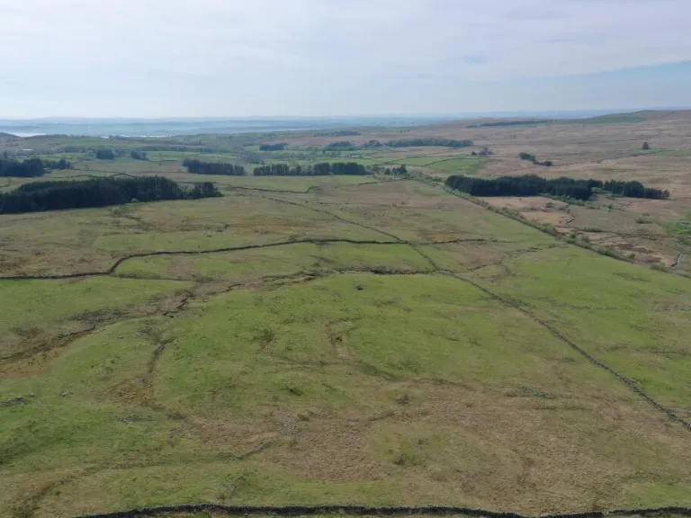
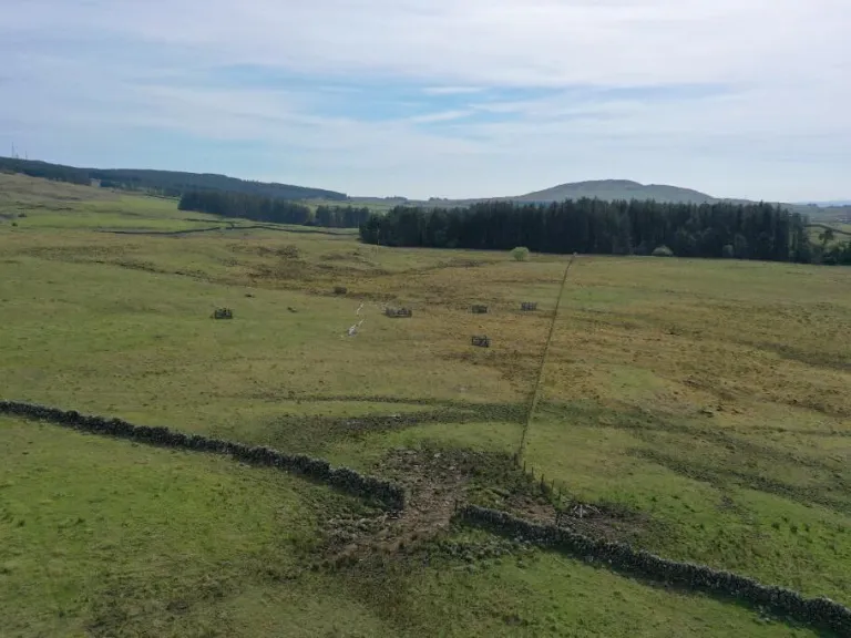
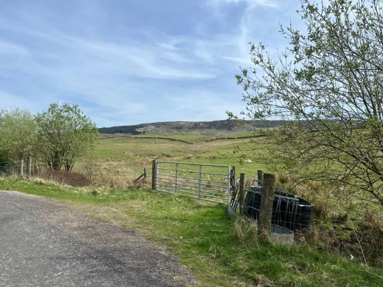
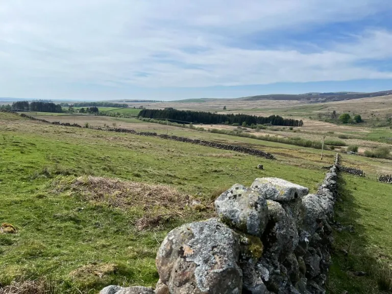
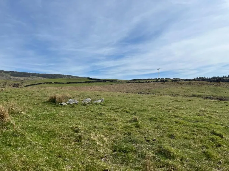
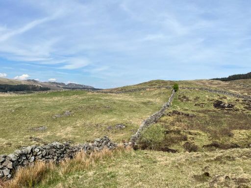
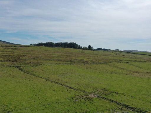
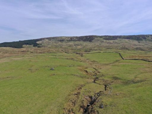
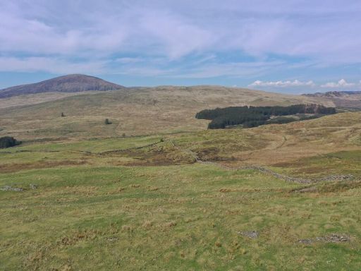
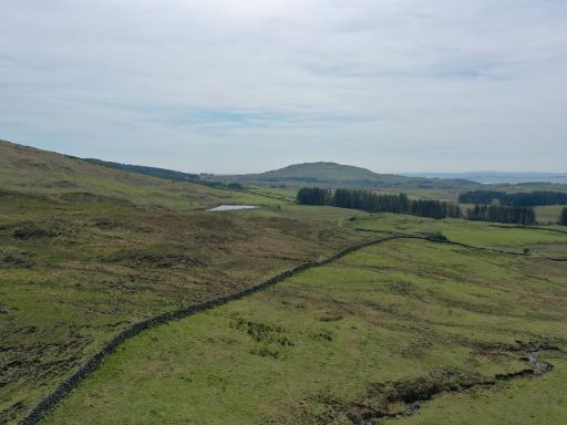
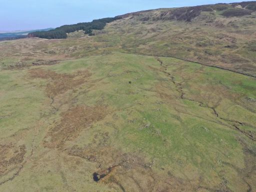
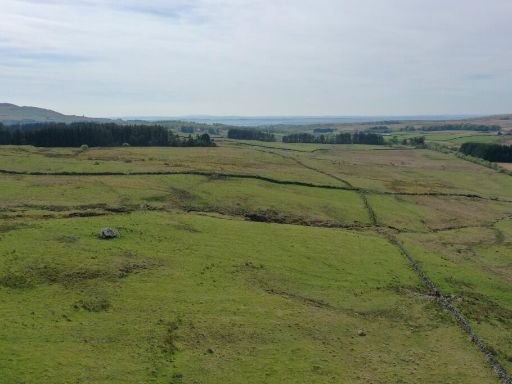
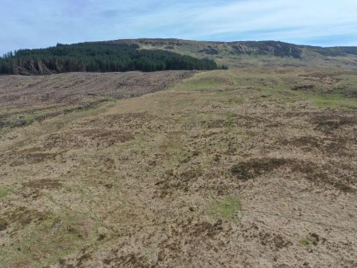
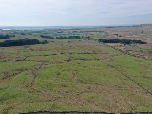
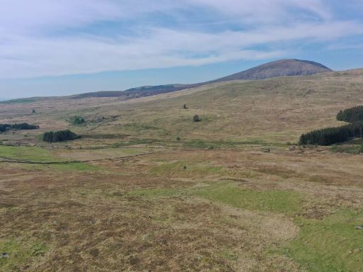
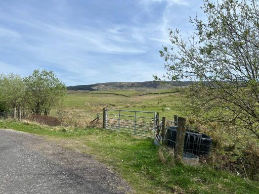
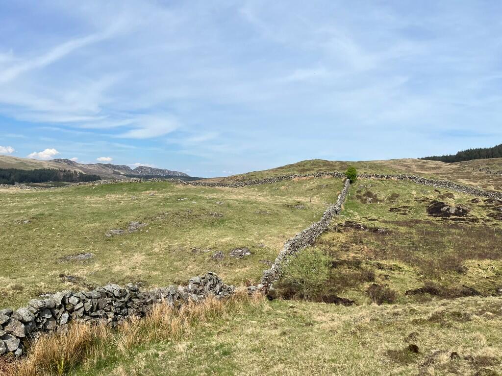
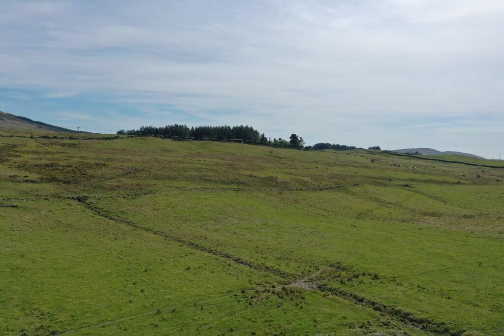
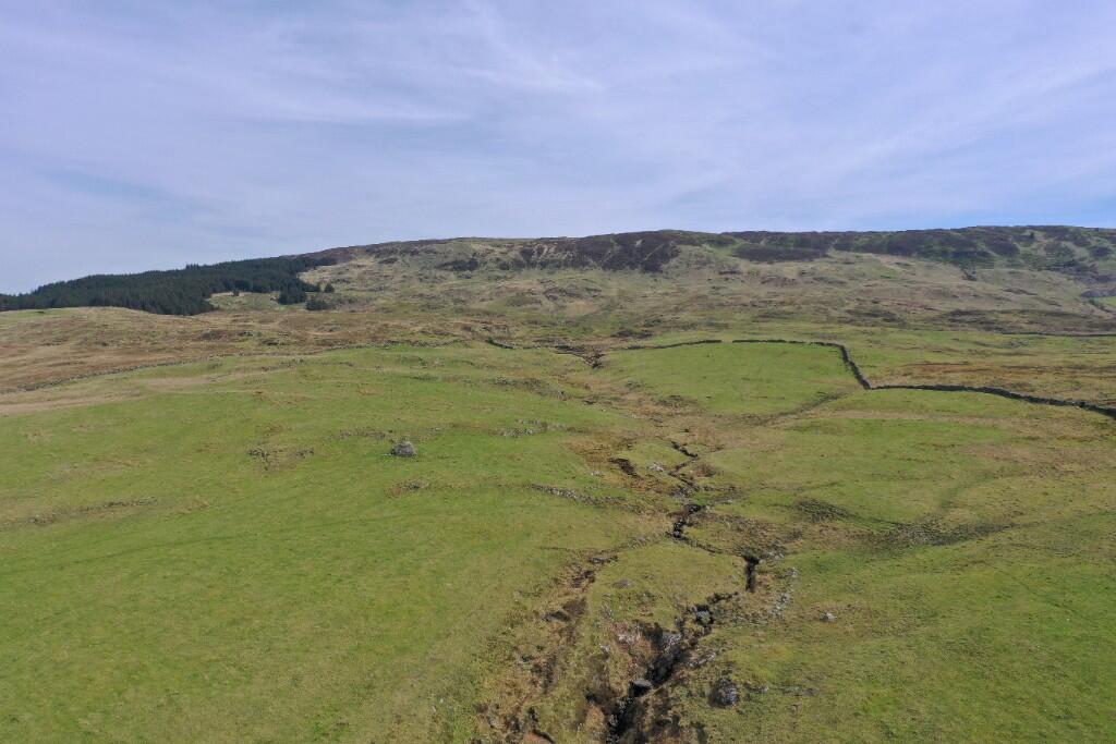
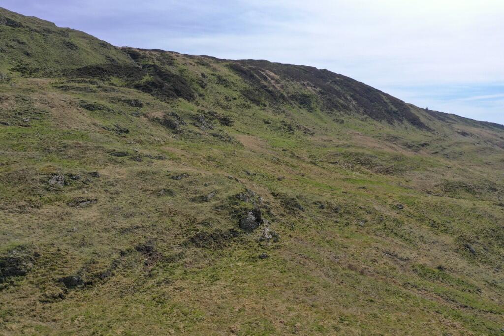
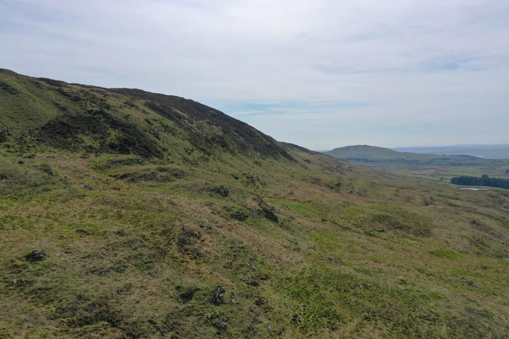
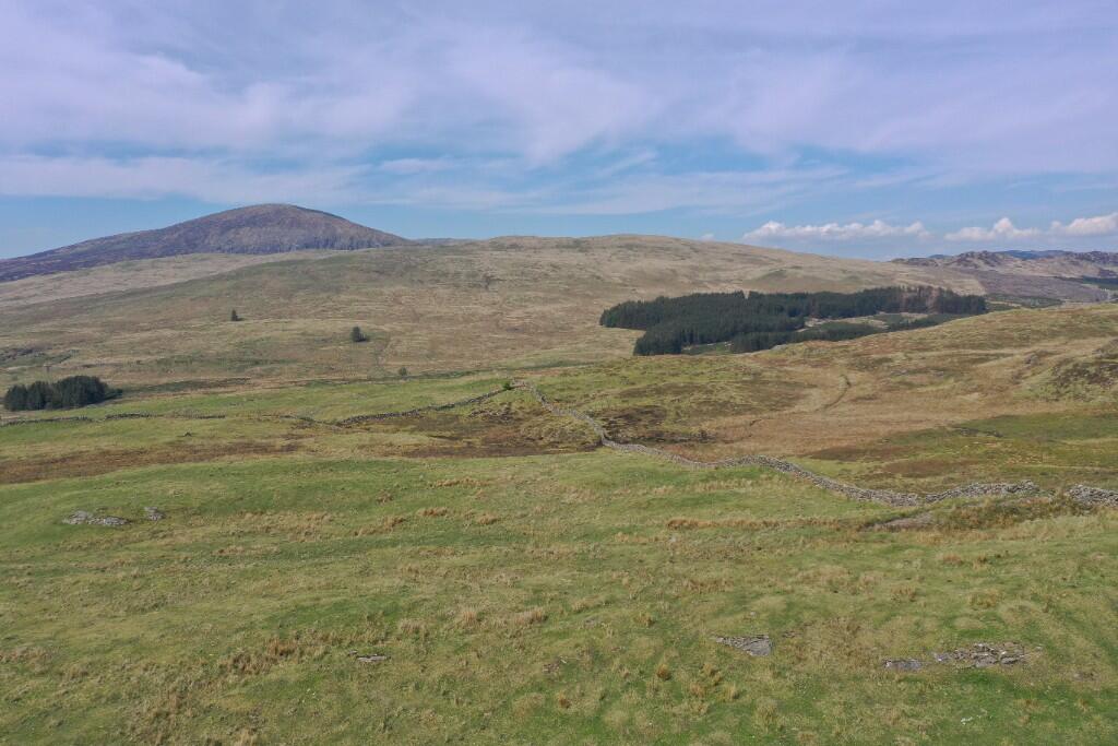
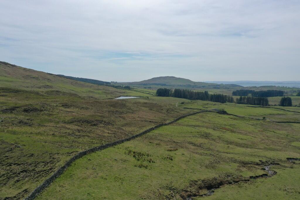
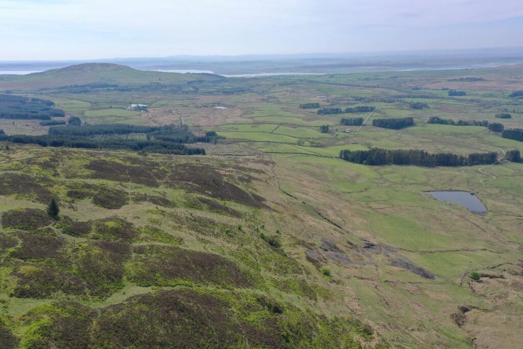
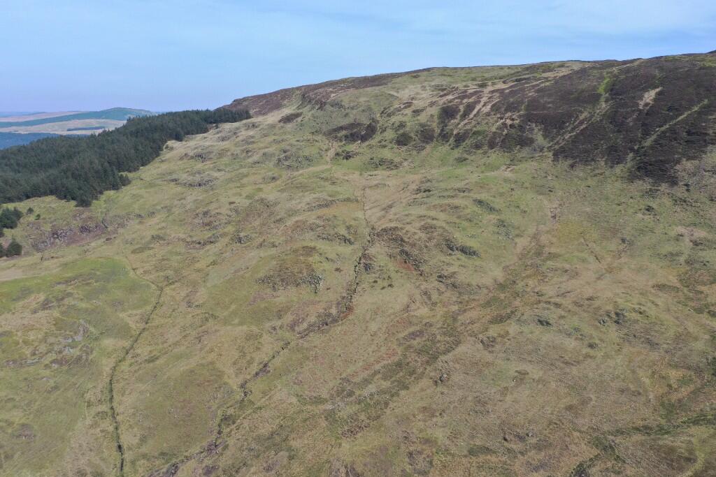
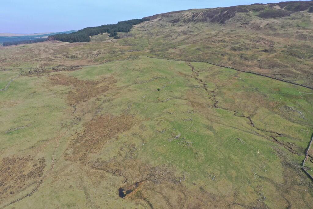
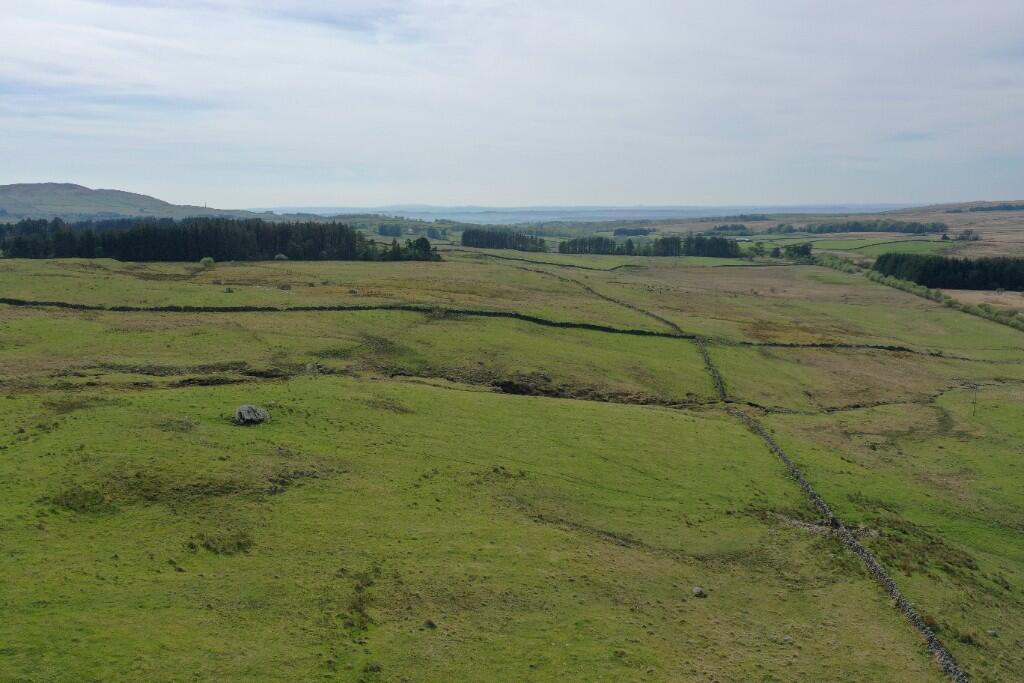
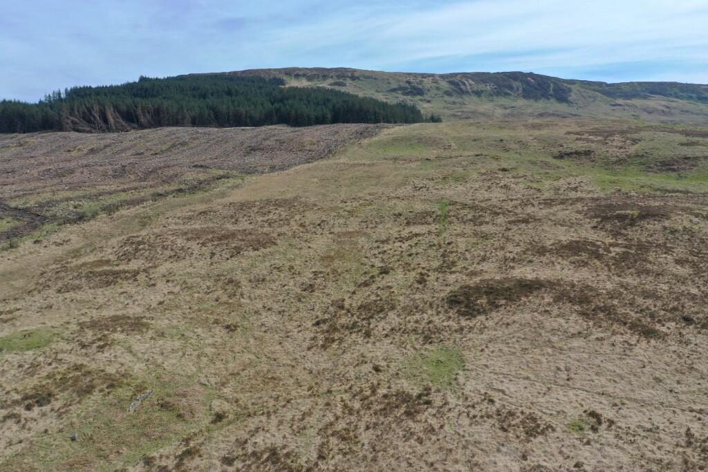
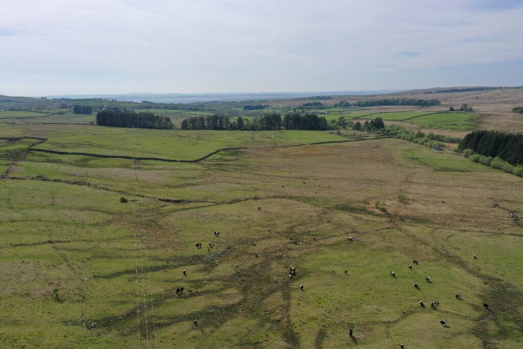
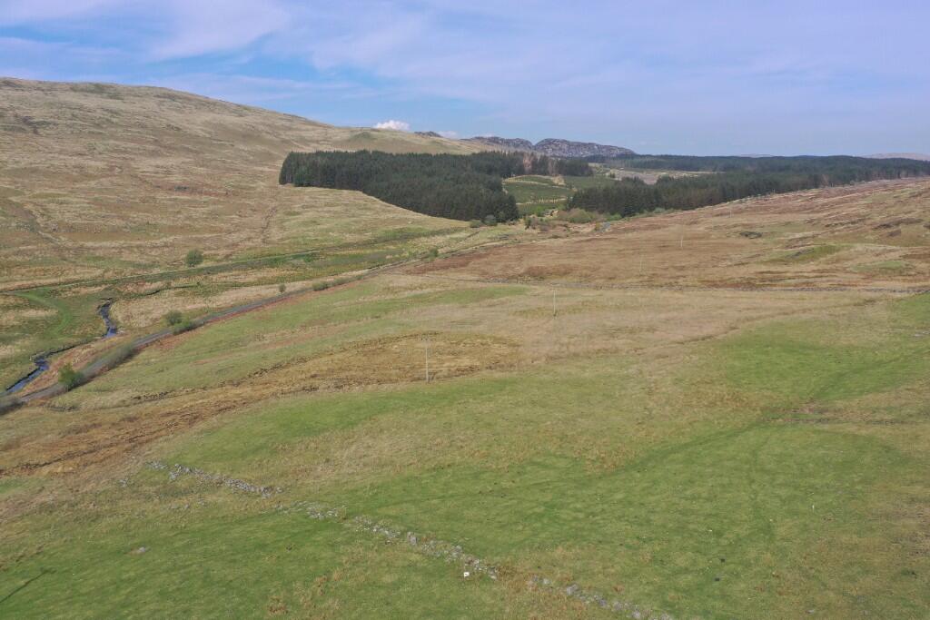
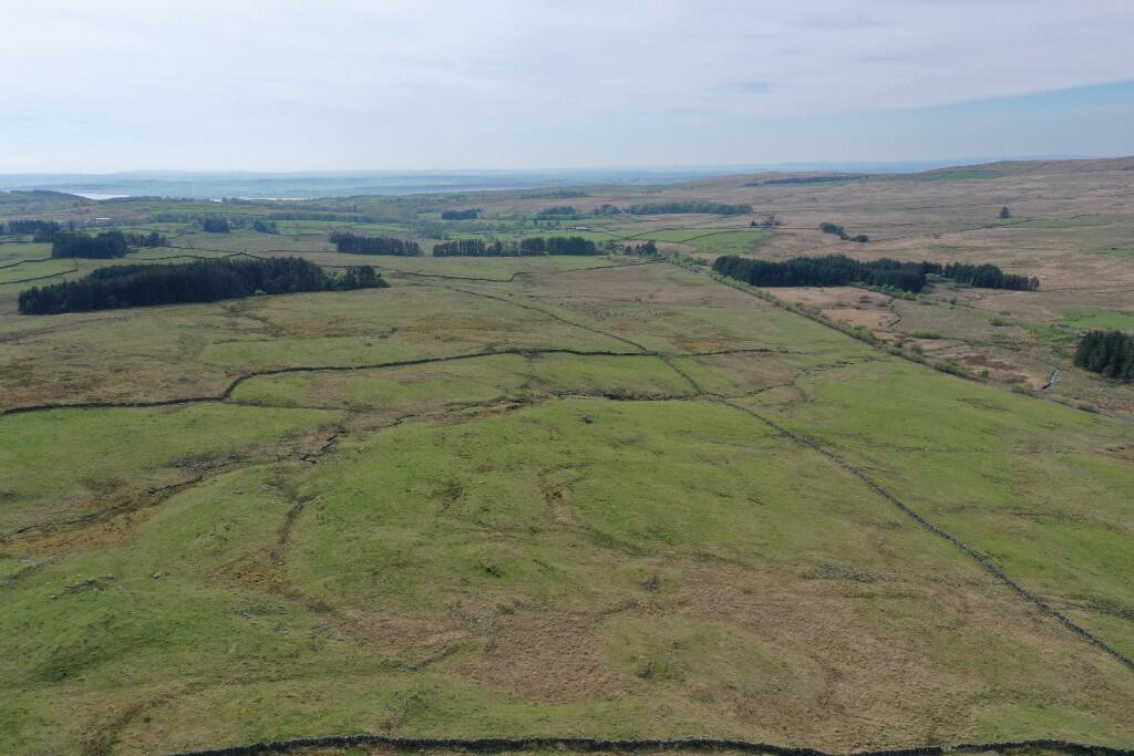
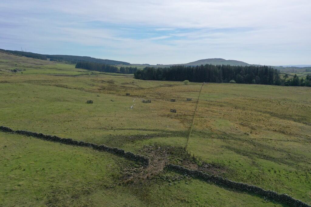
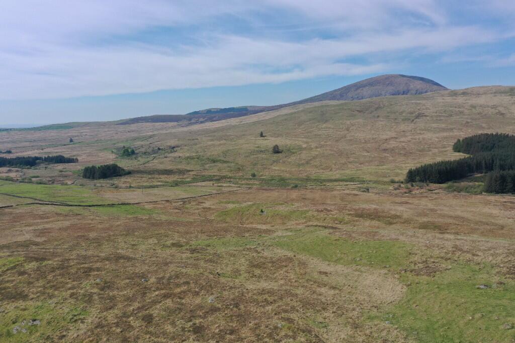
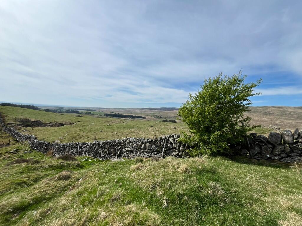
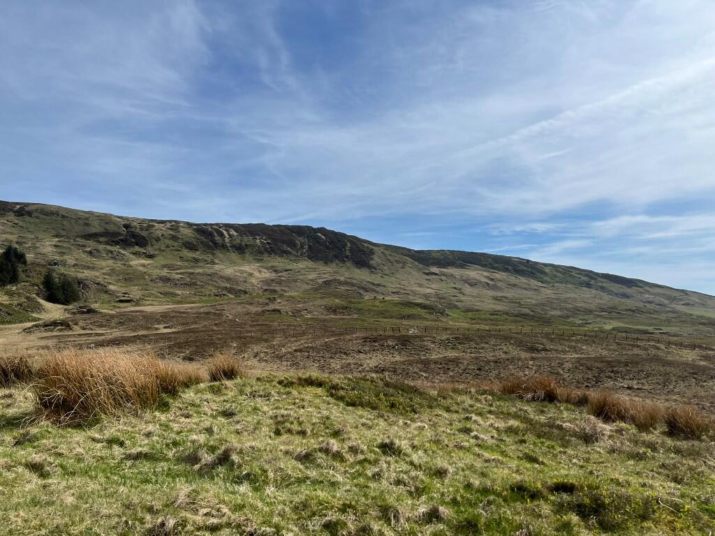
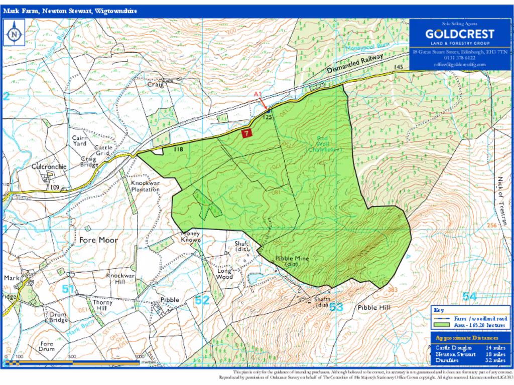
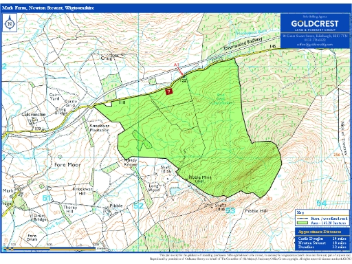
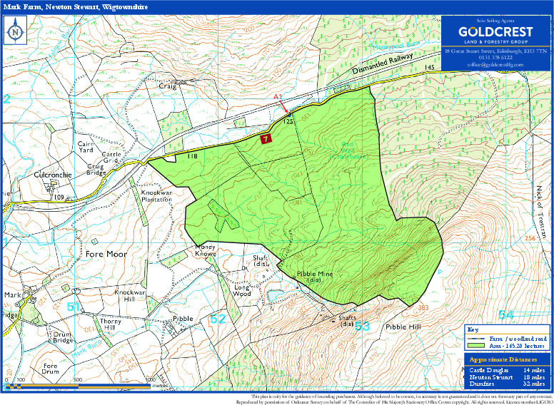
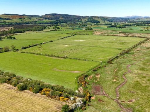
- The property consists of extensive, rolling countryside primarily consisting of grassland with scenic views of surrounding woodland and hills. The land totals 165.20 hectares (408.21 acres), offering exceptional potential for agricultural use and pastoral activities. The setting is tranquil with unspoiled panoramic views, suitable for various land use options from farming to conservation. The overall size of the property is substantial, best described as large, with no immediate residential structures visible.
- The property appears to be a large expanse of open grassland, possibly used for agricultural or forestry purposes. The land is characterized by a gentle slope and is bordered by a traditional stone wall, suggesting a rural location. The view from the property is expansive, offering wide vistas of the surrounding countryside, which may include distant hills or further fields. The size of the land is potentially substantial, ideal for those seeking rural development opportunities or recreational uses.
Image Descriptions
- rural land
- vacant land rural
Floorplan Description
- A farm land in Newton Stewart, Wigtownshire.
Textual Property Features
Detected Visual Features
- rural land
- countryside
- pasture
- stone wall
- undulating terrain
- remote
- natural
- open space
- development potential
- vacant land
- rural
- development opportunity
- investment
- buy-to-let potential
- expansive
- undeveloped
- agricultural potential
- tranquil setting
- land purchase
Nearest Bars And Restaurants
- Id: 5607305840
- Tags:
- TagsNormalized:
- Lat: 54.869036
- Lon: -4.4410239
- FullGeoHash: gcub4uw5k9ss
- PartitionGeoHash: gcub
- Images:
- FoodStandards: null
- Distance: 8885.7
,- Id: 9526550117
- Tags:
- Amenity: restaurant
- Name: Gather
- TagsNormalized:
- Lat: 54.8527415
- Lon: -4.2681933
- FullGeoHash: gcubnceuruhk
- PartitionGeoHash: gcub
- Images:
- FoodStandards: null
- Distance: 8266.5
,- Id: 6571225400
- Tags:
- TagsNormalized:
- Lat: 54.9543734
- Lon: -4.4194128
- FullGeoHash: gcubekjukjwy
- PartitionGeoHash: gcub
- Images:
- FoodStandards: null
- Distance: 6968.8
,- Id: 601740677
- Tags:
- Amenity: cafe
- Building: yes
- Outdoor_seating: yes
- TagsNormalized:
- Lat: 54.8594858
- Lon: -4.3463858
- FullGeoHash: gcubj4g59v7g
- PartitionGeoHash: gcub
- Images:
- FoodStandards: null
- Distance: 6554.5
,- Id: 926204582
- Tags:
- Amenity: pub
- Building: yes
- TagsNormalized:
- Lat: 54.9011673
- Lon: -4.3792798
- FullGeoHash: gcubk67n7rk7
- PartitionGeoHash: gcub
- Images:
- FoodStandards: null
- Distance: 3601.8
}
Nearest General Shops
- Id: 996377648
- Tags:
- Amenity: bicycle_rental
- Name: The Breakpad Bike Shop
- Shop: bicycle
- TagsNormalized:
- bicycle
- bicycle rental
- bike
- shop
- Lat: 54.9544852
- Lon: -4.4193572
- FullGeoHash: gcubekjvjd83
- PartitionGeoHash: gcub
- Images:
- FoodStandards: null
- Distance: 6973.2
,- Id: 6509262785
- Tags:
- Addr:
- Name: Galloway Smokehouse
- Shop: seafood
- Website: https://www.gallowaysmokehouse.co.uk/
- TagsNormalized:
- Lat: 54.8755322
- Lon: -4.3700351
- FullGeoHash: gcubhtcc4u9s
- PartitionGeoHash: gcub
- Images:
- FoodStandards: null
- Distance: 5320.6
,- Id: 222917583
- Tags:
- Building: yes
- Shop: car_repair
- TagsNormalized:
- Lat: 54.8959849
- Lon: -4.3830307
- FullGeoHash: gcubk3827cr3
- PartitionGeoHash: gcub
- Images:
- FoodStandards: null
- Distance: 4119.8
}
Nearest Grocery shops
- Id: 1091817682
- Tags:
- Brand: Premier
- Brand:wikidata: Q7240340
- Building: yes
- Shop: convenience
- TagsNormalized:
- Lat: 54.8434945
- Lon: -4.2799081
- FullGeoHash: gcszyxgqwbm5
- PartitionGeoHash: gcsz
- Images:
- FoodStandards: null
- Distance: 8877.7
,- Id: 222916871
- Tags:
- Building: yes
- Shop: convenience
- TagsNormalized:
- Lat: 54.8958772
- Lon: -4.3831728
- FullGeoHash: gcubk32r8tjq
- PartitionGeoHash: gcub
- Images:
- FoodStandards: null
- Distance: 4134.2
,- Id: 222916873
- Tags:
- Addr:
- City: Creetown
- Country: GB
- Housenumber: 79
- Postcode: DG8 7JB
- Street: St John Street
- Building: yes
- Fhrs:
- Name: Creetown Stores
- Shop: convenience
- TagsNormalized:
- Lat: 54.8994863
- Lon: -4.3789294
- FullGeoHash: gcubk65ketcx
- PartitionGeoHash: gcub
- Images:
- FoodStandards:
- Id: 764796
- FHRSID: 764796
- LocalAuthorityBusinessID: 94652
- BusinessName: Creetown Stores
- BusinessType: Retailers - other
- BusinessTypeID: 4613
- AddressLine1: null
- AddressLine2: 79 St John Street
- AddressLine3: Creetown
- AddressLine4: Newton Stewart
- PostCode: null
- RatingValue: Pass
- RatingKey: fhis_pass_en-GB
- RatingDate: 2019-03-18
- LocalAuthorityCode: 770
- LocalAuthorityName: Dumfries and Galloway
- LocalAuthorityWebSite: http://www.dumgal.gov.uk/
- LocalAuthorityEmailAddress: contact@dumgal.gov.uk
- Scores:
- Hygiene: null
- Structural: null
- ConfidenceInManagement: null
- NewRatingPending: false
- Geocode:
- Longitude: -4.37903530000000
- Latitude: 54.89948070000000
- Distance: 3682.3
}
Nearest Religious buildings
- Id: 256955885
- Tags:
- Amenity: place_of_worship
- Building: yes
- Denomination: roman_catholic
- Name: Sacred Heart Church
- Religion: christian
- Wikidata: Q13195255
- TagsNormalized:
- place of worship
- catholic
- roman catholic
- church
- christian
- Lat: 54.8678881
- Lon: -4.4417295
- FullGeoHash: gcub4umss5wm
- PartitionGeoHash: gcub
- Images:
- FoodStandards: null
- Distance: 8999.6
,- Id: 591255745
- Tags:
- Amenity: place_of_worship
- Building: church
- Denomination: church_of_scotland
- Name: Wigtown Parish Church
- Religion: christian
- Wikidata: Q17798171
- TagsNormalized:
- place of worship
- church
- church of scotland
- parish
- christian
- Lat: 54.8700581
- Lon: -4.4390615
- FullGeoHash: gcub4uz9625v
- PartitionGeoHash: gcub
- Images:
- FoodStandards: null
- Distance: 8716.8
,- Id: 42312176
- Tags:
- Landuse: forest
- Leaf_type: needleleaved
- Name: Churchiehill Wood
- Source: OS7
- TagsNormalized:
- Lat: 54.9522046
- Lon: -4.4147806
- FullGeoHash: gcubee9rb1ku
- PartitionGeoHash: gcub
- Images:
- FoodStandards: null
- Distance: 6588
}
Nearest Medical buildings
- Id: 516716247
- Tags:
- Amenity: doctors
- Building: yes
- Healthcare: centre
- Name: Newton Stewart Health Centre
- TagsNormalized:
- doctor
- doctors
- health
- healthcare
- health centre
- Lat: 54.9606032
- Lon: -4.4784388
- FullGeoHash: gcubdj6bsz1b
- PartitionGeoHash: gcub
- Images:
- FoodStandards: null
- Distance: 10561.2
,- Id: 256968046
- Tags:
- Access: customers
- Amenity: parking
- Fee: no
- Name: Surgery Car Park
- TagsNormalized:
- Lat: 54.8679041
- Lon: -4.4443573
- FullGeoHash: gcub4u7swyxh
- PartitionGeoHash: gcub
- Images:
- FoodStandards: null
- Distance: 9131.5
,- Id: 256967691
- Tags:
- Addr:
- Amenity: doctors
- Building: yes
- Healthcare: doctor
- Name: Wigtown Medical Practice
- TagsNormalized:
- doctor
- doctors
- health
- healthcare
- Lat: 54.8680483
- Lon: -4.4445438
- FullGeoHash: gcub4u7td9ec
- PartitionGeoHash: gcub
- Images:
- FoodStandards: null
- Distance: 9131.3
,- Id: 256952989
- Tags:
- Amenity: pharmacy
- Building: yes
- Name: Wigtown Pharmacy
- TagsNormalized:
- Lat: 54.8680522
- Lon: -4.4436848
- FullGeoHash: gcub4ukjwdk2
- PartitionGeoHash: gcub
- Images:
- FoodStandards: null
- Distance: 9087.3
}
Nearest Leisure Facilities
- Id: 591354877
- Tags:
- TagsNormalized:
- Lat: 54.9462367
- Lon: -4.3890716
- FullGeoHash: gcubs4evp0zh
- PartitionGeoHash: gcub
- Images:
- FoodStandards: null
- Distance: 4883.8
,- Id: 353315476
- Tags:
- Leisure: pitch
- Lit: yes
- Name: Creetown F.C.
- Sport: soccer
- Surface: grass
- Wikidata: Q5183963
- Wikipedia: en:Creetown F.C.
- TagsNormalized:
- Lat: 54.8941689
- Lon: -4.3830643
- FullGeoHash: gcubk30meny2
- PartitionGeoHash: gcub
- Images:
- FoodStandards: null
- Distance: 4243.4
,- Id: 222914822
- Tags:
- Leisure: pitch
- Sport: bowls
- TagsNormalized:
- Lat: 54.9020537
- Lon: -4.3804915
- FullGeoHash: gcubk6d5xhsg
- PartitionGeoHash: gcub
- Images:
- FoodStandards: null
- Distance: 3619.9
,- Id: 222916370
- Tags:
- Leisure: pitch
- Sport: tennis
- TagsNormalized:
- Lat: 54.903154
- Lon: -4.3781381
- FullGeoHash: gcubk6gfjcxw
- PartitionGeoHash: gcub
- Images:
- FoodStandards: null
- Distance: 3429.3
,- Id: 222916368
- Tags:
- TagsNormalized:
- Lat: 54.903483
- Lon: -4.3781672
- FullGeoHash: gcubk6ggvr1c
- PartitionGeoHash: gcub
- Images:
- FoodStandards: null
- Distance: 3413.8
}
Nearest Tourist attractions
- Id: 380936142
- Tags:
- TagsNormalized:
- Lat: 54.8900956
- Lon: -4.3804747
- FullGeoHash: gcubk26jzx3q
- PartitionGeoHash: gcub
- Images:
- FoodStandards: null
- Distance: 4417.1
,- Id: 1789140300
- Tags:
- Name: Castle Cary Holiday Park
- Source: ACSI
- Tourism: camp_site
- TagsNormalized:
- Lat: 54.89176
- Lon: -4.37902
- FullGeoHash: gcubk2er9mwn
- PartitionGeoHash: gcub
- Images:
- FoodStandards: null
- Distance: 4222
,- Id: 591417719
- Tags:
- Name: Gem Rock Museum
- Tourism: attraction
- Website: https://www.gemrock.net/
- Wikidata: Q113363922
- TagsNormalized:
- Lat: 54.9029135
- Lon: -4.3766241
- FullGeoHash: gcubk6v09kbs
- PartitionGeoHash: gcub
- Images:
- FoodStandards: null
- Distance: 3357.4
}
Nearest Train stations
- Id: 30670482
- Tags:
- Name: Barrhill
- Naptan:
- Network: National Rail
- Operator: ScotRail
- Public_transport: station
- Railway: station
- Ref:
- Source: OS7
- Train: yes
- Wikidata: Q2845001
- Wikipedia: en:Barrhill railway station
- TagsNormalized:
- Lat: 55.0973578
- Lon: -4.782098
- FullGeoHash: gcu97njv35cm
- PartitionGeoHash: gcu9
- Images:
- FoodStandards: null
- Distance: 35024.3
}
Nearest Hotels
- Id: 4200398708
- Tags:
- Addr:
- City: Gatehouse of Fleet
- Postcode: DG7 2HY
- Street: Ann Street
- Contact:
- Website: https://www.themurrayarmsgatehouse.com/
- Fhrs:
- Name: Murray Arms Hotel
- Source:
- Tourism: hotel
- TagsNormalized:
- Lat: 54.8831361
- Lon: -4.1812417
- FullGeoHash: gcv00z5m6n05
- PartitionGeoHash: gcv0
- Images:
- FoodStandards: null
- Distance: 10312.8
,- Id: 4200398725
- Tags:
- Amenity: pub
- Name: Bank of Fleet Hotel
- TagsNormalized:
- Lat: 54.8823541
- Lon: -4.183444
- FullGeoHash: gcv00z18ysq4
- PartitionGeoHash: gcv0
- Images:
- FoodStandards: null
- Distance: 10215.6
,- Id: 256971738
- Tags:
- Building: yes
- Name: Hillcrest House
- Tourism: hotel
- Website: https://hillcrest-wigtown.co.uk/
- TagsNormalized:
- Lat: 54.8648269
- Lon: -4.4431802
- FullGeoHash: gcub4gudf3h8
- PartitionGeoHash: gcub
- Images:
- FoodStandards: null
- Distance: 9285
}
Tags
- rural land
- countryside
- pasture
- stone wall
- undulating terrain
- remote
- natural
- open space
- development potential
- vacant land
- rural
- development opportunity
- investment
- buy-to-let potential
- expansive
- undeveloped
- agricultural potential
- tranquil setting
- land purchase
Local Market Stats
- Average Price/sqft: £132
- Planning Success Rate: 88%
Similar Properties
 Land for sale in Land At Greenmerse Farm, Dumfries, Dumfries and Galloway, DG2 — £1,400,000 • 1 bed • 1 bath
 Farm land for sale in Cutreoch & Morrach Farms, Isle of Whithorn, DG8 8JD, DG8 — £2,200,000 • 4 bed • 1 bath • 1496 ft²
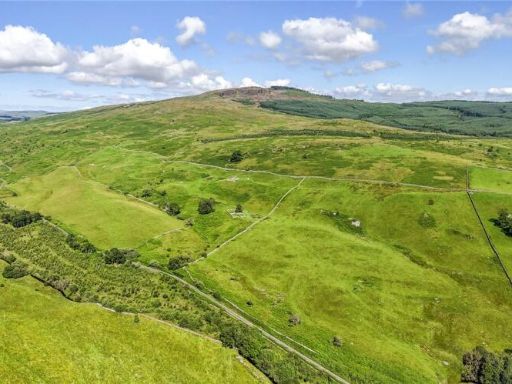 Land for sale in Sundaywell Moor & Nether Whiteside Moor, By Dunscore, Dumfries, DG2 — £2,050,000 • 1 bed • 1 bath • 6437 ft²
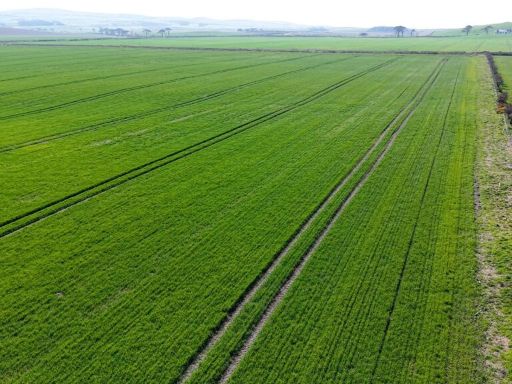 Land for sale in Land at Balgowan Farm, Ardwell, Stranraer, Dumfries and Galloway, South West Scotland, DG9 — £1,000,000 • 1 bed • 1 bath • 1246 ft²
 Land for sale in Land At Creetown, Creetown, Newton Stewart, Dumfries & Galloway, South West Scotland, DG8 — £200,000 • 1 bed • 1 bath
 Farm land for sale in High Auchenlarie & Holecroft Farms, Gatehouse of Fleet, DG7 2HB, DG7 — £1,200,000 • 4 bed • 1 bath • 1364 ft²
Meta
- {
"@context": "https://schema.org",
"@type": "Residence",
"name": "Land for sale in Mark Farm, Creetown DG8",
"description": "",
"url": "https://propertypiper.co.uk/property/0df8abbd-bfef-43a7-a631-c605f20c76e5",
"image": "https://image-a.propertypiper.co.uk/a785c1c9-d341-4a8d-b96d-258141355a37-1024.jpeg",
"address": {
"@type": "PostalAddress",
"streetAddress": "MARK FARM, NEWTON STEWART, CREETOWN",
"postalCode": "DG8 7ES",
"addressLocality": "Dumfries and Galloway",
"addressRegion": "Dumfries and Galloway",
"addressCountry": "Scotland"
},
"geo": {
"@type": "GeoCoordinates",
"latitude": 54.9177534,
"longitude": -4.3308811
},
"numberOfRooms": 1,
"numberOfBathroomsTotal": 1,
"offers": {
"@type": "Offer",
"price": 1250000,
"priceCurrency": "GBP",
"availability": "https://schema.org/InStock"
},
"additionalProperty": [
{
"@type": "PropertyValue",
"name": "Feature",
"value": "rural land"
},
{
"@type": "PropertyValue",
"name": "Feature",
"value": "countryside"
},
{
"@type": "PropertyValue",
"name": "Feature",
"value": "pasture"
},
{
"@type": "PropertyValue",
"name": "Feature",
"value": "stone wall"
},
{
"@type": "PropertyValue",
"name": "Feature",
"value": "undulating terrain"
},
{
"@type": "PropertyValue",
"name": "Feature",
"value": "remote"
},
{
"@type": "PropertyValue",
"name": "Feature",
"value": "natural"
},
{
"@type": "PropertyValue",
"name": "Feature",
"value": "open space"
},
{
"@type": "PropertyValue",
"name": "Feature",
"value": "development potential"
},
{
"@type": "PropertyValue",
"name": "Feature",
"value": "vacant land"
},
{
"@type": "PropertyValue",
"name": "Feature",
"value": "rural"
},
{
"@type": "PropertyValue",
"name": "Feature",
"value": "development opportunity"
},
{
"@type": "PropertyValue",
"name": "Feature",
"value": "investment"
},
{
"@type": "PropertyValue",
"name": "Feature",
"value": "buy-to-let potential"
},
{
"@type": "PropertyValue",
"name": "Feature",
"value": "expansive"
},
{
"@type": "PropertyValue",
"name": "Feature",
"value": "undeveloped"
},
{
"@type": "PropertyValue",
"name": "Feature",
"value": "agricultural potential"
},
{
"@type": "PropertyValue",
"name": "Feature",
"value": "tranquil setting"
},
{
"@type": "PropertyValue",
"name": "Feature",
"value": "land purchase"
}
]
}
High Res Floorplan Images
Compatible Floorplan Images
FloorplanImages Thumbnail