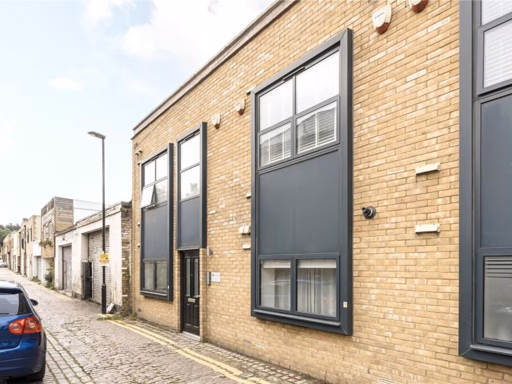
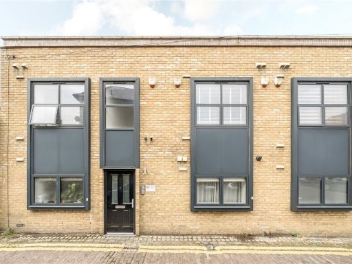
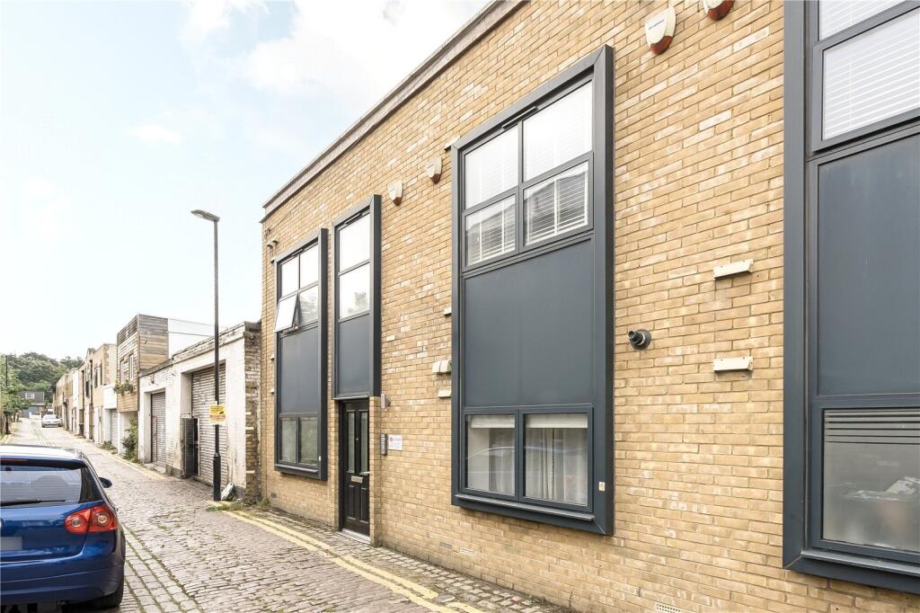
SE4 1LP - 1 bedroom apartment for sale in Harefield Mews, Brockley, S…
View on Property Piper
1 bedroom apartment for sale in Harefield Mews, Brockley, SE4
Property Details
- Price: £400000
- Bedrooms: 1
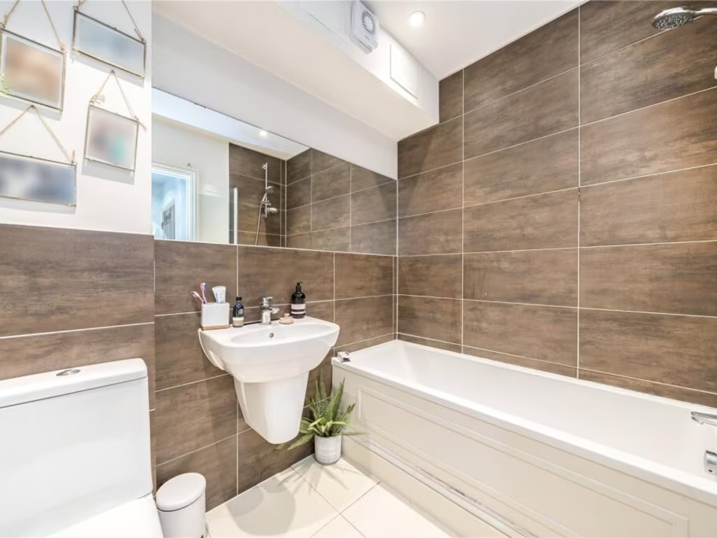
- Bathrooms: 1
- Property Type: undefined
- Property SubType: undefined
Image Descriptions
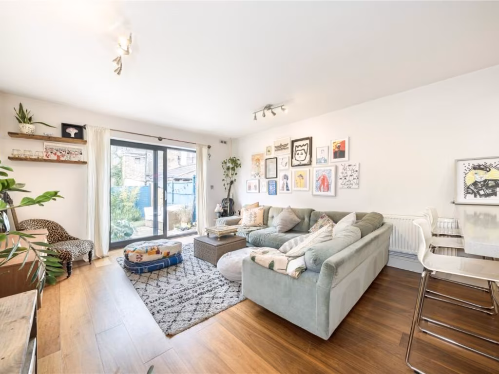
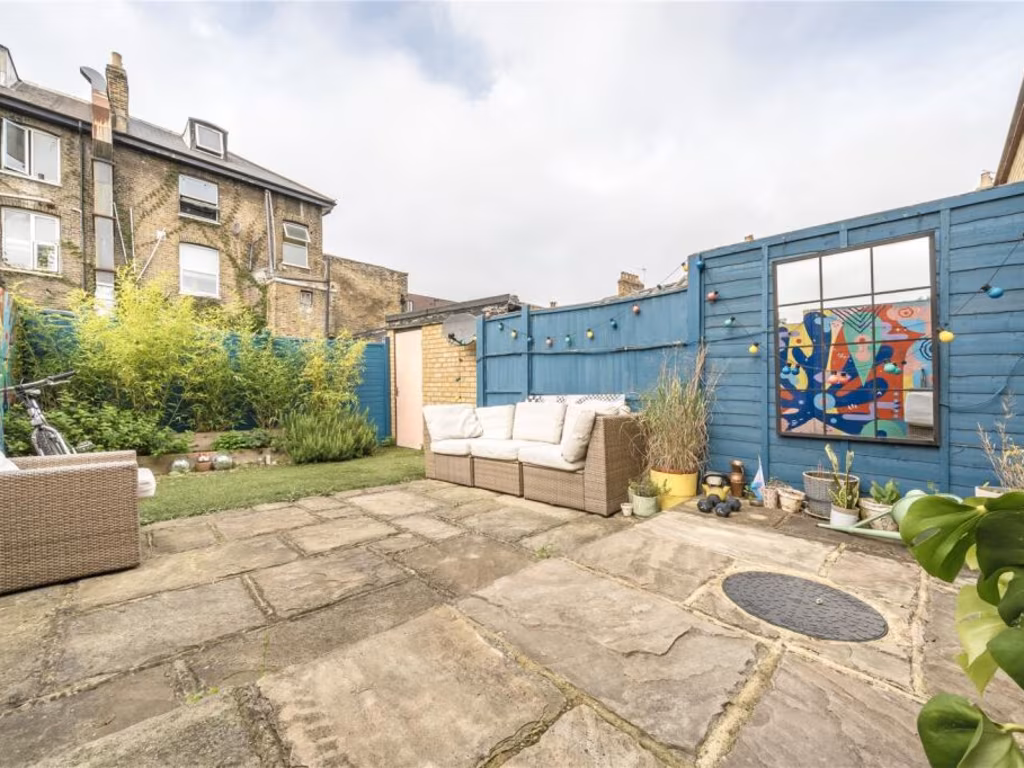
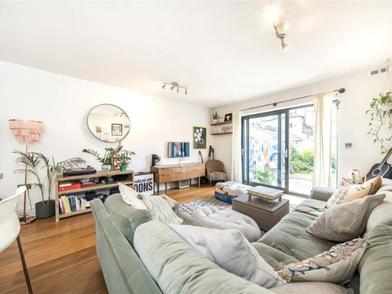
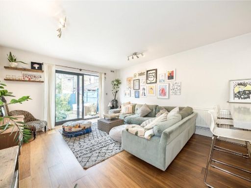
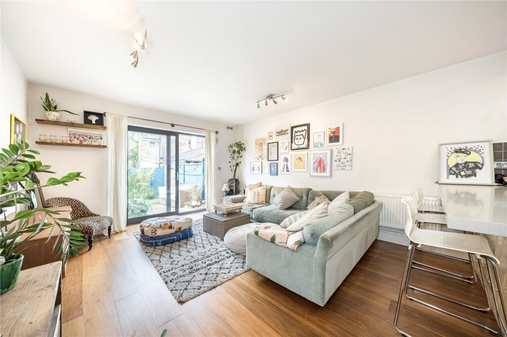
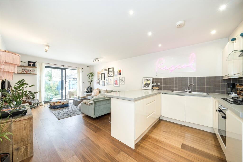
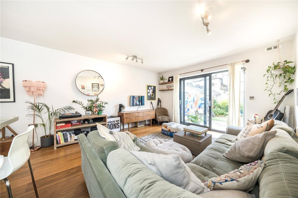
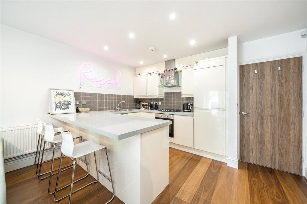
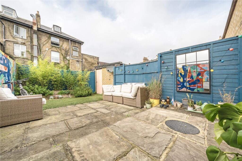
- living room contemporary
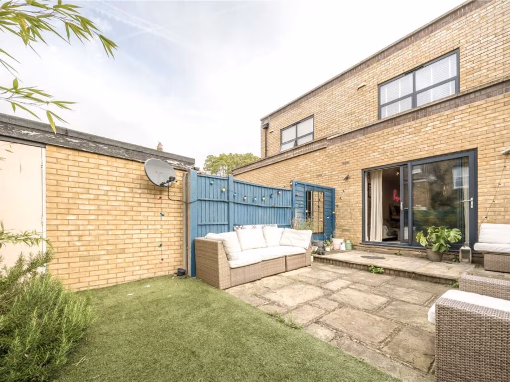
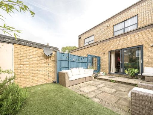
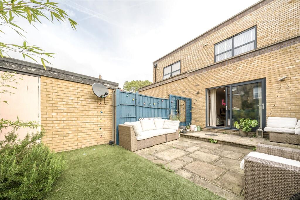
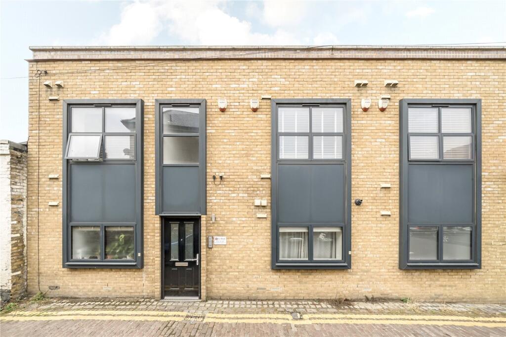
- backyard modern
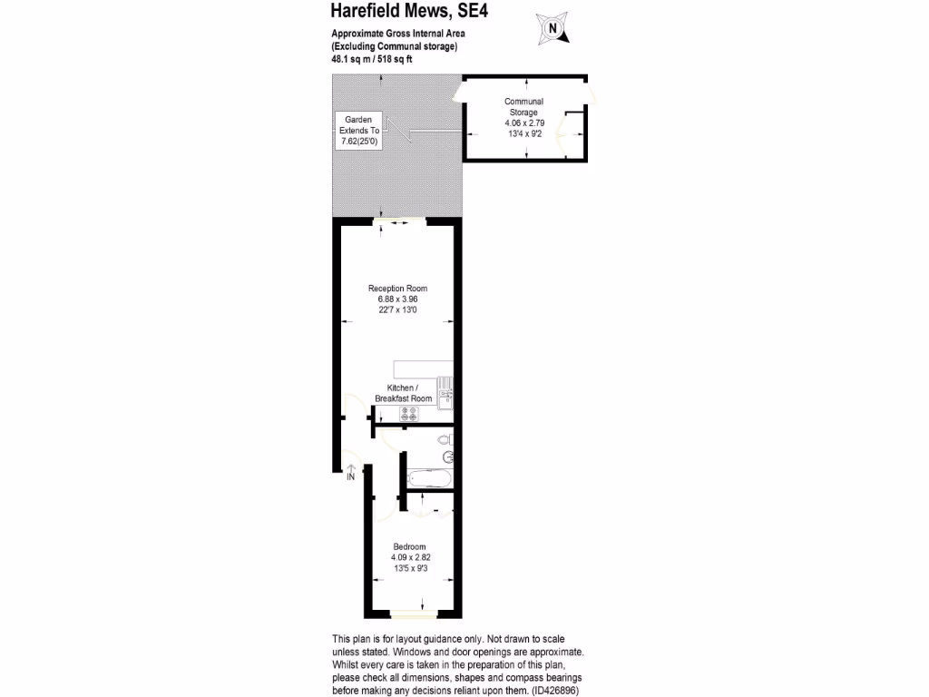
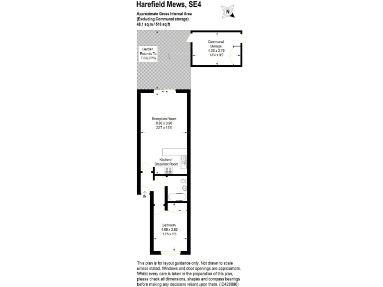
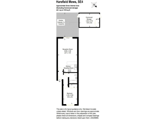
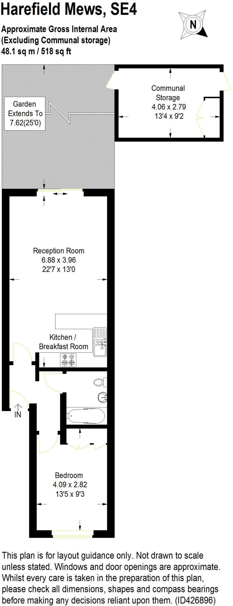
Floorplan Description
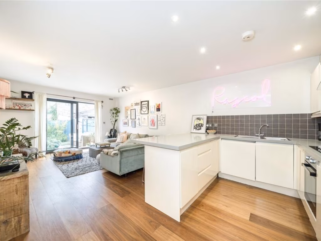
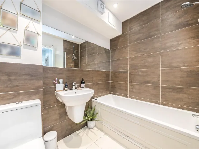
- Ground-floor flat with reception room, kitchen/breakfast room, bedroom, bathroom and garden (communal storage shown separately).
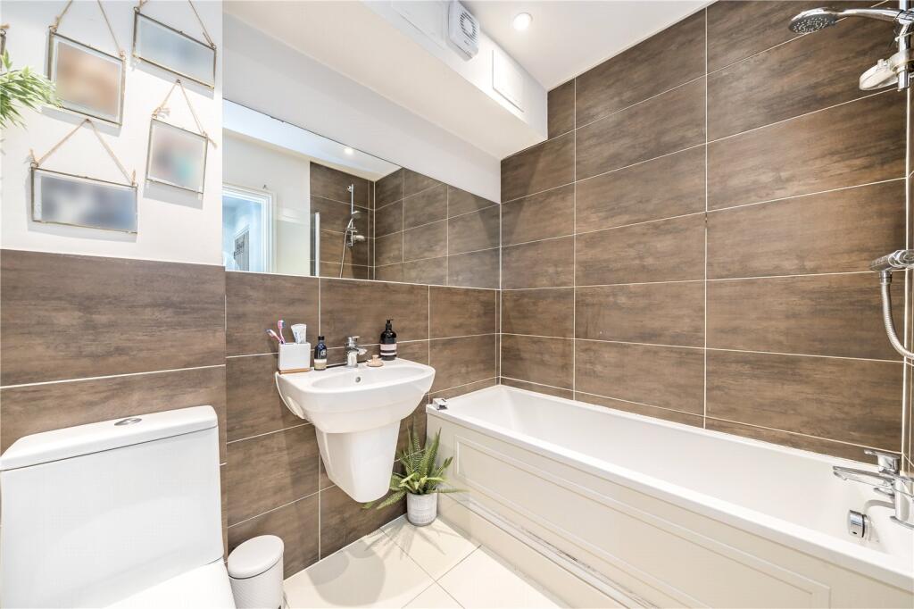
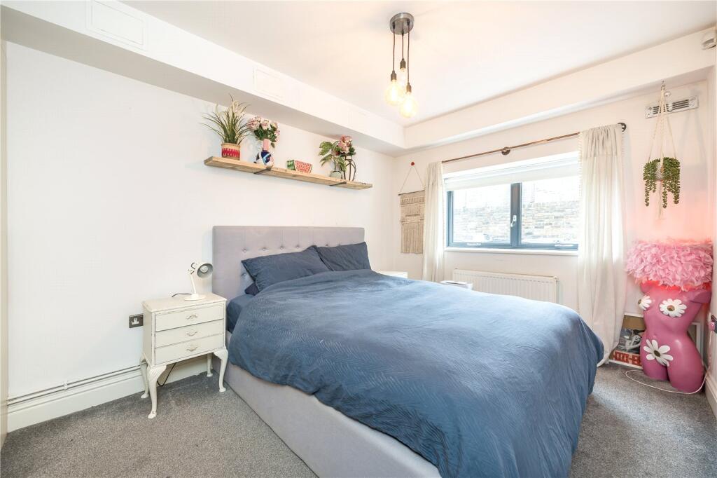
Rooms
- Reception Room:
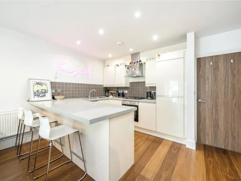
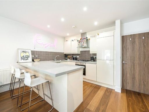
- Kitchen / Breakfast Room:
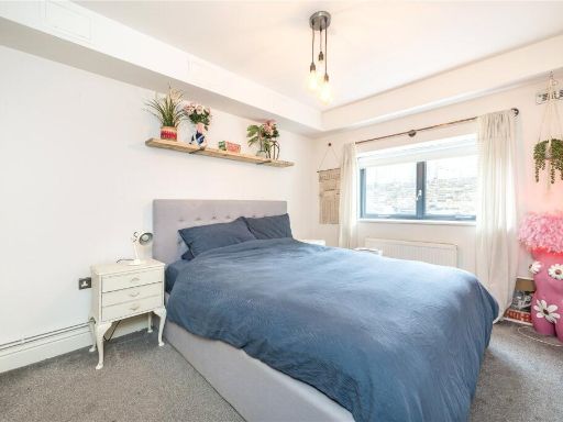
- Bedroom:
- Communal Storage:
Textual Property Features
Detected Visual Features
- contemporary
- living room
- medium size
- modern
- wooden flooring
- large sliding doors
- natural light
- neutral colors
- flat roof
- brickwork
- patio
- sliding doors
- outdoor space
- satellite dish
- low maintenance
EPC Details
- Fully double glazed
- Cavity wall, as built, insulated (assumed)
- Boiler and radiators, mains gas
- Low energy lighting in all fixed outlets
- (other premises below)
Nearby Schools
- John Stainer Community Primary School
- Haberdashers' Hatcham Free School
- Haberdashers' Hatcham College
- Ashmead Primary School
- Childeric Primary School
- Tidemill Academy
- St Joseph's Catholic Primary School
- Gordonbrock Primary School
- Beecroft Garden Primary
- Prendergast School
- Myatt Garden Primary School
- Addey and Stanhope School
- Kender Primary School
- Deptford Green School
- Stillness Infant School
- Stillness Junior School
- Turnham Academy
- Ivydale Primary School
- Prendergast Vale School
- Hollydale Primary School
- Lucas Vale Primary School
- Haberdashers' Hatcham Primary
- St William of York Catholic Primary School
- Prendergast Ladywell School
- Edmund Waller Primary School
- Grinling Gibbons Primary School
Nearest General Shops
- Id: 203599009
- Tags:
- Addr:
- Building: commercial
- Name: Mira
- Shop: alcohol
- TagsNormalized:
- Lat: 51.4637697
- Lon: -0.0359022
- FullGeoHash: gcpuz0ty5qj2
- PartitionGeoHash: gcpu
- Images:
- FoodStandards: null
- Distance: 75.9
,- Id: 203599008
- Tags:
- Addr:
- Building: commercial
- Shop: laundry
- TagsNormalized:
- Lat: 51.4638247
- Lon: -0.0359252
- FullGeoHash: gcpuz0tydbk0
- PartitionGeoHash: gcpu
- Images:
- FoodStandards: null
- Distance: 72.6
,- Id: 203599006
- Tags:
- Addr:
- Building: commercial
- Name: Sounds Around
- Shop: yes
- TagsNormalized:
- Lat: 51.4639364
- Lon: -0.0359705
- FullGeoHash: gcpuz0tz1v46
- PartitionGeoHash: gcpu
- Images:
- FoodStandards: null
- Distance: 67.3
}
Nearest Grocery shops
- Id: 200175761
- Tags:
- Building: commercial
- Name: Duke's
- Shop: convenience
- TagsNormalized:
- Lat: 51.4654316
- Lon: -0.0364862
- FullGeoHash: gcpuz0vrvgcc
- PartitionGeoHash: gcpu
- Images:
- FoodStandards: null
- Distance: 157.8
,- Id: 462413027
- Tags:
- Addr:
- City: London
- Housename: Langtry Court
- Housenumber: 180
- Postcode: SE4 2RR
- Street: Brockley Road
- Suburb: Crofton Park
- Brand: Sainsbury's Local
- Brand:wikidata: Q13218434
- Brand:wikipedia: en:Sainsbury's Local
- Fhrs:
- Name: Sainsbury's Local Brockley East
- Opening_hours: Mo-Fr 07:00-23:00
- Operator: Sainsbury's
- Shop: convenience
- Source:
- TagsNormalized:
- sainsburys
- sainsburys local
- convenience
- shop
- Lat: 51.4644903
- Lon: -0.0367028
- FullGeoHash: gcpuz0v62u26
- PartitionGeoHash: gcpu
- Images:
- FoodStandards:
- Id: 937513
- FHRSID: 937513
- LocalAuthorityBusinessID: PI/000198548
- BusinessName: Sainsbury's
- BusinessType: Retailers - supermarkets/hypermarkets
- BusinessTypeID: 7840
- AddressLine1: Sainsburys Supermarket Ltd, Langtry Court
- AddressLine2: 180 Brockley Road
- AddressLine3: Crofton Park
- AddressLine4: London
- PostCode: SE4 2RR
- RatingValue: 5
- RatingKey: fhrs_5_en-GB
- RatingDate: 2016-08-10
- LocalAuthorityCode: 523
- LocalAuthorityName: Lewisham
- LocalAuthorityWebSite: http://www.lewisham.gov.uk/myservices/business/food-safety/Pages/default.aspx
- LocalAuthorityEmailAddress: david.edwards@lewisham.gov.uk
- Scores:
- Hygiene: 0
- Structural: 0
- ConfidenceInManagement: 0
- NewRatingPending: false
- Geocode:
- Longitude: -0.03650800000000
- Latitude: 51.46407300000000
- Distance: 109.1
,- Id: 186873126
- Tags:
- Addr:
- Housenumber: 189-191
- Postcode: SE4 2RS
- Street: Brockley Road
- Brand: Costcutter
- Brand:wikidata: Q5175072
- Brand:wikipedia: en:Costcutter
- Building: yes
- Name: Costcutter
- Shop: convenience
- TagsNormalized:
- costcutter
- convenience
- shop
- Lat: 51.4640113
- Lon: -0.0359987
- FullGeoHash: gcpuz0tz95j3
- PartitionGeoHash: gcpu
- Images:
- FoodStandards: null
- Distance: 64.7
}
Nearest Religious buildings
- Id: 527341004
- Tags:
- Addr:
- Amenity: place_of_worship
- Building: yes
- Name: St Andrew's Church
- Religion: christian
- TagsNormalized:
- place of worship
- church
- christian
- Lat: 51.4607008
- Lon: -0.0336945
- FullGeoHash: gcpuz0pkqcgt
- PartitionGeoHash: gcpu
- Images:
- FoodStandards: null
- Distance: 410.3
,- Id: 199811
- Tags:
- Name: St Andrew's Church / Wickham Road
- Naptan:
- StopAreaCode: 490G00012538
- StopAreaType: GPBS
- Verified: no
- Network: London Buses
- Operator: Transport for London
- Public_transport: stop_area
- Public_transport:version: 2
- Type: public_transport
- TagsNormalized:
- Lat: 51.4613047
- Lon: -0.0350229
- FullGeoHash: gcpuz0nrzfmp
- PartitionGeoHash: gcpu
- Images:
- FoodStandards: null
- Distance: 330.5
,- Id: 177457471
- Tags:
- Amenity: place_of_worship
- Building: church
- Denomination: anglican
- Name: St Peter's Church, Brockley
- Religion: christian
- Wikidata: Q27083751
- TagsNormalized:
- place of worship
- church
- anglican
- christian
- Lat: 51.4650435
- Lon: -0.0306486
- FullGeoHash: gcpuz2cttg6w
- PartitionGeoHash: gcpu
- Images:
- FoodStandards: null
- Distance: 324.4
}
Nearest Medical buildings
- Id: 2124568175
- Tags:
- Addr:
- City: London
- Housenumber: 349-351
- Postcode: SE4 2AQ
- Street: Brockley Road
- Amenity: dentist
- Healthcare: dentist
- Name: Smiles For You
- Operator: L Ziman and Associates Ltd
- TagsNormalized:
- Lat: 51.456305
- Lon: -0.035947
- FullGeoHash: gcpuxpmfdq7z
- PartitionGeoHash: gcpu
- Images:
- FoodStandards: null
- Distance: 887.9
,- Id: 691965442
- Tags:
- Amenity: clinic
- Building: commercial
- Healthcare: doctor
- Name: Honor Oak Group Practice
- Operator: Honor Oak Group Practice/Lewisham CCG
- Phone: +44 3049 2345
- Website: https://www.honoroakgrouppractice.co.uk/
- TagsNormalized:
- clinic
- doctor
- doctors
- health
- healthcare
- Lat: 51.4581521
- Lon: -0.0411168
- FullGeoHash: gcpuxpdj3yv1
- PartitionGeoHash: gcpu
- Images:
- FoodStandards: null
- Distance: 796
,- Id: 5935894079
- Tags:
- Amenity: pharmacy
- Barrier: gate
- Name: Honor Oak Pharmacy
- TagsNormalized:
- Lat: 51.4581404
- Lon: -0.0409975
- FullGeoHash: gcpuxpdjkswh
- PartitionGeoHash: gcpu
- Images:
- FoodStandards: null
- Distance: 792.8
,- Id: 290009310
- Tags:
- Addr:
- Housenumber: 285-287
- Postcode: SE4 2SA
- Amenity: pharmacy
- Building: yes
- Healthcare: pharmacy
- TagsNormalized:
- Lat: 51.4604346
- Lon: -0.0338761
- FullGeoHash: gcpuz0p6f8k1
- PartitionGeoHash: gcpu
- Images:
- FoodStandards: null
- Distance: 436.3
}
Nearest Airports
- Id: 260720166
- Tags:
- Aerodrome: international
- Aeroway: aerodrome
- Alt_name: Gatwick Airport
- Ele: 62
- Iata: LGW
- Icao: EGKK
- Internet_access: wlan
- Internet_access:fee: no
- Internet_access:ssid: Gatwick FREE Wi-Fi
- Name: London Gatwick Airport
- Operator: Gatwick Airport Limited
- Ref: LGW
- Website: https://www.gatwickairport.com/
- Wikidata: Q8703
- Wikipedia: en:Gatwick Airport
- TagsNormalized:
- airport
- international airport
- Lat: 51.1540917
- Lon: -0.1883773
- FullGeoHash: gcpg58qf4mzd
- PartitionGeoHash: gcpg
- Images:
- FoodStandards: null
- Distance: 36097.5
,- Id: 121158889
- Tags:
- Aerodrome: continental
- Aeroway: aerodrome
- Fhrs:
- Authority: City of London Corporation
- Iata: LCY
- Icao: EGLC
- Name: London City Airport
- Operator: London City Airport Limited
- Ref: LCY
- Website: https://www.londoncityairport.com/
- Wikidata: Q8982
- Wikipedia: en:London City Airport
- TagsNormalized:
- airport
- continental airport
- Lat: 51.5042658
- Lon: 0.0539987
- FullGeoHash: u10j10p64702
- PartitionGeoHash: u10j
- Images:
- FoodStandards: null
- Distance: 7608.8
,- Id: 14001268
- Tags:
- Access: yes
- Aerodrome: international
- Aerodrome:type: public
- Aeroway: aerodrome
- Alt_name: London Heathrow
- Alt_name_2: London Heathrow Airport
- Ele: 25
- Iata: LHR
- Icao: EGLL
- Int_name: Heathrow Airport
- Name: London Heathrow Airport
- Note: area still approx
- Old_name: London Airport
- Operator: Heathrow Airport Limited
- Rank_aci:
- Ref: LHR
- Short_name: Heathrow
- Type: multipolygon
- Website: https://www.heathrow.com/
- Wikidata: Q8691
- Wikipedia: en:Heathrow Airport
- TagsNormalized:
- airport
- international airport
- Lat: 51.4677522
- Lon: -0.4547736
- FullGeoHash: gcpsv9kv7h2h
- PartitionGeoHash: gcps
- Images:
- FoodStandards: null
- Distance: 29069.6
}
Nearest Leisure Facilities
- Id: 202670481
- Tags:
- TagsNormalized:
- Lat: 51.4644322
- Lon: -0.0354219
- FullGeoHash: gcpuz0y4n9e8
- PartitionGeoHash: gcpu
- Images:
- FoodStandards: null
- Distance: 24.9
,- Id: 203248326
- Tags:
- TagsNormalized:
- Lat: 51.4640635
- Lon: -0.0352319
- FullGeoHash: gcpuz0wrghc0
- PartitionGeoHash: gcpu
- Images:
- FoodStandards: null
- Distance: 24
,- Id: 203248331
- Tags:
- TagsNormalized:
- Lat: 51.464072
- Lon: -0.0350615
- FullGeoHash: gcpuz0wrzn27
- PartitionGeoHash: gcpu
- Images:
- FoodStandards: null
- Distance: 23.7
,- Id: 203248324
- Tags:
- TagsNormalized:
- Lat: 51.4640692
- Lon: -0.0351474
- FullGeoHash: gcpuz0wrvjb4
- PartitionGeoHash: gcpu
- Images:
- FoodStandards: null
- Distance: 22.9
,- Id: 202670483
- Tags:
- TagsNormalized:
- Lat: 51.4644342
- Lon: -0.035349
- FullGeoHash: gcpuz0y603cu
- PartitionGeoHash: gcpu
- Images:
- FoodStandards: null
- Distance: 21.8
}
Nearest Tourist attractions
- Id: 10671793226
- Tags:
- Check_date: 2023-02-16
- Level: 0
- Name: StayCity
- Tourism: hostel
- TagsNormalized:
- Lat: 51.4743033
- Lon: -0.0230581
- FullGeoHash: gcpuz6x5w9we
- PartitionGeoHash: gcpu
- Images:
- FoodStandards: null
- Distance: 1395.3
,- Id: 6831558167
- Tags:
- Addr:
- City: London
- Housenumber: 323A
- Postcode: SE14 6AS
- Street: New Cross Road
- Name: New Cross Inn Hostel
- Tourism: hostel
- Website: http://www.newcrossinn.co.uk/
- Wikidata: Q111119364
- TagsNormalized:
- Lat: 51.4758487
- Lon: -0.0370837
- FullGeoHash: gcpuz4uuxcsq
- PartitionGeoHash: gcpu
- Images:
- FoodStandards: null
- Distance: 1293.8
,- Id: 828226531
- Tags:
- Area: yes
- Bicycle: yes
- Fixme: positions of picnic tables and benches need mapping
- Highway: pedestrian
- Lit: yes
- Name: Eddystone Road
- Segregated: no
- Surface: asphalt
- Tourism: picnic_site
- TagsNormalized:
- Lat: 51.45457
- Lon: -0.0402842
- FullGeoHash: gcpuxp48t71c
- PartitionGeoHash: gcpu
- Images:
- FoodStandards: null
- Distance: 1135.9
}
Nearest Hotels
- Id: 244667599
- Tags:
- Addr:
- Housenumber: 1
- Postcode: SE10 8BN
- Street: Merryweather Place
- Brand: Premier Inn
- Brand:wikidata: Q2108626
- Building: yes
- Contact:
- Website: https://www.premierinn.com/gb/en/hotels/england/greater-london/london/london-greenwich.html
- Fhrs:
- Internet_access: wlan
- Internet_access:fee: customers
- Internet_access:operator: Virgin Media
- Internet_access:ssid: Premier Inn Free Wi-Fi
- Name: Premier Inn London Greenwich
- Source:
- Tourism: hotel
- TagsNormalized:
- Lat: 51.475855
- Lon: -0.0198173
- FullGeoHash: gcpuzdcsd4z5
- PartitionGeoHash: gcpu
- Images:
- FoodStandards: null
- Distance: 1669.8
,- Id: 271726973
- Tags:
- Addr:
- City: Royal Borough of Greenwich
- Postcode: SE10 8FR
- Street: Catherine Grove
- Brand: DoubleTree
- Brand:wikidata: Q2504643
- Building: yes
- Contact:
- Facebook: https://www.facebook.com/thegreenwichlondon
- Linkedin: https://www.linkedin.com/company/dtgreenwich
- Twitter: https://twitter.com/DT_Greenwich
- Email: longw_hotel@hilton.com
- Internet_access: wlan
- Name: DoubleTree by Hilton London Greenwich
- Official_name: DoubleTree by Hilton
- Operator: Hilton
- Phone: +44 20 8469 4440
- Rooms: 147
- Smoking: no
- Stars: 4
- Tourism: hotel
- Website: https://www.hilton.com/en/hotels/longwdi-doubletree-london-greenwich/
- Wheelchair: yes
- Wikidata: Q111369026
- TagsNormalized:
- Lat: 51.4745089
- Lon: -0.0195552
- FullGeoHash: gcpuzd9u8rft
- PartitionGeoHash: gcpu
- Images:
- FoodStandards: null
- Distance: 1569.7
,- Id: 485839172
- Tags:
- Addr:
- Housenumber: 28
- Postcode: SE10 8DA
- Street: Blackheath Road
- Brand: Travelodge
- Brand:wikidata: Q9361374
- Building: hotel
- Fhrs:
- Internet_access: wlan
- Internet_access:fee: customers
- Internet_access:ssid: Travelodge WiFi
- Name: Travelodge Greenwich
- Source:
- Tourism: hotel
- Wheelchair: yes
- TagsNormalized:
- Lat: 51.4740308
- Lon: -0.0211851
- FullGeoHash: gcpuzd89fqg1
- PartitionGeoHash: gcpu
- Images:
- FoodStandards: null
- Distance: 1454.1
}
Tags
- contemporary
- living room
- medium size
- modern
- wooden flooring
- large sliding doors
- natural light
- neutral colors
- modern
- flat roof
- brickwork
- patio
- sliding doors
- outdoor space
- satellite dish
- low maintenance
Local Market Stats
- Average Price/sqft: £657
- Avg Income: £59800
- Rental Yield: 4%
- Social Housing: 26%
- Planning Success Rate: 80%
AirBnB Data
- 1km average: £109/night
- Listings in 1km: 28
Similar Properties
 1 bedroom flat for sale in Wallbutton Road, Brockley, SE4 — £350,000 • 1 bed • 1 bath • 499 ft²
 3 bedroom apartment for sale in Malpas Road, Brockley, SE4 — £450,000 • 3 bed • 1 bath • 960 ft²
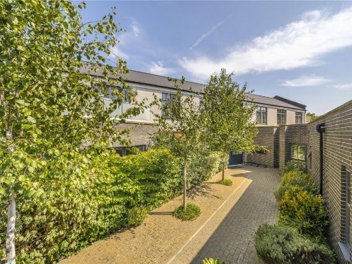 2 bedroom apartment for sale in Old Carpenters Yard, Brockley, SE4 — £585,000 • 2 bed • 1 bath • 680 ft²
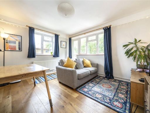 1 bedroom apartment for sale in Whitbread Road, Brockley, SE4 — £325,000 • 1 bed • 1 bath • 519 ft²
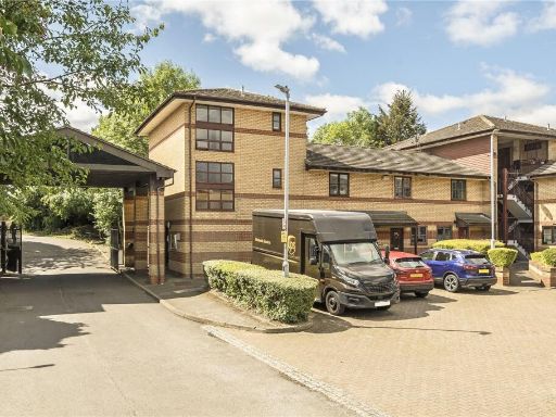 1 bedroom apartment for sale in Pincott Place, Brockley, SE4 — £250,000 • 1 bed • 1 bath • 452 ft²
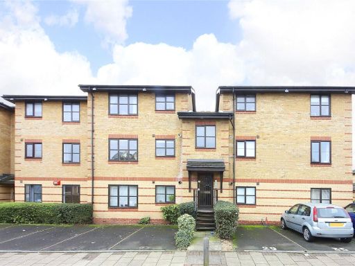 1 bedroom apartment for sale in Foxwell Street, Brockley, SE4 — £280,000 • 1 bed • 1 bath • 445 ft²
Meta
- {
"@context": "https://schema.org",
"@type": "Residence",
"name": "1 bedroom apartment for sale in Harefield Mews, Brockley, S…",
"description": "",
"url": "https://propertypiper.co.uk/property/ade04b73-f940-4977-8338-92fc429b45b0",
"image": "https://image-a.propertypiper.co.uk/daec9dbc-40fd-453b-b764-cb98dd7bfa07-1024.jpeg",
"address": {
"@type": "PostalAddress",
"streetAddress": "4 HAREFIELD MEWS LONDON",
"postalCode": "SE4 1LP",
"addressLocality": "Lewisham",
"addressRegion": "Lewisham, Deptford",
"addressCountry": "England"
},
"geo": {
"@type": "GeoCoordinates",
"latitude": 51.4642752,
"longitude": -0.0351658
},
"numberOfRooms": 1,
"numberOfBathroomsTotal": 1,
"floorSize": {
"@type": "QuantitativeValue",
"value": 518,
"unitCode": "FTK"
},
"offers": {
"@type": "Offer",
"price": 400000,
"priceCurrency": "GBP",
"availability": "https://schema.org/InStock"
},
"additionalProperty": [
{
"@type": "PropertyValue",
"name": "Feature",
"value": "contemporary"
},
{
"@type": "PropertyValue",
"name": "Feature",
"value": "living room"
},
{
"@type": "PropertyValue",
"name": "Feature",
"value": "medium size"
},
{
"@type": "PropertyValue",
"name": "Feature",
"value": "modern"
},
{
"@type": "PropertyValue",
"name": "Feature",
"value": "wooden flooring"
},
{
"@type": "PropertyValue",
"name": "Feature",
"value": "large sliding doors"
},
{
"@type": "PropertyValue",
"name": "Feature",
"value": "natural light"
},
{
"@type": "PropertyValue",
"name": "Feature",
"value": "neutral colors"
},
{
"@type": "PropertyValue",
"name": "Feature",
"value": "modern"
},
{
"@type": "PropertyValue",
"name": "Feature",
"value": "flat roof"
},
{
"@type": "PropertyValue",
"name": "Feature",
"value": "brickwork"
},
{
"@type": "PropertyValue",
"name": "Feature",
"value": "patio"
},
{
"@type": "PropertyValue",
"name": "Feature",
"value": "sliding doors"
},
{
"@type": "PropertyValue",
"name": "Feature",
"value": "outdoor space"
},
{
"@type": "PropertyValue",
"name": "Feature",
"value": "satellite dish"
},
{
"@type": "PropertyValue",
"name": "Feature",
"value": "low maintenance"
}
]
}
High Res Floorplan Images
Compatible Floorplan Images
FloorplanImages Thumbnail