SG15 6XR - 4 bedroom detached house for sale in Stotfold Road, Arlesey…
View on Property Piper
4 bedroom detached house for sale in Stotfold Road,
Arlesey,
SG15 6XR, SG15
Property Details
- Price: £620000
- Bedrooms: 4
- Bathrooms: 1
- Property Type: undefined
- Property SubType: undefined
Brochure Descriptions
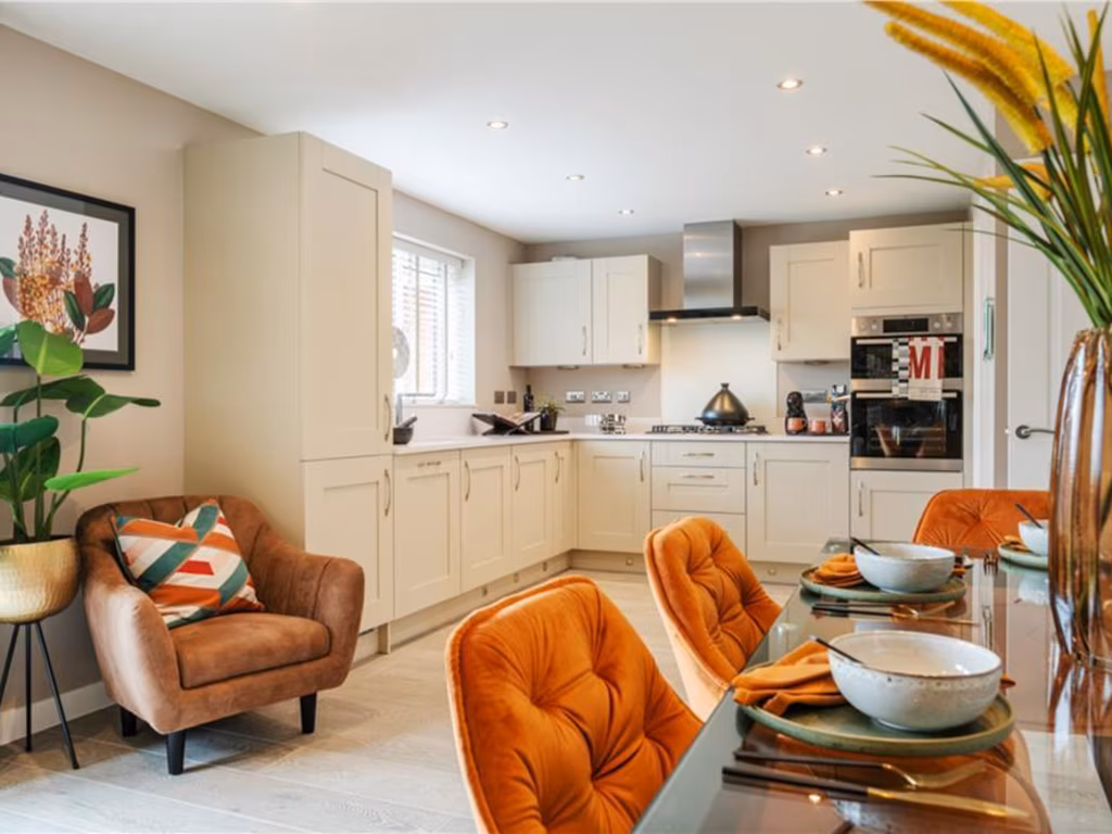
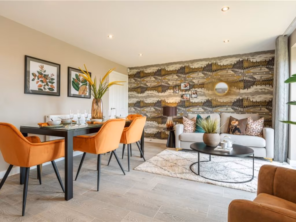
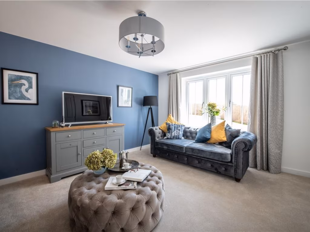
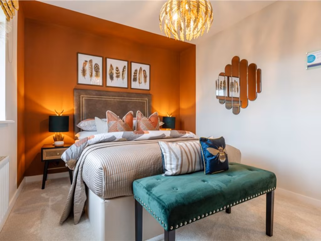
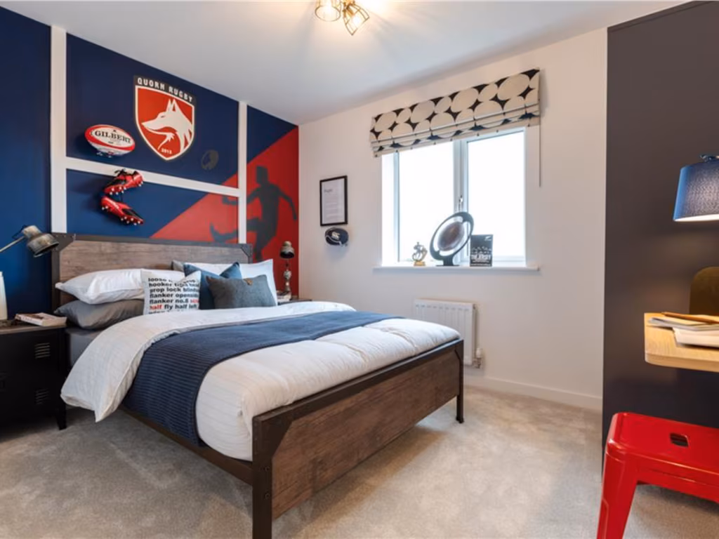
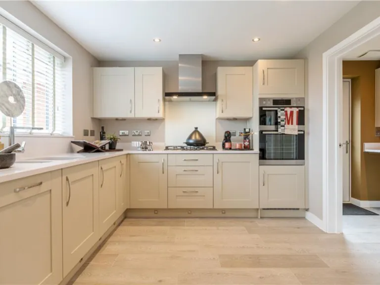
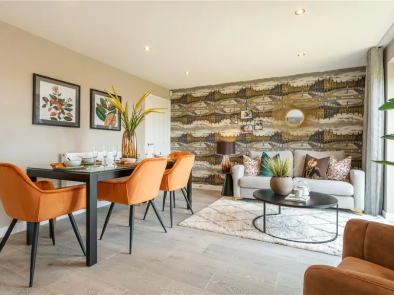
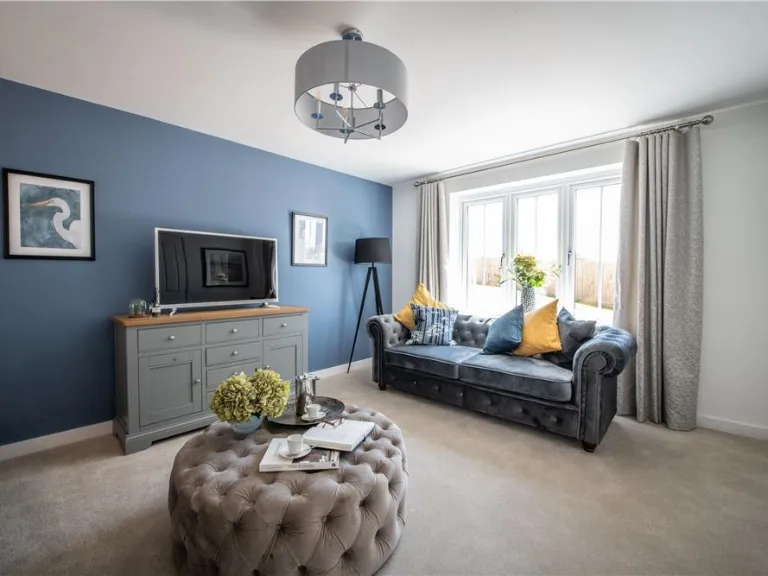
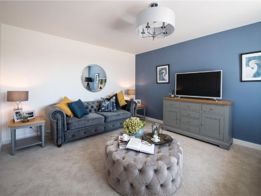
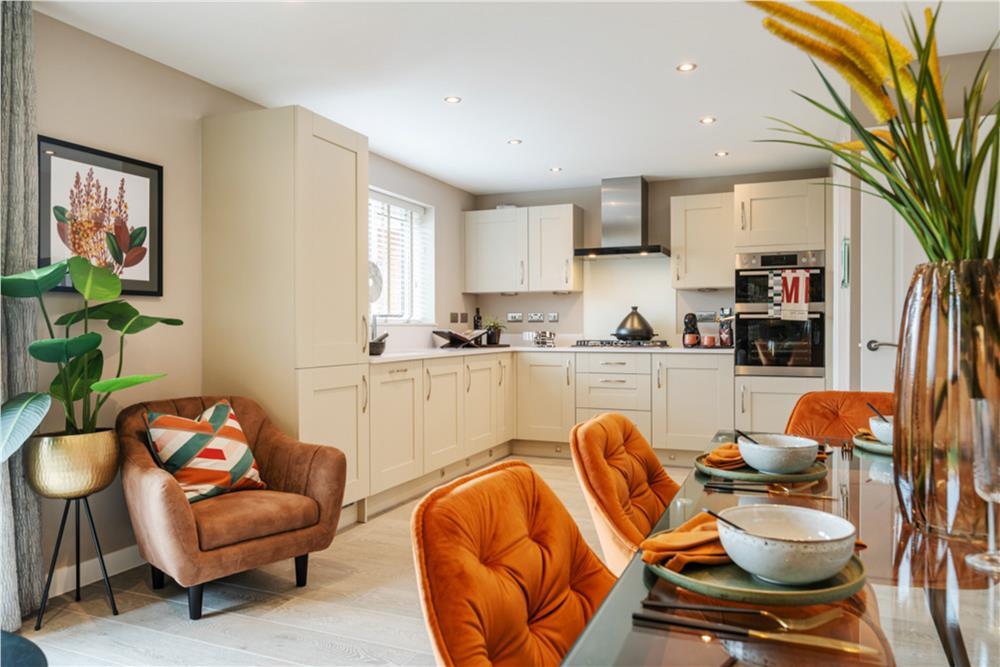
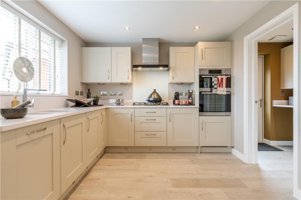
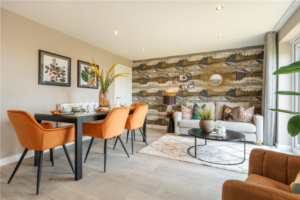
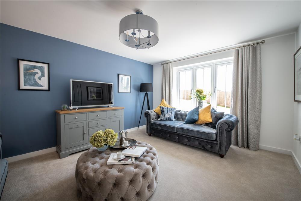
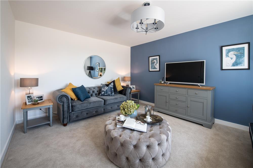
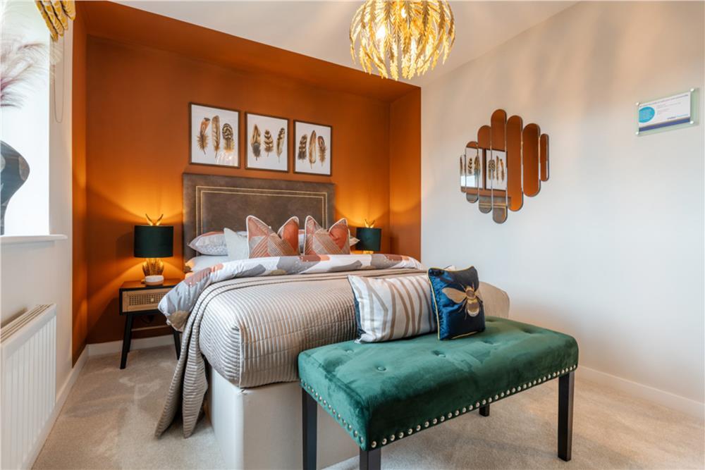
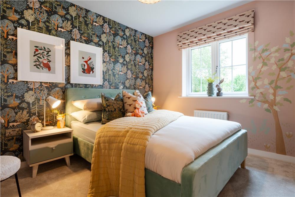
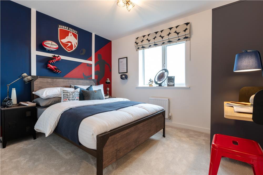
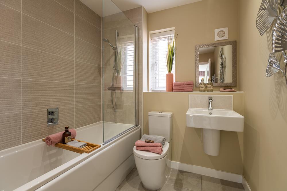
- The property features modern interiors with a large open plan layout evident from the spacious living and dining areas. The kitchen is streamlined and contemporary, complete with integrated ovens and a sleek induction cooktop, characteristic of recent high-quality developments. The images reveal a focus on natural light, streaming in through sizeable windows which likely offer views of a residential neighborhood given the fenced garden visible outside. The garden appears to be of average size, suitable for small gatherings or family activities. The overall property size cannot be determined completely, but it seems to fall within a moderately large family home category, providing ample space for comfort and functionality.
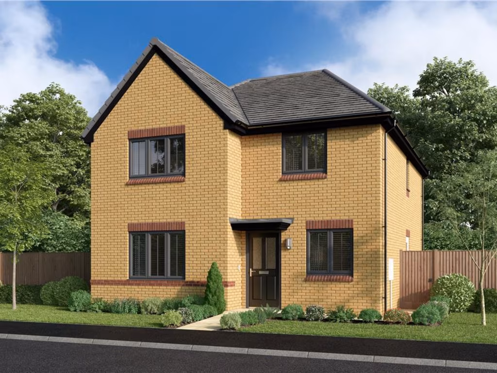
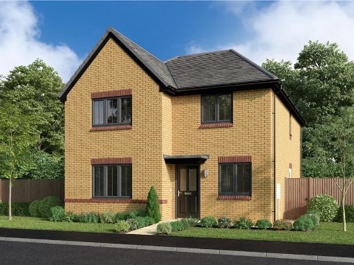
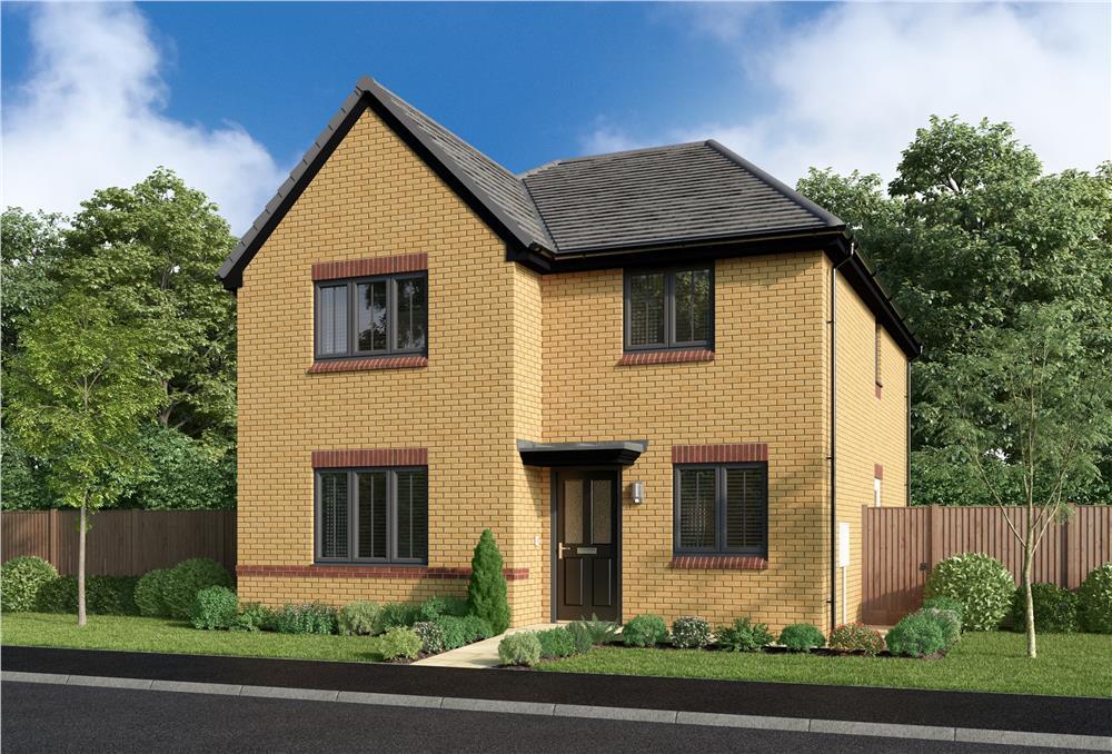
- This property appears to be part of a residential development called Arlesey Gate, located in Arlesey. The marketing suggests a family-friendly environment, and the mention of this development implies new or recently constructed houses, potentially offering modern amenities and efficient layouts. Specific characteristics such as the number of rooms, yard size, or unique features cannot be inferred from the image alone.
- The property appears to be a modern, newly built home, featuring bright and spacious rooms with ample natural light flowing through large windows. The kitchen has sleek, modern cabinetry and integrated appliances, presenting a clean and efficient space for cooking. High ceilings and an open-plan layout contribute to a feel of spaciousness. The visible outdoor area, seen through a window, suggests a modest-sized private garden with fencing offering privacy, ideal for small family gatherings. Overall, the property conveys a warm, inviting, and contemporary living environment.
Image Descriptions
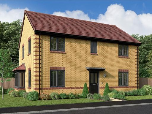
- two-story house modern brick
- kitchen and dining area modern
Floorplan Description
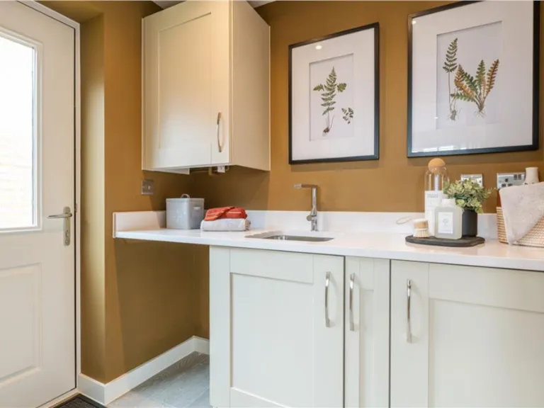
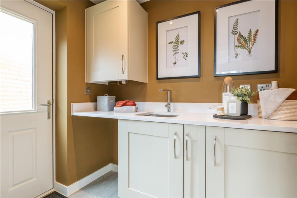
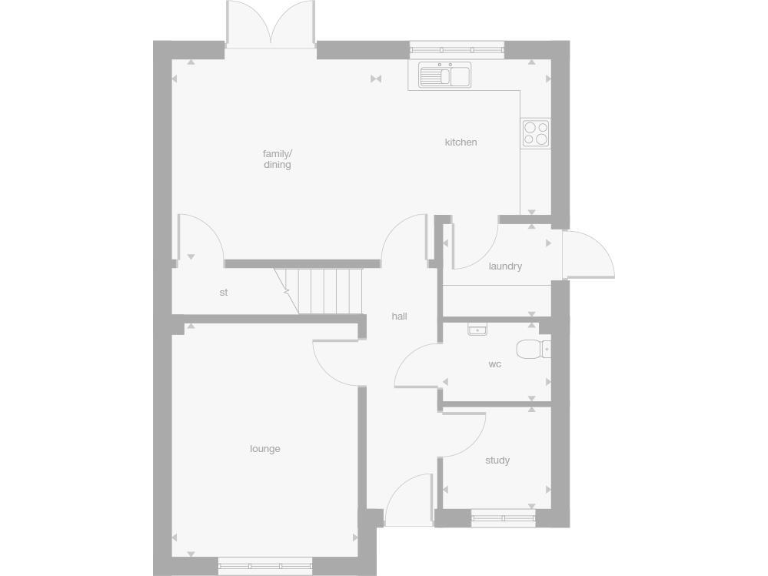
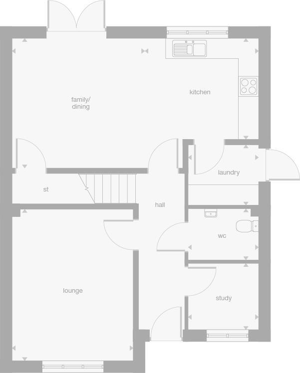
- A floor plan featuring a family/dining room, kitchen, lounge, laundry, wc, and study room.
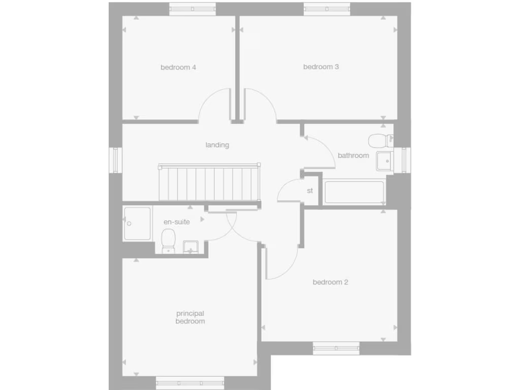
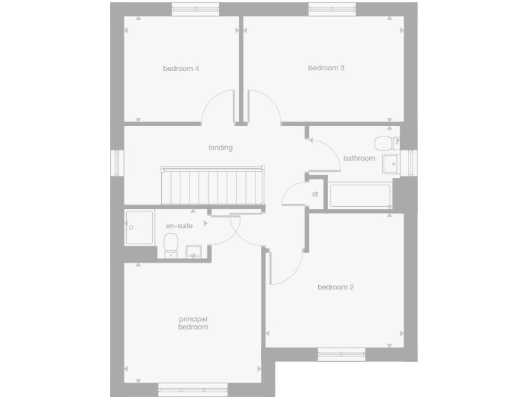
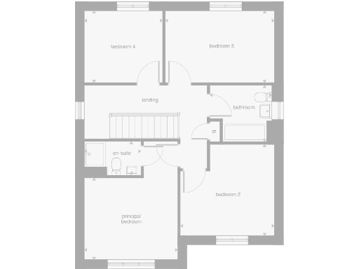
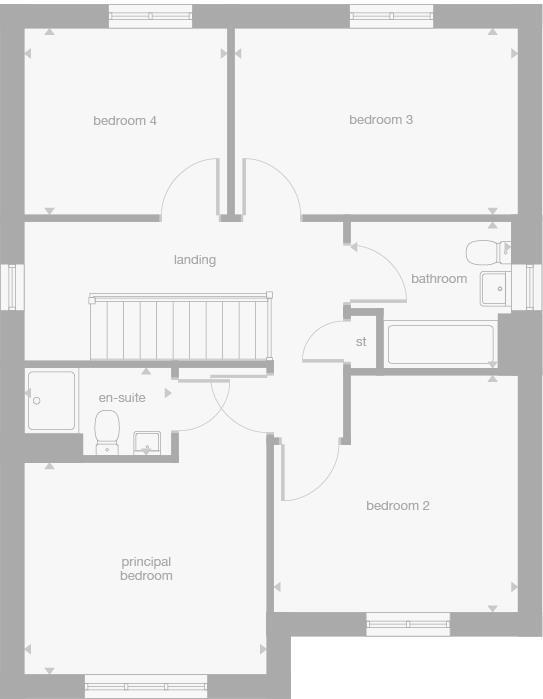
- A floor featuring a principal bedroom, three additional bedrooms, a bathroom, and an ensuite.
- A single-floor layout with a mix of family and utility spaces, including a lounge, kitchen, and study.
- A property floor featuring a landing, four bedrooms including a principal bedroom with an en-suite bathroom, a separate bathroom, and a storage area.
Rooms
- family/dining:
- kitchen:
- lounge:
- laundry:
- wc:
- study:
- principal bedroom:
- bedroom 2:
- bedroom 3:
- bedroom 4:
- bathroom:
- lounge:
- family/dining:
- kitchen:
- laundry:
- wc:
- study:
- principal bedroom:
- bedroom 2:
- bedroom 3:
- bedroom 4:
- bathroom:
- en-suite:
Textual Property Features
- Is New Build
- Has Garden
- Success
Detected Visual Features
- modern
- brick
- two-story
- new build
- detached
- residential
- well-maintained
- family home
- modern kitchen
- integrated appliances
- bright lighting
- open plan
- dining area
- corner kitchen
- contemporary
Nearby Schools
- Clifton All Saints Academy
- Samuel Whitbread Academy
- Langford Village Academy
- Biggleswade Academy
- Stratton Upper School
- Norton St Nicholas CofE (VA) Primary School
- Derwent Primary School
- Gothic Mede Academy
- Henlow Church of England Academy
- St Christopher School
- St Francis College
- Hillshott Infant School and Nursery
- Icknield Infant and Nursery School
- Roecroft Lower School
- Pix Brook Academy
- Etonbury Academy
- Raynsford Church of England Academy
- St Thomas More Roman Catholic Primary School
- Pixmore Junior School
- Stonehill School
- Our Lady Catholic Primary School
- St Mary's CofE Academy Stotfold
- The Highfield School
- Fearnhill School
- Wilbury Junior School
- Northfields Infants and Nursery School
- The Grange Academy
- Fairfield Park Lower School
- Ickleford Primary School
Nearest General Shops
- Id: 794117189
- Tags:
- Name: Henlow Car Sales
- Shop: car
- TagsNormalized:
- Lat: 52.0280496
- Lon: -0.2866301
- FullGeoHash: gcpzcrrm353h
- PartitionGeoHash: gcpz
- Images:
- FoodStandards: null
- Distance: 2052.8
,- Id: 323918817
- Tags:
- Name: Ambitions
- Phone: +44 1462 735588
- Shop: hairdresser
- TagsNormalized:
- Lat: 52.0061815
- Lon: -0.2657285
- FullGeoHash: gcpzcgqtbnfk
- PartitionGeoHash: gcpz
- Images:
- FoodStandards: null
- Distance: 2046.2
,- Id: 794117186
- Tags:
- Name: Prize Motor Services
- Shop: car_repair
- TagsNormalized:
- motor
- service
- car repair
- repair
- shop
- Lat: 52.0285843
- Lon: -0.2861365
- FullGeoHash: gcpzcrx8kx14
- PartitionGeoHash: gcpz
- Images:
- FoodStandards: null
- Distance: 2034.4
}
Nearest Medical buildings
- Id: 853548154
- Tags:
- Amenity: pharmacy
- Name: Stotfold Pharmacy
- TagsNormalized:
- Lat: 52.0139745
- Lon: -0.2290741
- FullGeoHash: gcpzfuc5q5tg
- PartitionGeoHash: gcpz
- Images:
- FoodStandards: null
- Distance: 2228.8
,- Id: 6779841909
- Tags:
- Amenity: dentist
- Name: Stotfold Dental Clinic
- TagsNormalized:
- Lat: 52.0144524
- Lon: -0.2290338
- FullGeoHash: gcpzfucnphsn
- PartitionGeoHash: gcpz
- Images:
- FoodStandards: null
- Distance: 2205.5
,- Id: 323918755
- Tags:
- Addr:
- City: Arlesey
- Country: GB
- Housenumber: 31
- Postcode: SG15 6RA
- Street: High Street
- Amenity: pharmacy
- Fhrs:
- Authority: Central Bedfordshire
- Id: 1173399
- Local_authority_id: 22000
- Name: Arlesey Pharmacy
- TagsNormalized:
- Lat: 52.006962
- Lon: -0.2656814
- FullGeoHash: gcpzcgwd90ms
- PartitionGeoHash: gcpz
- Images:
- FoodStandards: null
- Distance: 1962.1
,- Id: 190385990
- Tags:
- Addr:
- City: Stotfold
- Postcode: SG5 4HB
- Street: Arlesey Road
- Amenity: doctors
- Building: yes
- Healthcare: doctor
- Name: Larksfield Surgery
- Opening_hours: Mo 08:00-13:00,14:00-18:30; Tu-Fr 08:00-18:30
- Operator: Larksfield Surgery Medical Partnership
- Phone: +44 1462 732200
- Website: https://www.larksfieldsurgery.co.uk/
- TagsNormalized:
- doctor
- doctors
- health
- healthcare
- surgery
- Lat: 52.0177192
- Lon: -0.2351637
- FullGeoHash: gcpzftsc0m9j
- PartitionGeoHash: gcpz
- Images:
- FoodStandards: null
- Distance: 1668.3
}
Nearest Airports
- Id: 110273499
- Tags:
- Addr:
- Country: GB
- Postcode: LU2 9LY
- Aerodrome: international
- Aerodrome:type: public
- Aeroway: aerodrome
- Alt_name: London Luton
- Iata: LTN
- Icao: EGGW
- Name: London Luton Airport
- Website: https://www.london-luton.co.uk/
- Wikidata: Q8712
- Wikipedia: en:Luton Airport
- TagsNormalized:
- airport
- international airport
- Lat: 51.8780363
- Lon: -0.3701408
- FullGeoHash: gcpxps47rngh
- PartitionGeoHash: gcpx
- Images:
- FoodStandards: null
- Distance: 17961
,- Id: 495488524
- Tags:
- Aerodrome: international
- Aerodrome:type: public
- Aeroway: aerodrome
- Alt_name: Stansted
- Iata: STN
- Icao: EGSS
- Is_in: Essex,England,UK
- Name: London Stansted Airport
- Ref: STN
- Source: Gagravarr_Airports
- Website: https://www.stanstedairport.com/
- Wikidata: Q8709
- Wikipedia: en:London Stansted Airport
- TagsNormalized:
- airport
- international airport
- Lat: 51.8869677
- Lon: 0.2429264
- FullGeoHash: u10pjt8zkxg4
- PartitionGeoHash: u10p
- Images:
- FoodStandards: null
- Distance: 37513.2
}
Nearest Leisure Facilities
- Id: 1113317040
- Tags:
- TagsNormalized:
- Lat: 52.018514
- Lon: -0.260334
- FullGeoHash: gcpzfjdmvcbf
- PartitionGeoHash: gcpz
- Images:
- FoodStandards: null
- Distance: 626.9
,- Id: 863337799
- Tags:
- TagsNormalized:
- Lat: 52.0252003
- Lon: -0.2583141
- FullGeoHash: gcpzfnguub70
- PartitionGeoHash: gcpz
- Images:
- FoodStandards: null
- Distance: 161.6
,- Id: 370875345
- Tags:
- Leisure: nature_reserve
- Name: Pix Brook Nature Reserve
- TagsNormalized:
- Lat: 52.0233737
- Lon: -0.2552267
- FullGeoHash: gcpzfnw4hgc0
- PartitionGeoHash: gcpz
- Images:
- FoodStandards: null
- Distance: 158.8
,- Id: 1111780578
- Tags:
- TagsNormalized:
- Lat: 52.0225279
- Lon: -0.2580145
- FullGeoHash: gcpzfnkj5y46
- PartitionGeoHash: gcpz
- Images:
- FoodStandards: null
- Distance: 153.5
,- Id: 1034816401
- Tags:
- TagsNormalized:
- Lat: 52.0226514
- Lon: -0.2580237
- FullGeoHash: gcpzfnkjgt5e
- PartitionGeoHash: gcpz
- Images:
- FoodStandards: null
- Distance: 140.5
}
Nearest Tourist attractions
- Id: 6751166457
- Tags:
- Addr:
- City: Henlow
- Country: GB
- Housename: Poplars Farm
- Housenumber: 1
- Postcode: SG16 6BH
- Street: Clifton Road
- Fhrs:
- Authority: Central Bedfordshire
- Id: 877216
- Local_authority_id: 159519
- Name: Poplars Farm Bed & Breakfast
- Tourism: guest_house
- TagsNormalized:
- bed
- farm
- guest house
- tourism
- Lat: 52.0286751
- Lon: -0.2893648
- FullGeoHash: gcpzcrt3121b
- PartitionGeoHash: gcpz
- Images:
- FoodStandards:
- Id: 877216
- FHRSID: 877216
- LocalAuthorityBusinessID: 159519
- BusinessName: Poplars Farm Bed & Breakfast
- BusinessType: Hotel/bed & breakfast/guest house
- BusinessTypeID: 7842
- AddressLine1: Poplars Farm
- AddressLine2: 1 Clifton Road
- AddressLine3: Henlow
- AddressLine4: null
- PostCode: SG16 6BH
- RatingValue: 5
- RatingKey: fhrs_5_en-GB
- RatingDate: 2019-07-16
- LocalAuthorityCode: 702
- LocalAuthorityName: Central Bedfordshire
- LocalAuthorityWebSite: http://www.centralbedfordshire.gov.uk
- LocalAuthorityEmailAddress: env.health@centralbedfordshire.gov.uk
- Scores:
- Hygiene: 5
- Structural: 5
- ConfidenceInManagement: 5
- NewRatingPending: false
- Geocode:
- Longitude: -0.29040100000000
- Latitude: 52.02939400000000
- Distance: 2250.9
,- Id: 204108351
- Tags:
- Name: Boyd Memorial Campsite and Activity Centre
- Tourism: camp_site
- TagsNormalized:
- Lat: 52.0344738
- Lon: -0.2809702
- FullGeoHash: gcrb18e6ubvq
- PartitionGeoHash: gcrb
- Images:
- FoodStandards: null
- Distance: 1997.9
,- Id: 1271029494
- Tags:
- Name: Henlow Bridge Lakes Camping & Caravan Park
- Tourism: camp_site
- TagsNormalized:
- Lat: 52.0275146
- Lon: -0.269416
- FullGeoHash: gcpzcz7f4psv
- PartitionGeoHash: gcpz
- Images:
- FoodStandards: null
- Distance: 916.6
}
Nearest Train stations
- Id: 7140195250
- Tags:
- Name: Stevenage
- Naptan:
- Network: National Rail
- Public_transport: station
- Railway: station
- Ref:
- Wheelchair: yes
- Wikidata: Q19970
- Wikipedia: en:Stevenage railway station
- TagsNormalized:
- Lat: 51.9018356
- Lon: -0.207144
- FullGeoHash: gcpz723nj5qj
- PartitionGeoHash: gcpz
- Images:
- FoodStandards: null
- Distance: 13998.4
,- Id: 7209357138
- Tags:
- Name: Sandy
- Naptan:
- Network: National Rail
- Public_transport: station
- Railway: station
- Ref:
- Wikidata: Q3151015
- Wikipedia: en:Sandy railway station
- TagsNormalized:
- Lat: 52.1249106
- Lon: -0.2809477
- FullGeoHash: gcrb9953t7w5
- PartitionGeoHash: gcrb
- Images:
- FoodStandards: null
- Distance: 11351.2
,- Id: 20981580
- Tags:
- Name: Baldock
- Naptan:
- Network: National Rail
- Public_transport: station
- Railway: station
- Ref:
- Wheelchair: no
- Wikidata: Q19953
- Wikipedia: en:Baldock railway station
- TagsNormalized:
- Lat: 51.9929714
- Lon: -0.1875624
- FullGeoHash: gcpzg9p3j2r7
- PartitionGeoHash: gcpz
- Images:
- FoodStandards: null
- Distance: 5886.5
,- Id: 2089152132
- Tags:
- Name: Letchworth Garden City
- Naptan:
- Network: National Rail
- Old_name: Letchworth
- Operator: First Capital Connect
- Platforms: 2
- Public_transport: station
- Railway: station
- Ref:
- Wikidata: Q2582397
- Wikipedia: en:Letchworth Garden City railway station
- TagsNormalized:
- Lat: 51.9803536
- Lon: -0.2289056
- FullGeoHash: gcpzdy9rd05x
- PartitionGeoHash: gcpz
- Images:
- FoodStandards: null
- Distance: 5216.1
,- Id: 21264536
- Tags:
- Name: Arlesey
- Naptan:
- Network: National Rail
- Public_transport: station
- Railway: station
- Ref:
- Source:
- Wikidata: Q4567224
- Wikipedia: en:Arlesey railway station
- TagsNormalized:
- Lat: 52.0258212
- Lon: -0.266464
- FullGeoHash: gcpzczjbqgyp
- PartitionGeoHash: gcpz
- Images:
- FoodStandards: null
- Distance: 656.8
}
Nearest Bus stations and stops
- Id: 992478736
- Tags:
- Bus: yes
- Highway: bus_stop
- Public_transport: platform
- TagsNormalized:
- Lat: 52.0196626
- Lon: -0.2634535
- FullGeoHash: gcpzfjbhmpfy
- PartitionGeoHash: gcpz
- Images:
- FoodStandards: null
- Distance: 623.3
,- Id: 9066810568
- Tags:
- Bus: yes
- Highway: bus_stop
- Public_transport: platform
- TagsNormalized:
- Lat: 52.0259659
- Lon: -0.2645291
- FullGeoHash: gcpzczp3hnbz
- PartitionGeoHash: gcpz
- Images:
- FoodStandards: null
- Distance: 540.5
,- Id: 9066810569
- Tags:
- Bus: yes
- Highway: bus_stop
- Public_transport: platform
- TagsNormalized:
- Lat: 52.0261271
- Lon: -0.2643072
- FullGeoHash: gcpzczpd1jn2
- PartitionGeoHash: gcpz
- Images:
- FoodStandards: null
- Distance: 535.1
,- Id: 9532500042
- Tags:
- Bus: yes
- Highway: bus_stop
- Public_transport: platform
- TagsNormalized:
- Lat: 52.0223931
- Lon: -0.2633088
- FullGeoHash: gcpzfn2k2kyw
- PartitionGeoHash: gcpz
- Images:
- FoodStandards: null
- Distance: 435.2
,- Id: 9532500078
- Tags:
- Bus: yes
- Highway: bus_stop
- Public_transport: platform
- Shelter: no
- TagsNormalized:
- Lat: 52.0244179
- Lon: -0.2600504
- FullGeoHash: gcpzfnf8hqkk
- PartitionGeoHash: gcpz
- Images:
- FoodStandards: null
- Distance: 191.1
}
Nearest Hotels
- Id: 2093504533
- Tags:
- Name: Bird in Hand
- Tourism: hotel
- TagsNormalized:
- Lat: 52.0073198
- Lon: -0.3047858
- FullGeoHash: gcpzc5dh9gp4
- PartitionGeoHash: gcpz
- Images:
- FoodStandards: null
- Distance: 3727.3
,- Id: 859534590
- Tags:
- Addr:
- City: Stotfold
- Country: GB
- Postcode: SG5 4AZ
- Street: Taylors Road
- Fhrs:
- Authority: Central Bedfordshire
- Id: 1030550
- Local_authority_id: 165749
- Name: Tudor Oaks Lodge
- Tourism: hotel
- TagsNormalized:
- Lat: 52.0302981
- Lon: -0.2157727
- FullGeoHash: gcpzgpffkns1
- PartitionGeoHash: gcpz
- Images:
- FoodStandards: null
- Distance: 2937.4
,- Id: 62173586
- Tags:
- Addr:
- City: Henlow
- Country: GB
- Postcode: SG16 6DB
- Street: Coach Road
- Building: yes
- Fhrs:
- Authority: Central Bedfordshire
- Id: 450232
- Local_authority_id: 1563
- Name: Henlow Grange
- Operator: Champneys Health Resorts
- Tourism: hotel
- Wikidata: Q5714738
- Wikipedia: en:Henlow Grange
- TagsNormalized:
- Lat: 52.0315686
- Lon: -0.2763947
- FullGeoHash: gcrb18n9ze3h
- PartitionGeoHash: gcrb
- Images:
- FoodStandards: null
- Distance: 1556.3
}
Tags
- modern
- brick
- two-story
- new build
- detached
- residential
- well-maintained
- family home
- modern kitchen
- integrated appliances
- bright lighting
- open plan
- dining area
- corner kitchen
- contemporary
Local Market Stats
- Average Price/sqft: £367
- Avg Income: £51400
- Social Housing: 7%
- Planning Success Rate: 87%
Similar Properties
 4 bedroom detached house for sale in Stotfold Road,
Arlesey,
SG15 6XR, SG15 — £612,000 • 4 bed • 1 bath • 989 ft²
4 bedroom detached house for sale in Stotfold Road,
Arlesey,
SG15 6XR, SG15 — £612,000 • 4 bed • 1 bath • 989 ft² 4 bedroom detached house for sale in Stotfold Road,
Arlesey,
SG15 6XR, SG15 — £595,000 • 4 bed • 1 bath • 989 ft²
4 bedroom detached house for sale in Stotfold Road,
Arlesey,
SG15 6XR, SG15 — £595,000 • 4 bed • 1 bath • 989 ft² 4 bedroom detached house for sale in Stotfold Road,
Arlesey,
SG15 6XR, SG15 — £675,000 • 4 bed • 1 bath • 959 ft²
4 bedroom detached house for sale in Stotfold Road,
Arlesey,
SG15 6XR, SG15 — £675,000 • 4 bed • 1 bath • 959 ft² 4 bedroom detached house for sale in Stotfold Road,
Arlesey,
SG15 6XR, SG15 — £595,000 • 4 bed • 1 bath • 921 ft²
4 bedroom detached house for sale in Stotfold Road,
Arlesey,
SG15 6XR, SG15 — £595,000 • 4 bed • 1 bath • 921 ft²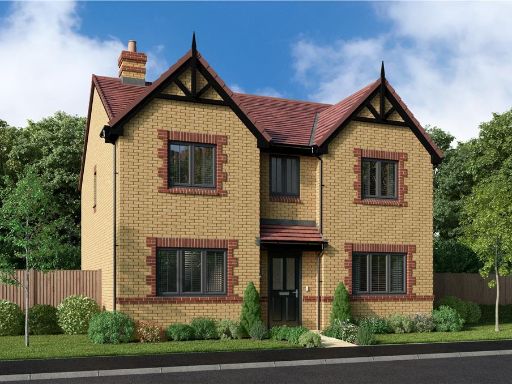 4 bedroom detached house for sale in Stotfold Road,
Arlesey,
SG15 6XR, SG15 — £640,000 • 4 bed • 1 bath • 959 ft²
4 bedroom detached house for sale in Stotfold Road,
Arlesey,
SG15 6XR, SG15 — £640,000 • 4 bed • 1 bath • 959 ft²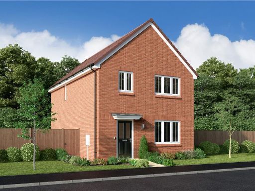 3 bedroom detached house for sale in Stotfold Road,
Arlesey,
SG15 6XR, SG15 — £495,000 • 3 bed • 1 bath • 701 ft²
3 bedroom detached house for sale in Stotfold Road,
Arlesey,
SG15 6XR, SG15 — £495,000 • 3 bed • 1 bath • 701 ft²
Meta
- {
"@context": "https://schema.org",
"@type": "Residence",
"name": "4 bedroom detached house for sale in Stotfold Road, Arlesey…",
"description": "",
"url": "https://propertypiper.co.uk/property/acb6cfb8-495f-4705-9dc6-1c47ba8e1c5e",
"image": "https://image-a.propertypiper.co.uk/1f320778-b66d-42df-a759-2776d2dfb473-1024.jpeg",
"address": {
"@type": "PostalAddress",
"streetAddress": "69, Stotfold Road, ARLESEY",
"postalCode": "SG15 6XR",
"addressLocality": "Central Bedfordshire",
"addressRegion": "North East Bedfordshire",
"addressCountry": "England"
},
"geo": {
"@type": "GeoCoordinates",
"latitude": 52.023857030098995,
"longitude": -0.2574107786117428
},
"numberOfRooms": 4,
"numberOfBathroomsTotal": 1,
"floorSize": {
"@type": "QuantitativeValue",
"value": 872,
"unitCode": "FTK"
},
"offers": {
"@type": "Offer",
"price": 620000,
"priceCurrency": "GBP",
"availability": "https://schema.org/InStock"
},
"additionalProperty": [
{
"@type": "PropertyValue",
"name": "Feature",
"value": "modern"
},
{
"@type": "PropertyValue",
"name": "Feature",
"value": "brick"
},
{
"@type": "PropertyValue",
"name": "Feature",
"value": "two-story"
},
{
"@type": "PropertyValue",
"name": "Feature",
"value": "new build"
},
{
"@type": "PropertyValue",
"name": "Feature",
"value": "detached"
},
{
"@type": "PropertyValue",
"name": "Feature",
"value": "residential"
},
{
"@type": "PropertyValue",
"name": "Feature",
"value": "well-maintained"
},
{
"@type": "PropertyValue",
"name": "Feature",
"value": "family home"
},
{
"@type": "PropertyValue",
"name": "Feature",
"value": "modern kitchen"
},
{
"@type": "PropertyValue",
"name": "Feature",
"value": "integrated appliances"
},
{
"@type": "PropertyValue",
"name": "Feature",
"value": "bright lighting"
},
{
"@type": "PropertyValue",
"name": "Feature",
"value": "open plan"
},
{
"@type": "PropertyValue",
"name": "Feature",
"value": "dining area"
},
{
"@type": "PropertyValue",
"name": "Feature",
"value": "corner kitchen"
},
{
"@type": "PropertyValue",
"name": "Feature",
"value": "contemporary"
}
]
}
High Res Floorplan Images
Compatible Floorplan Images
FloorplanImages Thumbnail