AL3 8BL - Land for sale in Land at Flamstead, Hertfordshire, AL3
View on Property Piper
Land for sale in Land at Flamstead, Hertfordshire, AL3
Property Details
- Price: £2900000
- Bedrooms: 1
- Bathrooms: 1
- Property Type: undefined
- Property SubType: undefined
Brochure Descriptions
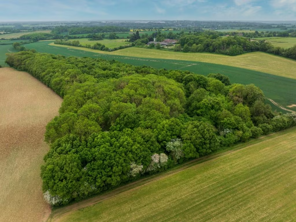
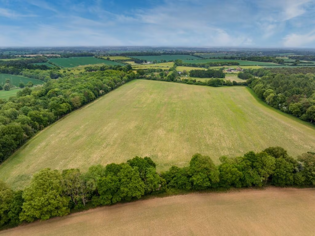
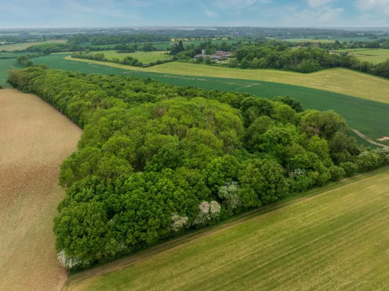
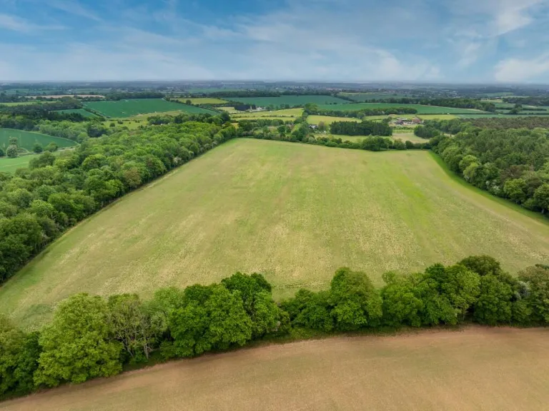
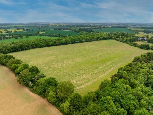
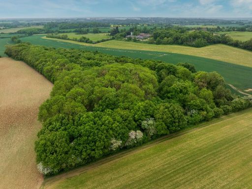
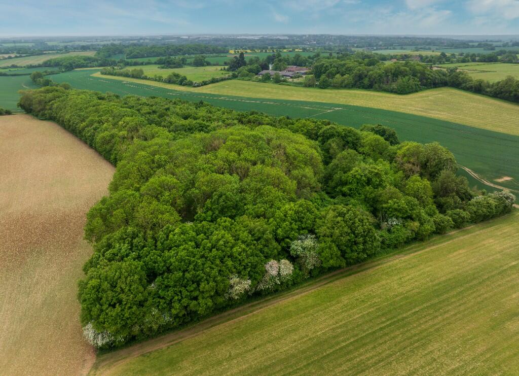
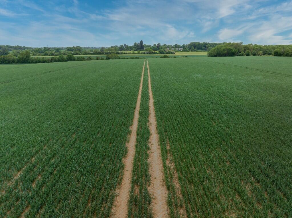
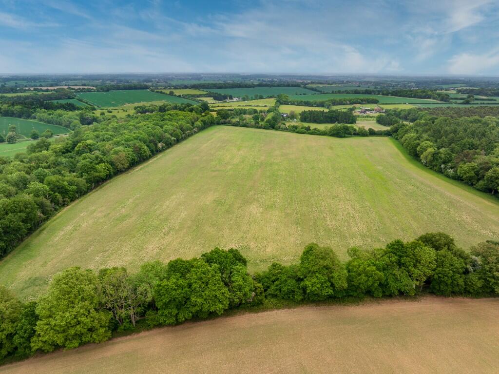
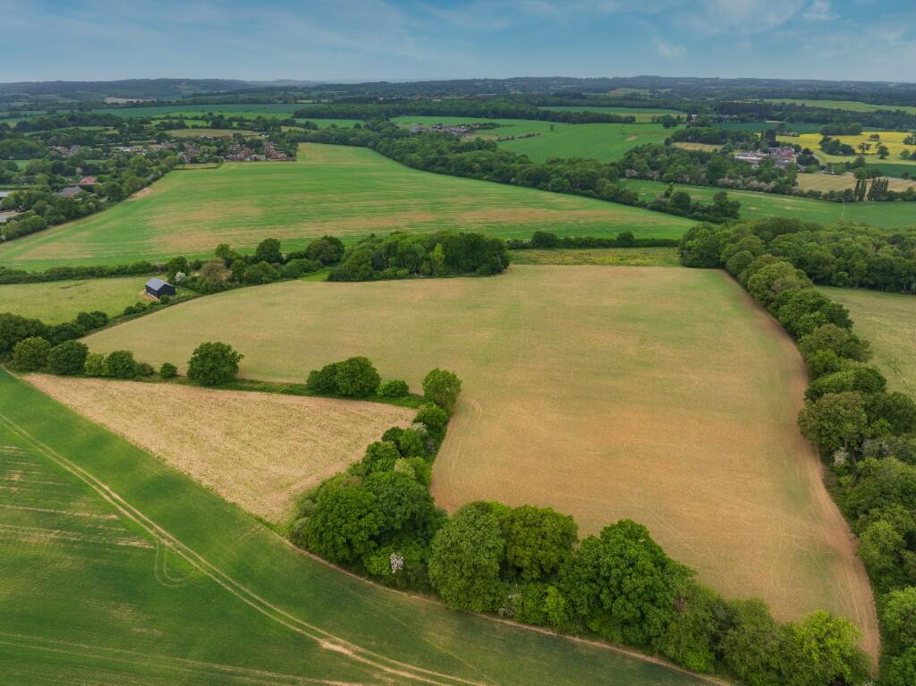
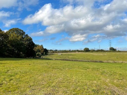
- This expansive plot of land, located in the picturesque setting of Flamstead, Hertfordshire, offers a vast and level terrain surrounded by lush greenery and mature trees. The property boasts breathtaking countryside views and is ideal for development or agricultural pursuits. With the land's extensive size, the opportunity for large-scale projects is promising. Its setting, amidst rolling hills and ample open spaces, provides a serene and tranquil environment.
- This property comprises a substantial area of 293.20 acres (118.84 hectares) of predominantly arable land with woodland. It is strategically located in an Area of Outstanding Natural Beauty, enhancing its appeal with its proximity just 24 miles from Central London. The land is subdivisible into four distinct lots, ranging in size to accommodate diverse agricultural pursuits or development. LOT 1 offers a massive area of 223.99 acres of combined arable land and woodland, ideal for extensive farming or environmental conservation projects. LOT 2 features smaller, versatile parcels of 6.70 acres of woodland and 5.61 acres of arable land, suitable for dedicated forestry or smaller agricultural undertakings. LOT 3 provides 29.80 acres of pure arable land, perfect for intensive agricultural use. Lastly, LOT 4 encompasses 26.96 acres of mixed-use area including arable, pasture, and wooded regions, offering flexibility in land use strategies. The property’s expanse and varied land types provide significant opportunities for both agricultural and strategic land investment.
Image Descriptions
- large field
- farmland or countryside
Textual Property Features
Detected Visual Features
- land
- field
- acreage
- open space
- pasture
- countryside
- farmland
- rural
- open land
- agriculture
- nature
Nearby Schools
- George Street Primary School
- Hammond Academy
- Aycliffe Drive Primary School
- Maple Grove Primary School
- Laureate Academy
- Galley Hill Primary School and Nursery
- The Astley Cooper School
- Holtsmere End Junior School
- Gaddesden Row JMI School
- Great Gaddesden Church of England Primary School
- Broadfield Academy
- Lockers Park School
- Gade Valley Primary School
- Jupiter Primary School
- Brockswood Primary School
- Beechwood Park School
- Kensworth Church of England Academy
- Slip End Village School
- Hobletts Manor Junior School
- Hobletts Manor Infants' School
- Yewtree Primary School
- Holtsmere End Infant and Nursery School
- Flamstead Village School
- Markyate Village School and Nursery
Nearest General Shops
- Id: 249461124
- Tags:
- Created_by: Potlatch 0.7b
- Name: Ye Olde Village News
- Shop: newsagent
- TagsNormalized:
- Lat: 51.8362562
- Lon: -0.4606296
- FullGeoHash: gcpwvs884d98
- PartitionGeoHash: gcpw
- Images:
- FoodStandards: null
- Distance: 3380.8
,- Id: 102851738
- Tags:
- Addr:
- Building: yes
- Shop: yes
- TagsNormalized:
- Lat: 51.7805317
- Lon: -0.4361257
- FullGeoHash: gcpww467mw9p
- PartitionGeoHash: gcpw
- Images:
- FoodStandards: null
- Distance: 3169.8
,- Id: 2622878244
- Tags:
- Name: Woodhall Chemist
- Shop: chemist
- TagsNormalized:
- Lat: 51.78057
- Lon: -0.4362173
- FullGeoHash: gcpww467emug
- PartitionGeoHash: gcpw
- Images:
- FoodStandards: null
- Distance: 3163.1
}
Nearest Grocery shops
- Id: 1438891438
- Tags:
- TagsNormalized:
- Lat: 51.7987829
- Lon: -0.405607
- FullGeoHash: gcpwwv8tu8vr
- PartitionGeoHash: gcpw
- Images:
- FoodStandards: null
- Distance: 3625.1
,- Id: 249460882
- Tags:
- Created_by: Potlatch 0.7b
- Name: Happy Shopper
- Shop: convenience
- TagsNormalized:
- Lat: 51.8361183
- Lon: -0.4607497
- FullGeoHash: gcpwvs2rrbb4
- PartitionGeoHash: gcpw
- Images:
- FoodStandards: null
- Distance: 3366.1
,- Id: 2622878240
- Tags:
- Brand: Londis
- Brand:wikidata: Q21008564
- Name: Londis
- Shop: convenience
- TagsNormalized:
- Lat: 51.7806114
- Lon: -0.4362522
- FullGeoHash: gcpww467ftdf
- PartitionGeoHash: gcpw
- Images:
- FoodStandards: null
- Distance: 3158
}
Nearest Supermarkets
- Id: 9657909816
- Tags:
- Addr:
- Country: GB
- Housename: The Peoplebuilding Estate
- Postcode: HP2 4NW
- Street: Maylands Avenue
- Unit: 1
- Brand: ALDI
- Brand:wikidata: Q41171672
- Brand:wikipedia: en:Aldi
- Contact:
- Website: https://stores.aldi.co.uk/hemel-hempstead/maylands-avenue
- Fhrs:
- Name: ALDI
- Operator: Aldi Stores Limited
- Shop: supermarket
- TagsNormalized:
- Lat: 51.7578911
- Lon: -0.4376587
- FullGeoHash: gcpwqn1r9f4n
- PartitionGeoHash: gcpw
- Images:
- FoodStandards:
- Id: 1226714
- FHRSID: 1226714
- LocalAuthorityBusinessID: 85377
- BusinessName: Aldi Stores Limited
- BusinessType: Retailers - supermarkets/hypermarkets
- BusinessTypeID: 7840
- AddressLine1: Unit 1, The Peoplebuilding Estate
- AddressLine2: Maylands Avenue
- AddressLine3: Hemel Hempstead
- AddressLine4: Hertfordshire
- PostCode: HP2 4NW
- RatingValue: 5
- RatingKey: fhrs_5_en-GB
- RatingDate: 2020-03-10
- LocalAuthorityCode: 156
- LocalAuthorityName: Dacorum
- LocalAuthorityWebSite: http://www.dacorum.gov.uk
- LocalAuthorityEmailAddress: ecp@dacorum.gov.uk
- Scores:
- Hygiene: 0
- Structural: 0
- ConfidenceInManagement: 5
- NewRatingPending: false
- Geocode:
- Longitude: -0.43627160000000
- Latitude: 51.75775280000000
- Distance: 5506
,- Id: 182674438
- Tags:
- Brand: ALDI
- Brand:wikidata: Q41171672
- Brand:wikipedia: en:Aldi
- Building: yes
- Contact:
- Website: https://stores.aldi.co.uk/hemel-hempstead/redbourn-road
- Name: ALDI
- Shop: supermarket
- TagsNormalized:
- Lat: 51.7697803
- Lon: -0.4481175
- FullGeoHash: gcpwtb3sy4e2
- PartitionGeoHash: gcpw
- Images:
- FoodStandards: null
- Distance: 4066.6
,- Id: 51353474
- Tags:
- Brand: Sainsbury's
- Brand:wikidata: Q152096
- Building: yes
- Name: Sainsbury's
- Shop: supermarket
- TagsNormalized:
- sainsburys
- supermarket
- shop
- Lat: 51.7802709
- Lon: -0.4356257
- FullGeoHash: gcpww46ccnjg
- PartitionGeoHash: gcpw
- Images:
- FoodStandards: null
- Distance: 3211.3
}
Nearest Religious buildings
- Id: 975298906
- Tags:
- Amenity: place_of_worship
- Denomination: methodist
- Name: Gaddesden Row Methodist Church
- Religion: christian
- TagsNormalized:
- place of worship
- methodist
- church
- christian
- Lat: 51.8125957
- Lon: -0.4927693
- FullGeoHash: gcpwub1njxus
- PartitionGeoHash: gcpw
- Images:
- FoodStandards: null
- Distance: 2565.3
,- Id: 255565352
- Tags:
- Amenity: place_of_worship
- Building: church
- Denomination: anglican
- Name: Parish Church of St Leonard
- Religion: christian
- Wikidata: Q17528866
- TagsNormalized:
- place of worship
- church
- anglican
- parish
- christian
- Lat: 51.8191702
- Lon: -0.4361618
- FullGeoHash: gcpwy16ks9qn
- PartitionGeoHash: gcpw
- Images:
- FoodStandards: null
- Distance: 2056.1
,- Id: 505834909
- Tags:
- Amenity: place_of_worship
- Building: church
- Denomination: methodist
- Name: Trowley Hill Methodist Church
- Religion: christian
- Source: OS OpenMap Local
- TagsNormalized:
- place of worship
- church
- methodist
- christian
- Lat: 51.8164713
- Lon: -0.4367248
- FullGeoHash: gcpwy0cuzd67
- PartitionGeoHash: gcpw
- Images:
- FoodStandards: null
- Distance: 1823.4
}
Nearest Airports
- Id: 110273499
- Tags:
- Addr:
- Country: GB
- Postcode: LU2 9LY
- Aerodrome: international
- Aerodrome:type: public
- Aeroway: aerodrome
- Alt_name: London Luton
- Iata: LTN
- Icao: EGGW
- Name: London Luton Airport
- Website: https://www.london-luton.co.uk/
- Wikidata: Q8712
- Wikipedia: en:Luton Airport
- TagsNormalized:
- airport
- international airport
- Lat: 51.8780363
- Lon: -0.3701408
- FullGeoHash: gcpxps47rngh
- PartitionGeoHash: gcpx
- Images:
- FoodStandards: null
- Distance: 9996.3
}
Nearest Leisure Facilities
- Id: 975384850
- Tags:
- Leisure: pitch
- Sport: equestrian
- TagsNormalized:
- pitch
- leisure
- equestrian
- sports
- Lat: 51.8004518
- Lon: -0.4420925
- FullGeoHash: gcpwtvypd2pg
- PartitionGeoHash: gcpw
- Images:
- FoodStandards: null
- Distance: 1195.2
,- Id: 975384840
- Tags:
- Leisure: pitch
- Sport: equestrian
- TagsNormalized:
- pitch
- leisure
- equestrian
- sports
- Lat: 51.8040568
- Lon: -0.440592
- FullGeoHash: gcpwtyxht2ng
- PartitionGeoHash: gcpw
- Images:
- FoodStandards: null
- Distance: 1150.3
,- Id: 975384837
- Tags:
- Leisure: pitch
- Sport: equestrian
- TagsNormalized:
- pitch
- leisure
- equestrian
- sports
- Lat: 51.8025269
- Lon: -0.443908
- FullGeoHash: gcpwtykg84yj
- PartitionGeoHash: gcpw
- Images:
- FoodStandards: null
- Distance: 979.5
,- Id: 975252971
- Tags:
- Leisure: pitch
- Sport: equestrian
- TagsNormalized:
- pitch
- leisure
- equestrian
- sports
- Lat: 51.8040897
- Lon: -0.4636776
- FullGeoHash: gcpwtqwkew2b
- PartitionGeoHash: gcpw
- Images:
- FoodStandards: null
- Distance: 500
,- Id: 884407229
- Tags:
- Leisure: pitch
- Sport: equestrian
- TagsNormalized:
- pitch
- leisure
- equestrian
- sports
- Lat: 51.806935
- Lon: -0.4565052
- FullGeoHash: gcpwtx5t68th
- PartitionGeoHash: gcpw
- Images:
- FoodStandards: null
- Distance: 117.4
}
Nearest Tourist attractions
- Id: 182876119
- Tags:
- Name: Three Cherry Trees Caravan Park
- Tourism: caravan_site
- TagsNormalized:
- Lat: 51.7712071
- Lon: -0.4368772
- FullGeoHash: gcpww09vhh2x
- PartitionGeoHash: gcpw
- Images:
- FoodStandards: null
- Distance: 4102.9
,- Id: 245934181
- Tags:
- Addr:
- City: Redbourn
- Housename: Silk Mill House
- Postcode: AL3 7NB
- Street: The Common
- Fee: no
- Museum: local_history
- Name: Redbourn Village Museum
- Tourism: museum
- Website: https://www.redbournmuseum.org/
- TagsNormalized:
- Lat: 51.7960101
- Lon: -0.4000394
- FullGeoHash: gcpwwvhtwkj5
- PartitionGeoHash: gcpw
- Images:
- FoodStandards: null
- Distance: 4072.2
,- Id: 519963463
- Tags:
- Building: yes
- Name: Silk Mill House
- Source: OS OpenMap Local
- Tourism: museum
- TagsNormalized:
- Lat: 51.7958272
- Lon: -0.4001388
- FullGeoHash: gcpwwvhss44b
- PartitionGeoHash: gcpw
- Images:
- FoodStandards: null
- Distance: 4071.2
}
Nearest Hotels
- Id: 4335652754
- Tags:
- Name: Aubrey Park Hotel
- Tourism: hotel
- Website: https://www.aubreypark.co.uk/
- TagsNormalized:
- Lat: 51.7874461
- Lon: -0.4140727
- FullGeoHash: gcpwwed7xrtj
- PartitionGeoHash: gcpw
- Images:
- FoodStandards: null
- Distance: 3599.8
,- Id: 67306317
- Tags:
- Brand: Premier Inn
- Brand:wikidata: Q2108626
- Building: yes
- Fixme: Check on ground - Was certainly a Premier Inn in 2018 (Mapillary)
- Internet_access: wlan
- Internet_access:fee: customers
- Internet_access:operator: Virgin Media
- Internet_access:ssid: Premier Inn Free Wi-Fi
- Name: Premier Inn
- Tourism: hotel
- TagsNormalized:
- Lat: 51.8216908
- Lon: -0.4230428
- FullGeoHash: gcpwy3ggnrk6
- PartitionGeoHash: gcpw
- Images:
- FoodStandards: null
- Distance: 2921.2
,- Id: 294878882
- Tags:
- Addr:
- City: St Albans
- Postcode: AL3 8HH
- Street: London Road
- Village: Markyate
- Brand: Holiday Inn
- Brand:wikidata: Q2717882
- Brand:wikipedia: en:Holiday Inn
- Fhrs:
- Name: Holiday Inn
- Source:
- Tourism: hotel
- TagsNormalized:
- Lat: 51.8290226
- Lon: -0.4443934
- FullGeoHash: gcpwvghmuyh6
- PartitionGeoHash: gcpw
- Images:
- FoodStandards: null
- Distance: 2710.7
}
Tags
- land
- field
- acreage
- open space
- pasture
- countryside
- farmland
- rural
- open land
- agriculture
- nature
Local Market Stats
- Average Price/sqft: £580
- Avg Income: £62600
- Rental Yield: 3.2%
- Social Housing: 6%
- Planning Success Rate: 82%
Similar Properties
 Land for sale in Cotton Paddock, Markyate, St. Albans, AL3 8AF, AL3 — £75,000 • 1 bed • 1 bath
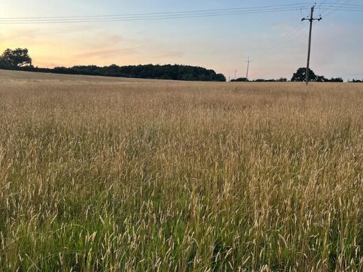 Land for sale in Valley Lane, Hertfordshire, AL3 8, AL3 — £310,000 • 1 bed • 1 bath
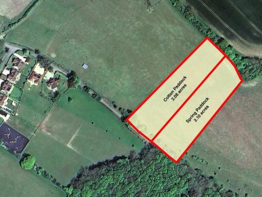 Land for sale in Spring Paddock, Markyate, St. Albans, AL3 8AF, AL3 — £75,000 • 1 bed • 1 bath
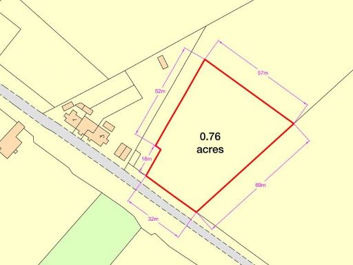 Land for sale in Forge Field, Gaddesden Row, Hertfordshire, HP2 — £58,000 • 1 bed • 1 bath
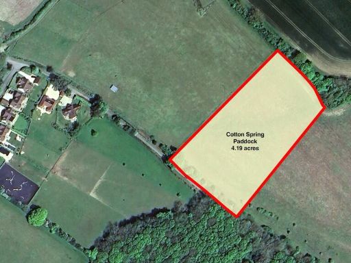 Land for sale in 4.2 acres of land in Markyate, St. Albans, AL3 — £150,000 • 1 bed • 1 bath
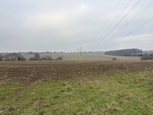 Land for sale in Land At, Gaddesden Lane, Redbourn, AL3 7AS, AL3 — £1,000,000 • 1 bed • 1 bath
Meta
- {
"@context": "https://schema.org",
"@type": "Residence",
"name": "Land for sale in Land at Flamstead, Hertfordshire, AL3",
"description": "",
"url": "https://propertypiper.co.uk/property/ab4642a0-f3f2-43c8-aadd-9eb625d290a0",
"image": "https://image-a.propertypiper.co.uk/6f413e20-1826-4970-a3a8-e4c30454cd81-1024.jpeg",
"address": {
"@type": "PostalAddress",
"streetAddress": "Land at Flamstead, Hertfordshire",
"postalCode": "AL3 8BL",
"addressLocality": "Dacorum",
"addressRegion": "Hemel Hempstead",
"addressCountry": "England"
},
"geo": {
"@type": "GeoCoordinates",
"latitude": 51.8059329410377,
"longitude": -0.4570450114841911
},
"numberOfRooms": 1,
"numberOfBathroomsTotal": 1,
"offers": {
"@type": "Offer",
"price": 2900000,
"priceCurrency": "GBP",
"availability": "https://schema.org/InStock"
},
"additionalProperty": [
{
"@type": "PropertyValue",
"name": "Feature",
"value": "land"
},
{
"@type": "PropertyValue",
"name": "Feature",
"value": "field"
},
{
"@type": "PropertyValue",
"name": "Feature",
"value": "acreage"
},
{
"@type": "PropertyValue",
"name": "Feature",
"value": "open space"
},
{
"@type": "PropertyValue",
"name": "Feature",
"value": "pasture"
},
{
"@type": "PropertyValue",
"name": "Feature",
"value": "countryside"
},
{
"@type": "PropertyValue",
"name": "Feature",
"value": "farmland"
},
{
"@type": "PropertyValue",
"name": "Feature",
"value": "rural"
},
{
"@type": "PropertyValue",
"name": "Feature",
"value": "open land"
},
{
"@type": "PropertyValue",
"name": "Feature",
"value": "agriculture"
},
{
"@type": "PropertyValue",
"name": "Feature",
"value": "nature"
}
]
}