Summary - M1 Junction 16, Harpole, Northamptonshire, NN7 NN7 4DE
1 bed 1 bath Land
Large contiguous rural site near major transport links for agricultural or development potential.
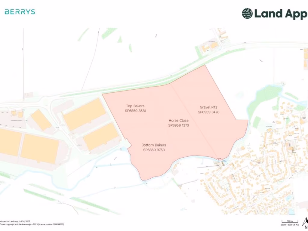
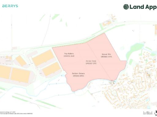
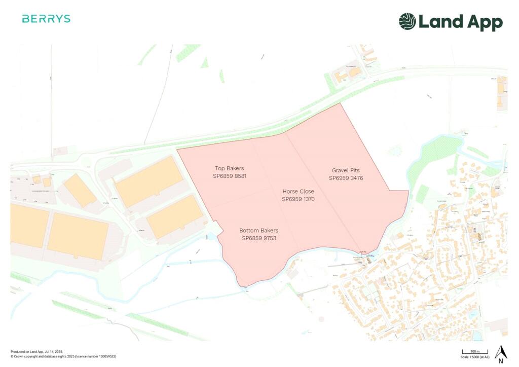
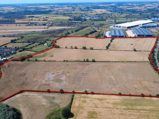
Approx. 96.08 acres (38.88 ha) across four arable parcels
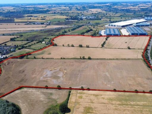
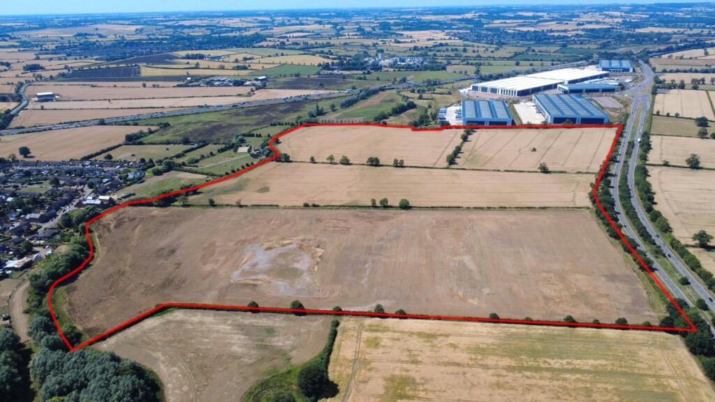
Extending to about 96.08 acres (38.88 ha) across four arable parcels, this level site sits immediately north of the River Nene and adjacent to major road links at M1 Junction 16. The land is enclosed by mature hedgerows, benefits from excellent mobile signal and fast broadband speeds, and has been traditionally used for arable cropping. Proximity to Panattoni Park and nearby settlements gives the site logistics and development appeal.
The land may suit agricultural continuity, biodiversity net gain (BNG) projects, or longer-term development opportunities subject to planning. One parcel (the western part of Top Bakers) has an under-drainage scheme; the remaining parcels are drained by conventional field systems. The scale and contiguity of the holding make it flexible for large-scale proposals or phased schemes.
Buyers should note material issues requiring due diligence. The parcel known as Gravel Pits was historically worked for gravel and later infilled; no records are available regarding the nature or remediation of that infill. Tenure is recorded as unknown and there are no guarantees of planning consent — prospective purchasers must satisfy themselves on title, contamination, utilities, and planning constraints. There is no recorded flood risk for the site.
For investors and developers this represents a rare, large-scale landholding in a very affluent area with strong transport links and neighbouring industrial/commercial activity. Its value will be driven by successful planning outcomes, any required ground investigations and remediation for worked areas, and confirmation of services and access arrangements.
 Property for sale in M1 Junction 16, Harpole, Northamptonshire, NN7 — £2,850,000 • 1 bed • 1 bath
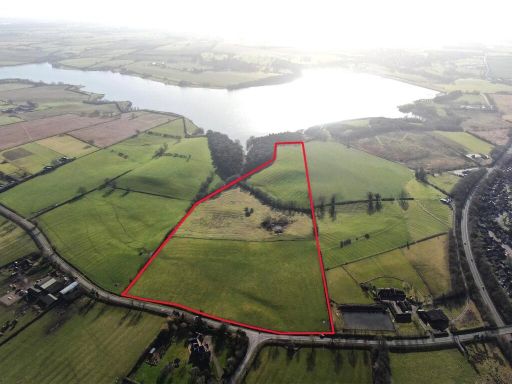 Land for sale in Land At Brixworth, Northamptonshire, NN6 — £400,000 • 1 bed • 1 bath
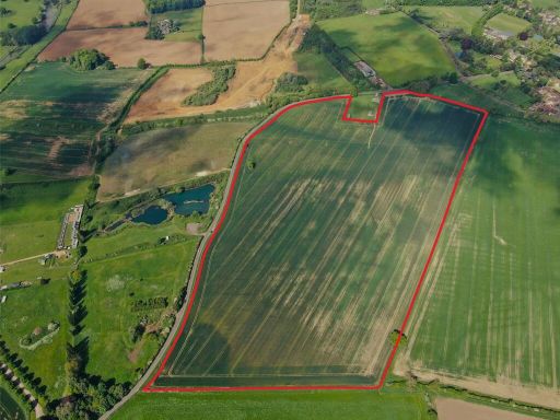 Property for sale in Moulton Road, Pitsford, Northampton, NN6 — £650,000 • 1 bed • 1 bath
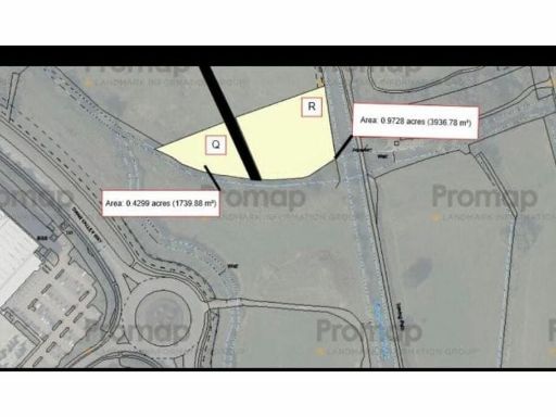 Land for sale in near Hunsbury Meadows, Northampton, NN4 — £90,000 • 1 bed • 1 bath • 1206 ft²
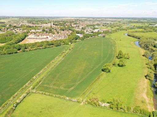 Land for sale in Ashton Road, Oundle, Peterborough, Northamptonshire, PE8 — £1,120,000 • 1 bed • 1 bath
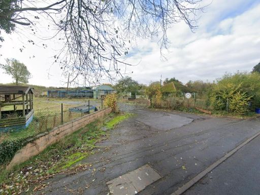 Land for sale in Yardley Hastings Garden Centre, 32 Bedford Road East, Yardley Hastings, Northampton, NN7 1HJ, NN7 — £1,250,000 • 1 bed • 1 bath