Summary - MOBILE HOME AT THE PADDOCKS, BOTTOM GREEN LE14 3BA
1 bed 1 bath Land
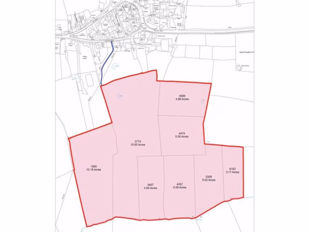
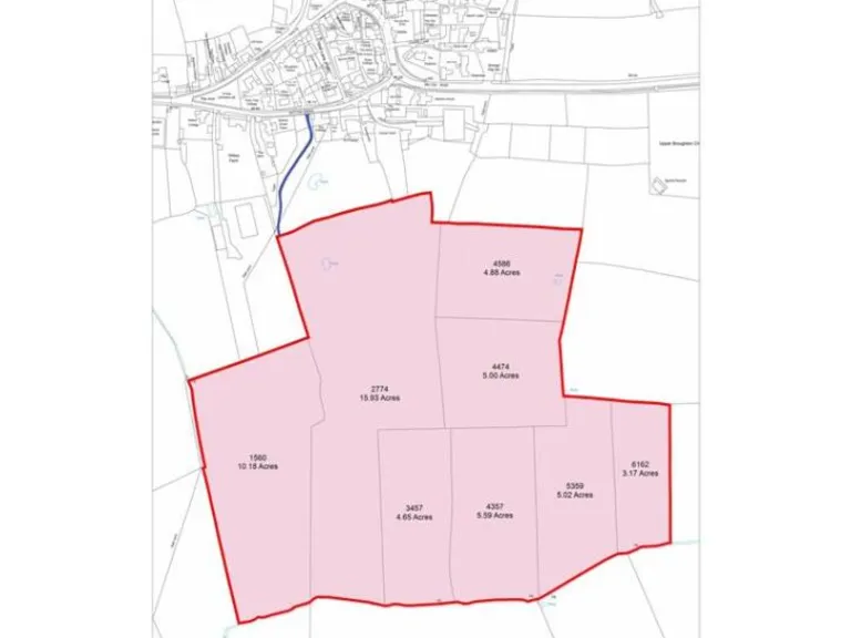
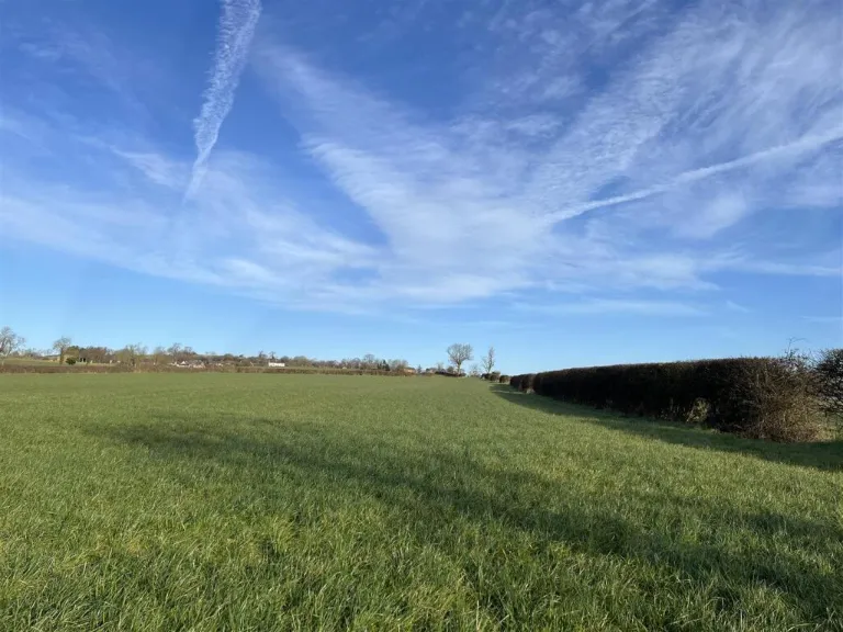
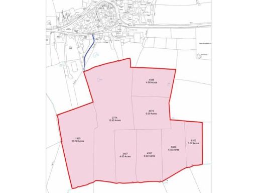
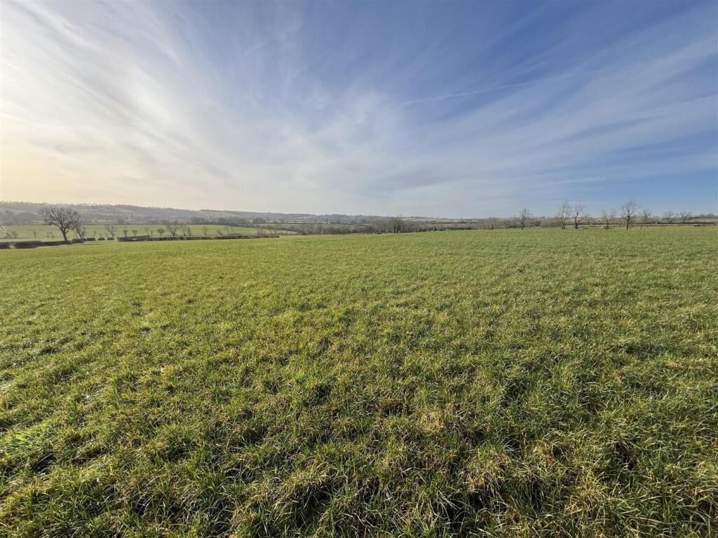
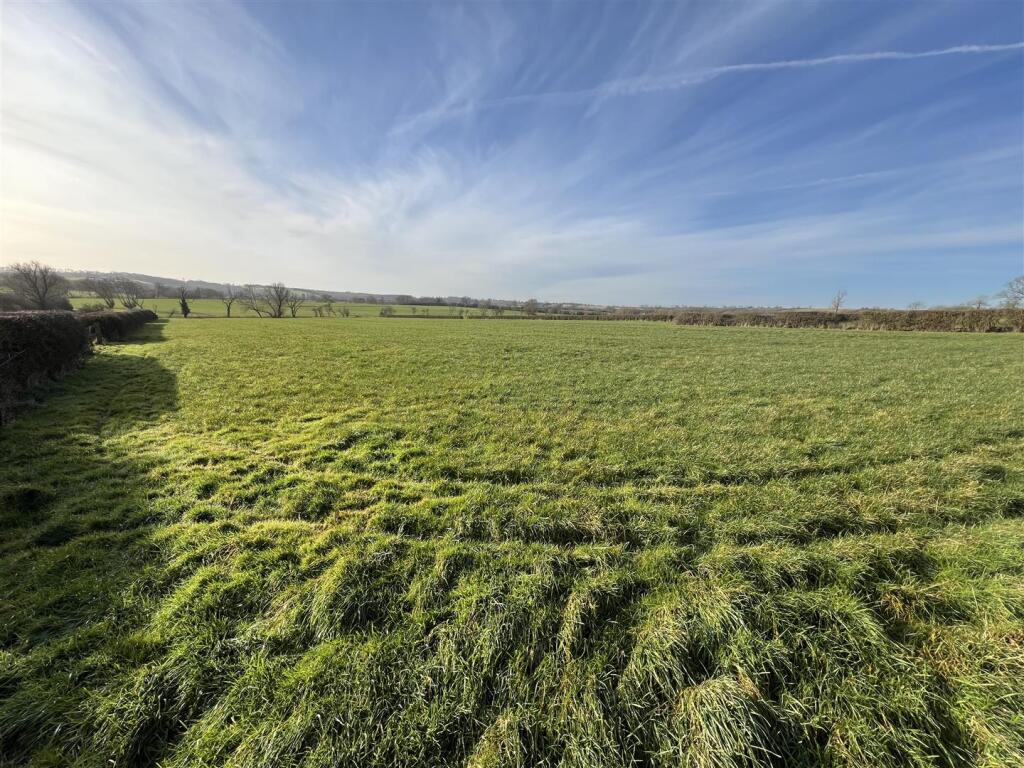
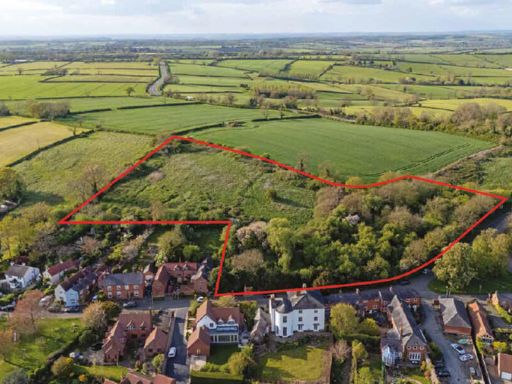
Large Grade 3 arable/grass block with water trough, stewardship agreements and easy road links..
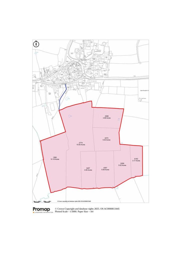
Approximately 54.42 acres (22.02 ha) of Grade 3 farmland
Denchworth series soils: suitable for some cereals and grassland
Mains-water trough present; two overhead electricity poles on site
Public footpath runs north–south through the land
Located in a Nitrate Vulnerable Zone (NVZ)
Mid Tier Countryside Stewardship to Dec 31, 2028; SFI to May 31, 2027
Access via agricultural track; right of way granted for agricultural use only
Sold as a whole with vacant possession; no delinked payments available
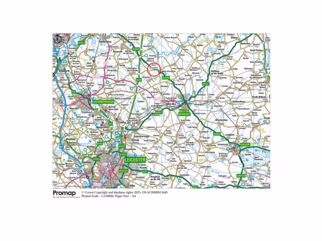
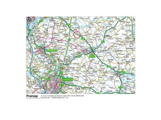
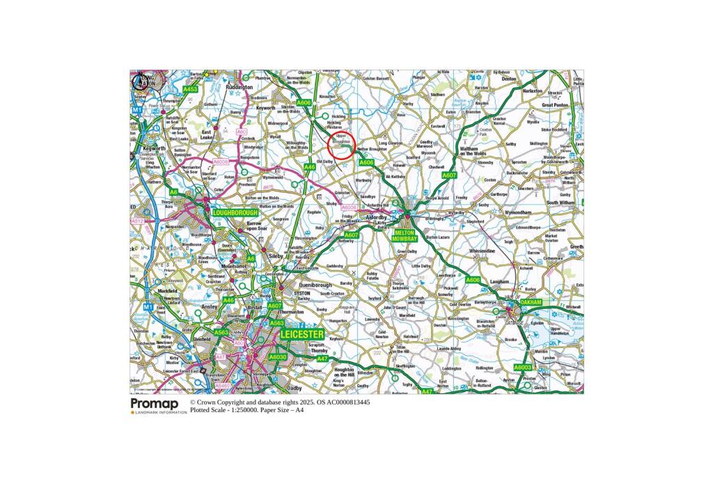
A substantial block of Grade 3 arable and grassland extending to approximately 54.42 acres (22.02 ha), situated just south of Upper Broughton. The parcel lies within easy driving distance of Melton Mowbray (6 miles), Loughborough (9½ miles) and Nottingham (11 miles), offering practical proximity to regional markets while retaining a rural setting.
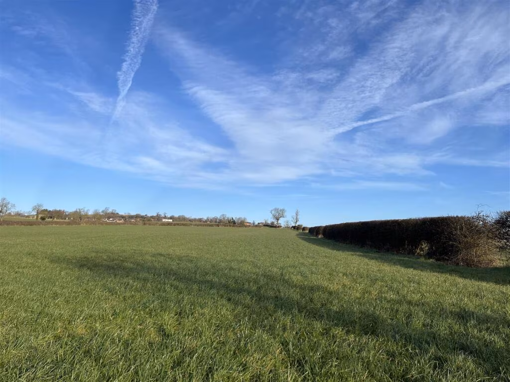
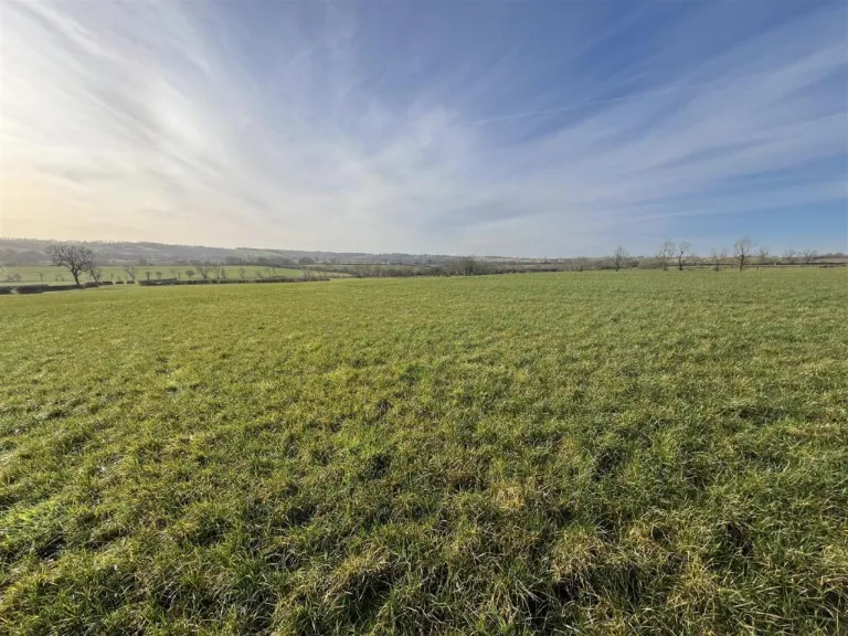
The land is currently in temporary grass and classified as Denchworth series soils — slowly permeable, seasonally wet loamy/clay soils suitable for some cereals and grazing. It includes a mains-water-connected trough and all sporting, timber and mineral rights owned in the freehold where applicable. A public footpath crosses the site and two overhead electricity poles/cables are located within the boundaries.
Practical considerations: the parcel is sold as a whole with vacant possession and access is via an agricultural track off Bottom Green (a right of way for agricultural use will be granted but the vendor reserves the right to vary the track route). The land sits within a Nitrate Vulnerable Zone and has existing environmental agreements (Mid Tier Countryside Stewardship to 31 Dec 2028; Sustainable Farming Incentive to 31 May 2027) which will transfer with the land where applicable.
This property will suit farming occupiers or land investors seeking scale and proximity to regional centres. Buyers should factor in the restrictions and obligations of the existing stewardship agreements, the public footpath, overhead lines, and the requirements for maintenance of the access track when assessing future use or change of use potential.
 Farm land for sale in Land off Top Green, LE14 — £95,000 • 1 bed • 1 bath
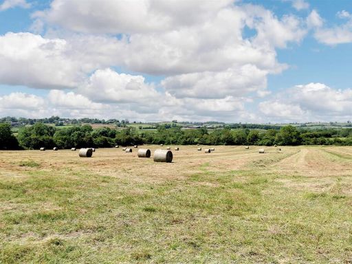 Land for sale in Land off Hickling Lane, Nether Broughton, LE14 — £100,000 • 1 bed • 1 bath
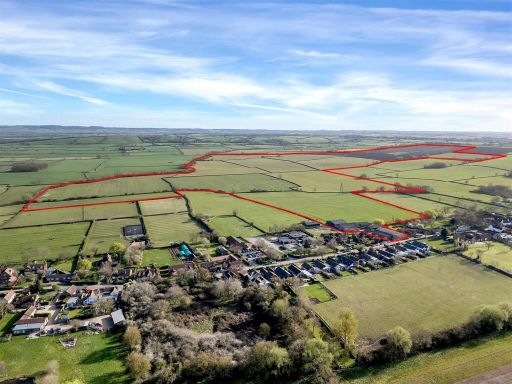 Land for sale in Land and Buildings at Ivy Farm, Kinoulton, Nottinghamshire, NG12 — £2,000,000 • 1 bed • 1 bath
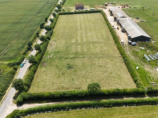 Land for sale in Barkestone Lane, Redmile, Nottingham, NG13 — £75,000 • 1 bed • 1 bath
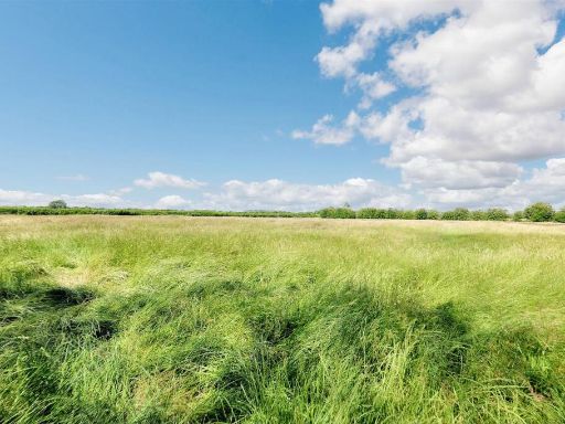 Land for sale in Barkestone Lane, Redmile, Nottingham, NG13 — £60,000 • 1 bed • 1 bath
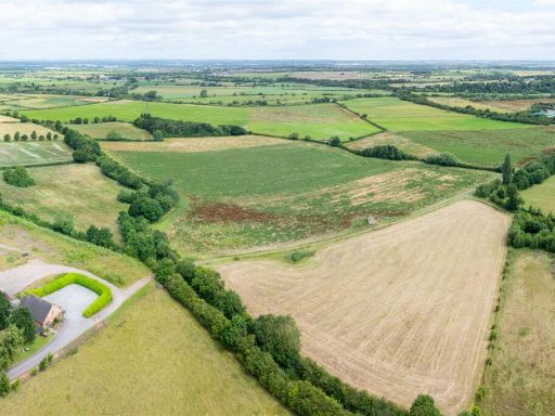 Land for sale in Land North of Kings Newton, Nr Melbourne, DE73 — £1,400,000 • 1 bed • 1 bath