HG4 5ER - Land for sale in Off Main Street, Wath, Ripon, HG4
View on Property Piper
Land for sale in Off Main Street, Wath, Ripon, HG4
Property Details
- Price: £280000
- Bedrooms: 1
- Bathrooms: 1
- Property Type: undefined
- Property SubType: undefined
Brochure Descriptions
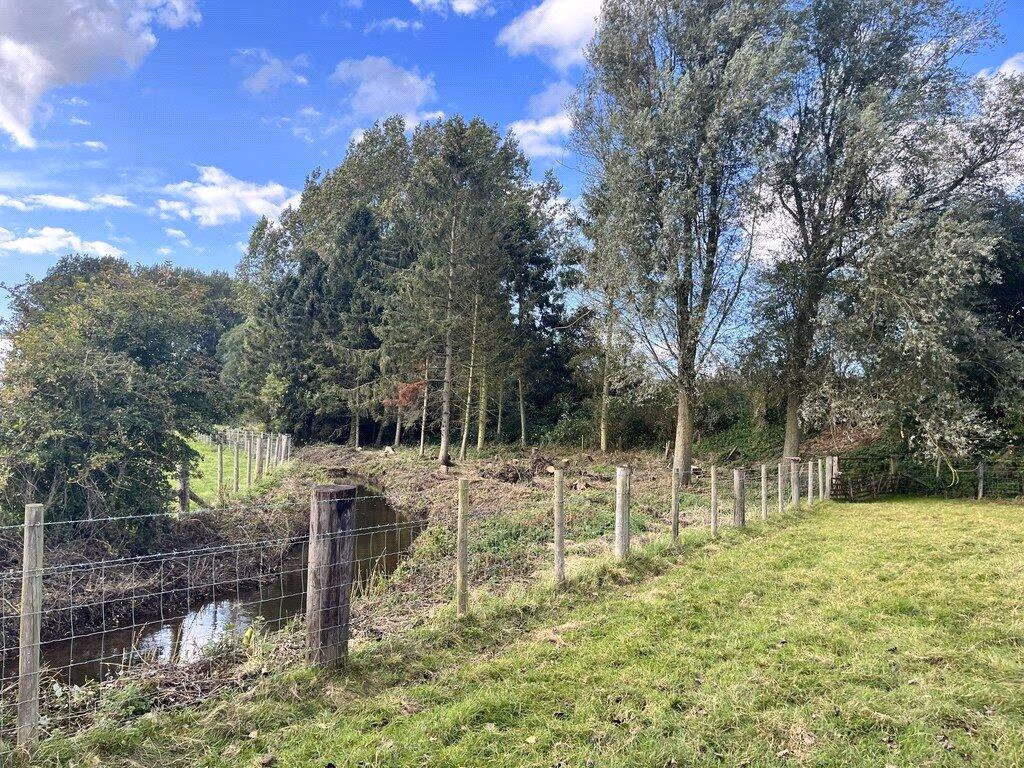
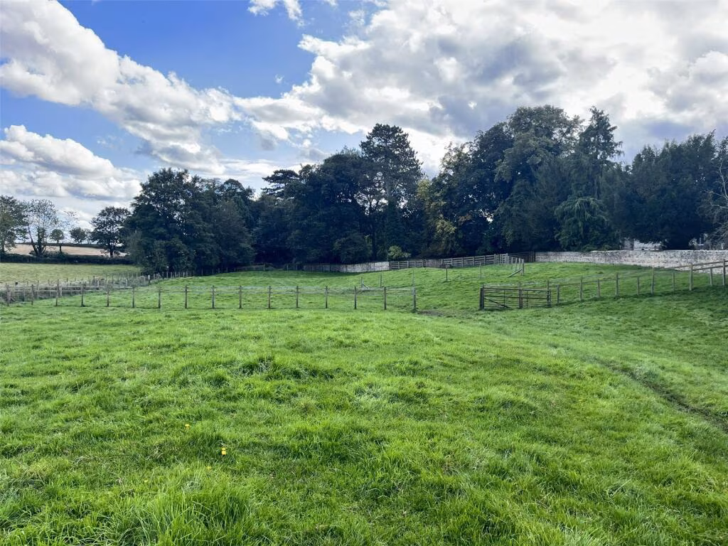
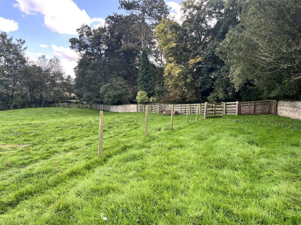
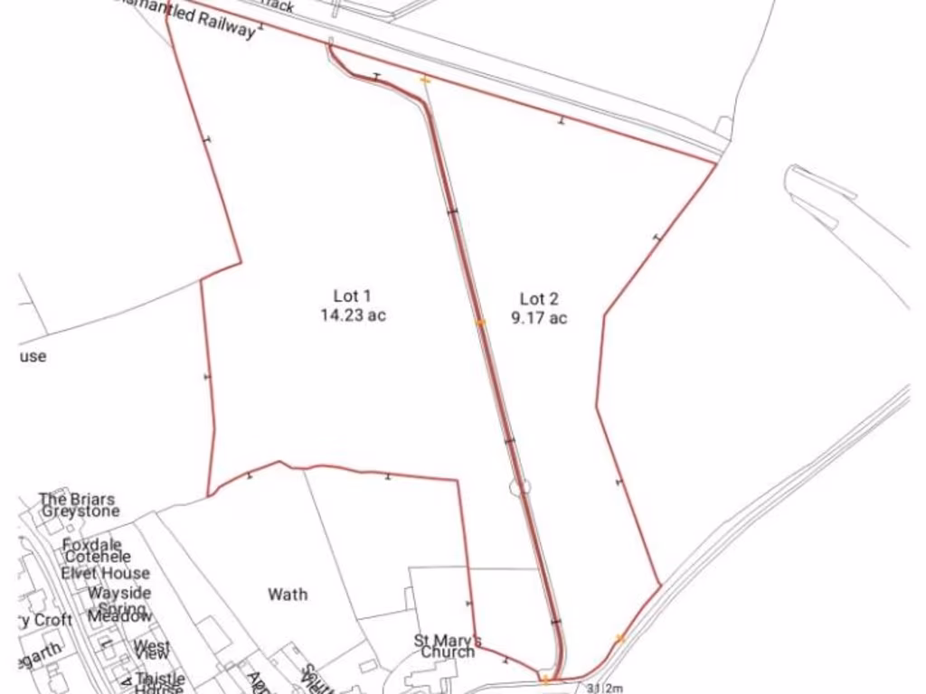
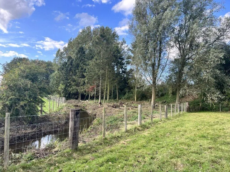
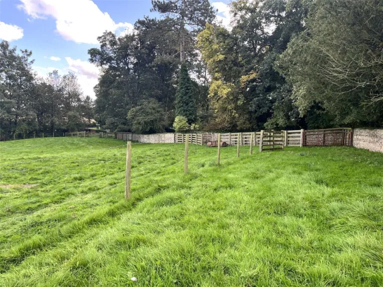
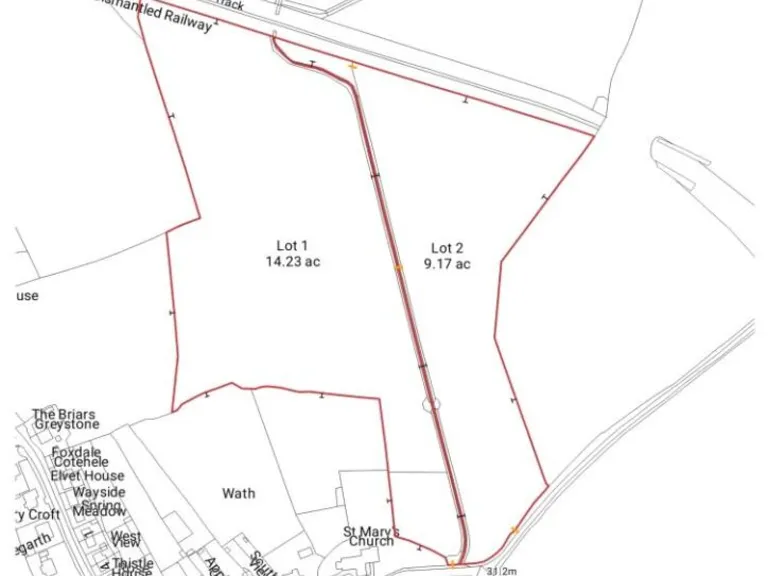
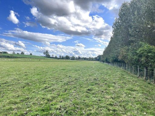
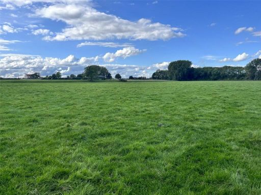
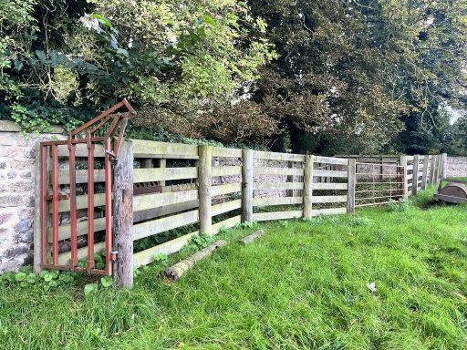
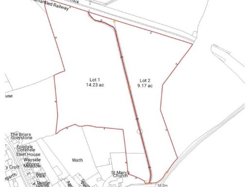
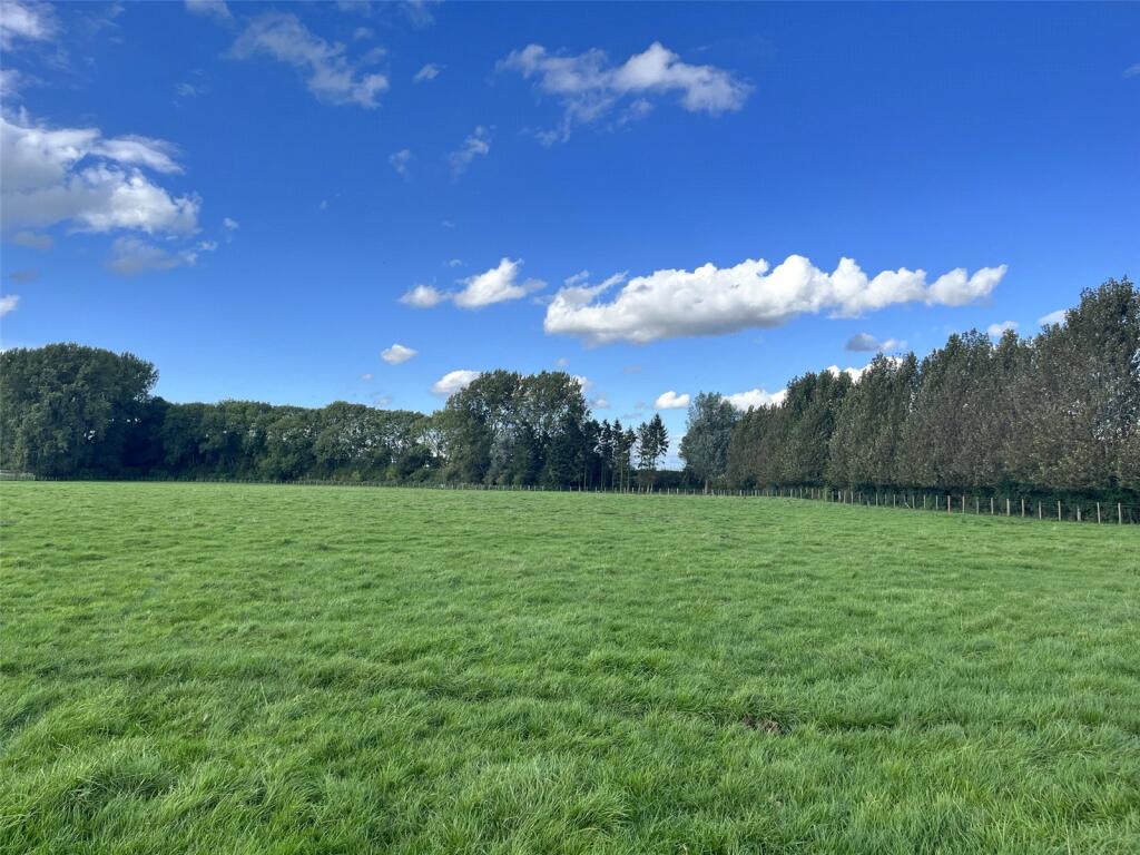
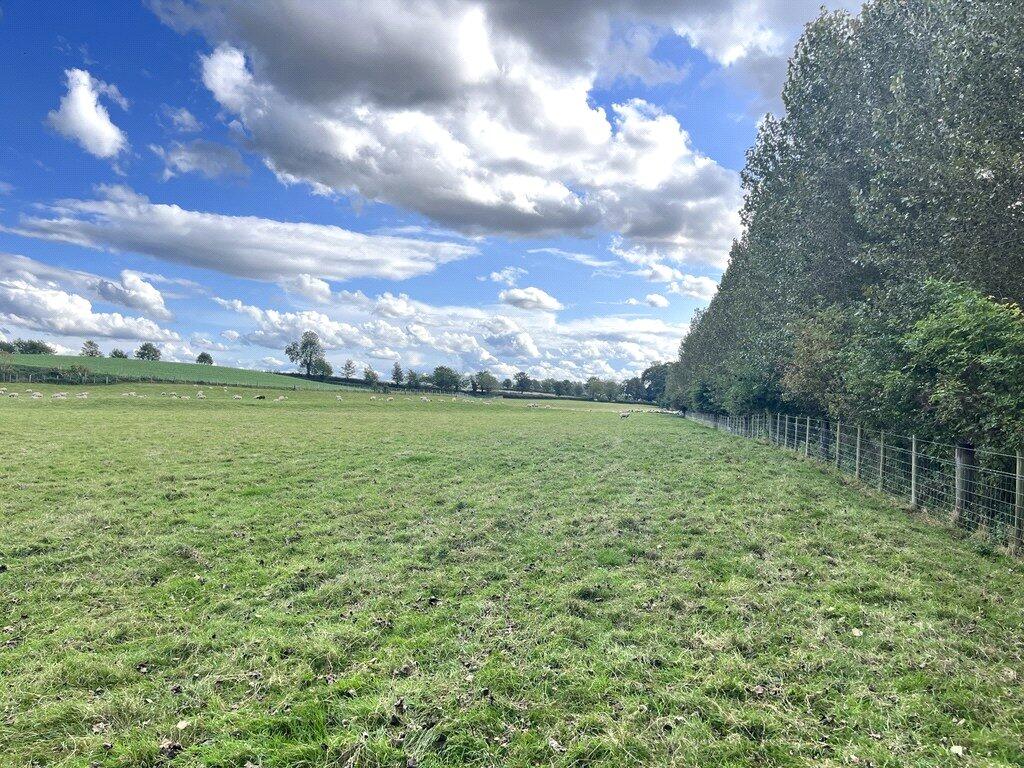
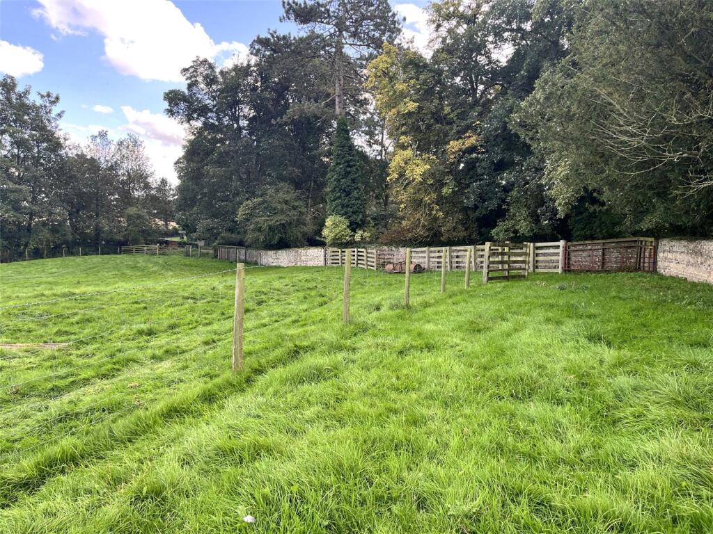
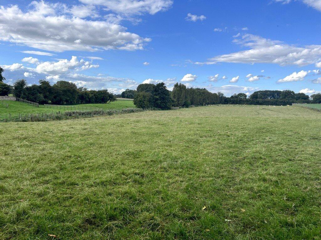
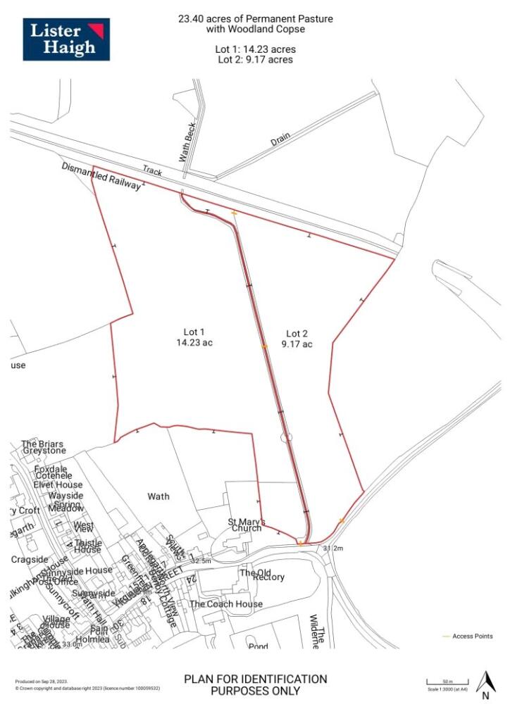
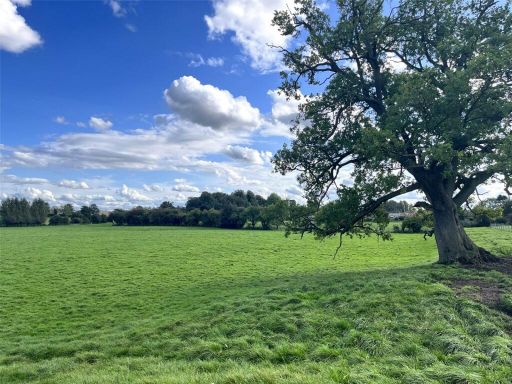
- The property comprises two separate parcels of grassland, extending to approximately 25.40 acres in total. Located conveniently off Main Street in Wath, Ripon, this land offers road frontage and individual access routes to each lot. The land predominantly features expansive, well-maintained grassland ideal for agricultural purposes. The views include surrounding trees and hedges, providing a natural and serene environment. Both lots are of considerable size, with Lot 1 measuring 16.23 acres and Lot 2 at 9.17 acres, suitable for various uses such as livestock grazing or crop cultivation. The property offers a rural setting with green landscapes and unobstructed views of nature.
Textual Property Features
Detected Visual Features
- plot of land
- potential development
- rural setting
- scenic
- open field
- agriculture
- tree-lined
- green space
- land
- field
- green area
- open space
- agricultural
- development potential
- rural
- expansive
- investment
Nearby Schools
- Moorside Primary School & Nursery
- St Nicholas Church of England Primary School, West Tanfield
- Snape Community Primary School
- Outwood Academy Ripon
- Ripon Grammar School
- Dishforth Church of England Voluntary Controlled Primary School
- Alanbrooke Academy
- Pickhill Church of England Primary School
- Outwood Primary Academy Greystone
- Holy Trinity Church of England Junior School
- Holy Trinity Church of England Infant and Nursery
- Burneston Church of England Voluntary Aided Primary School
- Ripon Cathedral Church of England Primary School
- Sharow Church of England Primary School
- Queen Mary's School
- North Stainley Church of England Primary School
Nearest Bars And Restaurants
- Id: 5224962219
- Tags:
- Amenity: pub
- Name: Black Horse
- TagsNormalized:
- Lat: 54.22684
- Lon: -1.5132795
- FullGeoHash: gcwumxdn4p9h
- PartitionGeoHash: gcwu
- Images:
- FoodStandards: null
- Distance: 4160.3
,- Id: 1028131308
- Tags:
- Amenity: pub
- Beer_garden: yes
- Building: yes
- Floor:
- Food: yes
- Name: The Staveley Arms
- Parking: yes
- Real_ale: Black Sheep bitter, Theakston's Best, Taylor Landlord
- Wheelchair: yes
- Wheelchair:description: Wide entrance, flat throughout
- TagsNormalized:
- Lat: 54.1851911
- Lon: -1.5608167
- FullGeoHash: gcwuk2p7w7dx
- PartitionGeoHash: gcwu
- Images:
- FoodStandards: null
- Distance: 3546.9
,- Id: 1026364892
- Tags:
- Amenity: pub
- Building: yes
- Name: George and Dragon
- TagsNormalized:
- Lat: 54.1861029
- Lon: -1.4861327
- FullGeoHash: gcwuq0mbften
- PartitionGeoHash: gcwu
- Images:
- FoodStandards: null
- Distance: 1402.2
,- Id: 992322085
- Tags:
- Amenity: pub
- Building: yes
- Name: The George
- TagsNormalized:
- Lat: 54.1878309
- Lon: -1.5060765
- FullGeoHash: gcwum8x6czgf
- PartitionGeoHash: gcwu
- Images:
- FoodStandards: null
- Distance: 204.5
,- Id: 554896827
- Tags:
- Amenity: pub
- Name: The George at Wath
- Source: survey
- TagsNormalized:
- Lat: 54.1878809
- Lon: -1.5061066
- FullGeoHash: gcwum8x731js
- PartitionGeoHash: gcwu
- Images:
- FoodStandards: null
- Distance: 198.6
}
Nearest General Shops
- Id: 3717415936
- Tags:
- Name: Ripon walled garden
- Shop: garden_centre
- TagsNormalized:
- Lat: 54.1542961
- Lon: -1.5410712
- FullGeoHash: gcwuhfmzdkqp
- PartitionGeoHash: gcwu
- Images:
- FoodStandards: null
- Distance: 4515.7
,- Id: 117550835
- Tags:
- Brand: Claas
- Building: yes
- Name: Seward
- Note: Tractor dealer
- Shop: agricultural_vehicles
- Source: Bing;survey
- Website: http://www.easternharvesters.co.uk/
- TagsNormalized:
- Lat: 54.2258329
- Lon: -1.4882494
- FullGeoHash: gcwuqps237bu
- PartitionGeoHash: gcwu
- Images:
- FoodStandards: null
- Distance: 4204.5
,- Id: 6577822181
- Tags:
- Addr:
- City: Baldersby
- Postcode: YO7 4PN
- Name: Smithy Farm Shop
- Shop: farm_shop
- TagsNormalized:
- Lat: 54.2010558
- Lon: -1.4558711
- FullGeoHash: gcwuqg5b59pg
- PartitionGeoHash: gcwu
- Images:
- FoodStandards: null
- Distance: 3550.7
}
Nearest Grocery shops
- Id: 1783878158
- Tags:
- Addr:
- City: Ripon
- Housenumber: 30
- Postcode: HG4 1HJ
- Street: North Street
- Brand: Spar
- Brand:wikidata: Q610492
- Brand:wikipedia: en:SPAR (retailer)
- Fhrs:
- Name: Spar
- Shop: convenience
- Source:
- TagsNormalized:
- Lat: 54.140198
- Lon: -1.5237451
- FullGeoHash: gcwgvrfmw0mk
- PartitionGeoHash: gcwg
- Images:
- FoodStandards:
- Id: 1382283
- FHRSID: 1382283
- LocalAuthorityBusinessID: PI/000119897
- BusinessName: Spar/ Tango Ice Blast - Broadway
- BusinessType: Retailers - other
- BusinessTypeID: 4613
- AddressLine1: Broadway Filling Station
- AddressLine2: 30 North Street
- AddressLine3: Ripon
- AddressLine4: North Yorkshire
- PostCode: HG4 1HJ
- RatingValue: 4
- RatingKey: fhrs_4_en-GB
- RatingDate: 2021-11-04
- LocalAuthorityCode: 252
- LocalAuthorityName: Harrogate
- LocalAuthorityWebSite: http://www.harrogate.gov.uk
- LocalAuthorityEmailAddress: foodandoccupationalsafety@harrogate.gov.uk
- Scores:
- Hygiene: 5
- Structural: 5
- ConfidenceInManagement: 10
- NewRatingPending: false
- Geocode:
- Longitude: -1.52362800000000
- Latitude: 54.13955600000000
- Distance: 5604.3
,- Id: 4227076948
- Tags:
- Addr:
- Country: GB
- Postcode: HG4 5JU
- Amenity: post_office
- Brand: Post Office
- Brand:wikidata: Q1783168
- Contact:
- Website: https://www.postoffice.co.uk/branch-finder/4153235/west-tanfield
- Name: West Tanfield Post Office
- Ref:
- Shop: convenience
- TagsNormalized:
- office
- post office
- convenience
- shop
- Lat: 54.2049756
- Lon: -1.5880979
- FullGeoHash: gcwu7gewfeu6
- PartitionGeoHash: gcwu
- Images:
- FoodStandards: null
- Distance: 5555.4
,- Id: 1001452783
- Tags:
- Building: yes
- Name: Smithy Farm Shop
- Shop: food
- TagsNormalized:
- Lat: 54.2010443
- Lon: -1.4558981
- FullGeoHash: gcwuqfgzgngx
- PartitionGeoHash: gcwu
- Images:
- FoodStandards: null
- Distance: 3548.6
}
Nearest Religious buildings
- Id: 189373849
- Tags:
- Addr:
- Amenity: school
- Capacity: 56
- Denomination: anglican
- Diocese: Diocese of Leeds
- Isced:
- Max_age: 11
- Min_age: 4
- Name: North Stainley Church of England Primary School
- Phone: +44 1765 635276
- Ref:
- Religion: christian
- School:
- Boarding: no
- Gender: mixed
- Selective: no
- Trust: no
- Type: voluntary_controlled
- Source:
- Addr:
- Postcode: get-information-schools.service.gov.uk
- Website: https://www.northstainley.n-yorks.sch.uk/
- TagsNormalized:
- school
- anglican
- church
- christian
- Lat: 54.1887205
- Lon: -1.5629247
- FullGeoHash: gcwuk2vbjjwu
- PartitionGeoHash: gcwu
- Images:
- FoodStandards: null
- Distance: 3650.9
,- Id: 852317627
- Tags:
- Amenity: place_of_worship
- Building: church
- Denomination: anglican
- Name: Baldersby Mission Room
- Religion: christian
- Wikidata: Q105106972
- TagsNormalized:
- place of worship
- church
- anglican
- christian
- Lat: 54.2019703
- Lon: -1.4568269
- FullGeoHash: gcwuqg5jm7x4
- PartitionGeoHash: gcwu
- Images:
- FoodStandards: null
- Distance: 3531
,- Id: 159926477
- Tags:
- Amenity: place_of_worship
- Building: church
- Denomination: anglican
- Name: St Mary, Wath
- Religion: christian
- Wikidata: Q17536387
- TagsNormalized:
- place of worship
- church
- anglican
- christian
- Lat: 54.1891213
- Lon: -1.503264
- FullGeoHash: gcwumbc6e2m5
- PartitionGeoHash: gcwu
- Images:
- FoodStandards: null
- Distance: 238.5
}
Nearest Medical buildings
- Id: 4184877489
- Tags:
- Amenity: pharmacy
- Dispensing: yes
- Healthcare: pharmacy
- Name: Day Lewis Ripon, North Street
- Old_name: Marsden Pharmacy
- Website: https://www.daylewis.co.uk/pharmacyFinder.php?phm_id=292
- TagsNormalized:
- Lat: 54.1379298
- Lon: -1.5237846
- FullGeoHash: gcwgvrd2m1xf
- PartitionGeoHash: gcwg
- Images:
- FoodStandards: null
- Distance: 5852.3
,- Id: 332260502
- Tags:
- Amenity: doctors
- Building: yes
- Healthcare: doctor
- Name: North House Surgery
- TagsNormalized:
- doctor
- doctors
- health
- healthcare
- surgery
- Lat: 54.1390852
- Lon: -1.5237254
- FullGeoHash: gcwgvrdrn8gy
- PartitionGeoHash: gcwg
- Images:
- FoodStandards: null
- Distance: 5725.4
,- Id: 1028638942
- Tags:
- Addr:
- Housenumber: 2
- Postcode: HG4 1HN
- Street: Princess Terrace
- Amenity: dentist
- Building: yes
- Healthcare: dentist
- Name: Beech House Dental Practice
- Website: https://www.beechhousedentalpractice.com/
- TagsNormalized:
- dentist
- health
- healthcare
- dental
- Lat: 54.1408794
- Lon: -1.5226819
- FullGeoHash: gcwuj251qzqj
- PartitionGeoHash: gcwu
- Images:
- FoodStandards: null
- Distance: 5516.6
,- Id: 1027695538
- Tags:
- Addr:
- Housenumber: 3
- Postcode: HG4 1ES
- Street: North Parade
- Amenity: dentist
- Branch: Clock Tower
- Brand: Bupa
- Brand:wikidata: Q931628
- Brand:wikipedia: en:Bupa
- Building: yes
- Healthcare: dentist
- Healthcare:speciality: dentistry
- Name: Bupa Dental Care
- Opening_hours: Mo-Fr 08:30-17:30
- Website: https://www.bupa.co.uk/dental/dental-care/practices/ripon-clock-tower
- TagsNormalized:
- dentist
- bupa
- health
- healthcare
- dentistry
- dental
- Lat: 54.1411756
- Lon: -1.5235993
- FullGeoHash: gcwuj24e1wdh
- PartitionGeoHash: gcwu
- Images:
- FoodStandards: null
- Distance: 5495.8
}
Nearest Leisure Facilities
- Id: 702856990
- Tags:
- Leisure: miniature_golf
- Name: Jurassic Adventure Golf
- TagsNormalized:
- miniature golf
- golf
- leisure
- Lat: 54.1782446
- Lon: -1.565639
- FullGeoHash: gcwuhqggjuyc
- PartitionGeoHash: gcwu
- Images:
- FoodStandards: null
- Distance: 4030.2
,- Id: 8941728176
- Tags:
- TagsNormalized:
- Lat: 54.1996525
- Lon: -1.4550464
- FullGeoHash: gcwuqfsrygwb
- PartitionGeoHash: gcwu
- Images:
- FoodStandards: null
- Distance: 3548.7
,- Id: 1016996706
- Tags:
- Leisure: pitch
- Sport: tennis
- TagsNormalized:
- Lat: 54.2020615
- Lon: -1.4584466
- FullGeoHash: gcwuqg1vzsx6
- PartitionGeoHash: gcwu
- Images:
- FoodStandards: null
- Distance: 3438.2
,- Id: 474558610
- Tags:
- Leisure: nature_reserve
- Name: The Batts
- Natural: wood
- TagsNormalized:
- nature reserve
- leisure
- wood
- Lat: 54.185327
- Lon: -1.5428587
- FullGeoHash: gcwukbhs2v11
- PartitionGeoHash: gcwu
- Images:
- FoodStandards: null
- Distance: 2392.2
,- Id: 2110023980
- Tags:
- TagsNormalized:
- Lat: 54.1863866
- Lon: -1.4837606
- FullGeoHash: gcwuq0rd9fef
- PartitionGeoHash: gcwu
- Images:
- FoodStandards: null
- Distance: 1543.4
}
Nearest Tourist attractions
- Id: 201858264
- Tags:
- Addr:
- Postcode: HG4 1JD
- Street: Ure Bank Top
- Name: Riverside Meadows Country Caravan Park
- Source: ACSI
- Tourism: caravan_site
- TagsNormalized:
- Lat: 54.1520302
- Lon: -1.5143479
- FullGeoHash: gcwujd163nh6
- PartitionGeoHash: gcwu
- Images:
- FoodStandards: null
- Distance: 4207.9
,- Id: 10062650419
- Tags:
- Guest_house: bed_and_breakfast
- Name: The Old Coach House
- Tourism: guest_house
- TagsNormalized:
- Lat: 54.1846638
- Lon: -1.5608043
- FullGeoHash: gcwuk2p2w97v
- PartitionGeoHash: gcwu
- Images:
- FoodStandards: null
- Distance: 3554.7
,- Id: 6577822175
- Tags:
- Addr:
- City: Baldersby
- Postcode: YO7 4PS
- Name: Venus Campsite
- Tourism: camp_site
- TagsNormalized:
- Lat: 54.1989832
- Lon: -1.4593948
- FullGeoHash: gcwuqf97cwu2
- PartitionGeoHash: gcwu
- Images:
- FoodStandards: null
- Distance: 3256.9
}
Nearest Bus stations and stops
- Id: 8890797492
- Tags:
- Bus: yes
- Departures_board: no
- Description: Outside Cherry Tree House - stops on both side of the road
- Highway: bus_stop
- Name: Mickley
- Note: If using yourbus there is no phone signal in this area to book. The phone box to the east calls 999 only. I found signal along the PROW about 54.18896, -1.60202 - but there may be nearer spots. Be careful if using.
- Physically_present: no
- Public_transport: platform
- Source: survey
- TagsNormalized:
- Lat: 54.1879824
- Lon: -1.6090772
- FullGeoHash: gcwu72s7cu11
- PartitionGeoHash: gcwu
- Images:
- FoodStandards: null
- Distance: 6654.9
,- Id: 8890797493
- Tags:
- Bus: yes
- Departures_board: no
- Description: Outside Cherry Tree House - stops on both side of the road
- Highway: bus_stop
- Name: Mickley
- Note: If using yourbus there is no phone signal in this area to book. The phone box to the east calls 999 only. I found signal along the PROW about 54.18896, -1.60202 - but there may be nearer spots. Be careful if using.
- Physically_present: no
- Public_transport: platform
- Source: survey
- TagsNormalized:
- Lat: 54.1879298
- Lon: -1.6090714
- FullGeoHash: gcwu72s79fm2
- PartitionGeoHash: gcwu
- Images:
- FoodStandards: null
- Distance: 6654.6
,- Id: 10136321535
- Tags:
- Bus: yes
- Fixme: Missing details
- Highway: bus_stop
- Mapillary: 4145834992207162
- Public_transport: platform
- Shelter: no
- TagsNormalized:
- Lat: 54.1329572
- Lon: -1.5190027
- FullGeoHash: gcwgvqtgkdt7
- PartitionGeoHash: gcwg
- Images:
- FoodStandards: null
- Distance: 6349.8
,- Id: 9487115535
- Tags:
- Bus: yes
- Highway: bus_stop
- Public_transport: platform
- TagsNormalized:
- Lat: 54.14244
- Lon: -1.5187861
- FullGeoHash: gcwuj2q49dr4
- PartitionGeoHash: gcwu
- Images:
- FoodStandards: null
- Distance: 5303.2
,- Id: 9487115534
- Tags:
- Bus: yes
- Highway: bus_stop
- Public_transport: platform
- TagsNormalized:
- Lat: 54.1426114
- Lon: -1.5182514
- FullGeoHash: gcwuj2q7w4m9
- PartitionGeoHash: gcwu
- Images:
- FoodStandards: null
- Distance: 5279.3
}
Nearest Hotels
- Id: 330909254
- Tags:
- Accommodation: yes
- Addr:
- City: Topcliffe
- Postcode: YO7 3RW
- Street: Long Street
- Amenity: pub
- Building: hotel
- Food: yes
- Name: The Angel at Topcliffe
- Opening_hours: Bar: OPENING TIMES Monday – Thursday 12:00 - 11:00pm Friday – Saturday 12:00 - Midnight Sunday, Food: Monday - Saturday 12:00 - 2:30pm & 5:00 - 9:00pm Sunday
- Phone: +44 1845 578000
- Source: http://www.theangelattopcliffe.co.uk/
- Website: http://www.theangelattopcliffe.co.uk/
- TagsNormalized:
- Lat: 54.1776533
- Lon: -1.3873836
- FullGeoHash: gcxh0qtxxwef
- PartitionGeoHash: gcxh
- Images:
- FoodStandards: null
- Distance: 7885.4
,- Id: 762048733
- Tags:
- Addr:
- City: Asenby
- Postcode: YO7 3QL
- Building: hotel
- Name: Crab Manor
- Tourism: hotel
- TagsNormalized:
- Lat: 54.1714281
- Lon: -1.3929562
- FullGeoHash: gcxh0m9emy0e
- PartitionGeoHash: gcxh
- Images:
- FoodStandards: null
- Distance: 7681.4
,- Id: 318374092
- Tags:
- Building: yes
- Internet_access: wlan
- Name: The Nags Head
- Tourism: hotel
- TagsNormalized:
- Lat: 54.2454834
- Lon: -1.4700784
- FullGeoHash: gcwuwe1dben0
- PartitionGeoHash: gcwu
- Images:
- FoodStandards: null
- Distance: 6655.9
}
Tags
- plot of land
- potential development
- rural setting
- scenic
- open field
- agriculture
- tree-lined
- green space
- land
- field
- green area
- open space
- agricultural
- development potential
- rural
- expansive
- investment
Local Market Stats
- Average Price/sqft: £275
- Avg Income: £44200
- Rental Yield: 3.1%
- Social Housing: 4%
- Planning Success Rate: 88%
AirBnB Data
- 1km average: £102/night
- Listings in 1km: 2
Similar Properties
 Land for sale in Off Main Street, Wath, Ripon, HG4 — £110,000 • 1 bed • 1 bath
 Land for sale in Off Main Street, Wath, Ripon, HG4 — £170,000 • 1 bed • 1 bath
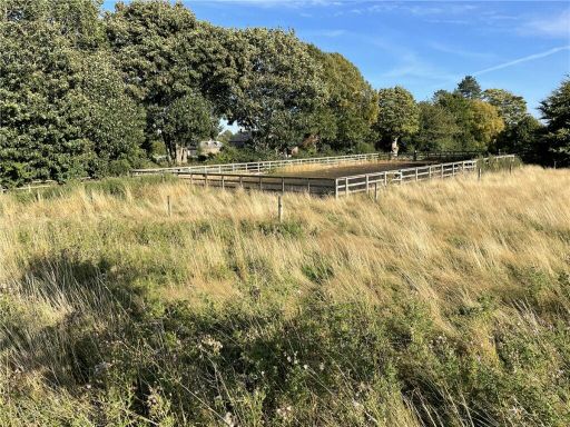 Land for sale in Bishop Monkton, Harrogate, North Yorkshire, HG3 — £200,000 • 1 bed • 1 bath
 Office for sale in Bishop Thornton, Harrogate, North Yorkshire, HG3 — £1,300,000 • 1 bed • 1 bath • 20000 ft²
 Land for sale in Bishop Thornton, Harrogate, North Yorkshire, HG3 — £1,300,000 • 1 bed • 1 bath • 20877 ft²
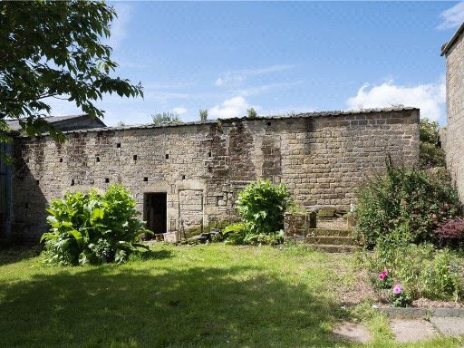 Plot for sale in Middle Farm, Warsill, Harrogate, North Yorkshire, HG3 — £249,000 • 1 bed • 1 bath • 2605 ft²
Meta
- {
"@context": "https://schema.org",
"@type": "Residence",
"name": "Land for sale in Off Main Street, Wath, Ripon, HG4",
"description": "",
"url": "https://propertypiper.co.uk/property/652c6fca-ab8a-42af-95be-f3b2112f77c9",
"image": "https://image-a.propertypiper.co.uk/5eb8af8f-5a59-41fe-8d35-8c577d6ee049-1024.jpeg",
"address": {
"@type": "PostalAddress",
"streetAddress": "Off Main Street, Wath, Ripon, HG4",
"postalCode": "HG4 5ER",
"addressLocality": "Harrogate",
"addressRegion": "Skipton and Ripon",
"addressCountry": "England"
},
"geo": {
"@type": "GeoCoordinates",
"latitude": 54.1896161,
"longitude": -1.5068304
},
"numberOfRooms": 1,
"numberOfBathroomsTotal": 1,
"offers": {
"@type": "Offer",
"price": 280000,
"priceCurrency": "GBP",
"availability": "https://schema.org/InStock"
},
"additionalProperty": [
{
"@type": "PropertyValue",
"name": "Feature",
"value": "plot of land"
},
{
"@type": "PropertyValue",
"name": "Feature",
"value": "potential development"
},
{
"@type": "PropertyValue",
"name": "Feature",
"value": "rural setting"
},
{
"@type": "PropertyValue",
"name": "Feature",
"value": "scenic"
},
{
"@type": "PropertyValue",
"name": "Feature",
"value": "open field"
},
{
"@type": "PropertyValue",
"name": "Feature",
"value": "agriculture"
},
{
"@type": "PropertyValue",
"name": "Feature",
"value": "tree-lined"
},
{
"@type": "PropertyValue",
"name": "Feature",
"value": "green space"
},
{
"@type": "PropertyValue",
"name": "Feature",
"value": "land"
},
{
"@type": "PropertyValue",
"name": "Feature",
"value": "field"
},
{
"@type": "PropertyValue",
"name": "Feature",
"value": "green area"
},
{
"@type": "PropertyValue",
"name": "Feature",
"value": "open space"
},
{
"@type": "PropertyValue",
"name": "Feature",
"value": "agricultural"
},
{
"@type": "PropertyValue",
"name": "Feature",
"value": "development potential"
},
{
"@type": "PropertyValue",
"name": "Feature",
"value": "rural"
},
{
"@type": "PropertyValue",
"name": "Feature",
"value": "expansive"
},
{
"@type": "PropertyValue",
"name": "Feature",
"value": "investment"
}
]
}