SY13 4HN - Land for sale in 84 acres of land at Tushingham, Nr Whitchu…
View on Property Piper
Land for sale in 84 acres of land at Tushingham, Nr Whitchurch, Cheshire., SY13
Property Details
- Price: £672000
- Bedrooms: 1
- Bathrooms: 1
- Property Type: undefined
- Property SubType: undefined
Brochure Descriptions
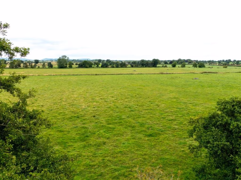
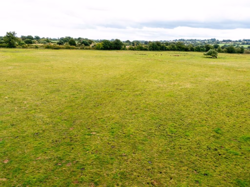
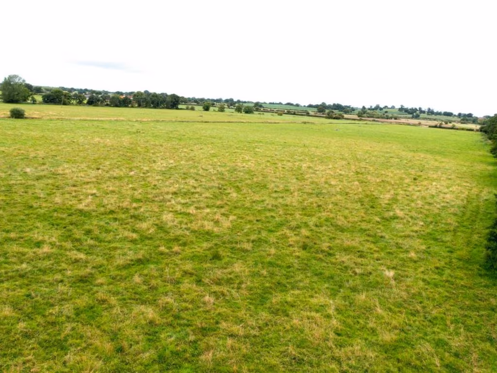
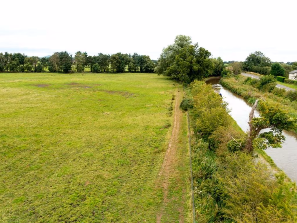
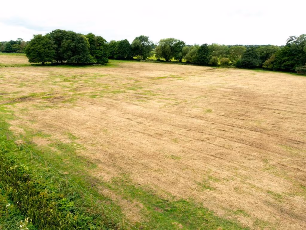
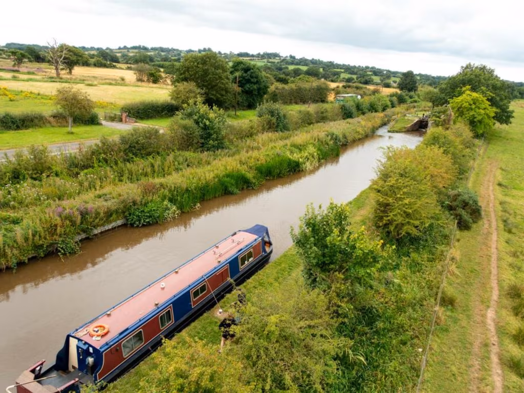
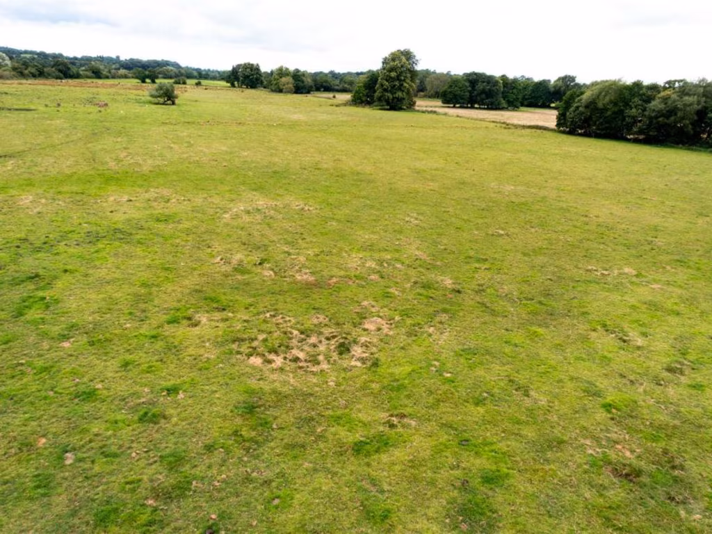
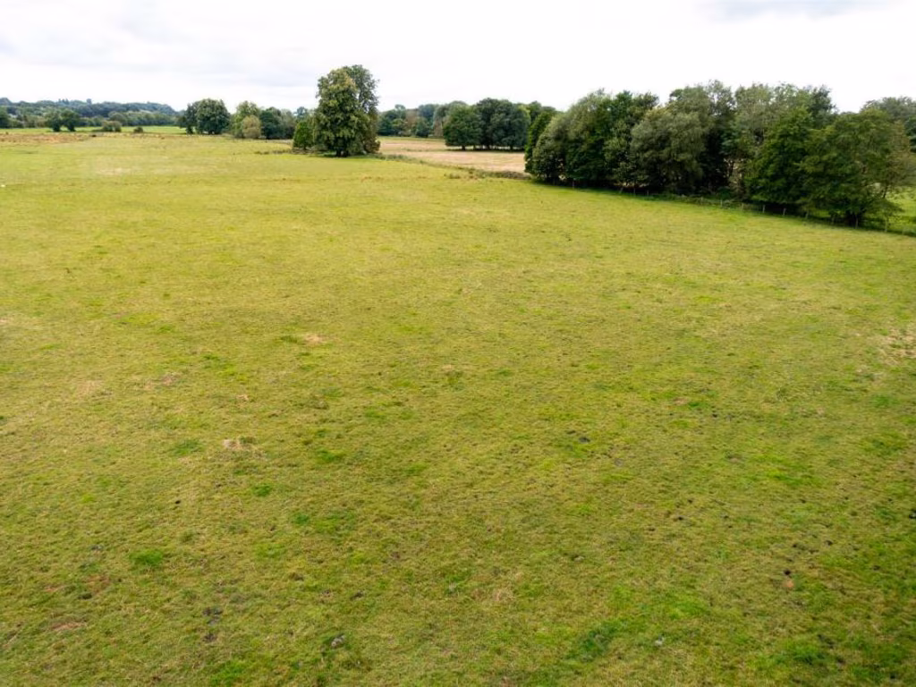
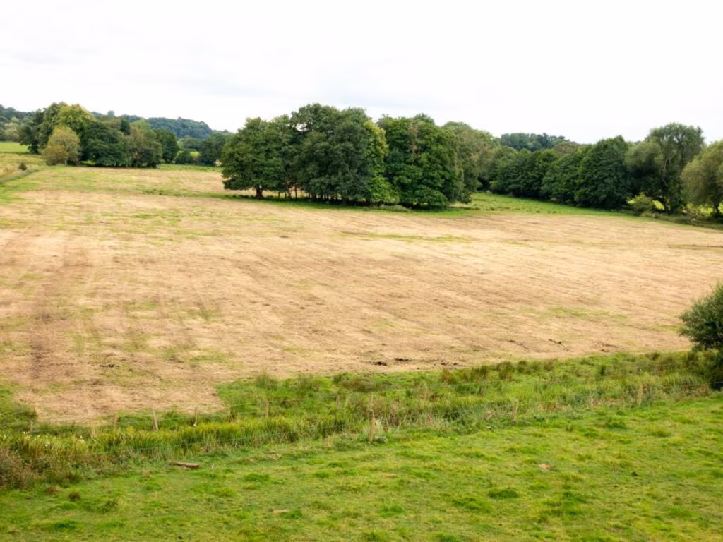
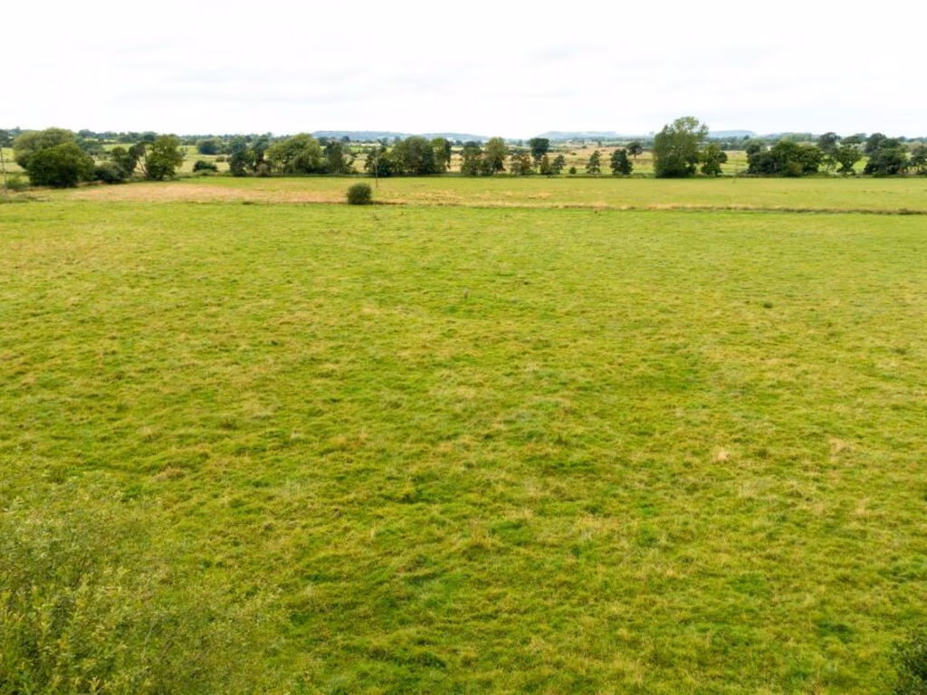
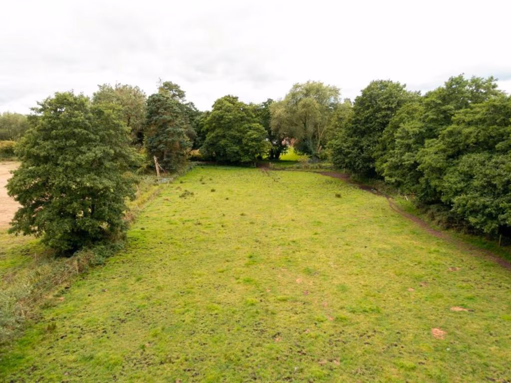
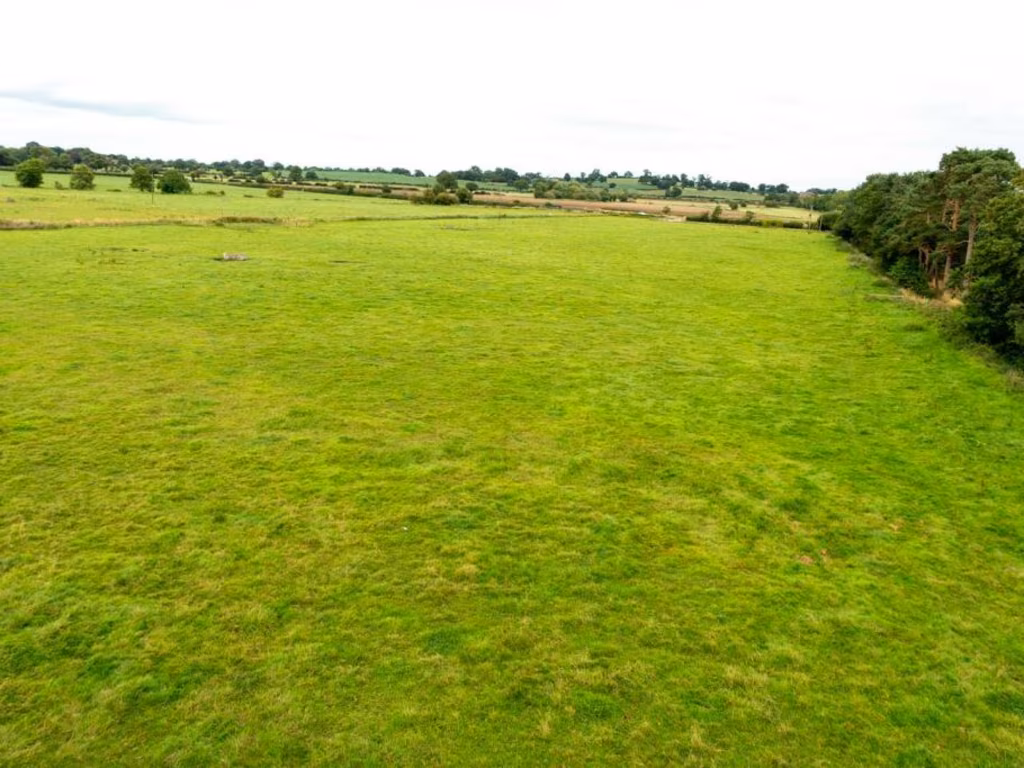
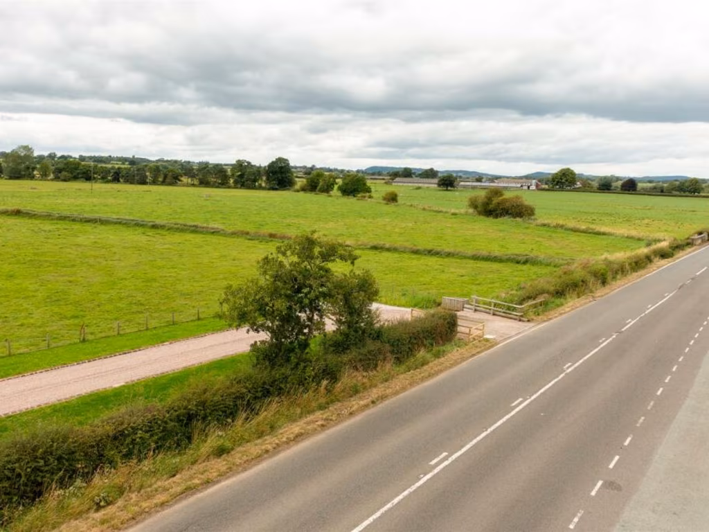
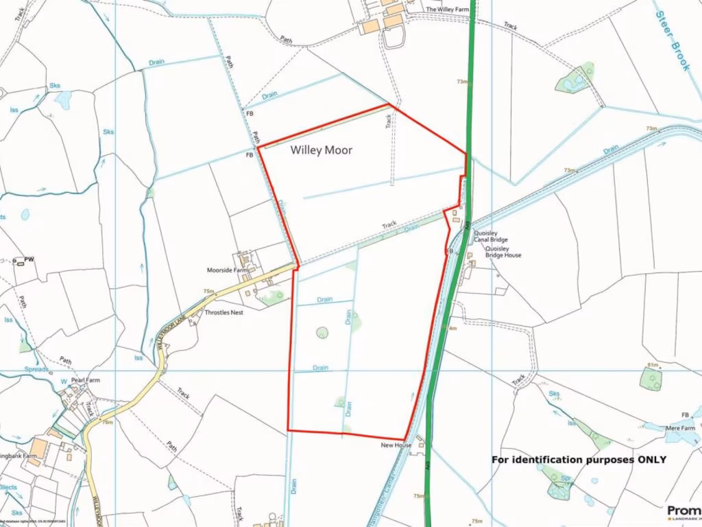
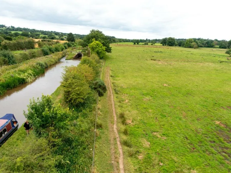
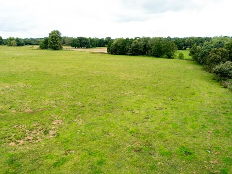
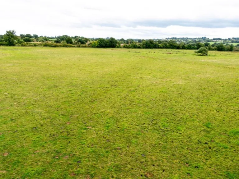
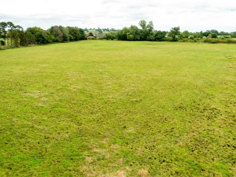
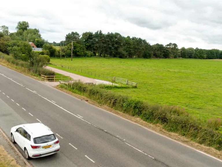
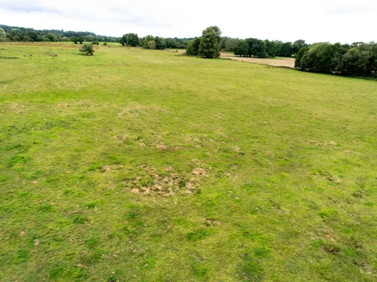
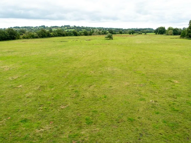
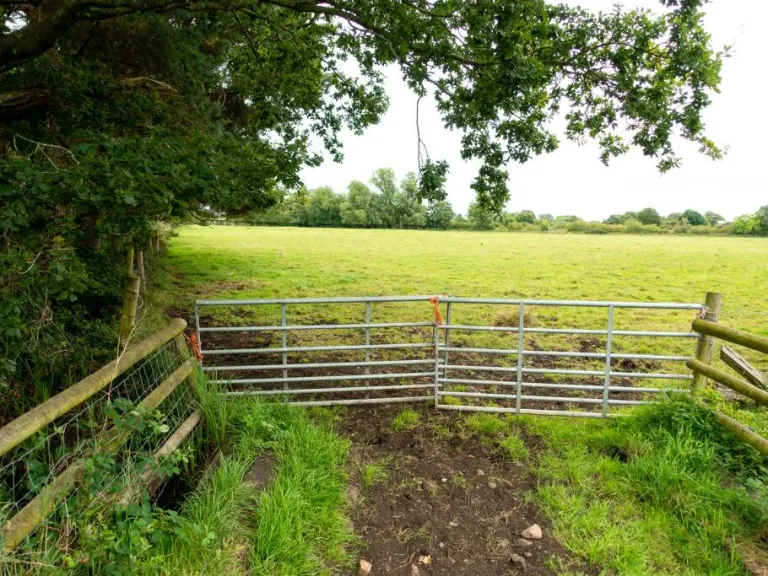
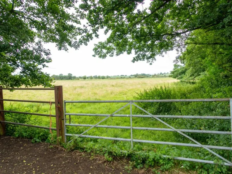
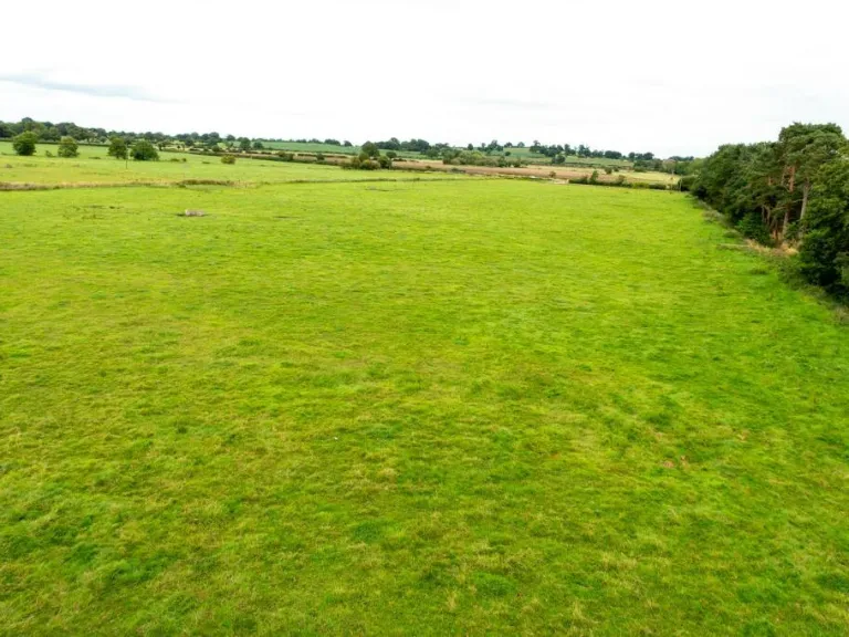
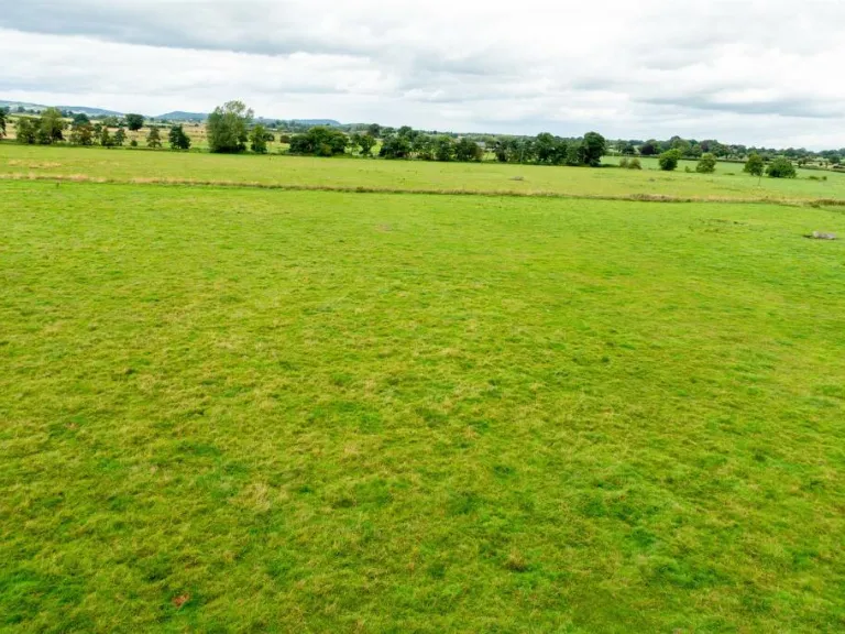
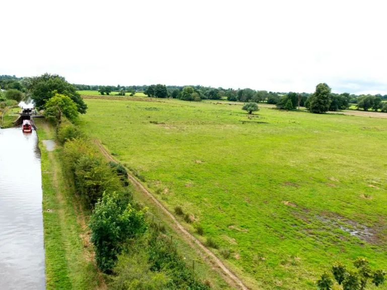
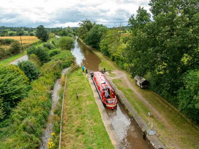
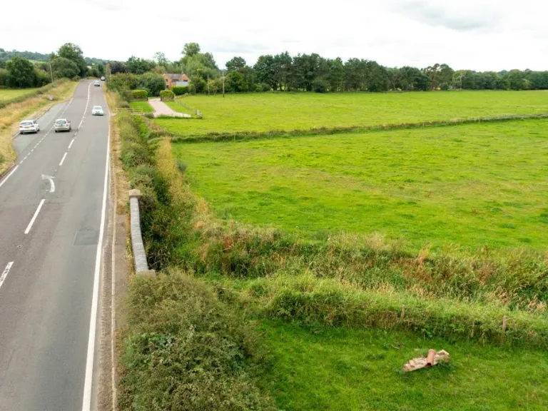
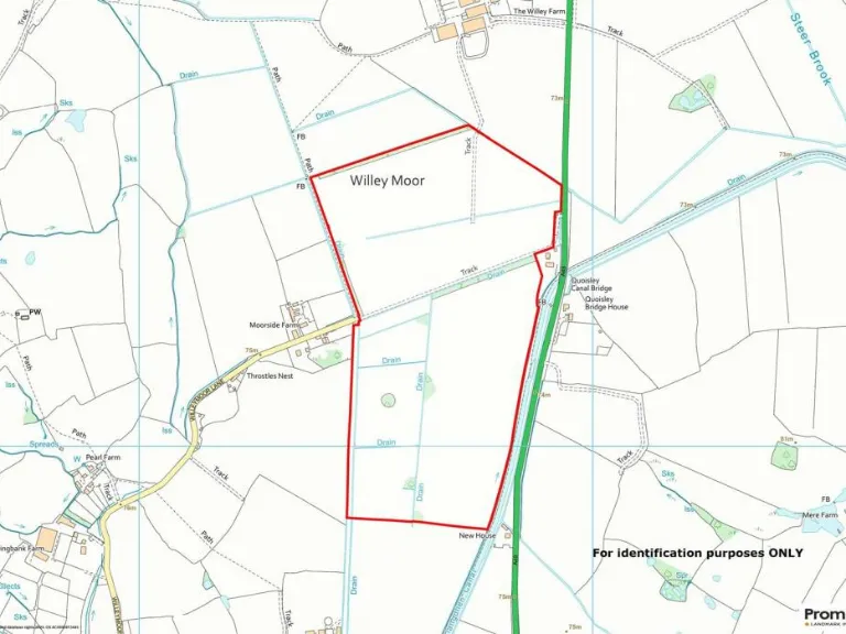
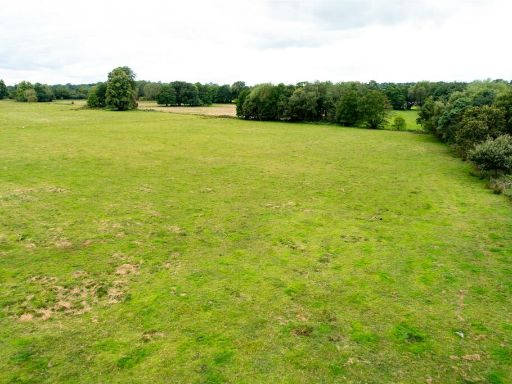
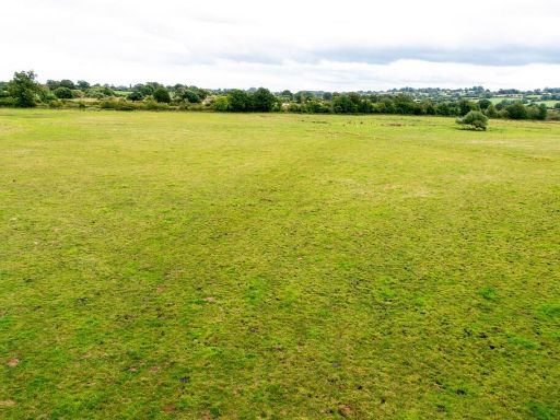
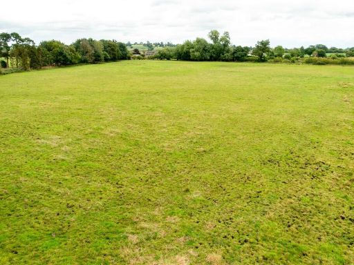
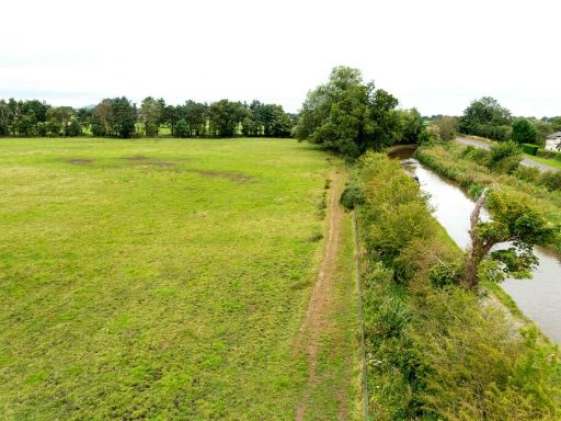
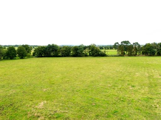
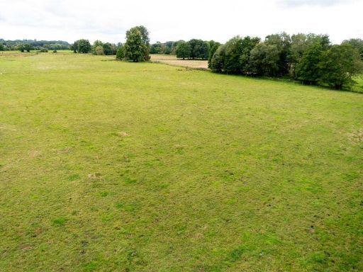
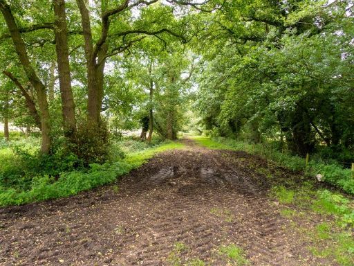
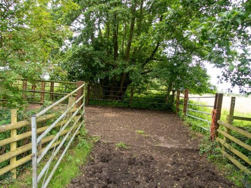
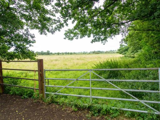
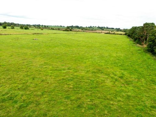
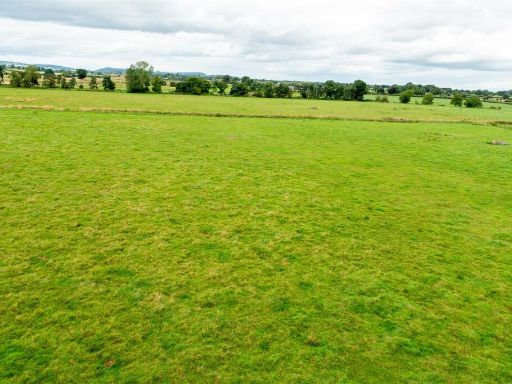
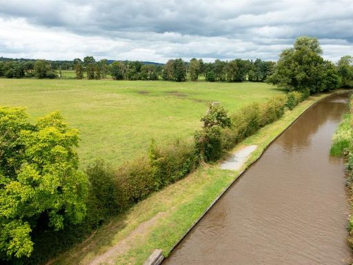
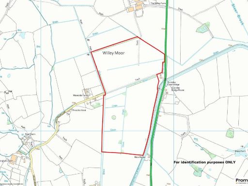
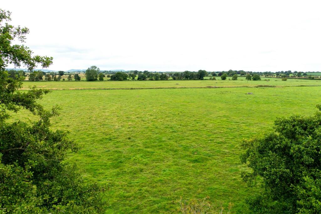
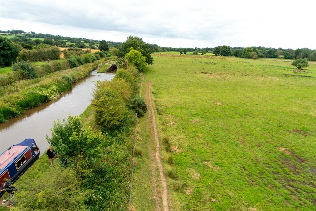
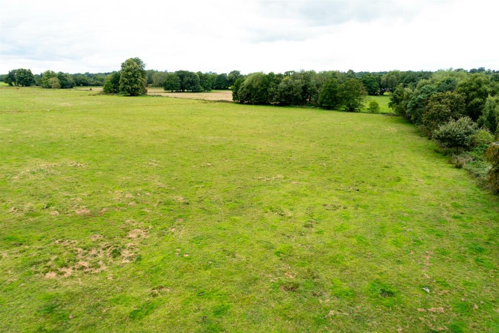
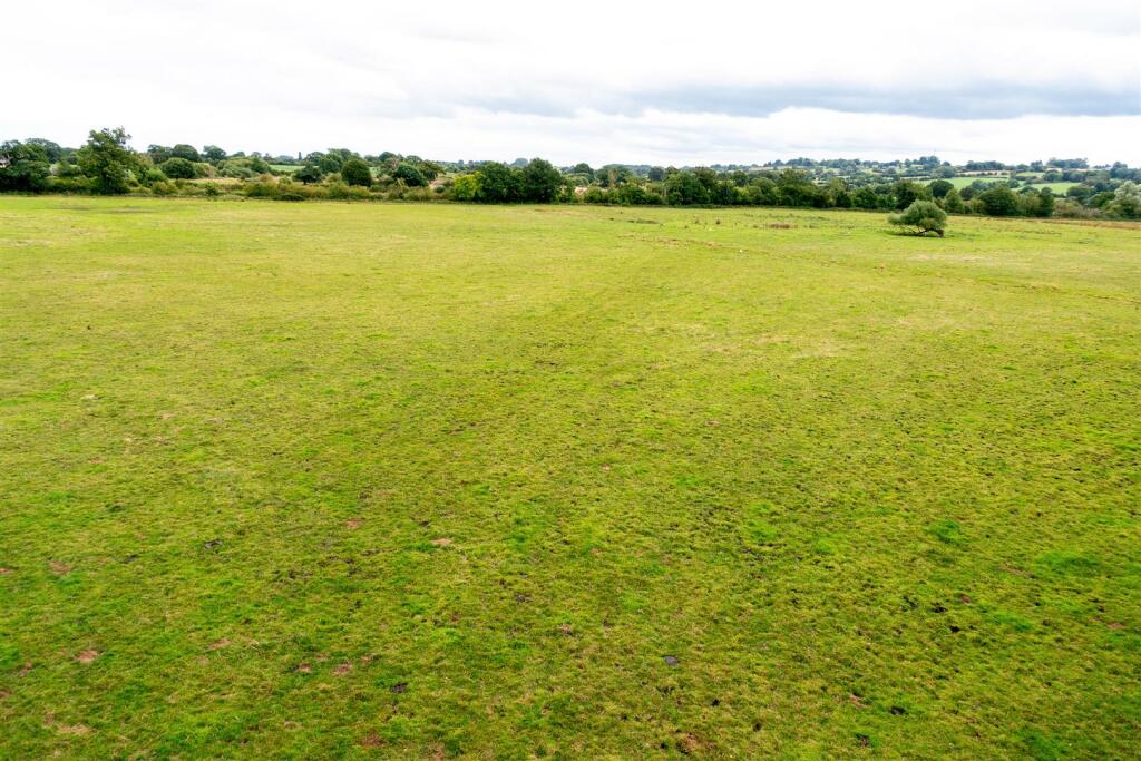
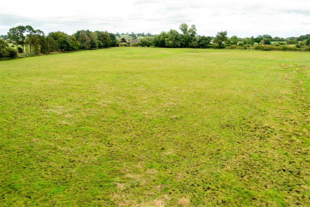
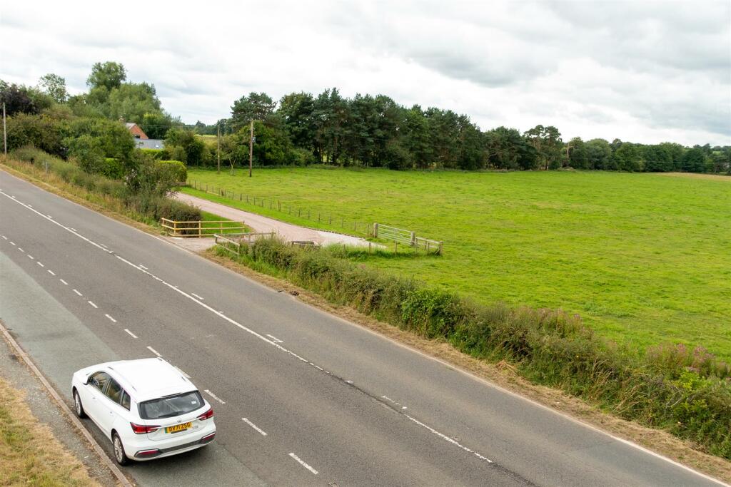
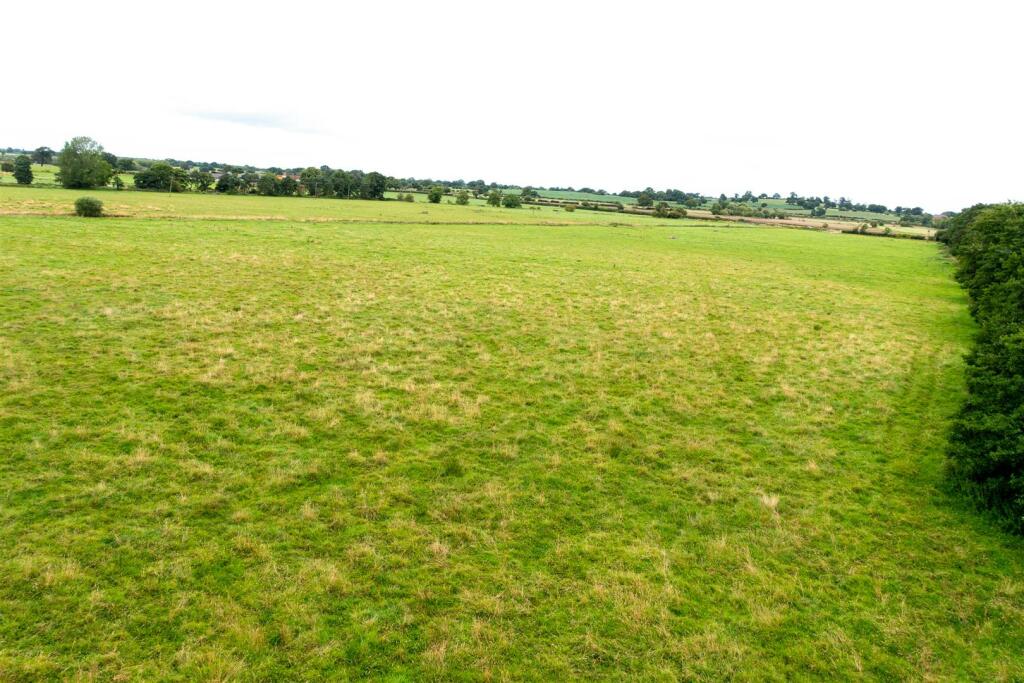
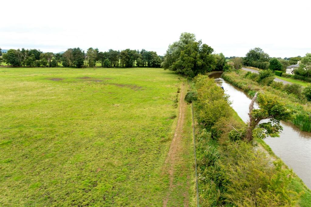
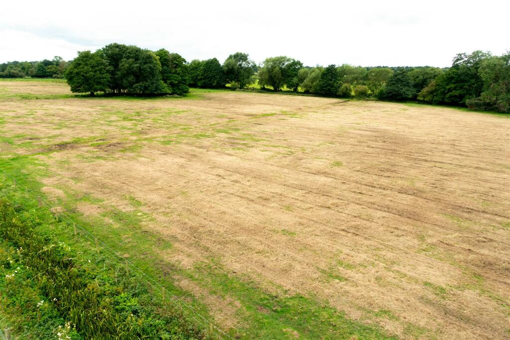
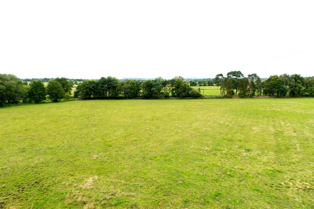
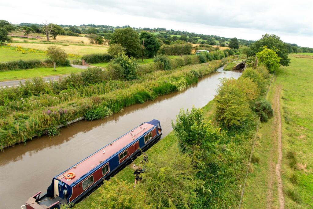
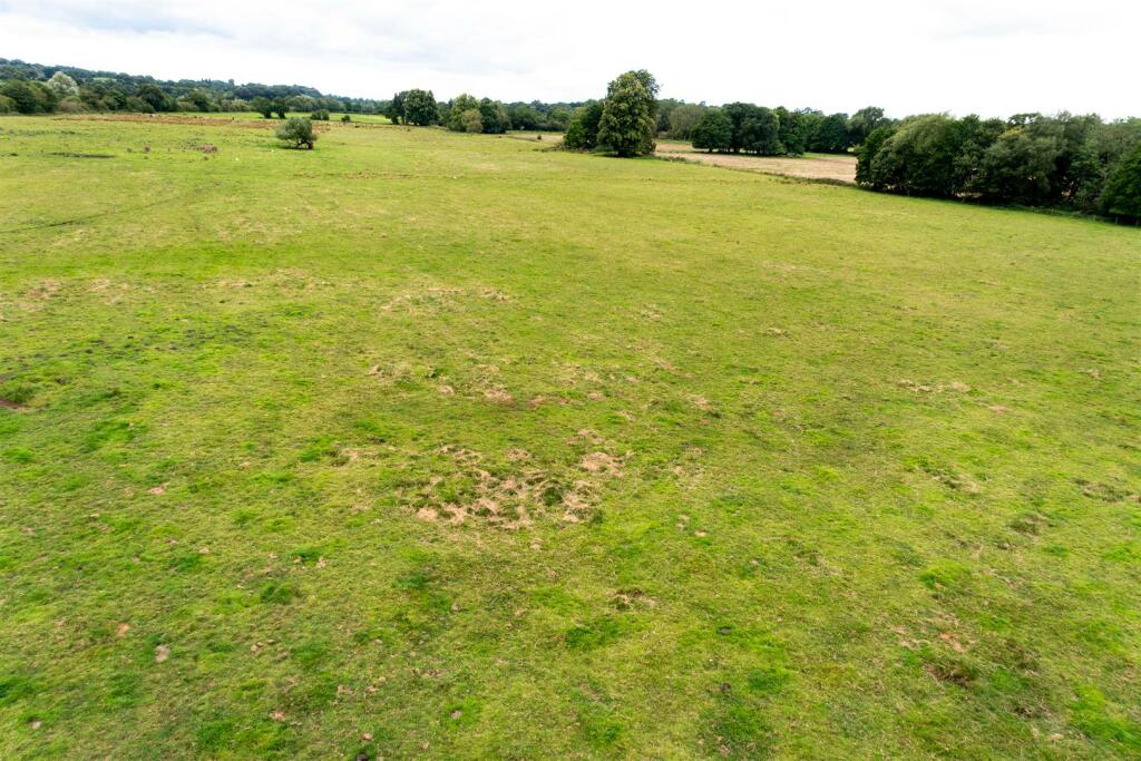
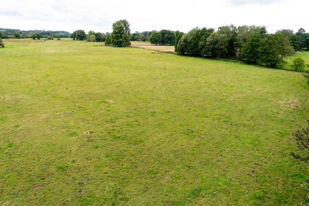
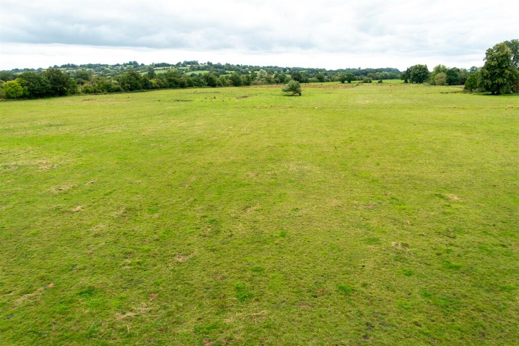
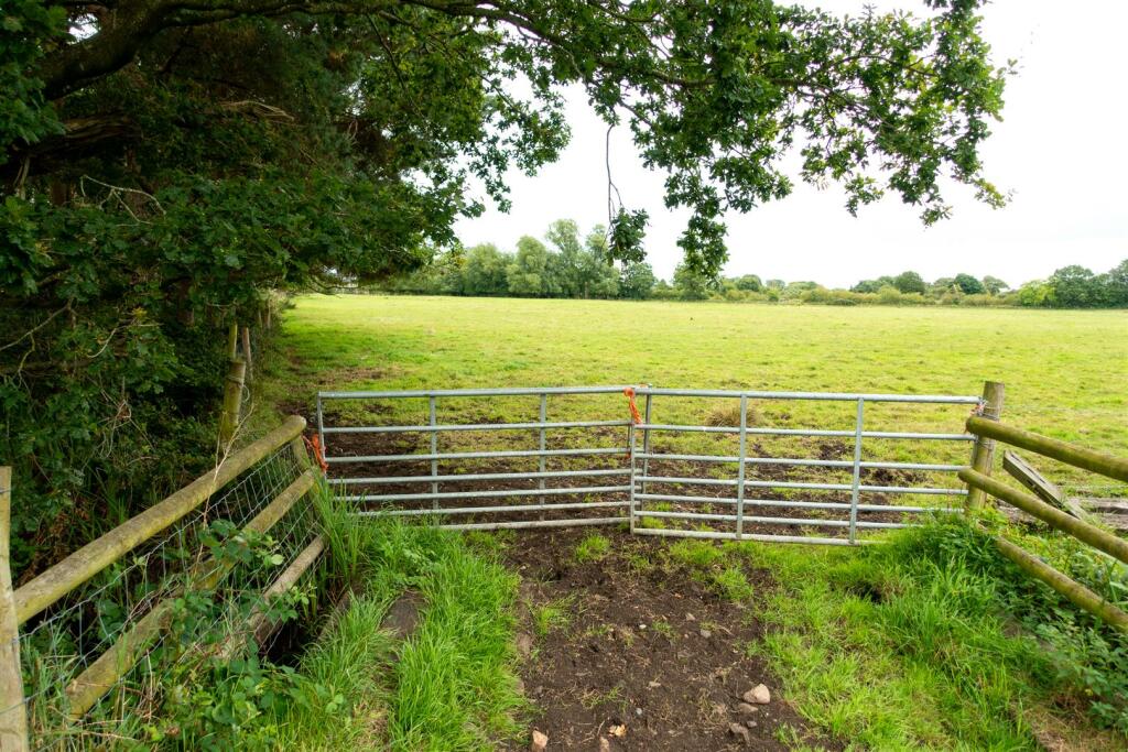
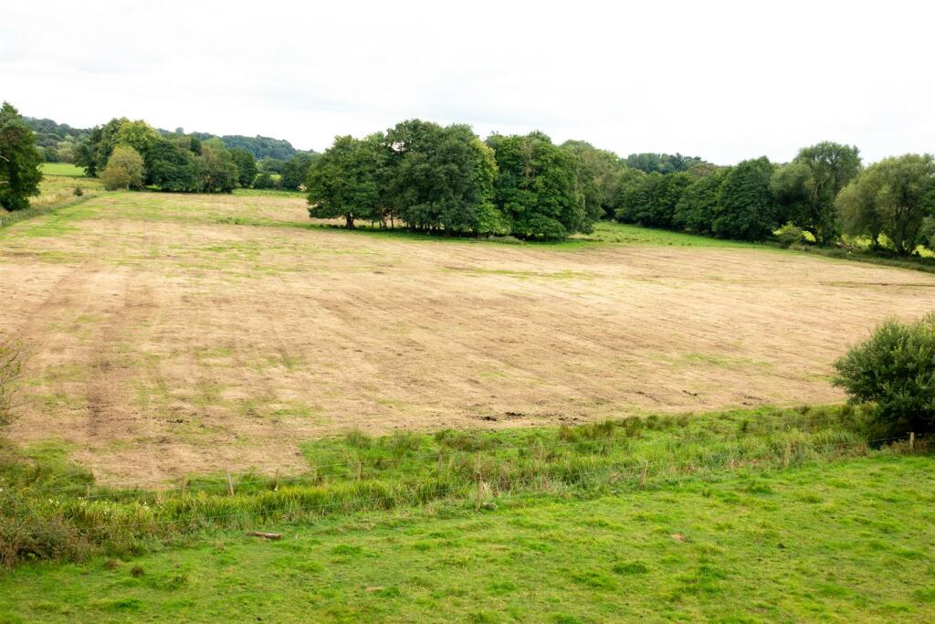
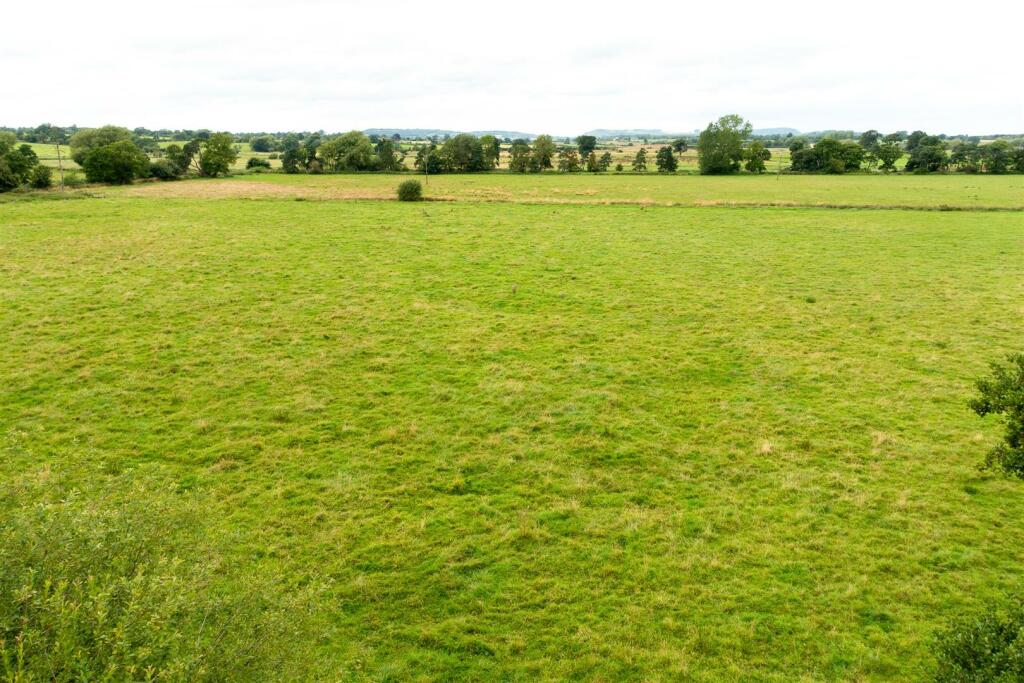
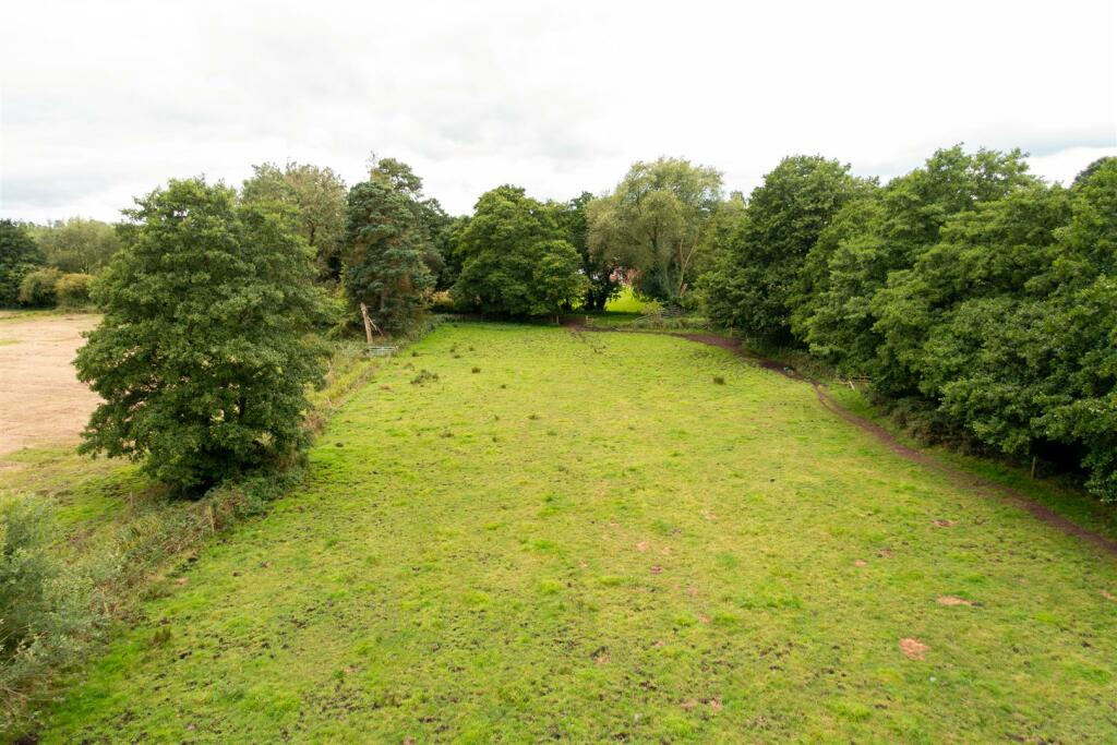
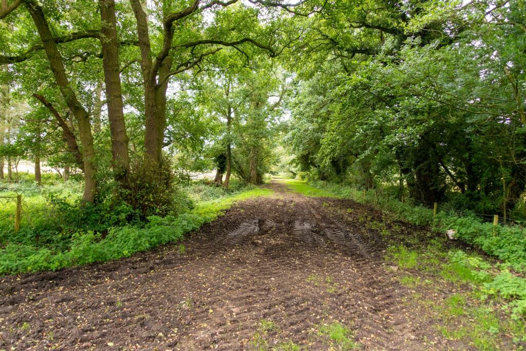
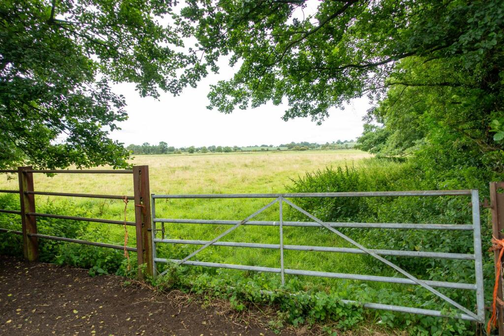
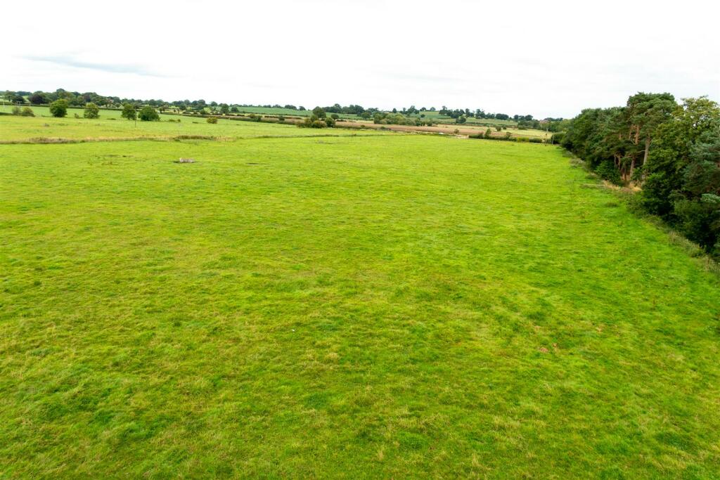
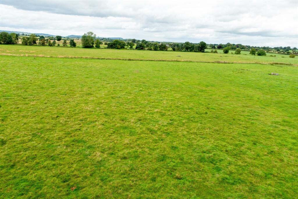
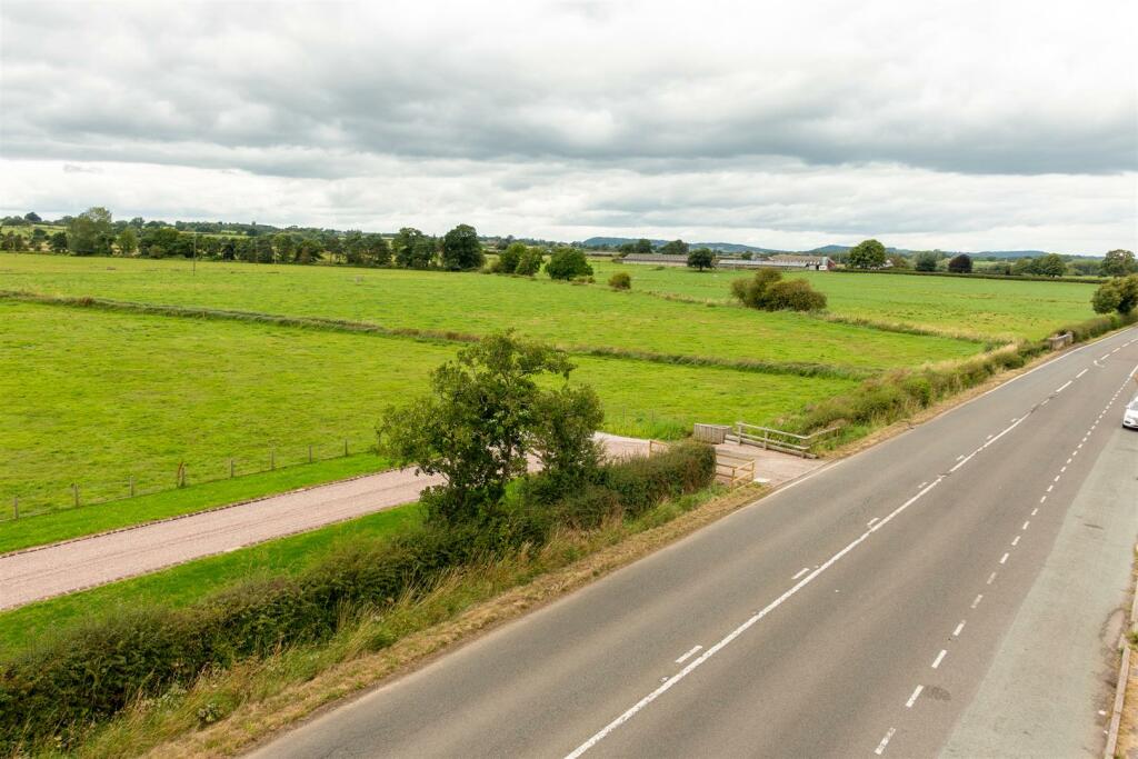
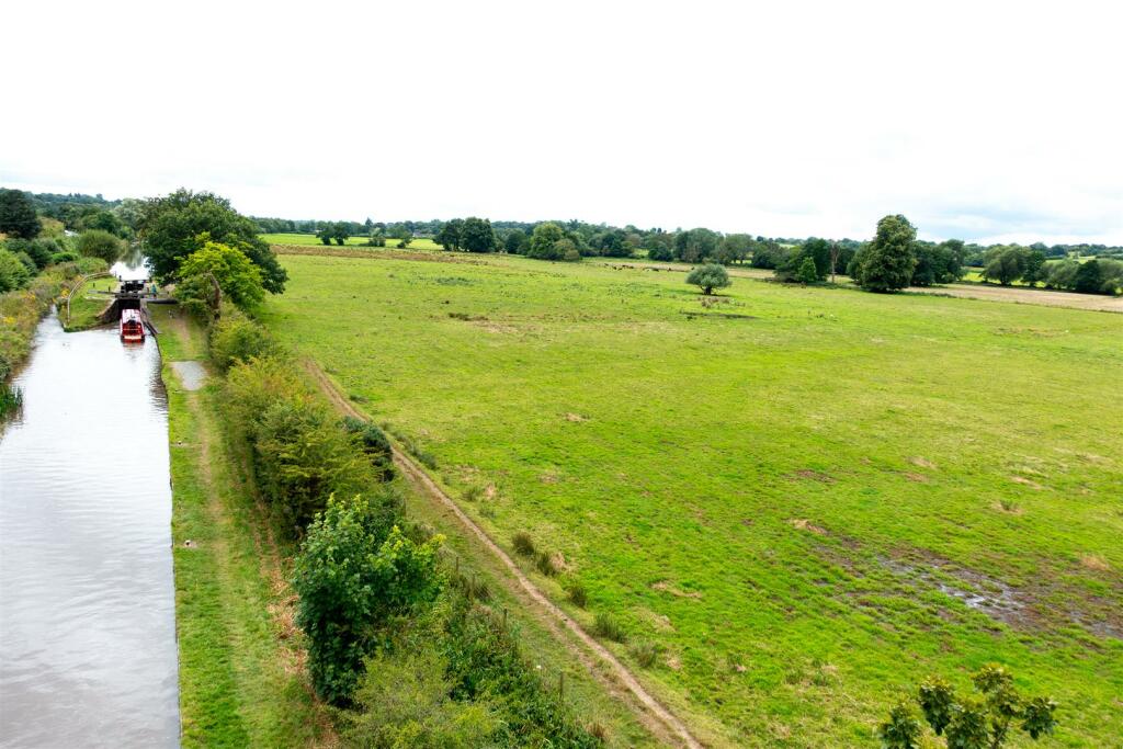
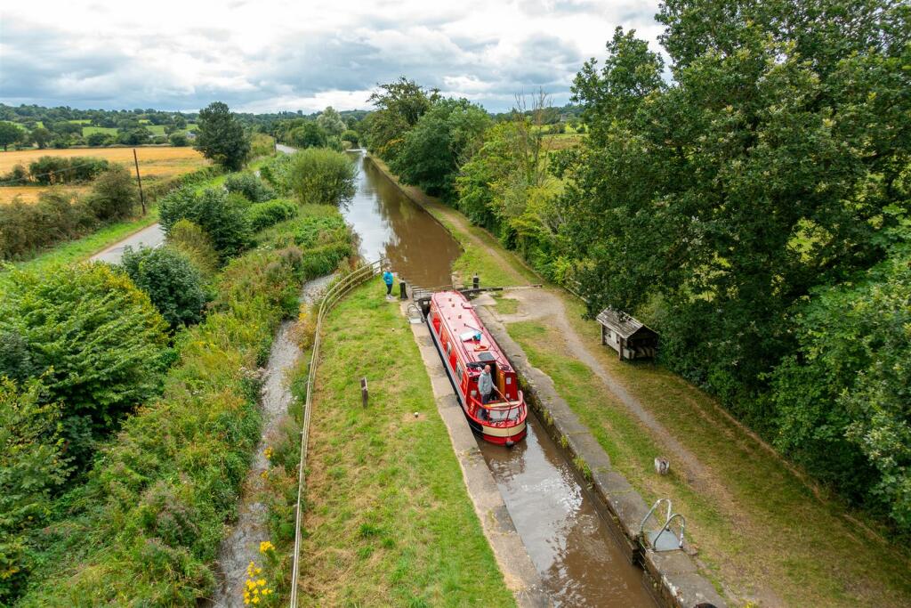
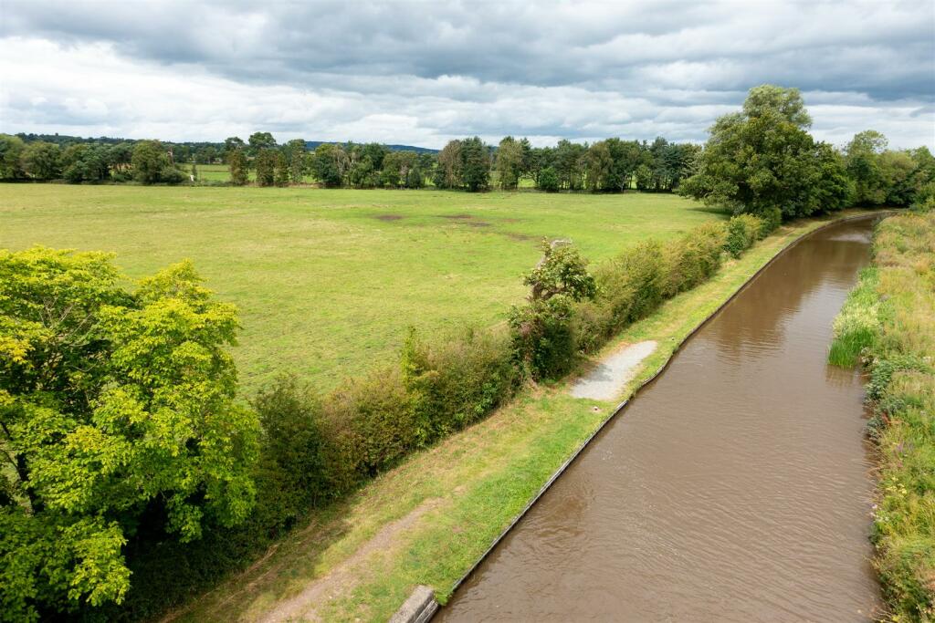
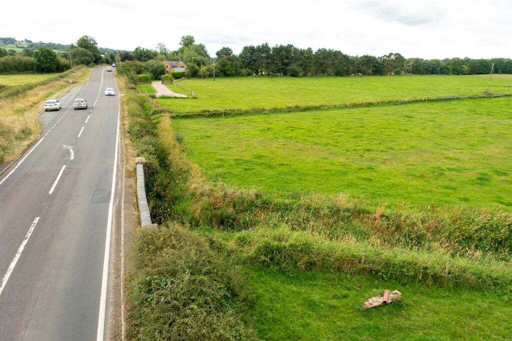
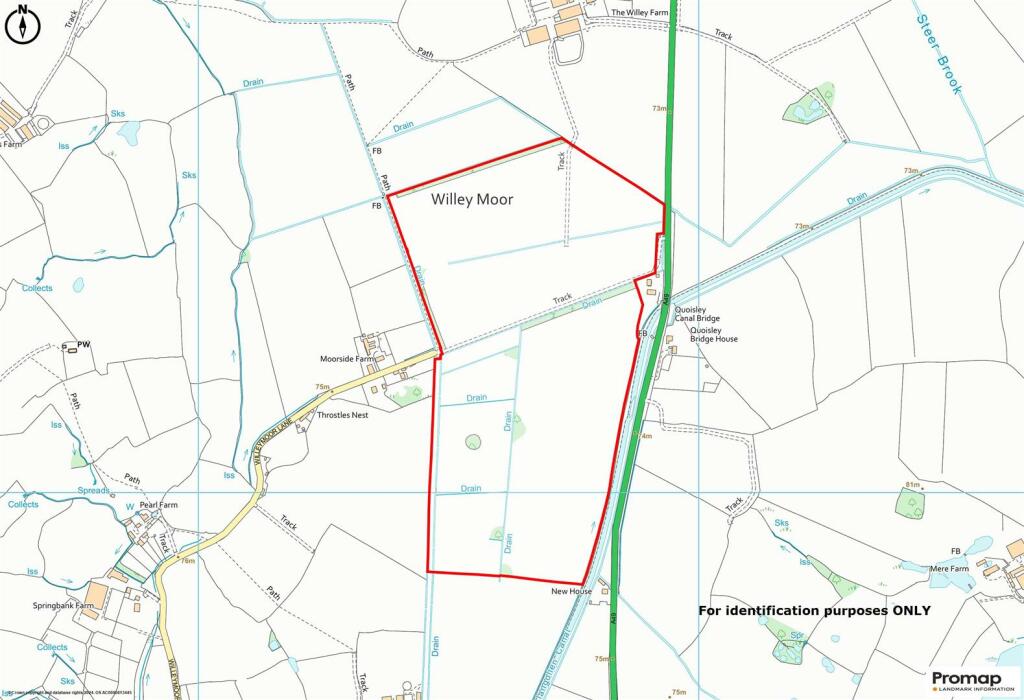
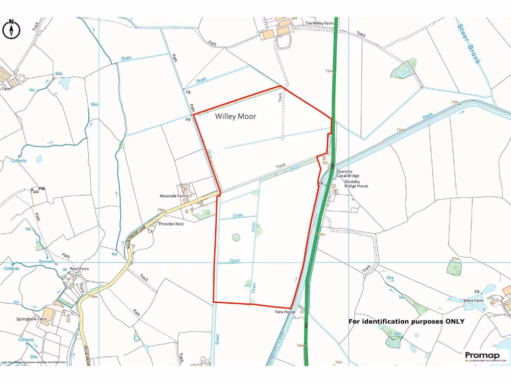
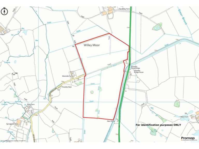
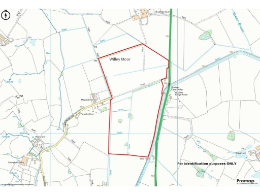
- This property consists of approximately 84 acres of productive grassland showcasing small wooded areas, ideal for agricultural use or development. The landscape appears expansive and moderately undulating, set in a serene rural location with proximity to the Shropshire Union Canal, which could provide charming views of local waterway activities. The land is conveniently accessible from major routes A49 and A41, adding to its appeal for various potential uses. The overall land size is significant, offering ample space for farming or recreational activities.
Textual Property Features
Detected Visual Features
- land
- farmland
- agriculture
- open space
- rural
- field
- countryside
- scenic
- pasture
- waterway
- agricultural
- development potential
Nearby Schools
- Bickerton Holy Trinity CofE Primary School
- Tushingham With Grindley CofE Primary School
- Whitchurch CofE Junior Academy
- Malpas Alport Endowed Primary School
- Sir John Talbot's School
- Whitchurch CofE Infant and Nursery Academy
- Wrenbury Primary School
- Bishop Heber High School
Nearest Bars And Restaurants
- Id: 6552871942
- Tags:
- Addr:
- City: Whitchurch
- Housenumber: 33
- Postcode: SY13 1AZ
- Street: High Street
- Amenity: restaurant
- Name: Docket No33
- Opening_hours: Th-Sa 16:00-21:00
- TagsNormalized:
- Lat: 52.9700146
- Lon: -2.6845372
- FullGeoHash: gcqj6fvhtwru
- PartitionGeoHash: gcqj
- Images:
- FoodStandards: null
- Distance: 852.7
,- Id: 6552871940
- Tags:
- Amenity: fast_food
- Cuisine: chinese
- Name: Hundredking
- Takeaway: yes
- TagsNormalized:
- fast food
- food
- chinese
- takeaway
- Lat: 52.9702205
- Lon: -2.6847719
- FullGeoHash: gcqj6fvjbkbc
- PartitionGeoHash: gcqj
- Images:
- FoodStandards: null
- Distance: 825.1
,- Id: 6552871950
- Tags:
- Addr:
- City: Whitchurch
- Housenumber: 58-60
- Postcode: SY13 1BB
- Street: High Street
- Amenity: restaurant
- Cuisine: italian
- Name: Etzio
- TagsNormalized:
- Lat: 52.9702666
- Lon: -2.6850294
- FullGeoHash: gcqj6fuy4m2u
- PartitionGeoHash: gcqj
- Images:
- FoodStandards: null
- Distance: 812.6
,- Id: 528376740
- Tags:
- Amenity: pub
- Name: The Black Bear
- TagsNormalized:
- Lat: 52.970399
- Lon: -2.6848554
- FullGeoHash: gcqj6fuyyq4d
- PartitionGeoHash: gcqj
- Images:
- FoodStandards: null
- Distance: 805
,- Id: 317967036
- Tags:
- Amenity: pub
- Building: commercial
- Name: Cock and Greyhound
- TagsNormalized:
- Lat: 52.9708416
- Lon: -2.6857469
- FullGeoHash: gcqj6gh3989f
- PartitionGeoHash: gcqj
- Images:
- FoodStandards: null
- Distance: 733.9
}
Nearest General Shops
- Id: 6552871951
- Tags:
- Addr:
- City: Whitchurch
- Housenumber: 47
- Postcode: SY13 1AZ
- Street: High Street
- Name: Galaxy Computer Services
- Phone: +44 1948 665855
- Shop: computer
- Website: http://www.galaxy-computers.co.uk/
- TagsNormalized:
- Lat: 52.9703312
- Lon: -2.6848564
- FullGeoHash: gcqj6fuyw33v
- PartitionGeoHash: gcqj
- Images:
- FoodStandards: null
- Distance: 811.6
,- Id: 6552871958
- Tags:
- Name: High Street Garage
- Shop: car
- TagsNormalized:
- Lat: 52.970546
- Lon: -2.6853539
- FullGeoHash: gcqj6fuxf9rn
- PartitionGeoHash: gcqj
- Images:
- FoodStandards: null
- Distance: 775
,- Id: 6329012160
- Tags:
- Brand: Argos
- Brand:wikidata: Q4789707
- Brand:wikipedia: en:Argos (retailer)
- Contact:
- Website: https://www.argos.co.uk/stores/4829-whitchurch-argos-in-sainsburys
- Name: Argos
- Operator: Sainsbury's
- Shop: catalogue
- TagsNormalized:
- Lat: 52.973276
- Lon: -2.6860403
- FullGeoHash: gcqj6gkpdwr5
- PartitionGeoHash: gcqj
- Images:
- FoodStandards: null
- Distance: 492.9
}
Nearest Grocery shops
- Id: 493079403
- Tags:
- Addr:
- Amenity: fuel
- Brand: Shell
- Brand:wikidata: Q154950
- Brand:wikipedia: en:Royal Dutch Shell
- Building: roof
- Fuel:
- Diesel: yes
- E10: yes
- E5: yes
- Octane_95: yes
- Octane_99: yes
- Layer: 1
- Name: Victoria Garage
- Opening_hours: Mo-Sa 06:00-23:00; Su 08:00-22:00
- Phone: +44 1948 663333
- Ref:
- Shop: convenience
- TagsNormalized:
- fuel
- shell
- roof
- garage
- convenience
- shop
- Lat: 52.9668749
- Lon: -2.6797924
- FullGeoHash: gcqj742dkm1g
- PartitionGeoHash: gcqj
- Images:
- FoodStandards: null
- Distance: 1315.8
,- Id: 333877486
- Tags:
- Addr:
- City: Whitchurch
- Housenumber: 69
- Postcode: SY13 1HT
- Street: Wrexham Road
- Brand: Morrisons Daily
- Brand:wikidata: Q99752411
- Brand:wikipedia: en:Morrisons
- Building: yes
- Contact:
- Website: https://my.morrisons.com/storefinder/34851
- Name: Morrisons Daily
- Operator: McColl's
- Operator:website: https://www.mccolls.co.uk/storelocator/whitchurch-69-wrexham-road/
- Operator:wikidata: Q16997477
- Shop: convenience
- TagsNormalized:
- morrisons
- morrisons daily
- convenience
- shop
- Lat: 52.9668773
- Lon: -2.6914622
- FullGeoHash: gcqj6f24kms6
- PartitionGeoHash: gcqj
- Images:
- FoodStandards: null
- Distance: 1101
,- Id: 214774088
- Tags:
- Addr:
- Postcode: SY13 1QW
- Street: Brownlow Street
- Brand: Iceland
- Brand:wikidata: Q721810
- Brand:wikipedia: en:Iceland (supermarket)
- Building: commercial
- Contact:
- Website: https://www.iceland.co.uk/store-finder/store?StoreID=353&StoreName=WHITCHURCH
- Name: Iceland
- Shop: frozen_food
- TagsNormalized:
- iceland
- frozen food
- food
- shop
- Lat: 52.9707633
- Lon: -2.6807929
- FullGeoHash: gcqj6gpchczz
- PartitionGeoHash: gcqj
- Images:
- FoodStandards: null
- Distance: 935.4
}
Nearest Supermarkets
- Id: 42728171
- Tags:
- Addr:
- Country: GB
- Postcode: SY13 1QL
- Street: Bridgewater Street
- Brand: Lidl
- Brand:wikidata: Q151954
- Brand:wikipedia: en:Lidl
- Building: yes
- Fhrs:
- Name: Lidl
- Shop: supermarket
- Wheelchair: yes
- TagsNormalized:
- Lat: 52.9684551
- Lon: -2.6791688
- FullGeoHash: gcqj7495dgdy
- PartitionGeoHash: gcqj
- Images:
- FoodStandards:
- Id: 1154410
- FHRSID: 1154410
- LocalAuthorityBusinessID: 50699
- BusinessName: Lidl
- BusinessType: Retailers - supermarkets/hypermarkets
- BusinessTypeID: 7840
- AddressLine1: Bridgewater Street
- AddressLine2: Whitchurch
- AddressLine3: Shropshire
- AddressLine4: null
- PostCode: SY13 1QL
- RatingValue: 5
- RatingKey: fhrs_5_en-GB
- RatingDate: 2019-06-26
- LocalAuthorityCode: 708
- LocalAuthorityName: Shropshire
- LocalAuthorityWebSite: http://www.shropshire.gov.uk/foodhygienescheme
- LocalAuthorityEmailAddress: food@shropshire.gov.uk
- Scores:
- Hygiene: 0
- Structural: 0
- ConfidenceInManagement: 0
- NewRatingPending: false
- Geocode:
- Longitude: -2.68034911155701
- Latitude: 52.96806335449220
- Distance: 1199.1
,- Id: 403063733
- Tags:
- Brand: Tesco
- Brand:wikidata: Q487494
- Brand:wikipedia: en:Tesco
- Building: yes
- Contact:
- Website: https://www.tesco.com/store-locator/whitchurch/white-lion-meadow
- Layer: 1
- Name: Tesco
- Shop: supermarket
- Wheelchair: yes
- TagsNormalized:
- Lat: 52.9682122
- Lon: -2.6815926
- FullGeoHash: gcqj6fx64q7t
- PartitionGeoHash: gcqj
- Images:
- FoodStandards: null
- Distance: 1125.5
,- Id: 200353909
- Tags:
- Brand: Sainsbury's
- Brand:wikidata: Q152096
- Brand:wikipedia: en:Sainsbury's
- Building: yes
- Name: Sainsbury's
- Shop: supermarket
- TagsNormalized:
- sainsburys
- supermarket
- shop
- Lat: 52.9731574
- Lon: -2.6855243
- FullGeoHash: gcqj6gkrn8rb
- PartitionGeoHash: gcqj
- Images:
- FoodStandards: null
- Distance: 524.9
}
Nearest Religious buildings
- Id: 484570094
- Tags:
- Amenity: place_of_worship
- Denomination: catholic
- Name: St. George
- Religion: christian
- TagsNormalized:
- place of worship
- catholic
- christian
- church
- Lat: 52.9710696
- Lon: -2.6832886
- FullGeoHash: gcqj6gn4fg54
- PartitionGeoHash: gcqj
- Images:
- FoodStandards: null
- Distance: 799.7
,- Id: 931221862
- Tags:
- HE_ref: 1177510
- Amenity: place_of_worship
- Building: church
- Denomination: anglican
- Heritage: 2
- Heritage:operator: Historic England
- Historic: heritage
- Listed_status: Grade I
- Name: Saint Alkmund
- Operator: Church of Saint Alkmund
- Religion: christian
- Start_date: 1712
- Website: https://historicengland.org.uk/listing/the-list/list-entry/1177510
- Wikidata: Q7592297
- TagsNormalized:
- place of worship
- church
- anglican
- christian
- Lat: 52.9707959
- Lon: -2.6849935
- FullGeoHash: gcqj6ghc7059
- PartitionGeoHash: gcqj
- Images:
- FoodStandards: null
- Distance: 761.9
,- Id: 9352391598
- Tags:
- Addr:
- City: Whitchurch
- Housename: Bargates Hall
- Street: Church Street
- Amenity: social_facility
- Email: info@whitchurch.foodbank.org.uk
- Name: Whitchurch Foodbank
- Network: Trussell Trust
- Parliamentary_constituency: North Shropshire
- Phone: +44 1948663943
- Social_facility: food_bank
- Social_facility:for: underprivileged
- Source: give_food
- Website: https://www.givefood.org.uk/needs/at/whitchurch/
- TagsNormalized:
- social facility
- church
- foodbank
- Lat: 52.9712853
- Lon: -2.6853959
- FullGeoHash: gcqj6ghs1er8
- PartitionGeoHash: gcqj
- Images:
- FoodStandards: null
- Distance: 701.3
}
Nearest Medical buildings
- Id: 813965216
- Tags:
- Addr:
- Postcode: SY14 8PS
- Street: Old Hall Street
- Amenity: doctors
- Building: yes
- Emergency: no
- Healthcare: doctor
- Name: Laurel Bank Surgery
- Opening_hours: Mo-Fr 08:00-18:30
- Phone: +44 1948 860205
- Toilets:
- Website: https://malpassurgery.co.uk/
- Wheelchair: yes
- TagsNormalized:
- doctor
- doctors
- health
- healthcare
- bank
- surgery
- Lat: 53.0176012
- Lon: -2.7626693
- FullGeoHash: gcqj95s3cjhq
- PartitionGeoHash: gcqj
- Images:
- FoodStandards: null
- Distance: 6625.2
,- Id: 6557540371
- Tags:
- Addr:
- City: Whitchurch
- Housenumber: 10-12
- Postcode: SY13 1DW
- Street: Watergate Street
- Amenity: pharmacy
- Brand: Boots
- Brand:wikidata: Q6123139
- Brand:wikipedia: en:Boots (company)
- Dispensing: yes
- Healthcare: pharmacy
- Mapillary: 257590456051683
- Name: Boots
- Opening_hours: Mo-Sa 09:00-17:30
- TagsNormalized:
- pharmacy
- boots
- health
- healthcare
- Lat: 52.9684566
- Lon: -2.6835957
- FullGeoHash: gcqj6ftgeeyp
- PartitionGeoHash: gcqj
- Images:
- FoodStandards: null
- Distance: 1035.5
,- Id: 9122948156
- Tags:
- Addr:
- City: Whitchurch
- Street: Green End
- Amenity: pharmacy
- Dispensing: yes
- Healthcare: pharmacy
- Name: Green End Pharmacy
- TagsNormalized:
- Lat: 52.9691511
- Lon: -2.6824135
- FullGeoHash: gcqj6fwxxjrt
- PartitionGeoHash: gcqj
- Images:
- FoodStandards: null
- Distance: 1007.9
,- Id: 9122948155
- Tags:
- Addr:
- City: Whitchurch
- Street: High Street
- Amenity: pharmacy
- Brand: Rowlands Pharmacy
- Brand:wikidata: Q62663235
- Dispensing: yes
- Healthcare: pharmacy
- Name: Rowlands Pharmacy
- TagsNormalized:
- pharmacy
- rowlands pharmacy
- health
- healthcare
- Lat: 52.9693352
- Lon: -2.6837838
- FullGeoHash: gcqj6fv8xrcb
- PartitionGeoHash: gcqj
- Images:
- FoodStandards: null
- Distance: 943.2
}
Nearest Leisure Facilities
- Id: 403093960
- Tags:
- Bowls: crown_green
- Leisure: pitch
- Lit: yes
- Sport: bowls
- Surface: grass
- TagsNormalized:
- Lat: 52.9724877
- Lon: -2.689945
- FullGeoHash: gcqj6g35pert
- PartitionGeoHash: gcqj
- Images:
- FoodStandards: null
- Distance: 477.5
,- Id: 846598533
- Tags:
- Leisure: pitch
- Sport: tennis
- TagsNormalized:
- Lat: 52.973474
- Lon: -2.6892235
- FullGeoHash: gcqj6g9bbe39
- PartitionGeoHash: gcqj
- Images:
- FoodStandards: null
- Distance: 377
,- Id: 846598532
- Tags:
- Leisure: pitch
- Sport: tennis
- TagsNormalized:
- Lat: 52.9734538
- Lon: -2.6894965
- FullGeoHash: gcqj6g98dpw0
- PartitionGeoHash: gcqj
- Images:
- FoodStandards: null
- Distance: 375.2
,- Id: 846598534
- Tags:
- Leisure: pitch
- Sport: tennis
- TagsNormalized:
- Lat: 52.9734657
- Lon: -2.6897027
- FullGeoHash: gcqj6g92v3sr
- PartitionGeoHash: gcqj
- Images:
- FoodStandards: null
- Distance: 371.5
,- Id: 1117677742
- Tags:
- TagsNormalized:
- Lat: 52.9772784
- Lon: -2.6934267
- FullGeoHash: gcqj6snxn87r
- PartitionGeoHash: gcqj
- Images:
- FoodStandards: null
- Distance: 198.8
}
Nearest Tourist attractions
- Id: 484570061
- Tags:
- TagsNormalized:
- Lat: 52.9797275
- Lon: -2.6766894
- FullGeoHash: gcqj7hdvk958
- PartitionGeoHash: gcqj
- Images:
- FoodStandards: null
- Distance: 986.8
,- Id: 4156354593
- Tags:
- Name: Heritage Centre
- Tourism: museum
- Website: www.whitchurch-heritage.co.uk
- TagsNormalized:
- Lat: 52.9699206
- Lon: -2.6833117
- FullGeoHash: gcqj6fyh4kcu
- PartitionGeoHash: gcqj
- Images:
- FoodStandards: null
- Distance: 903.4
,- Id: 4156354592
- Tags:
- Amenity: townhall
- Building: public
- Information: office
- Name: Civic Centre
- Name:en: Civic Centre
- Tourism: information
- TagsNormalized:
- townhall
- civic
- information
- tourism
- Lat: 52.9698924
- Lon: -2.6842062
- FullGeoHash: gcqj6fv7vrwu
- PartitionGeoHash: gcqj
- Images:
- FoodStandards: null
- Distance: 875.3
}
Nearest Bus stations and stops
- Id: 9215971474
- Tags:
- Bus: yes
- Highway: bus_stop
- Public_transport: platform
- Shelter: yes
- TagsNormalized:
- Lat: 52.9665105
- Lon: -2.6950056
- FullGeoHash: gcqj6dm83c4n
- PartitionGeoHash: gcqj
- Images:
- FoodStandards: null
- Distance: 1178
,- Id: 868630410
- Tags:
- Bus: yes
- Highway: bus_stop
- Public_transport: platform
- TagsNormalized:
- Lat: 52.9686773
- Lon: -2.7003451
- FullGeoHash: gcqj6d9svmhg
- PartitionGeoHash: gcqj
- Images:
- FoodStandards: null
- Distance: 1111.8
,- Id: 868833151
- Tags:
- Bus: yes
- Highway: bus_stop
- Public_transport: platform
- Shelter: yes
- TagsNormalized:
- Lat: 52.9682835
- Lon: -2.6824411
- FullGeoHash: gcqj6fwdwedy
- PartitionGeoHash: gcqj
- Images:
- FoodStandards: null
- Distance: 1089.3
,- Id: 484570131
- Tags:
- Bus: yes
- Highway: bus_stop
- Public_transport: platform
- TagsNormalized:
- Lat: 52.9698768
- Lon: -2.6875572
- FullGeoHash: gcqj6ffgzksn
- PartitionGeoHash: gcqj
- Images:
- FoodStandards: null
- Distance: 792.2
,- Id: 10647846215
- Tags:
- Bus: yes
- Highway: bus_stop
- Public_transport: platform
- Shelter: yes
- TagsNormalized:
- Lat: 52.9722208
- Lon: -2.6850996
- FullGeoHash: gcqj6gkc89st
- PartitionGeoHash: gcqj
- Images:
- FoodStandards: null
- Distance: 624.5
}
Nearest Hotels
- Id: 528309637
- Tags:
- Name: Dodington Lodge
- Tourism: hotel
- TagsNormalized:
- Lat: 52.9648437
- Lon: -2.6799461
- FullGeoHash: gcqj71bw8drr
- PartitionGeoHash: gcqj
- Images:
- FoodStandards: null
- Distance: 1504.8
,- Id: 534348906
- Tags:
- Amenity: pub
- Name: The Star Hotel
- TagsNormalized:
- Lat: 52.9687532
- Lon: -2.6835832
- FullGeoHash: gcqj6ftv7gr2
- PartitionGeoHash: gcqj
- Images:
- FoodStandards: null
- Distance: 1006.6
,- Id: 1131767131
- Tags:
- Brand: Macdonald
- Building: yes
- Name: MacDonald Hill Valley Hotel, Golf & Spa
- Tourism: hotel
- TagsNormalized:
- Lat: 52.9811464
- Lon: -2.6826447
- FullGeoHash: gcqj6uyt9ce0
- PartitionGeoHash: gcqj
- Images:
- FoodStandards: null
- Distance: 721
}
Tags
- land
- farmland
- agriculture
- open space
- rural
- field
- countryside
- farmland
- countryside
- rural
- scenic
- pasture
- waterway
- field
- agricultural
- land
- development potential
Local Market Stats
- Average Price/sqft: £233
- Avg Income: £41500
- Rental Yield: 3%
- Social Housing: 7%
- Planning Success Rate: 83%
AirBnB Data
- 1km average: £81/night
- Listings in 1km: 1
Similar Properties
 Land for sale in 36.7 acres of land at Tushingham, Nr Whitchurch, Cheshire., SY13 — £295,000 • 1 bed • 1 bath
 Farm land for sale in Land at Tetchill, Ellesmere Road, SY12 9AW (Lots 1 & 2), SY12 — £740,000 • 1 bed • 1 bath
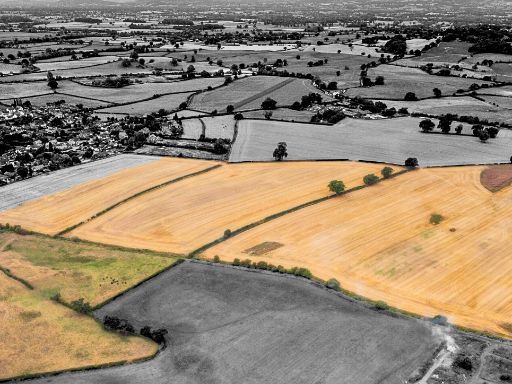 Farm land for sale in Land at Tetchill (Lot 2), Ellesmere, SY12 9AW, SY12 — £620,000 • 1 bed • 1 bath
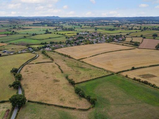 Farm land for sale in Land at Tetchill (Lot 1), Ellesmere, SY12 9AW, SY12 — £120,000 • 1 bed • 1 bath
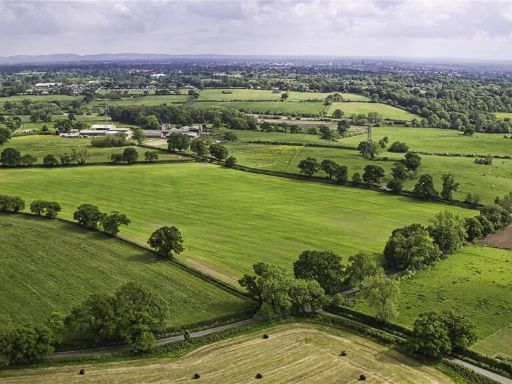 Land for sale in Chester, CH2 — £500,000 • 1 bed • 1 bath
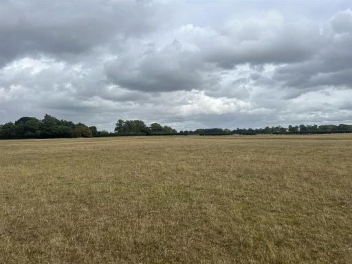 Land for sale in Land at Top House Farm, Woolston, Oswestry, Shropshire, SY10 8HZ, SY10 — £880,000 • 1 bed • 1 bath
Meta
- {
"@context": "https://schema.org",
"@type": "Residence",
"name": "Land for sale in 84 acres of land at Tushingham, Nr Whitchu…",
"description": "",
"url": "https://propertypiper.co.uk/property/4484f88c-5f17-4302-97b9-ba463ed0370f",
"image": "https://image-a.propertypiper.co.uk/c1b7c915-0948-480e-a28d-c8c20c7fecff-1024.jpeg",
"address": {
"@type": "PostalAddress",
"streetAddress": "84 acres of land at Tushingham, Nr Whitchurch, Cheshire.",
"postalCode": "SY13 4HN",
"addressLocality": "Shropshire",
"addressRegion": "North Shropshire",
"addressCountry": "England"
},
"geo": {
"@type": "GeoCoordinates",
"latitude": 52.9767645,
"longitude": -2.6905822
},
"numberOfRooms": 1,
"numberOfBathroomsTotal": 1,
"offers": {
"@type": "Offer",
"price": 672000,
"priceCurrency": "GBP",
"availability": "https://schema.org/InStock"
},
"additionalProperty": [
{
"@type": "PropertyValue",
"name": "Feature",
"value": "land"
},
{
"@type": "PropertyValue",
"name": "Feature",
"value": "farmland"
},
{
"@type": "PropertyValue",
"name": "Feature",
"value": "agriculture"
},
{
"@type": "PropertyValue",
"name": "Feature",
"value": "open space"
},
{
"@type": "PropertyValue",
"name": "Feature",
"value": "rural"
},
{
"@type": "PropertyValue",
"name": "Feature",
"value": "field"
},
{
"@type": "PropertyValue",
"name": "Feature",
"value": "countryside"
},
{
"@type": "PropertyValue",
"name": "Feature",
"value": "farmland"
},
{
"@type": "PropertyValue",
"name": "Feature",
"value": "countryside"
},
{
"@type": "PropertyValue",
"name": "Feature",
"value": "rural"
},
{
"@type": "PropertyValue",
"name": "Feature",
"value": "scenic"
},
{
"@type": "PropertyValue",
"name": "Feature",
"value": "pasture"
},
{
"@type": "PropertyValue",
"name": "Feature",
"value": "waterway"
},
{
"@type": "PropertyValue",
"name": "Feature",
"value": "field"
},
{
"@type": "PropertyValue",
"name": "Feature",
"value": "agricultural"
},
{
"@type": "PropertyValue",
"name": "Feature",
"value": "land"
},
{
"@type": "PropertyValue",
"name": "Feature",
"value": "development potential"
}
]
}
High Res Floorplan Images
Compatible Floorplan Images
FloorplanImages Thumbnail