CA6 6NW - Land for sale in Land At Ellery Hill, Bewcastle, Carlisle,…
View on Property Piper
Land for sale in Land At Ellery Hill, Bewcastle, Carlisle, Cumbria, CA6
Property Details
- Price: £400000
- Bedrooms: 1
- Bathrooms: 1
- Property Type: undefined
- Property SubType: undefined
Brochure Descriptions
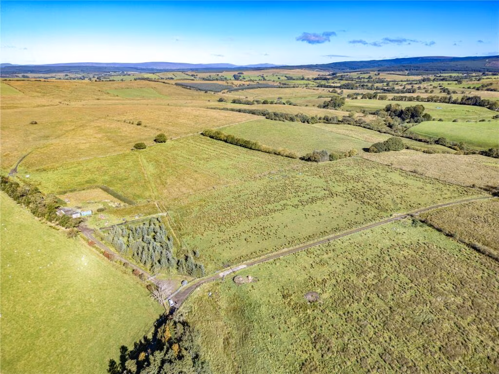
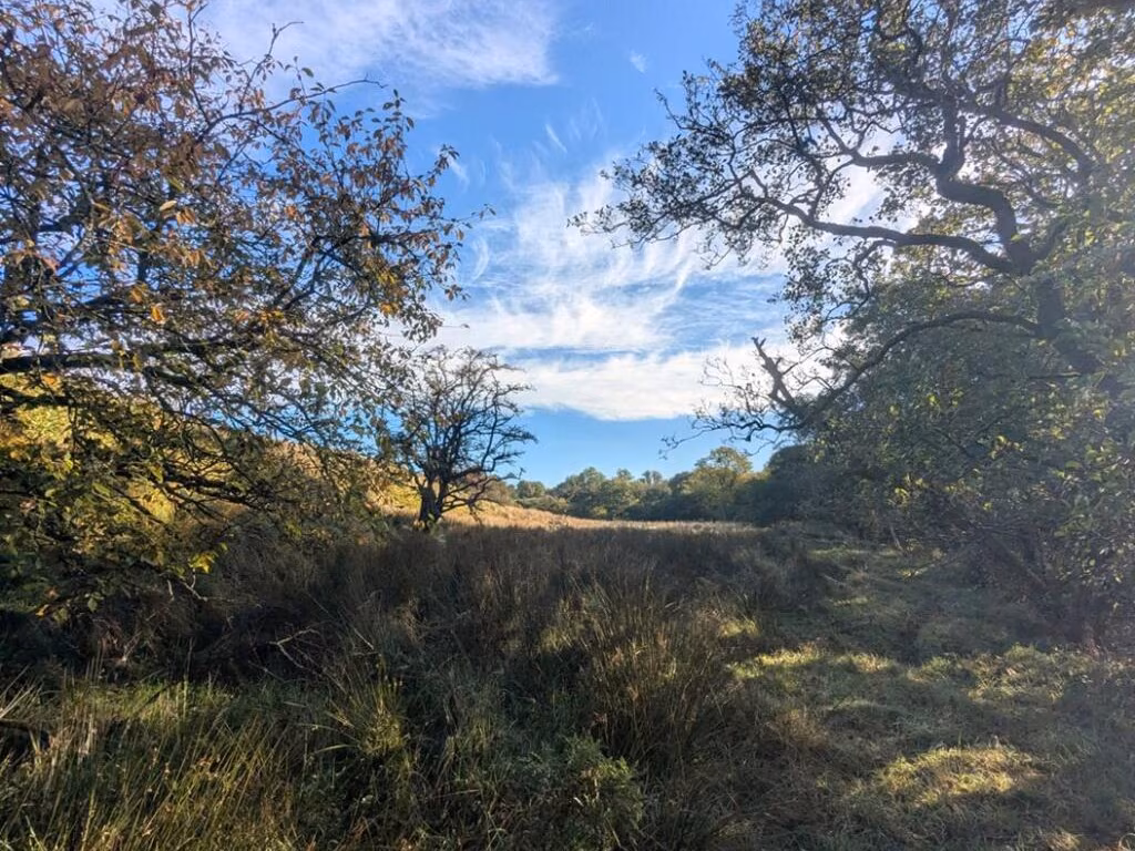
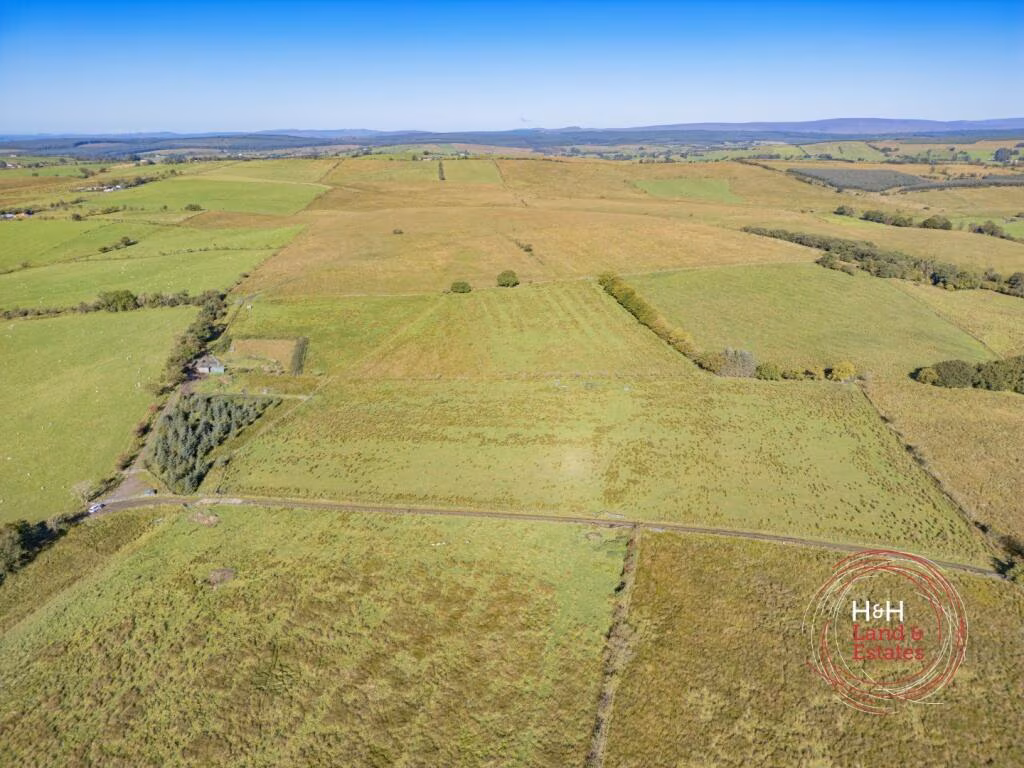
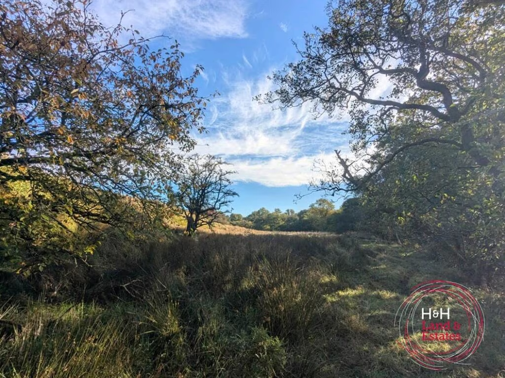
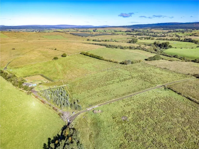
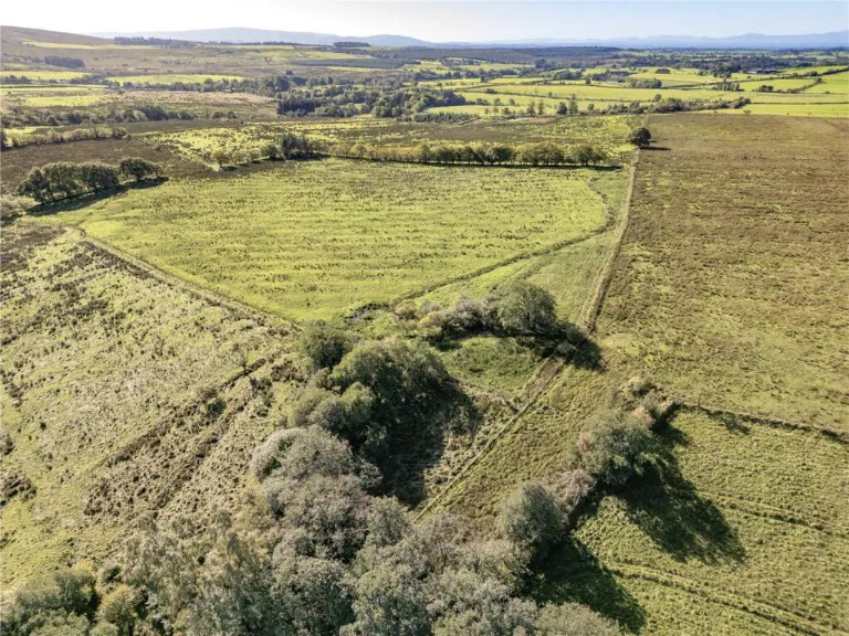
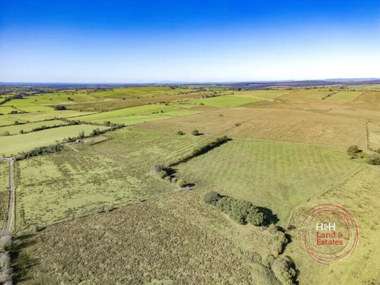
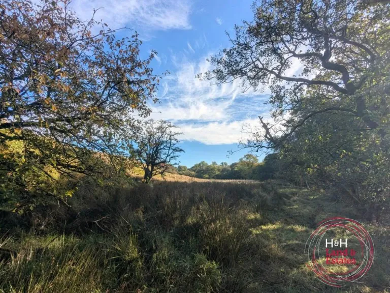
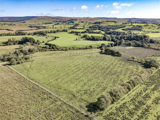
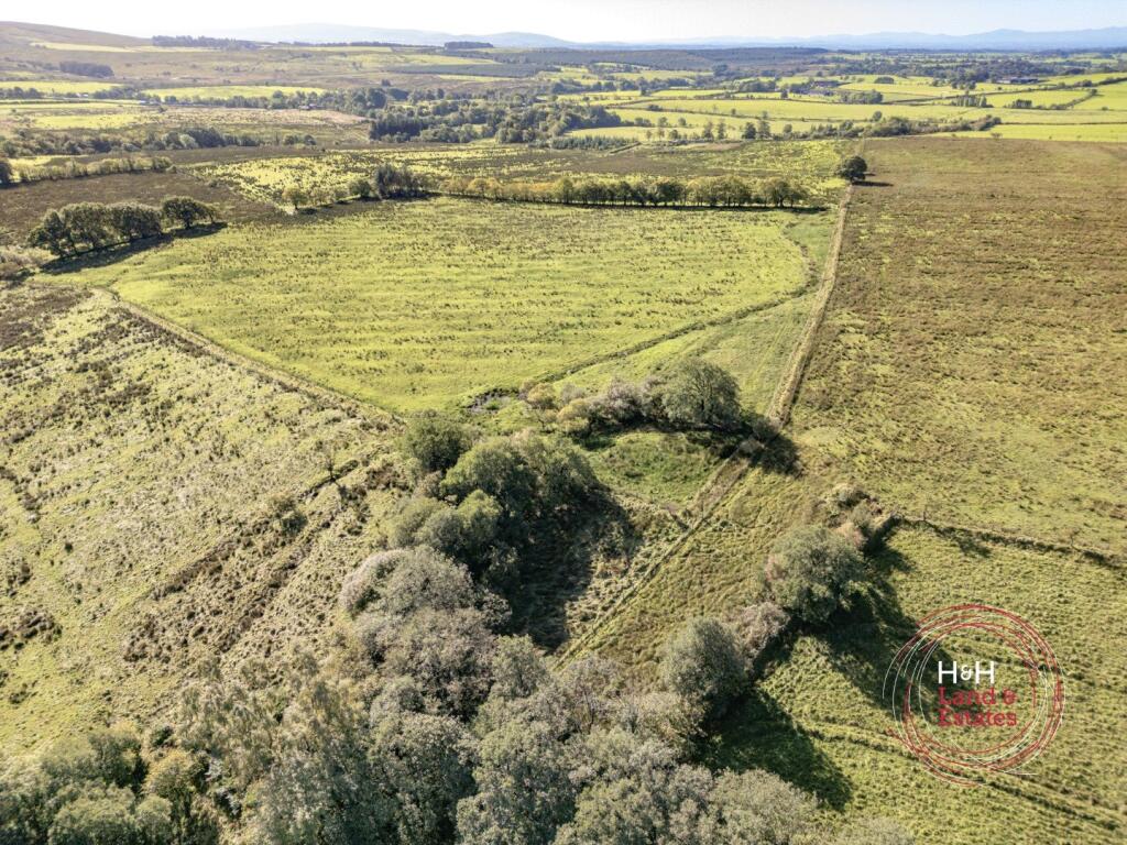
- Rural agricultural freehold land comprising several contiguous fields divided by hedgerows and tracks. The parcel is expansive (large to very large in scale) with gently undulating terrain and open countryside views in all directions. Boundaries are defined by hedgerows and small shelter belts; there is an internal access track visible. No buildings are evident on the land from the images. Suitable for grazing, agricultural use or potential redevelopment subject to consents. Overall impression: a substantial block of farmland with good access and panoramic rural views.
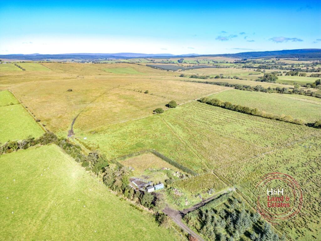
- Rural agricultural holding comprising large, rolling pastureland with an access track and a small cluster of outbuildings/yard near the entrance. The parcel appears to be predominantly unimproved grassland with boundary hedgerows/tree belts and scattered shelter belts. Terrain is gently undulating with extensive open views across surrounding farmland and distant hills. No obvious main dwelling is visible in the image — the site reads as a small farm or grazing paddocks suitable for livestock, silvo-pastoral use or amenity land. Parcel size appears large (several hectares) rather than a garden-sized plot; individual field sizes are medium to large. Overall the property is best described as an extensive rural holding with good access and strong landscape/long-distance views.
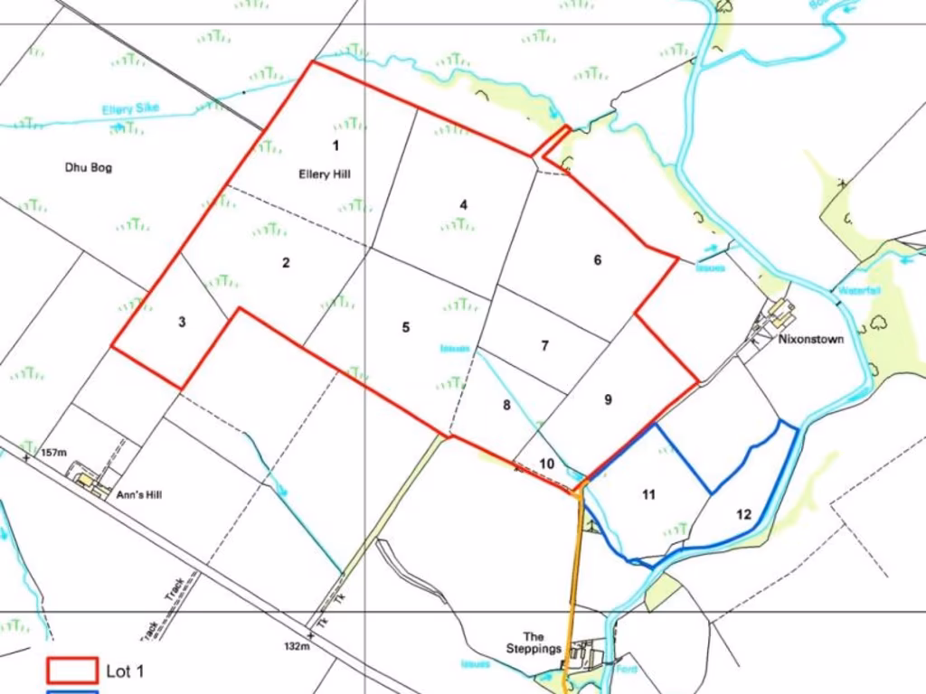
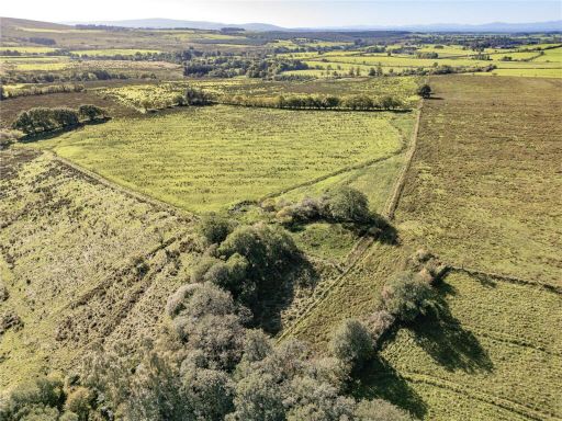
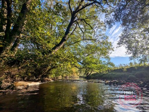
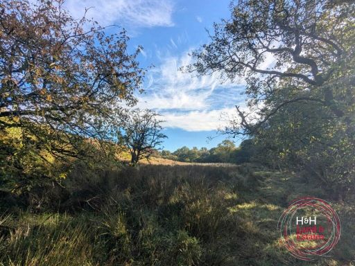
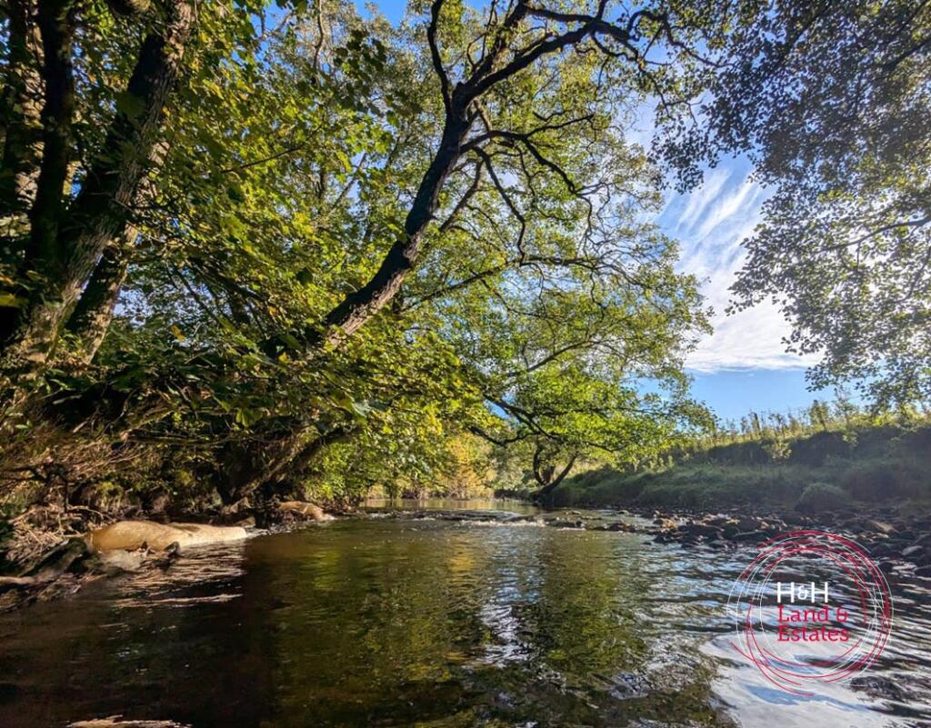
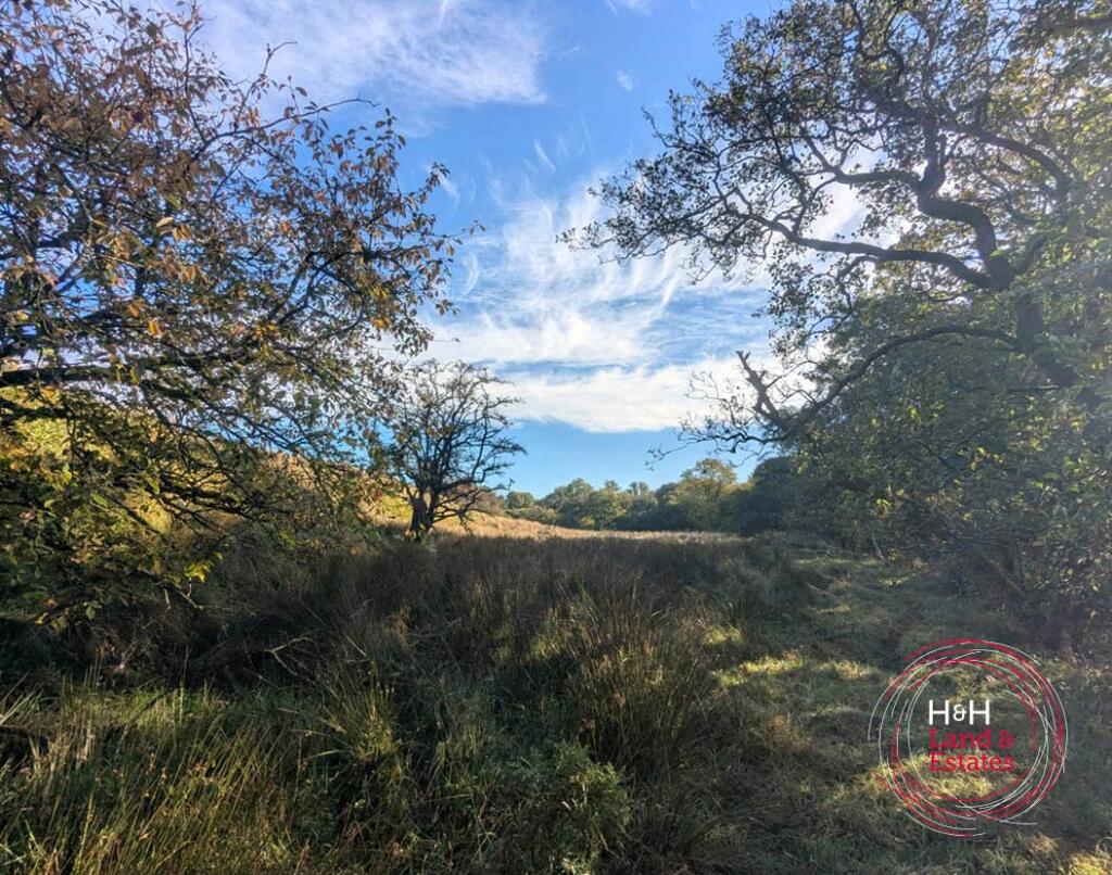
- Substantial rural grazing holding comprising two blocks of Grade 4 and 5 pasture with direct riverside access. The offering extends to a total of 106.54 acres (43.11 ha) and is available as a whole or in two lots (Lot 1: 94.36 acres; Lot 2: 12.18 acres). The land is ring-fenced with post and wire/stockproof fencing and presents well for continued agricultural use, low-intensity grazing or investment. Topography and imagery indicate a mix of riverside meadow, areas of scrub/rough grazing and scattered mature trees providing shelter; views are characteristically rural and unbroken by urban development. Overall plot size is very large and is best suited to farming, sporting or amenity use; individual lot sizes suggest Lot 1 is of substantial operational scale while Lot 2 is a smaller paddock or riparian parcel.
Image Descriptions
- large expanse of rural land
- rural land
Textual Property Features
Detected Visual Features
- rural land
- development opportunity
- agricultural use
- pasture
- farmland
- investment property
- expansive plots
- country setting
- rural
- land
- agriculture
- open countryside
- investment
- landscape
- scenic views
Nearby Schools
- Bewcastle School
- Walton & Lees Hill CofE School
- Shankhill CofE Primary School
Nearest Bars And Restaurants
- Id: 4867752805
- Tags:
- Amenity: cafe
- Diet:
- Name: Walton Reading Room Cafe
- TagsNormalized:
- Lat: 54.9729273
- Lon: -2.7498815
- FullGeoHash: gcy09rt8e07s
- PartitionGeoHash: gcy0
- Images:
- FoodStandards: null
- Distance: 11304.4
,- Id: 341210206
- Tags:
- Accommodation: yes
- Addr:
- City: Penton
- Postcode: CA6 5QB
- Amenity: pub
- Building: yes
- Contact:
- Phone: +1228577041
- Website: http://www.thebridgeinnpenton.co.uk/
- Food: yes
- Name: The Bridge Inn
- Opening_hours: mo-fr 17:00-23:00;sa-su 12:00-23:00
- Real_ale: yes
- TagsNormalized:
- Lat: 55.0797948
- Lon: -2.8814038
- FullGeoHash: gcvcq6vz43vw
- PartitionGeoHash: gcvc
- Images:
- FoodStandards: null
- Distance: 10890.1
,- Id: 1006238401
- Tags:
- Addr:
- City: Hethersgill
- Postcode: CA6 6EH
- Amenity: pub
- Building: retail
- Name: Black Lion
- TagsNormalized:
- Lat: 54.9962432
- Lon: -2.8178497
- FullGeoHash: gcvbzgu076fc
- PartitionGeoHash: gcvb
- Images:
- FoodStandards: null
- Distance: 10845.6
,- Id: 999694372
- Tags:
- Addr:
- City: Gilsland
- Housename: Slack house Farm
- Amenity: restaurant
- Name: Slack House Organic Farm cafe
- Source: local knowledge
- Website: https://slackhousefarm.co.uk/the-cafe-and-farm-shop/
- TagsNormalized:
- Lat: 54.9963579
- Lon: -2.6058803
- FullGeoHash: gcy0uey3n84v
- PartitionGeoHash: gcy0
- Images:
- FoodStandards: null
- Distance: 10755.7
,- Id: 264919336
- Tags:
- Amenity: pub
- Building: commercial
- Food: yes
- Name: The Crossings Inn
- TagsNormalized:
- Lat: 55.0403867
- Lon: -2.7537343
- FullGeoHash: gcy117fc3rdz
- PartitionGeoHash: gcy1
- Images:
- FoodStandards: null
- Distance: 4459.9
}
Nearest General Shops
- Id: 1663639265
- Tags:
- Addr:
- Housenumber: 1
- Postcode: TD9 0QR
- Street: South Hermitage Street
- Name: Holm Hardware
- Shop: doityourself
- TagsNormalized:
- Lat: 55.1791655
- Lon: -2.8131305
- FullGeoHash: gcvczvp9cmcz
- PartitionGeoHash: gcvc
- Images:
- FoodStandards: null
- Distance: 13565.2
,- Id: 1663647910
- Tags:
- Addr:
- Housenumber: 3
- Postcode: TD9 0QR
- Street: South Hermitage Street
- Name: Lumsden's Newsagents
- Shop: newsagent
- TagsNormalized:
- Lat: 55.1789143
- Lon: -2.8133558
- FullGeoHash: gcvczvp2kp1u
- PartitionGeoHash: gcvc
- Images:
- FoodStandards: null
- Distance: 13547.5
,- Id: 4405793091
- Tags:
- Name: Lanercost Gift Shop
- Name:en: Lanercost Gift Shop
- Shop: gift
- TagsNormalized:
- Lat: 54.9656609
- Lon: -2.6971005
- FullGeoHash: gcy0dwhn1jb4
- PartitionGeoHash: gcy0
- Images:
- FoodStandards: null
- Distance: 11867.8
}
Nearest Grocery shops
- Id: 9243954153
- Tags:
- Brand: Spar
- Brand:wikidata: Q610492
- Brand:wikipedia: en:SPAR (retailer)
- Name: Spar
- Shop: convenience
- TagsNormalized:
- Lat: 55.1802649
- Lon: -2.8121229
- FullGeoHash: gcy1bj222fcj
- PartitionGeoHash: gcy1
- Images:
- FoodStandards: null
- Distance: 13642.2
,- Id: 9243954148
- Tags:
- Brand: Costcutter
- Brand:wikidata: Q5175072
- Brand:wikipedia: en:Costcutter
- Contact:
- Website: https://store-locator.costcutter.co.uk/costcutter-78501fd9c904
- Name: Costcutter
- Shop: convenience
- TagsNormalized:
- costcutter
- convenience
- shop
- Lat: 55.1797262
- Lon: -2.8120324
- FullGeoHash: gcy1bj0m4ys8
- PartitionGeoHash: gcy1
- Images:
- FoodStandards: null
- Distance: 13586.7
,- Id: 409265607
- Tags:
- Brand: Spar
- Brand:wikidata: Q610492
- Building: yes
- Name: Spar
- Shop: convenience
- Toilets: yes
- TagsNormalized:
- Lat: 54.9598427
- Lon: -2.639998
- FullGeoHash: gcy0evjs794z
- PartitionGeoHash: gcy0
- Images:
- FoodStandards: null
- Distance: 13274.7
}
Nearest Religious buildings
- Id: 211913776
- Tags:
- Amenity: place_of_worship
- Building: church
- Denomination: anglican
- Name: St Mary's
- Religion: christian
- Wikidata: Q26500922
- TagsNormalized:
- place of worship
- church
- anglican
- christian
- Lat: 55.0336982
- Lon: -2.7785543
- FullGeoHash: gcy10f8dwbzt
- PartitionGeoHash: gcy1
- Images:
- FoodStandards: null
- Distance: 6068.2
,- Id: 341191112
- Tags:
- Amenity: place_of_worship
- Building: yes
- Name: Bewcastle Church
- Religion: christian
- TagsNormalized:
- place of worship
- church
- christian
- Lat: 55.0940339
- Lon: -2.733075
- FullGeoHash: gcy13v9f48r9
- PartitionGeoHash: gcy1
- Images:
- FoodStandards: null
- Distance: 2819.2
,- Id: 339722532
- Tags:
- Addr:
- Amenity: place_of_worship
- Building: yes
- Denomination: anglican
- Name: St Cuthberts Church
- Religion: christian
- Wikidata: Q17541590
- TagsNormalized:
- place of worship
- anglican
- church
- christian
- Lat: 55.0636016
- Lon: -2.6819573
- FullGeoHash: gcy16bp09z79
- PartitionGeoHash: gcy1
- Images:
- FoodStandards: null
- Distance: 2068.7
}
Nearest Medical buildings
- Id: 1075119289
- Tags:
- Addr:
- City: Brampton
- Postcode: CA8 1TX
- Street: Tree Road
- Amenity: hospital
- Emergency: no
- Healthcare: hospital
- Name: Brampton War Memorial Hospital
- Phone: +44 1228 608345
- Website: https://www.ncic.nhs.uk/locations/brampton-war-memorial-hospital
- TagsNormalized:
- Lat: 54.9386815
- Lon: -2.7266223
- FullGeoHash: gcy09cq910e0
- PartitionGeoHash: gcy0
- Images:
- FoodStandards: null
- Distance: 14869.4
,- Id: 1872498017
- Tags:
- Addr:
- Housenumber: 30
- Postcode: CA8 1RW
- Street: Market Place
- Amenity: pharmacy
- Dispensing: yes
- Healthcare: pharmacy
- Name: The Brampton Pharmacy
- TagsNormalized:
- Lat: 54.9420976
- Lon: -2.7347113
- FullGeoHash: gcy09cbsut76
- PartitionGeoHash: gcy0
- Images:
- FoodStandards: null
- Distance: 14535.3
,- Id: 1201040269
- Tags:
- Addr:
- City: Brampton
- Housenumber: 4
- Postcode: CA8 1NL
- Street: Market Place
- Amenity: doctors
- Healthcare: doctor
- Name: Brampton Medical Practice
- TagsNormalized:
- doctor
- doctors
- health
- healthcare
- Lat: 54.9423439
- Lon: -2.7348763
- FullGeoHash: gcy09cbw2g0r
- PartitionGeoHash: gcy0
- Images:
- FoodStandards: null
- Distance: 14509.2
,- Id: 9247807690
- Tags:
- Addr:
- City: Newcastleton
- Postcode: TD9 0RU
- Street: Moss Road
- Amenity: clinic
- Healthcare: clinic
- Name: Newcastleton Health Centre
- Website: https://www.newcastletonhc.co.uk
- TagsNormalized:
- clinic
- health
- healthcare
- health centre
- Lat: 55.1815536
- Lon: -2.812347
- FullGeoHash: gcy1bj2pge4h
- PartitionGeoHash: gcy1
- Images:
- FoodStandards: null
- Distance: 13775.3
}
Nearest Leisure Facilities
- Id: 1026774841
- Tags:
- Leisure: pitch
- Sport: equestrian
- TagsNormalized:
- pitch
- leisure
- equestrian
- sports
- Lat: 55.0276813
- Lon: -2.7820189
- FullGeoHash: gcy109qpqr22
- PartitionGeoHash: gcy1
- Images:
- FoodStandards: null
- Distance: 6703.7
,- Id: 1116568947
- Tags:
- TagsNormalized:
- Lat: 55.0843598
- Lon: -2.7775663
- FullGeoHash: gcy12gc3whbm
- PartitionGeoHash: gcy1
- Images:
- FoodStandards: null
- Distance: 4459.6
,- Id: 1116568948
- Tags:
- TagsNormalized:
- Lat: 55.0845626
- Lon: -2.7773956
- FullGeoHash: gcy12gcdcfxx
- PartitionGeoHash: gcy1
- Images:
- FoodStandards: null
- Distance: 4456.2
,- Id: 1116568949
- Tags:
- Leisure: pitch
- Sport: soccer
- Surface: grass
- TagsNormalized:
- Lat: 55.0842695
- Lon: -2.7775053
- FullGeoHash: gcy12gc3pkjf
- PartitionGeoHash: gcy1
- Images:
- FoodStandards: null
- Distance: 4452.8
,- Id: 218949758
- Tags:
- Leisure: swimming_pool
- Sport: swimming
- TagsNormalized:
- swimming
- swimming pool
- pool
- leisure
- sports
- Lat: 55.0882659
- Lon: -2.751608
- FullGeoHash: gcy13ks26vh6
- PartitionGeoHash: gcy1
- Images:
- FoodStandards: null
- Distance: 3155.7
}
Nearest Tourist attractions
- Id: 945393243
- Tags:
- Building: yes
- Museum: history
- Name: Bewcastle Museum
- Tourism: museum
- Website: https://www.bewcastle.com/bewcastle-museum/
- TagsNormalized:
- Lat: 55.0633758
- Lon: -2.682008
- FullGeoHash: gcy14zzp2tjy
- PartitionGeoHash: gcy1
- Images:
- FoodStandards: null
- Distance: 2077.4
,- Id: 1025118816
- Tags:
- Name: Bewcastle 7th Century Cross
- Source: local knowledge
- Tourism: attraction
- Wikidata: Q3003309
- Wikipedia: en:Bewcastle Cross
- TagsNormalized:
- Lat: 55.0637441
- Lon: -2.6819348
- FullGeoHash: gcy16bp1d3u7
- PartitionGeoHash: gcy1
- Images:
- FoodStandards: null
- Distance: 2062.8
,- Id: 339722546
- Tags:
- Area: yes
- Building: ruins
- Name: Bewcastle Castle (ruins)
- Source: local knowledge
- Tourism: attraction
- Wikidata: Q678595
- Wikipedia: en:Bewcastle Castle
- TagsNormalized:
- Lat: 55.0647376
- Lon: -2.6816003
- FullGeoHash: gcy16bpr65jf
- PartitionGeoHash: gcy1
- Images:
- FoodStandards: null
- Distance: 2034.9
}
Nearest Hotels
- Id: 792678702
- Tags:
- Addr:
- City: Newcastleton
- Postcode: TD9 0QD
- Street: Douglas Square
- Building: yes
- Building:levels: 2
- Fhrs:
- Height: 9
- Name: Liddesdale Hotel
- Roof:
- Tourism: hotel
- Website: https://www.theliddesdalehotel.co.uk/
- TagsNormalized:
- Lat: 55.1800806
- Lon: -2.8133168
- FullGeoHash: gcvczvprkbwf
- PartitionGeoHash: gcvc
- Images:
- FoodStandards: null
- Distance: 13660.2
,- Id: 792678703
- Tags:
- Addr:
- City: Newcastleton
- Housenumber: 16
- Postcode: TD9 0QD
- Street: Douglas Square
- Building: yes
- Building:levels: 2
- Fhrs:
- Height: 9
- Heritage: yes
- Name: Grapes Hotel
- Roof:
- Tourism: hotel
- Website: http://thegrapeshotel.co.uk
- Wikidata: Q77780578
- TagsNormalized:
- Lat: 55.1799716
- Lon: -2.8135901
- FullGeoHash: gcvczvpnws5p
- PartitionGeoHash: gcvc
- Images:
- FoodStandards: null
- Distance: 13657.8
,- Id: 338766556
- Tags:
- Addr:
- City: Gilsland
- Postcode: CA8 7AR
- Building: hotel
- Name: Gilsland Hall Hotel
- Phone: +44 16977 47203
- Tourism: hotel
- Website: www.gilslandhall.com
- TagsNormalized:
- Lat: 55.0024537
- Lon: -2.5707587
- FullGeoHash: gcy0vsbh8bx2
- PartitionGeoHash: gcy0
- Images:
- FoodStandards: null
- Distance: 11818.1
}
Tags
- rural land
- development opportunity
- agricultural use
- pasture
- farmland
- investment property
- expansive plots
- country setting
- rural
- land
- agriculture
- pasture
- open countryside
- farmland
- development opportunity
- investment
- landscape
- scenic views
Local Market Stats
- Average Price/sqft: £189
- Avg Income: £41300
- Social Housing: 2%
- Planning Success Rate: 98%
Similar Properties
 Land for sale in Land At Ellery Hill - Lot 1, Bewcastle, Carlisle, Cumbria, CA6 — £345,000 • 1 bed • 1 bath
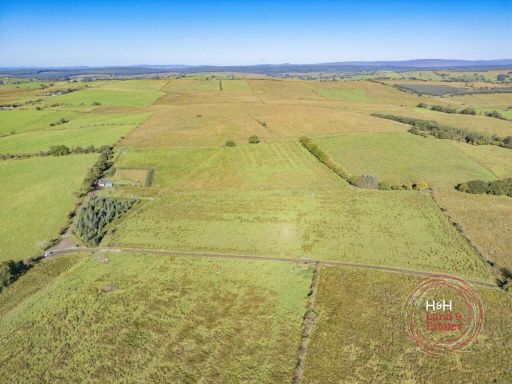 Land for sale in Land At Ellery Hill - Lot 2, Bewcastle, Carlisle, Cumbria, CA6 — £55,000 • 1 bed • 1 bath
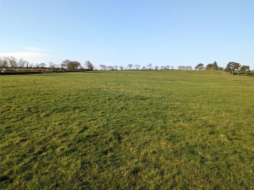 Land for sale in Land and Building At Lyneholmford, Roweltown, Carlisle, CA6 — £150,000 • 1 bed • 1 bath
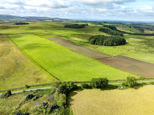 Land for sale in Cleugh Head Farm & Cottages - Lot 2, Low Row, Brampton, CA8 — £205,000 • 1 bed • 1 bath
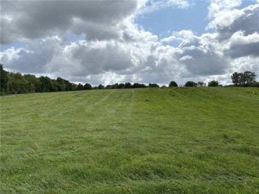 Land for sale in Land At Park Nook, West Hall, Brampton, Cumbria, CA8 — £320,000 • 1 bed • 1 bath
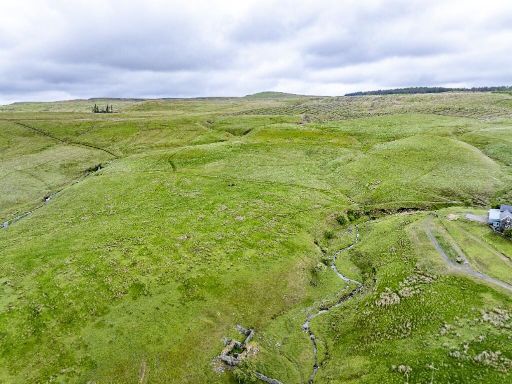 Farm land for sale in CA6 — £1,570,000 • 1 bed • 1 bath • 1088 ft²
Meta
- {
"@context": "https://schema.org",
"@type": "Residence",
"name": "Land for sale in Land At Ellery Hill, Bewcastle, Carlisle,…",
"description": "",
"url": "https://propertypiper.co.uk/property/386dcb40-e667-46a7-9c16-52db24457021",
"image": "https://image-a.propertypiper.co.uk/96618ddb-8bc7-4f73-9bec-52cfff9eac02-1024.jpeg",
"address": {
"@type": "PostalAddress",
"streetAddress": "Nixonstown, Bewcastle, CARLISLE",
"postalCode": "CA6 6NW",
"addressLocality": "Carlisle",
"addressRegion": "Penrith and The Border",
"addressCountry": "England"
},
"geo": {
"@type": "GeoCoordinates",
"latitude": 55.072099005775,
"longitude": -2.710860781206781
},
"numberOfRooms": 1,
"numberOfBathroomsTotal": 1,
"offers": {
"@type": "Offer",
"price": 400000,
"priceCurrency": "GBP",
"availability": "https://schema.org/InStock"
},
"additionalProperty": [
{
"@type": "PropertyValue",
"name": "Feature",
"value": "rural land"
},
{
"@type": "PropertyValue",
"name": "Feature",
"value": "development opportunity"
},
{
"@type": "PropertyValue",
"name": "Feature",
"value": "agricultural use"
},
{
"@type": "PropertyValue",
"name": "Feature",
"value": "pasture"
},
{
"@type": "PropertyValue",
"name": "Feature",
"value": "farmland"
},
{
"@type": "PropertyValue",
"name": "Feature",
"value": "investment property"
},
{
"@type": "PropertyValue",
"name": "Feature",
"value": "expansive plots"
},
{
"@type": "PropertyValue",
"name": "Feature",
"value": "country setting"
},
{
"@type": "PropertyValue",
"name": "Feature",
"value": "rural"
},
{
"@type": "PropertyValue",
"name": "Feature",
"value": "land"
},
{
"@type": "PropertyValue",
"name": "Feature",
"value": "agriculture"
},
{
"@type": "PropertyValue",
"name": "Feature",
"value": "pasture"
},
{
"@type": "PropertyValue",
"name": "Feature",
"value": "open countryside"
},
{
"@type": "PropertyValue",
"name": "Feature",
"value": "farmland"
},
{
"@type": "PropertyValue",
"name": "Feature",
"value": "development opportunity"
},
{
"@type": "PropertyValue",
"name": "Feature",
"value": "investment"
},
{
"@type": "PropertyValue",
"name": "Feature",
"value": "landscape"
},
{
"@type": "PropertyValue",
"name": "Feature",
"value": "scenic views"
}
]
}