LL16 5NW - Land for sale in Llansannan, LL16
View on Property Piper
Land for sale in Llansannan, LL16
Property Details
- Price: £80000
- Bedrooms: 1
- Bathrooms: 1
- Property Type: undefined
- Property SubType: undefined
Brochure Descriptions
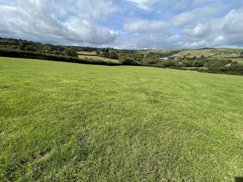
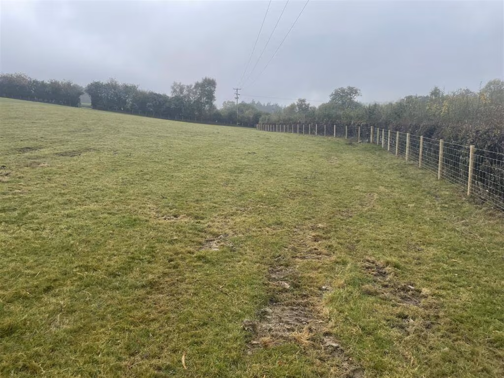
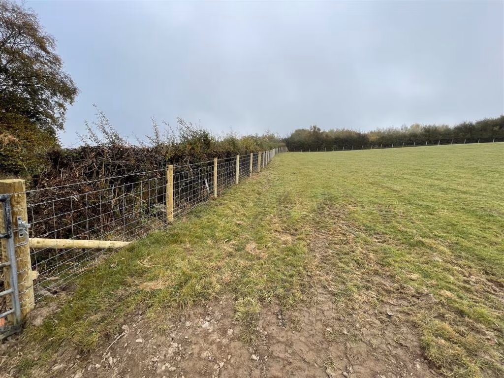
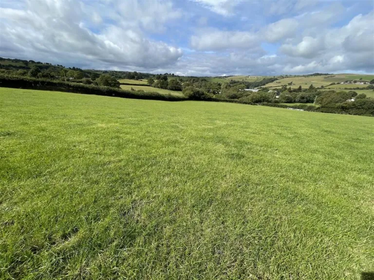
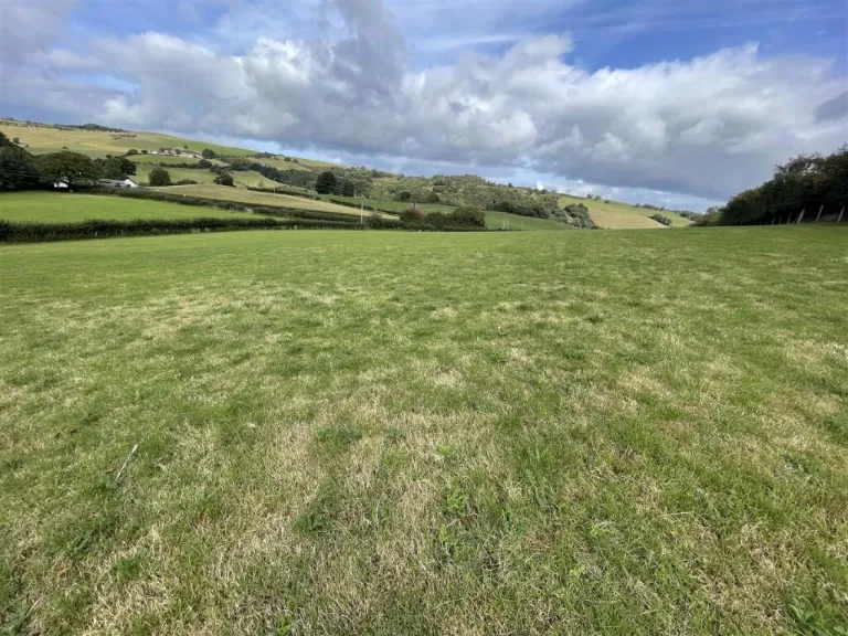
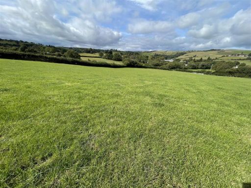
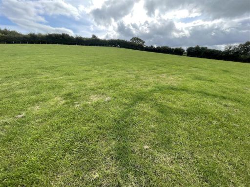
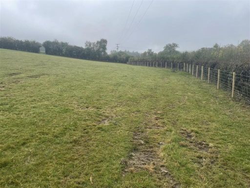
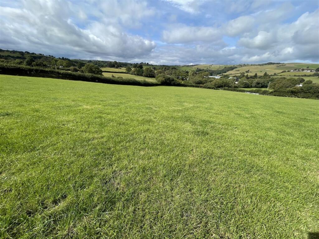
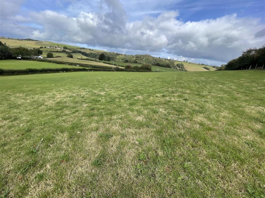
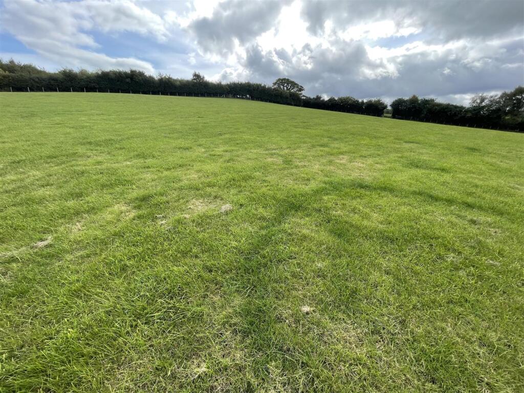
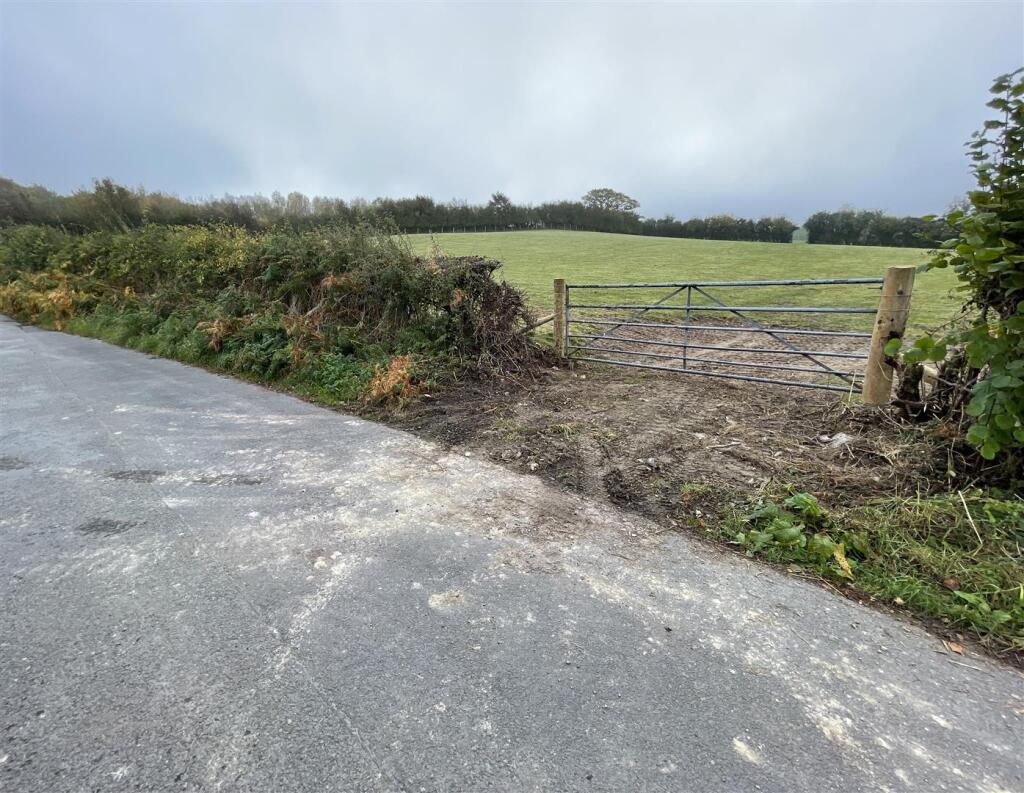
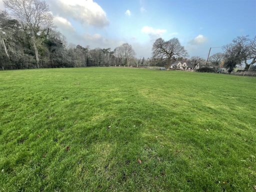
- Pasture land parcel shown in multiple photographs. Gently undulating, well-grassed field with surrounding hedgerows and views across rolling countryside and distant slopes. Vehicular access visible via a gated entrance onto a minor lane. No buildings shown. Field size appears to be a single medium-to-large agricultural paddock (suitable for grazing or hay production) with good internal condition and clear boundaries. Overall the property offers open rural views and typical pasture quality for livestock; topography is generally gentle rather than steep.
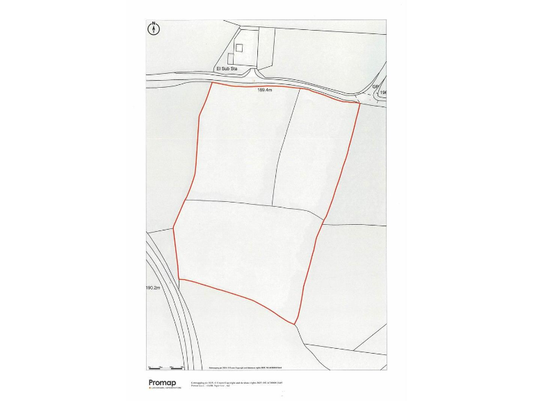
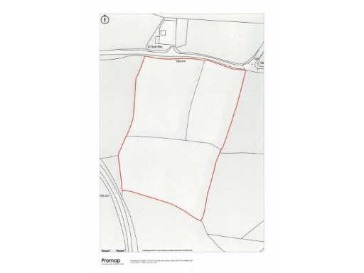
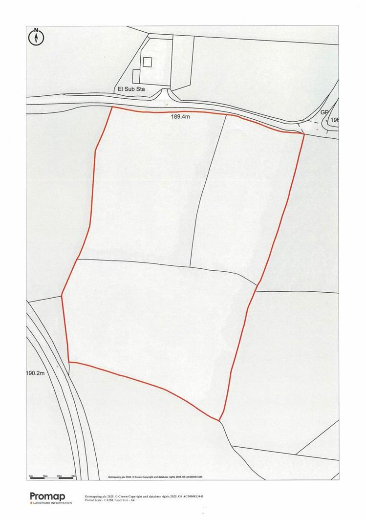
- A productive block of agricultural land extending to approximately 6.17 acres (2.49 hectares). The land lies on the edge of the small rural village of Llansannan with direct road frontage from the A544, mains water supply and double‑fenced boundaries. Topography is described as gently sloping and the holding has been divided into three conveniently sized parcels. Suited to grazing and cropping and likely of interest to farmers or equine enthusiasts. Setting is rural with village amenities nearby (local shop/post office, inn and primary school) and easy access to the A55 for access to the North Wales coast. Overall plot size: medium (6.17 acres).
Floorplan Description
- A parcel of land outlined in red on a map (boundaries marked; labelled distances 189.4m and 190.2m).
Textual Property Features
Detected Visual Features
- land
- plot
- countryside
- rural
- field
- scenic
- expansive
- development opportunity
- investment
- open space
- vacant land
- pasture
- residential land
- agricultural land
Nearest Religious buildings
- Id: 124803378
- Tags:
- Amenity: place_of_worship
- Building: chapel
- Denomination: presbyterian
- Geograph:
- Name: Capel Coffa Henry Rees
- Religion: christian
- Source:
- Wikidata: Q99449042
- TagsNormalized:
- place of worship
- chapel
- presbyterian
- christian
- church
- Lat: 53.1779695
- Lon: -3.5983316
- FullGeoHash: gcmqw0gb0u12
- PartitionGeoHash: gcmq
- Images:
- FoodStandards: null
- Distance: 1037.7
,- Id: 140239688
- Tags:
- Amenity: place_of_worship
- Building: chapel
- Name: Capel Bethania
- Religion: christian
- TagsNormalized:
- place of worship
- chapel
- christian
- church
- Lat: 53.1779741
- Lon: -3.5970745
- FullGeoHash: gcmqw0u8nhfg
- PartitionGeoHash: gcmq
- Images:
- FoodStandards: null
- Distance: 953.9
,- Id: 480048223
- Tags:
- Amenity: place_of_worship
- Building: church
- Denomination: anglican
- Listed_status: Grade II*
- Name: St Sannan's Church
- Religion: christian
- Wikidata: Q17738418
- TagsNormalized:
- place of worship
- church
- anglican
- christian
- Lat: 53.1795474
- Lon: -3.5964075
- FullGeoHash: gcmqw1j1mdhh
- PartitionGeoHash: gcmq
- Images:
- FoodStandards: null
- Distance: 930.4
}
Nearest Leisure Facilities
- Id: 480048336
- Tags:
- TagsNormalized:
- Lat: 53.1773955
- Lon: -3.5950803
- FullGeoHash: gcmqw0whu91b
- PartitionGeoHash: gcmq
- Images:
- FoodStandards: null
- Distance: 821.8
,- Id: 480048278
- Tags:
- Leisure: pitch
- Sport: bowls
- TagsNormalized:
- Lat: 53.1781908
- Lon: -3.5949141
- FullGeoHash: gcmqw0y32mmb
- PartitionGeoHash: gcmq
- Images:
- FoodStandards: null
- Distance: 811
,- Id: 480048337
- Tags:
- TagsNormalized:
- Lat: 53.1771699
- Lon: -3.5948434
- FullGeoHash: gcmqw0w76nfq
- PartitionGeoHash: gcmq
- Images:
- FoodStandards: null
- Distance: 807.8
,- Id: 480048338
- Tags:
- Leisure: pitch
- Sport: multi
- Surface: asphalt
- TagsNormalized:
- Lat: 53.1769441
- Lon: -3.5945599
- FullGeoHash: gcmqw0wd0svg
- PartitionGeoHash: gcmq
- Images:
- FoodStandards: null
- Distance: 791.5
,- Id: 339707738
- Tags:
- Leisure: pitch
- Source: Bing
- Sport: cricket
- TagsNormalized:
- pitch
- leisure
- cricket
- sports
- Lat: 53.177645
- Lon: -3.5944339
- FullGeoHash: gcmqw0ww5xeb
- PartitionGeoHash: gcmq
- Images:
- FoodStandards: null
- Distance: 777.8
}
Nearest Tourist attractions
- Id: 820481792
- Tags:
- Addr:
- City: Denbigh
- Place: Groes
- Postcode: LL16 5RU
- Caravans: yes
- Name: Henfryn Caravan Park
- Name:cy: Parc Carafanio Henfryn
- Operator: Henfryn Farm
- Tourism: caravan_site
- Website: https://henfryn.co.uk
- TagsNormalized:
- Lat: 53.166615
- Lon: -3.4824592
- FullGeoHash: gcmw2y8juz6h
- PartitionGeoHash: gcmw
- Images:
- FoodStandards: null
- Distance: 6799.6
,- Id: 367677002
- Tags:
- Name: Pen Isaf Farm Caravan Park
- Note: static caravans only
- Source: Bing
- Tourism: caravan_site
- Website: https://www.caravan-park-wales.co.uk/
- TagsNormalized:
- Lat: 53.1732011
- Lon: -3.6675243
- FullGeoHash: gcmqkxckk7pe
- PartitionGeoHash: gcmq
- Images:
- FoodStandards: null
- Distance: 5671.8
,- Id: 943590931
- Tags:
- Access: customers
- Addr:
- Fee: yes
- Group_only: yes
- Name: Tŷ Clwyd Centre
- Operator: Girlguiding Clwyd
- Tourism: camp_site
- Website: http://www.tyclwydcentre.org
- TagsNormalized:
- Lat: 53.2173371
- Lon: -3.6004357
- FullGeoHash: gcmqwpfjry8t
- PartitionGeoHash: gcmq
- Images:
- FoodStandards: null
- Distance: 4554.2
}
Nearest Bus stations and stops
- Id: 4379572208
- Tags:
- Bus: yes
- Highway: bus_stop
- Public_transport: platform
- TagsNormalized:
- Lat: 53.2010085
- Lon: -3.4620691
- FullGeoHash: gcmw9hyyrfy1
- PartitionGeoHash: gcmw
- Images:
- FoodStandards: null
- Distance: 8446.2
,- Id: 7661260226
- Tags:
- Bus: yes
- Highway: bus_stop
- Public_transport: platform
- Shelter: yes
- TagsNormalized:
- Lat: 53.1476527
- Lon: -3.4890145
- FullGeoHash: gcmw2e5rs0d1
- PartitionGeoHash: gcmw
- Images:
- FoodStandards: null
- Distance: 7090.8
,- Id: 7476844391
- Tags:
- Bus: yes
- Highway: bus_stop
- Public_transport: platform
- Shelter: yes
- TagsNormalized:
- Lat: 53.2111441
- Lon: -3.4995777
- FullGeoHash: gcmw8qg9mujw
- PartitionGeoHash: gcmw
- Images:
- FoodStandards: null
- Distance: 6669.3
,- Id: 6193242285
- Tags:
- Bus: yes
- Highway: bus_stop
- Public_transport: platform
- Shelter: yes
- TagsNormalized:
- Lat: 53.1706116
- Lon: -3.4859074
- FullGeoHash: gcmw2xmtk2rh
- PartitionGeoHash: gcmw
- Images:
- FoodStandards: null
- Distance: 6504.3
,- Id: 3358848214
- Tags:
- Bus: yes
- Highway: bus_stop
- Public_transport: platform
- Shelter: yes
- TagsNormalized:
- Lat: 53.2235096
- Lon: -3.5271997
- FullGeoHash: gcmqz9p96m33
- PartitionGeoHash: gcmq
- Images:
- FoodStandards: null
- Distance: 6289.9
}
Nearest Hotels
- Id: 509079248
- Tags:
- Addr:
- City: Denbigh
- Country: GB
- Postcode: LL16 3NU
- Street: Hall Square
- Building: yes
- Fhrs:
- Authority: Denbighshire
- Id: 921257
- Local_authority_id: 703251
- Name: Guildhall Tavern
- Name:en: Guildhall Tavern
- Tourism: hotel
- TagsNormalized:
- Lat: 53.1833489
- Lon: -3.4183541
- FullGeoHash: gcmwd1wz6wf3
- PartitionGeoHash: gcmw
- Images:
- FoodStandards: null
- Distance: 10973.6
,- Id: 851105432
- Tags:
- Addr:
- City: Abergele
- Country: GB
- Place: St. George
- Postcode: LL22 9BP
- Amenity: restaurant
- Fhrs:
- Authority: Conwy
- Id: 78914
- Local_authority_id: 1892
- Name: The Kinmel Arms
- Name:cy: Yr Arfau Cilmael
- Name:en: Kinmel Arms
- Smoking: no
- Tourism: hotel
- Wikidata: Q29496143
- TagsNormalized:
- Lat: 53.26888
- Lon: -3.5393948
- FullGeoHash: gcmrp3q9wngy
- PartitionGeoHash: gcmr
- Images:
- FoodStandards: null
- Distance: 10534.1
,- Id: 6055951374
- Tags:
- Addr:
- City: Abergele
- Country: GB
- Housename: Ffarm Hotel
- Place: Betws Yn Rhos
- Postcode: LL22 8AR
- Fhrs:
- Authority: Conwy
- Id: 565608
- Local_authority_id: 102643
- Name: Ffarm Country House
- Name:en: Ffarm Country House
- Tourism: hotel
- TagsNormalized:
- Lat: 53.2464293
- Lon: -3.6419356
- FullGeoHash: gcmqvjhnbtzf
- PartitionGeoHash: gcmq
- Images:
- FoodStandards: null
- Distance: 8591.1
}
Tags
- land
- plot
- countryside
- rural
- field
- scenic
- expansive
- development opportunity
- investment
- open space
- vacant land
- plot
- rural
- countryside
- pasture
- development opportunity
- residential land
- agricultural land
Local Market Stats
- Average Price/sqft: £215
- Avg Income: £40100
- Social Housing: 5%
- Planning Success Rate: 89%
Similar Properties
 Land for sale in Bont yr Allt Goch, St Asaph, LL17 — £30,000 • 1 bed • 1 bath
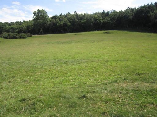 Land for sale in Llanfairtalhaiarn, LL22 — £70,000 • 1 bed • 1 bath
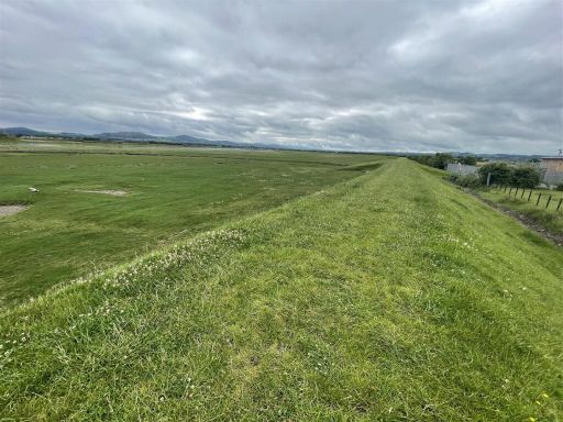 Land for sale in Kinmel Bay, Rhyl, LL18 — £30,000 • 1 bed • 1 bath
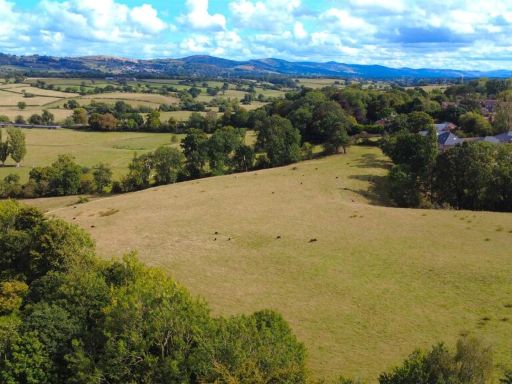 Land for sale in Lon Derw, St. Asaph, LL17 — £80,000 • 1 bed • 1 bath
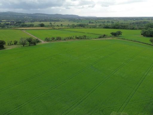 Land for sale in Land at Pen y Bryn, Mount Road, St. Asaph, LL17 — £750,000 • 1 bed • 1 bath
 Detached house for sale in Llanfairtalhaiarn, Abergele, Conwy, LL22 — £925,000 • 1 bed • 1 bath
Meta
- {
"@context": "https://schema.org",
"@type": "Residence",
"name": "Land for sale in Llansannan, LL16",
"description": "",
"url": "https://propertypiper.co.uk/property/30381ff6-fcec-42f7-9b0f-b1159402d9f1",
"image": "https://image-a.propertypiper.co.uk/cdbd3563-438a-45a7-9aa4-14b3088a93ad-1024.jpeg",
"address": {
"@type": "PostalAddress",
"streetAddress": "LLWYN DERW, DENBIGH, LLANSANNAN",
"postalCode": "LL16 5NW",
"addressLocality": "Conwy",
"addressRegion": "Clwyd West",
"addressCountry": "Wales"
},
"geo": {
"@type": "GeoCoordinates",
"latitude": 53.1777723,
"longitude": -3.5827644
},
"numberOfRooms": 1,
"numberOfBathroomsTotal": 1,
"offers": {
"@type": "Offer",
"price": 80000,
"priceCurrency": "GBP",
"availability": "https://schema.org/InStock"
},
"additionalProperty": [
{
"@type": "PropertyValue",
"name": "Feature",
"value": "land"
},
{
"@type": "PropertyValue",
"name": "Feature",
"value": "plot"
},
{
"@type": "PropertyValue",
"name": "Feature",
"value": "countryside"
},
{
"@type": "PropertyValue",
"name": "Feature",
"value": "rural"
},
{
"@type": "PropertyValue",
"name": "Feature",
"value": "field"
},
{
"@type": "PropertyValue",
"name": "Feature",
"value": "scenic"
},
{
"@type": "PropertyValue",
"name": "Feature",
"value": "expansive"
},
{
"@type": "PropertyValue",
"name": "Feature",
"value": "development opportunity"
},
{
"@type": "PropertyValue",
"name": "Feature",
"value": "investment"
},
{
"@type": "PropertyValue",
"name": "Feature",
"value": "open space"
},
{
"@type": "PropertyValue",
"name": "Feature",
"value": "vacant land"
},
{
"@type": "PropertyValue",
"name": "Feature",
"value": "plot"
},
{
"@type": "PropertyValue",
"name": "Feature",
"value": "rural"
},
{
"@type": "PropertyValue",
"name": "Feature",
"value": "countryside"
},
{
"@type": "PropertyValue",
"name": "Feature",
"value": "pasture"
},
{
"@type": "PropertyValue",
"name": "Feature",
"value": "development opportunity"
},
{
"@type": "PropertyValue",
"name": "Feature",
"value": "residential land"
},
{
"@type": "PropertyValue",
"name": "Feature",
"value": "agricultural land"
}
]
}
High Res Floorplan Images
Compatible Floorplan Images
FloorplanImages Thumbnail