EH54 5NY - Land for sale in Almond North, Livingston, Scotland, EH54 5…
View on Property Piper
Land for sale in Almond North, Livingston, Scotland, EH54 5NY, EH54
Property Details
- Price: £1
- Bedrooms: 1
- Bathrooms: 1
- Property Type: undefined
- Property SubType: undefined
Brochure Descriptions
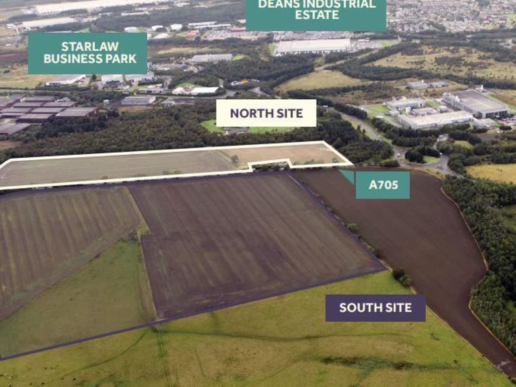
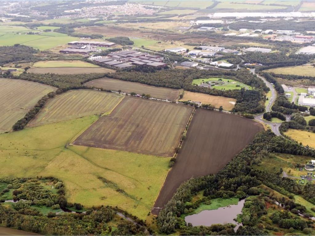
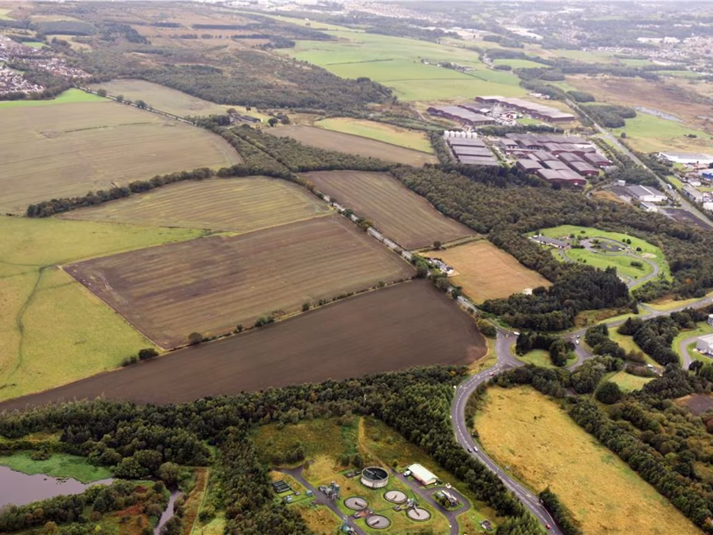
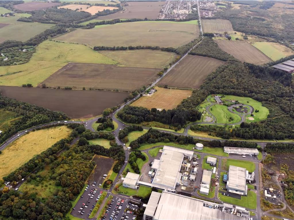
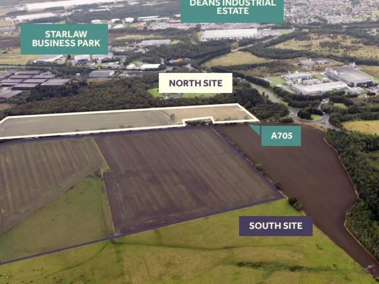
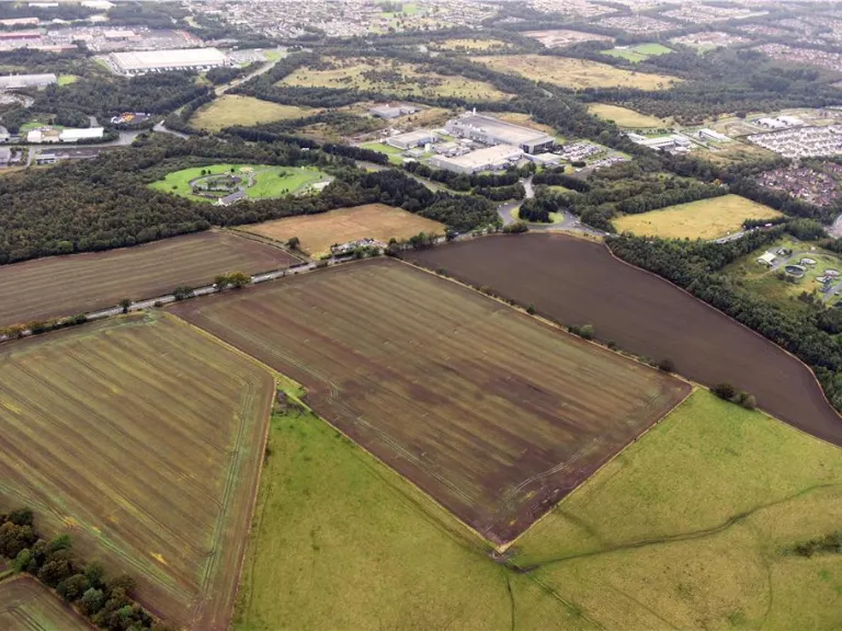
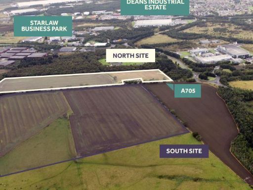
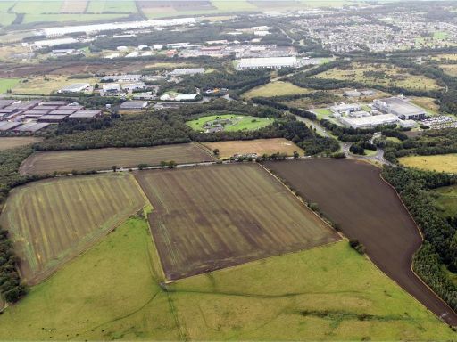
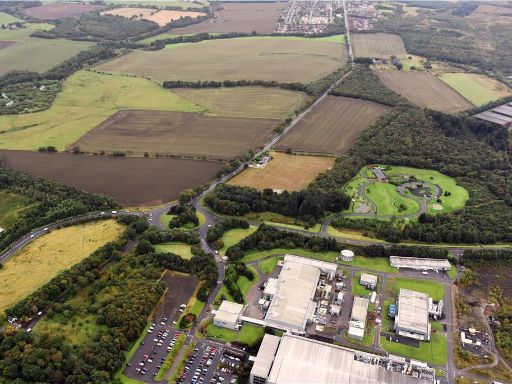
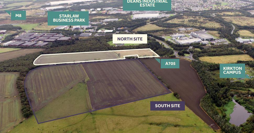
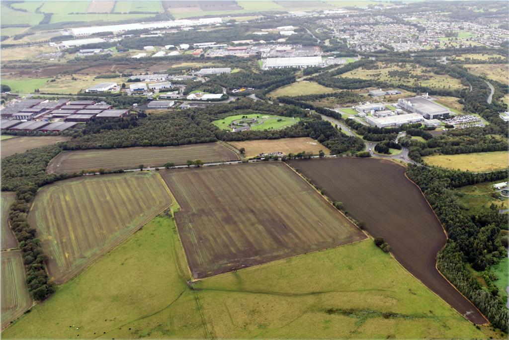
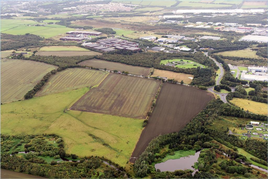
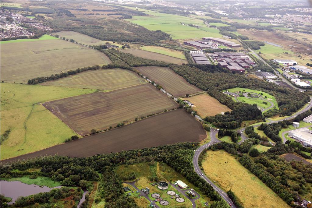
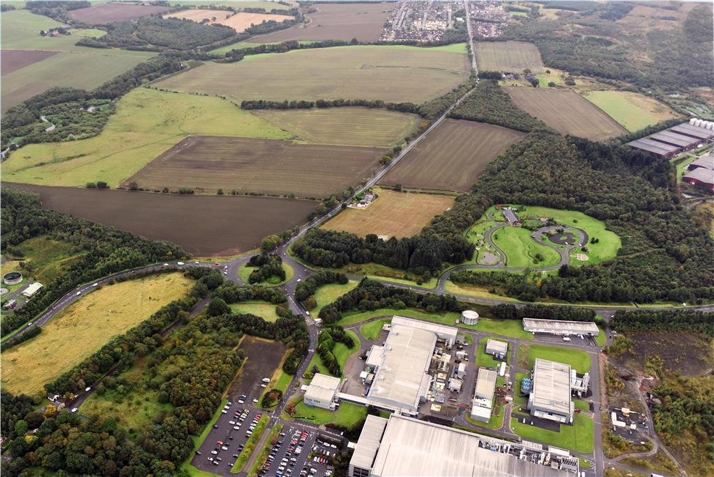
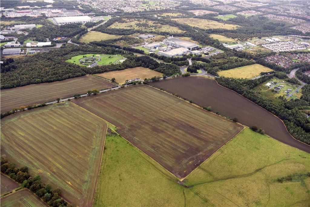
- This property offers a significant commercial development opportunity with two distinct sites: the North Site covering 7.3 hectares (18 acres) and the South Site spanning 17 hectares (42 acres). Nestled in a strategic location, it provides close proximity to major roadways such as the M8 and the A705, enhancing its commercial appeal. The property is surrounded by key industrial and business parks including the Deans Industrial Estate and the Starlaw Business Park, indicating its suitability for a range of commercial uses. The entire property is vast, making it suitable for large-scale development projects, with the surrounding landscape contributing to its expansive aesthetic.
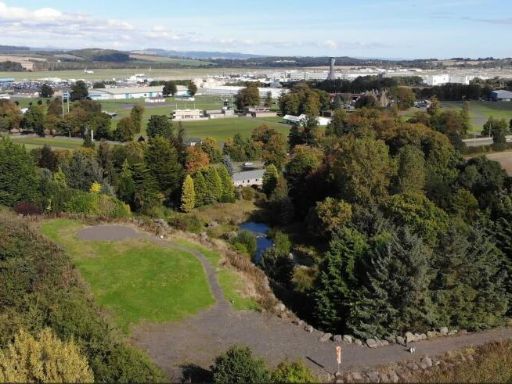
- Spanning across an impressive total area of 72 hectares (42 acres), this property is divided into two significant sections: the north site, irregularly shaped, bordered by woodland with varied elevations, and the south site, more square in shape with a gentle slope from north to south. The site offers views of surrounding woodlands and has a rural, natural ambiance. Given its size and land characteristics, it suits extensive development with ample space for structures and landscaping.
Image Descriptions
- vacant land industrial development site
- land plot
Textual Property Features
Detected Visual Features
- vacant land
- development potential
- industrial site
- business park
- large acreage
- land plot
- agricultural
- development opportunity
- rural
- greenbelt
- farmland
- investment potential
- open field
- country living
Nearest Bars And Restaurants
- Id: 203864793
- Tags:
- Addr:
- City: Livingston
- Housenumber: 6
- Postcode: EH54 6BA
- Street: Kingsport Avenue
- Suburb: Howden
- Amenity: fast_food
- Building: yes
- Cuisine: fish_and_chips;pizza
- Fhrs:
- Name: Minerva
- Source:
- TagsNormalized:
- Lat: 55.8928666
- Lon: -3.5092351
- FullGeoHash: gcvtbnuxscs8
- PartitionGeoHash: gcvt
- Images:
- FoodStandards: null
- Distance: 756.1
,- Id: 2280121656
- Tags:
- Amenity: fast_food
- Cuisine: chinese
- Name: Quango
- Phone: +44 1506433304
- TagsNormalized:
- Lat: 55.8975451
- Lon: -3.4954349
- FullGeoHash: gcvtbrydy3wu
- PartitionGeoHash: gcvt
- Images:
- FoodStandards: null
- Distance: 557.6
,- Id: 2280121657
- Tags:
- Addr:
- City: Livingston
- Postcode: EH54 5DZ
- Street: Adelaide Street
- Suburb: Craigshill
- Amenity: fast_food
- Cuisine: chinese
- Fhrs:
- Name: Taste of China
- Phone: +44 1506 430430
- Source:
- TagsNormalized:
- Lat: 55.8974351
- Lon: -3.495227
- FullGeoHash: gcvtbryf5m1u
- PartitionGeoHash: gcvt
- Images:
- FoodStandards: null
- Distance: 548.2
,- Id: 2280121655
- Tags:
- Addr:
- City: Livingston
- Postcode: EH54 5DZ
- Street: Adelaide Street
- Suburb: Craigshill
- Amenity: fast_food
- Cuisine: fish_and_chips;pizza
- Fhrs:
- Name: Marmaris
- Opening_hours: Mo-Su 11:30-00:00
- Phone: +44 1506 444405
- Source:
- TagsNormalized:
- Lat: 55.8974521
- Lon: -3.4957433
- FullGeoHash: gcvtbry6r22c
- PartitionGeoHash: gcvt
- Images:
- FoodStandards: null
- Distance: 544.1
,- Id: 217798482
- Tags:
- Addr:
- City: Livingston
- Housenumber: 37
- Postcode: EH54 5DZ
- Street: The Mall
- Amenity: pub
- Building: yes
- Name: The Tower
- Phone: +44 1506 444941
- Source: Bing;survey
- TagsNormalized:
- Lat: 55.8971395
- Lon: -3.4975039
- FullGeoHash: gcvtbrv0qq01
- PartitionGeoHash: gcvt
- Images:
- FoodStandards: null
- Distance: 503.1
}
Nearest General Shops
- Id: 280364159
- Tags:
- Building: commercial
- Name: car store
- Shop: car
- TagsNormalized:
- Lat: 55.8919735
- Lon: -3.5021775
- FullGeoHash: gcvtbqcf3750
- PartitionGeoHash: gcvt
- Images:
- FoodStandards: null
- Distance: 323.7
,- Id: 3511413232
- Tags:
- Name: Hogarth Motor Company Ltd
- Shop: car_repair
- TagsNormalized:
- motor
- car repair
- repair
- shop
- Lat: 55.8924249
- Lon: -3.5014889
- FullGeoHash: gcvtbqfkcrht
- PartitionGeoHash: gcvt
- Images:
- FoodStandards: null
- Distance: 273.5
,- Id: 3511413235
- Tags:
- TagsNormalized:
- Lat: 55.8919782
- Lon: -3.5008961
- FullGeoHash: gcvtbqfdr5ys
- PartitionGeoHash: gcvt
- Images:
- FoodStandards: null
- Distance: 246.2
}
Nearest Grocery shops
- Id: 3511396971
- Tags:
- TagsNormalized:
- Lat: 55.8970826
- Lon: -3.4964839
- FullGeoHash: gcvtbrvbn52t
- PartitionGeoHash: gcvt
- Images:
- FoodStandards: null
- Distance: 497.8
,- Id: 3511413230
- Tags:
- TagsNormalized:
- Lat: 55.8924084
- Lon: -3.5011724
- FullGeoHash: gcvtbqfsbu0e
- PartitionGeoHash: gcvt
- Images:
- FoodStandards: null
- Distance: 254
,- Id: 334001479
- Tags:
- Addr:
- City: Livingston
- Housenumber: 15
- Postcode: EH54 5AQ
- Street: Tay Walk
- Suburb: Craigshill
- Building: yes
- Fhrs:
- Name: Licensed Mini-Market
- Shop: convenience
- Wheelchair: no
- TagsNormalized:
- Lat: 55.8927092
- Lon: -3.4985514
- FullGeoHash: gcvtbquqtu4v
- PartitionGeoHash: gcvt
- Images:
- FoodStandards: null
- Distance: 90
}
Nearest Religious buildings
- Id: 93329258
- Tags:
- Amenity: place_of_worship
- Building: church
- Denomination: church_of_scotland
- Name: Kirk of Calder
- Religion: christian
- Source: OS OpenData StreetView
- Wikidata: Q15526091
- TagsNormalized:
- place of worship
- church
- church of scotland
- christian
- Lat: 55.8900768
- Lon: -3.4824928
- FullGeoHash: gcvtby2pk13n
- PartitionGeoHash: gcvt
- Images:
- FoodStandards: null
- Distance: 954.7
,- Id: 55425377
- Tags:
- Amenity: place_of_worship
- Building: yes
- Denomination: salvation_army
- Name: The Salvation Army Livingston Community Church
- Religion: christian
- TagsNormalized:
- place of worship
- salvation army
- church
- the salvation army
- christian
- Lat: 55.8932822
- Lon: -3.5097235
- FullGeoHash: gcvtbph3cwbr
- PartitionGeoHash: gcvt
- Images:
- FoodStandards: null
- Distance: 789.5
,- Id: 55425436
- Tags:
- Amenity: place_of_worship
- Building: yes
- Denomination: roman_catholic
- Heritage: yes
- Name: St. Andrew's R. C. Church
- Religion: christian
- Wikidata: Q17852249
- TagsNormalized:
- place of worship
- catholic
- roman catholic
- church
- christian
- Lat: 55.8960314
- Lon: -3.5015857
- FullGeoHash: gcvtbrd1zpkr
- PartitionGeoHash: gcvt
- Images:
- FoodStandards: null
- Distance: 470.7
}
Nearest Medical buildings
- Id: 201816696
- Tags:
- Amenity: pharmacy
- Building: yes
- Dispensing: yes
- Name: Lloyds pharmacy
- Source: survey
- TagsNormalized:
- Lat: 55.8800334
- Lon: -3.507716
- FullGeoHash: gcvtbhtub31r
- PartitionGeoHash: gcvt
- Images:
- FoodStandards: null
- Distance: 1547.8
,- Id: 335983742
- Tags:
- Addr:
- City: Livingston
- Housenumber: 45
- Postcode: EH54 6DT
- Street: Fernbank
- Suburb: Ladywell
- Amenity: pharmacy
- Building: yes
- Dispensing: yes
- Name: Ladywell Pharmacy
- Phone: +44 1506 437100
- Website: http://ladywellpharmacy.com/
- TagsNormalized:
- Lat: 55.8979318
- Lon: -3.5155711
- FullGeoHash: gcvtbpbj138p
- PartitionGeoHash: gcvt
- Images:
- FoodStandards: null
- Distance: 1293.3
,- Id: 203864792
- Tags:
- Amenity: dentist
- Building: yes
- Name: Kingsport Dental Clinic
- Phone: +44 1506 442270
- Source: survey
- Website: www.kingsportdental.co.uk
- TagsNormalized:
- Lat: 55.893033
- Lon: -3.509412
- FullGeoHash: gcvtbph88b88
- PartitionGeoHash: gcvt
- Images:
- FoodStandards: null
- Distance: 768
,- Id: 218526286
- Tags:
- Amenity: doctors
- Building: yes
- Name: Craigshill Health Centre
- Source: survey;Bing
- TagsNormalized:
- doctor
- doctors
- health
- health centre
- Lat: 55.8975358
- Lon: -3.4946396
- FullGeoHash: gcvtbrz68zzv
- PartitionGeoHash: gcvt
- Images:
- FoodStandards: null
- Distance: 568
}
Nearest Airports
- Id: 403150963
- Tags:
- Aerodrome: international
- Aerodrome:type: public
- Aeroway: aerodrome
- Iata: EDI
- Icao: EGPH
- Is_in: Edinburgh,Scotland,UK
- Name: Edinburgh Airport
- Old_name: Turnhouse
- Source: Gagravarr_Airports
- Wikidata: Q8716
- Wikipedia: en:Edinburgh Airport
- TagsNormalized:
- airport
- international airport
- Lat: 55.9500825
- Lon: -3.3614651
- FullGeoHash: gcvw792kb5mf
- PartitionGeoHash: gcvw
- Images:
- FoodStandards: null
- Distance: 10595.3
}
Nearest Leisure Facilities
- Id: 218907620
- Tags:
- Leisure: pitch
- Sport: bowls
- TagsNormalized:
- Lat: 55.8947352
- Lon: -3.5016932
- FullGeoHash: gcvtbr64ktu6
- PartitionGeoHash: gcvt
- Images:
- FoodStandards: null
- Distance: 369.8
,- Id: 344521825
- Tags:
- TagsNormalized:
- Lat: 55.8937851
- Lon: -3.4997281
- FullGeoHash: gcvtbr5sfktx
- PartitionGeoHash: gcvt
- Images:
- FoodStandards: null
- Distance: 208.1
,- Id: 367154449
- Tags:
- Leisure: park
- Name: Almond Park
- TagsNormalized:
- Lat: 55.8921079
- Lon: -3.4945813
- FullGeoHash: gcvtbqz74k56
- PartitionGeoHash: gcvt
- Images:
- FoodStandards: null
- Distance: 168
,- Id: 932002737
- Tags:
- TagsNormalized:
- Lat: 55.8915267
- Lon: -3.4953987
- FullGeoHash: gcvtbqwxxr9z
- PartitionGeoHash: gcvt
- Images:
- FoodStandards: null
- Distance: 162
,- Id: 344756275
- Tags:
- TagsNormalized:
- Lat: 55.8919463
- Lon: -3.4964194
- FullGeoHash: gcvtbqvfptbw
- PartitionGeoHash: gcvt
- Images:
- FoodStandards: null
- Distance: 86.6
}
Nearest Tourist attractions
- Id: 2805451357
- Tags:
- Source: survey
- Tourism: picnic_site
- TagsNormalized:
- Lat: 55.8866935
- Lon: -3.5279612
- FullGeoHash: gcvmztz58dc2
- PartitionGeoHash: gcvm
- Images:
- FoodStandards: null
- Distance: 2033.2
,- Id: 10090364864
- Tags:
- Name: The Wee Museum of Memory
- Tourism: museum
- Website: https://www.livingmemory.org.uk/westLothian.php
- TagsNormalized:
- Lat: 55.8844361
- Lon: -3.51016
- FullGeoHash: gcvtbj7yrmfy
- PartitionGeoHash: gcvt
- Images:
- FoodStandards: null
- Distance: 1220.6
,- Id: 1000823922
- Tags:
- Barrier: fence
- Source: Bing
- Tourism: picnic_site
- TagsNormalized:
- Lat: 55.8872814
- Lon: -3.5103317
- FullGeoHash: gcvtbjgz526g
- PartitionGeoHash: gcvt
- Images:
- FoodStandards: null
- Distance: 1015.6
}
Nearest Train stations
- Id: 2958369107
- Tags:
- Name: West Calder
- Naptan:
- Network: National Rail
- Operator: ScotRail
- Public_transport: station
- Railway: station
- Ref:
- Source: npe/landsat
- Wikidata: Q3246677
- Wikipedia: en:West Calder railway station
- TagsNormalized:
- Lat: 55.8537711
- Lon: -3.566816
- FullGeoHash: gcvmwzfez1t4
- PartitionGeoHash: gcvm
- Images:
- FoodStandards: null
- Distance: 6129.2
,- Id: 3727341273
- Tags:
- Name: Kirknewton
- Naptan:
- Network: National Rail
- Operator: ScotRail
- Public_transport: station
- Railway: station
- Ref:
- Wikidata: Q2475701
- Wikipedia: en:Kirknewton railway station
- TagsNormalized:
- Lat: 55.8889332
- Lon: -3.4335165
- FullGeoHash: gcvtcy7b9k28
- PartitionGeoHash: gcvt
- Images:
- FoodStandards: null
- Distance: 3986.9
,- Id: 7556744224
- Tags:
- Name: Almondhaugh Halt
- Operator: Almond Valley Heritage Centre
- Platforms: 1
- Public_transport: station
- Railway: station
- Train: yes
- Usage: tourism
- TagsNormalized:
- Lat: 55.8847771
- Lon: -3.5553551
- FullGeoHash: gcvmzje06jx0
- PartitionGeoHash: gcvm
- Images:
- FoodStandards: null
- Distance: 3734.9
,- Id: 7556744219
- Tags:
- Name: Livingston Mill
- Platforms: 1
- Public_transport: station
- Railway: station
- Train: yes
- Usage: tourism
- TagsNormalized:
- Lat: 55.8852617
- Lon: -3.5485017
- FullGeoHash: gcvmzm851zv7
- PartitionGeoHash: gcvm
- Images:
- FoodStandards: null
- Distance: 3307.1
,- Id: 244116428
- Tags:
- Name: Livingston South
- Naptan:
- Network: National Rail
- Operator: ScotRail
- Public_transport: station
- Railway: station
- Ref:
- Wheelchair: yes
- Wikidata: Q4451346
- Wikipedia: en:Livingston South railway station
- TagsNormalized:
- Lat: 55.8716089
- Lon: -3.5015189
- FullGeoHash: gcvtb7478wy3
- PartitionGeoHash: gcvt
- Images:
- FoodStandards: null
- Distance: 2352.4
}
Nearest Bus stations and stops
- Id: 1729560501
- Tags:
- Bench: yes
- Bin: yes
- Bus: yes
- Highway: bus_stop
- Layby: yes
- Name: Railway Station
- Naptan:
- AtcoCode: 6290LDN029
- Bearing: NW
- CommonName: Railway Station
- Indicator: near
- Landmark: Deans North Rail Station
- NaptanCode: 95624765
- Street: DEANS NORTH ROAD
- Verified: no
- Public_transport: platform
- Shelter: yes
- TagsNormalized:
- Lat: 55.9024194
- Lon: -3.5429047
- FullGeoHash: gcvqp2sphq6b
- PartitionGeoHash: gcvq
- Images:
- FoodStandards: null
- Distance: 3055.5
,- Id: 1729560495
- Tags:
- Bench: yes
- Bin: yes
- Bus: yes
- Highway: bus_stop
- Layby: yes
- Name: Railway Station
- Naptan:
- AtcoCode: 6290LDN030
- Bearing: SE
- CommonName: Railway Station
- Indicator: opp
- Landmark: Deans North Rail Station
- NaptanCode: 95624758
- Street: Deans North
- Verified: no
- Public_transport: platform
- Shelter: yes
- TagsNormalized:
- Lat: 55.9018255
- Lon: -3.5419163
- FullGeoHash: gcvqp2sgeref
- PartitionGeoHash: gcvq
- Images:
- FoodStandards: null
- Distance: 2974.7
,- Id: 8871928382
- Tags:
- Bus: yes
- Highway: bus_stop
- Public_transport: platform
- TagsNormalized:
- Lat: 55.9084444
- Lon: -3.4942945
- FullGeoHash: gcvw03zd313j
- PartitionGeoHash: gcvw
- Images:
- FoodStandards: null
- Distance: 1768.3
,- Id: 7463811430
- Tags:
- Bus: yes
- Highway: bus_stop
- Public_transport: platform
- TagsNormalized:
- Lat: 55.8997276
- Lon: -3.4923688
- FullGeoHash: gcvw080ztbmp
- PartitionGeoHash: gcvw
- Images:
- FoodStandards: null
- Distance: 843.9
,- Id: 7463811431
- Tags:
- Bus: yes
- Highway: bus_stop
- Public_transport: platform
- TagsNormalized:
- Lat: 55.899518
- Lon: -3.4933345
- FullGeoHash: gcvw080nr3mj
- PartitionGeoHash: gcvw
- Images:
- FoodStandards: null
- Distance: 802.4
}
Nearest Hotels
- Id: 2200506229
- Tags:
- Addr:
- City: Livingston
- Postcode: EH54 7EY
- Street: Almondvale Crescent
- Brand: Travelodge
- Brand:wikidata: Q9361374
- Brand:wikipedia: en:Travelodge UK
- Fax: +44 1506 464662
- Internet_access: wlan
- Internet_access:fee: customers
- Internet_access:ssid: Travelodge WiFi
- Name: Travelodge
- Operator: Travelodge
- Phone: +44 871 984 6288
- Tourism: hotel
- Website: https://www.travelodge.co.uk/hotels/276/Livingston-hotel
- TagsNormalized:
- Lat: 55.8823962
- Lon: -3.5253035
- FullGeoHash: gcvmzv0fw3xj
- PartitionGeoHash: gcvm
- Images:
- FoodStandards: null
- Distance: 2093.4
,- Id: 224756984
- Tags:
- Addr:
- City: Livingston
- Postcode: EH54 9AQ
- Suburb: Murieston
- Building: yes
- Fhrs:
- Name: Bankton House Hotel
- Source:
- Tourism: hotel
- TagsNormalized:
- Lat: 55.874651
- Lon: -3.5009597
- FullGeoHash: gcvtb7dtmtzh
- PartitionGeoHash: gcvt
- Images:
- FoodStandards: null
- Distance: 2012.4
,- Id: 1109040
- Tags:
- Addr:
- City: Livingston
- Housenumber: 1
- Postcode: EH54 6QB
- Street: Almondview
- Suburb: Almondvale
- Building: yes
- Fhrs:
- Name: Mercure Livingston Hotel
- Source:
- Tourism: hotel
- Type: multipolygon
- TagsNormalized:
- Lat: 55.8863403
- Lon: -3.503843
- FullGeoHash: gcvtbmb9d8cm
- PartitionGeoHash: gcvt
- Images:
- FoodStandards: null
- Distance: 814.6
}
Tags
- vacant land
- development potential
- industrial site
- business park
- large acreage
- land plot
- agricultural
- development opportunity
- rural
- greenbelt
- farmland
- investment potential
- open field
- country living
Local Market Stats
- Average Price/sqft: £201
- Rental Yield: 6%
- Planning Success Rate: 93%
Similar Properties
 Land for sale in West Ingliston Cottage (Formerly Ingliston Castle), 200 Glasgow Road, Edinburgh, EH28 8LY, EH28 — POA • 1 bed • 1 bath • 2605 ft²
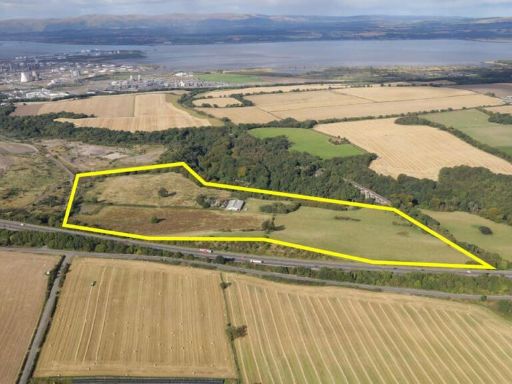 Land for sale in Land at Avonbank, Polmont, Falkirk, FK2 0YG, FK2 — POA • 1 bed • 1 bath
 Land for sale in Land, Adjacent to A89, Uphall, Broxburn, West Lothian, EH525SU, EH52 — £6,000 • 1 bed • 1 bath
 Mixed use property for sale in Land & Buildings by Cathlaw Lane Torphichen, West Lothian , EH48 — £175,000 • 1 bed • 1 bath
 Out-of-town retail property for sale in Whitburn Road, Bathgate, EH48 2XN, EH48 — POA • 1 bed • 1 bath
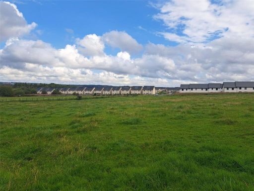 Land for sale in Site Y4, Land At Mossend, West Calder, EH55 — £150,000 • 1 bed • 1 bath
Meta
- {
"@context": "https://schema.org",
"@type": "Residence",
"name": "Land for sale in Almond North, Livingston, Scotland, EH54 5…",
"description": "",
"url": "https://propertypiper.co.uk/property/04d6755a-c6a0-4009-9446-9c3796825869",
"image": "https://image-a.propertypiper.co.uk/9123f88f-cf48-4711-9738-567c894a81a1-1024.jpeg",
"address": {
"@type": "PostalAddress",
"streetAddress": "Almond North, Livingston, Scotland, EH54 5NY",
"postalCode": "EH54 5NY",
"addressLocality": "West Lothian",
"addressRegion": "Livingston",
"addressCountry": "Scotland"
},
"geo": {
"@type": "GeoCoordinates",
"latitude": 55.892620227044475,
"longitude": -3.49711639992505
},
"numberOfRooms": 1,
"numberOfBathroomsTotal": 1,
"offers": {
"@type": "Offer",
"price": 1,
"priceCurrency": "GBP",
"availability": "https://schema.org/InStock"
},
"additionalProperty": [
{
"@type": "PropertyValue",
"name": "Feature",
"value": "vacant land"
},
{
"@type": "PropertyValue",
"name": "Feature",
"value": "development potential"
},
{
"@type": "PropertyValue",
"name": "Feature",
"value": "industrial site"
},
{
"@type": "PropertyValue",
"name": "Feature",
"value": "business park"
},
{
"@type": "PropertyValue",
"name": "Feature",
"value": "large acreage"
},
{
"@type": "PropertyValue",
"name": "Feature",
"value": "land plot"
},
{
"@type": "PropertyValue",
"name": "Feature",
"value": "agricultural"
},
{
"@type": "PropertyValue",
"name": "Feature",
"value": "development opportunity"
},
{
"@type": "PropertyValue",
"name": "Feature",
"value": "rural"
},
{
"@type": "PropertyValue",
"name": "Feature",
"value": "greenbelt"
},
{
"@type": "PropertyValue",
"name": "Feature",
"value": "farmland"
},
{
"@type": "PropertyValue",
"name": "Feature",
"value": "investment potential"
},
{
"@type": "PropertyValue",
"name": "Feature",
"value": "open field"
},
{
"@type": "PropertyValue",
"name": "Feature",
"value": "country living"
}
]
}