WA14 1PF - Office for sale in Altrincham, WA14
View on Property Piper
Office for sale in Altrincham, WA14
Property Details
- Price: £85000
- Bedrooms: 1
- Bathrooms: 1
- Property Type: undefined
- Property SubType: undefined
Brochure Descriptions
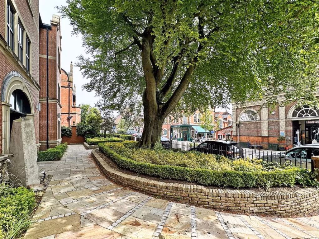
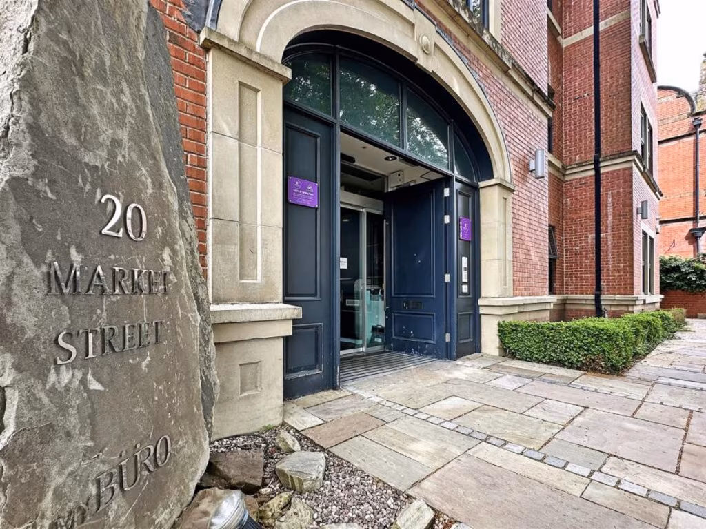
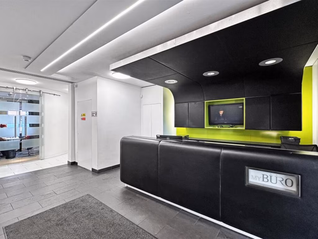
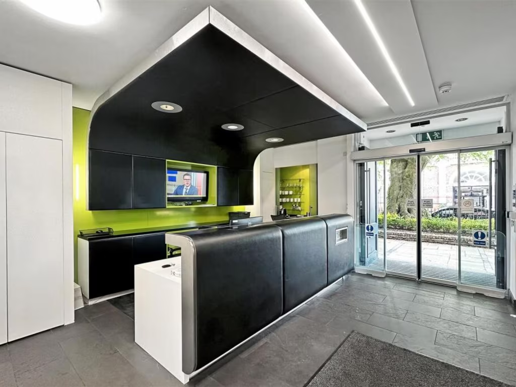
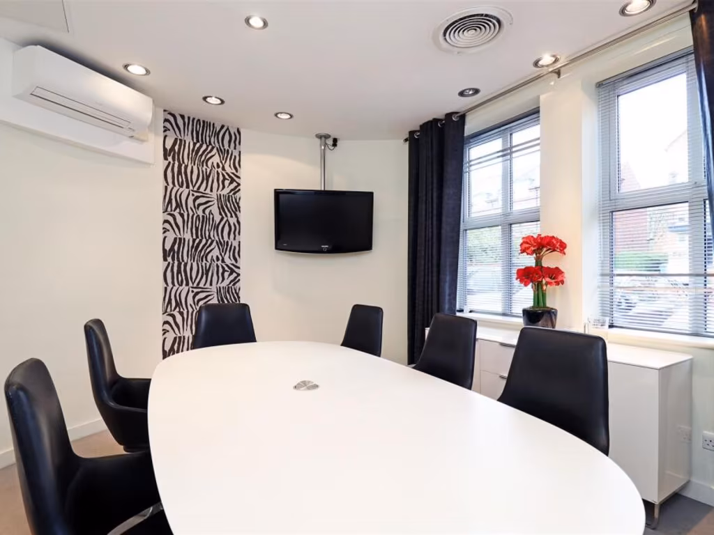
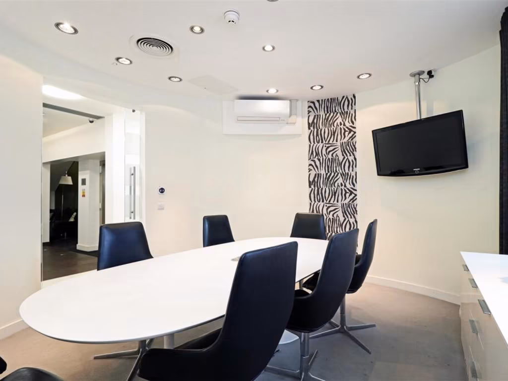
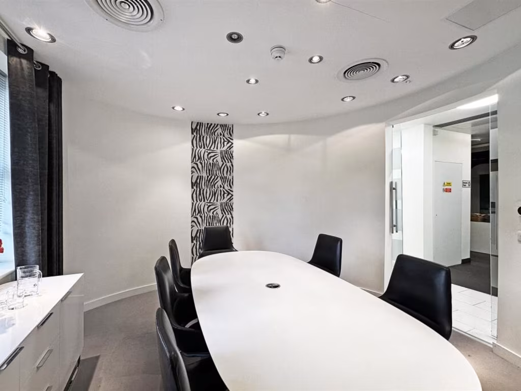
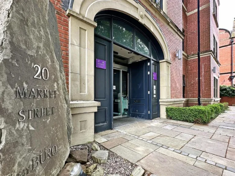
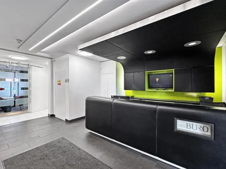
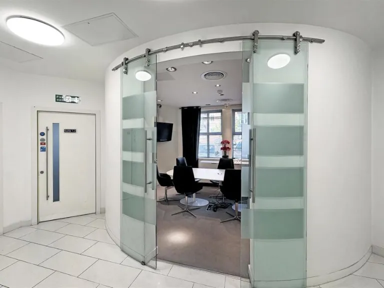
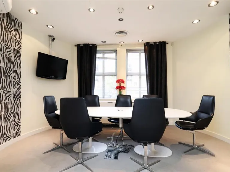
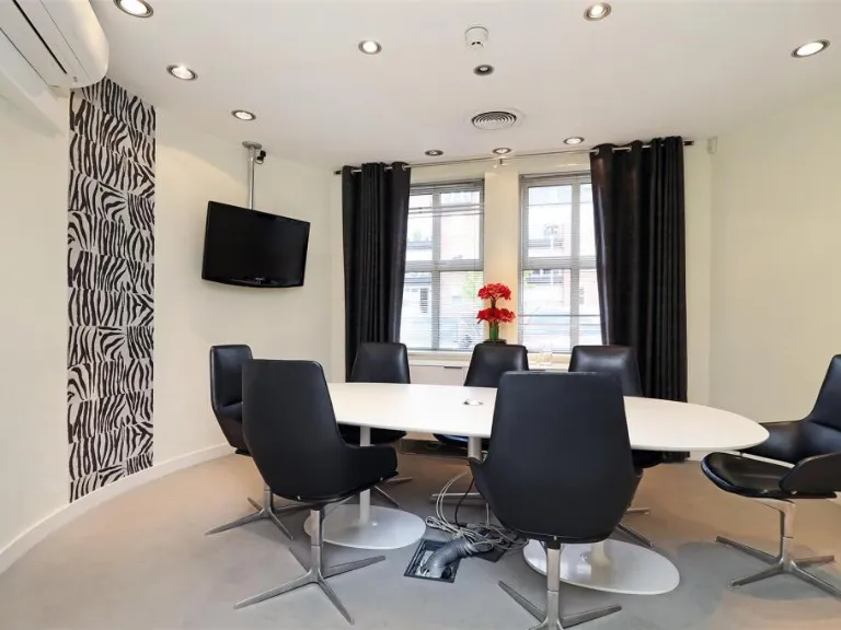
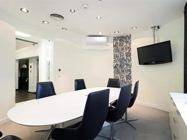
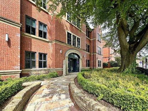
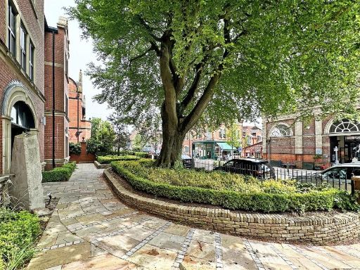
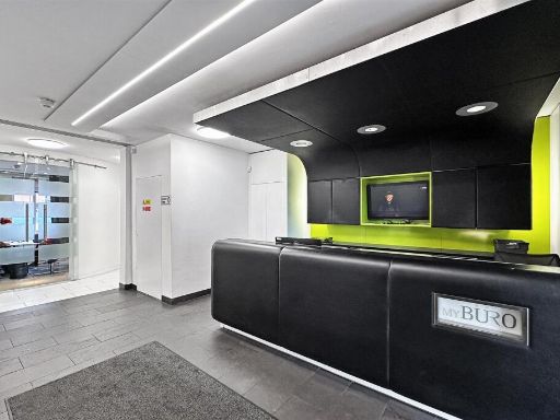
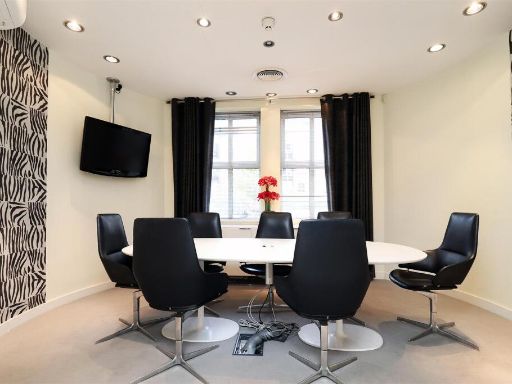
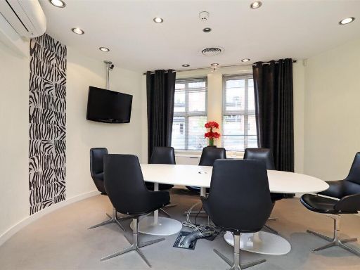
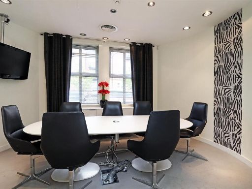
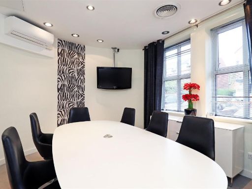
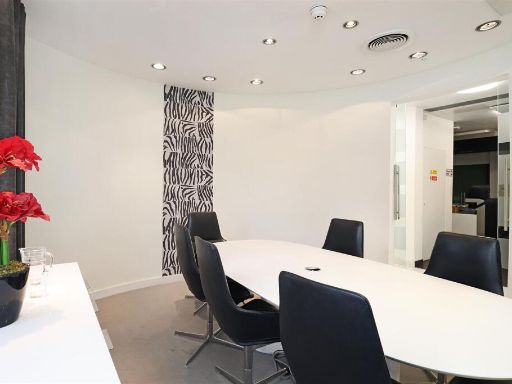
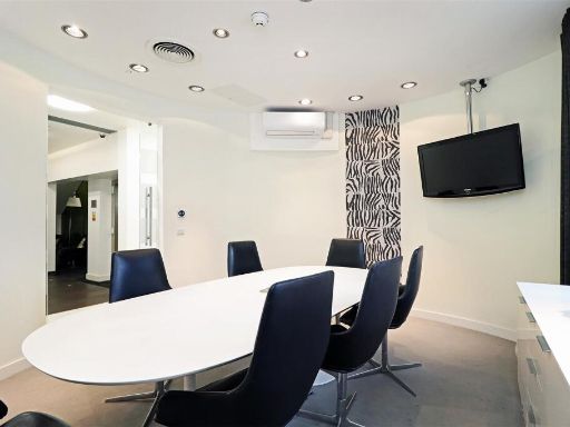
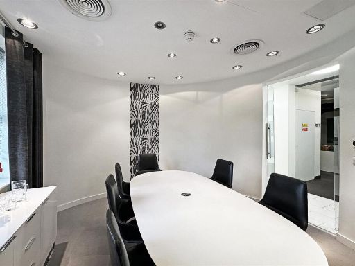
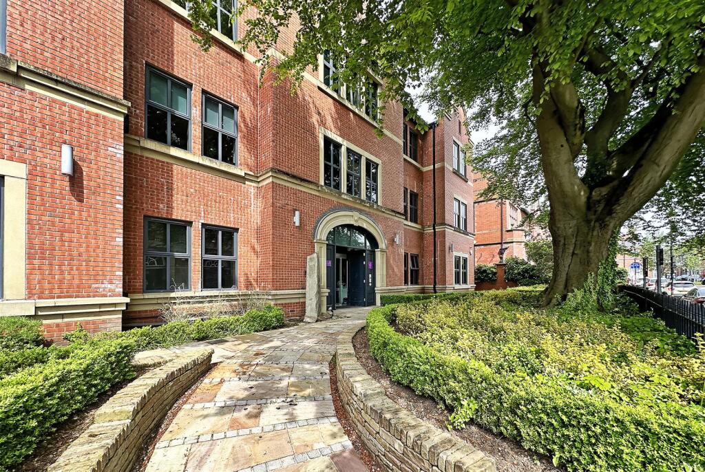
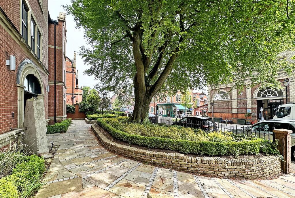
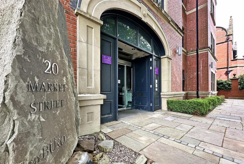
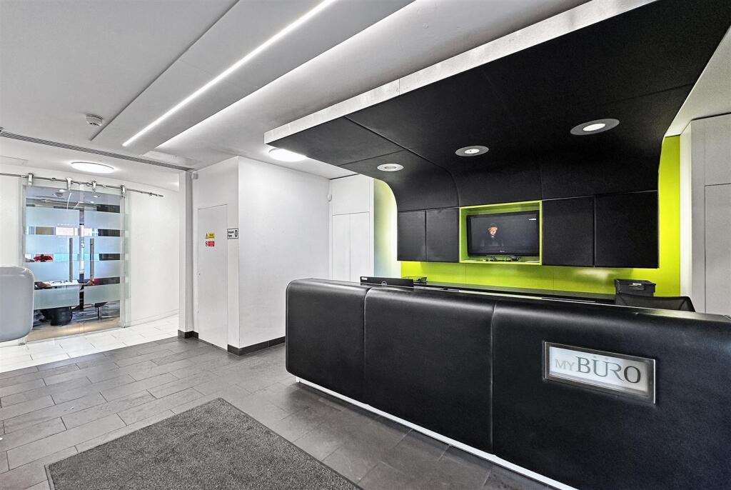
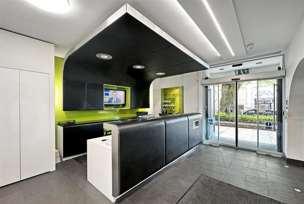
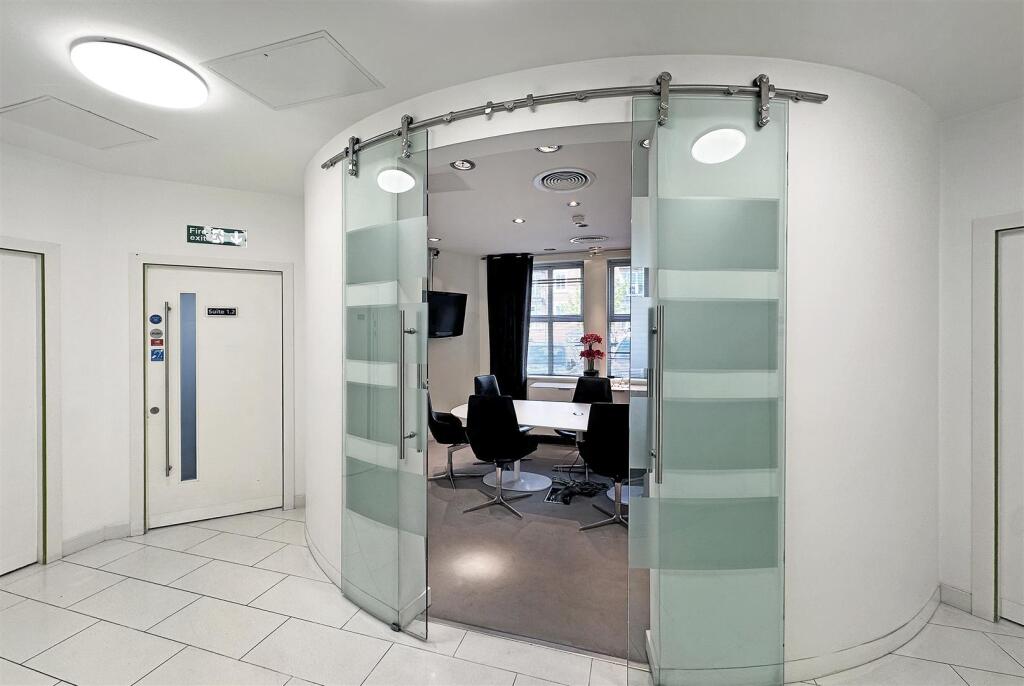
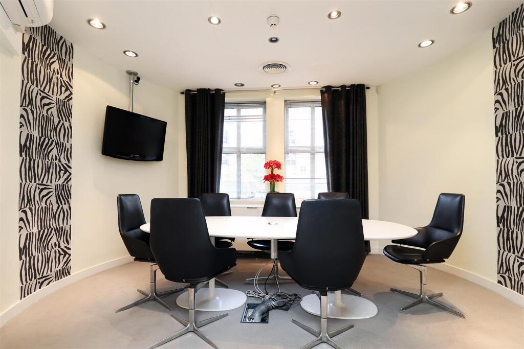
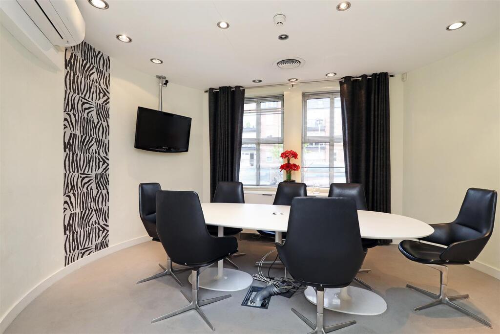
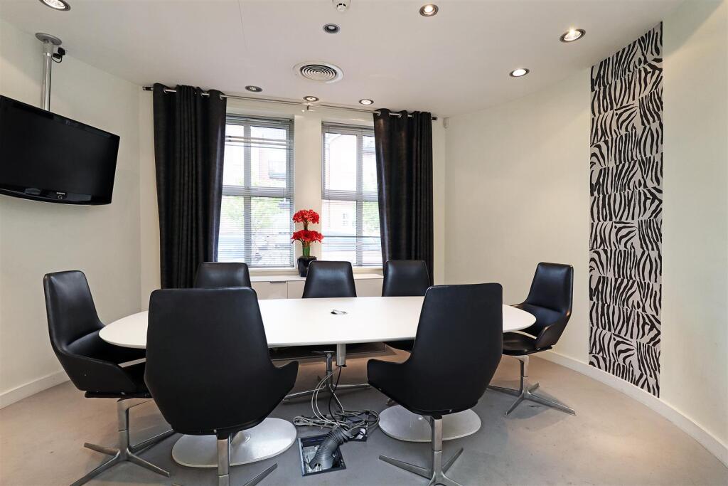
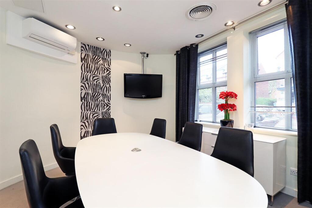
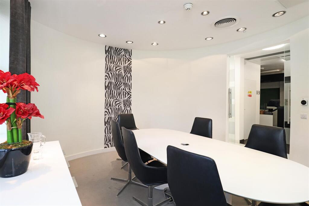
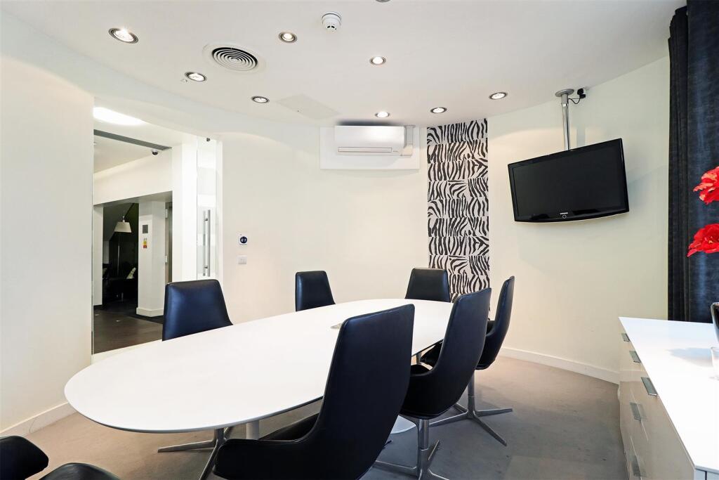
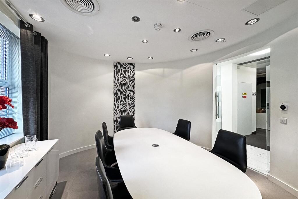
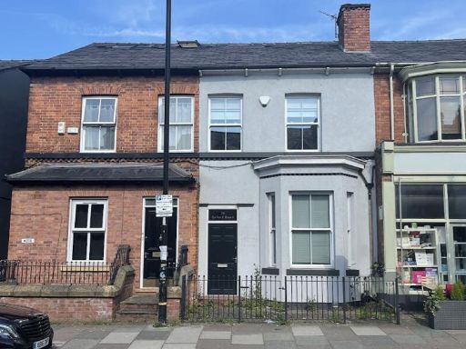
- This property is an immaculately maintained office space located within a charming and substantial brick building, featuring picturesque landscaping in the front with mature trees providing shade and elegance. The exterior creates an inviting entrance with stone-paved pathways leading to a grand archway, reflecting both modern appeal and historical charm. Inside, the office features contemporary meeting rooms with clean lines and ample light, suitable for professional use. The space available is of average size, yet well-structured to accommodate a moderate capacity; perfect for businesses seeking a sophisticated environment in an urban setting.
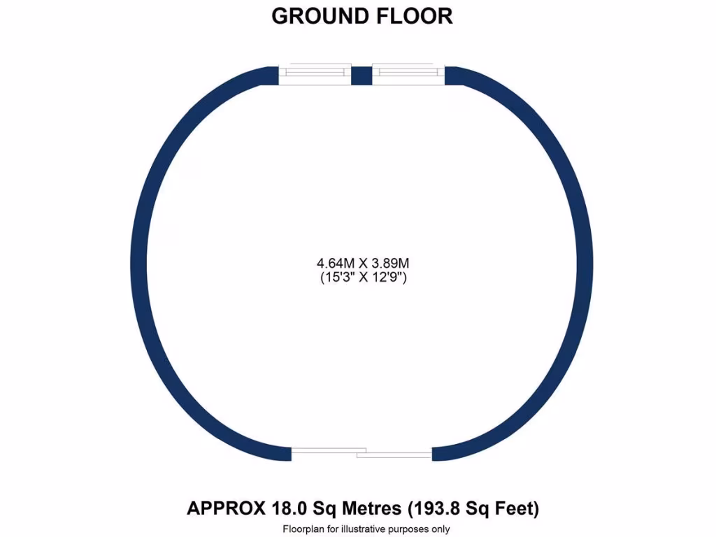
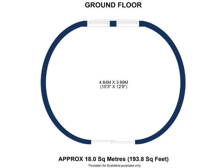
- The property for sale features a ground floor area with an approximate measurement of 18.0 square meters (193.8 square feet). The floorplan suggests a practical layout, suitable for diverse uses such as a living area or office space. The size is compact, ideal for a small apartment or a segment of a larger house. There is no indication of external views from the images provided.
Image Descriptions
- building exterior modern apartment block
- exterior garden view Victorian
Textual Property Features
Detected Visual Features
- modern building
- red brick
- apartment block
- well-maintained
- landscaped garden
- arched entrance
- multiple windows
- residential property
- Victorian
- garden
- mature tree
- exterior
- patio
- landscaping
- historic
- period property
- urban setting
- curb appeal
Nearby Schools
- Bowdon CofE Primary School
- Altrincham Grammar School for Girls
- Bowdon Preparatory School for Girls
- Blessed Thomas Holford Catholic College
- St Vincent's Catholic Primary School
- Cloverlea Primary School
- Oldfield Brow Primary School
- Forest School
- St Hugh's Catholic Primary School
- Heyes Lane Primary School
- Park Road Academy Primary School
- Bollin Primary School
- Altrincham College
- North Cestrian School
- Loreto Grammar School
- Tyntesfield Primary School
- Woodheys Primary School
- Altrincham Grammar School for Boys
- Altrincham Preparatory School
- Hale Preparatory School
- Stamford Park Primary School
- Altrincham CofE (Aided) Primary School
- Wellington School
- Navigation Primary School
- Willows Primary School
- Broadheath Primary School
- St Margaret Ward Catholic Primary School
Nearest Bars And Restaurants
- Id: 60613356
- Tags:
- Amenity: pub
- Created_by: Potlatch alpha
- Name: The Bricklayers Arms
- TagsNormalized:
- Lat: 53.3869786
- Lon: -2.3508128
- FullGeoHash: gcqrdwb1wn4u
- PartitionGeoHash: gcqr
- Images:
- FoodStandards: null
- Distance: 133.4
,- Id: 5258609795
- Tags:
- Addr:
- City: Altrincham
- Street: Shaw's Road
- Amenity: cafe
- Brand: Caffè Nero
- Brand:wikidata: Q675808
- Brand:wikipedia: en:Caffè Nero
- Contact:
- Website: https://caffenero.com/uk/store/altrincham-202/
- Cuisine: coffee_shop
- Name: Caffè Nero
- Takeaway: yes
- TagsNormalized:
- cafe
- caffè nero
- coffee
- takeaway
- Lat: 53.3871883
- Lon: -2.3506817
- FullGeoHash: gcqrdwb6cjhx
- PartitionGeoHash: gcqr
- Images:
- FoodStandards: null
- Distance: 128.6
,- Id: 9393153129
- Tags:
- Amenity: fast_food
- Brand: Subway
- Brand:wikidata: Q244457
- Brand:wikipedia: en:Subway (restaurant)
- Contact:
- Website: https://restaurants.subway.com/united-kingdom/en/altrincham/esso-altrincham-dunham-road
- Cuisine: sandwich
- Name: Subway
- Takeaway: yes
- TagsNormalized:
- fast food
- food
- sandwich
- takeaway
- Lat: 53.3887274
- Lon: -2.3518497
- FullGeoHash: gcqrdrp7vuju
- PartitionGeoHash: gcqr
- Images:
- FoodStandards: null
- Distance: 120.5
,- Id: 5353024548
- Tags:
- Amenity: cafe
- Cuisine: coffee_shop
- Name: Common Ground
- TagsNormalized:
- Lat: 53.3875486
- Lon: -2.3513562
- FullGeoHash: gcqrdqzv12ms
- PartitionGeoHash: gcqr
- Images:
- FoodStandards: null
- Distance: 72.6
,- Id: 5353024547
- Tags:
- Addr:
- City: Altrincham
- Street: Shaw's Road
- Amenity: restaurant
- Cuisine: italian
- Name: Sugo Pasta Kitchen
- TagsNormalized:
- restaurant
- italian
- kitchen
- pasta
- Lat: 53.387591
- Lon: -2.3514836
- FullGeoHash: gcqrdqztq2q9
- PartitionGeoHash: gcqr
- Images:
- FoodStandards: null
- Distance: 63.4
}
Nearest General Shops
- Id: 5353024546
- Tags:
- Name: Blanchflower
- Shop: bakery
- TagsNormalized:
- Lat: 53.3874291
- Lon: -2.3509617
- FullGeoHash: gcqrdwbh6d5g
- PartitionGeoHash: gcqr
- Images:
- FoodStandards: null
- Distance: 101.4
,- Id: 5060389164
- Tags:
- Name: The Wool Shack
- Opening_hours: Tu, We, Fr 09:00-17:00
- Shop: craft
- TagsNormalized:
- Lat: 53.3872166
- Lon: -2.3512675
- FullGeoHash: gcqrdqzg56rz
- PartitionGeoHash: gcqr
- Images:
- FoodStandards: null
- Distance: 93.5
,- Id: 27599130
- Tags:
- Addr:
- Amenity: marketplace
- Building: yes
- Name: Altrincham Market
- Shop: market
- TagsNormalized:
- Lat: 53.3873334
- Lon: -2.3520439
- FullGeoHash: gcqrdqz7c2kb
- PartitionGeoHash: gcqr
- Images:
- FoodStandards: null
- Distance: 47.7
}
Nearest Grocery shops
- Id: 6386542161
- Tags:
- Name: The Corner Shop
- Shop: convenience
- TagsNormalized:
- Lat: 53.3972749
- Lon: -2.3524105
- FullGeoHash: gcqrf2xj8v7x
- PartitionGeoHash: gcqr
- Images:
- FoodStandards: null
- Distance: 1064.8
,- Id: 5035603566
- Tags:
- Addr:
- City: Altrincham
- Street: Railway Street
- Brand: Costcutter
- Brand:wikidata: Q5175072
- Brand:wikipedia: en:Costcutter
- Contact:
- Website: https://store-locator.costcutter.co.uk/costcutter-2edec11afa28
- Name: Costcutter
- Shop: convenience
- TagsNormalized:
- costcutter
- convenience
- shop
- Lat: 53.3852168
- Lon: -2.3516645
- FullGeoHash: gcqrdqrx6jxy
- PartitionGeoHash: gcqr
- Images:
- FoodStandards: null
- Distance: 280.5
,- Id: 1018385316
- Tags:
- Brand: Spar
- Brand:wikidata: Q610492
- Brand:wikipedia: en:SPAR (retailer)
- Building: yes
- Name: Spar
- Shop: convenience
- TagsNormalized:
- Lat: 53.3886903
- Lon: -2.3517266
- FullGeoHash: gcqrdrpe8v1w
- PartitionGeoHash: gcqr
- Images:
- FoodStandards: null
- Distance: 119.5
}
Nearest Supermarkets
- Id: 166726459
- Tags:
- Branch: Altrincham
- Brand: Sainsbury's
- Brand:wikidata: Q152096
- Brand:wikipedia: en:Sainsbury's
- Building: yes
- Name: Sainsbury's
- Shop: supermarket
- TagsNormalized:
- sainsburys
- supermarket
- shop
- Lat: 53.3838647
- Lon: -2.3508813
- FullGeoHash: gcqrdw0ps3xu
- PartitionGeoHash: gcqr
- Images:
- FoodStandards: null
- Distance: 438.4
,- Id: 27283250
- Tags:
- Brand: Tesco Extra
- Brand:wikidata: Q25172225
- Brand:wikipedia: en:Tesco Extra
- Building: yes
- Contact:
- Website: https://www.tesco.com/store-locator/altrincham/manor-road
- Landuse: retail
- Layer: 1
- Name: Tesco Extra
- Shop: supermarket
- TagsNormalized:
- tesco
- tesco extra
- retail
- supermarket
- shop
- Lat: 53.3853225
- Lon: -2.347561
- FullGeoHash: gcqrdwd81c7t
- PartitionGeoHash: gcqr
- Images:
- FoodStandards: null
- Distance: 416.8
,- Id: 5109545136
- Tags:
- Addr:
- Brand: Marks & Spencer
- Brand:wikidata: Q714491
- Brand:wikipedia: en:Marks & Spencer
- Contact:
- Website: https://www.marksandspencer.com/stores/altrincham-3036
- Name: Marks & Spencer
- Shop: supermarket
- TagsNormalized:
- marks & spencer
- supermarket
- shop
- Lat: 53.3873994
- Lon: -2.3504033
- FullGeoHash: gcqrdwbkpss6
- PartitionGeoHash: gcqr
- Images:
- FoodStandards: null
- Distance: 137.9
}
Nearest Religious buildings
- Id: 882371678
- Tags:
- Amenity: place_of_worship
- Building: church
- Denomination: anglican
- Name: Saint George's Church
- Religion: christian
- Wikidata: Q7593124
- Wikipedia: en:St George's Church, Altrincham
- TagsNormalized:
- place of worship
- church
- anglican
- christian
- Lat: 53.3900748
- Lon: -2.3511579
- FullGeoHash: gcqrdrrgwp39
- PartitionGeoHash: gcqr
- Images:
- FoodStandards: null
- Distance: 277.2
,- Id: 1018386363
- Tags:
- Amenity: place_of_worship
- Building: yes
- Religion: christian
- TagsNormalized:
- place of worship
- christian
- church
- Lat: 53.3886161
- Lon: -2.3527402
- FullGeoHash: gcqrdrng1pmu
- PartitionGeoHash: gcqr
- Images:
- FoodStandards: null
- Distance: 104.2
,- Id: 60610927
- Tags:
- Amenity: place_of_worship
- Created_by: Potlatch alpha
- Name: Dunham Road Unitary Chapel
- Religion: christian
- TagsNormalized:
- place of worship
- chapel
- christian
- church
- Lat: 53.3885604
- Lon: -2.3527869
- FullGeoHash: gcqrdrnfbhfz
- PartitionGeoHash: gcqr
- Images:
- FoodStandards: null
- Distance: 98.8
}
Nearest Medical buildings
- Id: 3883558410
- Tags:
- Addr:
- Postcode: WA14 2RQ
- Street: Railway Street
- Amenity: hospital
- Emergency: no
- Healthcare: hospital
- Name: Altrincham Hospital
- Operator: Manchester University NHS Foundation Trust
- Phone: +44 161 413 7700
- Website: https://mft.nhs.uk/altrincham/
- Wikidata: Q85741065
- TagsNormalized:
- Lat: 53.38496
- Lon: -2.3514937
- FullGeoHash: gcqrdqrtyjz4
- PartitionGeoHash: gcqr
- Images:
- FoodStandards: null
- Distance: 310.7
,- Id: 521998351
- Tags:
- Amenity: doctors
- Healthcare: doctor
- Name: Altrincham Medical Practice
- TagsNormalized:
- doctor
- doctors
- health
- healthcare
- Lat: 53.3861898
- Lon: -2.3536484
- FullGeoHash: gcqrdqwjh50d
- PartitionGeoHash: gcqr
- Images:
- FoodStandards: null
- Distance: 186.5
,- Id: 305288220
- Tags:
- Amenity: pharmacy
- Brand: Boots
- Brand:wikidata: Q6123139
- Brand:wikipedia: en:Boots (company)
- Healthcare: pharmacy
- Name: Boots
- TagsNormalized:
- pharmacy
- boots
- health
- healthcare
- Lat: 53.3878965
- Lon: -2.3497112
- FullGeoHash: gcqrdwbzpc0r
- PartitionGeoHash: gcqr
- Images:
- FoodStandards: null
- Distance: 181.1
,- Id: 305288642
- Tags:
- Amenity: pharmacy
- Brand: Rowlands Pharmacy
- Brand:wikidata: Q62663235
- Healthcare: pharmacy
- Name: Rowlands Pharmacy
- TagsNormalized:
- pharmacy
- rowlands pharmacy
- health
- healthcare
- Lat: 53.3863165
- Lon: -2.3534882
- FullGeoHash: gcqrdqwjzf8n
- PartitionGeoHash: gcqr
- Images:
- FoodStandards: null
- Distance: 169.2
}
Nearest Airports
- Id: 1224469
- Tags:
- Addr:
- City: Manchester
- Country: GB
- Postcode: M90 1QX
- Aerodrome: international
- Aeroway: aerodrome
- Arp: yes
- Atis: 128.175
- Iata: MAN
- Icao: EGCC
- Name: Manchester Airport
- Note: rough sketched outline referring to Yahoo imagery - true boundary is where?
- Old_name: Ringway
- Operator: Manchester Airport PLC
- Size: 18720000
- Source:
- Tower_frequency: 118.625,119.400
- Type: multipolygon
- Website: https://www.manchesterairport.co.uk/
- Wikidata: Q8694
- Wikipedia: en:Manchester Airport
- TagsNormalized:
- airport
- international airport
- Lat: 53.3503197
- Lon: -2.2798822
- FullGeoHash: gcqrs05u4ukt
- PartitionGeoHash: gcqr
- Images:
- FoodStandards: null
- Distance: 6359
}
Nearest Leisure Facilities
- Id: 1017329172
- Tags:
- TagsNormalized:
- Lat: 53.3899616
- Lon: -2.3507983
- FullGeoHash: gcqrdx25n6jw
- PartitionGeoHash: gcqr
- Images:
- FoodStandards: null
- Distance: 273.7
,- Id: 5035608234
- Tags:
- Addr:
- City: Altrincham
- Street: Stamford New Road
- Leisure: fitness_centre
- Name: Yogalife
- Sport: yoga
- TagsNormalized:
- fitness
- fitness centre
- leisure
- yoga
- sports
- Lat: 53.3854965
- Lon: -2.3510568
- FullGeoHash: gcqrdw8103ug
- PartitionGeoHash: gcqr
- Images:
- FoodStandards: null
- Distance: 261.1
,- Id: 1023748686
- Tags:
- Leisure: pitch
- Sport: tennis
- Surface: paved
- TagsNormalized:
- Lat: 53.3898909
- Lon: -2.3534458
- FullGeoHash: gcqrdrq68tp8
- PartitionGeoHash: gcqr
- Images:
- FoodStandards: null
- Distance: 253
,- Id: 1023542573
- Tags:
- TagsNormalized:
- Lat: 53.3890579
- Lon: -2.355366
- FullGeoHash: gcqrdrhvgcxz
- PartitionGeoHash: gcqr
- Images:
- FoodStandards: null
- Distance: 246.9
,- Id: 1023718574
- Tags:
- Access: private
- Leisure: playground
- TagsNormalized:
- Lat: 53.3887724
- Lon: -2.3551569
- FullGeoHash: gcqrdrjh0ue8
- PartitionGeoHash: gcqr
- Images:
- FoodStandards: null
- Distance: 217.1
}
Nearest Tourist attractions
- Id: 7376654568
- Tags:
- Group_only: yes
- Name: Into the Wild Bushcraft
- Tourism: camp_site
- TagsNormalized:
- Lat: 53.3641395
- Lon: -2.358231
- FullGeoHash: gcqrd6du9hxe
- PartitionGeoHash: gcqr
- Images:
- FoodStandards: null
- Distance: 2647.9
,- Id: 5284195331
- Tags:
- Name: Cornbrooke Gue
- Name:en: Cornbrooke Gue
- Tourism: guest_house
- TagsNormalized:
- Lat: 53.393364
- Lon: -2.3525079
- FullGeoHash: gcqrdryyys6y
- PartitionGeoHash: gcqr
- Images:
- FoodStandards: null
- Distance: 630
,- Id: 5035608614
- Tags:
- Addr:
- City: Altrincham
- Street: Stamford New Road
- Artwork_type: contemporary
- Name: The Contemporary
- Tourism: gallery
- TagsNormalized:
- Lat: 53.3857996
- Lon: -2.3509563
- FullGeoHash: gcqrdw84fdrg
- PartitionGeoHash: gcqr
- Images:
- FoodStandards: null
- Distance: 232.5
}
Nearest Train stations
- Id: 6661444856
- Tags:
- Addr:
- Name: Manchester Airport
- Naptan:
- Network: National Rail
- Operator: First TransPennine Express
- Public_transport: station
- Railway: station
- Ref:
- Train: yes
- Wheelchair: yes
- Wikidata: Q2453867
- Wikipedia: en:Manchester Airport station
- TagsNormalized:
- Lat: 53.365183
- Lon: -2.2720385
- FullGeoHash: gcqrs6cd9xjk
- PartitionGeoHash: gcqr
- Images:
- FoodStandards: null
- Distance: 5890.7
,- Id: 4338622515
- Tags:
- Name: Ashley
- Naptan:
- Network: National Rail
- Public_transport: station
- Railway: station
- Ref:
- Wikipedia: en:Ashley railway station
- TagsNormalized:
- Lat: 53.3557218
- Lon: -2.341439
- FullGeoHash: gcqrd9p58e2w
- PartitionGeoHash: gcqr
- Images:
- FoodStandards: null
- Distance: 3629.6
,- Id: 292004869
- Tags:
- Name: Navigation Road
- Naptan:
- Network: National Rail
- Public_transport: station
- Railway: station
- Ref:
- Wikipedia: en:Navigation Road station
- TagsNormalized:
- Lat: 53.3957446
- Lon: -2.3432686
- FullGeoHash: gcqrf8msvbhr
- PartitionGeoHash: gcqr
- Images:
- FoodStandards: null
- Distance: 1081.1
,- Id: 6334988574
- Tags:
- Name: Hale
- Naptan:
- Network: National Rail
- Operator: Northern Rail
- Public_transport: station
- Railway: station
- Ref:
- Wheelchair: yes
- Wikipedia: en:Hale railway station
- TagsNormalized:
- Lat: 53.3785218
- Lon: -2.3474975
- FullGeoHash: gcqrdt687mdv
- PartitionGeoHash: gcqr
- Images:
- FoodStandards: null
- Distance: 1071.4
,- Id: 6334988573
- Tags:
- Name: Altrincham
- Naptan:
- Network: National Rail
- Old_name: Altrincham and Bowdon
- Public_transport: station
- Railway: station
- Ref:
- Wikidata: Q1921455
- Wikipedia: en:Altrincham Interchange
- TagsNormalized:
- Lat: 53.3876561
- Lon: -2.3470824
- FullGeoHash: gcqrdwfvth2t
- PartitionGeoHash: gcqr
- Images:
- FoodStandards: null
- Distance: 354.1
}
Nearest Hotels
- Id: 1017366195
- Tags:
- Brand: Best Western
- Brand:wikidata: Q830334
- Brand:wikipedia: en:Best Western
- Building: yes
- Name: Best Western
- Tourism: hotel
- TagsNormalized:
- Lat: 53.3909606
- Lon: -2.3498081
- FullGeoHash: gcqrdx8bvs2j
- PartitionGeoHash: gcqr
- Images:
- FoodStandards: null
- Distance: 402
,- Id: 3375851467
- Tags:
- TagsNormalized:
- Lat: 53.3909162
- Lon: -2.3498581
- FullGeoHash: gcqrdx8bsk4u
- PartitionGeoHash: gcqr
- Images:
- FoodStandards: null
- Distance: 396.1
,- Id: 2089219202
- Tags:
- Brand: Travelodge
- Brand:wikidata: Q9361374
- Brand:wikipedia: en:Travelodge UK
- Internet_access: wlan
- Internet_access:fee: customers
- Internet_access:ssid: Travelodge WiFi
- Name: Travelodge Altrincham Central
- Tourism: hotel
- TagsNormalized:
- Lat: 53.3857904
- Lon: -2.3513597
- FullGeoHash: gcqrdqxfc2eh
- PartitionGeoHash: gcqr
- Images:
- FoodStandards: null
- Distance: 223.6
}
Tags
- modern building
- red brick
- apartment block
- well-maintained
- landscaped garden
- arched entrance
- multiple windows
- residential property
- Victorian
- garden
- mature tree
- exterior
- patio
- landscaping
- historic
- period property
- urban setting
- curb appeal
Local Market Stats
- Average Price/sqft: £386
- Avg Income: £53500
- Rental Yield: 3.8%
- Social Housing: 15%
- Planning Success Rate: 87%
AirBnB Data
- 1km average: £161/night
- Listings in 1km: 6
Similar Properties
 Office for sale in 39 Oxford Road, Altrincham, WA14 2ED, WA14 — £550,000 • 1 bed • 1 bath • 1861 ft²
 Office for sale in Barrington Road, Altrincham, WA14 — £1,250,000 • 1 bed • 1 bath • 4931 ft²
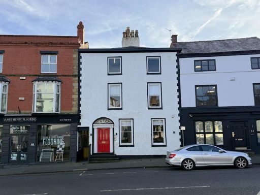 Office for sale in 16 Old Market Place, Altrincham, WA14 4DF, WA14 — £425,000 • 1 bed • 1 bath • 1409 ft²
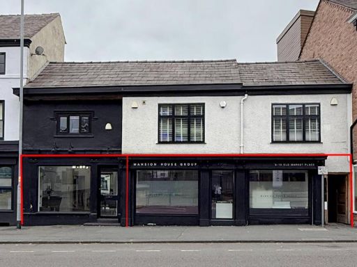 Commercial property for sale in 8-12 Old Market Place, Altrincham, WA14 4DF, WA14 — £485,000 • 1 bed • 1 bath • 1761 ft²
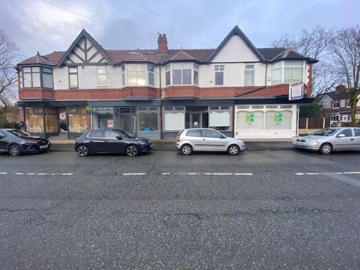 Office for sale in Marsland Road, Sale, Greater Manchester, M33 — £365,000 • 1 bed • 1 bath • 956 ft²
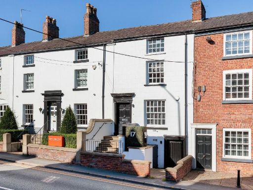 Office for sale in 17 Manchester Road, Wilmslow, Cheshire, SK9 — £675,000 • 1 bed • 1 bath • 1994 ft²
Meta
- {
"@context": "https://schema.org",
"@type": "Residence",
"name": "Office for sale in Altrincham, WA14",
"description": "",
"url": "https://propertypiper.co.uk/property/f5c70600-07f7-4635-a6d1-fb5d01b70d2c",
"image": "https://image-a.propertypiper.co.uk/a0c8b347-ee80-4412-996c-3f1eade88432-1024.jpeg",
"address": {
"@type": "PostalAddress",
"streetAddress": "MYBURO, 20, MARKET STREET",
"postalCode": "WA14 1PF",
"addressLocality": "Trafford",
"addressRegion": "Altrincham and Sale West",
"addressCountry": "England"
},
"geo": {
"@type": "GeoCoordinates",
"latitude": 53.38769873363118,
"longitude": -2.3524217092575213
},
"numberOfRooms": 1,
"numberOfBathroomsTotal": 1,
"floorSize": {
"@type": "QuantitativeValue",
"value": 389,
"unitCode": "FTK"
},
"offers": {
"@type": "Offer",
"price": 85000,
"priceCurrency": "GBP",
"availability": "https://schema.org/InStock"
},
"additionalProperty": [
{
"@type": "PropertyValue",
"name": "Feature",
"value": "modern building"
},
{
"@type": "PropertyValue",
"name": "Feature",
"value": "red brick"
},
{
"@type": "PropertyValue",
"name": "Feature",
"value": "apartment block"
},
{
"@type": "PropertyValue",
"name": "Feature",
"value": "well-maintained"
},
{
"@type": "PropertyValue",
"name": "Feature",
"value": "landscaped garden"
},
{
"@type": "PropertyValue",
"name": "Feature",
"value": "arched entrance"
},
{
"@type": "PropertyValue",
"name": "Feature",
"value": "multiple windows"
},
{
"@type": "PropertyValue",
"name": "Feature",
"value": "residential property"
},
{
"@type": "PropertyValue",
"name": "Feature",
"value": "Victorian"
},
{
"@type": "PropertyValue",
"name": "Feature",
"value": "garden"
},
{
"@type": "PropertyValue",
"name": "Feature",
"value": "mature tree"
},
{
"@type": "PropertyValue",
"name": "Feature",
"value": "exterior"
},
{
"@type": "PropertyValue",
"name": "Feature",
"value": "patio"
},
{
"@type": "PropertyValue",
"name": "Feature",
"value": "landscaping"
},
{
"@type": "PropertyValue",
"name": "Feature",
"value": "historic"
},
{
"@type": "PropertyValue",
"name": "Feature",
"value": "period property"
},
{
"@type": "PropertyValue",
"name": "Feature",
"value": "urban setting"
},
{
"@type": "PropertyValue",
"name": "Feature",
"value": "curb appeal"
}
]
}
High Res Floorplan Images
Compatible Floorplan Images
FloorplanImages Thumbnail