S42 5TB - 4 bedroom detached house for sale in Tibshelf Road, Holmewo…
View on Property Piper
4 bedroom detached house for sale in Tibshelf Road,
Holmewood,
Chesterfield,
S42 5TB, S42
Property Details
- Price: £350000
- Bedrooms: 4
- Bathrooms: 1
- Property Type: undefined
- Property SubType: undefined
Brochure Descriptions
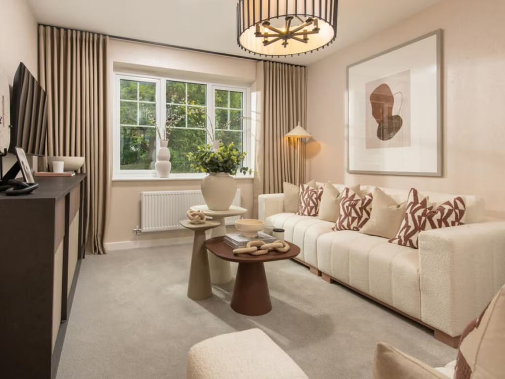
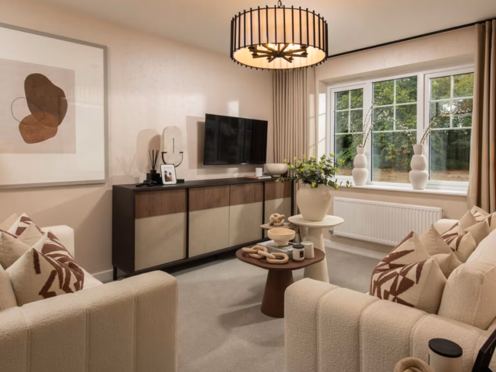
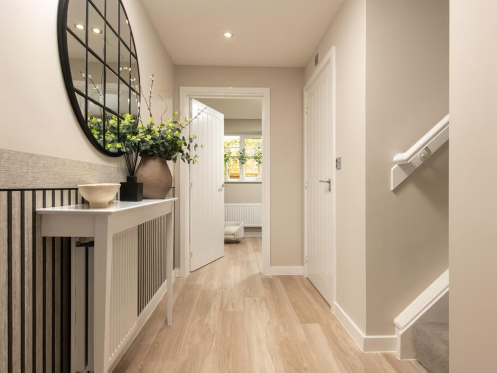
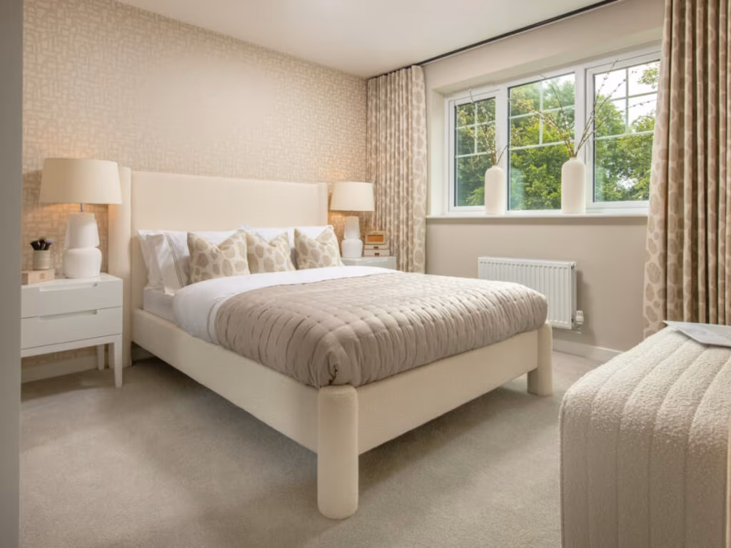
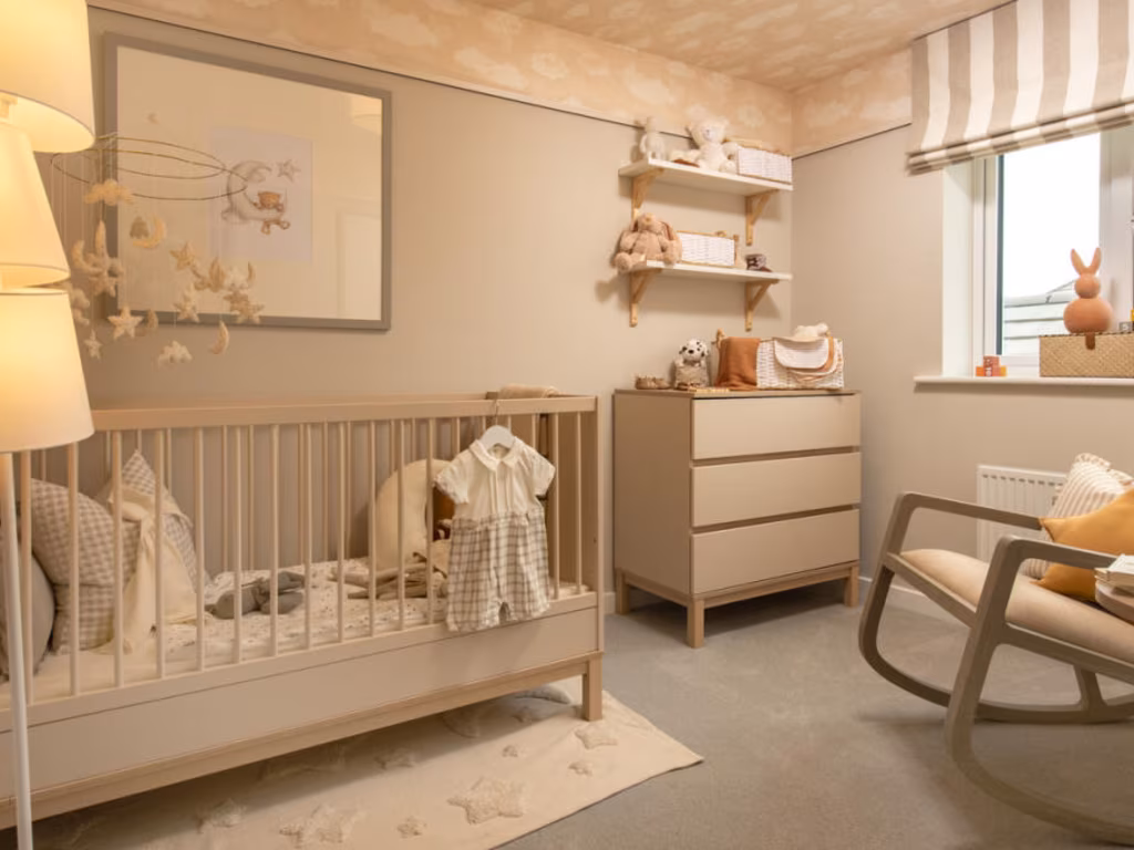
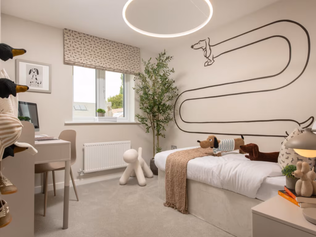
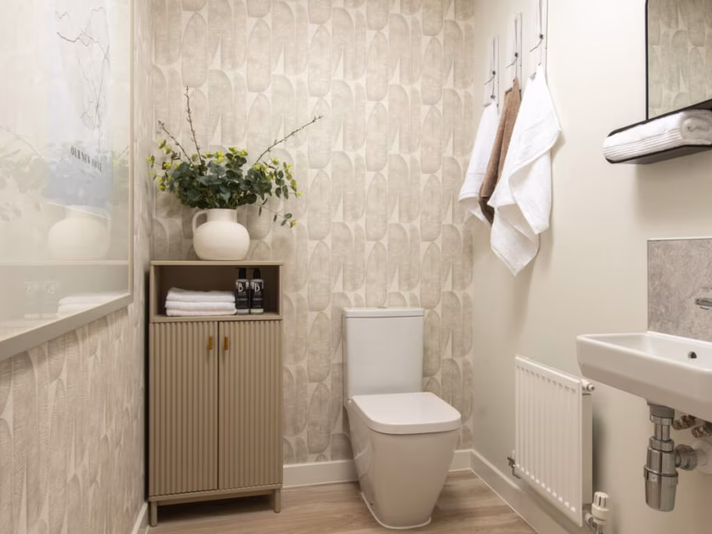
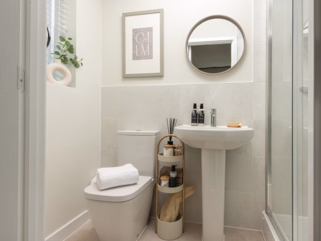
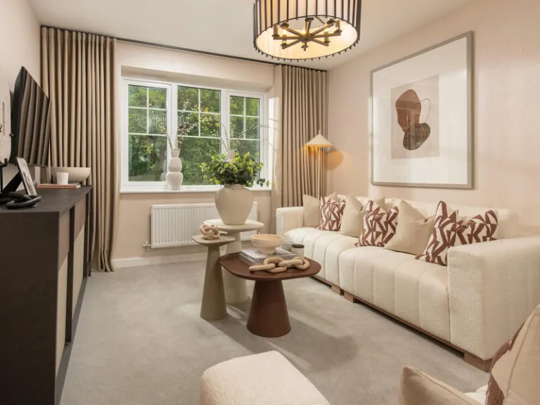
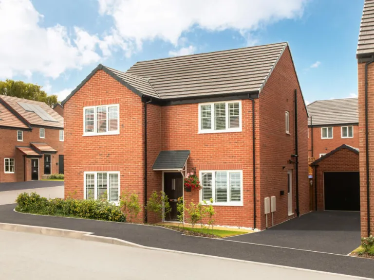
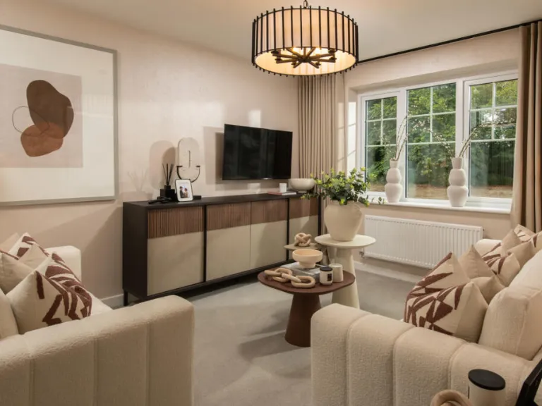
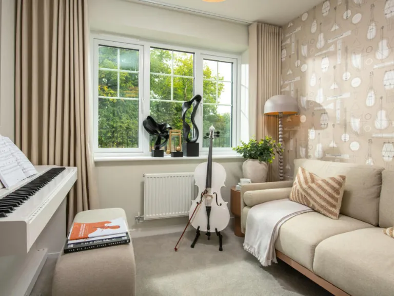
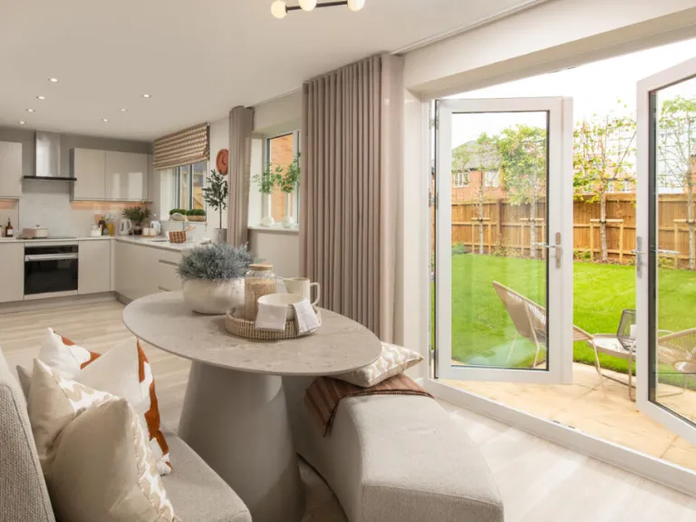
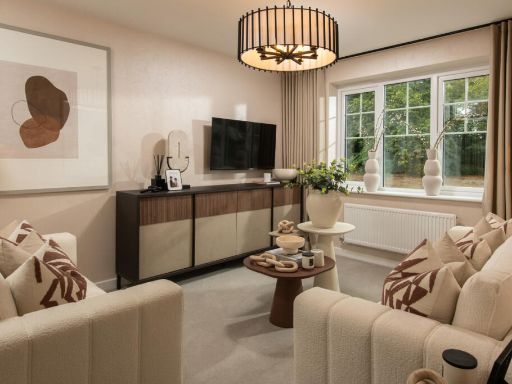
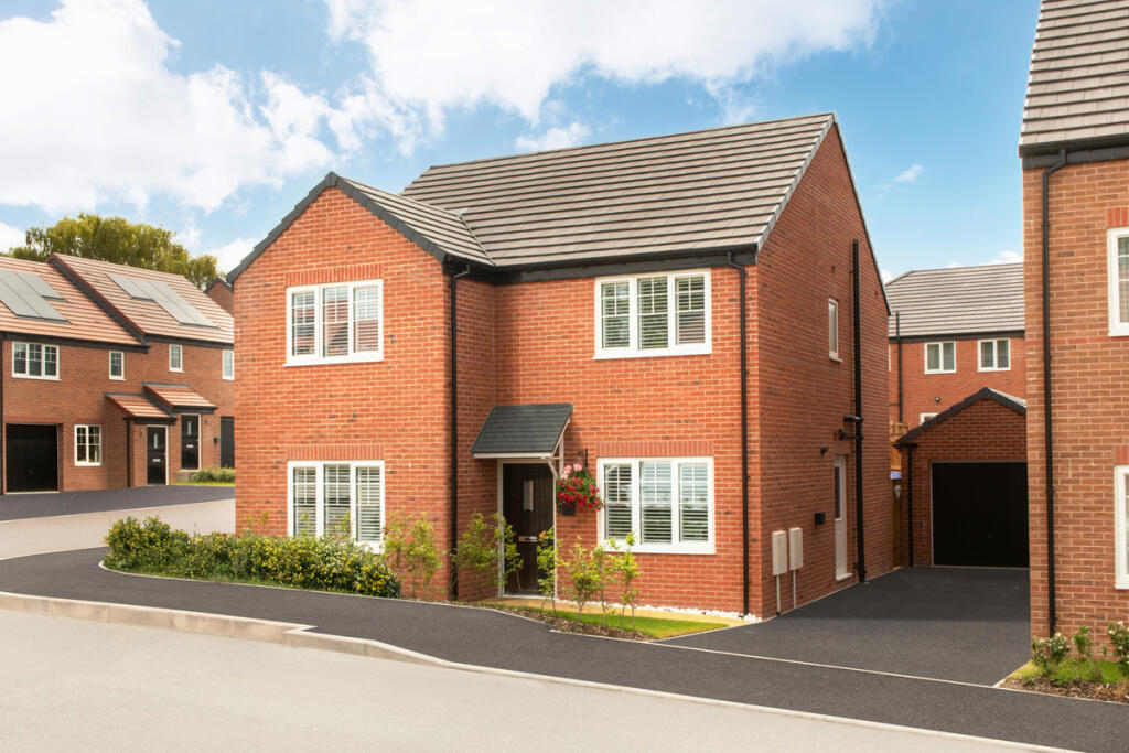
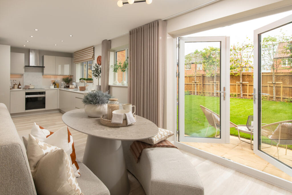
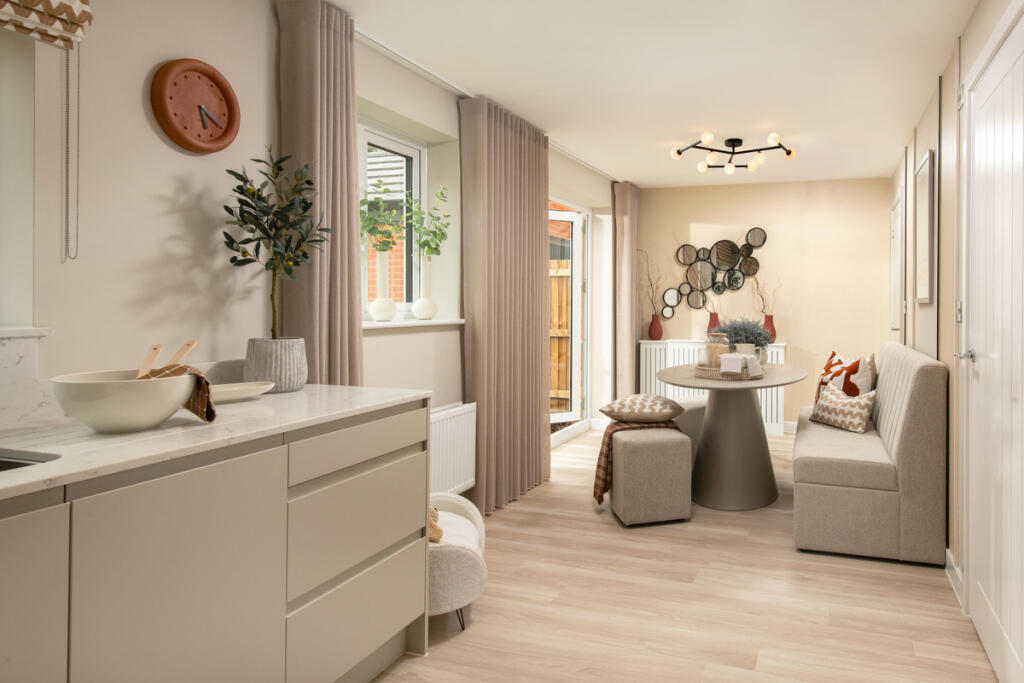
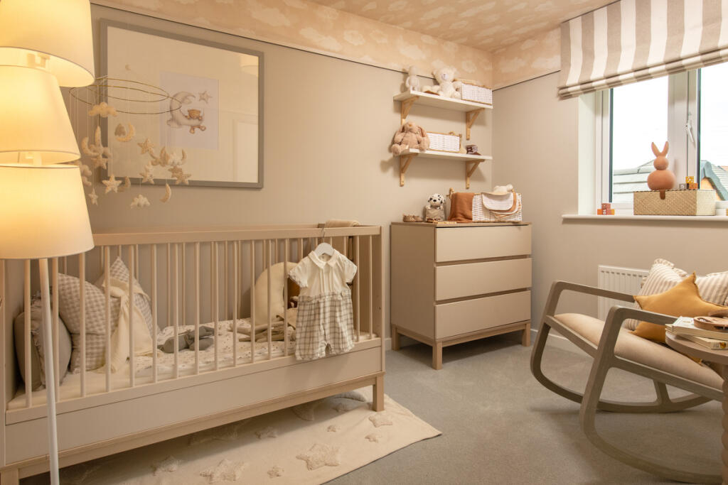
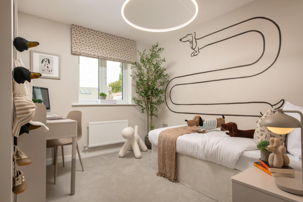
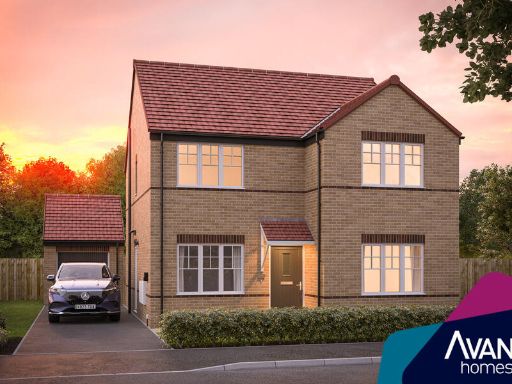
- New-build detached/semidetached two-storey homes within a planned residential development. Properties appear to be modern brick construction with pitched tiled roofs and white-framed windows. The site includes front gardens with low hedging, paved driveways and tarmac access roads. Overall plot sizes appear to be average for suburban family housing; individual gardens are not fully visible but likely to be modest to medium in size. The development presents a consistent, contemporary aesthetic suited to first-time buyers or growing families, with good kerb appeal, off-street parking and likely 3–4 bedroom layouts based on house proportions. No exceptional vistas or natural features are visible from the image.
- New-build residential development (Earl's Park) by Avant Homes located on Hillfield Road, Chesterfield. From the listing artwork this is a planned estate of newly built homes rather than a single historic property. Typical characteristics expected: modern construction to developer specification, energy-efficient fittings, and a mix of house types (likely 2–4 bedroom homes). Overall plot sizes are likely to be average for suburban new developments with modest private rear gardens; communal landscaping and estate roads are probable. Suited to first-time buyers, families and investors seeking new-build warranties and low-maintenance exteriors. No interior photographs provided on this image to assess room sizes or exact square footage.
Image Descriptions
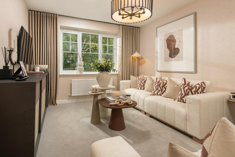
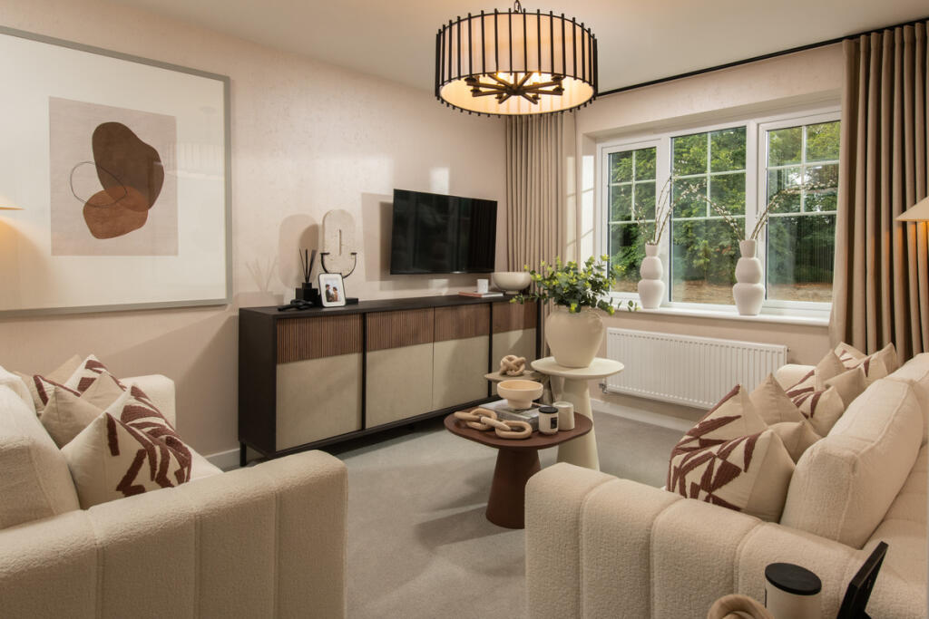
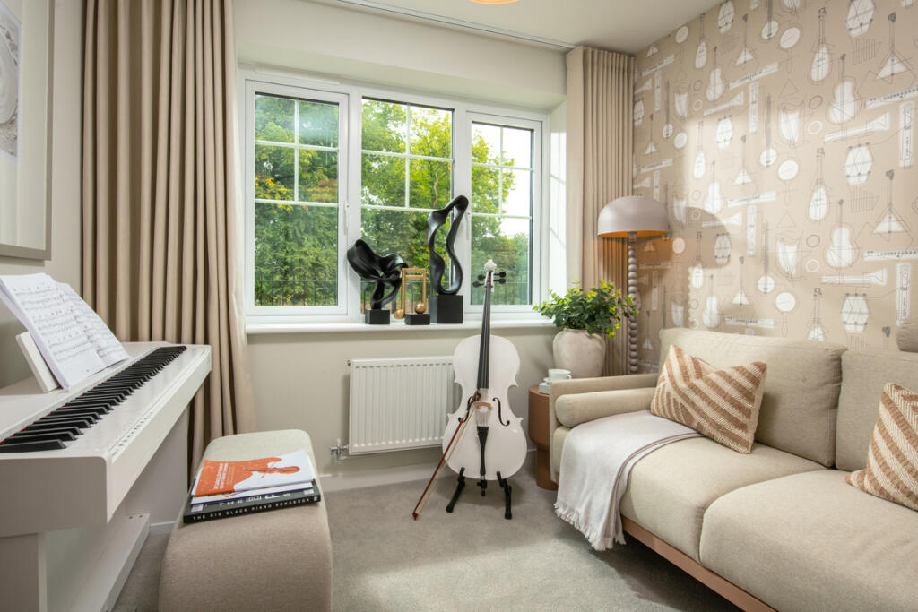
- living room contemporary
- house modern
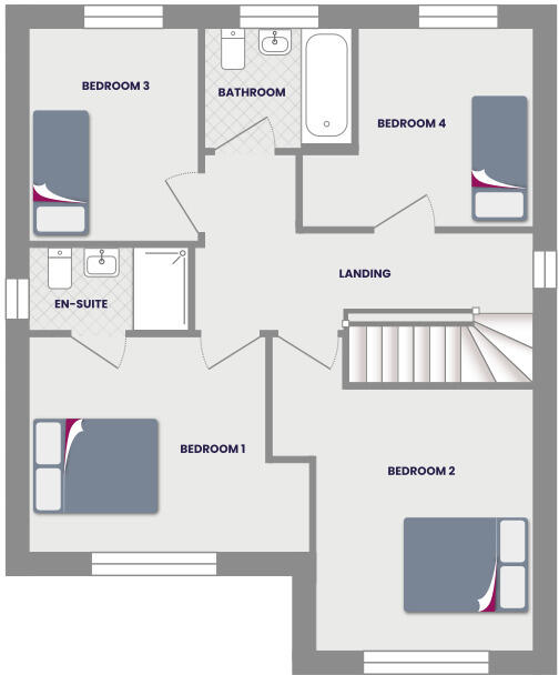
Rooms
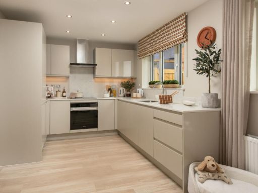
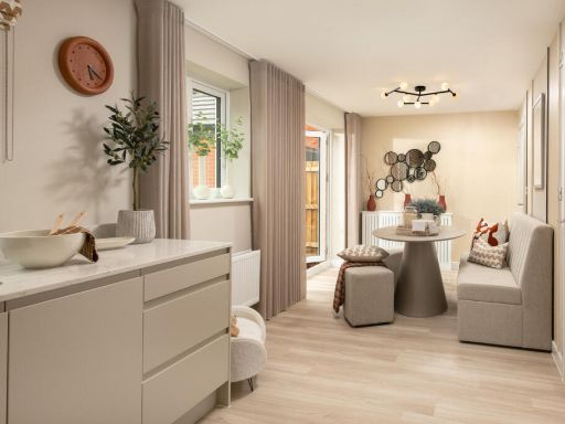
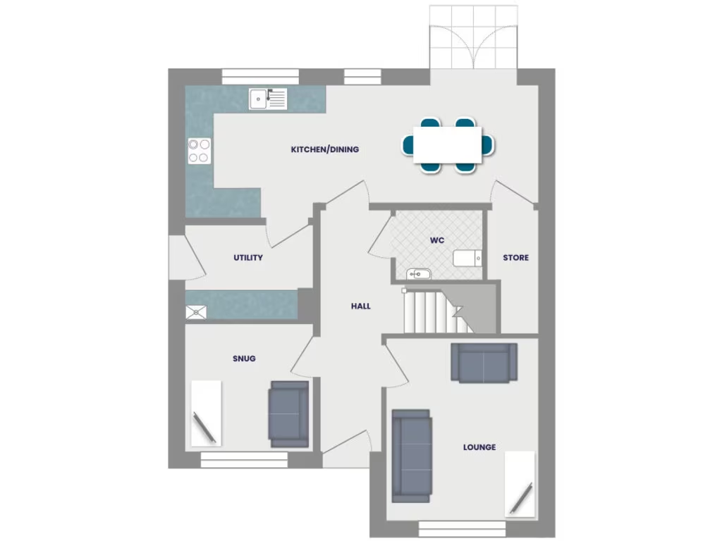
- KITCHEN/DINING:
- UTILITY:
- SNUG:
- HALL:
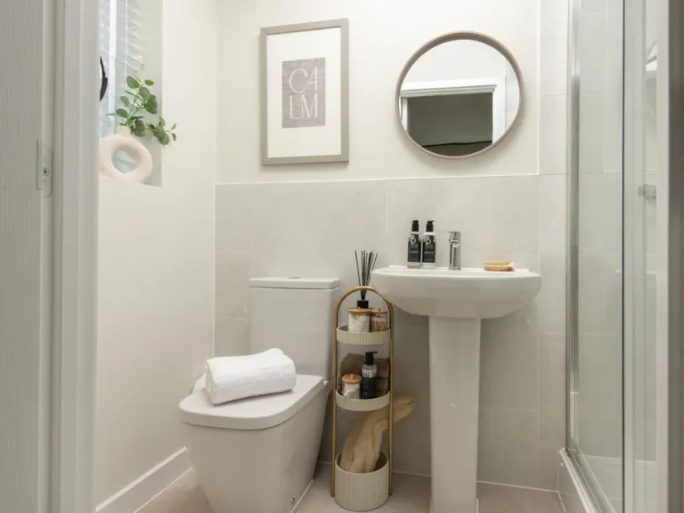
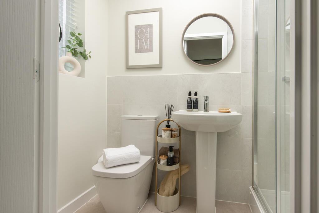
- WC:
- STORE:
- LOUNGE:
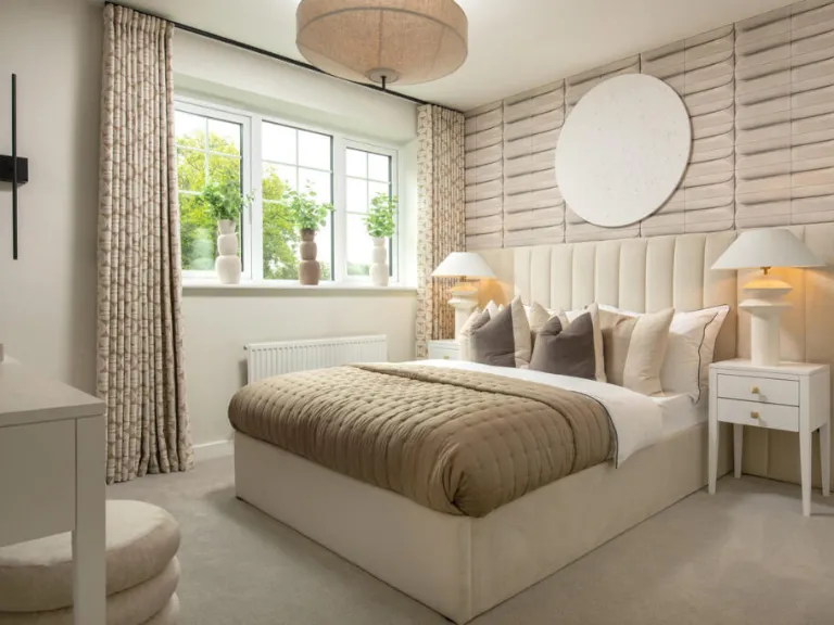
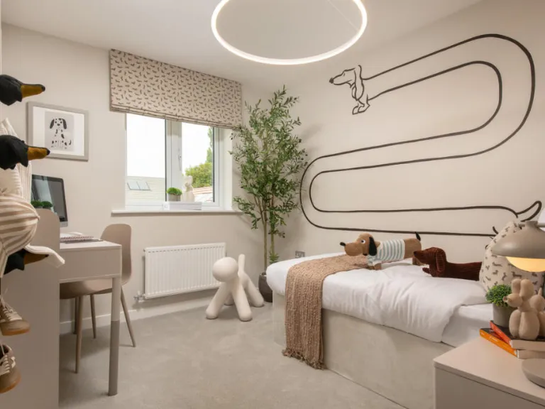
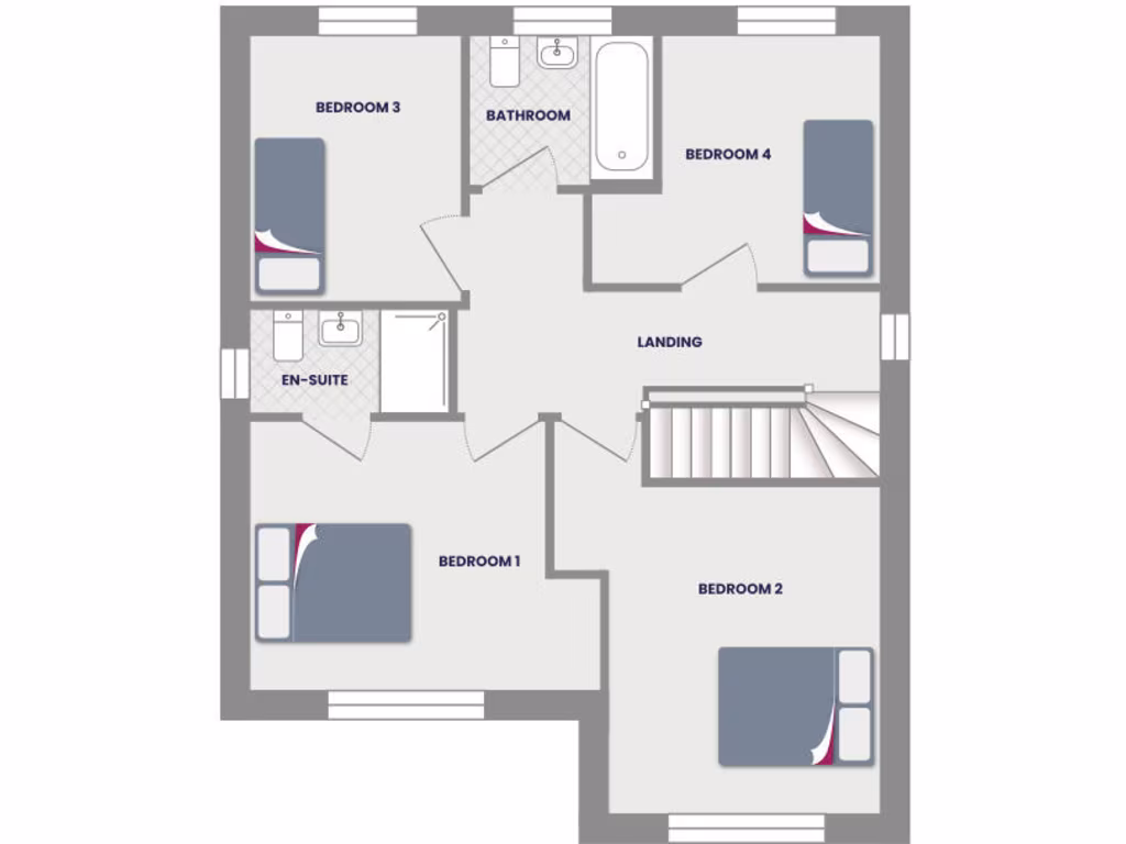
- BEDROOM 3:
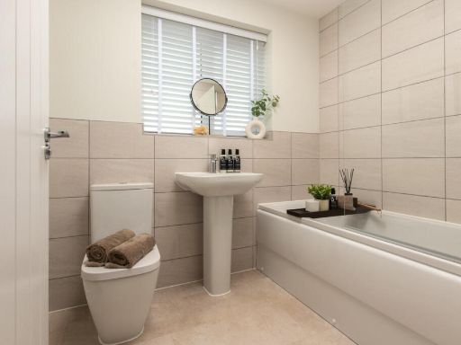
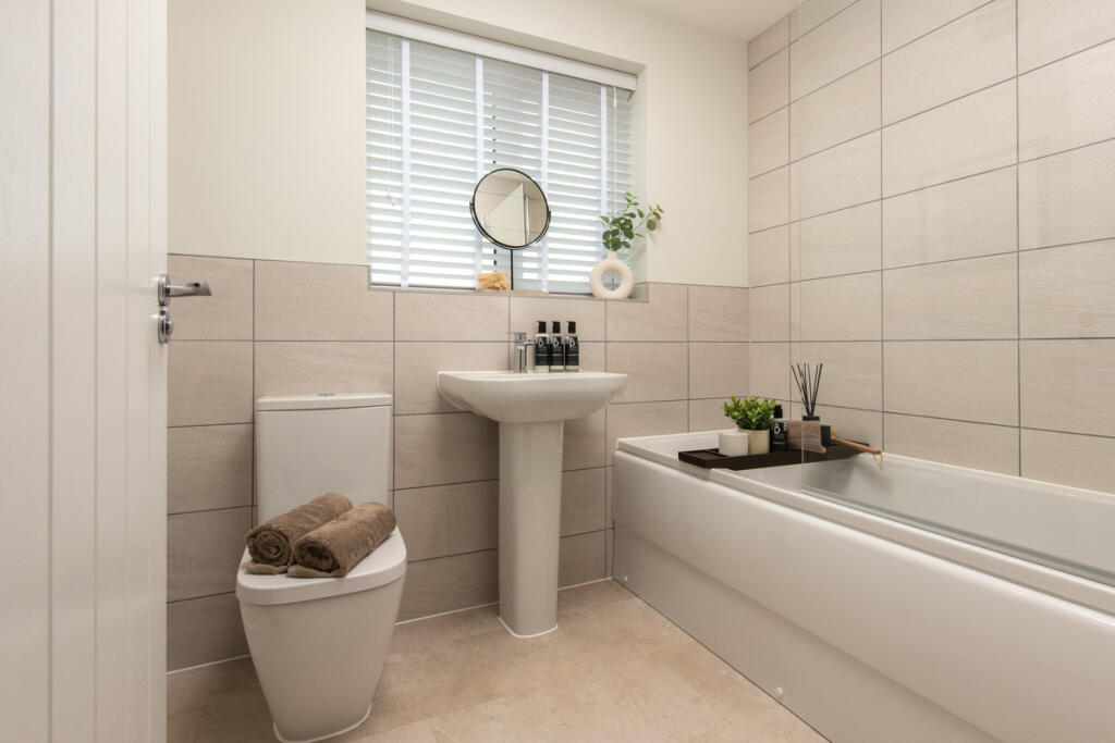
- BATHROOM:
- BEDROOM 4:
- EN-SUITE:
- LANDING:
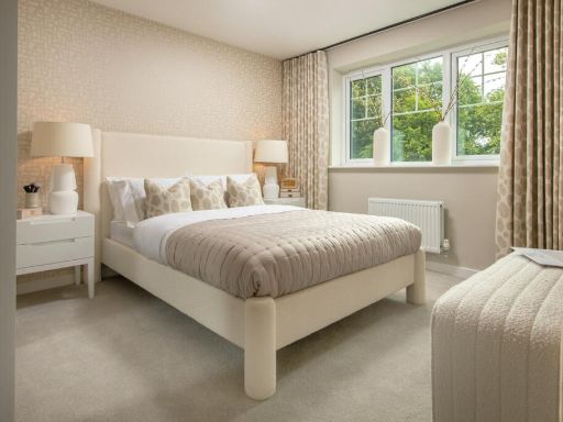
- BEDROOM 1:
- BEDROOM 2:
Textual Property Features
Detected Visual Features
- contemporary living room
- large window
- natural light
- central heating
- soft colors
- modern light fixture
- curtains
- detached
- modern
- brick
- double-storey
- newly-built
- residential
- suburban
- well-maintained
Nearby Schools
- Newton Primary School
- Morton Primary Academy
- Pilsley Primary School
- Hunloke Park Primary School
- Calow CofE VC Primary School
- Duckmanton Primary School
- Westhouses Primary School
- Park House Primary School
- St Peter and St Paul School
- Arkwright Primary School
- Blackwell Community Primary and Nursery School
- Stonebroom Primary and Nursery School
- Town End Junior School
- Tibshelf Community School
- Tibshelf Infant School
- Sharley Park Community Primary School
- Tupton Hall School
- North Wingfield Primary and Nursery Academy
- Bramley Vale Primary School
- Tupton Primary and Nursery Academy
- Heath Primary School
- Grassmoor Primary School
- Temple Normanton Junior Academy
- Hasland Junior School
- Outwood Academy Hasland Hall
- Hasland Infant School
- Brimington Manor Infant and Nursery School
Nearest Bars And Restaurants
- Id: 263736812
- Tags:
- Addr:
- Amenity: fast_food
- Building: yes
- Cuisine: chinese
- Name: Greenland
- TagsNormalized:
- Lat: 53.1885895
- Lon: -1.3537562
- FullGeoHash: gcrn94wjzpwp
- PartitionGeoHash: gcrn
- Images:
- FoodStandards: null
- Distance: 596
,- Id: 246964227
- Tags:
- Amenity: fast_food
- Building: yes
- Cuisine: pizza
- Name: Pizzarella
- TagsNormalized:
- Lat: 53.1884091
- Lon: -1.3542634
- FullGeoHash: gcrn94tugqh4
- PartitionGeoHash: gcrn
- Images:
- FoodStandards: null
- Distance: 557
,- Id: 243531104
- Tags:
- Addr:
- Amenity: restaurant
- Building: yes
- Cuisine: indian
- Name: Anaarkali
- Takeaway: yes
- TagsNormalized:
- Lat: 53.1882914
- Lon: -1.3546875
- FullGeoHash: gcrn94ts32pu
- PartitionGeoHash: gcrn
- Images:
- FoodStandards: null
- Distance: 526.7
,- Id: 243532088
- Tags:
- Addr:
- Amenity: fast_food
- Building: yes
- Cuisine: kebab;fish_and_chips
- Name: Star Kebab House
- Note: rebranded but looks the same inside (i.e. still a chippy)
- TagsNormalized:
- Lat: 53.187647
- Lon: -1.3576672
- FullGeoHash: gcrn94e2s01b
- PartitionGeoHash: gcrn
- Images:
- FoodStandards: null
- Distance: 333.6
,- Id: 243532451
- Tags:
- Amenity: fast_food
- Building: yes
- Cuisine: sandwich
- Name: It's a Cob
- TagsNormalized:
- Lat: 53.1874477
- Lon: -1.3578964
- FullGeoHash: gcrn947pqdz5
- PartitionGeoHash: gcrn
- Images:
- FoodStandards: null
- Distance: 306.8
}
Nearest General Shops
- Id: 4744112207
- Tags:
- Name: J29 Aquatics
- Pet: fish
- Shop: pet
- TagsNormalized:
- Lat: 53.187567
- Lon: -1.3574306
- FullGeoHash: gcrn94e81947
- PartitionGeoHash: gcrn
- Images:
- FoodStandards: null
- Distance: 337.4
,- Id: 4744112205
- Tags:
- Note: Name long gone, To Let sign still there
- Shop: vacant
- TagsNormalized:
- Lat: 53.1875453
- Lon: -1.3575165
- FullGeoHash: gcrn947rzt46
- PartitionGeoHash: gcrn
- Images:
- FoodStandards: null
- Distance: 331.7
,- Id: 243532450
- Tags:
- Building: yes
- Name: Butcher
- Note: The name above the door is (small letters) Traditional (large letters) Butcher
- Shop: butcher
- TagsNormalized:
- Lat: 53.1874747
- Lon: -1.3578422
- FullGeoHash: gcrn947przzk
- PartitionGeoHash: gcrn
- Images:
- FoodStandards: null
- Distance: 311.5
}
Nearest Grocery shops
- Id: 372614856
- Tags:
- Building: yes
- Name: G & E Wallage
- Shop: convenience
- Source: View from road
- TagsNormalized:
- Lat: 53.1885123
- Lon: -1.3540879
- FullGeoHash: gcrn94tvx3qf
- PartitionGeoHash: gcrn
- Images:
- FoodStandards: null
- Distance: 573.3
,- Id: 243531103
- Tags:
- Brand: Costcutter
- Brand:wikidata: Q5175072
- Brand:wikipedia: en:Costcutter
- Building: yes
- Name: Costcutter
- Shop: convenience
- TagsNormalized:
- costcutter
- convenience
- shop
- Lat: 53.1883232
- Lon: -1.3545535
- FullGeoHash: gcrn94tskw5d
- PartitionGeoHash: gcrn
- Images:
- FoodStandards: null
- Distance: 535.9
,- Id: 416538715
- Tags:
- Building: yes
- Shop: convenience
- TagsNormalized:
- Lat: 53.1882484
- Lon: -1.3629168
- FullGeoHash: gcrn8fxs18ps
- PartitionGeoHash: gcrn
- Images:
- FoodStandards: null
- Distance: 350.7
}
Nearest Supermarkets
- Id: 278437079
- Tags:
- Addr:
- City: Chesterfield
- Postcode: S41 0HL
- Street: Spital Lane
- Building: yes
- Name: Co-op
- Opening_hours: 07:00-23:00
- Operator: The Co-operative Group
- Shop: supermarket
- Wheelchair: yes
- TagsNormalized:
- Lat: 53.2293331
- Lon: -1.4161285
- FullGeoHash: gcqyzf0g3ffh
- PartitionGeoHash: gcqy
- Images:
- FoodStandards: null
- Distance: 6121.2
,- Id: 508491368
- Tags:
- Brand: ALDI
- Brand:wikidata: Q41171672
- Brand:wikipedia: en:Aldi
- Building: yes
- Contact:
- Website: https://stores.aldi.co.uk/clay-cross/8-high-street
- Name: Aldi
- Opening_hours: Mo-Sa 08:00-22:00; Su 10:00-16:00
- Shop: supermarket
- Source: View from west
- TagsNormalized:
- Lat: 53.1681587
- Lon: -1.4154848
- FullGeoHash: gcqyrycqbz4h
- PartitionGeoHash: gcqy
- Images:
- FoodStandards: null
- Distance: 4110.6
,- Id: 97165999
- Tags:
- Brand: Tesco Extra
- Brand:wikidata: Q25172225
- Brand:wikipedia: en:Tesco Extra
- Building: yes
- Contact:
- Website: https://www.tesco.com/store-locator/chesterfield/bridge-st-north
- Name: Tesco Extra
- Opening_hours: Mo-Sa 06:00-24:00; Su 10:00-16:00
- Shop: supermarket
- Source: Bing;local_knowledge
- Wheelchair: yes
- TagsNormalized:
- tesco
- tesco extra
- supermarket
- shop
- Lat: 53.1689938
- Lon: -1.4096825
- FullGeoHash: gcqyrzjeb4bd
- PartitionGeoHash: gcqy
- Images:
- FoodStandards: null
- Distance: 3726.4
}
Nearest Religious buildings
- Id: 345731011
- Tags:
- Building: yes
- Guest_house: bed_and_breakfast
- Name: Church Villa
- Source: View from road;Bing
- Tourism: guest_house
- TagsNormalized:
- Lat: 53.2017225
- Lon: -1.3754765
- FullGeoHash: gcrn8tn6mpfk
- PartitionGeoHash: gcrn
- Images:
- FoodStandards: null
- Distance: 2065
,- Id: 373401083
- Tags:
- Amenity: place_of_worship
- Building: yes
- Denomination: anglican
- Name: St Albans Parish Centre
- Religion: christian
- Wikidata: Q105094473
- TagsNormalized:
- place of worship
- anglican
- parish
- christian
- church
- Lat: 53.1888201
- Lon: -1.353302
- FullGeoHash: gcrn94wx3f8y
- PartitionGeoHash: gcrn
- Images:
- FoodStandards: null
- Distance: 635.6
,- Id: 348064365
- Tags:
- Amenity: place_of_worship
- Denomination: evangelical
- Name: Abundant Life Christian Church
- Religion: christian
- TagsNormalized:
- place of worship
- evangelical
- christian
- church
- Lat: 53.1842553
- Lon: -1.3601928
- FullGeoHash: gcrn91cs9py8
- PartitionGeoHash: gcrn
- Images:
- FoodStandards: null
- Distance: 129
}
Nearest Medical buildings
- Id: 243539774
- Tags:
- Amenity: pharmacy
- Building: yes
- Healthcare: pharmacy
- TagsNormalized:
- Lat: 53.1814102
- Lon: -1.3872448
- FullGeoHash: gcrn83mu4v7k
- PartitionGeoHash: gcrn
- Images:
- FoodStandards: null
- Distance: 1810.9
,- Id: 239328831
- Tags:
- Amenity: doctors
- Building: yes
- Healthcare: doctor
- Name: North Wingfield Medical Centre
- Source: survey;Bing
- TagsNormalized:
- doctor
- doctors
- health
- healthcare
- Lat: 53.1843302
- Lon: -1.3877661
- FullGeoHash: gcrn83vmntwx
- PartitionGeoHash: gcrn
- Images:
- FoodStandards: null
- Distance: 1795.5
,- Id: 360143857
- Tags:
- Amenity: pharmacy
- Brand: Boots
- Brand:wikidata: Q6123139
- Brand:wikipedia: en:Boots (company)
- Building: yes
- Healthcare: pharmacy
- Name: Boots
- Source: View from N;Bing
- TagsNormalized:
- pharmacy
- boots
- health
- healthcare
- Lat: 53.1886728
- Lon: -1.352565
- FullGeoHash: gcrn94xn6znr
- PartitionGeoHash: gcrn
- Images:
- FoodStandards: null
- Distance: 666
,- Id: 339161479
- Tags:
- Amenity: doctors
- Building: yes
- Building:levels: 1
- Healthcare: doctor
- Name: Staffa Health Care
- Note: GP_Practice
- TagsNormalized:
- doctor
- doctors
- health
- healthcare
- Lat: 53.1883984
- Lon: -1.3532192
- FullGeoHash: gcrn94wsgsne
- PartitionGeoHash: gcrn
- Images:
- FoodStandards: null
- Distance: 612.8
}
Nearest Leisure Facilities
- Id: 44028538
- Tags:
- Leisure: park
- Source: View from path
- TagsNormalized:
- Lat: 53.1932051
- Lon: -1.347968
- FullGeoHash: gcrn97d2yh4h
- PartitionGeoHash: gcrn
- Images:
- FoodStandards: null
- Distance: 1226.2
,- Id: 37079411
- Tags:
- TagsNormalized:
- Lat: 53.1958523
- Lon: -1.357813
- FullGeoHash: gcrn9h5229t5
- PartitionGeoHash: gcrn
- Images:
- FoodStandards: null
- Distance: 1186.3
,- Id: 52613337
- Tags:
- TagsNormalized:
- Lat: 53.1890524
- Lon: -1.353814
- FullGeoHash: gcrn94y0ty50
- PartitionGeoHash: gcrn
- Images:
- FoodStandards: null
- Distance: 625.6
,- Id: 243530308
- Tags:
- Description: MUGA
- Leisure: pitch
- Sport: multi
- TagsNormalized:
- Lat: 53.1878387
- Lon: -1.3528427
- FullGeoHash: gcrn94wcs7z2
- PartitionGeoHash: gcrn
- Images:
- FoodStandards: null
- Distance: 602.8
,- Id: 10283038351
- Tags:
- TagsNormalized:
- picnic
- picnic table
- leisure
- Lat: 53.1804624
- Lon: -1.3612446
- FullGeoHash: gcrn910y8swq
- PartitionGeoHash: gcrn
- Images:
- FoodStandards: null
- Distance: 543.1
}
Nearest Tourist attractions
- Id: 322401958
- Tags:
- Addr:
- City: Chesterfield
- Country: GB
- Place: Doe Lea
- Postcode: S44 5RW
- Name: Stainsby Mill
- Operator: National Trust
- Tourism: attraction
- TagsNormalized:
- Lat: 53.183055
- Lon: -1.3196301
- FullGeoHash: gcrn9cxjf2h2
- PartitionGeoHash: gcrn
- Images:
- FoodStandards: null
- Distance: 2759.8
,- Id: 397705584
- Tags:
- Guest_house: bed_and_breakfast
- Name: South View
- Tourism: guest_house
- TagsNormalized:
- Lat: 53.1732765
- Lon: -1.3889372
- FullGeoHash: gcrn2rusg3jm
- PartitionGeoHash: gcrn
- Images:
- FoodStandards: null
- Distance: 2301.7
,- Id: 8065997485
- Tags:
- Name: Timberland Motorhomes
- Tourism: camp_site
- TagsNormalized:
- Lat: 53.2005125
- Lon: -1.3407532
- FullGeoHash: gcrn9kzeqnmf
- PartitionGeoHash: gcrn
- Images:
- FoodStandards: null
- Distance: 2154.6
}
Nearest Train stations
- Id: 3170173968
- Tags:
- Name: Shirebrook
- Naptan:
- Network: National Rail
- Operator: East Midlands Railway;Network Rail
- Public_transport: station
- Railway: station
- Ref:
- Train: yes
- Wikidata: Q2412758
- Wikipedia: en:Shirebrook railway station
- TagsNormalized:
- Lat: 53.2041213
- Lon: -1.2025927
- FullGeoHash: gcrnsts23x1c
- PartitionGeoHash: gcrn
- Images:
- FoodStandards: null
- Distance: 10748.8
,- Id: 1716256015
- Tags:
- Name: Roundhouse Halt
- Public_transport: station
- Railway: station
- Usage: tourism
- Website: https://www.barrowhill.org/
- TagsNormalized:
- Lat: 53.2746594
- Lon: -1.3813376
- FullGeoHash: gcrp0d65ks21
- PartitionGeoHash: gcrp
- Images:
- FoodStandards: null
- Distance: 10024.6
,- Id: 102031003
- Tags:
- Building: train_station
- Name: Barrow Hill Roundhouse
- Railway: turntable
- Tourism: attraction
- Wikidata: Q4863884
- Wikipedia: en:Barrow Hill Engine Shed
- TagsNormalized:
- station
- train
- train station
- railway
- attraction
- tourism
- Lat: 53.2744292
- Lon: -1.381839
- FullGeoHash: gcrp0d3f0c6h
- PartitionGeoHash: gcrp
- Images:
- FoodStandards: null
- Distance: 10003.9
,- Id: 7147304696
- Tags:
- Name: Alfreton
- Naptan:
- Network: National Rail
- Public_transport: station
- Railway: station
- Ref:
- Train: yes
- Wikidata: Q1872948
- Wikipedia: en:Alfreton railway station
- TagsNormalized:
- Lat: 53.1010582
- Lon: -1.3698401
- FullGeoHash: gcrn0ff806tn
- PartitionGeoHash: gcrn
- Images:
- FoodStandards: null
- Distance: 9391
,- Id: 7154300845
- Tags:
- Name: Chesterfield
- Naptan:
- Network: National Rail
- Public_transport: station
- Railway: station
- Ref:
- Wikidata: Q2645921
- Wikipedia: en:Chesterfield railway station
- TagsNormalized:
- Lat: 53.2382236
- Lon: -1.4197283
- FullGeoHash: gcqyzewpjujv
- PartitionGeoHash: gcqy
- Images:
- FoodStandards: null
- Distance: 7066.6
}
Nearest Bus stations and stops
- Id: 9926328121
- Tags:
- Bus: yes
- Highway: bus_stop
- Public_transport: platform
- TagsNormalized:
- Lat: 53.1892295
- Lon: -1.3645765
- FullGeoHash: gcrn8fy3ep40
- PartitionGeoHash: gcrn
- Images:
- FoodStandards: null
- Distance: 497.8
,- Id: 348062766
- Tags:
- Bus: yes
- Highway: bus_stop
- Public_transport: platform
- TagsNormalized:
- Lat: 53.1877003
- Lon: -1.3560519
- FullGeoHash: gcrn94s8c9yq
- PartitionGeoHash: gcrn
- Images:
- FoodStandards: null
- Distance: 414.7
,- Id: 348062959
- Tags:
- Bus: yes
- Highway: bus_stop
- Public_transport: platform
- TagsNormalized:
- Lat: 53.1876643
- Lon: -1.356687
- FullGeoHash: gcrn94s0dghz
- PartitionGeoHash: gcrn
- Images:
- FoodStandards: null
- Distance: 380.1
,- Id: 1141532274
- Tags:
- Bus: yes
- Highway: bus_stop
- Public_transport: platform
- TagsNormalized:
- Lat: 53.1872008
- Lon: -1.3636213
- FullGeoHash: gcrn8frjckf7
- PartitionGeoHash: gcrn
- Images:
- FoodStandards: null
- Distance: 276.2
,- Id: 3647465795
- Tags:
- Bus: yes
- Highway: bus_stop
- Name: Holmewood, Heath Road
- Public_transport: platform
- TagsNormalized:
- Lat: 53.187135
- Lon: -1.3608346
- FullGeoHash: gcrn943jd284
- PartitionGeoHash: gcrn
- Images:
- FoodStandards: null
- Distance: 199.4
}
Nearest Hotels
- Id: 145343569
- Tags:
- Addr:
- City: Alfreton
- Postcode: DE55 5TX
- Street: Newtonwood Lane
- Brand: Days Inn
- Brand:wikidata: Q1047239
- Brand:wikipedia: en:Days Inn
- Building: yes
- Name: Days Inn
- Source: Bing
- Tourism: hotel
- TagsNormalized:
- Lat: 53.1356061
- Lon: -1.3330634
- FullGeoHash: gcrn39j336gu
- PartitionGeoHash: gcrn
- Images:
- FoodStandards: null
- Distance: 5832.9
,- Id: 391076123
- Tags:
- Amenity: pub
- Name: Hasland Hotel
- Old_name: The New Inn
- Real_ale: 6 varying beers, usually including Peak Aleas
- TagsNormalized:
- Lat: 53.2216914
- Lon: -1.4040766
- FullGeoHash: gcrnb09wfdke
- PartitionGeoHash: gcrn
- Images:
- FoodStandards: null
- Distance: 4961.5
,- Id: 270763132
- Tags:
- Building: yes
- Name: Twinoaks Motel
- Tourism: hotel
- TagsNormalized:
- Lat: 53.199371
- Lon: -1.3196402
- FullGeoHash: gcrn9uxhf1sc
- PartitionGeoHash: gcrn
- Images:
- FoodStandards: null
- Distance: 3159
}
Tags
- contemporary living room
- large window
- natural light
- central heating
- soft colors
- modern light fixture
- curtains
- detached
- modern
- brick
- double-storey
- newly-built
- residential
- suburban
- well-maintained
Local Market Stats
- Average Price/sqft: £241
- Avg Income: £40000
- Rental Yield: 4.2%
- Social Housing: 13%
- Planning Success Rate: 93%
Similar Properties
 4 bedroom detached house for sale in Tibshelf Road,
Holmewood,
Chesterfield,
S42 5TB, S42 — £350,000 • 4 bed • 1 bath • 966 ft²
4 bedroom detached house for sale in Tibshelf Road,
Holmewood,
Chesterfield,
S42 5TB, S42 — £350,000 • 4 bed • 1 bath • 966 ft²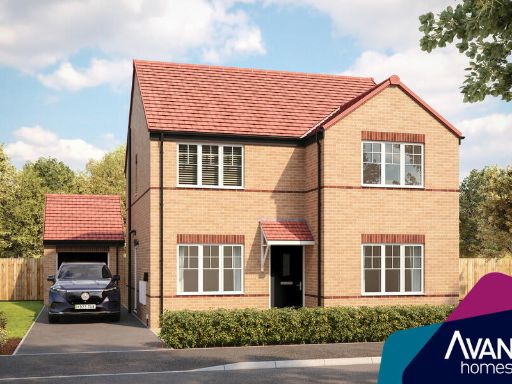 4 bedroom detached house for sale in Birchwood Lane,
Somercotes,
DE55 4ND, DE55 — £350,000 • 4 bed • 1 bath • 966 ft²
4 bedroom detached house for sale in Birchwood Lane,
Somercotes,
DE55 4ND, DE55 — £350,000 • 4 bed • 1 bath • 966 ft²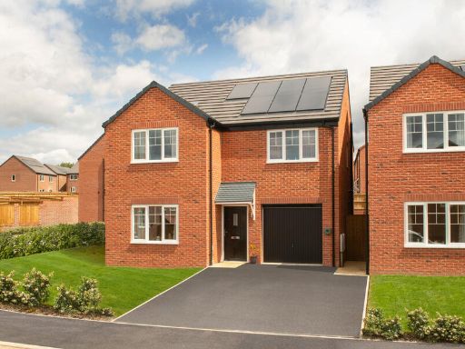 4 bedroom detached house for sale in Tibshelf Road,
Holmewood,
Chesterfield,
S42 5TB, S42 — £335,000 • 4 bed • 1 bath • 478 ft²
4 bedroom detached house for sale in Tibshelf Road,
Holmewood,
Chesterfield,
S42 5TB, S42 — £335,000 • 4 bed • 1 bath • 478 ft²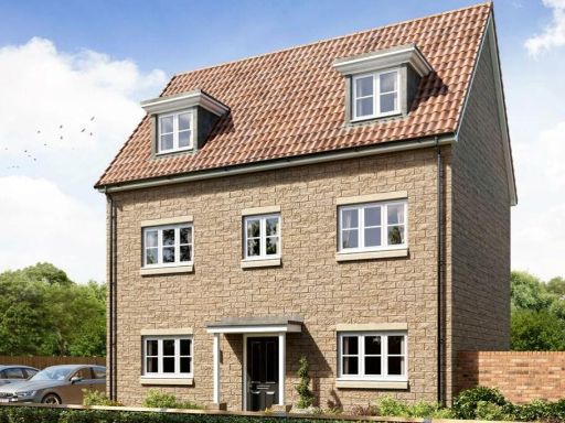 4 bedroom detached house for sale in Linacre Road,
Chesterfield ,
Derbyshire,
S40 4UX, S40 — £400,000 • 4 bed • 1 bath • 1102 ft²
4 bedroom detached house for sale in Linacre Road,
Chesterfield ,
Derbyshire,
S40 4UX, S40 — £400,000 • 4 bed • 1 bath • 1102 ft²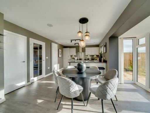 4 bedroom detached house for sale in Bolsover Road,
Mastin Moor,
S43 3FF, S43 — £394,500 • 4 bed • 1 bath • 1097 ft²
4 bedroom detached house for sale in Bolsover Road,
Mastin Moor,
S43 3FF, S43 — £394,500 • 4 bed • 1 bath • 1097 ft²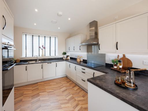 4 bedroom detached house for sale in Chesterfield Road,
Brimington,
Chesterfield,
S43 1FG, S43 — £376,950 • 4 bed • 1 bath
4 bedroom detached house for sale in Chesterfield Road,
Brimington,
Chesterfield,
S43 1FG, S43 — £376,950 • 4 bed • 1 bath
Meta
- {
"@context": "https://schema.org",
"@type": "Residence",
"name": "4 bedroom detached house for sale in Tibshelf Road, Holmewo…",
"description": "",
"url": "https://propertypiper.co.uk/property/f58ba746-3a49-4efa-8503-23094bdea473",
"image": "https://image-a.propertypiper.co.uk/27bd6fb4-0222-4cf2-9dd9-3cd9b146e817-1024.jpeg",
"address": {
"@type": "PostalAddress",
"streetAddress": "17 TIBSHELF ROAD HOLMEWOOD CHESTERFIELD",
"postalCode": "S42 5TB",
"addressLocality": "North East Derbyshire",
"addressRegion": "Bolsover",
"addressCountry": "England"
},
"geo": {
"@type": "GeoCoordinates",
"latitude": 53.1853419,
"longitude": -1.3608726
},
"numberOfRooms": 4,
"numberOfBathroomsTotal": 1,
"floorSize": {
"@type": "QuantitativeValue",
"value": 966,
"unitCode": "FTK"
},
"offers": {
"@type": "Offer",
"price": 350000,
"priceCurrency": "GBP",
"availability": "https://schema.org/InStock"
},
"additionalProperty": [
{
"@type": "PropertyValue",
"name": "Feature",
"value": "contemporary living room"
},
{
"@type": "PropertyValue",
"name": "Feature",
"value": "large window"
},
{
"@type": "PropertyValue",
"name": "Feature",
"value": "natural light"
},
{
"@type": "PropertyValue",
"name": "Feature",
"value": "central heating"
},
{
"@type": "PropertyValue",
"name": "Feature",
"value": "soft colors"
},
{
"@type": "PropertyValue",
"name": "Feature",
"value": "modern light fixture"
},
{
"@type": "PropertyValue",
"name": "Feature",
"value": "curtains"
},
{
"@type": "PropertyValue",
"name": "Feature",
"value": "detached"
},
{
"@type": "PropertyValue",
"name": "Feature",
"value": "modern"
},
{
"@type": "PropertyValue",
"name": "Feature",
"value": "brick"
},
{
"@type": "PropertyValue",
"name": "Feature",
"value": "double-storey"
},
{
"@type": "PropertyValue",
"name": "Feature",
"value": "newly-built"
},
{
"@type": "PropertyValue",
"name": "Feature",
"value": "residential"
},
{
"@type": "PropertyValue",
"name": "Feature",
"value": "suburban"
},
{
"@type": "PropertyValue",
"name": "Feature",
"value": "well-maintained"
}
]
}
High Res Floorplan Images
Compatible Floorplan Images
FloorplanImages Thumbnail