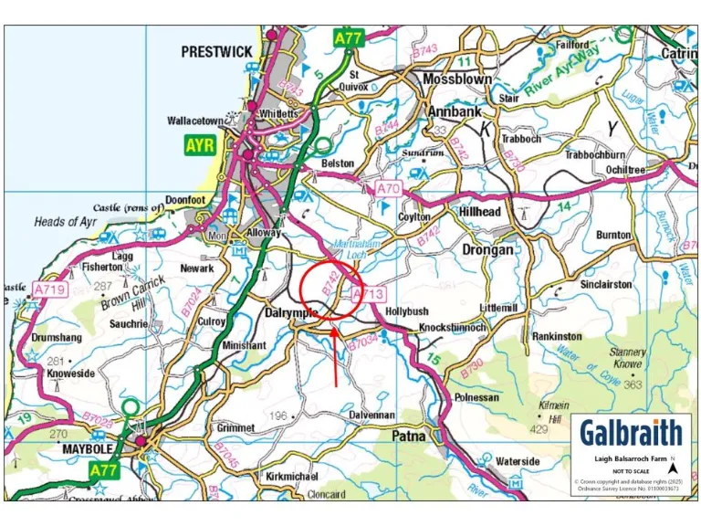
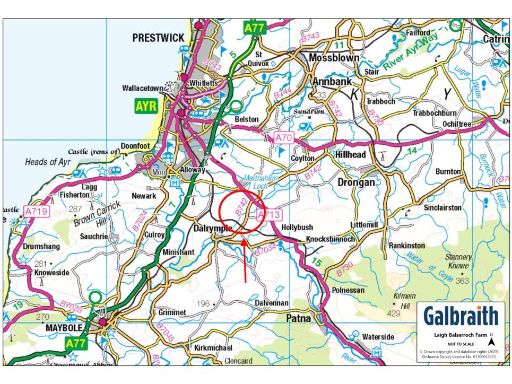
KA6 6AN - Land for sale in Laigh Balsarroch Farm, Dalrymple, Ayr, Eas…
View on Property Piper
Land for sale in Laigh Balsarroch Farm, Dalrymple, Ayr, East Ayrshire, KA6
Property Details
- Price: £2110000
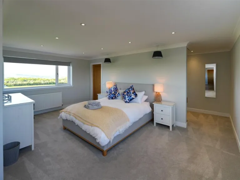
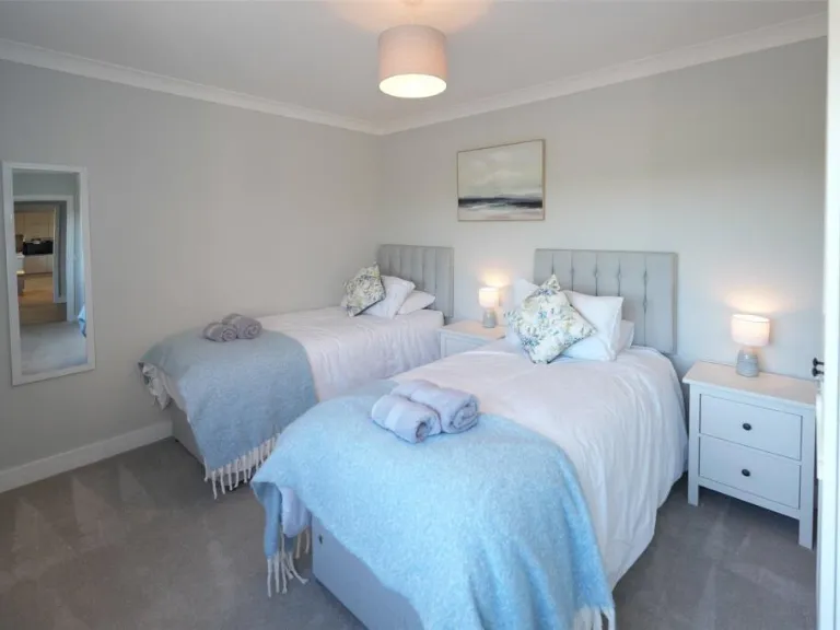
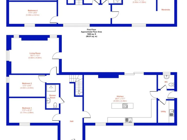
- Bedrooms: 5
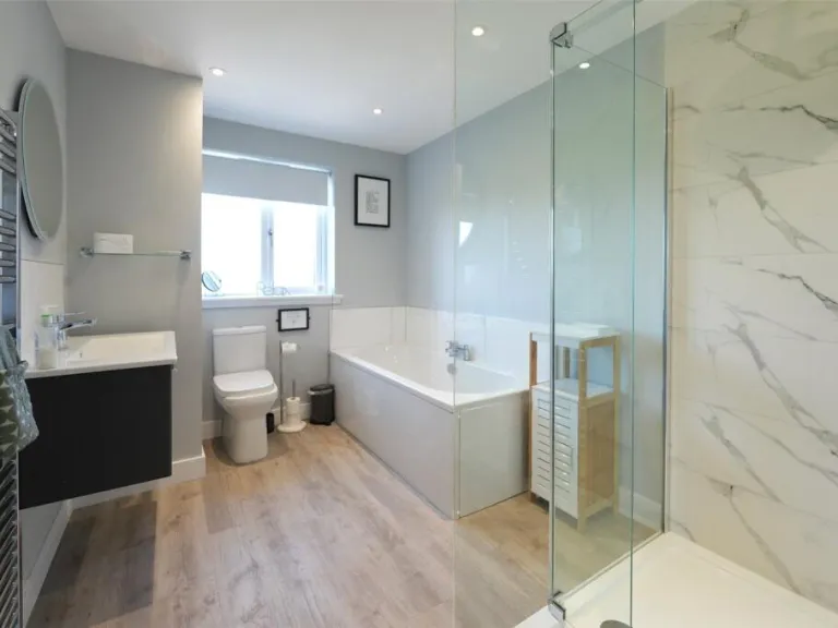
- Bathrooms: 3
- Property Type: undefined
- Property SubType: undefined
Brochure Descriptions
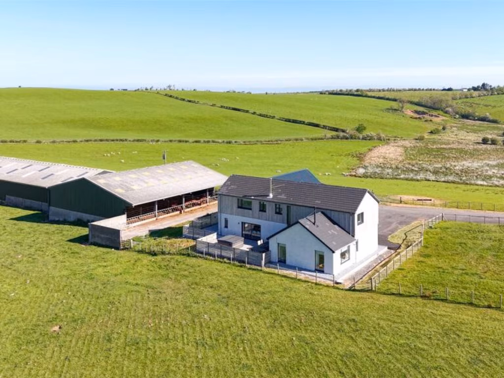
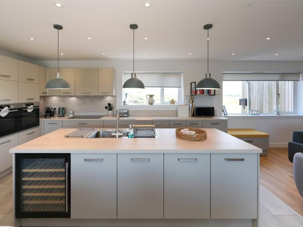
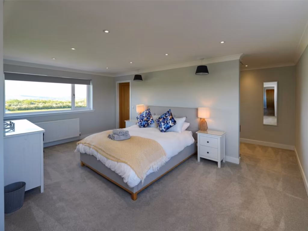
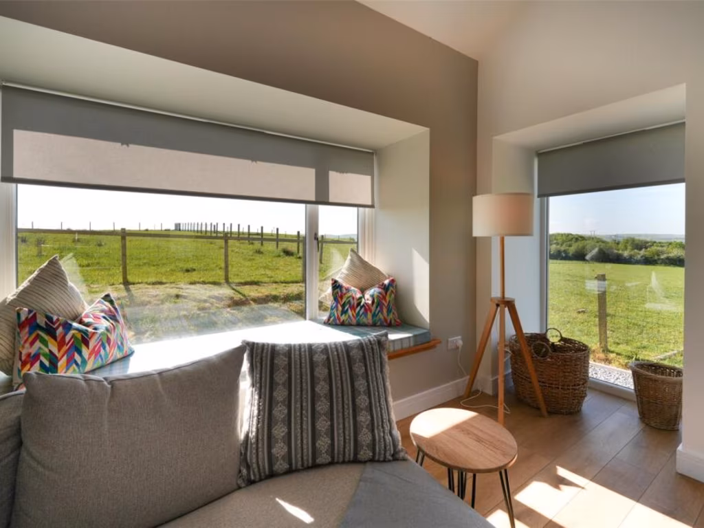
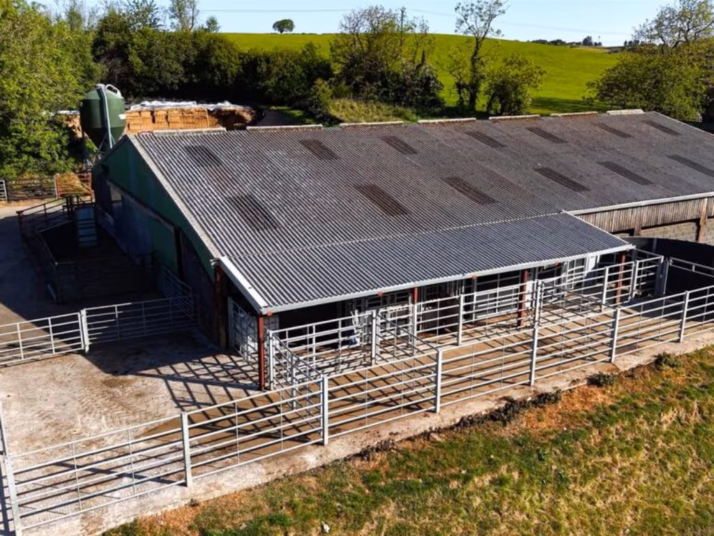
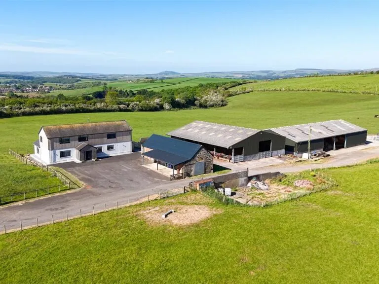
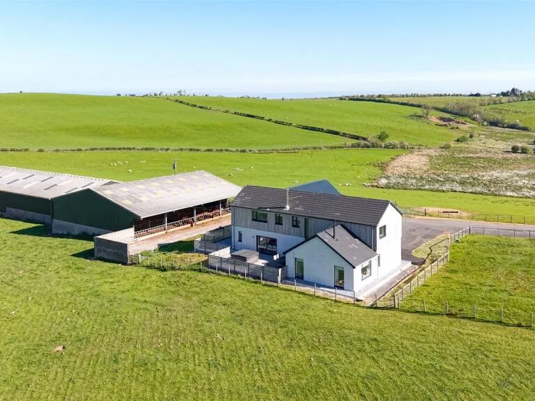
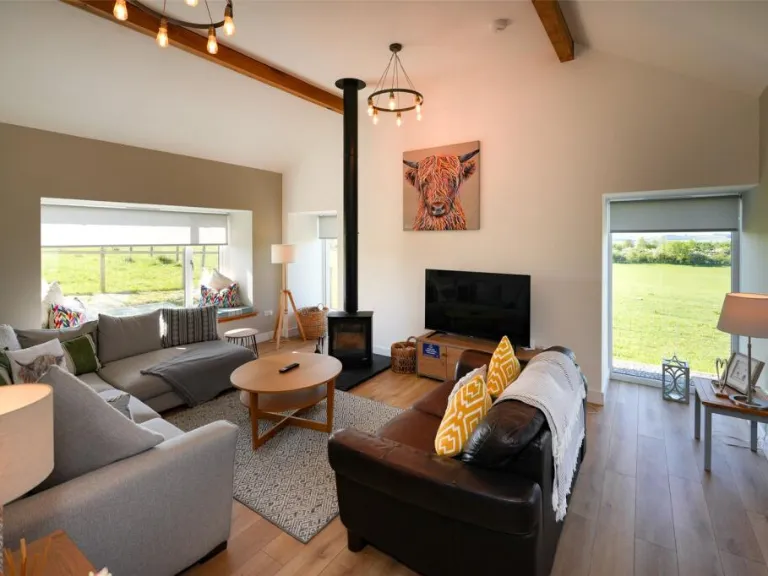
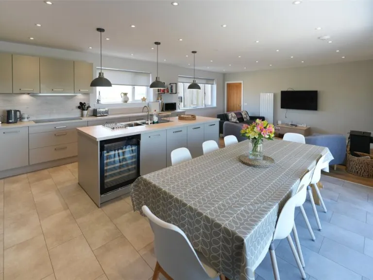
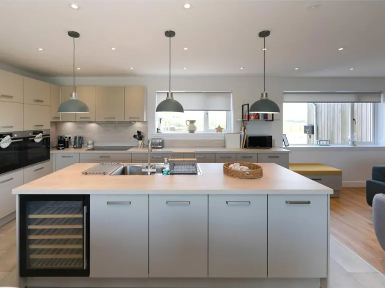
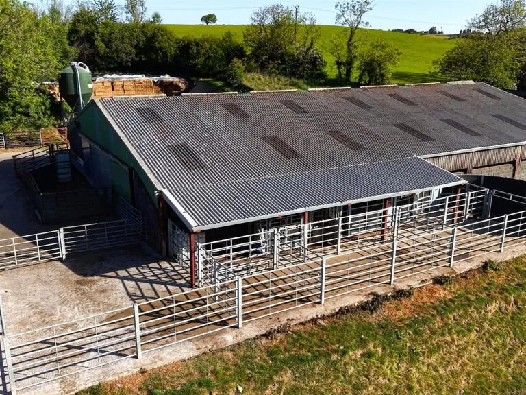
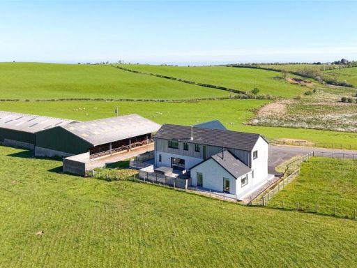
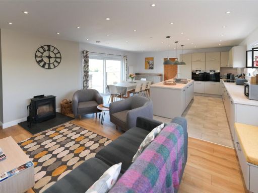
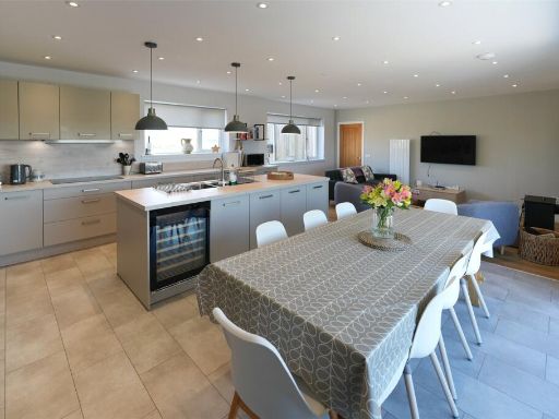
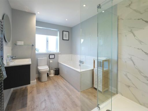
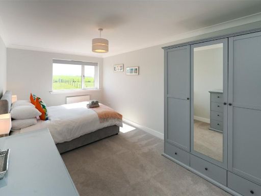
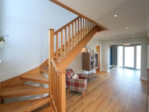
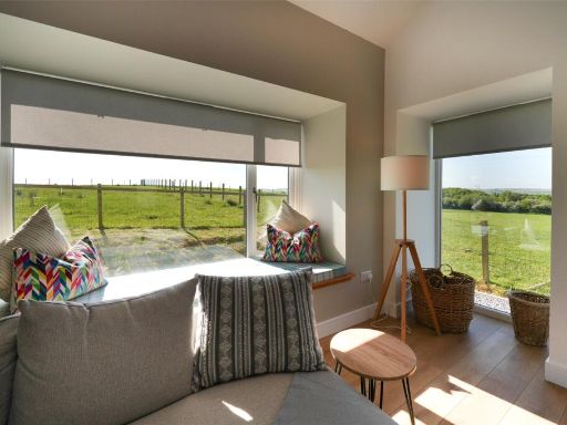
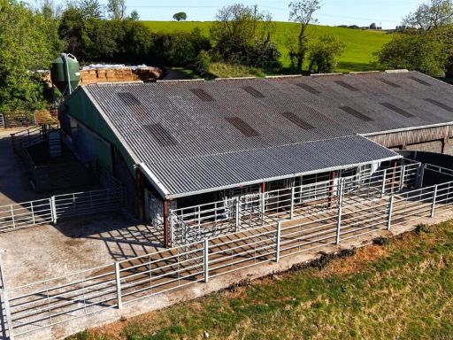
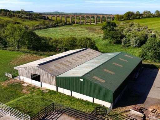
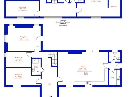
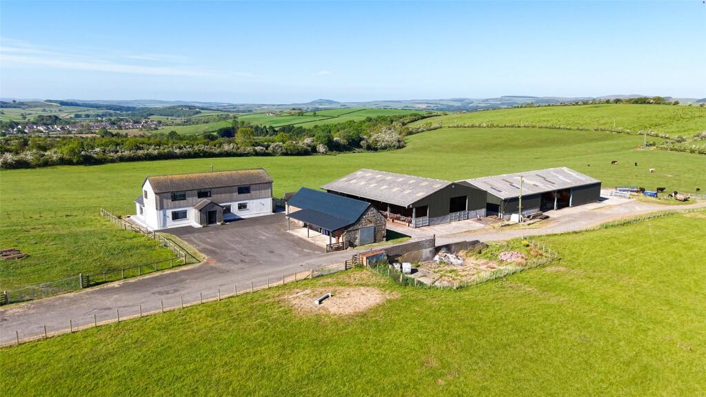
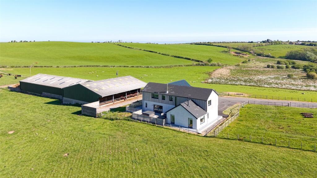
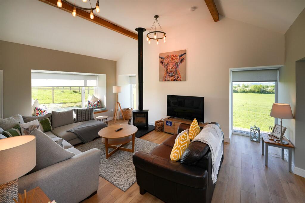
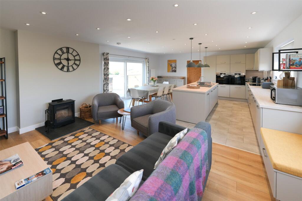
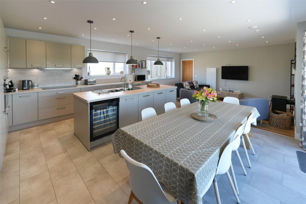
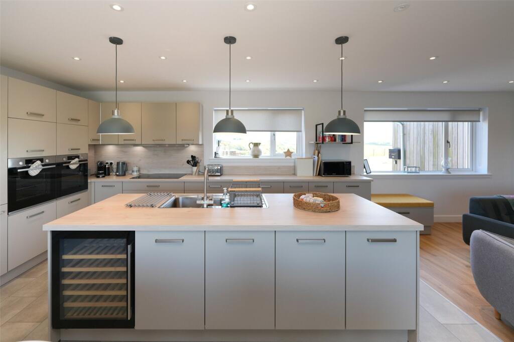
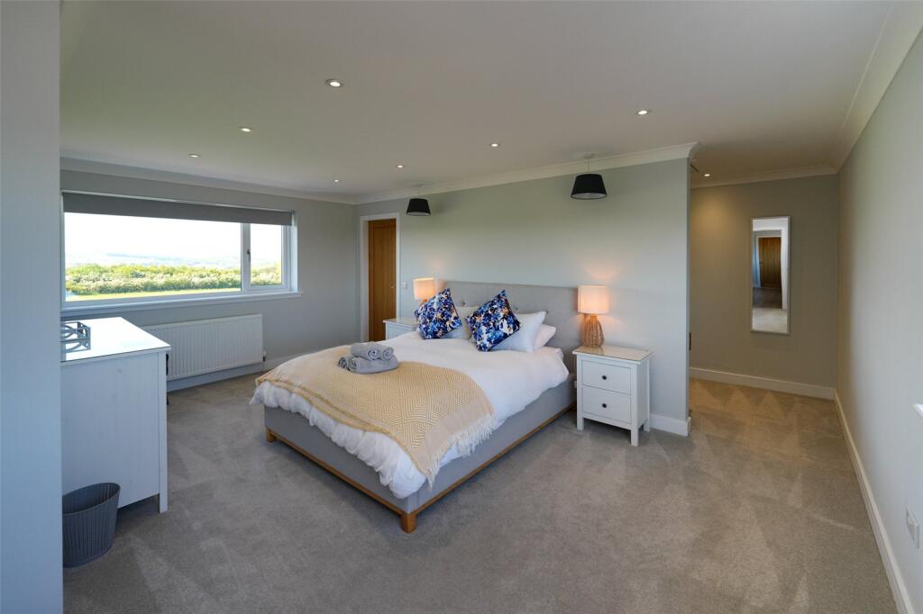
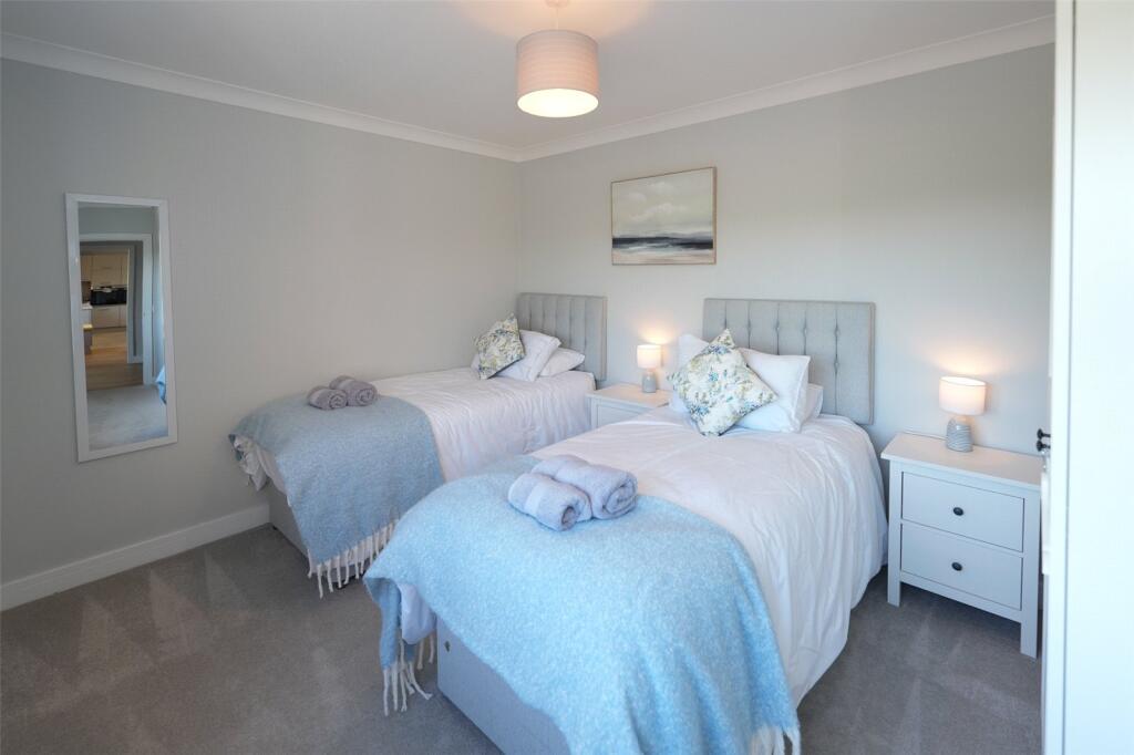
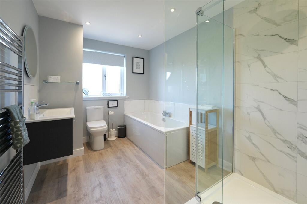
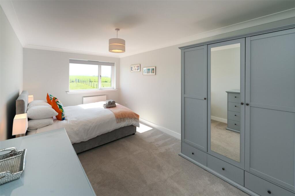
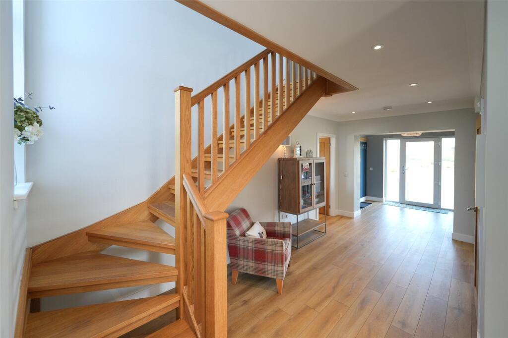
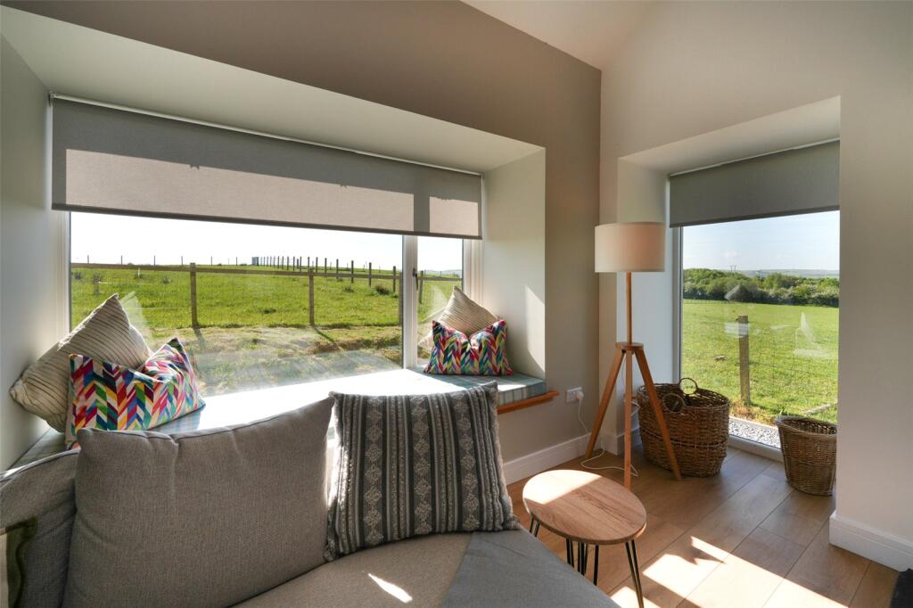
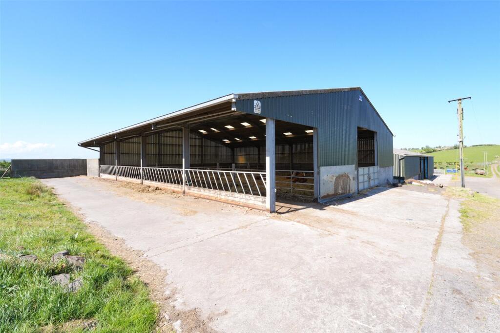
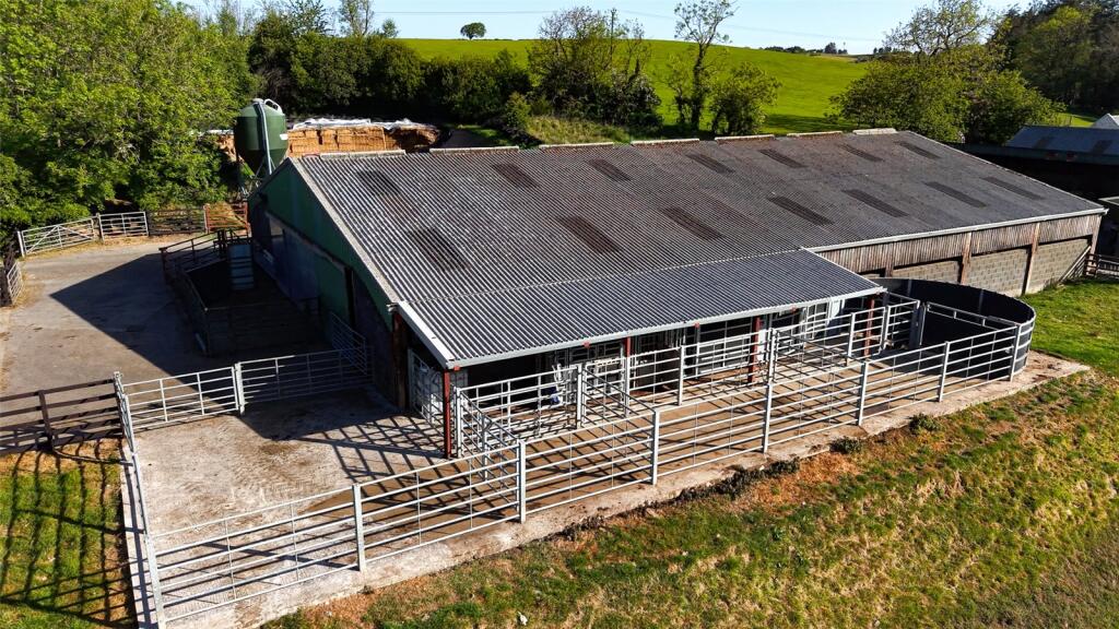
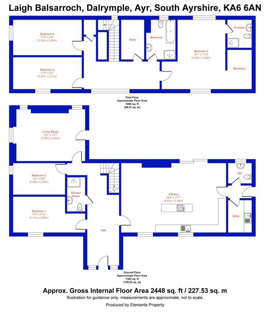
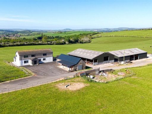
- This property is an expansive farmstead situated in a rural setting with vast open fields surrounding it. The main house appears to be a two-story building with a well-maintained exterior and ample space for parking and farming equipment. Adjacent to the house, there are large agricultural buildings suitable for livestock or storage needs. The overall property size is large, offering panoramic views of the lush Ayrshire countryside, making it an ideal choice for those seeking both privacy and space.
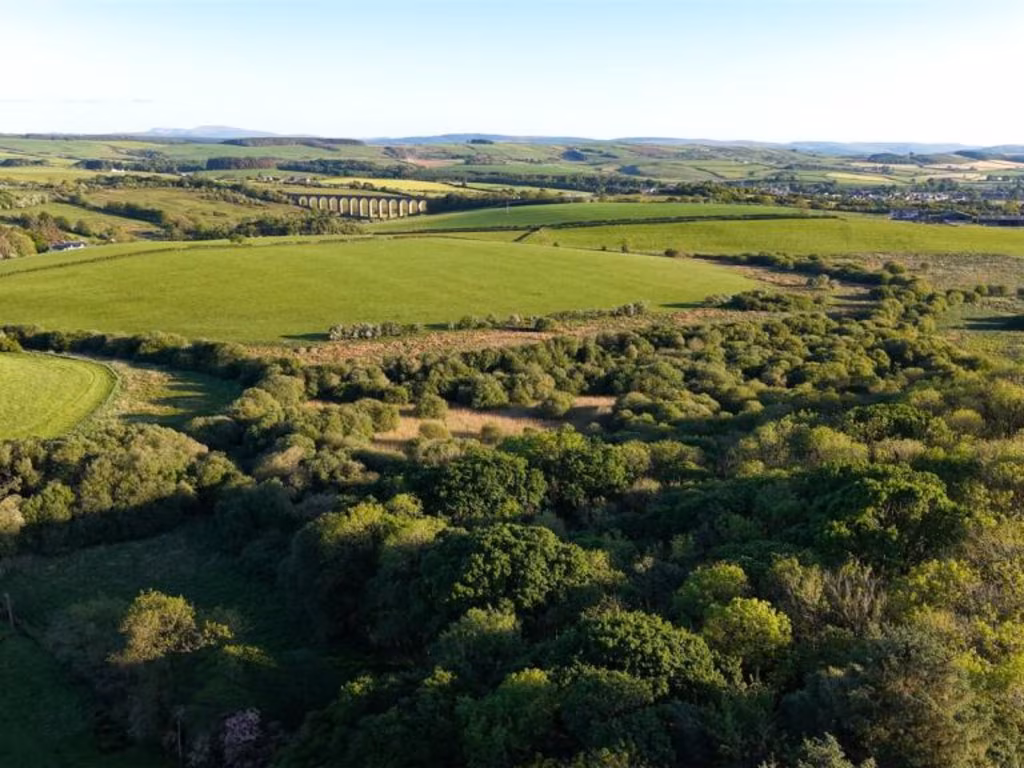
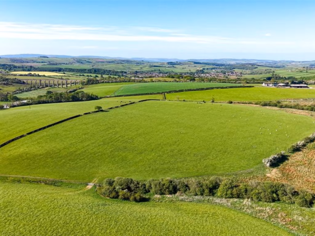
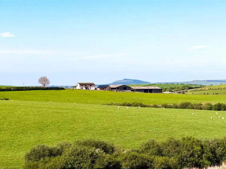
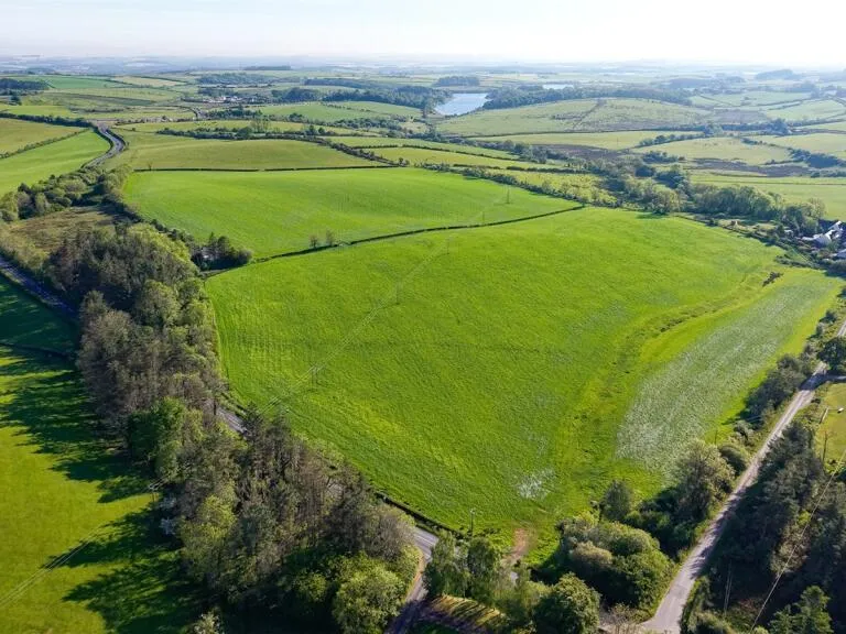
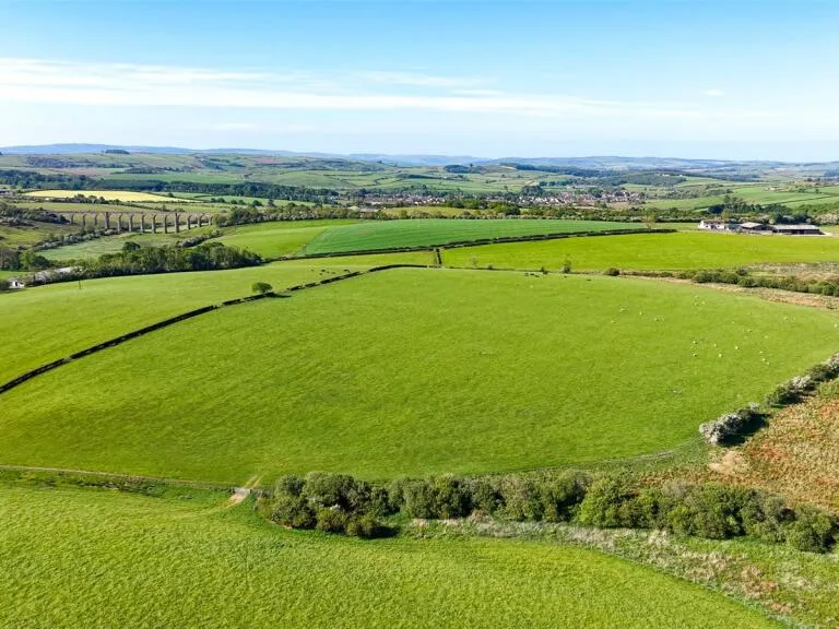
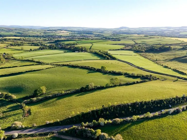
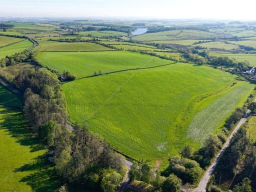
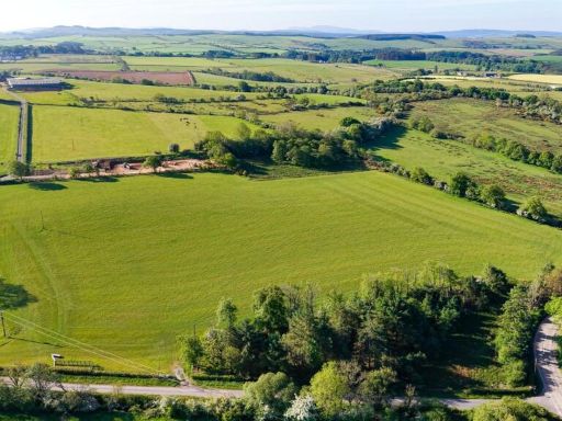
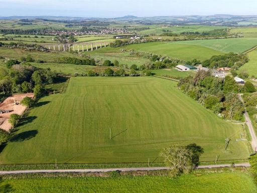
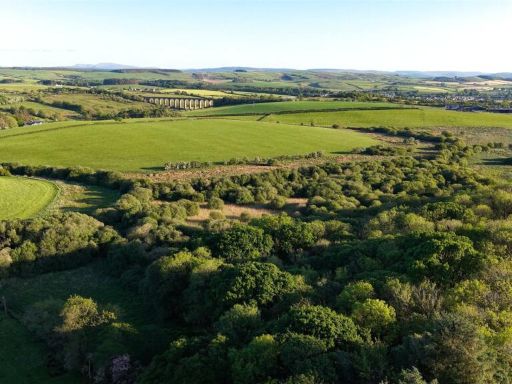
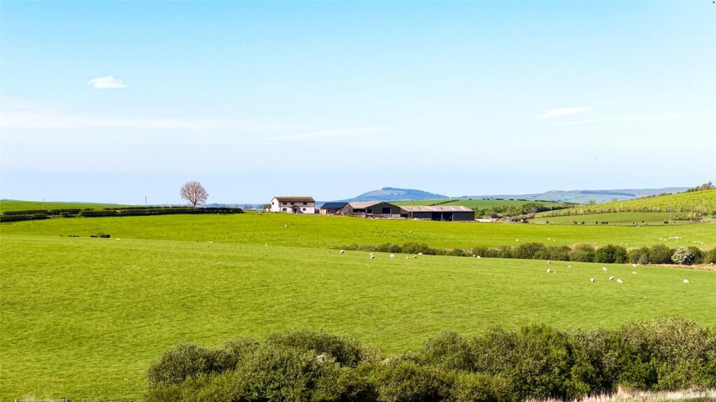
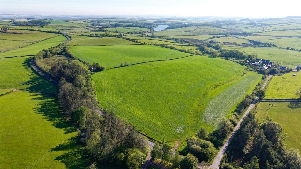
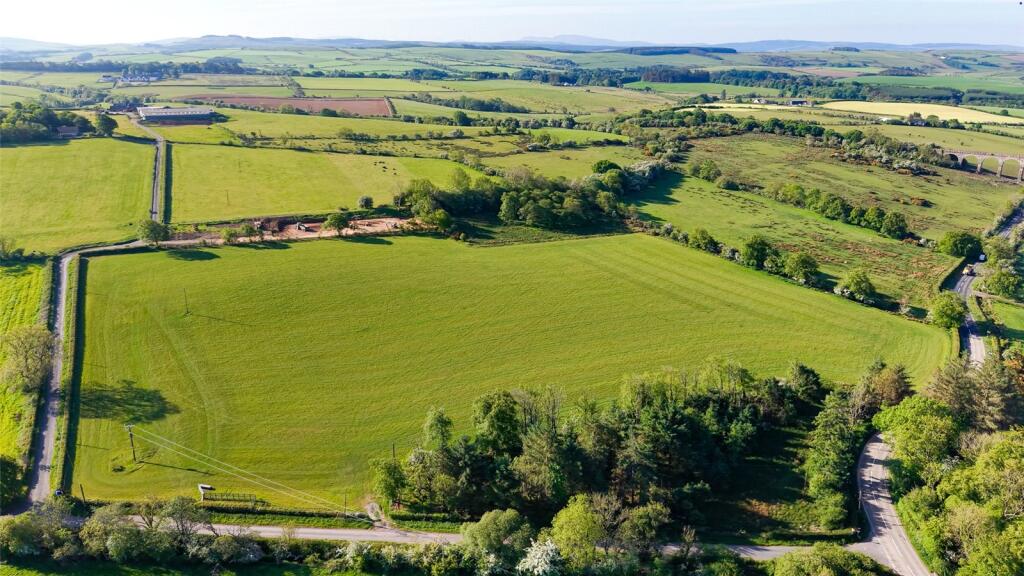
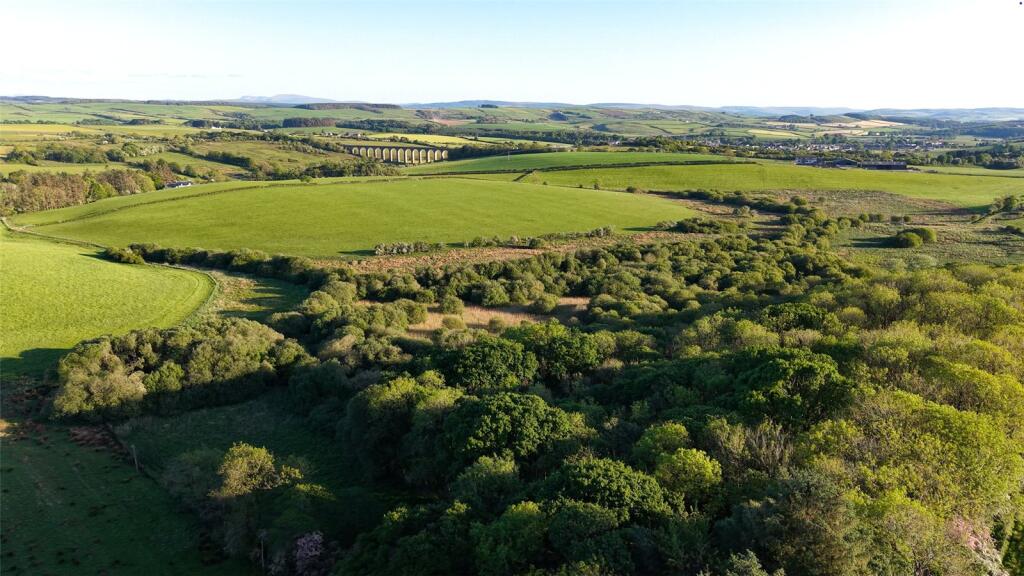
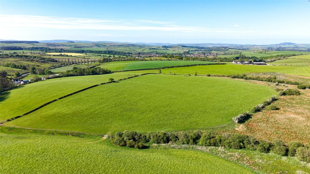
- A vast expanse of lush, rolling farmland dotted with greenery and framed by hedges and trees. The landscape is expansive with no visible structures, offering panoramic views of gentle hills stretching toward the horizon. The property features sprawling fields ideal for agricultural use or potential redevelopment, bordered by a country road. The overall size is enormous, giving it potential for various large-scale outdoor pursuits or farming operations.
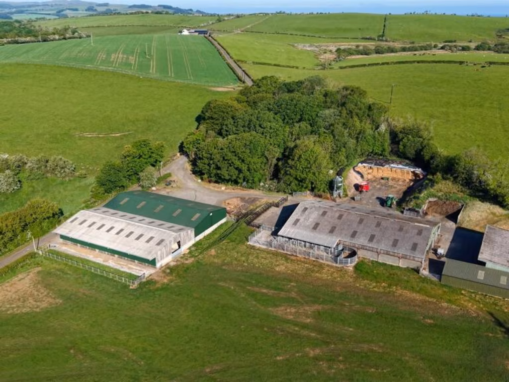
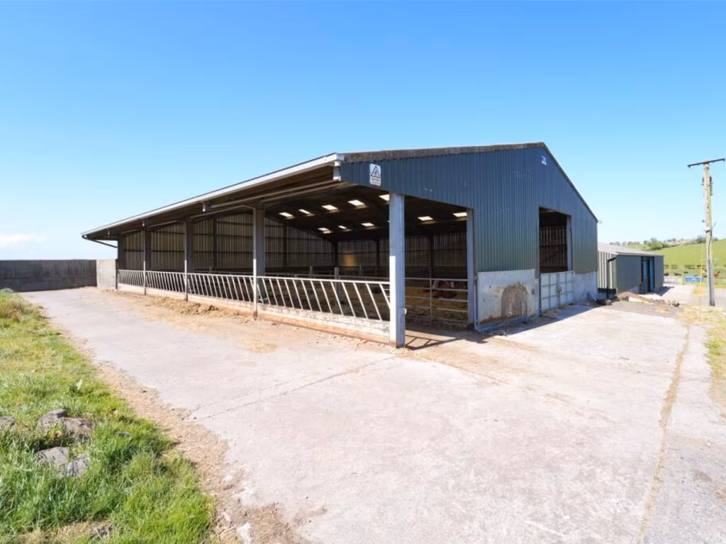
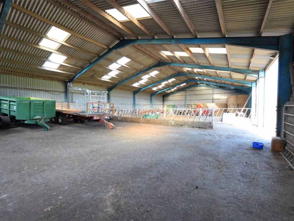
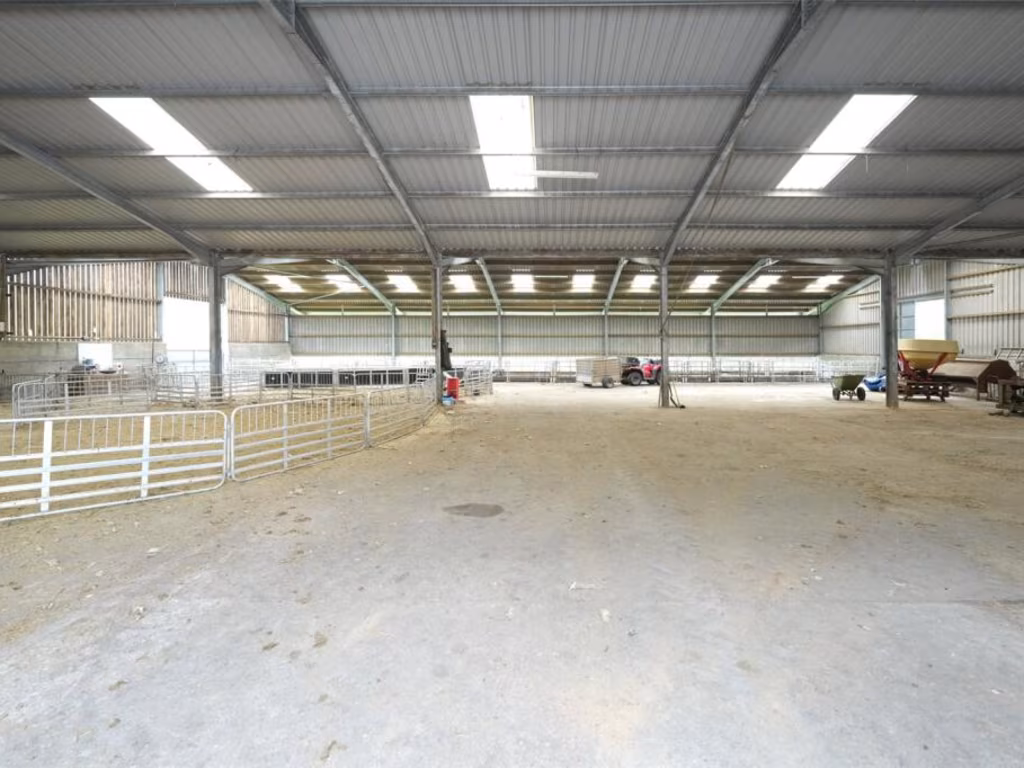
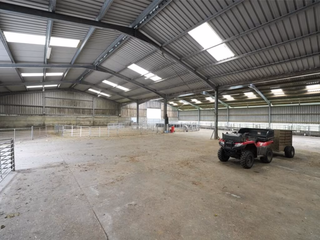
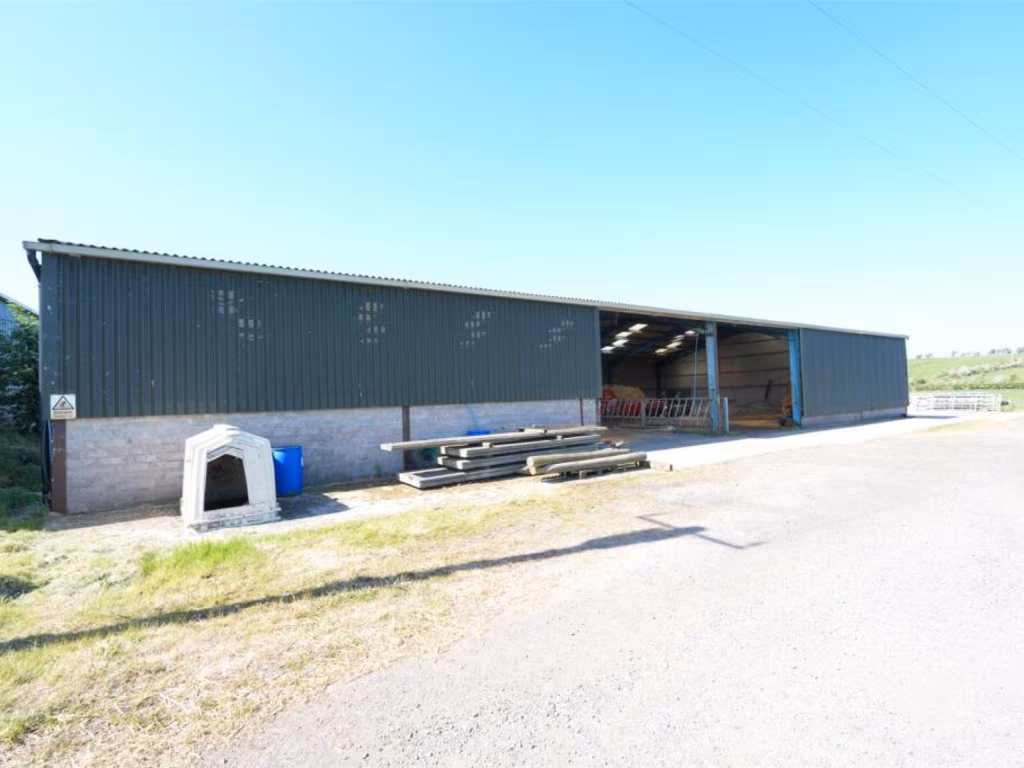
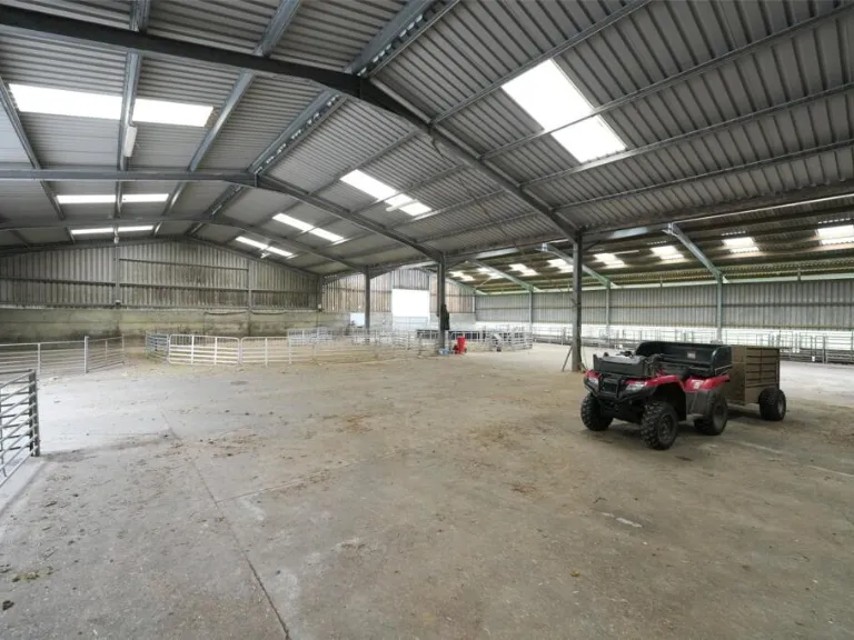
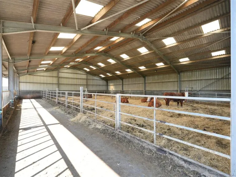
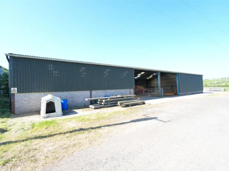
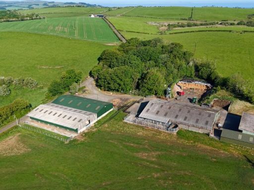
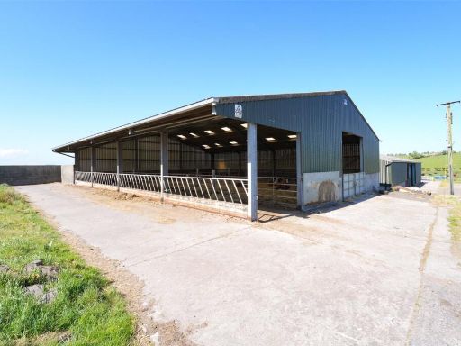
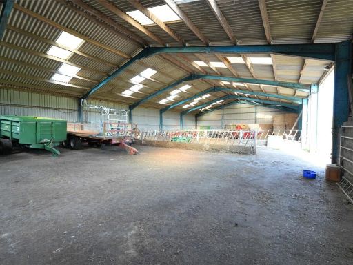
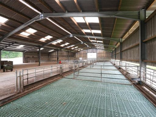
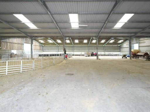
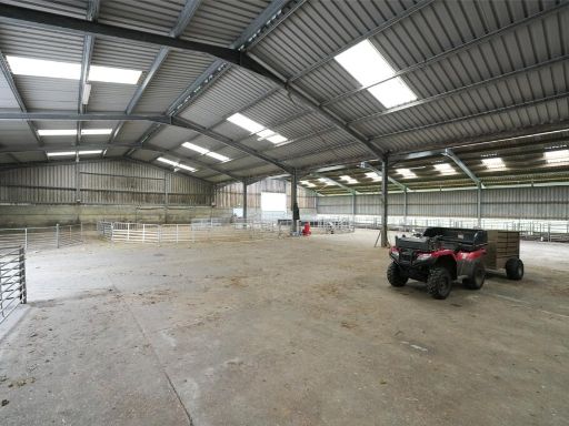
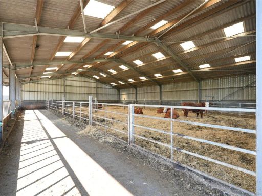
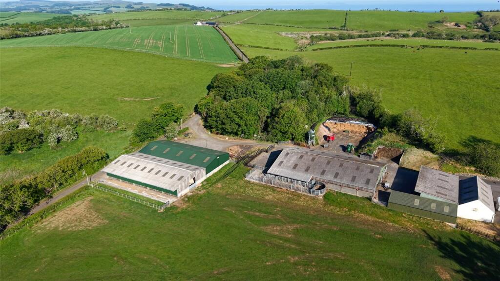
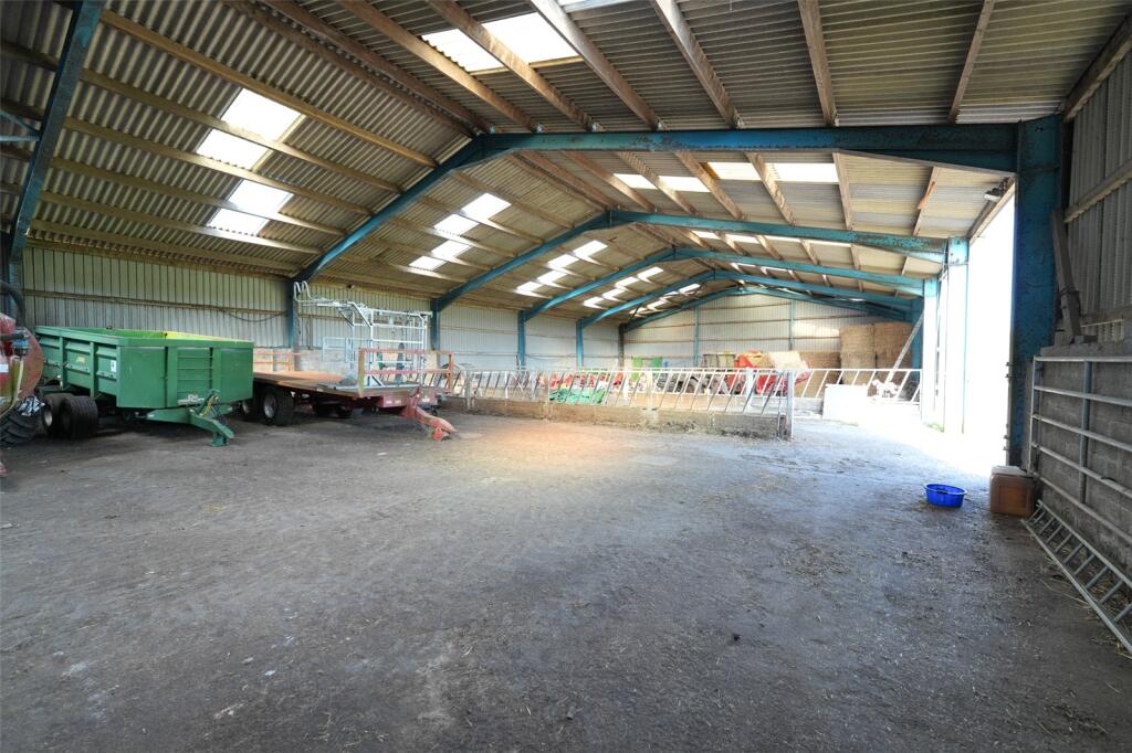
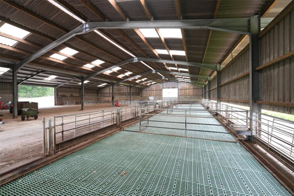
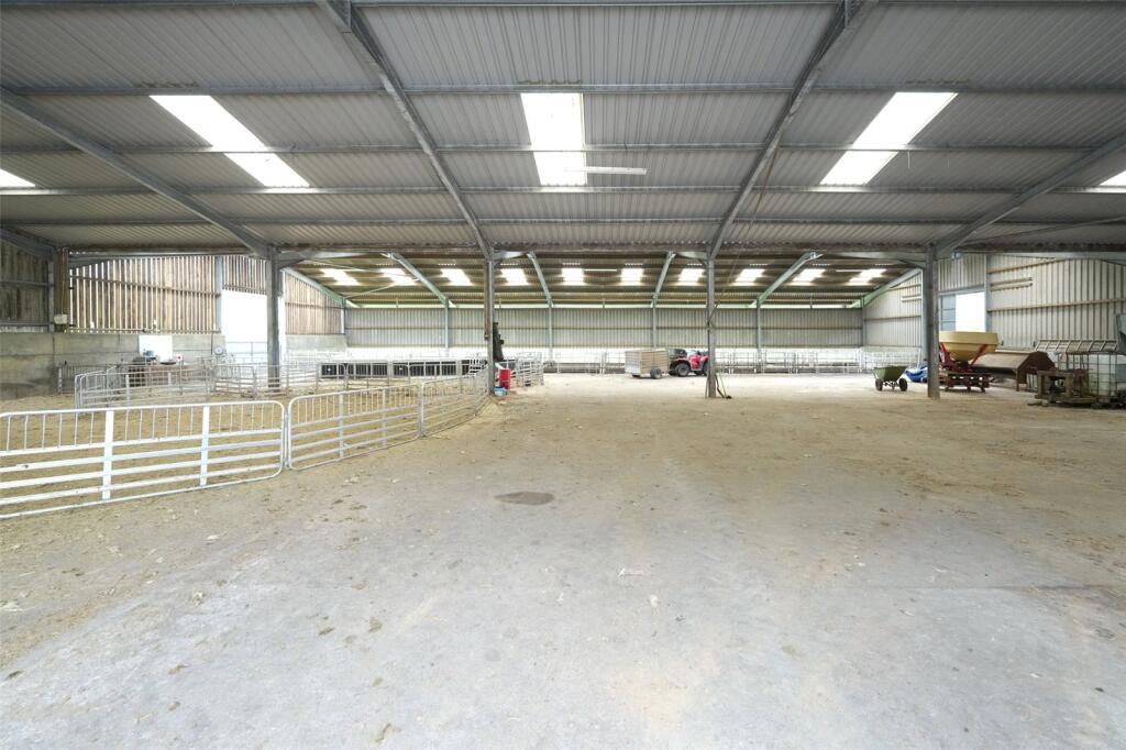
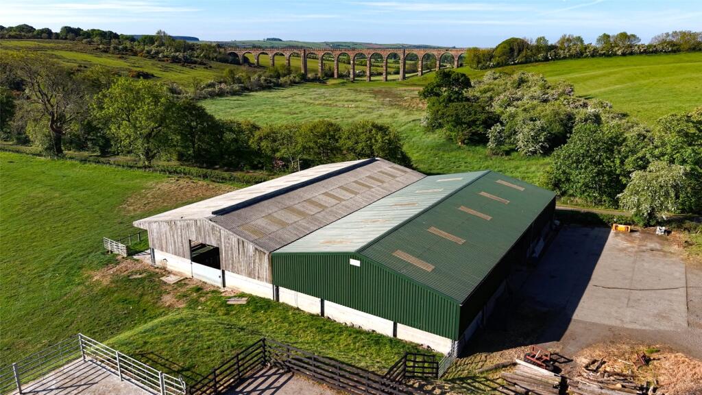
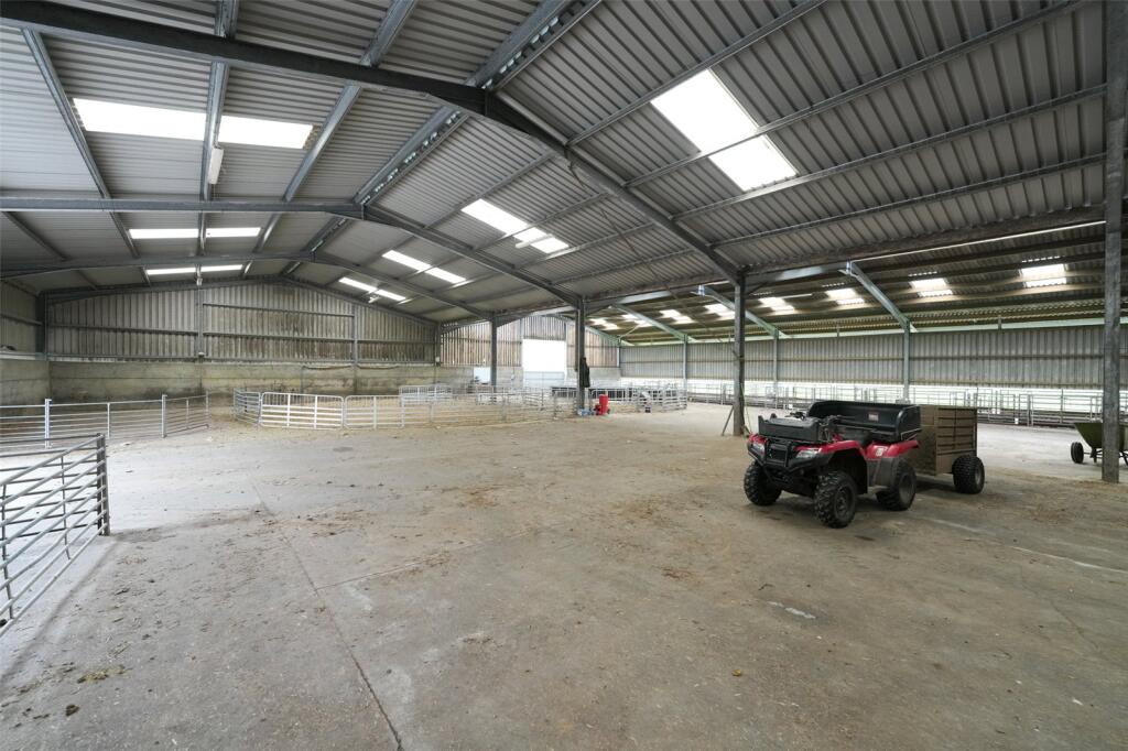
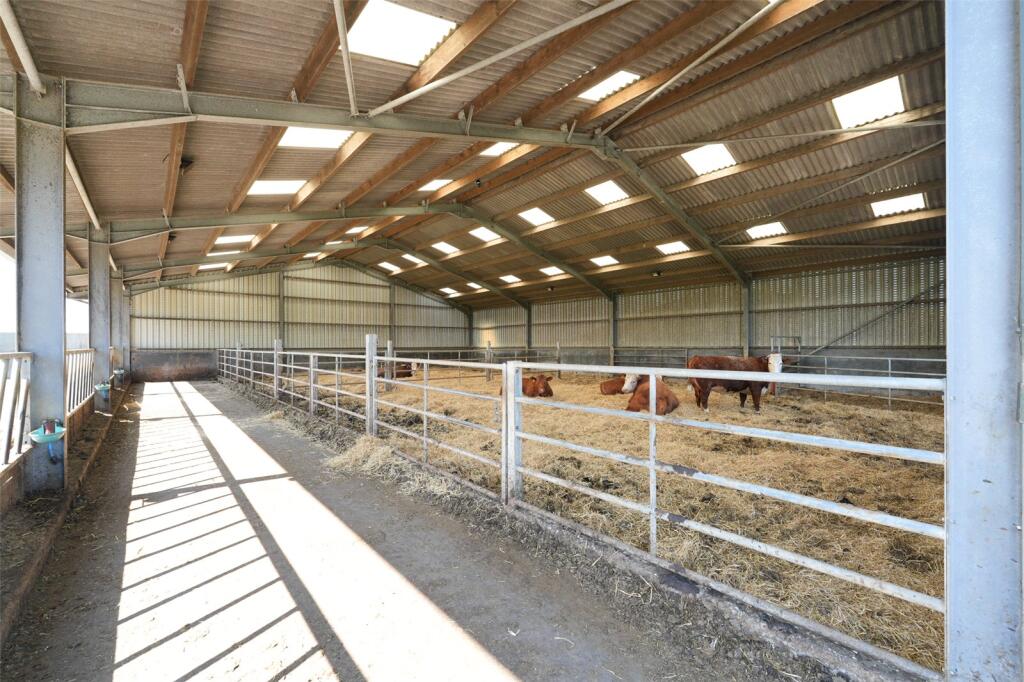
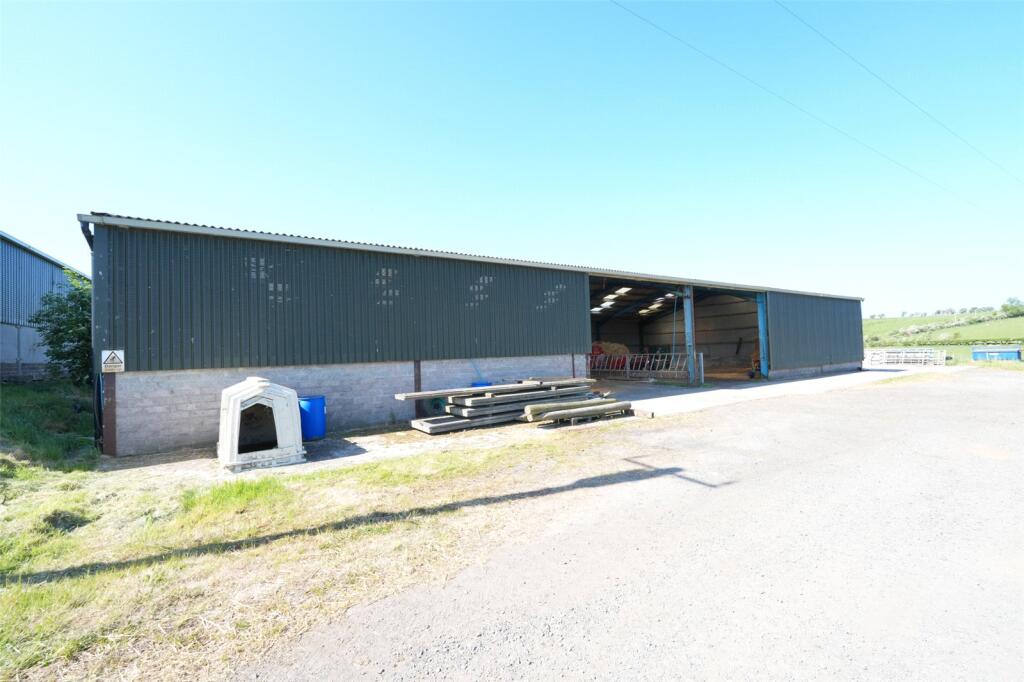
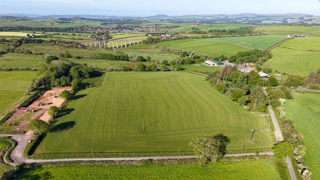
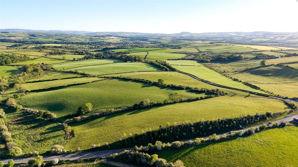
- The property features expansive agricultural land with multiple large barns and storage sheds, ideal for farming or livestock purposes. Surrounded by lush green fields and mature trees, it offers a serene rural setting with open countryside views. The spacious layout supports various farming activities with ample room for equipment and livestock.
Image Descriptions
- farmhouse with outbuildings modern farmhouse
- agricultural development site industrial
Textual Property Features
Detected Visual Features
- farmhouse
- outbuildings
- rural
- modern
- spacious
- countryside
- land
- potential
- agricultural
- development site
- industrial
- barn
- potential development
Nearest Bars And Restaurants
- Id: 890860954
- Tags:
- Amenity: restaurant
- Name: R.B.B.M. restaurant
- TagsNormalized:
- Lat: 55.4274107
- Lon: -4.6343917
- FullGeoHash: gcueqd324f5p
- PartitionGeoHash: gcue
- Images:
- FoodStandards: null
- Distance: 4118.7
,- Id: 4279099622
- Tags:
- Amenity: pub
- Name: Kirkton Inn
- TagsNormalized:
- Lat: 55.3971383
- Lon: -4.5920328
- FullGeoHash: gcueps8ptzh1
- PartitionGeoHash: gcue
- Images:
- FoodStandards: null
- Distance: 1617.2
,- Id: 4279099637
- Tags:
- Amenity: fast_food
- Name: Sizzle N’ Spice
- Phone: +441292560066
- TagsNormalized:
- Lat: 55.3983125
- Lon: -4.5906112
- FullGeoHash: gcuepscnx1bn
- PartitionGeoHash: gcue
- Images:
- FoodStandards: null
- Distance: 1458.7
,- Id: 8862961859
- Tags:
- Amenity: fast_food
- Cuisine: fish_and_chips
- Name: Fryer Tucks
- TagsNormalized:
- Lat: 55.3979143
- Lon: -4.5884165
- FullGeoHash: gcuepsfu4psw
- PartitionGeoHash: gcue
- Images:
- FoodStandards: null
- Distance: 1424.2
,- Id: 4279099669
- Tags:
- Addr:
- Housenumber: 22
- Postcode: KA6 6DZ
- Street: Barbieston Road
- Amenity: pub
- Fhrs:
- Name: White Horse
- Source:
- TagsNormalized:
- Lat: 55.3979974
- Lon: -4.5884601
- FullGeoHash: gcuepsfu9phn
- PartitionGeoHash: gcue
- Images:
- FoodStandards:
- Id: 538594
- FHRSID: 538594
- LocalAuthorityBusinessID: PI/000000070
- BusinessName: The White Horse Inn
- BusinessType: Restaurant/Cafe/Canteen
- BusinessTypeID: 1
- AddressLine1: The White Horse Inn
- AddressLine2: 22 Barbieston Road
- AddressLine3: Dalrymple
- AddressLine4: Ayr
- PostCode: KA6 6DZ
- RatingValue: Exempt
- RatingKey: fhis_exempt_en-GB
- RatingDate: 2016-03-04
- LocalAuthorityCode: 764
- LocalAuthorityName: East Ayrshire
- LocalAuthorityWebSite: http://eac.eu/
- LocalAuthorityEmailAddress: environmentalhealth@east-ayrshire.gov.uk
- Scores:
- Hygiene: null
- Structural: null
- ConfidenceInManagement: null
- NewRatingPending: false
- Geocode:
- Longitude: -4.58854800000000
- Latitude: 55.39806300000000
- Distance: 1417.4
}
Nearest General Shops
- Id: 366523435
- Tags:
- Building: yes
- Shop: laundry
- TagsNormalized:
- Lat: 55.4416119
- Lon: -4.6183723
- FullGeoHash: gcuequv4b1s1
- PartitionGeoHash: gcue
- Images:
- FoodStandards: null
- Distance: 4431.8
,- Id: 2239285006
- Tags:
- Name: Beauty Spot
- Shop: beauty
- TagsNormalized:
- Lat: 55.4331287
- Lon: -4.6327298
- FullGeoHash: gcueqe693s4k
- PartitionGeoHash: gcue
- Images:
- FoodStandards: null
- Distance: 4382.5
,- Id: 4279099615
- Tags:
- Name: Stobbs the Baker
- Shop: bakery
- TagsNormalized:
- Lat: 55.3983018
- Lon: -4.5907131
- FullGeoHash: gcuepscnkxun
- PartitionGeoHash: gcue
- Images:
- FoodStandards: null
- Distance: 1463.4
}
Nearest Grocery shops
- Id: 624225097
- Tags:
- Addr:
- City: Ayr
- Housenumber: 102
- Postcode: KA7 3PS
- Street: Dalmellington Road
- Name: Basra Stores
- Phone: +44 1292 262138
- Shop: convenience
- TagsNormalized:
- Lat: 55.4444307
- Lon: -4.6087183
- FullGeoHash: gcuerjk51nfx
- PartitionGeoHash: gcue
- Images:
- FoodStandards: null
- Distance: 4386.1
,- Id: 721905180
- Tags:
- Addr:
- City: Minishant
- Street: Main Road
- Building: yes
- Name: Minishant General Store
- Shop: convenience
- TagsNormalized:
- Lat: 55.3938806
- Lon: -4.6393088
- FullGeoHash: gcuenkju8rb8
- PartitionGeoHash: gcue
- Images:
- FoodStandards: null
- Distance: 4249.9
,- Id: 702062257
- Tags:
- Addr:
- Housenumber: 18
- Postcode: KA6 6DZ
- Street: Barbieston Road
- Brand: Spar
- Brand:wikidata: Q610492
- Brand:wikipedia: en:Spar (retailer)
- Building: yes
- Fhrs:
- Name: Spar
- Shop: convenience
- Source:
- TagsNormalized:
- Lat: 55.3983421
- Lon: -4.5907752
- FullGeoHash: gcuepscnepmy
- PartitionGeoHash: gcue
- Images:
- FoodStandards:
- Id: 539392
- FHRSID: 539392
- LocalAuthorityBusinessID: PI/000066825
- BusinessName: Spar
- BusinessType: Retailers - other
- BusinessTypeID: 4613
- AddressLine1: Spar
- AddressLine2: 18 Barbieston Road
- AddressLine3: Dalrymple
- AddressLine4: Ayr
- PostCode: KA6 6DZ
- RatingValue: Exempt
- RatingKey: fhis_exempt_en-GB
- RatingDate: 2018-11-05
- LocalAuthorityCode: 764
- LocalAuthorityName: East Ayrshire
- LocalAuthorityWebSite: http://eac.eu/
- LocalAuthorityEmailAddress: environmentalhealth@east-ayrshire.gov.uk
- Scores:
- Hygiene: null
- Structural: null
- ConfidenceInManagement: null
- NewRatingPending: false
- Geocode:
- Longitude: -4.58854800000000
- Latitude: 55.39806300000000
- Distance: 1461.9
}
Nearest Supermarkets
- Id: 95545714
- Tags:
- Addr:
- Postcode: KA8 0QA
- Street: Whitletts Road
- Brand: Tesco Extra
- Brand:wikidata: Q25172225
- Brand:wikipedia: en:Tesco Extra
- Building: yes
- Contact:
- Website: https://www.tesco.com/store-locator/ayr/whitletts-rd
- Name: Tesco Extra Ayr
- Shop: supermarket
- TagsNormalized:
- tesco
- tesco extra
- supermarket
- shop
- Lat: 55.4677765
- Lon: -4.6084714
- FullGeoHash: gcuex1s5nyfx
- PartitionGeoHash: gcue
- Images:
- FoodStandards: null
- Distance: 6802.8
,- Id: 191009063
- Tags:
- Addr:
- Postcode: KA7 2HT
- Street: Castlehill Road
- Brand: Morrisons
- Brand:wikidata: Q922344
- Brand:wikipedia: en:Morrisons
- Building: yes
- Contact:
- Website: https://my.morrisons.com/storefinder/165
- Name: Morrisons
- Shop: supermarket
- Source: visit, Bing
- TagsNormalized:
- Lat: 55.4557298
- Lon: -4.625777
- FullGeoHash: gcueqxrt5969
- PartitionGeoHash: gcue
- Images:
- FoodStandards: null
- Distance: 6004.5
,- Id: 6116991103
- Tags:
- Brand: Co-op Food
- Brand:wikidata: Q3277439
- Brand:wikipedia: en:Co-op Food
- Name: Co-op Food
- Operator: The Co-operative Group
- Operator:wikidata: Q117202
- Shop: supermarket
- TagsNormalized:
- co-op
- co-op food
- food
- supermarket
- shop
- Lat: 55.4322541
- Lon: -4.6601203
- FullGeoHash: gcuemgns7347
- PartitionGeoHash: gcue
- Images:
- FoodStandards: null
- Distance: 5806.2
}
Nearest Religious buildings
- Id: 359778146
- Tags:
- Amenity: place_of_worship
- Building: church
- Denomination: roman_catholic
- Name: Saint Paul's
- Religion: christian
- TagsNormalized:
- place of worship
- church
- catholic
- roman catholic
- christian
- Lat: 55.4460316
- Lon: -4.6137259
- FullGeoHash: gcuerj8ks3kt
- PartitionGeoHash: gcue
- Images:
- FoodStandards: null
- Distance: 4691.1
,- Id: 214334143
- Tags:
- Amenity: place_of_worship
- Building: church
- Denomination: presbyterian
- Heritage: yes
- Name: Alloway Church
- Religion: christian
- Wikidata: Q17853788
- TagsNormalized:
- place of worship
- church
- presbyterian
- christian
- Lat: 55.4276189
- Lon: -4.6367226
- FullGeoHash: gcueq6r9k911
- PartitionGeoHash: gcue
- Images:
- FoodStandards: null
- Distance: 4258.4
,- Id: 120129135
- Tags:
- Amenity: place_of_worship
- Building: church
- Religion: christian
- Source: OS_OpenData_StreetView
- TagsNormalized:
- place of worship
- church
- christian
- Lat: 55.3962606
- Lon: -4.5950099
- FullGeoHash: gcuepkw48e2q
- PartitionGeoHash: gcue
- Images:
- FoodStandards: null
- Distance: 1806.5
}
Nearest Medical buildings
- Id: 359612870
- Tags:
- Addr:
- City: Ayr
- Housenumber: 148
- Postcode: KA7 3PR
- Street: Dalmellington Road
- Amenity: doctors
- Building: yes
- Name: Bankfield Medical Practice
- Phone: +44 1292 264080
- Website: www.bankfieldmedical.co.uk
- TagsNormalized:
- Lat: 55.4425753
- Lon: -4.606186
- FullGeoHash: gcuerjjbkj4u
- PartitionGeoHash: gcue
- Images:
- FoodStandards: null
- Distance: 4130.4
,- Id: 119567092
- Tags:
- Amenity: hospital
- Emergency: yes
- Healthcare:
- Speciality: general;psychiatry
- Name: Ayr & Ailsa Hospitals
- Operator: Ayrshire NHS trust
- Source: estimate
- Wikidata: Q14943178
- Wikipedia: en:University Hospital Ayr
- TagsNormalized:
- hospital
- general
- psychiatry
- health
- healthcare
- Lat: 55.4324393
- Lon: -4.5972454
- FullGeoHash: gcuer7hmk7tk
- PartitionGeoHash: gcue
- Images:
- FoodStandards: null
- Distance: 2870.3
,- Id: 810603236
- Tags:
- Aeroway: helipad
- Name: Ayr & Ailsa Hospitals Helipad
- TagsNormalized:
- Lat: 55.4307547
- Lon: -4.598201
- FullGeoHash: gcuer6gew1sg
- PartitionGeoHash: gcue
- Images:
- FoodStandards: null
- Distance: 2730.7
,- Id: 1150129852
- Tags:
- Aeroway: helipad
- Name: University Hospital Ayr
- Operator: NHS
- TagsNormalized:
- helipad
- hospital
- university
- Lat: 55.4307465
- Lon: -4.5981783
- FullGeoHash: gcuer6gew8jf
- PartitionGeoHash: gcue
- Images:
- FoodStandards: null
- Distance: 2729.2
}
Nearest Airports
- Id: 97095239
- Tags:
- Addr:
- Aerodrome: international
- Aerodrome:type: public
- Aeroway: aerodrome
- Arp: no
- Atis: 121.125
- Ele: 20
- Iata: PIK
- Icao: EGPK
- Is_in: South Ayrshire
- Name: Glasgow Prestwick Airport
- Name_1: Prestwick Airport
- Name_2: Glasgow Prestwick Airport
- Operator: Infratil Airports Europe
- Owner: Infratil
- Size: 1817727
- Tower_frequency: 118.150
- Website: https://www.glasgowprestwick.com/
- Wikidata: Q8992
- Wikipedia: en:Glasgow Prestwick Airport
- TagsNormalized:
- airport
- international airport
- Lat: 55.5022118
- Lon: -4.5948374
- FullGeoHash: gcuexry5ud0v
- PartitionGeoHash: gcue
- Images:
- FoodStandards: null
- Distance: 10404.2
}
Nearest Leisure Facilities
- Id: 428809364
- Tags:
- Leisure: pitch
- Name: Dalrymple Bowling Club
- Sport: bowls
- TagsNormalized:
- pitch
- leisure
- bowling
- club
- bowls
- sports
- Lat: 55.3971653
- Lon: -4.5931343
- FullGeoHash: gcuepkxruhnf
- PartitionGeoHash: gcue
- Images:
- FoodStandards: null
- Distance: 1654.9
,- Id: 958520794
- Tags:
- TagsNormalized:
- Lat: 55.3979854
- Lon: -4.5900668
- FullGeoHash: gcuepscsesyn
- PartitionGeoHash: gcue
- Images:
- FoodStandards: null
- Distance: 1470.3
,- Id: 428809358
- Tags:
- TagsNormalized:
- Lat: 55.39724
- Lon: -4.5872379
- FullGeoHash: gcuepsg8md58
- PartitionGeoHash: gcue
- Images:
- FoodStandards: null
- Distance: 1457.9
,- Id: 428809401
- Tags:
- TagsNormalized:
- Lat: 55.3974864
- Lon: -4.5851239
- FullGeoHash: gcuepsv1wzgy
- PartitionGeoHash: gcue
- Images:
- FoodStandards: null
- Distance: 1381.7
,- Id: 1070087729
- Tags:
- TagsNormalized:
- Lat: 55.3998392
- Lon: -4.5904767
- FullGeoHash: gcuept1r6ns3
- PartitionGeoHash: gcue
- Images:
- FoodStandards: null
- Distance: 1316.6
}
Nearest Tourist attractions
- Id: 214334142
- Tags:
- Barrier: wall
- Historic: ruins
- Name: Alloway Auld Kirk
- Tourism: attraction
- Wikidata: Q4733238
- Wikipedia: en:Alloway Auld Kirk
- TagsNormalized:
- Lat: 55.4278908
- Lon: -4.637506
- FullGeoHash: gcueq6r4f78z
- PartitionGeoHash: gcue
- Images:
- FoodStandards: null
- Distance: 4316.3
,- Id: 214334150
- Tags:
- Addr:
- City: Alloway
- Postcode: KA7 4PQ
- Street: Murdoch's Lone
- Building: yes
- Name: Robert Burns Birthplace Museum
- Opening_hours: Mo-Su 10:00-17:00
- Operator: National Trust for Scotland
- Tourism: museum
- Website: http://www.burnsmuseum.org.uk/
- Wikidata: Q5000064
- Wikipedia: en:Burns Cottage
- TagsNormalized:
- Lat: 55.42749
- Lon: -4.6345863
- FullGeoHash: gcueqd30w31b
- PartitionGeoHash: gcue
- Images:
- FoodStandards: null
- Distance: 4133.7
,- Id: 383576990
- Tags:
- Name: Crofthead Holiday Park
- Tourism: caravan_site
- TagsNormalized:
- Lat: 55.4443847
- Lon: -4.587254
- FullGeoHash: gcuert7dvnrt
- PartitionGeoHash: gcue
- Images:
- FoodStandards: null
- Distance: 3964.2
}
Nearest Bus stations and stops
- Id: 890860935
- Tags:
- Bench: no
- Bus: yes
- Departures_board: timetable
- Highway: bus_stop
- Name: Burns Cottage bus stop
- Operator: Stagecoach
- Public_transport: platform
- Shelter: yes
- TagsNormalized:
- Lat: 55.4330559
- Lon: -4.6331017
- FullGeoHash: gcueqe62bysf
- PartitionGeoHash: gcue
- Images:
- FoodStandards: null
- Distance: 4396.2
,- Id: 8960372177
- Tags:
- Bus: yes
- Highway: bus_stop
- Public_transport: platform
- TagsNormalized:
- Lat: 55.3933726
- Lon: -4.6404891
- FullGeoHash: gcuenkhcuc0d
- PartitionGeoHash: gcue
- Images:
- FoodStandards: null
- Distance: 4340.9
,- Id: 9182555355
- Tags:
- Bus: yes
- Highway: bus_stop
- Public_transport: platform
- TagsNormalized:
- Lat: 55.4382791
- Lon: -4.6054801
- FullGeoHash: gcuerhnrks30
- PartitionGeoHash: gcue
- Images:
- FoodStandards: null
- Distance: 3685.1
,- Id: 8862957100
- Tags:
- Bus: yes
- Highway: bus_stop
- Name: Barbieston Rd opp No. 20
- Public_transport: platform
- Ref: 6180667
- TagsNormalized:
- Lat: 55.3981792
- Lon: -4.5902458
- FullGeoHash: gcuepscmz90e
- PartitionGeoHash: gcue
- Images:
- FoodStandards: null
- Distance: 1458.3
,- Id: 8862956919
- Tags:
- Bus: yes
- Highway: bus_stop
- Public_transport: platform
- TagsNormalized:
- Lat: 55.3978663
- Lon: -4.5886574
- FullGeoHash: gcuepsfeuwc0
- PartitionGeoHash: gcue
- Images:
- FoodStandards: null
- Distance: 1436.2
}
Nearest Hotels
- Id: 3558226284
- Tags:
- Name: The Abbotsford
- Source: knowledge
- Tourism: hotel
- TagsNormalized:
- Lat: 55.4486814
- Lon: -4.6315733
- FullGeoHash: gcueqw57ux2s
- PartitionGeoHash: gcue
- Images:
- FoodStandards: null
- Distance: 5559.6
,- Id: 890860931
- Tags:
- Amenity: restaurant
- Name: Brig o' Doon Hotel
- TagsNormalized:
- Lat: 55.4268797
- Lon: -4.637484
- FullGeoHash: gcueq6phfz32
- PartitionGeoHash: gcue
- Images:
- FoodStandards: null
- Distance: 4262
,- Id: 214365553
- Tags:
- Building: yes
- Heritage: yes
- Name: Brig o' Doon Hotel
- Tourism: hotel
- Wikidata: Q56626041
- TagsNormalized:
- Lat: 55.4269309
- Lon: -4.6373025
- FullGeoHash: gcueq6pjr0b9
- PartitionGeoHash: gcue
- Images:
- FoodStandards: null
- Distance: 4254.4
}
Tags
- farmhouse
- outbuildings
- rural
- modern
- spacious
- countryside
- land
- potential
- agricultural
- agricultural
- development site
- industrial
- rural
- outbuildings
- barn
- potential development
Local Market Stats
- Average Price/sqft: £127
- Planning Success Rate: 92%
Similar Properties
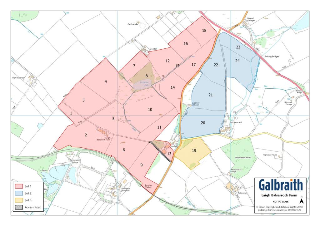
 Land for sale in Laigh Balsarroch Farm - Lot 1, Dalrymple, Ayr, East Ayrshire, KA6 — £1,650,000 • 5 bed • 3 bath
 Land for sale in Laigh Balsarroch Farm - Lot 2, Dalrymple, Ayr, East Ayrshire, KA6 — £390,000 • 1 bed • 1 bath
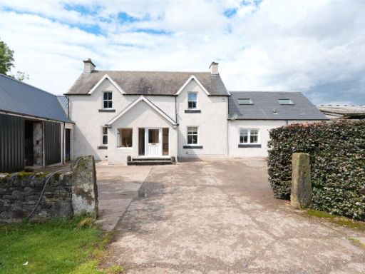 Land for sale in West Blackbyre Farm, Waterside, Kilmarnock, East Ayrshire, KA3 — £1,300,000 • 4 bed • 3 bath • 2559 ft²
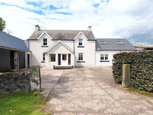 Land for sale in West Blackbyre Farm Lot 1, Waterside, Kilmarnock, East Ayrshire, KA3 — £915,000 • 4 bed • 3 bath • 2559 ft²
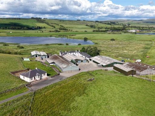 Farm for sale in Little Creoch Farm, New Cumnock, Cumnock, East Ayrshire, KA18 — £1,750,000 • 4 bed • 2 bath • 5899 ft²
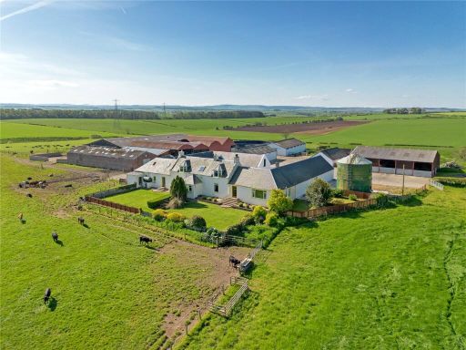 4 bedroom detached house for sale in Coilsholm Farm, Tarbolton, Ayrshire, KA5 — £2,100,000 • 4 bed • 1 bath • 3229 ft²
Meta
- {
"@context": "https://schema.org",
"@type": "Residence",
"name": "Land for sale in Laigh Balsarroch Farm, Dalrymple, Ayr, Eas…",
"description": "",
"url": "https://propertypiper.co.uk/property/f0f25236-c332-464e-99f3-e7ae7a87994e",
"image": "https://image-a.propertypiper.co.uk/c37e3aac-d8db-47ac-a651-53045543e3a6-1024.jpeg",
"address": {
"@type": "PostalAddress",
"streetAddress": "LAIGH BALSARROCH, AYR, DALRYMPLE",
"postalCode": "KA6 6AN",
"addressLocality": "South Ayrshire",
"addressRegion": "Ayr, Carrick and Cumnock",
"addressCountry": "Scotland"
},
"geo": {
"@type": "GeoCoordinates",
"latitude": 55.4091564,
"longitude": -4.5776077
},
"numberOfRooms": 5,
"numberOfBathroomsTotal": 3,
"offers": {
"@type": "Offer",
"price": 2110000,
"priceCurrency": "GBP",
"availability": "https://schema.org/InStock"
},
"additionalProperty": [
{
"@type": "PropertyValue",
"name": "Feature",
"value": "farmhouse"
},
{
"@type": "PropertyValue",
"name": "Feature",
"value": "outbuildings"
},
{
"@type": "PropertyValue",
"name": "Feature",
"value": "rural"
},
{
"@type": "PropertyValue",
"name": "Feature",
"value": "modern"
},
{
"@type": "PropertyValue",
"name": "Feature",
"value": "spacious"
},
{
"@type": "PropertyValue",
"name": "Feature",
"value": "countryside"
},
{
"@type": "PropertyValue",
"name": "Feature",
"value": "land"
},
{
"@type": "PropertyValue",
"name": "Feature",
"value": "potential"
},
{
"@type": "PropertyValue",
"name": "Feature",
"value": "agricultural"
},
{
"@type": "PropertyValue",
"name": "Feature",
"value": "agricultural"
},
{
"@type": "PropertyValue",
"name": "Feature",
"value": "development site"
},
{
"@type": "PropertyValue",
"name": "Feature",
"value": "industrial"
},
{
"@type": "PropertyValue",
"name": "Feature",
"value": "rural"
},
{
"@type": "PropertyValue",
"name": "Feature",
"value": "outbuildings"
},
{
"@type": "PropertyValue",
"name": "Feature",
"value": "barn"
},
{
"@type": "PropertyValue",
"name": "Feature",
"value": "potential development"
}
]
}