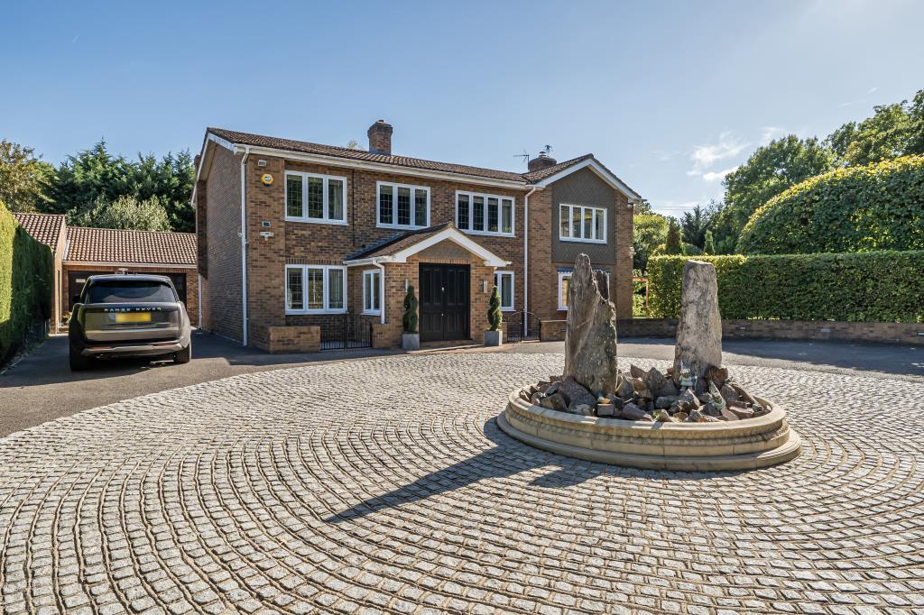
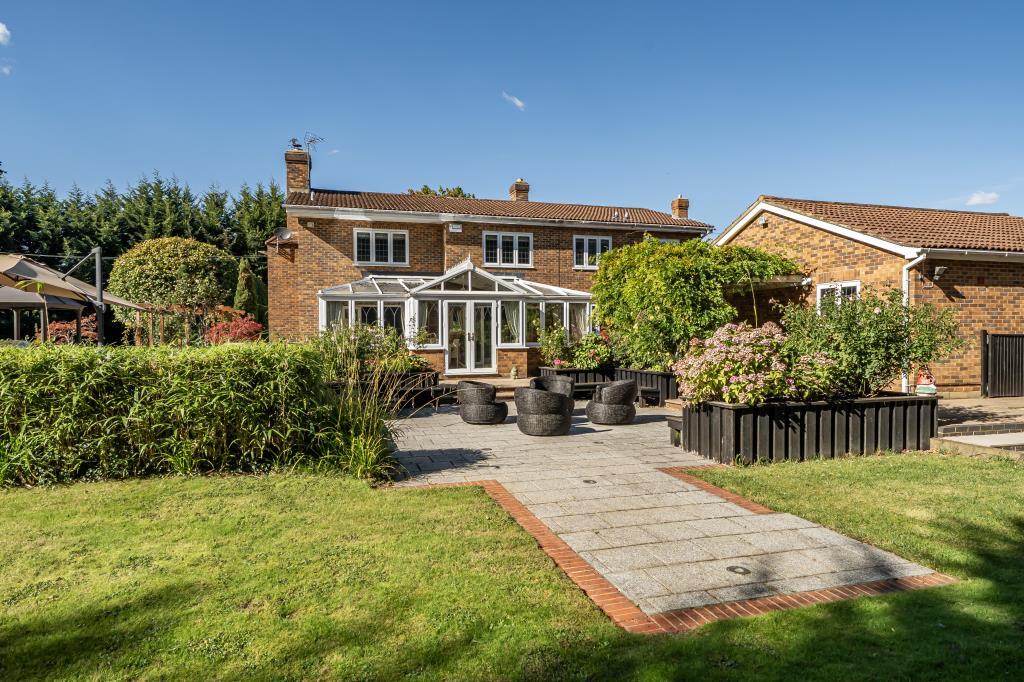
RG10 0UA - 5 bedroom detached house for sale in Waingels Road, Charvil…
View on Property Piper
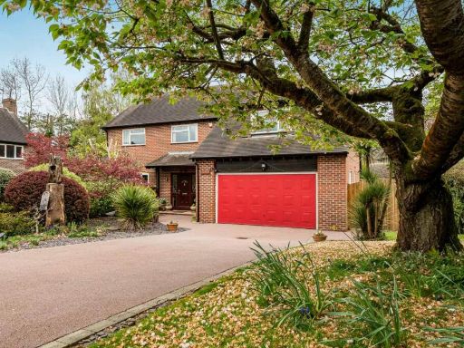
5 bedroom detached house for sale in Waingels Road, Charvil, RG10
Property Details
- Price: £1750000
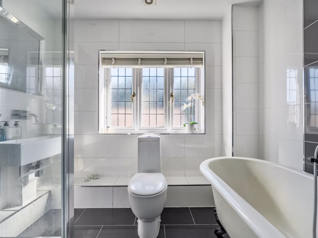
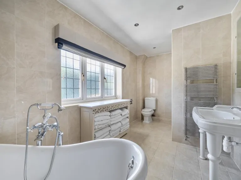
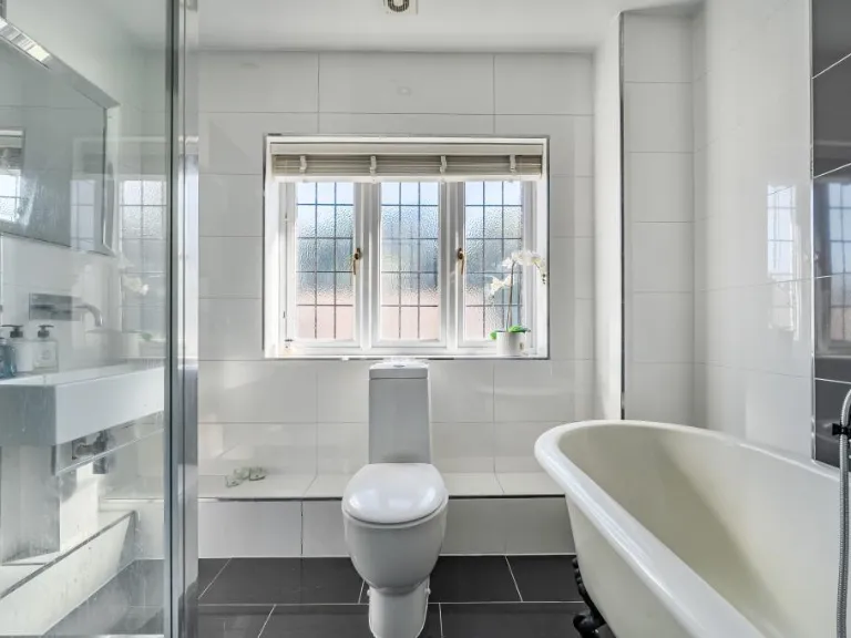
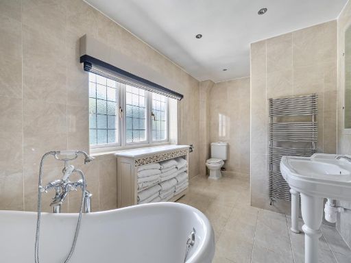
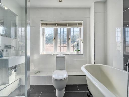
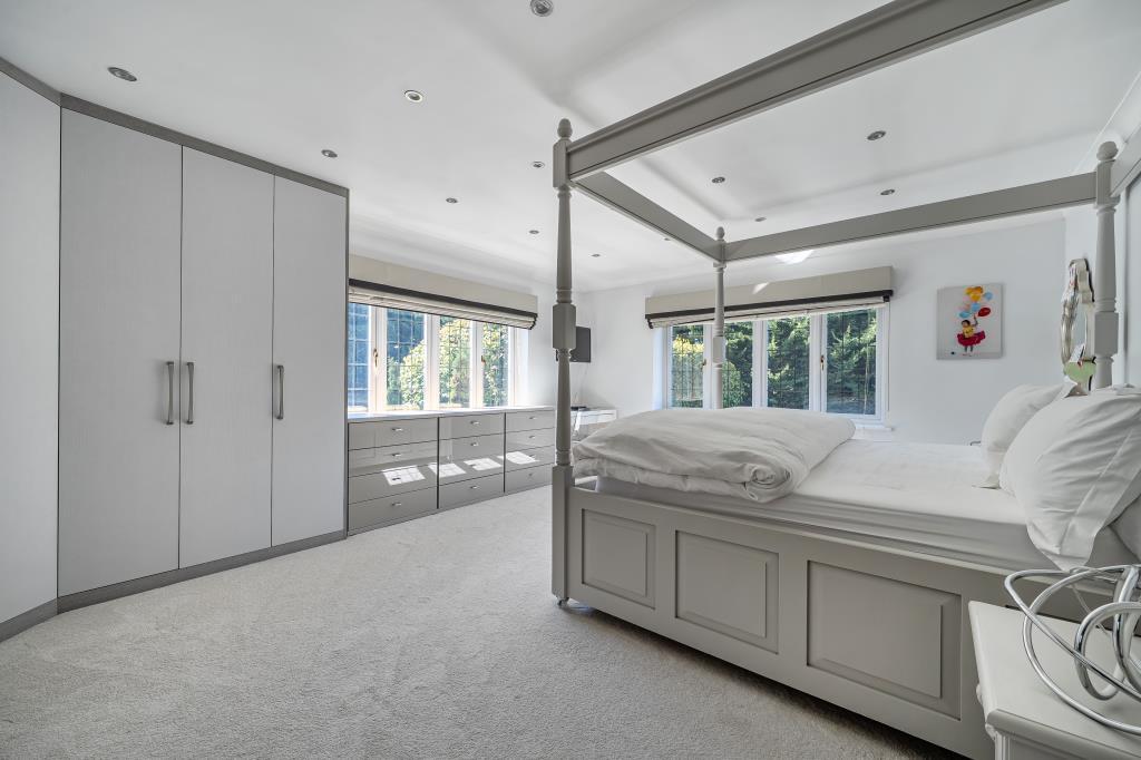
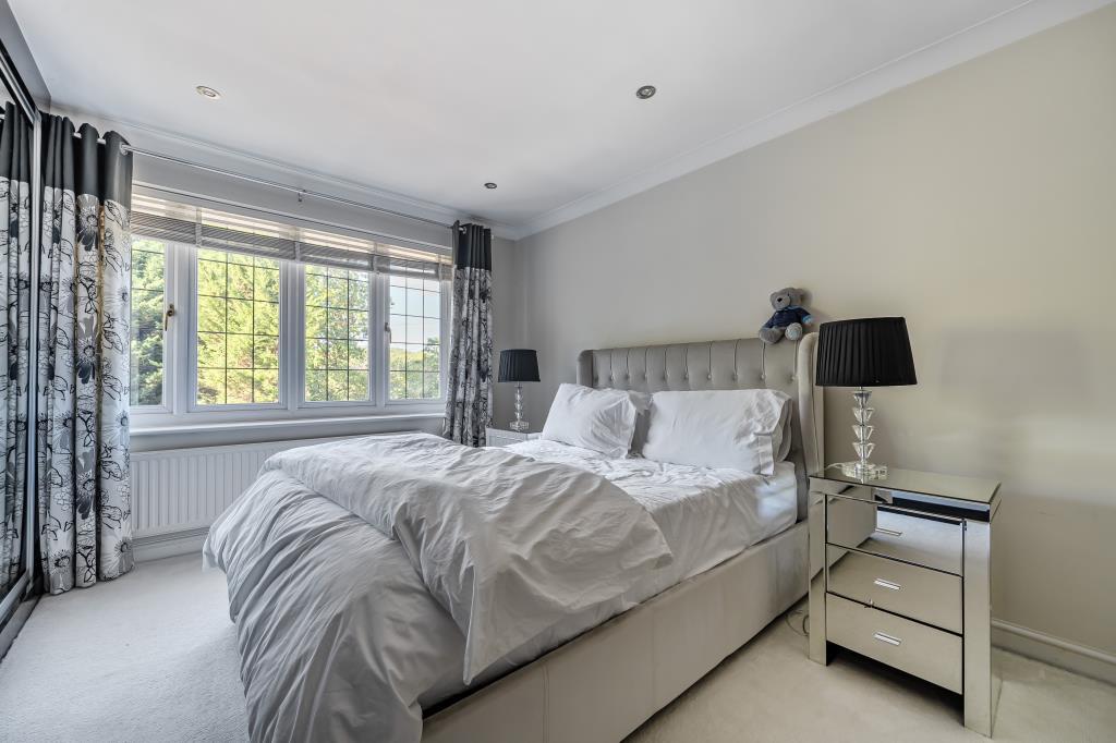
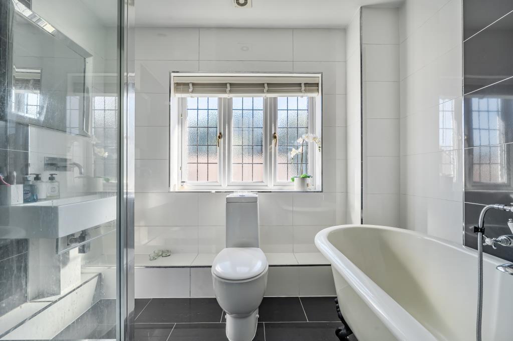
- Bedrooms: 5
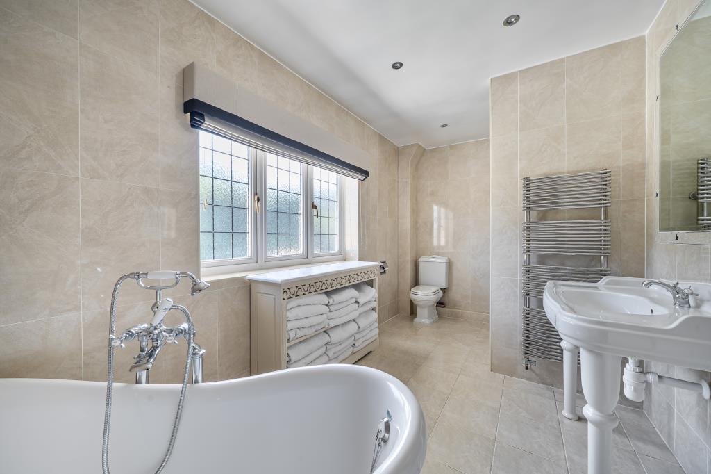
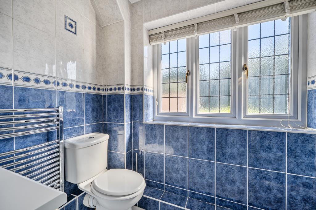
- Bathrooms: 3
- Property Type: undefined
- Property SubType: undefined
Image Descriptions
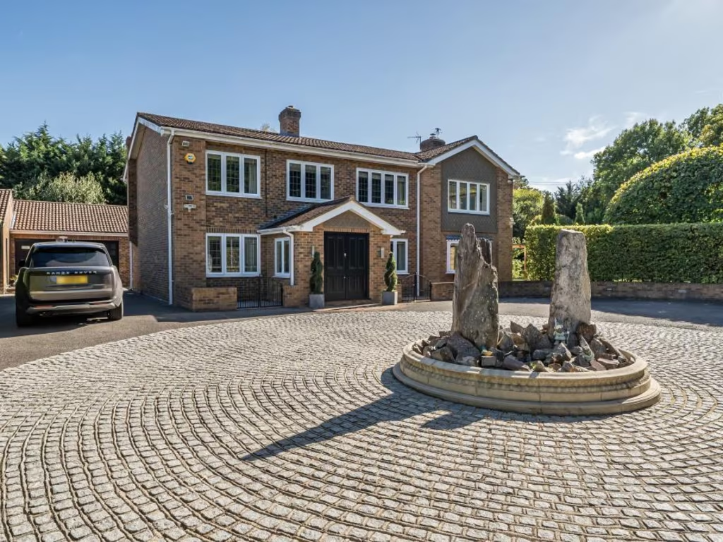
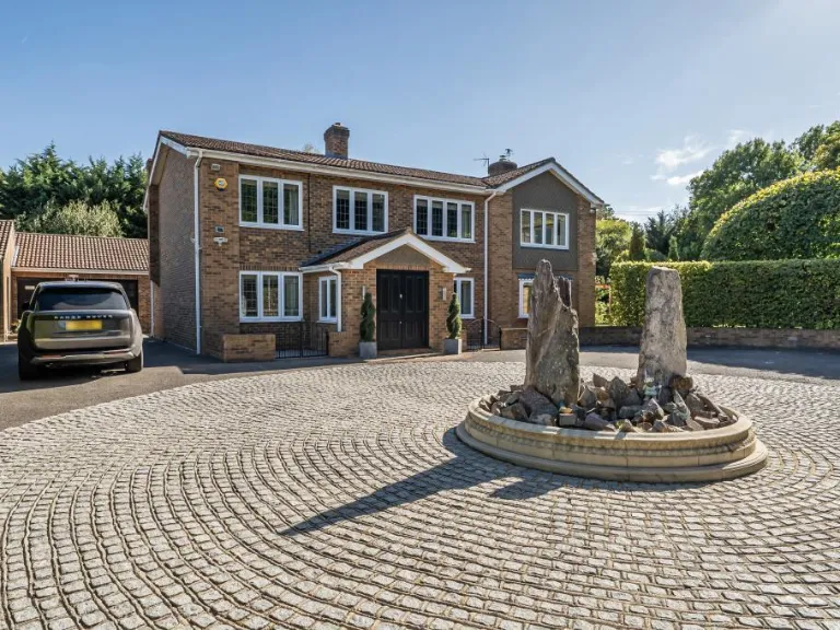
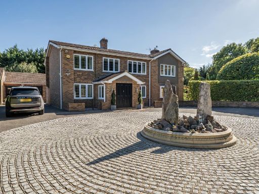
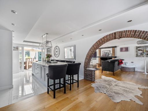
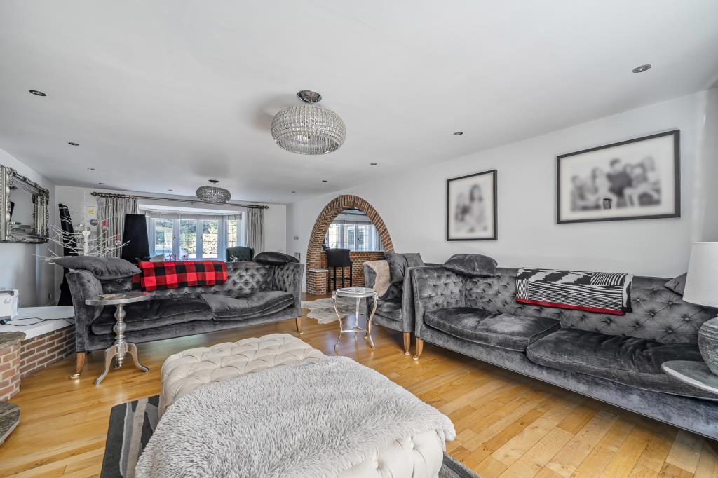
- detached house modern
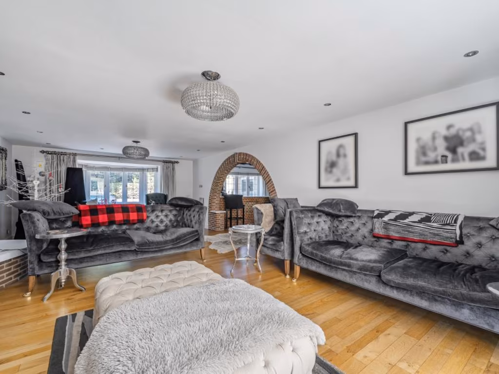
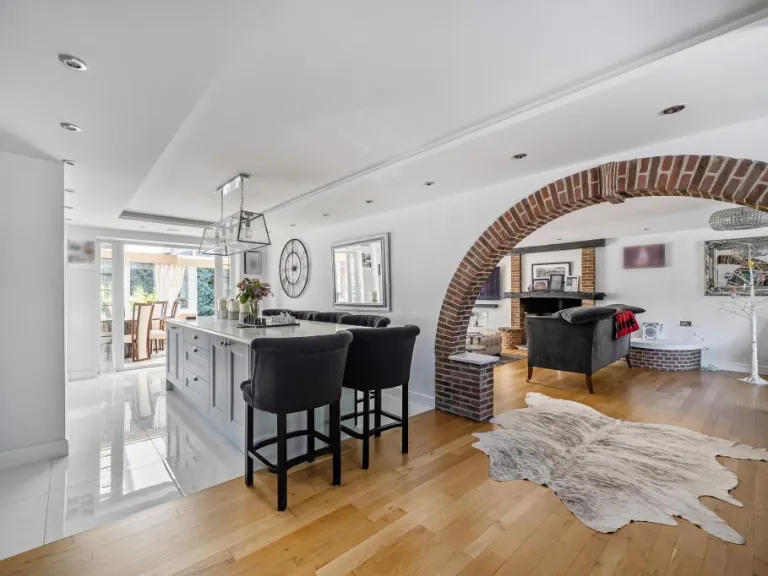
- modern living room modern
Rooms
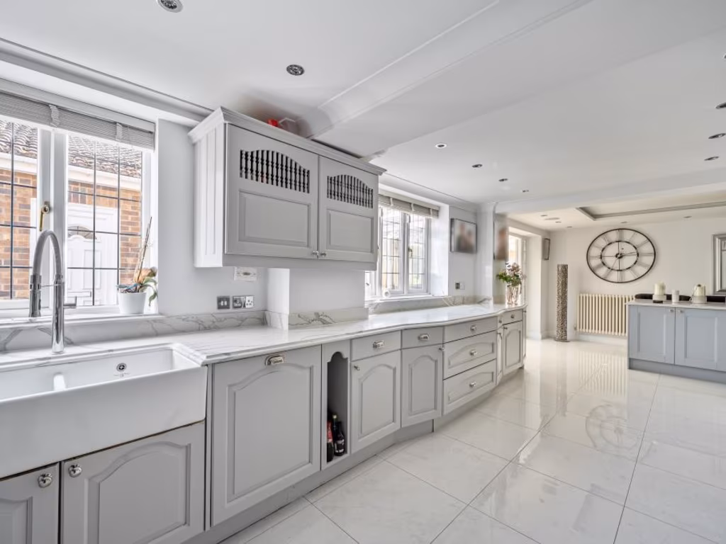
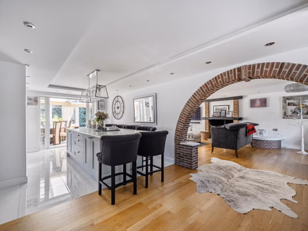
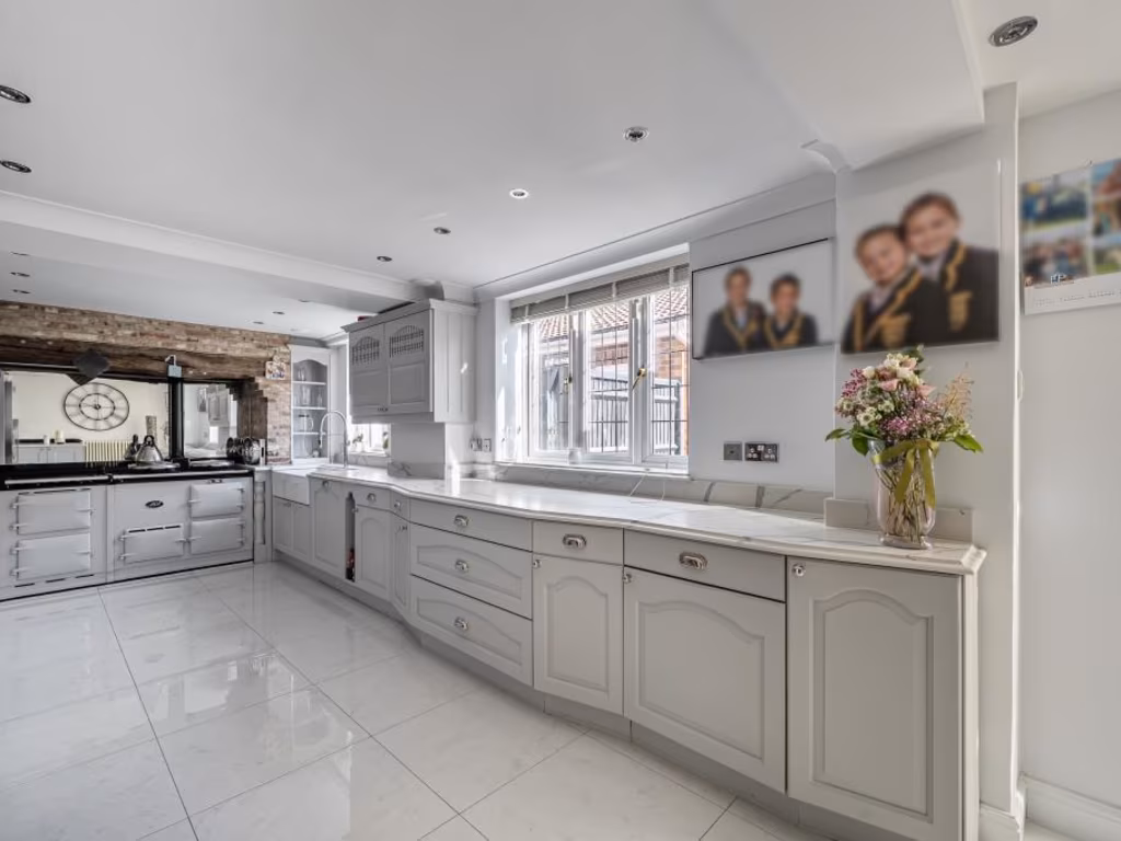
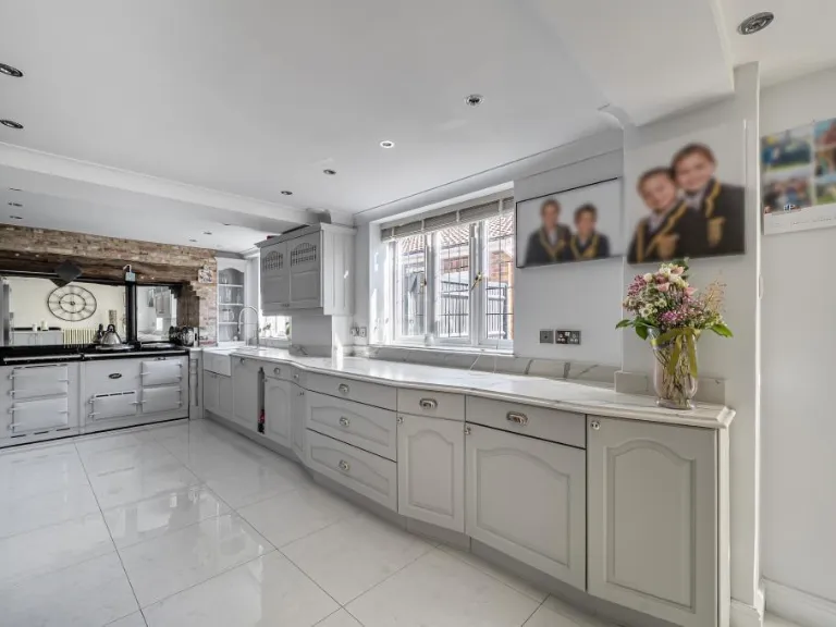
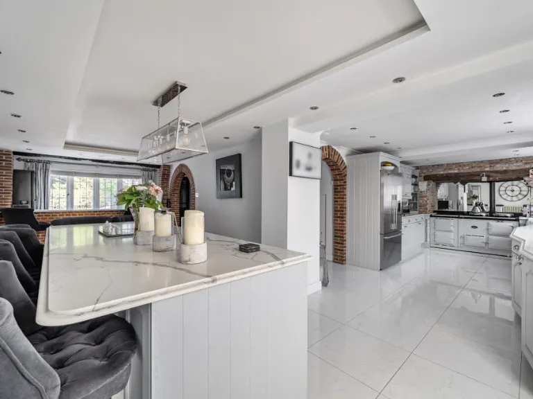
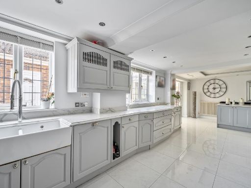
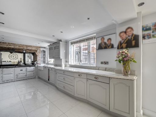
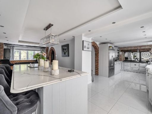
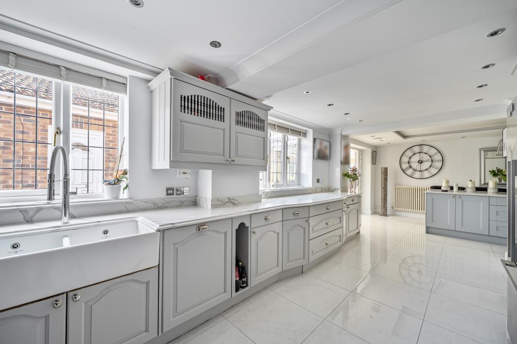
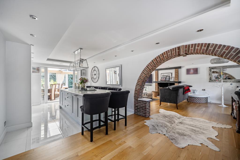
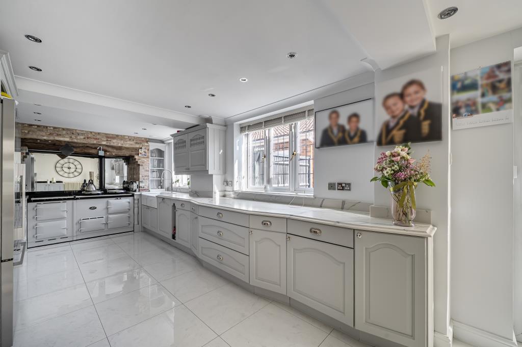
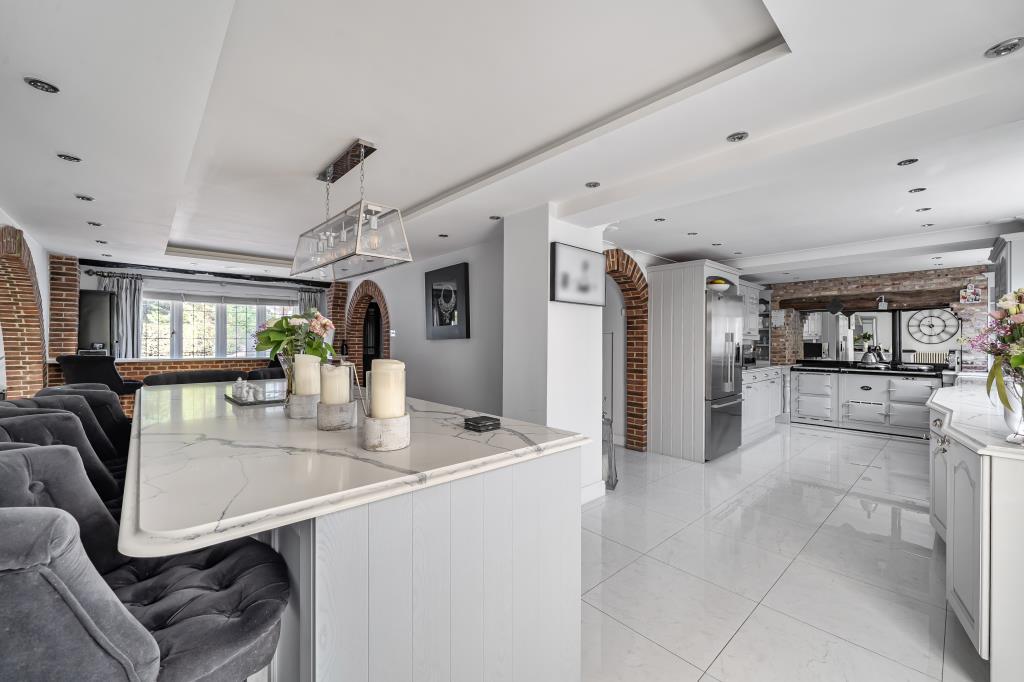
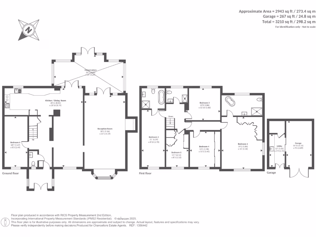
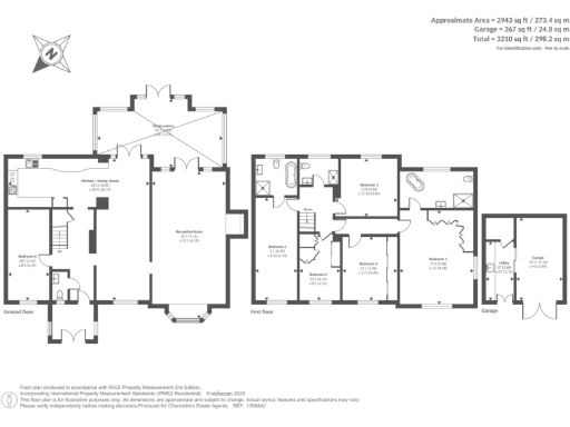
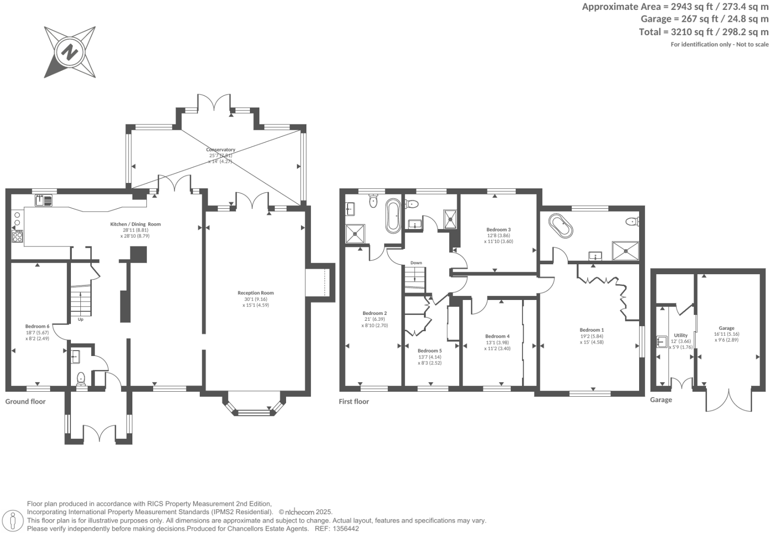
- Kitchen / Dining Room:
- Reception Room:
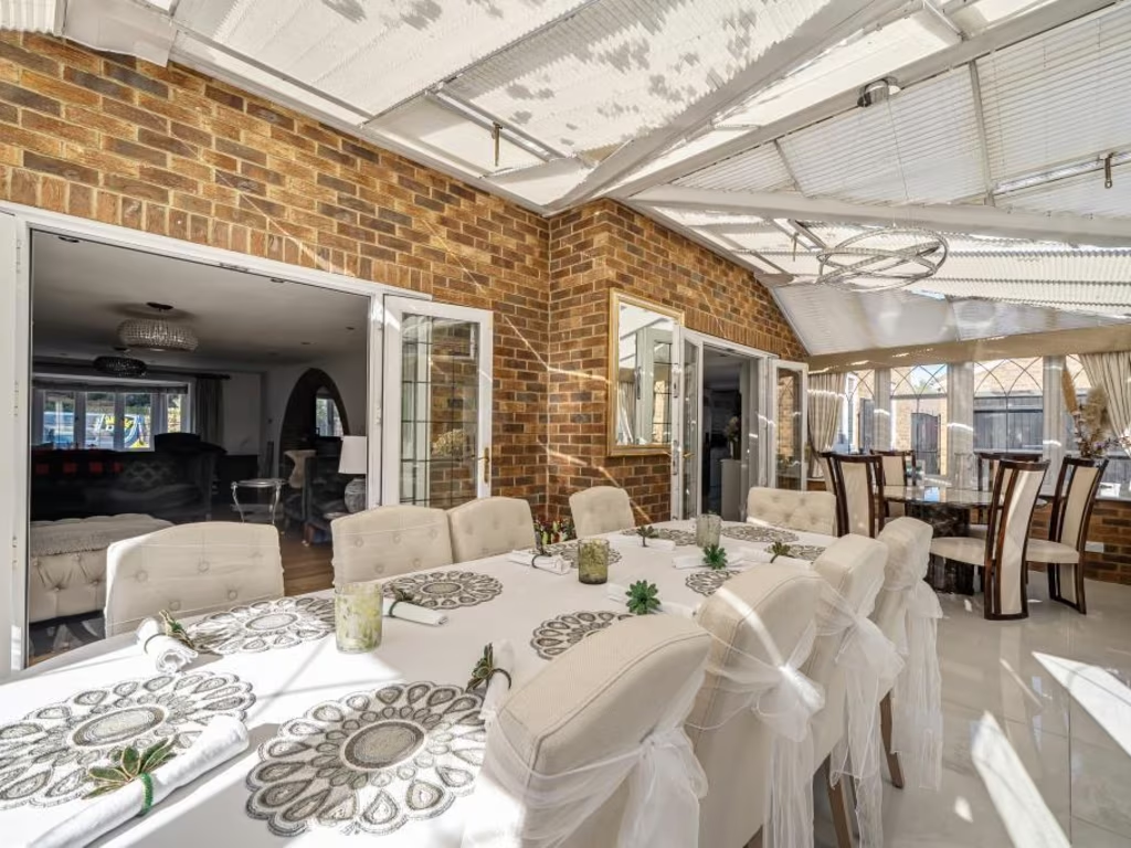
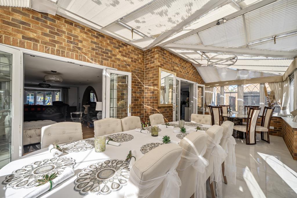
- Conservatory:
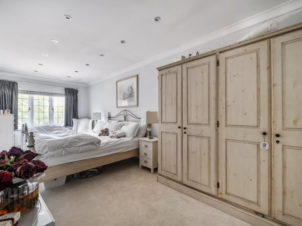
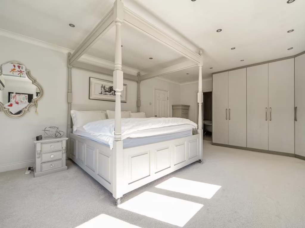
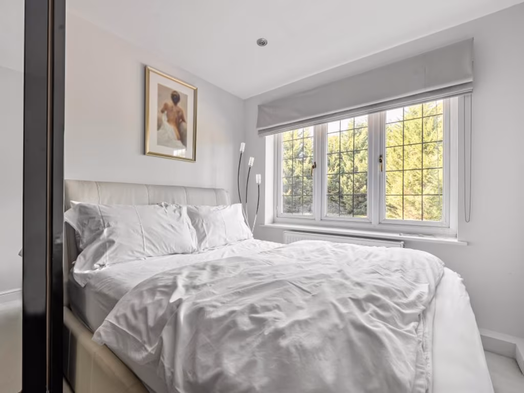
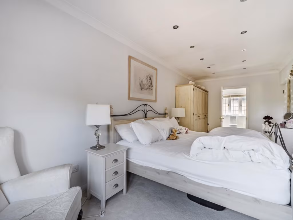
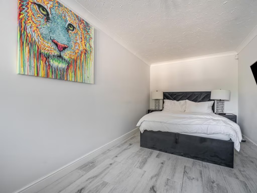
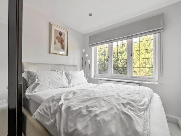
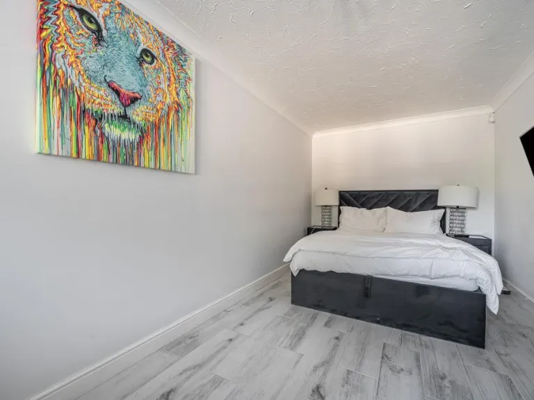
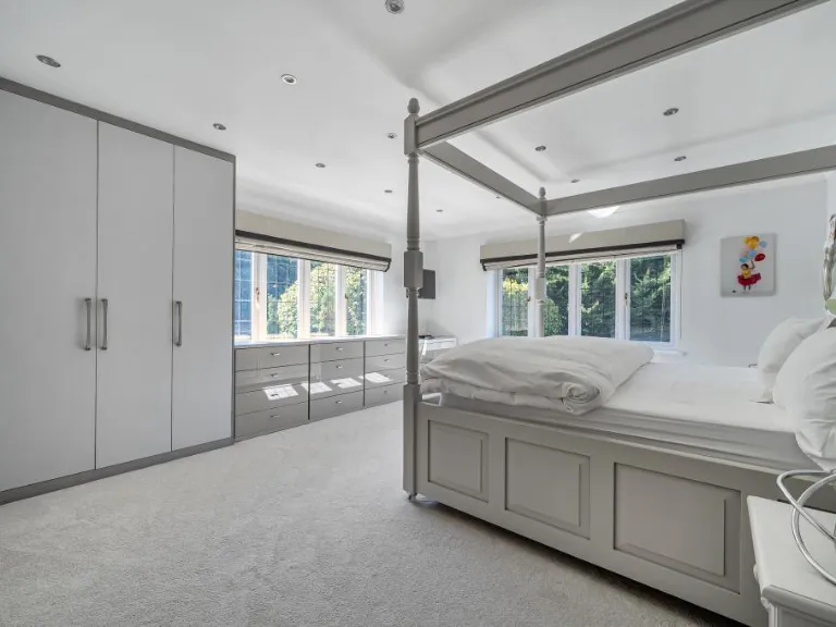
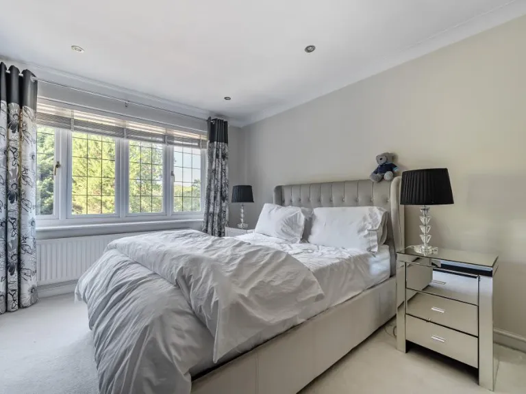
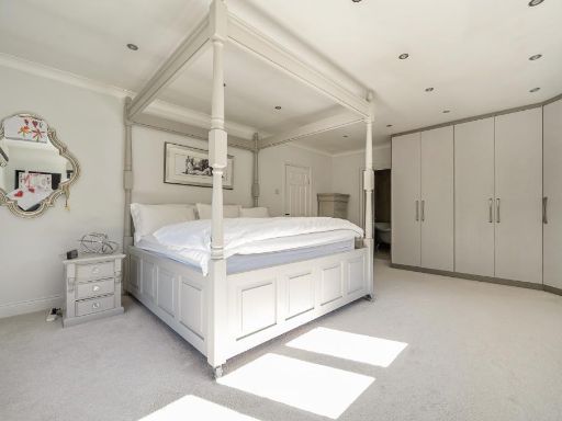
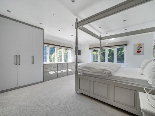
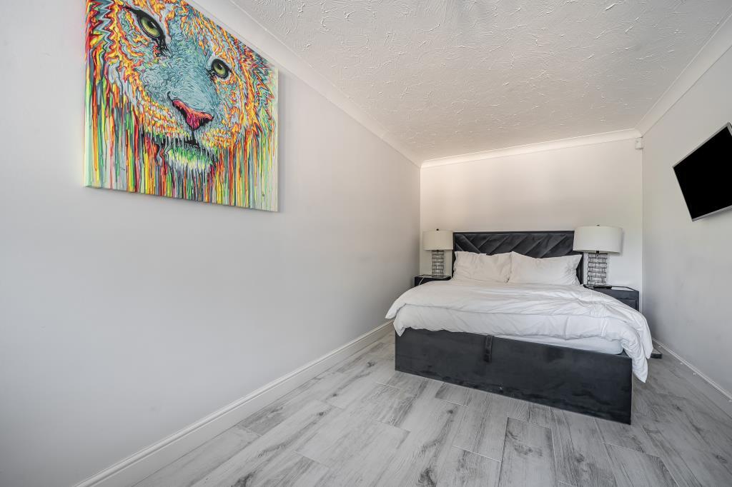
- Bedroom 6:
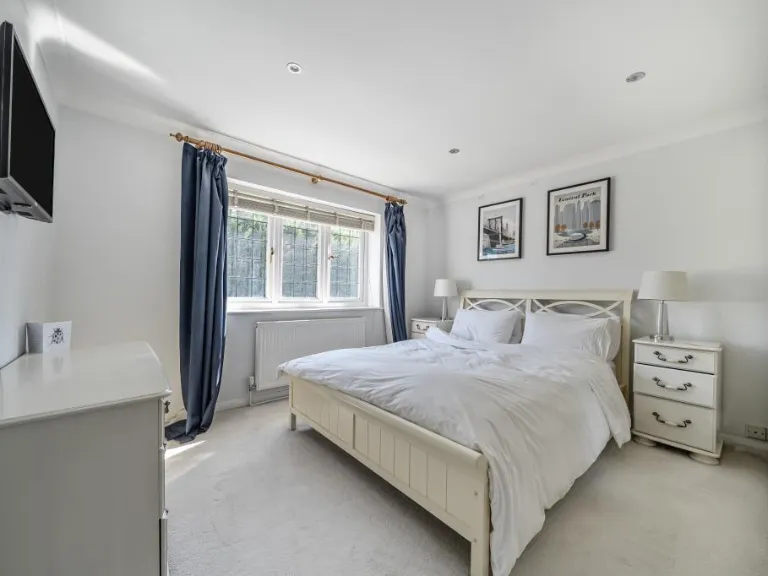
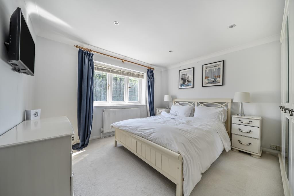
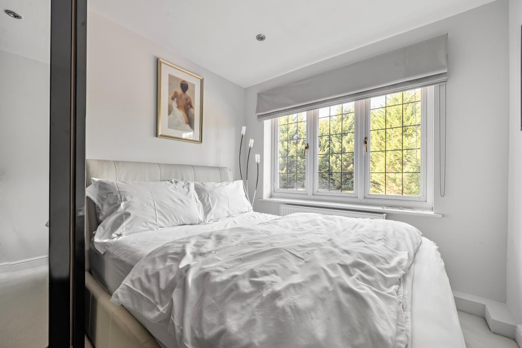
- Bedroom 2:
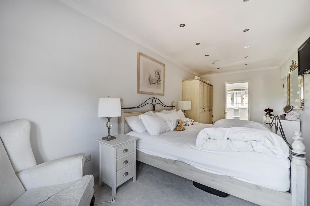
- Bedroom 5:
- Bedroom 4:
- Bedroom 3:
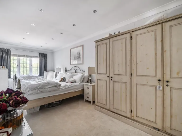
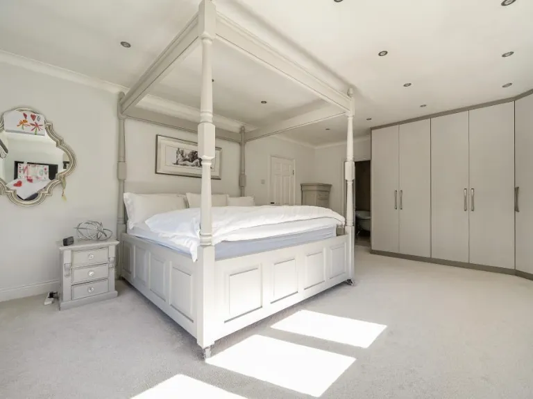
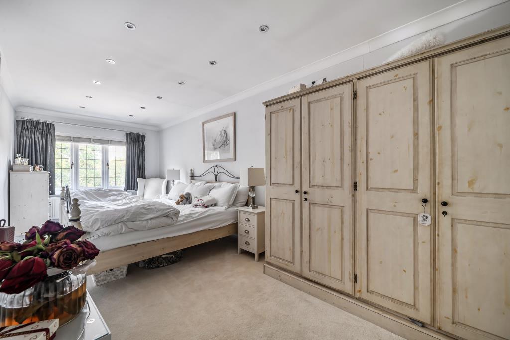
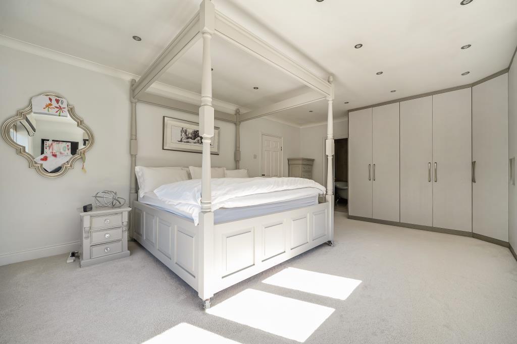
- Bedroom 1:
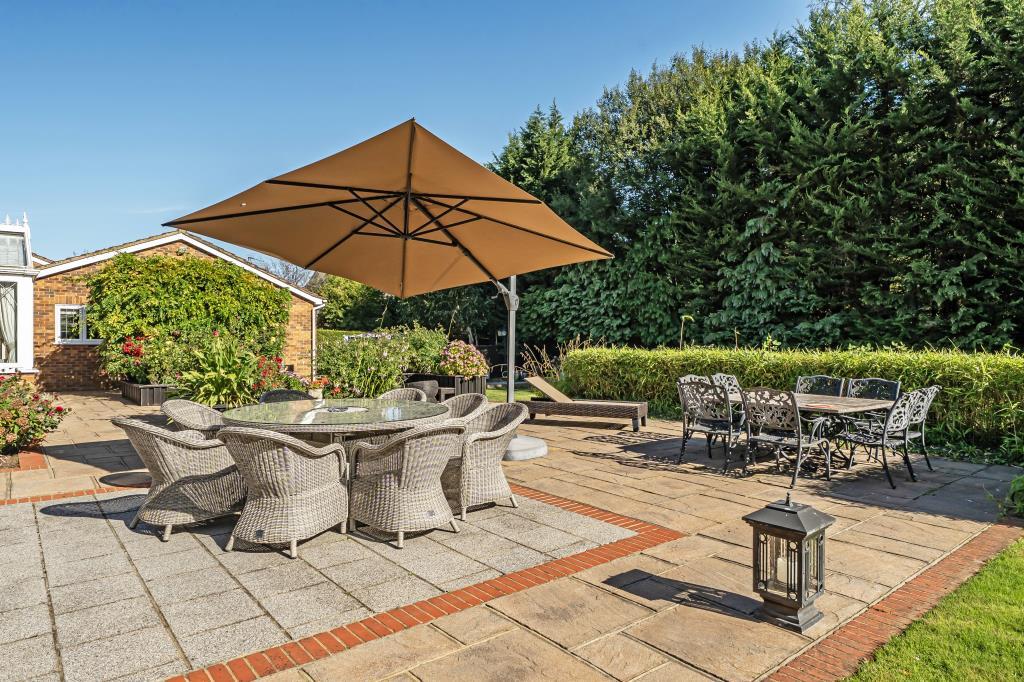
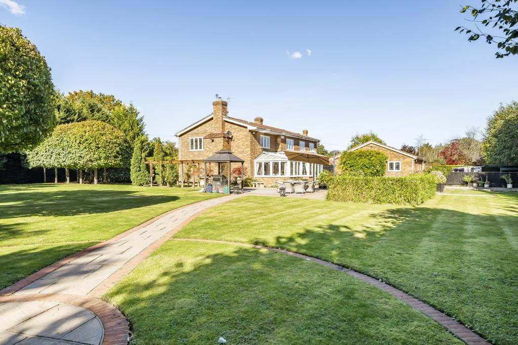
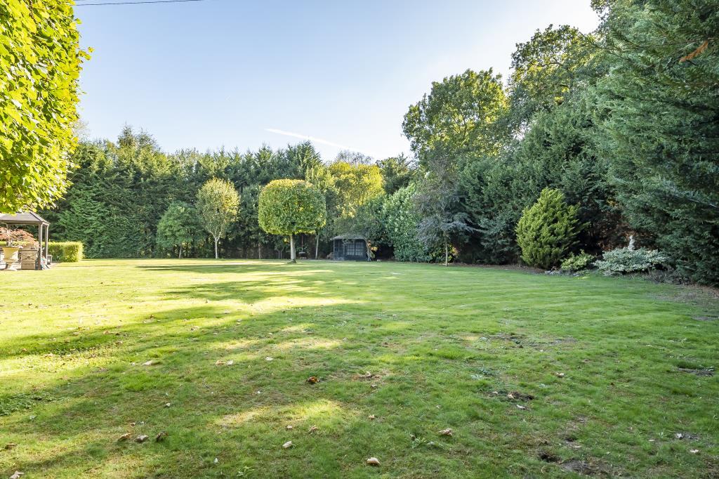
Textual Property Features
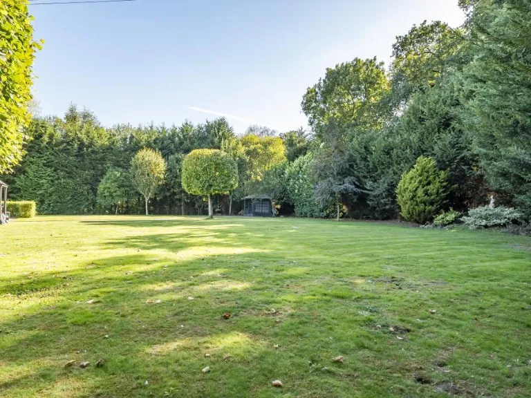
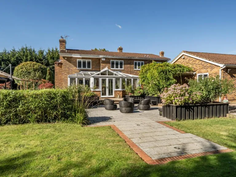
Detected Visual Features
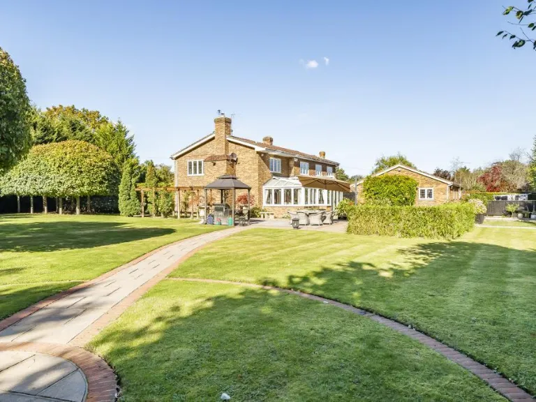
- detached
- modern
- two-storey
- brick exterior
- double glazing
- driveway
- circular fountain
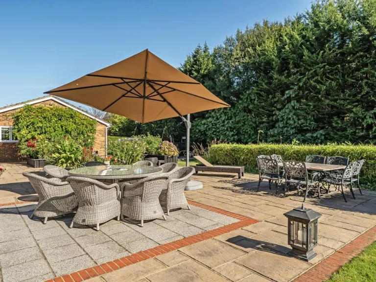
- landscaped garden
- modern style
- open plan
- natural light
- wood flooring
- renovated
- spacious living room
- arched doorway
EPC Details
- High performance glazing
- Average thermal transmittance 0.19 W/m-¦K
- Air source heat pump, underfloor, electric
- Low energy lighting in 88% of fixed outlets
- Average thermal transmittance 0.13 W/m-¦K
Nearby Schools
- Winnersh Primary School
- Highwood Primary School
- St Nicholas Church of England Primary, Hurst
- Willow Bank Infant School
- Sonning Church of England Primary School
- The Piggott School
- Shiplake Church of England School
- The Forest School
- Rivermead Primary School
- Woodley CofE Primary School
- Polehampton Church of England Infant School
- Robert Piggott CofE Junior School
- Robert Piggott CofE Infant School
- Wheatfield Primary School
- Beechwood Primary School
- Willow Bank Junior School
- Dolphin School
- Shiplake College
- Bearwood Primary School
- Loddon Primary School
- St Dominic Savio Catholic Primary School
- Waingels
- Reading Blue Coat School
- The Colleton Primary School
- Polehampton Church of England Junior School
Nearest Bars And Restaurants
- Id: 82311589
- Tags:
- Addr:
- City: Reading
- Country: GB
- Housenumber: 58
- Postcode: RG5 4JE
- Street: Headley Road
- Amenity: restaurant
- Building: yes
- Cuisine: indian
- Name: Red Rose
- Phone: +44 1189440908
- Source:
- Building: OS_OpenData_StreetView
- Website: http://redrosewoodley.com/
- TagsNormalized:
- Lat: 51.4538973
- Lon: -0.9010261
- FullGeoHash: gcpkeqzustdh
- PartitionGeoHash: gcpk
- Images:
- FoodStandards: null
- Distance: 1656.6
,- Id: 84217862
- Tags:
- Addr:
- Amenity: pub
- Building: yes
- Name: Bull and Chequers
- Source:
- Building: OS_OpenData_StreetView
- Wikidata: Q26411571
- TagsNormalized:
- Lat: 51.4553815
- Lon: -0.8963492
- FullGeoHash: gcpkex5m3d3d
- PartitionGeoHash: gcpk
- Images:
- FoodStandards: null
- Distance: 1343.2
,- Id: 530645467
- Tags:
- Amenity: fast_food
- Brand: Pizza Hut
- Brand:wikidata: Q107293079
- Cuisine: pizza
- Name: Pizza Hut (Takeaway)
- Takeaway: yes
- TagsNormalized:
- fast food
- food
- pizza
- pizza hut
- hut
- takeaway
- Lat: 51.4547405
- Lon: -0.8883044
- FullGeoHash: gcpkez11t4b4
- PartitionGeoHash: gcpk
- Images:
- FoodStandards: null
- Distance: 1251.6
,- Id: 108724936
- Tags:
- Addr:
- Amenity: fast_food
- Building: yes
- Cuisine: chinese
- Name: Want Want Chinese take away
- Phone: +44 118 9693 288
- Source:
- Building: OS_OpenData_StreetView
- TagsNormalized:
- Lat: 51.4590874
- Lon: -0.8943556
- FullGeoHash: gcpkexufbj0j
- PartitionGeoHash: gcpk
- Images:
- FoodStandards: null
- Distance: 918.8
,- Id: 203442441
- Tags:
- Amenity: pub
- Building: yes
- Name: Heron on the Ford
- Source:
- Building: OS_OpenData_StreetView
- TagsNormalized:
- Lat: 51.4668915
- Lon: -0.8765201
- FullGeoHash: gcpku138regn
- PartitionGeoHash: gcpk
- Images:
- FoodStandards: null
- Distance: 733.9
}
Nearest General Shops
- Id: 7379606286
- Tags:
- Brand: Toolstation
- Brand:wikidata: Q7824103
- Brand:wikipedia: en:Toolstation
- Name: Toolstation
- Shop: doityourself
- TagsNormalized:
- station
- toolstation
- doityourself
- shop
- Lat: 51.4541696
- Lon: -0.8931429
- FullGeoHash: gcpkewvwk22m
- PartitionGeoHash: gcpk
- Images:
- FoodStandards: null
- Distance: 1379
,- Id: 3150221382
- Tags:
- Addr:
- Brand: Screwfix
- Brand:wikidata: Q7439115
- Name: Screwfix
- Shop: doityourself
- Website: https://www.screwfix.com/
- TagsNormalized:
- Lat: 51.4542395
- Lon: -0.8929031
- FullGeoHash: gcpkewvy9v7n
- PartitionGeoHash: gcpk
- Images:
- FoodStandards: null
- Distance: 1366.5
,- Id: 108724925
- Tags:
- Addr:
- City: Reading
- Postcode: RG5 4PS
- Building: yes
- Name: Traditional Barber
- Shop: hairdresser
- Source:
- Building: OS_OpenData_StreetView
- TagsNormalized:
- Lat: 51.4591441
- Lon: -0.8944159
- FullGeoHash: gcpkexuenxep
- PartitionGeoHash: gcpk
- Images:
- FoodStandards: null
- Distance: 915.9
}
Nearest Grocery shops
- Id: 204208027
- Tags:
- Addr:
- Housenumber: 36
- Postcode: RG10 9QX
- Building: yes
- Name: Nisa Local
- Opening_hours: Mo-Su 07:00-21:30
- Shop: convenience
- Website: http://www.nisalocally.co.uk
- TagsNormalized:
- nisa
- nisa local
- convenience
- shop
- Lat: 51.4785655
- Lon: -0.8862809
- FullGeoHash: gcpkgg6skhjh
- PartitionGeoHash: gcpk
- Images:
- FoodStandards: null
- Distance: 1401.7
,- Id: 204176138
- Tags:
- Addr:
- City: Charvil
- Postcode: RG10 9RL
- Street: New Bath Road
- Atm: yes
- Branch: Petrol Charvil
- Building: yes
- Fhrs:
- Name: The Co-operative Food
- Opening_hours: 24/7
- Shop: convenience
- Website: https://finder.coop.co.uk/food/store/RG10-9RL/new-bath-road
- TagsNormalized:
- atm
- the co-operative food
- food
- convenience
- shop
- Lat: 51.4746543
- Lon: -0.8905138
- FullGeoHash: gcpkgdxt9e0c
- PartitionGeoHash: gcpk
- Images:
- FoodStandards: null
- Distance: 995.9
,- Id: 108724938
- Tags:
- Addr:
- Building: yes
- Name: Brecon Food and Wine
- Shop: convenience
- Source:
- Building: OS_OpenData_StreetView
- TagsNormalized:
- Lat: 51.4590308
- Lon: -0.8942952
- FullGeoHash: gcpkexuf96t5
- PartitionGeoHash: gcpk
- Images:
- FoodStandards: null
- Distance: 921.8
}
Nearest Religious buildings
- Id: 173538729
- Tags:
- Addr:
- Amenity: school
- Name: Sonning Church of England Primary School
- Ref:
- Source:
- Addr:
- Postcode: get-information-schools.service.gov.uk
- Wikidata: Q66223056
- TagsNormalized:
- Lat: 51.468817
- Lon: -0.9077187
- FullGeoHash: gcpkg3e58dgu
- PartitionGeoHash: gcpk
- Images:
- FoodStandards: null
- Distance: 1469.1
,- Id: 83591433
- Tags:
- Addr:
- Amenity: place_of_worship
- Building: yes
- Denomination: baptist
- Name: Woodley Baptist
- Religion: christian
- Source:
- Building: OS_OpenData_StreetView
- TagsNormalized:
- place of worship
- baptist
- christian
- church
- Lat: 51.4548184
- Lon: -0.8888805
- FullGeoHash: gcpkez0dp96e
- PartitionGeoHash: gcpk
- Images:
- FoodStandards: null
- Distance: 1246.5
,- Id: 84278268
- Tags:
- Addr:
- Amenity: place_of_worship
- Building: church
- Denomination: anglican
- Name: The Parish Church of St. John the Evangelist
- Religion: christian
- Source:
- Building: OS_OpenData_StreetView
- Wikidata: Q7593806
- Wikipedia: en:St John the Evangelist Church, Woodley
- TagsNormalized:
- place of worship
- church
- anglican
- evangelist
- parish
- christian
- Lat: 51.4569731
- Lon: -0.8954794
- FullGeoHash: gcpkex7ytg40
- PartitionGeoHash: gcpk
- Images:
- FoodStandards: null
- Distance: 1159.6
}
Nearest Medical buildings
- Id: 1641017483
- Tags:
- Amenity: doctors
- Healthcare: doctor
- Name: Parkside Family Practice
- Opening_hours: Mo-Fr 08:30-11:00,16:00-18:00
- Phone: +44 118 926 0026
- Website: http://www.parksidefamilypractice.org.uk/
- TagsNormalized:
- doctor
- doctors
- health
- healthcare
- Lat: 51.4531968
- Lon: -0.9048327
- FullGeoHash: gcpkeqv0eg5f
- PartitionGeoHash: gcpk
- Images:
- FoodStandards: null
- Distance: 1881.8
,- Id: 7330118404
- Tags:
- Addr:
- City: Woodley
- Housename: Flat E Shopping Piazza
- Postcode: RG5 4UL
- Street: Hurricane Way
- Amenity: dentist
- Healthcare: dentist
- Name: Loddon Vale Dental Practice
- TagsNormalized:
- dentist
- health
- healthcare
- dental
- Lat: 51.4549333
- Lon: -0.8883418
- FullGeoHash: gcpkez14snu2
- PartitionGeoHash: gcpk
- Images:
- FoodStandards: null
- Distance: 1230.4
,- Id: 530650156
- Tags:
- TagsNormalized:
- Lat: 51.4551054
- Lon: -0.8885424
- FullGeoHash: gcpkez0gxqyg
- PartitionGeoHash: gcpk
- Images:
- FoodStandards: null
- Distance: 1212.5
,- Id: 232370826
- Tags:
- Addr:
- Amenity: doctors
- Building: yes
- Name: St Jonhs Ambulance
- Source:
- Building: OS_OpenData_StreetView
- Website: http://www.sja.org.uk
- TagsNormalized:
- Lat: 51.4575378
- Lon: -0.8952928
- FullGeoHash: gcpkexs1fhm3
- PartitionGeoHash: gcpk
- Images:
- FoodStandards: null
- Distance: 1099
}
Nearest Airports
- Id: 14001268
- Tags:
- Access: yes
- Aerodrome: international
- Aerodrome:type: public
- Aeroway: aerodrome
- Alt_name: London Heathrow
- Alt_name_2: London Heathrow Airport
- Ele: 25
- Iata: LHR
- Icao: EGLL
- Int_name: Heathrow Airport
- Name: London Heathrow Airport
- Note: area still approx
- Old_name: London Airport
- Operator: Heathrow Airport Limited
- Rank_aci:
- Ref: LHR
- Short_name: Heathrow
- Type: multipolygon
- Website: https://www.heathrow.com/
- Wikidata: Q8691
- Wikipedia: en:Heathrow Airport
- TagsNormalized:
- airport
- international airport
- Lat: 51.4677522
- Lon: -0.4547736
- FullGeoHash: gcpsv9kv7h2h
- PartitionGeoHash: gcps
- Images:
- FoodStandards: null
- Distance: 29942
}
Nearest Leisure Facilities
- Id: 537746149
- Tags:
- Leisure: pitch
- Sport: tennis
- TagsNormalized:
- Lat: 51.4712685
- Lon: -0.8814935
- FullGeoHash: gcpkgfn1geyu
- PartitionGeoHash: gcpk
- Images:
- FoodStandards: null
- Distance: 702.5
,- Id: 22957541
- Tags:
- Addr:
- City: Sonning-on-Thames
- Postcode: RG4 6GJ
- Street: Duffield Road
- Description: 18 hole Par 70
- Golf:
- Leisure: golf_course
- Name: Sonning Golf Club
- Phone: +44 118 969 2910
- Start_date: 1914
- Website: https://www.sonning-golf-club.co.uk/
- TagsNormalized:
- golf
- golf course
- leisure
- club
- Lat: 51.4694638
- Lon: -0.8944841
- FullGeoHash: gcpkg9sxm52q
- PartitionGeoHash: gcpk
- Images:
- FoodStandards: null
- Distance: 647.4
,- Id: 1268151150
- Tags:
- TagsNormalized:
- picnic
- picnic table
- leisure
- Lat: 51.4610027
- Lon: -0.8893187
- FullGeoHash: gcpkgb0qj65y
- PartitionGeoHash: gcpk
- Images:
- FoodStandards: null
- Distance: 574.8
,- Id: 72493294
- Tags:
- Leisure: playground
- Name: Ashenbury Play Area
- TagsNormalized:
- Lat: 51.4611491
- Lon: -0.8896838
- FullGeoHash: gcpkgb0nuv7x
- PartitionGeoHash: gcpk
- Images:
- FoodStandards: null
- Distance: 566.9
,- Id: 48551892
- Tags:
- Leisure: park
- Name: Ashenbury Park
- TagsNormalized:
- Lat: 51.4622321
- Lon: -0.8855474
- FullGeoHash: gcpkgb7jjpru
- PartitionGeoHash: gcpk
- Images:
- FoodStandards: null
- Distance: 427.6
}
Nearest Tourist attractions
- Id: 145351517
- Tags:
- TagsNormalized:
- Lat: 51.4445042
- Lon: -0.9152181
- FullGeoHash: gcpkejjtcyeu
- PartitionGeoHash: gcpk
- Images:
- FoodStandards: null
- Distance: 3084.8
,- Id: 1243353056
- Tags:
- TagsNormalized:
- Lat: 51.4416627
- Lon: -0.8757201
- FullGeoHash: gcpkshdm6hzy
- PartitionGeoHash: gcpk
- Images:
- FoodStandards: null
- Distance: 2813.5
,- Id: 82487215
- Tags:
- Addr:
- City: Woodley
- Country: GB
- County: Berkshire
- Housename: Museum of Berkshire Aviation
- Postcode: RG5 4UE
- Street: Mohawk Way
- Building: yes
- Name: The Museum Of Berkshire Aviation
- Opening_hours: Apr-Oct: We, Sa-Su 10:30-17:00;Apr-Oct: We 10:30-17:00;Apr-Oct: Su 12:00-16:00
- Source:
- Building: OS_OpenData_StreetView
- Tourism: museum
- Url: https://museumofberkshireaviation.co.uk/
- Wikidata: Q6940780
- Wikipedia: en:Museum of Berkshire Aviation
- TagsNormalized:
- Lat: 51.4504848
- Lon: -0.8828848
- FullGeoHash: gcpkeym0g392
- PartitionGeoHash: gcpk
- Images:
- FoodStandards: null
- Distance: 1745.2
}
Nearest Bus stations and stops
- Id: 530647140
- Tags:
- Bus: yes
- Highway: bus_stop
- Public_transport: platform
- TagsNormalized:
- Lat: 51.4543841
- Lon: -0.8888881
- FullGeoHash: gcpkeybxx2ku
- PartitionGeoHash: gcpk
- Images:
- FoodStandards: null
- Distance: 1294.6
,- Id: 530647176
- Tags:
- Highway: bus_stop
- Name: Woodley Plaza
- Public_transport: platform
- Route_ref: 19;19a
- TagsNormalized:
- Lat: 51.454404
- Lon: -0.8886453
- FullGeoHash: gcpkeybzth45
- PartitionGeoHash: gcpk
- Images:
- FoodStandards: null
- Distance: 1290.8
,- Id: 530647216
- Tags:
- Bus: yes
- Highway: bus_stop
- Name: Lysander Close
- Public_transport: platform
- TagsNormalized:
- Lat: 51.4549907
- Lon: -0.8853977
- FullGeoHash: gcpkez5709rx
- PartitionGeoHash: gcpk
- Images:
- FoodStandards: null
- Distance: 1225.7
,- Id: 530647185
- Tags:
- Highway: bus_stop
- Name: Lysander Close
- Public_transport: platform
- TagsNormalized:
- Lat: 51.4553934
- Lon: -0.8848001
- FullGeoHash: gcpkez5tqst1
- PartitionGeoHash: gcpk
- Images:
- FoodStandards: null
- Distance: 1185.7
,- Id: 6345372218
- Tags:
- Bench: yes
- Bin: yes
- Bus: yes
- Highway: bus_stop
- Lit: yes
- Name: Sonning Halt
- Public_transport: platform
- Shelter: yes
- Source: Bing
- Tactile_paving: no
- TagsNormalized:
- Lat: 51.4686175
- Lon: -0.903215
- FullGeoHash: gcpkg3w63tdn
- PartitionGeoHash: gcpk
- Images:
- FoodStandards: null
- Distance: 1160.5
}
Nearest Hotels
- Id: 360064117
- Tags:
- Addr:
- Housename: 100 Berkshire Place
- Postcode: RG41 5RD
- Street: Wharfedale Road
- Brand: Travelodge
- Brand:wikidata: Q9361374
- Brand:wikipedia: en:Travelodge UK
- Building: yes
- Fhrs:
- Authority: Wokingham
- Id: 741636
- Local_authority_id: 54394
- Name: Travelodge Winnersh Triangle
- Note: Moved based on perimeter walk-round. Previously: http://www.wokingham.gov.uk/planning-and-building-control/planning-application/search-planning-applications/ https://www.travelodge.co.uk/hotels/591/Winnersh-Triangle-hotel?checkin=23/01/2015#tabs-2
- Operator: Travelodge
- Tourism: hotel
- TagsNormalized:
- Lat: 51.4389985
- Lon: -0.8914437
- FullGeoHash: gcpkesnvgu76
- PartitionGeoHash: gcpk
- Images:
- FoodStandards: null
- Distance: 3014.5
,- Id: 82885263
- Tags:
- Addr:
- Building: yes
- Name: The Great House Hotel
- Source:
- Building: OS_OpenData_StreetView
- Tourism: hotel
- TagsNormalized:
- Lat: 51.4753669
- Lon: -0.9125477
- FullGeoHash: gcpkg4z98pgh
- PartitionGeoHash: gcpk
- Images:
- FoodStandards: null
- Distance: 2054.6
,- Id: 204176132
- Tags:
- Addr:
- City: Charvil
- Postcode: RG10 9RA
- Street: Old Bath Road
- Amenity: pub
- Brand: Hungry Horse
- Brand:wikidata: Q5943510
- Building: yes
- Fhrs:
- Name: The Wee Waif
- Operator: Greene King
- Source:
- Building: OS_OpenData_StreetView
- Tourism: hotel
- Website: https://www.hungryhorse.co.uk/pubs/berkshire/wee-waif/
- TagsNormalized:
- bar
- pub
- horses
- hungry horse
- hotel
- tourism
- Lat: 51.4749486
- Lon: -0.8899359
- FullGeoHash: gcpkgdxzqczs
- PartitionGeoHash: gcpk
- Images:
- FoodStandards: null
- Distance: 1019
}
Tags
- detached
- modern
- two-storey
- brick exterior
- double glazing
- driveway
- circular fountain
- landscaped garden
- modern style
- open plan
- natural light
- wood flooring
- renovated
- spacious living room
- arched doorway
Local Market Stats
- Average Price/sqft: £513
- Avg Income: £69100
- Rental Yield: 3%
- Social Housing: 6%
- Planning Success Rate: 83%
Similar Properties
 5 bedroom detached house for sale in Sonning Meadows, Sonning, Reading, Berkshire, RG4 — £1,250,000 • 5 bed • 3 bath • 2639 ft²
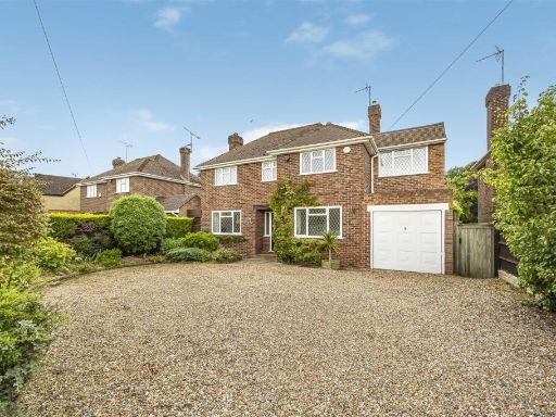 4 bedroom detached house for sale in Western Avenue, Woodley, RG5 — £825,000 • 4 bed • 3 bath • 1926 ft²
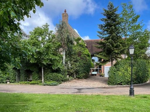 4 bedroom detached house for sale in Hazel Grove, Kingwood, RG9 — £1,100,000 • 4 bed • 3 bath • 2551 ft²
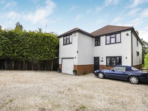 4 bedroom detached house for sale in Bath Road, Sonning, Reading, RG4 — £850,000 • 4 bed • 3 bath • 1742 ft²
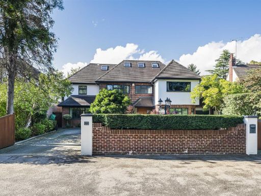 7 bedroom detached house for sale in The Spears, South Drive, Sonning, RG4 — £1,650,000 • 7 bed • 5 bath • 4367 ft²
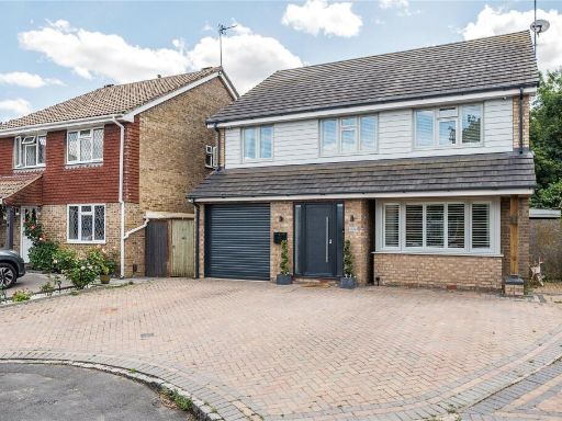 5 bedroom detached house for sale in Hambledon Close, Earley, Wokingham, RG6 — £900,000 • 5 bed • 4 bath • 1721 ft²
Meta
- {
"@context": "https://schema.org",
"@type": "Residence",
"name": "5 bedroom detached house for sale in Waingels Road, Charvil…",
"description": "",
"url": "https://propertypiper.co.uk/property/e7cd9372-fe79-4a54-b785-633861faa0cd",
"image": "https://image-a.propertypiper.co.uk/7c8adc33-c9d3-4942-a262-445cb6314e15-1024.jpeg",
"address": {
"@type": "PostalAddress",
"streetAddress": "KENROY WAINGELS ROAD LANDS END READING",
"postalCode": "RG10 0UA",
"addressLocality": "Wokingham",
"addressRegion": "Maidenhead",
"addressCountry": "England"
},
"geo": {
"@type": "GeoCoordinates",
"latitude": 51.46596768356419,
"longitude": -0.8870101910941771
},
"numberOfRooms": 5,
"numberOfBathroomsTotal": 3,
"floorSize": {
"@type": "QuantitativeValue",
"value": 3210,
"unitCode": "FTK"
},
"offers": {
"@type": "Offer",
"price": 1750000,
"priceCurrency": "GBP",
"availability": "https://schema.org/InStock"
},
"additionalProperty": [
{
"@type": "PropertyValue",
"name": "Feature",
"value": "detached"
},
{
"@type": "PropertyValue",
"name": "Feature",
"value": "modern"
},
{
"@type": "PropertyValue",
"name": "Feature",
"value": "two-storey"
},
{
"@type": "PropertyValue",
"name": "Feature",
"value": "brick exterior"
},
{
"@type": "PropertyValue",
"name": "Feature",
"value": "double glazing"
},
{
"@type": "PropertyValue",
"name": "Feature",
"value": "driveway"
},
{
"@type": "PropertyValue",
"name": "Feature",
"value": "circular fountain"
},
{
"@type": "PropertyValue",
"name": "Feature",
"value": "landscaped garden"
},
{
"@type": "PropertyValue",
"name": "Feature",
"value": "modern style"
},
{
"@type": "PropertyValue",
"name": "Feature",
"value": "open plan"
},
{
"@type": "PropertyValue",
"name": "Feature",
"value": "natural light"
},
{
"@type": "PropertyValue",
"name": "Feature",
"value": "wood flooring"
},
{
"@type": "PropertyValue",
"name": "Feature",
"value": "renovated"
},
{
"@type": "PropertyValue",
"name": "Feature",
"value": "spacious living room"
},
{
"@type": "PropertyValue",
"name": "Feature",
"value": "arched doorway"
}
]
}
High Res Floorplan Images
Compatible Floorplan Images
FloorplanImages Thumbnail