BN27 3PN - 4 bedroom detached house for sale in Ersham Road, Hailsham,…
View on Property Piper
4 bedroom detached house for sale in Ersham Road,
Hailsham,
BN27 3PN, BN27
Property Details
- Price: £500000
- Bedrooms: 4
- Bathrooms: 1
- Property Type: undefined
- Property SubType: undefined
Brochure Descriptions
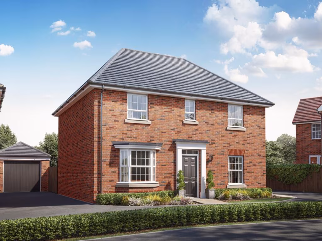
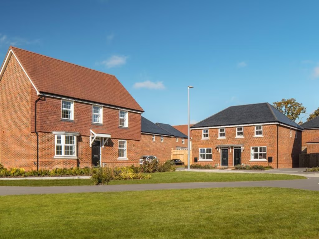
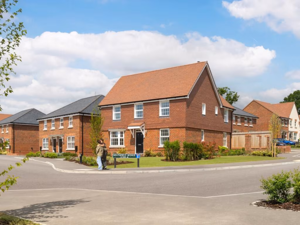
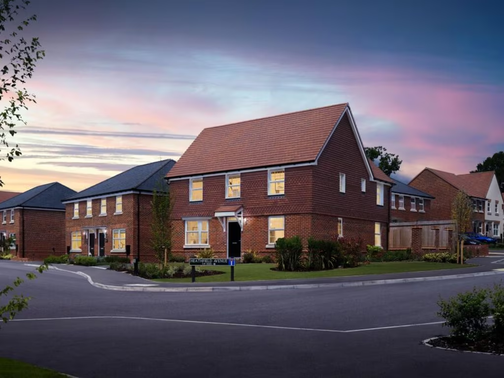
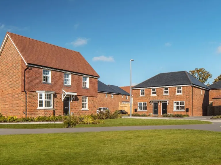
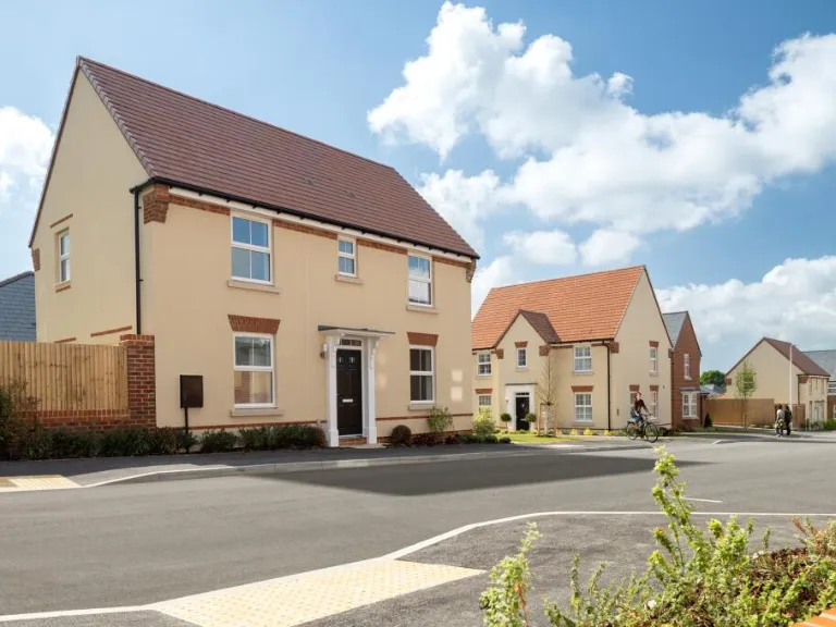
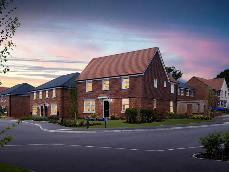
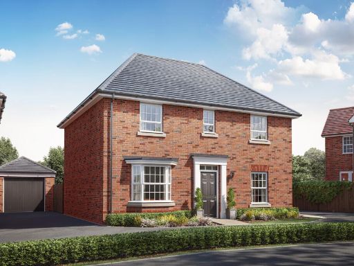
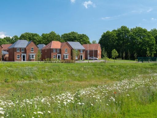
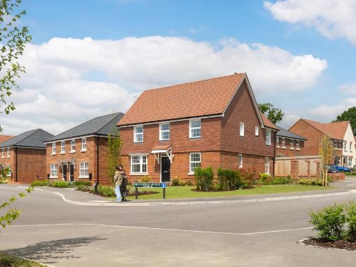
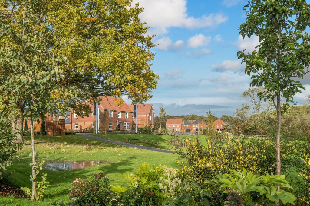
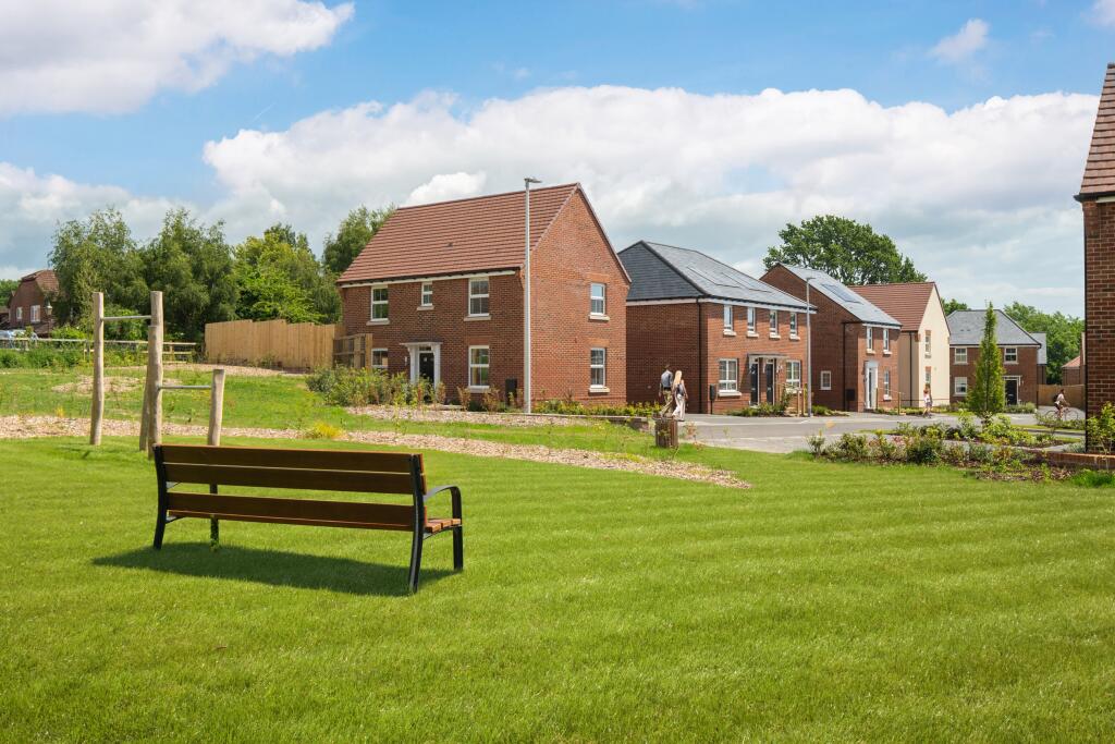
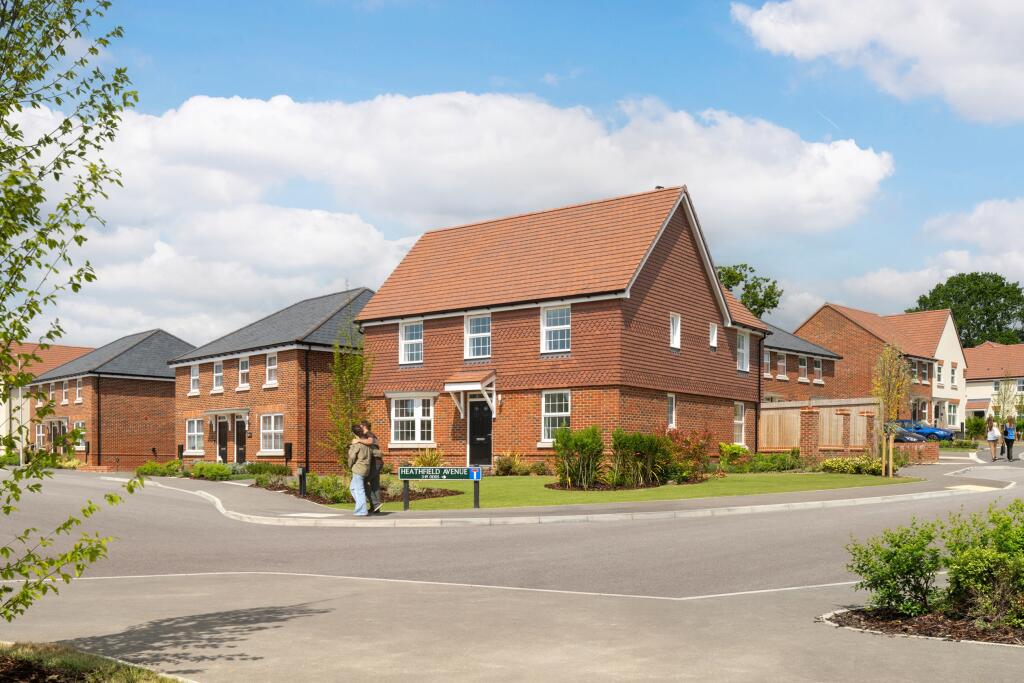
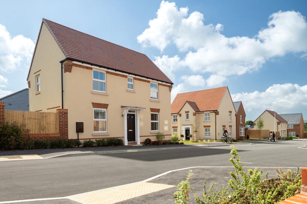
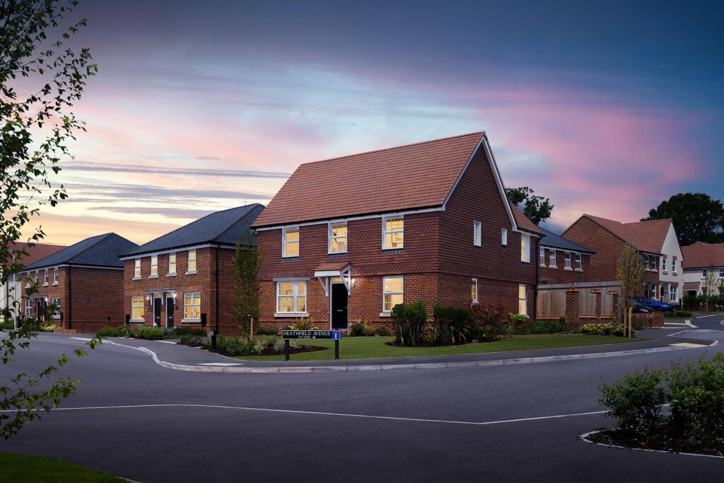
- The property, presumably named 'Ersham Park', conveys a sense of exclusivity and refinement. While the image does not provide detailed visual information about the property, the name itself suggests a prestigious and potentially expansive residence. The inferred qualities from the name could imply a setting that might enjoy expansive grounds or include significant historical or architectural features.
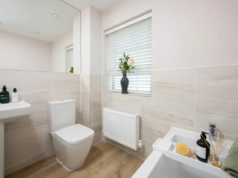
Image Descriptions
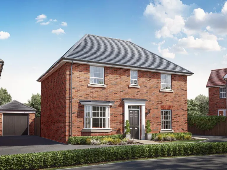
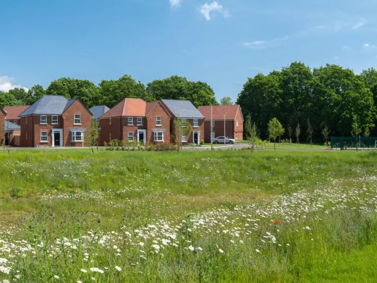
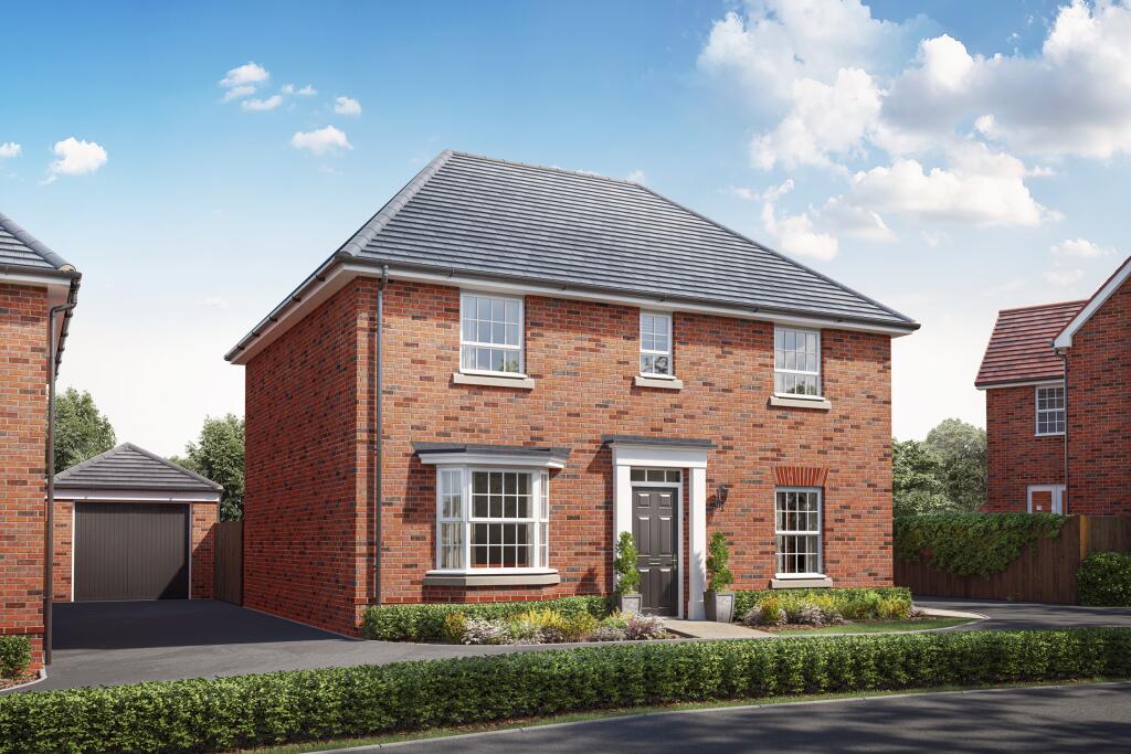
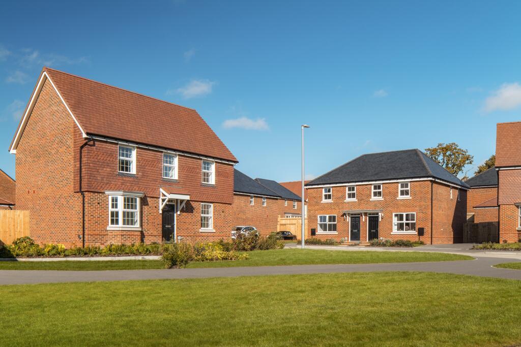
- a two-story detached home modern Georgian-inspired
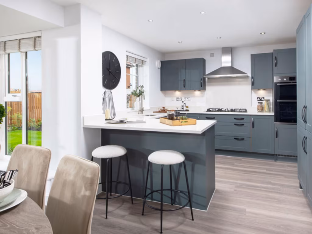
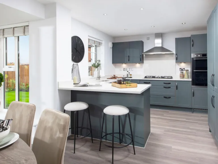
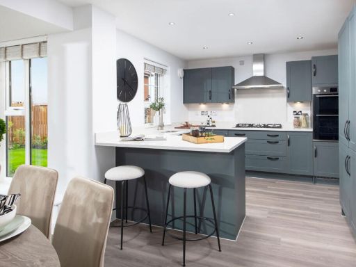
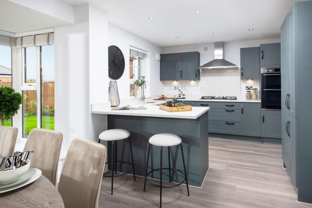
- kitchen interior contemporary
Floorplan Description
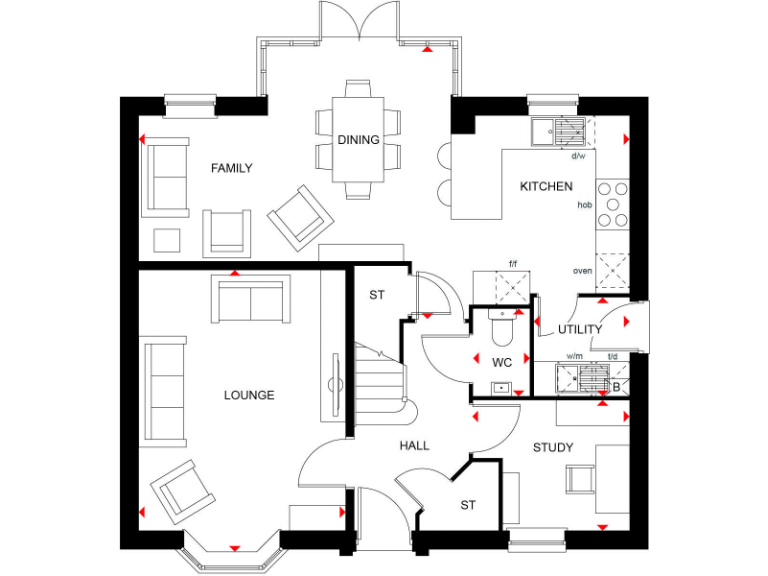
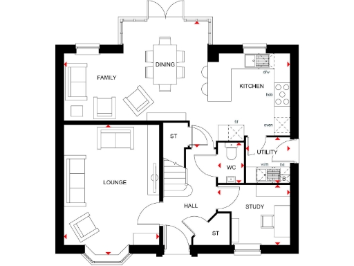
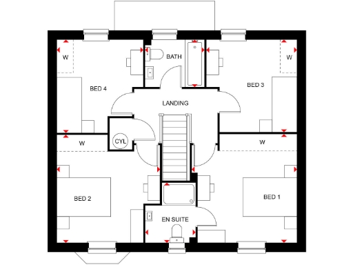
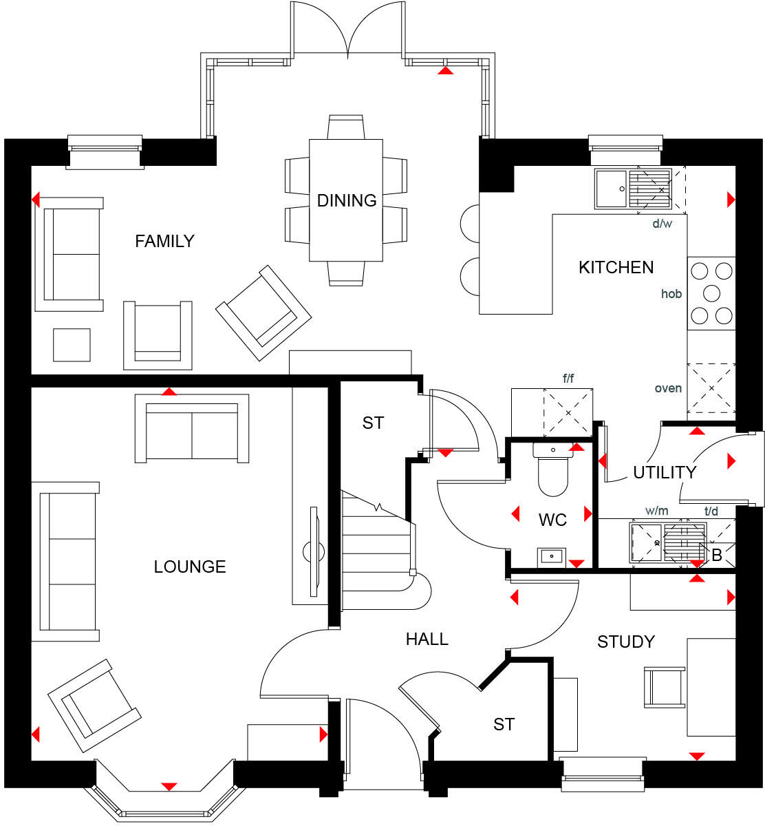
- A floor plan featuring key living spaces.
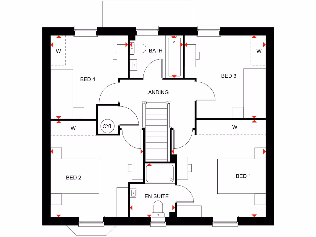
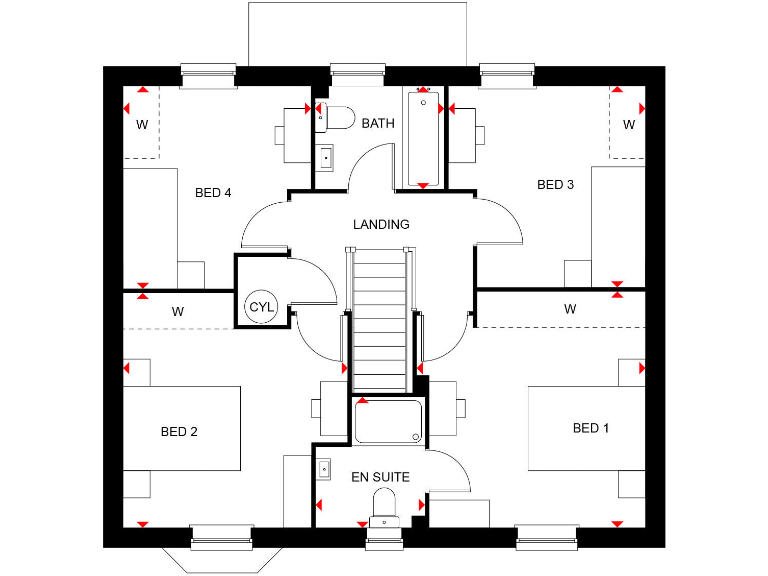
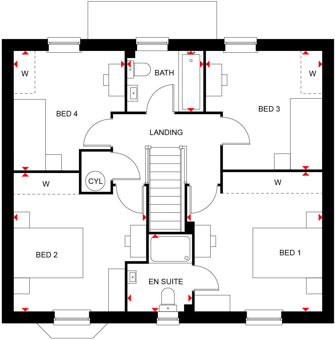
- A floor plan featuring 4 bedrooms, a bathroom, and an ensuite.
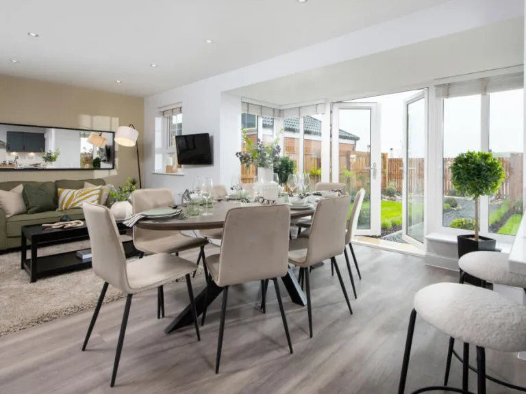
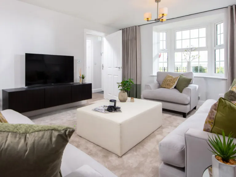
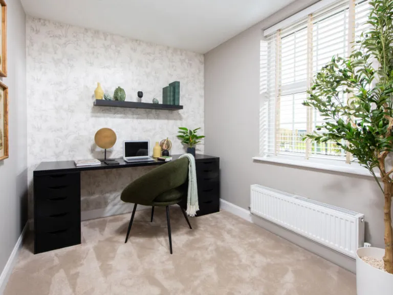
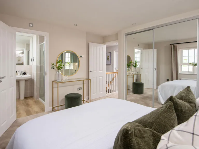
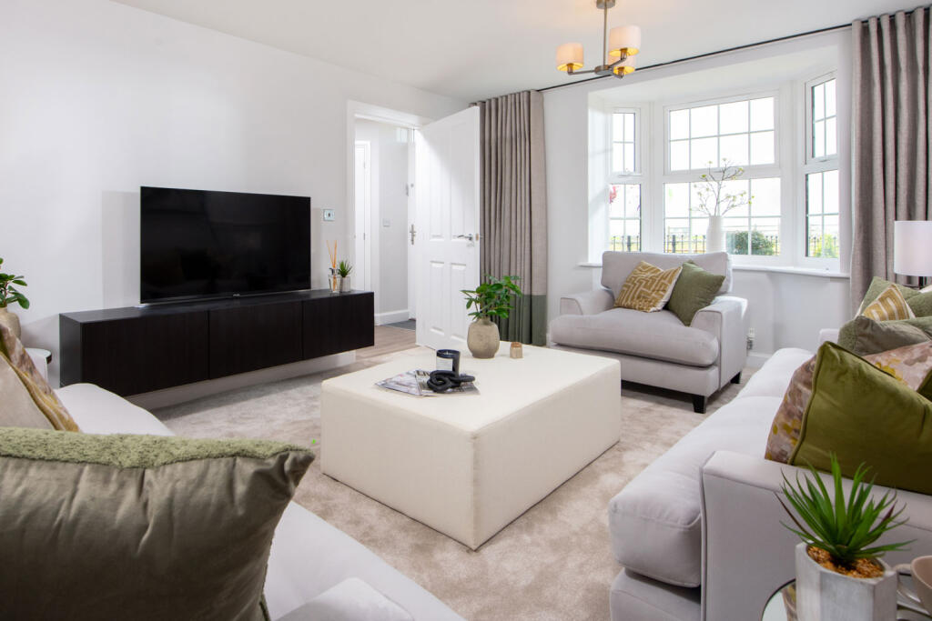
Rooms
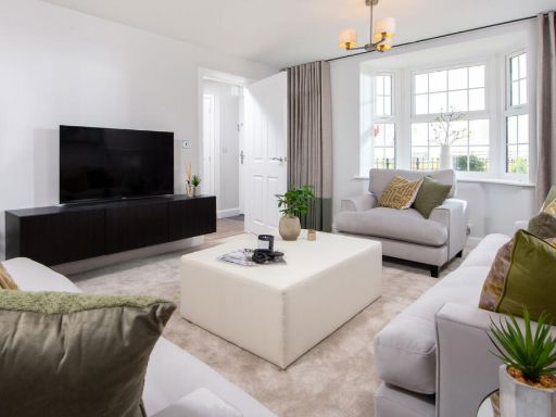
- Family:
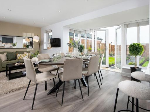
- Dining:
- Kitchen:
- Lounge:
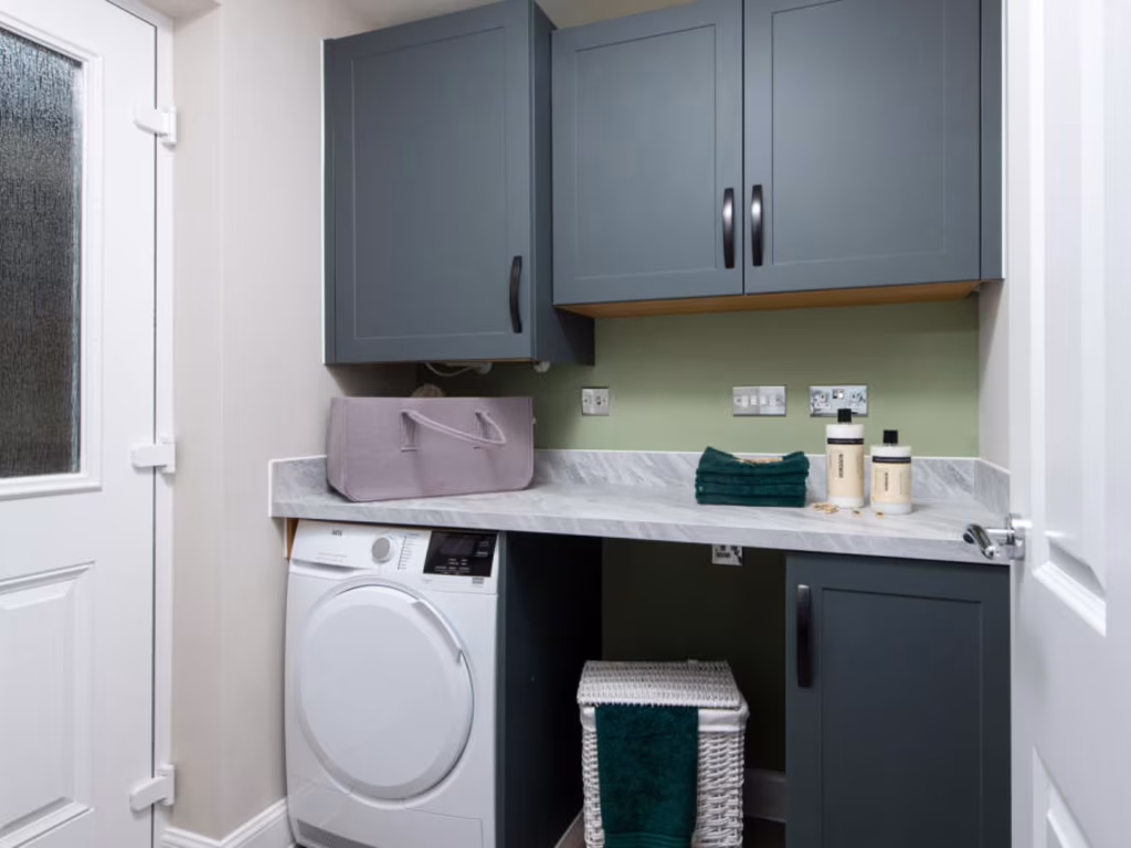
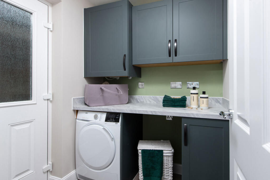
- Utility:
- WC:
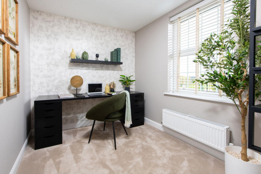
- Study:
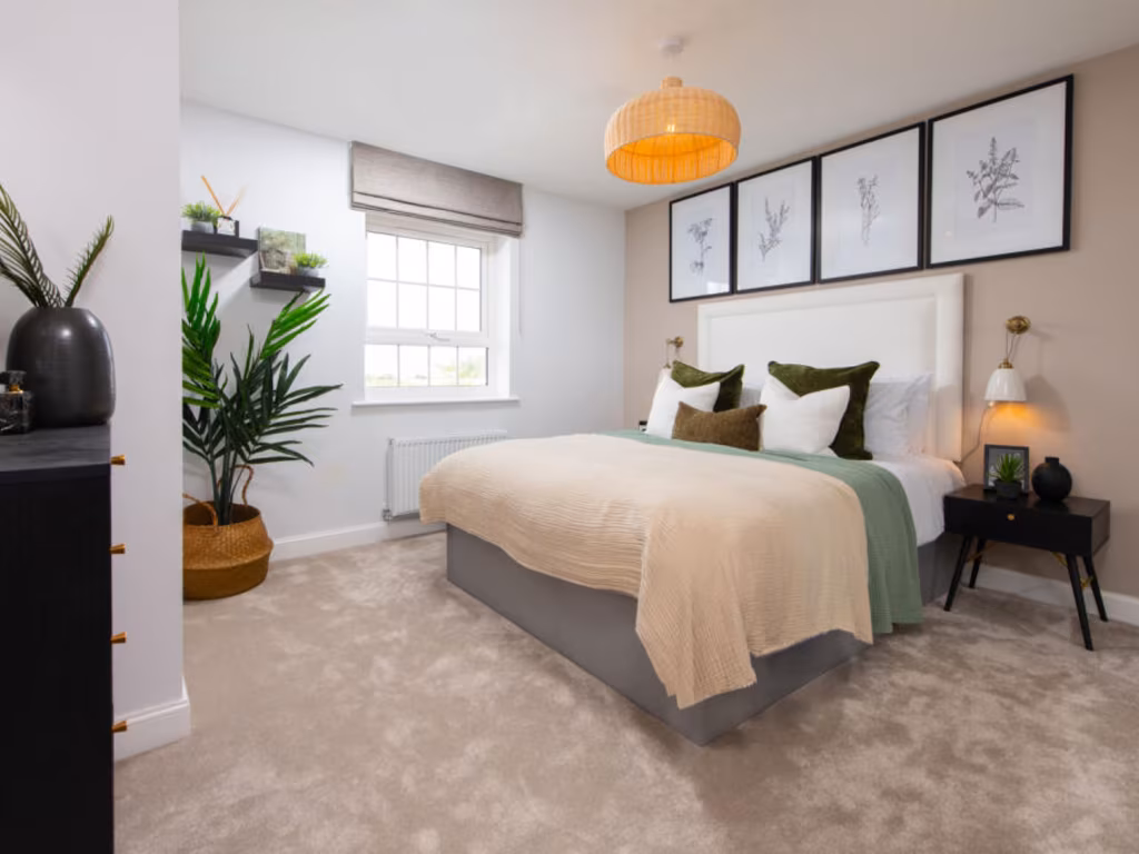
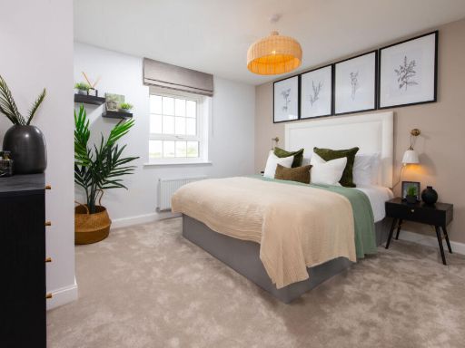
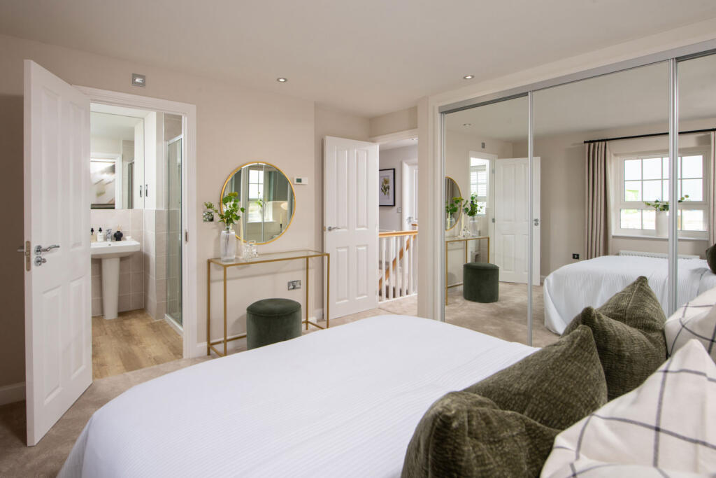
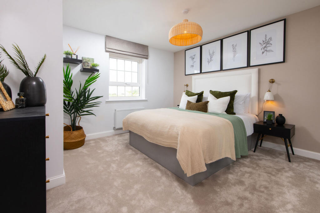
- BED 1:
- BED 2:
- BED 3:
- BED 4:
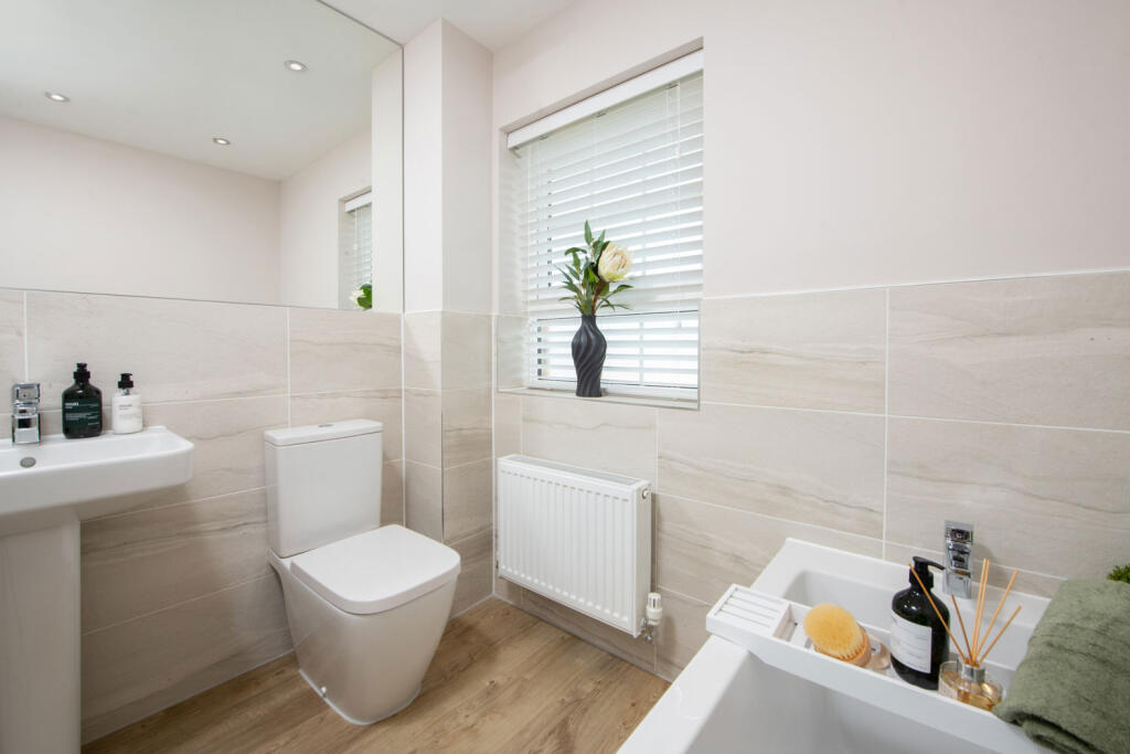
- BATH:
- EN SUITE:
- LANDING:
Textual Property Features
Detected Visual Features
- detached property
- modern Georgian
- two-story
- brick exterior
- symmetrical design
- bay window
- modern
- kitchen
- open-plan
- contemporary
- kitchen island
- grey cabinets
- wood flooring
- integrated appliances
- spotlights
- breakfast bar
Nearby Schools
- West Rise Community Infant School
- Oakwood Primary Academy
- Willingdon Community School
- Hailsham Community College
- Grovelands Community Primary School
- West Rise Junior School
- The Eastbourne Academy
- The Turing School
- Willingdon Primary School
- Burfield Academy
- Park Mead Primary School
- Hellingly Community Primary School
- Ocklynge Junior School
- Ratton School
- Parkland Infant School
- Parkland Junior School
- Phoenix Academy
- White House Academy
- Bede's Senior School
- Heron Park Primary Academy
- Shinewater Primary School
- Stone Cross School
- Polegate Primary School
- Hankham Primary School
- Hawkes Farm Academy
Nearest General Shops
- Id: 620929252
- Tags:
- Building: yes
- Name: Howdens - Hailsham
- Shop: kitchen
- TagsNormalized:
- Lat: 50.8596225
- Lon: 0.2513318
- FullGeoHash: u101mdxnb2y9
- PartitionGeoHash: u101
- Images:
- FoodStandards: null
- Distance: 1077.3
,- Id: 4921671020
- Tags:
- Name: The Sun
- Shop: newsagent
- TagsNormalized:
- Lat: 50.8557935
- Lon: 0.2470157
- FullGeoHash: u101md5b7zh2
- PartitionGeoHash: u101
- Images:
- FoodStandards: null
- Distance: 801.3
,- Id: 689580612
- Tags:
- Addr:
- City: Hailsham
- Postcode: BN27 2RH
- Street: Ersham Road
- Landuse: retail
- Name: World Of Water
- Phone: +44 1323 442400
- Shop: aquatic_supplies
- Website: worldofwater.com/east-sussex-hailsham/
- Wheelchair: yes
- TagsNormalized:
- Lat: 50.8443288
- Lon: 0.2557534
- FullGeoHash: u101jzfjxmze
- PartitionGeoHash: u101
- Images:
- FoodStandards: null
- Distance: 651.5
}
Nearest Grocery shops
- Id: 937099367
- Tags:
- Brand: Holland & Barrett
- Brand:wikidata: Q5880870
- Brand:wikipedia: en:Holland & Barrett
- Building: yes
- Inside: area
- Name: Holland & Barrett
- Shop: health_food
- TagsNormalized:
- holland & barrett
- health
- health food
- food
- shop
- Lat: 50.8636889
- Lon: 0.258594
- FullGeoHash: u101mgkq3wvd
- PartitionGeoHash: u101
- Images:
- FoodStandards: null
- Distance: 1547.8
,- Id: 620958895
- Tags:
- Addr:
- City: Hailsham
- Postcode: BN27 3JH
- Street: South Road
- Brand: Spar
- Brand:wikidata: Q610492
- Brand:wikipedia: en:SPAR (retailer)
- Building: yes
- Name: Spar
- Shop: convenience
- TagsNormalized:
- Lat: 50.8595379
- Lon: 0.2529276
- FullGeoHash: u101mf8nm9h3
- PartitionGeoHash: u101
- Images:
- FoodStandards: null
- Distance: 1054.4
,- Id: 689506126
- Tags:
- Brand: Tesco Express
- Brand:wikidata: Q98456772
- Brand:wikipedia: en:Tesco
- Building: yes
- Contact:
- Website: https://www.tesco.com/store-locator/hailsham/south-rd
- Name: Tesco Express
- Shop: convenience
- TagsNormalized:
- tesco
- tesco express
- convenience
- shop
- Lat: 50.8590172
- Lon: 0.2522849
- FullGeoHash: u101mdxenxvq
- PartitionGeoHash: u101
- Images:
- FoodStandards: null
- Distance: 1000.9
}
Nearest Religious buildings
- Id: 297282956
- Tags:
- Amenity: place_of_worship
- Building: yes
- Denomination: anglican
- Name: Hailsham Parish Church (HPC)
- Religion: christian
- TagsNormalized:
- place of worship
- anglican
- church
- parish
- christian
- Lat: 50.8630566
- Lon: 0.2604121
- FullGeoHash: u101mgmdu0cq
- PartitionGeoHash: u101
- Images:
- FoodStandards: null
- Distance: 1512.3
,- Id: 442879288
- Tags:
- Addr:
- Postcode: BN27 3DG
- Street: Western Road
- Amenity: place_of_worship
- Denomination: evangelical
- Fhrs:
- Name: Hailsham Free Church
- Religion: christian
- Source:
- TagsNormalized:
- place of worship
- evangelical
- church
- christian
- Lat: 50.8616419
- Lon: 0.2560889
- FullGeoHash: u101mg46x31x
- PartitionGeoHash: u101
- Images:
- FoodStandards:
- Id: 178073
- FHRSID: 178073
- LocalAuthorityBusinessID: PI/000045020
- BusinessName: Hailsham Free Church
- BusinessType: Other catering premises
- BusinessTypeID: 7841
- AddressLine1: Western Road
- AddressLine2: Hailsham
- AddressLine3: East Sussex
- AddressLine4: null
- PostCode: BN27 3DG
- RatingValue: 5
- RatingKey: fhrs_5_en-GB
- RatingDate: 2021-10-22
- LocalAuthorityCode: 107
- LocalAuthorityName: Wealden
- LocalAuthorityWebSite: http://www.wealden.gov.uk
- LocalAuthorityEmailAddress: envhealth@rother.gov.uk
- Scores:
- Hygiene: 5
- Structural: 5
- ConfidenceInManagement: 5
- NewRatingPending: false
- Geocode:
- Longitude: 0.25590700000000
- Latitude: 50.86192300000000
- Distance: 1294.4
,- Id: 176818948
- Tags:
- Amenity: place_of_worship
- Denomination: roman_catholic
- Name: St. WIlfreds
- Religion: christian
- TagsNormalized:
- place of worship
- catholic
- roman catholic
- christian
- church
- Lat: 50.8604828
- Lon: 0.2556529
- FullGeoHash: u101mff5v1ht
- PartitionGeoHash: u101
- Images:
- FoodStandards: null
- Distance: 1162.9
}
Nearest Medical buildings
- Id: 501166757
- Tags:
- Addr:
- City: Hailsham
- Housenumber: 25
- Postcode: BN27 1AN
- Street: High Street
- Amenity: pharmacy
- Building: yes
- Fhrs:
- Healthcare: pharmacy
- Name: Paydens
- Source:
- TagsNormalized:
- Lat: 50.8634386
- Lon: 0.2590613
- FullGeoHash: u101mgkth84j
- PartitionGeoHash: u101
- Images:
- FoodStandards: null
- Distance: 1528
,- Id: 501166758
- Tags:
- Addr:
- Housenumber: 21
- Street: High Street
- Amenity: dentist
- Building: yes
- Healthcare: dentist
- Name: Portman smile clinc
- TagsNormalized:
- Lat: 50.8632455
- Lon: 0.2590996
- FullGeoHash: u101mgkevknt
- PartitionGeoHash: u101
- Images:
- FoodStandards: null
- Distance: 1507.7
,- Id: 4907168050
- Tags:
- Amenity: clinic
- Building: yes
- Healthcare: clinic
- Name: Highmore
- Operator: NHS
- TagsNormalized:
- Lat: 50.8629213
- Lon: 0.2529858
- FullGeoHash: u101mg21yzxz
- PartitionGeoHash: u101
- Images:
- FoodStandards: null
- Distance: 1429.7
,- Id: 8954392902
- Tags:
- Amenity: doctors
- Healthcare: doctor
- Name: Bridge Side Surgery
- TagsNormalized:
- doctor
- doctors
- health
- healthcare
- surgery
- Lat: 50.8620241
- Lon: 0.2562754
- FullGeoHash: u101mg4sg8kz
- PartitionGeoHash: u101
- Images:
- FoodStandards: null
- Distance: 1338.1
}
Nearest Leisure Facilities
- Id: 7959815984
- Tags:
- TagsNormalized:
- picnic
- picnic table
- leisure
- Lat: 50.8404017
- Lon: 0.2523657
- FullGeoHash: u101jxpyb9c9
- PartitionGeoHash: u101
- Images:
- FoodStandards: null
- Distance: 1081.9
,- Id: 40013010
- Tags:
- TagsNormalized:
- Lat: 50.8591615
- Lon: 0.2589284
- FullGeoHash: u101mfss16z5
- PartitionGeoHash: u101
- Images:
- FoodStandards: null
- Distance: 1068.3
,- Id: 802502200
- Tags:
- Leisure: playground
- Name: Childrens Play Park
- TagsNormalized:
- Lat: 50.8551871
- Lon: 0.2438447
- FullGeoHash: u101m9cscvzz
- PartitionGeoHash: u101
- Images:
- FoodStandards: null
- Distance: 909.8
,- Id: 7959823187
- Tags:
- TagsNormalized:
- picnic
- picnic table
- leisure
- Lat: 50.8421816
- Lon: 0.2531546
- FullGeoHash: u101jz834vtf
- PartitionGeoHash: u101
- Images:
- FoodStandards: null
- Distance: 880
,- Id: 826782941
- Tags:
- Leisure: pitch
- Sport: tennis
- TagsNormalized:
- Lat: 50.8442975
- Lon: 0.2476957
- FullGeoHash: u101jxume8p2
- PartitionGeoHash: u101
- Images:
- FoodStandards: null
- Distance: 779.2
}
Nearest Tourist attractions
- Id: 38444538
- Tags:
- TagsNormalized:
- Lat: 50.856042
- Lon: 0.2756075
- FullGeoHash: u101q609yj7g
- PartitionGeoHash: u101
- Images:
- FoodStandards: null
- Distance: 1657.4
,- Id: 499881581
- Tags:
- Addr:
- City: Hailsham
- Housename: Bushy Wood Activity Centre
- Postcode: BN27 3LZ
- Street: Hailsham Bypass A22
- Description: Bushy Wood is an Activity Centre located in the heart of rural Sussex, in the south-east of England. We have 17 acres of English woodland, a great venue for a campsite and activity centre, situated adjacent to Hailsham in East Sussex.
- Name: Bushy Wood Activity Centre
- Operator: Eastbourne District Scout Council
- Phone: +44 1323 843713
- Tourism: camp_site
- Website: https://www.bushywood.org.uk
- TagsNormalized:
- Lat: 50.8602653
- Lon: 0.2389401
- FullGeoHash: u101m6vfx8ws
- PartitionGeoHash: u101
- Images:
- FoodStandards: null
- Distance: 1547.9
,- Id: 164652970
- Tags:
- Capacity: 5
- Internet_access: no
- Name: The Homestead
- Phone: +44 1323 840346
- Power_supply: yes
- Tourism: caravan_site
- TagsNormalized:
- Lat: 50.8483024
- Lon: 0.2541176
- FullGeoHash: u101mb9hc6ef
- PartitionGeoHash: u101
- Images:
- FoodStandards: null
- Distance: 197.8
}
Nearest Train stations
- Id: 1252781690
- Tags:
- Name: Eastbourne Miniature Steam Railway
- Public_transport: station
- Railway: station
- Usage: tourism
- TagsNormalized:
- Lat: 50.7882891
- Lon: 0.2874059
- FullGeoHash: u100yt9r1p33
- PartitionGeoHash: u100
- Images:
- FoodStandards: null
- Distance: 7261.1
,- Id: 6745645283
- Tags:
- Name: Pevensey Bay
- Naptan:
- Network: National Rail
- Public_transport: station
- Railway: station
- Ref:
- Wikidata: Q2721185
- Wikipedia: en:Pevensey Bay railway station
- TagsNormalized:
- Lat: 50.8176698
- Lon: 0.3431985
- FullGeoHash: u101pg1fmh72
- PartitionGeoHash: u101
- Images:
- FoodStandards: null
- Distance: 7228.7
,- Id: 6745645284
- Tags:
- Name: Pevensey and Westham
- Naptan:
- Network: National Rail
- Public_transport: station
- Railway: station
- Ref:
- Wikidata: Q2280818
- Wikipedia: en:Pevensey & Westham railway station
- TagsNormalized:
- Lat: 50.8157704
- Lon: 0.3253781
- FullGeoHash: u101p6szmf5m
- PartitionGeoHash: u101
- Images:
- FoodStandards: null
- Distance: 6301.1
,- Id: 6745675396
- Tags:
- Name: Hampden Park
- Naptan:
- Network: National Rail
- Platforms: 2
- Public_transport: station
- Railway: station
- Ref:
- Source: NPE
- Wheelchair: no
- Wikidata: Q2163730
- Wikipedia: en:Hampden Park railway station
- TagsNormalized:
- Lat: 50.7959254
- Lon: 0.2796796
- FullGeoHash: u100yr5etnb1
- PartitionGeoHash: u100
- Images:
- FoodStandards: null
- Distance: 6286.6
,- Id: 6745675394
- Tags:
- Name: Polegate
- Naptan:
- Network: National Rail
- Public_transport: station
- Railway: station
- Ref:
- Wikidata: Q1928088
- Wikipedia: en:Polegate railway station
- TagsNormalized:
- Lat: 50.8211277
- Lon: 0.2467483
- FullGeoHash: u101jeewt8ug
- PartitionGeoHash: u101
- Images:
- FoodStandards: null
- Distance: 3258.9
}
Nearest Bus stations and stops
- Id: 132726341
- Tags:
- Bus: yes
- Highway: bus_stop
- Public_transport: platform
- TagsNormalized:
- Lat: 50.875487
- Lon: 0.253632
- FullGeoHash: u101mv8enn1t
- PartitionGeoHash: u101
- Images:
- FoodStandards: null
- Distance: 2825.4
,- Id: 132726347
- Tags:
- Bus: yes
- Highway: bus_stop
- Note_1: nice
- Public_transport: platform
- TagsNormalized:
- Lat: 50.8735265
- Lon: 0.2528191
- FullGeoHash: u101mv0pg0ew
- PartitionGeoHash: u101
- Images:
- FoodStandards: null
- Distance: 2608.5
,- Id: 132726349
- Tags:
- Bus: yes
- Highway: bus_stop
- Public_transport: platform
- TagsNormalized:
- Lat: 50.873206
- Lon: 0.25273
- FullGeoHash: u101mv0jchcn
- PartitionGeoHash: u101
- Images:
- FoodStandards: null
- Distance: 2573.1
,- Id: 333644542
- Tags:
- Bus: yes
- Highway: bus_stop
- Name: High Street
- Public_transport: platform
- TagsNormalized:
- Lat: 50.8637088
- Lon: 0.259123
- FullGeoHash: u101mgkww481
- PartitionGeoHash: u101
- Images:
- FoodStandards: null
- Distance: 1558.2
,- Id: 4920099535
- Tags:
- Bus: yes
- Highway: bus_stop
- Name: Police Station
- Public_transport: platform
- TagsNormalized:
- Lat: 50.8618769
- Lon: 0.2584956
- FullGeoHash: u101mgh5zmh3
- PartitionGeoHash: u101
- Images:
- FoodStandards: null
- Distance: 1349.8
}
Nearest Hotels
- Id: 104276354
- Tags:
- Building: yes
- Name: Boship Hotel
- Tourism: hotel
- TagsNormalized:
- Lat: 50.8779026
- Lon: 0.2308023
- FullGeoHash: u101mq01606w
- PartitionGeoHash: u101
- Images:
- FoodStandards: null
- Distance: 3495.1
,- Id: 487028113
- Tags:
- Addr:
- City: Polegate
- Postcode: BN26 6QL
- Street: Hailsham Road
- Brand: Premier Inn
- Brand:wikidata: Q2108626
- Brand:wikipedia: en:Premier Inn
- Building: yes
- Internet_access: wlan
- Internet_access:fee: no
- Name: Premier Inn Polegate Services
- Tourism: hotel
- TagsNormalized:
- premier
- inn
- service
- hotel
- tourism
- Lat: 50.829759
- Lon: 0.2364043
- FullGeoHash: u101jmk0u9gg
- PartitionGeoHash: u101
- Images:
- FoodStandards: null
- Distance: 2574.2
,- Id: 186608067
- Tags:
- Addr:
- City: Hailsham
- Housenumber: 1
- Postcode: BN27 1AD
- Street: George Street
- Amenity: pub
- Brand: Wetherspoon
- Brand:wikidata: Q6109362
- Brand:wikipedia: en:Wetherspoons
- Building: yes
- Internet_access: wlan
- Internet_access:fee: no
- Name: The George Hotel
- Wikidata: Q26295229
- TagsNormalized:
- Lat: 50.8620255
- Lon: 0.2596268
- FullGeoHash: u101mgjhc8zb
- PartitionGeoHash: u101
- Images:
- FoodStandards: null
- Distance: 1386.5
}
Tags
- detached property
- modern Georgian
- two-story
- brick exterior
- symmetrical design
- bay window
- modern
- kitchen
- open-plan
- contemporary
- kitchen island
- grey cabinets
- wood flooring
- integrated appliances
- spotlights
- breakfast bar
Local Market Stats
- Average Price/sqft: £335
- Avg Income: £42000
- Rental Yield: 4.6%
- Social Housing: 6%
- Planning Success Rate: 83%
Similar Properties
 4 bedroom detached house for sale in Ersham Road,
Hailsham,
BN27 3PN, BN27 — £480,000 • 4 bed • 1 bath • 854 ft²
4 bedroom detached house for sale in Ersham Road,
Hailsham,
BN27 3PN, BN27 — £480,000 • 4 bed • 1 bath • 854 ft²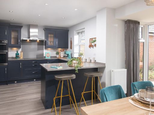 4 bedroom detached house for sale in Ersham Road,
Hailsham,
BN27 3PN, BN27 — £529,995 • 4 bed • 1 bath • 1339 ft²
4 bedroom detached house for sale in Ersham Road,
Hailsham,
BN27 3PN, BN27 — £529,995 • 4 bed • 1 bath • 1339 ft²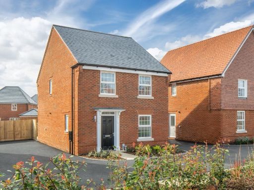 4 bedroom detached house for sale in Ersham Road,
Hailsham,
BN27 3PN, BN27 — £415,000 • 4 bed • 1 bath • 929 ft²
4 bedroom detached house for sale in Ersham Road,
Hailsham,
BN27 3PN, BN27 — £415,000 • 4 bed • 1 bath • 929 ft²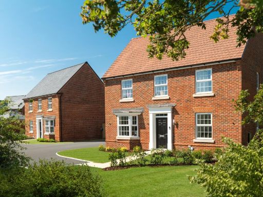 4 bedroom detached house for sale in Ersham Road,
Hailsham,
BN27 3PN, BN27 — £541,995 • 4 bed • 1 bath • 1308 ft²
4 bedroom detached house for sale in Ersham Road,
Hailsham,
BN27 3PN, BN27 — £541,995 • 4 bed • 1 bath • 1308 ft²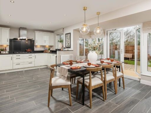 4 bedroom detached house for sale in Ersham Road,
Hailsham,
BN27 3PN, BN27 — £544,995 • 4 bed • 1 bath • 1330 ft²
4 bedroom detached house for sale in Ersham Road,
Hailsham,
BN27 3PN, BN27 — £544,995 • 4 bed • 1 bath • 1330 ft²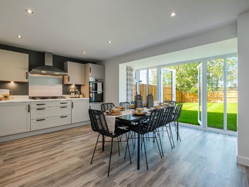 4 bedroom detached house for sale in Ersham Road,
Hailsham,
BN27 3PN, BN27 — £532,500 • 4 bed • 1 bath • 1228 ft²
4 bedroom detached house for sale in Ersham Road,
Hailsham,
BN27 3PN, BN27 — £532,500 • 4 bed • 1 bath • 1228 ft²
Meta
- {
"@context": "https://schema.org",
"@type": "Residence",
"name": "4 bedroom detached house for sale in Ersham Road, Hailsham,…",
"description": "",
"url": "https://propertypiper.co.uk/property/e2477aa3-a67e-467b-ad17-b76dee8259bc",
"image": "https://image-a.propertypiper.co.uk/6929ee3f-8c6c-423a-97a2-851b3d95210b-1024.jpeg",
"address": {
"@type": "PostalAddress",
"streetAddress": "Ersham Road,\r\nHailsham,\r\nBN27 3PN",
"postalCode": "BN27 3PN",
"addressLocality": "Wealden",
"addressRegion": "Wealden",
"addressCountry": "England"
},
"geo": {
"@type": "GeoCoordinates",
"latitude": 50.85007865168604,
"longitude": 0.2539690465074259
},
"numberOfRooms": 4,
"numberOfBathroomsTotal": 1,
"floorSize": {
"@type": "QuantitativeValue",
"value": 1339,
"unitCode": "FTK"
},
"offers": {
"@type": "Offer",
"price": 500000,
"priceCurrency": "GBP",
"availability": "https://schema.org/InStock"
},
"additionalProperty": [
{
"@type": "PropertyValue",
"name": "Feature",
"value": "detached property"
},
{
"@type": "PropertyValue",
"name": "Feature",
"value": "modern Georgian"
},
{
"@type": "PropertyValue",
"name": "Feature",
"value": "two-story"
},
{
"@type": "PropertyValue",
"name": "Feature",
"value": "brick exterior"
},
{
"@type": "PropertyValue",
"name": "Feature",
"value": "symmetrical design"
},
{
"@type": "PropertyValue",
"name": "Feature",
"value": "bay window"
},
{
"@type": "PropertyValue",
"name": "Feature",
"value": "modern"
},
{
"@type": "PropertyValue",
"name": "Feature",
"value": "kitchen"
},
{
"@type": "PropertyValue",
"name": "Feature",
"value": "open-plan"
},
{
"@type": "PropertyValue",
"name": "Feature",
"value": "contemporary"
},
{
"@type": "PropertyValue",
"name": "Feature",
"value": "kitchen island"
},
{
"@type": "PropertyValue",
"name": "Feature",
"value": "grey cabinets"
},
{
"@type": "PropertyValue",
"name": "Feature",
"value": "wood flooring"
},
{
"@type": "PropertyValue",
"name": "Feature",
"value": "integrated appliances"
},
{
"@type": "PropertyValue",
"name": "Feature",
"value": "spotlights"
},
{
"@type": "PropertyValue",
"name": "Feature",
"value": "breakfast bar"
}
]
}
High Res Floorplan Images
Compatible Floorplan Images
FloorplanImages Thumbnail