SY17 5LW - Plot for sale in Old Post Office Lane, Carno, Powys, SY17
View on Property Piper
Plot for sale in Old Post Office Lane, Carno, Powys, SY17
Property Details
- Price: £120000
- Bedrooms: 1
- Bathrooms: 1
- Property Type: undefined
- Property SubType: undefined
Brochure Descriptions
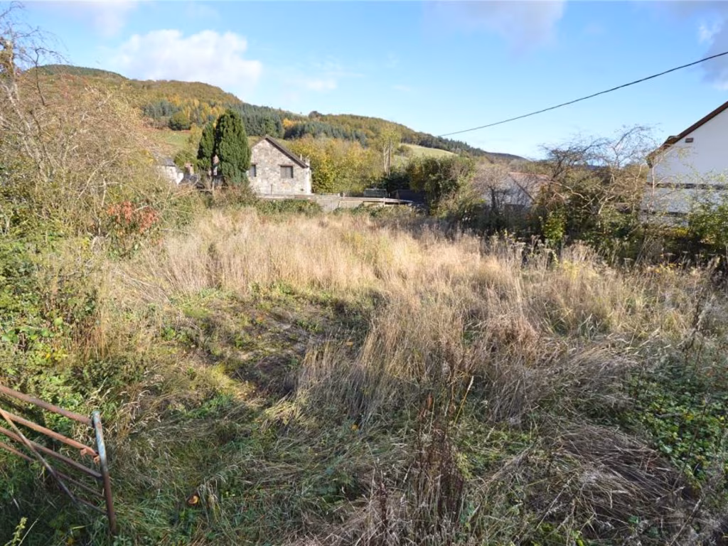
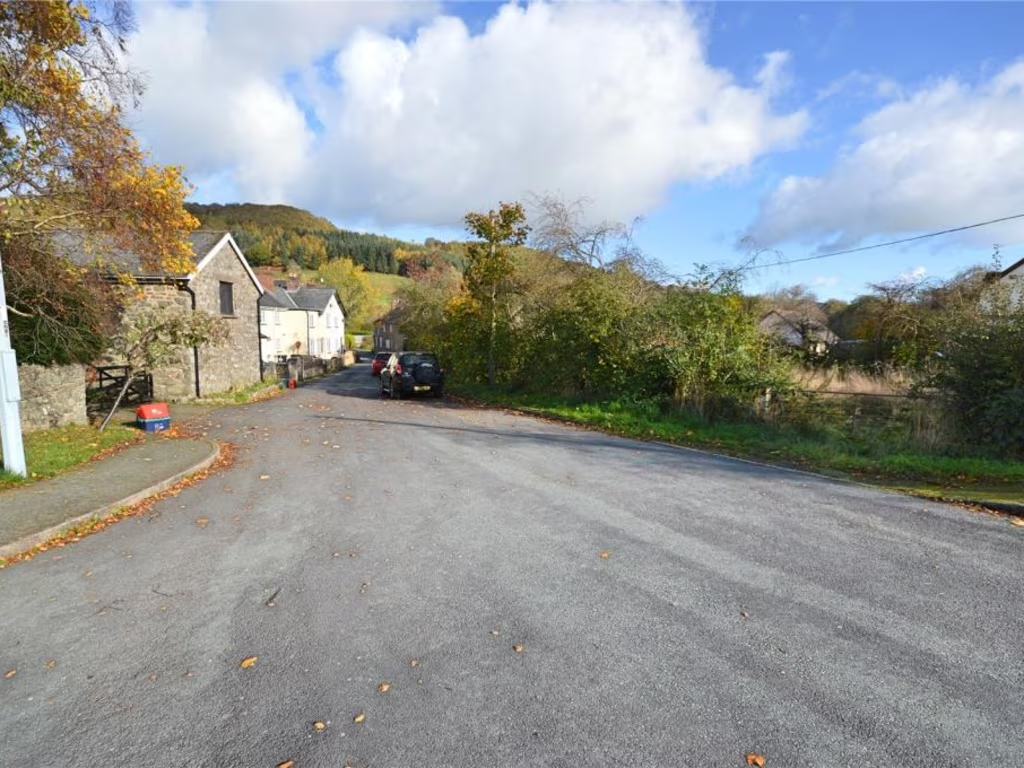
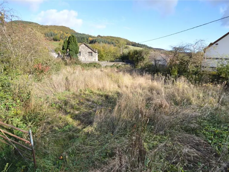
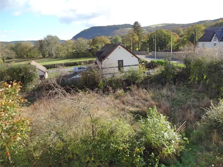
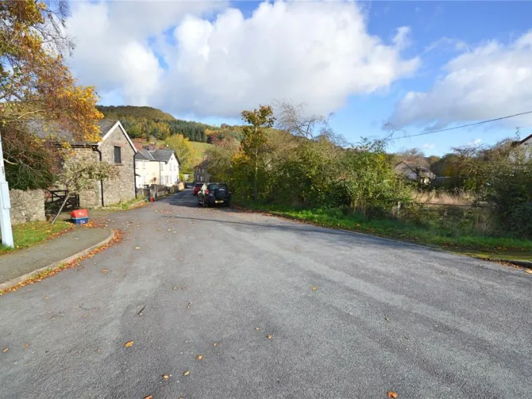
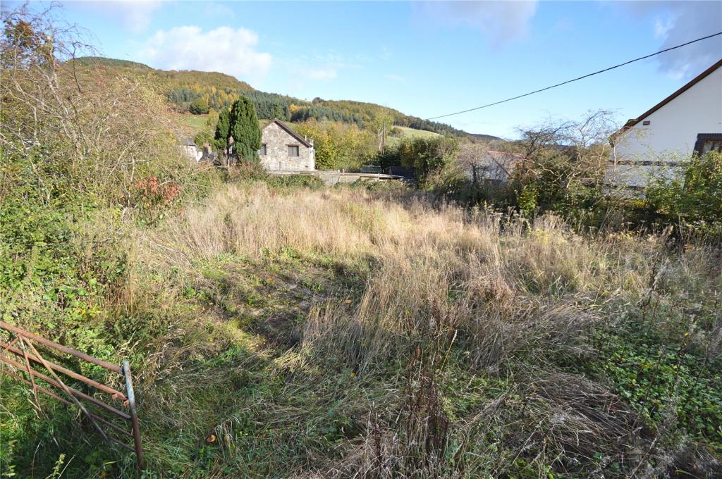
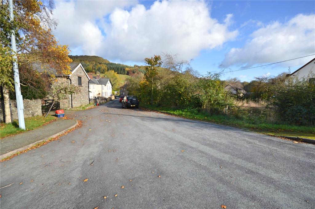
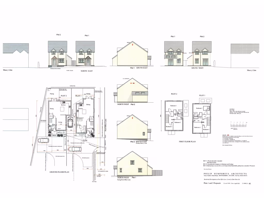
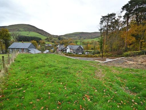
- The property is a residential building plot situated amidst expansive rural surroundings, offering stunning vistas of the Powys countryside. The plots are depicted with tasteful architectural designs, shown as detached homes on generous-sized lands. The area is characterized by vast open spaces, accentuating the landscape with views of rolling hills and distant forests. The images show the property surrounded by lush greenery, suggesting a peaceful and serene environment, ideal for families seeking a quiet lifestyle away from city bustle. The road access appears straightforward, with the surrounding area showcasing an average plot size with potential for gardens and driveways.
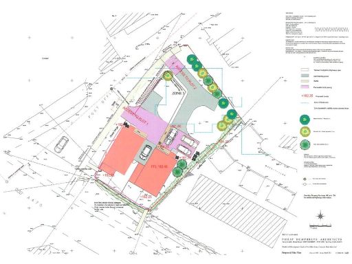
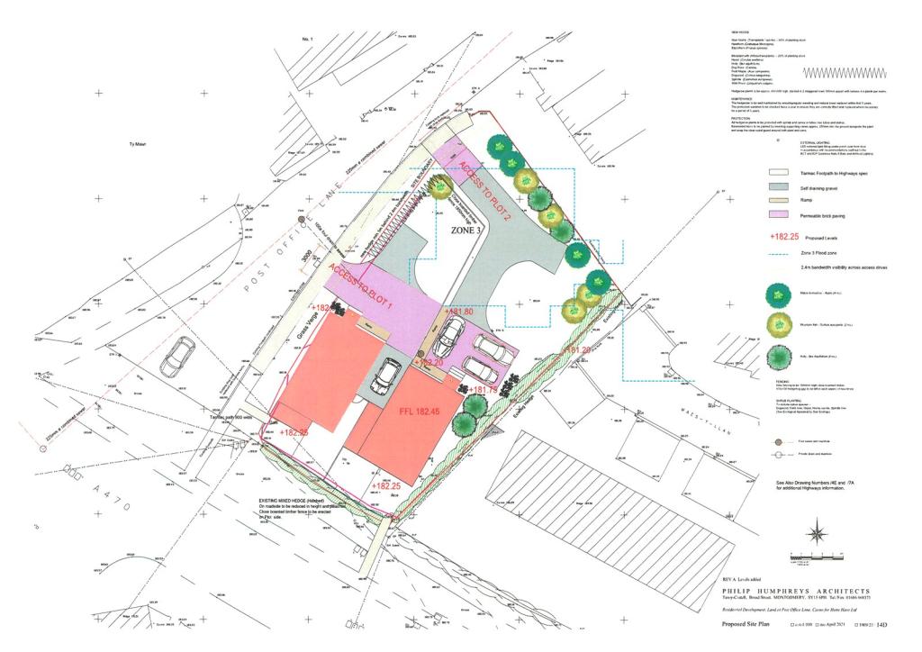
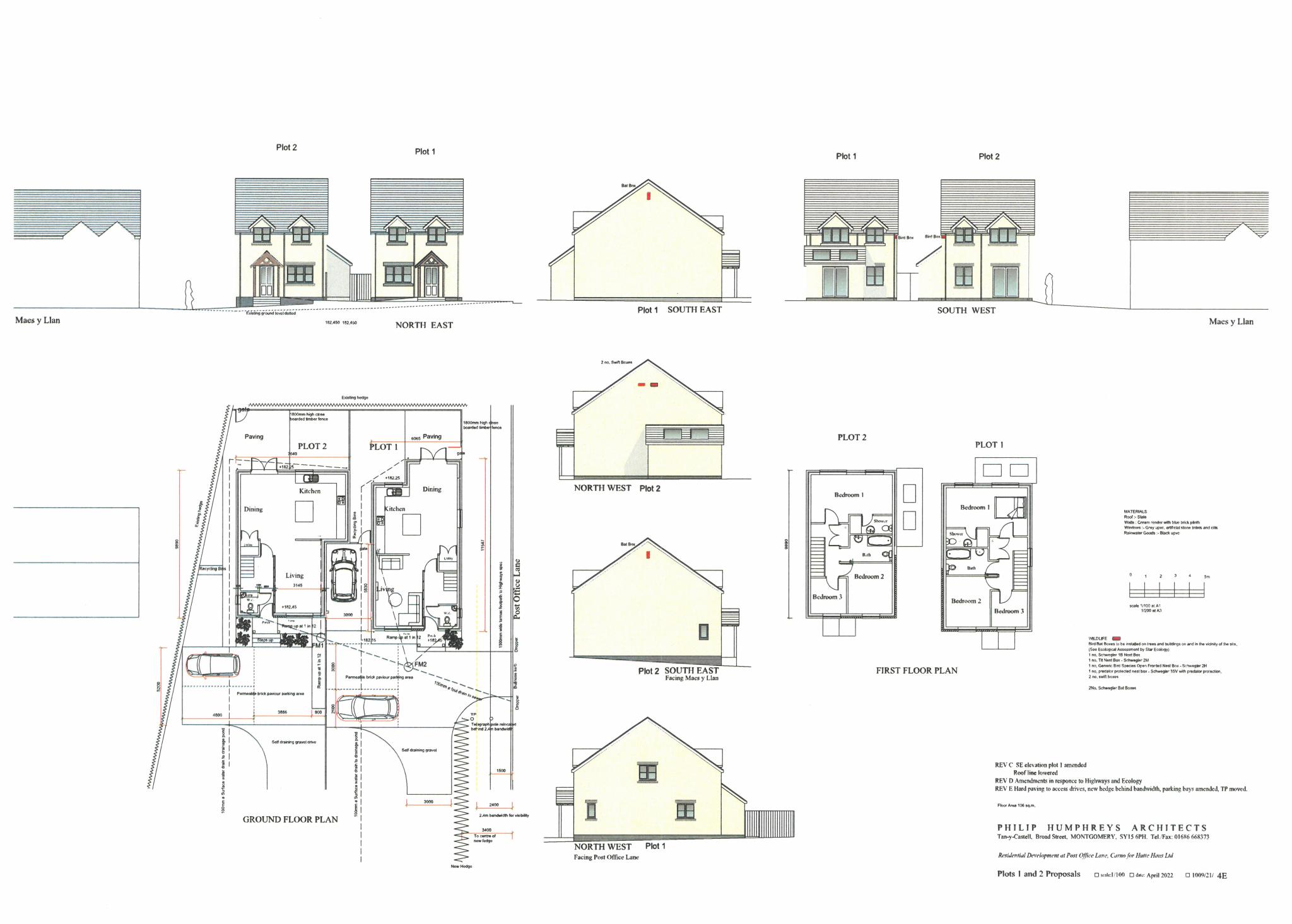
- The property is a modern, efficiently designed residential development, set within a carefully planned layout. It includes multiple zones, possibly suggesting distinct living areas or multiple units. The landscaping features a mix of greenery and open paved areas meant for vehicular access, indicating ease of movement and a potential for driveway parking. Overall, the planning suggests a spacious residential plot that looks to provide privacy and comfort in a suburban or semi-rural setting. The plot size appears to be average in size, accommodating separate units with adequate spacing between them. There are no significant natural views emanating from the layout alone, although the map suggests a carefully integrated outdoor design intended to appeal aesthetically.
Image Descriptions
- property exterior/land
- detached house Contemporary
Textual Property Features
Detected Visual Features
- land
- rural
- countryside
- development opportunity
- investment
- vacant lot
- overgrown
- nature
- potential
- views
- detached
- house
- landscape
- country
- garden
- garage
- modern
- private
- spacious
Nearest Bars And Restaurants
- Id: 5926441135
- Tags:
- Amenity: cafe
- Name: Cafe Draig
- TagsNormalized:
- Lat: 52.612579
- Lon: -3.628365
- FullGeoHash: gcm7m3vfkzwf
- PartitionGeoHash: gcm7
- Images:
- FoodStandards: null
- Distance: 9150.6
,- Id: 275126829
- Tags:
- Addr:
- Amenity: pub
- Building: yes
- Name: Wynnstay Arms
- Smoking: outside
- Website: http://www.wynnstayarmshotel.co.uk/
- Wikidata: Q29486582
- TagsNormalized:
- Lat: 52.6121914
- Lon: -3.6273807
- FullGeoHash: gcm7m3y85zkf
- PartitionGeoHash: gcm7
- Images:
- FoodStandards: null
- Distance: 9072.7
,- Id: 6616614590
- Tags:
- Amenity: cafe
- Name: Seasons Cafe
- TagsNormalized:
- Lat: 52.5126419
- Lon: -3.4241485
- FullGeoHash: gcmddpds79cy
- PartitionGeoHash: gcmd
- Images:
- FoodStandards: null
- Distance: 8633.6
,- Id: 1574640214
- Tags:
- Amenity: pub
- Name: Red Lion
- Real_cider: yes
- Wikidata: Q80858737
- TagsNormalized:
- Lat: 52.5164231
- Lon: -3.4290706
- FullGeoHash: gcmdcbr42fgd
- PartitionGeoHash: gcmd
- Images:
- FoodStandards: null
- Distance: 8124.1
,- Id: 199541528
- Tags:
- Addr:
- Amenity: pub
- Building: yes
- Name: The Aleppo Merchant Inn
- Website: http://www.thealeppo.co.uk/
- Wikidata: Q80584168
- TagsNormalized:
- Lat: 52.5558034
- Lon: -3.5312833
- FullGeoHash: gcm6zxkxepu6
- PartitionGeoHash: gcm6
- Images:
- FoodStandards: null
- Distance: 82.4
}
Nearest General Shops
- Id: 2797818260
- Tags:
- TagsNormalized:
- Lat: 52.611509
- Lon: -3.6276913
- FullGeoHash: gcm7m3wkk8j7
- PartitionGeoHash: gcm7
- Images:
- FoodStandards: null
- Distance: 9035.9
,- Id: 440061236
- Tags:
- Addr:
- City: Caersws
- Postcode: SY17 5EQ
- Street: The Cross
- Alt_name: SPAR Caersws
- Atm: yes
- Brand: Spar
- Brand:wikidata: Q610492
- Building: yes
- Name: SPAR
- Opening_hours: Mo-Sa 07:30-20:00; Su 08:00-18:30
- Shop: supermarket
- Website: https://www.spar.co.uk/store-locator/afb19384-spar-caersws
- TagsNormalized:
- Lat: 52.516028
- Lon: -3.429469
- FullGeoHash: gcmdcbq8p94t
- PartitionGeoHash: gcmd
- Images:
- FoodStandards: null
- Distance: 8125.4
,- Id: 9882901717
- Tags:
- Name: Alun. W. Owen
- Shop: butcher
- TagsNormalized:
- Lat: 52.5161544
- Lon: -3.4295788
- FullGeoHash: gcmdcbq8v08x
- PartitionGeoHash: gcmd
- Images:
- FoodStandards: null
- Distance: 8111.5
}
Nearest Grocery shops
- Id: 9882901917
- Tags:
- Brand: Premier
- Brand:wikidata: Q7240340
- Name: Premier
- Shop: convenience
- TagsNormalized:
- Lat: 52.5160803
- Lon: -3.4294095
- FullGeoHash: gcmdcbqb2fyv
- PartitionGeoHash: gcmd
- Images:
- FoodStandards: null
- Distance: 8125.6
,- Id: 199545009
- Tags:
- Addr:
- Housename: Central Garage
- Postcode: SY17 5EF
- Brand: Costcutter
- Brand:wikidata: Q5175072
- Contact:
- Website: https://store-locator.costcutter.co.uk/costcutter-4d03b4e88f7f
- Name: Costcutter
- Shop: convenience
- TagsNormalized:
- costcutter
- convenience
- shop
- Lat: 52.5165235
- Lon: -3.429643
- FullGeoHash: gcmdcbqdgt8c
- PartitionGeoHash: gcmd
- Images:
- FoodStandards: null
- Distance: 8085.5
,- Id: 199544890
- Tags:
- Addr:
- Housename: The Old Village Hall
- Postcode: SY17 5LE
- Brand: Spar
- Brand:wikidata: Q610492
- Building: yes
- Name: SPAR
- Shop: convenience
- TagsNormalized:
- Lat: 52.5600818
- Lon: -3.5364323
- FullGeoHash: gcm7p82bejku
- PartitionGeoHash: gcm7
- Images:
- FoodStandards: null
- Distance: 628.3
}
Nearest Supermarkets
- Id: 199543700
- Tags:
- Addr:
- City: Newtown
- Postcode: SY16 3AH
- Street: Pool Road
- Alt_name: Morrisons Newtown
- Brand: Morrisons
- Brand:wikidata: Q922344
- Brand:wikipedia: en:Morrisons
- Building: yes
- Contact:
- Website: https://my.morrisons.com/storefinder/397
- Name: Morrisons
- Opening_hours: Mo-Sa 07:00-22:00; Su 10:00-16:00
- Shop: supermarket
- TagsNormalized:
- Lat: 52.5164812
- Lon: -3.298945
- FullGeoHash: gcmdubmf9j8k
- PartitionGeoHash: gcmd
- Images:
- FoodStandards: null
- Distance: 16237.9
,- Id: 199543701
- Tags:
- Addr:
- City: Newtown
- Postcode: SY16 1DW
- Street: Pool Road
- Alt_name: Tesco Newtown Superstore
- Brand: Tesco
- Brand:wikidata: Q487494
- Brand:wikipedia: en:Tesco
- Building: yes
- Contact:
- Website: https://www.tesco.com/store-locator/newtown/pool-rd
- Name: Tesco
- Opening_hours: Mo-Sa 07:00-22:00; Su 10:00-16:00
- Shop: supermarket
- TagsNormalized:
- Lat: 52.513807
- Lon: -3.3060246
- FullGeoHash: gcmdszbeh51k
- PartitionGeoHash: gcmd
- Images:
- FoodStandards: null
- Distance: 15863.1
,- Id: 199543699
- Tags:
- Addr:
- City: Newtown
- Postcode: SY16 1ET
- Street: Llanidloes Road
- Alt_name: LIDL Newtown
- Brand: Lidl
- Brand:wikidata: Q151954
- Building: yes
- Fhrs:
- Name: LIDL
- Opening_hours: Mo-Sa 08:00-20:00; Su 10:00-16:00
- Shop: supermarket
- Source:
- Addr:
- Postcode: FSA Food Hygiene Ratings Database
- TagsNormalized:
- Lat: 52.5100333
- Lon: -3.3193359
- FullGeoHash: gcmdsrnvjgev
- PartitionGeoHash: gcmd
- Images:
- FoodStandards:
- Id: 182526
- FHRSID: 182526
- LocalAuthorityBusinessID: PI/000076036
- BusinessName: Lidl
- BusinessType: Retailers - supermarkets/hypermarkets
- BusinessTypeID: 7840
- AddressLine1: Lidl Great Britain Ltd
- AddressLine2: Llanidloes Road
- AddressLine3: Newtown
- AddressLine4: Powys
- PostCode: SY16 1ET
- RatingValue: 4
- RatingKey: fhrs_4_en-GB
- RatingDate: 2022-05-20
- LocalAuthorityCode: 566
- LocalAuthorityName: Powys
- LocalAuthorityWebSite: http://www.powys.gov.uk
- LocalAuthorityEmailAddress: public.protection@powys.gov.uk
- Scores:
- Hygiene: 5
- Structural: 10
- ConfidenceInManagement: 0
- NewRatingPending: false
- Geocode:
- Longitude: null
- Latitude: null
- Distance: 15142.2
}
Nearest Religious buildings
- Id: 361246847
- Tags:
- Amenity: place_of_worship
- Building: church
- Name: St Gwynog's
- Religion: christian
- Source: Bing
- TagsNormalized:
- place of worship
- church
- christian
- Lat: 52.5335277
- Lon: -3.4428736
- FullGeoHash: gcmdcekvzpr7
- PartitionGeoHash: gcmd
- Images:
- FoodStandards: null
- Distance: 6403.1
,- Id: 361254367
- Tags:
- Amenity: place_of_worship
- Building: church
- Religion: christian
- TagsNormalized:
- place of worship
- church
- christian
- Lat: 52.5036434
- Lon: -3.5182404
- FullGeoHash: gcm6xvypgh9b
- PartitionGeoHash: gcm6
- Images:
- FoodStandards: null
- Distance: 5871.4
,- Id: 199541062
- Tags:
- Amenity: place_of_worship
- Denomination: church_in_wales
- Name: St John the Baptist
- Religion: christian
- TagsNormalized:
- place of worship
- church
- church in wales
- baptist
- christian
- Lat: 52.5562484
- Lon: -3.5306746
- FullGeoHash: gcm6zxt436f1
- PartitionGeoHash: gcm6
- Images:
- FoodStandards: null
- Distance: 51.5
}
Nearest Medical buildings
- Id: 392508036
- Tags:
- Addr:
- City: Newtown
- Housename: Trosely House
- Housenumber: 65
- Postcode: SY16 1BG
- Street: Clifton Terrace
- Amenity: dentist
- Brand: My Dentist
- Brand:wikidata: Q65118035
- Brand:wikipedia: en:Mydentist
- Building: terrace
- Contact:
- Healthcare: dentist
- Name: My Dentist
- Website: https://www.mydentist.co.uk/dentists/practices/wales/north-wales/newtown/65-clifton-house
- TagsNormalized:
- dentist
- my dentist
- health
- healthcare
- Lat: 52.5138257
- Lon: -3.3131588
- FullGeoHash: gcmdsxg7jy9s
- PartitionGeoHash: gcmd
- Images:
- FoodStandards: null
- Distance: 15402.2
,- Id: 1060879251
- Tags:
- Amenity: dentist
- Building: yes
- Healthcare: dentist
- TagsNormalized:
- Lat: 52.5153139
- Lon: -3.3139492
- FullGeoHash: gcmdu84ggkh3
- PartitionGeoHash: gcmd
- Images:
- FoodStandards: null
- Distance: 15301.3
,- Id: 199544331
- Tags:
- Addr:
- Housenumber: 20-21
- Postcode: SY16 2NU
- Street: High Street
- Amenity: pharmacy
- Brand: Boots
- Brand:wikidata: Q6123139
- Brand:wikipedia: en:Boots (company)
- Building: yes
- Dispensing: yes
- Healthcare: pharmacy
- Name: Boots
- TagsNormalized:
- pharmacy
- boots
- health
- healthcare
- Lat: 52.514858
- Lon: -3.3159656
- FullGeoHash: gcmdu813hrhf
- PartitionGeoHash: gcmd
- Images:
- FoodStandards: null
- Distance: 15186.3
,- Id: 681360352
- Tags:
- Addr:
- City: Llanidloes
- County: Powys
- Postcode: SY18 6HF
- Street: Eastgate Street
- Amenity: hospital
- Emergency: no
- Healthcare: hospital
- Name: Llanidloes War Memorial Hospital
- Phone: +44 1686 412121
- Website: http://www.powysthb.wales.nhs.uk/llanidloes-hospital
- TagsNormalized:
- Lat: 52.452536
- Lon: -3.539661
- FullGeoHash: gcm6rkwqpvmk
- PartitionGeoHash: gcm6
- Images:
- FoodStandards: null
- Distance: 11517.6
}
Nearest Leisure Facilities
- Id: 398694785
- Tags:
- TagsNormalized:
- Lat: 52.5566984
- Lon: -3.5360151
- FullGeoHash: gcm6zx9huysj
- PartitionGeoHash: gcm6
- Images:
- FoodStandards: null
- Distance: 409.2
,- Id: 199541058
- Tags:
- Leisure: pitch
- Sport: soccer
- TagsNormalized:
- Lat: 52.5573192
- Lon: -3.5351309
- FullGeoHash: gcm6zxcb96rm
- PartitionGeoHash: gcm6
- Images:
- FoodStandards: null
- Distance: 373.2
,- Id: 199541056
- Tags:
- Leisure: pitch
- Sport: bowls
- TagsNormalized:
- Lat: 52.556533
- Lon: -3.5352428
- FullGeoHash: gcm6zx9eyzgg
- PartitionGeoHash: gcm6
- Images:
- FoodStandards: null
- Distance: 354.4
,- Id: 199541061
- Tags:
- TagsNormalized:
- Lat: 52.556595
- Lon: -3.5346567
- FullGeoHash: gcm6zxdhke2u
- PartitionGeoHash: gcm6
- Images:
- FoodStandards: null
- Distance: 317
,- Id: 1056551674
- Tags:
- TagsNormalized:
- Lat: 52.5550272
- Lon: -3.5341379
- FullGeoHash: gcm6zx6e0x5u
- PartitionGeoHash: gcm6
- Images:
- FoodStandards: null
- Distance: 292.4
}
Nearest Tourist attractions
- Id: 1010808417
- Tags:
- Note: replaces Shooting Centre
- Tourism: caravan_site
- TagsNormalized:
- Lat: 52.5077004
- Lon: -3.5033125
- FullGeoHash: gcmd8q8zwbuc
- PartitionGeoHash: gcmd
- Images:
- FoodStandards: null
- Distance: 5662.8
,- Id: 398694781
- Tags:
- TagsNormalized:
- Lat: 52.553499
- Lon: -3.5387942
- FullGeoHash: gcm6zrp4k47b
- PartitionGeoHash: gcm6
- Images:
- FoodStandards: null
- Distance: 648.7
,- Id: 595505186
- Tags:
- Building: yes
- Name: Tremallt Bed and Breakfast
- Tourism: guest_house
- TagsNormalized:
- Lat: 52.554807
- Lon: -3.5280429
- FullGeoHash: gcm6zxqcywhe
- PartitionGeoHash: gcm6
- Images:
- FoodStandards: null
- Distance: 188
}
Nearest Bus stations and stops
- Id: 6127412910
- Tags:
- Bus: yes
- Highway: bus_stop
- Local_ref: E
- Name: Newtown Bus Station
- Public_transport: platform
- Shelter: yes
- TagsNormalized:
- Lat: 52.515172
- Lon: -3.3176585
- FullGeoHash: gcmdu805hcwe
- PartitionGeoHash: gcmd
- Images:
- FoodStandards: null
- Distance: 15066.6
,- Id: 7613688639
- Tags:
- Bus: yes
- Highway: bus_stop
- Public_transport: platform
- TagsNormalized:
- Lat: 52.5071947
- Lon: -3.3320229
- FullGeoHash: gcmdsntsw4x8
- PartitionGeoHash: gcmd
- Images:
- FoodStandards: null
- Distance: 14453.1
,- Id: 6084186395
- Tags:
- Highway: bus_stop
- Name: The Groe
- Public_transport: platform
- Shelter: yes
- TagsNormalized:
- Lat: 52.4477652
- Lon: -3.5417438
- FullGeoHash: gcm6r7ufrkh3
- PartitionGeoHash: gcm6
- Images:
- FoodStandards: null
- Distance: 12055.7
,- Id: 6127412911
- Tags:
- Highway: bus_stop
- Name: Llandinam Post Office
- Public_transport: platform
- Shelter: no
- TagsNormalized:
- Lat: 52.4848854
- Lon: -3.4367658
- FullGeoHash: gcmd9f96tec8
- PartitionGeoHash: gcmd
- Images:
- FoodStandards: null
- Distance: 10115.1
,- Id: 6127412912
- Tags:
- Highway: bus_stop
- Name: Llandinam Post Office
- Public_transport: platform
- Shelter: yes
- TagsNormalized:
- Lat: 52.4852165
- Lon: -3.4370195
- FullGeoHash: gcmd9f9hx9kx
- PartitionGeoHash: gcmd
- Images:
- FoodStandards: null
- Distance: 10075.6
}
Nearest Hotels
- Id: 945196450
- Tags:
- Building: yes
- Name: Unicorn Hotel
- Source: Bing
- Tourism: hotel
- TagsNormalized:
- Lat: 52.4490451
- Lon: -3.5402772
- FullGeoHash: gcm6rkn1cd9u
- PartitionGeoHash: gcm6
- Images:
- FoodStandards: null
- Distance: 11907.5
,- Id: 4909646692
- Tags:
- Internet_access: yes
- Internet_access:fee: no
- Name: Maesmawr Hall Hotel
- Smoking: no
- Stars: 3
- Tourism: hotel
- Wikidata: Q6729305
- Wikipedia: en:Maesmawr Hall
- TagsNormalized:
- Lat: 52.5166518
- Lon: -3.4154552
- FullGeoHash: gcmdf22gwjkn
- PartitionGeoHash: gcmd
- Images:
- FoodStandards: null
- Distance: 8900
,- Id: 9881516420
- Tags:
- Addr:
- Internet_access: wlan
- Internet_access:fee: no
- Name: The Unicorn
- Tourism: hotel
- TagsNormalized:
- Lat: 52.5155318
- Lon: -3.4286258
- FullGeoHash: gcmdcbpm5hxm
- PartitionGeoHash: gcmd
- Images:
- FoodStandards: null
- Distance: 8203.4
}
Tags
- land
- rural
- countryside
- development opportunity
- investment
- vacant lot
- overgrown
- nature
- potential
- views
- detached
- house
- rural
- landscape
- country
- garden
- garage
- modern
- private
- spacious
Local Market Stats
- Average Price/sqft: £211
- Avg Income: £37300
- Social Housing: 5%
- Planning Success Rate: 90%
AirBnB Data
- 1km average: £161/night
- Listings in 1km: 1
Similar Properties
 Plot for sale in Land Adjacent Maes Awel, Bont Dolgadfan, Llanbrynmair, Powys, SY19 — £85,000 • 1 bed • 1 bath • 1268 ft²
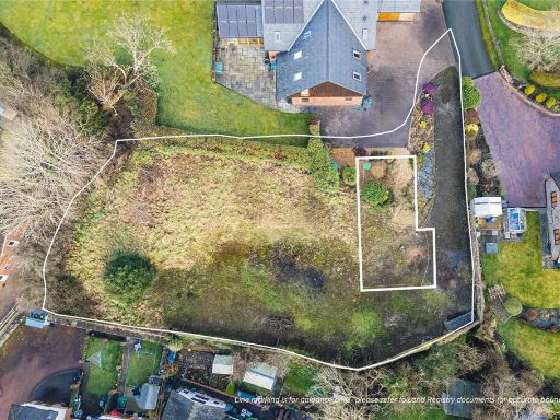 Detached house for sale in Olivers Lane, Tregynon, Newtown, Powys, SY16 — £100,000 • 1 bed • 1 bath
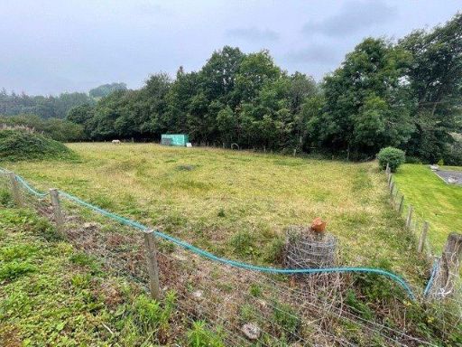 Plot for sale in Van Road, Llanidloes, Powys, SY18 — £150,000 • 1 bed • 1 bath • 8254 ft²
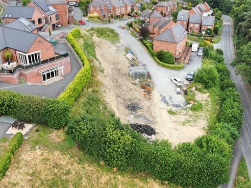 Plot for sale in At Hendidley, Milford Road, Newtown, Powys, SY16 — £200,000 • 1 bed • 1 bath
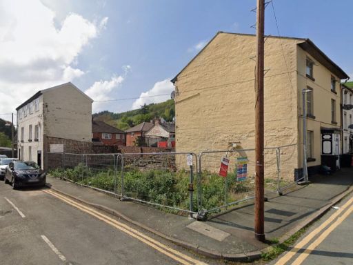 Plot for sale in Building Plot at, Crescent Street, Newtown, Powys, SY16 2HB, SY16 — £18,000 • 1 bed • 1 bath
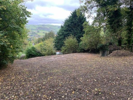 Plot for sale in To The Rear Of Dolguan East, Milford Road, SY16 2BD, SY16 — £160,000 • 1 bed • 1 bath
Meta
- {
"@context": "https://schema.org",
"@type": "Residence",
"name": "Plot for sale in Old Post Office Lane, Carno, Powys, SY17",
"description": "",
"url": "https://propertypiper.co.uk/property/e116b339-399e-4a86-a4d0-22bba85a125c",
"image": "https://image-a.propertypiper.co.uk/5060f348-a548-434e-a1c1-81c4dc28d69a-1024.jpeg",
"address": {
"@type": "PostalAddress",
"streetAddress": "Old Post Office Lane, Carno, Powys, SY17",
"postalCode": "SY17 5LW",
"addressLocality": "Powys",
"addressRegion": "Montgomeryshire",
"addressCountry": "Wales"
},
"geo": {
"@type": "GeoCoordinates",
"latitude": 52.55595201954027,
"longitude": -3.5300886021339046
},
"numberOfRooms": 1,
"numberOfBathroomsTotal": 1,
"offers": {
"@type": "Offer",
"price": 120000,
"priceCurrency": "GBP",
"availability": "https://schema.org/InStock"
},
"additionalProperty": [
{
"@type": "PropertyValue",
"name": "Feature",
"value": "land"
},
{
"@type": "PropertyValue",
"name": "Feature",
"value": "rural"
},
{
"@type": "PropertyValue",
"name": "Feature",
"value": "countryside"
},
{
"@type": "PropertyValue",
"name": "Feature",
"value": "development opportunity"
},
{
"@type": "PropertyValue",
"name": "Feature",
"value": "investment"
},
{
"@type": "PropertyValue",
"name": "Feature",
"value": "vacant lot"
},
{
"@type": "PropertyValue",
"name": "Feature",
"value": "overgrown"
},
{
"@type": "PropertyValue",
"name": "Feature",
"value": "nature"
},
{
"@type": "PropertyValue",
"name": "Feature",
"value": "potential"
},
{
"@type": "PropertyValue",
"name": "Feature",
"value": "views"
},
{
"@type": "PropertyValue",
"name": "Feature",
"value": "detached"
},
{
"@type": "PropertyValue",
"name": "Feature",
"value": "house"
},
{
"@type": "PropertyValue",
"name": "Feature",
"value": "rural"
},
{
"@type": "PropertyValue",
"name": "Feature",
"value": "landscape"
},
{
"@type": "PropertyValue",
"name": "Feature",
"value": "country"
},
{
"@type": "PropertyValue",
"name": "Feature",
"value": "garden"
},
{
"@type": "PropertyValue",
"name": "Feature",
"value": "garage"
},
{
"@type": "PropertyValue",
"name": "Feature",
"value": "modern"
},
{
"@type": "PropertyValue",
"name": "Feature",
"value": "private"
},
{
"@type": "PropertyValue",
"name": "Feature",
"value": "spacious"
}
]
}
High Res Floorplan Images
Compatible Floorplan Images
FloorplanImages Thumbnail