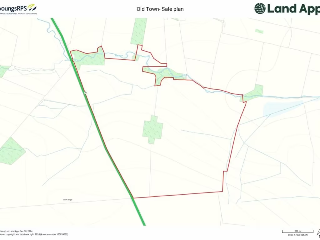
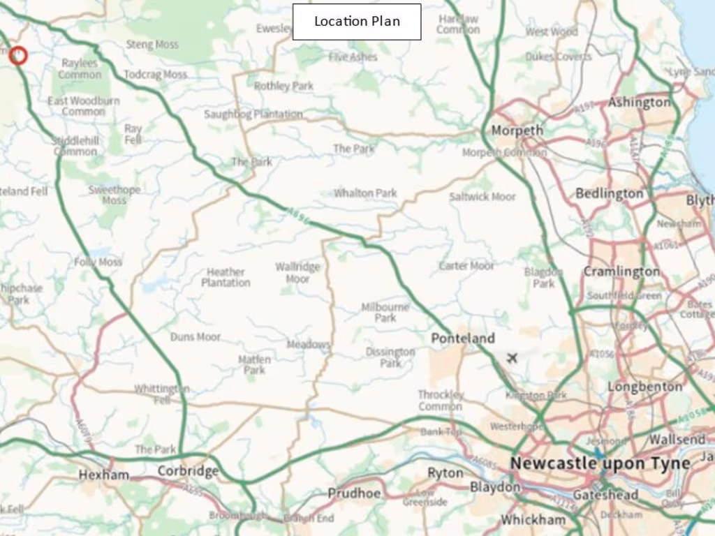
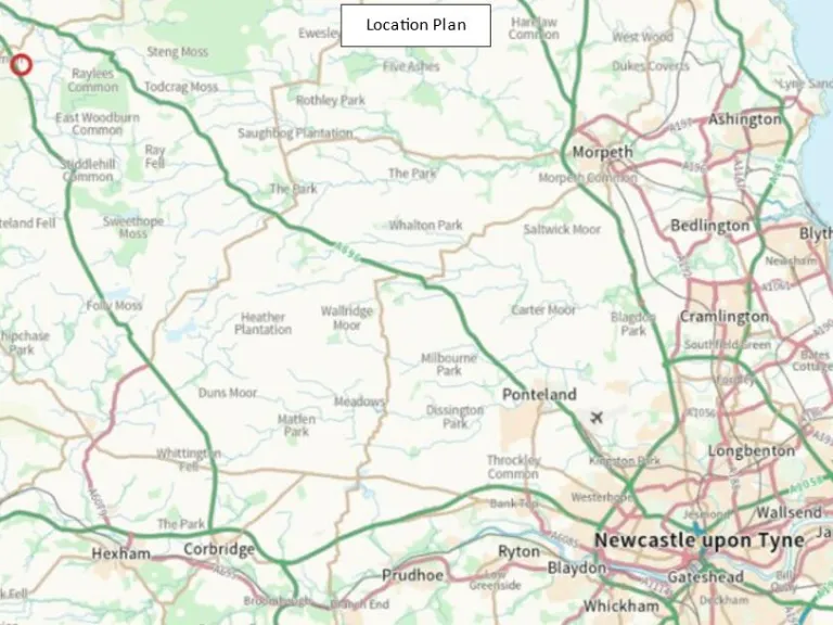
NE19 1JZ - Land for sale in Land At Old Town Farm, Otterburn, Newcastl…
View on Property Piper
Land for sale in Land At Old Town Farm, Otterburn, Newcastle Upon Tyne, NE19
Property Details
- Price: £490000
- Bedrooms: 1
- Bathrooms: 1
- Property Type: undefined
- Property SubType: undefined
Brochure Descriptions
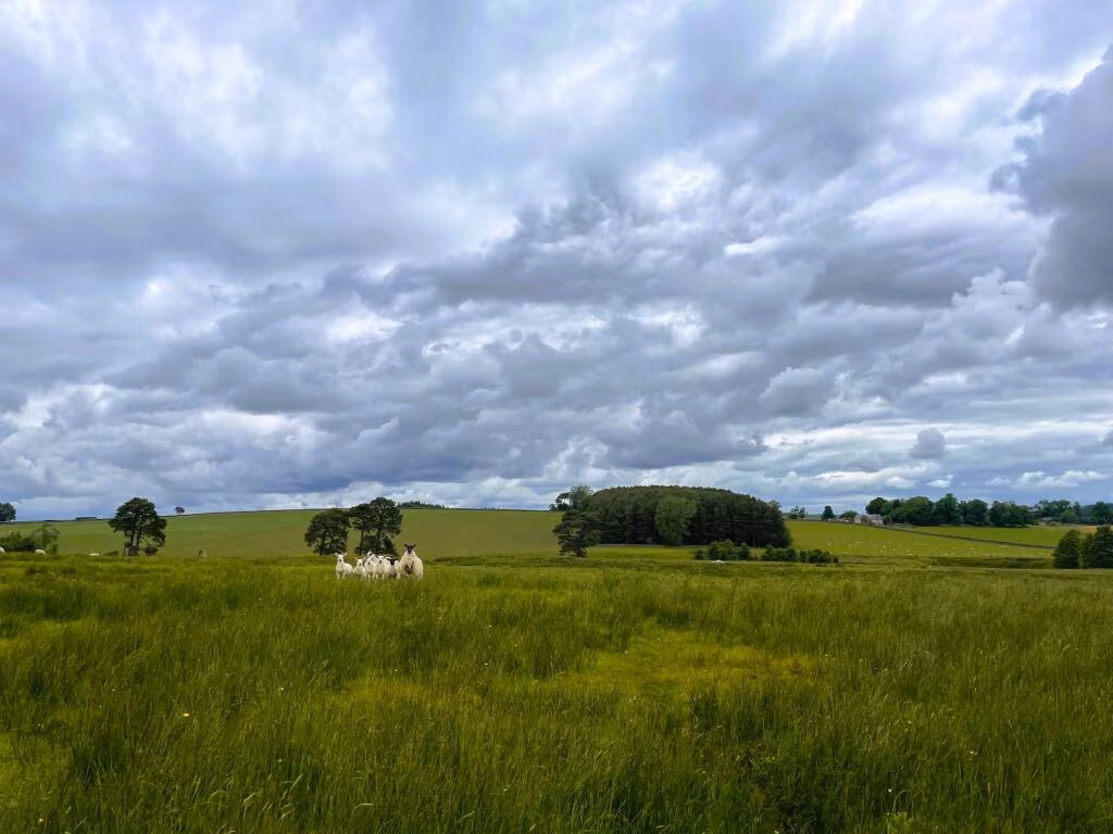
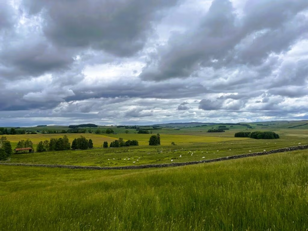
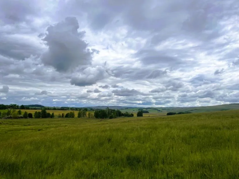
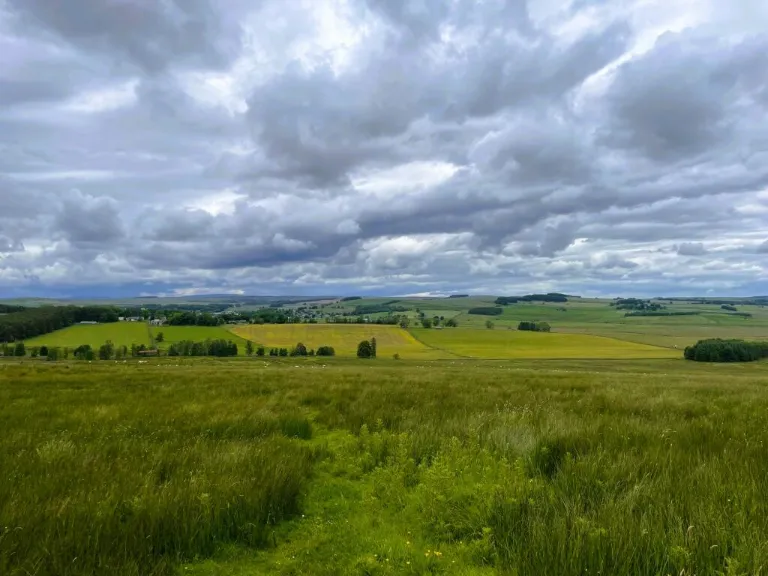
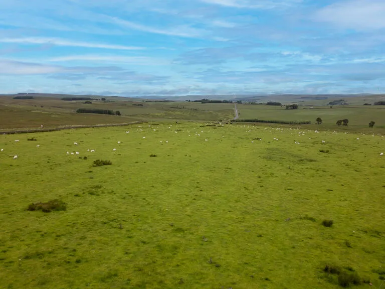
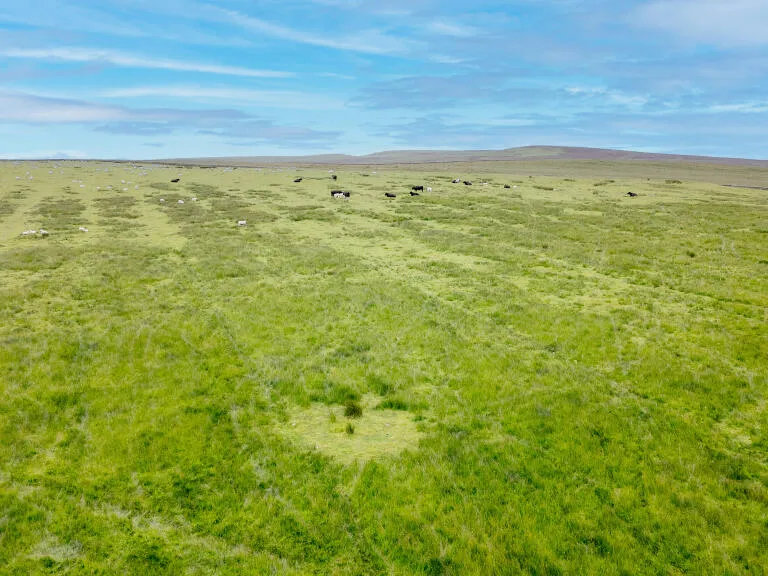
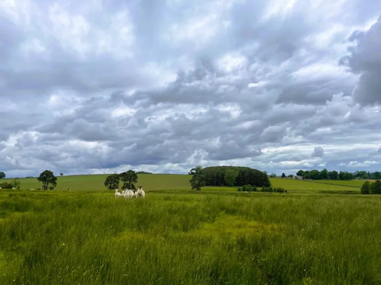
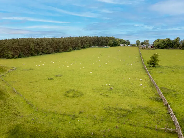
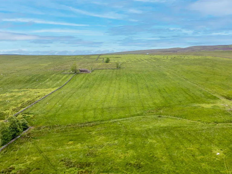
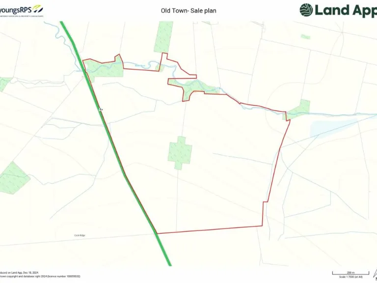
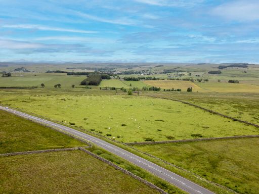
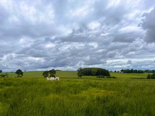
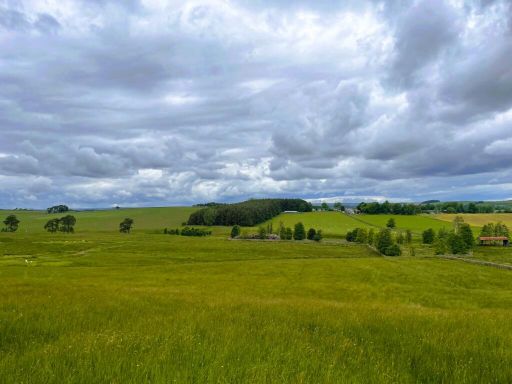
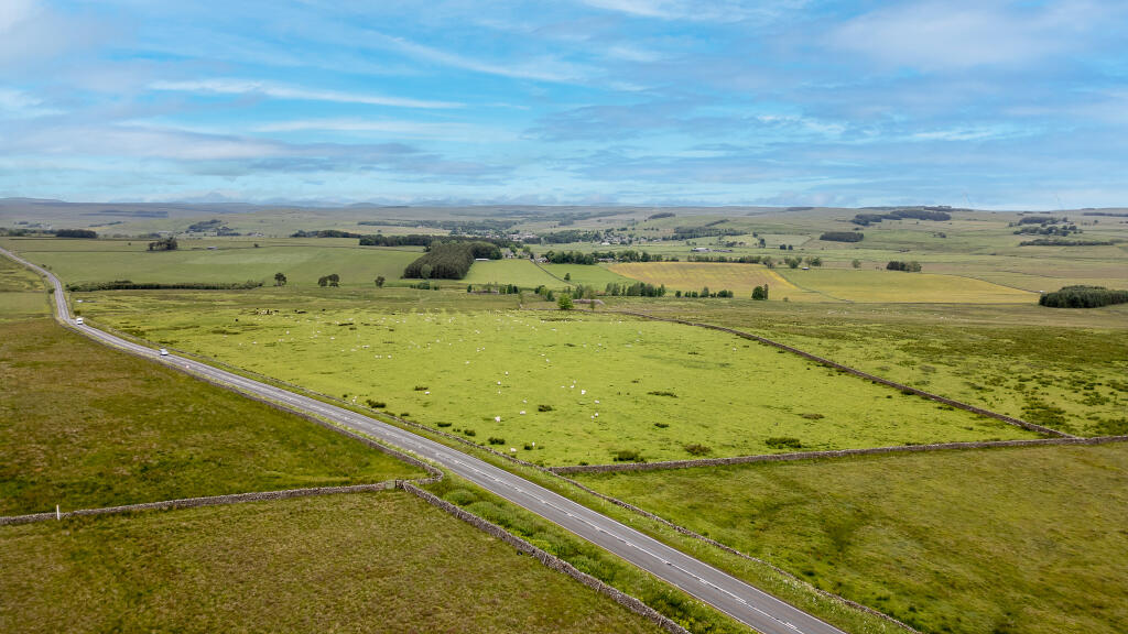
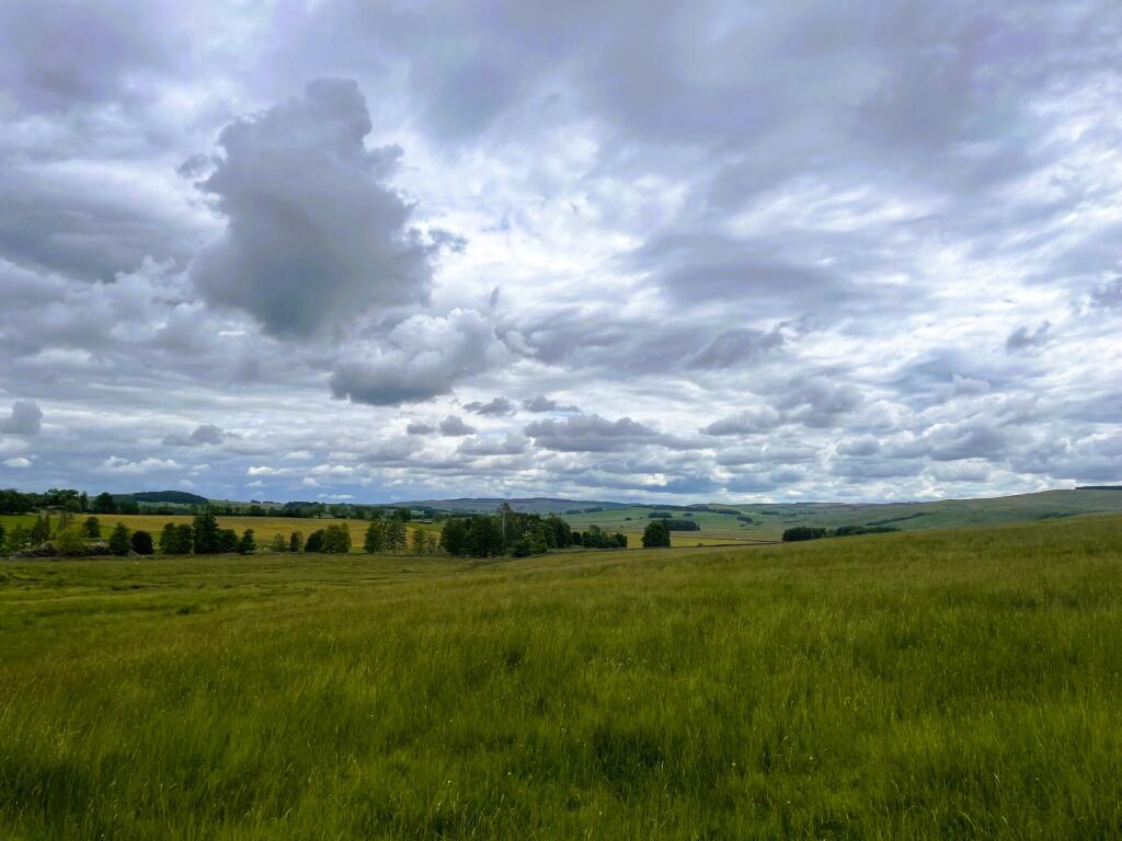
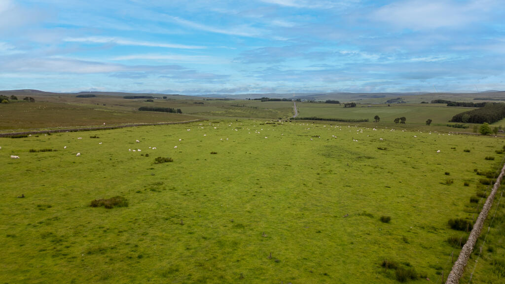
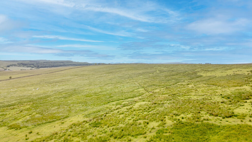
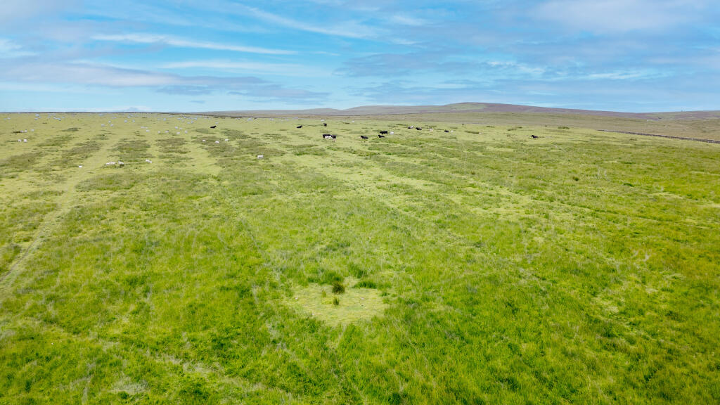
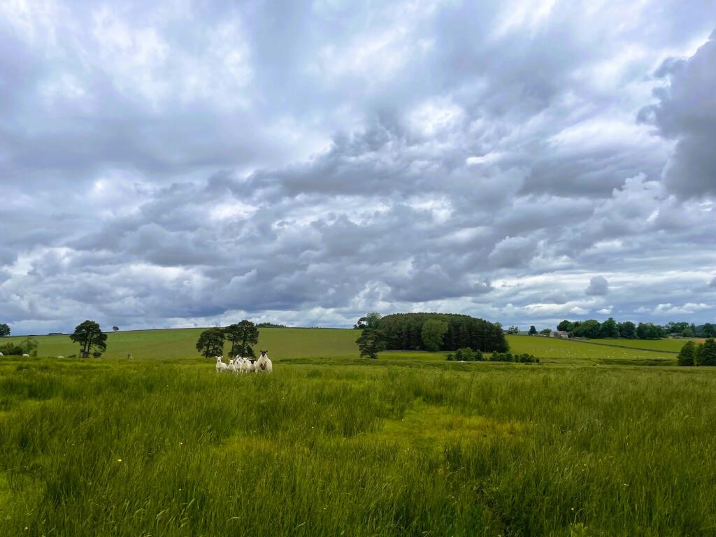
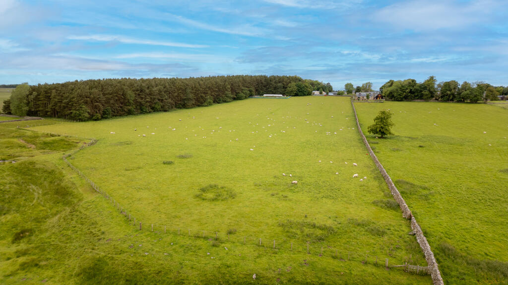
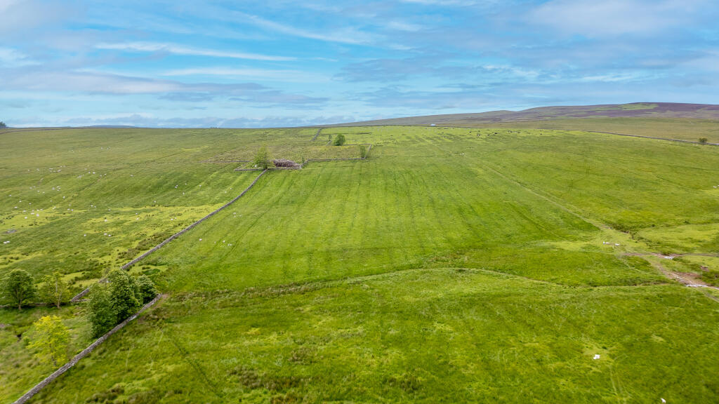
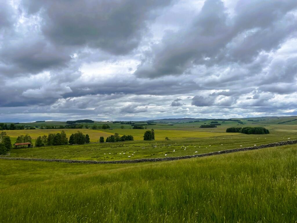
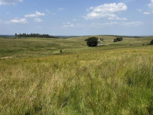
- This property comprises expansive land at Old Town Farm, featuring vast, open fields. It offers stunning, unobstructed views of the expansive countryside, providing a peaceful and rural setting. The land is bordered by traditional stone walls and includes a small road for easy access. The overall property size is extensive, with large fields suitable for agricultural or other rural uses.
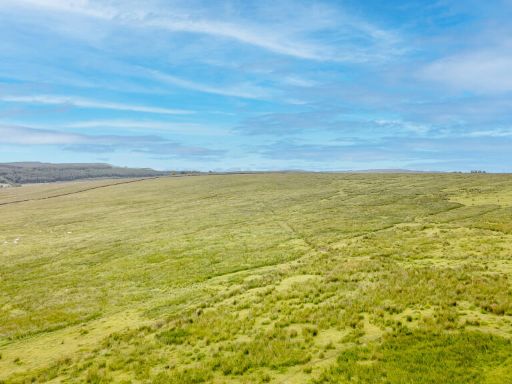
- The property consists of expansive open fields, characterized by lush green grass and gentle rolling hills. The setting provides a panoramic view of a vast countryside landscape, creating a serene and open atmosphere. Ideal for agricultural purposes or development, the land is large with potential for various uses.
Image Descriptions
- landscape rural
- landscape countryside
- rural landscape
Textual Property Features
Detected Visual Features
- rural
- landscape
- countryside
- fields
- open land
- road
- farming
- scenic
- grassland
- nature
- greenery
- open space
Nearby Schools
- Bellingham Primary School
- Otterburn Primary School
- Bellingham Middle School and Sports College
Nearest Bars And Restaurants
- Id: 1495764888
- Tags:
- Amenity: cafe
- Name: Impromptu Tea Room
- TagsNormalized:
- Lat: 55.2336897
- Lon: -2.1025162
- FullGeoHash: gcyd0nuzxf42
- PartitionGeoHash: gcyd
- Images:
- FoodStandards: null
- Distance: 5590.4
,- Id: 136340355
- Tags:
- Addr:
- City: Elsdon
- County: Northumberland
- Postcode: NE19 1AA
- Amenity: pub
- Building: yes
- Fhrs:
- Name: Bird in Bush
- Source:
- TagsNormalized:
- Lat: 55.2326439
- Lon: -2.1028898
- FullGeoHash: gcyd0nu9rp5d
- PartitionGeoHash: gcyd
- Images:
- FoodStandards:
- Id: 288177
- FHRSID: 288177
- LocalAuthorityBusinessID: 7100
- BusinessName: Bird in the Bush
- BusinessType: Pub/bar/nightclub
- BusinessTypeID: 7843
- AddressLine1: null
- AddressLine2: Elsdon
- AddressLine3: Northumberland
- AddressLine4: null
- PostCode: NE19 1AA
- RatingValue: 5
- RatingKey: fhrs_5_en-GB
- RatingDate: 2022-10-28
- LocalAuthorityCode: 707
- LocalAuthorityName: Northumberland
- LocalAuthorityWebSite: http://www.northumberland.gov.uk
- LocalAuthorityEmailAddress: public.protection@northumberland.gov.uk
- Scores:
- Hygiene: 5
- Structural: 0
- ConfidenceInManagement: 5
- NewRatingPending: false
- Geocode:
- Longitude: -2.10253930091858
- Latitude: 55.23372268676758
- Distance: 5530
,- Id: 619557668
- Tags:
- Amenity: restaurant
- Building: yes
- TagsNormalized:
- Lat: 55.2590771
- Lon: -2.1662608
- FullGeoHash: gcy6qewe6qwf
- PartitionGeoHash: gcy6
- Images:
- FoodStandards: null
- Distance: 4857.1
,- Id: 4183128001
- Tags:
- Addr:
- Amenity: pub
- Name: Otterburn Working Mens Club
- TagsNormalized:
- Lat: 55.2327747
- Lon: -2.1804085
- FullGeoHash: gcy6nqu60z3w
- PartitionGeoHash: gcy6
- Images:
- FoodStandards: null
- Distance: 1805.7
,- Id: 1706688701
- Tags:
- Addr:
- City: Otterburn
- Postcode: NE19 1JT
- Amenity: restaurant
- Name: Weavers Restaurant
- Website: https://www.otterburnmill.co.uk/weavers-restaurant
- TagsNormalized:
- Lat: 55.2294513
- Lon: -2.177814
- FullGeoHash: gcy6nqnnv7bj
- PartitionGeoHash: gcy6
- Images:
- FoodStandards: null
- Distance: 1489.5
}
Nearest General Shops
- Id: 178210948
- Tags:
- Addr:
- City: Bellingham
- County: Northumberland
- Postcode: NE48 2AY
- Street: Parkside Place
- Building: yes
- Fhrs:
- Name: Bellingham News
- Shop: confectionery
- TagsNormalized:
- Lat: 55.1442926
- Lon: -2.2538598
- FullGeoHash: gcy3swwyc30q
- PartitionGeoHash: gcy3
- Images:
- FoodStandards:
- Id: 287394
- FHRSID: 287394
- LocalAuthorityBusinessID: 5445
- BusinessName: Bellingham News & Post Office
- BusinessType: Retailers - other
- BusinessTypeID: 4613
- AddressLine1: Parkside Place
- AddressLine2: Bellingham
- AddressLine3: Northumberland
- AddressLine4: null
- PostCode: NE48 2AY
- RatingValue: 5
- RatingKey: fhrs_5_en-GB
- RatingDate: 2022-01-21
- LocalAuthorityCode: 707
- LocalAuthorityName: Northumberland
- LocalAuthorityWebSite: http://www.northumberland.gov.uk
- LocalAuthorityEmailAddress: public.protection@northumberland.gov.uk
- Scores:
- Hygiene: 5
- Structural: 5
- ConfidenceInManagement: 5
- NewRatingPending: false
- Geocode:
- Longitude: -2.25411200000000
- Latitude: 55.14419800000000
- Distance: 9155.4
,- Id: 4183117377
- Tags:
- TagsNormalized:
- Lat: 55.2293176
- Lon: -2.1779155
- FullGeoHash: gcy6nqnn4gh2
- PartitionGeoHash: gcy6
- Images:
- FoodStandards: null
- Distance: 1473.3
,- Id: 151395987
- Tags:
- Addr:
- Building: yes
- Name: Otterburn Mill
- Shop: clothes
- Source: Bing
- Url: http://www.otterburnmill.co.uk/
- TagsNormalized:
- Lat: 55.2289069
- Lon: -2.1781492
- FullGeoHash: gcy6nqjgtqqn
- PartitionGeoHash: gcy6
- Images:
- FoodStandards: null
- Distance: 1425.3
}
Nearest Religious buildings
- Id: 362268897
- Tags:
- Amenity: place_of_worship
- Building: church
- Denomination: anglican
- Name: All Saints
- Religion: christian
- Wikidata: Q26591034
- TagsNormalized:
- place of worship
- church
- anglican
- christian
- Lat: 55.1753427
- Lon: -2.1566358
- FullGeoHash: gcy3yumedtrg
- PartitionGeoHash: gcy3
- Images:
- FoodStandards: null
- Distance: 4961.7
,- Id: 398859610
- Tags:
- Amenity: place_of_worship
- Building: church
- Denomination: anglican
- Name: St Cuthbert
- Religion: christian
- Wikidata: Q26651677
- TagsNormalized:
- place of worship
- church
- anglican
- christian
- Lat: 55.197549
- Lon: -2.1739911
- FullGeoHash: gcy6n82vn2ft
- PartitionGeoHash: gcy6
- Images:
- FoodStandards: null
- Distance: 2262.9
,- Id: 151395992
- Tags:
- Addr:
- City: Otterburn
- Postcode: NE19 1NT
- Street: A696
- Amenity: place_of_worship
- Building: yes
- Denomination: anglican
- Name: St John the Evangelist Church
- Religion: christian
- Source: Bing
- Wikidata: Q7593790
- TagsNormalized:
- place of worship
- anglican
- church
- evangelist
- christian
- Lat: 55.2322789
- Lon: -2.1817539
- FullGeoHash: gcy6nqer37n3
- PartitionGeoHash: gcy6
- Images:
- FoodStandards: null
- Distance: 1737.6
}
Nearest Medical buildings
- Id: 179172091
- Tags:
- Amenity: hospital
- Building: hospital
- Designation: Community Hospital
- Emergency: no
- Name: Coquetdale Community Hospital
- Source: User
- TagsNormalized:
- Lat: 55.3068134
- Lon: -1.9138233
- FullGeoHash: gcydskq3s9mb
- PartitionGeoHash: gcyd
- Images:
- FoodStandards: null
- Distance: 19914.5
,- Id: 179172319
- Tags:
- Amenity: hospital
- Designation: NHS Ambulance Service
- Emergency: yes
- Name: Community Paramedic Service
- Source: User
- TagsNormalized:
- Lat: 55.3067526
- Lon: -1.9141491
- FullGeoHash: gcydskq1jjfy
- PartitionGeoHash: gcyd
- Images:
- FoodStandards: null
- Distance: 19893.3
,- Id: 233114094
- Tags:
- Addr:
- City: Bellingham
- Postcode: NE48 2HE
- Amenity: doctors
- Building: yes
- Name: The Bellingham Practice
- Phone: +44 1434 220203
- Website: https://thebellinghampractice.co.uk/
- TagsNormalized:
- Lat: 55.1437832
- Lon: -2.2579655
- FullGeoHash: gcy3swegcd4z
- PartitionGeoHash: gcy3
- Images:
- FoodStandards: null
- Distance: 9331
,- Id: 178210964
- Tags:
- Addr:
- City: Bellingham
- County: Northumberland
- Postcode: NE48 2AA
- Street: Front Street
- Amenity: pharmacy
- Building: yes
- Fhrs:
- Healthcare: pharmacy
- Name: Parkside Pharmacy
- TagsNormalized:
- Lat: 55.1441055
- Lon: -2.2543953
- FullGeoHash: gcy3swwmsy34
- PartitionGeoHash: gcy3
- Images:
- FoodStandards:
- Id: 287393
- FHRSID: 287393
- LocalAuthorityBusinessID: 5444
- BusinessName: Parkside Pharmacy
- BusinessType: Retailers - other
- BusinessTypeID: 4613
- AddressLine1: Front Street
- AddressLine2: Bellingham
- AddressLine3: Northumberland
- AddressLine4: null
- PostCode: NE48 2AA
- RatingValue: Exempt
- RatingKey: fhrs_exempt_en-GB
- RatingDate: 2022-01-21
- LocalAuthorityCode: 707
- LocalAuthorityName: Northumberland
- LocalAuthorityWebSite: http://www.northumberland.gov.uk
- LocalAuthorityEmailAddress: public.protection@northumberland.gov.uk
- Scores:
- Hygiene: null
- Structural: null
- ConfidenceInManagement: null
- NewRatingPending: false
- Geocode:
- Longitude: -2.25486200000000
- Latitude: 55.14382800000000
- Distance: 9189.9
}
Nearest Leisure Facilities
- Id: 619571163
- Tags:
- Leisure: pitch
- Sport: tennis
- TagsNormalized:
- Lat: 55.2439042
- Lon: -2.1830138
- FullGeoHash: gcy6q2f7h44u
- PartitionGeoHash: gcy6
- Images:
- FoodStandards: null
- Distance: 3017.9
,- Id: 158261676
- Tags:
- Area: no
- Highway: track
- Leisure: track
- Name: Horse Exercise Circle
- Sport: equestrian
- Surface: ground
- TagsNormalized:
- track
- leisure
- exercise
- equestrian
- sports
- Lat: 55.2362634
- Lon: -2.1755022
- FullGeoHash: gcy6nrrye1gc
- PartitionGeoHash: gcy6
- Images:
- FoodStandards: null
- Distance: 2255.7
,- Id: 723957476
- Tags:
- Leisure: pitch
- Source: Bing
- Sport: soccer
- Surface: grass
- TagsNormalized:
- Lat: 55.2369876
- Lon: -2.1831041
- FullGeoHash: gcy6nrd6cbz9
- PartitionGeoHash: gcy6
- Images:
- FoodStandards: null
- Distance: 2249.8
,- Id: 204996259
- Tags:
- TagsNormalized:
- Lat: 55.2340921
- Lon: -2.181159
- FullGeoHash: gcy6nr59zm1c
- PartitionGeoHash: gcy6
- Images:
- FoodStandards: null
- Distance: 1942.5
,- Id: 187472704
- Tags:
- Designation: millennium_green
- Leisure: park
- Name: Otterburn (Millennium Green)
- Note: V1 as per Natural England dataset
- Source: Natural England
- TagsNormalized:
- Lat: 55.232331
- Lon: -2.1827474
- FullGeoHash: gcy6nqdxdk9x
- PartitionGeoHash: gcy6
- Images:
- FoodStandards: null
- Distance: 1735.8
}
Nearest Train stations
- Id: 8737285723
- Tags:
- Addr:
- City: Hawick
- Postcode: TD9 9TY
- Street: Whitrope
- Name: Whitrope Siding
- Network: Whitrope Heritage Centre
- Operator: Whitrope Heritage Centre
- Public_transport: station
- Railway: station
- Train: yes
- Usage: tourism
- Wikidata: Q7996783
- Wikipedia: en:Whitrope Siding
- TagsNormalized:
- Lat: 55.2938104
- Lon: -2.7482498
- FullGeoHash: gcy493yvc1k6
- PartitionGeoHash: gcy4
- Images:
- FoodStandards: null
- Distance: 36673.6
}
Nearest Hotels
- Id: 2046554
- Tags:
- Building: yes
- Name: Otterburn Hall Hotel
- Postal_code: NE19 1HE
- Tourism: hotel
- Type: multipolygon
- Wikidata: Q7109431
- Wikipedia: en:Otterburn Hall
- TagsNormalized:
- Lat: 55.2430229
- Lon: -2.1847382
- FullGeoHash: gcy6q29jgvv5
- PartitionGeoHash: gcy6
- Images:
- FoodStandards: null
- Distance: 2916
,- Id: 723957347
- Tags:
- Addr:
- City: Otterburn
- County: Northumberland
- Postcode: NE19 1NS
- Fhrs:
- Landuse: commercial
- Name: Otterburn Castle Country House Hotel
- Phone: +44 1830 520 620
- Source: Bing
- Tourism: hotel
- Website: https://www.otterburncastle.com/
- Wikidata: Q7109434
- TagsNormalized:
- Lat: 55.2322401
- Lon: -2.1780202
- FullGeoHash: gcy6nqwp07y3
- PartitionGeoHash: gcy6
- Images:
- FoodStandards: null
- Distance: 1781.7
,- Id: 117681287
- Tags:
- Addr:
- Amenity: pub
- Building: yes
- Name: Percy Arms Hotel
- Source: Bing;survey
- Tourism: hotel
- Website: http://www.thepercyarms.co.uk/
- TagsNormalized:
- Lat: 55.2314563
- Lon: -2.1798997
- FullGeoHash: gcy6nqsds9sy
- PartitionGeoHash: gcy6
- Images:
- FoodStandards: null
- Distance: 1668.3
}
Tags
- rural
- landscape
- countryside
- fields
- open land
- road
- farming
- countryside
- landscape
- scenic
- rural
- grassland
- nature
- rural
- landscape
- fields
- countryside
- scenic
- greenery
- open space
Local Market Stats
- Average Price/sqft: £226
- Avg Income: £41800
- Social Housing: 6%
- Planning Success Rate: 80%
Similar Properties
 Land for sale in Land at Middleburn Farm, Simonburn, NE48 — £260,000 • 1 bed • 1 bath
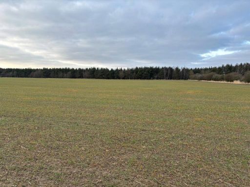 Land for sale in Burgham, Morpeth, Northumberland, NE65 — £405,000 • 1 bed • 1 bath
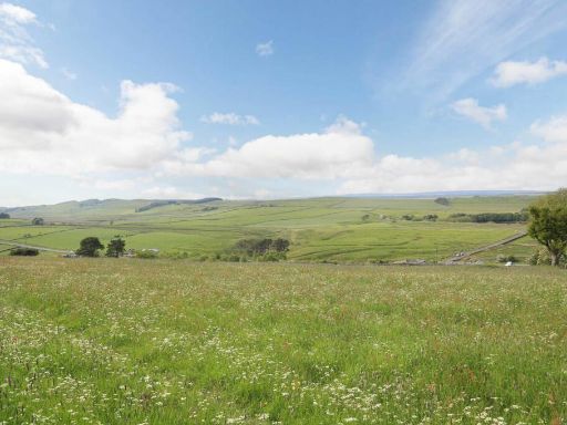 Land for sale in Land to the South of Moor Cottage, Milecastle, Haltwhistle, Northumberland, NE49 — £50,000 • 1 bed • 1 bath • 2454 ft²
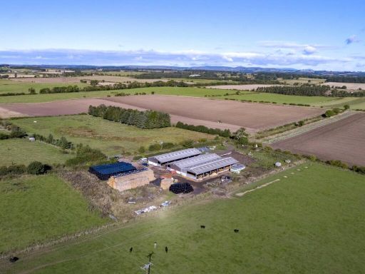 Land for sale in Throphill Farm - Lot 1, Throphill, Morpeth, Northumberland, NE61 — £695,000 • 1 bed • 1 bath
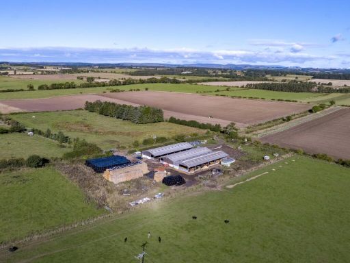 Land for sale in Throphill Farm, Throphill, Morpeth, Northumberland, NE61 — £1,695,000 • 1 bed • 1 bath
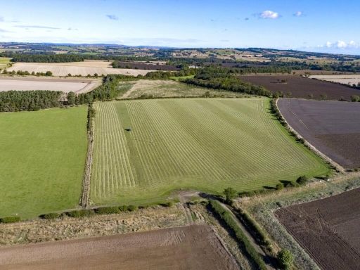 Land for sale in Throphill Farm - Lot 2, Throphill, Morpeth, Northumberland, NE61 — £1,000,000 • 1 bed • 1 bath
Meta
- {
"@context": "https://schema.org",
"@type": "Residence",
"name": "Land for sale in Land At Old Town Farm, Otterburn, Newcastl…",
"description": "",
"url": "https://propertypiper.co.uk/property/df749857-94c2-471d-81ad-049679046f4e",
"image": "https://image-a.propertypiper.co.uk/36d39906-9e6f-45fd-a2bd-5e9208111f48-1024.jpeg",
"address": {
"@type": "PostalAddress",
"streetAddress": "Land At Old Town Farm, Otterburn, Newcastle Upon Tyne, NE19",
"postalCode": "NE19 1JZ",
"addressLocality": "Northumberland",
"addressRegion": "Hexham",
"addressCountry": "England"
},
"geo": {
"@type": "GeoCoordinates",
"latitude": 55.216802256061435,
"longitude": -2.185542674424252
},
"numberOfRooms": 1,
"numberOfBathroomsTotal": 1,
"offers": {
"@type": "Offer",
"price": 490000,
"priceCurrency": "GBP",
"availability": "https://schema.org/InStock"
},
"additionalProperty": [
{
"@type": "PropertyValue",
"name": "Feature",
"value": "rural"
},
{
"@type": "PropertyValue",
"name": "Feature",
"value": "landscape"
},
{
"@type": "PropertyValue",
"name": "Feature",
"value": "countryside"
},
{
"@type": "PropertyValue",
"name": "Feature",
"value": "fields"
},
{
"@type": "PropertyValue",
"name": "Feature",
"value": "open land"
},
{
"@type": "PropertyValue",
"name": "Feature",
"value": "road"
},
{
"@type": "PropertyValue",
"name": "Feature",
"value": "farming"
},
{
"@type": "PropertyValue",
"name": "Feature",
"value": "countryside"
},
{
"@type": "PropertyValue",
"name": "Feature",
"value": "landscape"
},
{
"@type": "PropertyValue",
"name": "Feature",
"value": "scenic"
},
{
"@type": "PropertyValue",
"name": "Feature",
"value": "rural"
},
{
"@type": "PropertyValue",
"name": "Feature",
"value": "grassland"
},
{
"@type": "PropertyValue",
"name": "Feature",
"value": "nature"
},
{
"@type": "PropertyValue",
"name": "Feature",
"value": "rural"
},
{
"@type": "PropertyValue",
"name": "Feature",
"value": "landscape"
},
{
"@type": "PropertyValue",
"name": "Feature",
"value": "fields"
},
{
"@type": "PropertyValue",
"name": "Feature",
"value": "countryside"
},
{
"@type": "PropertyValue",
"name": "Feature",
"value": "scenic"
},
{
"@type": "PropertyValue",
"name": "Feature",
"value": "greenery"
},
{
"@type": "PropertyValue",
"name": "Feature",
"value": "open space"
}
]
}