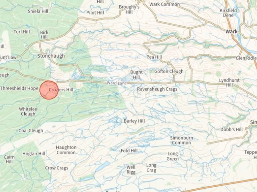
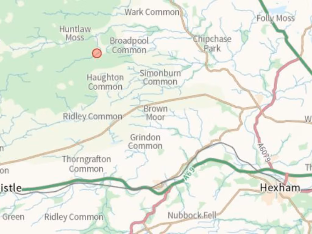
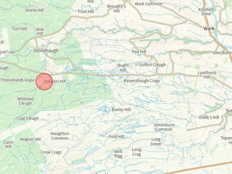
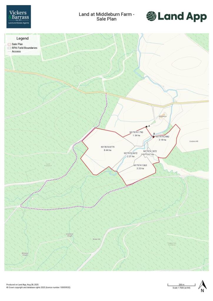
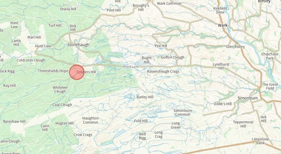
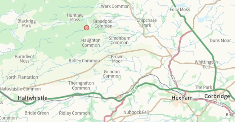
Summary - Middleburn Farm, Simonburn, HEXHAM NE48 3EE
1 bed 1 bath Land
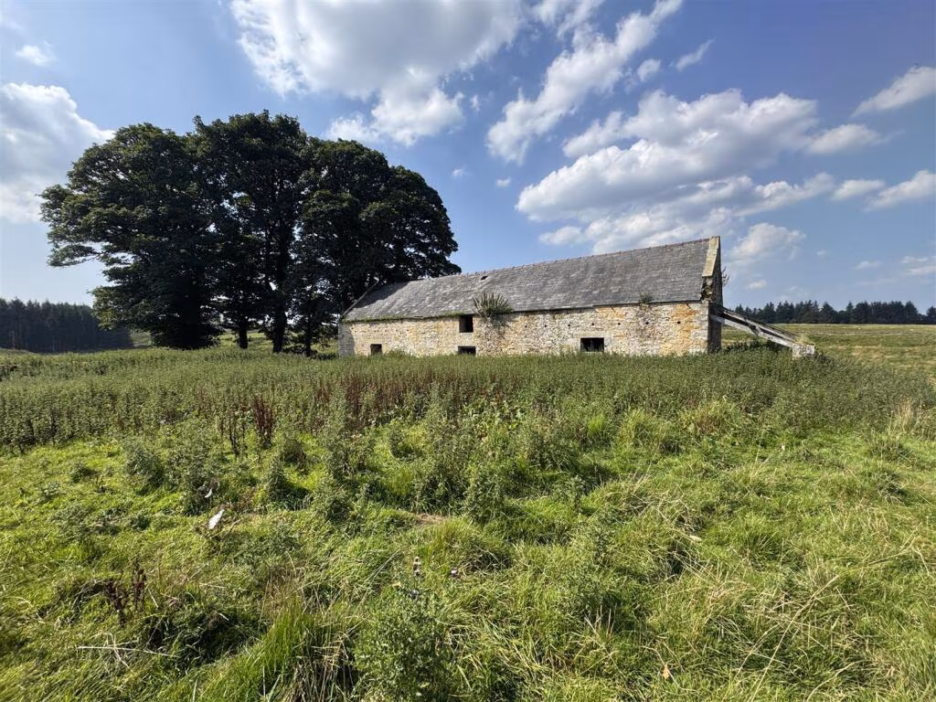
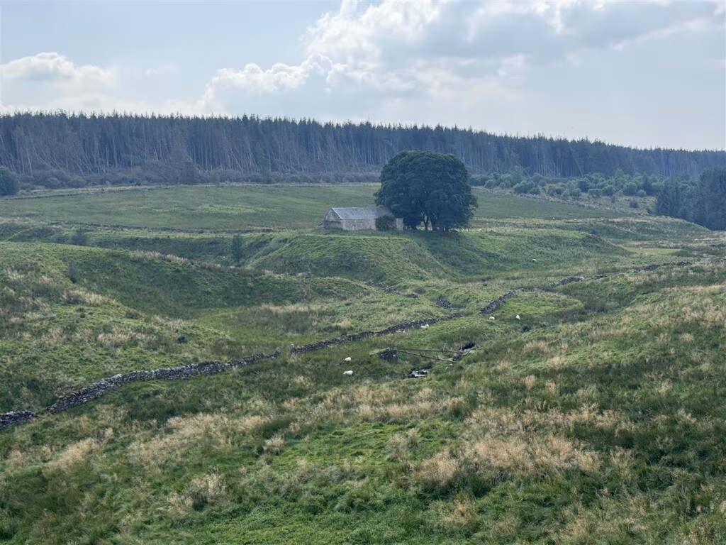
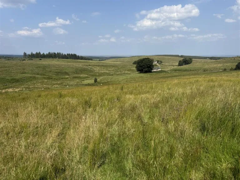
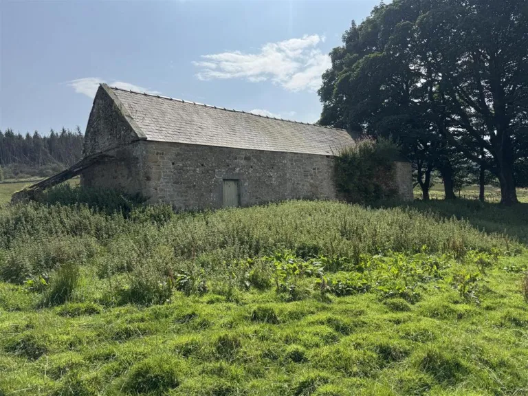
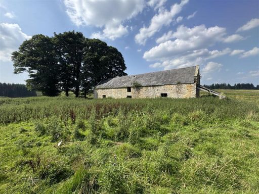
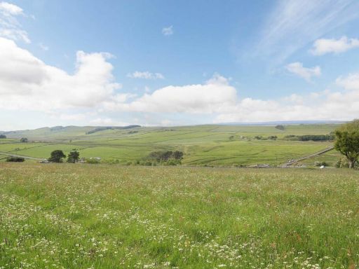
Remote Northumberland holding with derelict stone bothy and natural water supply.
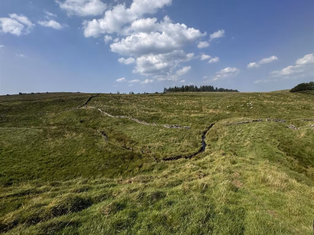
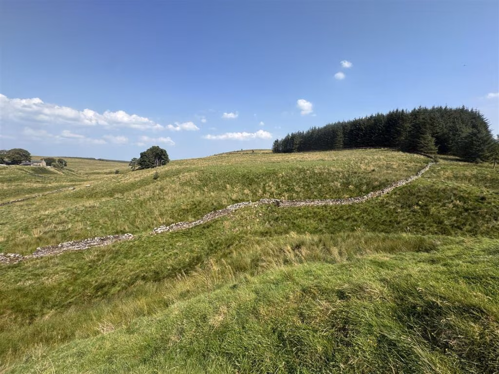
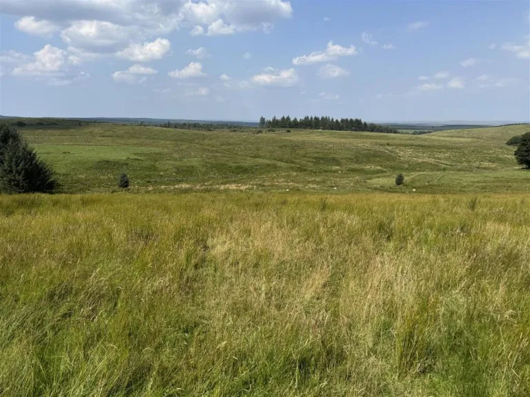
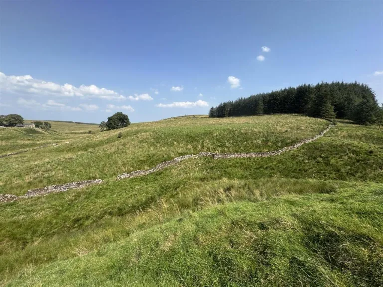
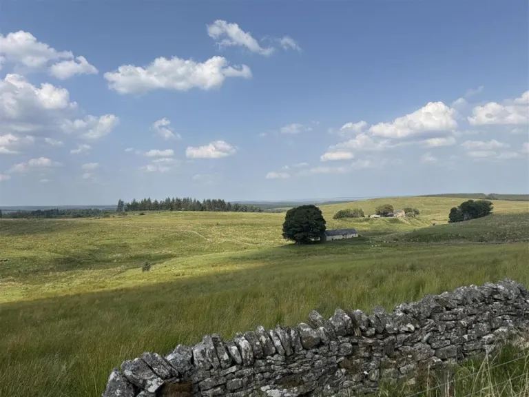
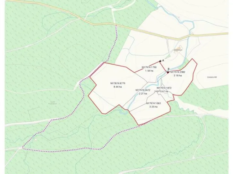
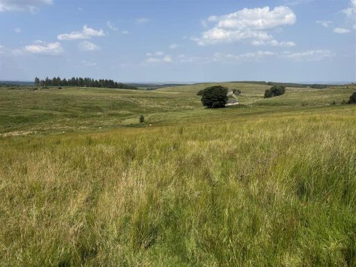
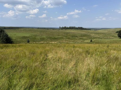
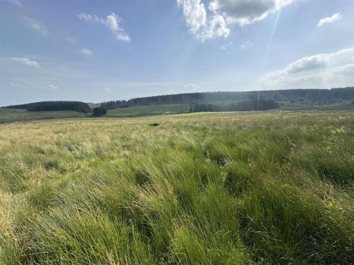
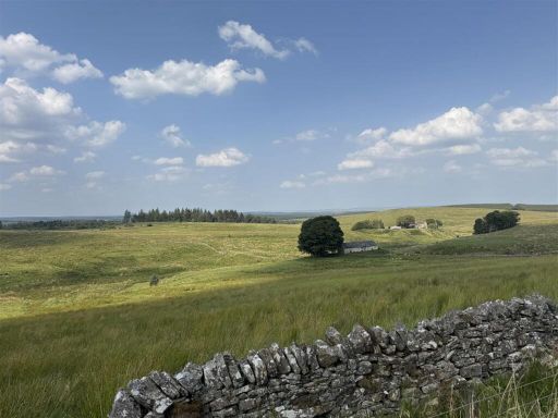
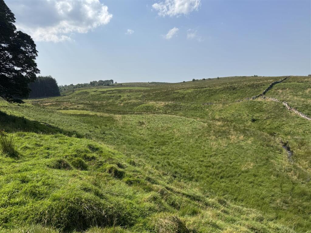
19.51 hectares (48.21 acres) permanent upland grazing
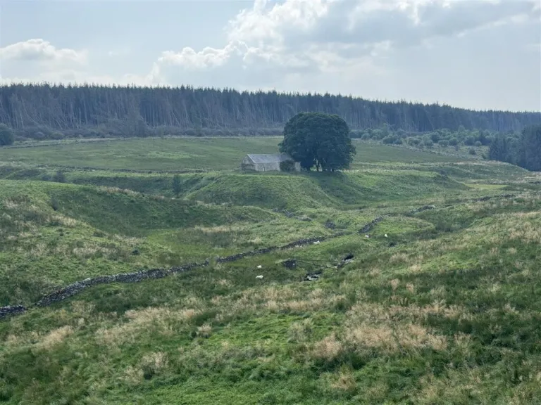
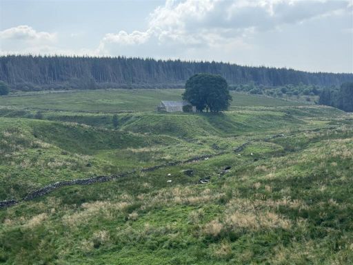
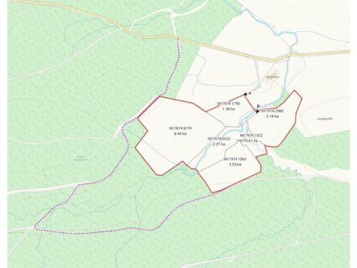
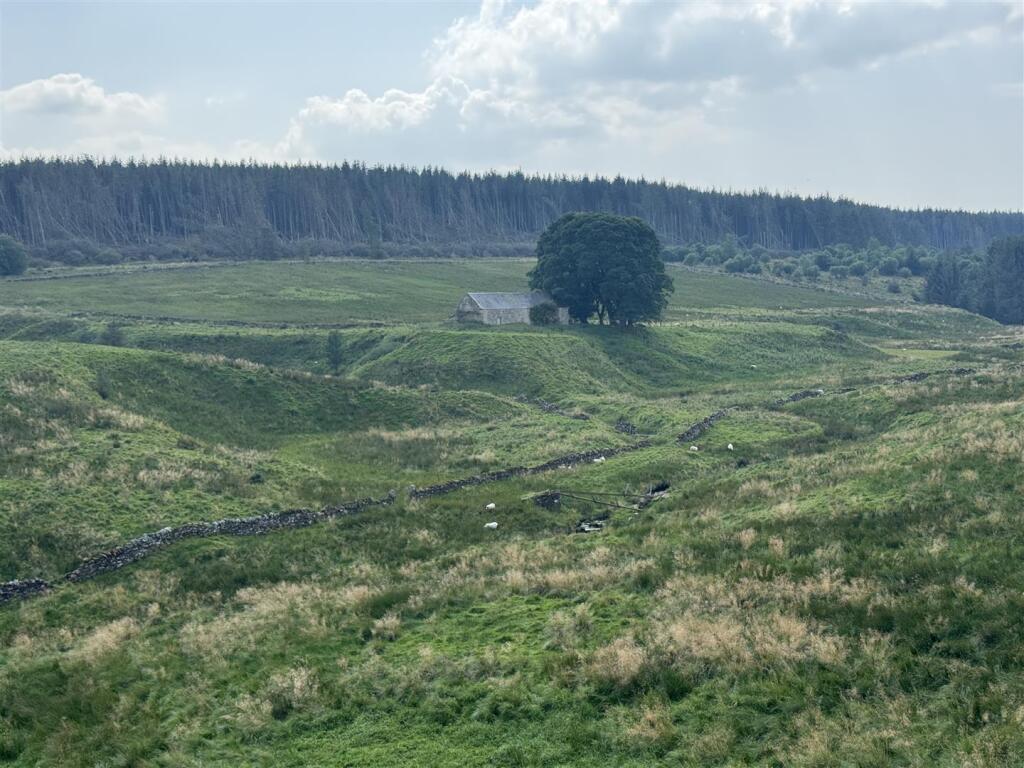
A substantial upland grazing holding extending to 19.51 hectares (48.21 acres) in the Northumberland National Park, offered freehold. The parcel is split into multiple fields with natural water supply, established stock‑proof boundaries and gently undulating permanent grassland suited to upland grazing or conservation management. A derelict two‑storey stone building known as “The Bothy” sits centrally and could offer refurbishment or alternative use subject to planning consent.
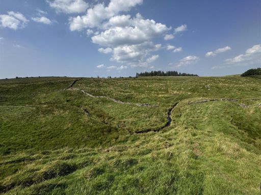
Practical benefits include a natural water supply, generally sound stone wall and post & wire boundaries, and an electrical connection nearby (a wayleave can be arranged across retained land). The land is registered with the Rural Payments Agency and currently subject to a Mid Tier Countryside Stewardship Agreement until 31 December 2027; a Sustainable Farming Incentive agreement exists but cannot be transferred to the purchaser.
Material drawbacks are straightforward: the Bothy is derelict and requires complete renovation and any change of use needs consent; access is via an unadopted gravel forestry track 1.5 miles from the adopted road and there is no metal track directly to the building. The land is classified Grade 5 (peaty, slowly permeable soils) and lies in a severely disadvantaged upland area, so productive options are limited and agricultural support rules apply. There is a local medium flood risk around the beck; mineral rights are excluded and sporting rights are retained by the owner.
This holding will suit buyers seeking a countryside grazing unit, a conservation/management project or someone prepared to invest in building refurbishment and track improvements. Expect modest local services (very slow broadband, average mobile signal), remote tranquillity and the regulatory constraints of a National Park when planning any works.
 Land for sale in Land to the South of Moor Cottage, Milecastle, Haltwhistle, Northumberland, NE49 — £50,000 • 1 bed • 1 bath • 2454 ft²
 4 bedroom detached house for sale in High Carriteth, Bellingham, Hexham, Northumberland, NE48 — £825,000 • 4 bed • 2 bath • 2453 ft²
 4 bedroom detached house for sale in Haltwhistle, Northumberland, NE49 — £825,000 • 4 bed • 3 bath • 2196 ft²
 3 bedroom farm house for sale in Greenhaugh Farm, Greenhaugh, Hexham, Northumberland, NE48 — £1,175,000 • 3 bed • 2 bath • 1955 ft²
 Farm for sale in Willimoteswick Farm, Bardon Mill, Hexham, Northumberland, NE47 — £4,400,000 • 1 bed • 1 bath • 1203 ft²
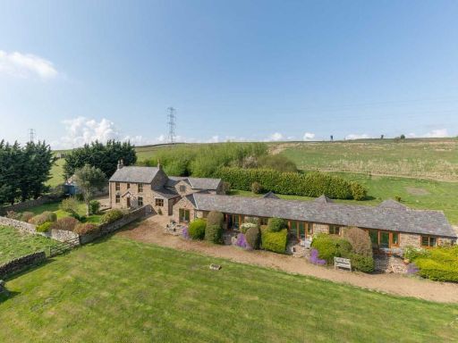 3 bedroom farm house for sale in Common House Farm, Melkridge, Haltwhistle, Northumberland, NE49 — £1,375,000 • 3 bed • 2 bath • 1670 ft²