BS6 5QU - 5 bedroom terraced house for sale in Freehold Mixed Use | £…
View on Property Piper
5 bedroom terraced house for sale in Freehold Mixed Use | £56K Pa, BS6
Property Details
- Price: £475000
- Bedrooms: 5
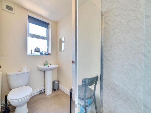
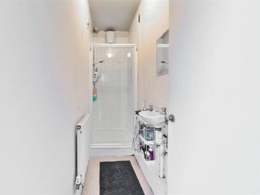
- Bathrooms: 4
- Property Type: undefined
- Property SubType: undefined
Brochure Descriptions
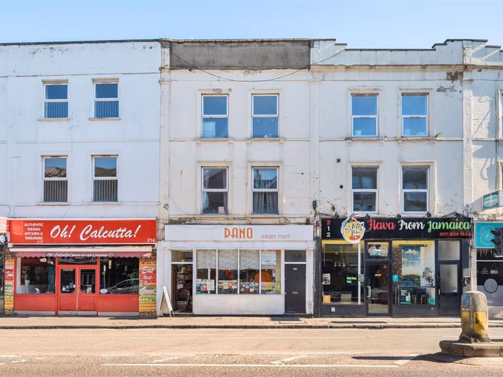
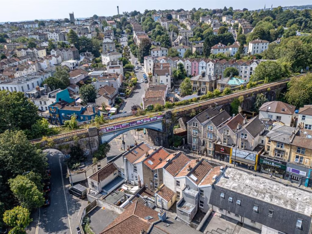
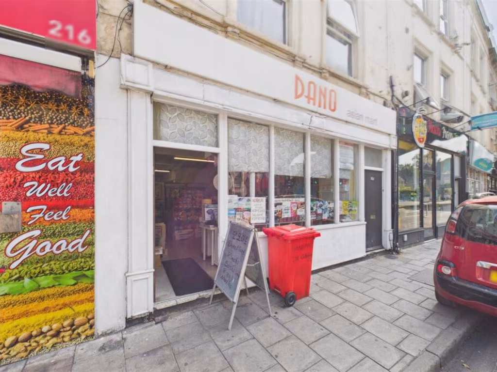
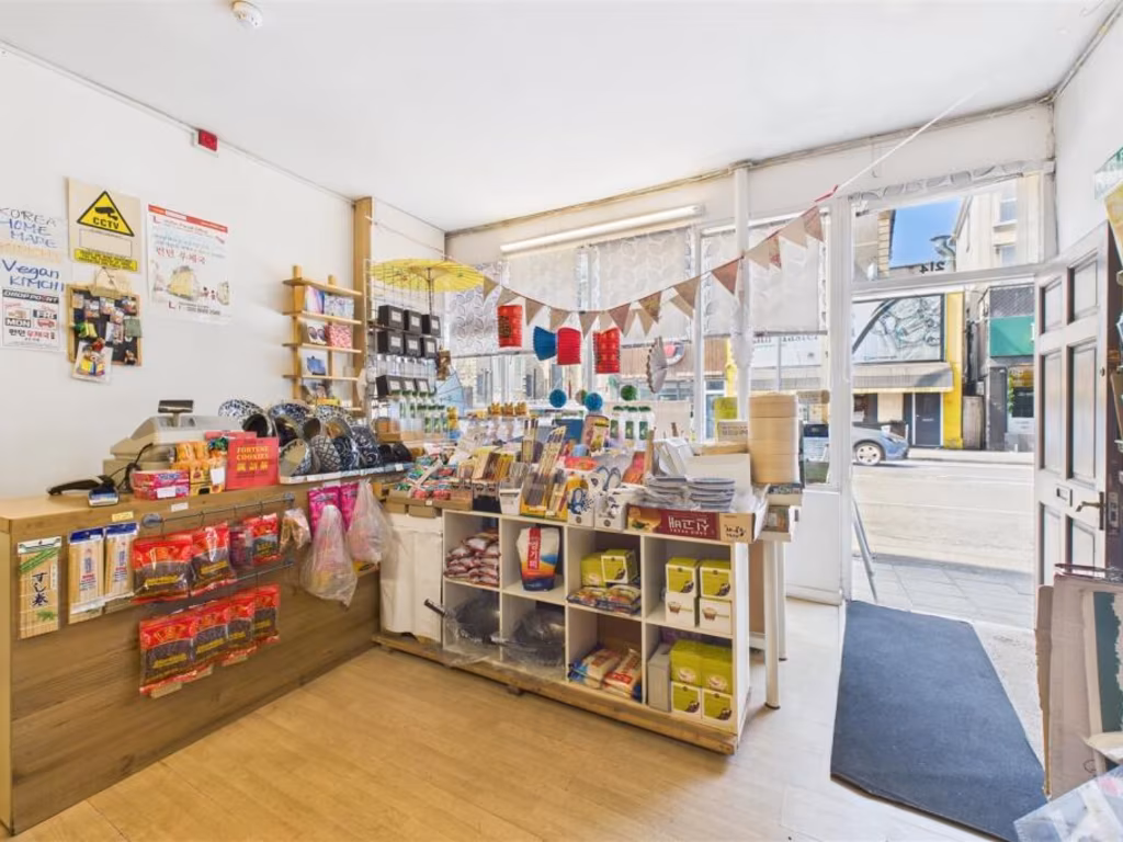
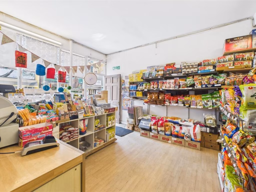
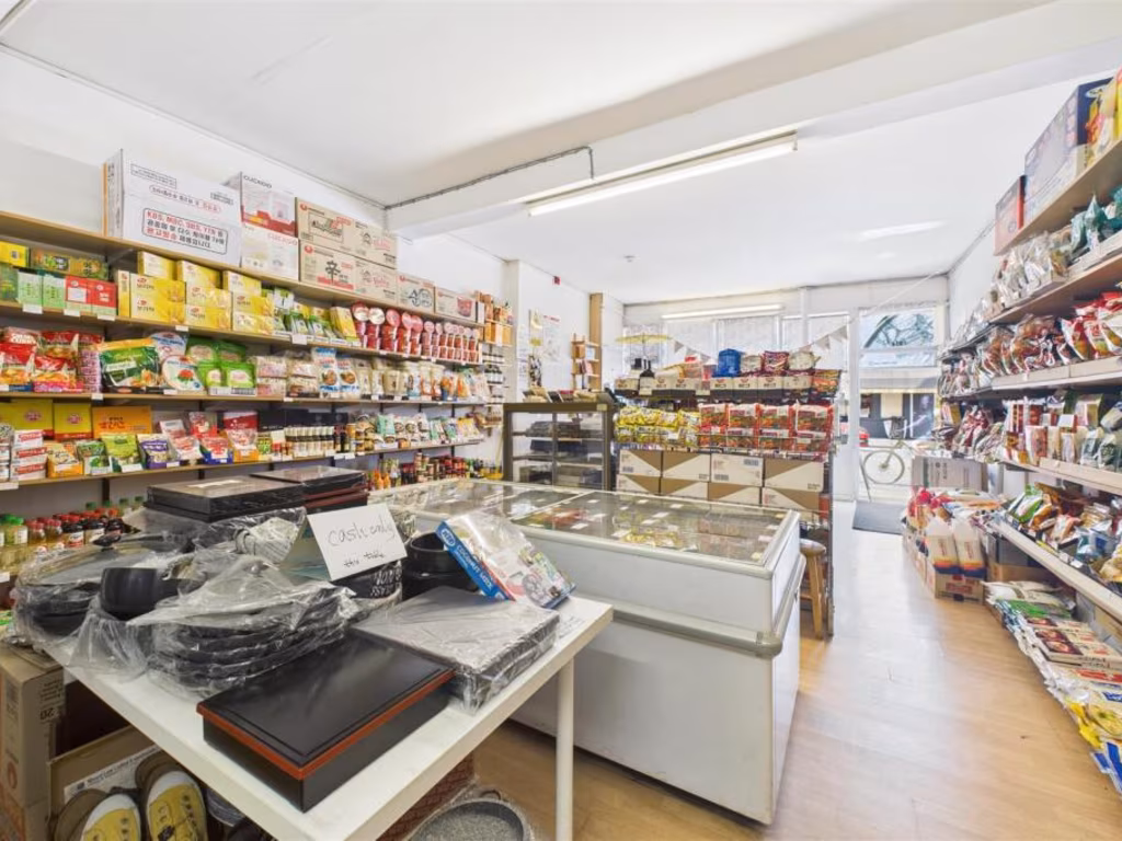
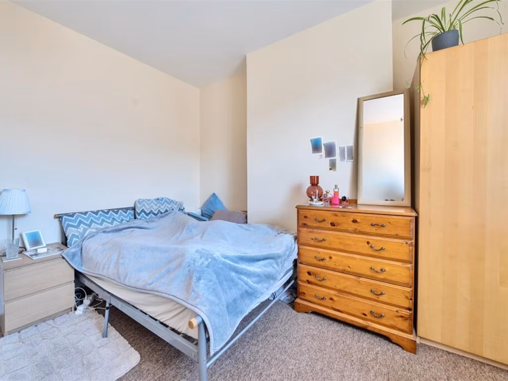
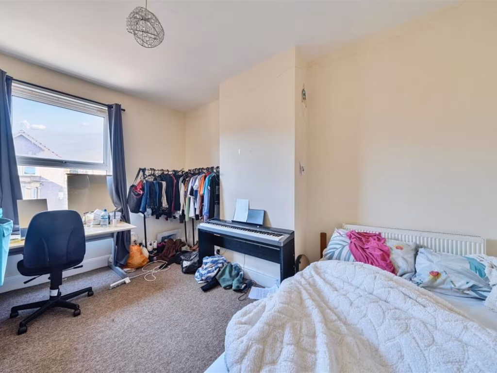
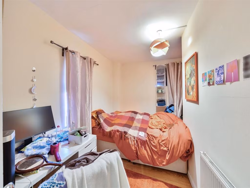
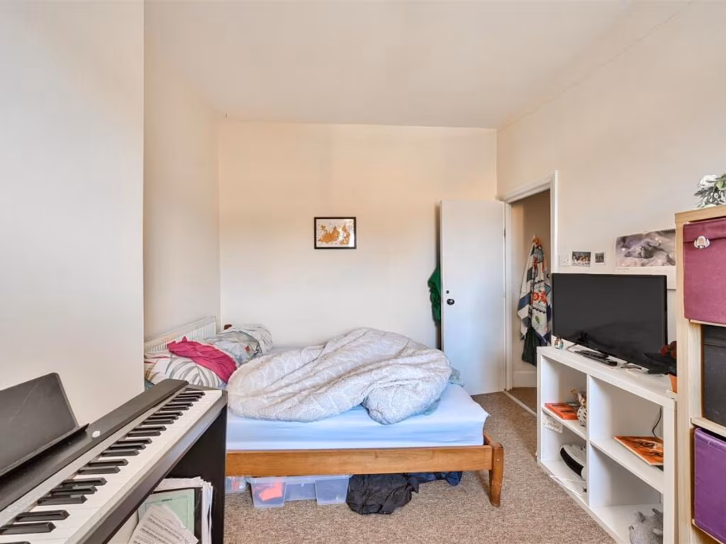
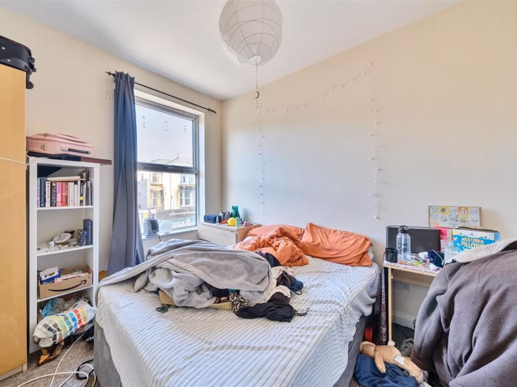
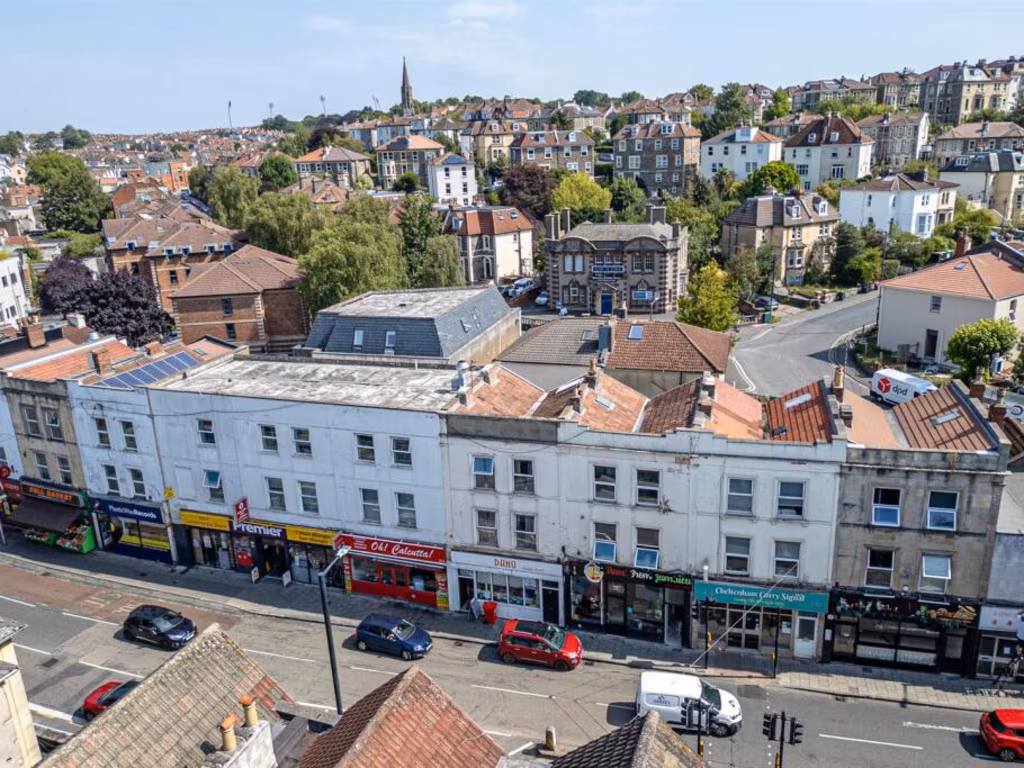
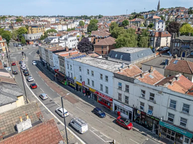
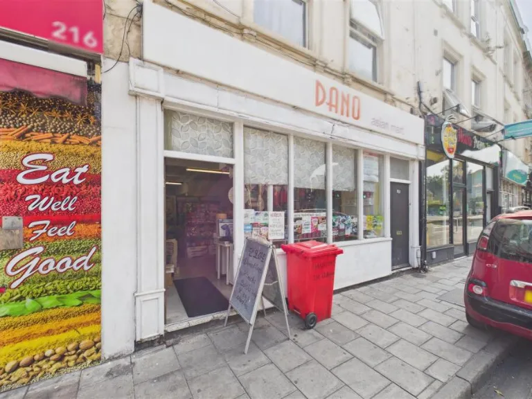
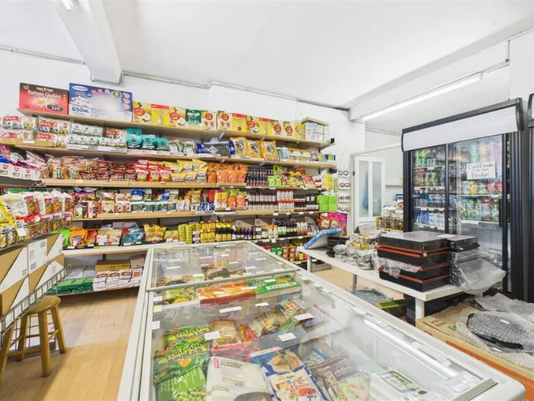
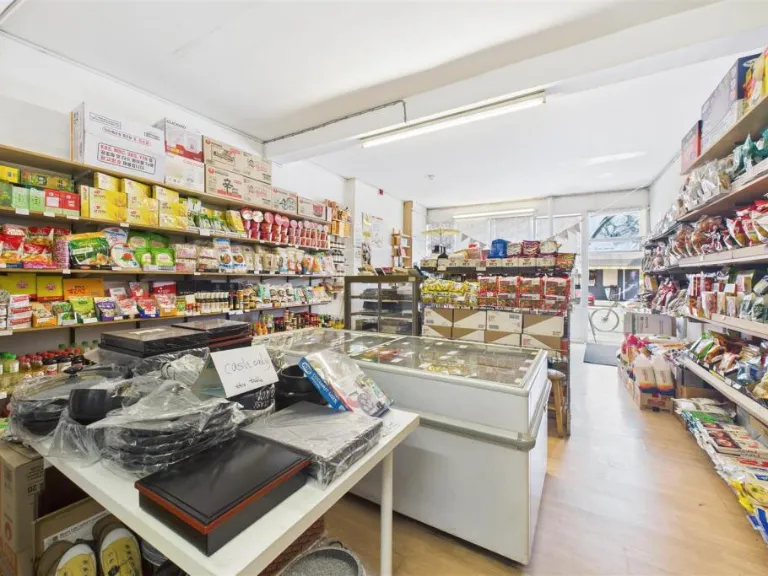
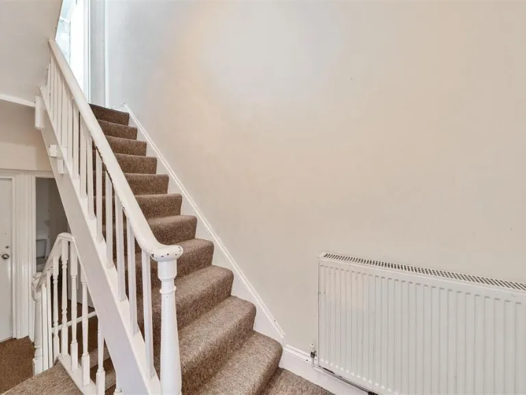
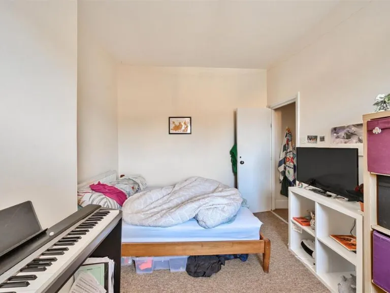
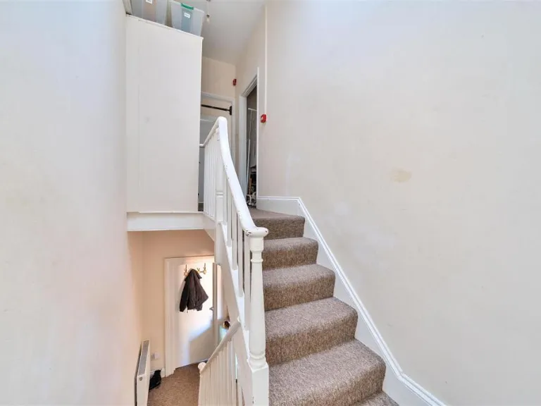
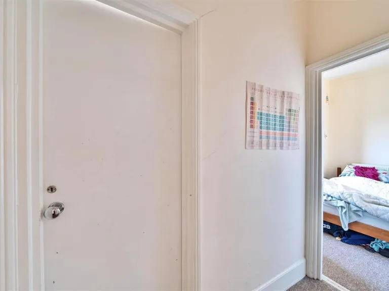
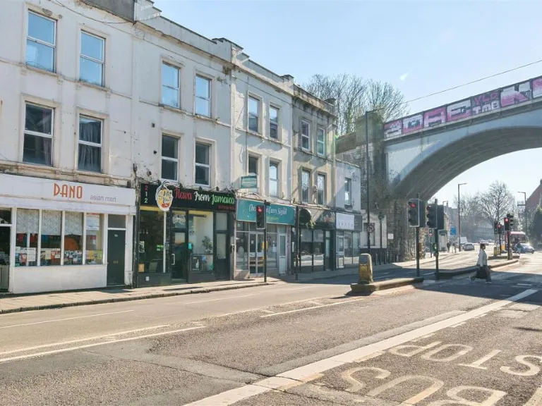
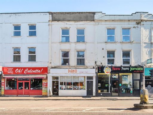
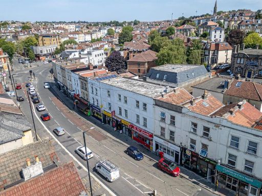
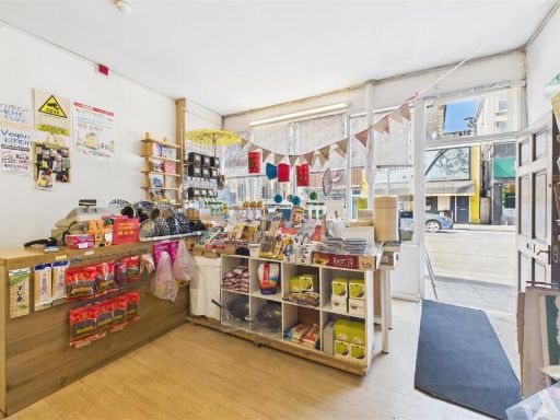
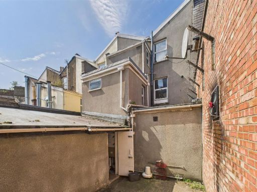
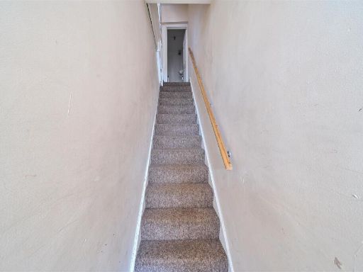
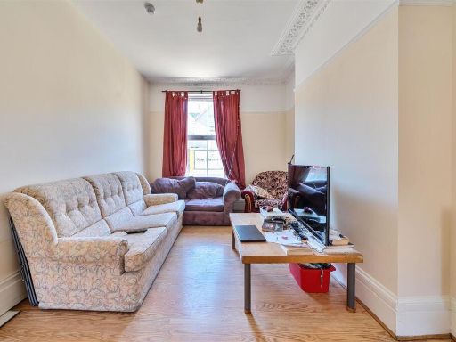
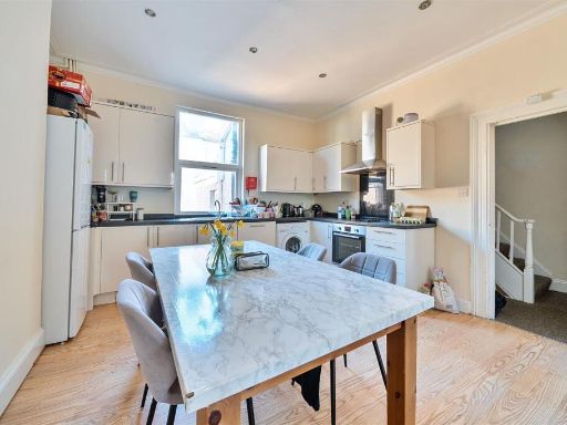
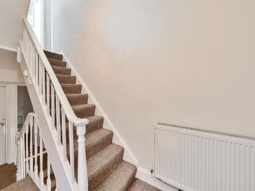
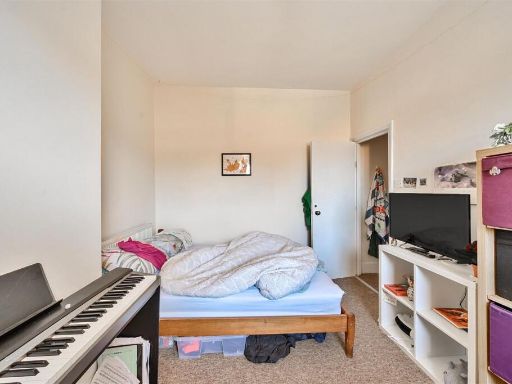
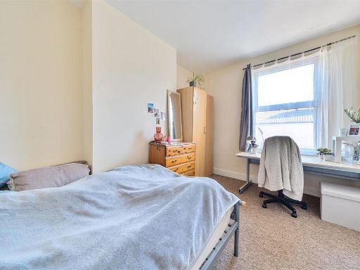
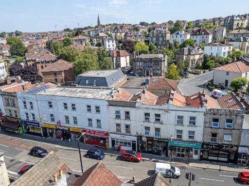
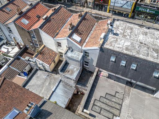
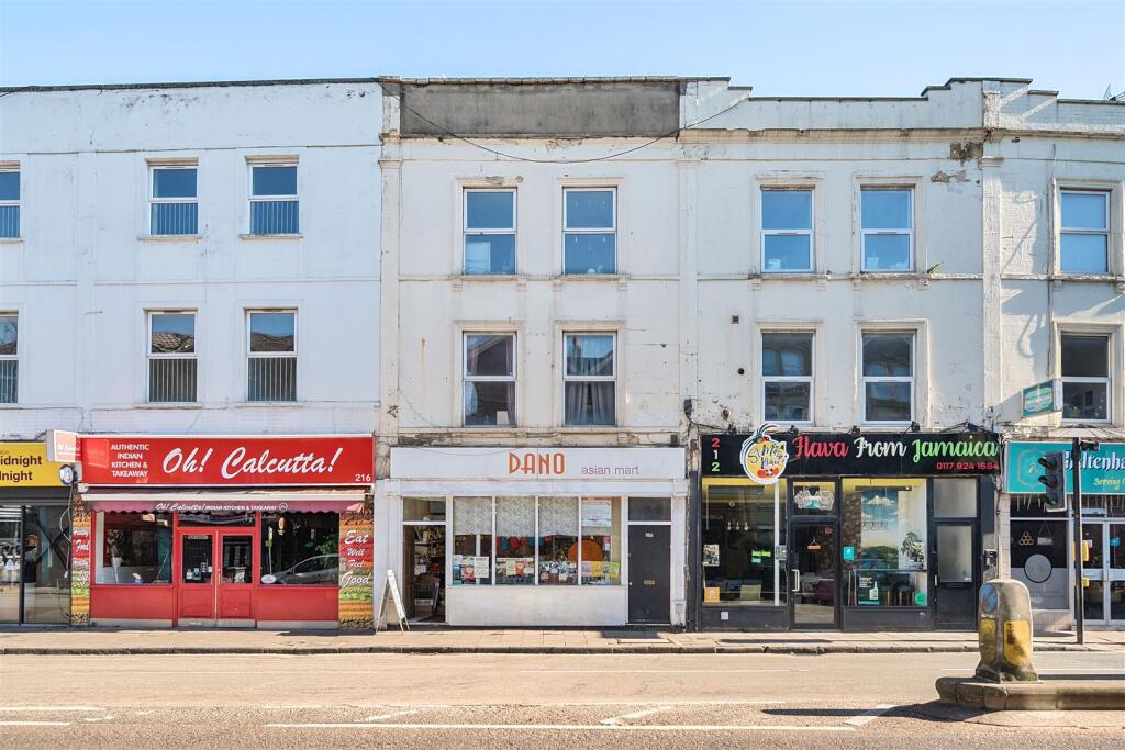
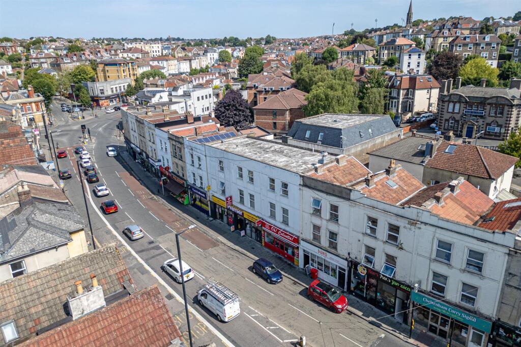
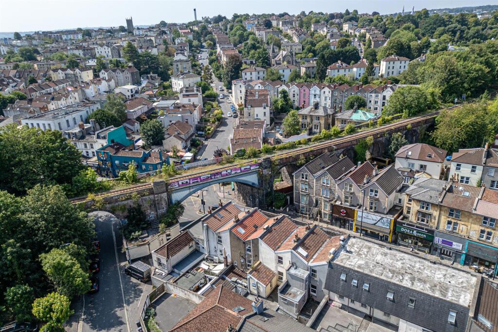
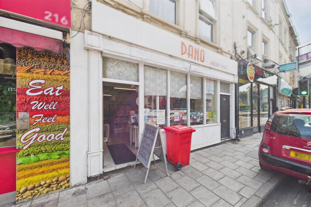
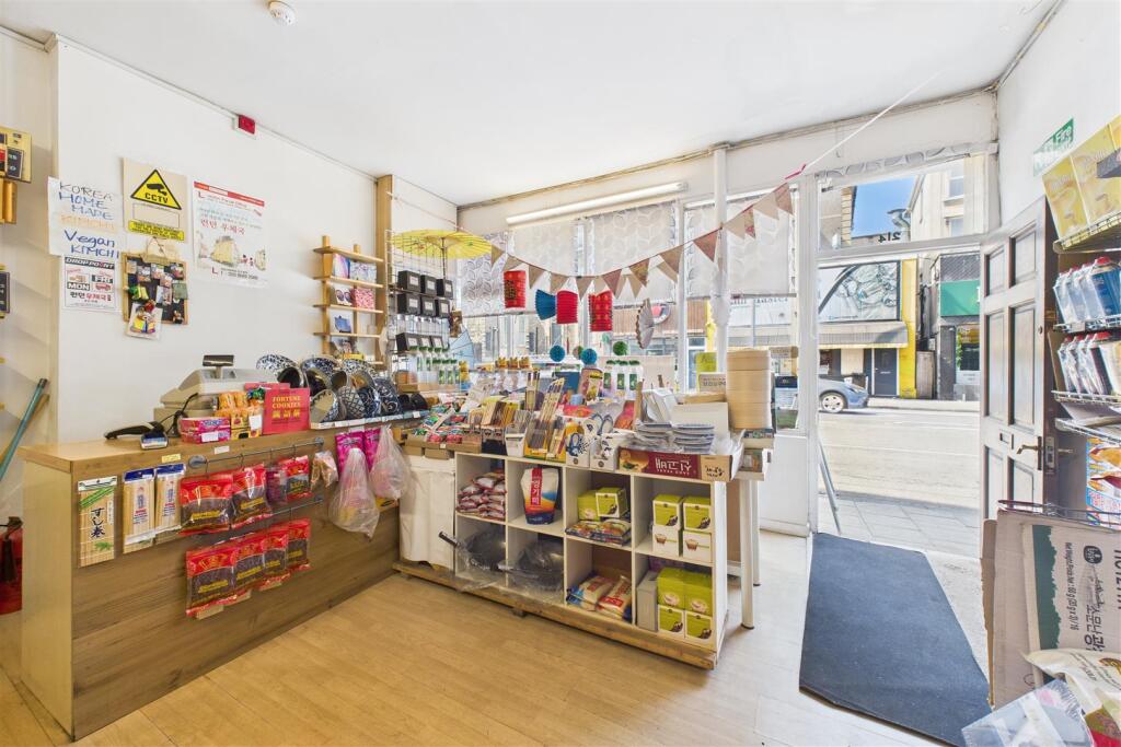
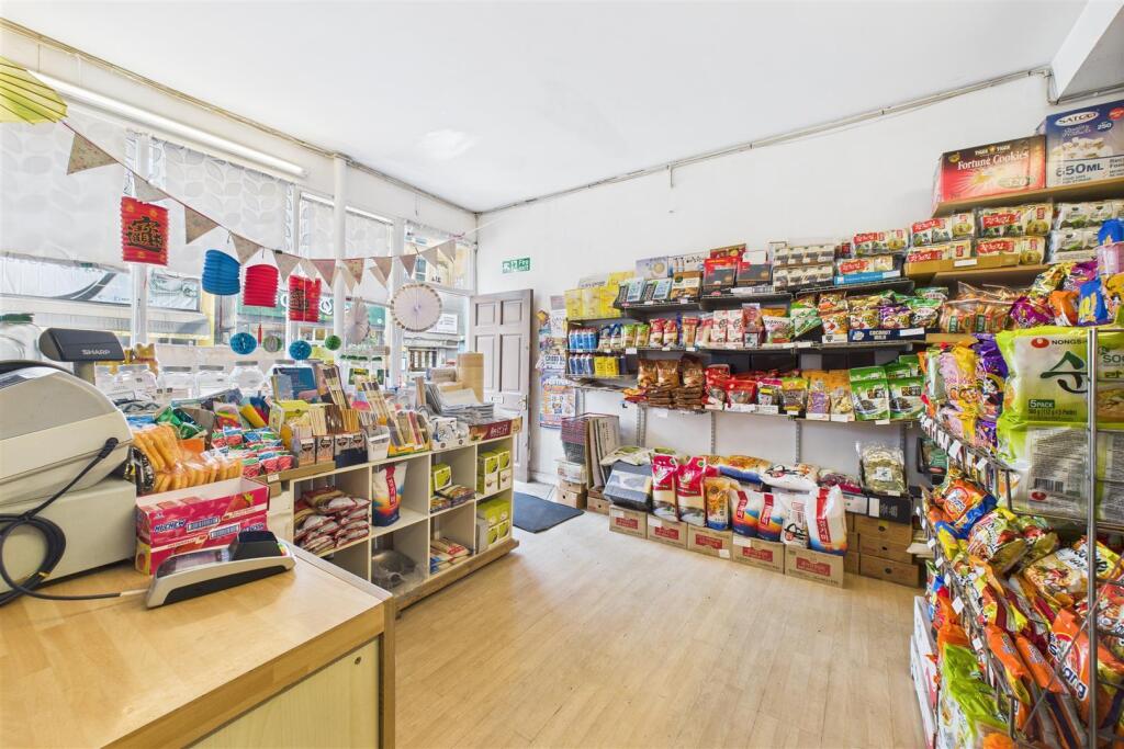
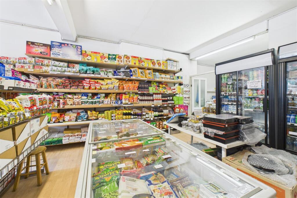
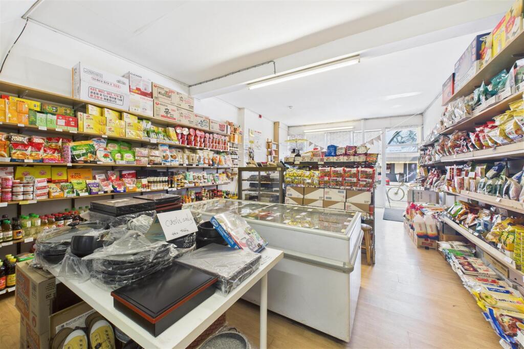
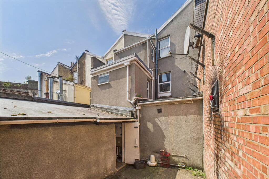
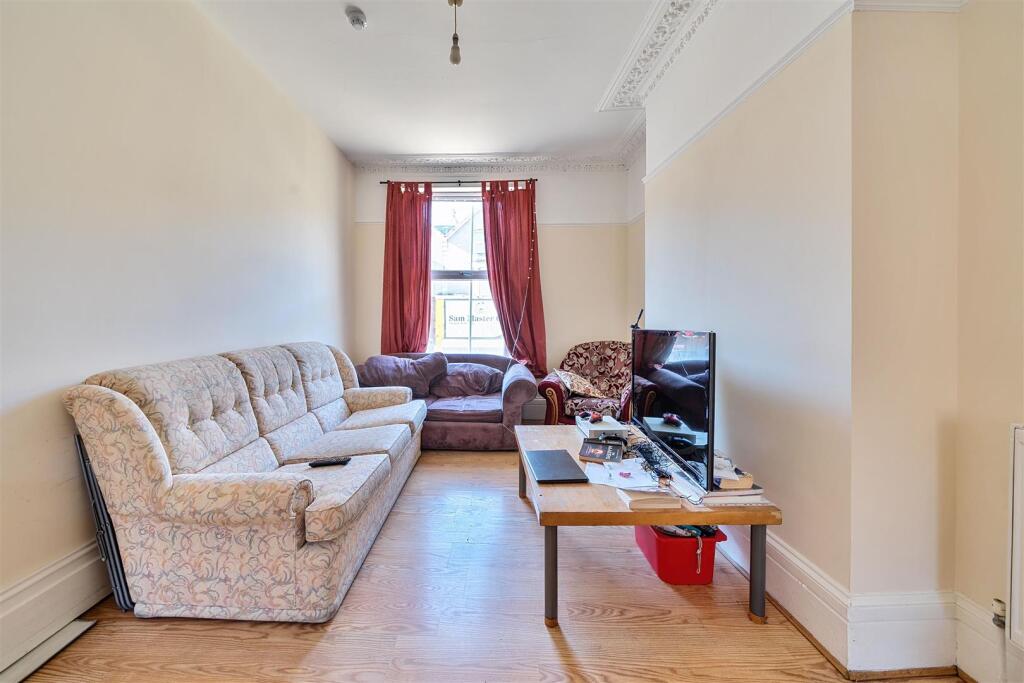
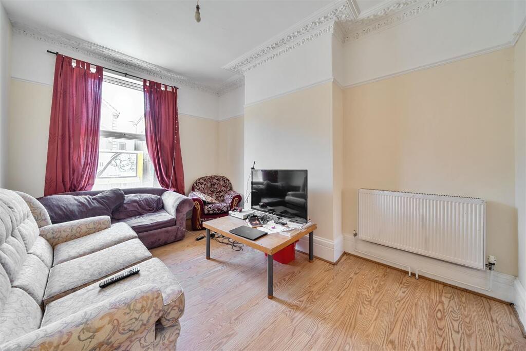
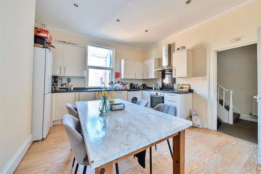
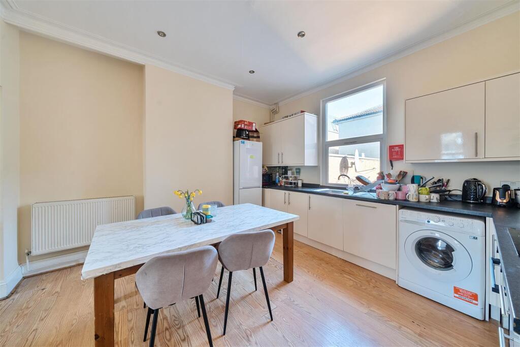
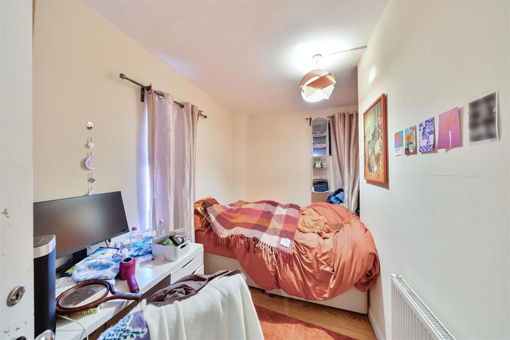
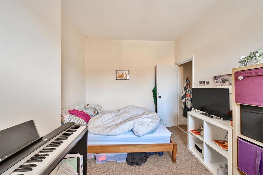
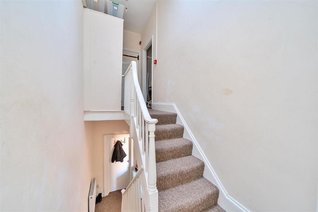
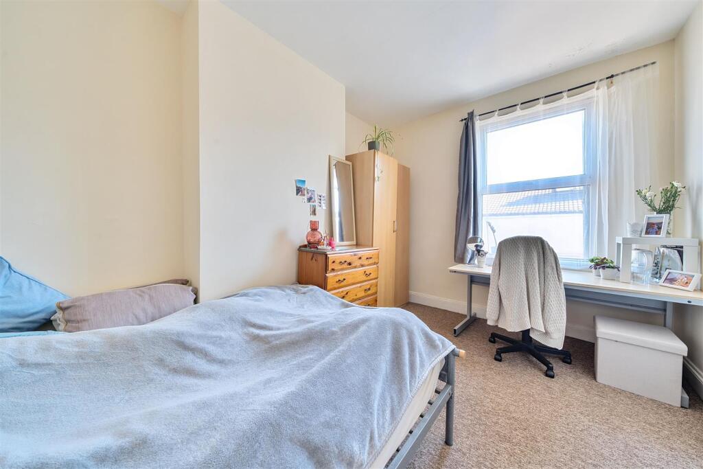
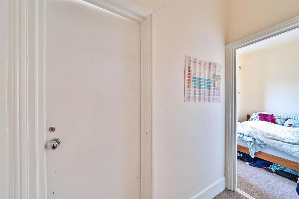
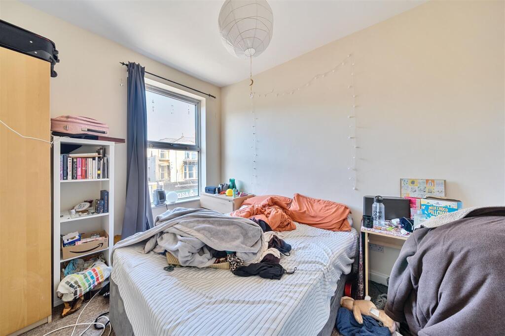
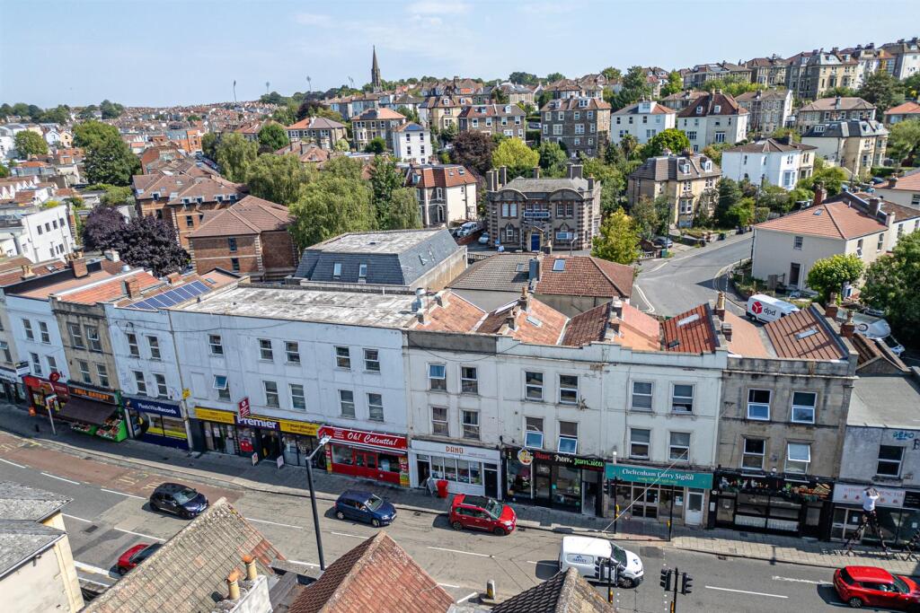
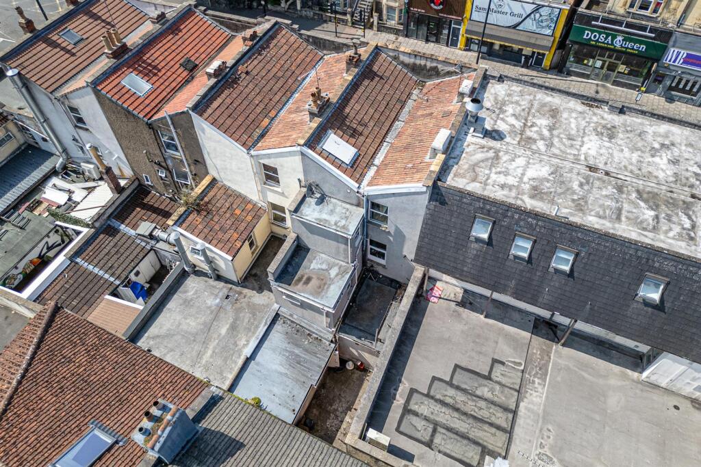
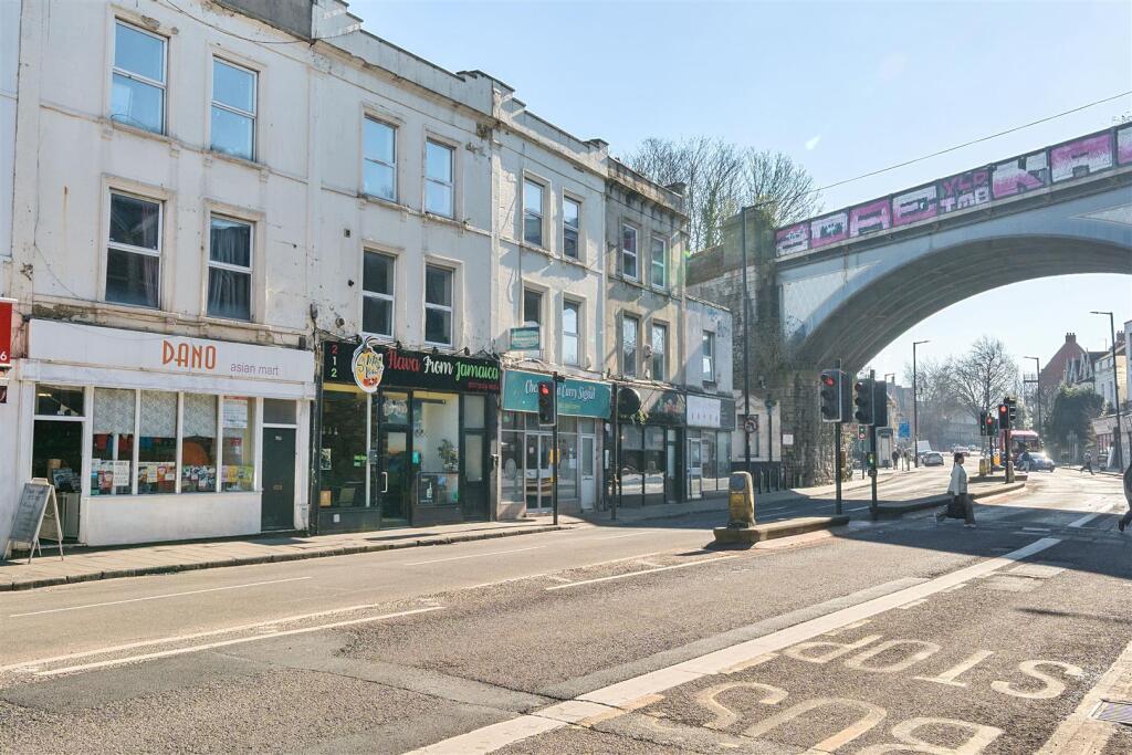
- The property comprises a traditional three-storey terraced building in an urban setting, with a mixed-use arrangement: a licensed 5-bedroom HMO on upper floors and a ground-floor retail unit. The retail unit appears spacious, and the HMO likely offers average-sized rooms (judging by typical layouts for such buildings in this area). The total internal area is substantial, at 2184 square feet. The property faces a busy street with shops and enjoys cityscape views, potentially over an active neighbourhood. There is no visible garden; the property is strictly urban in character. The building's overall size is large for a mixed-use city property.
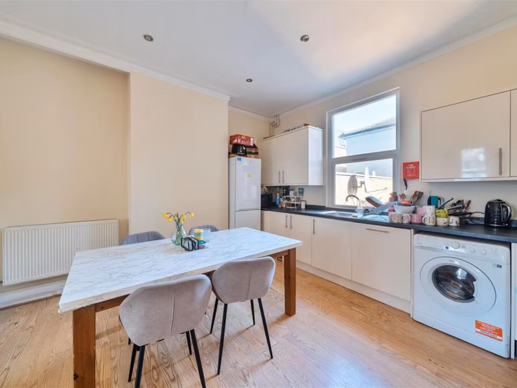
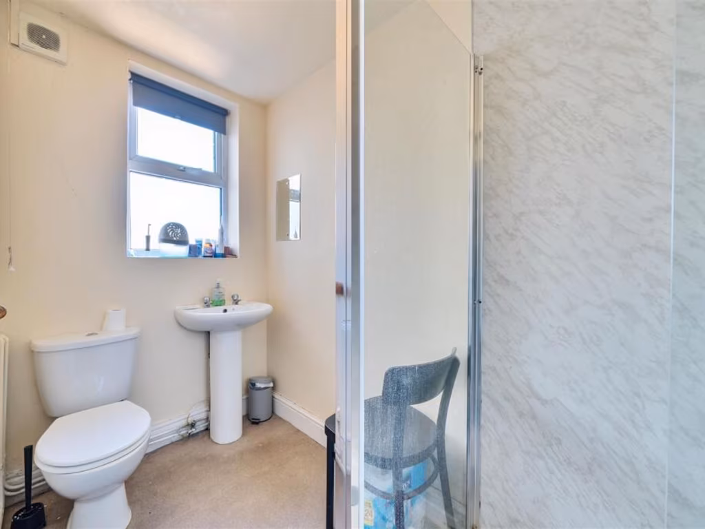
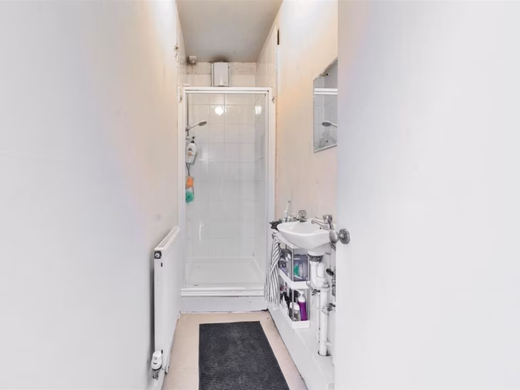
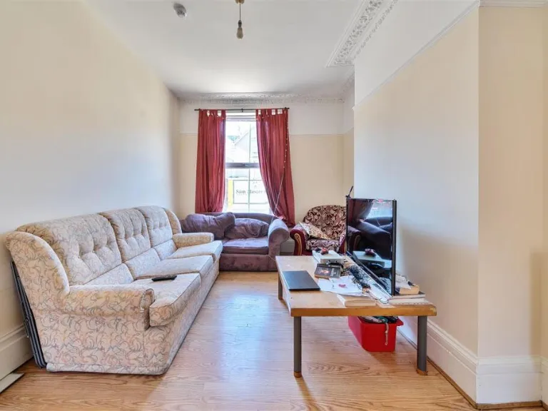
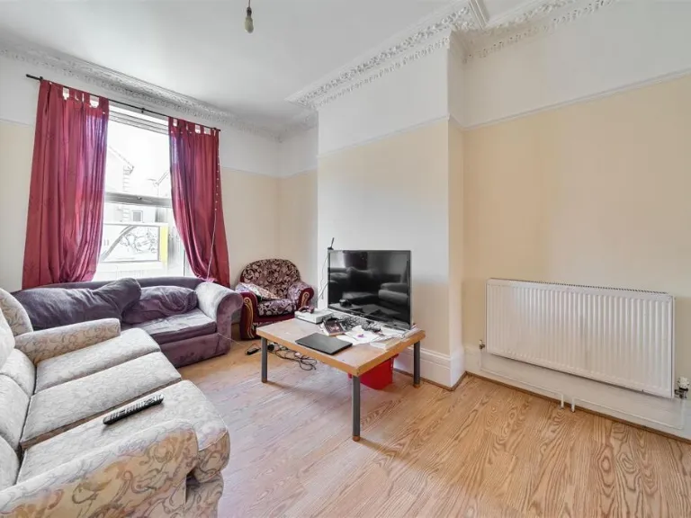
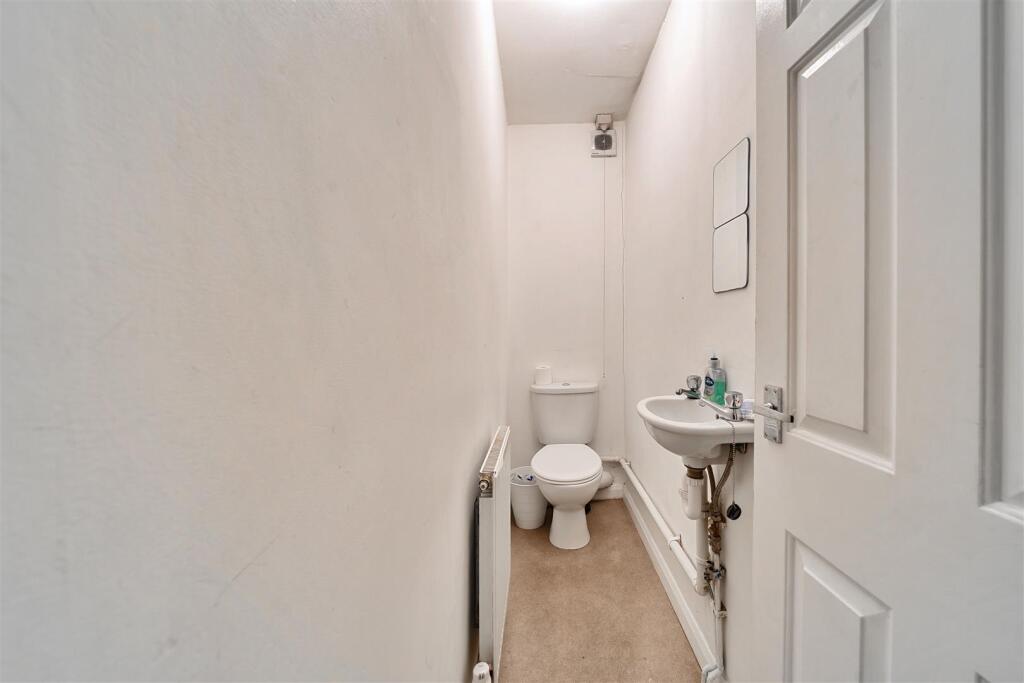
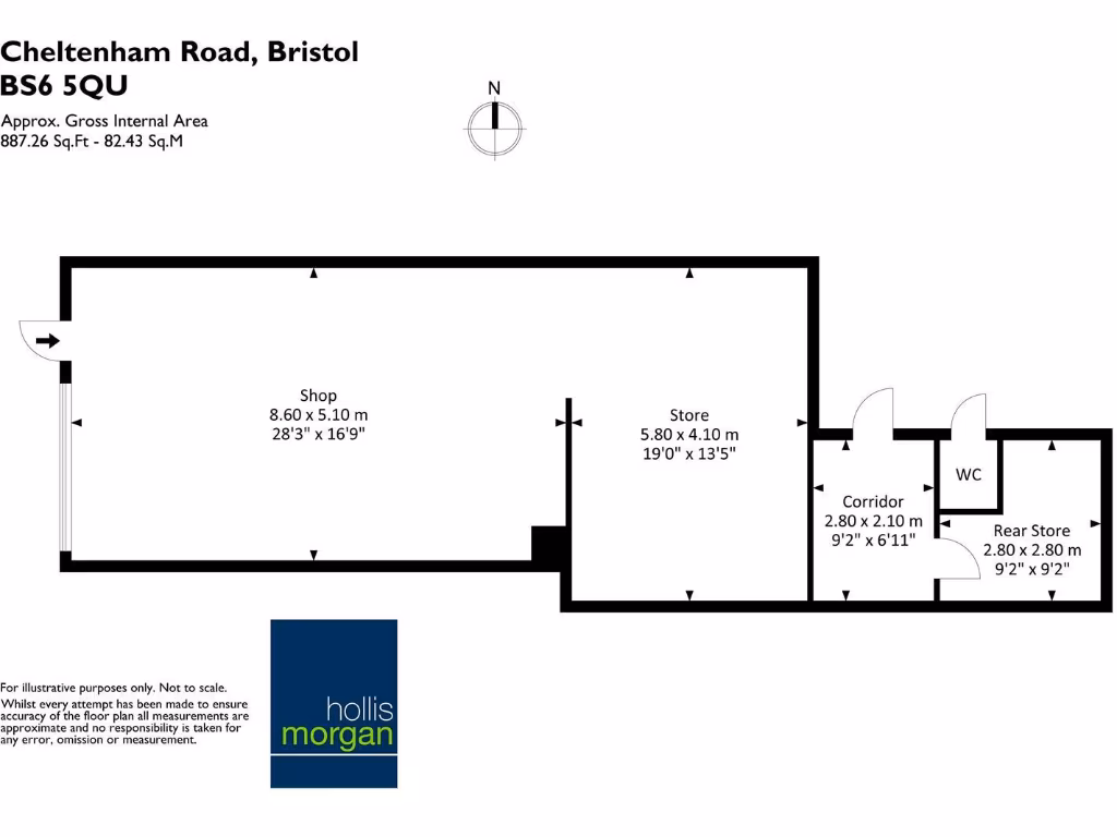
- This is a substantial mid-terraced mixed-use property arranged over three floors. The ground floor comprises a self-contained retail unit with excellent trading position and frontage. The upper floors offer a fully licensed HMO configuration, including 5 bedrooms, 2 bathrooms, a communal living area, and a large open-plan kitchen/living space. The overall property size is notably large, with a total area of approximately 2184 square feet split between the retail unit (887 sq ft) and the residential (1297 sq ft). From the floor plan, rooms are of average to large size and occupancy level is high, making this suitable for investment purposes. No significant views are visible from the provided images.
Image Descriptions
- mixed-use building Victorian
- commercial and residential block Victorian
Floorplan Description
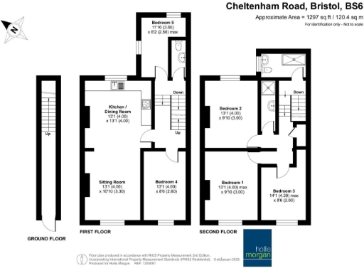
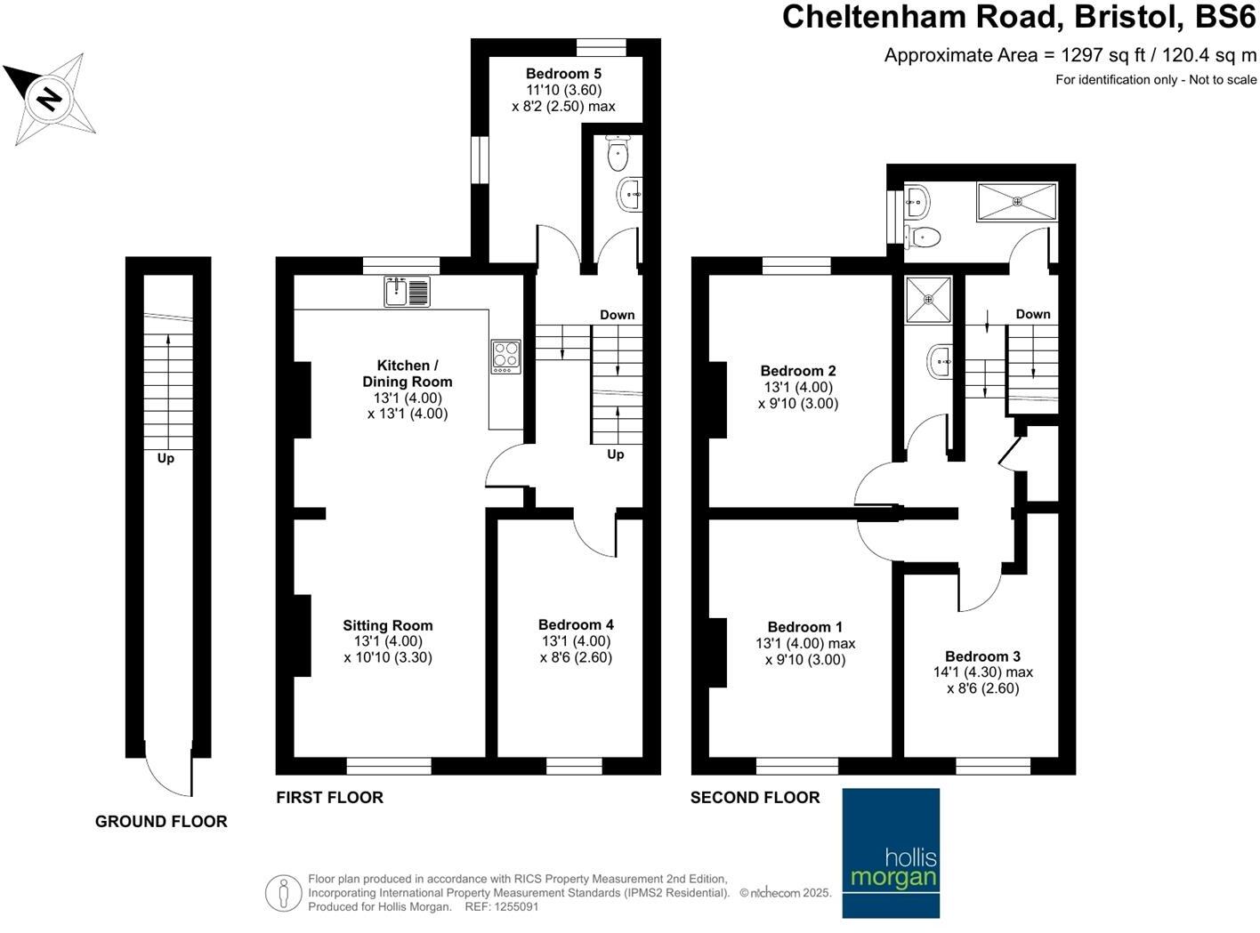
- Multi-story property with five bedrooms located on Cheltenham Road, Bristol.
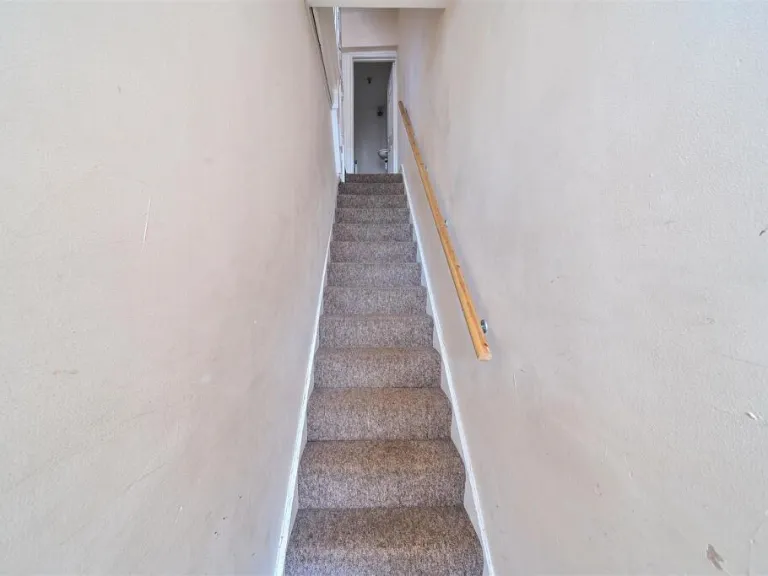
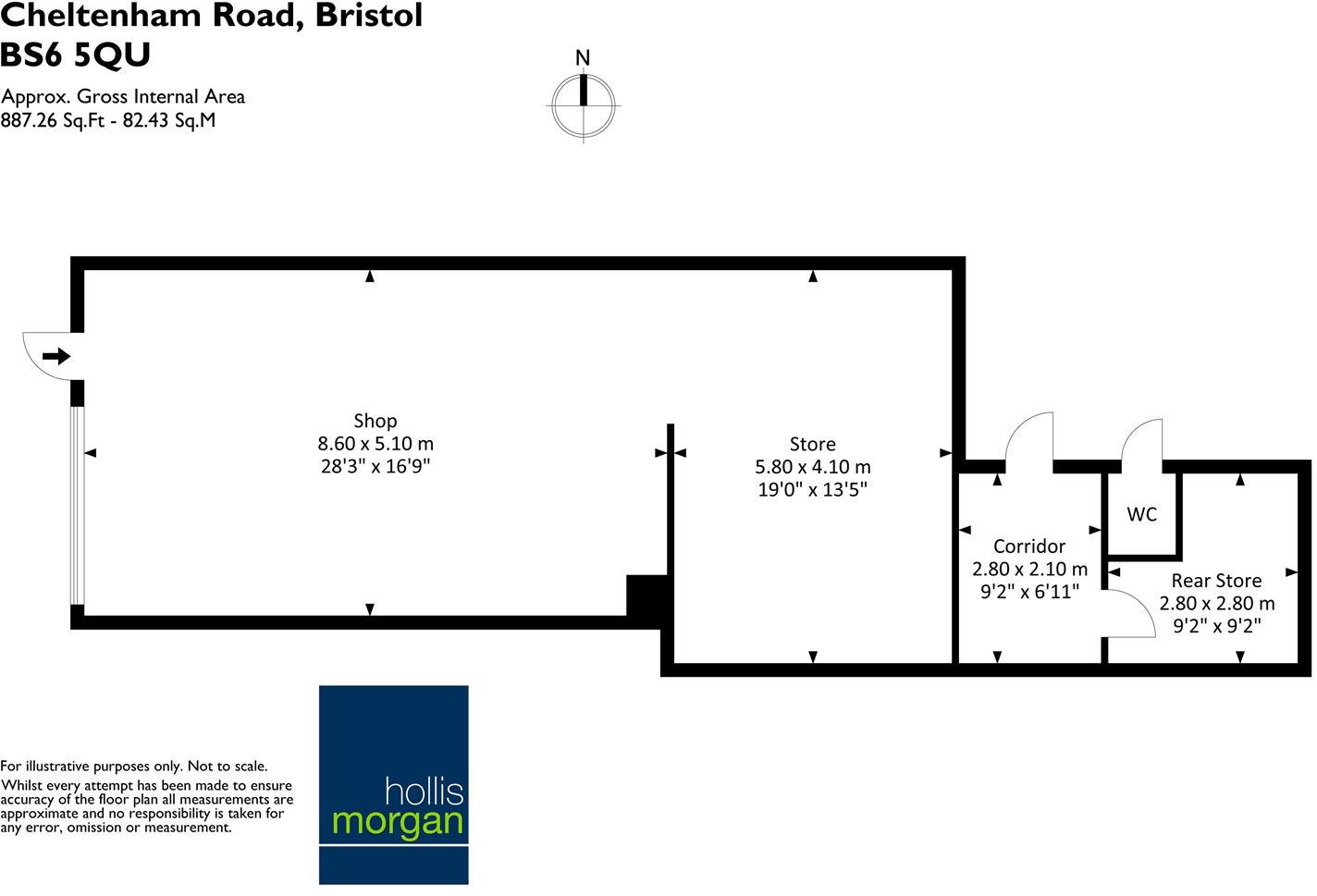
- A commercial property on Cheltenham Road in Bristol with a shop, store rooms, corridor, and WC.
Rooms
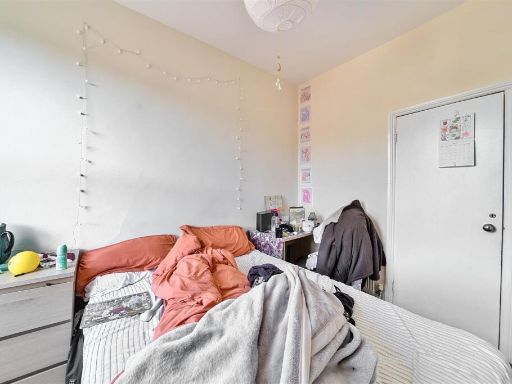
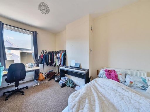
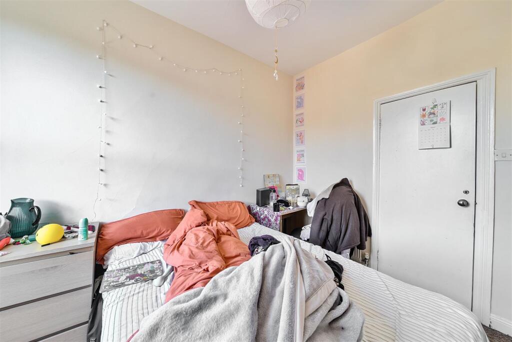
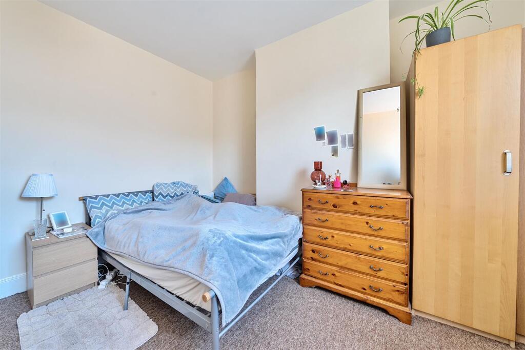
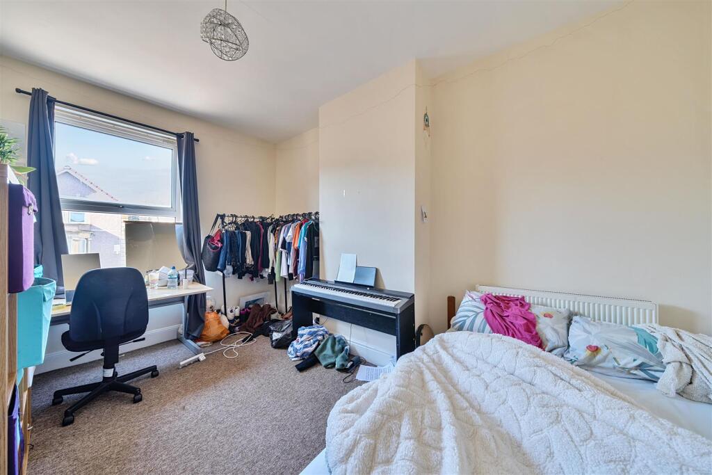
- Bedroom 5:
- Kitchen / Dining Room:
- Sitting Room:
- Bedroom 4:
- Bedroom 2:
- Bedroom 1:
- Bedroom 3:
- Shop: large
- Store: average
- Corridor: small
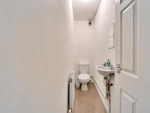
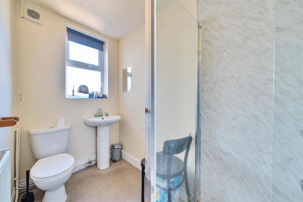
- WC:
- Rear Store: small
Textual Property Features
Detected Visual Features
- Victorian
- mixed-use building
- three-story
- commercial property
- retail space
- residential units
- fixer-upper
- urban location
- period property
- city center
- terraced
- mixed-use
- high street
EPC Details
- Fully double glazed
- Solid brick, as built, no insulation (assumed)
- Boiler and radiators, mains gas
- Low energy lighting in 83% of fixed outlets
- (other premises below)
Nearby Schools
- Bristol Cathedral Choir School
- Hannah More Primary School
- St Nicholas of Tolentine Catholic Primary School
- Brunel Field Primary School
- Henleaze Junior School
- Cathedral Primary School
- Queen Elizabeth's Hospital
- Easton Church of England Academy
- Cabot Primary School
- Ss Peter and Paul RC Primary School
- Cotham Gardens Primary School
- Westbury Park School
- Bishop Road Primary School
- Willow Park CofE Primary School
- Cotham School
- Evergreen Primary Academy
- Fairlawn Primary School
- St Werburgh's Primary School
- Sefton Park Infant School
- St Bonaventure's Catholic Primary School
- Bristol Grammar School
- The Dolphin School
- Bristol Steiner School
- Redland Green School
- Sefton Park Junior School
- Ashley Down Primary School
Nearest General Shops
- Id: 267330968
- Tags:
- Addr:
- City: Bristol
- Housenumber: 230
- Postcode: BS6 5QU
- Street: Cheltenham Road
- Suburb: Montpelier
- Building: yes
- Name: Zero Barbershop
- Shop: hairdresser
- Source: Bing
- Source:addr: FHRS Open Data
- TagsNormalized:
- Lat: 51.4699105
- Lon: -2.5934064
- FullGeoHash: gcnhucz9cq8p
- PartitionGeoHash: gcnh
- Images:
- FoodStandards: null
- Distance: 45.8
,- Id: 264388821
- Tags:
- Addr:
- City: Bristol
- Housenumber: 215
- Postcode: BS6 5QP
- Street: Cheltenham Road
- Suburb: Montpelier
- Building: yes
- Fhrs:
- Name: Persian Deli
- Opening_hours: Mo-Sa 09:15-21:00; Su 09:00-20:00
- Phone: +44 7429 360082
- Shop: deli
- Source:
- Website: https://persian-store.business.site
- TagsNormalized:
- Lat: 51.4694099
- Lon: -2.5936218
- FullGeoHash: gcnhucxrh1rm
- PartitionGeoHash: gcnh
- Images:
- FoodStandards:
- Id: 1242170
- FHRSID: 1242170
- LocalAuthorityBusinessID: 254340
- BusinessName: Sam's Master Grill
- BusinessType: Restaurant/Cafe/Canteen
- BusinessTypeID: 1
- AddressLine1: null
- AddressLine2: 215 Cheltenham Road
- AddressLine3: Montpelier
- AddressLine4: Bristol
- PostCode: BS6 5QP
- RatingValue: 5
- RatingKey: fhrs_5_en-GB
- RatingDate: 2021-08-24
- LocalAuthorityCode: 855
- LocalAuthorityName: Bristol
- LocalAuthorityWebSite: http://www.bristol.gov.uk
- LocalAuthorityEmailAddress: food.safety@bristol.gov.uk
- Scores:
- Hygiene: 0
- Structural: 0
- ConfidenceInManagement: 0
- NewRatingPending: false
- Geocode:
- Longitude: -2.59376600000000
- Latitude: 51.46949900000000
- Distance: 32.2
,- Id: 209652761
- Tags:
- Addr:
- City: Bristol
- Housename: Plastic Wax Records
- Housenumber: 222
- Postcode: BS6 5QU
- Street: Cheltenham Road
- Building: yes
- Email: dave.kellard@plasticwaxrecords.com
- Name: Plastic Wax Records
- Opening_hours: Mo 09:30-17:30; Tu-Fr 09:30-19:00; Sa 09:00-18:00; Su 12:00-17:00
- Phone: +44 117 942 7368
- Shop: music
- Source: Bing
- Website: http://www.plasticwaxrecords.com/
- TagsNormalized:
- Lat: 51.4697115
- Lon: -2.5932734
- FullGeoHash: gcnhucz8u3eh
- PartitionGeoHash: gcnh
- Images:
- FoodStandards: null
- Distance: 21.9
}
Nearest Grocery shops
- Id: 209652743
- Tags:
- Addr:
- City: Bristol
- Housenumber: 224
- Postcode: BS6 5QU
- Street: Cheltenham Road
- Suburb: Montpelier
- Building: yes
- Name: Full Basket
- Opening_hours: Mo-Sa 08:00-20:00; Su 10:00-20:00
- Shop: greengrocer
- Source: Bing
- Source:addr: FHRS Open Data
- TagsNormalized:
- Lat: 51.4697591
- Lon: -2.5933002
- FullGeoHash: gcnhucz95dx0
- PartitionGeoHash: gcnh
- Images:
- FoodStandards: null
- Distance: 27.5
,- Id: 267330966
- Tags:
- Addr:
- City: Bristol
- Housenumber: 218-220
- Postcode: BS6 5QU
- Street: Cheltenham Road
- Suburb: Montpelier
- Branch: Premier
- Building: yes
- Name: No 1 Convenience Store
- Shop: convenience
- Source: Bing
- TagsNormalized:
- Lat: 51.4696414
- Lon: -2.5932332
- FullGeoHash: gcnhucz8mk94
- PartitionGeoHash: gcnh
- Images:
- FoodStandards: null
- Distance: 13.7
,- Id: 209652745
- Tags:
- Addr:
- City: Bristol
- Housenumber: 214
- Postcode: BS6 5QU
- Street: Cheltenham Road
- Suburb: Montpelier
- Building: yes
- Fhrs:
- Name: Dano Asian Mart
- Opening_hours: Mo-Sa 09:30-20:00; Su 11:00-20:00
- Shop: convenience
- Source: Bing
- TagsNormalized:
- Lat: 51.4695135
- Lon: -2.5931608
- FullGeoHash: gcnhucxxwuxp
- PartitionGeoHash: gcnh
- Images:
- FoodStandards:
- Id: 312776
- FHRSID: 312776
- LocalAuthorityBusinessID: 94421
- BusinessName: Dano Mart
- BusinessType: Retailers - other
- BusinessTypeID: 4613
- AddressLine1: null
- AddressLine2: 214 Cheltenham Road
- AddressLine3: Montpelier
- AddressLine4: Bristol
- PostCode: BS6 5QU
- RatingValue: 4
- RatingKey: fhrs_4_en-GB
- RatingDate: 2021-10-14
- LocalAuthorityCode: 855
- LocalAuthorityName: Bristol
- LocalAuthorityWebSite: http://www.bristol.gov.uk
- LocalAuthorityEmailAddress: food.safety@bristol.gov.uk
- Scores:
- Hygiene: 5
- Structural: 0
- ConfidenceInManagement: 10
- NewRatingPending: false
- Geocode:
- Longitude: -2.59330800000000
- Latitude: 51.46973600000000
- Distance: 2.3
}
Nearest Religious buildings
- Id: 486667608
- Tags:
- Addr:
- City: Bristol
- Housenumber: 31
- Postcode: BS6 5AW
- Street: Belmont Road
- Amenity: place_of_worship
- Building: house
- Name: Belmont Road Spiritualist Centre
- Religion: spiritualist
- TagsNormalized:
- place of worship
- spiritualist
- Lat: 51.4714283
- Lon: -2.5908668
- FullGeoHash: gcnhv416u3tt
- PartitionGeoHash: gcnh
- Images:
- FoodStandards: null
- Distance: 266.4
,- Id: 187027700
- Tags:
- Addr:
- City: Bristol
- Postcode: BS6 6AG
- Street: Redland Road
- Suburb: Redland
- Amenity: place_of_worship
- Building: yes
- Fhrs:
- Name: Cornerstone Church
- Religion: christian
- Source:
- Website: cornerstonebristol.org.uk
- TagsNormalized:
- place of worship
- church
- christian
- Lat: 51.4676867
- Lon: -2.5953237
- FullGeoHash: gcnhucqjh84m
- PartitionGeoHash: gcnh
- Images:
- FoodStandards:
- Id: 1300410
- FHRSID: 1300410
- LocalAuthorityBusinessID: 255491
- BusinessName: Cornerstone Church
- BusinessType: Other catering premises
- BusinessTypeID: 7841
- AddressLine1: Cornerstone Church
- AddressLine2: Redland Road
- AddressLine3: Redland
- AddressLine4: Bristol
- PostCode: BS6 6AG
- RatingValue: AwaitingInspection
- RatingKey: fhrs_awaitinginspection_en-GB
- RatingDate: null
- LocalAuthorityCode: 855
- LocalAuthorityName: Bristol
- LocalAuthorityWebSite: http://www.bristol.gov.uk
- LocalAuthorityEmailAddress: food.safety@bristol.gov.uk
- Scores:
- Hygiene: null
- Structural: null
- ConfidenceInManagement: null
- NewRatingPending: false
- Geocode:
- Longitude: -2.59528740000000
- Latitude: 51.46774660000000
- Distance: 251.8
,- Id: 69932264
- Tags:
- Addr:
- Housenumber: 4-6
- Street: North Road
- Amenity: place_of_worship
- Building: yes
- Denomination: evangelical
- Name: Zetland Evangelical Church
- Religion: christian
- Source: bing
- TagsNormalized:
- place of worship
- evangelical
- church
- christian
- Lat: 51.469788
- Lon: -2.5923818
- FullGeoHash: gcnhv1b31puh
- PartitionGeoHash: gcnh
- Images:
- FoodStandards: null
- Distance: 63.5
}
Nearest Medical buildings
- Id: 464077272
- Tags:
- Addr:
- Housenumber: 30
- Street: Zetland Road
- Amenity: dentist
- Building: house
- Healthcare: dentist
- Name: Zetland Road Dental Practice
- Phone: +44 117 942 4126
- TagsNormalized:
- dentist
- health
- healthcare
- dental
- Lat: 51.4699464
- Lon: -2.5957137
- FullGeoHash: gcnhucvf5mrt
- PartitionGeoHash: gcnh
- Images:
- FoodStandards: null
- Distance: 180.9
,- Id: 263295816
- Tags:
- Addr:
- City: Bristol
- Housenumber: 25
- Postcode: BS7 8AA
- Street: Gloucester Road
- Amenity: pharmacy
- Building: yes
- Dispensing: yes
- Email: soodanoop@hotmail.com
- Healthcare: pharmacy
- Name: Sood Chemist
- Opening_hours: Mo-Fr 09:00-19:00; Sa 09:00-17:30
- TagsNormalized:
- pharmacy
- health
- healthcare
- chemist
- Lat: 51.4709143
- Lon: -2.5928408
- FullGeoHash: gcnhuczzy3vg
- PartitionGeoHash: gcnh
- Images:
- FoodStandards: null
- Distance: 156.9
,- Id: 267903982
- Tags:
- Addr:
- Housenumber: 198
- Street: Cheltenham Road
- Amenity: clinic
- Building: yes
- Healthcare: clinic
- Name: The Arches Therapy Rooms
- TagsNormalized:
- clinic
- health
- healthcare
- therapy
- Lat: 51.4684294
- Lon: -2.5920315
- FullGeoHash: gcnhv189369h
- PartitionGeoHash: gcnh
- Images:
- FoodStandards: null
- Distance: 145.6
,- Id: 209652763
- Tags:
- Addr:
- Housenumber: 206
- Street: Cheltenham Road
- Amenity: clinic
- Building: yes
- Building:levels: 2
- Health_facility:
- Health_specialty:
- Acupuncture: yes
- Traditional_chinese_medicine: yes
- Healthcare: clinic
- Medical_system:
- Name: Wongs Acupuncture Clinic
- Source: Bing
- TagsNormalized:
- clinic
- chinese
- health
- healthcare
- Lat: 51.4693111
- Lon: -2.593025
- FullGeoHash: gcnhucxy6nur
- PartitionGeoHash: gcnh
- Images:
- FoodStandards: null
- Distance: 26
}
Nearest Airports
- Id: 47483196
- Tags:
- Aerodrome: international
- Aeroway: aerodrome
- Iata: BRS
- Icao: EGGD
- Internet_access: wlan
- Internet_access:fee: no
- Name: Bristol Airport
- Type: public
- Website: https://www.bristolairport.co.uk/
- Wikidata: Q8725
- Wikipedia: en:Bristol Airport
- TagsNormalized:
- airport
- international airport
- Lat: 51.3830799
- Lon: -2.7186615
- FullGeoHash: gcnh64h24s74
- PartitionGeoHash: gcnh
- Images:
- FoodStandards: null
- Distance: 12963.8
}
Nearest Tourist attractions
- Id: 298233966
- Tags:
- Addr:
- City: Bristol
- Housename: Müller House
- Housenumber: 7
- Postcode: BS6 6DA
- Street: Cotham Park
- Building: house
- Facebook: https://www.facebook.com/mullersbristol/
- Name: Muller House
- Phone: +44 117 924 5001
- Tourism: museum
- Twitter: mullersbristol
- Website: https://www.mullers.org/museum
- TagsNormalized:
- Lat: 51.463882
- Lon: -2.5990611
- FullGeoHash: gcnhubeqv6zw
- PartitionGeoHash: gcnh
- Images:
- FoodStandards: null
- Distance: 747.2
,- Id: 108832765
- Tags:
- Addr:
- Housenumber: 85
- Street: Stokes Croft
- Building: yes
- Name: Apothecaire
- Photo: http://bristolculture.files.wordpress.com/2012/08/apothecaire-stokes-croft-bristol.jpg
- Tourism: attraction
- TagsNormalized:
- Lat: 51.4631501
- Lon: -2.5900754
- FullGeoHash: gcnhv09fwfeb
- PartitionGeoHash: gcnh
- Images:
- FoodStandards: null
- Distance: 740.6
,- Id: 1897223863
- Tags:
- TagsNormalized:
- Lat: 51.4677619
- Lon: -2.5983481
- FullGeoHash: gcnhuc7vqn5n
- PartitionGeoHash: gcnh
- Images:
- FoodStandards: null
- Distance: 407.2
}
Nearest Train stations
- Id: 278435766
- Tags:
- Name: Filton Abbey Wood
- Naptan:
- Network: National Rail
- Postal_code: BS34 7JW
- Public_transport: station
- Railway: station
- Ref:
- Train: yes
- Wheelchair: yes
- Wikidata: Q2311503
- Wikipedia: en:Filton Abbey Wood railway station
- TagsNormalized:
- Lat: 51.503393
- Lon: -2.563826
- FullGeoHash: gcnhvxvj482f
- PartitionGeoHash: gcnh
- Images:
- FoodStandards: null
- Distance: 4280.3
,- Id: 7167219010
- Tags:
- Name: Sea Mills
- Naptan:
- Network: National Rail
- Public_transport: station
- Railway: station
- Ref:
- Toilets:
- Wheelchair: yes
- Wikidata: Q2672919
- Wikipedia: en:Sea Mills railway station
- TagsNormalized:
- Lat: 51.4795006
- Lon: -2.6496514
- FullGeoHash: gcnhgew9fdkw
- PartitionGeoHash: gcnh
- Images:
- FoodStandards: null
- Distance: 4064.7
,- Id: 1097293785
- Tags:
- Name: Butterfly Junction
- Public_transport: station
- Railway: station
- Usage: tourism
- TagsNormalized:
- Lat: 51.4465304
- Lon: -2.6199792
- FullGeoHash: gcnhsms1y03g
- PartitionGeoHash: gcnh
- Images:
- FoodStandards: null
- Distance: 3159
,- Id: 151002947
- Tags:
- Name: SS Great Britain
- Public_transport: station
- Railway: station
- Usage: tourism
- Wheelchair: yes
- TagsNormalized:
- Lat: 51.4480613
- Lon: -2.605539
- FullGeoHash: gcnhstydwt9r
- PartitionGeoHash: gcnh
- Images:
- FoodStandards: null
- Distance: 2534.9
,- Id: 7167271113
- Tags:
- Addr:
- City: Bristol
- Postcode: BS1 6QF
- Alt_name: Temple Meads
- Name: Bristol Temple Meads
- Name:cy: Temple Meads Bryste
- Name:en: Bristol Temple Meads
- Naptan:
- Network: National Rail
- Operator: Network Rail
- Public_transport: station
- Railway: station
- Ref:
- Crs: BRI
- Stanox: 81700
- Tiploc: BRSTLTM
- Wikidata: Q800579
- Wikipedia: en:Bristol Temple Meads railway station
- TagsNormalized:
- Lat: 51.4490991
- Lon: -2.5804029
- FullGeoHash: gcnhtq108r0n
- PartitionGeoHash: gcnh
- Images:
- FoodStandards: null
- Distance: 2437.5
}
Nearest Hotels
- Id: 519432813
- Tags:
- Addr:
- City: Bristol
- Country: GB
- Postcode: BS1 3LQ
- Street: Bond Street
- Suburb: City Centre
- Brand: Hampton by HIlton
- Building: yes
- Building:levels: 7
- Contact:
- Facebook: https://www.facebook.com/pages/Hampton-by-Hilton-Bristol-City-Centre/448671118629233
- Email: sales@hamptonbristol.co.uk
- Fax: +44 117 970 4160
- Gym: yes
- Internet_access: wlan
- Internet_access:fee: no
- Layer: 1
- Name: Hampton by Hilton Bristol City Centre
- Operator: Hilton
- Parking: no
- Phone: +44 117 944 6888
- Rooms: 188
- Source:
- Stars: 3
- Tourism: hotel
- Website: https://www.hilton.com/en/hotels/brsbchx-hampton-bristol-city-centre/
- Wheelchair: yes
- Wikidata: Q30301927
- TagsNormalized:
- Lat: 51.4598151
- Lon: -2.5885946
- FullGeoHash: gcnhtpgp1kgf
- PartitionGeoHash: gcnh
- Images:
- FoodStandards: null
- Distance: 1125.2
,- Id: 124097574
- Tags:
- Addr:
- City: Bristol
- Postcode: BS1 3LE
- Street: Bond Street
- Suburb: City Centre
- Building: yes
- Building:levels: 7
- Fhrs:
- Layer: 1
- Name: Holiday Inn
- Operator: Holiday Inn
- Source:
- Tourism: hotel
- Wheelchair: yes
- TagsNormalized:
- Lat: 51.4598692
- Lon: -2.5893622
- FullGeoHash: gcnhtpfrrqzs
- PartitionGeoHash: gcnh
- Images:
- FoodStandards: null
- Distance: 1105.5
,- Id: 298450676
- Tags:
- Addr:
- City: Bristol
- Housenumber: 132
- Postcode: BS6 6AE
- Street: Cotham Brow
- Suburb: Cotham
- Building: yes
- Name: Arches Hotel
- Source:
- Tourism: hotel
- TagsNormalized:
- Lat: 51.4682428
- Lon: -2.5937808
- FullGeoHash: gcnhucx20xbg
- PartitionGeoHash: gcnh
- Images:
- FoodStandards: null
- Distance: 147.8
}
Tags
- Victorian
- mixed-use building
- three-story
- commercial property
- retail space
- residential units
- fixer-upper
- urban location
- period property
- city center
- Victorian
- commercial property
- terraced
- mixed-use
- urban location
- high street
Local Market Stats
- Average Price/sqft: £479
- Avg Income: £61600
- Rental Yield: 3.6%
- Social Housing: 6%
- Planning Success Rate: 99%
AirBnB Data
- 1km average: £95/night
- Listings in 1km: 46
Similar Properties
 Commercial property for sale in Freehold Mixed Use | £56K Pa, BS6 — £475,000 • 5 bed • 4 bath • 2184 ft²
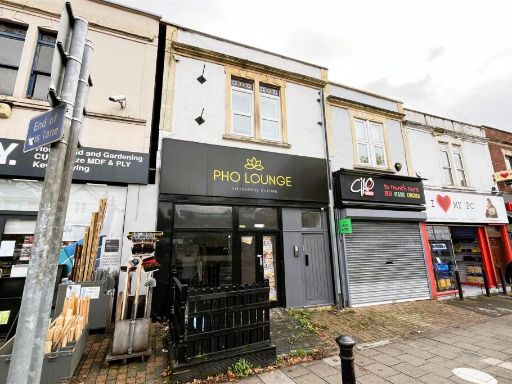 Commercial property for sale in Investment + Development | Bishopston, BS7 — £635,000 • 5 bed • 7 bath • 3590 ft²
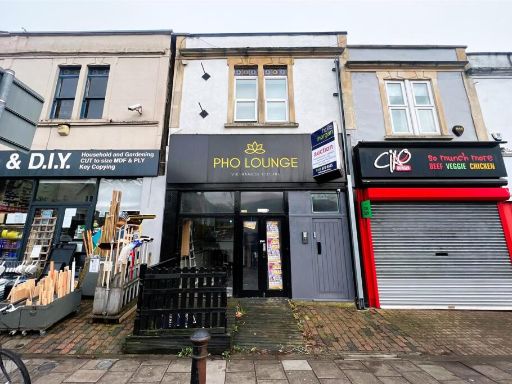 5 bedroom flat for sale in Investment + Development | Bishopston, BS7 — £635,000 • 5 bed • 7 bath • 3590 ft²
 Commercial property for sale in HMO | £92,500 pa | BS7 — £825,000 • 10 bed • 8 bath • 1797 ft²
 10 bedroom terraced house for sale in HMO | £92,500 pa | BS7 — £825,000 • 10 bed • 8 bath • 1833 ft²
 Commercial property for sale in MIXED USE INVESTMENT | £185,840 pa - £204,840 pa INCOME, BS21 — £1,950,000 • 18 bed • 12 bath • 11912 ft²
Meta
- {
"@context": "https://schema.org",
"@type": "Residence",
"name": "5 bedroom terraced house for sale in Freehold Mixed Use | £…",
"description": "",
"url": "https://propertypiper.co.uk/property/d4a97e32-ae9f-45d0-8975-804ffcb7ba2e",
"image": "https://image-a.propertypiper.co.uk/03377cce-6b36-47c4-a61d-121c2a6e793b-1024.jpeg",
"address": {
"@type": "PostalAddress",
"streetAddress": "First & Top Floor Maisonette, 214 Cheltenham Road",
"postalCode": "BS6 5QU",
"addressLocality": "Bristol, City of",
"addressRegion": "Bristol West",
"addressCountry": "England"
},
"geo": {
"@type": "GeoCoordinates",
"latitude": 51.46952066528889,
"longitude": -2.5931924453609008
},
"numberOfRooms": 5,
"numberOfBathroomsTotal": 4,
"floorSize": {
"@type": "QuantitativeValue",
"value": 2184,
"unitCode": "FTK"
},
"offers": {
"@type": "Offer",
"price": 475000,
"priceCurrency": "GBP",
"availability": "https://schema.org/InStock"
},
"additionalProperty": [
{
"@type": "PropertyValue",
"name": "Feature",
"value": "Victorian"
},
{
"@type": "PropertyValue",
"name": "Feature",
"value": "mixed-use building"
},
{
"@type": "PropertyValue",
"name": "Feature",
"value": "three-story"
},
{
"@type": "PropertyValue",
"name": "Feature",
"value": "commercial property"
},
{
"@type": "PropertyValue",
"name": "Feature",
"value": "retail space"
},
{
"@type": "PropertyValue",
"name": "Feature",
"value": "residential units"
},
{
"@type": "PropertyValue",
"name": "Feature",
"value": "fixer-upper"
},
{
"@type": "PropertyValue",
"name": "Feature",
"value": "urban location"
},
{
"@type": "PropertyValue",
"name": "Feature",
"value": "period property"
},
{
"@type": "PropertyValue",
"name": "Feature",
"value": "city center"
},
{
"@type": "PropertyValue",
"name": "Feature",
"value": "Victorian"
},
{
"@type": "PropertyValue",
"name": "Feature",
"value": "commercial property"
},
{
"@type": "PropertyValue",
"name": "Feature",
"value": "terraced"
},
{
"@type": "PropertyValue",
"name": "Feature",
"value": "mixed-use"
},
{
"@type": "PropertyValue",
"name": "Feature",
"value": "urban location"
},
{
"@type": "PropertyValue",
"name": "Feature",
"value": "high street"
}
]
}
High Res Floorplan Images
Compatible Floorplan Images
FloorplanImages Thumbnail