AL1 4HH - 4 bedroom detached house for sale in Churchill Road, St. Al…
View on Property Piper
4 bedroom detached house for sale in Churchill Road, St. Albans, Hertfordshire, AL1
Property Details
- Price: £1800000
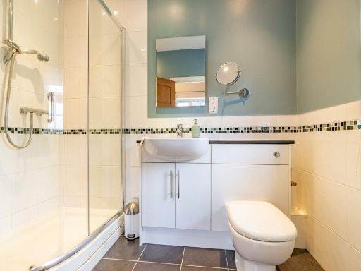
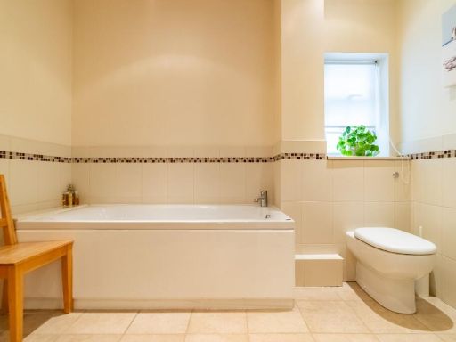
- Bedrooms: 4
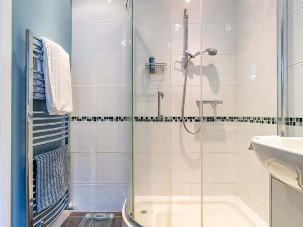
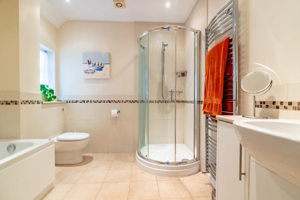
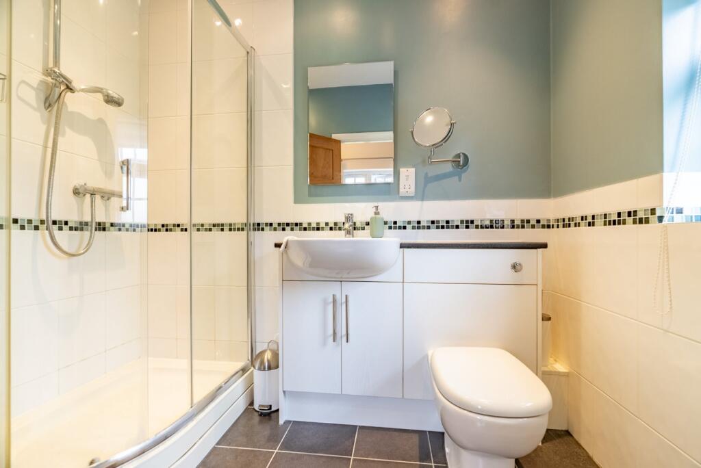
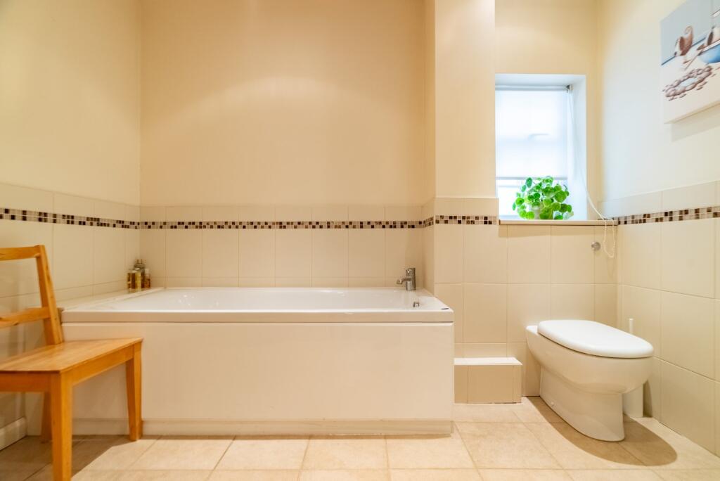
- Bathrooms: 2
- Property Type: undefined
- Property SubType: undefined
Brochure Descriptions
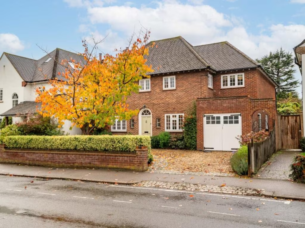
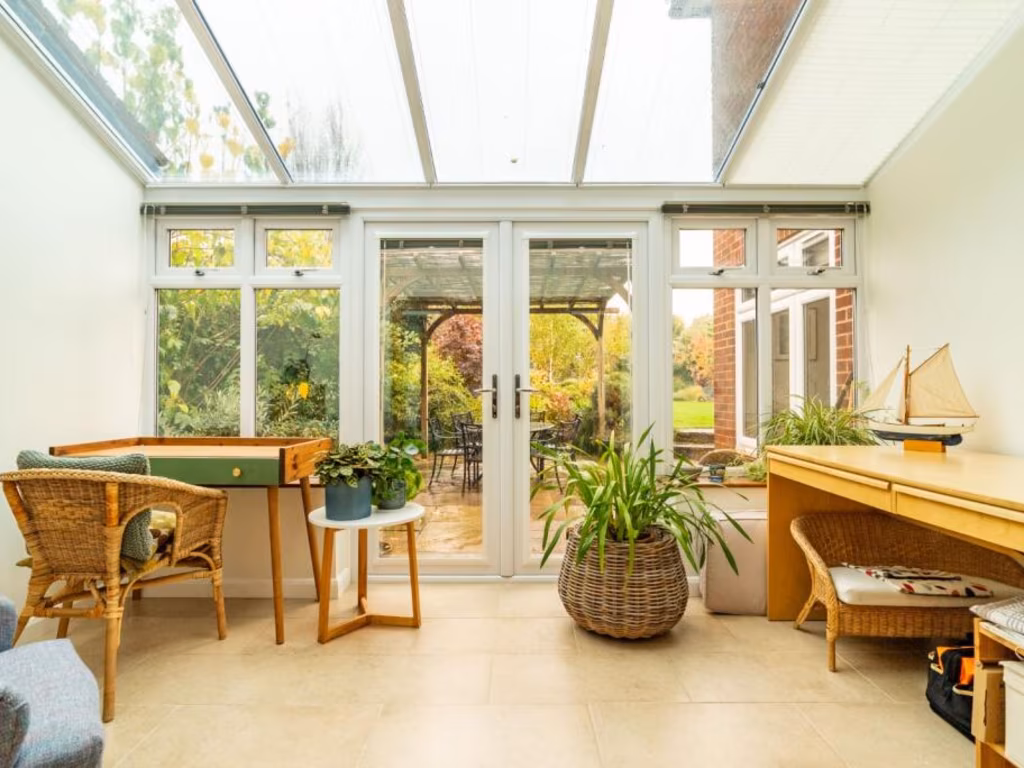
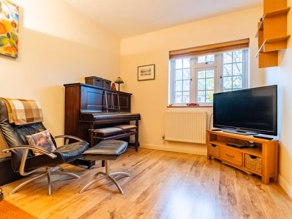
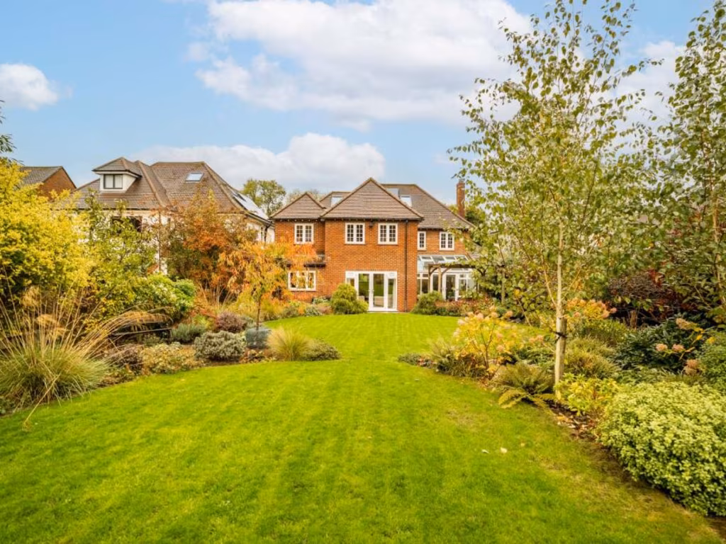
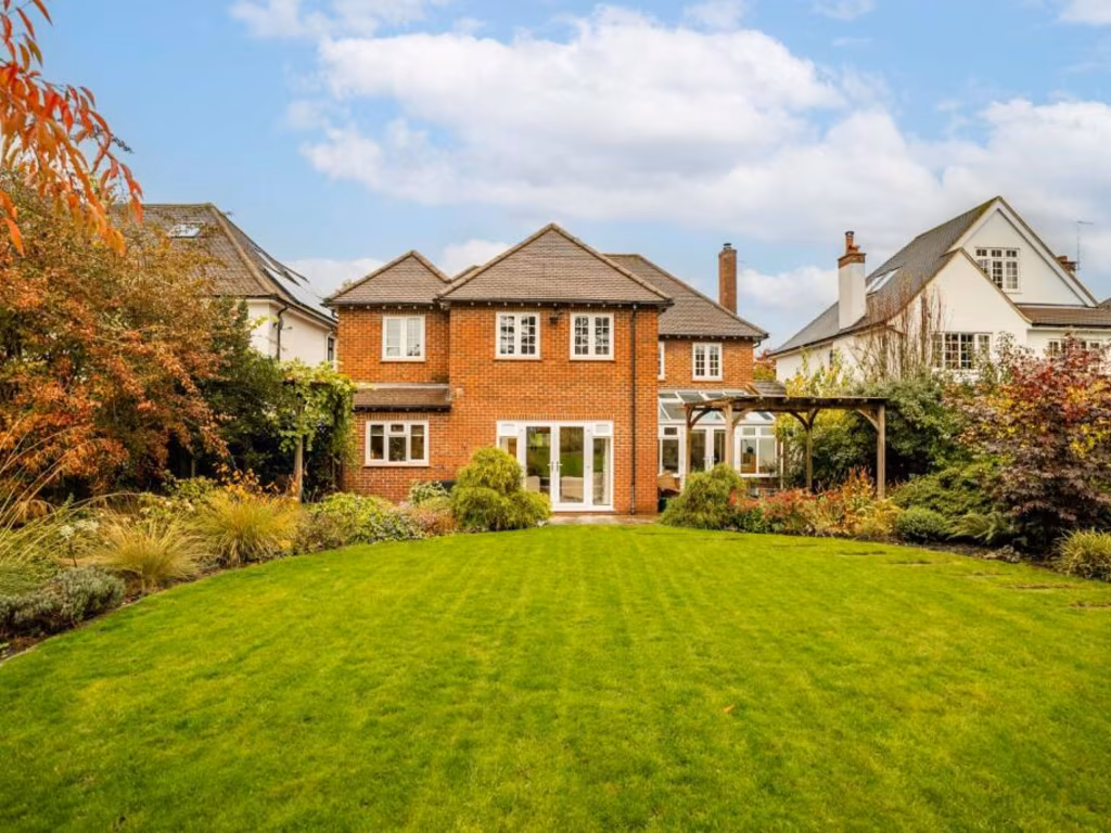
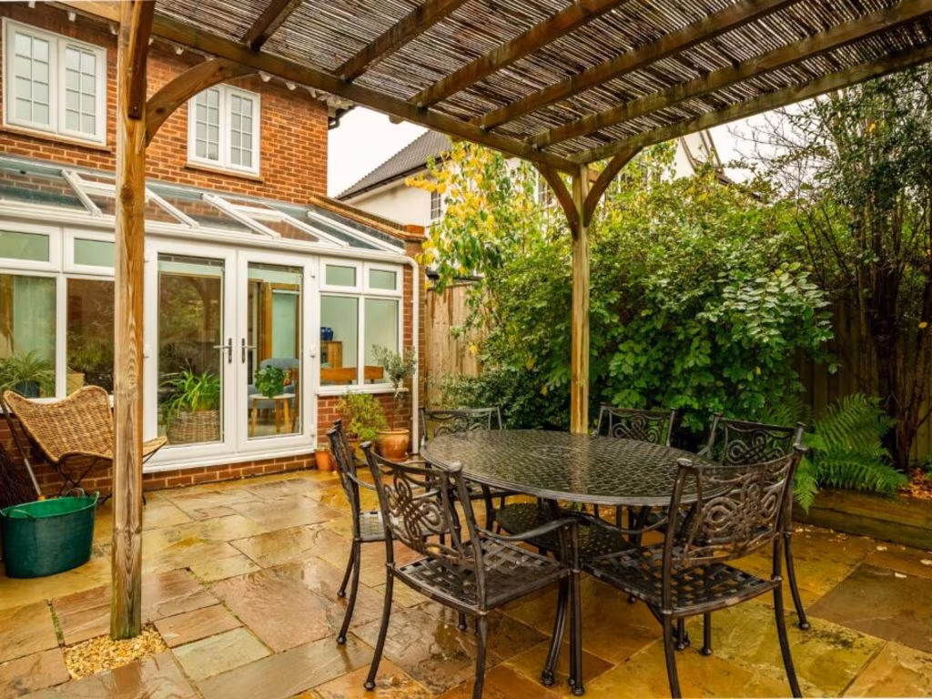
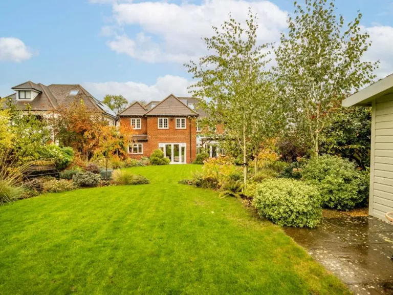
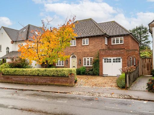
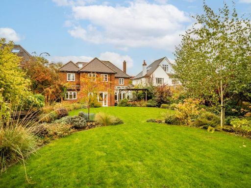
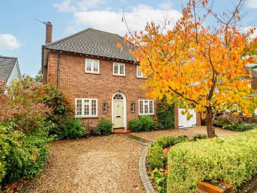
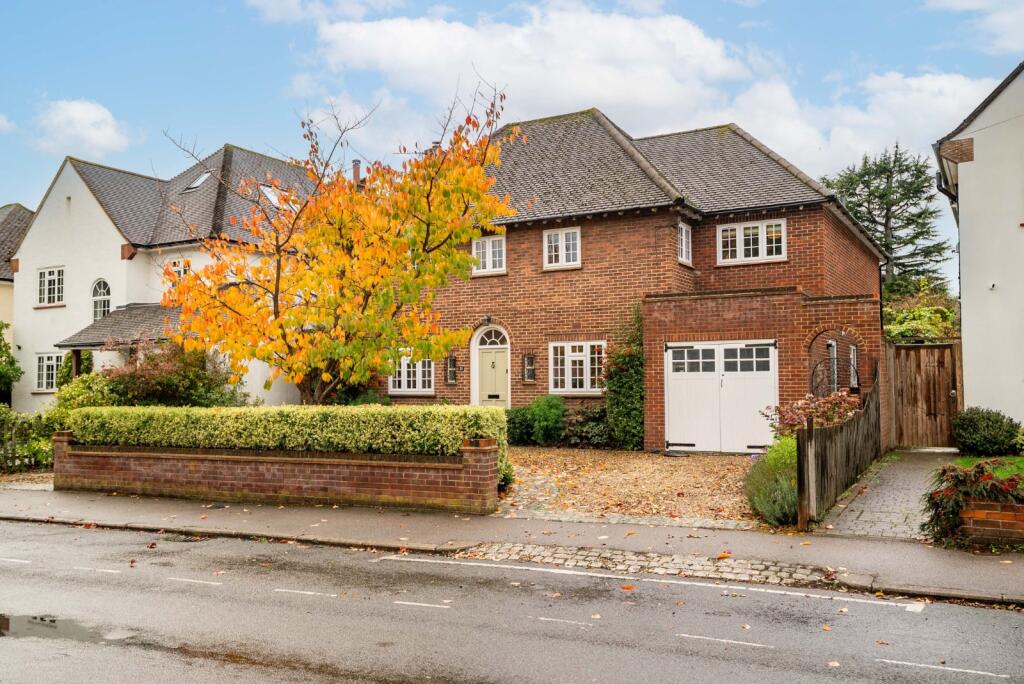
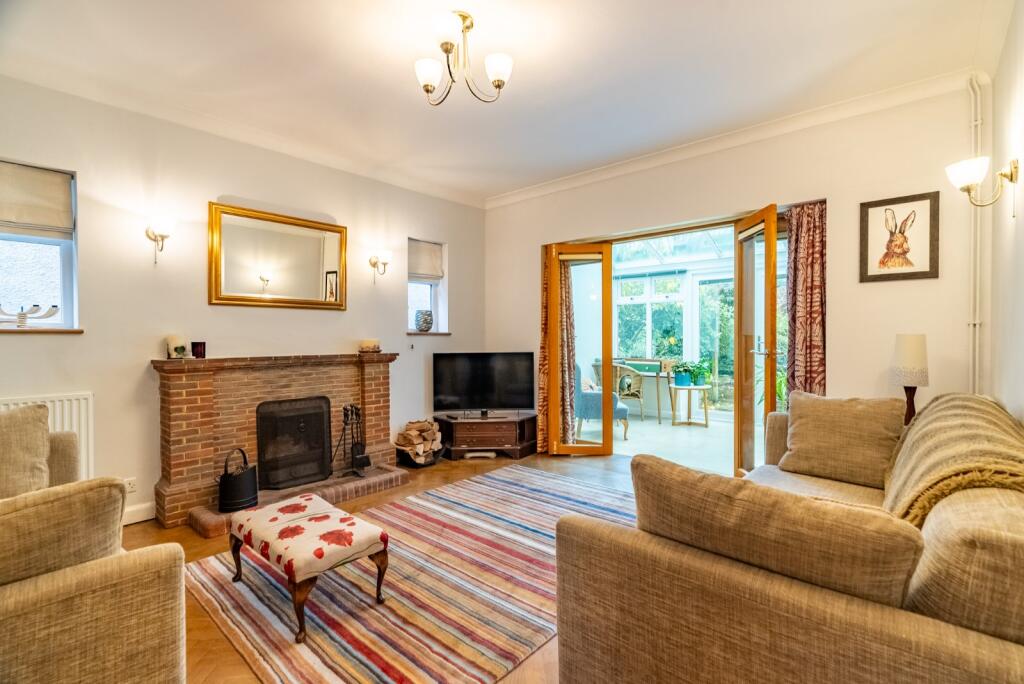
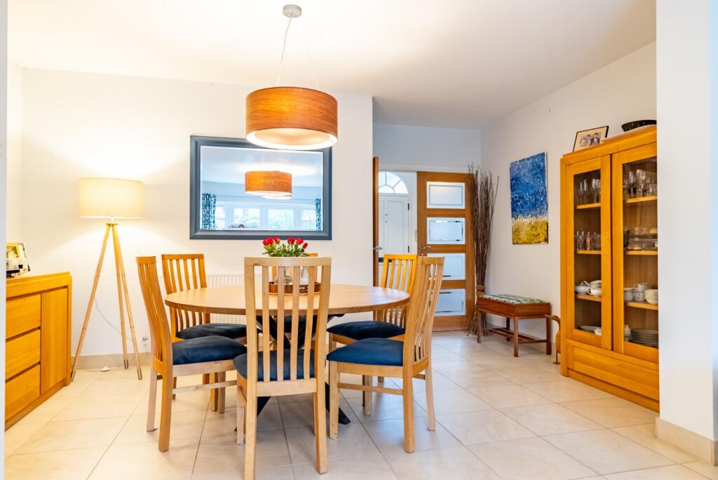
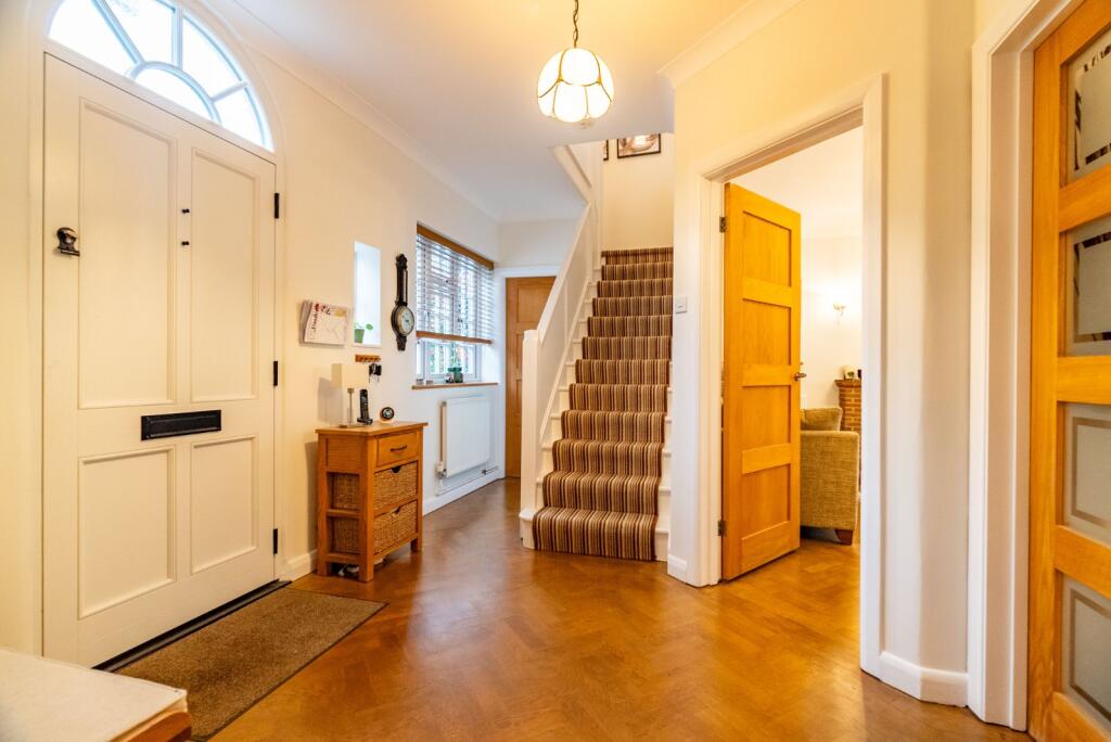
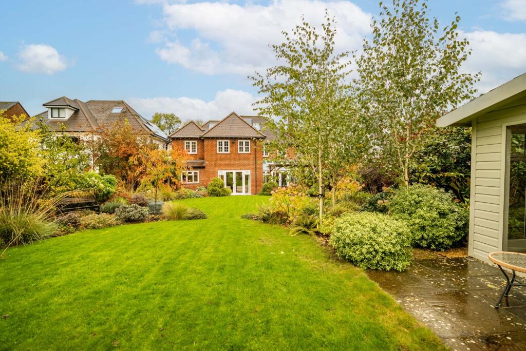
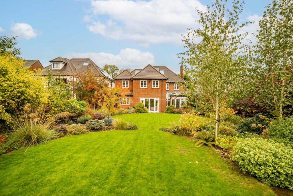
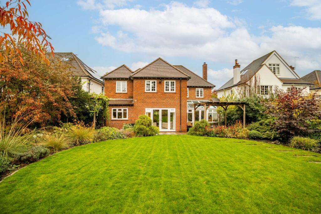
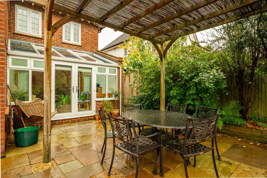
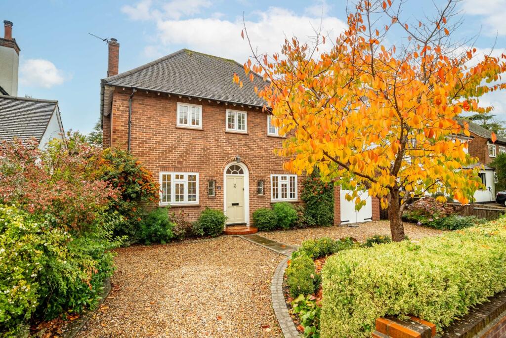
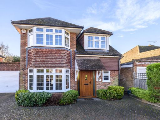
- Substantial detached two-storey family house constructed in brick with a pitched roof and attached single garage. The property presents good kerb appeal with a gravel driveway providing parking for 2–3 cars and a low-maintenance front garden bounded by a brick wall. Likely arranged with reception accommodation to the ground floor and principal bedrooms to the first floor (typical 3–5 bedroom layout for this house type). The plot appears to be medium to large for an in-town suburban lot with potential for rear extension subject to planning. Overall condition and external finishes are good; the property would suit a family buyer seeking a spacious, well-located home on a residential road. Views are typical suburban — street outlook with mature trees — no notable landscape or water views visible from the images.
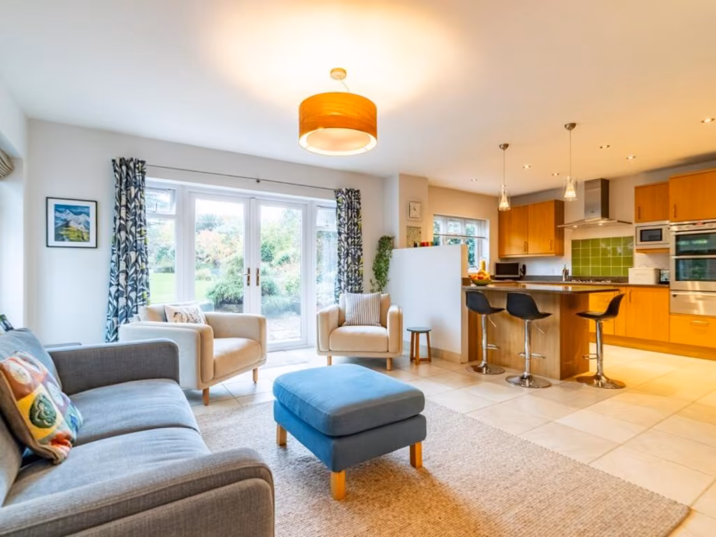
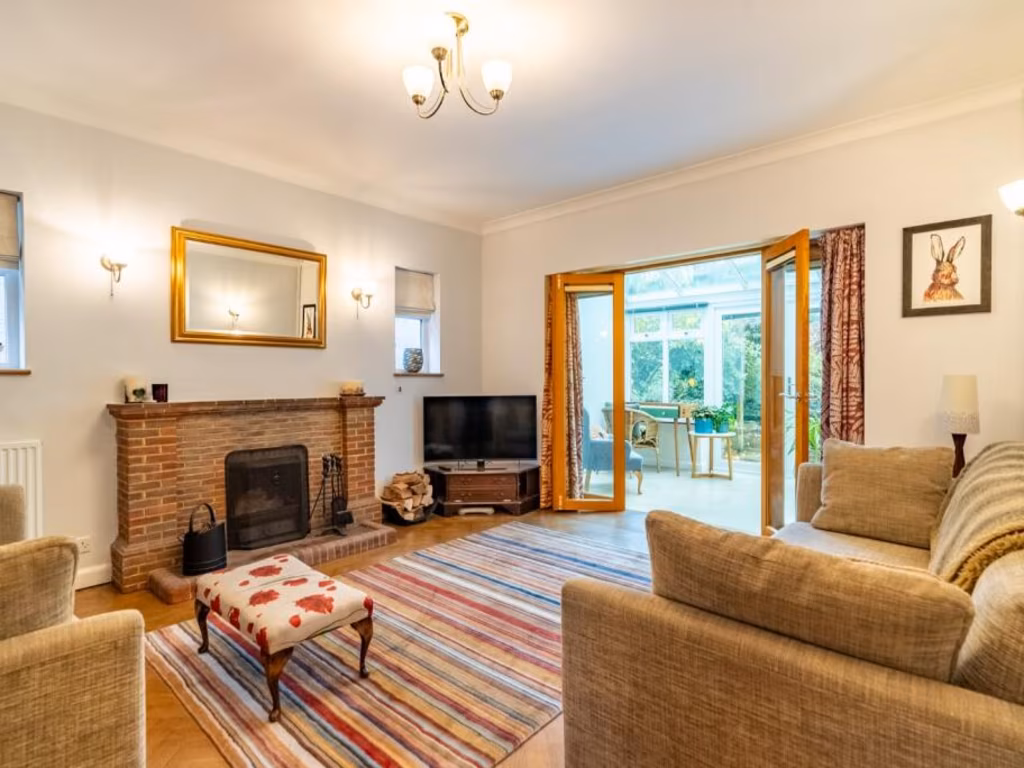
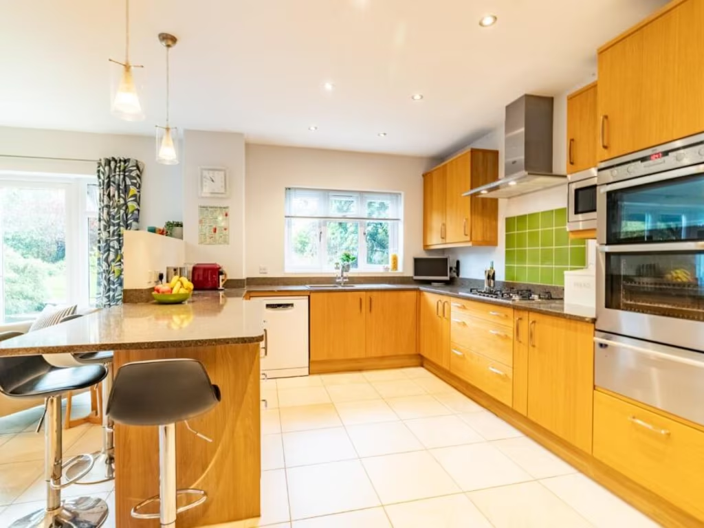
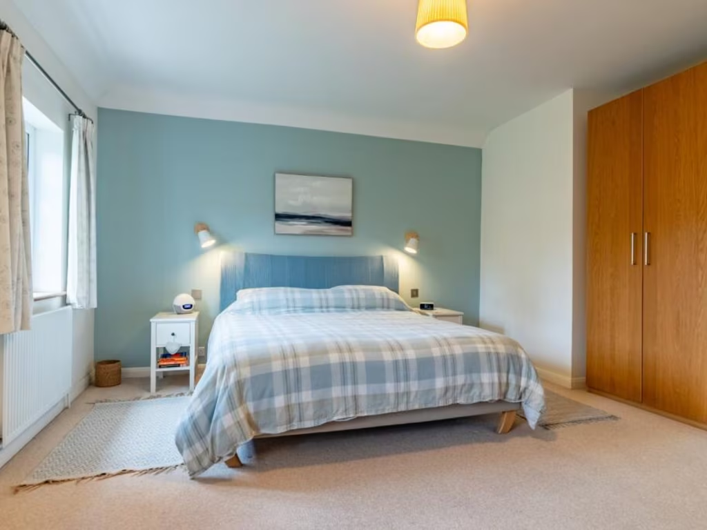
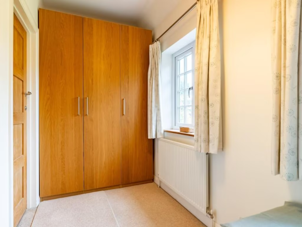
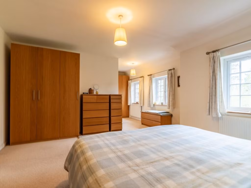
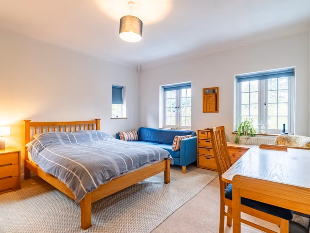
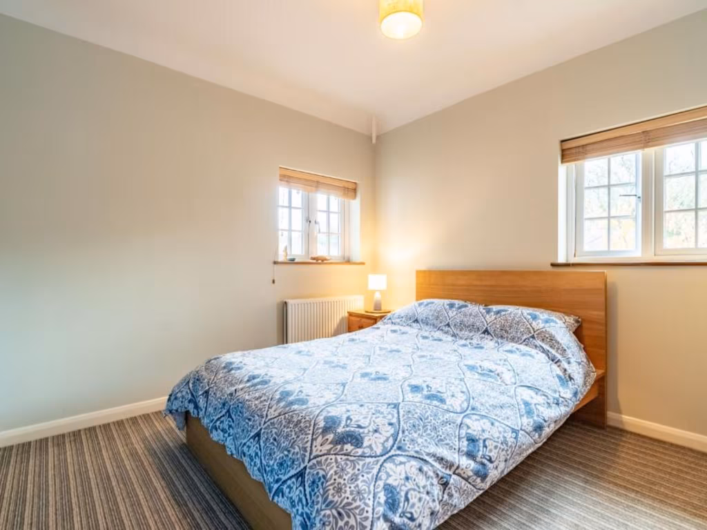
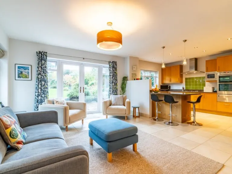
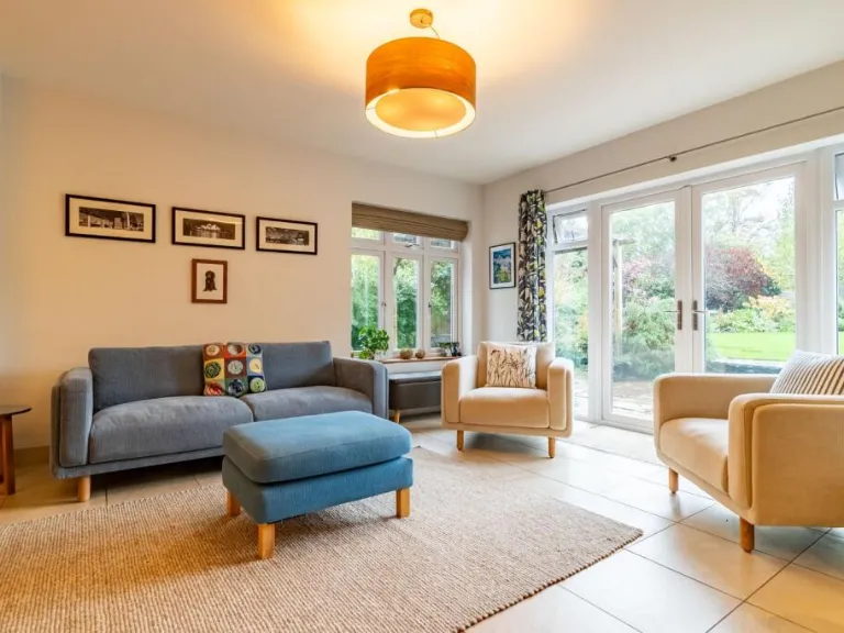
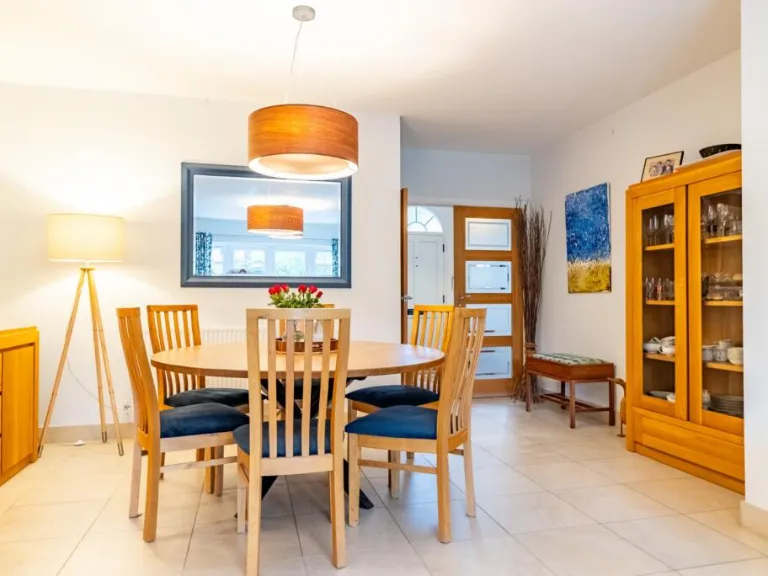
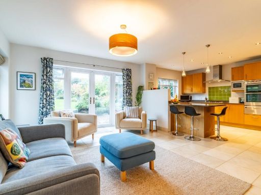
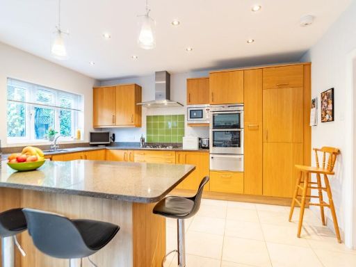
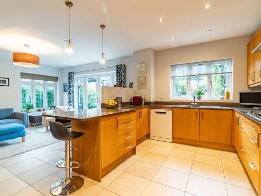
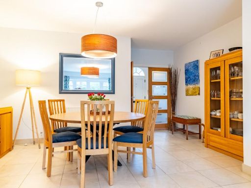
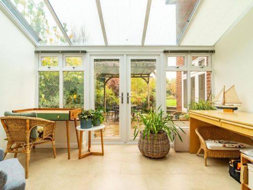
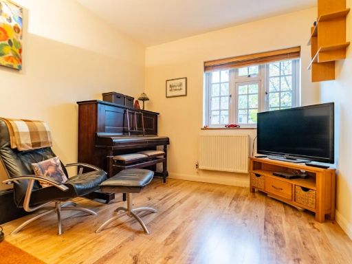
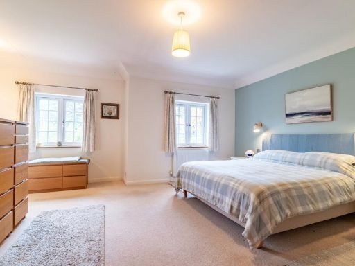
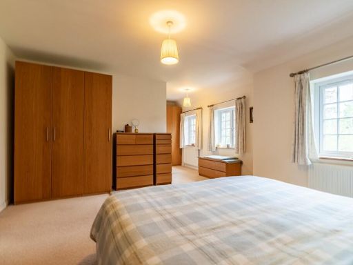
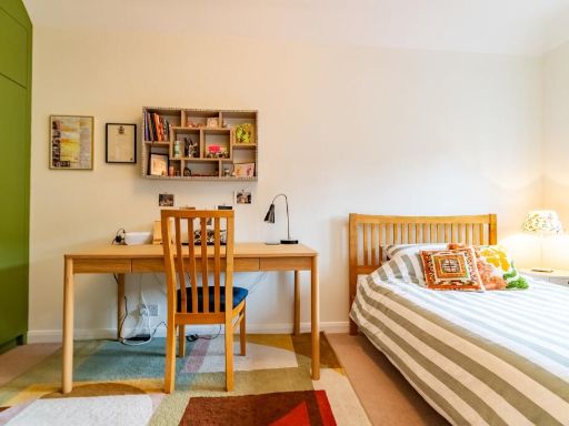
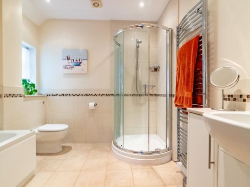
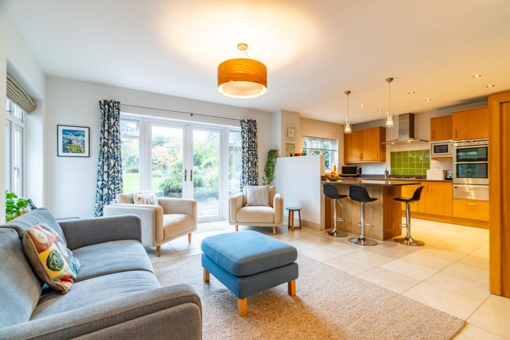
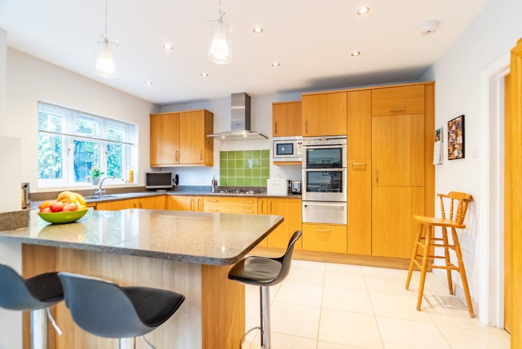
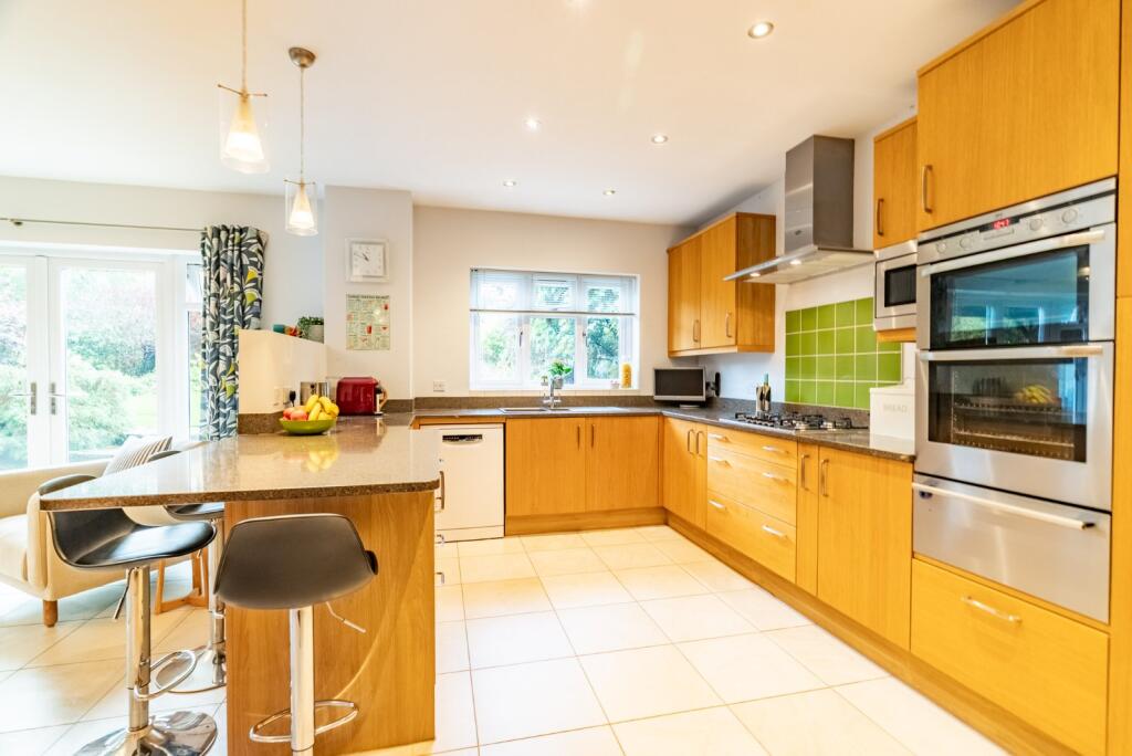
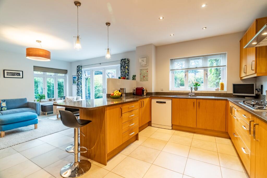
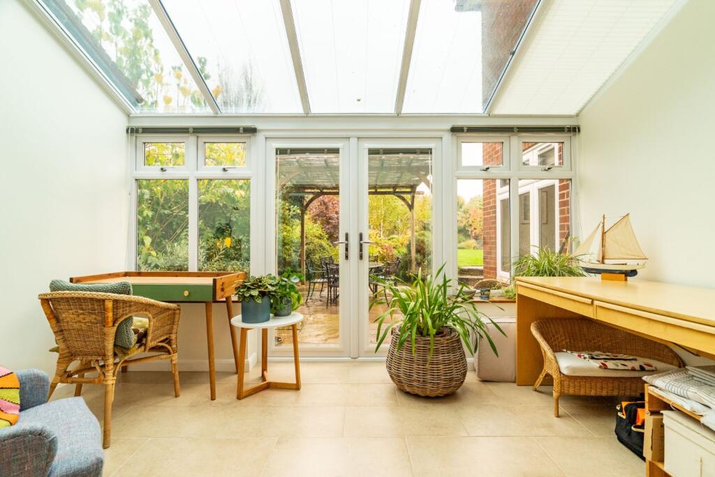
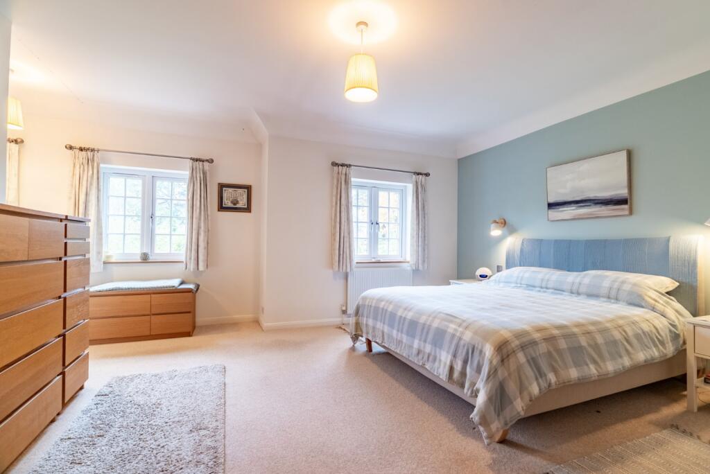
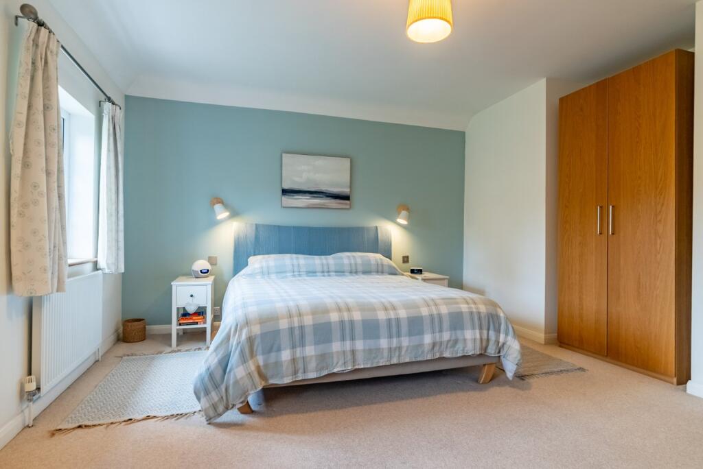
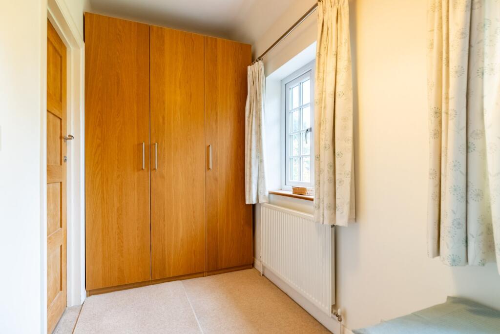
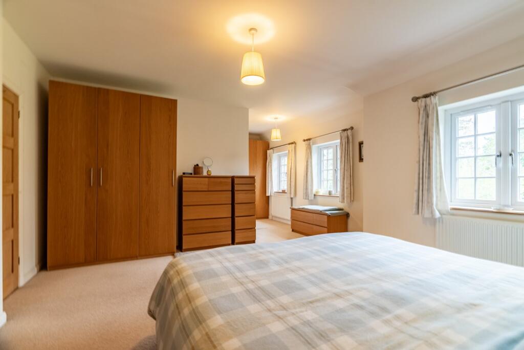
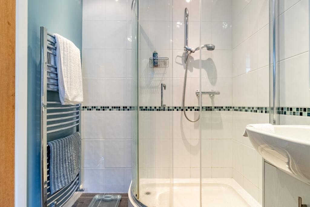
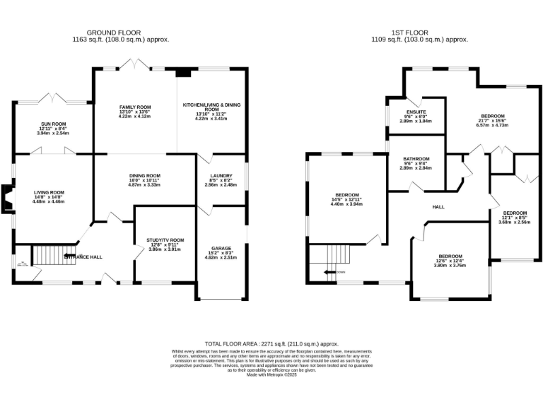
- Large detached two-storey family house as shown on the provided floorplans. The accommodation extends to approximately 2,271 sq ft (211.0 sq m) and appears to provide multiple reception rooms on the ground floor (living room, family room, open-plan kitchen/dining/living area, dining room and a sun room), a study, utility/ancillary space and an integral garage. The first floor shows several bedrooms (including a principal bedroom with en-suite and additional family bathroom facilities) — overall likely a 4–5 bedroom arrangement. The layout indicates substantial circulation space and good separation of living and sleeping accommodation, suitable for a large/extended family. Externally there is access to a rear garden from the sun room/ground floor living areas; garden size can be inferred as medium to large from the presence of a dedicated sun room and rear access but no definitive external photographs are provided. No distinctive views (sea, river, city skyline or similar) are visible on the plans. The property would be described by a valuer as a sizeable family dwelling with versatile reception space, off-street parking/garage and scope for modernisation or reconfiguration to contemporary open-plan living.
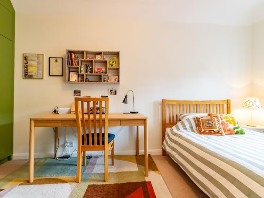
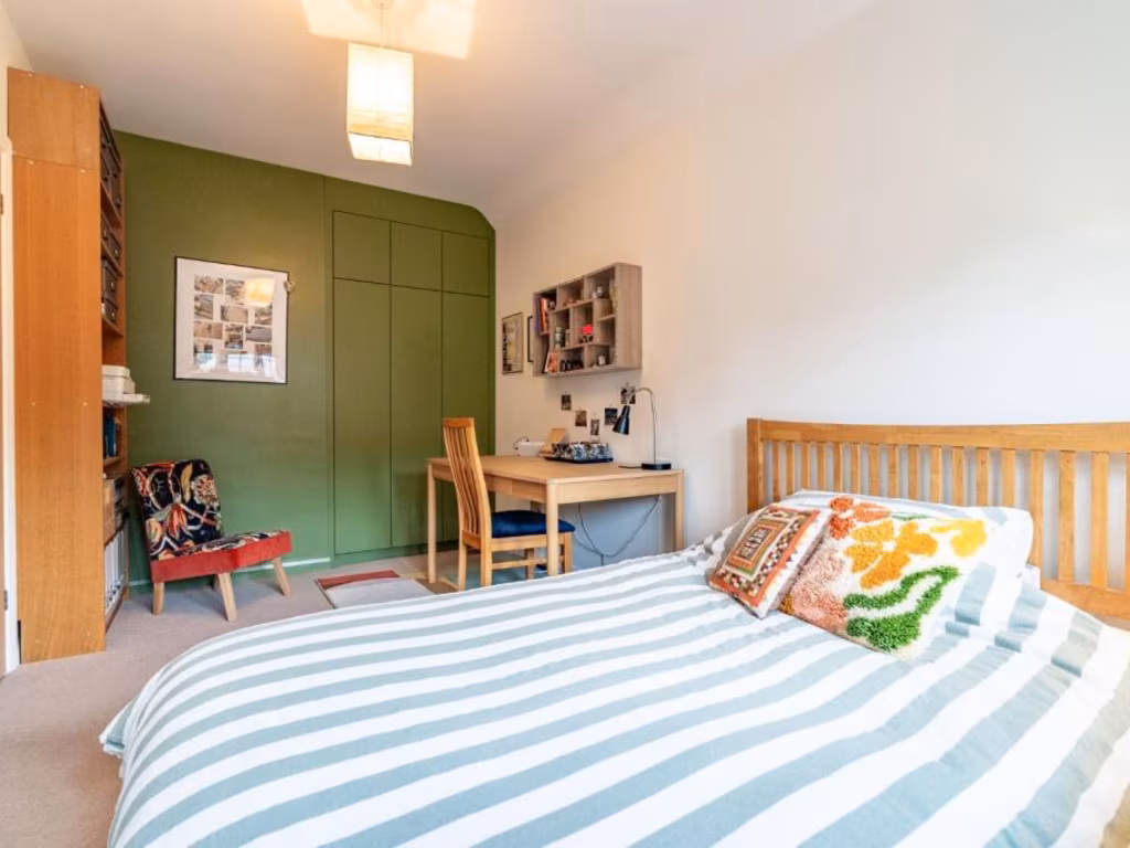
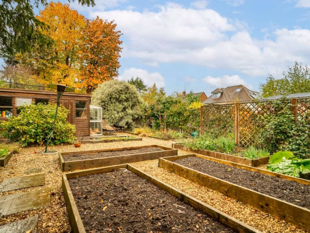
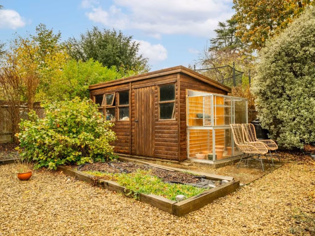
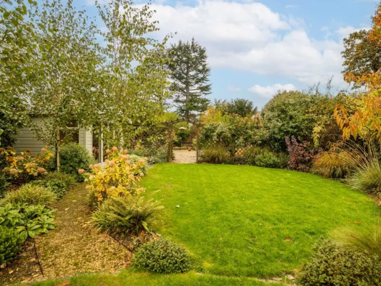
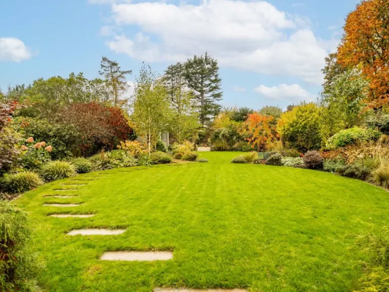
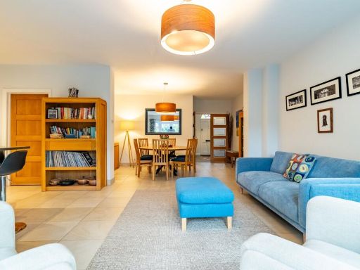
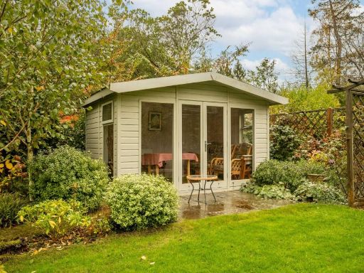
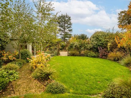
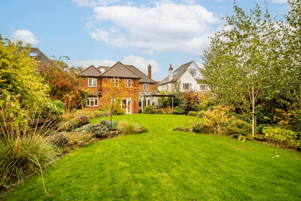
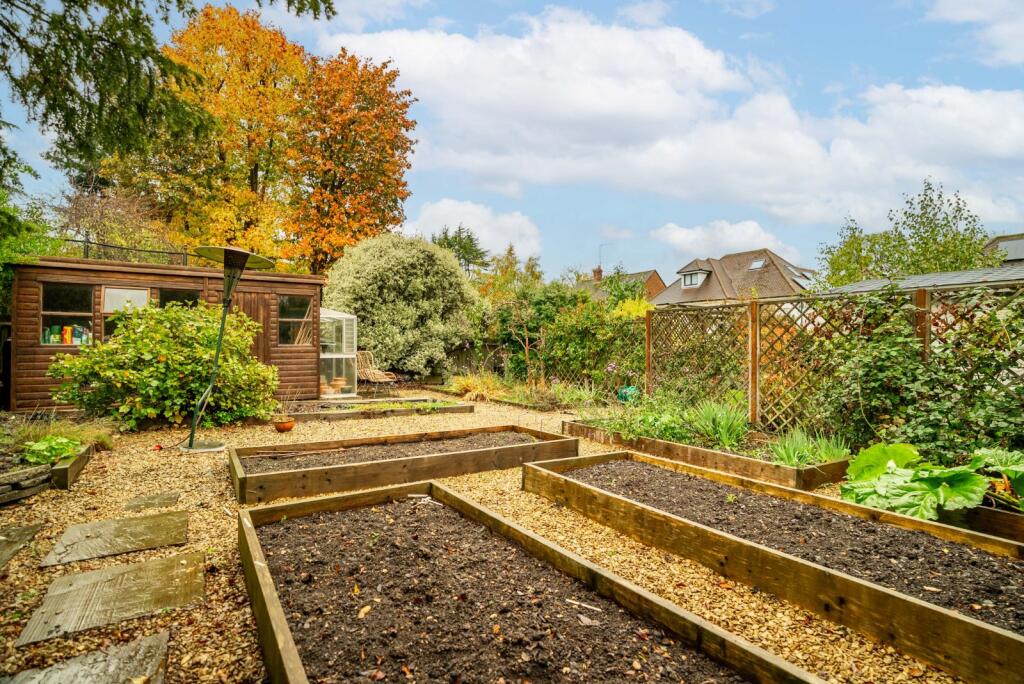
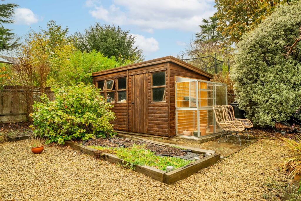
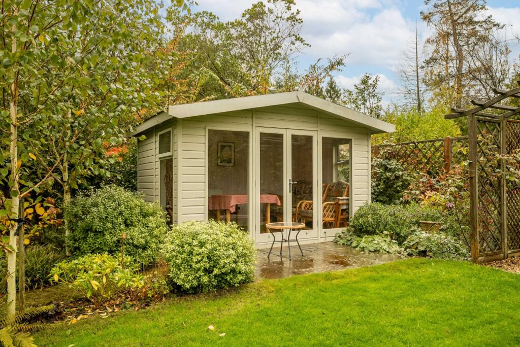
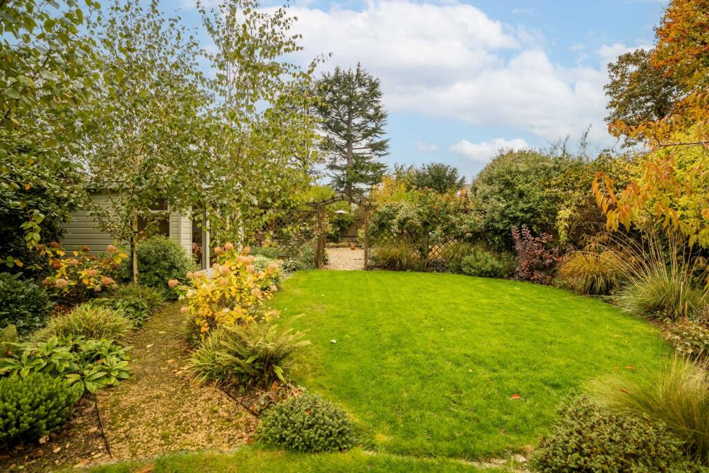
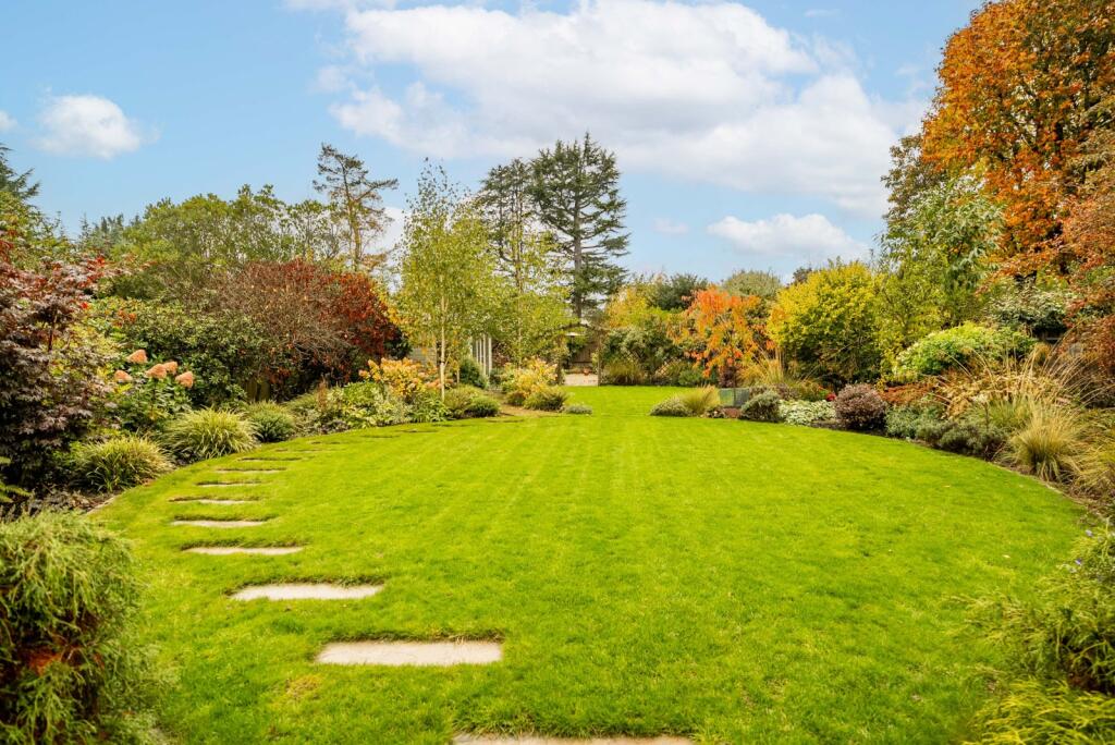
- Traditional, character-filled family house situated on a generous plot with a mature, landscaped garden and separate summer house. The vendor statement indicates the property has been lovingly maintained since 1952 and occupied by the current owners for 18 years. Accommodation is described as flexible and spacious, suitable for entertaining and family living. Location is convenient — on quiet Churchill Road within easy walking distance of the station, town centre, local shops and Clarence Park. Garden size: large/mature; overall property footprint: medium to large for a family dwelling. No sea, river or elevated/city skyline views are referenced.
Image Descriptions
- detached house Modern
- open-plan kitchen and living area modern
Floorplan Description
- Two-storey detached house with multiple reception rooms and bedrooms.
Rooms
- SUN ROOM: small
- FAMILY ROOM: average
- KITCHEN/LIVING & DINING ROOM: average
- LIVING ROOM: large
- DINING ROOM: large
- LAUNDRY: small
- STUDY/TV ROOM: average
- GARAGE: small
- ENSUITE: small
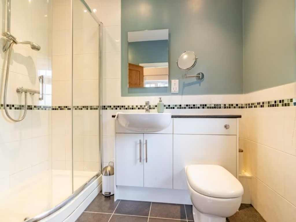
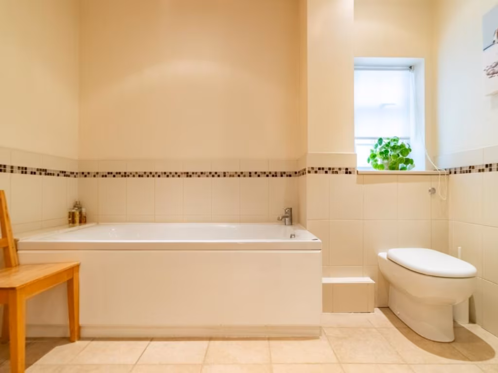
- BATHROOM: small
- BEDROOM: very large
- BEDROOM: large
- BEDROOM: average
- BEDROOM: small
Textual Property Features
Detected Visual Features
- modern house
- detached
- brick exterior
- garage
- driveway
- garden
- well-maintained
- two-story
- suburban
- residential
- modern
- open-plan
- kitchen
- living area
- French doors
- natural light
- garden view
- island counter
EPC Details
- Fully double glazed
- Solid brick, as built, no insulation (assumed)
- Boiler and radiators, mains gas
- Low energy lighting in all fixed outlets
- Suspended, no insulation (assumed)
Nearby Schools
- Loreto College
- Beaumont School
- Maple Primary School
- Bernards Heath Junior School
- St Albans Girls' School
- Samuel Ryder Academy
- Camp Primary and Nursery School
- St Alban & St Stephen Catholic Primary School & Nursery
- Alban City School
- Aboyne Lodge Junior Mixed and Infant School
- Bernards Heath Infant and Nursery School
- Wheatfields Junior Mixed School
- Cunningham Hill Junior School
- St Peter's School
- St Albans Independent College
- Fleetville Junior School
- St Albans High School for Girls
- St John Fisher Catholic Primary School, a Voluntary Academy
- Wheatfields Infants' and Nursery School
- Windermere Primary School
- Cunningham Hill Infant School
- Fleetville Infant and Nursery School
- Verulam School
- Oakwood Primary School
- Garden Fields Junior Mixed and Infant School
- Skyswood Primary & Nursery School
- Sandringham School
Nearest Bars And Restaurants
- Id: 1765466242
- Tags:
- Addr:
- City: St Albans
- Housenumber: 182
- Street: Hatfield Road
- Amenity: fast_food
- Brand: Papa John's
- Brand:wikidata: Q2759586
- Brand:wikipedia: en:Papa John's Pizza
- Contact:
- Website: https://www.papajohns.co.uk/stores/st.-albans/home.aspx
- Cuisine: pizza
- Name: Papa John's
- Takeaway: yes
- TagsNormalized:
- fast food
- food
- papa johns
- pizza
- takeaway
- Lat: 51.7524813
- Lon: -0.3170251
- FullGeoHash: gcpy2v30hc8z
- PartitionGeoHash: gcpy
- Images:
- FoodStandards: null
- Distance: 600.3
,- Id: 8420144836
- Tags:
- Addr:
- City: St Albans
- Housenumber: 184
- Postcode: AL1 4JG
- Street: Hatfield Road
- Amenity: restaurant
- Cuisine: dessert
- Name: Room for Dessert
- TagsNormalized:
- Lat: 51.7524959
- Lon: -0.3171585
- FullGeoHash: gcpy2v301smr
- PartitionGeoHash: gcpy
- Images:
- FoodStandards: null
- Distance: 599.1
,- Id: 8440835795
- Tags:
- Amenity: fast_food
- Cuisine: pizza
- Name: Cheerz Pizza
- TagsNormalized:
- Lat: 51.7525878
- Lon: -0.3182889
- FullGeoHash: gcpy2v20xmde
- PartitionGeoHash: gcpy
- Images:
- FoodStandards: null
- Distance: 598.2
,- Id: 8440835792
- Tags:
- Amenity: cafe
- Name: Fleetville Larder
- Opening_hours: Mo-Th 09:00-15:00; Fr,Sa 09:00-15:00
- TagsNormalized:
- Lat: 51.7526035
- Lon: -0.3179047
- FullGeoHash: gcpy2v28b290
- PartitionGeoHash: gcpy
- Images:
- FoodStandards: null
- Distance: 592.2
,- Id: 1762386725
- Tags:
- Amenity: restaurant
- Cuisine: mediterranean
- Name: The Oasis
- TagsNormalized:
- Lat: 51.7526741
- Lon: -0.3161081
- FullGeoHash: gcpy2v3c4jsw
- PartitionGeoHash: gcpy
- Images:
- FoodStandards: null
- Distance: 579.8
}
Nearest General Shops
- Id: 8440835793
- Tags:
- Beauty: nails
- Name: Natural Nail Salon
- Opening_hours: Mo-Fr 10:00-19:00; Sa 09:00-17:00
- Shop: beauty
- TagsNormalized:
- Lat: 51.7526042
- Lon: -0.317984
- FullGeoHash: gcpy2v22y2tv
- PartitionGeoHash: gcpy
- Images:
- FoodStandards: null
- Distance: 592.9
,- Id: 8440880734
- Tags:
- Name: S.K. Carpets
- Shop: carpet
- TagsNormalized:
- Lat: 51.752609
- Lon: -0.3158189
- FullGeoHash: gcpy2v60bcs3
- PartitionGeoHash: gcpy
- Images:
- FoodStandards: null
- Distance: 588.7
,- Id: 8440880746
- Tags:
- Name: Rennie Grove Hospice Care
- Shop: charity
- TagsNormalized:
- Lat: 51.7526345
- Lon: -0.31595
- FullGeoHash: gcpy2v3bvy69
- PartitionGeoHash: gcpy
- Images:
- FoodStandards: null
- Distance: 585.1
}
Nearest Grocery shops
- Id: 8440595799
- Tags:
- Name: Andrews
- Opening_hours: Tu 10:00-13:00; Fr 09:00-16:00; Sa 09:00-13:00
- Shop: convenience
- TagsNormalized:
- Lat: 51.7522068
- Lon: -0.3141196
- FullGeoHash: gcpy2v5q2qx6
- PartitionGeoHash: gcpy
- Images:
- FoodStandards: null
- Distance: 654.8
,- Id: 939155154
- Tags:
- Addr:
- Housenumber: 117
- Postcode: AL1 4JS
- Street: Hatfield Road
- Name: The wellness bar
- Shop: health_food
- TagsNormalized:
- health
- health food
- food
- shop
- Lat: 51.752583
- Lon: -0.3183948
- FullGeoHash: gcpy2v20suew
- PartitionGeoHash: gcpy
- Images:
- FoodStandards: null
- Distance: 600.1
,- Id: 8440880747
- Tags:
- Name: Al Barkha mini Market
- Shop: convenience
- TagsNormalized:
- Lat: 51.752647
- Lon: -0.3160238
- FullGeoHash: gcpy2v3ch0es
- PartitionGeoHash: gcpy
- Images:
- FoodStandards: null
- Distance: 583.2
}
Nearest Supermarkets
- Id: 553648435
- Tags:
- Brand: Co-op Food
- Brand:wikidata: Q3277439
- Brand:wikipedia: en:Co-op Food
- Building: yes
- Name: Co-op Food
- Operator: The Co-operative Group
- Operator:wikidata: Q117202
- Shop: supermarket
- TagsNormalized:
- co-op
- co-op food
- food
- supermarket
- shop
- Lat: 51.7436102
- Lon: -0.3124636
- FullGeoHash: gcpy2gskrh43
- PartitionGeoHash: gcpy
- Images:
- FoodStandards: null
- Distance: 1612.8
,- Id: 878155331
- Tags:
- Addr:
- City: St Albans
- Postcode: AL4 9TU
- Street: The Ridgeway
- Brand: M&S Foodhall
- Brand:wikidata: Q714491
- Brand:wikipedia: en:Marks & Spencer
- Building: yes
- Contact:
- Website: https://www.marksandspencer.com/stores/marshalswick-foodhall-2109
- Name: M&S Foodhall
- Shop: supermarket
- TagsNormalized:
- m&s foodhall
- supermarket
- shop
- Lat: 51.7631396
- Lon: -0.306826
- FullGeoHash: gcpy3p0w4ktg
- PartitionGeoHash: gcpy
- Images:
- FoodStandards: null
- Distance: 896.5
,- Id: 4370426
- Tags:
- Addr:
- Housenumber: 244
- Postcode: AL1 4SU
- Street: Hatfield Road
- Brand: Morrisons
- Brand:wikidata: Q922344
- Brand:wikipedia: en:Morrisons
- Building: store
- Contact:
- Website: https://my.morrisons.com/storefinder/317
- Name: Morrisons
- Opening_hours: Mo-Sa 07:00-22:00; Su 10:00-16:00
- Shop: supermarket
- TagsNormalized:
- Lat: 51.751448
- Lon: -0.3113174
- FullGeoHash: gcpy2vj61c0u
- PartitionGeoHash: gcpy
- Images:
- FoodStandards: null
- Distance: 804.8
}
Nearest Religious buildings
- Id: 164625085
- Tags:
- Amenity: place_of_worship
- Building: yes
- Denomination: methodist
- Name: Hatfield Road Methodist Church
- Religion: christian
- TagsNormalized:
- place of worship
- methodist
- church
- christian
- Lat: 51.7527855
- Lon: -0.3171945
- FullGeoHash: gcpy2v31bf6w
- PartitionGeoHash: gcpy
- Images:
- FoodStandards: null
- Distance: 567.1
,- Id: 211113275
- Tags:
- Amenity: place_of_worship
- Building: yes
- Denomination: Subset_of_Christian_Evangelical_Church
- Name: Brethern's Meeting Rooms
- Religion: christian
- TagsNormalized:
- place of worship
- christian
- church
- evangelical
- Lat: 51.7602372
- Lon: -0.310867
- FullGeoHash: gcpy2ytthr8c
- PartitionGeoHash: gcpy
- Images:
- FoodStandards: null
- Distance: 479.3
,- Id: 211113101
- Tags:
- Amenity: place_of_worship
- Name: United Reformed Church
- Religion: christian
- TagsNormalized:
- place of worship
- church
- united reformed
- christian
- Lat: 51.7596947
- Lon: -0.3117636
- FullGeoHash: gcpy2ysfp6kj
- PartitionGeoHash: gcpy
- Images:
- FoodStandards: null
- Distance: 395
}
Nearest Medical buildings
- Id: 8440488589
- Tags:
- Amenity: veterinary
- Name: Marshalswick Vetinary Surgery
- TagsNormalized:
- veterinary
- surgery
- vetinary
- Lat: 51.7636471
- Lon: -0.3055168
- FullGeoHash: gcpy3p390gnn
- PartitionGeoHash: gcpy
- Images:
- FoodStandards: null
- Distance: 1001.7
,- Id: 370321023
- Tags:
- Addr:
- City: St Albans
- Housenumber: 17
- Postcode: AL4 9RB
- Street: The Quadrant
- Amenity: pharmacy
- Healthcare: pharmacy
- Name: Quadrant Pharmacy
- Operator: Quadrant Pharmacies
- Phone: +44 1727 851013
- Website: https://www.quadrantpharmacy.co.uk/
- TagsNormalized:
- Lat: 51.7644144
- Lon: -0.3074451
- FullGeoHash: gcpy3p2js40r
- PartitionGeoHash: gcpy
- Images:
- FoodStandards: null
- Distance: 966.3
,- Id: 8442500587
- Tags:
- Amenity: pharmacy
- Dispensing: yes
- Healthcare: pharmacy
- Name: Morrisons - Pharmacy
- TagsNormalized:
- pharmacy
- health
- healthcare
- morrisons
- Lat: 51.7517467
- Lon: -0.3113782
- FullGeoHash: gcpy2vj7b2g9
- PartitionGeoHash: gcpy
- Images:
- FoodStandards: null
- Distance: 773.5
,- Id: 8440853885
- Tags:
- Amenity: dentist
- Healthcare: dentist
- Name: St Albans Dental Clinic
- TagsNormalized:
- dentist
- health
- healthcare
- clinic
- dental
- Lat: 51.7518803
- Lon: -0.3219413
- FullGeoHash: gcpy2tjsd1xn
- PartitionGeoHash: gcpy
- Images:
- FoodStandards: null
- Distance: 758.3
}
Nearest Airports
- Id: 110273499
- Tags:
- Addr:
- Country: GB
- Postcode: LU2 9LY
- Aerodrome: international
- Aerodrome:type: public
- Aeroway: aerodrome
- Alt_name: London Luton
- Iata: LTN
- Icao: EGGW
- Name: London Luton Airport
- Website: https://www.london-luton.co.uk/
- Wikidata: Q8712
- Wikipedia: en:Luton Airport
- TagsNormalized:
- airport
- international airport
- Lat: 51.8780363
- Lon: -0.3701408
- FullGeoHash: gcpxps47rngh
- PartitionGeoHash: gcpx
- Images:
- FoodStandards: null
- Distance: 13857.1
,- Id: 495488524
- Tags:
- Aerodrome: international
- Aerodrome:type: public
- Aeroway: aerodrome
- Alt_name: Stansted
- Iata: STN
- Icao: EGSS
- Is_in: Essex,England,UK
- Name: London Stansted Airport
- Ref: STN
- Source: Gagravarr_Airports
- Website: https://www.stanstedairport.com/
- Wikidata: Q8709
- Wikipedia: en:London Stansted Airport
- TagsNormalized:
- airport
- international airport
- Lat: 51.8869677
- Lon: 0.2429264
- FullGeoHash: u10pjt8zkxg4
- PartitionGeoHash: u10p
- Images:
- FoodStandards: null
- Distance: 41053.6
,- Id: 121158889
- Tags:
- Aerodrome: continental
- Aeroway: aerodrome
- Fhrs:
- Authority: City of London Corporation
- Iata: LCY
- Icao: EGLC
- Name: London City Airport
- Operator: London City Airport Limited
- Ref: LCY
- Website: https://www.londoncityairport.com/
- Wikidata: Q8982
- Wikipedia: en:London City Airport
- TagsNormalized:
- airport
- continental airport
- Lat: 51.5042658
- Lon: 0.0539987
- FullGeoHash: u10j10p64702
- PartitionGeoHash: u10j
- Images:
- FoodStandards: null
- Distance: 38077.1
}
Nearest Leisure Facilities
- Id: 3986251
- Tags:
- Access: private
- Leisure: pitch
- Name: Salisbury Tennis Courts
- Sport: tennis
- Surface: asphalt
- TagsNormalized:
- Lat: 51.7552276
- Lon: -0.3100363
- FullGeoHash: gcpy2vy0p9sn
- PartitionGeoHash: gcpy
- Images:
- FoodStandards: null
- Distance: 544.6
,- Id: 4044283
- Tags:
- Created_by: JOSM
- Leisure: playground
- TagsNormalized:
- Lat: 51.7605818
- Lon: -0.3103851
- FullGeoHash: gcpy2ytzpxb1
- PartitionGeoHash: gcpy
- Images:
- FoodStandards: null
- Distance: 528.2
,- Id: 3592523
- Tags:
- Access: private
- Leisure: pitch
- Sport: bowls
- Surface: grass
- TagsNormalized:
- Lat: 51.7545507
- Lon: -0.3212708
- FullGeoHash: gcpy2twh1ge0
- PartitionGeoHash: gcpy
- Images:
- FoodStandards: null
- Distance: 485.8
,- Id: 171275573
- Tags:
- TagsNormalized:
- Lat: 51.7582282
- Lon: -0.3222521
- FullGeoHash: gcpy2wm3dcp3
- PartitionGeoHash: gcpy
- Images:
- FoodStandards: null
- Distance: 384.6
,- Id: 171275568
- Tags:
- TagsNormalized:
- Lat: 51.7588853
- Lon: -0.3215214
- FullGeoHash: gcpy2wmvk583
- PartitionGeoHash: gcpy
- Images:
- FoodStandards: null
- Distance: 350.8
}
Nearest Tourist attractions
- Id: 6432285885
- Tags:
- Addr:
- Housenumber: 36
- Postcode: AL1 3AB
- Street: Ridgmont Road
- Name: Ridgmont Plaza
- Tourism: apartment
- TagsNormalized:
- Lat: 51.7481859
- Lon: -0.3279743
- FullGeoHash: gcpy2s3pj9h8
- PartitionGeoHash: gcpy
- Images:
- FoodStandards: null
- Distance: 1328.2
,- Id: 1723084642
- Tags:
- Addr:
- Name: St Albans South Signal Box Museum
- Note: Open 2-5pm on the 2nd and 4th Sunday of the month April to October and 2nd Sunday only Nov to March
- Operator: St Albans Signal Box Preservation Trust
- Tourism: museum
- Website: http://sigbox.co.uk/
- Wikidata: Q26397078
- TagsNormalized:
- Lat: 51.7488118
- Lon: -0.3278503
- FullGeoHash: gcpy2s968t9n
- PartitionGeoHash: gcpy
- Images:
- FoodStandards: null
- Distance: 1267.2
,- Id: 912782528
- Tags:
- Building: yes
- Name: Wren Lodge
- Tourism: guest_house
- TagsNormalized:
- Lat: 51.7518138
- Lon: -0.3282411
- FullGeoHash: gcpy2t0upmmd
- PartitionGeoHash: gcpy
- Images:
- FoodStandards: null
- Distance: 1042.2
}
Nearest Hotels
- Id: 12412125
- Tags:
- Addr:
- City: St Albans
- Housenumber: 1
- Postcode: AL3 5BH
- Street: Adelaide Street
- Brand: Premier Inn
- Brand:wikidata: Q2108626
- Brand:wikipedia: en:Premier Inn
- Building: yes
- Internet_access: wlan
- Internet_access:fee: customers
- Internet_access:operator: Virgin Media
- Internet_access:ssid: Premier Inn Free Wi-Fi
- Name: Premier Inn
- Phone: +44 871 527 9464
- Smoking: outside
- Tourism: hotel
- Type: multipolygon
- Website: https://www.premierinn.com/gb/en/hotels/england/hertfordshire/st-albans/st-albans-city-centre.html
- TagsNormalized:
- Lat: 51.7544699
- Lon: -0.337243
- FullGeoHash: gcpy2md7tsmq
- PartitionGeoHash: gcpy
- Images:
- FoodStandards: null
- Distance: 1464.3
,- Id: 168720566
- Tags:
- Access: private
- Amenity: parking
- Name: St Albans Hotel
- Parking: surface
- TagsNormalized:
- Lat: 51.755299
- Lon: -0.32935
- FullGeoHash: gcpy2tb0mx4b
- PartitionGeoHash: gcpy
- Images:
- FoodStandards: null
- Distance: 917.1
,- Id: 1423846242
- Tags:
- Addr:
- City: St Albans
- Country: GB
- Housenumber: 54
- Postcode: AL1 3PR
- Street: Lemsford Road
- Bar: yes
- Email: info@ardmorehousehotel.co.uk
- Fax: +44 1727 859313
- Internet_access: wlan
- Internet_access:fee: no
- Name: Ardmore House Hotel
- Phone: +44 1727 859313
- Smoking: no
- Stars: 3
- Tourism: hotel
- Website: http://www.ardmorehousehotel.co.uk
- TagsNormalized:
- Lat: 51.7567116
- Lon: -0.3256417
- FullGeoHash: gcpy2w4beyrf
- PartitionGeoHash: gcpy
- Images:
- FoodStandards: null
- Distance: 629.4
}
Tags
- modern house
- detached
- brick exterior
- garage
- driveway
- garden
- well-maintained
- two-story
- suburban
- residential
- modern
- open-plan
- kitchen
- living area
- French doors
- natural light
- garden view
- island counter
Local Market Stats
- Average Price/sqft: £622
- Avg Income: £69100
- Rental Yield: 3.9%
- Social Housing: 13%
- Planning Success Rate: 84%
AirBnB Data
- 1km average: £110/night
- Listings in 1km: 1
Similar Properties
 5 bedroom detached house for sale in Westfields, St Albans, Hertfordshire, AL3 — £1,250,000 • 5 bed • 3 bath • 1954 ft²
 4 bedroom terraced house for sale in St. Johns Court, Beaumont Avenue, St. Albans, Hertfordshire, AL1 — £700,000 • 4 bed • 2 bath • 1264 ft²
 5 bedroom semi-detached house for sale in Harpenden Road, St. Albans, Hertfordshire, AL3 — £1,000,000 • 5 bed • 4 bath • 2356 ft²
 3 bedroom house for sale in Beaumont Avenue, St. Albans, Hertfordshire, AL1 — £800,000 • 3 bed • 1 bath • 1115 ft²
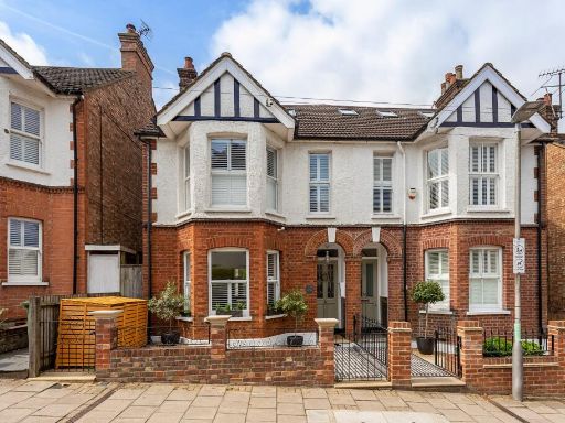 5 bedroom semi-detached house for sale in Carlisle Avenue, St. Albans, Hertfordshire, AL3 — £1,300,000 • 5 bed • 3 bath • 1666 ft²
 5 bedroom semi-detached house for sale in Ellis Fields, St. Albans, Hertfordshire, AL3 — £1,400,000 • 5 bed • 5 bath • 2982 ft²
Meta
- {
"@context": "https://schema.org",
"@type": "Residence",
"name": "4 bedroom detached house for sale in Churchill Road, St. Al…",
"description": "",
"url": "https://propertypiper.co.uk/property/c2d7f2b0-eb3a-455f-807f-d3ac4bb58b66",
"image": "https://image-a.propertypiper.co.uk/39105411-e9ac-4b26-ba4b-28071804ed9f-1024.jpeg",
"address": {
"@type": "PostalAddress",
"streetAddress": "21 CHURCHILL ROAD ST. ALBANS ",
"postalCode": "AL1 4HH",
"addressLocality": "St Albans",
"addressRegion": "St Albans",
"addressCountry": "England"
},
"geo": {
"@type": "GeoCoordinates",
"latitude": 51.7578759,
"longitude": -0.3166927
},
"numberOfRooms": 4,
"numberOfBathroomsTotal": 2,
"floorSize": {
"@type": "QuantitativeValue",
"value": 2146,
"unitCode": "FTK"
},
"offers": {
"@type": "Offer",
"price": 1800000,
"priceCurrency": "GBP",
"availability": "https://schema.org/InStock"
},
"additionalProperty": [
{
"@type": "PropertyValue",
"name": "Feature",
"value": "modern house"
},
{
"@type": "PropertyValue",
"name": "Feature",
"value": "detached"
},
{
"@type": "PropertyValue",
"name": "Feature",
"value": "brick exterior"
},
{
"@type": "PropertyValue",
"name": "Feature",
"value": "garage"
},
{
"@type": "PropertyValue",
"name": "Feature",
"value": "driveway"
},
{
"@type": "PropertyValue",
"name": "Feature",
"value": "garden"
},
{
"@type": "PropertyValue",
"name": "Feature",
"value": "well-maintained"
},
{
"@type": "PropertyValue",
"name": "Feature",
"value": "two-story"
},
{
"@type": "PropertyValue",
"name": "Feature",
"value": "suburban"
},
{
"@type": "PropertyValue",
"name": "Feature",
"value": "residential"
},
{
"@type": "PropertyValue",
"name": "Feature",
"value": "modern"
},
{
"@type": "PropertyValue",
"name": "Feature",
"value": "open-plan"
},
{
"@type": "PropertyValue",
"name": "Feature",
"value": "kitchen"
},
{
"@type": "PropertyValue",
"name": "Feature",
"value": "living area"
},
{
"@type": "PropertyValue",
"name": "Feature",
"value": "French doors"
},
{
"@type": "PropertyValue",
"name": "Feature",
"value": "natural light"
},
{
"@type": "PropertyValue",
"name": "Feature",
"value": "garden view"
},
{
"@type": "PropertyValue",
"name": "Feature",
"value": "island counter"
}
]
}
High Res Floorplan Images
Compatible Floorplan Images
FloorplanImages Thumbnail