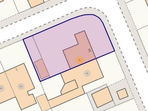
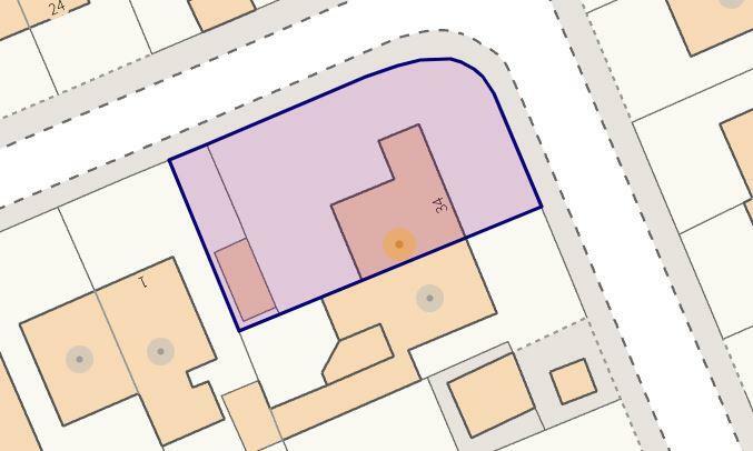
WF2 6NS - 2 bedroom semidetached bungalow for sale in Thornhill Drive…
View on Property Piper
2 bedroom semi-detached bungalow for sale in Thornhill Drive, Walton, Wakefield, WF2
Property Details
- Price: £200000
- Bedrooms: 2
- Bathrooms: 1
- Property Type: undefined
- Property SubType: undefined
Brochure Descriptions
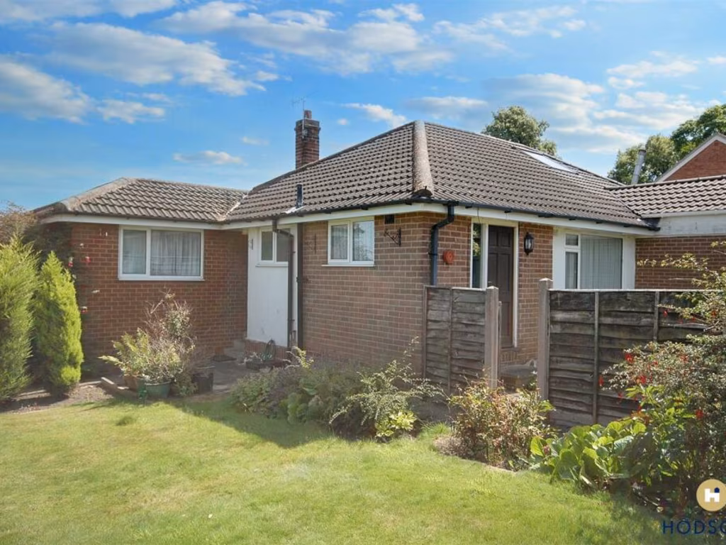
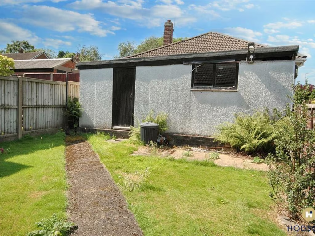
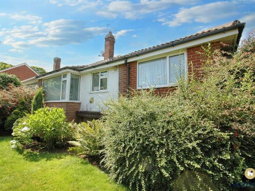
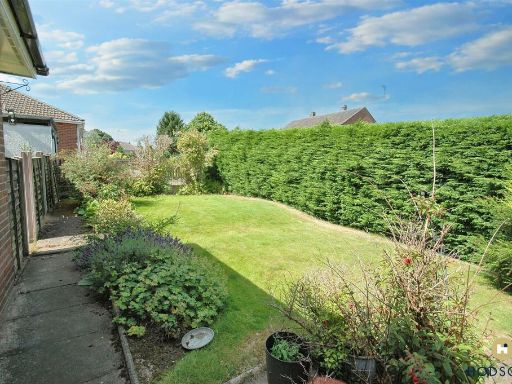
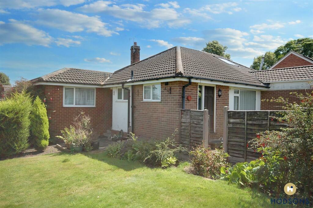
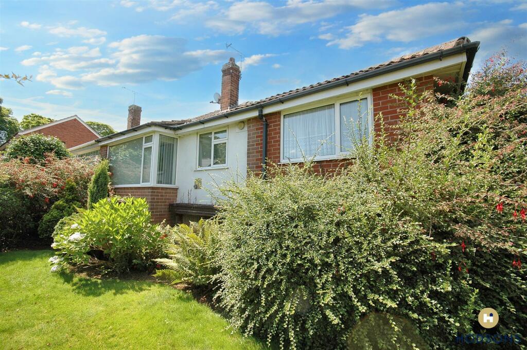
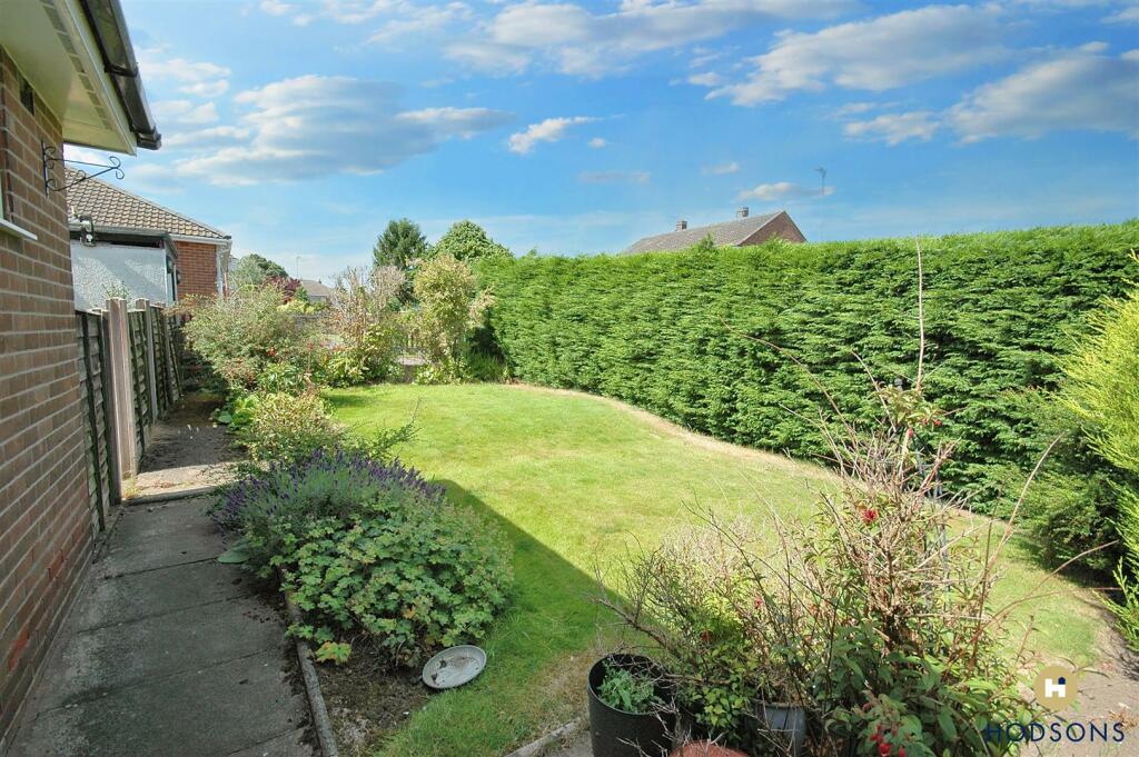
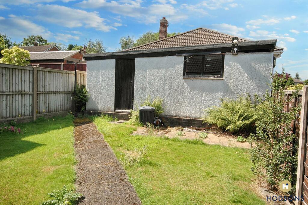
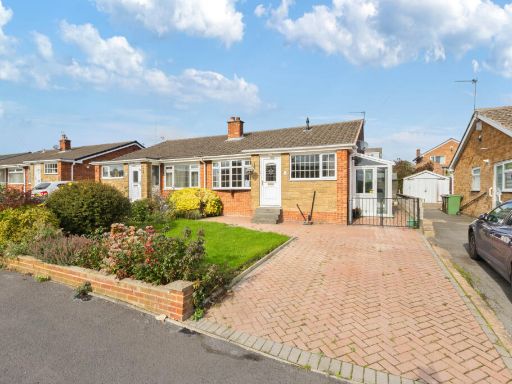
- The property is a single-story bungalow featuring a brick exterior with a sloped, tiled roof. It is set on a plot with mature shrubs and a small garden area in front, providing a verdant setting. The size of the garden can be described as average. The overall structure is compact, making it suitable for individuals or small families seeking a cozy home in a peaceful residential area.
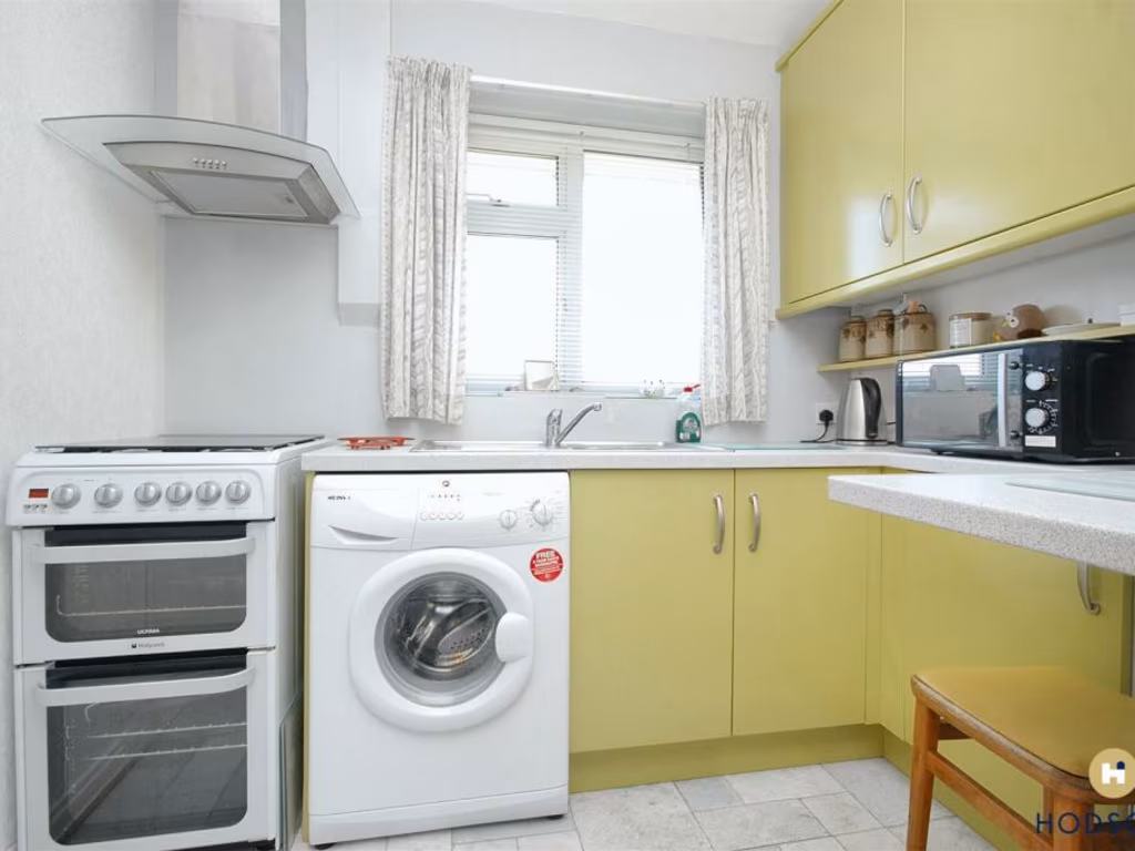
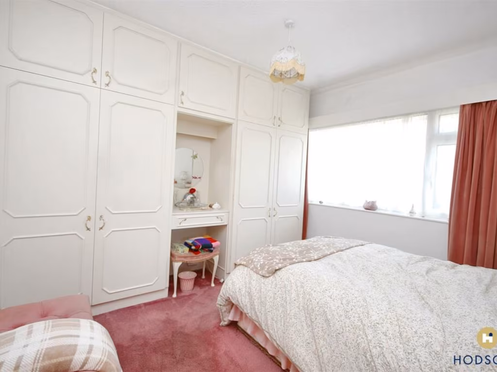
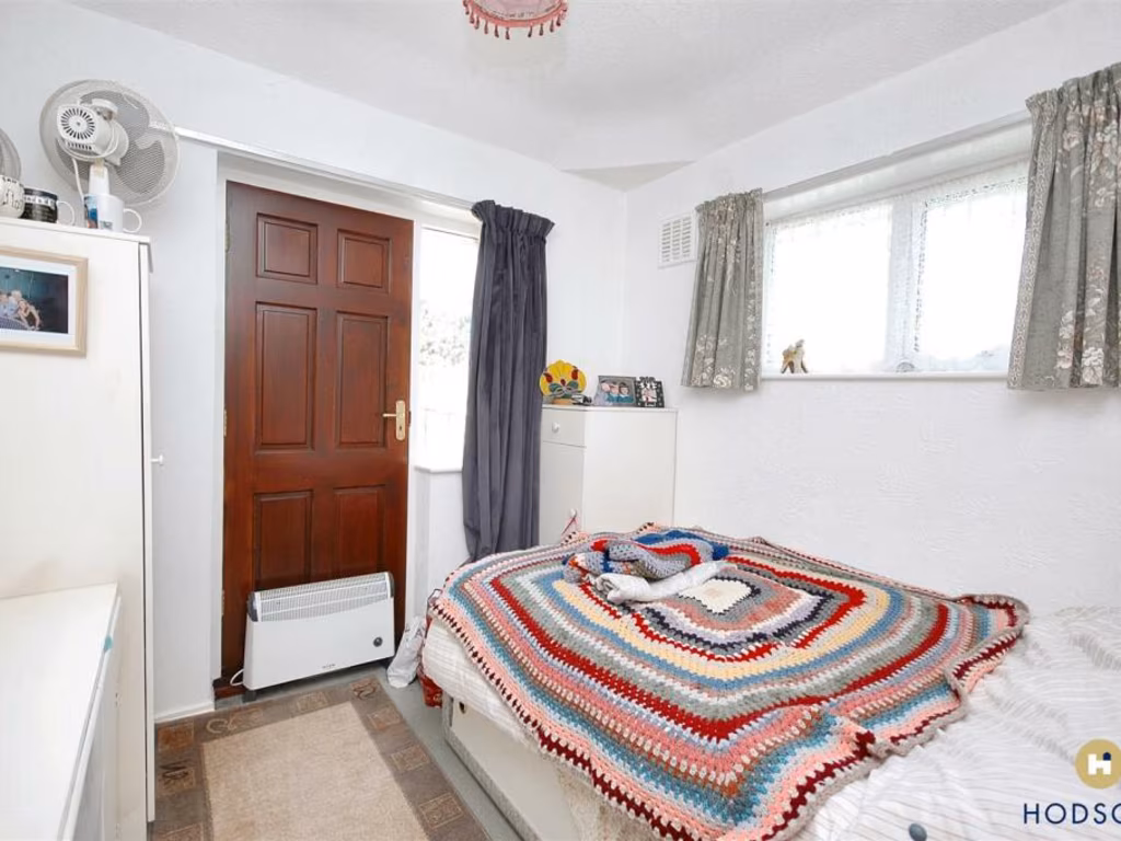
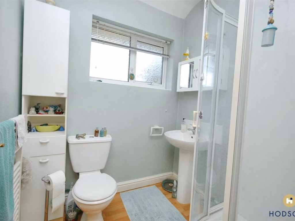
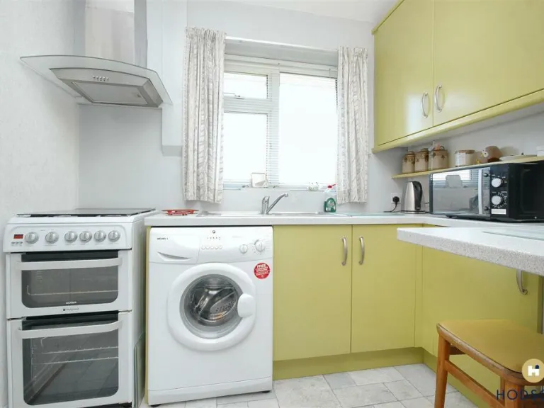
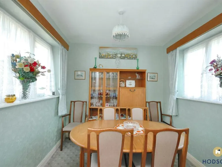
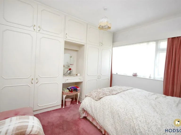
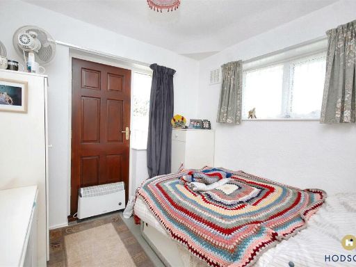
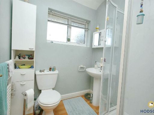
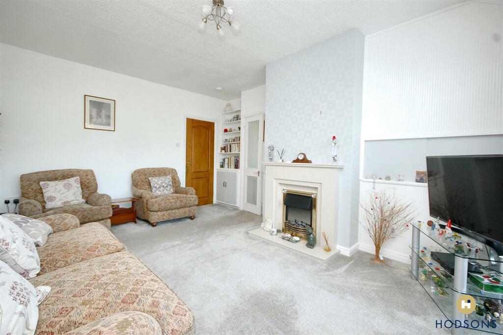
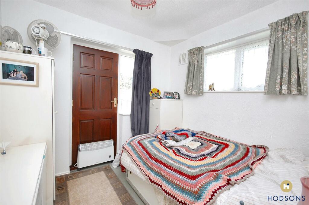
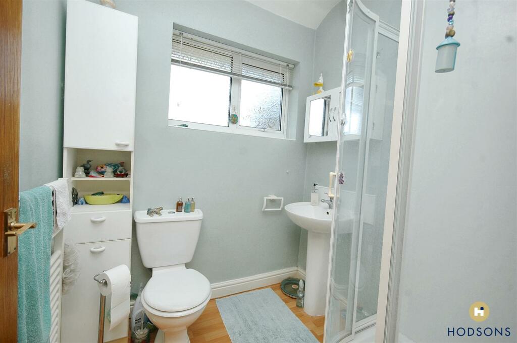
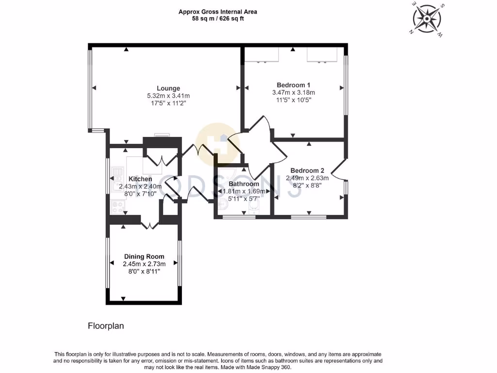
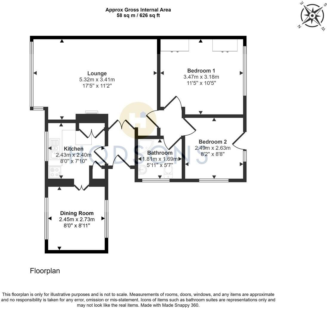
- The property consists of a lounge, two bedrooms, a kitchen, a dining room, and a bathroom. It has an approximate internal area of 58 square meters (626 square feet). The rooms are of average size, and the floor plan suggests efficient use of space. No additional information about the garden or external views is provided.
Image Descriptions
- detached bungalow Mid-20th Century
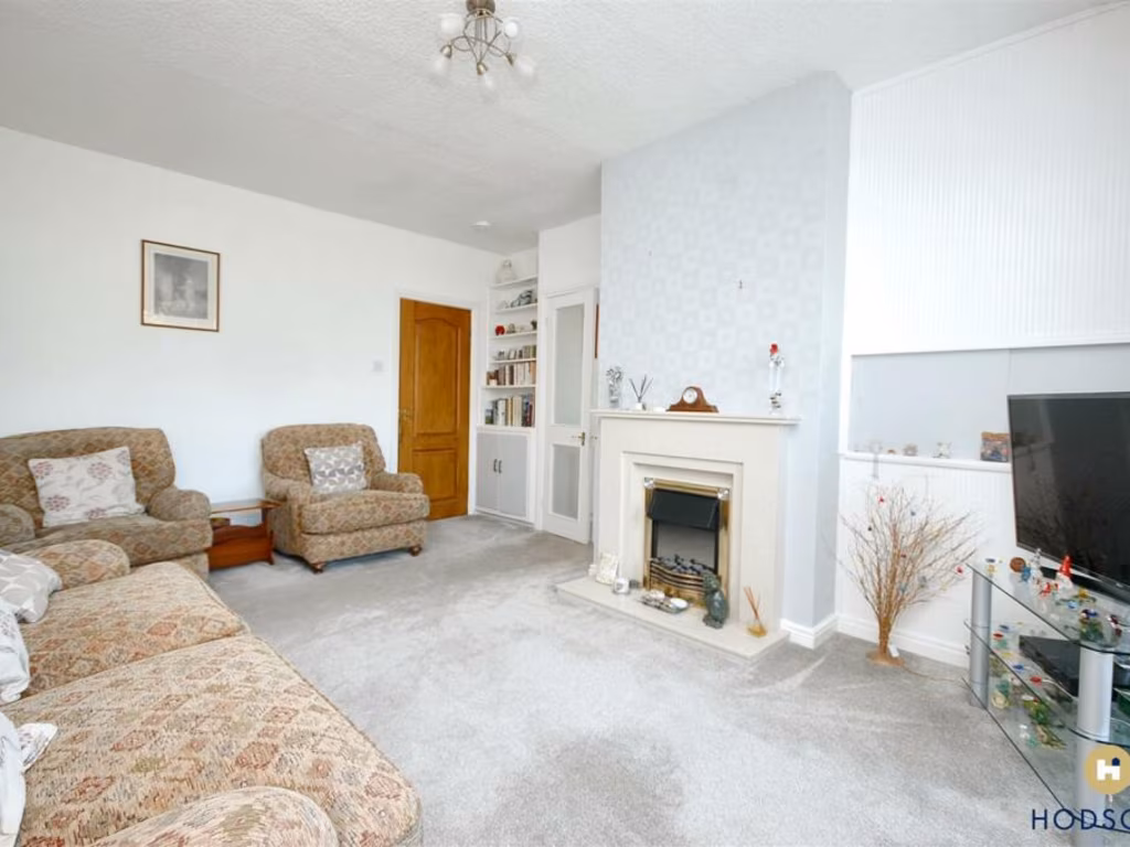
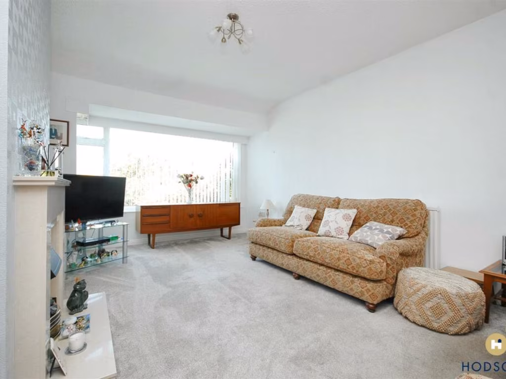
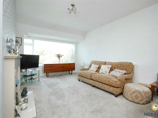
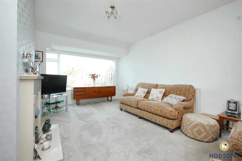
- living room mid-20th century
- single-story brick house mid-20th century bungalow
Floorplan Description
- A single-story layout with a lounge, dining room, kitchen, two bedrooms, and a bathroom.
Rooms
- Lounge: Large
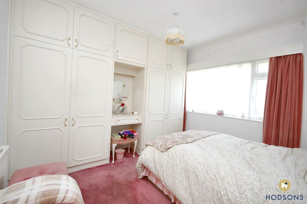
- Bedroom 1: Average
- Bedroom 2: Small
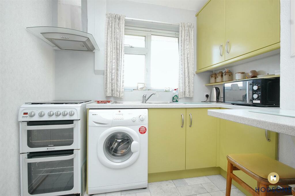
- Kitchen: Small
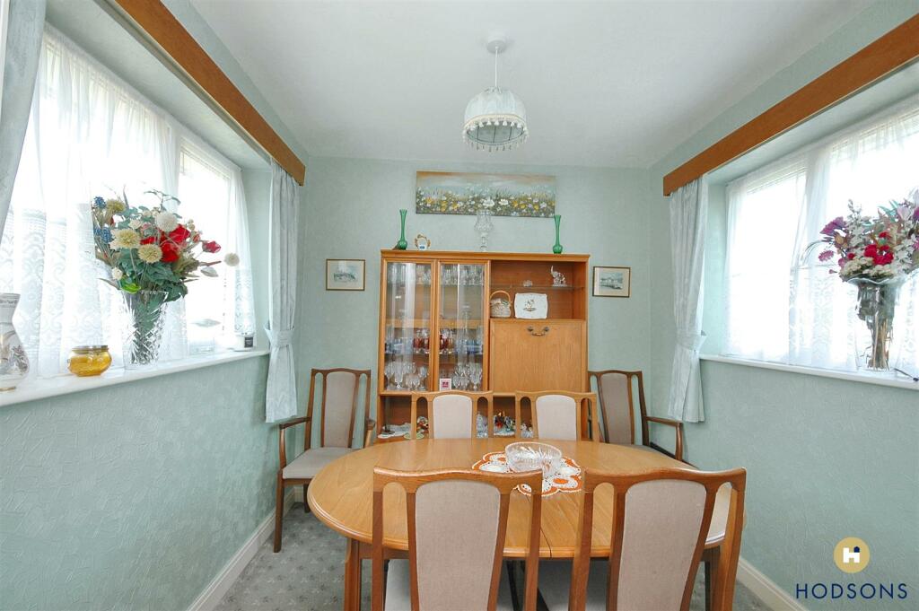
- Dining Room: Average
- Bathroom: Small
Textual Property Features
- Has Garden
- Chain Free
- Success
Detected Visual Features
- detached
- bungalow
- mid-20th century
- brick exterior
- pitched roof
- well-maintained
- garden
- residential
- single-story
- living room
- neutral colors
- fireplace
- built-in shelving
- carpet
- standard ceiling
- chimney
EPC Details
- Fully double glazed
- Cavity wall, filled cavity
- Boiler and radiators, mains gas
- Low energy lighting in 29% of fixed outlets
- Suspended, no insulation (assumed)
Nearby Schools
- Meadstead Primary Academy
- Shay Lane Primary (J and I) School
- Sandal Magna Community Academy
- Outwood Primary Academy Greenhill
- Outwood Primary Academy Park Hill
- St Austin's Catholic Primary School
- Outwood Academy City Fields
- Wakefield Girls' High School
- Wakefield Grammar Pre-Preparatory School
- Royston St John Baptist CE Primary
- Sandal Castle VA Community Primary School
- Crofton Academy
- Wakefield Lawefield Primary School
- Summerfields Primary Academy
- Ryhill Junior, Infant and Nursery School
- Walton Primary Academy
- Crofton Infant School
- Crofton Junior School
- St Thomas à Becket Catholic Secondary School, A Voluntary Academy
- Methodist Voluntary Controlled Junior, Infant and Nursery School: With Communication Resource
- Wakefield Pinders Primary (JIN) School
- Parkside Primary Academy
- Kettlethorpe High School
- Wakefield St Marys Church of England Voluntary Aided Primary School
- Hendal Primary School
- Trinity Academy Cathedral
- Queen Elizabeth Grammar School
Nearest General Shops
- Id: 543253401
- Tags:
- Addr:
- City: Wakefield
- Housenumber: 59
- Postcode: WF2 6NJ
- Street: Oakenshaw Lane
- Building: yes
- Name: Walton Herbs
- Phone: +44 1924 255666
- Shop: herbs
- Website: http://waltonherbs.co.uk/
- TagsNormalized:
- Lat: 53.657013
- Lon: -1.4670626
- FullGeoHash: gcwcnxgwybny
- PartitionGeoHash: gcwc
- Images:
- FoodStandards: null
- Distance: 994.3
,- Id: 220562160
- Tags:
- Addr:
- City: Wakefield
- Housenumber: 111
- Postcode: WF2 6LN
- Street: Shay Lane
- Alt_name: Vision
- Building: yes
- Name: Creative Edge
- Phone: +44 1924 259000
- Shop: hairdresser
- TagsNormalized:
- Lat: 53.650396
- Lon: -1.4583641
- FullGeoHash: gcwcnyf01wsy
- PartitionGeoHash: gcwc
- Images:
- FoodStandards: null
- Distance: 665.3
,- Id: 543125281
- Tags:
- Addr:
- City: Wakefield
- Housenumber: 19
- Postcode: WF2 6PQ
- Street: School Lane
- Building: yes
- Name: En Route Hair & Beauty
- Phone: +44 1924 249996
- Shop: hairdresser
- Website: https://enroute.uk.com
- TagsNormalized:
- Lat: 53.6513915
- Lon: -1.4682813
- FullGeoHash: gcwcnwfy4860
- PartitionGeoHash: gcwc
- Images:
- FoodStandards: null
- Distance: 370.6
}
Nearest Grocery shops
- Id: 359644946
- Tags:
- Addr:
- City: Wakefield
- Housenumber: 85
- Postcode: WF1 5AB
- Street: Agbrigg Road
- Building: terrace
- Fhrs:
- Name: Sandal Convenience Store
- Old_name: McColl's
- Shop: convenience
- Source: survey
- TagsNormalized:
- Lat: 53.665163
- Lon: -1.4811773
- FullGeoHash: gcwcq33qnp6n
- PartitionGeoHash: gcwc
- Images:
- FoodStandards: null
- Distance: 2097.9
,- Id: 436720673
- Tags:
- Brand: Londis
- Brand:wikidata: Q21008564
- Brand:wikipedia: en:Londis (United Kingdom)
- Building: yes
- Name: Londis
- Shop: convenience
- TagsNormalized:
- Lat: 53.6502589
- Lon: -1.491541
- FullGeoHash: gcwcnn9zkt4k
- PartitionGeoHash: gcwc
- Images:
- FoodStandards: null
- Distance: 1591.9
,- Id: 199741163
- Tags:
- Addr:
- City: Wakefield
- Housenumber: 9-13
- Postcode: WF2 6LG
- Street: Cherry Tree Drive
- Building: retail
- Fhrs:
- Name: CTS Local
- Old_name: Andys
- Shop: convenience
- Source: OS_OpenData_StreetView
- TagsNormalized:
- Lat: 53.6499032
- Lon: -1.4598309
- FullGeoHash: gcwcny8vr6z4
- PartitionGeoHash: gcwc
- Images:
- FoodStandards:
- Id: 313209
- FHRSID: 313209
- LocalAuthorityBusinessID: PI/000014690
- BusinessName: CTS Local
- BusinessType: Retailers - other
- BusinessTypeID: 4613
- AddressLine1: 9-13 Cherry Tree Drive
- AddressLine2: Walton
- AddressLine3: Wakefield
- AddressLine4: null
- PostCode: WF2 6LG
- RatingValue: 5
- RatingKey: fhrs_5_en-GB
- RatingDate: 2018-03-26
- LocalAuthorityCode: 432
- LocalAuthorityName: Wakefield
- LocalAuthorityWebSite: http://www.wakefield.gov.uk
- LocalAuthorityEmailAddress: food@wakefield.gov.uk
- Scores:
- Hygiene: 0
- Structural: 0
- ConfidenceInManagement: 0
- NewRatingPending: false
- Geocode:
- Longitude: -1.45965900000000
- Latitude: 53.65001000000000
- Distance: 555.1
}
Nearest Religious buildings
- Id: 435492782
- Tags:
- Addr:
- City: Wakefield
- Postcode: WF2 6EJ
- Amenity: place_of_worship
- Building: church
- Denomination: anglican
- Name: Saint Helens
- Religion: christian
- Wikidata: Q17550203
- TagsNormalized:
- place of worship
- church
- anglican
- christian
- Lat: 53.6593653
- Lon: -1.4817745
- FullGeoHash: gcwcq23h2nsy
- PartitionGeoHash: gcwc
- Images:
- FoodStandards: null
- Distance: 1561.8
,- Id: 543125303
- Tags:
- Addr:
- City: Wakefield
- Postcode: WF2 6LA
- Street: Shay Lane
- Amenity: place_of_worship
- Building: yes
- Denomination: methodist
- Name: Walton Methodist Church
- Religion: christian
- TagsNormalized:
- place of worship
- methodist
- church
- christian
- Lat: 53.6494096
- Lon: -1.4632699
- FullGeoHash: gcwcnww6rqff
- PartitionGeoHash: gcwc
- Images:
- FoodStandards: null
- Distance: 325.6
,- Id: 542799340
- Tags:
- Addr:
- City: Wakefield
- Postcode: WF2 6JU
- Street: The Balk
- Amenity: place_of_worship
- Building: yes
- Denomination: anglican
- Name: St Pauls
- Phone: +44 1924 259966
- Religion: christian
- Wikidata: Q105104183
- TagsNormalized:
- place of worship
- anglican
- christian
- church
- Lat: 53.6476332
- Lon: -1.4652999
- FullGeoHash: gcwcnwm0059j
- PartitionGeoHash: gcwc
- Images:
- FoodStandards: null
- Distance: 163.9
}
Nearest Medical buildings
- Id: 6634337614
- Tags:
- Addr:
- City: Wakefield
- Housename: ASDA
- Postcode: WF2 7EQ
- Street: Asdale Road
- Amenity: pharmacy
- Brand: Asda
- Brand:wikidata: Q297410
- Brand:wikipedia: en:Asda
- Contact:
- Phone: +44 1924 241810
- Website: https://storelocator.asda.com/yorkshire-&-humber/wakefield/asdale-road/pharmacy
- Healthcare: pharmacy
- Name: Asda
- Operator: Asda Stores Ltd
- TagsNormalized:
- pharmacy
- asda
- health
- healthcare
- Lat: 53.6497446
- Lon: -1.5010044
- FullGeoHash: gcwcjyeh2j3b
- PartitionGeoHash: gcwc
- Images:
- FoodStandards: null
- Distance: 2204.8
,- Id: 197846067
- Tags:
- Addr:
- City: Wakefield
- Postcode: WF2 7JE
- Amenity: pharmacy
- Brand: Rowlands Pharmacy
- Brand:wikidata: Q62663235
- Building: yes
- Dispensing: yes
- Healthcare: pharmacy
- Name: Rowlands Pharmacy
- TagsNormalized:
- pharmacy
- rowlands pharmacy
- health
- healthcare
- Lat: 53.6491079
- Lon: -1.4976065
- FullGeoHash: gcwcjyt2xnxd
- PartitionGeoHash: gcwc
- Images:
- FoodStandards: null
- Distance: 1976.4
,- Id: 4728997794
- Tags:
- Amenity: dentist
- Healthcare: dentist
- Name: Sandal Dentalcare
- Phone: +44 1924 256008
- TagsNormalized:
- dentist
- health
- healthcare
- dental
- Lat: 53.6489819
- Lon: -1.4969708
- FullGeoHash: gcwcjymzyp1d
- PartitionGeoHash: gcwc
- Images:
- FoodStandards: null
- Distance: 1933.8
,- Id: 4727640981
- Tags:
- Amenity: dentist
- Healthcare: dentist
- Name: Advance Dental Care
- TagsNormalized:
- dentist
- health
- healthcare
- dental
- Lat: 53.6533406
- Lon: -1.4883437
- FullGeoHash: gcwcnpk1r5de
- PartitionGeoHash: gcwc
- Images:
- FoodStandards: null
- Distance: 1482.8
}
Nearest Airports
- Id: 11519546
- Tags:
- Addr:
- City: Leeds
- Postcode: LS19 7TU
- Aerodrome: international
- Aerodrome:type: public
- Aeroway: aerodrome
- Iata: LBA
- Icao: EGNM
- Name: Leeds Bradford Airport
- Operator: Leeds Bradford Airport Limited
- Operator:type: private
- Ref: LBA
- Type: multipolygon
- Website: https://www.leedsbradfordairport.co.uk/
- Wikidata: Q8699
- Wikipedia: en:Leeds Bradford Airport
- TagsNormalized:
- airport
- international airport
- Lat: 53.8667047
- Lon: -1.660138
- FullGeoHash: gcwf6nph7cx3
- PartitionGeoHash: gcwf
- Images:
- Q8699-1
- Q8699-2
- Q8699-3
- Q8699-4
- FoodStandards: null
- Distance: 27405.7
}
Nearest Leisure Facilities
- Id: 7197838710
- Tags:
- Leisure: picnic_table
- Name: Walton Parish Council seat 33
- TagsNormalized:
- picnic
- picnic table
- leisure
- parish
- Lat: 53.6506871
- Lon: -1.4672082
- FullGeoHash: gcwcnwg9gsfq
- PartitionGeoHash: gcwc
- Images:
- FoodStandards: null
- Distance: 291.7
,- Id: 7197800301
- Tags:
- Leisure: picnic_table
- Name: Walton Parish Council seat 32
- TagsNormalized:
- picnic
- picnic table
- leisure
- parish
- Lat: 53.650686
- Lon: -1.467601
- FullGeoHash: gcwcnwg3fkv2
- PartitionGeoHash: gcwc
- Images:
- FoodStandards: null
- Distance: 290
,- Id: 499908028
- Tags:
- TagsNormalized:
- Lat: 53.6506226
- Lon: -1.4673823
- FullGeoHash: gcwcnwg3x8bm
- PartitionGeoHash: gcwc
- Images:
- FoodStandards: null
- Distance: 283.6
,- Id: 443260488
- Tags:
- Leisure: pitch
- Sport: soccer
- TagsNormalized:
- Lat: 53.6502888
- Lon: -1.4682556
- FullGeoHash: gcwcnwdze4tq
- PartitionGeoHash: gcwc
- Images:
- FoodStandards: null
- Distance: 248.8
,- Id: 24752886
- Tags:
- Leisure: pitch
- Sport: tennis
- Surface: sand
- TagsNormalized:
- Lat: 53.6501872
- Lon: -1.4670842
- FullGeoHash: gcwcnwewyry8
- PartitionGeoHash: gcwc
- Images:
- FoodStandards: null
- Distance: 237.7
}
Nearest Tourist attractions
- Id: 475765787
- Tags:
- Name: Heath Common Travelers Site
- Tourism: caravan_site
- TagsNormalized:
- common
- heath
- caravan
- tourism
- Lat: 53.6704726
- Lon: -1.469546
- FullGeoHash: gcwcqd3vjj5p
- PartitionGeoHash: gcwc
- Images:
- FoodStandards: null
- Distance: 2493.2
,- Id: 331191
- Tags:
- Name: Newmillerdam
- Tourism: country_park
- TagsNormalized:
- Lat: 53.6355
- Lon: -1.49562
- FullGeoHash: gcwcjuncmtbu
- PartitionGeoHash: gcwc
- Images:
- FoodStandards: null
- Distance: 2313.1
,- Id: 179039554
- Tags:
- Building: yes
- Name: Redbeck Motel
- Tourism: motel
- TagsNormalized:
- Lat: 53.6645663
- Lon: -1.4476555
- FullGeoHash: gcwcr13fg0jz
- PartitionGeoHash: gcwc
- Images:
- FoodStandards: null
- Distance: 2258.5
}
Nearest Train stations
- Id: 258134259
- Tags:
- Public_transport: station
- Railway: station
- Usage: tourism
- TagsNormalized:
- Lat: 53.6763613
- Lon: -1.5121653
- FullGeoHash: gcwcme6z7yzz
- PartitionGeoHash: gcwc
- Images:
- FoodStandards: null
- Distance: 4299.5
,- Id: 5356649224
- Tags:
- Addr:
- City: Wakefield
- Postcode: WF1 4EL
- Street: Monk Street
- Name: Wakefield Kirkgate
- Naptan:
- Network: National Rail
- Operator: National Rail
- Public_transport: station
- Railway: station
- Ref:
- Wikidata: Q2279070
- Wikipedia: en:Wakefield Kirkgate railway station
- TagsNormalized:
- Lat: 53.6786558
- Lon: -1.4886398
- FullGeoHash: gcwcq5uhb4tw
- PartitionGeoHash: gcwc
- Images:
- FoodStandards: null
- Distance: 3670.1
,- Id: 3784334159
- Tags:
- Name: Pugneys Lakeside
- Operator: Pugneys Light Railway
- Public_transport: station
- Railway: station
- Usage: tourism
- Wheelchair: yes
- TagsNormalized:
- Lat: 53.6564954
- Lon: -1.5116661
- FullGeoHash: gcwcjxg5xxsn
- PartitionGeoHash: gcwc
- Images:
- FoodStandards: null
- Distance: 3046.8
,- Id: 3784334157
- Tags:
- Name: Pugneys Central
- Operator: Pugneys Light Railway
- Public_transport: station
- Railway: station
- Usage: tourism
- Wheelchair: no
- TagsNormalized:
- Lat: 53.6536471
- Lon: -1.5091855
- FullGeoHash: gcwcjxm51ktx
- PartitionGeoHash: gcwc
- Images:
- FoodStandards: null
- Distance: 2805.3
,- Id: 415732
- Tags:
- Name: Sandal and Agbrigg
- Naptan:
- Network: National Rail
- Public_transport: station
- Railway: station
- Ref:
- Wikidata: Q2018294
- Wikipedia: en:Sandal and Agbrigg railway station
- TagsNormalized:
- Lat: 53.6628109
- Lon: -1.480623
- FullGeoHash: gcwcq31bdbzr
- PartitionGeoHash: gcwc
- Images:
- FoodStandards: null
- Distance: 1847.3
}
Nearest Hotels
- Id: 442752956
- Tags:
- Addr:
- City: Wakefield
- Housenumber: 833
- Postcode: WF2 6QG
- Street: Barnsley Road
- Building: hotel
- Fhrs:
- Name: Hotel St Pierre
- Operator: Best Western
- Tourism: hotel
- TagsNormalized:
- Lat: 53.6347135
- Lon: -1.5029104
- FullGeoHash: gcwcjgcsgekb
- PartitionGeoHash: gcwc
- Images:
- FoodStandards: null
- Distance: 2757.7
,- Id: 176017380
- Tags:
- Addr:
- City: Wakefield
- Housename: Walton Hall
- Postcode: WF2 6PW
- Street: The Balk
- Building: hotel
- Fhrs:
- Name: Waterton Park Hotel
- Tourism: hotel
- TagsNormalized:
- Lat: 53.6414937
- Lon: -1.4512515
- FullGeoHash: gcwcnvphr7hm
- PartitionGeoHash: gcwc
- Images:
- FoodStandards: null
- Distance: 1306.6
,- Id: 172048645
- Tags:
- Addr:
- City: Wakefield
- Postcode: WF2 6PW
- Street: The Balk
- Building: hotel
- Fhrs:
- Name: Waterton Park Hotel
- Source: Bing
- Tourism: hotel
- TagsNormalized:
- Lat: 53.642655
- Lon: -1.4506471
- FullGeoHash: gcwcnvrej7xj
- PartitionGeoHash: gcwc
- Images:
- FoodStandards: null
- Distance: 1273.8
}
Tags
- detached
- bungalow
- mid-20th century
- brick exterior
- pitched roof
- well-maintained
- garden
- residential
- single-story
- living room
- mid-20th century
- neutral colors
- fireplace
- built-in shelving
- carpet
- standard ceiling
- bungalow
- mid-20th century
- single-story
- brick exterior
- garden
- chimney
- residential
Local Market Stats
- Average Price/sqft: £223
- Avg Income: £43900
- Rental Yield: 3.8%
- Social Housing: 14%
- Planning Success Rate: 96%
Similar Properties
 2 bedroom bungalow for sale in Grampian Avenue, Wakefield, WF2 — £200,000 • 2 bed • 1 bath • 619 ft²
 2 bedroom bungalow for sale in Wrenthorpe Lane, Wrenthorpe, Wakefield, West Yorkshire, WF2 — £265,000 • 2 bed • 1 bath • 594 ft²
 2 bedroom semi-detached bungalow for sale in Woolgreaves Avenue, Wakefield, WF2 — £275,000 • 2 bed • 1 bath • 538 ft²
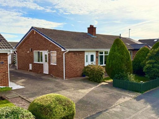 2 bedroom bungalow for sale in Coxley View, Netherton, Wakefield, West Yorkshire, WF4 — £260,000 • 2 bed • 1 bath • 630 ft²
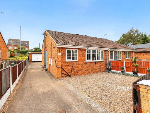 2 bedroom semi-detached bungalow for sale in Redland Crescent, Kinsley, WF9 — £175,000 • 2 bed • 1 bath • 781 ft²
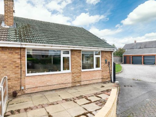 2 bedroom semi-detached bungalow for sale in Thornleigh Drive, Wakefield, WF2 — £285,000 • 2 bed • 1 bath • 581 ft²
Meta
- {
"@context": "https://schema.org",
"@type": "Residence",
"name": "2 bedroom semidetached bungalow for sale in Thornhill Drive…",
"description": "",
"url": "https://propertypiper.co.uk/property/bfe73fe4-07cd-41f9-a14e-f4f8535c2eb4",
"image": "https://image-a.propertypiper.co.uk/57e6d1d1-19be-48a2-9944-2cf051dc833a-1024.jpeg",
"address": {
"@type": "PostalAddress",
"streetAddress": "34 Thornhill Drive, Walton",
"postalCode": "WF2 6NS",
"addressLocality": "Wakefield",
"addressRegion": "Hemsworth",
"addressCountry": "England"
},
"geo": {
"@type": "GeoCoordinates",
"latitude": 53.64807789166098,
"longitude": -1.4676704013237964
},
"numberOfRooms": 2,
"numberOfBathroomsTotal": 1,
"floorSize": {
"@type": "QuantitativeValue",
"value": 626,
"unitCode": "FTK"
},
"offers": {
"@type": "Offer",
"price": 200000,
"priceCurrency": "GBP",
"availability": "https://schema.org/InStock"
},
"additionalProperty": [
{
"@type": "PropertyValue",
"name": "Feature",
"value": "detached"
},
{
"@type": "PropertyValue",
"name": "Feature",
"value": "bungalow"
},
{
"@type": "PropertyValue",
"name": "Feature",
"value": "mid-20th century"
},
{
"@type": "PropertyValue",
"name": "Feature",
"value": "brick exterior"
},
{
"@type": "PropertyValue",
"name": "Feature",
"value": "pitched roof"
},
{
"@type": "PropertyValue",
"name": "Feature",
"value": "well-maintained"
},
{
"@type": "PropertyValue",
"name": "Feature",
"value": "garden"
},
{
"@type": "PropertyValue",
"name": "Feature",
"value": "residential"
},
{
"@type": "PropertyValue",
"name": "Feature",
"value": "single-story"
},
{
"@type": "PropertyValue",
"name": "Feature",
"value": "living room"
},
{
"@type": "PropertyValue",
"name": "Feature",
"value": "mid-20th century"
},
{
"@type": "PropertyValue",
"name": "Feature",
"value": "neutral colors"
},
{
"@type": "PropertyValue",
"name": "Feature",
"value": "fireplace"
},
{
"@type": "PropertyValue",
"name": "Feature",
"value": "built-in shelving"
},
{
"@type": "PropertyValue",
"name": "Feature",
"value": "carpet"
},
{
"@type": "PropertyValue",
"name": "Feature",
"value": "standard ceiling"
},
{
"@type": "PropertyValue",
"name": "Feature",
"value": "bungalow"
},
{
"@type": "PropertyValue",
"name": "Feature",
"value": "mid-20th century"
},
{
"@type": "PropertyValue",
"name": "Feature",
"value": "single-story"
},
{
"@type": "PropertyValue",
"name": "Feature",
"value": "brick exterior"
},
{
"@type": "PropertyValue",
"name": "Feature",
"value": "garden"
},
{
"@type": "PropertyValue",
"name": "Feature",
"value": "chimney"
},
{
"@type": "PropertyValue",
"name": "Feature",
"value": "residential"
}
]
}
High Res Floorplan Images
Compatible Floorplan Images
FloorplanImages Thumbnail