WN5 8ED - 4 bedroom detached house for sale in Meadow Brook, Pemberto…
View on Property Piper
4 bedroom detached house for sale in Meadow Brook, Pemberton, Wigan, WN5
Property Details
- Price: £260000
- Bedrooms: 4
- Bathrooms: 2
- Property Type: undefined
- Property SubType: undefined
Image Descriptions
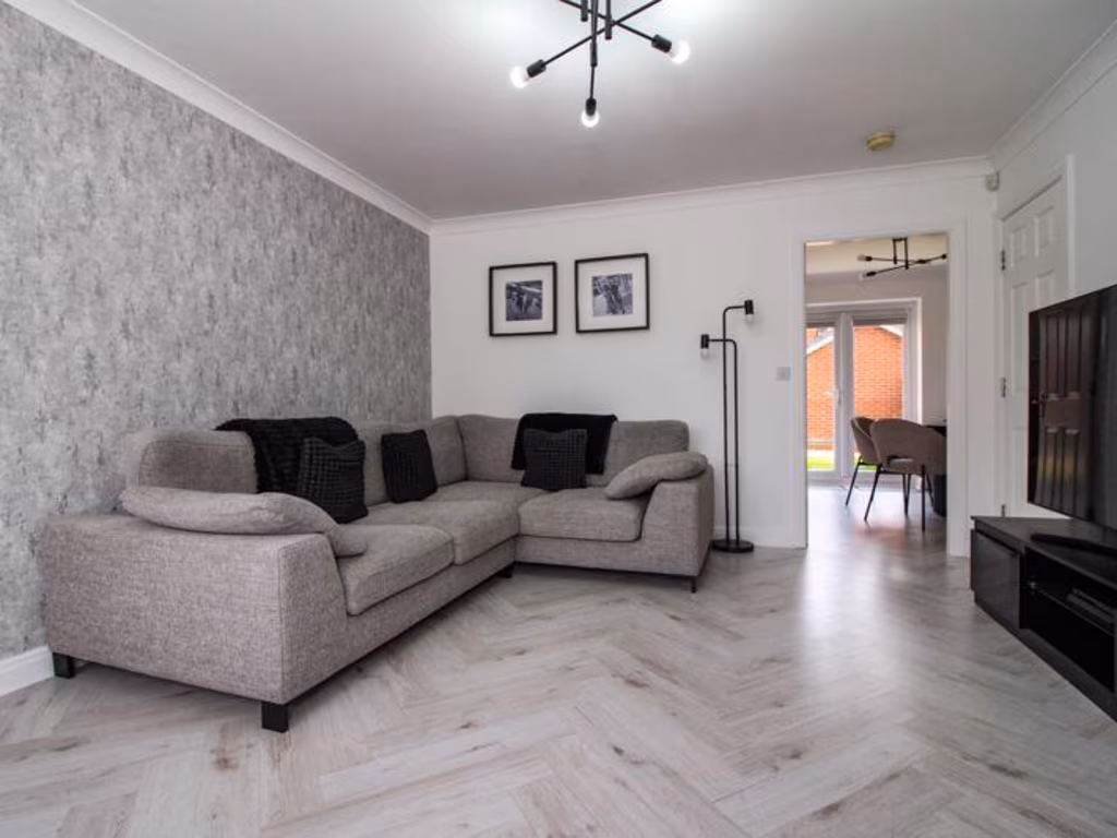
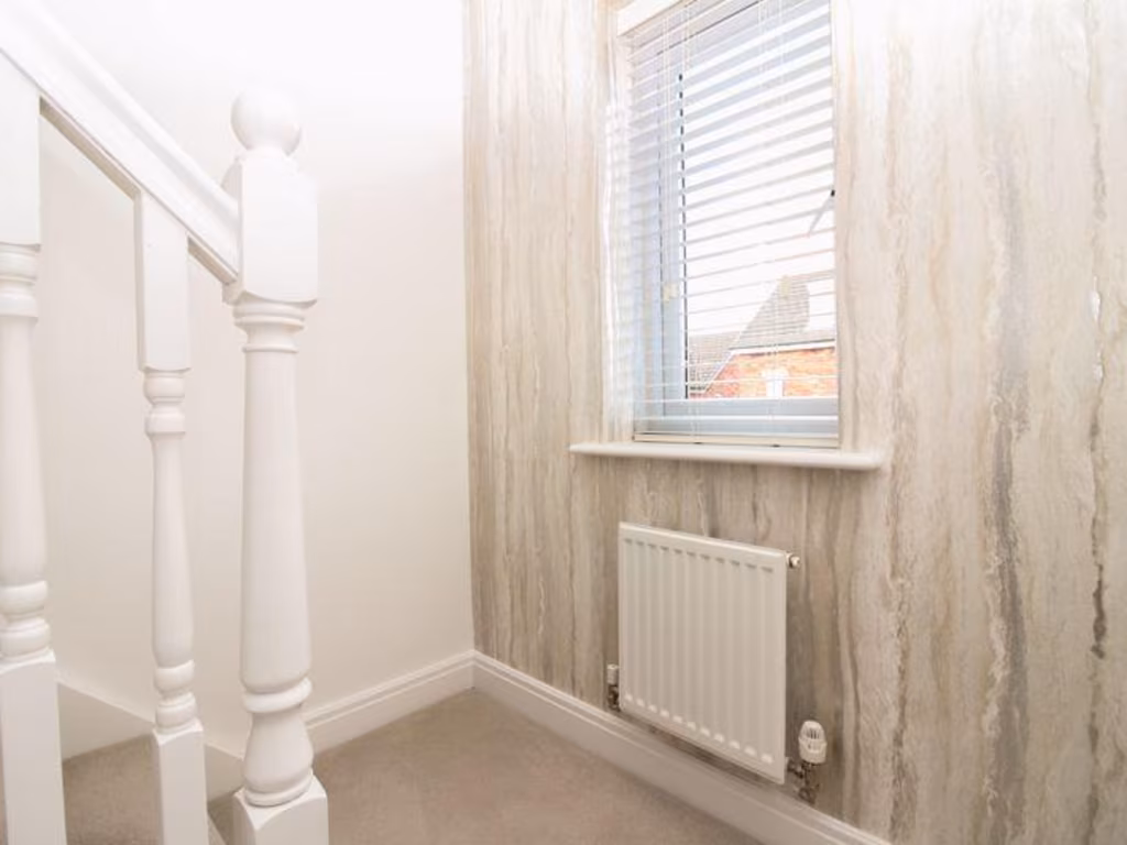
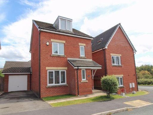
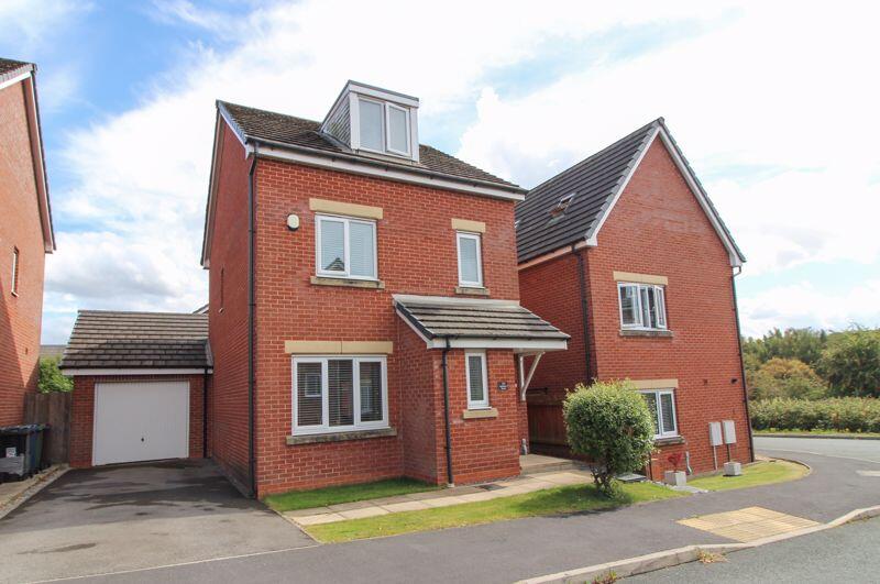
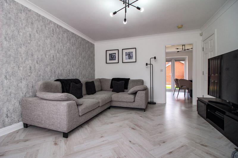
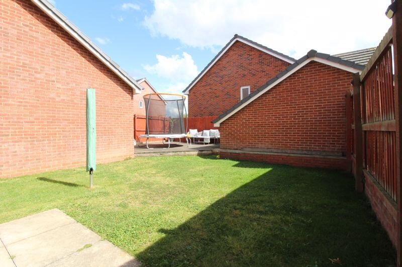
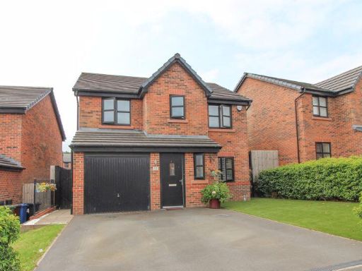
- detached house modern
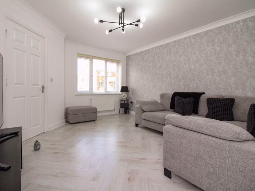
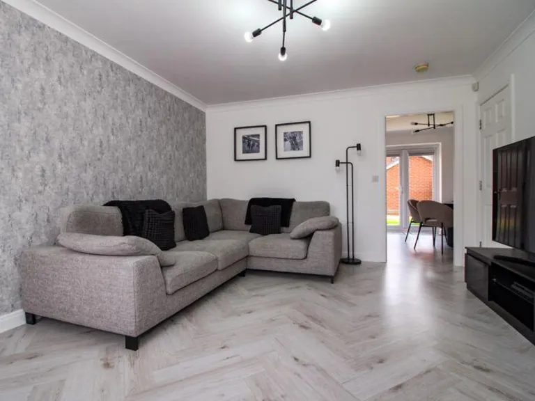
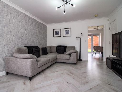
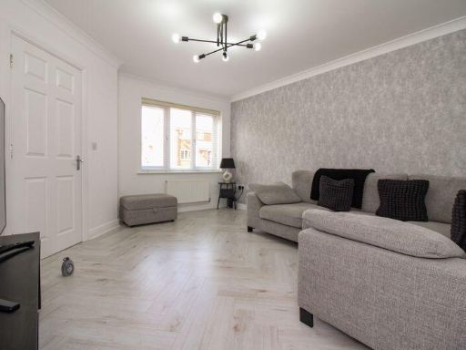
- living room modern
Floorplan Description
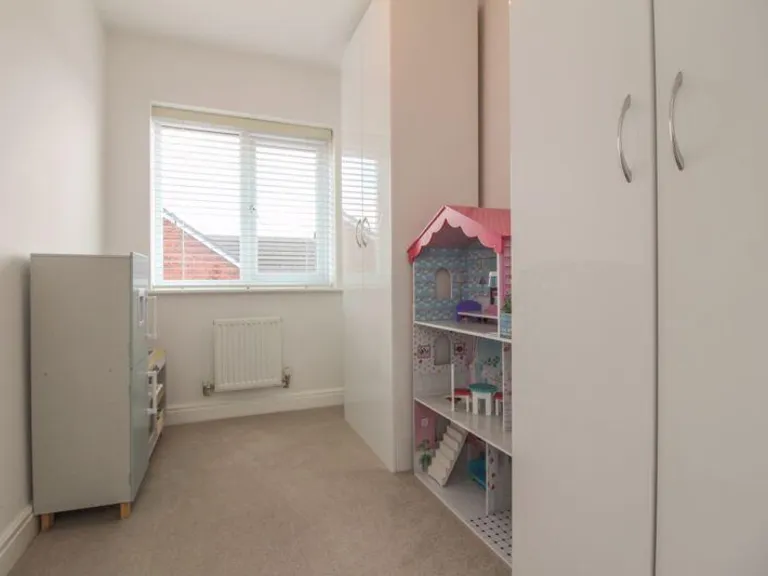
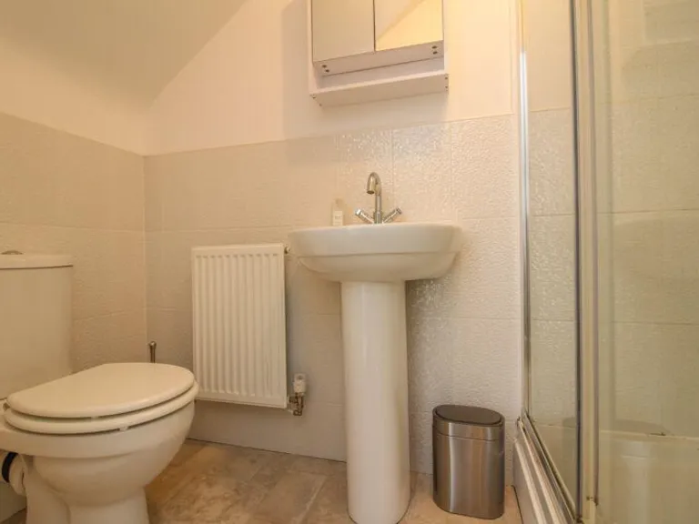
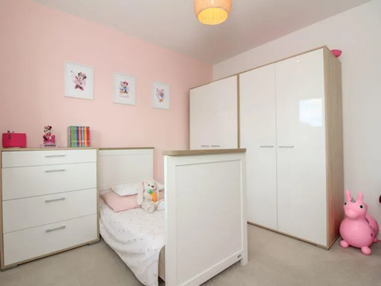
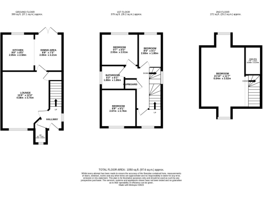
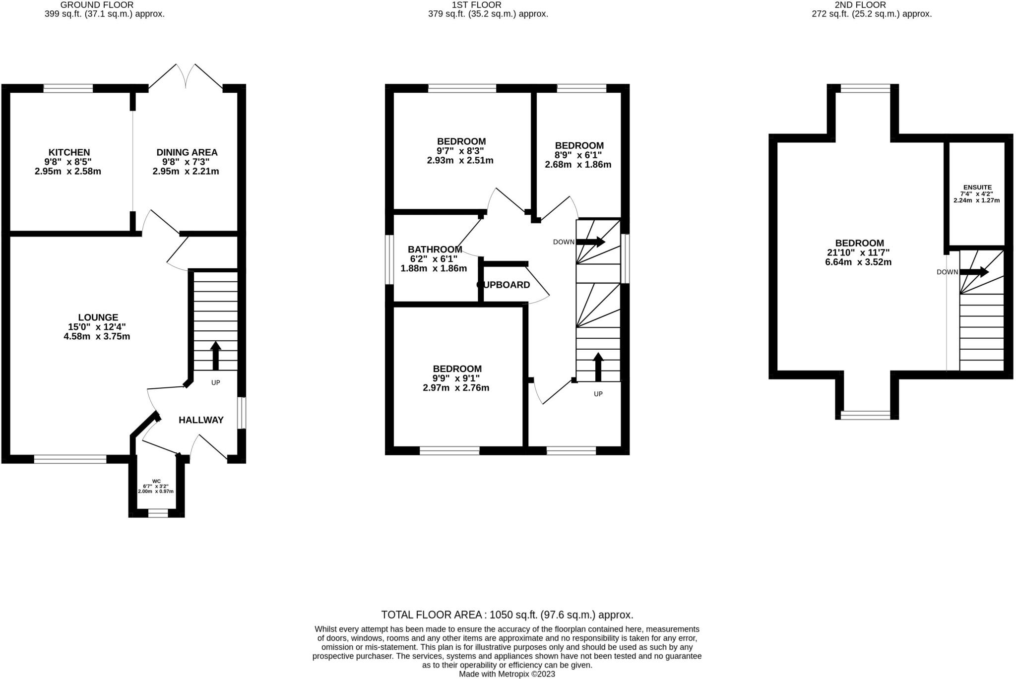
- Three-storey house with lounge, kitchen/dining on ground floor, three bedrooms and bathroom on first floor, large bedroom with ensuite on second floor
Rooms
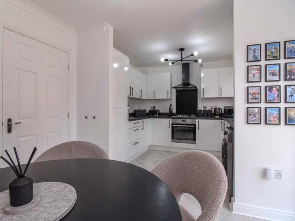
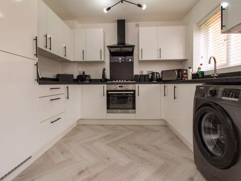
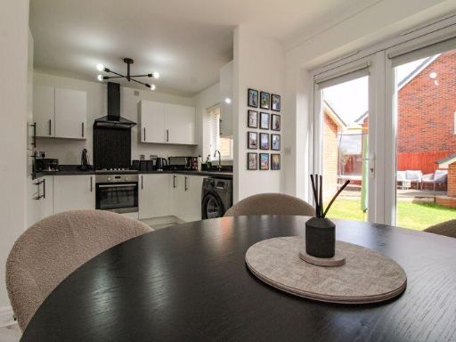
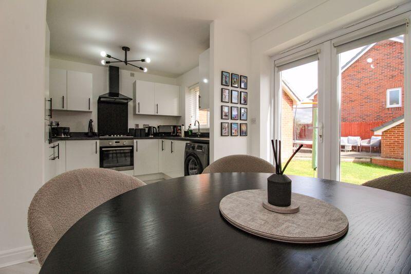
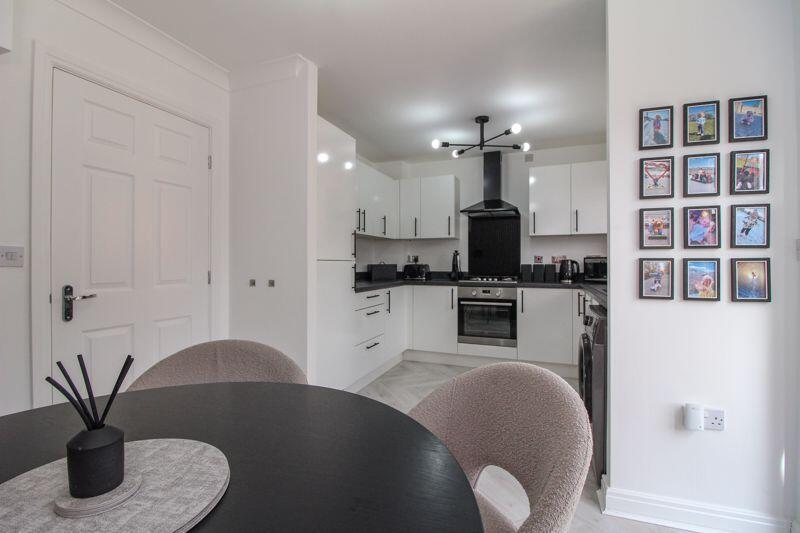
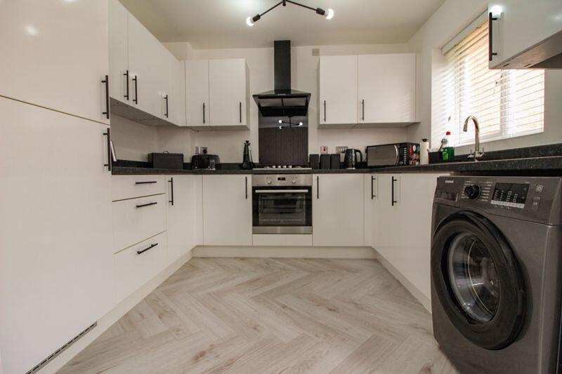
- KITCHEN:
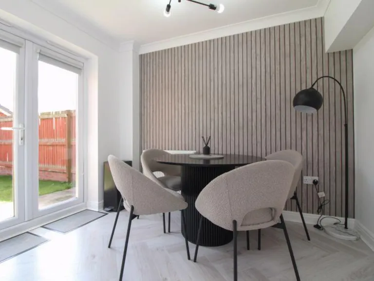
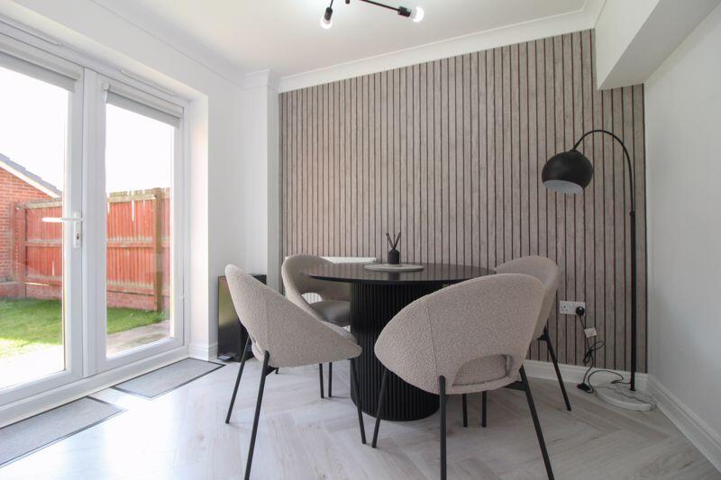
- DINING AREA:
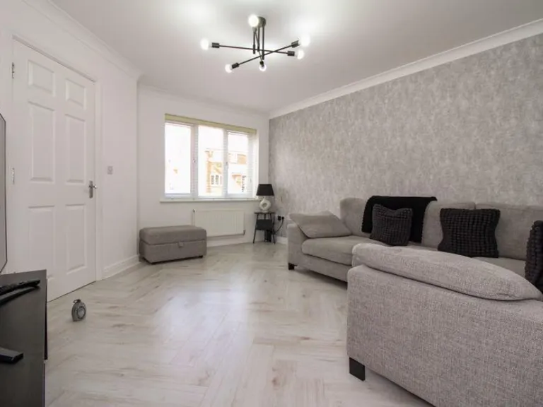
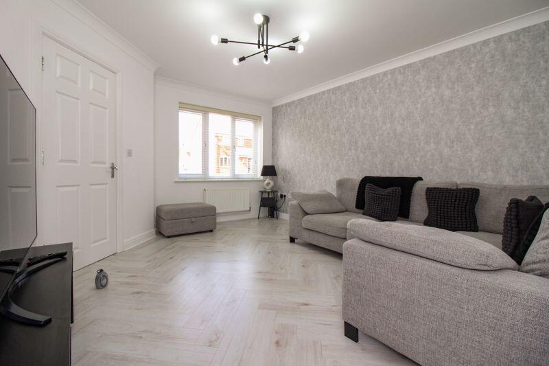
- LOUNGE:
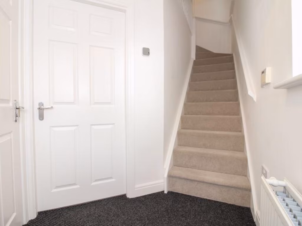
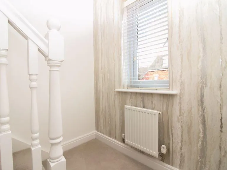
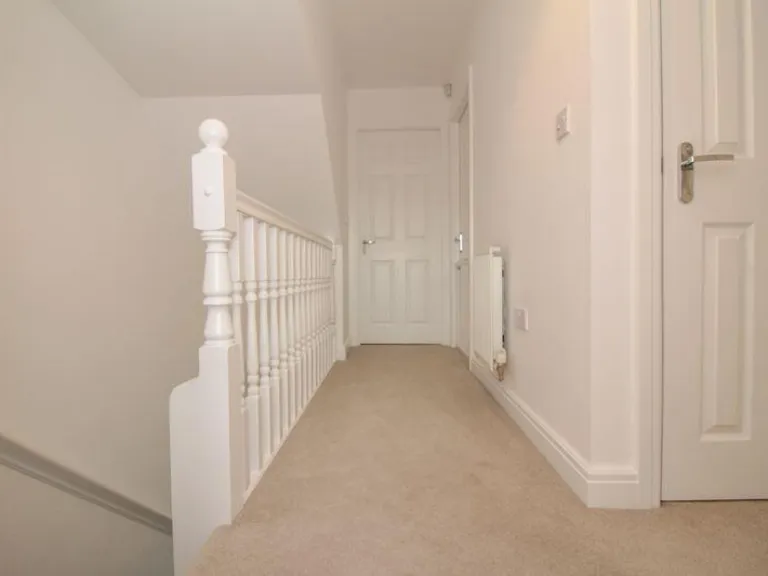
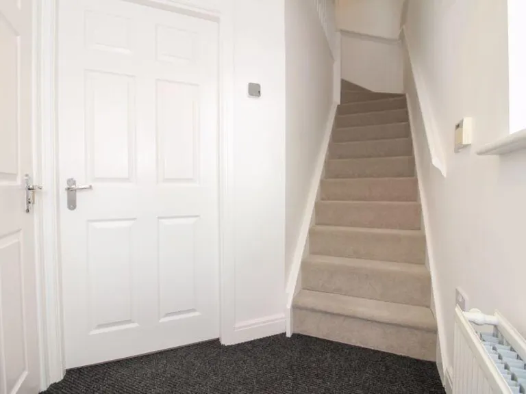
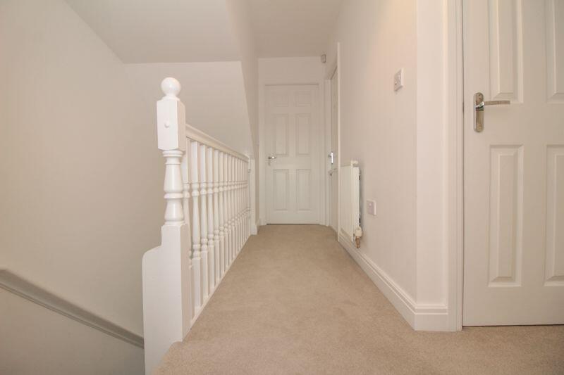
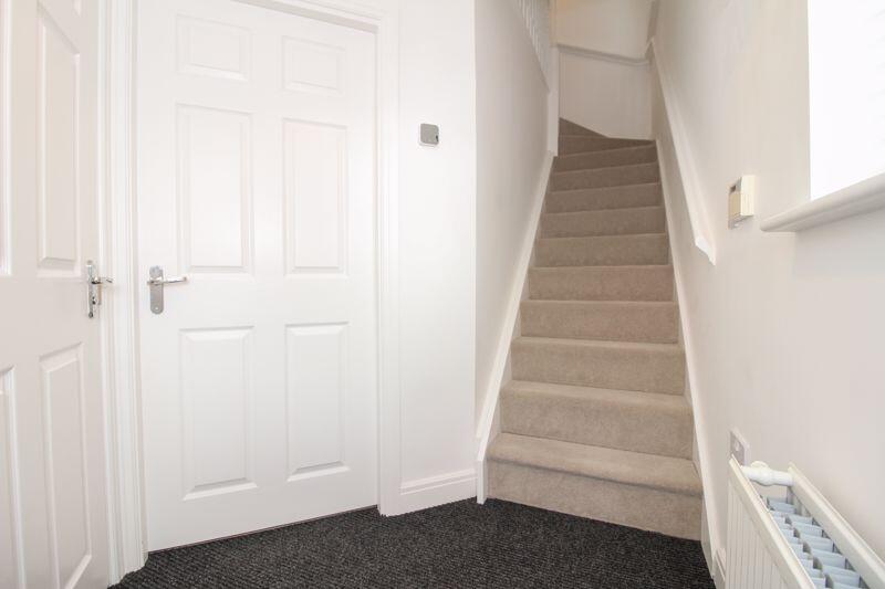
- HALLWAY:
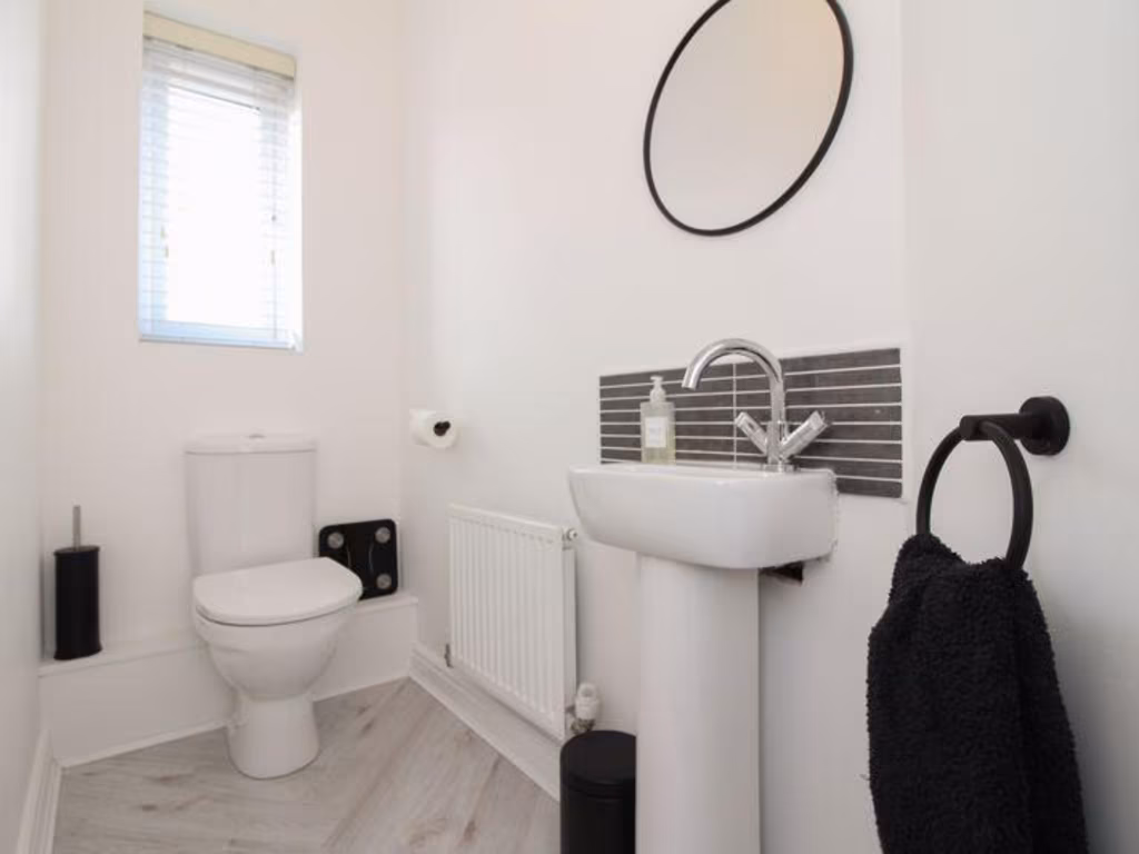
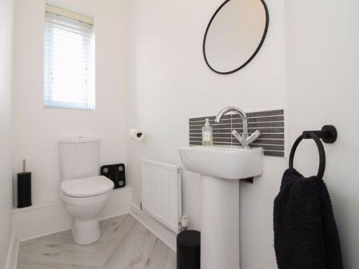
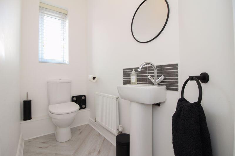
- W.C.:
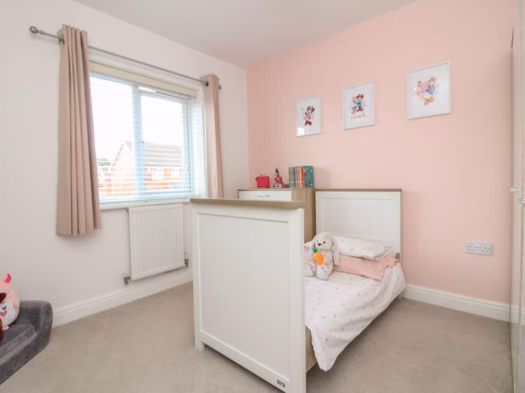
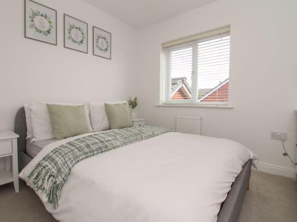
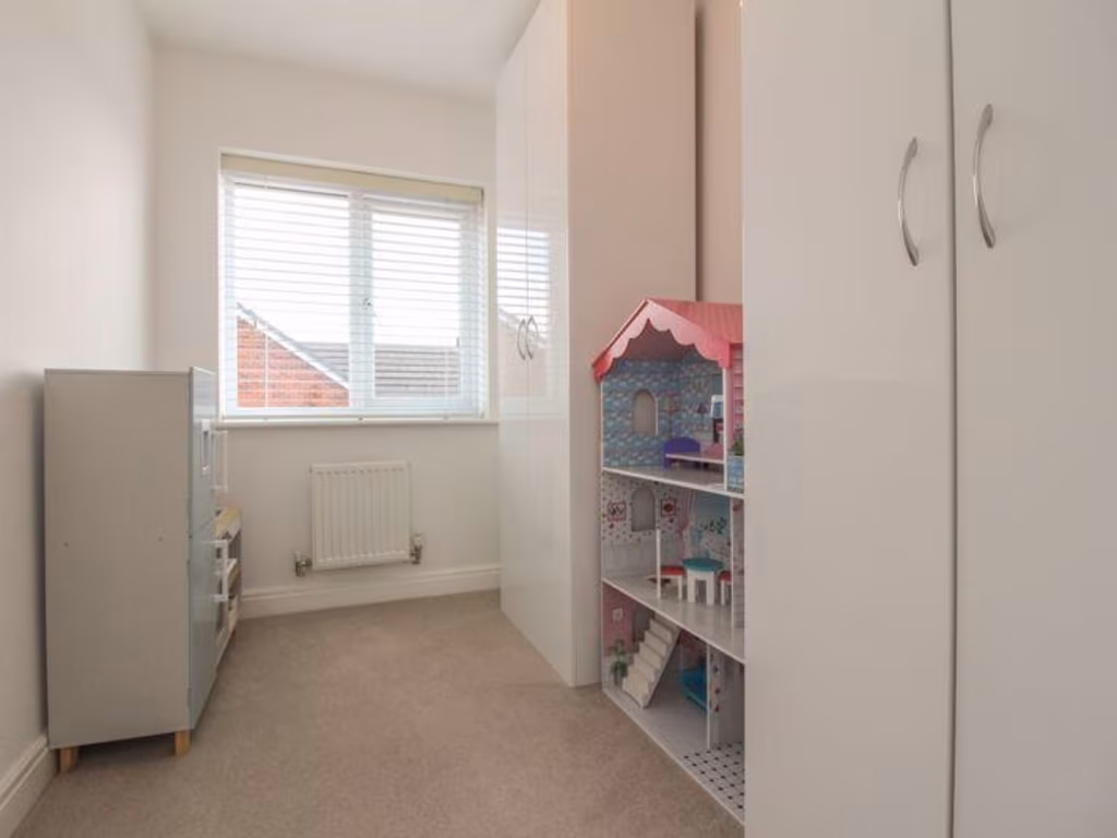
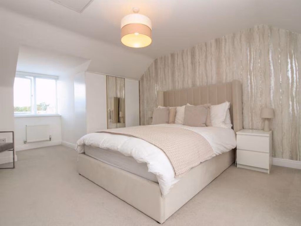
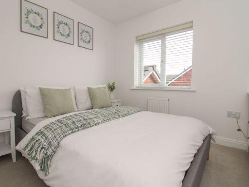
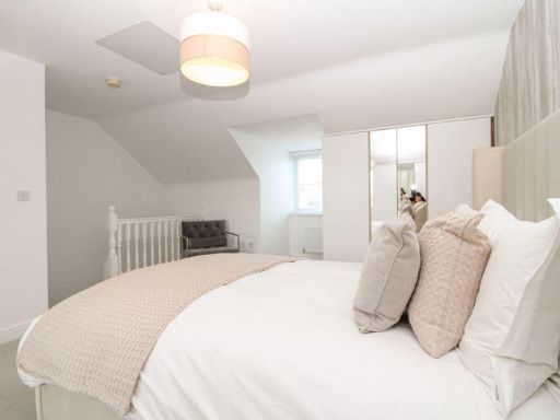
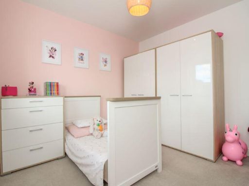
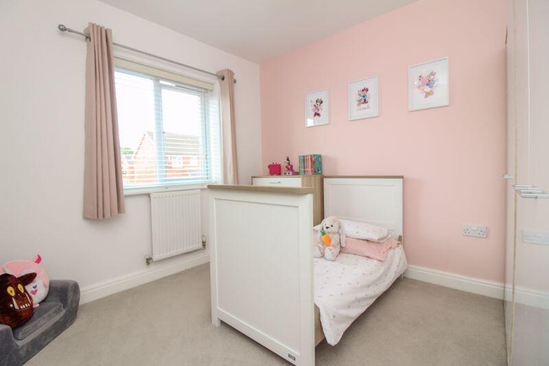
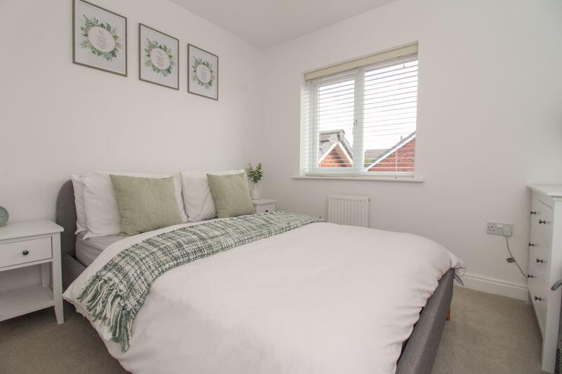
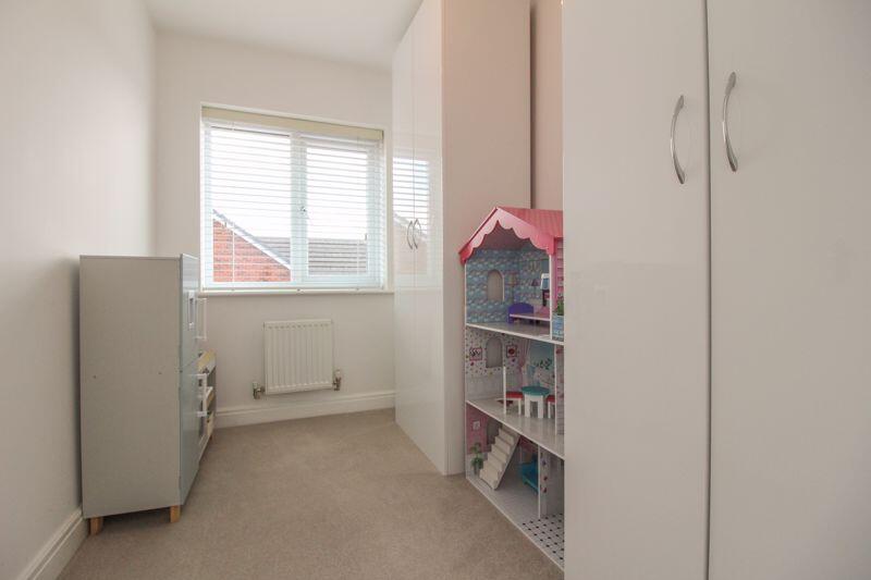
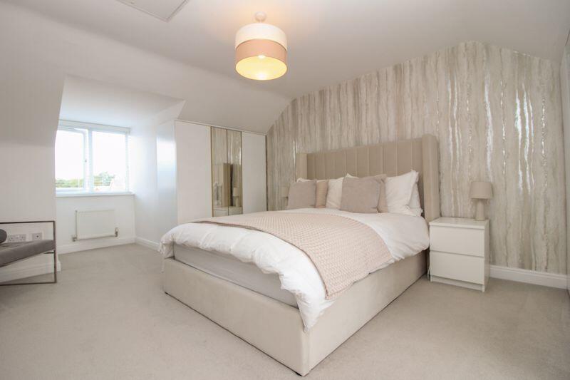
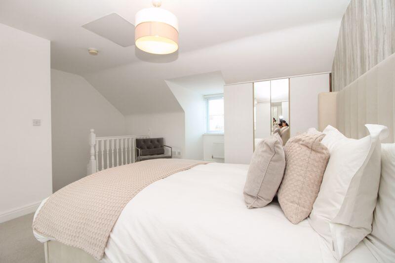
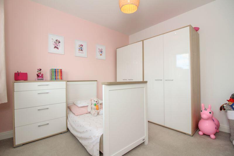
- BEDROOM:
- BEDROOM:
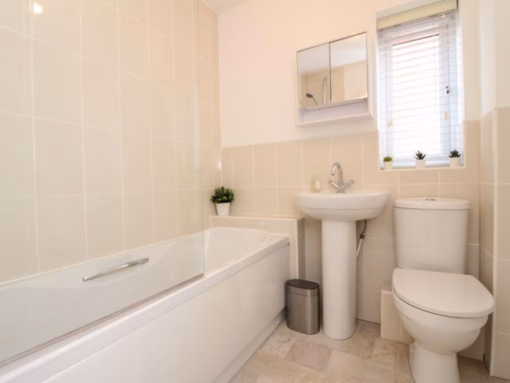
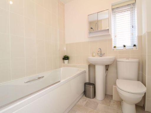
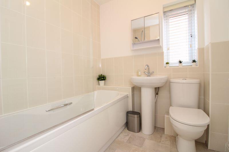
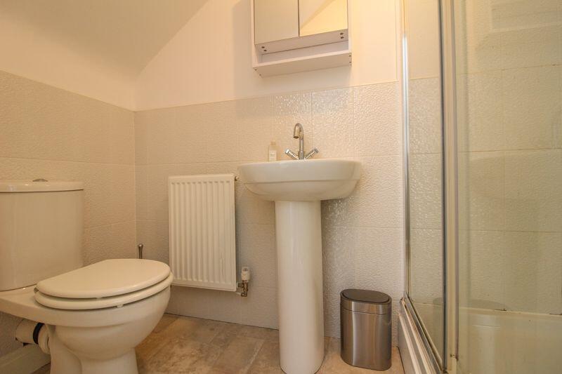
- BATHROOM:
- BEDROOM:
- UPBOARD:
- BEDROOM:
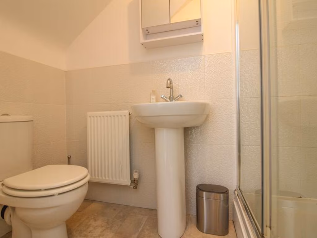
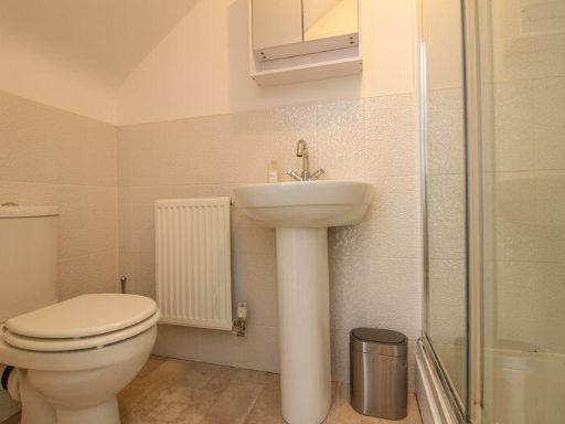
- ENSUITE:
Textual Property Features
Detected Visual Features
- detached house
- modern
- brick exterior
- three stories
- driveway
- garage
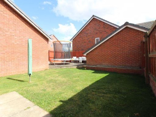
- garden
- suburban
- dormer window
- living room
- herringbone flooring
- wallpaper
- white walls
- standard ceiling
- bright
- clean
EPC Details
- Fully double glazed
- Cavity wall, as built, insulated (assumed)
- Boiler and radiators, mains gas
- Low energy lighting in 83% of fixed outlets
- Solid, insulated (assumed)
Nearby Schools
- Wigan Worsley Mesnes Community Primary School
- Highfield St Matthew's Church of England Primary School
- St Mark's CofE Primary School
- Orrell Lamberhead Green Academy
- Dean Trust Wigan
- St John Fisher Catholic High School
- St Bernadette's Catholic Primary School
- Marus Bridge Primary School
- St James' Catholic Primary School Orrell
- St John's CofE Primary School
- St Peter's Catholic High School
- Westfield Community School
- Standish Lower Ground St Anne's CofE Primary School
- Rectory CofE Primary School
- Winstanley Community Primary School
- St Aidan's Catholic Primary School, Wigan
- Orrell Newfold Community Primary School
- St James' Church of England Primary School
- St Cuthbert's Catholic Primary School Wigan
- Marsh Green Primary School
- St Paul's Church of England Primary School
- Up Holland High School
- St Jude's Catholic Primary School Wigan
- Orrell Holgate Academy
- Wigan St Andrew's CofE Junior and Infant School
- St Aidan's CofE Primary School Billinge
Nearest Bars And Restaurants
- Id: 9441105065
- Tags:
- Amenity: fast_food
- Name: Shalimar
- TagsNormalized:
- Lat: 53.5366977
- Lon: -2.6862007
- FullGeoHash: gcw0df5cygz9
- PartitionGeoHash: gcw0
- Images:
- FoodStandards: null
- Distance: 529.6
,- Id: 9441105066
- Tags:
- TagsNormalized:
- Lat: 53.5366782
- Lon: -2.6861011
- FullGeoHash: gcw0dfh1c21v
- PartitionGeoHash: gcw0
- Images:
- FoodStandards: null
- Distance: 527.4
,- Id: 1023802424
- Tags:
- Amenity: pub
- Building: yes
- Name: White Swan
- TagsNormalized:
- Lat: 53.5362684
- Lon: -2.6848203
- FullGeoHash: gcw0dcuzr5ub
- PartitionGeoHash: gcw0
- Images:
- FoodStandards: null
- Distance: 489.2
,- Id: 9441105231
- Tags:
- Amenity: restaurant
- Cuisine: italian
- Name: Mama Mia
- TagsNormalized:
- Lat: 53.5361892
- Lon: -2.6852297
- FullGeoHash: gcw0dcuwvt58
- PartitionGeoHash: gcw0
- Images:
- FoodStandards: null
- Distance: 476.5
,- Id: 5277609003
- Tags:
- Amenity: fast_food
- Name: The Lean Kitchen
- TagsNormalized:
- Lat: 53.5345078
- Lon: -2.6866373
- FullGeoHash: gcw0dcethgd4
- PartitionGeoHash: gcw0
- Images:
- FoodStandards: null
- Distance: 288.3
}
Nearest General Shops
- Id: 9441071346
- Tags:
- Name: Pemberton Mower Care
- Shop: doityourself
- TagsNormalized:
- Lat: 53.5358701
- Lon: -2.6850565
- FullGeoHash: gcw0dcuv19sb
- PartitionGeoHash: gcw0
- Images:
- FoodStandards: null
- Distance: 443
,- Id: 9441071345
- Tags:
- Name: Aubergine
- Shop: clothes
- TagsNormalized:
- Lat: 53.5358046
- Lon: -2.6850185
- FullGeoHash: gcw0dcuudt31
- PartitionGeoHash: gcw0
- Images:
- FoodStandards: null
- Distance: 436.2
,- Id: 1023902440
- Tags:
- Building: yes
- Name: Pemberton Tyres
- Shop: tyres
- TagsNormalized:
- Lat: 53.53537
- Lon: -2.6845844
- FullGeoHash: gcw0dcv4hskc
- PartitionGeoHash: gcw0
- Images:
- FoodStandards: null
- Distance: 394.9
}
Nearest Religious buildings
- Id: 564502923
- Tags:
- Amenity: place_of_worship
- Denomination: methodist
- Landuse: religious
- Name: Mount Zion Independant Methodist Church
- Religion: christian
- TagsNormalized:
- place of worship
- methodist
- religious
- church
- christian
- Lat: 53.5352401
- Lon: -2.6751978
- FullGeoHash: gcw0e1gcrk5f
- PartitionGeoHash: gcw0
- Images:
- FoodStandards: null
- Distance: 808.7
,- Id: 564502915
- Tags:
- Addr:
- City: Wigan
- Housenumber: 583
- Street: Ormskirk Road
- Amenity: place_of_worship
- Building: church
- Denomination: methodist
- Religion: christian
- TagsNormalized:
- place of worship
- church
- methodist
- christian
- Lat: 53.5351968
- Lon: -2.6752768
- FullGeoHash: gcw0e1gcjs10
- PartitionGeoHash: gcw0
- Images:
- FoodStandards: null
- Distance: 801.9
,- Id: 564872582
- Tags:
- Addr:
- Postcode: WN5 0DT
- Street: Church Street
- Amenity: place_of_worship
- Building: church
- Denomination: anglican
- Description: The church of St. John the Divine aswell as the boundary wall and gateways to the south and west are listed at Grade II
- Historic: heritage_building
- Listed_status: Grade II
- Name: St John the Divine
- Religion: christian
- Wikidata: Q7593759
- Wikipedia: en:St John the Divine's Church, Pemberton
- TagsNormalized:
- place of worship
- church
- anglican
- christian
- Lat: 53.5369578
- Lon: -2.6829264
- FullGeoHash: gcw0dfn77k30
- PartitionGeoHash: gcw0
- Images:
- FoodStandards: null
- Distance: 596.6
}
Nearest Medical buildings
- Id: 3284258340
- Tags:
- Amenity: pharmacy
- Brand: Well Pharmacy
- Brand:wikidata: Q7726524
- Dispensing: yes
- Healthcare: pharmacy
- Name: Well Pharmacy
- TagsNormalized:
- pharmacy
- well pharmacy
- health
- healthcare
- Lat: 53.5318822
- Lon: -2.7104956
- FullGeoHash: gcw0d34mbf5g
- PartitionGeoHash: gcw0
- Images:
- FoodStandards: null
- Distance: 1612.5
,- Id: 769182006
- Tags:
- Amenity: pharmacy
- Healthcare: pharmacy
- TagsNormalized:
- Lat: 53.521434
- Lon: -2.6699288
- FullGeoHash: gcw07prbfnkv
- PartitionGeoHash: gcw0
- Images:
- FoodStandards: null
- Distance: 1583
,- Id: 7761107702
- Tags:
- Amenity: pharmacy
- Brand: Cohens Chemist
- Brand:wikidata: Q107998495
- Dispensing: yes
- Healthcare: pharmacy
- Name: Cohens Chemist
- TagsNormalized:
- pharmacy
- chemist
- cohens chemist
- health
- healthcare
- Lat: 53.53973
- Lon: -2.7037852
- FullGeoHash: gcw0d6x5t1p9
- PartitionGeoHash: gcw0
- Images:
- FoodStandards: null
- Distance: 1455.2
,- Id: 564462920
- Tags:
- Addr:
- Amenity: doctors
- Building: yes
- Healthcare: doctor
- Name: Pemberton Surgery
- TagsNormalized:
- doctor
- doctors
- health
- healthcare
- surgery
- Lat: 53.5382404
- Lon: -2.6712136
- FullGeoHash: gcw0e4qfu5qg
- PartitionGeoHash: gcw0
- Images:
- FoodStandards: null
- Distance: 1208
}
Nearest Airports
- Id: 116737532
- Tags:
- Addr:
- City: Liverpool
- Country: GB
- Postcode: L24 1YD
- Street: Speke Hall Avenue
- Aerodrome: international
- Aerodrome:type: public
- Aeroway: aerodrome
- Iata: LPL
- Icao: EGGP
- Is_in: Liverpool,England,UK
- Name: Liverpool John Lennon Airport
- Old_name: Speke Airport
- Operator: Liverpool Airport plc
- Source: wikipedia
- Website: https://www.liverpoolairport.com/
- Wikidata: Q8727
- Wikipedia: en:Liverpool John Lennon Airport
- TagsNormalized:
- airport
- international airport
- Lat: 53.3357677
- Lon: -2.8518179
- FullGeoHash: gcmzrj7r7gdr
- PartitionGeoHash: gcmz
- Images:
- FoodStandards: null
- Distance: 24419.5
,- Id: 1224469
- Tags:
- Addr:
- City: Manchester
- Country: GB
- Postcode: M90 1QX
- Aerodrome: international
- Aeroway: aerodrome
- Arp: yes
- Atis: 128.175
- Iata: MAN
- Icao: EGCC
- Name: Manchester Airport
- Note: rough sketched outline referring to Yahoo imagery - true boundary is where?
- Old_name: Ringway
- Operator: Manchester Airport PLC
- Size: 18720000
- Source:
- Tower_frequency: 118.625,119.400
- Type: multipolygon
- Website: https://www.manchesterairport.co.uk/
- Wikidata: Q8694
- Wikipedia: en:Manchester Airport
- TagsNormalized:
- airport
- international airport
- Lat: 53.3503197
- Lon: -2.2798822
- FullGeoHash: gcqrs05u4ukt
- PartitionGeoHash: gcqr
- Images:
- FoodStandards: null
- Distance: 33640.7
}
Nearest Leisure Facilities
- Id: 728905959
- Tags:
- Leisure: pitch
- Name: Pemberton Cons Crown Green Bowls Club
- Sport: bowls
- TagsNormalized:
- pitch
- leisure
- bowls
- club
- sports
- Lat: 53.5358301
- Lon: -2.6860395
- FullGeoHash: gcw0dcuhfdpc
- PartitionGeoHash: gcw0
- Images:
- FoodStandards: null
- Distance: 433.1
,- Id: 566013249
- Tags:
- Leisure: pitch
- Sport: soccer
- Surface: grass
- TagsNormalized:
- Lat: 53.5346262
- Lon: -2.6888815
- FullGeoHash: gcw0dcdjb98s
- PartitionGeoHash: gcw0
- Images:
- FoodStandards: null
- Distance: 351.3
,- Id: 1023903764
- Tags:
- Fee: no
- Leisure: garden
- Name: Pemberton Memorial Garden
- Note: The garden was set out in 2006 on the site of a former Methodist Church Burial Ground. In November 2014 a chainsaw-carved sculpture of a WW1 soldier was added.
- TagsNormalized:
- Lat: 53.5346875
- Lon: -2.6853174
- FullGeoHash: gcw0dcsw5t44
- PartitionGeoHash: gcw0
- Images:
- FoodStandards: null
- Distance: 310.4
,- Id: 566013250
- Tags:
- Leisure: pitch
- Sport: soccer
- TagsNormalized:
- Lat: 53.5339428
- Lon: -2.6890472
- FullGeoHash: gcw0dc9cudjp
- PartitionGeoHash: gcw0
- Images:
- FoodStandards: null
- Distance: 296.4
,- Id: 9403054072
- Tags:
- Dance:
- Leisure: dance
- Name: Miss Sutcliffe's Dance Academy
- TagsNormalized:
- Lat: 53.5329939
- Lon: -2.6869047
- FullGeoHash: gcw0dc7kq96e
- PartitionGeoHash: gcw0
- Images:
- FoodStandards: null
- Distance: 129.2
}
Nearest Tourist attractions
- Id: 36938179
- Tags:
- Building: yes
- Building:year_built: 1877
- Historic: building
- Name: The Orwell at Wigan Pier
- Old_name: Gibson's Warehouse
- Source: Yahoo
- Tourism: attraction
- TagsNormalized:
- Lat: 53.5421171
- Lon: -2.6398639
- FullGeoHash: gcw0egj9qwnc
- PartitionGeoHash: gcw0
- Images:
- FoodStandards: null
- Distance: 3258.4
,- Id: 956420709
- Tags:
- Building: yes
- Tourism: gallery
- TagsNormalized:
- Lat: 53.5175598
- Lon: -2.6957356
- FullGeoHash: gcw06wt42u1z
- PartitionGeoHash: gcw0
- Images:
- FoodStandards: null
- Distance: 1720.7
,- Id: 956420708
- Tags:
- Building: yes
- Name: Love It Gallery
- Tourism: gallery
- TagsNormalized:
- Lat: 53.5176317
- Lon: -2.6955352
- FullGeoHash: gcw06wt4v3xk
- PartitionGeoHash: gcw0
- Images:
- FoodStandards: null
- Distance: 1708.4
}
Nearest Train stations
- Id: 30416942
- Tags:
- Name: Wigan Wallgate
- Naptan:
- Network: National Rail
- Public_transport: station
- Railway: station
- Ref:
- Source:
- Train: yes
- Wikidata: Q7999554
- Wikipedia: en:Wigan Wallgate railway station
- TagsNormalized:
- Lat: 53.5450582
- Lon: -2.6342351
- FullGeoHash: gcw0s59f9f7c
- PartitionGeoHash: gcw0
- Images:
- FoodStandards: null
- Distance: 3724.9
,- Id: 30581723
- Tags:
- Name: Upholland
- Naptan:
- Network: National Rail
- Public_transport: station
- Railway: station
- Ref:
- Source: npe
- Wikipedia: en:Upholland railway station
- TagsNormalized:
- Lat: 53.5284097
- Lon: -2.7410475
- FullGeoHash: gcw098s18fyc
- PartitionGeoHash: gcw0
- Images:
- FoodStandards: null
- Distance: 3652.9
,- Id: 3713687530
- Tags:
- Name: Gathurst
- Naptan:
- Network: National Rail
- Public_transport: station
- Railway: station
- Ref:
- Source: npe
- Wikidata: Q2311154
- Wikipedia: en:Gathurst railway station
- TagsNormalized:
- Lat: 53.5593822
- Lon: -2.6938146
- FullGeoHash: gcw0dwnqj86p
- PartitionGeoHash: gcw0
- Images:
- FoodStandards: null
- Distance: 3094.3
,- Id: 30581712
- Tags:
- Name: Orrell
- Naptan:
- Network: National Rail
- Public_transport: station
- Railway: station
- Ref:
- Source: npe
- Wikipedia: en:Orrell railway station
- TagsNormalized:
- Lat: 53.53016
- Lon: -2.7091136
- FullGeoHash: gcw0d2g7c146
- PartitionGeoHash: gcw0
- Images:
- FoodStandards: null
- Distance: 1533.9
,- Id: 30416929
- Tags:
- Name: Pemberton
- Naptan:
- Network: National Rail
- Public_transport: station
- Railway: station
- Ref:
- Source: npe
- Wikipedia: en:Pemberton railway station
- TagsNormalized:
- Lat: 53.530526
- Lon: -2.6695158
- FullGeoHash: gcw0e2bjgv29
- PartitionGeoHash: gcw0
- Images:
- FoodStandards: null
- Distance: 1107.1
}
Nearest Hotels
- Id: 35904716
- Tags:
- Addr:
- City: Wigan
- Housename: Wheatlea Park
- Postcode: WN3 6XB
- Street: Warrington Road
- Brand: Premier Inn
- Brand:wikidata: Q2108626
- Brand:wikipedia: en:Premier Inn
- Building: yes
- Internet_access: wlan
- Internet_access:fee: customers
- Internet_access:operator: Virgin Media
- Internet_access:ssid: Premier Inn Free Wi-Fi
- Name: Premier Inn
- Tourism: hotel
- Website: https://www.premierinn.com/gb/en/hotels/england/greater-manchester/wigan/wigan-m6-j25.html
- TagsNormalized:
- Lat: 53.5164098
- Lon: -2.653511
- FullGeoHash: gcw07w7g8tyg
- PartitionGeoHash: gcw0
- Images:
- FoodStandards: null
- Distance: 2760.5
,- Id: 982811480
- Tags:
- Addr:
- City: Wigan
- Housenumber: 161
- Postcode: WN3 5HL
- Street: Poolstock Lane
- Amenity: pub
- Building: yes
- Fhrs:
- Name: The Bold Hotel
- Phone: +44 1942 241095
- Source:
- Website: https://www.facebook.com/Bold-Hotel-109904202508777/
- TagsNormalized:
- Lat: 53.5288406
- Lon: -2.6447274
- FullGeoHash: gcw0ebdhj7h7
- PartitionGeoHash: gcw0
- Images:
- FoodStandards: null
- Distance: 2755.9
,- Id: 1019686670
- Tags:
- Addr:
- City: Wigan
- Postcode: WN5 8HQ
- Street: Orrell Road
- Brand: Greene King
- Brand:wikidata: Q5564162
- Building: yes
- Internet_access: wlan
- Internet_access:fee: customers
- Name: Mount Hotel
- Tourism: hotel
- Website: https://www.greenekinginns.co.uk/hotels/mount-hotel/
- TagsNormalized:
- Lat: 53.539816
- Lon: -2.6981308
- FullGeoHash: gcw0ddek0cpf
- PartitionGeoHash: gcw0
- Images:
- FoodStandards: null
- Distance: 1183.3
}
Tags
- detached house
- modern
- brick exterior
- three stories
- driveway
- garage
- garden
- suburban
- dormer window
- modern
- living room
- herringbone flooring
- wallpaper
- white walls
- standard ceiling
- bright
- clean
Local Market Stats
- Average Price/sqft: £176
- Avg Income: £37400
- Rental Yield: 4.5%
- Social Housing: 14%
- Planning Success Rate: 90%
AirBnB Data
- 1km average: £71/night
- Listings in 1km: 1
Similar Properties
 4 bedroom detached house for sale in Bryn Green Avenue, Ashton in Makerfield, Wigan, WN4 — £345,750 • 4 bed • 3 bath • 1224 ft²
 4 bedroom detached house for sale in Herons Wharf, Appley Bridge, Wigan, WN6 — £390,000 • 4 bed • 3 bath • 1164 ft²
 4 bedroom detached house for sale in Dunsdale Drive, Ashton-In-Makerfield, WN4 — £400,000 • 4 bed • 2 bath • 1698 ft²
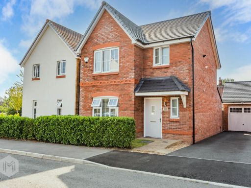 3 bedroom detached house for sale in Rigley Potts Park, Hindley Green, Wigan, Greater Manchester, WN2 4UN, WN2 — £320,000 • 3 bed • 3 bath • 950 ft²
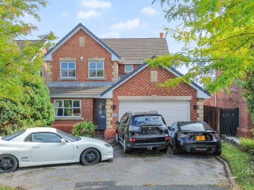 4 bedroom detached house for sale in Sandbrook Road, Orrell, WN5 — £450,000 • 4 bed • 3 bath • 1755 ft²
 4 bedroom detached house for sale in Talman Grove, Ashton-In-Makerfield, WN4 — £375,000 • 4 bed • 2 bath • 1163 ft²
Meta
- {
"@context": "https://schema.org",
"@type": "Residence",
"name": "4 bedroom detached house for sale in Meadow Brook, Pemberto…",
"description": "",
"url": "https://propertypiper.co.uk/property/af1da308-6207-4139-a00a-53e8ac206a4f",
"image": "https://image-a.propertypiper.co.uk/9f89f593-704f-4632-944b-46cd7537385e-1024.jpeg",
"address": {
"@type": "PostalAddress",
"streetAddress": "31 Meadow Brook",
"postalCode": "WN5 8ED",
"addressLocality": "Wigan",
"addressRegion": "Wigan",
"addressCountry": "England"
},
"geo": {
"@type": "GeoCoordinates",
"latitude": 53.53193491555483,
"longitude": -2.6860984682546687
},
"numberOfRooms": 4,
"numberOfBathroomsTotal": 2,
"floorSize": {
"@type": "QuantitativeValue",
"value": 1050,
"unitCode": "FTK"
},
"offers": {
"@type": "Offer",
"price": 260000,
"priceCurrency": "GBP",
"availability": "https://schema.org/InStock"
},
"additionalProperty": [
{
"@type": "PropertyValue",
"name": "Feature",
"value": "detached house"
},
{
"@type": "PropertyValue",
"name": "Feature",
"value": "modern"
},
{
"@type": "PropertyValue",
"name": "Feature",
"value": "brick exterior"
},
{
"@type": "PropertyValue",
"name": "Feature",
"value": "three stories"
},
{
"@type": "PropertyValue",
"name": "Feature",
"value": "driveway"
},
{
"@type": "PropertyValue",
"name": "Feature",
"value": "garage"
},
{
"@type": "PropertyValue",
"name": "Feature",
"value": "garden"
},
{
"@type": "PropertyValue",
"name": "Feature",
"value": "suburban"
},
{
"@type": "PropertyValue",
"name": "Feature",
"value": "dormer window"
},
{
"@type": "PropertyValue",
"name": "Feature",
"value": "modern"
},
{
"@type": "PropertyValue",
"name": "Feature",
"value": "living room"
},
{
"@type": "PropertyValue",
"name": "Feature",
"value": "herringbone flooring"
},
{
"@type": "PropertyValue",
"name": "Feature",
"value": "wallpaper"
},
{
"@type": "PropertyValue",
"name": "Feature",
"value": "white walls"
},
{
"@type": "PropertyValue",
"name": "Feature",
"value": "standard ceiling"
},
{
"@type": "PropertyValue",
"name": "Feature",
"value": "bright"
},
{
"@type": "PropertyValue",
"name": "Feature",
"value": "clean"
}
]
}
High Res Floorplan Images
Compatible Floorplan Images
FloorplanImages Thumbnail