SE19 3EQ - 2 bedroom flat for sale in The Woodlands, London, SE19
View on Property Piper
2 bedroom flat for sale in The Woodlands, London, SE19
Property Details
- Price: £275000
- Bedrooms: 2
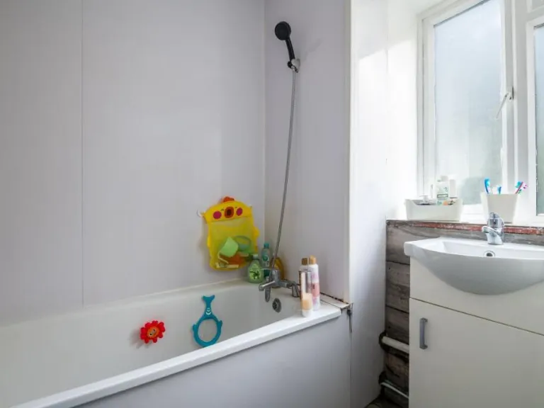
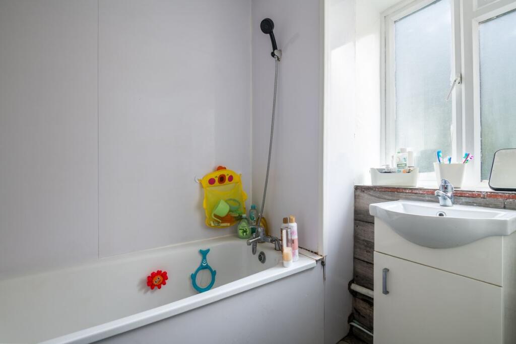
- Bathrooms: 1
- Property Type: undefined
- Property SubType: undefined
Image Descriptions
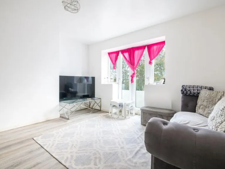
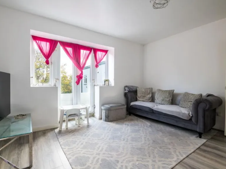
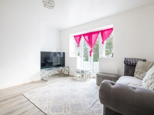
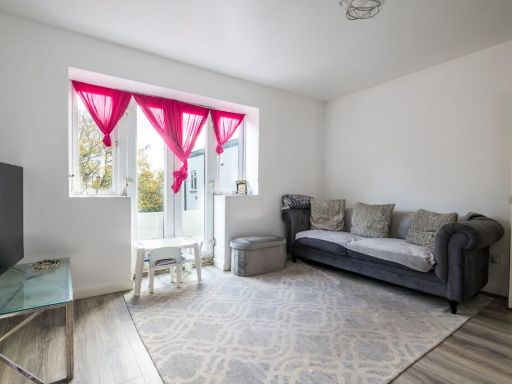
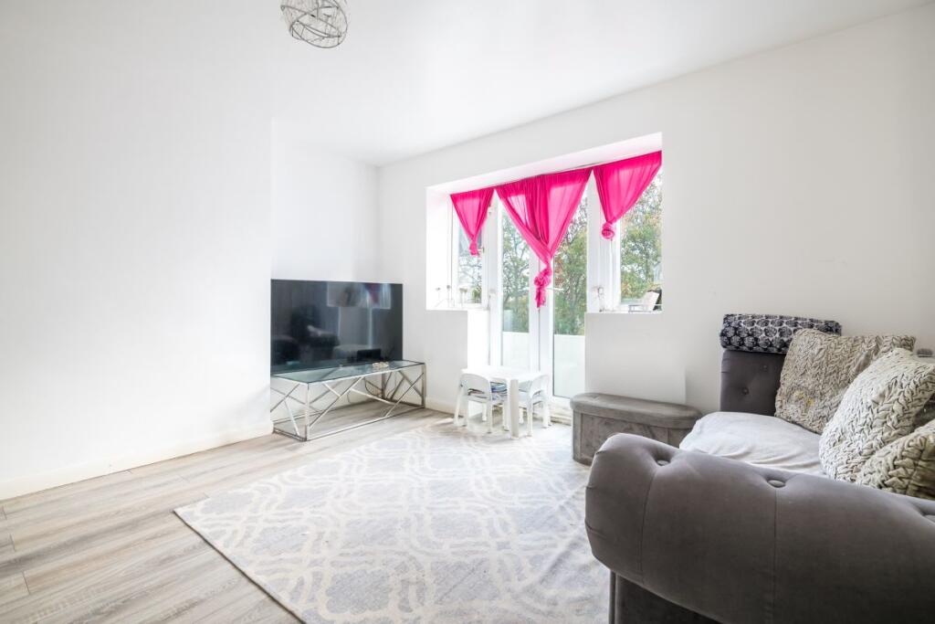
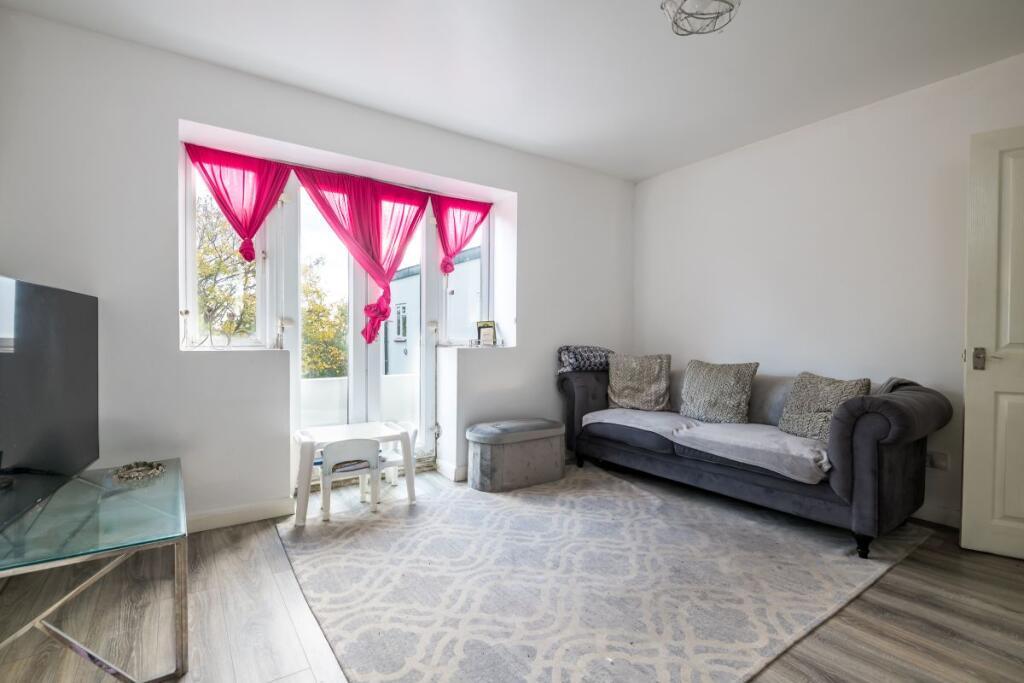
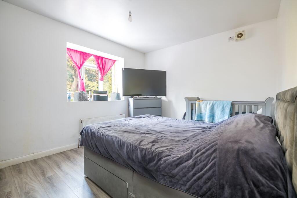
- living room contemporary
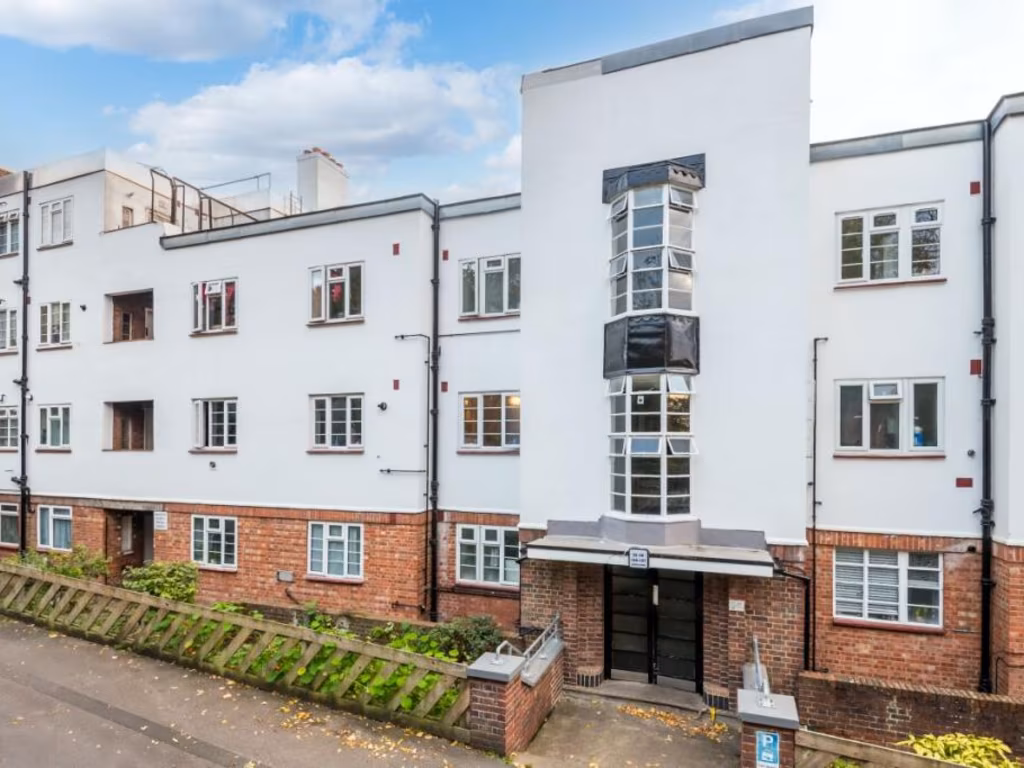
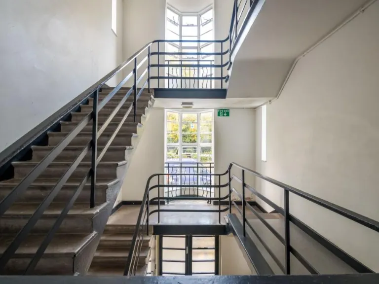
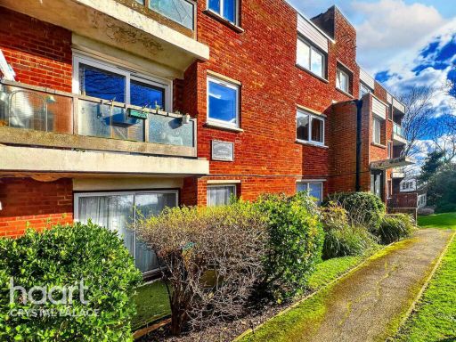
- apartment building Modern
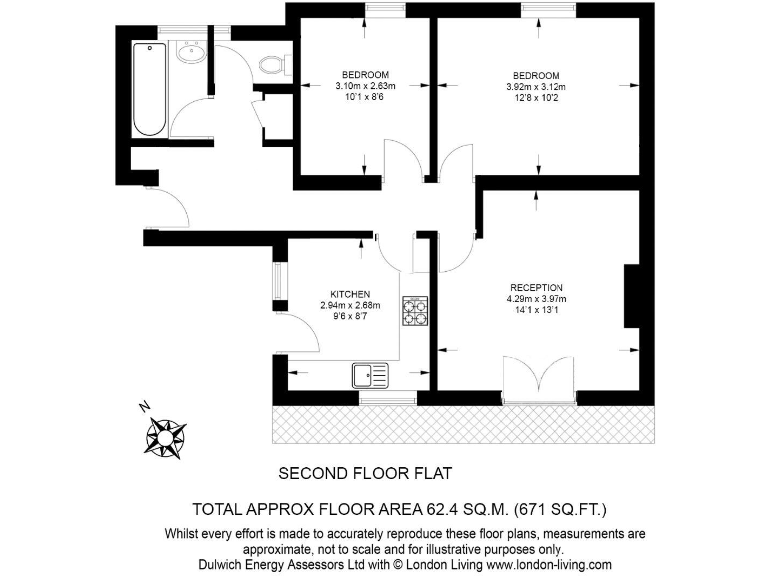
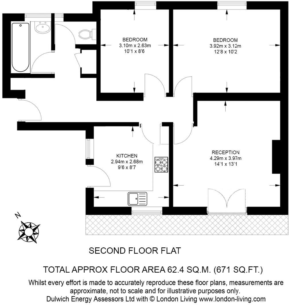
Floorplan Description
- Second floor flat with reception, kitchen and two bedrooms.
Rooms
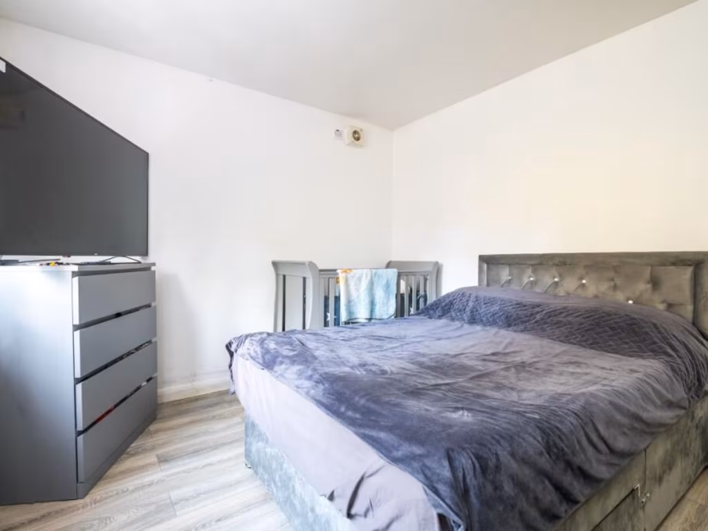
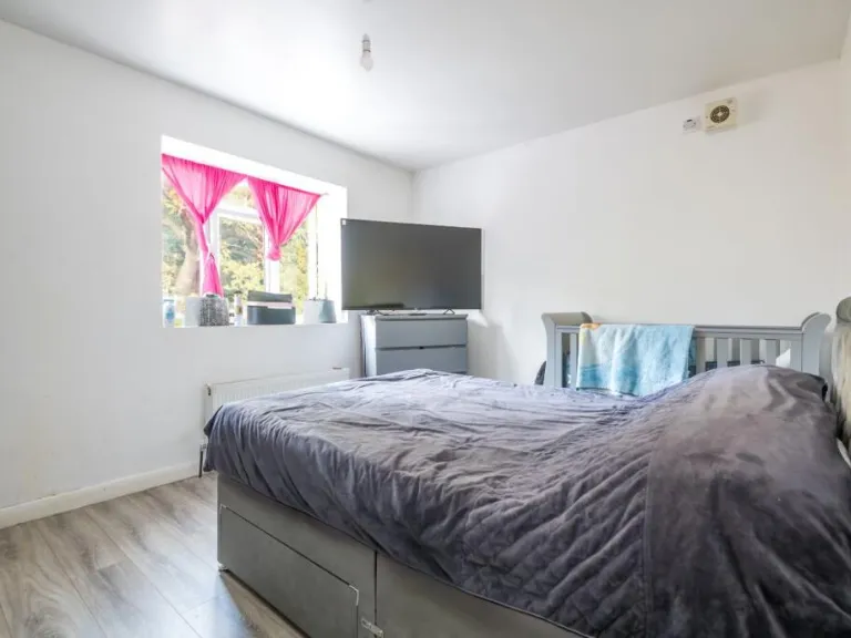
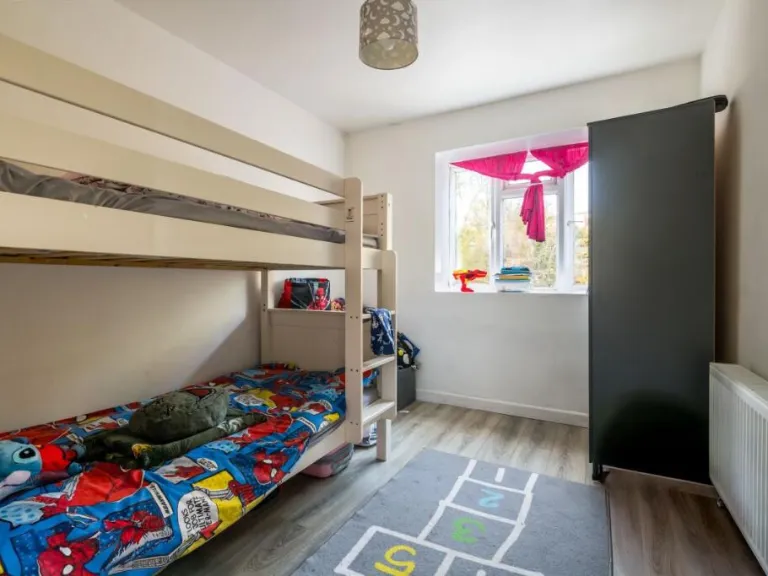
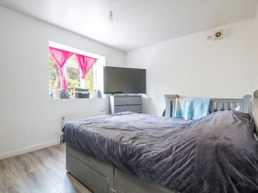
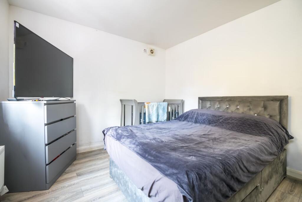
- BEDROOM:
- BEDROOM:
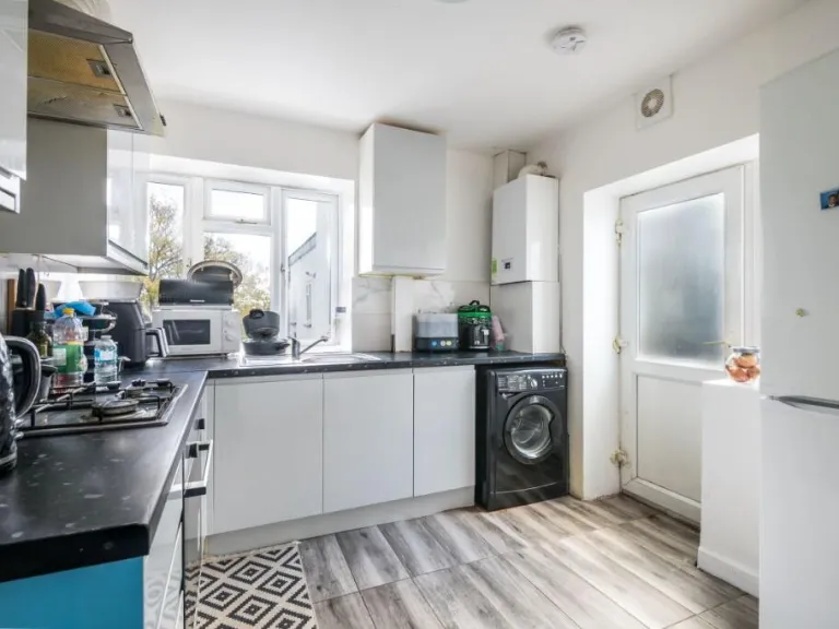
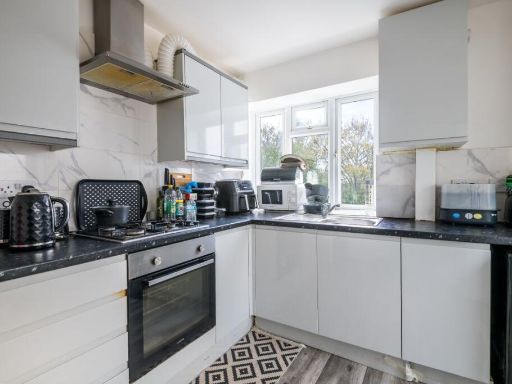
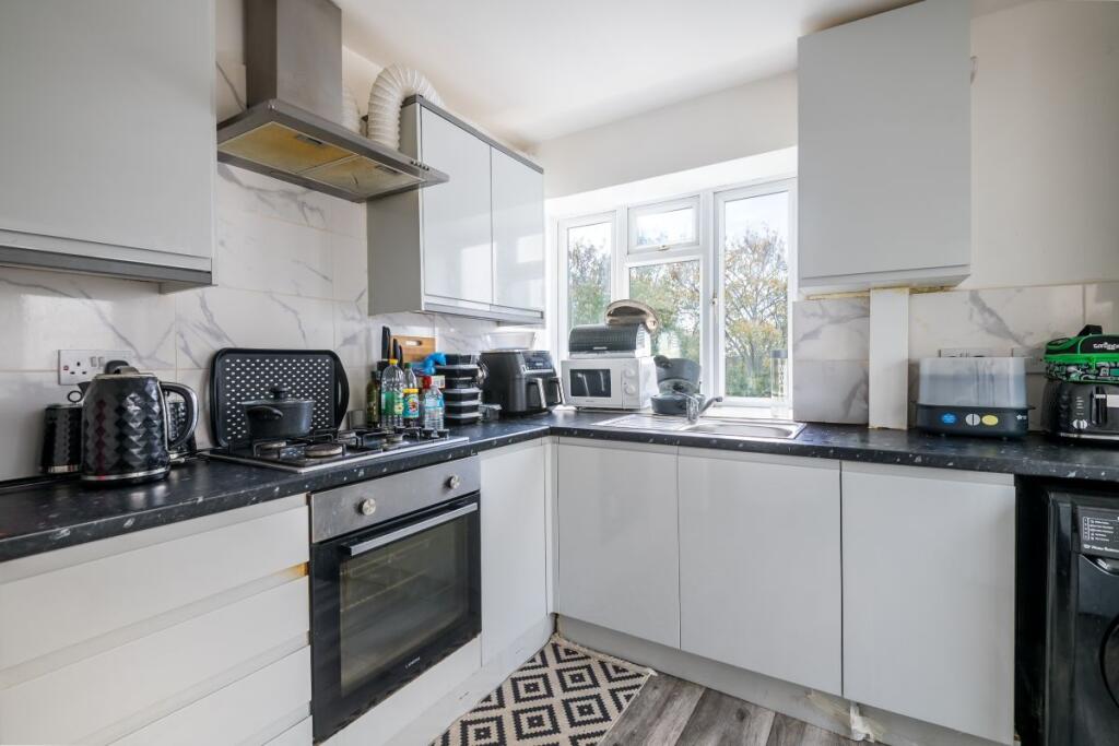
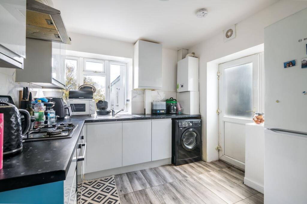
- KITCHEN:
- RECEPTION:
Textual Property Features
Detected Visual Features
- contemporary
- living room
- bright
- neutral colors
- modern
- window seat
- apartment
- building
- urban
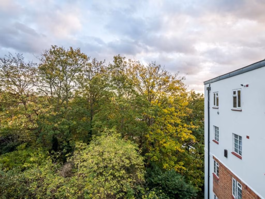
- trees
- greenery
- exterior
EPC Details
- Fully double glazed
- Solid brick, as built, no insulation (assumed)
- Boiler and radiators, mains gas
- Low energy lighting in all fixed outlets
- (another dwelling below)
Nearby Schools
- Whitehorse Manor Junior School
- David Livingstone Academy
- Kensington Avenue Primary School
- Rockmount Primary School
- St Joseph's RC Infant School
- Kingswood Primary School
- Beulah Junior School
- Cypress Primary School
- St Cyprian's Greek Orthodox Primary Academy
- Downsview Primary and Nursery School
- St Joseph's College
- St Joseph's RC Junior School
- The Cedars School
- The Laurels School
- The New School
- The Norwood School
- Julian's School
- Beulah Infants' School
- All Saints CofE Primary School
- St Luke's Church of England Primary School
- Whitehorse Manor Infant School
- St James the Great RC Primary and Nursery School
- Norbury High School for Girls
- Harris Academy Beulah Hill
- Paxton Primary School
- Crown Lane Primary School
- Elm Wood School
Nearest General Shops
- Id: 5892620655
- Tags:
- Addr:
- City: Thornton Heath
- Housenumber: 32-34
- Postcode: CR7 8BB
- Street: Green Lane
- Name: Green Lane Tyres
- Shop: tyres
- TagsNormalized:
- Lat: 51.4089297
- Lon: -0.106058
- FullGeoHash: gcpumwdy8xj6
- PartitionGeoHash: gcpu
- Images:
- FoodStandards: null
- Distance: 890.1
,- Id: 5892620658
- Tags:
- Addr:
- City: Thornton Heath
- Housenumber: 36
- Postcode: CR7 8BB
- Street: Green Lane
- Note: From memory and imperfect photo, this appears to be out of business
- Old_name: Jamaican Barbeque Centre
- Shop: vacant
- Source: survey;fhrs
- TagsNormalized:
- Lat: 51.4090063
- Lon: -0.1061154
- FullGeoHash: gcpumwdxpm6e
- PartitionGeoHash: gcpu
- Images:
- FoodStandards: null
- Distance: 885.6
,- Id: 5890384362
- Tags:
- Addr:
- City: Thornton Heath
- Housenumber: 161
- Postcode: CR7 8HX
- Street: Northwood Road
- Fhrs:
- Authority: Croydon
- Id: 5118
- Name: P.L. Gauntlett
- Shop: newsagent
- Source: survey;fhrs
- TagsNormalized:
- Lat: 51.4084726
- Lon: -0.0987895
- FullGeoHash: gcpumy8h41ch
- PartitionGeoHash: gcpu
- Images:
- FoodStandards: null
- Distance: 771.6
}
Nearest Grocery shops
- Id: 367075864
- Tags:
- Name: SS Food & Wine
- Shop: convenience
- TagsNormalized:
- Lat: 51.4082701
- Lon: -0.0994967
- FullGeoHash: gcpumwxdcs1u
- PartitionGeoHash: gcpu
- Images:
- FoodStandards: null
- Distance: 796.8
,- Id: 5890384359
- Tags:
- Addr:
- City: Thornton Heath
- Housenumber: 167
- Postcode: CR7 8HX
- Street: Northwood Road
- Fhrs:
- Authority: Croydon
- Id: 36166
- Name: New Way Food & Wine
- Old_name: SS Food & Wine
- Shop: convenience
- Source: survey;fhrs
- TagsNormalized:
- Lat: 51.4085409
- Lon: -0.0986108
- FullGeoHash: gcpumy8hqnw7
- PartitionGeoHash: gcpu
- Images:
- FoodStandards: null
- Distance: 763.9
,- Id: 6582176512
- Tags:
- Name: Spa Off License
- Shop: convenience
- TagsNormalized:
- Lat: 51.4111877
- Lon: -0.093677
- FullGeoHash: gcpumz5gchj2
- PartitionGeoHash: gcpu
- Images:
- FoodStandards: null
- Distance: 577.4
}
Nearest Religious buildings
- Id: 1089271228
- Tags:
- Amenity: place_of_worship
- Name: Virgo Fidelis Convent
- TagsNormalized:
- Lat: 51.4225677
- Lon: -0.096581
- FullGeoHash: gcputc1wjmru
- PartitionGeoHash: gcpu
- Images:
- FoodStandards: null
- Distance: 807.2
,- Id: 826322722
- Tags:
- Addr:
- City: London
- Housenumber: 76
- Postcode: SE19 3EW
- Street: Beulah Hill
- Amenity: place_of_worship
- Building: yes
- Building:levels: 2
- Name: Linh Son Temple
- Religion: buddhist
- TagsNormalized:
- place of worship
- temple
- buddhist
- buddhist temple
- Lat: 51.4164049
- Lon: -0.0956214
- FullGeoHash: gcputb467bed
- PartitionGeoHash: gcpu
- Images:
- FoodStandards: null
- Distance: 229.6
,- Id: 168241812
- Tags:
- Addr:
- City: London
- Postcode: SE19 3XD
- Street: Downsview Road
- Suburb: Upper Norwood
- Amenity: place_of_worship
- Denomination: methodist
- Fhrs:
- Authority: Croydon
- Id: 2143
- Name: Downsview Methodist Church
- Religion: christian
- TagsNormalized:
- place of worship
- methodist
- church
- christian
- Lat: 51.4140501
- Lon: -0.1007262
- FullGeoHash: gcpumxwssct5
- PartitionGeoHash: gcpu
- Images:
- FoodStandards:
- Id: 2143
- FHRSID: 2143
- LocalAuthorityBusinessID: 00677/2002/2/200
- BusinessName: Downsview Methodist Church Lunch Club
- BusinessType: Restaurant/Cafe/Canteen
- BusinessTypeID: 1
- AddressLine1: Downsview Methodist Church
- AddressLine2: Downsview Road
- AddressLine3: Upper Norwood
- AddressLine4: London
- PostCode: SE19 3XD
- RatingValue: 5
- RatingKey: fhrs_5_en-GB
- RatingDate: 2023-01-18
- LocalAuthorityCode: 507
- LocalAuthorityName: Croydon
- LocalAuthorityWebSite: http://www.croydon.gov.uk
- LocalAuthorityEmailAddress: food.safety@croydon.gov.uk
- Scores:
- Hygiene: 5
- Structural: 5
- ConfidenceInManagement: 5
- NewRatingPending: false
- Geocode:
- Longitude: -0.10025300085545
- Latitude: 51.41596984863280
- Distance: 215
}
Nearest Medical buildings
- Id: 296563324
- Tags:
- Amenity: hospital
- Created_by: Potlatch 0.10b
- Name: Royal Home and Hospital for Incurables
- TagsNormalized:
- Lat: 51.423089
- Lon: -0.1070682
- FullGeoHash: gcput9611ns4
- PartitionGeoHash: gcpu
- Images:
- FoodStandards: null
- Distance: 1039.3
,- Id: 6582148013
- Tags:
- Amenity: pharmacy
- Brand: Day Lewis Pharmacy
- Brand:wikidata: Q62563772
- Dispensing: yes
- Healthcare: pharmacy
- Name: Day Lewis Pharmacy
- TagsNormalized:
- pharmacy
- day lewis pharmacy
- health
- healthcare
- Lat: 51.4098428
- Lon: -0.0871185
- FullGeoHash: gcpuqnbs1cr9
- PartitionGeoHash: gcpu
- Images:
- FoodStandards: null
- Distance: 1004.4
,- Id: 2320400194
- Tags:
- Amenity: pharmacy
- Dispensing: yes
- TagsNormalized:
- Lat: 51.4228815
- Lon: -0.1051959
- FullGeoHash: gcput95ruzbk
- PartitionGeoHash: gcpu
- Images:
- FoodStandards: null
- Distance: 950.9
,- Id: 2320400216
- Tags:
- Addr:
- City: London
- Housenumber: 10
- Parentstreet: Beulah Hill
- Postcode: SE19 3NG
- Street: Crown Parade
- Suburb: Upper Norwood
- Amenity: pharmacy
- Dispensing: yes
- Email: manager@klubpharmacy.co.uk
- Name: Klub Pharmacy
- Opening_hours: Mo-Fr 09:00-18:30; Sa 09:00-14:30
- Phone: +44 20 8761 7296
- Website: https://www.klubpharmacy.co.uk/
- TagsNormalized:
- Lat: 51.4222744
- Lon: -0.1057216
- FullGeoHash: gcput95h2w8r
- PartitionGeoHash: gcpu
- Images:
- FoodStandards: null
- Distance: 912
}
Nearest Airports
- Id: 260720166
- Tags:
- Aerodrome: international
- Aeroway: aerodrome
- Alt_name: Gatwick Airport
- Ele: 62
- Iata: LGW
- Icao: EGKK
- Internet_access: wlan
- Internet_access:fee: no
- Internet_access:ssid: Gatwick FREE Wi-Fi
- Name: London Gatwick Airport
- Operator: Gatwick Airport Limited
- Ref: LGW
- Website: https://www.gatwickairport.com/
- Wikidata: Q8703
- Wikipedia: en:Gatwick Airport
- TagsNormalized:
- airport
- international airport
- Lat: 51.1540917
- Lon: -0.1883773
- FullGeoHash: gcpg58qf4mzd
- PartitionGeoHash: gcpg
- Images:
- FoodStandards: null
- Distance: 29721.6
,- Id: 121158889
- Tags:
- Aerodrome: continental
- Aeroway: aerodrome
- Fhrs:
- Authority: City of London Corporation
- Iata: LCY
- Icao: EGLC
- Name: London City Airport
- Operator: London City Airport Limited
- Ref: LCY
- Website: https://www.londoncityairport.com/
- Wikidata: Q8982
- Wikipedia: en:London City Airport
- TagsNormalized:
- airport
- continental airport
- Lat: 51.5042658
- Lon: 0.0539987
- FullGeoHash: u10j10p64702
- PartitionGeoHash: u10j
- Images:
- FoodStandards: null
- Distance: 14466.5
,- Id: 14001268
- Tags:
- Access: yes
- Aerodrome: international
- Aerodrome:type: public
- Aeroway: aerodrome
- Alt_name: London Heathrow
- Alt_name_2: London Heathrow Airport
- Ele: 25
- Iata: LHR
- Icao: EGLL
- Int_name: Heathrow Airport
- Name: London Heathrow Airport
- Note: area still approx
- Old_name: London Airport
- Operator: Heathrow Airport Limited
- Rank_aci:
- Ref: LHR
- Short_name: Heathrow
- Type: multipolygon
- Website: https://www.heathrow.com/
- Wikidata: Q8691
- Wikipedia: en:Heathrow Airport
- TagsNormalized:
- airport
- international airport
- Lat: 51.4677522
- Lon: -0.4547736
- FullGeoHash: gcpsv9kv7h2h
- PartitionGeoHash: gcps
- Images:
- FoodStandards: null
- Distance: 25368.1
}
Nearest Leisure Facilities
- Id: 265138132
- Tags:
- Leisure: pitch
- Sport: tennis
- TagsNormalized:
- Lat: 51.416489
- Lon: -0.0908955
- FullGeoHash: gcputbjfcbpr
- PartitionGeoHash: gcpu
- Images:
- FoodStandards: null
- Distance: 542.4
,- Id: 265138131
- Tags:
- Leisure: pitch
- Sport: tennis
- TagsNormalized:
- Lat: 51.4163939
- Lon: -0.0910374
- FullGeoHash: gcputbjdnwt8
- PartitionGeoHash: gcpu
- Images:
- FoodStandards: null
- Distance: 530.5
,- Id: 181604497
- Tags:
- TagsNormalized:
- Lat: 51.415909
- Lon: -0.1056631
- FullGeoHash: gcpumxgp3u5g
- PartitionGeoHash: gcpu
- Images:
- FoodStandards: null
- Distance: 498.2
,- Id: 23875651
- Tags:
- Leisure: park
- Name: Upper Norwood Recreation Ground
- TagsNormalized:
- Lat: 51.4172925
- Lon: -0.0923426
- FullGeoHash: gcputbhz2q02
- PartitionGeoHash: gcpu
- Images:
- FoodStandards: null
- Distance: 477
,- Id: 34750829
- Tags:
- Leisure: pitch
- Lit: no
- Sport: tennis
- Surface: asphalt
- TagsNormalized:
- Lat: 51.4159136
- Lon: -0.1050985
- FullGeoHash: gcpumxgrrhbz
- PartitionGeoHash: gcpu
- Images:
- FoodStandards: null
- Distance: 459.4
}
Nearest Tourist attractions
- Id: 293536391
- Tags:
- Addr:
- City: London
- Housenumber: 24
- Postcode: SE19 2XE
- Street: Fox Hill
- Name: Fox Hill Bed and Breakfast
- Tourism: guest_house
- Website: www.foxhill-bandb.co.uk
- TagsNormalized:
- Lat: 51.4147408
- Lon: -0.0780868
- FullGeoHash: gcpuqpz0s6q7
- PartitionGeoHash: gcpu
- Images:
- FoodStandards: null
- Distance: 1419.2
,- Id: 226373596
- Tags:
- Addr:
- Housenumber: 38
- Street: Church Road
- Building: yes
- Building:levels: 2
- Name: Tom Cox
- Roof:
- Tourism: gallery
- TagsNormalized:
- Lat: 51.4188715
- Lon: -0.079694
- FullGeoHash: gcpuw0tbwurg
- PartitionGeoHash: gcpu
- Images:
- FoodStandards: null
- Distance: 1361.3
,- Id: 189057254
- Tags:
- Addr:
- City: London
- Housenumber: 4
- Postcode: SE19 1RX
- Street: Westow Hill
- Building: yes
- Name: A L'etage 2
- Source: Bing;photograph
- Tourism: gallery
- Website: https://www.aletage2.com/
- TagsNormalized:
- Lat: 51.419614
- Lon: -0.082744
- FullGeoHash: gcpuw0eszyv9
- PartitionGeoHash: gcpu
- Images:
- FoodStandards: null
- Distance: 1189.9
}
Nearest Hotels
- Id: 245252963
- Tags:
- Addr:
- City: Thornton Heath
- Housenumber: 639-641
- Postcode: CR7 6AZ
- Street: London Road
- Building: yes
- Fhrs:
- Authority: Croydon
- Id: 7016
- Name: Dunheved Hotel
- Source:
- Postcode: FSA Food Hygiene Ratings database
- Tourism: hotel
- TagsNormalized:
- Lat: 51.3910203
- Lon: -0.113151
- FullGeoHash: gcpum7mw7ks3
- PartitionGeoHash: gcpu
- Images:
- FoodStandards: null
- Distance: 2895.6
,- Id: 102679636
- Tags:
- Name: Leigham Court Hotel
- Tourism: hotel
- TagsNormalized:
- Lat: 51.4353512
- Lon: -0.1245498
- FullGeoHash: gcput5t29u2v
- PartitionGeoHash: gcpu
- Images:
- FoodStandards: null
- Distance: 2858.8
,- Id: 32349145
- Tags:
- Addr:
- City: London
- Housenumber: 122
- Postcode: SE19 2UG
- Street: Church Road
- Suburb: Upper Norwood
- Building: yes
- Building:levels: 1
- Fhrs:
- Authority: Croydon
- Id: 1867
- Name: Queens Hotel
- Phone: +44 20 8653 6622
- Tourism: hotel
- Website: www.euroqueenshotel.com
- TagsNormalized:
- Lat: 51.415216
- Lon: -0.0835473
- FullGeoHash: gcpuqpg5m4yw
- PartitionGeoHash: gcpu
- Images:
- FoodStandards: null
- Distance: 1038.8
}
Tags
- contemporary
- living room
- bright
- neutral colors
- modern
- window seat
- modern
- apartment
- building
- urban
- trees
- greenery
- exterior
Local Market Stats
- Average Price/sqft: £573
- Avg Income: £58200
- Rental Yield: 4.5%
- Social Housing: 22%
- Planning Success Rate: 72%
AirBnB Data
- 1km average: £86/night
- Listings in 1km: 7
Similar Properties
 2 bedroom flat for sale in The Woodlands, London, SE19 — £325,000 • 2 bed • 1 bath • 640 ft²
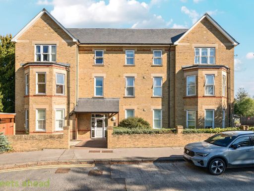 2 bedroom apartment for sale in Beulah Hill, London, SE19 — £199,995 • 2 bed • 1 bath • 748 ft²
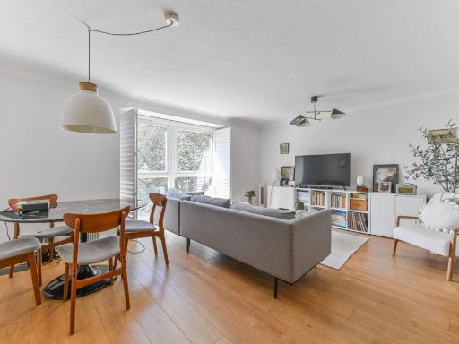 2 bedroom flat for sale in Beulah Hill, Crystal Palace, London, SE19 — £385,000 • 2 bed • 1 bath • 828 ft²
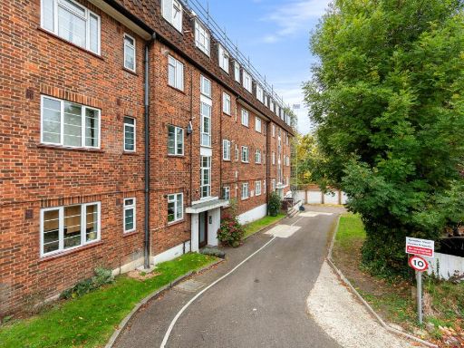 2 bedroom flat for sale in Victoria Crescent, Compton Court Victoria Crescent, SE19 — £325,000 • 2 bed • 1 bath • 614 ft²
 2 bedroom flat for sale in Harold Road, Crystal Palace, London, SE19 — £525,000 • 2 bed • 2 bath • 947 ft²
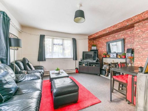 2 bedroom flat for sale in Anerley Road, Anerley, London, SE20 — £290,000 • 2 bed • 1 bath • 789 ft²
Meta
- {
"@context": "https://schema.org",
"@type": "Residence",
"name": "2 bedroom flat for sale in The Woodlands, London, SE19",
"description": "",
"url": "https://propertypiper.co.uk/property/ae3f1f71-7dc0-4bc5-9466-f38eb838a808",
"image": "https://image-a.propertypiper.co.uk/1ca32002-c267-48a3-865d-8652e7f40fd4-1024.jpeg",
"address": {
"@type": "PostalAddress",
"streetAddress": "45 THE WOODLANDS LONDON ",
"postalCode": "SE19 3EQ",
"addressLocality": "Croydon",
"addressRegion": "Croydon North",
"addressCountry": "England"
},
"geo": {
"@type": "GeoCoordinates",
"latitude": 51.41541017589079,
"longitude": -0.0985234243004348
},
"numberOfRooms": 2,
"numberOfBathroomsTotal": 1,
"floorSize": {
"@type": "QuantitativeValue",
"value": 667,
"unitCode": "FTK"
},
"offers": {
"@type": "Offer",
"price": 275000,
"priceCurrency": "GBP",
"availability": "https://schema.org/InStock"
},
"additionalProperty": [
{
"@type": "PropertyValue",
"name": "Feature",
"value": "contemporary"
},
{
"@type": "PropertyValue",
"name": "Feature",
"value": "living room"
},
{
"@type": "PropertyValue",
"name": "Feature",
"value": "bright"
},
{
"@type": "PropertyValue",
"name": "Feature",
"value": "neutral colors"
},
{
"@type": "PropertyValue",
"name": "Feature",
"value": "modern"
},
{
"@type": "PropertyValue",
"name": "Feature",
"value": "window seat"
},
{
"@type": "PropertyValue",
"name": "Feature",
"value": "modern"
},
{
"@type": "PropertyValue",
"name": "Feature",
"value": "apartment"
},
{
"@type": "PropertyValue",
"name": "Feature",
"value": "building"
},
{
"@type": "PropertyValue",
"name": "Feature",
"value": "urban"
},
{
"@type": "PropertyValue",
"name": "Feature",
"value": "trees"
},
{
"@type": "PropertyValue",
"name": "Feature",
"value": "greenery"
},
{
"@type": "PropertyValue",
"name": "Feature",
"value": "exterior"
}
]
}
High Res Floorplan Images
Compatible Floorplan Images
FloorplanImages Thumbnail