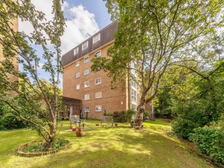
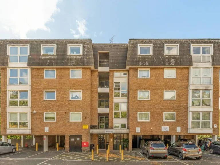
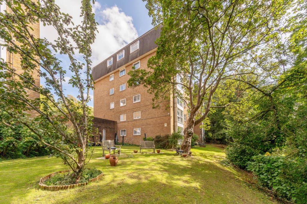
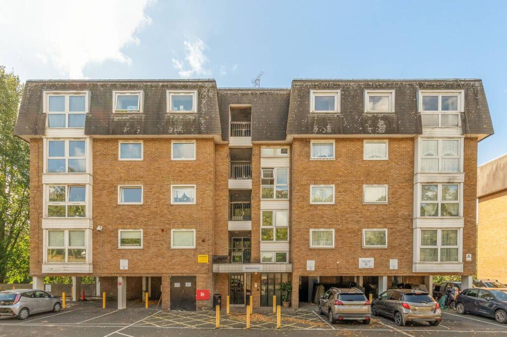
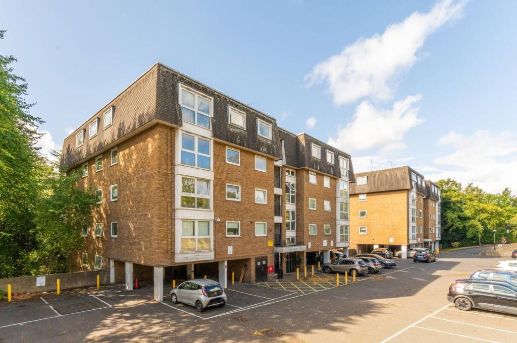
SE19 3LJ - 2 bedroom flat for sale in Beulah Hill, Crystal Palace, Lon…
View on Property Piper
2 bedroom flat for sale in Beulah Hill, Crystal Palace, London, SE19
Property Details
- Price: £385000
- Bedrooms: 2
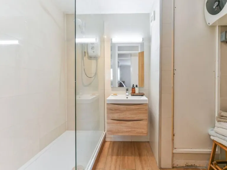
- Bathrooms: 1
- Property Type: undefined
- Property SubType: undefined
Image Descriptions
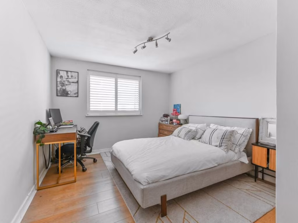
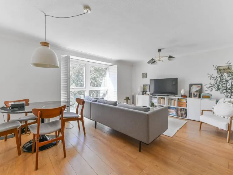
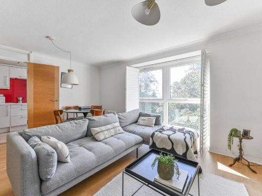
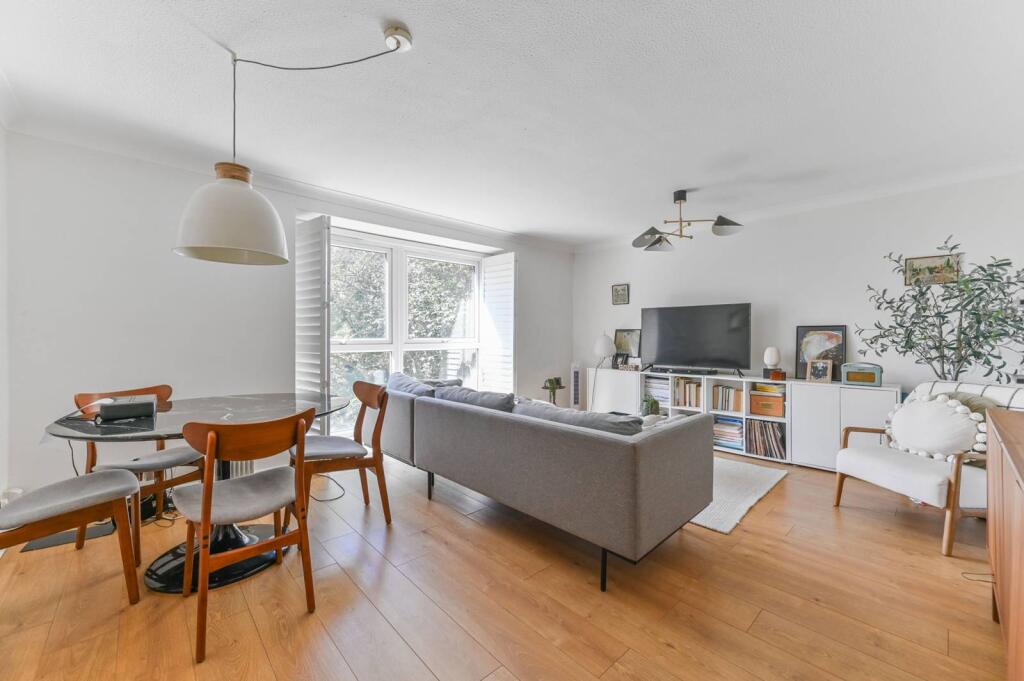
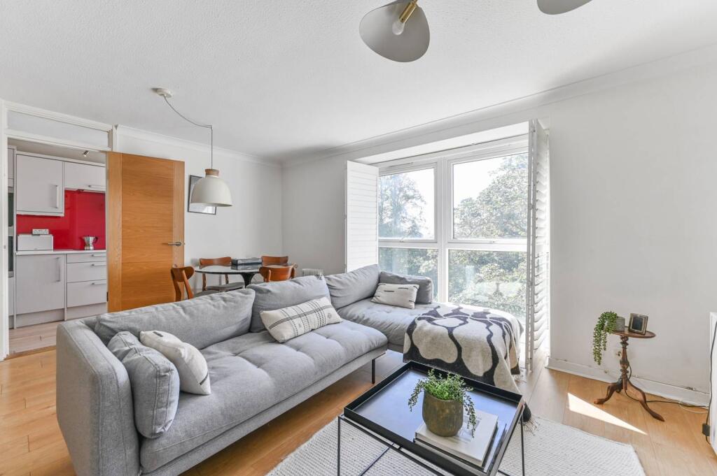
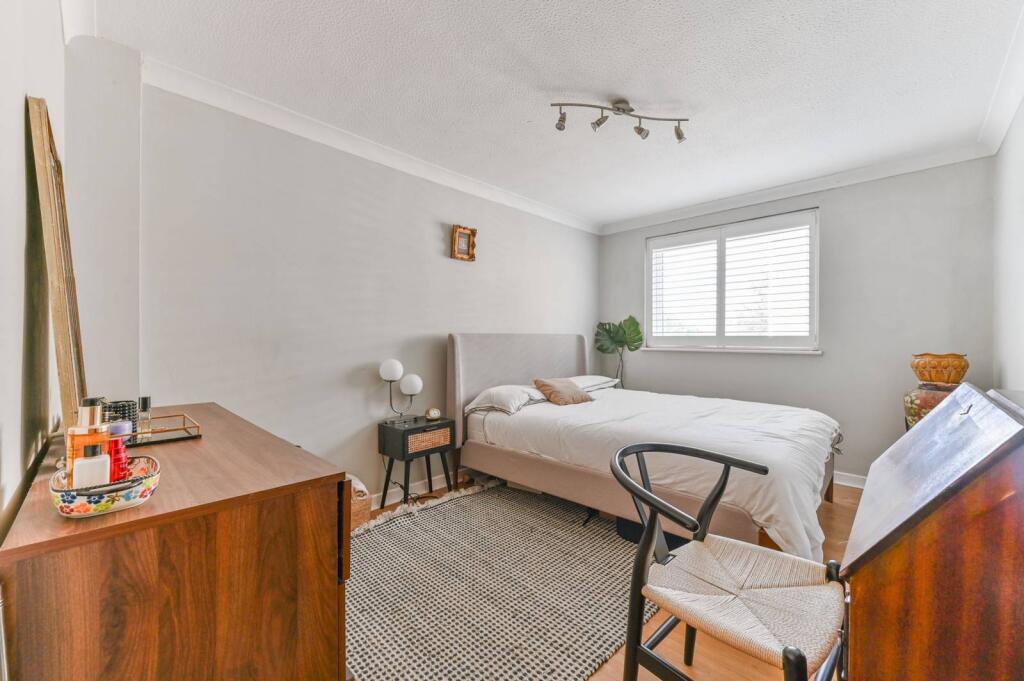
- living room Contemporary
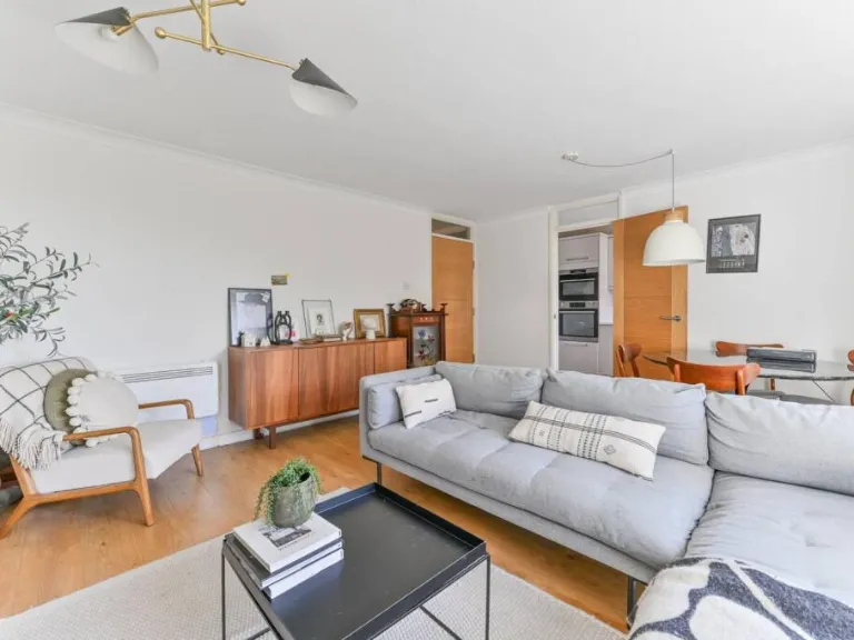
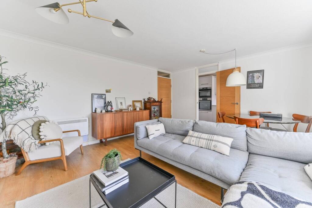
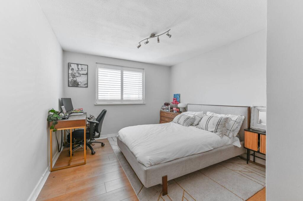
- living room Modern
Floorplan Description
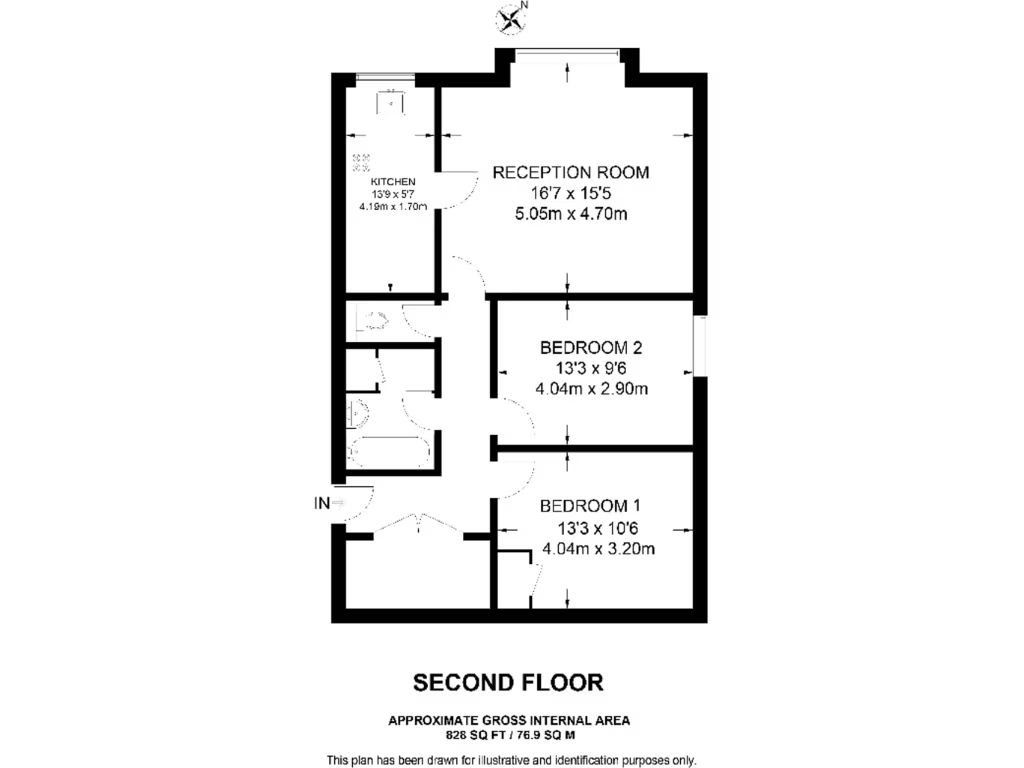
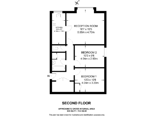
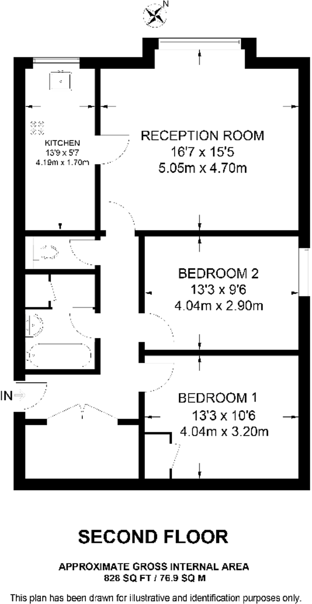
- Second floor flat plan with reception room, kitchen and two bedrooms
Rooms
- RECEPTION ROOM:
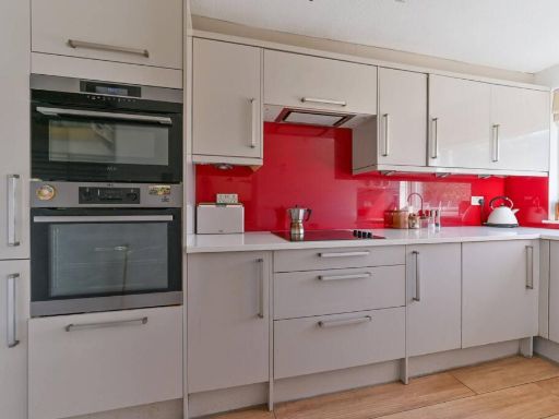
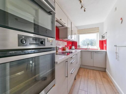
- KITCHEN:
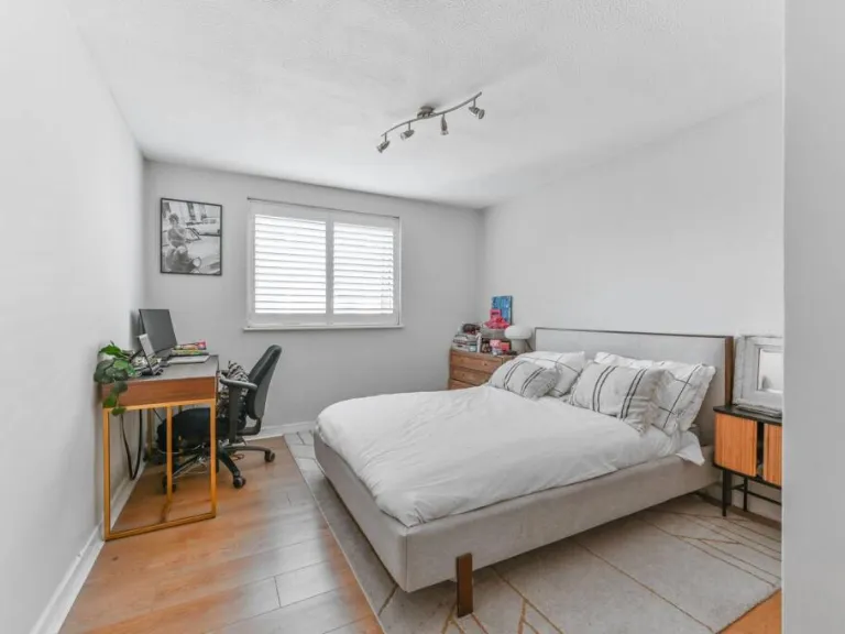
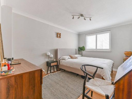
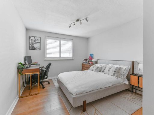
- BEDROOM 2:
- BEDROOM 1:
Textual Property Features
Detected Visual Features
- living room
- contemporary style
- large window
- wooden flooring
- standard ceiling
- medium room
- modern
- apartment
- large windows
- natural light
- open plan
- hardwood flooring
EPC Details
- Fully double glazed
- Cavity wall, as built, insulated (assumed)
- Electric storage heaters
- Low energy lighting in all fixed outlets
- (another dwelling below)
Nearby Schools
- St Chad's Catholic Primary School
- Whitehorse Manor Junior School
- Harris Aspire Academy
- David Livingstone Academy
- Rockmount Primary School
- St Joseph's RC Infant School
- Kingswood Primary School
- Heavers Farm Primary School
- Beulah Junior School
- Cypress Primary School
- St Cyprian's Greek Orthodox Primary Academy
- Harris City Academy Crystal Palace
- Downsview Primary and Nursery School
- St Joseph's RC Junior School
- The Cedars School
- The Laurels School
- The New School
- The Norwood School
- Aya College (Educational Provision)
- Beulah Infants' School
- All Saints CofE Primary School
- St Luke's Church of England Primary School
- Whitehorse Manor Infant School
- Harris Academy South Norwood
- St James the Great RC Primary and Nursery School
- Harris Academy Beulah Hill
- Paxton Primary School
Nearest General Shops
- Id: 6582148020
- Tags:
- Name: Beau-Style
- Shop: dry_cleaning
- TagsNormalized:
- Lat: 51.4092352
- Lon: -0.0869227
- FullGeoHash: gcpuqnb8w819
- PartitionGeoHash: gcpu
- Images:
- FoodStandards: null
- Distance: 275.4
,- Id: 6582148019
- Tags:
- Brand: Mind
- Brand:wikidata: Q3314763
- Brand:wikipedia: en:Mind (charity)
- Name: Mind
- Shop: charity
- TagsNormalized:
- Lat: 51.409279
- Lon: -0.0869259
- FullGeoHash: gcpuqnb8y2pq
- PartitionGeoHash: gcpu
- Images:
- FoodStandards: null
- Distance: 270.8
,- Id: 6582148015
- Tags:
- Name: Rambling Rose
- Shop: garden_centre
- TagsNormalized:
- Lat: 51.4097359
- Lon: -0.0870858
- FullGeoHash: gcpuqnbe6v25
- PartitionGeoHash: gcpu
- Images:
- FoodStandards: null
- Distance: 220
}
Nearest Grocery shops
- Id: 3966395757
- Tags:
- Addr:
- City: London
- Housenumber: 267
- Postcode: SE25 6DP
- Street: South Norwood Hill
- Suburb: South Norwood
- Fhrs:
- Authority: Croydon
- Id: 712864
- Name: Greens
- Shop: convenience
- TagsNormalized:
- Lat: 51.4088962
- Lon: -0.0867496
- FullGeoHash: gcpuqn8yd8ff
- PartitionGeoHash: gcpu
- Images:
- FoodStandards:
- Id: 712864
- FHRSID: 712864
- LocalAuthorityBusinessID: 14/00036/COMM
- BusinessName: Greens Superfoods
- BusinessType: Retailers - other
- BusinessTypeID: 4613
- AddressLine1: 267 South Norwood Hill
- AddressLine2: South Norwood
- AddressLine3: London
- AddressLine4: null
- PostCode: SE25 6DP
- RatingValue: 4
- RatingKey: fhrs_4_en-GB
- RatingDate: 2018-05-10
- LocalAuthorityCode: 507
- LocalAuthorityName: Croydon
- LocalAuthorityWebSite: http://www.croydon.gov.uk
- LocalAuthorityEmailAddress: food.safety@croydon.gov.uk
- Scores:
- Hygiene: 10
- Structural: 0
- ConfidenceInManagement: 10
- NewRatingPending: false
- Geocode:
- Longitude: -0.08713100105524
- Latitude: 51.40956878662110
- Distance: 314.8
,- Id: 6582148018
- Tags:
- Brand: Premier
- Brand:wikidata: Q7240340
- Brand:wikipedia: en:Premier Stores
- Name: Premier
- Shop: convenience
- TagsNormalized:
- Lat: 51.409336
- Lon: -0.086952
- FullGeoHash: gcpuqnb9jfgf
- PartitionGeoHash: gcpu
- Images:
- FoodStandards: null
- Distance: 264.3
,- Id: 6582148012
- Tags:
- Name: Crystal Convenience Store
- Shop: convenience
- TagsNormalized:
- Lat: 51.4098906
- Lon: -0.0871266
- FullGeoHash: gcpuqnbs3f1w
- PartitionGeoHash: gcpu
- Images:
- FoodStandards: null
- Distance: 203.4
}
Nearest Religious buildings
- Id: 8088877
- Tags:
- Name: South Norwood Hill / All Saints Church
- Network: London Buses
- Operator: Transport for London
- Public_transport: stop_area
- Public_transport:version: 2
- Type: public_transport
- TagsNormalized:
- Lat: 51.4097933
- Lon: -0.0869585
- FullGeoHash: gcpuqnbev8p4
- PartitionGeoHash: gcpu
- Images:
- FoodStandards: null
- Distance: 218.4
,- Id: 38866892
- Tags:
- Addr:
- City: London
- Postcode: SE19 3EP
- Street: Beulah Hill
- Suburb: Upper Norwood
- Amenity: place_of_worship
- Building: church
- Denomination: anglican
- Fhrs:
- Authority: Croydon
- Id: 983426
- Name: All Saints
- Religion: christian
- Wikidata: Q26351463
- TagsNormalized:
- place of worship
- church
- anglican
- christian
- Lat: 51.4111186
- Lon: -0.0868761
- FullGeoHash: gcpuqp0erxhk
- PartitionGeoHash: gcpu
- Images:
- FoodStandards: null
- Distance: 119.3
,- Id: 204591
- Tags:
- Name: Beulah Hill / All Saints Church
- Naptan:
- StopAreaCode: 490G00003242
- StopAreaType: GPBS
- Verified: no
- Public_transport: stop_area
- Type: public_transport
- TagsNormalized:
- Lat: 51.4109875
- Lon: -0.0873332
- FullGeoHash: gcpuqp06syxw
- PartitionGeoHash: gcpu
- Images:
- FoodStandards: null
- Distance: 98.5
}
Nearest Medical buildings
- Id: 5890360895
- Tags:
- Addr:
- City: Thornton Heath
- Housenumber: 30
- Postcode: CR7 8JN
- Street: Norbury Road
- Amenity: doctors
- Healthcare: doctor
- Healthcare:speciality: family_planning
- Name: Mersham Medical Centre
- Opening_hours: Mo-Fr 08:00-18:30; Sa-Su off
- Phone: +44 20 8653 1869
- Source: survey;website
- Website: https://www.mershammedicalcentre.co.uk/
- TagsNormalized:
- doctor
- doctors
- health
- healthcare
- Lat: 51.4041393
- Lon: -0.0963938
- FullGeoHash: gcpumvcfcf5d
- PartitionGeoHash: gcpu
- Images:
- FoodStandards: null
- Distance: 987
,- Id: 225812845
- Tags:
- Addr:
- Housenumber: 73-75
- Street: Church Road
- Amenity: dentist
- Building: yes
- Building:levels: 3
- Healthcare: dentist
- Name: The Mindful Dentist
- TagsNormalized:
- Lat: 51.4177112
- Lon: -0.0803975
- FullGeoHash: gcpuw0m3ys56
- PartitionGeoHash: gcpu
- Images:
- FoodStandards: null
- Distance: 888
,- Id: 224388619
- Tags:
- Amenity: doctors
- Building: yes
- Name: Auckland Road Surgery
- Opening_hours: Mo,Tu,Th,Fr 08:00-18:30, We 07:15-18:30, Sa 08:30-10:30
- TagsNormalized:
- Lat: 51.4095338
- Lon: -0.0808946
- FullGeoHash: gcpuqnv45p8w
- PartitionGeoHash: gcpu
- Images:
- FoodStandards: null
- Distance: 570
,- Id: 6582148013
- Tags:
- Amenity: pharmacy
- Brand: Day Lewis Pharmacy
- Brand:wikidata: Q62563772
- Dispensing: yes
- Healthcare: pharmacy
- Name: Day Lewis Pharmacy
- TagsNormalized:
- pharmacy
- day lewis pharmacy
- health
- healthcare
- Lat: 51.4098428
- Lon: -0.0871185
- FullGeoHash: gcpuqnbs1cr9
- PartitionGeoHash: gcpu
- Images:
- FoodStandards: null
- Distance: 208.4
}
Nearest Airports
- Id: 260720166
- Tags:
- Aerodrome: international
- Aeroway: aerodrome
- Alt_name: Gatwick Airport
- Ele: 62
- Iata: LGW
- Icao: EGKK
- Internet_access: wlan
- Internet_access:fee: no
- Internet_access:ssid: Gatwick FREE Wi-Fi
- Name: London Gatwick Airport
- Operator: Gatwick Airport Limited
- Ref: LGW
- Website: https://www.gatwickairport.com/
- Wikidata: Q8703
- Wikipedia: en:Gatwick Airport
- TagsNormalized:
- airport
- international airport
- Lat: 51.1540917
- Lon: -0.1883773
- FullGeoHash: gcpg58qf4mzd
- PartitionGeoHash: gcpg
- Images:
- FoodStandards: null
- Distance: 29455.4
,- Id: 121158889
- Tags:
- Aerodrome: continental
- Aeroway: aerodrome
- Fhrs:
- Authority: City of London Corporation
- Iata: LCY
- Icao: EGLC
- Name: London City Airport
- Operator: London City Airport Limited
- Ref: LCY
- Website: https://www.londoncityairport.com/
- Wikidata: Q8982
- Wikipedia: en:London City Airport
- TagsNormalized:
- airport
- continental airport
- Lat: 51.5042658
- Lon: 0.0539987
- FullGeoHash: u10j10p64702
- PartitionGeoHash: u10j
- Images:
- FoodStandards: null
- Distance: 14276.1
,- Id: 14001268
- Tags:
- Access: yes
- Aerodrome: international
- Aerodrome:type: public
- Aeroway: aerodrome
- Alt_name: London Heathrow
- Alt_name_2: London Heathrow Airport
- Ele: 25
- Iata: LHR
- Icao: EGLL
- Int_name: Heathrow Airport
- Name: London Heathrow Airport
- Note: area still approx
- Old_name: London Airport
- Operator: Heathrow Airport Limited
- Rank_aci:
- Ref: LHR
- Short_name: Heathrow
- Type: multipolygon
- Website: https://www.heathrow.com/
- Wikidata: Q8691
- Wikipedia: en:Heathrow Airport
- TagsNormalized:
- airport
- international airport
- Lat: 51.4677522
- Lon: -0.4547736
- FullGeoHash: gcpsv9kv7h2h
- PartitionGeoHash: gcps
- Images:
- FoodStandards: null
- Distance: 26147.6
}
Nearest Leisure Facilities
- Id: 25929506
- Tags:
- Leisure: park
- Name: Beaulieu Heights
- Wikidata: Q4877512
- Wikipedia: en:Beaulieu Heights
- TagsNormalized:
- Lat: 51.4092794
- Lon: -0.0840048
- FullGeoHash: gcpuqnfbf832
- PartitionGeoHash: gcpu
- Images:
- FoodStandards: null
- Distance: 397.4
,- Id: 171277278
- Tags:
- TagsNormalized:
- Lat: 51.4114205
- Lon: -0.0835308
- FullGeoHash: gcpuqp5jjx6v
- PartitionGeoHash: gcpu
- Images:
- FoodStandards: null
- Distance: 343.1
,- Id: 178871614
- Tags:
- TagsNormalized:
- Lat: 51.4115209
- Lon: -0.0922014
- FullGeoHash: gcpumzhvgd1e
- PartitionGeoHash: gcpu
- Images:
- FoodStandards: null
- Distance: 258.4
,- Id: 158665802
- Tags:
- Fixme: needs re-surveying
- Leisure: playground
- TagsNormalized:
- Lat: 51.4115457
- Lon: -0.0918101
- FullGeoHash: gcpumzjjuwtr
- PartitionGeoHash: gcpu
- Images:
- FoodStandards: null
- Distance: 231.3
,- Id: 24776691
- Tags:
- Leisure: park
- Name: The Lawns
- Url: http://www.croydon.gov.uk/leisure/parksandopenspaces/parksatoz/lawns/lawns
- TagsNormalized:
- Lat: 51.4111665
- Lon: -0.0912205
- FullGeoHash: gcpumzjef2j1
- PartitionGeoHash: gcpu
- Images:
- FoodStandards: null
- Distance: 194.3
}
Nearest Tourist attractions
- Id: 226373596
- Tags:
- Addr:
- Housenumber: 38
- Street: Church Road
- Building: yes
- Building:levels: 2
- Name: Tom Cox
- Roof:
- Tourism: gallery
- TagsNormalized:
- Lat: 51.4188715
- Lon: -0.079694
- FullGeoHash: gcpuw0tbwurg
- PartitionGeoHash: gcpu
- Images:
- FoodStandards: null
- Distance: 1019.8
,- Id: 189057254
- Tags:
- Addr:
- City: London
- Housenumber: 4
- Postcode: SE19 1RX
- Street: Westow Hill
- Building: yes
- Name: A L'etage 2
- Source: Bing;photograph
- Tourism: gallery
- Website: https://www.aletage2.com/
- TagsNormalized:
- Lat: 51.419614
- Lon: -0.082744
- FullGeoHash: gcpuw0eszyv9
- PartitionGeoHash: gcpu
- Images:
- FoodStandards: null
- Distance: 984.4
,- Id: 293536391
- Tags:
- Addr:
- City: London
- Housenumber: 24
- Postcode: SE19 2XE
- Street: Fox Hill
- Name: Fox Hill Bed and Breakfast
- Tourism: guest_house
- Website: www.foxhill-bandb.co.uk
- TagsNormalized:
- Lat: 51.4147408
- Lon: -0.0780868
- FullGeoHash: gcpuqpz0s6q7
- PartitionGeoHash: gcpu
- Images:
- FoodStandards: null
- Distance: 804.8
}
Nearest Bus stations and stops
- Id: 469786656
- Tags:
- Highway: bus_stop
- Local_ref: EN
- Name: All Saints Church
- Naptan:
- AtcoCode: 490015128E
- Bearing: E
- CommonName: All Saints Church (Church Rd)
- Indicator: EN
- Verified: no
- Public_transport: platform
- TagsNormalized:
- Lat: 51.411136
- Lon: -0.0862479
- FullGeoHash: gcpuqp15w62g
- PartitionGeoHash: gcpu
- Images:
- FoodStandards: null
- Distance: 160.1
,- Id: 469785726
- Tags:
- Highway: bus_stop
- Local_ref: SK
- Name: Upper Beulah Hill
- Naptan:
- AtcoCode: 490013929S
- Bearing: S
- CommonName: Upper Beulah Hill
- Indicator: SK
- Verified: no
- Public_transport: platform
- TagsNormalized:
- Lat: 51.4126738
- Lon: -0.0887558
- FullGeoHash: gcpumzrkec4c
- PartitionGeoHash: gcpu
- Images:
- FoodStandards: null
- Distance: 130.3
,- Id: 469785727
- Tags:
- Highway: bus_stop
- Name: Upper Beulah Hill
- Naptan:
- AtcoCode: 490013929W
- Bearing: W
- CommonName: Upper Beulah Hill
- Indicator: Stop
- Verified: yes
- Public_transport: platform
- Shelter: no
- TagsNormalized:
- Lat: 51.4125082
- Lon: -0.0878114
- FullGeoHash: gcpuqp259f5j
- PartitionGeoHash: gcpu
- Images:
- FoodStandards: null
- Distance: 119.7
,- Id: 469762212
- Tags:
- Highway: bus_stop
- Local_ref: SL
- Name: Beulah Hill / All Saints Church
- Naptan:
- AtcoCode: 490003242S
- Bearing: S
- CommonName: Beulah Hill All Saints Church
- Indicator: SL
- Verified: no
- Public_transport: platform
- TagsNormalized:
- Lat: 51.4109875
- Lon: -0.0873332
- FullGeoHash: gcpuqp06syxw
- PartitionGeoHash: gcpu
- Images:
- FoodStandards: null
- Distance: 98.5
,- Id: 312633731
- Tags:
- Highway: bus_stop
- Local_ref: NE
- Name: Upper Beulah Hill
- Naptan:
- AtcoCode: 490013929N
- Bearing: N
- Public_transport: platform
- TagsNormalized:
- Lat: 51.4119353
- Lon: -0.0881049
- FullGeoHash: gcpumzrb5p25
- PartitionGeoHash: gcpu
- Images:
- FoodStandards: null
- Distance: 53.4
}
Nearest Hotels
- Id: 245252963
- Tags:
- Addr:
- City: Thornton Heath
- Housenumber: 639-641
- Postcode: CR7 6AZ
- Street: London Road
- Building: yes
- Fhrs:
- Authority: Croydon
- Id: 7016
- Name: Dunheved Hotel
- Source:
- Postcode: FSA Food Hygiene Ratings database
- Tourism: hotel
- TagsNormalized:
- Lat: 51.3910203
- Lon: -0.113151
- FullGeoHash: gcpum7mw7ks3
- PartitionGeoHash: gcpu
- Images:
- FoodStandards: null
- Distance: 2850.2
,- Id: 1084648842
- Tags:
- Brand: Travelodge
- Brand:wikidata: Q9361374
- Building: yes
- Internet_access: wlan
- Internet_access:fee: customers
- Internet_access:ssid: Travelodge WiFi
- Name: Travelodge
- Tourism: hotel
- TagsNormalized:
- Lat: 51.4106898
- Lon: -0.0551484
- FullGeoHash: gcpuqxpbfznq
- PartitionGeoHash: gcpu
- Images:
- FoodStandards: null
- Distance: 2313.2
,- Id: 32349145
- Tags:
- Addr:
- City: London
- Housenumber: 122
- Postcode: SE19 2UG
- Street: Church Road
- Suburb: Upper Norwood
- Building: yes
- Building:levels: 1
- Fhrs:
- Authority: Croydon
- Id: 1867
- Name: Queens Hotel
- Phone: +44 20 8653 6622
- Tourism: hotel
- Website: www.euroqueenshotel.com
- TagsNormalized:
- Lat: 51.415216
- Lon: -0.0835473
- FullGeoHash: gcpuqpg5m4yw
- PartitionGeoHash: gcpu
- Images:
- FoodStandards: null
- Distance: 535
}
Tags
- living room
- contemporary style
- large window
- wooden flooring
- standard ceiling
- medium room
- modern
- apartment
- living room
- large windows
- natural light
- open plan
- hardwood flooring
Local Market Stats
- Average Price/sqft: £573
- Avg Income: £58200
- Rental Yield: 4.5%
- Social Housing: 22%
- Planning Success Rate: 72%
AirBnB Data
- 1km average: £93/night
- Listings in 1km: 8
Similar Properties
 2 bedroom flat for sale in Auckland Road, Crystal Palace, LONDON, SE19 — £575,000 • 2 bed • 2 bath • 958 ft²
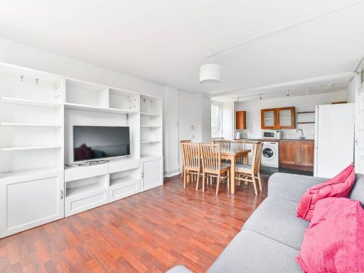 2 bedroom flat for sale in College Road, Crystal Palace, London, SE19 — £325,000 • 2 bed • 1 bath • 768 ft²
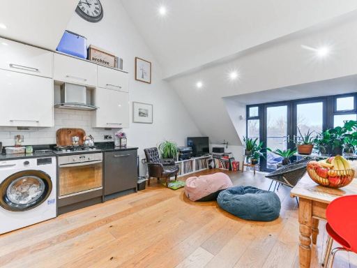 2 bedroom flat for sale in Auckland Road, Crystal Palace, London, SE19 — £465,000 • 2 bed • 2 bath • 887 ft²
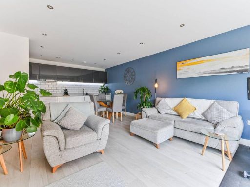 2 bedroom flat for sale in Sylvan Hill, Crystal Palace, London, SE19 — £560,000 • 2 bed • 2 bath • 866 ft²
 2 bedroom flat for sale in College Road, Crystal Palace, London, SE19 — £350,000 • 2 bed • 1 bath • 765 ft²
 2 bedroom apartment for sale in Sylvan Hill, London, SE19 — £450,000 • 2 bed • 1 bath • 722 ft²
Meta
- {
"@context": "https://schema.org",
"@type": "Residence",
"name": "2 bedroom flat for sale in Beulah Hill, Crystal Palace, Lon…",
"description": "",
"url": "https://propertypiper.co.uk/property/ef33ba8e-c83e-40e3-a466-98ff7a573e2d",
"image": "https://image-a.propertypiper.co.uk/925fae8a-0ccd-4df7-8052-23f98eded80f-1024.jpeg",
"address": {
"@type": "PostalAddress",
"streetAddress": "BLENHEIM COURT, 17 FLAT 15 BEULAH HILL LONDON",
"postalCode": "SE19 3LJ",
"addressLocality": "Croydon",
"addressRegion": "Croydon North",
"addressCountry": "England"
},
"geo": {
"@type": "GeoCoordinates",
"latitude": 51.41151473807592,
"longitude": -0.0884751885574156
},
"numberOfRooms": 2,
"numberOfBathroomsTotal": 1,
"floorSize": {
"@type": "QuantitativeValue",
"value": 828,
"unitCode": "FTK"
},
"offers": {
"@type": "Offer",
"price": 385000,
"priceCurrency": "GBP",
"availability": "https://schema.org/InStock"
},
"additionalProperty": [
{
"@type": "PropertyValue",
"name": "Feature",
"value": "living room"
},
{
"@type": "PropertyValue",
"name": "Feature",
"value": "contemporary style"
},
{
"@type": "PropertyValue",
"name": "Feature",
"value": "large window"
},
{
"@type": "PropertyValue",
"name": "Feature",
"value": "wooden flooring"
},
{
"@type": "PropertyValue",
"name": "Feature",
"value": "standard ceiling"
},
{
"@type": "PropertyValue",
"name": "Feature",
"value": "medium room"
},
{
"@type": "PropertyValue",
"name": "Feature",
"value": "modern"
},
{
"@type": "PropertyValue",
"name": "Feature",
"value": "apartment"
},
{
"@type": "PropertyValue",
"name": "Feature",
"value": "living room"
},
{
"@type": "PropertyValue",
"name": "Feature",
"value": "large windows"
},
{
"@type": "PropertyValue",
"name": "Feature",
"value": "natural light"
},
{
"@type": "PropertyValue",
"name": "Feature",
"value": "open plan"
},
{
"@type": "PropertyValue",
"name": "Feature",
"value": "hardwood flooring"
}
]
}
High Res Floorplan Images
Compatible Floorplan Images
FloorplanImages Thumbnail