NG32 2NX - Land for sale in Belton, Grantham, Lincolnshire, NG32
View on Property Piper
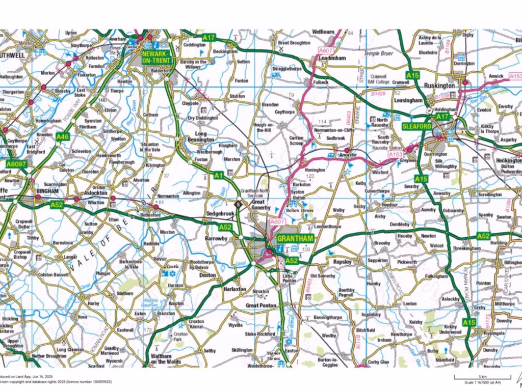
Land for sale in Belton, Grantham, Lincolnshire, NG32
Property Details
- Price: £2700000
- Bedrooms: 1
- Bathrooms: 1
- Property Type: undefined
- Property SubType: undefined
Brochure Descriptions
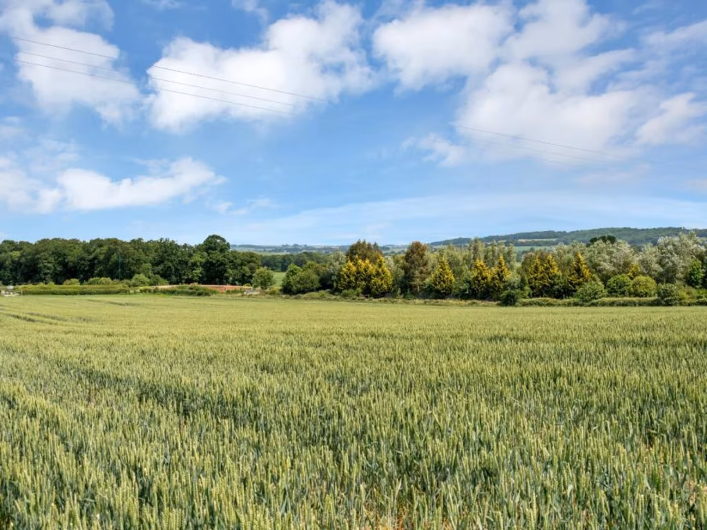
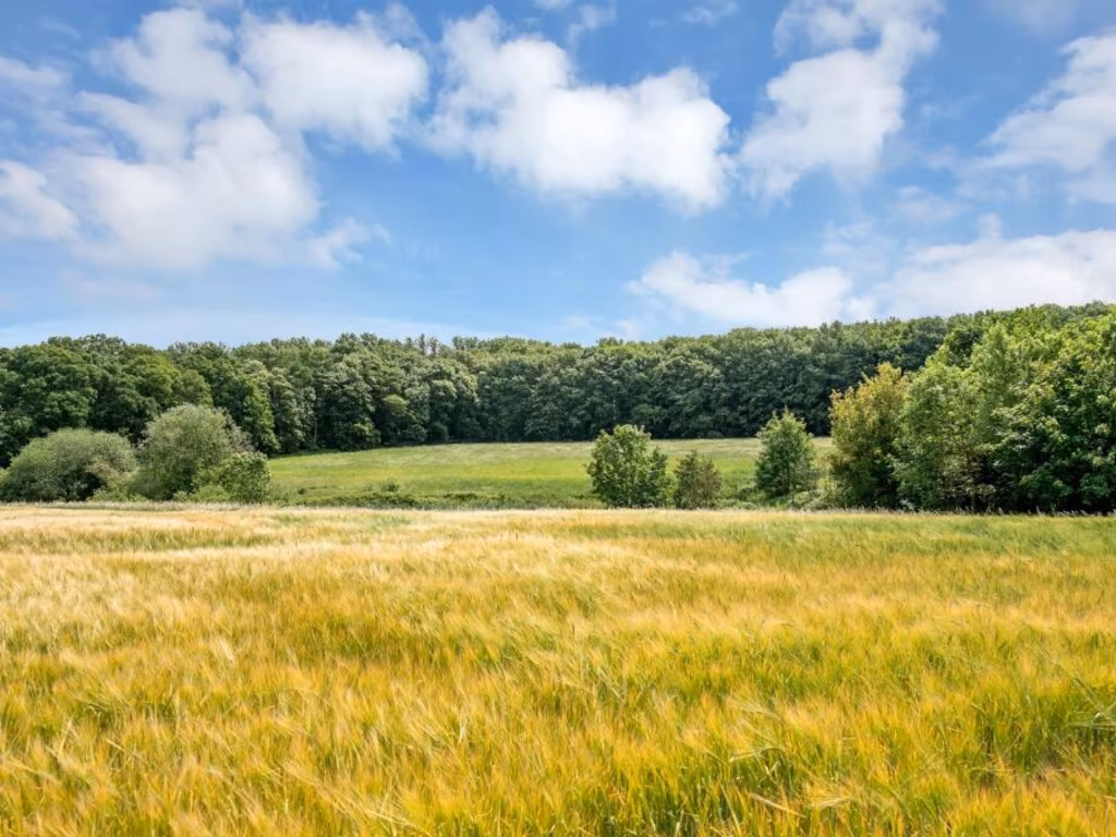
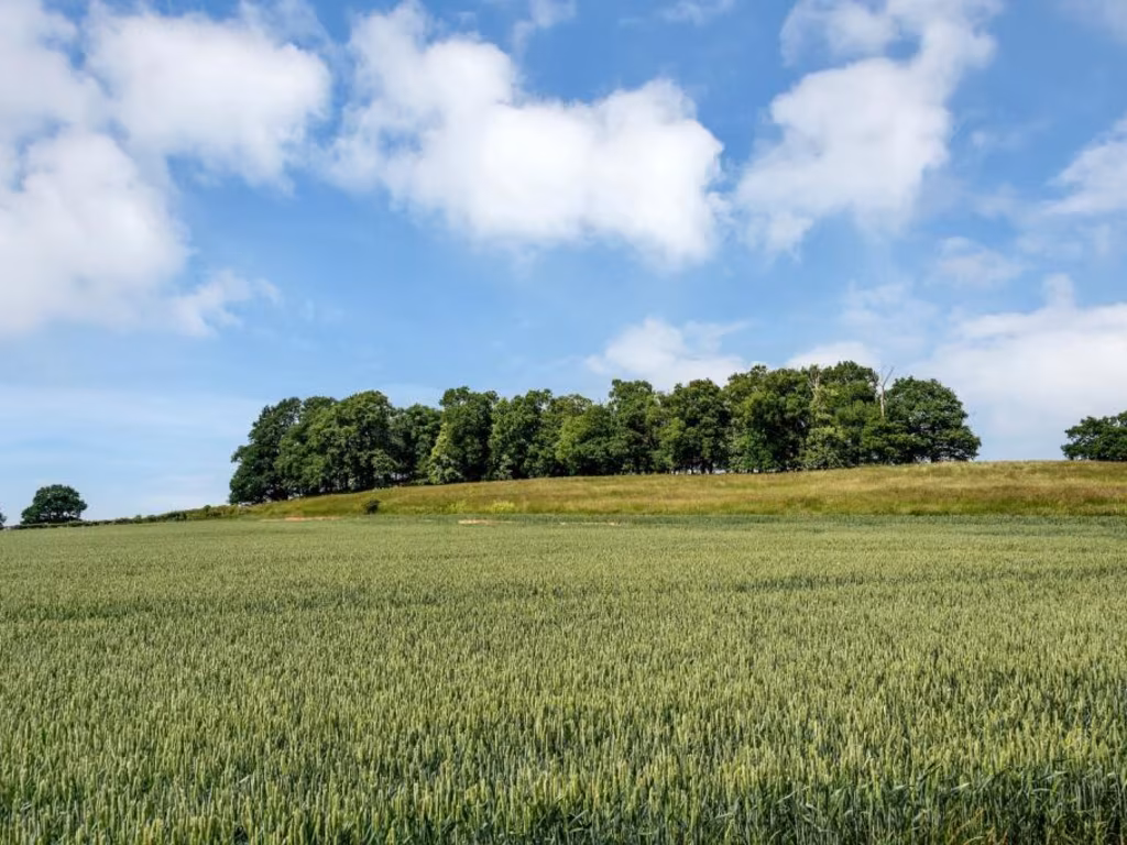
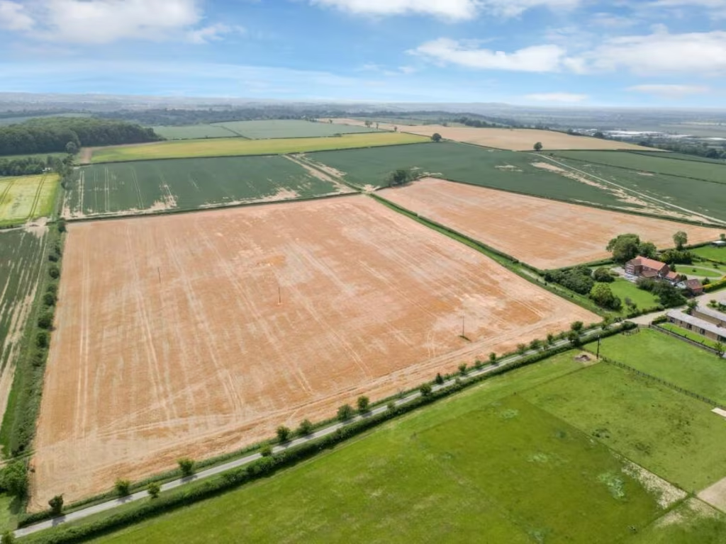
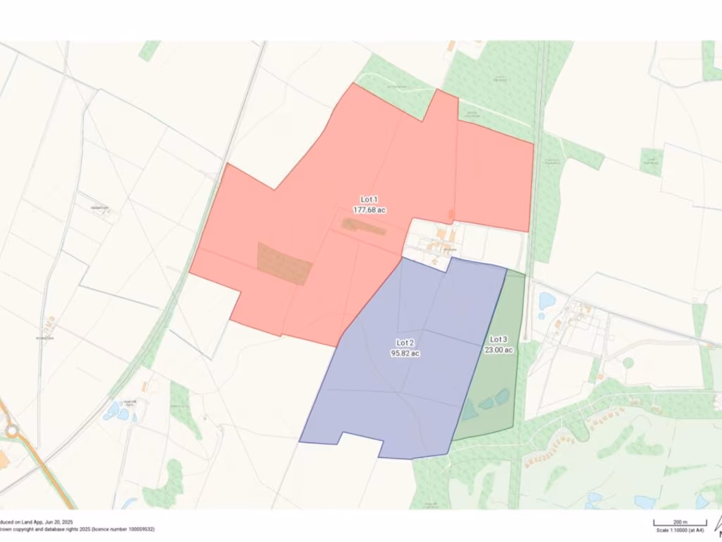
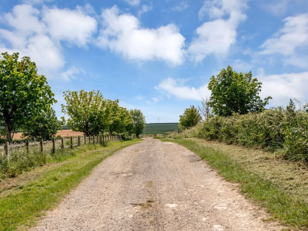
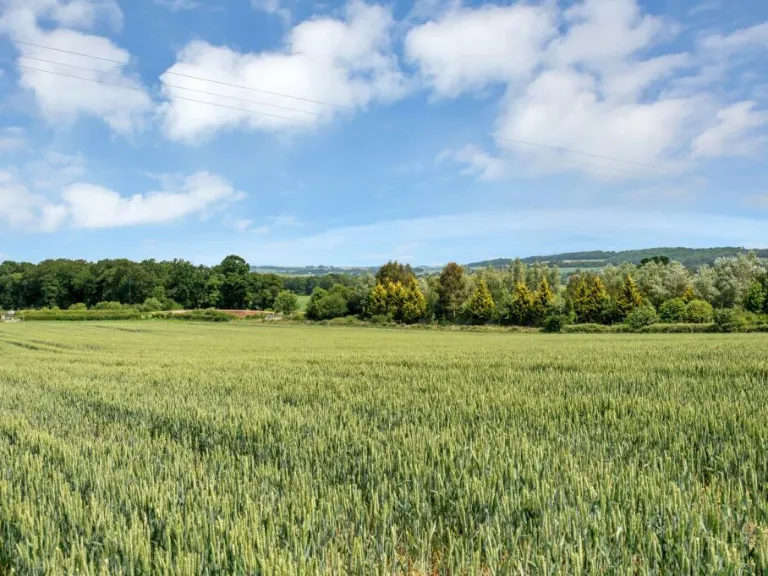
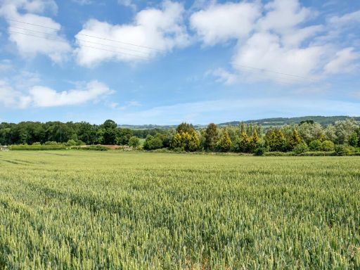
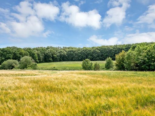
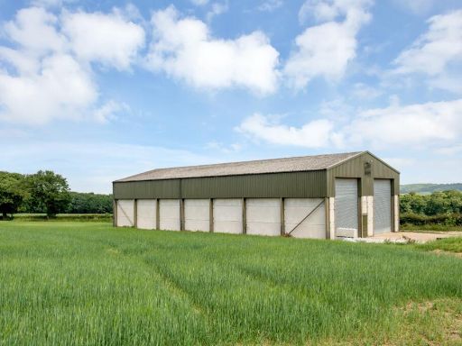
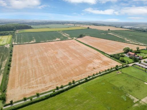
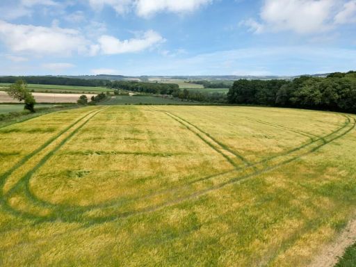
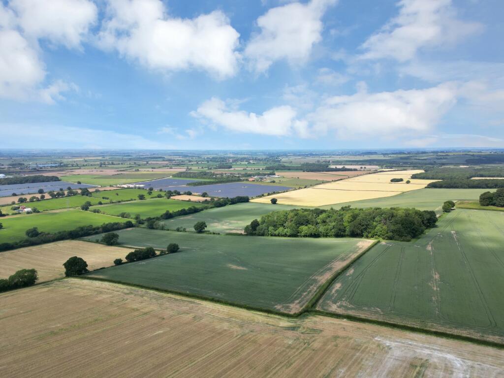
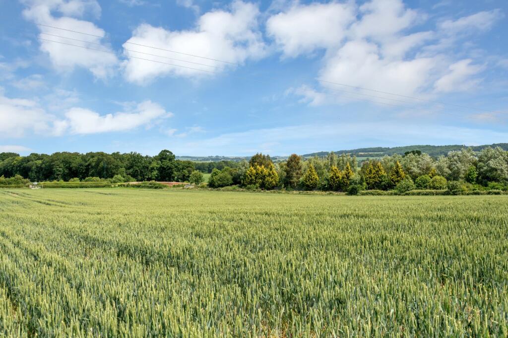
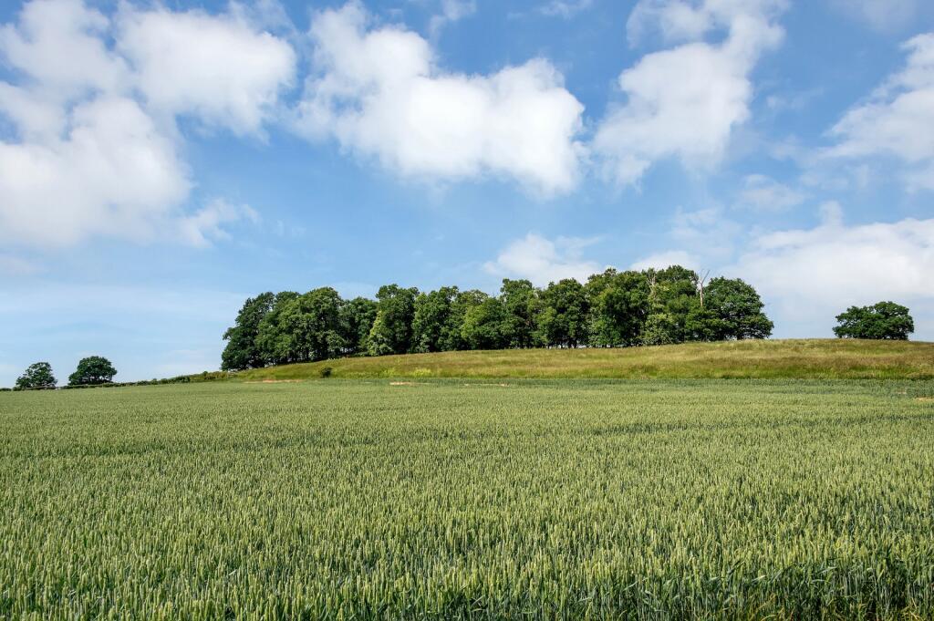
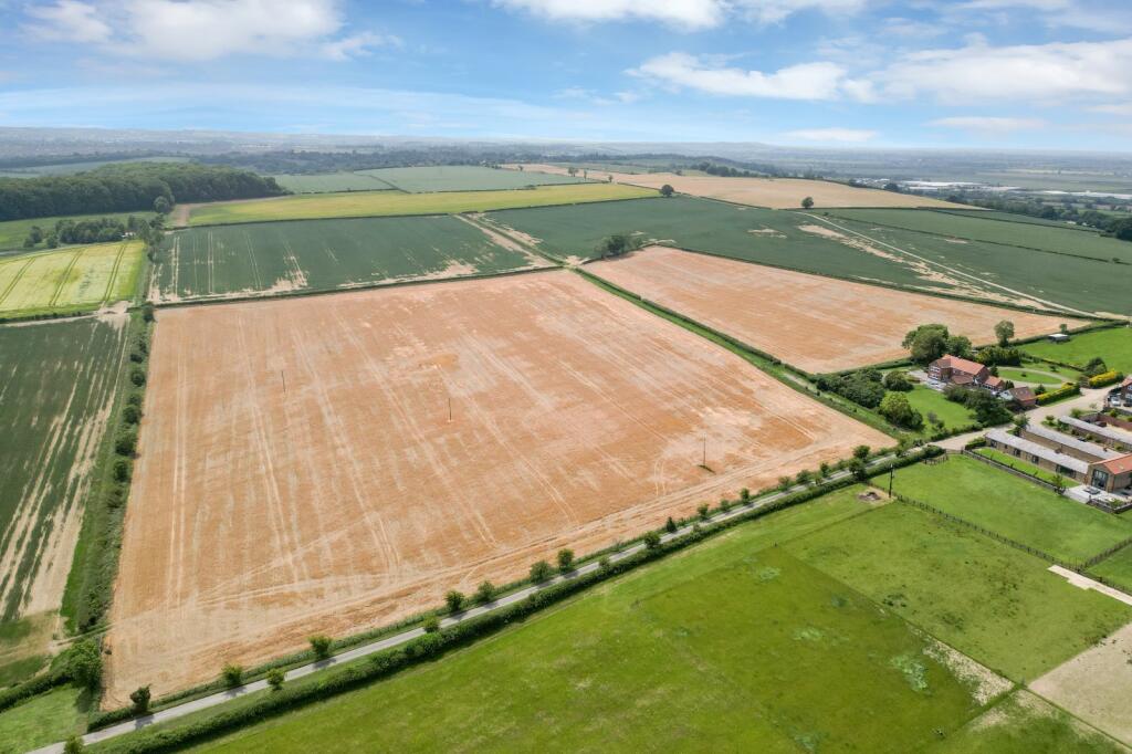
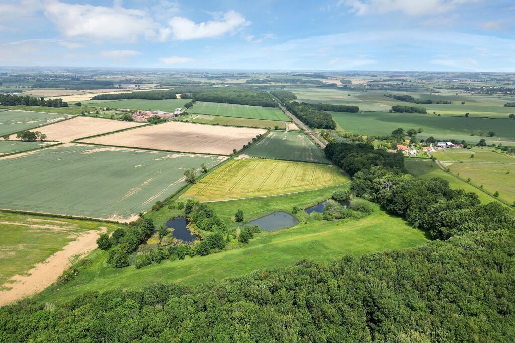
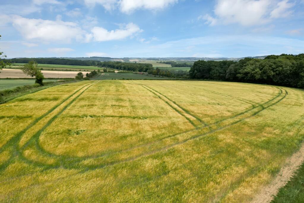
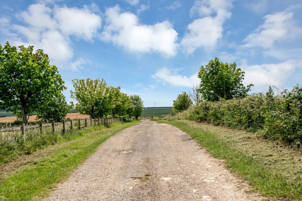
- This expansive parcel of land located in the scenic area of Great Gonerby in Lincolnshire offers a sweeping view of the picturesque agricultural landscape. The property comprises lush, fertile fields that stretch across large expanses, ideal for farming or development subject to planning permissions. Natural hedgerows and small clusters of trees complement the vast open spaces, providing an exceptional rural panorama.
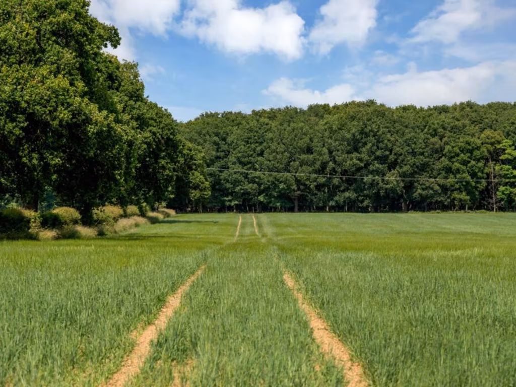
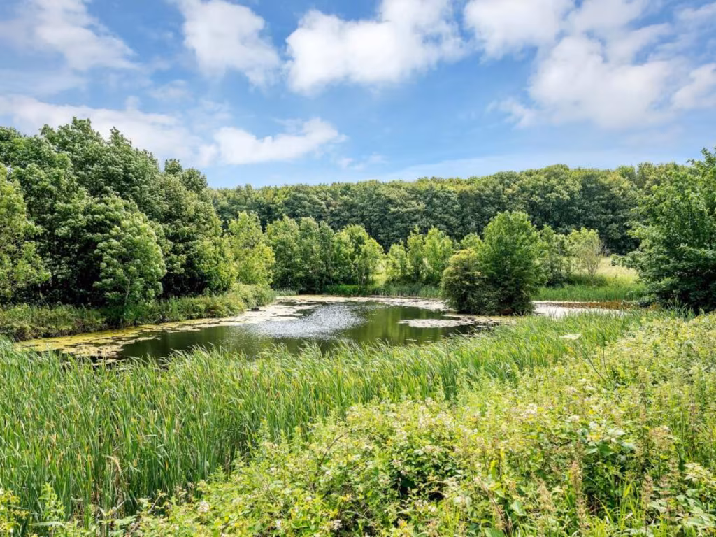
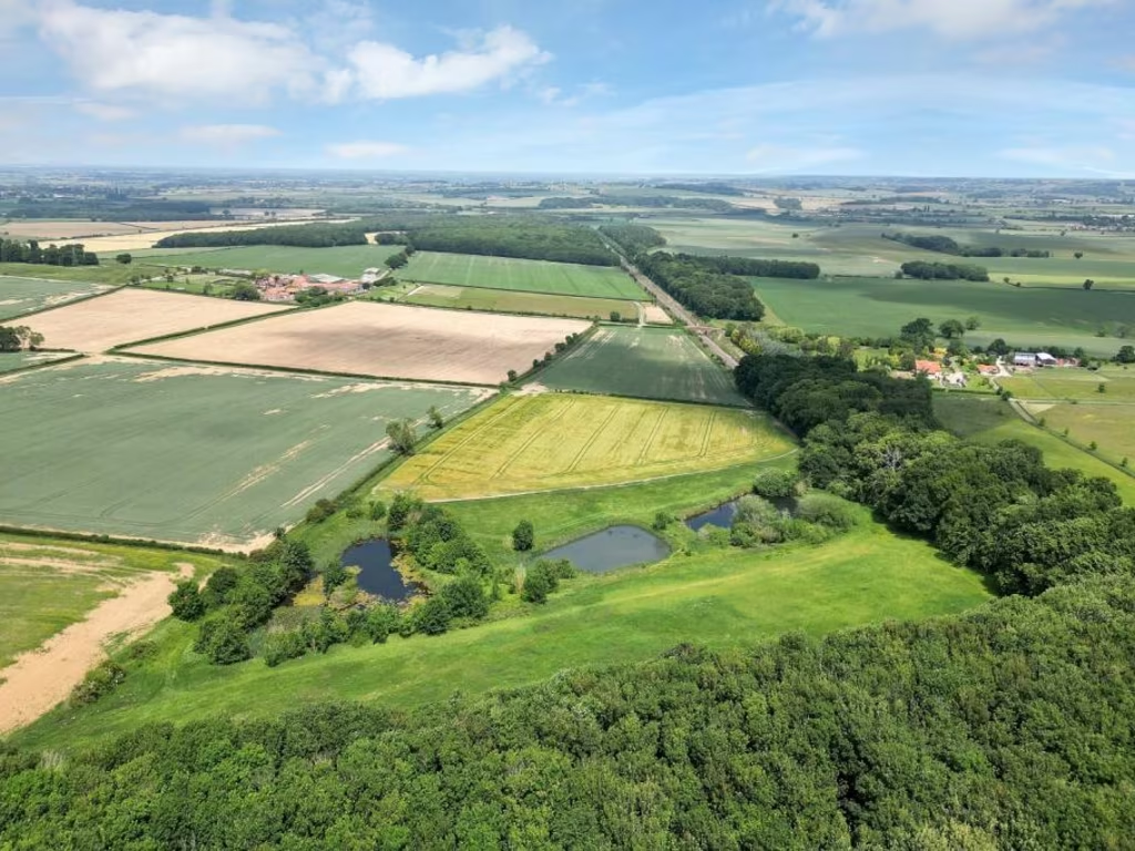
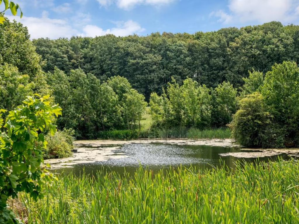
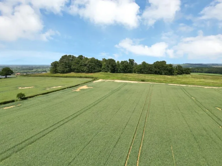
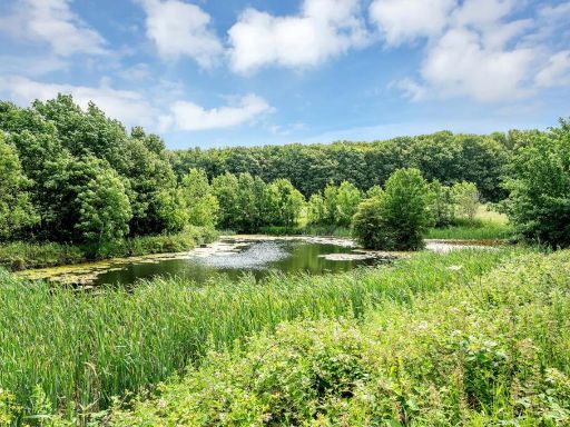
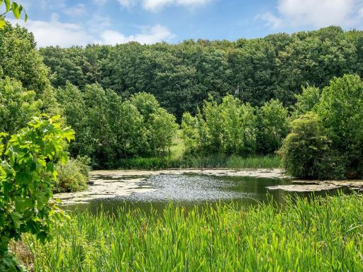
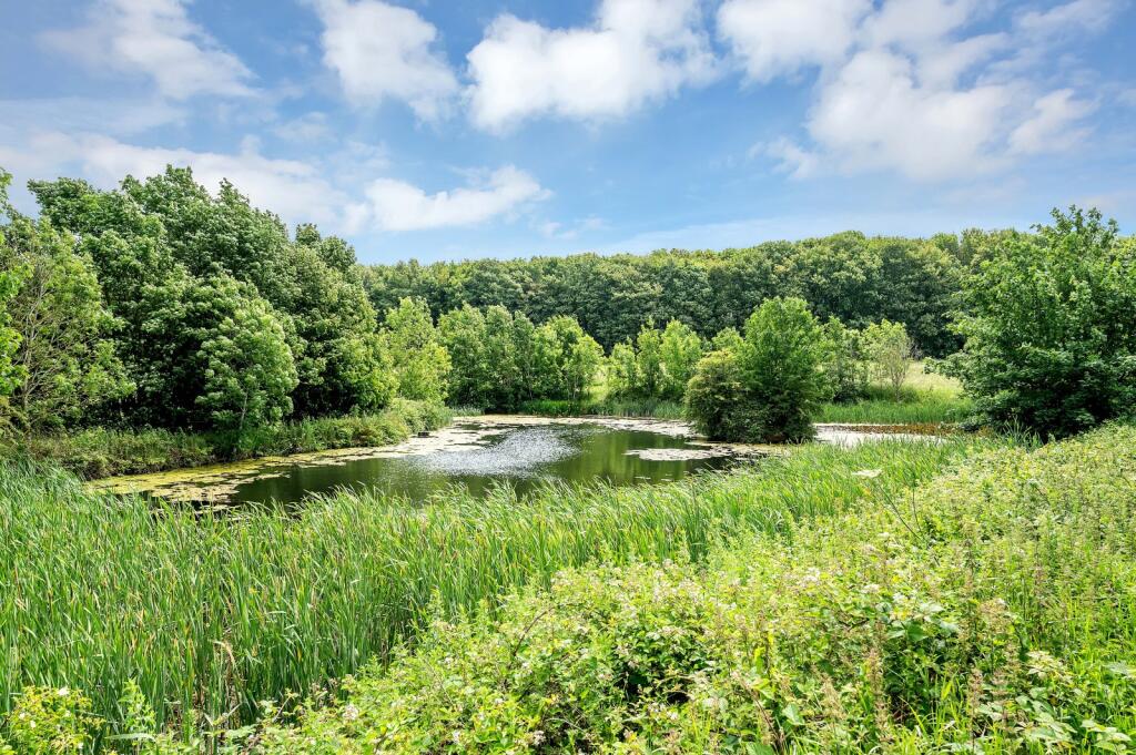
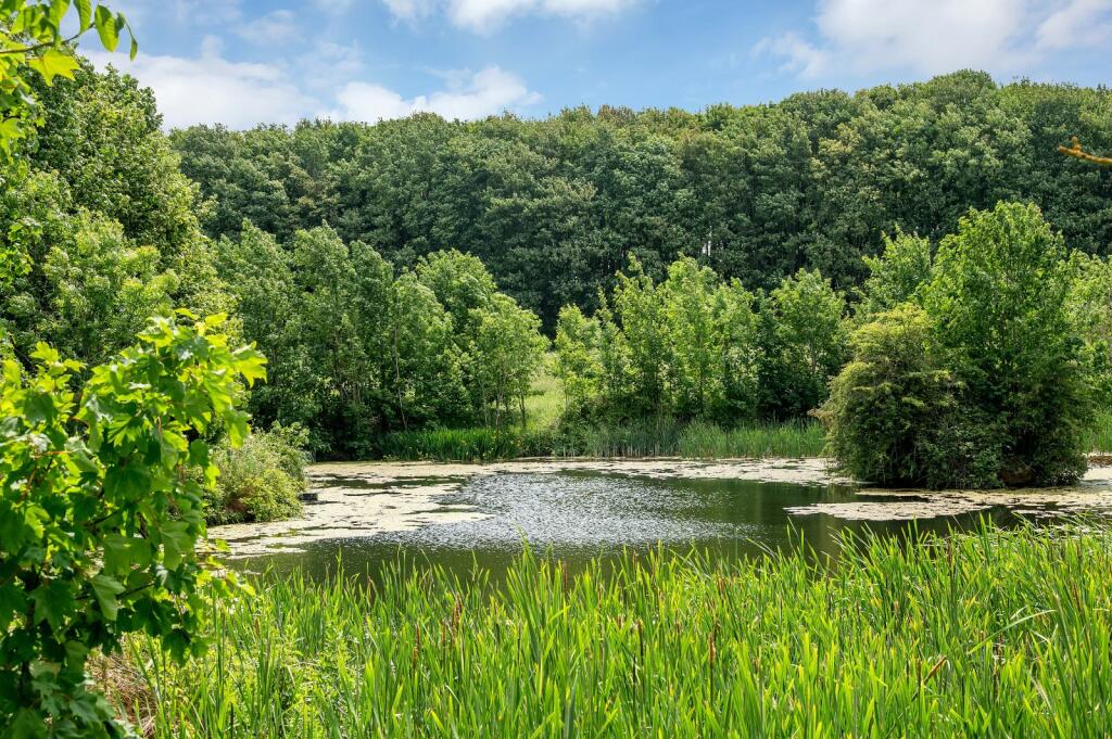
- The property for sale is a substantial piece of land located in Great Gonerby, Lincolnshire. It offers picturesque views, primarily overlooking a lush, dense forest that provides a sense of seclusion and natural beauty. The land appears to include a water feature or pond, contributing to its serene landscape. While explicit sizes are not detailed in the image, the property suggests a large estate size, suitable for agricultural or development potential.
Image Descriptions
- vast agricultural land rural
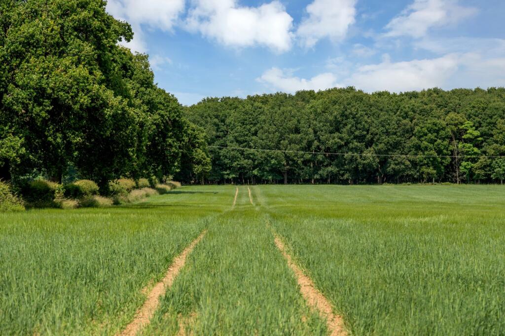
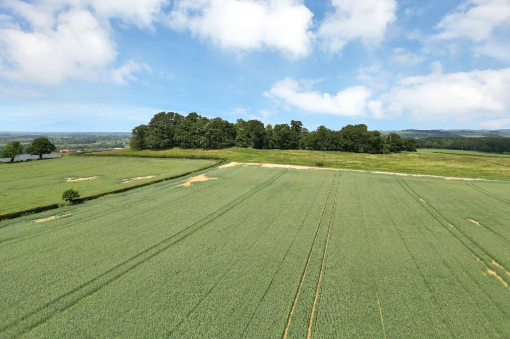
- agricultural field
Textual Property Features
Detected Visual Features
- agricultural land
- farmland
- rural
- fields
- expansive views
- countryside
- open space
- undeveloped
- land
- field
- agriculture
- development potential
- greenery
Nearby Schools
- Walton Academy
- Huntingtower Community Primary Academy
- Dudley House School
- Kesteven and Grantham Girls' School
- Barrowby Church of England Primary School
- Allington with Sedgebrook Church of England Primary School
- The Harlaxton Church of England Primary School
- West Grantham Church of England Primary Academy
- St Wulfram's National Church of England Primary School
- The King's School, Grantham
- The Little Gonerby Church of England Primary Academy, Grantham
- The Harrowby Church of England Primary School
- Poplar Farm School
- The Priory Ruskin Academy
- Belton Lane Community Primary School
- The Gonerby Hill Foot Church of England Primary School
- The St Sebastian's Church of England Primary School, Great Gonerby
- St Anne's Church of England Primary School, Grantham
- Saint Mary's Catholic Voluntary Academy
- Belmont Community Primary School
- Cliffedale Primary School
- Barkston and Syston CofE Primary School
- The Marston Thorold's Charity Church of England School
- Grantham Preparatory International School
- West Grantham Church of England Secondary Academy
- The Isaac Newton Primary School
- Springwell Alternative Academy Grantham
Nearest General Shops
- Id: 1068567691
- Tags:
- TagsNormalized:
- Lat: 52.9446933
- Lon: -0.6243581
- FullGeoHash: gcrt1y335qhv
- PartitionGeoHash: gcrt
- Images:
- FoodStandards: null
- Distance: 1789.5
,- Id: 3402188741
- Tags:
- Addr:
- City: Belton
- Postcode: NG32 2LN
- Street: Grantham Road
- Fhrs:
- Authority: South Kesteven
- Id: 238021
- Local_authority_id: 3874
- Name: Belton Garden Centre
- Shop: garden_centre
- TagsNormalized:
- Lat: 52.9450434
- Lon: -0.624633
- FullGeoHash: gcrt1y35hzrv
- PartitionGeoHash: gcrt
- Images:
- FoodStandards:
- Id: 238021
- FHRSID: 238021
- LocalAuthorityBusinessID: 3874
- BusinessName: Belton Garden Centre
- BusinessType: Restaurant/Cafe/Canteen
- BusinessTypeID: 1
- AddressLine1: Belton Garden Centre
- AddressLine2: Grantham Road
- AddressLine3: Belton
- AddressLine4: Lincolnshire
- PostCode: NG32 2LN
- RatingValue: 5
- RatingKey: fhrs_5_en-GB
- RatingDate: 2021-09-15
- LocalAuthorityCode: 224
- LocalAuthorityName: South Kesteven
- LocalAuthorityWebSite: http://www.southkesteven.gov.uk
- LocalAuthorityEmailAddress: healthy@southkesteven.gov.uk
- Scores:
- Hygiene: 0
- Structural: 5
- ConfidenceInManagement: 0
- NewRatingPending: false
- Geocode:
- Longitude: -0.62711800000000
- Latitude: 52.94319000000000
- Distance: 1757.2
,- Id: 1012591684
- Tags:
- Building: yes
- Shop: outdoor
- TagsNormalized:
- Lat: 52.946016
- Lon: -0.6291691
- FullGeoHash: gcrt1wtbgk9x
- PartitionGeoHash: gcrt
- Images:
- FoodStandards: null
- Distance: 1435.2
}
Nearest Religious buildings
- Id: 273788275
- Tags:
- Amenity: place_of_worship
- Building: church
- Denomination: anglican
- Name: St Mary's
- Religion: christian
- Source: bing
- Wikidata: Q17549873
- TagsNormalized:
- place of worship
- church
- anglican
- christian
- Lat: 52.9577835
- Lon: -0.6172662
- FullGeoHash: gcrt3bwt2wkg
- PartitionGeoHash: gcrt
- Images:
- FoodStandards: null
- Distance: 2238.8
,- Id: 172658484
- Tags:
- Amenity: place_of_worship
- Building: church
- Denomination: anglican
- Name: Parish Church of St Peter and St Paul
- Religion: christian
- Source: Bing
- Wikidata: Q17532049
- TagsNormalized:
- place of worship
- church
- anglican
- parish
- paul
- christian
- Lat: 52.9451651
- Lon: -0.6176811
- FullGeoHash: gcrt1yq5yype
- PartitionGeoHash: gcrt
- Images:
- FoodStandards: null
- Distance: 2190
,- Id: 712767852
- Tags:
- Amenity: place_of_worship
- Denomination: methodist
- Name: Methodist Church Great Gonerby
- Religion: christian
- TagsNormalized:
- place of worship
- methodist
- church
- christian
- Lat: 52.9350737
- Lon: -0.667283
- FullGeoHash: gcrt0ud15hvw
- PartitionGeoHash: gcrt
- Images:
- FoodStandards: null
- Distance: 2174
}
Nearest Medical buildings
- Id: 10093301805
- Tags:
- Amenity: clinic
- Healthcare: clinic
- Name: Footsteps
- TagsNormalized:
- Lat: 52.9151504
- Lon: -0.6445013
- FullGeoHash: gcrt12ftn4bz
- PartitionGeoHash: gcrt
- Images:
- FoodStandards: null
- Distance: 4013.6
,- Id: 10107116228
- Tags:
- Amenity: pharmacy
- Name: Lloyds Pharmacy
- TagsNormalized:
- Lat: 52.9191014
- Lon: -0.6240508
- FullGeoHash: gcrt1c9s4e3z
- PartitionGeoHash: gcrt
- Images:
- FoodStandards: null
- Distance: 3931.5
,- Id: 7324572
- Tags:
- Addr:
- City: Grantham
- Postcode: NG31 8DG
- Street: Manthorpe Road
- Amenity: hospital
- Fhrs:
- Authority: South Kesteven
- Id: 237675
- Local_authority_id: 1095
- Healthcare: hospital
- Name: Grantham and District Hospital
- Type: multipolygon
- Wikidata: Q5596642
- TagsNormalized:
- Lat: 52.9208496
- Lon: -0.6421237
- FullGeoHash: gcrt13uqm3mu
- PartitionGeoHash: gcrt
- Images:
- FoodStandards:
- Id: 237675
- FHRSID: 237675
- LocalAuthorityBusinessID: 1095
- BusinessName: Grantham & District Hospital - ULTH
- BusinessType: Hospitals/Childcare/Caring Premises
- BusinessTypeID: 5
- AddressLine1: Grantham And District Hospital
- AddressLine2: Manthorpe Road
- AddressLine3: Grantham
- AddressLine4: Lincolnshire
- PostCode: NG31 8DG
- RatingValue: 5
- RatingKey: fhrs_5_en-GB
- RatingDate: 2022-03-05
- LocalAuthorityCode: 224
- LocalAuthorityName: South Kesteven
- LocalAuthorityWebSite: http://www.southkesteven.gov.uk
- LocalAuthorityEmailAddress: healthy@southkesteven.gov.uk
- Scores:
- Hygiene: 0
- Structural: 5
- ConfidenceInManagement: 0
- NewRatingPending: false
- Geocode:
- Longitude: -0.64189400000000
- Latitude: 52.92093900000000
- Distance: 3399.2
,- Id: 7313253890
- Tags:
- Aeroway: helipad
- Lit: no
- Name: Grantham & District Hospital Helipad
- Surface: grass
- TagsNormalized:
- Lat: 52.9209001
- Lon: -0.64382
- FullGeoHash: gcrt13gntfv1
- PartitionGeoHash: gcrt
- Images:
- FoodStandards: null
- Distance: 3380.5
}
Nearest Leisure Facilities
- Id: 495168242
- Tags:
- Leisure: track
- Name: Gonerby Moor Motocross Track
- TagsNormalized:
- Lat: 52.9559497
- Lon: -0.6796799
- FullGeoHash: gcrt2834f29b
- PartitionGeoHash: gcrt
- Images:
- FoodStandards: null
- Distance: 2135
,- Id: 172565127
- Tags:
- Access: customers
- Dog: no
- Leisure: playground
- Name: Belton House Adventure Playground
- Operator: National Trust
- Source: Bing;local knowledge
- Surface: unpaved
- TagsNormalized:
- Lat: 52.9425282
- Lon: -0.6229678
- FullGeoHash: gcrt1vfkef9d
- PartitionGeoHash: gcrt
- Images:
- FoodStandards: null
- Distance: 1979.9
,- Id: 321984666
- Tags:
- Leisure: pitch
- Sport: soccer
- TagsNormalized:
- Lat: 52.9371359
- Lon: -0.6657874
- FullGeoHash: gcrt0ugjnj2g
- PartitionGeoHash: gcrt
- Images:
- FoodStandards: null
- Distance: 1929
,- Id: 205251810
- Tags:
- TagsNormalized:
- Lat: 52.9375565
- Lon: -0.6665101
- FullGeoHash: gcrt0ufxt5y0
- PartitionGeoHash: gcrt
- Images:
- FoodStandards: null
- Distance: 1920.9
,- Id: 205247157
- Tags:
- TagsNormalized:
- Lat: 52.9450516
- Lon: -0.6738145
- FullGeoHash: gcrt0wm76bzq
- PartitionGeoHash: gcrt
- Images:
- FoodStandards: null
- Distance: 1806.7
}
Nearest Tourist attractions
- Id: 172634883
- Tags:
- Addr:
- City: Belton
- Postcode: NG32 2LS
- Street: Belton Park
- Building: yes
- Fhrs:
- Authority: South Kesteven
- Id: 1061272
- Local_authority_id: 85343
- Name: Belton House
- Operator: National Trust
- Source: Bing
- Tourism: attraction
- Wheelchair: no
- Wikidata: Q2415840
- Wikipedia: en:Belton House
- TagsNormalized:
- Lat: 52.9430835
- Lon: -0.6177401
- FullGeoHash: gcrt1vypvd5d
- PartitionGeoHash: gcrt
- Images:
- FoodStandards:
- Id: 1061272
- FHRSID: 1061272
- LocalAuthorityBusinessID: 85343
- BusinessName: Belton House
- BusinessType: Restaurant/Cafe/Canteen
- BusinessTypeID: 1
- AddressLine1: null
- AddressLine2: Belton Park
- AddressLine3: Belton
- AddressLine4: Grantham
- PostCode: NG32 2LS
- RatingValue: 5
- RatingKey: fhrs_5_en-GB
- RatingDate: 2021-08-23
- LocalAuthorityCode: 224
- LocalAuthorityName: South Kesteven
- LocalAuthorityWebSite: http://www.southkesteven.gov.uk
- LocalAuthorityEmailAddress: healthy@southkesteven.gov.uk
- Scores:
- Hygiene: 0
- Structural: 5
- ConfidenceInManagement: 0
- NewRatingPending: false
- Geocode:
- Longitude: -0.61794900894165
- Latitude: 52.94324493408200
- Distance: 2267.5
,- Id: 33721188
- Tags:
- Created_by: JOSM
- Name: Belton House (National Trust)
- Tourism: attraction
- TagsNormalized:
- national trust
- attraction
- tourism
- Lat: 52.9422625
- Lon: -0.6195264
- FullGeoHash: gcrt1vug5cp9
- PartitionGeoHash: gcrt
- Images:
- FoodStandards: null
- Distance: 2197.6
,- Id: 117094777
- Tags:
- Building: yes
- Name: Orangery
- Source: Bing
- Tourism: attraction
- Wheelchair: no
- TagsNormalized:
- Lat: 52.9449802
- Lon: -0.6183848
- FullGeoHash: gcrt1ymdyedu
- PartitionGeoHash: gcrt
- Images:
- FoodStandards: null
- Distance: 2151.6
}
Nearest Train stations
- Id: 3170037835
- Tags:
- Name: Aslockton
- Naptan:
- Network: National Rail
- Public_transport: station
- Railway: station
- Ref:
- Source: NPE
- Train: yes
- Wikidata: Q2261645
- Wikipedia: en:Aslockton railway station
- TagsNormalized:
- Lat: 52.9515525
- Lon: -0.8984194
- FullGeoHash: gcrm5x9c1kcf
- PartitionGeoHash: gcrm
- Images:
- FoodStandards: null
- Distance: 16721.6
,- Id: 27410438
- Tags:
- Name: Elton and Orston
- Naptan:
- Network: National Rail
- Public_transport: station
- Railway: station
- Ref:
- Source: NPE
- Wikidata: Q2585835
- Wikipedia: en:Elton and Orston railway station
- TagsNormalized:
- Lat: 52.9521534
- Lon: -0.8554051
- FullGeoHash: gcrmhx9hesgd
- PartitionGeoHash: gcrm
- Images:
- FoodStandards: null
- Distance: 13840.2
,- Id: 152441568
- Tags:
- Name: Bottesford
- Naptan:
- Network: National Rail
- Public_transport: station
- Railway: station
- Ref:
- Source: NPE
- Wikidata: Q3985747
- Wikipedia: en:Bottesford railway station
- TagsNormalized:
- Lat: 52.9447732
- Lon: -0.7951793
- FullGeoHash: gcrmjykcwvp6
- PartitionGeoHash: gcrm
- Images:
- FoodStandards: null
- Distance: 9831.5
,- Id: 5520056018
- Tags:
- Name: Ancaster
- Naptan:
- Network: National Rail
- Public_transport: station
- Railway: station
- Ref:
- Source: NPE
- Wikidata: Q2861300
- Wikipedia: en:Ancaster railway station
- TagsNormalized:
- Lat: 52.987708
- Lon: -0.5353535
- FullGeoHash: gcrt7y45v2eq
- PartitionGeoHash: gcrt
- Images:
- FoodStandards: null
- Distance: 8617.5
,- Id: 6414872009
- Tags:
- Name: Grantham
- Naptan:
- Network: National Rail
- Public_transport: station
- Railway: station
- Ref:
- Source: NPE
- Train: yes
- Wheelchair: yes
- Wikidata: Q4496900
- Wikipedia: en:Grantham railway station
- TagsNormalized:
- Lat: 52.9065217
- Lon: -0.6430066
- FullGeoHash: gcrscr7fbf7x
- PartitionGeoHash: gcrs
- Images:
- FoodStandards: null
- Distance: 4977.9
}
Nearest Hotels
- Id: 205124067
- Tags:
- Addr:
- City: Great Gonerby
- Postcode: NG32 2HB
- Street: Old Great North Road
- Brand: Travelodge
- Brand:wikidata: Q9361374
- Building: yes
- Fhrs:
- Authority: South Kesteven
- Id: 238421
- Local_authority_id: 4678
- Internet_access: wlan
- Internet_access:fee: customers
- Internet_access:ssid: Travelodge WiFi
- Name: Travelodge
- Tourism: hotel
- TagsNormalized:
- Lat: 52.9480356
- Lon: -0.6783836
- FullGeoHash: gcrt0wfh8t0x
- PartitionGeoHash: gcrt
- Images:
- FoodStandards: null
- Distance: 2010.6
,- Id: 55032222
- Tags:
- Addr:
- City: Belton
- Postcode: NG32 2LN
- Street: Grantham Road
- Building: yes
- Fhrs:
- Authority: South Kesteven
- Id: 237618
- Local_authority_id: 3877
- Name: Belton Wood Hotel
- Operator: De Vere
- Tourism: hotel
- TagsNormalized:
- Lat: 52.9442961
- Lon: -0.6304563
- FullGeoHash: gcrt1whyvk1s
- PartitionGeoHash: gcrt
- Images:
- FoodStandards: null
- Distance: 1447.5
,- Id: 14238729
- Tags:
- Addr:
- City: Grantham
- Postcode: NG32 2LN
- Street: Belton
- Description: 18 hole Par 72 Lakes Course & 18 hole Par 73 Woodside Course & 9 hole Par 27 Academy Course
- Email: belton.woods@devere-hotels.com
- Golf:
- Course: 45_hole
- Par: 72 + 73 + 27
- Leisure: golf_course
- Name: Belton Woods Hotel
- Phone: +44 871 222 4691
- Source: Bing
- Type: multipolygon
- Website: http://www.devere-hotels.co.uk/hotel-lodges/locations/belton-woods/golf/introduction.html
- TagsNormalized:
- golf
- golf course
- leisure
- hotel
- Lat: 52.9411645
- Lon: -0.6374088
- FullGeoHash: gcrt1mxuek3e
- PartitionGeoHash: gcrt
- Images:
- FoodStandards: null
- Distance: 1348.3
}
Tags
- agricultural land
- farmland
- rural
- fields
- expansive views
- countryside
- open space
- undeveloped
- land
- field
- agriculture
- rural
- countryside
- open space
- development potential
- greenery
- farmland
Local Market Stats
- Average Price/sqft: £246
- Avg Income: £44200
- Rental Yield: 3.6%
- Social Housing: 9%
- Planning Success Rate: 90%
Similar Properties
 Land for sale in Belton, Grantham, Lincolnshire, NG32 — £900,000 • 1 bed • 1 bath
 Land for sale in Belton, Grantham, Lincolnshire, NG32 — £1,700,000 • 1 bed • 1 bath
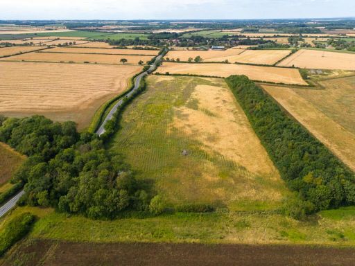 Land for sale in Highly Productive Arable And Grass Land, Scopwick, Lincolnshire, LN4 — £480,000 • 1 bed • 1 bath
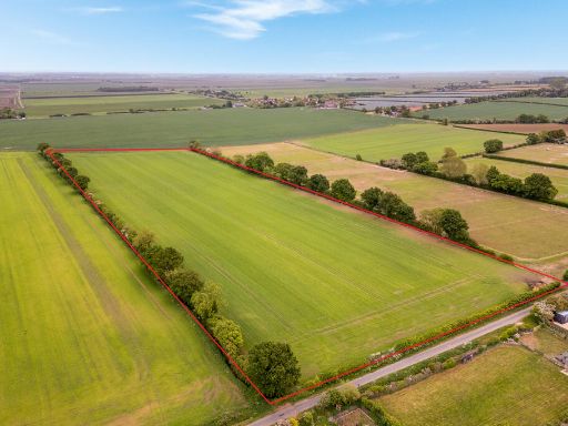 Farm land for sale in Lot 2 - Around 11.50 Acres, Acre Dyke Lane, Branston Booths, Lincoln, Lincolnshire, LN4 1JD, LN4 — £100,000 • 1 bed • 1 bath
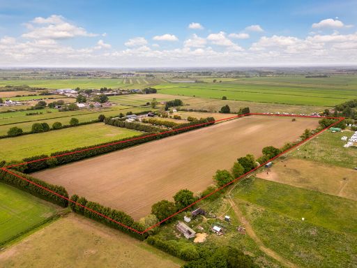 Farm land for sale in Lot 6 - Around 13.02 Acres Bardney Road, Branston Booths, Lincoln, Lincolnshire, LN4 1JD, LN4 — £130,000 • 1 bed • 1 bath
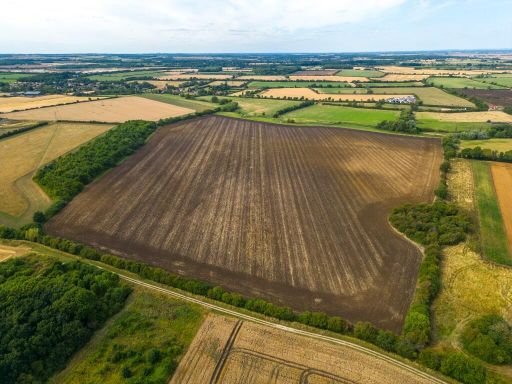 Farm land for sale in SCOPWICK, Near LincolnLN4 — £480,000 • 1 bed • 1 bath
Meta
- {
"@context": "https://schema.org",
"@type": "Residence",
"name": "Land for sale in Belton, Grantham, Lincolnshire, NG32",
"description": "",
"url": "https://propertypiper.co.uk/property/90c5a757-d5b7-4f3b-b618-a3e64f192805",
"image": "https://image-a.propertypiper.co.uk/0d98070b-88cc-40f7-a668-98d6960f19a2-1024.jpeg",
"address": {
"@type": "PostalAddress",
"streetAddress": "Belton, Grantham, Lincolnshire",
"postalCode": "NG32 2NX",
"addressLocality": "South Kesteven",
"addressRegion": "Sleaford and North Hykeham",
"addressCountry": "England"
},
"geo": {
"@type": "GeoCoordinates",
"latitude": 52.95115151515306,
"longitude": -0.648821580698595
},
"numberOfRooms": 1,
"numberOfBathroomsTotal": 1,
"offers": {
"@type": "Offer",
"price": 2700000,
"priceCurrency": "GBP",
"availability": "https://schema.org/InStock"
},
"additionalProperty": [
{
"@type": "PropertyValue",
"name": "Feature",
"value": "agricultural land"
},
{
"@type": "PropertyValue",
"name": "Feature",
"value": "farmland"
},
{
"@type": "PropertyValue",
"name": "Feature",
"value": "rural"
},
{
"@type": "PropertyValue",
"name": "Feature",
"value": "fields"
},
{
"@type": "PropertyValue",
"name": "Feature",
"value": "expansive views"
},
{
"@type": "PropertyValue",
"name": "Feature",
"value": "countryside"
},
{
"@type": "PropertyValue",
"name": "Feature",
"value": "open space"
},
{
"@type": "PropertyValue",
"name": "Feature",
"value": "undeveloped"
},
{
"@type": "PropertyValue",
"name": "Feature",
"value": "land"
},
{
"@type": "PropertyValue",
"name": "Feature",
"value": "field"
},
{
"@type": "PropertyValue",
"name": "Feature",
"value": "agriculture"
},
{
"@type": "PropertyValue",
"name": "Feature",
"value": "rural"
},
{
"@type": "PropertyValue",
"name": "Feature",
"value": "countryside"
},
{
"@type": "PropertyValue",
"name": "Feature",
"value": "open space"
},
{
"@type": "PropertyValue",
"name": "Feature",
"value": "development potential"
},
{
"@type": "PropertyValue",
"name": "Feature",
"value": "greenery"
},
{
"@type": "PropertyValue",
"name": "Feature",
"value": "farmland"
}
]
}