Summary - 1 GLEN DALE ROWLAND'S CASTLE PO9 6EP
1 bed 1 bath Land
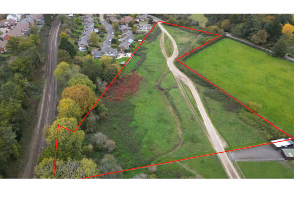
Large versatile plot for grazing, recreation or considered development potential.
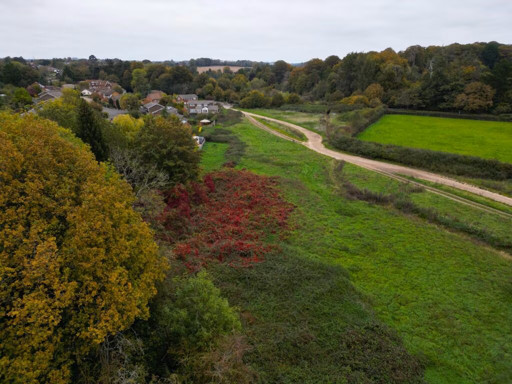
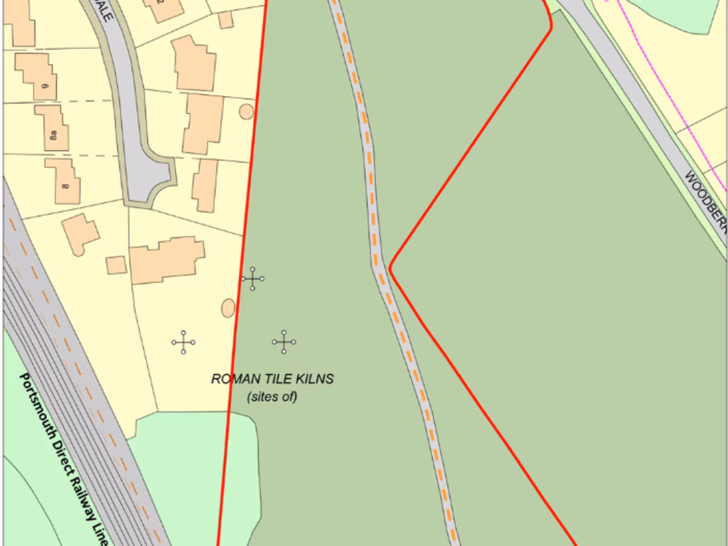
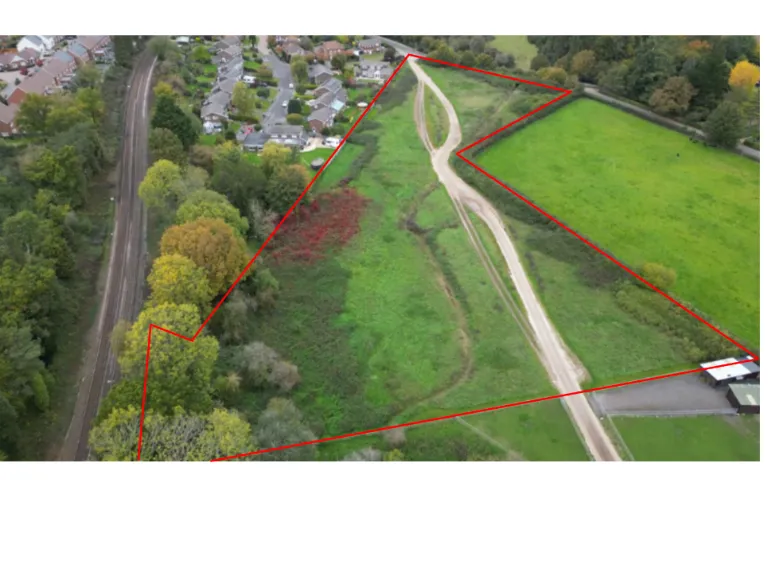
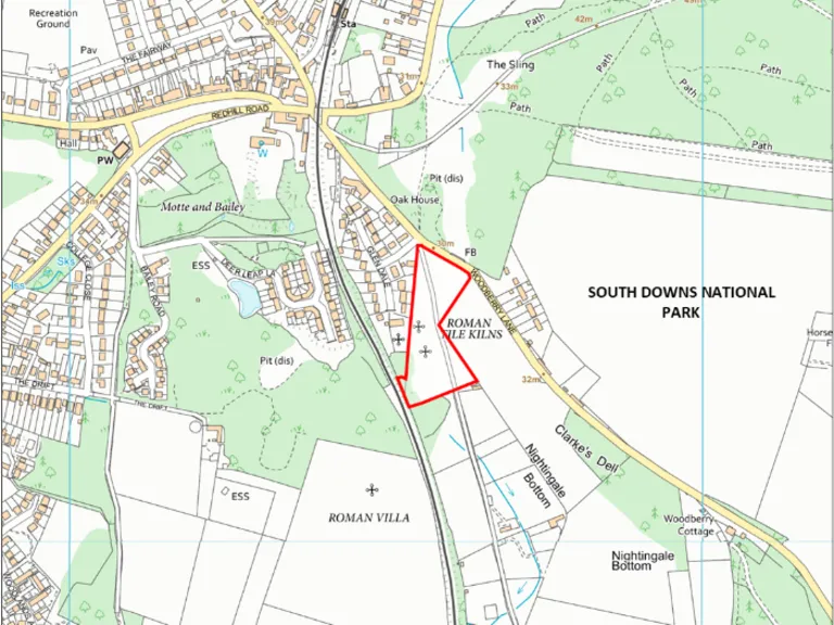
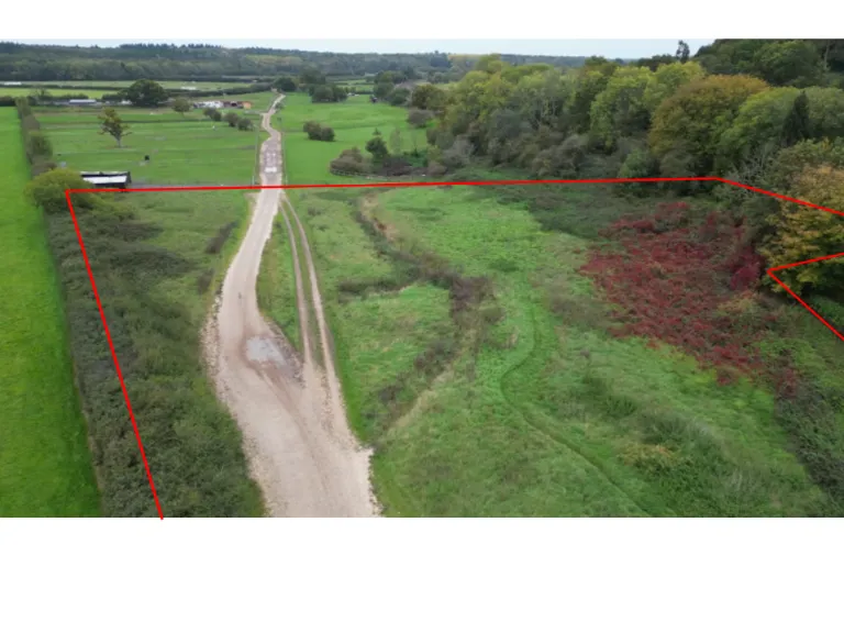
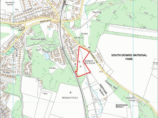
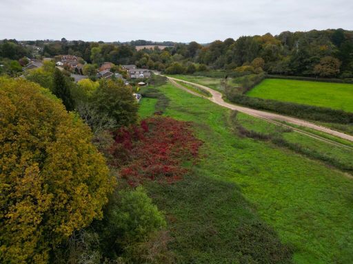
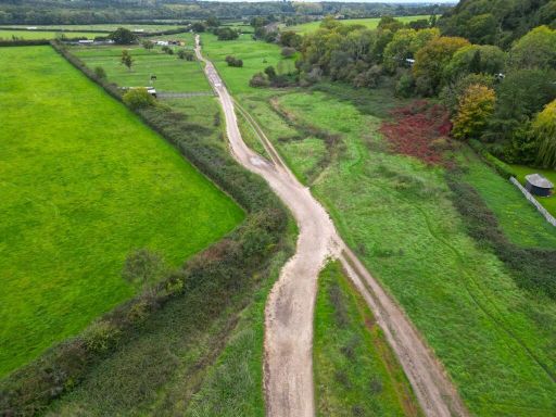
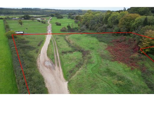
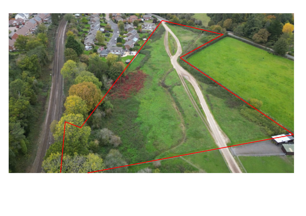
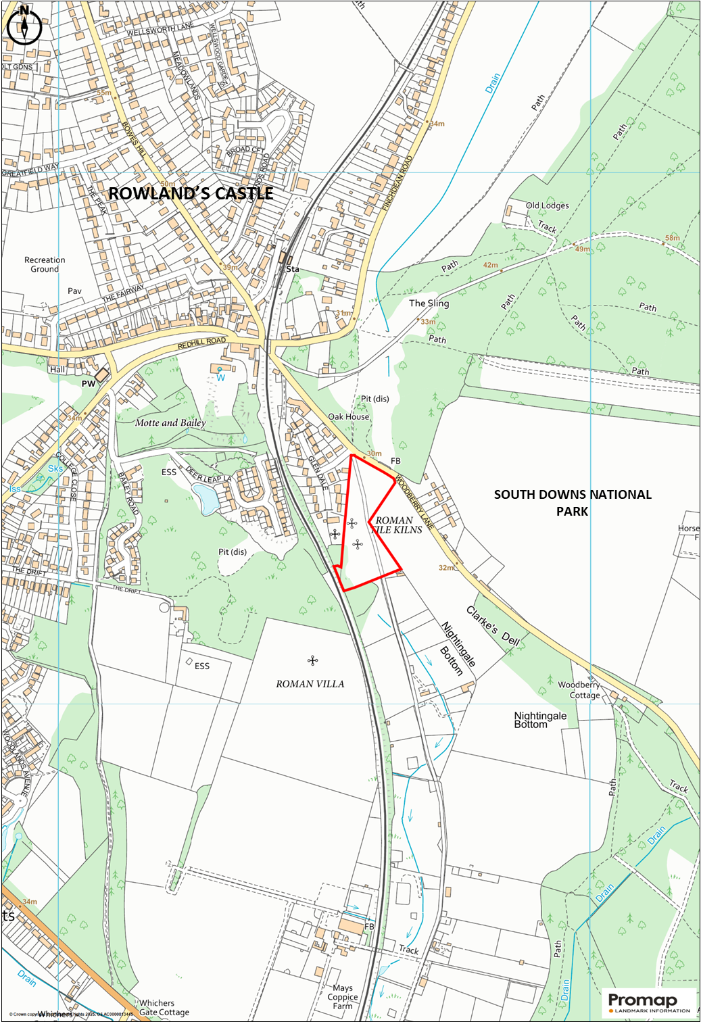
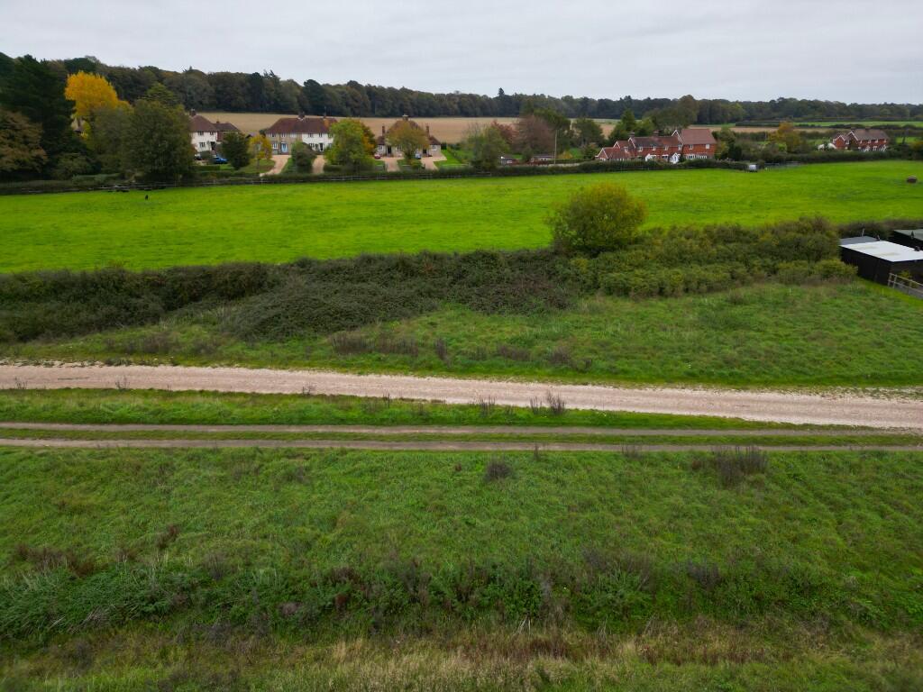
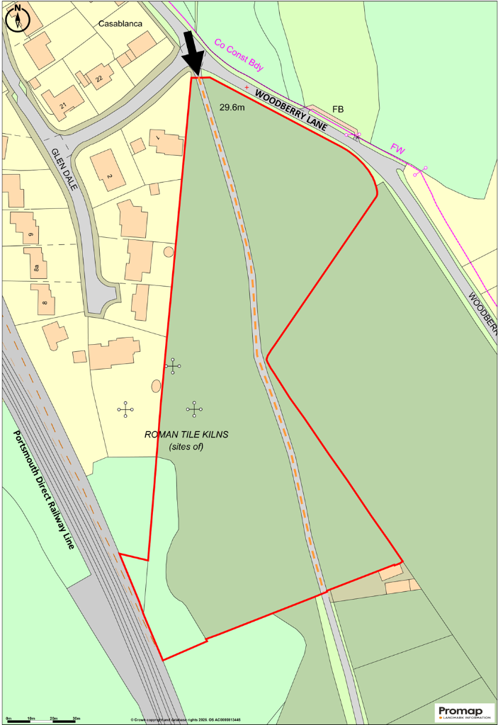
Approx. 4.28 acres (1.73 ha) of pastureland with small woodland area
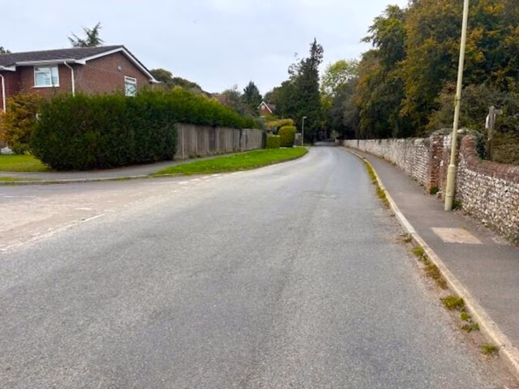
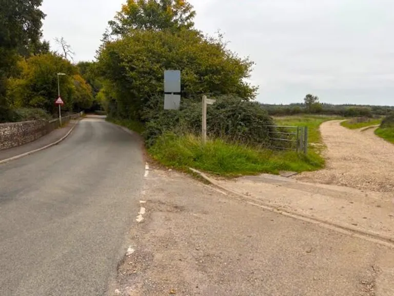
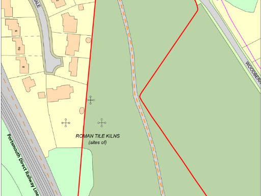
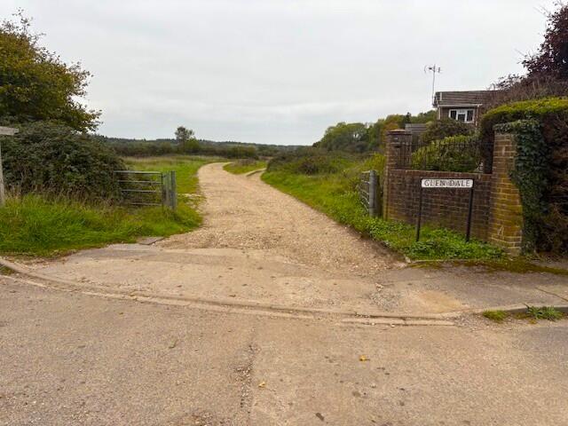
Direct access from Woodberry Lane; bridleway/right of way across site
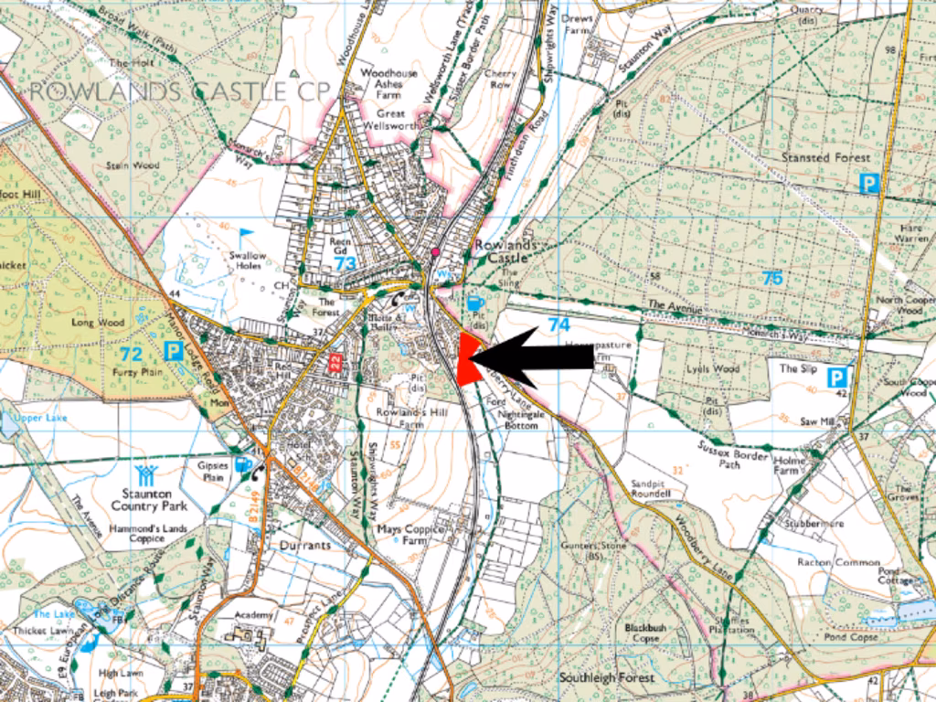
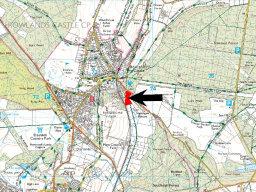
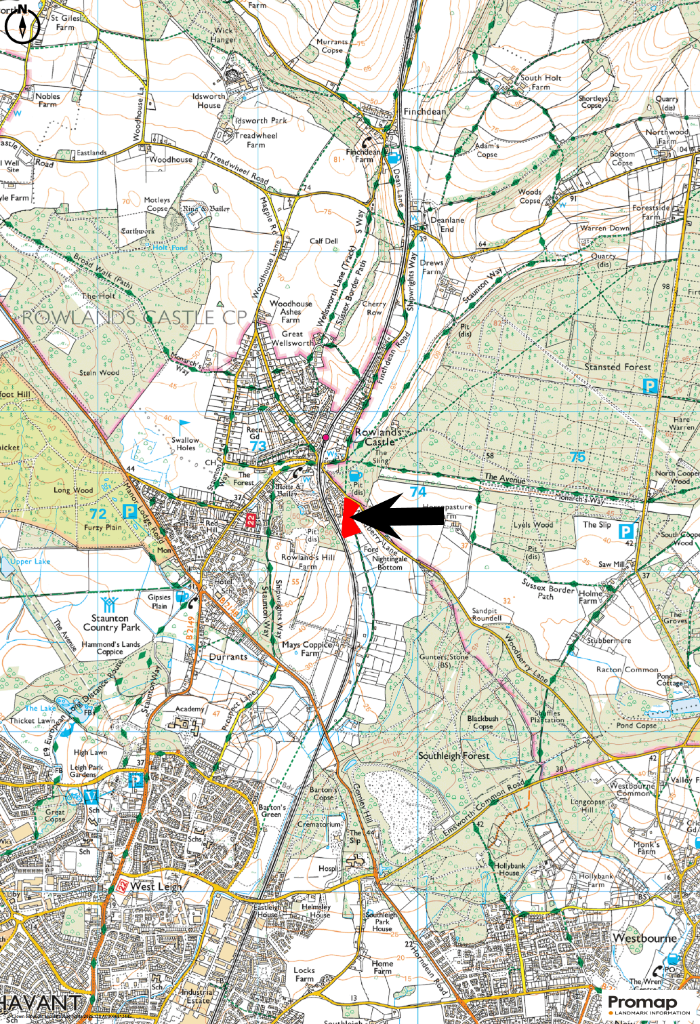
Adjacent to Rowlands Castle settlement boundary; edge-of-village location
Close to South Downs National Park boundary with extensive footpath access
Much of site in Flood Zones 2–3; medium to high flooding probability
Eastern area recorded as historic landfill — environmental investigation advised
Article 4 Direction restricts fences, gates and similar enclosures
Seller retains 25% development overage for 25 years; planning risk present
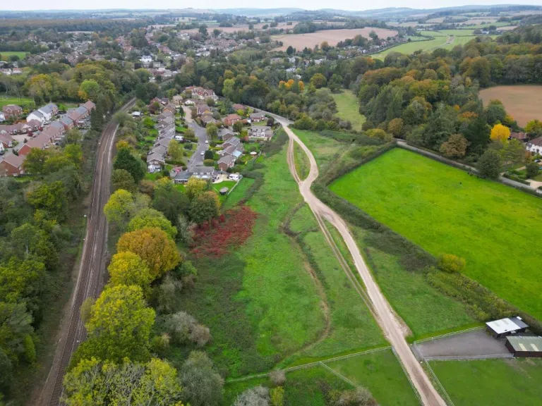
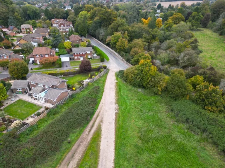
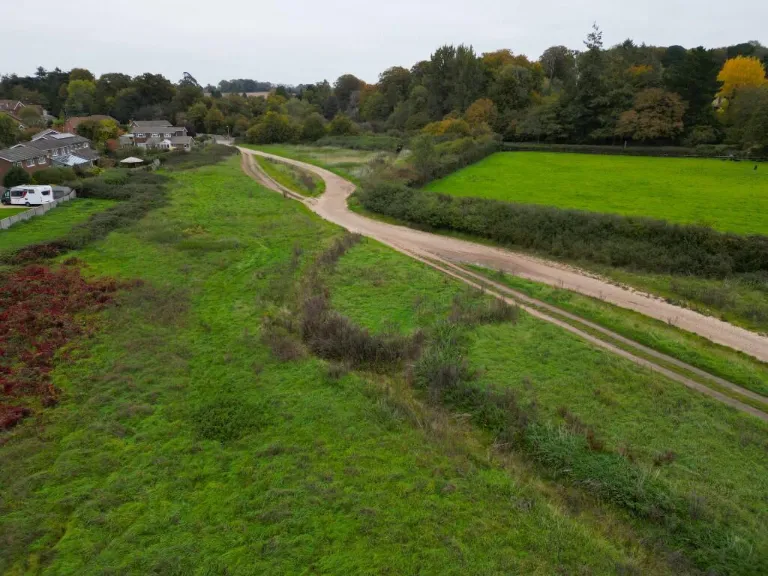
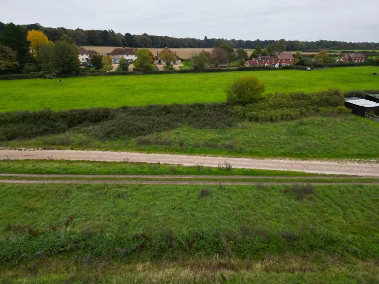
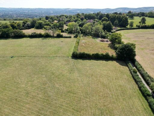
Approximately 4.28 acres (1.73 ha) of level-to-gently-undulating pastureland on the edge of Rowlands Castle, offered freehold. The parcel sits immediately adjacent to the village boundary with good local public rights of way and direct access from Woodberry Lane. Its position just outside the South Downs National Park gives broad rural views while remaining convenient for the A3(M) and local services.
The land is principally pasture with a small area of scrub/woodland at the south‑west corner and a stream (Lavant Stream) running toward the southern boundary. Uses suggested by current information include amenity, recreation, forestry, conservation and agricultural grazing, subject to any necessary consents. Electricity and water appear available nearby but are not connected.
Important constraints are set out plainly. Much of the site lies within Flood Zones 2 and 3 (medium–high probability of flooding) and the eastern part contains historic landfill. An Article 4 Direction restricts erection or alteration of enclosures, and a number of historic rights and covenants appear on the Land Registry title. The seller will retain a 25% overage on any uplift from planning consent for development within 25 years of completion.
This holding will suit a purchaser seeking a sizable village‑edge pasture for grazing, recreation, woodland management or conservation projects, or an investor prepared to investigate planning potential and the implications of the environmental/designation issues. Viewing is on foot only, unaccompanied, during daylight hours—review the drone footage before visiting.
 Land for sale in Stoner Hill Road, GU32 1DX, GU32 — £390,000 • 1 bed • 1 bath
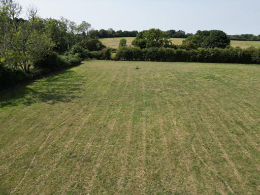 Land for sale in Stoner Hill Road, GU32 1DX, GU32 — £290,000 • 1 bed • 1 bath
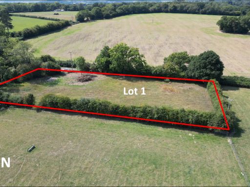 Land for sale in Stoner Hill Road, GU32 1DX, GU32 — £100,000 • 1 bed • 1 bath
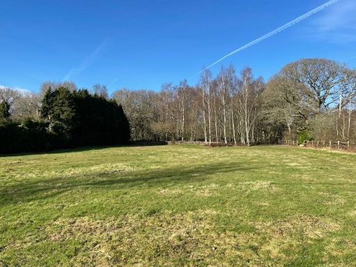 Land for sale in off A272 at Sheet, Nr. Petersfield, GU31 5AT, GU31 — £110,000 • 1 bed • 1 bath
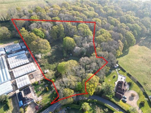 Property for sale in Maybush Lane, Soberton, SO32 — £175,000 • 1 bed • 1 bath
 4 bedroom house for sale in Forestside Road, Forestside, Rowland's Castle, PO9 — £780,000 • 4 bed • 2 bath • 1878 ft²