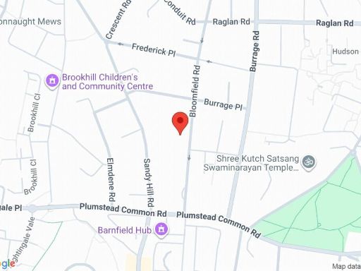
SE18 7JD - 1 bedroom apartment for sale in Bloomfield Road, Woolwich,…
View on Property Piper
1 bedroom apartment for sale in Bloomfield Road, Woolwich, SE18
Property Details
- Price: £250000
- Bedrooms: 1
- Bathrooms: 1
- Property Type: undefined
- Property SubType: undefined
Brochure Descriptions
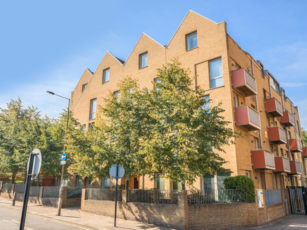
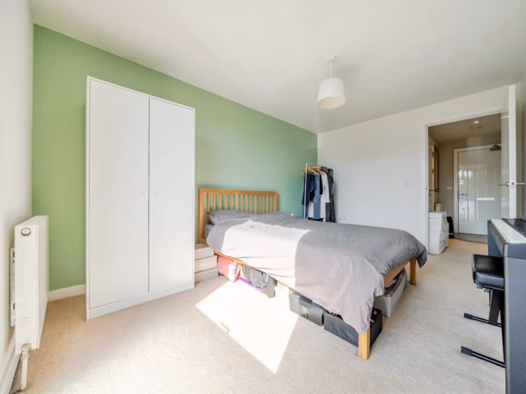
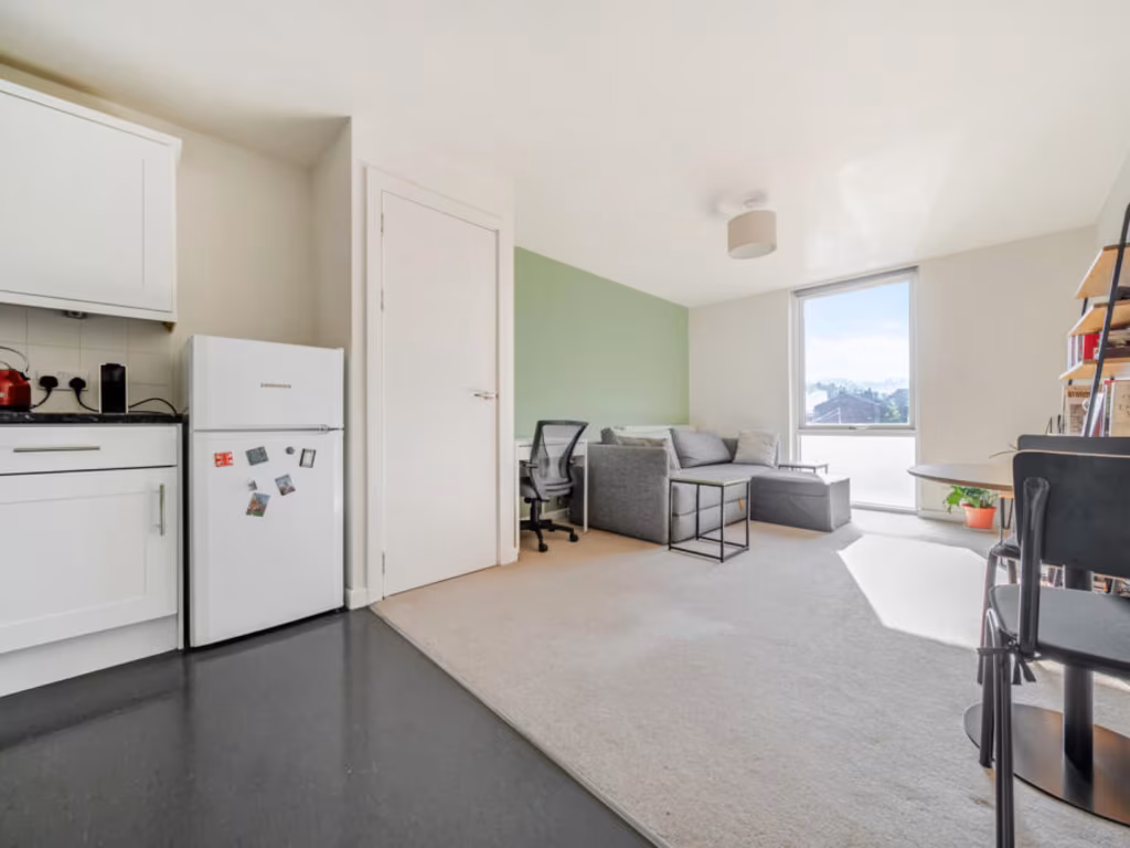
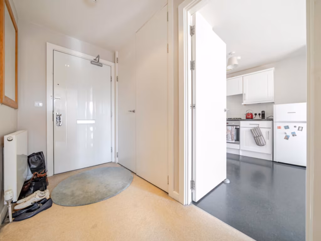
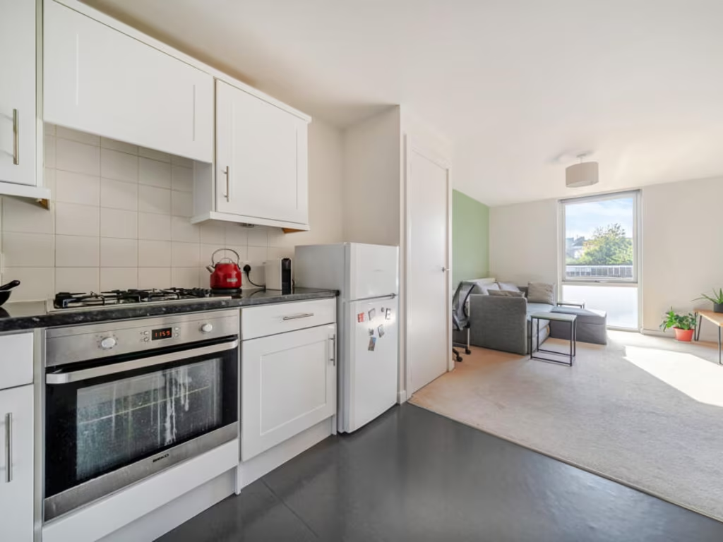
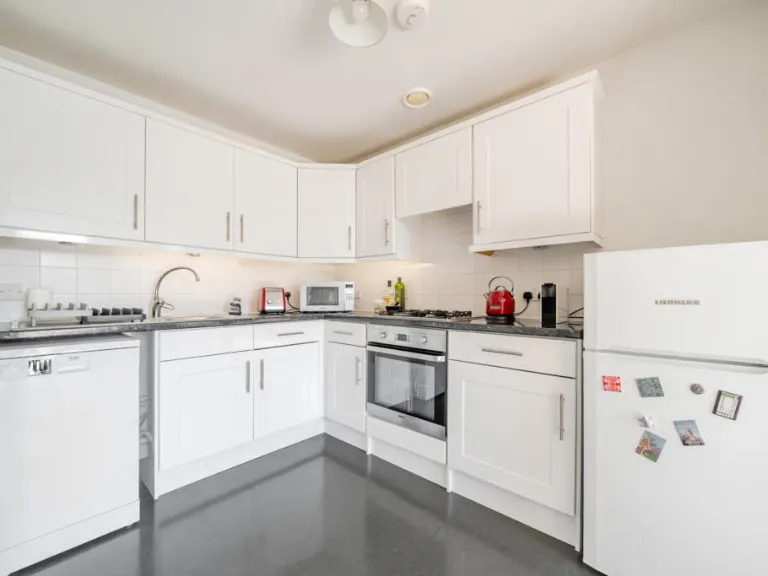
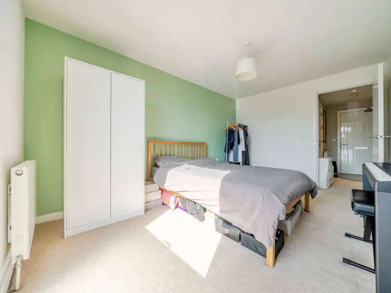
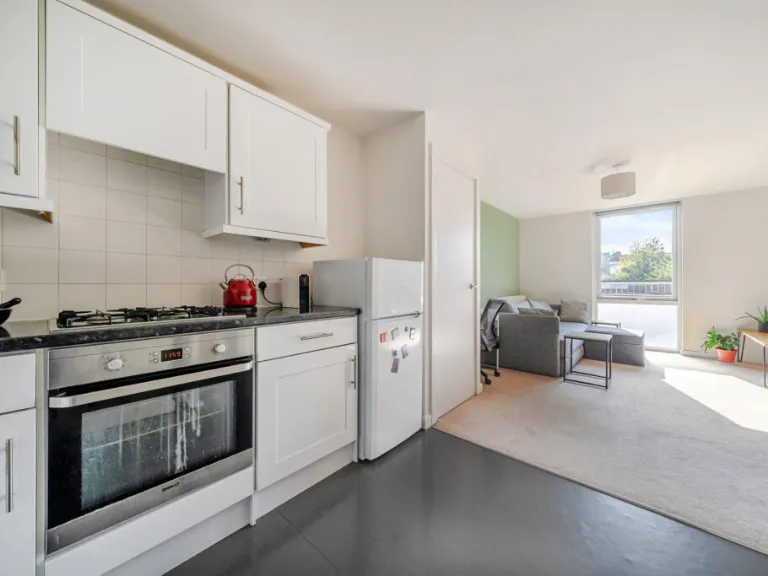
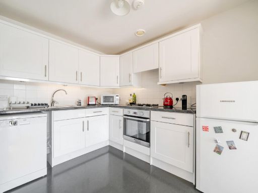
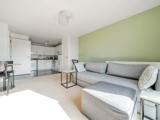
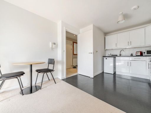
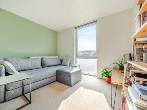
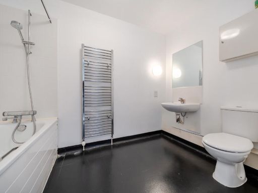
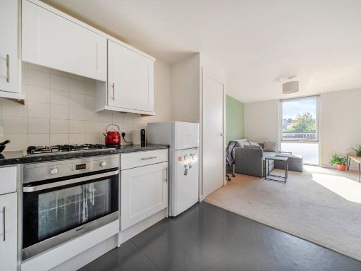
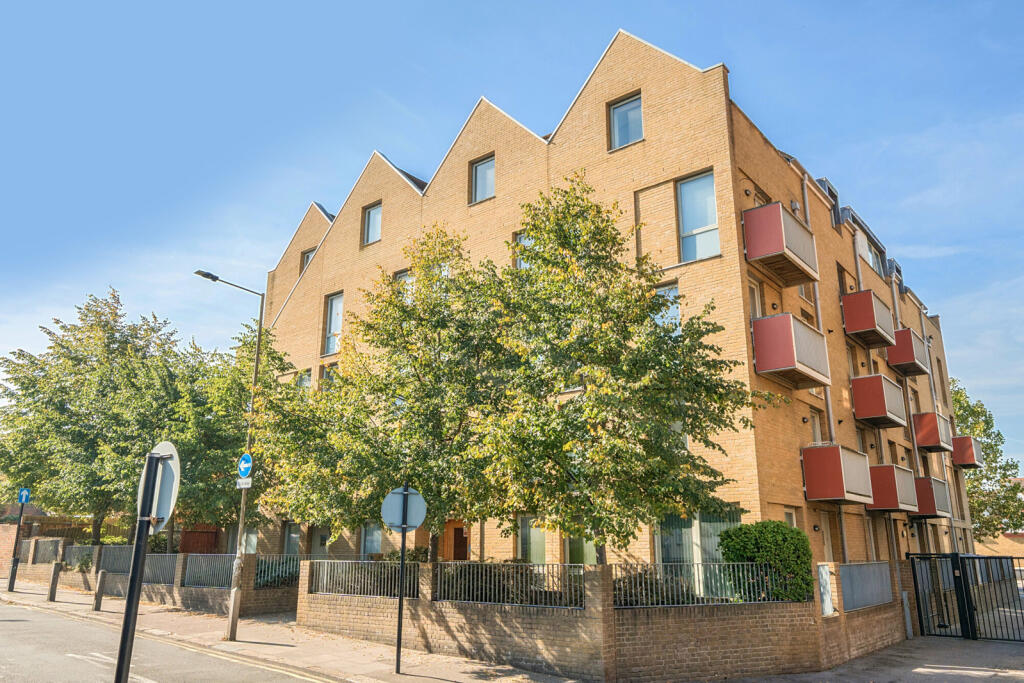
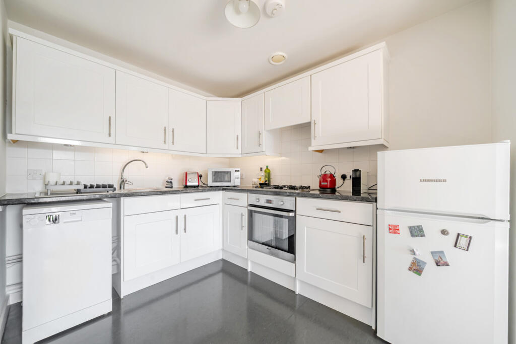
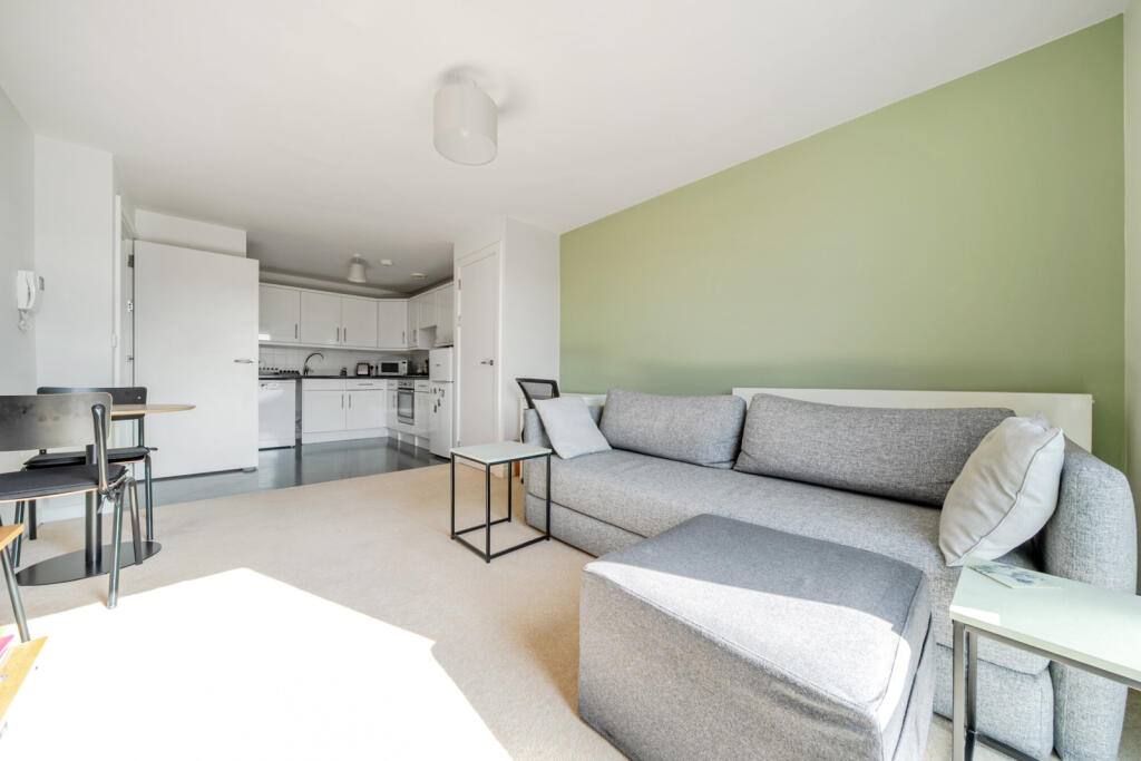
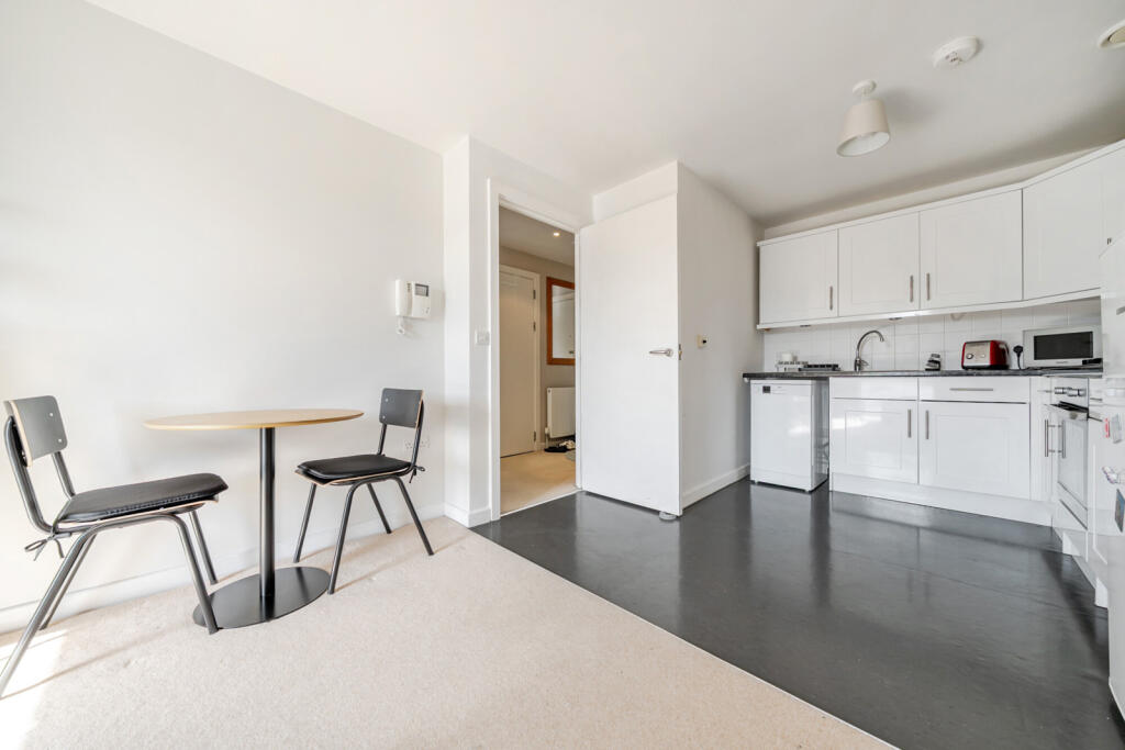
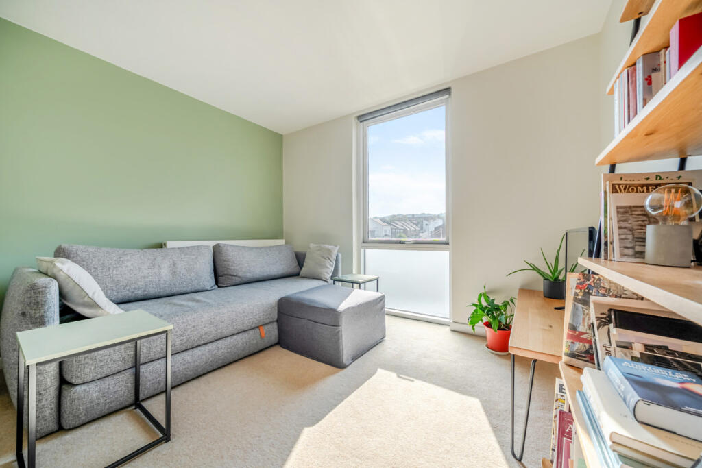
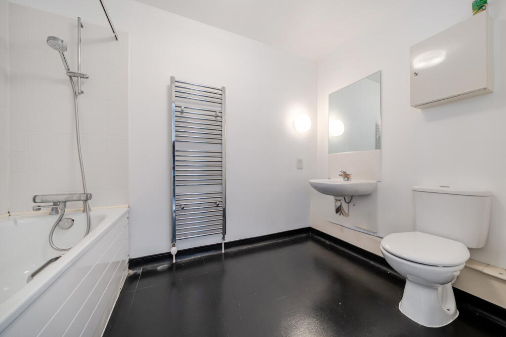
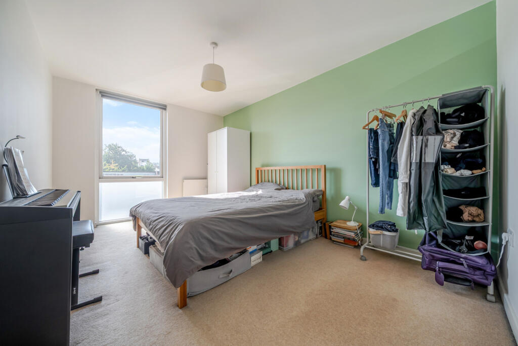
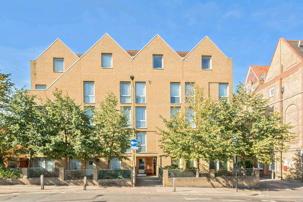
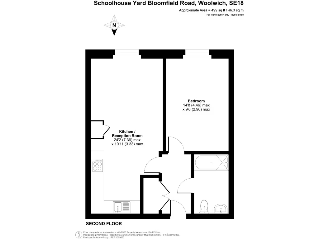
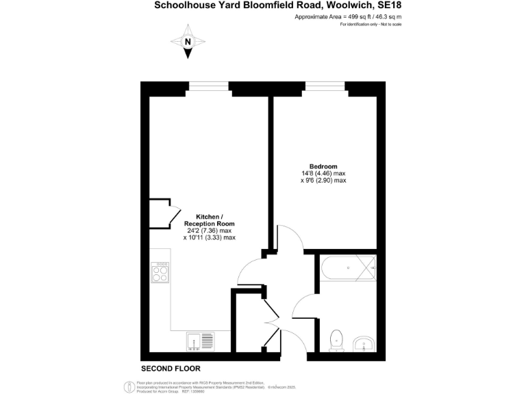
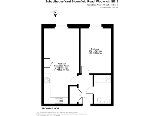
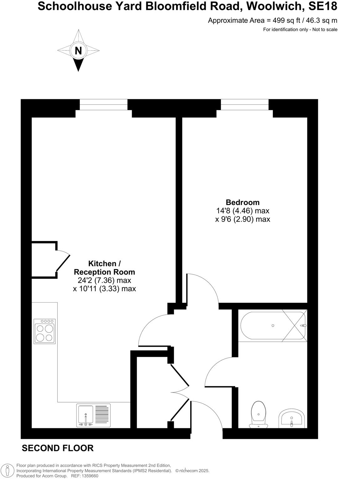
- Second-floor one-bedroom apartment located on Bloomfield Road in Woolwich. The property comprises an open-plan kitchen/living room, one double bedroom and a three-piece bathroom suite. Modern kitchen units, double glazing and central heating are noted. No private garden shown; the apartment faces the street with typical urban/residential views (trees and neighbouring buildings). Overall internal size is compact — suitable for a single occupant or couple — and the accommodation would be classified as small-to-average for a one-bedroom flat.
Image Descriptions
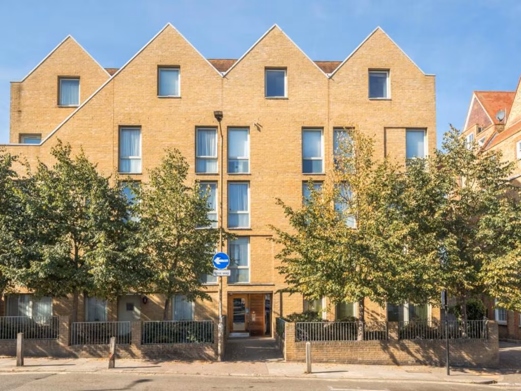
- apartment block modern
- kitchen contemporary
Rooms
- Kitchen / Reception Room: large (max dimensions shown)
- Bedroom: average (max dimensions shown)
Textual Property Features
Detected Visual Features
- modern
- brickwork
- apartment block
- urban
- balconies
- trees
- city living
- white cabinetry
- integrated appliances
- clean
- compact
- functional
- bright
- ventilation fan
- tiled backsplash
EPC Details
- Fully double glazed
- Cavity wall, as built, insulated (assumed)
- Boiler and radiators, mains gas
- Low energy lighting in all fixed outlets
- (another dwelling below)
Nearby Schools
- Eglinton Primary School
- Greenslade Primary School
- Notre Dame Catholic Primary School
- Nightingale Primary School
- Christ Church Church of England Primary School, Shooters Hill
- Ark Greenwich Free School
- Plumcroft Primary School
- Rockliffe Manor Primary School
- St Peter's Catholic Primary School
- Bannockburn Primary School
- Mulgrave Primary School
- Eastcote Primary Academy
- Timbercroft Primary School
- Plumstead Manor School
- St Patrick's Catholic Primary School
- Saint Mary Magdalene Church of England All Through School
- Heronsgate Primary School
- Deansfield Primary School
- St Margaret's Church of England Primary School
- South Rise Primary School
- Foxfield Primary School
- Conway Primary School
- Woodhill Primary School
- Cardwell Primary School
Nearest Bars And Restaurants
- Id: 10096041761
- Tags:
- Amenity: restaurant
- Contact:
- Website: https://www.roosterspiripiri.com/copy-of-wood-green
- Cuisine: chicken
- Name: Roosters Piri Piri
- TagsNormalized:
- Lat: 51.4889185
- Lon: 0.0666908
- FullGeoHash: u10hct28dn06
- PartitionGeoHash: u10h
- Images:
- FoodStandards: null
- Distance: 645.7
,- Id: 1199974660
- Tags:
- Amenity: pub
- Name: The Star Inn
- TagsNormalized:
- Lat: 51.4808317
- Lon: 0.0789749
- FullGeoHash: u10hcgc984xf
- PartitionGeoHash: u10h
- Images:
- FoodStandards: null
- Distance: 642.6
,- Id: 8462307239
- Tags:
- Addr:
- City: Woolwich
- Housenumber: 73
- Postcode: SE18 6ED
- Street: Woolwich New Road
- Amenity: restaurant
- Cuisine: eritrean;italian
- Name: Blue Nile
- Opening_hours: Tu-Th 18:00-21:00; Fr 18:00-22:00; Sa 12:00-16:00, 18:00-22:00; Su 12:00-16:00, 18:00-21:00
- Phone: +44 20 8855 0369
- Website: http://www.bluenilecafe.co.uk/
- TagsNormalized:
- Lat: 51.4890944
- Lon: 0.0674304
- FullGeoHash: u10hct31enzg
- PartitionGeoHash: u10h
- Images:
- FoodStandards: null
- Distance: 641.9
,- Id: 1199372547
- Tags:
- TagsNormalized:
- Lat: 51.4824675
- Lon: 0.0668964
- FullGeoHash: u10hcs0eng98
- PartitionGeoHash: u10h
- Images:
- FoodStandards: null
- Distance: 316.9
,- Id: 7878204108
- Tags:
- Amenity: cafe
- Name: Queen’s Diner
- TagsNormalized:
- Lat: 51.4811783
- Lon: 0.0696948
- FullGeoHash: u10hcefg850n
- PartitionGeoHash: u10h
- Images:
- FoodStandards: null
- Distance: 300.5
}
Nearest General Shops
- Id: 10095832954
- Tags:
- Addr:
- City: London
- Housenumber: 2
- Postcode: SE18 6HX
- Street: Greens End
- Brand: H&T Pawnbrokers
- Brand:wikidata: Q105672451
- Contact:
- Website: https://handt.co.uk/store-details/6475
- Name: H&T Pawnbrokers
- Shop: pawnbroker
- TagsNormalized:
- h&t pawnbrokers
- pawnbroker
- shop
- Lat: 51.4903239
- Lon: 0.0670917
- FullGeoHash: u10hct8bgk54
- PartitionGeoHash: u10h
- Images:
- FoodStandards: null
- Distance: 777.8
,- Id: 9669182144
- Tags:
- Amenity: pub
- Description: Pub and bottle shop
- Name: The Plum Tree - Beer Shop
- TagsNormalized:
- Lat: 51.4808444
- Lon: 0.078666
- FullGeoHash: u10hcgc39hcw
- PartitionGeoHash: u10h
- Images:
- FoodStandards: null
- Distance: 623.5
,- Id: 6326076766
- Tags:
- Addr:
- City: London
- Housenumber: Fountain House, 83
- Postcode: SE18 6TT
- Street: Brookhill Rd, Woolwich,
- Name: VBeauty & Hair Salon
- Shop: hairdresser
- TagsNormalized:
- Lat: 51.4870171
- Lon: 0.0672112
- FullGeoHash: u10hcsbvw5sk
- PartitionGeoHash: u10h
- Images:
- FoodStandards: null
- Distance: 446.1
}
Nearest Grocery shops
- Id: 266638591
- Tags:
- Addr:
- Housenumber: 72-74
- Postcode: SE18 3SH
- Street: Herbert Road
- Alt_name: Louroy Supermarket
- Brand: Premier
- Brand:wikidata: Q7240340
- Building: yes
- Name: Premier
- Shop: convenience
- TagsNormalized:
- Lat: 51.4798359
- Lon: 0.0689976
- FullGeoHash: u10hced5zbbq
- PartitionGeoHash: u10h
- Images:
- FoodStandards: null
- Distance: 457.4
,- Id: 6326073873
- Tags:
- Brand: Ministop
- Brand:wikidata: Q1038929
- Name: BBN MINI MART
- Shop: convenience
- TagsNormalized:
- Lat: 51.4869091
- Lon: 0.067105
- FullGeoHash: u10hcsbugxt0
- PartitionGeoHash: u10h
- Images:
- FoodStandards: null
- Distance: 440.9
,- Id: 6326076765
- Tags:
- Brand: Ministop
- Brand:wikidata: Q1038929
- Name: P J Off Licence
- Shop: convenience
- TagsNormalized:
- Lat: 51.4869267
- Lon: 0.0673245
- FullGeoHash: u10hcscj0fbc
- PartitionGeoHash: u10h
- Images:
- FoodStandards: null
- Distance: 433.4
}
Nearest Supermarkets
- Id: 232841491
- Tags:
- Addr:
- Housenumber: 196-212
- Postcode: SE18 2RS
- Street: Plumstead Common Road
- Building: yes
- Designation: The Co-operative Food
- Name: Co-op
- Shop: supermarket
- TagsNormalized:
- Lat: 51.4804474
- Lon: 0.0807781
- FullGeoHash: u10hcgdz66bw
- PartitionGeoHash: u10h
- Images:
- FoodStandards: null
- Distance: 772.4
,- Id: 8462302952
- Tags:
- Addr:
- City: Woolwich
- Postcode: SE18 6HQ
- Street: Grand Depot Road
- Branch: Woolwich Extra
- Brand: Tesco Extra
- Brand:wikidata: Q25172225
- Contact:
- Website: https://www.tesco.com/store-locator/london/grand-depot-road
- Name: Tesco Extra
- Opening_hours: Mo-Sa 06:00-24:00, Su 11:00-17:00
- Shop: supermarket
- TagsNormalized:
- tesco
- tesco extra
- supermarket
- shop
- Lat: 51.4892684
- Lon: 0.066274
- FullGeoHash: u10hct268r33
- PartitionGeoHash: u10h
- Images:
- FoodStandards: null
- Distance: 693.6
,- Id: 266638590
- Tags:
- Addr:
- Housenumber: 9-15
- Postcode: SE18 3TB
- Street: Herbert Road
- Alt_name: The Co-operative Food
- Building: yes
- Name: Co-op
- Shop: supermarket
- TagsNormalized:
- Lat: 51.4813611
- Lon: 0.0698559
- FullGeoHash: u10hcefuev22
- PartitionGeoHash: u10h
- Images:
- FoodStandards: null
- Distance: 277.9
}
Nearest Religious buildings
- Id: 666512890
- Tags:
- Amenity: place_of_worship
- Name: Woolwich Central Baptist Church
- Religion: christian
- TagsNormalized:
- place of worship
- baptist
- church
- christian
- Lat: 51.4872538
- Lon: 0.0658859
- FullGeoHash: u10hckzyzrb0
- PartitionGeoHash: u10h
- Images:
- FoodStandards: null
- Distance: 524.5
,- Id: 203335
- Tags:
- Name: Trinity Church
- Naptan:
- StopAreaCode: 490G00013801
- StopAreaType: GPBS
- Verified: no
- Network: London Buses
- Operator: Transport for London
- Public_transport: stop_area
- Public_transport:version: 2
- Type: public_transport
- TagsNormalized:
- Lat: 51.4817549
- Lon: 0.0732966
- FullGeoHash: u10hcevqgyty
- PartitionGeoHash: u10h
- Images:
- FoodStandards: null
- Distance: 274.9
,- Id: 472881512
- Tags:
- Amenity: place_of_worship
- Denomination: methodist
- Name: Trinity Methodist Church
- Religion: christian
- TagsNormalized:
- place of worship
- methodist
- church
- christian
- Lat: 51.4821331
- Lon: 0.0728653
- FullGeoHash: u10hcsj11vhq
- PartitionGeoHash: u10h
- Images:
- FoodStandards: null
- Distance: 223.3
}
Nearest Medical buildings
- Id: 8988341183
- Tags:
- Addr:
- City: London
- Housename: Lower Ground Floor, Equitable House
- Housenumber: 10
- Postcode: SE18 6AB
- Street: Woolwich New Road
- Amenity: pharmacy
- Dispensing: yes
- Drive_through: no
- Email: info@woolwichpharmacy.co.uk
- Healthcare: pharmacy
- Name: Woolwich Late Night Pharmacy
- Opening_hours: Mo-Fr 07:30-22:30; Sa 08:00-21:00; Su 08:00-20:00
- Operator: Woolwich Late Night Pharmacy
- Phone: +44 20 8316 7977
- TagsNormalized:
- Lat: 51.4902434
- Lon: 0.0685877
- FullGeoHash: u10hct9bqjn9
- PartitionGeoHash: u10h
- Images:
- FoodStandards: null
- Distance: 739.6
,- Id: 1199260332
- Tags:
- Amenity: medical_centre
- Healthcare: centre
- Name: All Saints Medical Centre
- TagsNormalized:
- Lat: 51.4796622
- Lon: 0.0665399
- FullGeoHash: u10hce86y2xd
- PartitionGeoHash: u10h
- Images:
- FoodStandards: null
- Distance: 549.6
,- Id: 906820479
- Tags:
- Addr:
- Country: GB
- Housenumber: 36-38
- Postcode: SE18 3SH
- Street: Herbert Road
- Amenity: pharmacy
- Building: yes
- Dispensing: yes
- Healthcare: pharmacy
- Name: Herbert Pharmacy
- Website: https://www.herbertpharmacyltd.co.uk/
- TagsNormalized:
- Lat: 51.480612
- Lon: 0.0694672
- FullGeoHash: u10hcef869wk
- PartitionGeoHash: u10h
- Images:
- FoodStandards: null
- Distance: 365.4
,- Id: 7878200729
- Tags:
- Amenity: dentist
- Healthcare: dentist
- TagsNormalized:
- Lat: 51.4811718
- Lon: 0.0693287
- FullGeoHash: u10hcef7x3zp
- PartitionGeoHash: u10h
- Images:
- FoodStandards: null
- Distance: 309.6
}
Nearest Airports
- Id: 121158889
- Tags:
- Aerodrome: continental
- Aeroway: aerodrome
- Fhrs:
- Authority: City of London Corporation
- Iata: LCY
- Icao: EGLC
- Name: London City Airport
- Operator: London City Airport Limited
- Ref: LCY
- Website: https://www.londoncityairport.com/
- Wikidata: Q8982
- Wikipedia: en:London City Airport
- TagsNormalized:
- airport
- continental airport
- Lat: 51.5042658
- Lon: 0.0539987
- FullGeoHash: u10j10p64702
- PartitionGeoHash: u10j
- Images:
- FoodStandards: null
- Distance: 2565.1
,- Id: 103894219
- Tags:
- Aerodrome: international
- Aeroway: aerodrome
- Iata: SEN
- Icao: EGMC
- Name: London Southend Airport
- Old_name: Southend Municipal Airport
- Ref: SEN
- Wikidata: Q1415441
- TagsNormalized:
- airport
- international airport
- Lat: 51.5701749
- Lon: 0.6924624
- FullGeoHash: u10mru04p937
- PartitionGeoHash: u10m
- Images:
- FoodStandards: null
- Distance: 44054.7
,- Id: 260720166
- Tags:
- Aerodrome: international
- Aeroway: aerodrome
- Alt_name: Gatwick Airport
- Ele: 62
- Iata: LGW
- Icao: EGKK
- Internet_access: wlan
- Internet_access:fee: no
- Internet_access:ssid: Gatwick FREE Wi-Fi
- Name: London Gatwick Airport
- Operator: Gatwick Airport Limited
- Ref: LGW
- Website: https://www.gatwickairport.com/
- Wikidata: Q8703
- Wikipedia: en:Gatwick Airport
- TagsNormalized:
- airport
- international airport
- Lat: 51.1540917
- Lon: -0.1883773
- FullGeoHash: gcpg58qf4mzd
- PartitionGeoHash: gcpg
- Images:
- FoodStandards: null
- Distance: 40848.8
}
Nearest Leisure Facilities
- Id: 103024838
- Tags:
- Access: private
- Leisure: garden
- Note: Grounds of the church, not a park.
- Surface: grass
- TagsNormalized:
- Lat: 51.487251
- Lon: 0.0656781
- FullGeoHash: u10hckzyfrjp
- PartitionGeoHash: u10h
- Images:
- FoodStandards: null
- Distance: 534
,- Id: 6244605447
- Tags:
- Leisure: fitness_station
- Sport: fitness
- TagsNormalized:
- fitness
- fitness station
- station
- leisure
- sports
- Lat: 51.487022
- Lon: 0.0662301
- FullGeoHash: u10hcsbjxk89
- PartitionGeoHash: u10h
- Images:
- FoodStandards: null
- Distance: 489.4
,- Id: 39480485
- Tags:
- Leisure: playground
- Name: Plumstead Adventure Play Centre
- TagsNormalized:
- Lat: 51.4819765
- Lon: 0.0764083
- FullGeoHash: u10hcsp8hryp
- PartitionGeoHash: u10h
- Images:
- FoodStandards: null
- Distance: 425.3
,- Id: 1047852520
- Tags:
- TagsNormalized:
- Lat: 51.4835807
- Lon: 0.0655881
- FullGeoHash: u10hckrc8741
- PartitionGeoHash: u10h
- Images:
- FoodStandards: null
- Distance: 373.6
,- Id: 6680219638
- Tags:
- Access: yes
- Leisure: pitch
- Lit: no
- Name: Woolwich Skatepark
- Sport: skateboard
- TagsNormalized:
- pitch
- leisure
- skateboard
- sports
- Lat: 51.4850937
- Lon: 0.066392
- FullGeoHash: u10hcs867j16
- PartitionGeoHash: u10h
- Images:
- FoodStandards: null
- Distance: 350.3
}
Nearest Tourist attractions
- Id: 7999204585
- Tags:
- Addr:
- Name: Minotaur house
- Tourism: apartment
- TagsNormalized:
- Lat: 51.4929246
- Lon: 0.06886
- FullGeoHash: u10hcw40h8ce
- PartitionGeoHash: u10h
- Images:
- FoodStandards: null
- Distance: 1029.5
,- Id: 8001029312
- Tags:
- Addr:
- Housenumber: 5
- Street: thunderer walk
- Name: Amphion
- Name:en: Amphion house
- Tourism: apartment
- TagsNormalized:
- Lat: 51.4928584
- Lon: 0.069225
- FullGeoHash: u10hctfrth9c
- PartitionGeoHash: u10h
- Images:
- FoodStandards: null
- Distance: 1018.9
,- Id: 7999204685
- Tags:
- Name: Thalía
- Tourism: apartment
- TagsNormalized:
- Lat: 51.4926366
- Lon: 0.0688189
- FullGeoHash: u10hctfn7e5j
- PartitionGeoHash: u10h
- Images:
- FoodStandards: null
- Distance: 998.2
}
Nearest Hotels
- Id: 2959234563
- Tags:
- Brand: Travelodge
- Brand:wikidata: Q9361374
- Internet_access: wlan
- Internet_access:fee: customers
- Internet_access:ssid: Travelodge WiFi
- Name: Travelodge Hotel
- Tourism: hotel
- TagsNormalized:
- Lat: 51.4927255
- Lon: 0.0617961
- FullGeoHash: u10hcmuyzgy8
- PartitionGeoHash: u10h
- Images:
- FoodStandards: null
- Distance: 1182.2
,- Id: 10095832951
- Tags:
- Brand: Travelodge
- Brand:wikidata: Q9361374
- Internet_access: wlan
- Internet_access:fee: customers
- Internet_access:ssid: Travelodge WiFi
- Name: Travelodge
- Tourism: hotel
- TagsNormalized:
- Lat: 51.4923324
- Lon: 0.0630677
- FullGeoHash: u10hcmvutd6x
- PartitionGeoHash: u10h
- Images:
- FoodStandards: null
- Distance: 1099.2
,- Id: 748824064
- Tags:
- Addr:
- City: London
- Housenumber: 91
- Postcode: SE18 6BF
- Street: Beresford Street
- Suburb: Woolwich
- Branch: London Woolwich
- Brand: Premier Inn
- Brand:wikidata: Q2108626
- Building: yes
- Building:levels: 6
- Internet_access: wlan
- Internet_access:fee: customers
- Internet_access:operator: Virgin Media
- Internet_access:ssid: Premier Inn Free Wi-Fi
- Name: Premier Inn London Woolwich
- Tourism: hotel
- TagsNormalized:
- Lat: 51.4926863
- Lon: 0.0675913
- FullGeoHash: u10hctcnwurw
- PartitionGeoHash: u10h
- Images:
- FoodStandards: null
- Distance: 1019.8
}
Tags
- modern
- brickwork
- apartment block
- urban
- balconies
- trees
- city living
- modern
- white cabinetry
- integrated appliances
- clean
- compact
- functional
- bright
- ventilation fan
- tiled backsplash
Local Market Stats
- Average Price/sqft: £465
- Avg Income: £50400
- Rental Yield: 5.6%
- Social Housing: 30%
- Planning Success Rate: 62%
AirBnB Data
- 1km average: £124/night
- Listings in 1km: 25
Similar Properties
 1 bedroom apartment for sale in Bloomfield Road, Woolwich, SE18 — £250,000 • 1 bed • 1 bath • 494 ft²
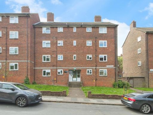 1 bedroom flat for sale in Church Hill, London, SE18 — £230,000 • 1 bed • 1 bath • 500 ft²
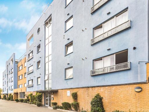 1 bedroom flat for sale in Merbury Close, London, SE28 — £220,000 • 1 bed • 1 bath • 521 ft²
 1 bedroom apartment for sale in Wellington Street, Woolwich, SE18 — £350,000 • 1 bed • 1 bath • 566 ft²
 1 bedroom flat for sale in Master Gunner Place, London, SE18 — £280,000 • 1 bed • 1 bath • 537 ft²
 1 bedroom apartment for sale in Berber Parade, Woolwich, SE18 — £260,000 • 1 bed • 1 bath • 497 ft²
Meta
- {
"@context": "https://schema.org",
"@type": "Residence",
"name": "1 bedroom apartment for sale in Bloomfield Road, Woolwich,…",
"description": "",
"url": "https://propertypiper.co.uk/property/75d53278-9a5b-42d1-b3d6-d361178ce6db",
"image": "https://image-a.propertypiper.co.uk/c13c25f5-98ef-4718-98ff-2c2b8cf0e374-1024.jpeg",
"address": {
"@type": "PostalAddress",
"streetAddress": "Schoolhouse Yard Bloomfield Road, Woolwich, SE18",
"postalCode": "SE18 7JD",
"addressLocality": "Greenwich",
"addressRegion": "Greenwich and Woolwich",
"addressCountry": "England"
},
"geo": {
"@type": "GeoCoordinates",
"latitude": 51.48376067974079,
"longitude": 0.07097528828117657
},
"numberOfRooms": 1,
"numberOfBathroomsTotal": 1,
"floorSize": {
"@type": "QuantitativeValue",
"value": 499,
"unitCode": "FTK"
},
"offers": {
"@type": "Offer",
"price": 250000,
"priceCurrency": "GBP",
"availability": "https://schema.org/InStock"
},
"additionalProperty": [
{
"@type": "PropertyValue",
"name": "Feature",
"value": "modern"
},
{
"@type": "PropertyValue",
"name": "Feature",
"value": "brickwork"
},
{
"@type": "PropertyValue",
"name": "Feature",
"value": "apartment block"
},
{
"@type": "PropertyValue",
"name": "Feature",
"value": "urban"
},
{
"@type": "PropertyValue",
"name": "Feature",
"value": "balconies"
},
{
"@type": "PropertyValue",
"name": "Feature",
"value": "trees"
},
{
"@type": "PropertyValue",
"name": "Feature",
"value": "city living"
},
{
"@type": "PropertyValue",
"name": "Feature",
"value": "modern"
},
{
"@type": "PropertyValue",
"name": "Feature",
"value": "white cabinetry"
},
{
"@type": "PropertyValue",
"name": "Feature",
"value": "integrated appliances"
},
{
"@type": "PropertyValue",
"name": "Feature",
"value": "clean"
},
{
"@type": "PropertyValue",
"name": "Feature",
"value": "compact"
},
{
"@type": "PropertyValue",
"name": "Feature",
"value": "functional"
},
{
"@type": "PropertyValue",
"name": "Feature",
"value": "bright"
},
{
"@type": "PropertyValue",
"name": "Feature",
"value": "ventilation fan"
},
{
"@type": "PropertyValue",
"name": "Feature",
"value": "tiled backsplash"
}
]
}
High Res Floorplan Images
Compatible Floorplan Images
FloorplanImages Thumbnail