CT2 0BF - 4 bedroom detached house for sale in Water Meadows, Fordwic…
View on Property Piper
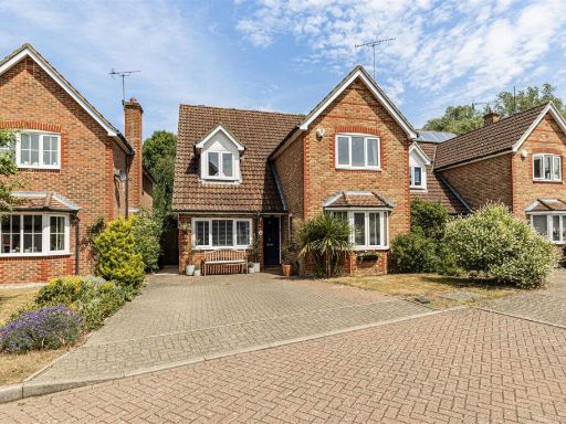
4 bedroom detached house for sale in Water Meadows, Fordwich, CT2
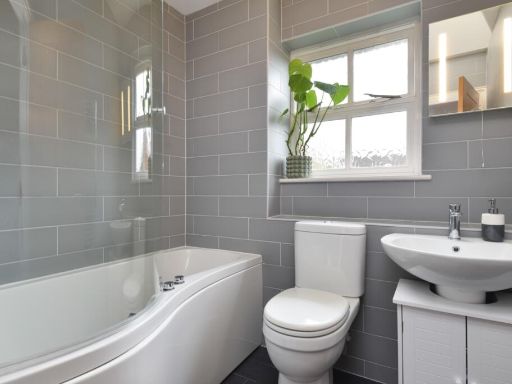
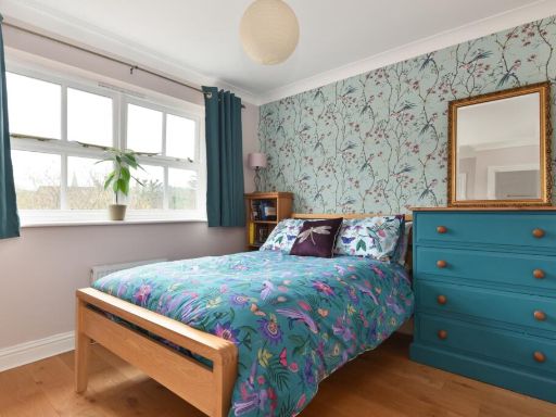
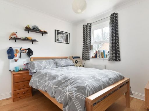
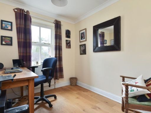
Property Details
- Price: £550000
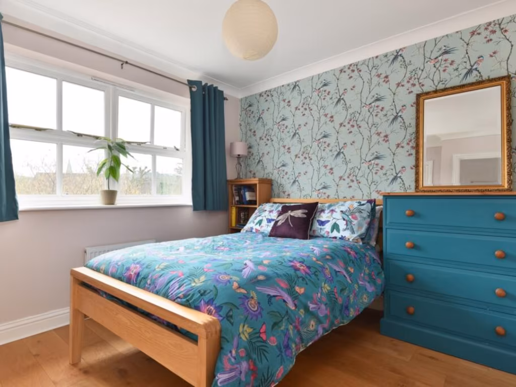
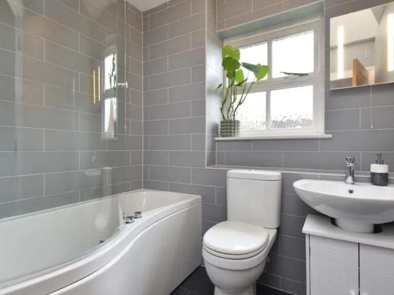
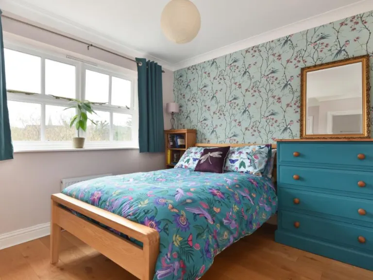
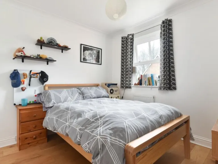
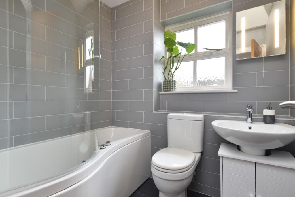
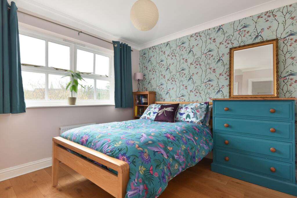
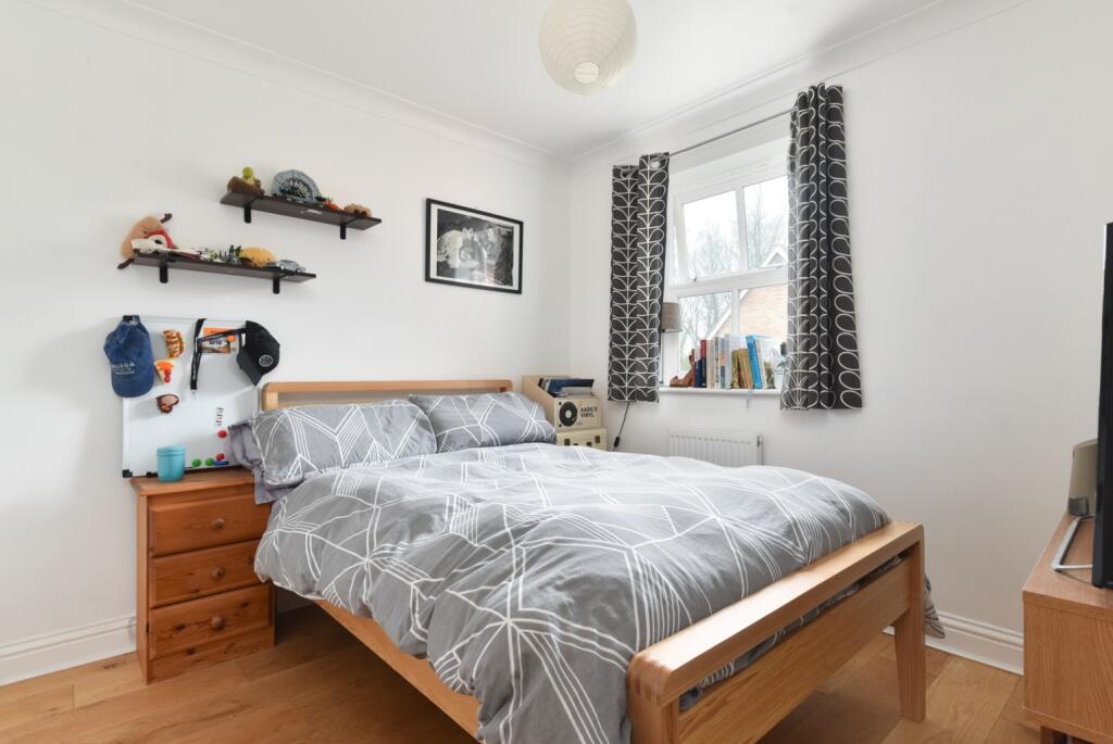
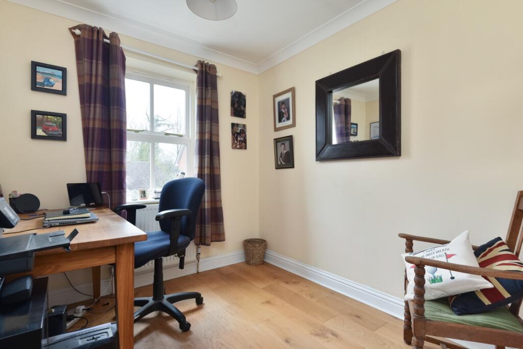
- Bedrooms: 4
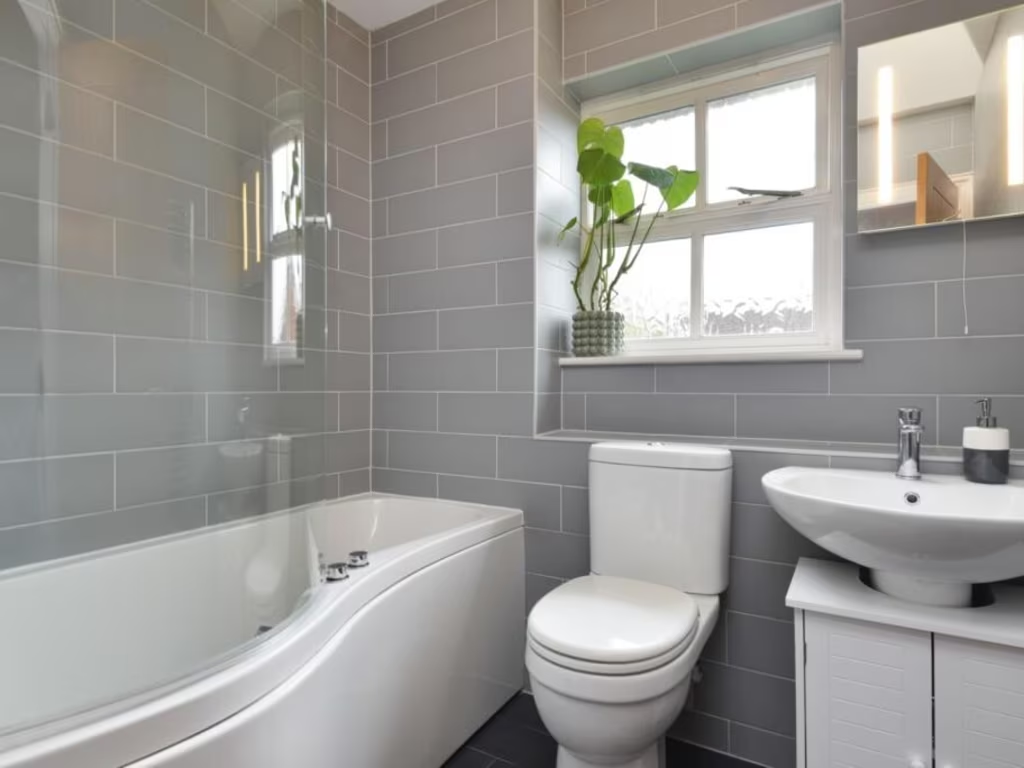
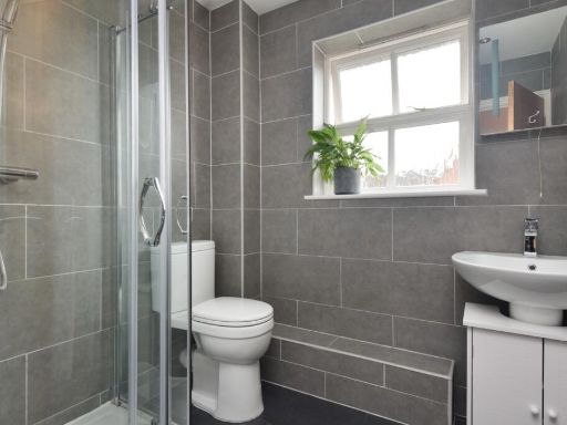
- Bathrooms: 2
- Property Type: undefined
- Property SubType: undefined
Image Descriptions
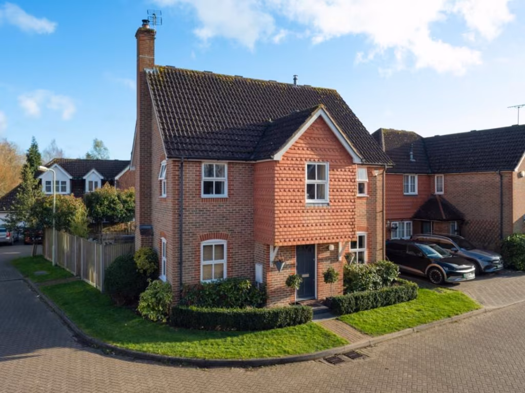
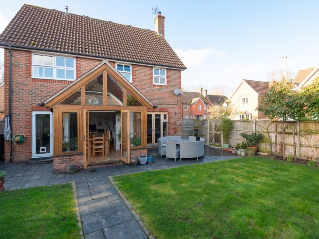
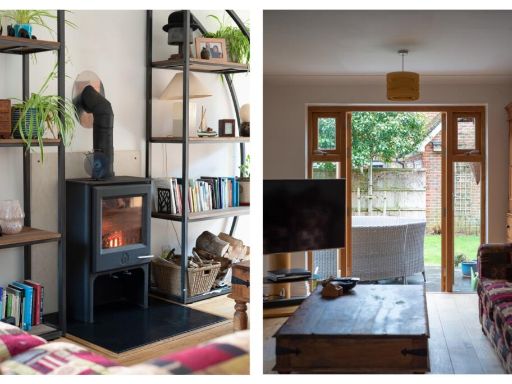
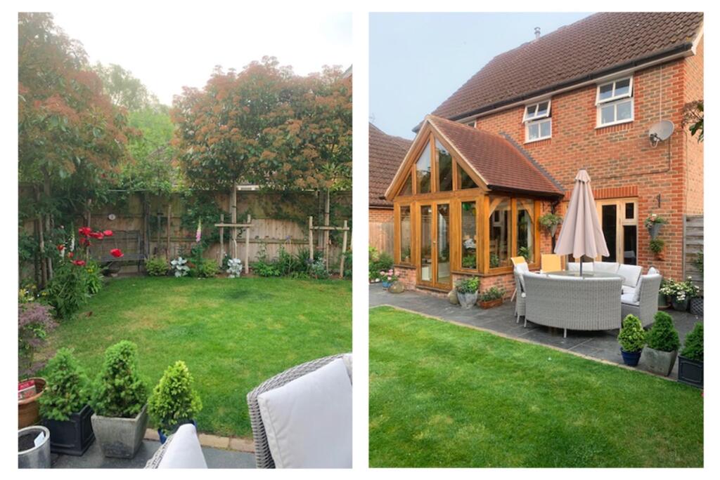
- detached house modern
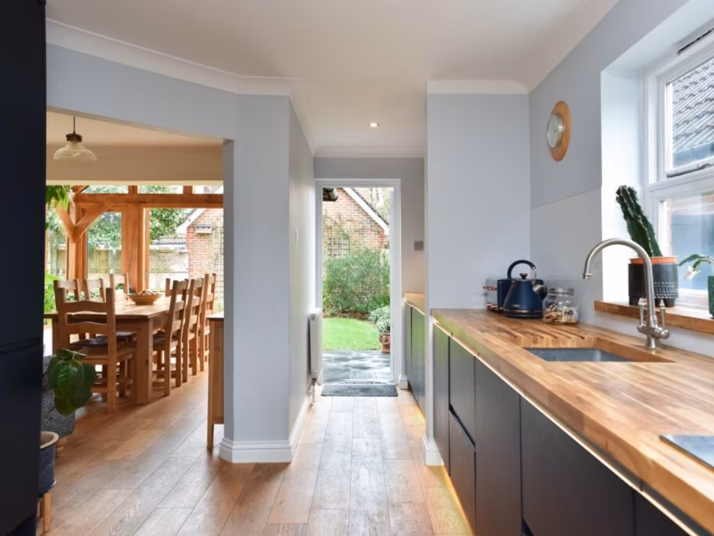
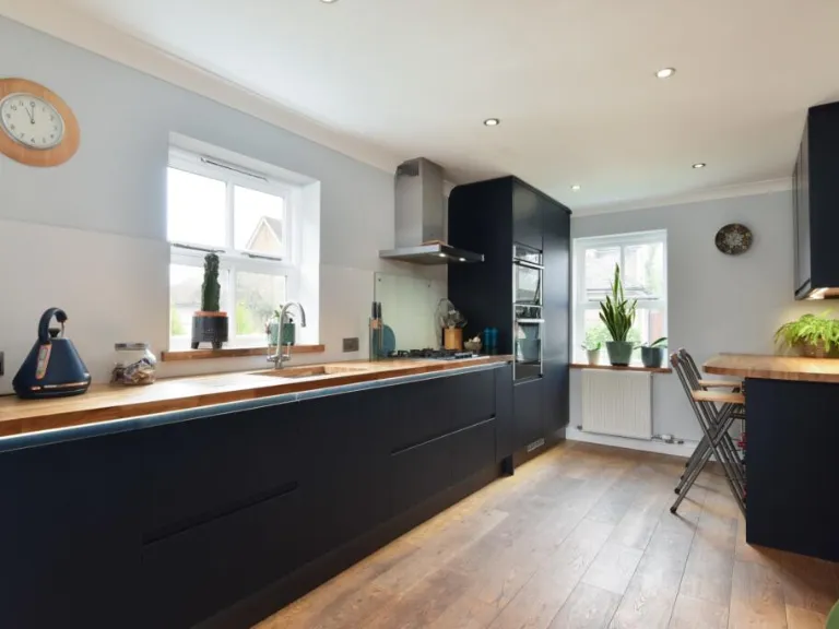
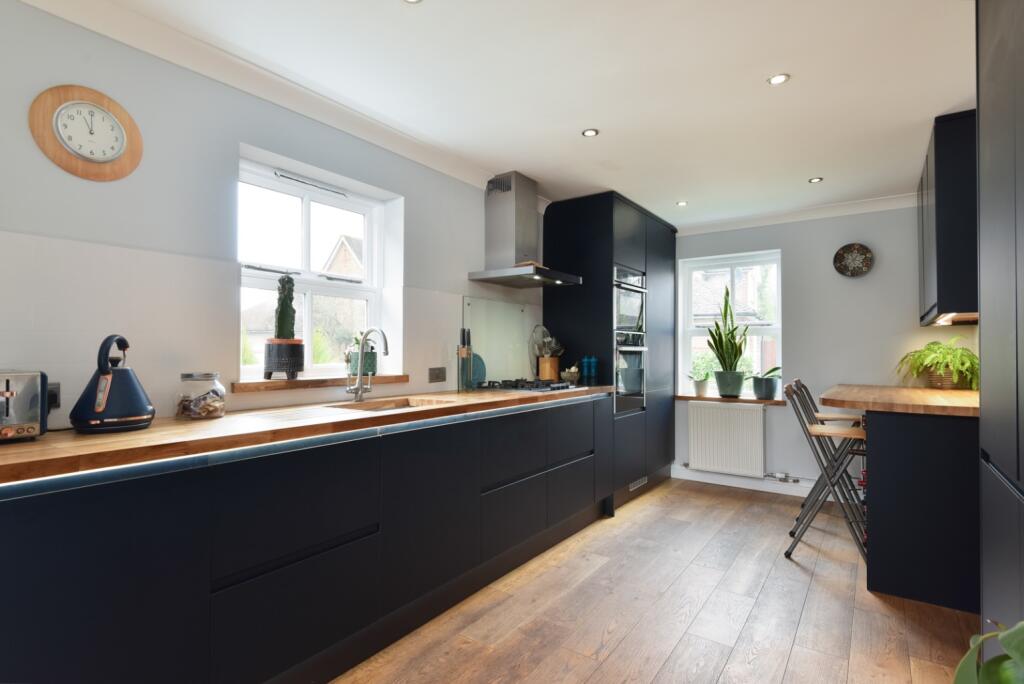
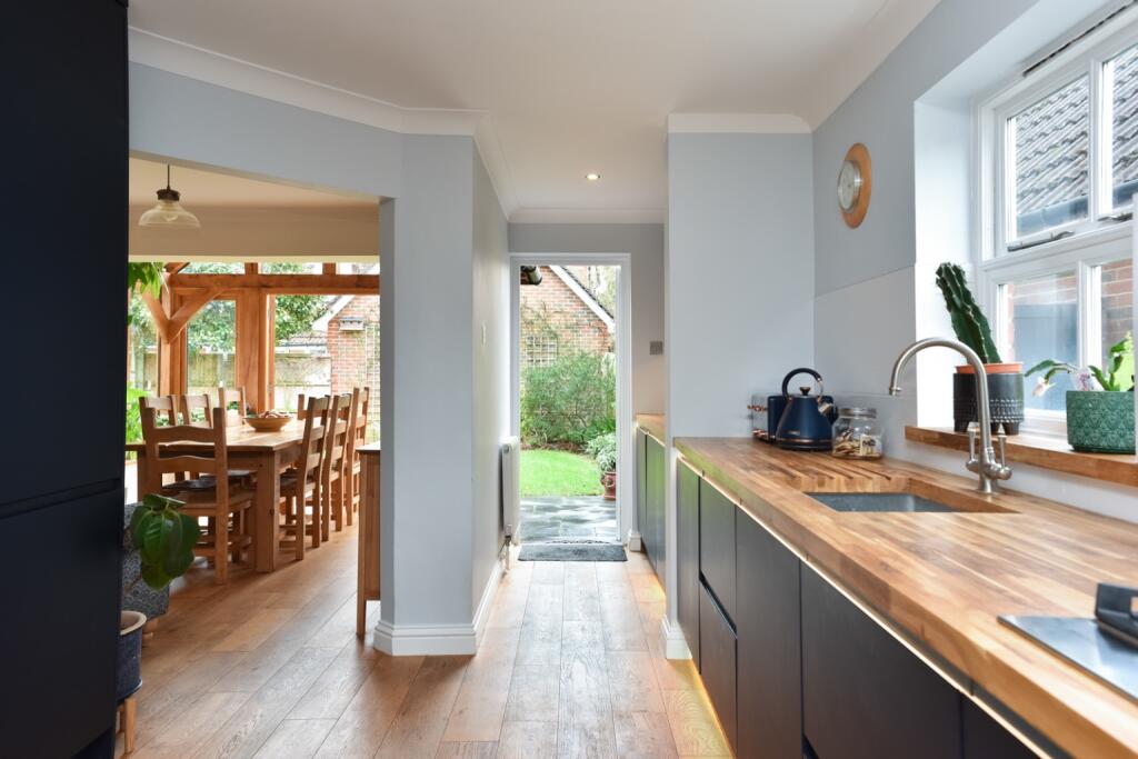
- kitchen modern
Floorplan Description
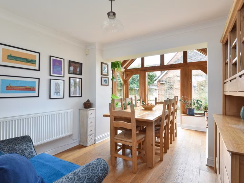
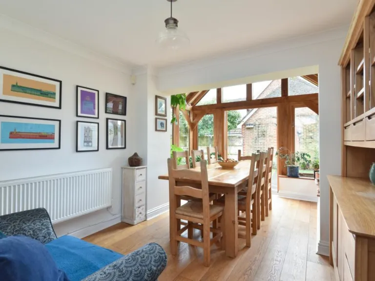
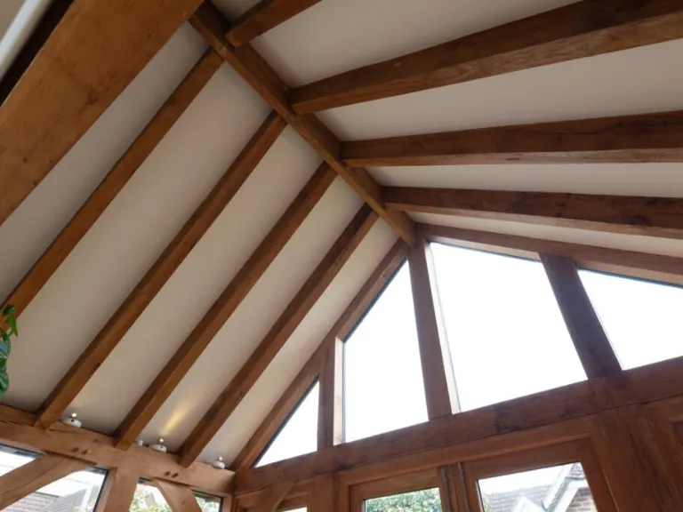
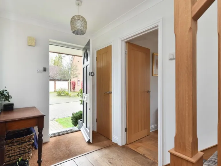
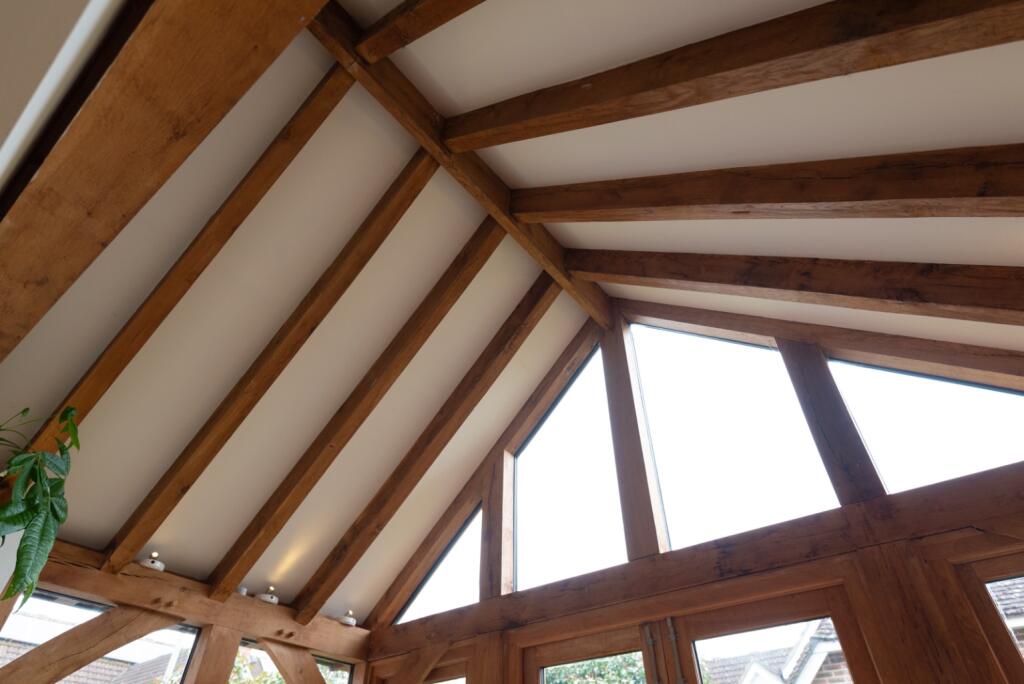
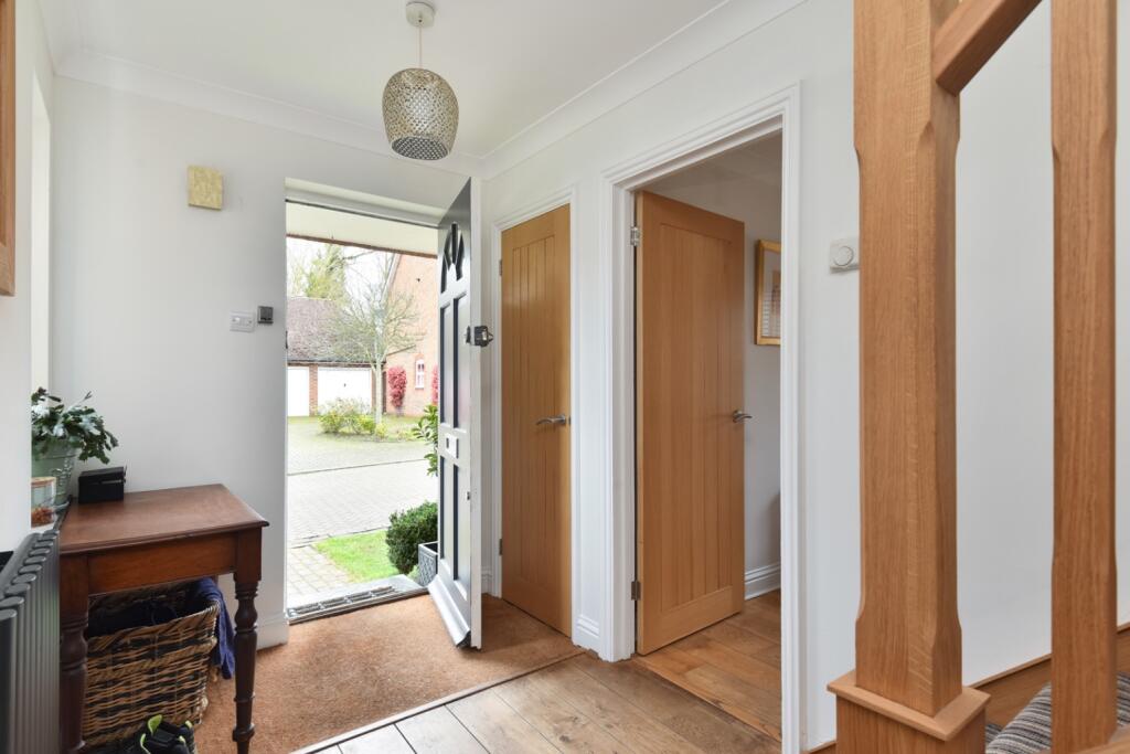
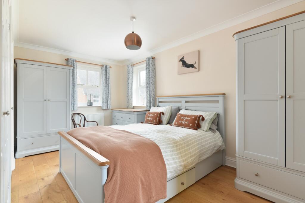
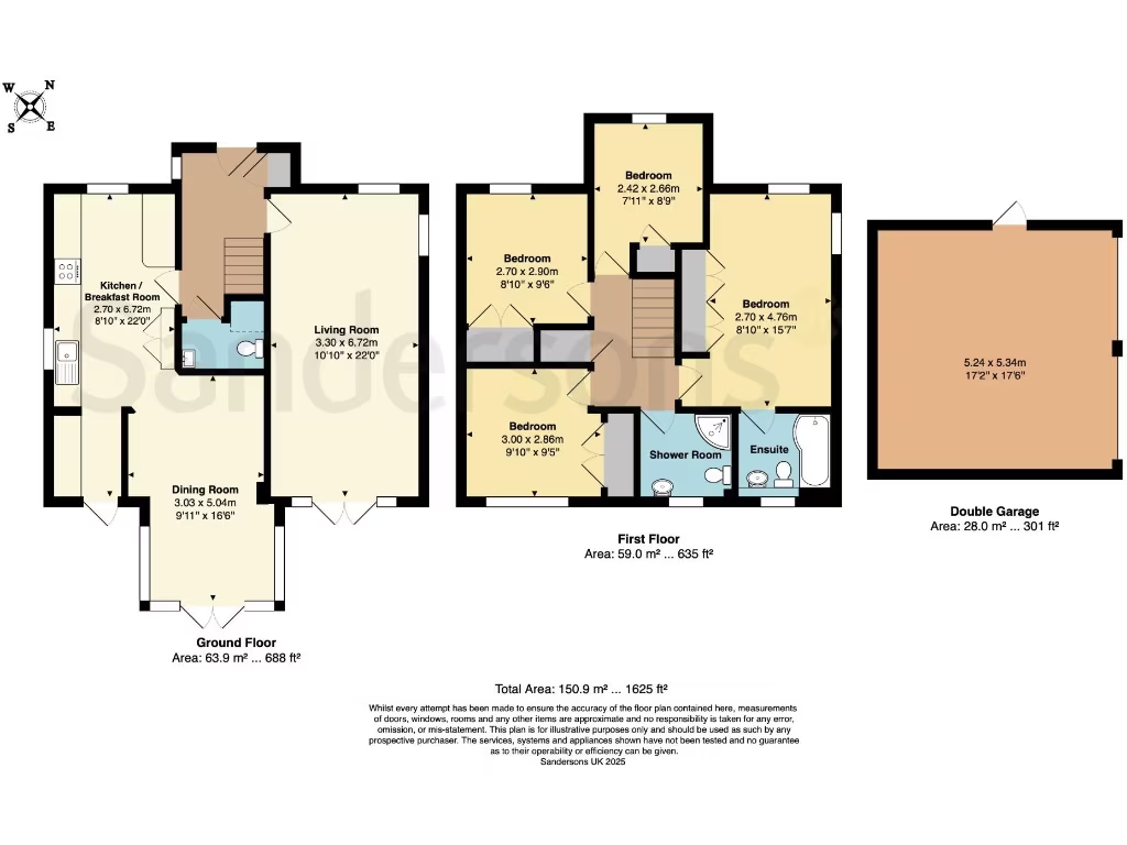
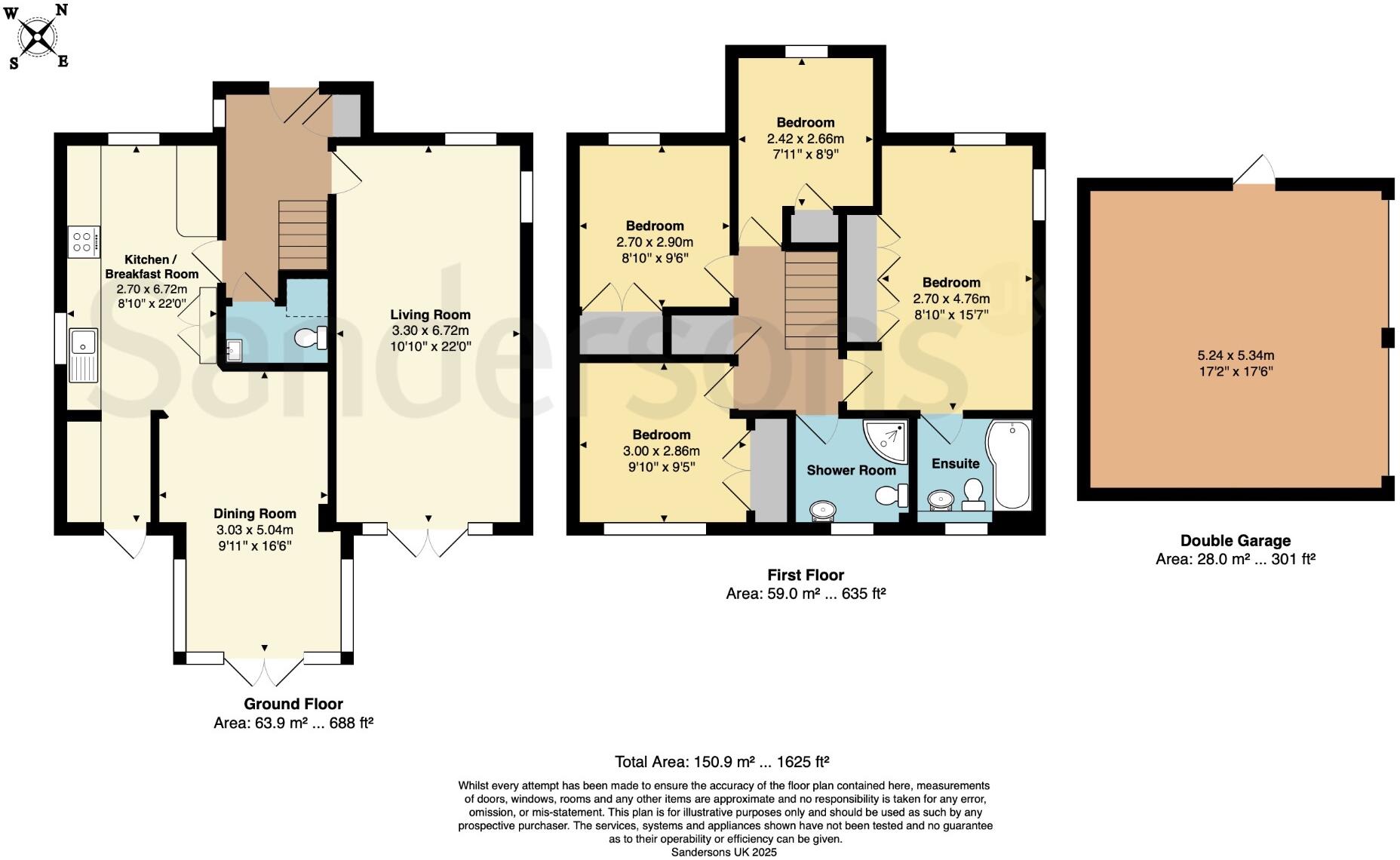
- A two-story home with a ground floor featuring a large kitchen, dining room, and living room. The first floor has four bedrooms, two bathrooms, and a garage.
Rooms
- Kitchen / Breakfast Room: Large
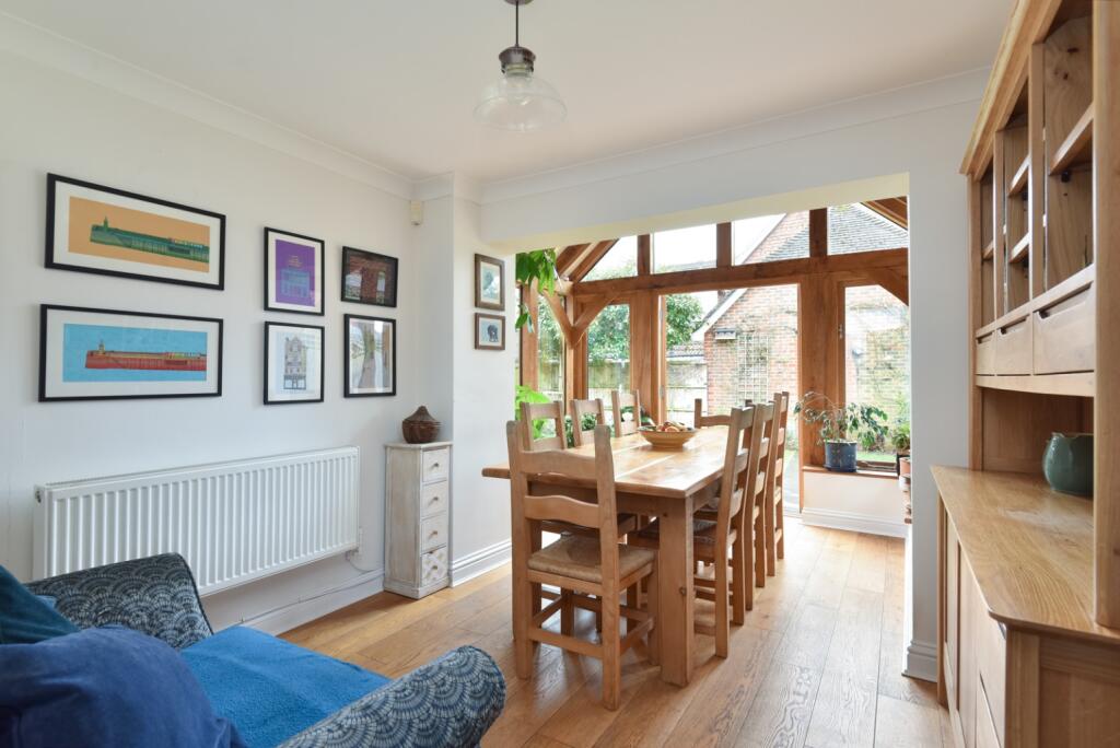
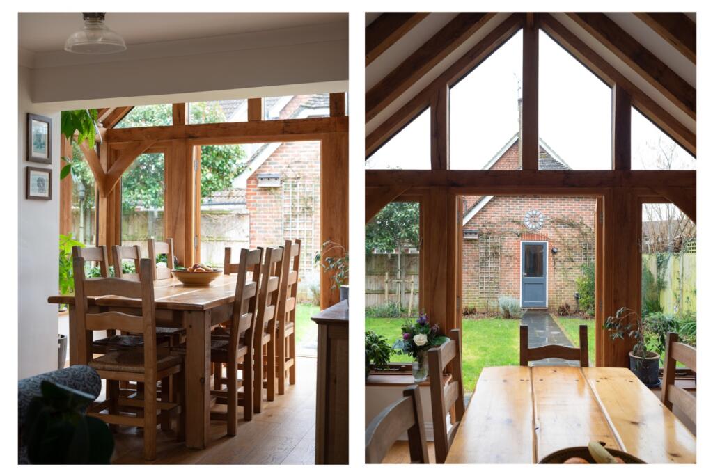
- Dining Room: Average
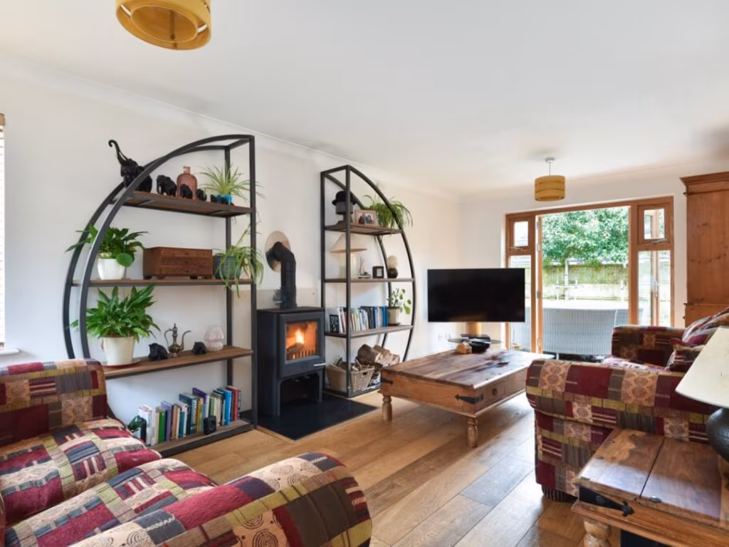
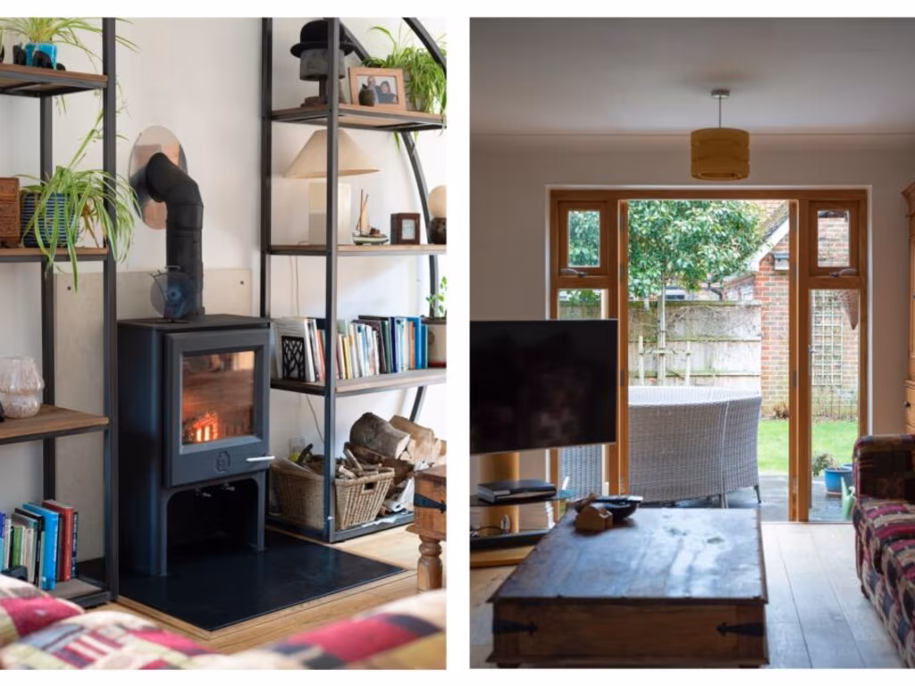
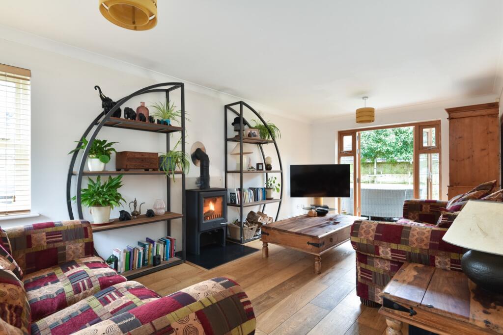
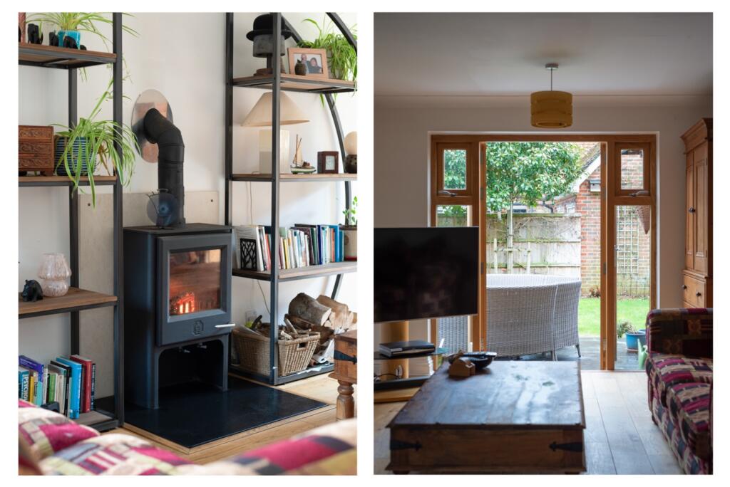
- Living Room: Large
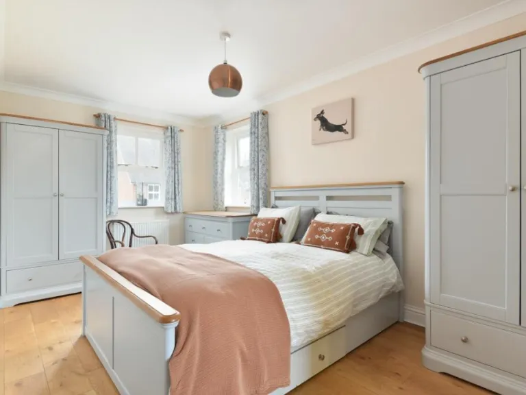
- Bedroom: Small
- Bedroom: Small
- Bedroom: Average
- Bedroom: Large
- Double Garage: Large
Textual Property Features
Detected Visual Features
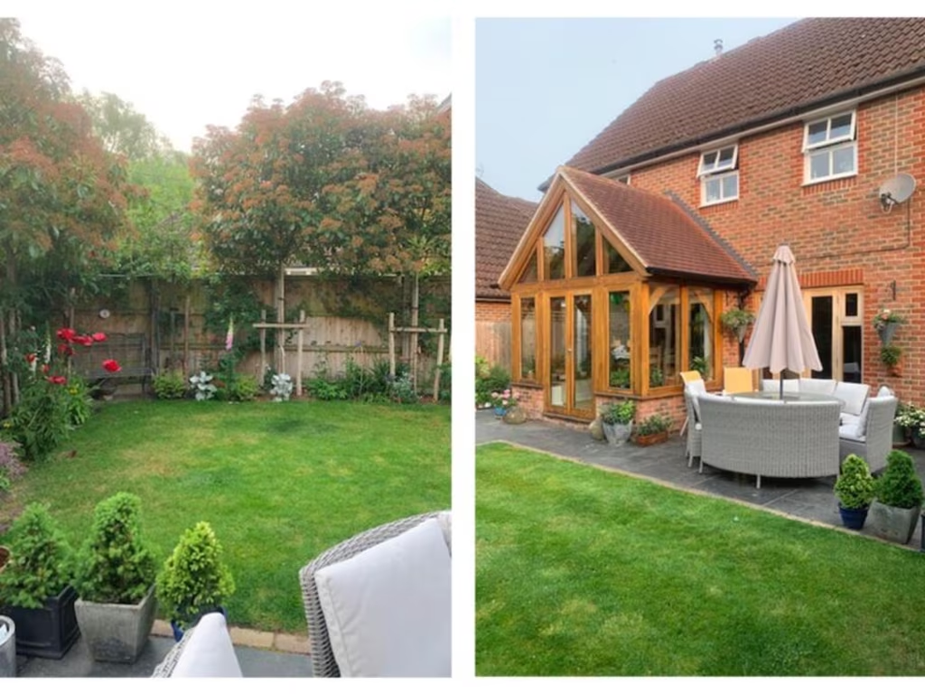
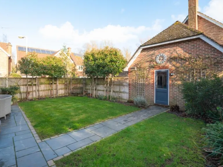
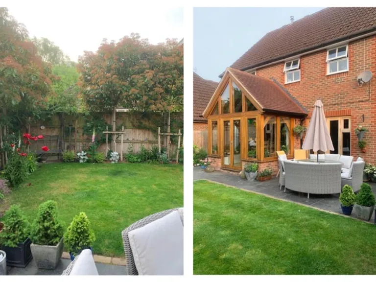
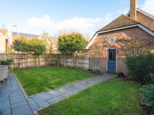
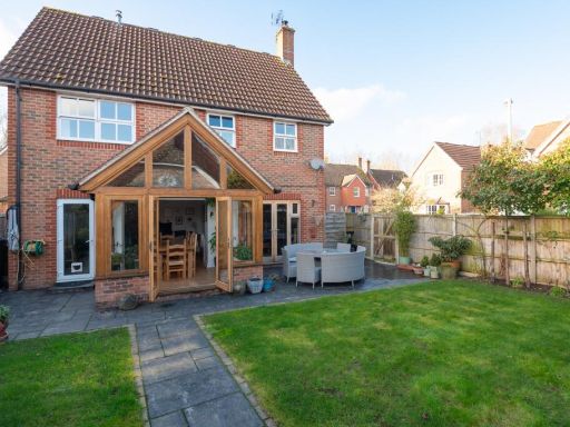
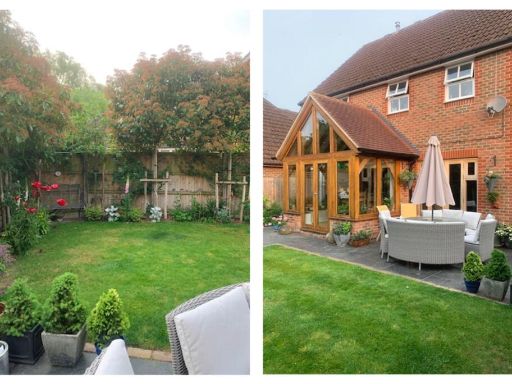
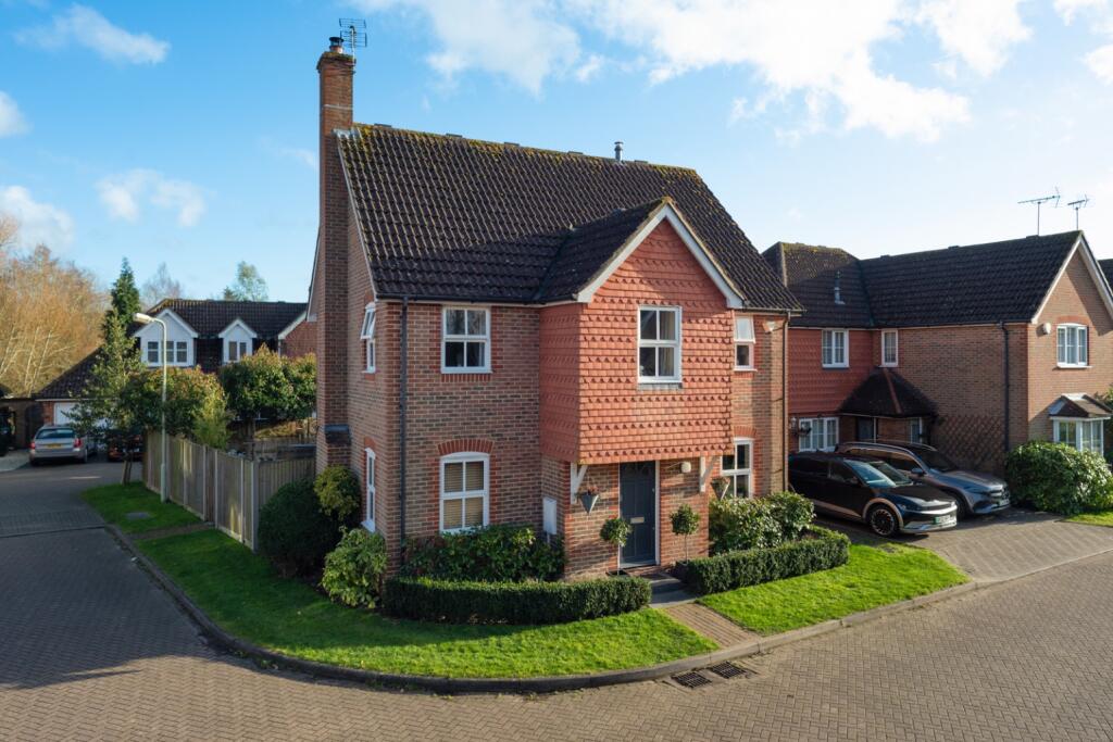
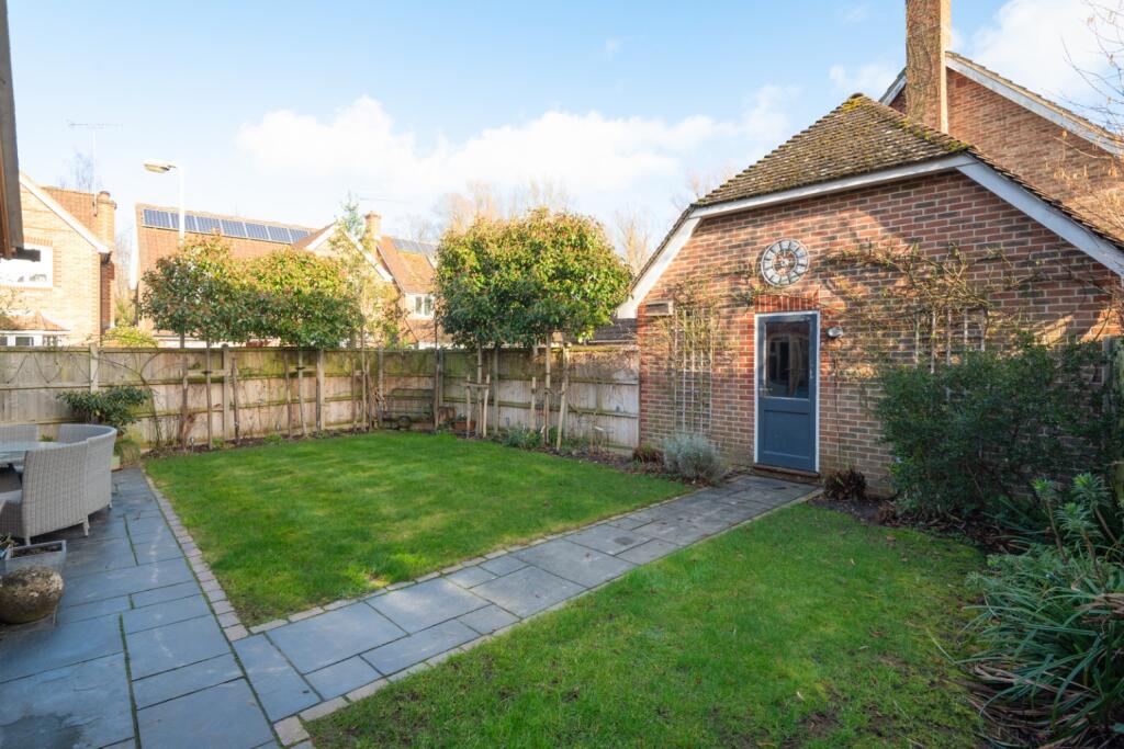
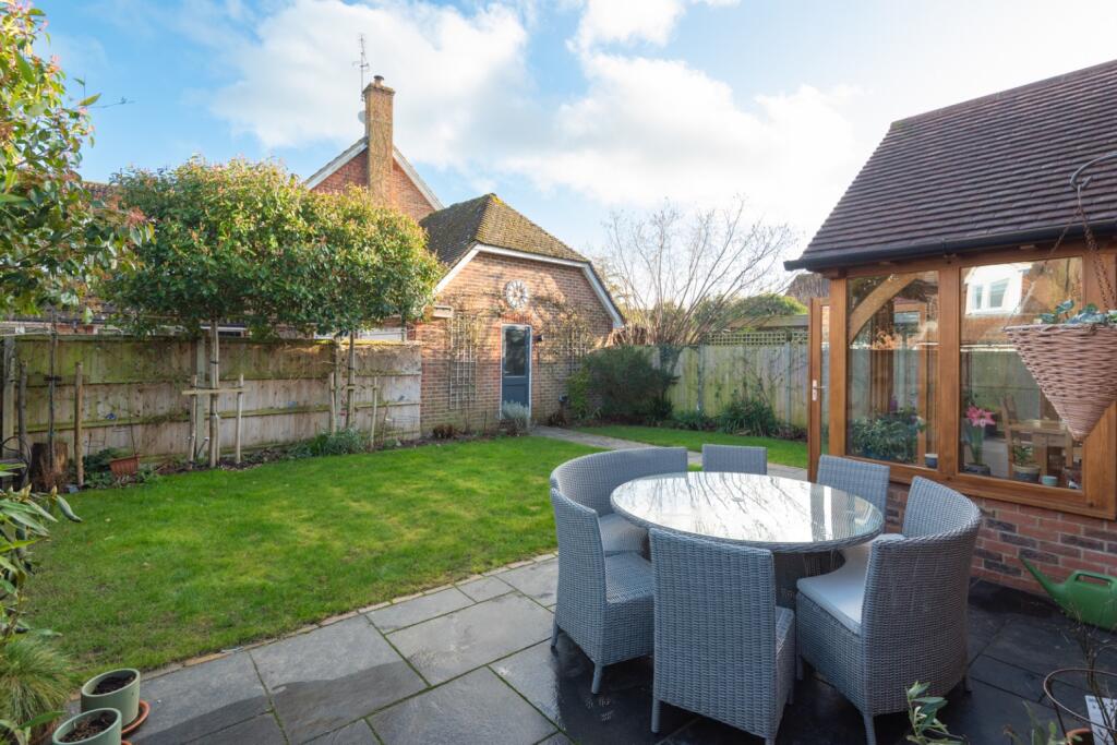
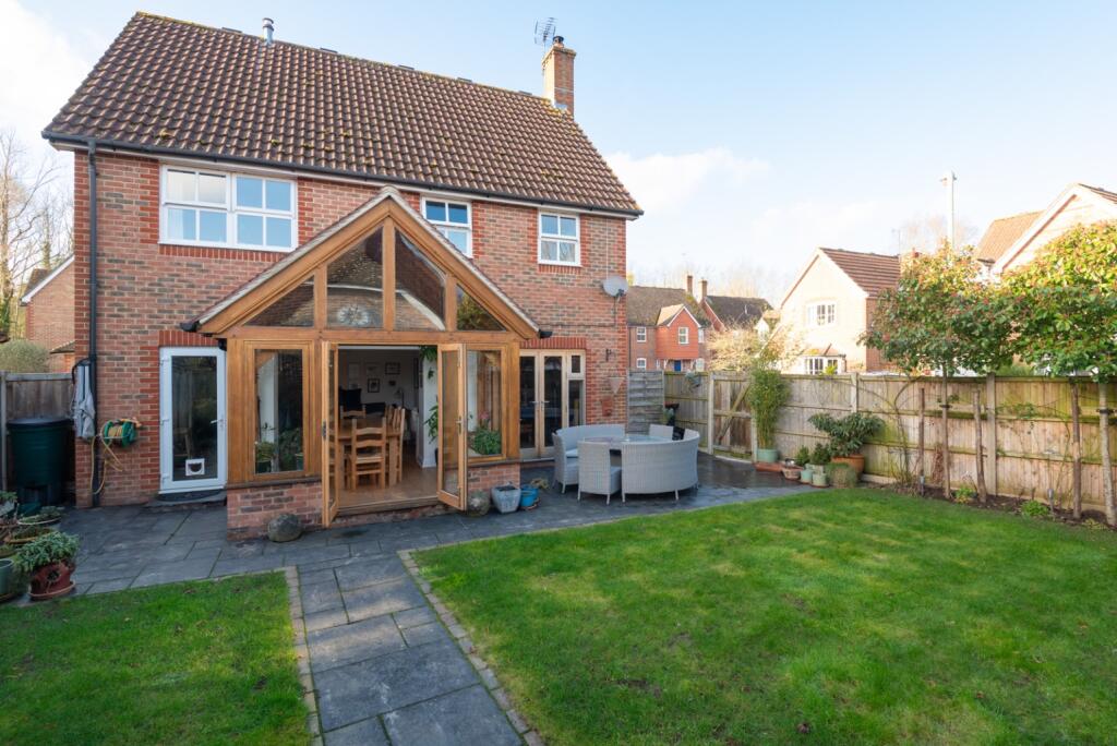
- detached house
- modern style
- two-story
- brick exterior
- pitched roof
- gabled dormers
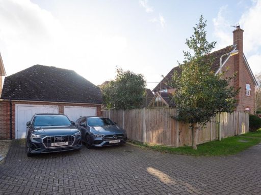
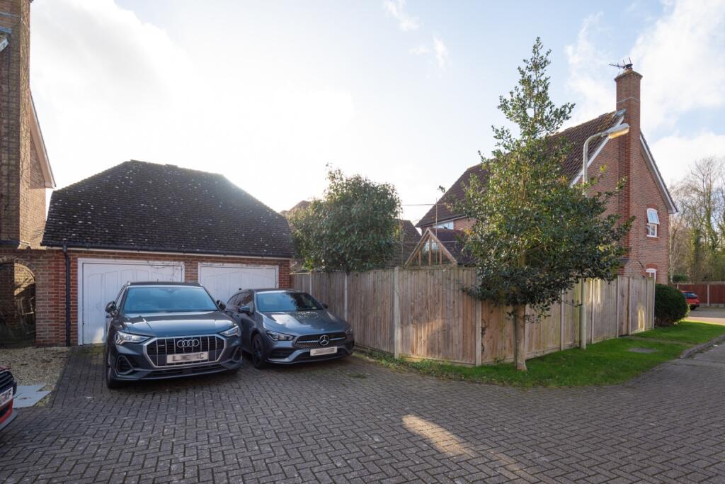
- garage
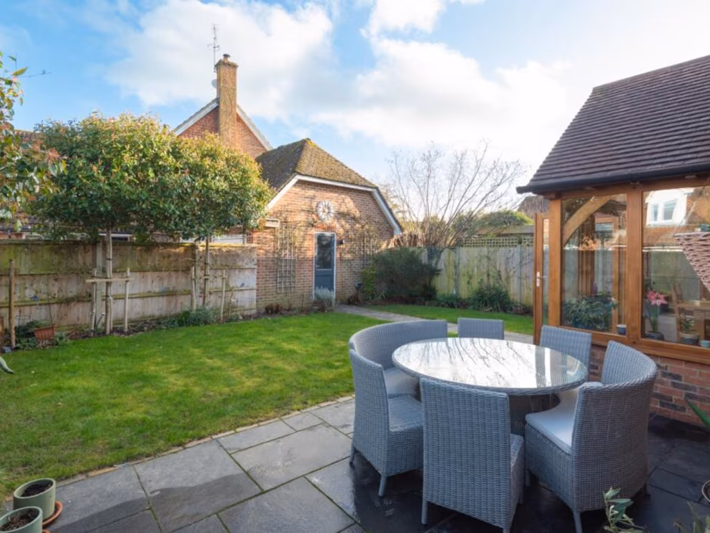
- garden
- suburban location
- modern kitchen
- wooden countertops
- dark cabinets
- built-in appliances
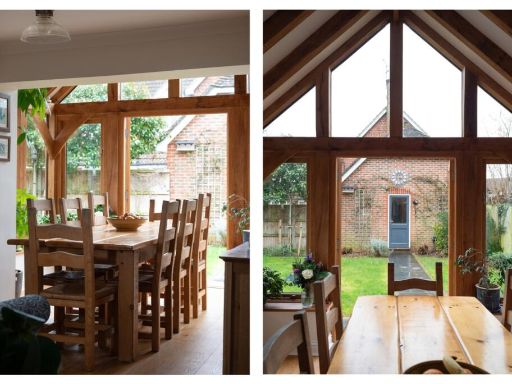
- wooden flooring
- double windows
EPC Details
- Fully double glazed
- Cavity wall, as built, insulated (assumed)
- Boiler and radiators, mains gas
- Low energy lighting in all fixed outlets
- Solid, limited insulation (assumed)
Nearby Schools
- Wickhambreaux Church of England Primary School
- Parkside Community Primary School
- St Stephen's Infant School
- Sturry Church of England Primary School
- Hoath Primary School
- Herne Church of England Junior School
- St Peter's Methodist Primary School
- St Stephen's Junior School
- Water Meadows Primary School
- Bridge and Patrixbourne Church of England Primary School
- St Anselm's Catholic School, Canterbury
- Barton Manor School
- St Thomas' Catholic Primary School, Canterbury
- St Johns Church of England Primary School
- The Archbishop's School
- Junior King's School
- Spires Academy
- Herne Church of England Infant and Nursery School
- Simon Langton Grammar School for Boys
- Simon Langton Girls' Grammar School
- The Worthgate School
- Pilgrims' Way Primary School
- Littlebourne Church of England Primary School
- Barton Court Grammar School
- The King's School Canterbury
Nearest General Shops
- Id: 542024419
- Tags:
- Addr:
- City: Canterbury
- Postcode: CT2 0AD
- Street: Mill Road
- Village: Sturry
- Brand: Mercedes-Benz
- Building: retail
- Name: Mercedes-Benz
- Shop: car
- TagsNormalized:
- Lat: 51.2976176
- Lon: 1.117674
- FullGeoHash: u10gc6my79n0
- PartitionGeoHash: u10g
- Images:
- FoodStandards: null
- Distance: 551.1
,- Id: 1040630337
- Tags:
- Addr:
- City: Canterbury
- Housenumber: 8-9
- Postcode: CT2 0BD
- Street: High Street
- Village: Sturry
- Amenity: pharmacy
- Healthcare: pharmacy
- Name: Sturry Pharmacy
- Opening_hours: Mo-Fr 09:00-18:00; Sa 09:00-13:00
- Shop: chemist
- Source: survey
- TagsNormalized:
- pharmacy
- health
- healthcare
- chemist
- shop
- Lat: 51.3002503
- Lon: 1.1216018
- FullGeoHash: u10gcdbtx5yb
- PartitionGeoHash: u10g
- Images:
- FoodStandards: null
- Distance: 418.5
,- Id: 934755550
- Tags:
- Addr:
- City: Canterbury
- Postcode: CT2 0AS
- Street: Mill Road
- Village: Sturry
- Building: yes
- Name: Ziggy's Barber Shop
- Shop: hairdresser
- Source:
- TagsNormalized:
- Lat: 51.2984186
- Lon: 1.1225026
- FullGeoHash: u10gcd96unqd
- PartitionGeoHash: u10g
- Images:
- FoodStandards: null
- Distance: 241.3
}
Nearest Religious buildings
- Id: 161495270
- Tags:
- Addr:
- City: Canterbury
- Postcode: CT2 0NR
- Street: Park View
- Village: Sturry
- Amenity: school
- Fhrs:
- Isced:
- Name: Sturry Church of England Primary School
- Phone: +44 1227 710477
- Ref:
- Website: https://www.sturry.kent.sch.uk/
- Wikidata: Q66229711
- TagsNormalized:
- Lat: 51.3071541
- Lon: 1.1270194
- FullGeoHash: u10gcshtv6wx
- PartitionGeoHash: u10g
- Images:
- FoodStandards: null
- Distance: 1085.3
,- Id: 530024232
- Tags:
- Addr:
- City: Canterbury
- Postcode: CT2 0BL
- Street: Church Lane
- Village: Sturry
- Amenity: place_of_worship
- Building: church
- Denomination: anglican
- Fhrs:
- Name: St. Nicholas
- Religion: christian
- Source:
- Wikidata: Q7594934
- TagsNormalized:
- place of worship
- church
- anglican
- christian
- Lat: 51.2985104
- Lon: 1.1201653
- FullGeoHash: u10gc6xemxry
- PartitionGeoHash: u10g
- Images:
- FoodStandards:
- Id: 1102175
- FHRSID: 1102175
- LocalAuthorityBusinessID: 1687
- BusinessName: St Nicholas Church & Hall
- BusinessType: Other catering premises
- BusinessTypeID: 7841
- AddressLine1: Saint Nicholas Church
- AddressLine2: Church Lane
- AddressLine3: Sturry
- AddressLine4: null
- PostCode: CT2 0BL
- RatingValue: Exempt
- RatingKey: fhrs_exempt_en-GB
- RatingDate: 2009-07-14
- LocalAuthorityCode: 180
- LocalAuthorityName: Canterbury City
- LocalAuthorityWebSite: http://www.canterbury.gov.uk
- LocalAuthorityEmailAddress: null
- Scores:
- Hygiene: null
- Structural: null
- ConfidenceInManagement: null
- NewRatingPending: false
- Geocode:
- Longitude: 1.12061703205109
- Latitude: 51.29994201660160
- Distance: 396.1
,- Id: 75715482
- Tags:
- Amenity: place_of_worship
- Name: St. Mary the Virgin
- Ref:
- Religion: christian
- Wikidata: Q5117593
- TagsNormalized:
- place of worship
- christian
- church
- Lat: 51.2958134
- Lon: 1.1270557
- FullGeoHash: u10gcdhey29t
- PartitionGeoHash: u10g
- Images:
- FoodStandards: null
- Distance: 206.9
}
Nearest Leisure Facilities
- Id: 933661800
- Tags:
- Leisure: pitch
- Sport: basketball
- TagsNormalized:
- pitch
- leisure
- basketball
- sports
- Lat: 51.3054199
- Lon: 1.1230315
- FullGeoHash: u10gcecg8x2y
- PartitionGeoHash: u10g
- Images:
- FoodStandards: null
- Distance: 905.7
,- Id: 192721810
- Tags:
- TagsNormalized:
- Lat: 51.2989459
- Lon: 1.1176543
- FullGeoHash: u10gc6ty50x7
- PartitionGeoHash: u10g
- Images:
- FoodStandards: null
- Distance: 577.1
,- Id: 192721811
- Tags:
- Leisure: swimming_pool
- Sport: swimming
- TagsNormalized:
- swimming
- swimming pool
- pool
- leisure
- sports
- Lat: 51.2994865
- Lon: 1.1183512
- FullGeoHash: u10gc6y35mrh
- PartitionGeoHash: u10g
- Images:
- FoodStandards: null
- Distance: 552.9
,- Id: 192721813
- Tags:
- TagsNormalized:
- Lat: 51.2984369
- Lon: 1.1191516
- FullGeoHash: u10gc6wgn1ez
- PartitionGeoHash: u10g
- Images:
- FoodStandards: null
- Distance: 461.7
,- Id: 146908629
- Tags:
- TagsNormalized:
- Lat: 51.3007592
- Lon: 1.1251776
- FullGeoHash: u10gce52dd9h
- PartitionGeoHash: u10g
- Images:
- FoodStandards: null
- Distance: 370.9
}
Nearest Tourist attractions
- Id: 89670500
- Tags:
- Addr:
- City: Canterbury
- Country: GB
- County: Kent
- Postcode: CT3 4AB
- Street: Bekesbourne Lane
- Caravans: yes
- Dryer: yes
- Name: Canterbury Camping and Caravanning Club Site
- Phone: +44 1227 463216
- Power_supply: yes
- Tents: yes
- Tourism: camp_site
- Washing_machine: yes
- Website: https://www.campingandcaravanningclub.co.uk/campsites/uk/kent/canterbury/canterbury
- TagsNormalized:
- Lat: 51.2766699
- Lon: 1.1111317
- FullGeoHash: u10g9q9h70pf
- PartitionGeoHash: u10g
- Images:
- FoodStandards: null
- Distance: 2518.5
,- Id: 329386019
- Tags:
- TagsNormalized:
- Lat: 51.3114993
- Lon: 1.108418
- FullGeoHash: u10gchzphh8r
- PartitionGeoHash: u10g
- Images:
- FoodStandards: null
- Distance: 1967.7
,- Id: 33177866
- Tags:
- Source: landsat
- Tourism: chalet
- TagsNormalized:
- Lat: 51.3052067
- Lon: 1.1096925
- FullGeoHash: u10gc7b43xwx
- PartitionGeoHash: u10g
- Images:
- FoodStandards: null
- Distance: 1403.3
}
Nearest Train stations
- Id: 6743987558
- Tags:
- Name: Herne Bay
- Naptan:
- Network: National Rail
- Platforms: 2
- Public_transport: station
- Railway: station
- Ref:
- Wheelchair: yes
- Wikidata: Q2294609
- Wikipedia: en:Herne Bay railway station
- TagsNormalized:
- Lat: 51.3644375
- Lon: 1.1183071
- FullGeoHash: u10u1qw7d3nh
- PartitionGeoHash: u10u
- Images:
- FoodStandards: null
- Distance: 7467.6
,- Id: 6689773482
- Tags:
- Name: Canterbury East
- Naptan:
- Network: National Rail
- Public_transport: station
- Railway: station
- Ref:
- Wheelchair: limited
- Wikidata: Q4381574
- Wikipedia: en:Canterbury East railway station
- TagsNormalized:
- Lat: 51.274185
- Lon: 1.07582
- FullGeoHash: u10g8qpmu2ve
- PartitionGeoHash: u10g
- Images:
- FoodStandards: null
- Distance: 4320.4
,- Id: 6689773481
- Tags:
- Name: Bekesbourne
- Naptan:
- Network: National Rail
- Public_transport: station
- Railway: station
- Ref:
- Source: survey
- Wheelchair: limited
- Wikidata: Q4881599
- Wikipedia: en:Bekesbourne railway station
- TagsNormalized:
- Lat: 51.2614031
- Lon: 1.1372301
- FullGeoHash: u10g9gu576hh
- PartitionGeoHash: u10g
- Images:
- FoodStandards: null
- Distance: 4087.4
,- Id: 3453612249
- Tags:
- Name: Canterbury West
- Naptan:
- Network: National Rail
- Operator: Southeastern
- Platforms: 2
- Public_transport: station
- Railway: station
- Ref:
- Train: yes
- Wheelchair: yes
- Wikidata: Q671106
- Wikipedia: en:Canterbury West railway station
- TagsNormalized:
- Lat: 51.2842245
- Lon: 1.0753092
- FullGeoHash: u10gb2p0282e
- PartitionGeoHash: u10g
- Images:
- FoodStandards: null
- Distance: 3792.8
,- Id: 6688385697
- Tags:
- Name: Sturry
- Naptan:
- Network: National Rail
- Platforms: 2
- Public_transport: station
- Railway: station
- Ref:
- Wikidata: Q2519465
- Wikipedia: en:Sturry railway station
- TagsNormalized:
- Lat: 51.300986
- Lon: 1.1222644
- FullGeoHash: u10gce11ysuv
- PartitionGeoHash: u10g
- Images:
- FoodStandards: null
- Distance: 457.8
}
Nearest Hotels
- Id: 29990232
- Tags:
- Addr:
- City: Canterbury
- Country: GB
- County: Kent
- District: Kent
- Housenumber: 63
- Postcode: CT1 1TU
- Street: Ivy Lane
- Brand: Travelodge
- Brand:wikidata: Q9361374
- Brand:wikipedia: en:Travelodge UK
- Fhrs:
- Name: Travelodge Chaucer Central
- Not:
- Note: FHRS postcode disagrees with website as of Oct 2017
- Old_name: The Chaucer Hotel
- Tourism: hotel
- Wheelchair: yes
- TagsNormalized:
- Lat: 51.2769373
- Lon: 1.0852636
- FullGeoHash: u10g8wwmb3zj
- PartitionGeoHash: u10g
- Images:
- FoodStandards: null
- Distance: 3614.1
,- Id: 116448105
- Tags:
- Addr:
- City: Canterbury
- Country: GB
- County: Kent
- Housenumber: 1
- Postcode: CT1 3AS
- Street: New Dover Road
- Brand: Premier Inn
- Brand:wikidata: Q2108626
- Brand:wikipedia: en:Premier Inn
- Building: yes
- Fhrs:
- Name: Premier Inn
- Source:
- Tourism: hotel
- TagsNormalized:
- Lat: 51.2755072
- Lon: 1.0872677
- FullGeoHash: u10g8wrtrpmd
- PartitionGeoHash: u10g
- Images:
- FoodStandards: null
- Distance: 3612.4
,- Id: 3413986
- Tags:
- Addr:
- City: Canterbury
- Country: GB
- County: Kent
- Housename: Canterbury Cathedral Lodge
- Postcode: CT1 2EH
- Street: The Precincts
- Building: yes
- Fhrs:
- Name: Canterbury Cathedral Lodge
- Source: Bing
- Tourism: hotel
- Type: multipolygon
- TagsNormalized:
- Lat: 51.279052
- Lon: 1.0828396
- FullGeoHash: u10g8xh6pups
- PartitionGeoHash: u10g
- Images:
- FoodStandards: null
- Distance: 3608.1
}
Tags
- detached house
- modern style
- two-story
- brick exterior
- pitched roof
- gabled dormers
- garage
- garden
- suburban location
- modern kitchen
- wooden countertops
- dark cabinets
- built-in appliances
- wooden flooring
- double windows
Local Market Stats
- Average Price/sqft: £353
- Avg Income: £49400
- Rental Yield: 4.1%
- Social Housing: 8%
- Planning Success Rate: 88%
AirBnB Data
- 1km average: £50/night
- Listings in 1km: 1
Similar Properties
 4 bedroom detached house for sale in Water Meadows, Fordwich, Canterbury, CT2 — £570,000 • 4 bed • 2 bath • 1536 ft²
 4 bedroom detached house for sale in High Street, Fordwich, Canterbury, Kent, CT2 — £900,000 • 4 bed • 3 bath • 2131 ft²
 5 bedroom detached house for sale in Water Meadows, Fordwich, CT2 — £650,000 • 5 bed • 2 bath • 2000 ft²
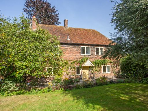 3 bedroom detached house for sale in Moat Lane, Fordwich, Canterbury, CT2 — £750,000 • 3 bed • 1 bath • 1795 ft²
 3 bedroom bungalow for sale in The Drove, Fordwich, Canterbury, Kent, CT2 — £550,000 • 3 bed • 2 bath • 1302 ft²
 3 bedroom detached house for sale in Tonford Lane, Canterbury, CT1 — £500,000 • 3 bed • 2 bath • 1694 ft²
Meta
- {
"@context": "https://schema.org",
"@type": "Residence",
"name": "4 bedroom detached house for sale in Water Meadows, Fordwic…",
"description": "",
"url": "https://propertypiper.co.uk/property/5134b0fd-9356-4d2b-9116-44d19f1702fd",
"image": "https://image-a.propertypiper.co.uk/27615326-2254-4190-99cb-b2873069630e-1024.jpeg",
"address": {
"@type": "PostalAddress",
"streetAddress": "19 WATER MEADOWS FORDWICH CANTERBURY",
"postalCode": "CT2 0BF",
"addressLocality": "Canterbury",
"addressRegion": "Canterbury",
"addressCountry": "England"
},
"geo": {
"@type": "GeoCoordinates",
"latitude": 51.297434222954244,
"longitude": 1.125595427698368
},
"numberOfRooms": 4,
"numberOfBathroomsTotal": 2,
"floorSize": {
"@type": "QuantitativeValue",
"value": 1625,
"unitCode": "FTK"
},
"offers": {
"@type": "Offer",
"price": 550000,
"priceCurrency": "GBP",
"availability": "https://schema.org/InStock"
},
"additionalProperty": [
{
"@type": "PropertyValue",
"name": "Feature",
"value": "detached house"
},
{
"@type": "PropertyValue",
"name": "Feature",
"value": "modern style"
},
{
"@type": "PropertyValue",
"name": "Feature",
"value": "two-story"
},
{
"@type": "PropertyValue",
"name": "Feature",
"value": "brick exterior"
},
{
"@type": "PropertyValue",
"name": "Feature",
"value": "pitched roof"
},
{
"@type": "PropertyValue",
"name": "Feature",
"value": "gabled dormers"
},
{
"@type": "PropertyValue",
"name": "Feature",
"value": "garage"
},
{
"@type": "PropertyValue",
"name": "Feature",
"value": "garden"
},
{
"@type": "PropertyValue",
"name": "Feature",
"value": "suburban location"
},
{
"@type": "PropertyValue",
"name": "Feature",
"value": "modern kitchen"
},
{
"@type": "PropertyValue",
"name": "Feature",
"value": "wooden countertops"
},
{
"@type": "PropertyValue",
"name": "Feature",
"value": "dark cabinets"
},
{
"@type": "PropertyValue",
"name": "Feature",
"value": "built-in appliances"
},
{
"@type": "PropertyValue",
"name": "Feature",
"value": "wooden flooring"
},
{
"@type": "PropertyValue",
"name": "Feature",
"value": "double windows"
}
]
}
High Res Floorplan Images
Compatible Floorplan Images
FloorplanImages Thumbnail