TW12 1BQ - 2 bedroom apartment for sale in Uxbridge Road, Hampton Hill…
View on Property Piper
2 bedroom apartment for sale in Uxbridge Road, Hampton Hill, TW12
Property Details
- Price: £475000
- Bedrooms: 2
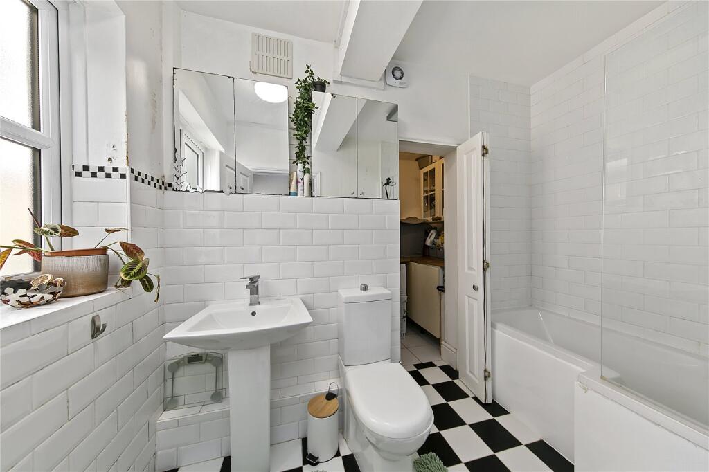
- Bathrooms: 1
- Property Type: undefined
- Property SubType: undefined
Image Descriptions
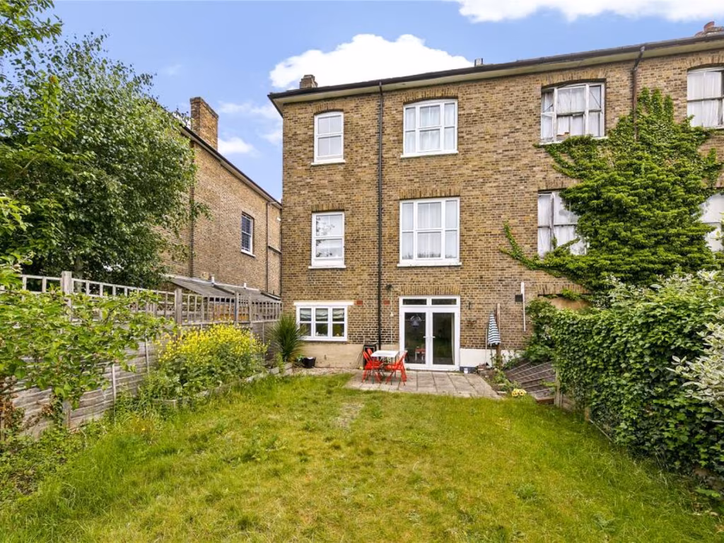
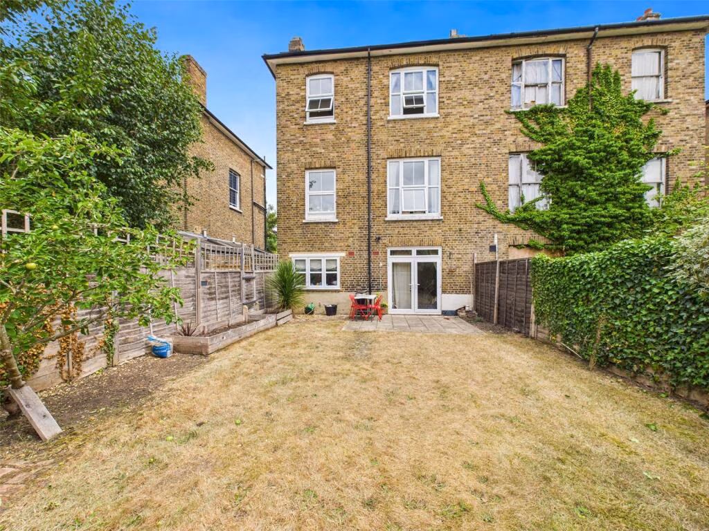
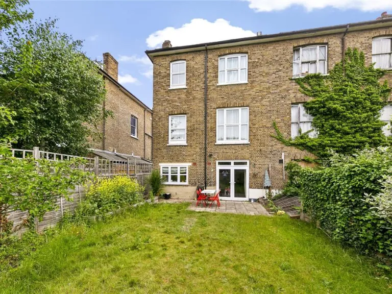
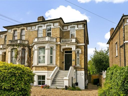
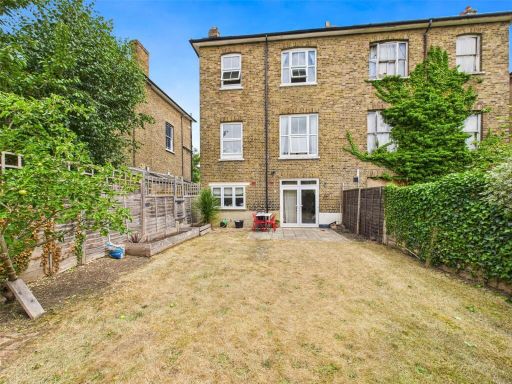
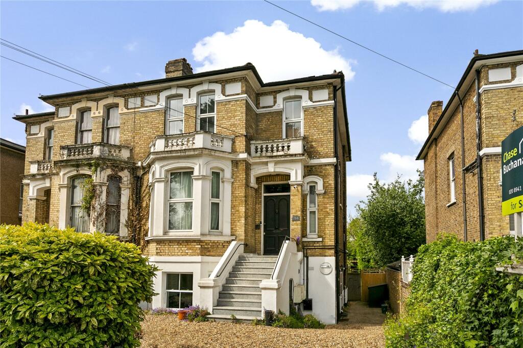
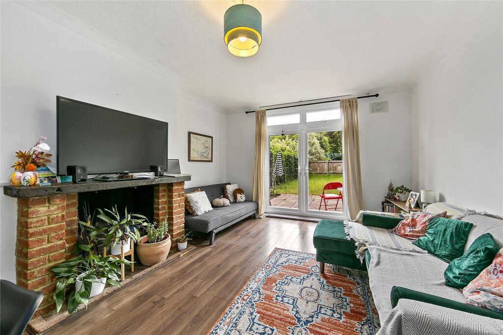
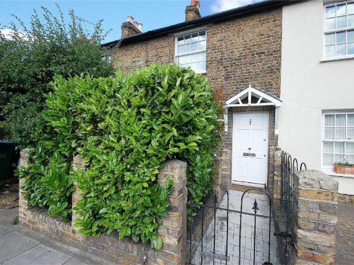
- period house Victorian
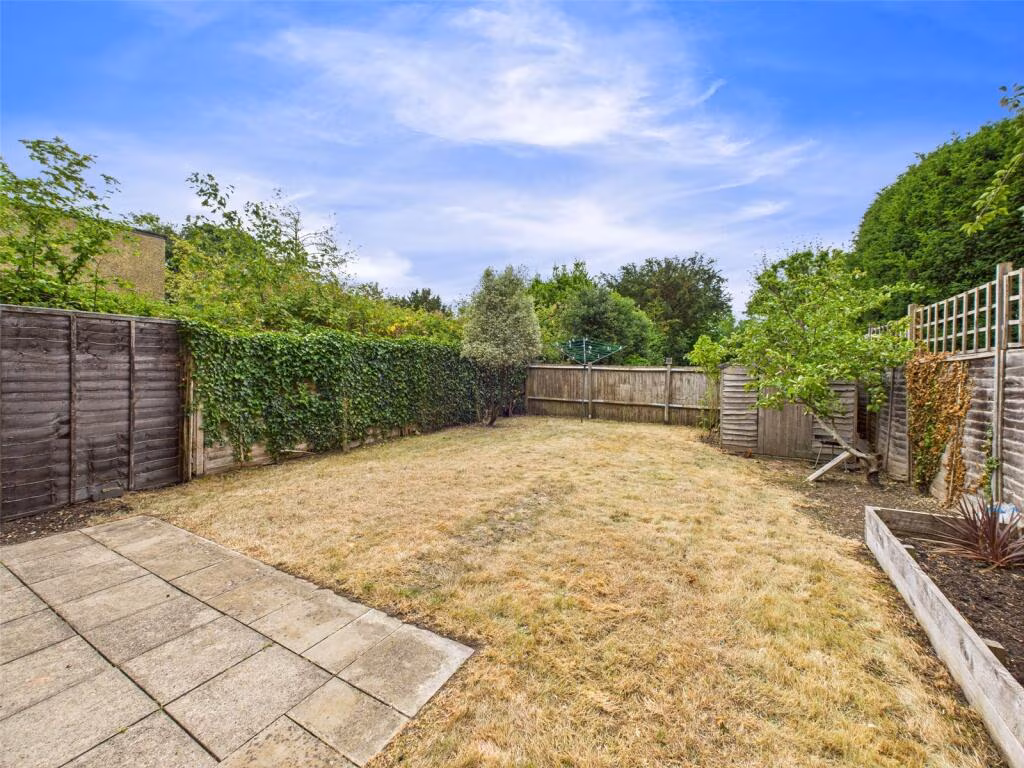
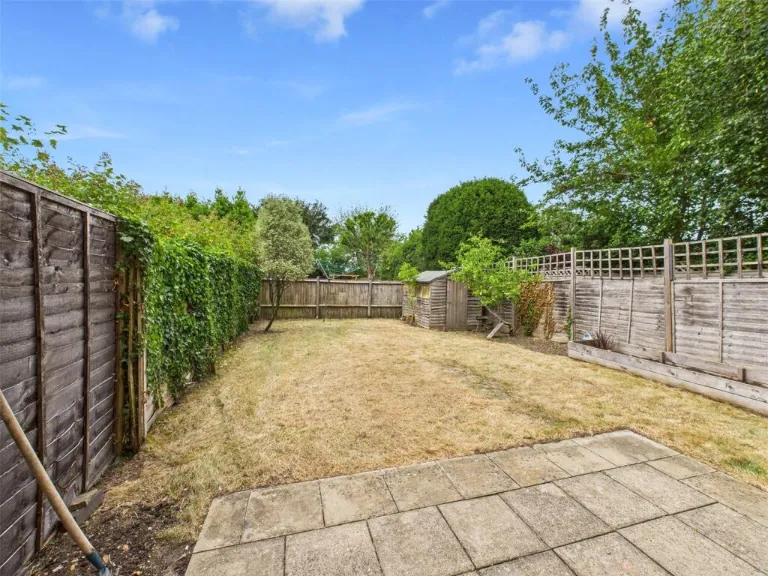
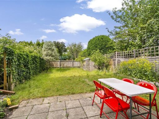
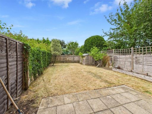
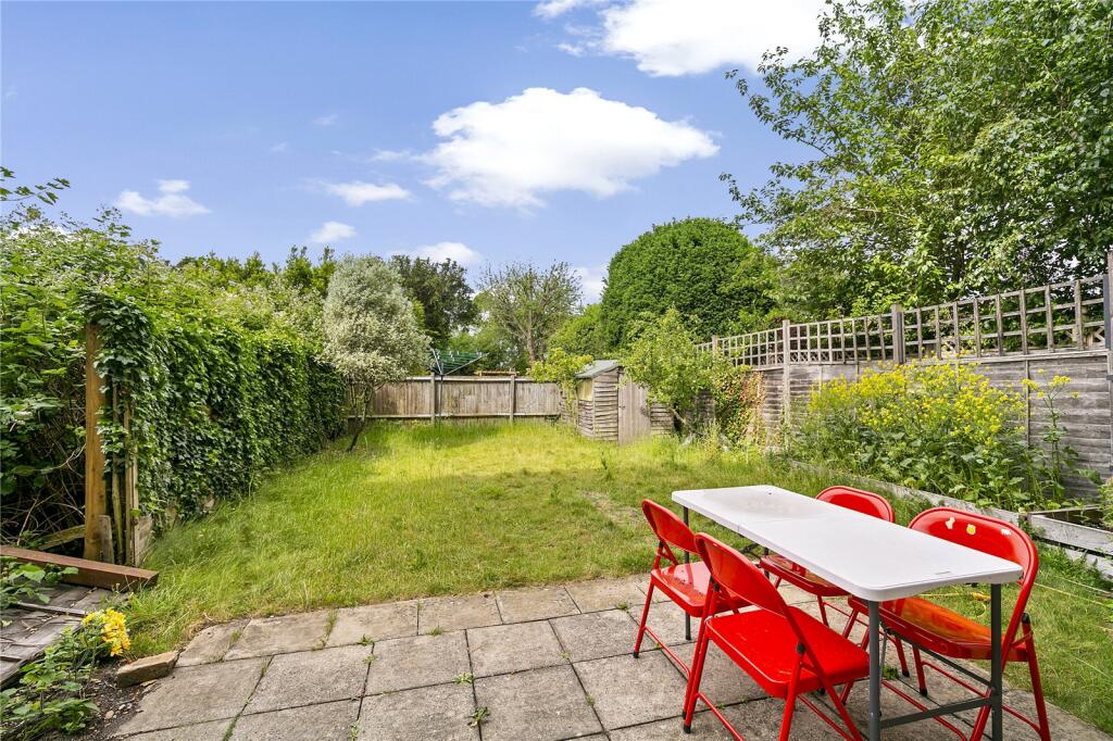
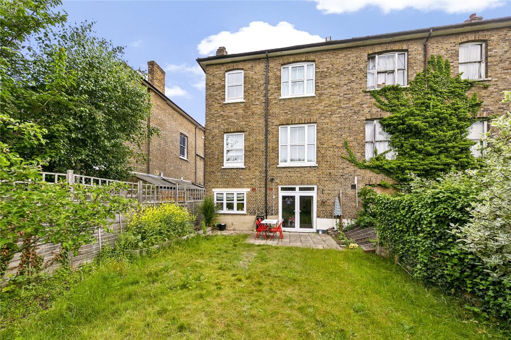
- rear garden
Floorplan Description
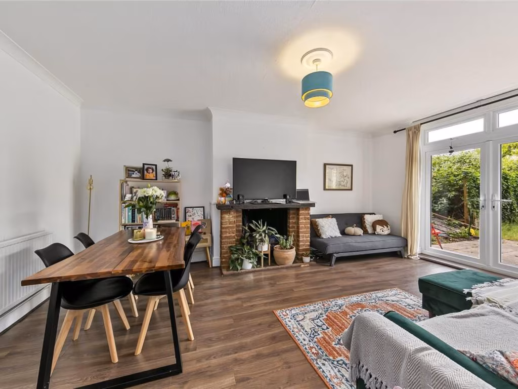
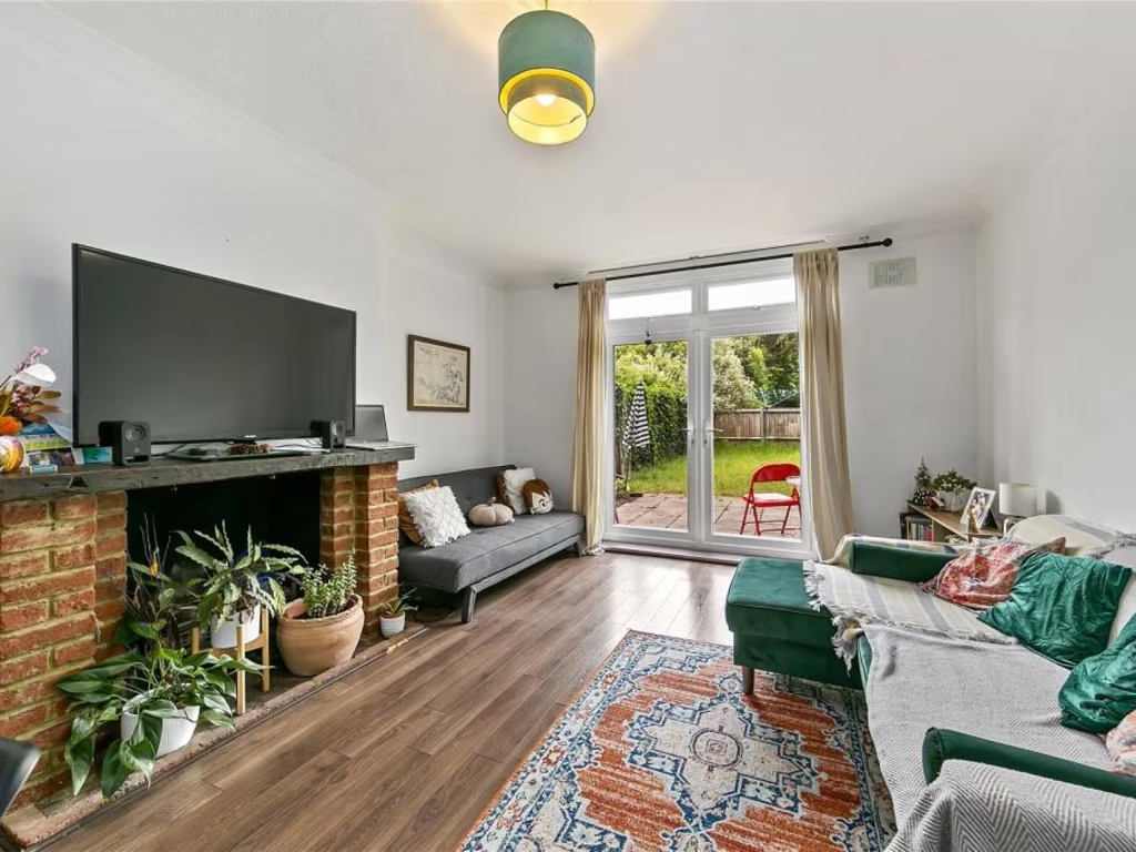
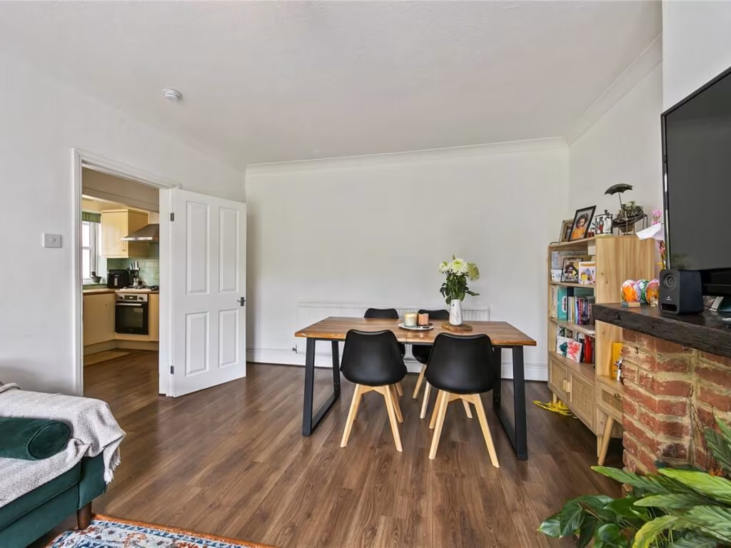
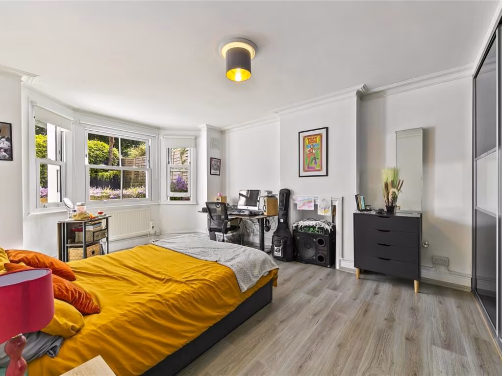
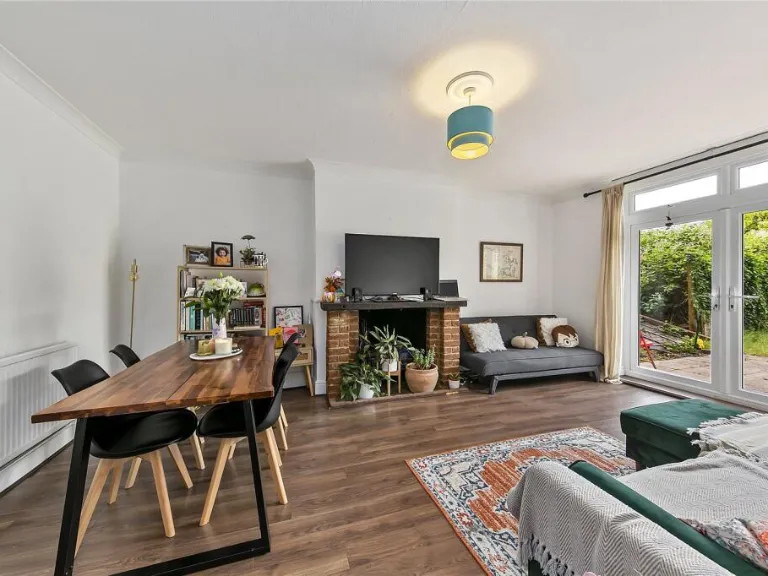
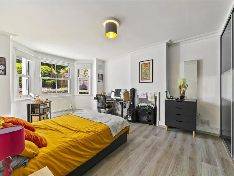
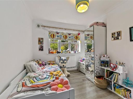
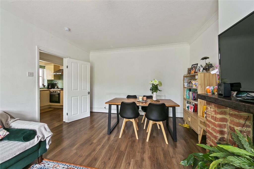
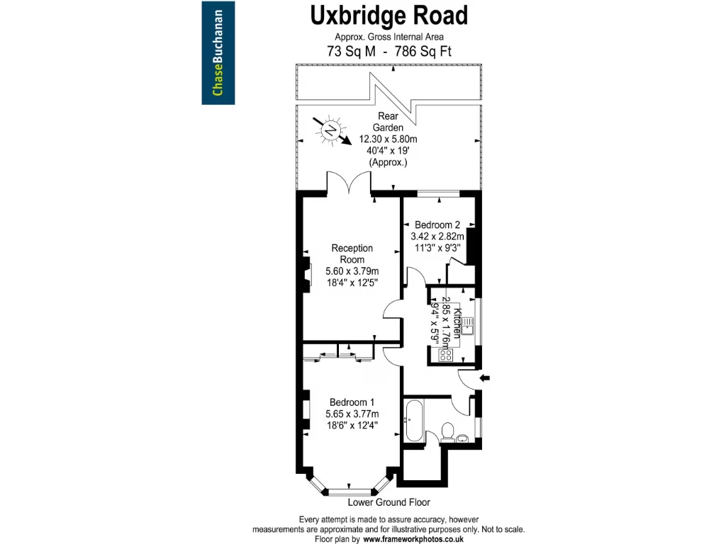
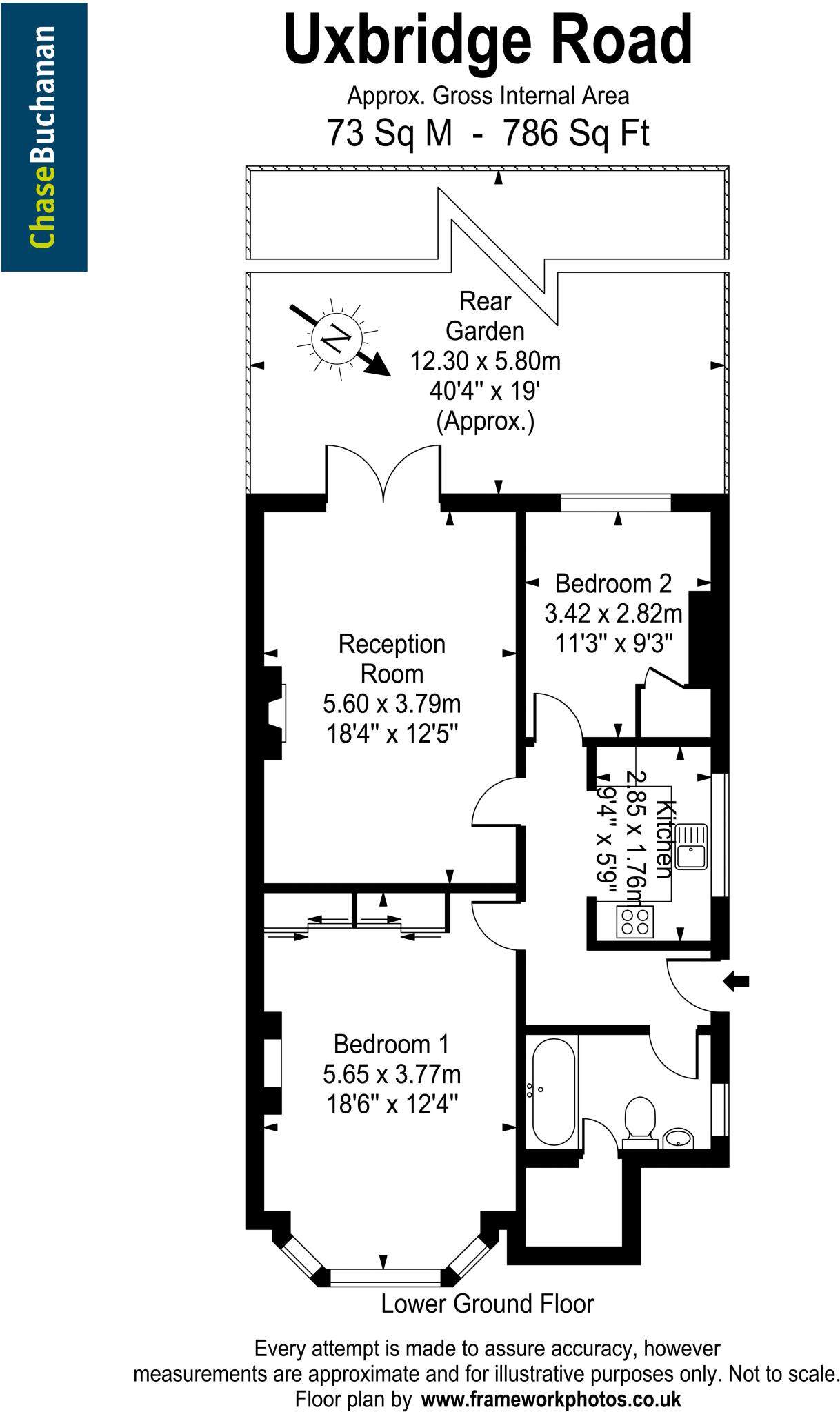
- A property located on Uxbridge Road with spacious reception and main bedroom, suitable for a lower ground floor configuration.
Rooms
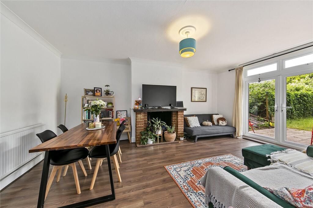
- Reception Room: Large
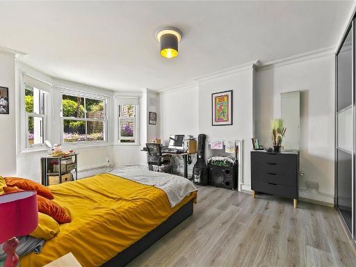
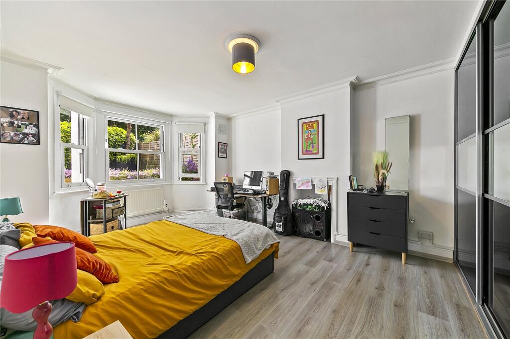
- Bedroom 1: Large
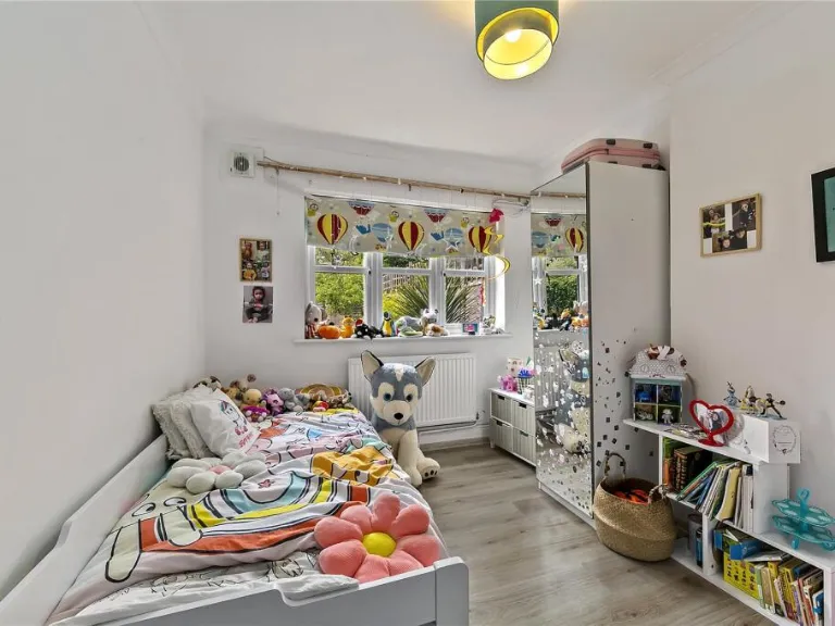
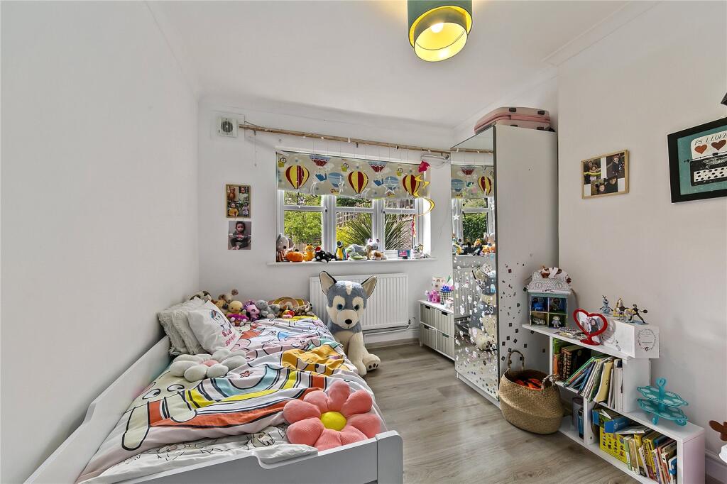
- Bedroom 2: Average
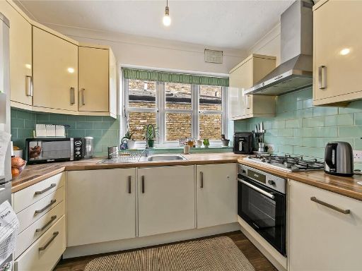
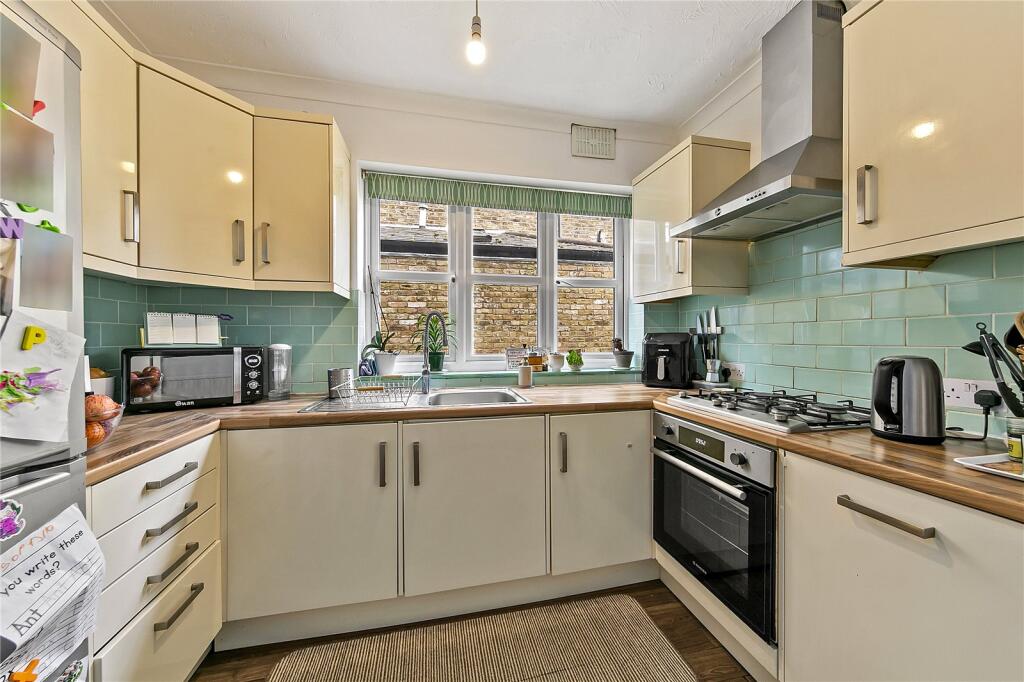
- Kitchen: Small
Textual Property Features
Detected Visual Features
- Victorian
- period house
- brick exterior
- bay windows
- arched doorway
- detached
- garden
- spacious
- multi-storey
- patio
- rear garden
- outdoor space
- fencing
- secluded
- lawn
- shrubbery
- garden maintenance
EPC Details
- Fully double glazed
- Solid brick, as built, no insulation (assumed)
- Boiler and radiators, mains gas
- Low energy lighting in 80% of fixed outlets
- Solid, no insulation (assumed)
Nearby Schools
- Lady Eleanor Holles School
- St Mary's and St Peter's Church of England Primary School
- The Mall School
- Trafalgar Junior School
- Twickenham Preparatory School
- Carlisle Infant School
- Hampton Hill Junior School
- St Richard's Church of England Primary School
- St James's Roman Catholic Primary School
- Turing House School
- Hurst Park Primary Academy
- Hampton Infant School and Nursery
- Jack and Jill School
- Buckingham Primary School
- Hampton High
- Oriel Academy West London
- Waldegrave School
- Crane Park Primary School
- Trafalgar Infant School
- Heathfield Junior School
- Nelson Primary School
- St Mary's Hampton Church of England Primary
- Hampton Junior School
- Hampton School
- Stanley Primary School
- Twickenham School
- Heathfield Infant School
- Bishop Perrin Church of England Primary School
- St Edmund's Catholic Primary School
Nearest General Shops
- Id: 717894026
- Tags:
- Addr:
- Name: Stewart & Young
- Shop: electronics
- TagsNormalized:
- Lat: 51.4265784
- Lon: -0.3563559
- FullGeoHash: gcpsxcut831c
- PartitionGeoHash: gcps
- Images:
- FoodStandards: null
- Distance: 676.5
,- Id: 6920409551
- Tags:
- Male: yes
- Name: Alex Hair Design 4U
- Opening_hours: Mo-Fr 09:00-19:00; Sa 08:45-18:30; Su 09:30-17:00
- Shop: hairdresser
- TagsNormalized:
- Lat: 51.4260473
- Lon: -0.3568369
- FullGeoHash: gcpsxcu4mn51
- PartitionGeoHash: gcps
- Images:
- FoodStandards: null
- Distance: 674
,- Id: 717894020
- Tags:
- Addr:
- Building: retail
- Building:levels: 2
- Name: The Good Skin Company
- Opening_hours: Fr 10:00-18:00; We,Th 10:00-19:00; Sa 10:00-17:00
- Roof:
- Shop: beauty
- TagsNormalized:
- Lat: 51.4259635
- Lon: -0.3570389
- FullGeoHash: gcpsxcu1bqkt
- PartitionGeoHash: gcps
- Images:
- FoodStandards: null
- Distance: 666.8
}
Nearest Grocery shops
- Id: 454289033
- Tags:
- Addr:
- City: Hampton Hill
- Housenumber: 68-78
- Postcode: TW12 1NY
- Street: High Street
- Alt_name: Sainsbury's Hampton HIll Local
- Brand: Sainsbury's Local
- Brand:wikidata: Q13218434
- Brand:wikipedia: en:Sainsbury's Local
- Building: yes
- Fhrs:
- Name: Sainsbury's Local
- Opening_hours: Mo-Su 07:00-23:00
- Shop: convenience
- TagsNormalized:
- sainsburys
- sainsburys local
- convenience
- shop
- Lat: 51.4267545
- Lon: -0.3557094
- FullGeoHash: gcpsxcuyx3gg
- PartitionGeoHash: gcps
- Images:
- FoodStandards: null
- Distance: 710.1
,- Id: 423437080
- Tags:
- Addr:
- City: Hampton Hill
- Housenumber: 177
- Postcode: TW12 1NL
- Street: High Street
- Alt_name: Tesco Hampton Hill Express
- Brand: Tesco Express
- Brand:wikidata: Q98456772
- Building: yes
- Contact:
- Website: https://www.tesco.com/store-locator/hampton/177-high-st
- Fhrs:
- Name: Tesco Express
- Opening_hours: Mo-Su 07:00-23:00
- Shop: convenience
- TagsNormalized:
- tesco
- tesco express
- convenience
- shop
- Lat: 51.42832
- Lon: -0.3550861
- FullGeoHash: gcpsxfjrtvsw
- PartitionGeoHash: gcps
- Images:
- FoodStandards: null
- Distance: 709
,- Id: 725685189
- Tags:
- Addr:
- Housenumber: 60
- Postcode: TW12 1PD
- Street: High Street
- Building: retail
- Building:levels: 2
- Fhrs:
- Name: Hampton Hill Local
- Roof:
- Shop: convenience
- Source:
- TagsNormalized:
- Lat: 51.4262147
- Lon: -0.3562102
- FullGeoHash: gcpsxcue7tnr
- PartitionGeoHash: gcps
- Images:
- FoodStandards: null
- Distance: 703.2
}
Nearest Supermarkets
- Id: 284847208
- Tags:
- Addr:
- City: Twickenham
- Housenumber: 50
- Postcode: TW2 5NT
- Street: South Road
- Brand: Lidl
- Brand:wikidata: Q151954
- Brand:wikipedia: en:Lidl
- Building: retail
- Fhrs:
- Name: Lidl
- Shop: supermarket
- Source:
- TagsNormalized:
- lidl
- retail
- supermarket
- shop
- Lat: 51.4354389
- Lon: -0.350552
- FullGeoHash: gcpu8589psc2
- PartitionGeoHash: gcpu
- Images:
- FoodStandards: null
- Distance: 1238.1
,- Id: 152728631
- Tags:
- Addr:
- Housenumber: 30
- Postcode: TW12 3YH
- Street: Tangley Park Road
- Brand: Sainsbury's
- Brand:wikidata: Q152096
- Brand:wikipedia: en:Sainsbury's
- Building: retail
- Fhrs:
- Loc_name: Little Sainsbury's
- Name: Sainsbury's
- Opening_hours: Mo-Sa 07:00-20:30; Su 10:00-16:00
- Operator: Sainsbury's
- Shop: supermarket
- Source:
- Wheelchair: yes
- TagsNormalized:
- sainsburys
- retail
- supermarket
- shop
- Lat: 51.4264392
- Lon: -0.3775939
- FullGeoHash: gcpsx3vh9rje
- PartitionGeoHash: gcps
- Images:
- FoodStandards: null
- Distance: 906.5
,- Id: 22924468
- Tags:
- Addr:
- City: Hampton
- Housenumber: 303
- Postcode: TW12 1AW
- Street: Uxbridge Road
- Alt_name: Sainsbury's St Clares Superstore
- Brand: Sainsbury's
- Brand:wikidata: Q152096
- Brand:wikipedia: en:Sainsbury's
- Building: yes
- Fhrs:
- Name: Sainsbury's
- Opening_hours: Mo-Fr 07:00-22:00; Sa 07:00-21:00; Su 10:00-16:00; PH Mo 09:00-19:00
- Operator: Sainsbury's
- Phone: +44 20 8941 7571
- Shop: supermarket
- Website: http://www.sainsburys.co.uk/sol/storelocator/storelocator_detail_view.jsp?storeId=661
- TagsNormalized:
- sainsburys
- supermarket
- shop
- Lat: 51.4341465
- Lon: -0.3749872
- FullGeoHash: gcpsx7qcw5v6
- PartitionGeoHash: gcps
- Images:
- FoodStandards: null
- Distance: 878.5
}
Nearest Religious buildings
- Id: 311904782
- Tags:
- Amenity: place_of_worship
- Building: yes
- Denomination: united_reformed
- Name: United Reformed Church
- Religion: christian
- Website: https://www.hamptonhillurc.org.uk/
- Wikidata: Q20055630
- Wikipedia: en:Hampton Hill United Reformed Church
- TagsNormalized:
- place of worship
- united reformed
- church
- christian
- Lat: 51.4237375
- Lon: -0.3586492
- FullGeoHash: gcpsxc6ufz7y
- PartitionGeoHash: gcps
- Images:
- FoodStandards: null
- Distance: 751.1
,- Id: 105510410
- Tags:
- Affiliation: Spiritualist National Union
- Amenity: place_of_worship
- Contact:
- Denomination: spiritualist
- Name: Hampton Hill Spiritualist Church
- Religion: spiritualist
- TagsNormalized:
- place of worship
- spiritualist
- church
- Lat: 51.4265544
- Lon: -0.3578151
- FullGeoHash: gcpsxcgmqk9d
- PartitionGeoHash: gcps
- Images:
- FoodStandards: null
- Distance: 587.2
,- Id: 276094241
- Tags:
- Amenity: place_of_worship
- Building: church
- Denomination: anglican
- Name: Parish Church of St James
- Religion: christian
- Url: http://www.stjames-hamptonhill.org.uk
- Wikidata: Q18708761
- TagsNormalized:
- place of worship
- church
- anglican
- parish
- christian
- Lat: 51.4302654
- Lon: -0.3613163
- FullGeoHash: gcpsxf8gh8r5
- PartitionGeoHash: gcps
- Images:
- FoodStandards: null
- Distance: 301
}
Nearest Medical buildings
- Id: 4232062730
- Tags:
- Amenity: doctors
- Healthcare: doctor
- Name: Hampton Hill Medical Centre
- TagsNormalized:
- doctor
- doctors
- health
- healthcare
- Lat: 51.4277467
- Lon: -0.3547749
- FullGeoHash: gcpsxfjsm4ud
- PartitionGeoHash: gcps
- Images:
- FoodStandards: null
- Distance: 740.7
,- Id: 725685190
- Tags:
- Addr:
- Housenumber: 62
- Street: High Street
- Amenity: pharmacy
- Building: retail
- Building:levels: 2
- Healthcare: pharmacy
- Name: Health on the Hill
- Roof:
- TagsNormalized:
- pharmacy
- retail
- health
- healthcare
- Lat: 51.4262628
- Lon: -0.3561485
- FullGeoHash: gcpsxcuetnhq
- PartitionGeoHash: gcps
- Images:
- FoodStandards: null
- Distance: 704.6
,- Id: 423437082
- Tags:
- Addr:
- City: Hampton Hill
- Housenumber: 173B
- Postcode: TW12 1NL
- Street: High Street
- Amenity: pharmacy
- Building: yes
- Healthcare: pharmacy
- Name: Hampton Hill Pharmacy
- TagsNormalized:
- Lat: 51.4282231
- Lon: -0.3552011
- FullGeoHash: gcpsxfjr55wu
- PartitionGeoHash: gcps
- Images:
- FoodStandards: null
- Distance: 702.5
,- Id: 717894013
- Tags:
- Addr:
- Country: GB
- Housenumber: 127
- Street: High Street
- Amenity: dentist
- Brand: Bupa
- Brand:wikidata: Q931628
- Brand:wikipedia: en:Bupa
- Building: retail
- Building:levels: 2
- Contact:
- Website: https://www.bupa.co.uk/dental/dental-care/practices/hampton-hill
- Healthcare: dentist
- Name: Bupa Dental Care
- TagsNormalized:
- dentist
- bupa
- retail
- health
- healthcare
- dental
- Lat: 51.426376
- Lon: -0.3565124
- FullGeoHash: gcpsxcukkem4
- PartitionGeoHash: gcps
- Images:
- FoodStandards: null
- Distance: 676.4
}
Nearest Airports
- Id: 260720166
- Tags:
- Aerodrome: international
- Aeroway: aerodrome
- Alt_name: Gatwick Airport
- Ele: 62
- Iata: LGW
- Icao: EGKK
- Internet_access: wlan
- Internet_access:fee: no
- Internet_access:ssid: Gatwick FREE Wi-Fi
- Name: London Gatwick Airport
- Operator: Gatwick Airport Limited
- Ref: LGW
- Website: https://www.gatwickairport.com/
- Wikidata: Q8703
- Wikipedia: en:Gatwick Airport
- TagsNormalized:
- airport
- international airport
- Lat: 51.1540917
- Lon: -0.1883773
- FullGeoHash: gcpg58qf4mzd
- PartitionGeoHash: gcpg
- Images:
- FoodStandards: null
- Distance: 32959.9
,- Id: 14001268
- Tags:
- Access: yes
- Aerodrome: international
- Aerodrome:type: public
- Aeroway: aerodrome
- Alt_name: London Heathrow
- Alt_name_2: London Heathrow Airport
- Ele: 25
- Iata: LHR
- Icao: EGLL
- Int_name: Heathrow Airport
- Name: London Heathrow Airport
- Note: area still approx
- Old_name: London Airport
- Operator: Heathrow Airport Limited
- Rank_aci:
- Ref: LHR
- Short_name: Heathrow
- Type: multipolygon
- Website: https://www.heathrow.com/
- Wikidata: Q8691
- Wikipedia: en:Heathrow Airport
- TagsNormalized:
- airport
- international airport
- Lat: 51.4677522
- Lon: -0.4547736
- FullGeoHash: gcpsv9kv7h2h
- PartitionGeoHash: gcps
- Images:
- FoodStandards: null
- Distance: 7548
}
Nearest Leisure Facilities
- Id: 871121304
- Tags:
- TagsNormalized:
- Lat: 51.4297588
- Lon: -0.367296
- FullGeoHash: gcpsxds813um
- PartitionGeoHash: gcps
- Images:
- FoodStandards: null
- Distance: 160.5
,- Id: 871121305
- Tags:
- TagsNormalized:
- Lat: 51.4294683
- Lon: -0.3670087
- FullGeoHash: gcpsxdky25f2
- PartitionGeoHash: gcps
- Images:
- FoodStandards: null
- Distance: 129.6
,- Id: 871121307
- Tags:
- Area: yes
- Lanes: 8
- Leisure: track
- Sport: running
- Surface: grass
- TagsNormalized:
- track
- leisure
- running
- sports
- Lat: 51.4282067
- Lon: -0.3663759
- FullGeoHash: gcpsxdjpnbd6
- PartitionGeoHash: gcps
- Images:
- FoodStandards: null
- Distance: 127
,- Id: 871121306
- Tags:
- Area: yes
- Lanes: 8
- Leisure: track
- Sport: running
- Surface: grass
- TagsNormalized:
- track
- leisure
- running
- sports
- Lat: 51.4284383
- Lon: -0.3664734
- FullGeoHash: gcpsxdm0kec8
- PartitionGeoHash: gcps
- Images:
- FoodStandards: null
- Distance: 113.1
,- Id: 871121308
- Tags:
- Area: yes
- Lanes: 6
- Leisure: track
- Sport: running
- Surface: grass
- TagsNormalized:
- track
- leisure
- running
- sports
- Lat: 51.4285888
- Lon: -0.3660877
- FullGeoHash: gcpsxdm3jxc1
- PartitionGeoHash: gcps
- Images:
- FoodStandards: null
- Distance: 82
}
Nearest Tourist attractions
- Id: 854039943
- Tags:
- TagsNormalized:
- Lat: 51.4505149
- Lon: -0.3500454
- FullGeoHash: gcpu8n30gr5h
- PartitionGeoHash: gcpu
- Images:
- FoodStandards: null
- Distance: 2603.5
,- Id: 207444024
- Tags:
- Addr:
- City: Twickenham
- Housenumber: 268
- Postcode: TW1 4ST
- Street: Waldegrave Road
- Building: detached
- Building:colour: white
- Building:levels: 3
- Fhrs:
- Historic: house
- Name: Strawberry Hill House
- Roof:
- Source:
- Tourism: villa
- Wikidata: Q7622436
- Wikipedia: en:Strawberry Hill House
- TagsNormalized:
- Lat: 51.4381936
- Lon: -0.3348139
- FullGeoHash: gcpu8kh1nq28
- PartitionGeoHash: gcpu
- Images:
- FoodStandards: null
- Distance: 2338.7
,- Id: 612160020
- Tags:
- Addr:
- City: Twickenham
- Housenumber: 18
- Postcode: TW2 6RG
- Street: Mereway Road
- Building: industrial
- Craft: brewery
- Description: Twickenham Fine Ales is London’s oldest micro-brewery. Founded by Steve Brown in 2004, Twickenham has been at the forefront of the resurgence of breweries in London.
- Email: info@twickenham-fine-ales.co.uk
- Name: Twickenham Fine Ales
- Phone: +44 20 8241 1825
- Tourism: http://twickenham-fine-ales.co.uk/toursbar/
- Website: http://twickenham-fine-ales.co.uk/
- TagsNormalized:
- Lat: 51.4451382
- Lon: -0.3454693
- FullGeoHash: gcpu8jk3tuz6
- PartitionGeoHash: gcpu
- Images:
- FoodStandards: null
- Distance: 2248.8
}
Nearest Hotels
- Id: 298834132
- Tags:
- Addr:
- Housenumber: 19
- Postcode: TW11 0AB
- Street: Park Road
- Building: yes
- Building:levels: 3
- Fhrs:
- Name: The Park Hotel
- Source:
- Tourism: hotel
- Wikidata: Q27085011
- TagsNormalized:
- Lat: 51.4256307
- Lon: -0.3341924
- FullGeoHash: gcpu83u8hb2h
- PartitionGeoHash: gcpu
- Images:
- FoodStandards: null
- Distance: 2186.5
,- Id: 864727591
- Tags:
- Addr:
- City: Twickenham
- Postcode: TW2 6LS
- Street: Chertsey Road
- Brand: Premier Inn
- Brand:wikidata: Q2108626
- Brand:wikipedia: en:Premier Inn
- Building: yes
- Internet_access: wlan
- Internet_access:fee: customers
- Internet_access:operator: Virgin Media
- Internet_access:ssid: Premier Inn Free Wi-Fi
- Name: Premier Inn
- Tourism: hotel
- TagsNormalized:
- Lat: 51.446908
- Lon: -0.3582118
- FullGeoHash: gcpsxve5vncb
- PartitionGeoHash: gcps
- Images:
- FoodStandards: null
- Distance: 2039.1
,- Id: 284845153
- Tags:
- Addr:
- City: Twickenham
- Postcode: TW2 5PE
- Street: Sixth Cross Road
- Brand: Premier Inn
- Brand:wikidata: Q2108626
- Brand:wikipedia: en:Premier Inn
- Building: yes
- Internet_access: wlan
- Internet_access:fee: customers
- Internet_access:operator: Virgin Media
- Internet_access:ssid: Premier Inn Free Wi-Fi
- Name: Premier Inn
- Operator: Premier Inn
- Tourism: hotel
- TagsNormalized:
- Lat: 51.4392818
- Lon: -0.3599279
- FullGeoHash: gcpsxu1zt14k
- PartitionGeoHash: gcps
- Images:
- FoodStandards: null
- Distance: 1190.4
}
Tags
- Victorian
- period house
- brick exterior
- bay windows
- arched doorway
- detached
- garden
- spacious
- multi-storey
- garden
- patio
- rear garden
- outdoor space
- fencing
- secluded
- lawn
- shrubbery
- garden maintenance
Local Market Stats
- Average Price/sqft: £629
- Avg Income: £62700
- Rental Yield: 3.9%
- Social Housing: 19%
- Planning Success Rate: 78%
AirBnB Data
- 1km average: £108/night
- Listings in 1km: 2
Similar Properties
 2 bedroom terraced house for sale in Uxbridge Road, Hampton Hill, TW12 — £575,000 • 2 bed • 1 bath • 693 ft²
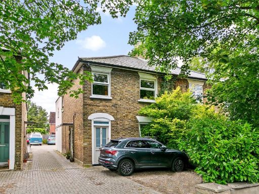 1 bedroom apartment for sale in Uxbridge Road, Hampton Hill, TW12 — £400,000 • 1 bed • 1 bath • 657 ft²
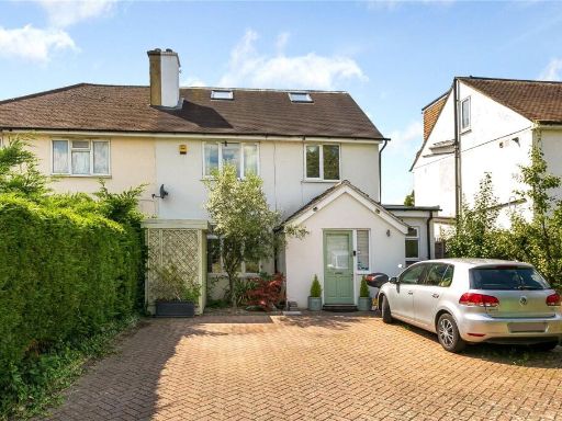 4 bedroom semi-detached house for sale in Uxbridge Road, Hampton Hill, TW12 — £1,095,000 • 4 bed • 3 bath • 1782 ft²
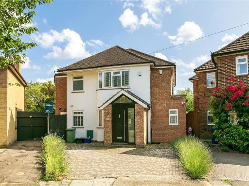 5 bedroom detached house for sale in Longford Close, Hampton Hill, TW12 — £1,100,000 • 5 bed • 4 bath • 2275 ft²
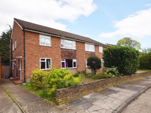 2 bedroom maisonette for sale in Hartland Road, Hampton Hill, TW12 — £360,000 • 2 bed • 1 bath • 659 ft²
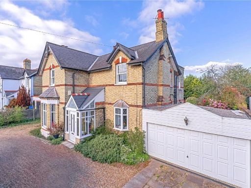 4 bedroom detached house for sale in Uxbridge Road, Hampton Hill, Hampton, TW12 — £1,200,000 • 4 bed • 1 bath • 1906 ft²
Meta
- {
"@context": "https://schema.org",
"@type": "Residence",
"name": "2 bedroom apartment for sale in Uxbridge Road, Hampton Hill…",
"description": "",
"url": "https://propertypiper.co.uk/property/312289e9-5393-45e2-90d8-327868839533",
"image": "https://image-a.propertypiper.co.uk/fbf8f4ff-86e6-4e7d-ad04-3d0e2fb71ce9-1024.jpeg",
"address": {
"@type": "PostalAddress",
"streetAddress": "155 THE GARDEN FLAT UXBRIDGE ROAD HAMPTON HILL HAMPTON",
"postalCode": "TW12 1BQ",
"addressLocality": "Richmond upon Thames",
"addressRegion": "Twickenham",
"addressCountry": "England"
},
"geo": {
"@type": "GeoCoordinates",
"latitude": 51.429100644184444,
"longitude": -0.3652352537988799
},
"numberOfRooms": 2,
"numberOfBathroomsTotal": 1,
"floorSize": {
"@type": "QuantitativeValue",
"value": 786,
"unitCode": "FTK"
},
"offers": {
"@type": "Offer",
"price": 475000,
"priceCurrency": "GBP",
"availability": "https://schema.org/InStock"
},
"additionalProperty": [
{
"@type": "PropertyValue",
"name": "Feature",
"value": "Victorian"
},
{
"@type": "PropertyValue",
"name": "Feature",
"value": "period house"
},
{
"@type": "PropertyValue",
"name": "Feature",
"value": "brick exterior"
},
{
"@type": "PropertyValue",
"name": "Feature",
"value": "bay windows"
},
{
"@type": "PropertyValue",
"name": "Feature",
"value": "arched doorway"
},
{
"@type": "PropertyValue",
"name": "Feature",
"value": "detached"
},
{
"@type": "PropertyValue",
"name": "Feature",
"value": "garden"
},
{
"@type": "PropertyValue",
"name": "Feature",
"value": "spacious"
},
{
"@type": "PropertyValue",
"name": "Feature",
"value": "multi-storey"
},
{
"@type": "PropertyValue",
"name": "Feature",
"value": "garden"
},
{
"@type": "PropertyValue",
"name": "Feature",
"value": "patio"
},
{
"@type": "PropertyValue",
"name": "Feature",
"value": "rear garden"
},
{
"@type": "PropertyValue",
"name": "Feature",
"value": "outdoor space"
},
{
"@type": "PropertyValue",
"name": "Feature",
"value": "fencing"
},
{
"@type": "PropertyValue",
"name": "Feature",
"value": "secluded"
},
{
"@type": "PropertyValue",
"name": "Feature",
"value": "lawn"
},
{
"@type": "PropertyValue",
"name": "Feature",
"value": "shrubbery"
},
{
"@type": "PropertyValue",
"name": "Feature",
"value": "garden maintenance"
}
]
}
High Res Floorplan Images
Compatible Floorplan Images
FloorplanImages Thumbnail