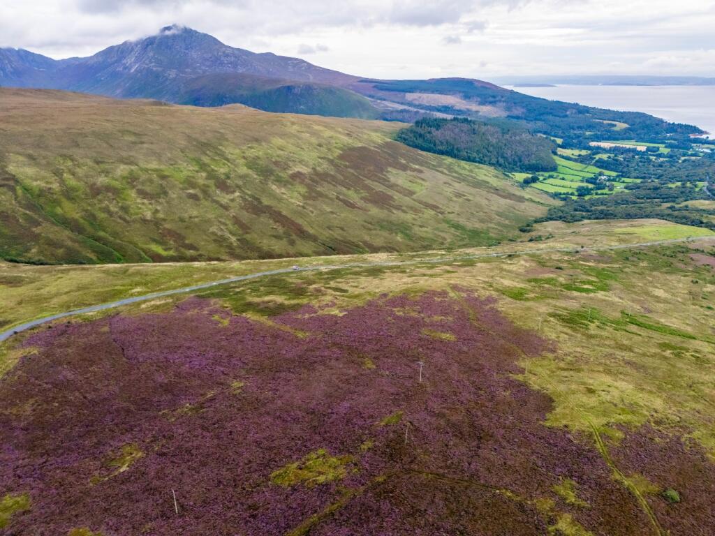
Summary - STRATHALDER, GLENSHERRIG, ACCESS FROM B880 TO WEST GLENSHERRAIG FARM KA27 8DF
1 bed 1 bath Land
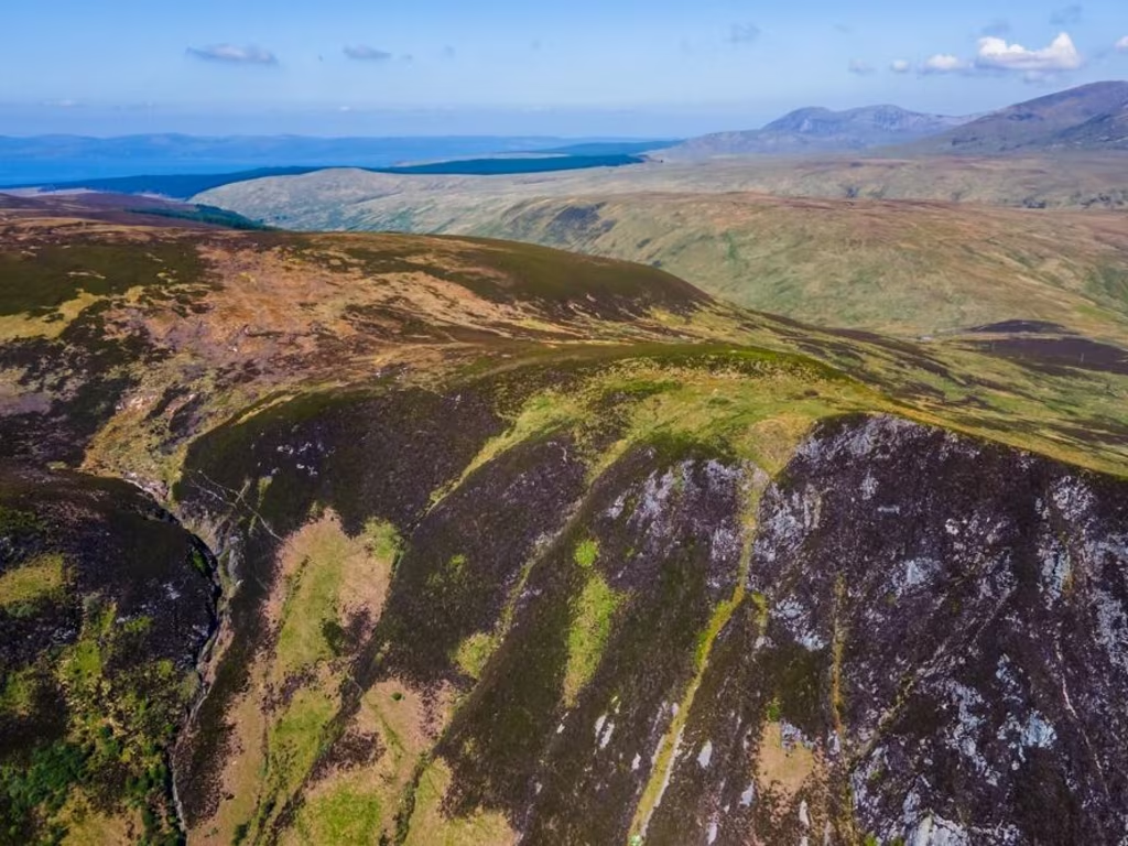
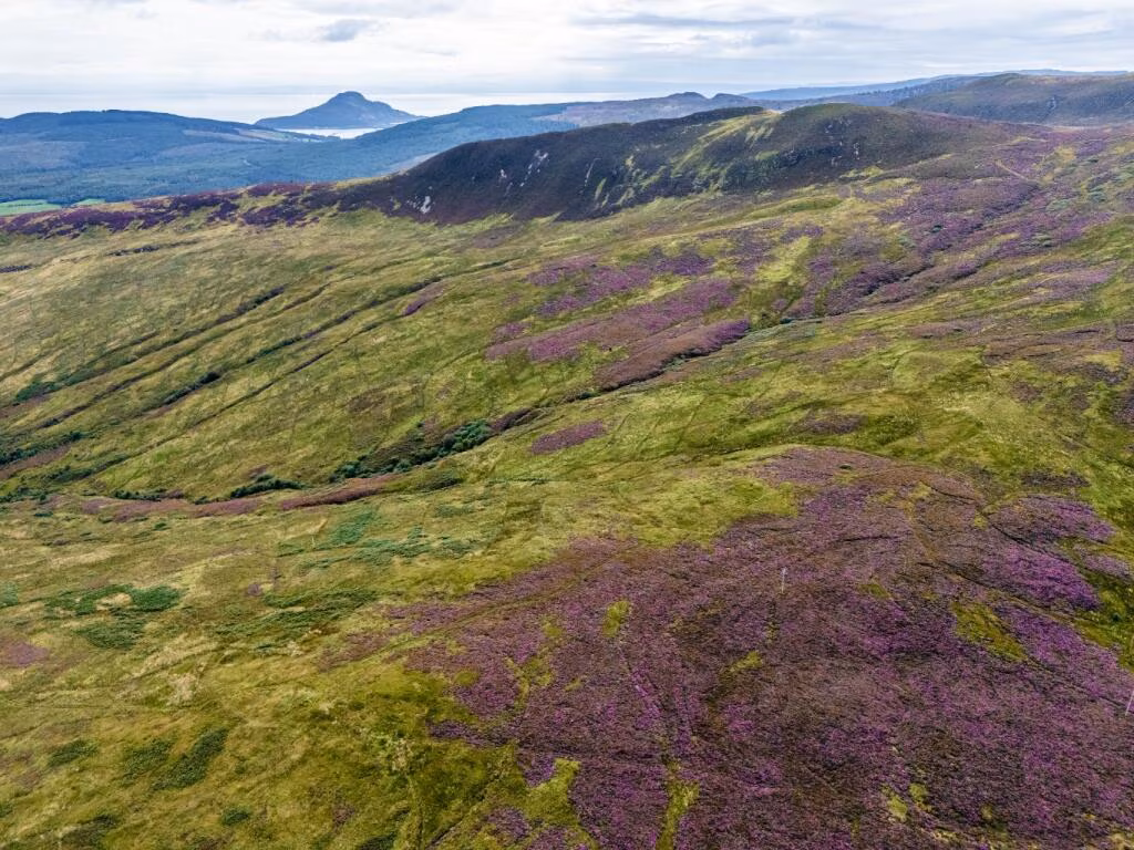
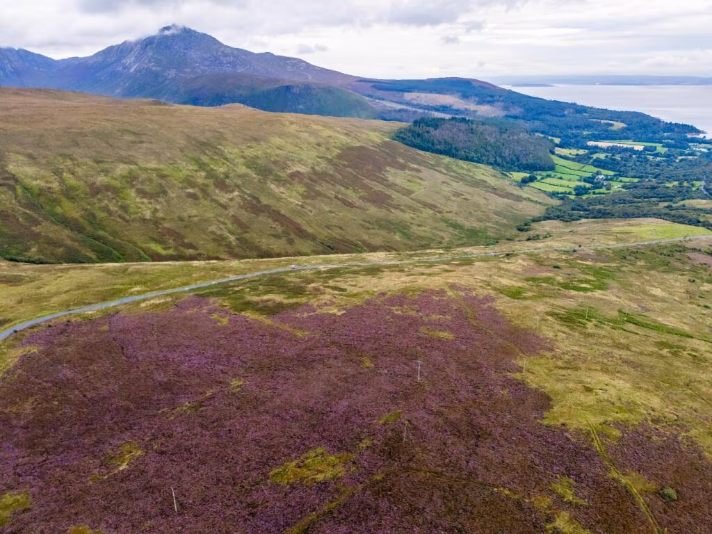
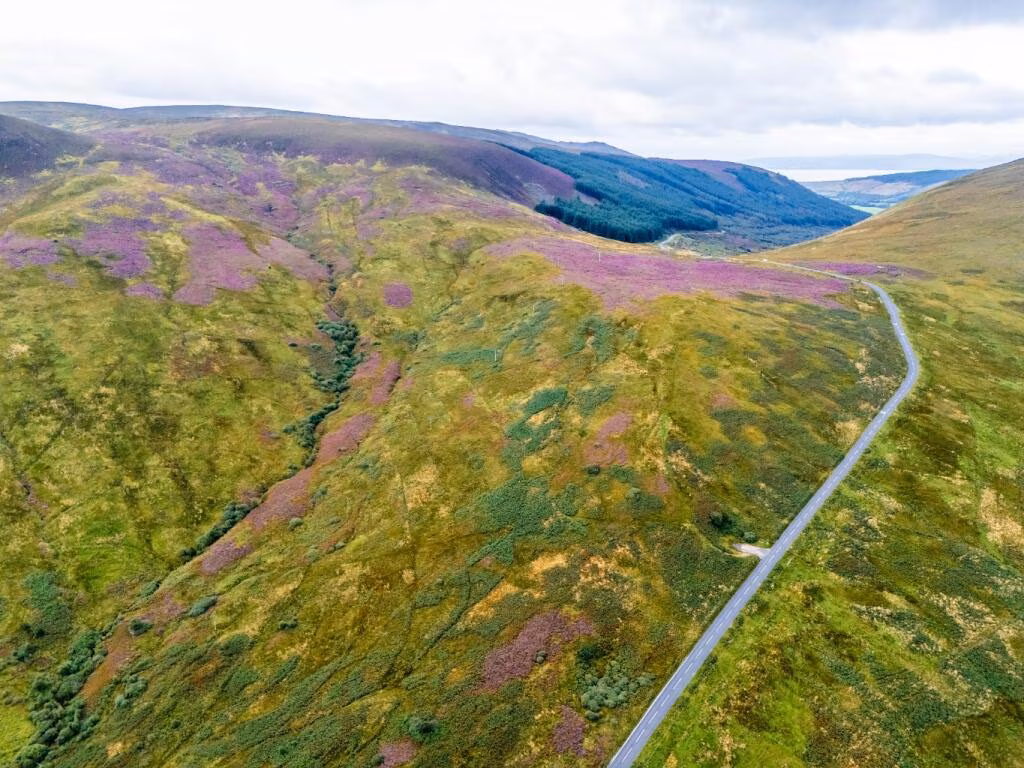
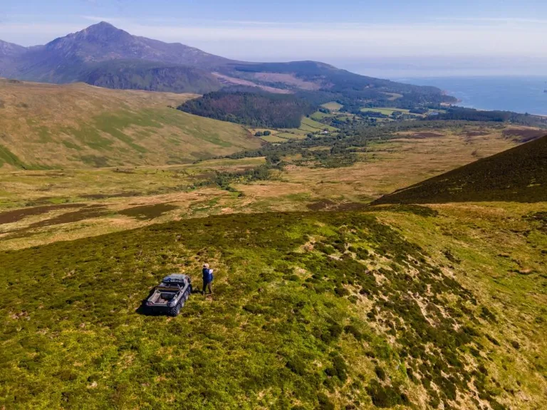
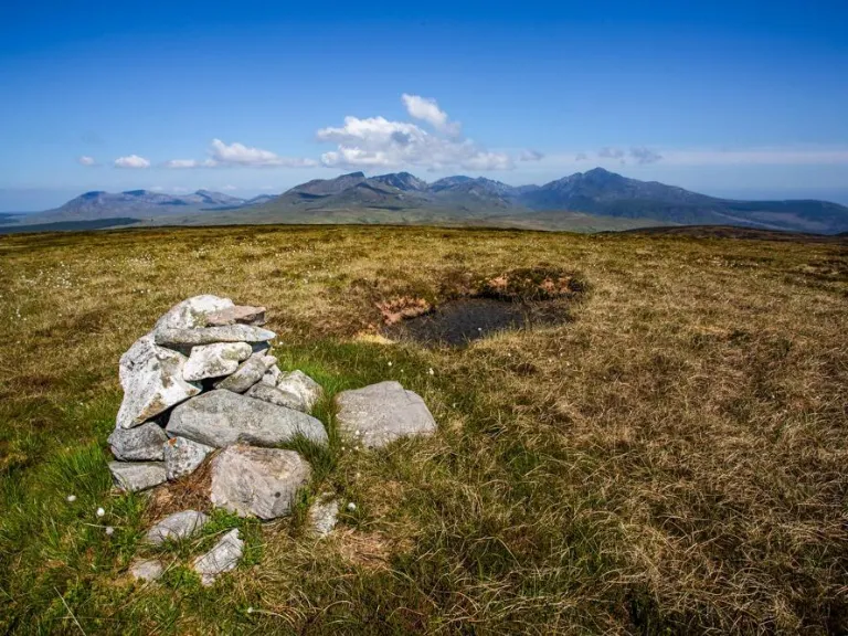
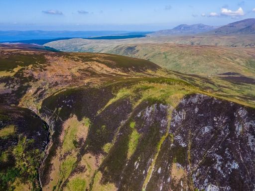
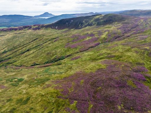
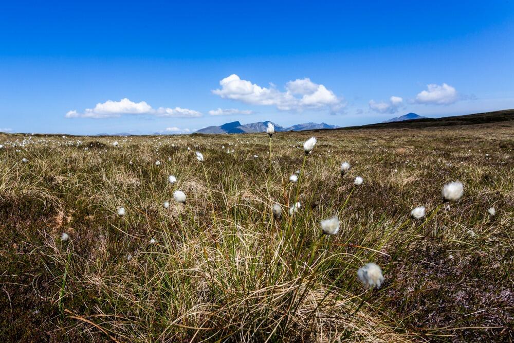
Massive freehold hill grazing with ecological value and sporting rights near Brodick.
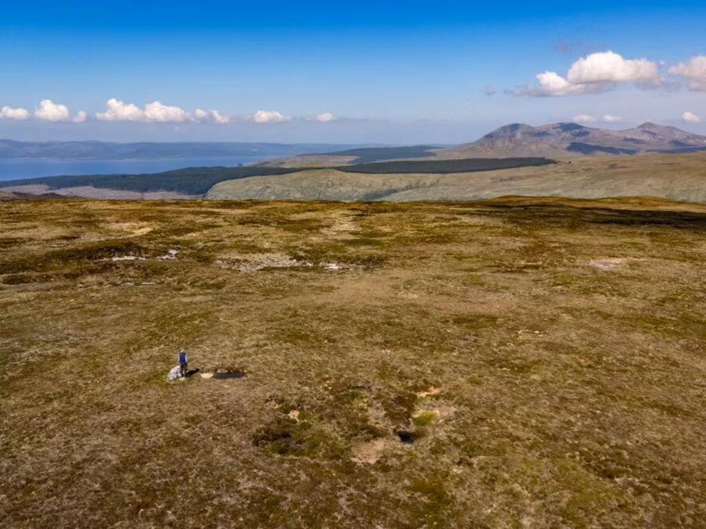
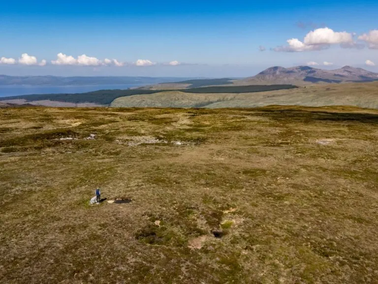
- Substantial freehold parcel: 532.95 ha / 1,316.95 acres
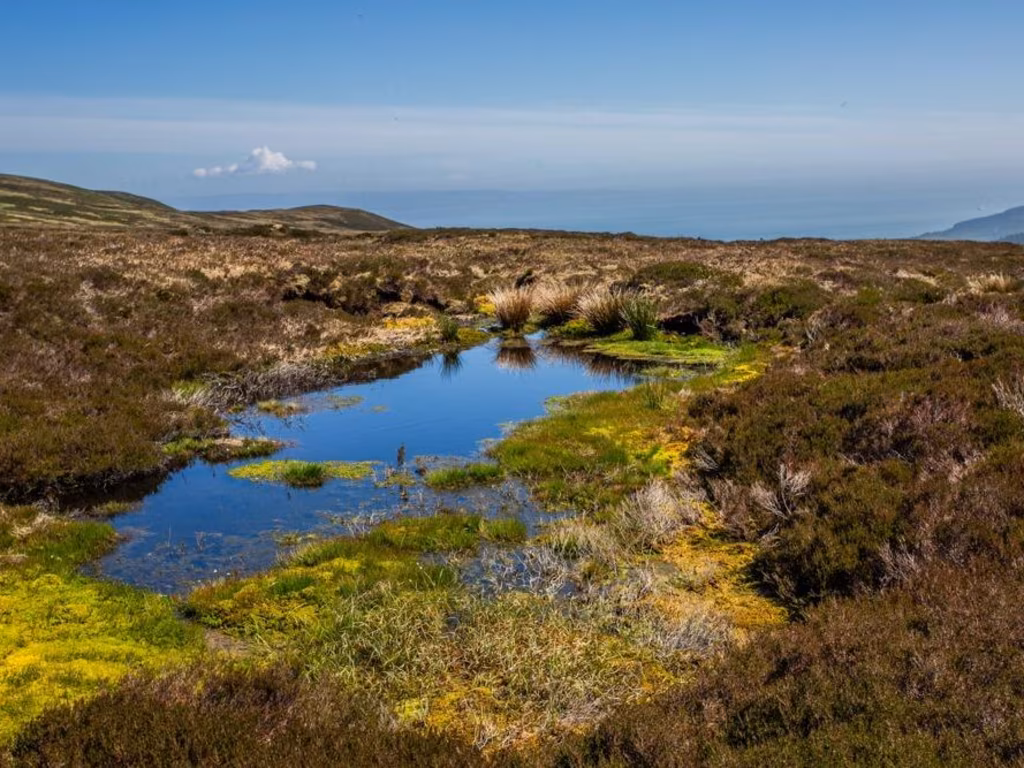
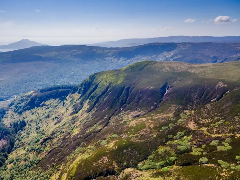
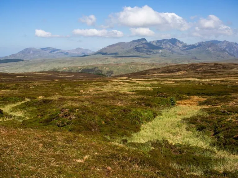
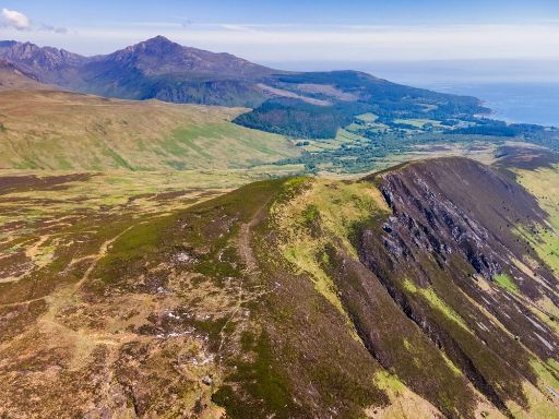
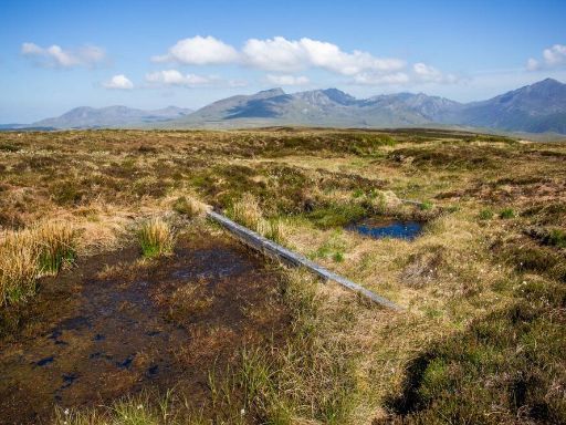
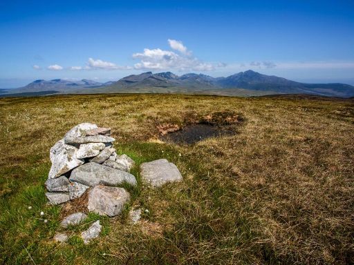
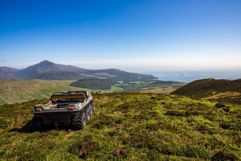
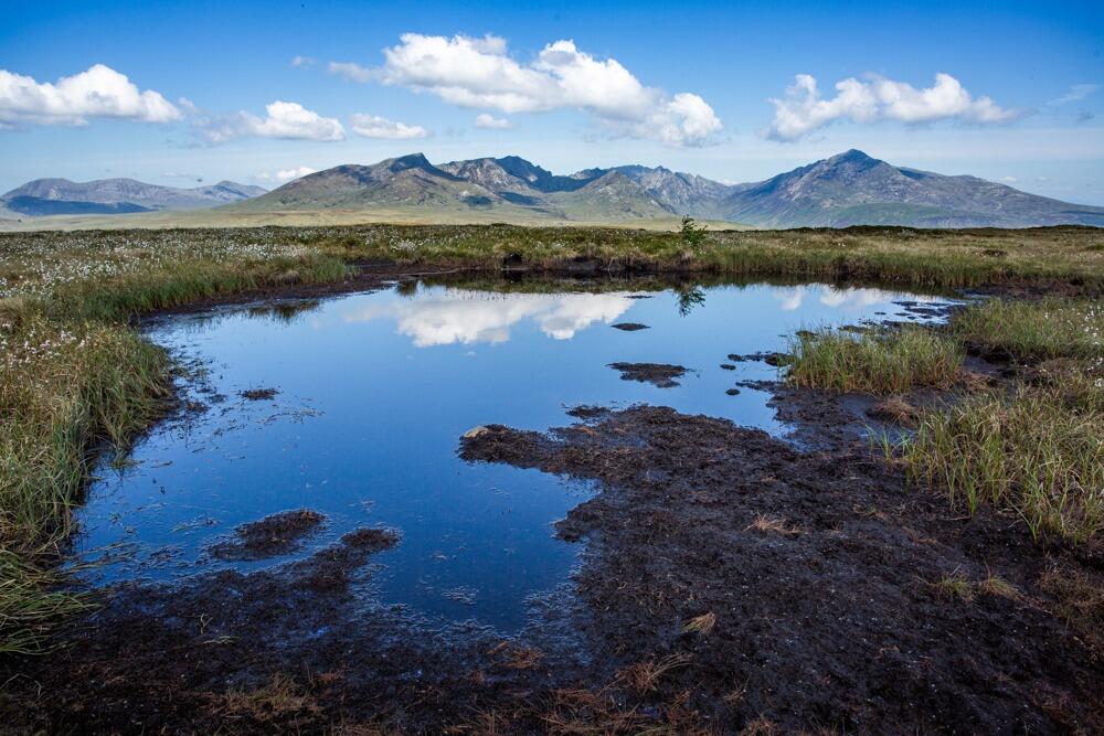
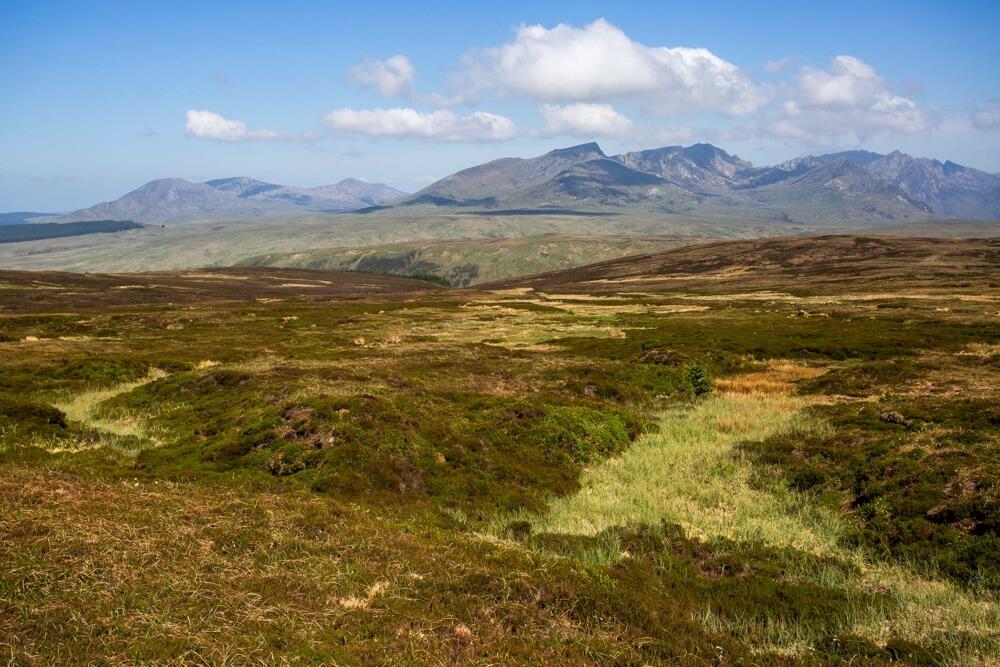
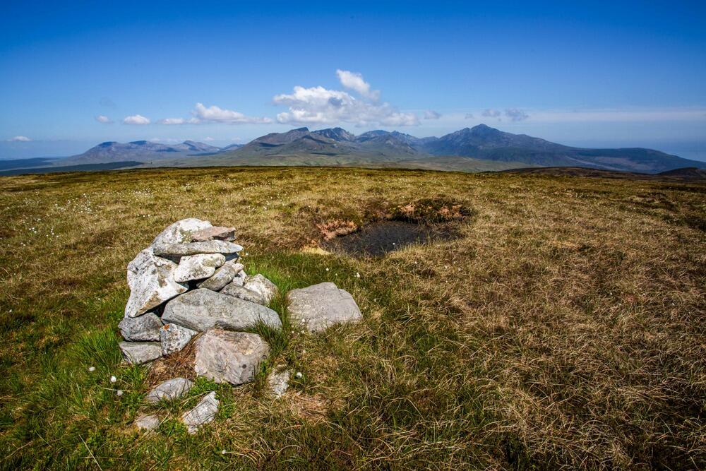
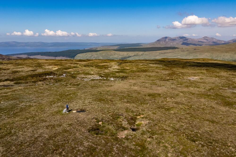
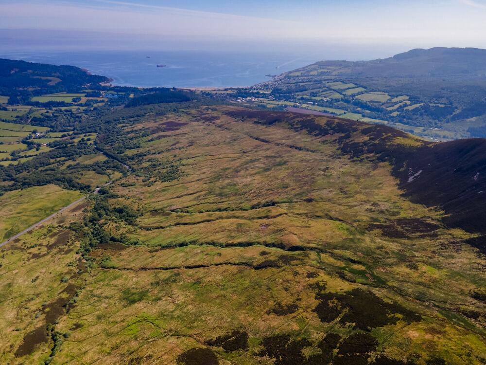
- Panoramic coastal and mountain views toward Brodick
- Predominantly Class 4.2 agricultural hill grazing
- Sporting rights included; well used by red deer and grouse
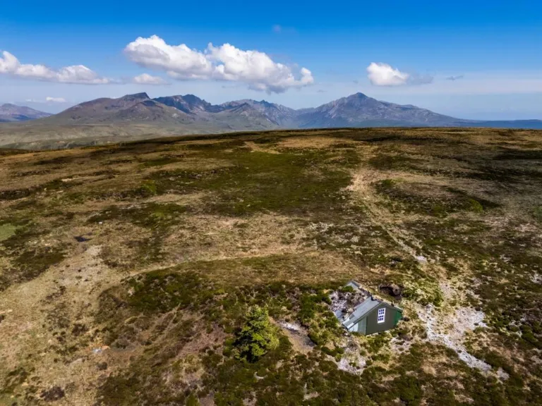
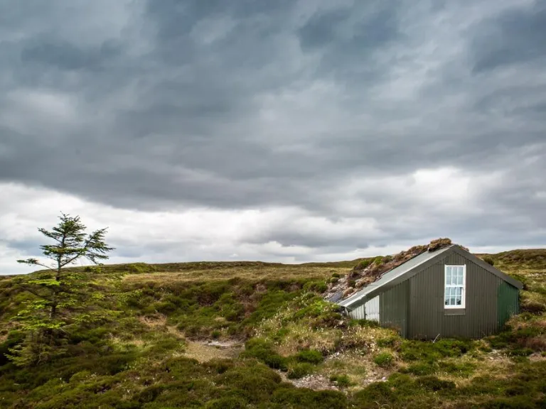
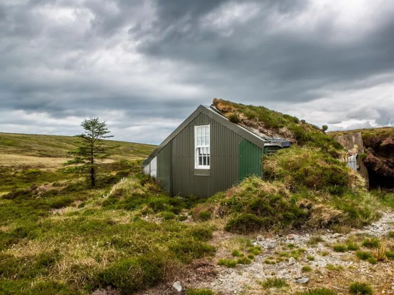
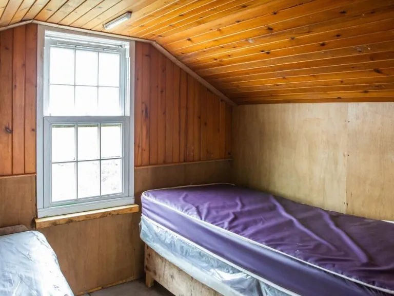
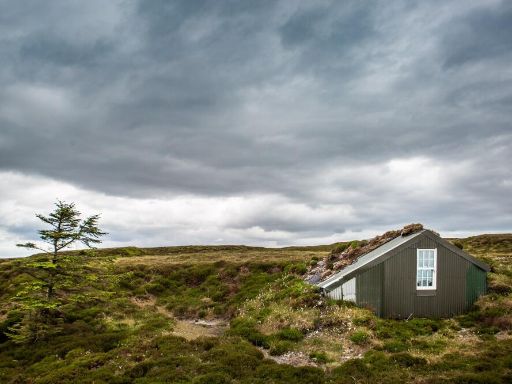
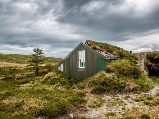
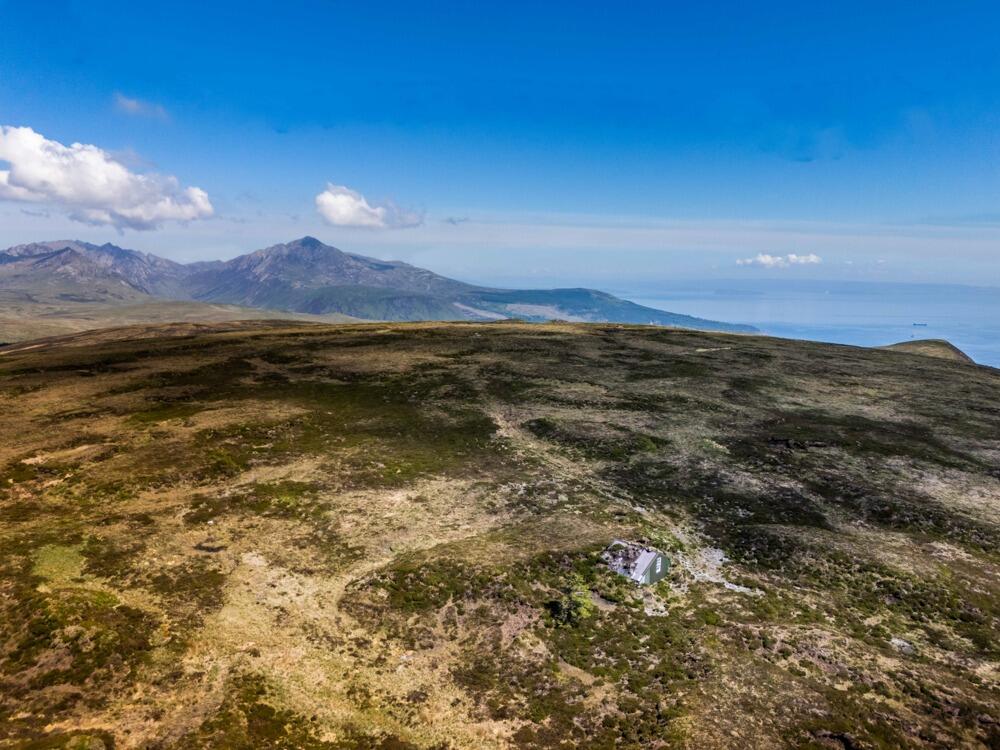
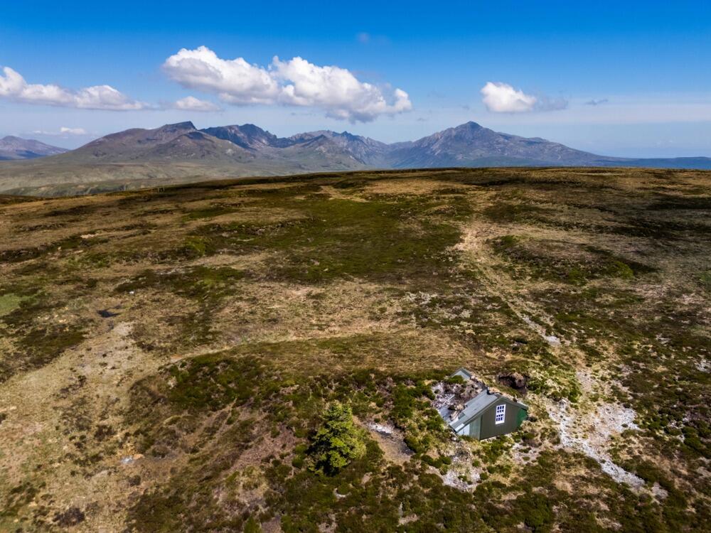
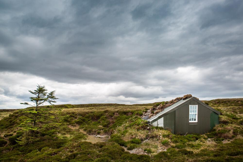
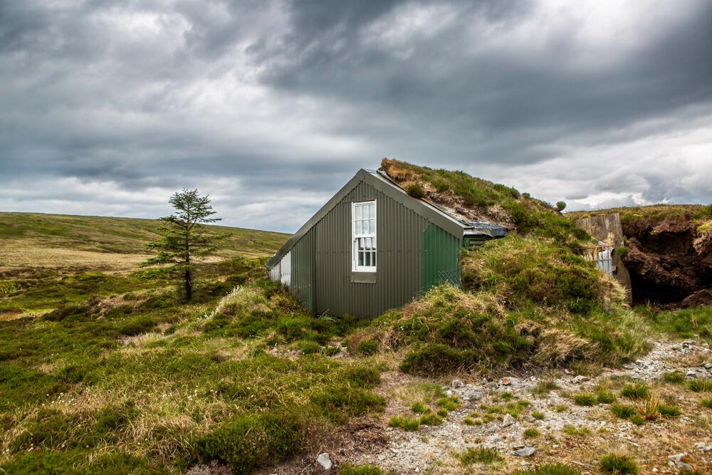
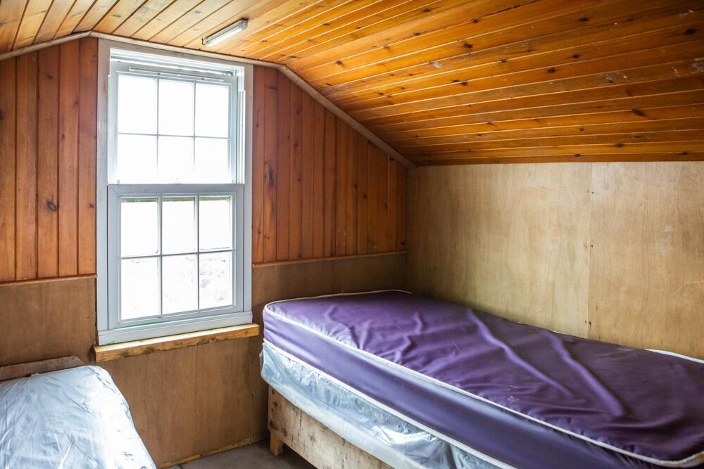
- Bothy on site sleeps two; basic accommodation only
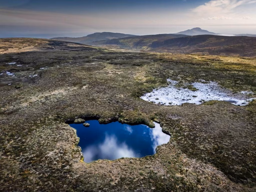
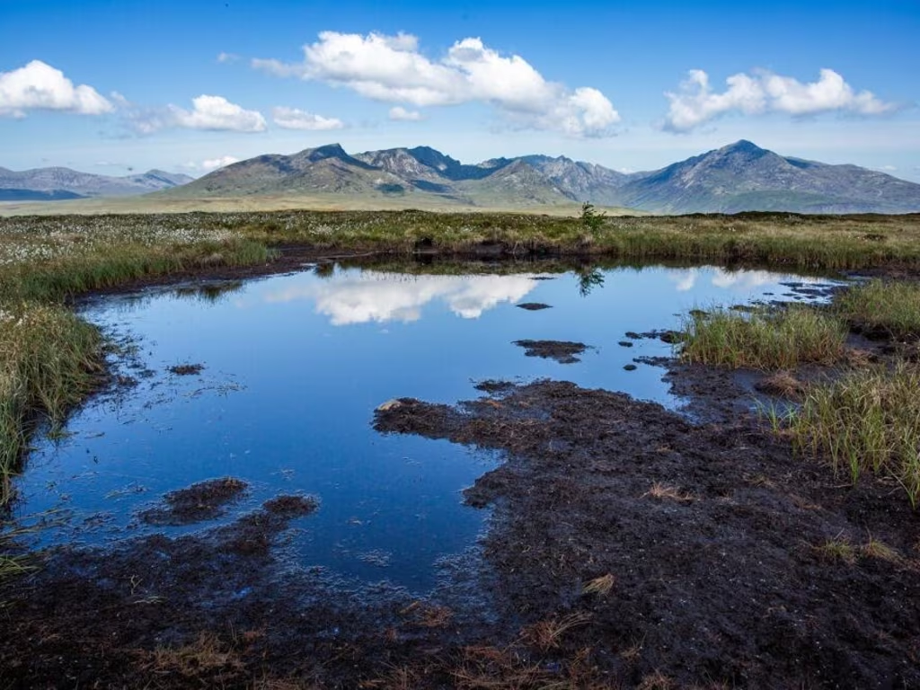
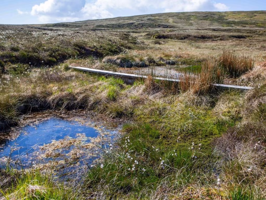
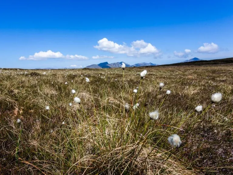
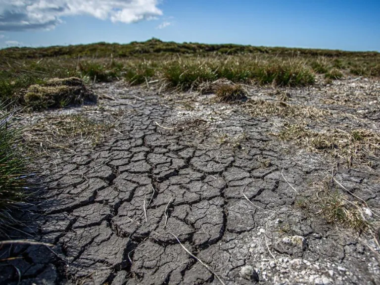
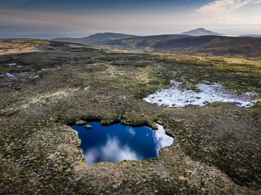
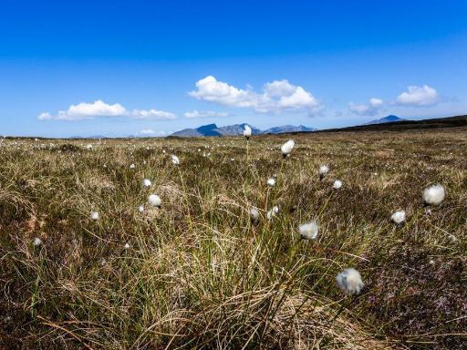
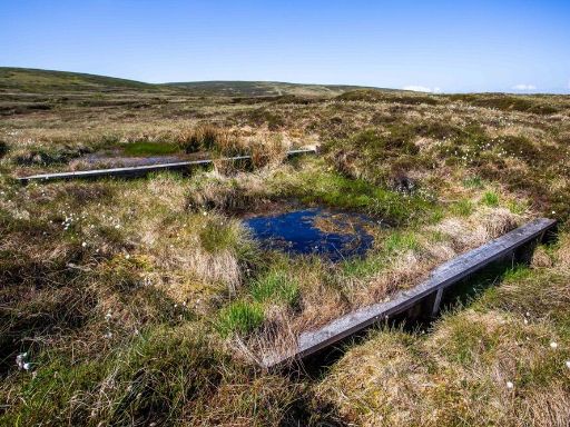
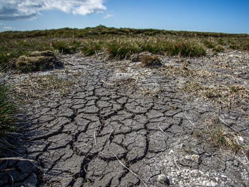
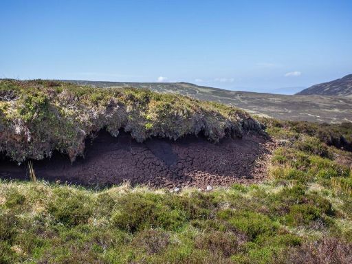
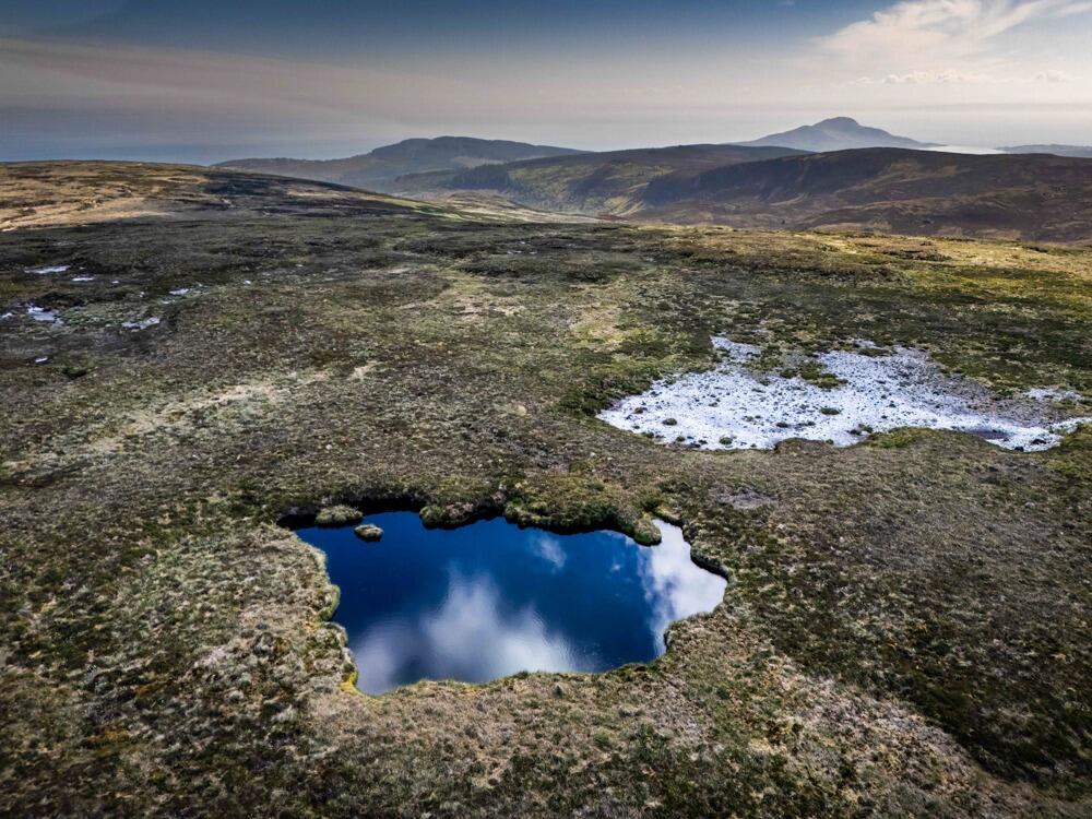
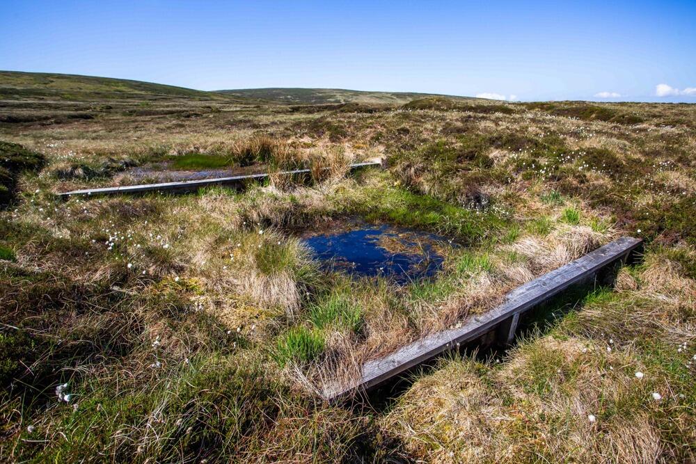
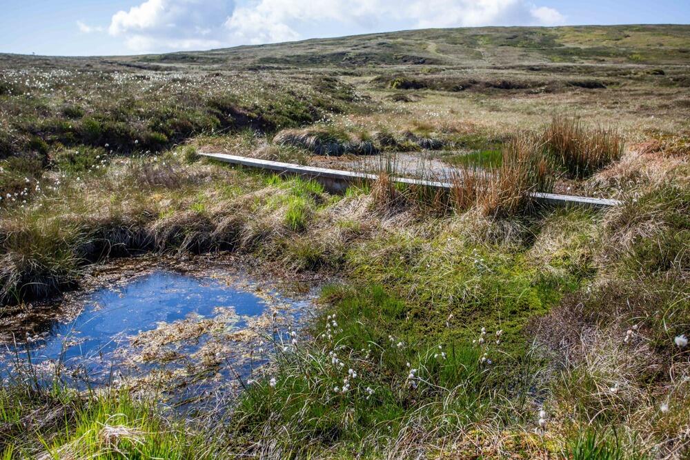
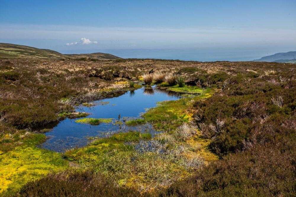
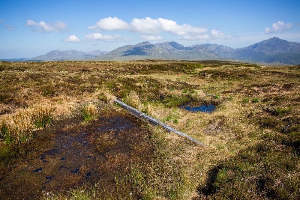
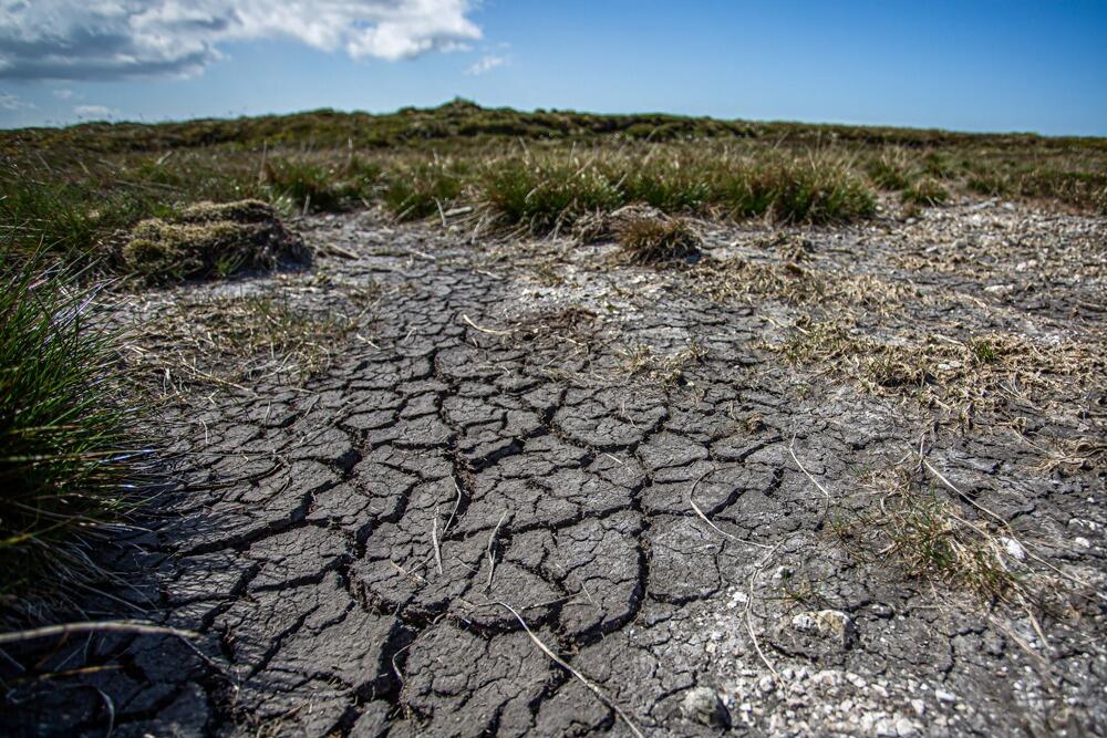
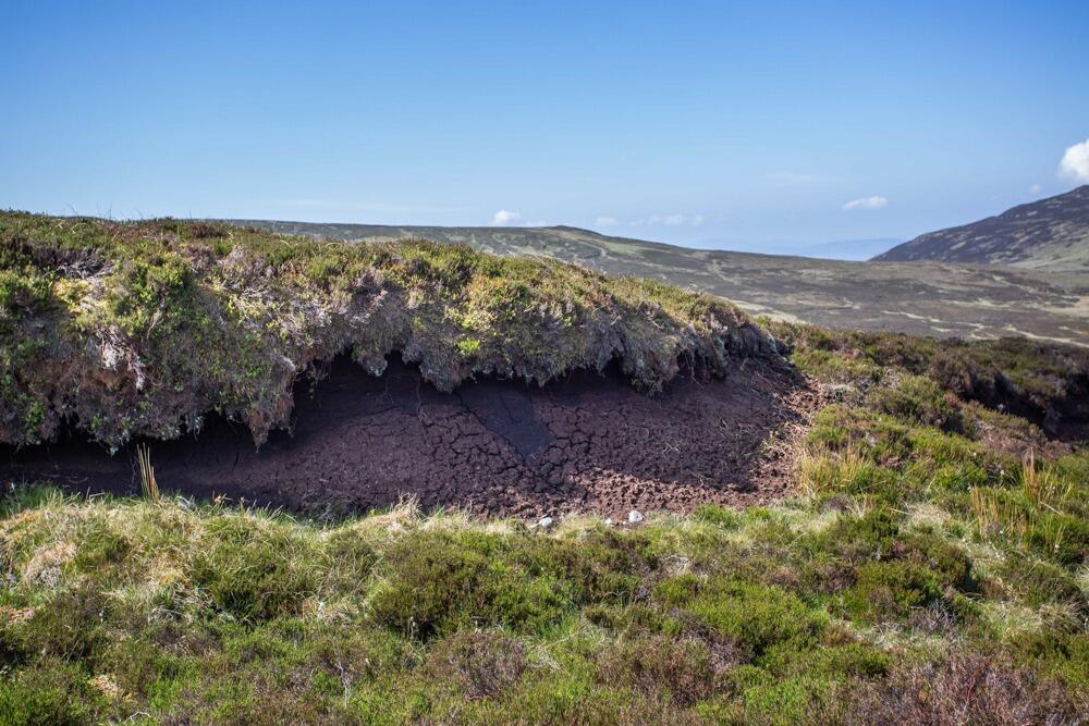
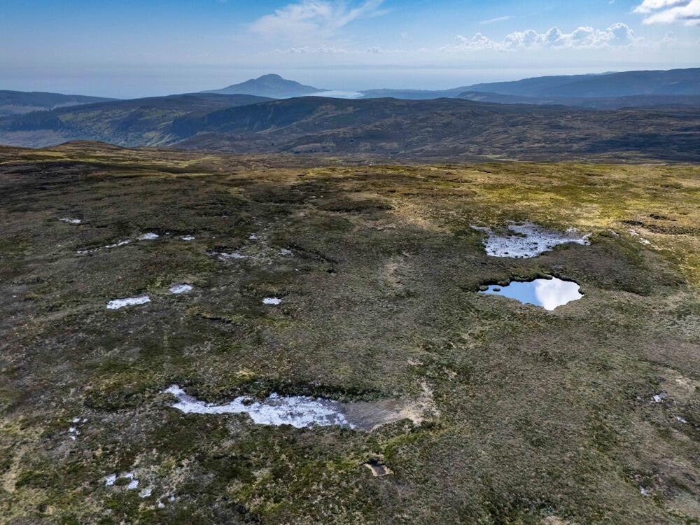
- Significant peat deposits; areas of deep peat and impeded drainage
- Peatland restoration underway; yields and carbon potential unassessed
- Very slow broadband and average mobile signal; remote location
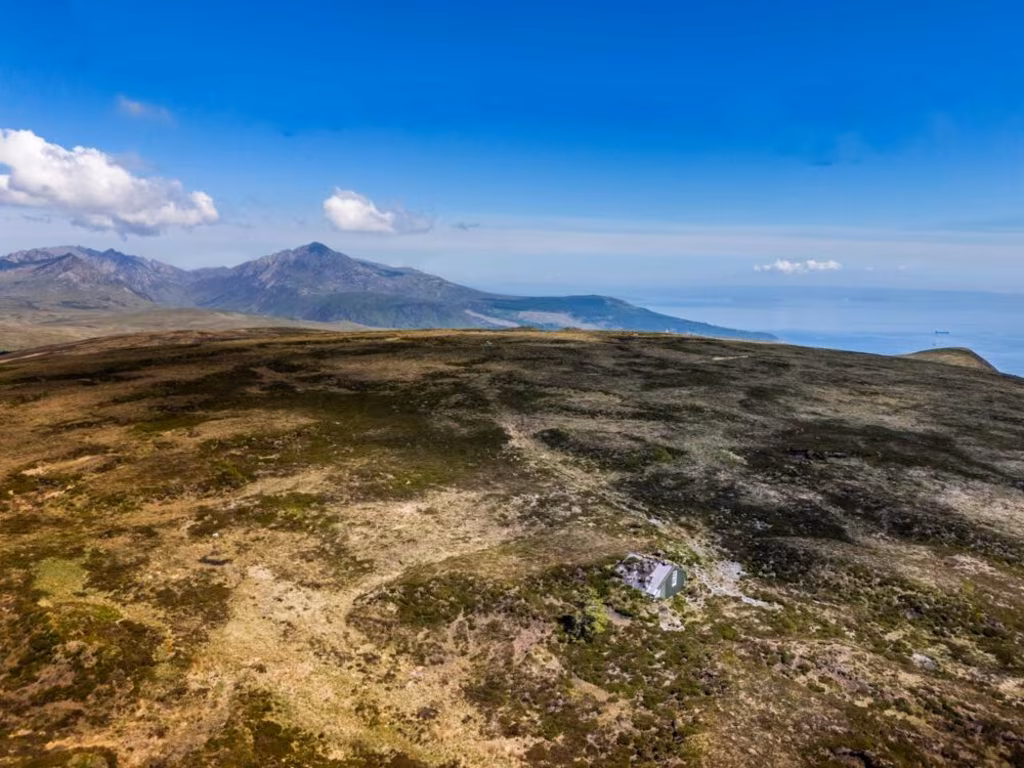
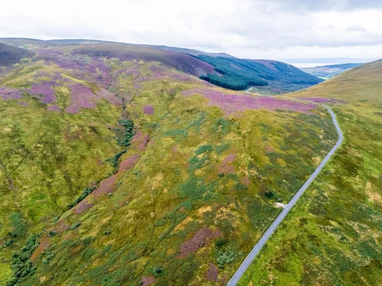
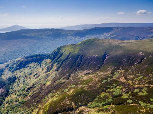
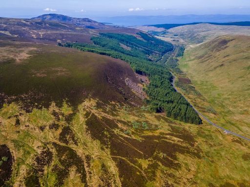
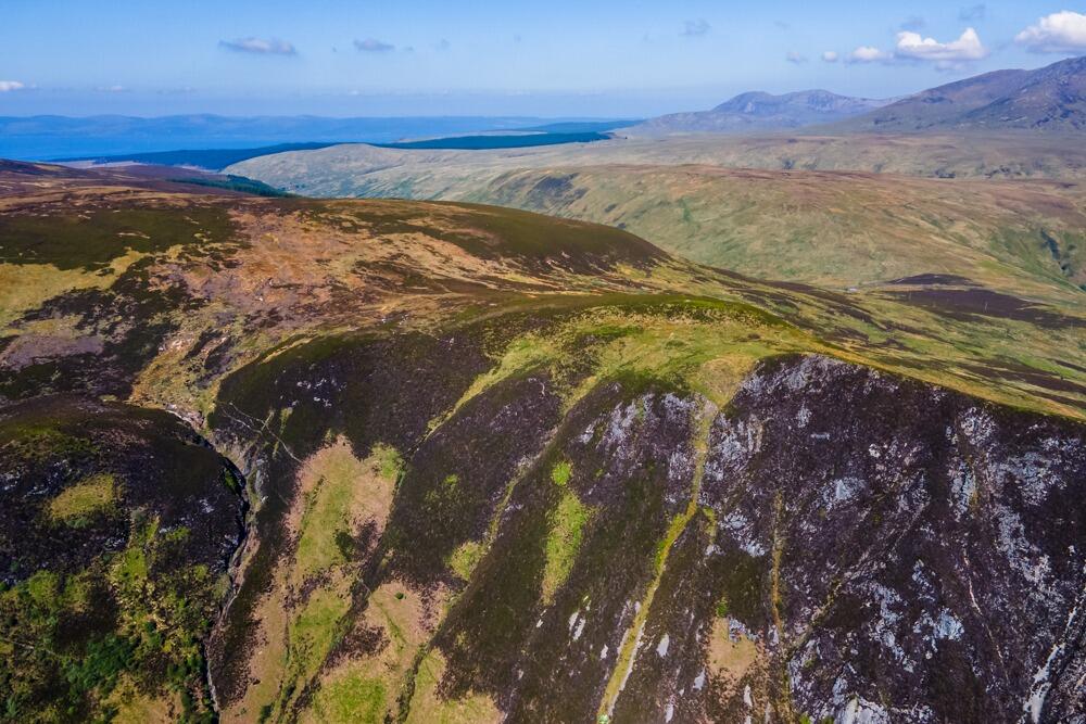
An exceptional and unusually large freehold landholding extending to 532.95 ha (1,316.95 acres) on the south side of the B880 near Brodick. The ground is predominantly hill grazing sloping north to south, previously stocked with sheep and cattle, and offers wide panoramic coastal and mountain views. A corrugated-metal bothy with a grass roof (sleeps two) sits within the parcel and provides simple shelter for estate management or occasional visitors.
The holding carries a mix of environmental and agricultural characteristics that will interest conservation-minded buyers and investors. The land is largely Class 4.2 agricultural ground with forestry classes F2/F3 in places, is within a designated area of scientific importance, and contains significant peat deposits. The current owners have undertaken peatland restoration work (not commercial; yields and carbon potential unassessed), so the site has clear ecological value and potential for environmental stewardship or habitat-focused funding and projects.
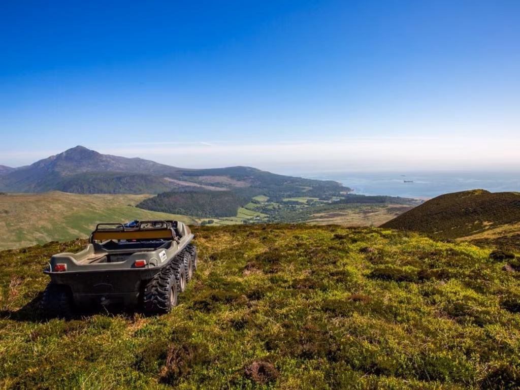
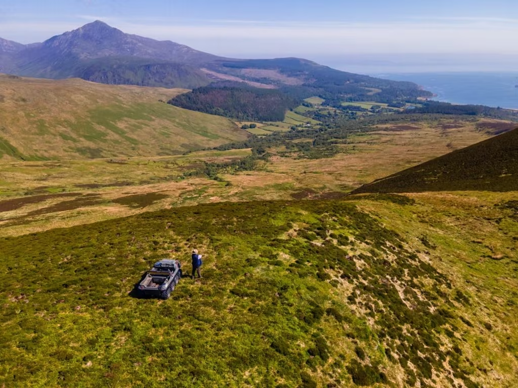
Practical features and constraints are straightforward: internal tracks give field access, sporting rights are included, and there are overhead cables and water routes crossing Field 4. Areas of flatter ground show impeded drainage and patches of deep peat; soils range from peat and peaty gleys to mineral podzols lower down. Connectivity is limited (very slow broadband, average mobile signal) and the land sits in an ageing, very deprived rural area — factors to consider for any development or commercial strategy. Offers are invited in excess of £1,200,000.
 Land for sale in Land by West Glensherraig, Brodick, KA27 — £1,200,000 • 1 bed • 1 bath
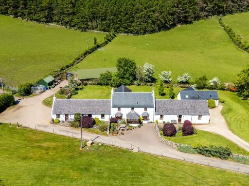 5 bedroom farm house for sale in Burnbank (4 Properties) , Brodick, Isle of Arran, North Ayrshire, KA27 8DF, KA27 — £785,000 • 5 bed • 5 bath
 Land for sale in Land West Of Auchgoyle Cottage, Millhouse, Tighnabruaich, PA21 — £149,950 • 1 bed • 1 bath
 Land for sale in Land At Saddell Home Farm, Campbeltown, Argyll and Bute, PA28 — £450,000 • 1 bed • 1 bath
 4 bedroom detached villa for sale in Glencloy Farmhouse, Glencloy Road, Brodick, Isle of Arran, North Ayrshire, KA27 8DA, KA27 — £535,000 • 4 bed • 3 bath • 3142 ft²
 Plot for sale in 20 Acres Land at Gortonallister, Lamlash, Isle Of Arran, KA27 — £160,000 • 4 bed • 3 bath