BH13 6BH - 1 bedroom apartment for sale in 37 Lindsay Road, Poole, BH13
View on Property Piper
1 bedroom apartment for sale in 37 Lindsay Road, Poole, BH13
Property Details
- Price: £130000
- Bedrooms: 1
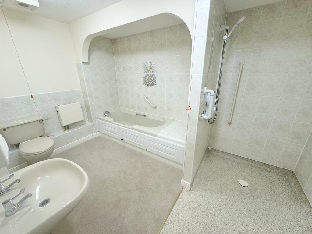
- Bathrooms: 1
- Property Type: undefined
- Property SubType: undefined
Brochure Descriptions
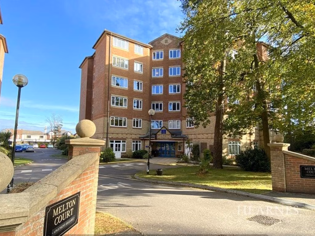
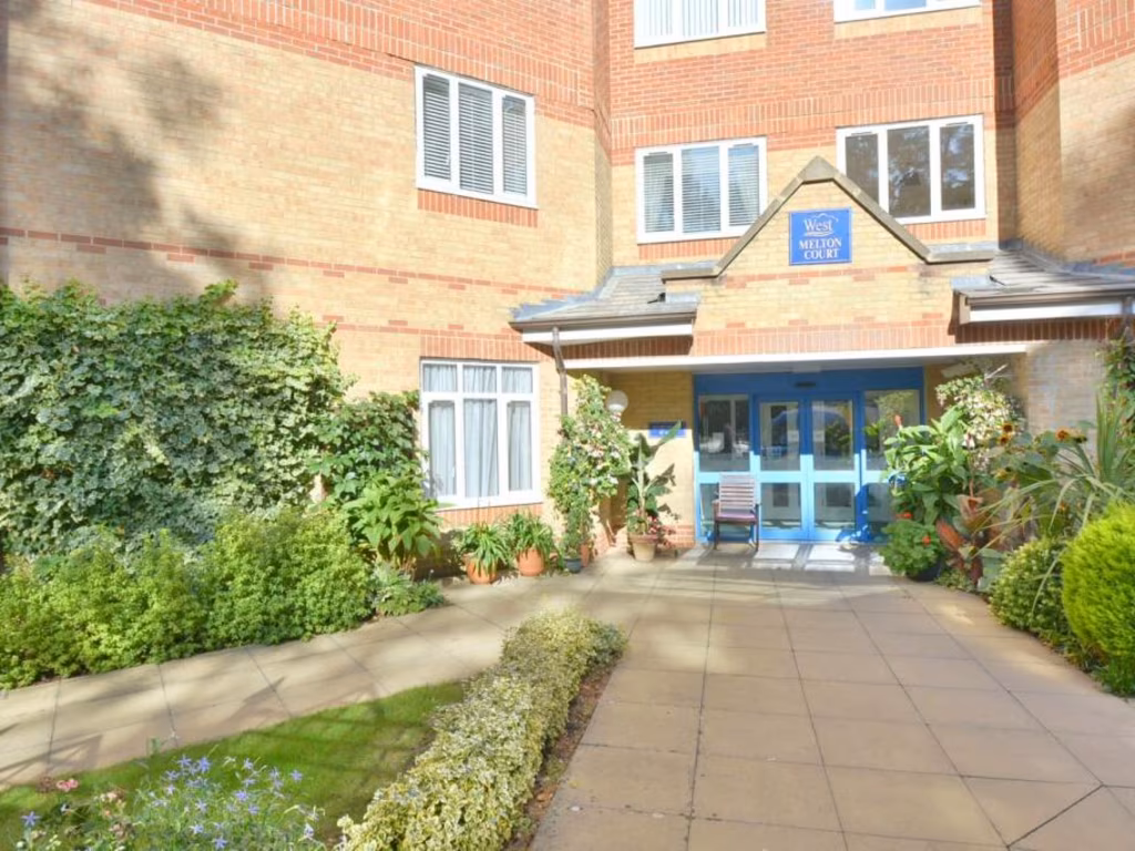
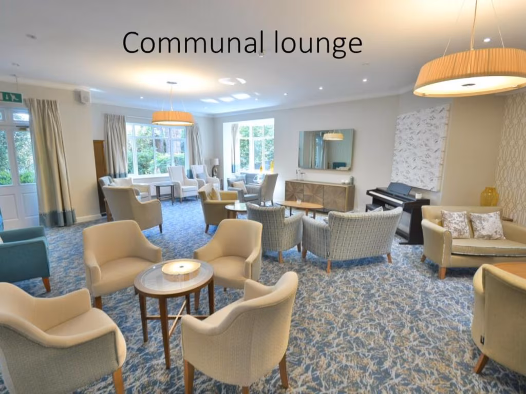
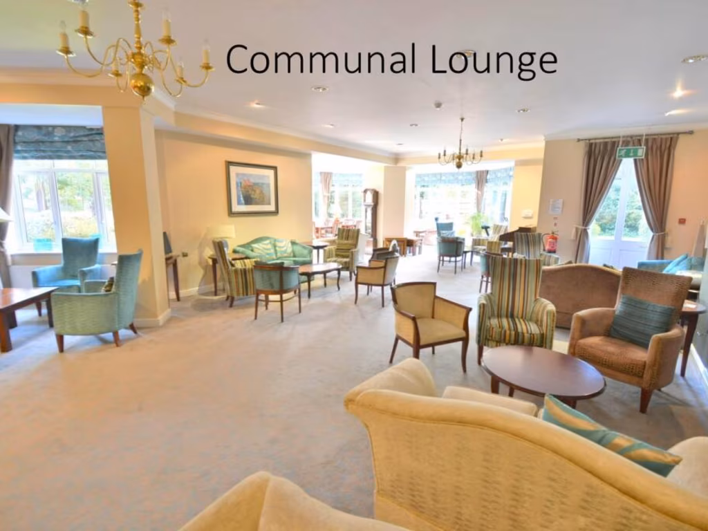
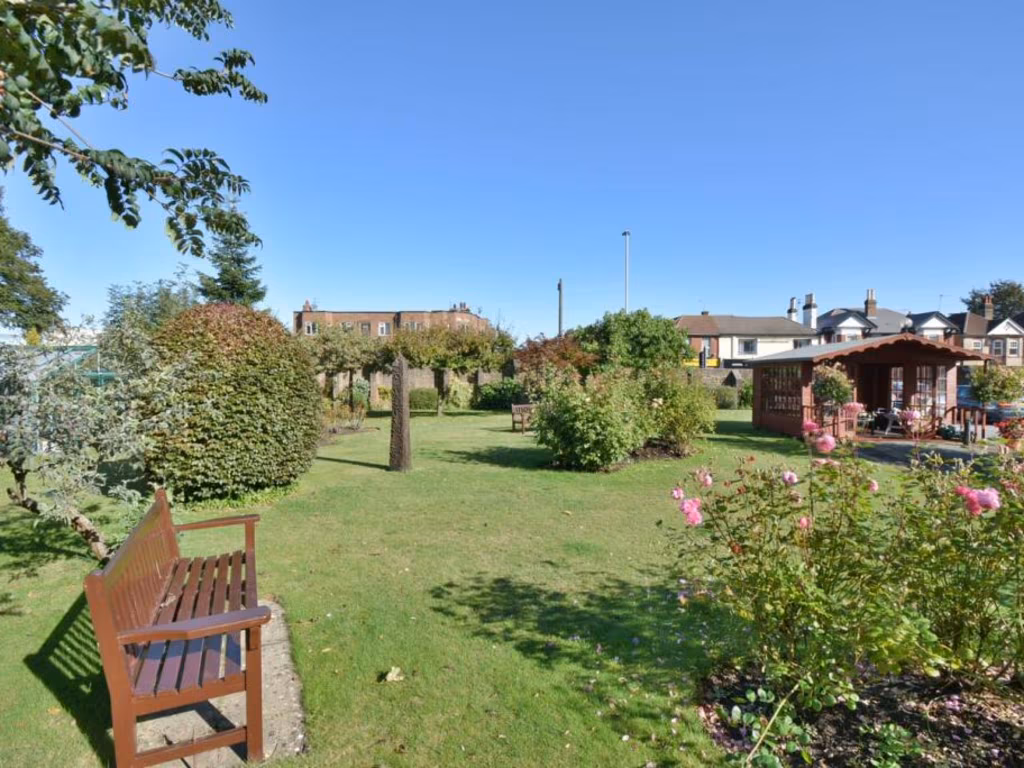
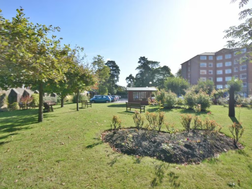
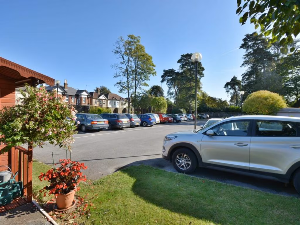
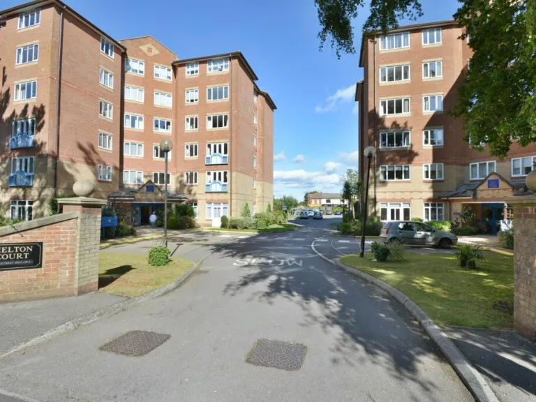
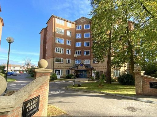
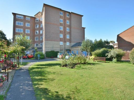
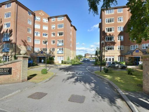
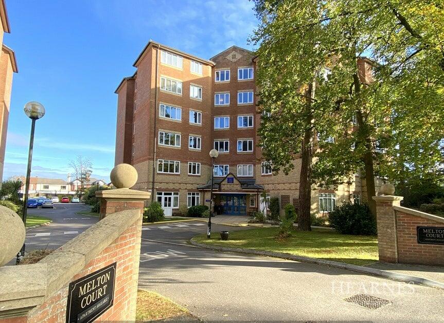
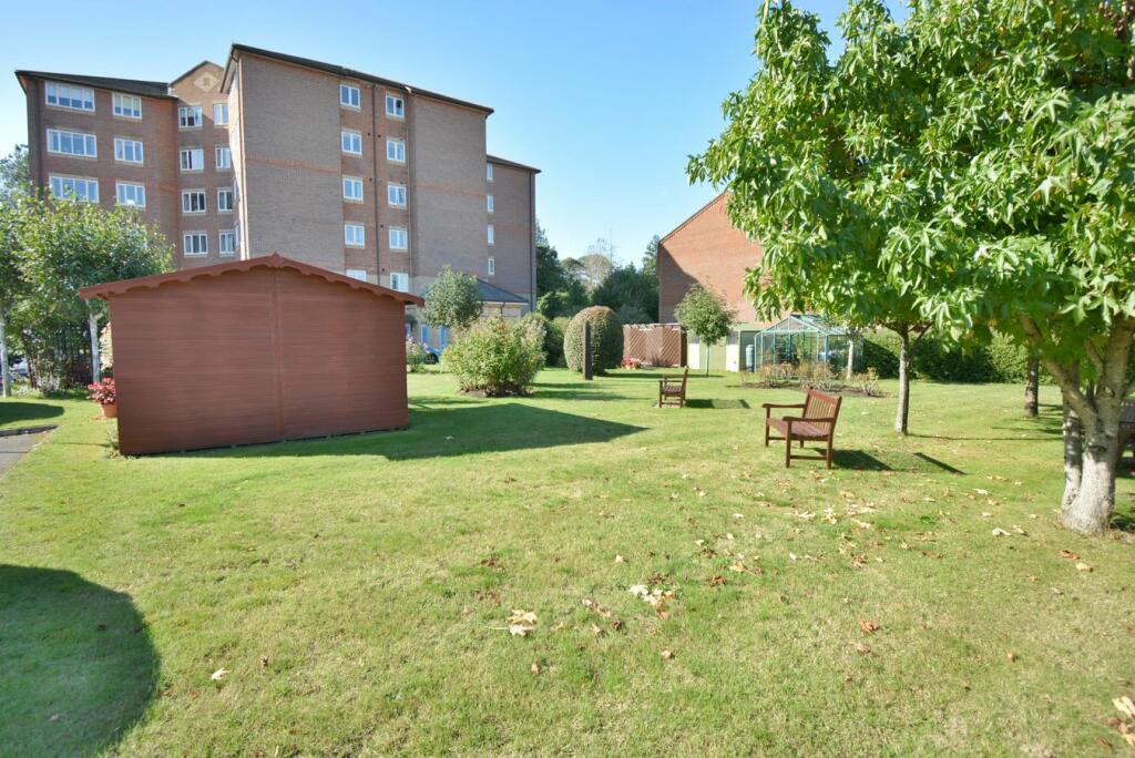
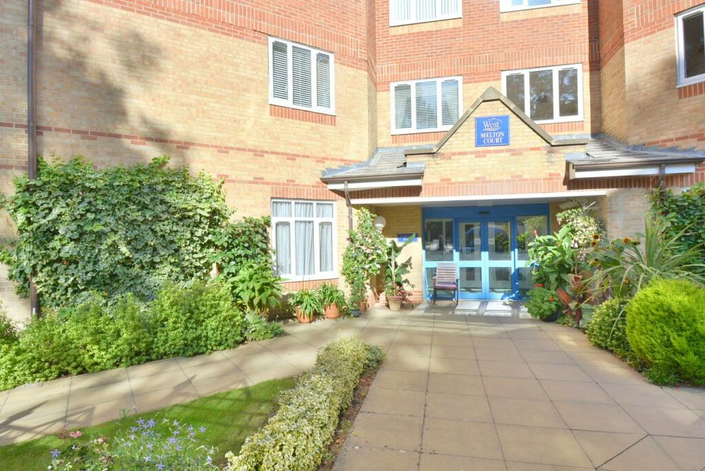
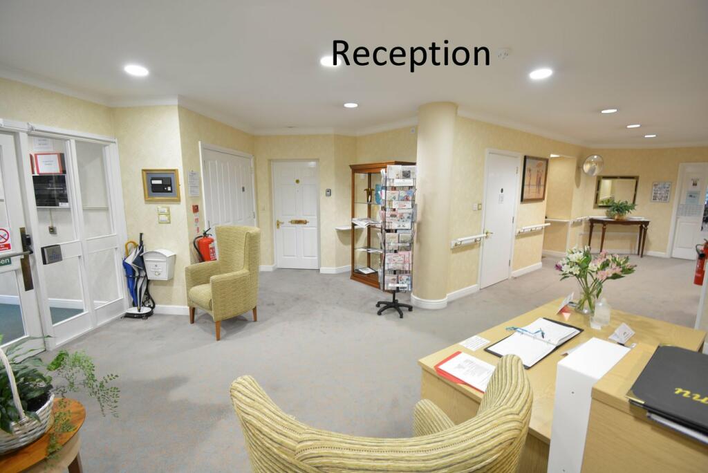
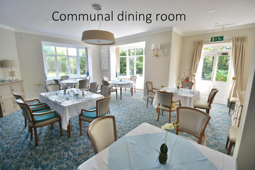
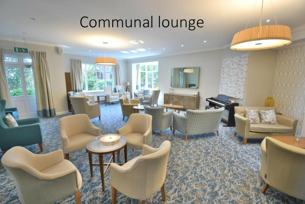
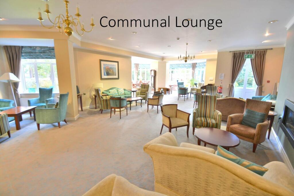
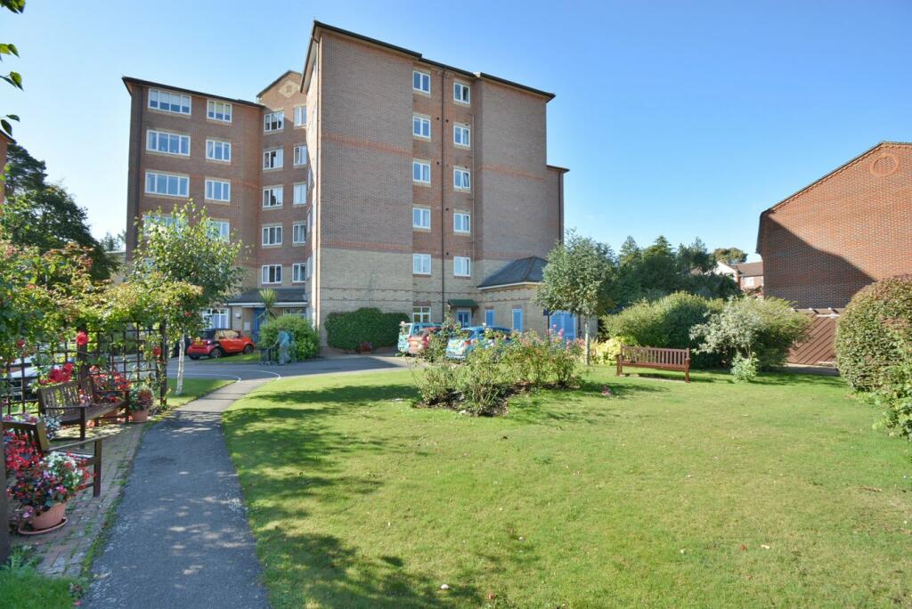
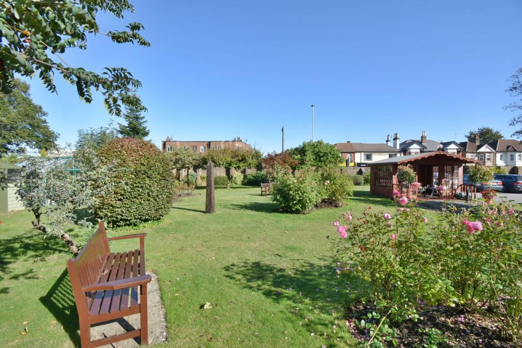
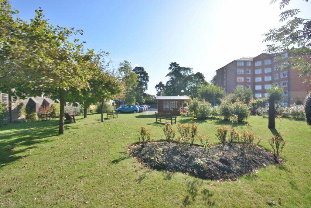
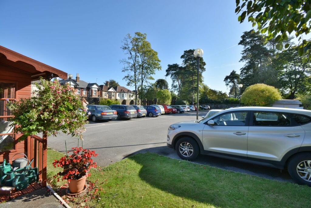
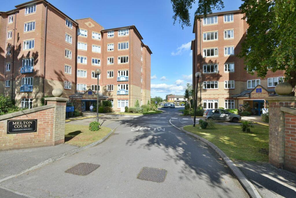
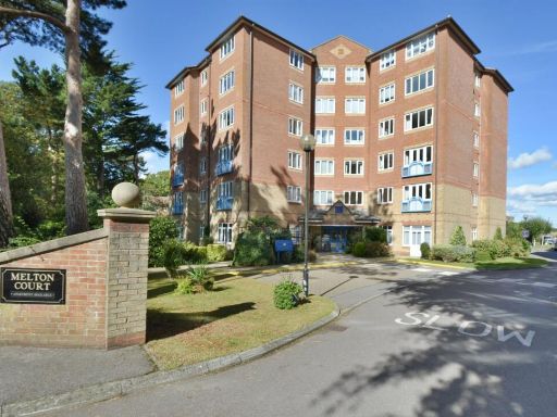
- A mid-sized residential flat located in a well-maintained multi-story brick building, surrounded by landscaped grounds with mature trees. The property has well-kept communal areas and off-street parking. It appears to be part of a complex with a mixture of residents, likely providing communal amenities and ease of access.
Image Descriptions
- apartment building modern
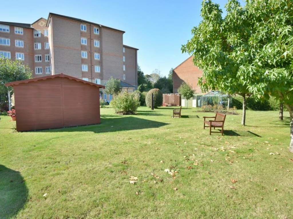
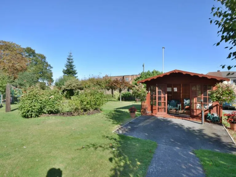
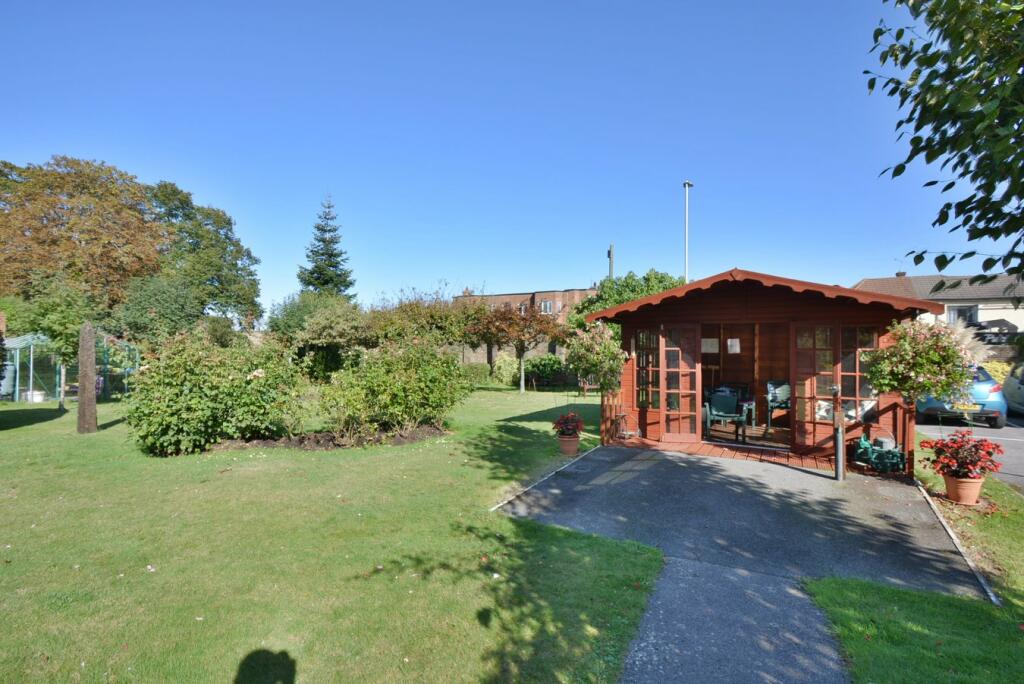
- garden with a wooden gazebo rustic
- garden area with residential backdrop Modern apartment block
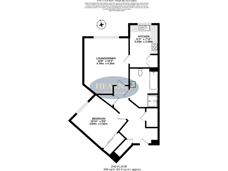
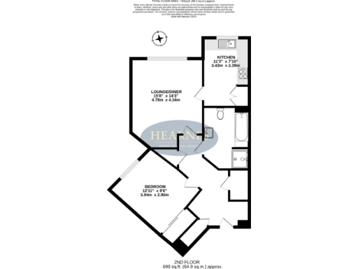
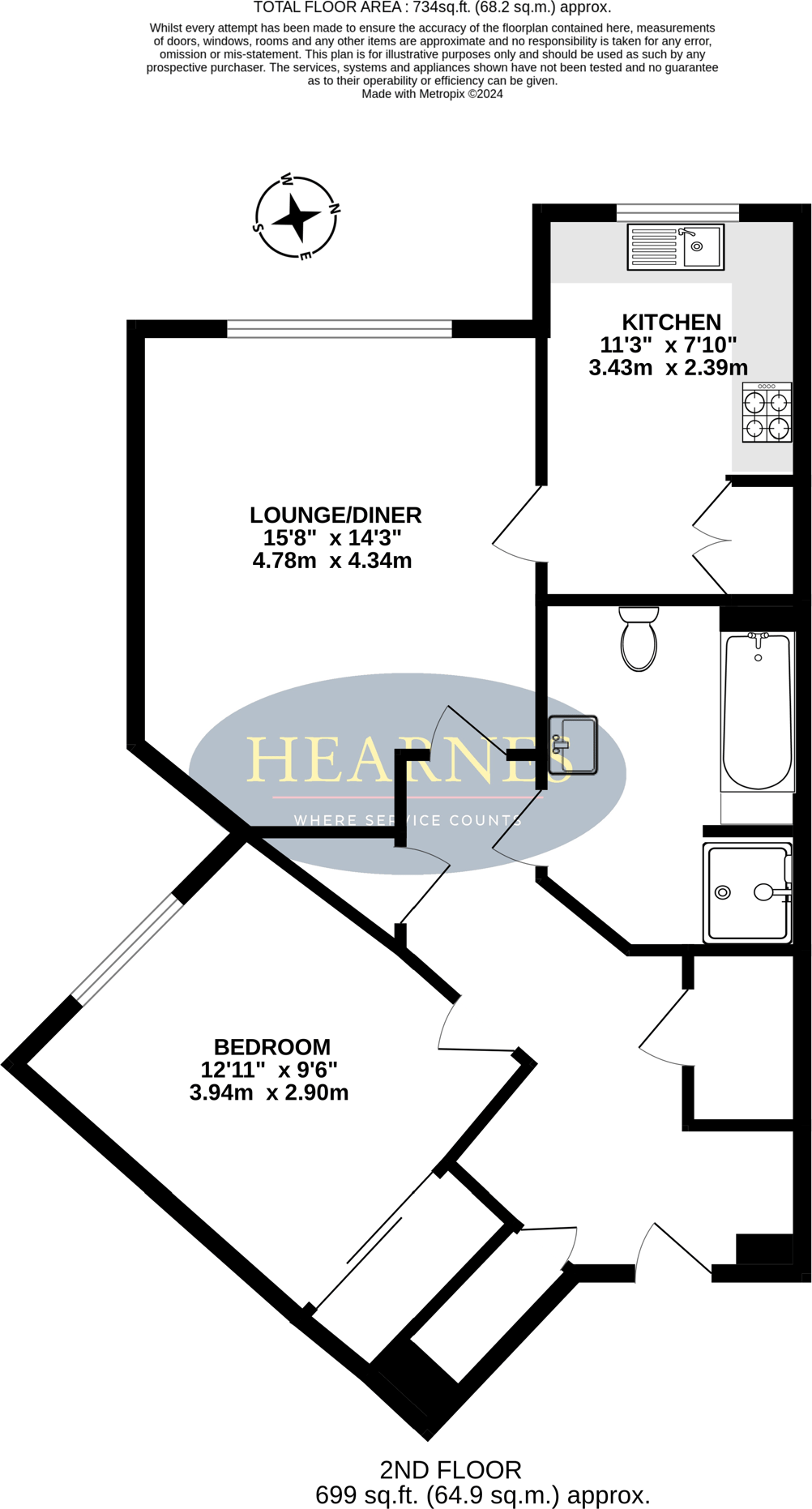
Floorplan Description
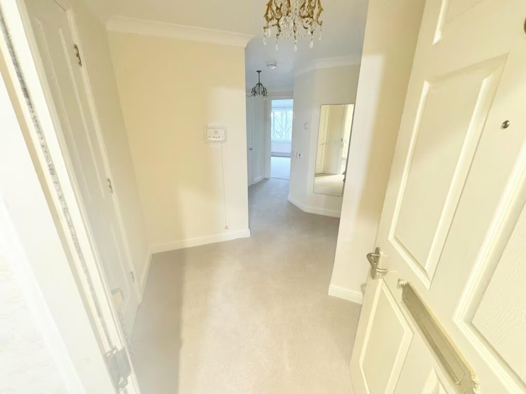
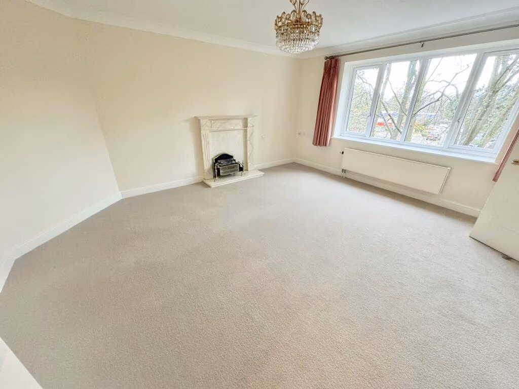
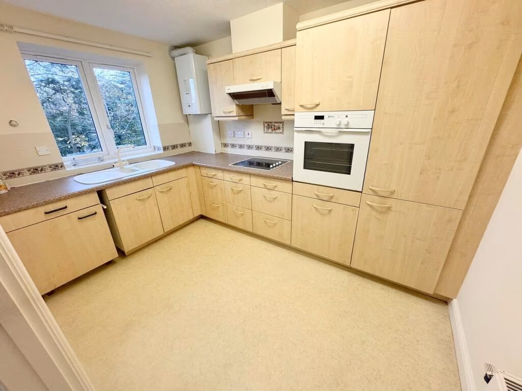
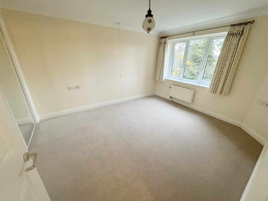
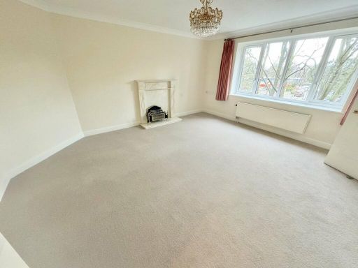
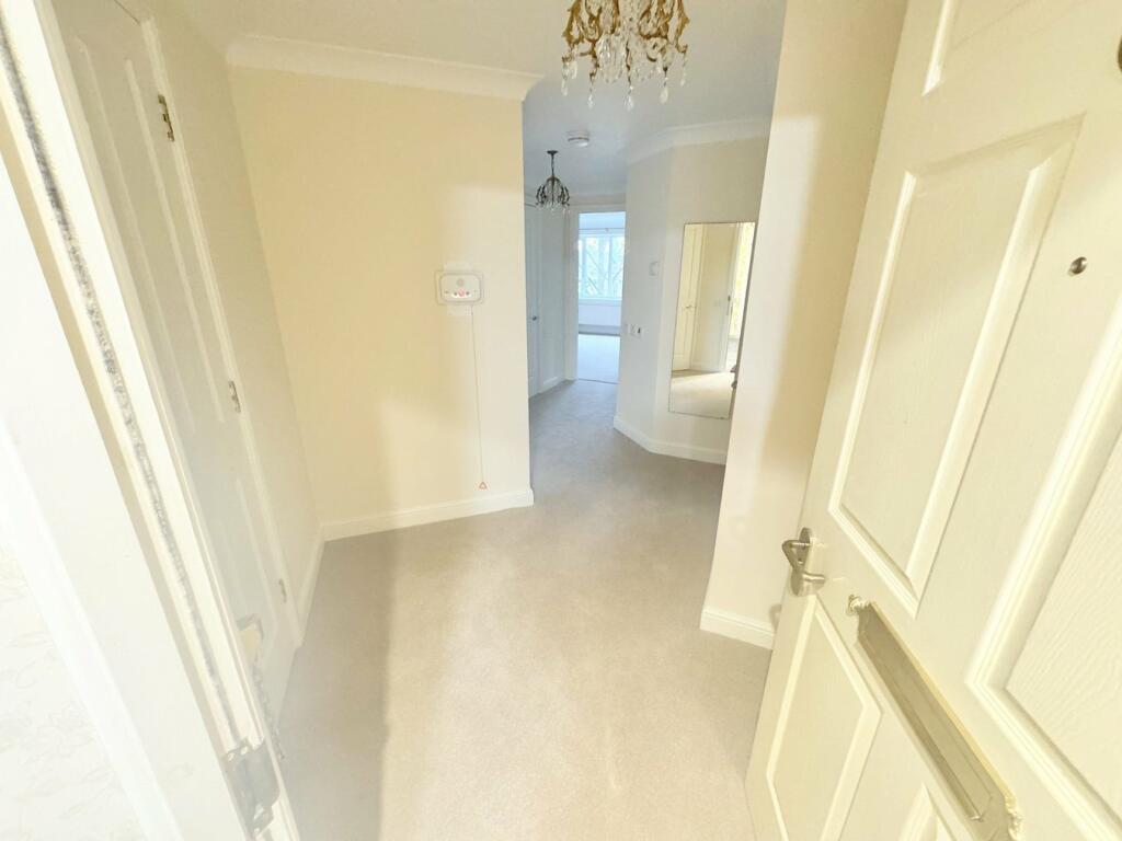
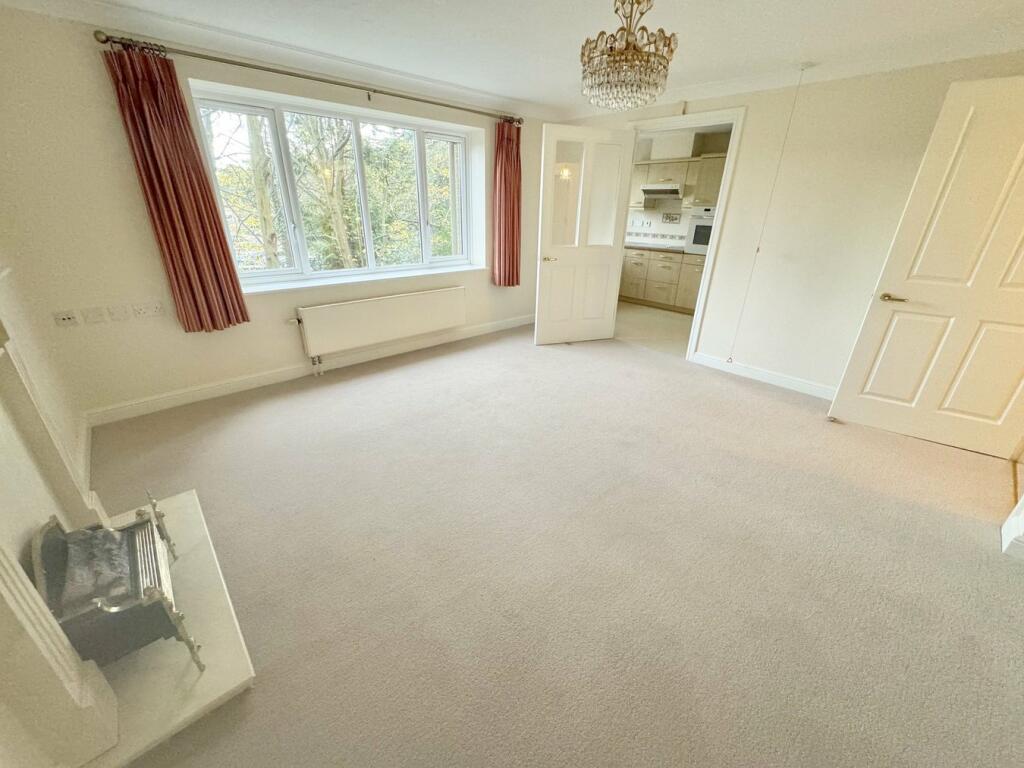
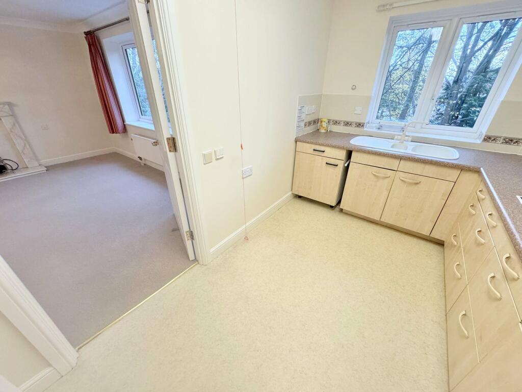
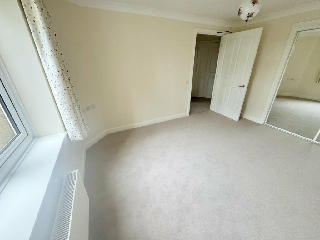
- A 2nd floor apartment with a modern layout including a lounge/diner, kitchen, and bedroom.
Rooms
- Lounge/Diner: Large
- Kitchen: Average
- Bedroom: Average
Textual Property Features
- Probate Detected
- Chain Free
- Is Retirement
- Success
Detected Visual Features
- Melton Court
- apartment building
- modern design
- brick facade
- multi-story
- residential
- urban
- landscaped
- tree-lined
- gated entrance
- garden
- gazebo
- greenery
- sitting area
- outdoor space
- wooden structure
- rustic
- modern apartment
- sheds
- benches
- communal area
EPC Details
- Fully double glazed
- Cavity wall, as built, no insulation (assumed)
- Boiler and radiators, mains gas
- Low energy lighting in 67% of fixed outlets
- (another dwelling below)
Nearby Schools
- Bournemouth Collegiate Preparatory School
- St Joseph's Catholic Primary School, Poole
- Talbot House School
- Heathlands Primary Academy
- Baden-Powell and St Peter's Church of England Junior School
- Livingstone Road Infant School
- Livingstone Road Junior School
- St Mark's Church of England Primary School
- Winton Academy
- Talbot Heath School
- St Aldhelm's Academy
- Talbot Primary School
- Manorside Academy
- Glenmoor Academy
- Oak Academy
- Lilliput Church of England Infant School
- St Michael's Church of England Primary School
- Courthill Infant School
- Kings Bournemouth
- Heatherlands Primary School
- Bishop Aldhelm's Church of England Primary School
- Kingsleigh Primary School
- The Bourne Academy
- Elm Academy
Nearest General Shops
- Id: 227069657
- Tags:
- Brand: HSL
- Brand:wikidata: Q64284324
- Building: yes
- Name: HSL
- Official_name: High Seat Limited
- Shop: furniture
- Source: Bing; survey
- TagsNormalized:
- Lat: 50.7263372
- Lon: -1.9169615
- FullGeoHash: gcn8s6kn7d9g
- PartitionGeoHash: gcn8
- Images:
- FoodStandards: null
- Distance: 136.8
,- Id: 1095126544
- Tags:
- Building: yes
- Name: Handsome Barbers
- Shop: hairdresser
- TagsNormalized:
- Lat: 50.7261654
- Lon: -1.9161306
- FullGeoHash: gcn8s6ktqft7
- PartitionGeoHash: gcn8
- Images:
- FoodStandards: null
- Distance: 105.6
,- Id: 1095126546
- Tags:
- Building: yes
- Name: Branksome Antiques
- Shop: antiques
- TagsNormalized:
- Lat: 50.726126
- Lon: -1.9159282
- FullGeoHash: gcn8s6kv5ek2
- PartitionGeoHash: gcn8
- Images:
- FoodStandards: null
- Distance: 102.5
}
Nearest Grocery shops
- Id: 364702228
- Tags:
- Building: yes
- Name: The Co-operative Food
- Shop: convenience
- TagsNormalized:
- the co-operative food
- food
- convenience
- shop
- Lat: 50.723318
- Lon: -1.925578
- FullGeoHash: gcn8s1vudzbc
- PartitionGeoHash: gcn8
- Images:
- FoodStandards: null
- Distance: 695.5
,- Id: 1114900430
- Tags:
- Building: yes
- Name: Branksome Food & Wine
- Shop: alcohol
- TagsNormalized:
- Lat: 50.727132
- Lon: -1.9220282
- FullGeoHash: gcn8s686vqzc
- PartitionGeoHash: gcn8
- Images:
- FoodStandards: null
- Distance: 464.6
,- Id: 117384510
- Tags:
- Addr:
- Postcode: BH12 1AU
- Street: Poole Road
- Brand: Tesco
- Brand:wikidata: Q487494
- Brand:wikipedia: en:Tesco
- Building: yes
- Fhrs:
- Name: Tesco
- Note: Petrol station shop attached to larger store
- Operator: Tesco
- Shop: convenience
- Source:
- Website: https://www.tesco.com/store-locator/poole/poole-rd
- TagsNormalized:
- Lat: 50.7254338
- Lon: -1.9148451
- FullGeoHash: gcn8s6m9hfhn
- PartitionGeoHash: gcn8
- Images:
- FoodStandards:
- Id: 1352130
- FHRSID: 1352130
- LocalAuthorityBusinessID: 151733
- BusinessName: Tesco Petrol Poole Road
- BusinessType: Retailers - other
- BusinessTypeID: 4613
- AddressLine1: Tesco Stores Ltd
- AddressLine2: Poole Road
- AddressLine3: Poole
- AddressLine4: null
- PostCode: BH12 1AU
- RatingValue: 5
- RatingKey: fhrs_5_en-GB
- RatingDate: 2019-11-13
- LocalAuthorityCode: 872
- LocalAuthorityName: Bournemouth, Christchurch and Poole
- LocalAuthorityWebSite: http://www.bcpcouncil.gov.uk
- LocalAuthorityEmailAddress: food.safety@bcpcouncil.gov.uk
- Scores:
- Hygiene: 0
- Structural: 0
- ConfidenceInManagement: 0
- NewRatingPending: false
- Geocode:
- Longitude: -1.91364204883575
- Latitude: 50.72484588623050
- Distance: 95.9
}
Nearest Religious buildings
- Id: 478552208
- Tags:
- Amenity: place_of_worship
- Building: yes
- Denomination: jehovahs_witness
- Name: Kingdom Hall of Jehovah's Witnesses
- Religion: christian
- Source: Bing
- TagsNormalized:
- place of worship
- jehovah
- jehovahs witness
- christian
- church
- Lat: 50.7270961
- Lon: -1.9206168
- FullGeoHash: gcn8s696y2h6
- PartitionGeoHash: gcn8
- Images:
- FoodStandards: null
- Distance: 376.8
,- Id: 227069659
- Tags:
- Amenity: place_of_worship
- Building: yes
- Denomination: anglican
- Name: St Aldhelm
- Ref:
- Religion: christian
- Source: Bing; survey
- Wikidata: Q17533684
- TagsNormalized:
- place of worship
- anglican
- christian
- church
- Lat: 50.7257763
- Lon: -1.9185723
- FullGeoHash: gcn8s66gn40f
- PartitionGeoHash: gcn8
- Images:
- FoodStandards: null
- Distance: 180.7
,- Id: 478552242
- Tags:
- Amenity: community_centre
- Building: yes
- Community_centre: parish_hall
- Name: St Aldhelm's Church Hall
- Ref:
- Source: Bing
- TagsNormalized:
- community centre
- church
- church hall
- Lat: 50.7260724
- Lon: -1.9178527
- FullGeoHash: gcn8s67kyc32
- PartitionGeoHash: gcn8
- Images:
- FoodStandards: null
- Distance: 152.4
}
Nearest Medical buildings
- Id: 1019550737
- Tags:
- Amenity: doctors
- Building: yes
- Healthcare: doctor
- Name: The Clinic
- TagsNormalized:
- doctor
- doctors
- health
- healthcare
- clinic
- Lat: 50.7232809
- Lon: -1.9028038
- FullGeoHash: gcn8s9ykt2ys
- PartitionGeoHash: gcn8
- Images:
- FoodStandards: null
- Distance: 964.7
,- Id: 117361839
- Tags:
- Addr:
- Housename: The Exchange
- Housenumber: 95
- Postcode: BH4 9BB
- Street: Poole Road
- Alt_name: Taylor's the Chemists
- Amenity: pharmacy
- Building: yes
- Dispensing: yes
- Healthcare: pharmacy
- Name: Vantage Pharmacy
- Old_name: G Taylor & Son, chemist
- Source: local knowledge; Bing; survey
- TagsNormalized:
- Lat: 50.7230982
- Lon: -1.9039195
- FullGeoHash: gcn8s9ve7qyd
- PartitionGeoHash: gcn8
- Images:
- FoodStandards: null
- Distance: 893.4
,- Id: 364704832
- Tags:
- Addr:
- City: Poole
- Housenumber: 9
- Postcode: BH14 9NB
- Street: Bankes Chambers
- Amenity: pharmacy
- Building: retail
- Name: Penn Hill Pharmacy
- TagsNormalized:
- Lat: 50.7230859
- Lon: -1.926149
- FullGeoHash: gcn8s1v7mkx1
- PartitionGeoHash: gcn8
- Images:
- FoodStandards: null
- Distance: 741.8
,- Id: 1114900436
- Tags:
- Amenity: clinic
- Building: yes
- Healthcare: clinic
- Name: Canford Healthcare
- TagsNormalized:
- Lat: 50.7271405
- Lon: -1.9210593
- FullGeoHash: gcn8s695h067
- PartitionGeoHash: gcn8
- Images:
- FoodStandards: null
- Distance: 405.7
}
Nearest Airports
- Id: 386864426
- Tags:
- Aerodrome: international
- Aeroway: aerodrome
- Alt_name: Bournemouth International Airport
- Ele: 12
- Iata: BOH
- Icao: EGHH
- Int_name: B
- Name: Bournemouth Airport
- Old_name: Hurn Airport
- Ref: EGHH
- Source: wikipedia
- Wikidata: Q580409
- Wikipedia: en:Bournemouth Airport
- TagsNormalized:
- airport
- international airport
- Lat: 50.7825186
- Lon: -1.84232
- FullGeoHash: gcn8yhdmwgde
- PartitionGeoHash: gcn8
- Images:
- FoodStandards: null
- Distance: 8221
}
Nearest Tourist attractions
- Id: 244466851
- Tags:
- Building: yes
- Name: Tiffanys
- Tourism: guest_house
- TagsNormalized:
- Lat: 50.7170534
- Lon: -1.8891832
- FullGeoHash: gcn8t0b24zfz
- PartitionGeoHash: gcn8
- Images:
- FoodStandards: null
- Distance: 2105
,- Id: 217550051
- Tags:
- Addr:
- Housenumber: 16
- Postcode: BH4 9EH
- Street: Landseer Road
- Building: yes
- Fhrs:
- Name: Lollipops Play Cafe
- Old_name: Bee a Bug Play Cafe
- Tourism: attraction
- TagsNormalized:
- Lat: 50.7230221
- Lon: -1.9010477
- FullGeoHash: gcn8s9zen2sh
- PartitionGeoHash: gcn8
- Images:
- FoodStandards:
- Id: 607200
- FHRSID: 607200
- LocalAuthorityBusinessID: 134253
- BusinessName: Lollipops Play Cafe
- BusinessType: Hospitals/Childcare/Caring Premises
- BusinessTypeID: 5
- AddressLine1: null
- AddressLine2: 16 Landseer Road
- AddressLine3: Bournemouth
- AddressLine4: null
- PostCode: BH4 9EH
- RatingValue: 5
- RatingKey: fhrs_5_en-GB
- RatingDate: 2022-11-02
- LocalAuthorityCode: 872
- LocalAuthorityName: Bournemouth, Christchurch and Poole
- LocalAuthorityWebSite: http://www.bcpcouncil.gov.uk
- LocalAuthorityEmailAddress: food.safety@bcpcouncil.gov.uk
- Scores:
- Hygiene: 0
- Structural: 0
- ConfidenceInManagement: 0
- NewRatingPending: false
- Geocode:
- Longitude: -1.90100500000000
- Latitude: 50.72311800000000
- Distance: 1091.6
,- Id: 4472053290
- Tags:
- TagsNormalized:
- Lat: 50.7256154
- Lon: -1.9018048
- FullGeoHash: gcn8sdr4hspd
- PartitionGeoHash: gcn8
- Images:
- FoodStandards: null
- Distance: 1011.6
}
Nearest Train stations
- Id: 19404192
- Tags:
- Addr:
- Name: Pokesdown
- Naptan:
- Network: National Rail
- Public_transport: station
- Railway: station
- Ref:
- Source: NPE
- Wikidata: Q12066077
- Wikipedia: en:Pokesdown railway station
- TagsNormalized:
- Lat: 50.7311874
- Lon: -1.8267335
- FullGeoHash: gcn8w7mfd4bb
- PartitionGeoHash: gcn8
- Images:
- FoodStandards: null
- Distance: 6329.5
,- Id: 19425303
- Tags:
- Addr:
- Name: Poole
- Naptan:
- Network: National Rail
- Public_transport: station
- Railway: station
- Ref:
- Source: NPE
- Surveillance: outdoor
- Train: yes
- Wheelchair: yes
- Wikidata: Q7228632
- Wikipedia: en:Poole railway station
- TagsNormalized:
- Lat: 50.7189814
- Lon: -1.9836745
- FullGeoHash: gcn8dc5e3p3h
- PartitionGeoHash: gcn8
- Images:
- FoodStandards: null
- Distance: 4802.8
,- Id: 6634567434
- Tags:
- Name: Bournemouth
- Name:en: Bournemouth
- Name:lt: Bornmutas
- Naptan:
- Network: National Rail
- Old_name: Bournemouth Central
- Public_transport: station
- Railway: station
- Ref:
- Wheelchair: yes
- Wikidata: Q4950306
- Wikipedia: en:Bournemouth railway station
- TagsNormalized:
- Lat: 50.7272094
- Lon: -1.8641943
- FullGeoHash: gcn8tdde3j5y
- PartitionGeoHash: gcn8
- Images:
- FoodStandards: null
- Distance: 3664.7
,- Id: 7566828921
- Tags:
- Name: Poole Park
- Public_transport: station
- Railway: station
- Usage: tourism
- TagsNormalized:
- Lat: 50.7203394
- Lon: -1.9647209
- FullGeoHash: gcn8e3376stc
- PartitionGeoHash: gcn8
- Images:
- FoodStandards: null
- Distance: 3461
,- Id: 19404890
- Tags:
- Addr:
- Name: Parkstone
- Naptan:
- Network: National Rail
- Public_transport: station
- Railway: station
- Ref:
- Source: NPE
- Wikidata: Q7138723
- Wikipedia: en:Parkstone railway station
- TagsNormalized:
- Lat: 50.7229607
- Lon: -1.9478482
- FullGeoHash: gcn8e9vdev5n
- PartitionGeoHash: gcn8
- Images:
- FoodStandards: null
- Distance: 2244.5
}
Nearest Hotels
- Id: 233476651
- Tags:
- Addr:
- Housenumber: 6-8
- Postcode: BH2 5QU
- Street: Poole Road
- Area: yes
- Brand: Premier Inn
- Brand:wikidata: Q2108626
- Brand:wikipedia: en:Premier Inn
- Building: hotel
- Fhrs:
- Name: Premier Inn
- Source:
- Tourism: hotel
- TagsNormalized:
- Lat: 50.7210187
- Lon: -1.8917491
- FullGeoHash: gcn8scqrr51t
- PartitionGeoHash: gcn8
- Images:
- FoodStandards: null
- Distance: 1780.8
,- Id: 789376449
- Tags:
- Addr:
- Housenumber: 6
- Postcode: BH2 6AZ
- Street: Suffolk Road South
- Fhrs:
- Name: Laguna
- Source: survey
- Source:addr: FHRS Open Data
- Tourism: hotel
- TagsNormalized:
- Lat: 50.7229328
- Lon: -1.8912462
- FullGeoHash: gcn8scyf6zbx
- PartitionGeoHash: gcn8
- Images:
- FoodStandards: null
- Distance: 1772.2
,- Id: 309404433
- Tags:
- Addr:
- City: Poole
- Housename: The Greenhouse Christian Centre
- Housenumber: 17
- Postcode: BH13 6DT
- Street: Burton Road
- Building: yes
- Fhrs:
- Name: The Greenhouse Christian Centre
- Source:
- Tourism: hotel
- Website: https://www.the-greenhouse.org/
- TagsNormalized:
- Lat: 50.7197903
- Lon: -1.9108064
- FullGeoHash: gcn8s9284ypq
- PartitionGeoHash: gcn8
- Images:
- FoodStandards: null
- Distance: 711.4
}
Tags
- Melton Court
- apartment building
- modern design
- brick facade
- multi-story
- residential
- urban
- landscaped
- tree-lined
- gated entrance
- garden
- gazebo
- landscaped
- greenery
- sitting area
- outdoor space
- wooden structure
- rustic
- garden
- modern apartment
- residential
- outdoor space
- sheds
- benches
- landscaped
- communal area
Local Market Stats
- Average Price/sqft: £465
- Avg Income: £53200
- Rental Yield: 2.7%
- Social Housing: 2%
- Planning Success Rate: 70%
AirBnB Data
- 1km average: £137/night
- Listings in 1km: 11
Similar Properties
 2 bedroom apartment for sale in 37 Lindsay Road, Poole, BH13 — £130,000 • 2 bed • 1 bath • 788 ft²
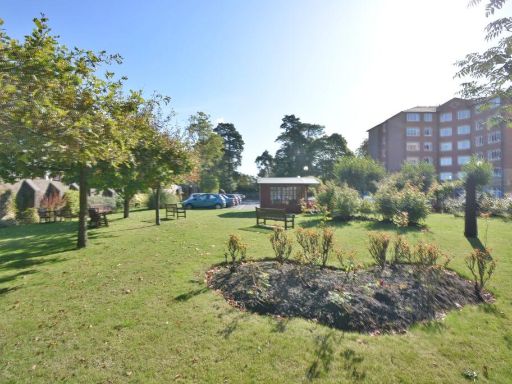 2 bedroom apartment for sale in 37 Lindsay Road, Poole, BH13 — £210,000 • 2 bed • 1 bath • 814 ft²
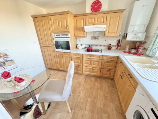 2 bedroom apartment for sale in 37 Lindsay Road, Poole, BH13 — £220,000 • 2 bed • 1 bath • 760 ft²
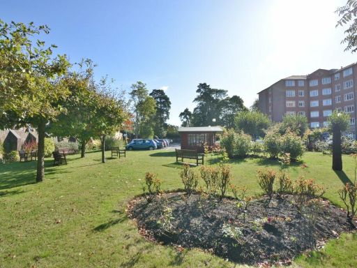 2 bedroom apartment for sale in 37 Lindsay Road, Poole, BH13 — £100,000 • 2 bed • 1 bath • 740 ft²
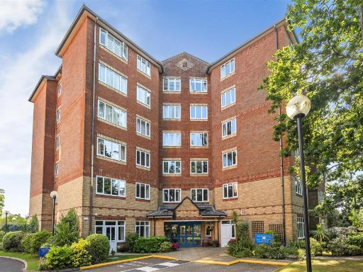 1 bedroom retirement property for sale in Melton Court, Poole, Dorset, BH13 — £185,000 • 1 bed • 1 bath • 736 ft²
 2 bedroom apartment for sale in 37 Lindsay Road, Poole, BH13 — £250,000 • 2 bed • 1 bath • 808 ft²
Meta
- {
"@context": "https://schema.org",
"@type": "Residence",
"name": "1 bedroom apartment for sale in 37 Lindsay Road, Poole, BH13",
"description": "",
"url": "https://propertypiper.co.uk/property/26efd4b1-7aeb-40b3-8e00-e94ab21a9d7e",
"image": "https://image-a.propertypiper.co.uk/8fc6d904-afd2-4060-912e-fafe0e6b7d09-1024.jpeg",
"address": {
"@type": "PostalAddress",
"streetAddress": "MELTON COURT, 37 FLAT 17 LINDSAY ROAD BRANKSOME PARK POOLE",
"postalCode": "BH13 6BH",
"addressLocality": "Bournemouth, Christchurch and Poole",
"addressRegion": "Poole",
"addressCountry": "England"
},
"geo": {
"@type": "GeoCoordinates",
"latitude": 50.72521577504465,
"longitude": -1.916162699618358
},
"numberOfRooms": 1,
"numberOfBathroomsTotal": 1,
"floorSize": {
"@type": "QuantitativeValue",
"value": 734,
"unitCode": "FTK"
},
"offers": {
"@type": "Offer",
"price": 130000,
"priceCurrency": "GBP",
"availability": "https://schema.org/InStock"
},
"additionalProperty": [
{
"@type": "PropertyValue",
"name": "Feature",
"value": "Melton Court"
},
{
"@type": "PropertyValue",
"name": "Feature",
"value": "apartment building"
},
{
"@type": "PropertyValue",
"name": "Feature",
"value": "modern design"
},
{
"@type": "PropertyValue",
"name": "Feature",
"value": "brick facade"
},
{
"@type": "PropertyValue",
"name": "Feature",
"value": "multi-story"
},
{
"@type": "PropertyValue",
"name": "Feature",
"value": "residential"
},
{
"@type": "PropertyValue",
"name": "Feature",
"value": "urban"
},
{
"@type": "PropertyValue",
"name": "Feature",
"value": "landscaped"
},
{
"@type": "PropertyValue",
"name": "Feature",
"value": "tree-lined"
},
{
"@type": "PropertyValue",
"name": "Feature",
"value": "gated entrance"
},
{
"@type": "PropertyValue",
"name": "Feature",
"value": "garden"
},
{
"@type": "PropertyValue",
"name": "Feature",
"value": "gazebo"
},
{
"@type": "PropertyValue",
"name": "Feature",
"value": "landscaped"
},
{
"@type": "PropertyValue",
"name": "Feature",
"value": "greenery"
},
{
"@type": "PropertyValue",
"name": "Feature",
"value": "sitting area"
},
{
"@type": "PropertyValue",
"name": "Feature",
"value": "outdoor space"
},
{
"@type": "PropertyValue",
"name": "Feature",
"value": "wooden structure"
},
{
"@type": "PropertyValue",
"name": "Feature",
"value": "rustic"
},
{
"@type": "PropertyValue",
"name": "Feature",
"value": "garden"
},
{
"@type": "PropertyValue",
"name": "Feature",
"value": "modern apartment"
},
{
"@type": "PropertyValue",
"name": "Feature",
"value": "residential"
},
{
"@type": "PropertyValue",
"name": "Feature",
"value": "outdoor space"
},
{
"@type": "PropertyValue",
"name": "Feature",
"value": "sheds"
},
{
"@type": "PropertyValue",
"name": "Feature",
"value": "benches"
},
{
"@type": "PropertyValue",
"name": "Feature",
"value": "landscaped"
},
{
"@type": "PropertyValue",
"name": "Feature",
"value": "communal area"
}
]
}
High Res Floorplan Images
Compatible Floorplan Images
FloorplanImages Thumbnail