EX32 0HL - 14 bedroom house for sale in Landkey Road, Barnstaple, Devo…
View on Property Piper
14 bedroom house for sale in Landkey Road, Barnstaple, Devon, EX32
Property Details
- Price: £1495000
- Bedrooms: 14
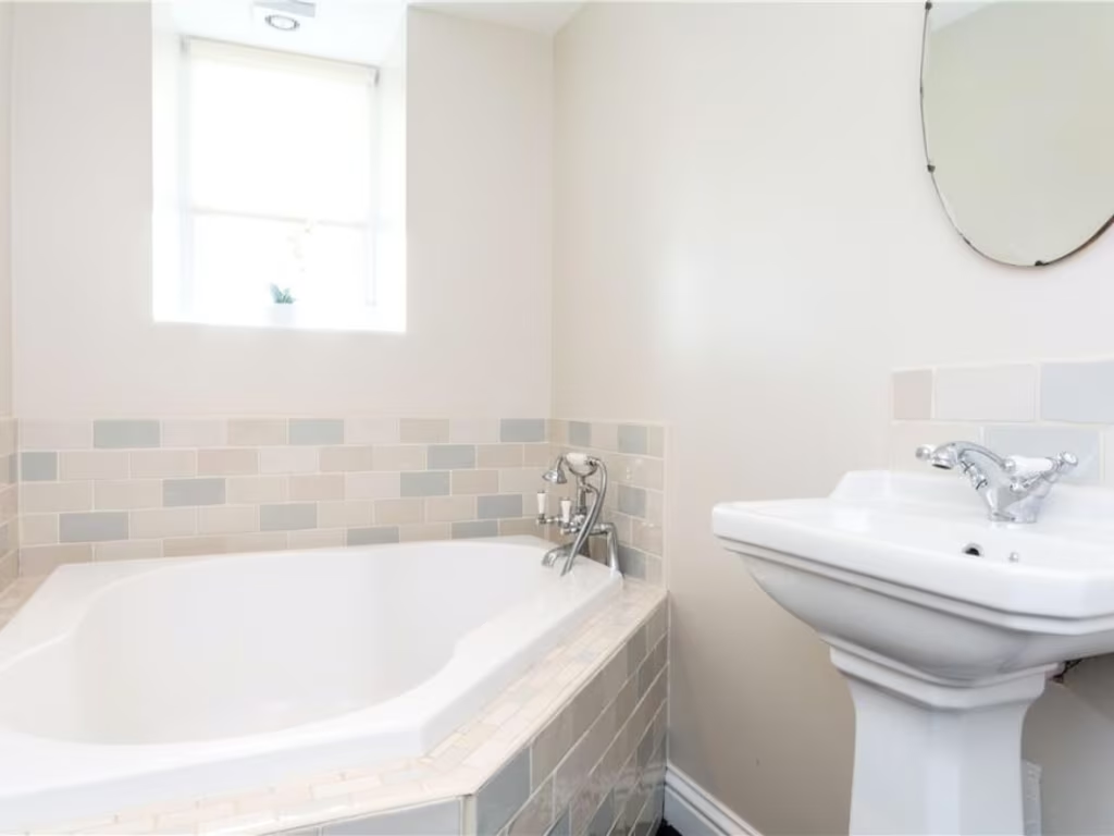
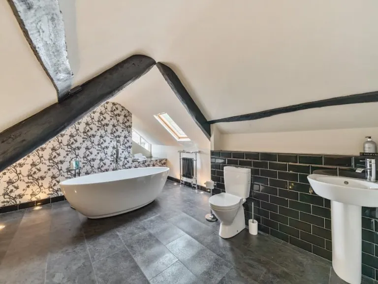
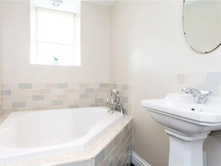
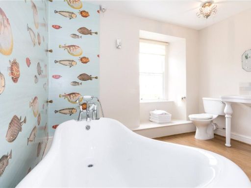
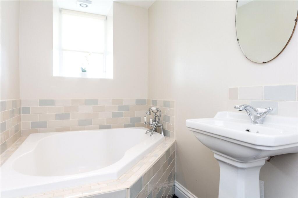
- Bathrooms: 1
- Property Type: undefined
- Property SubType: undefined
Brochure Descriptions
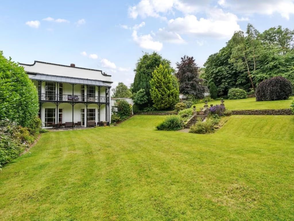
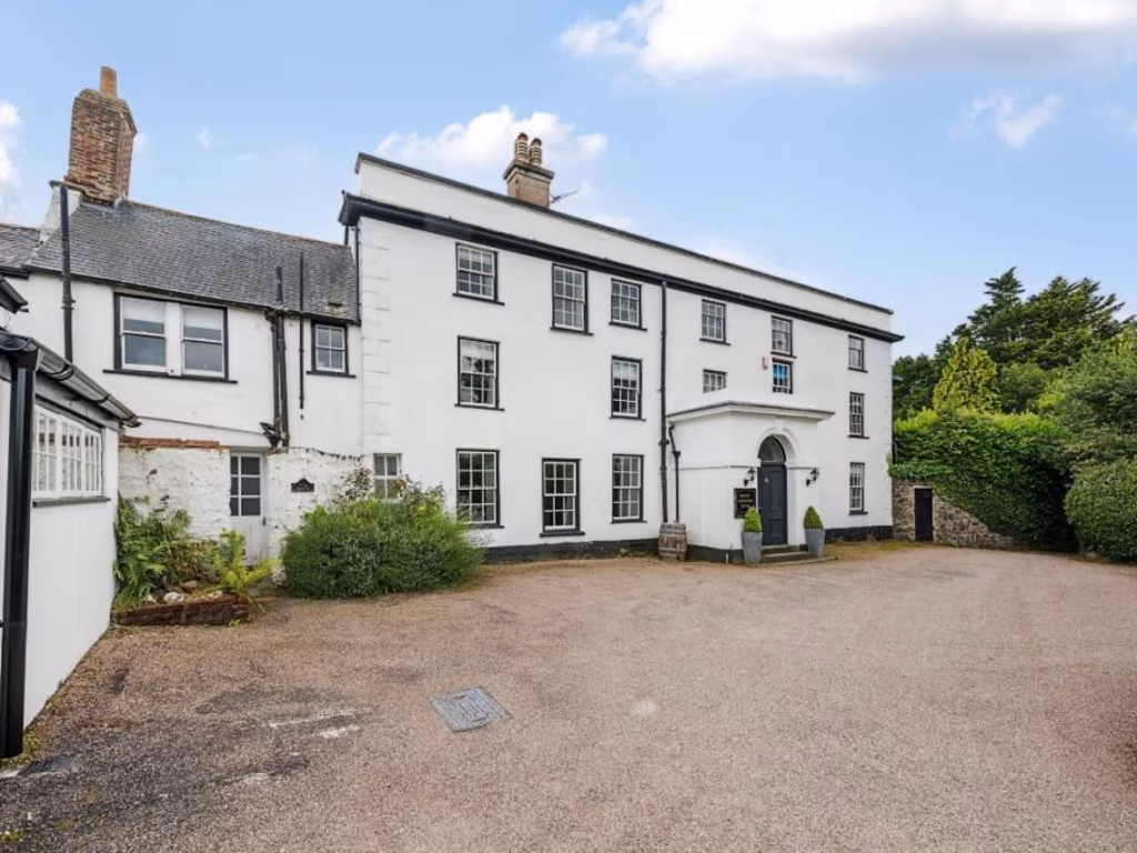
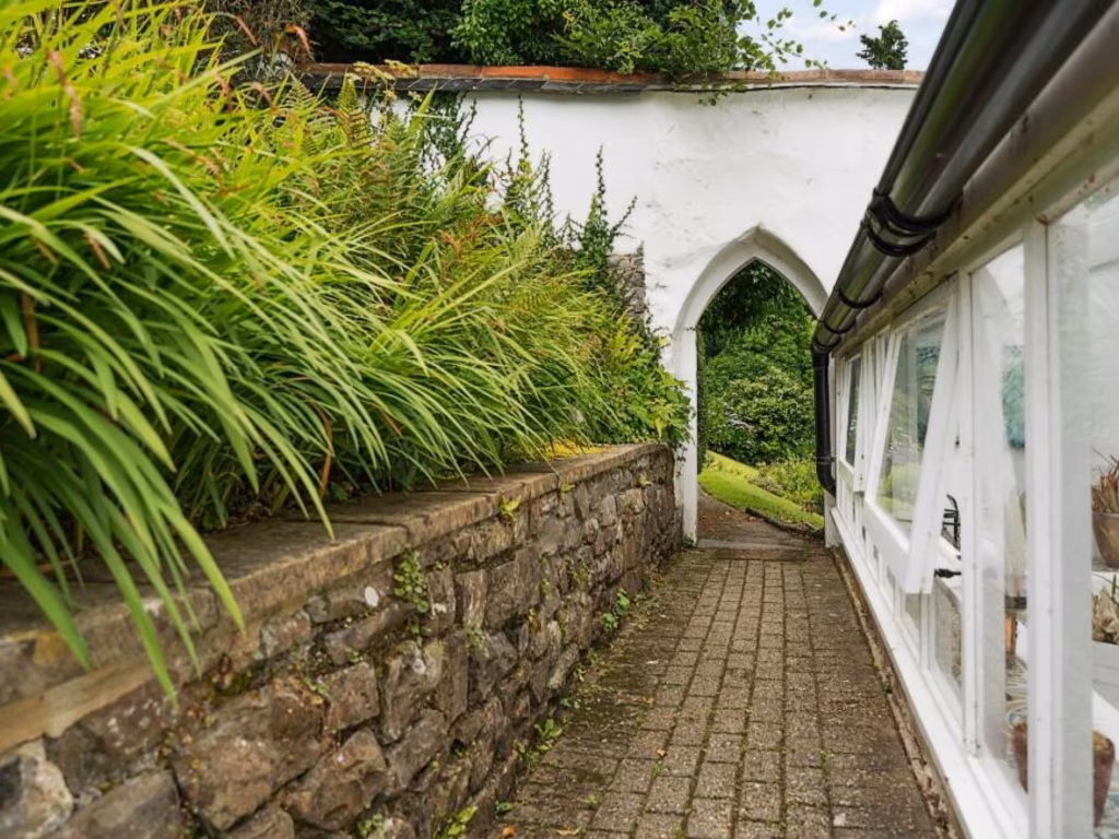
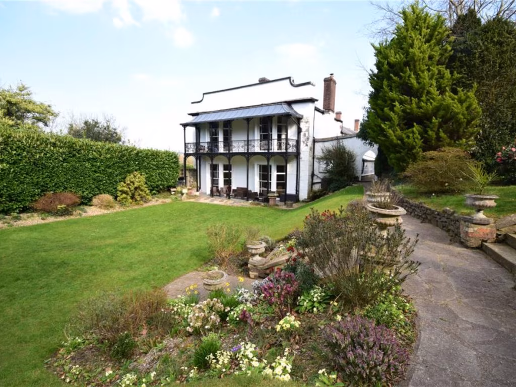
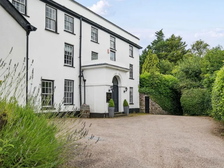
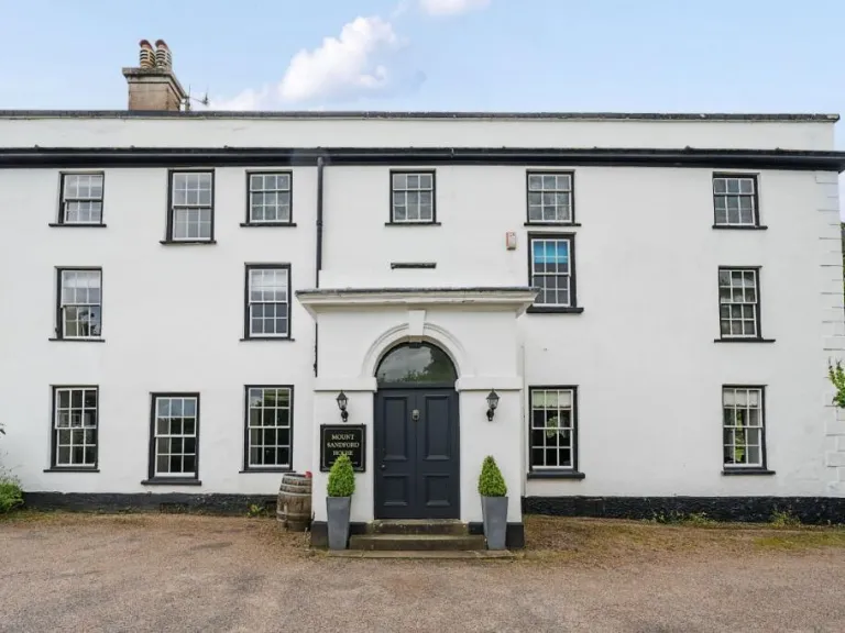
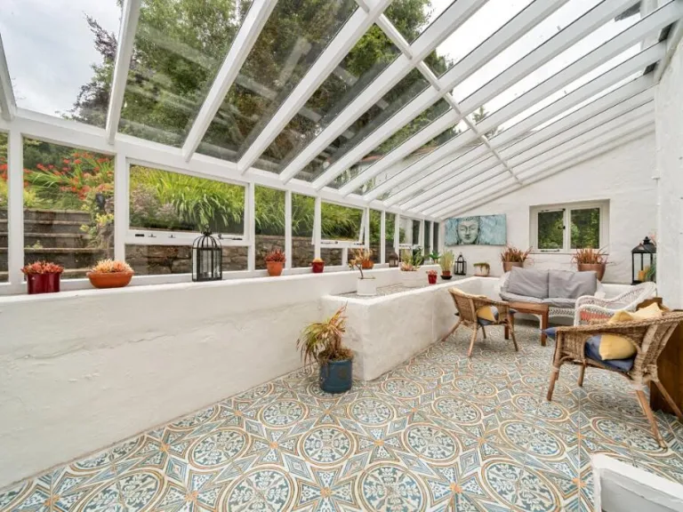
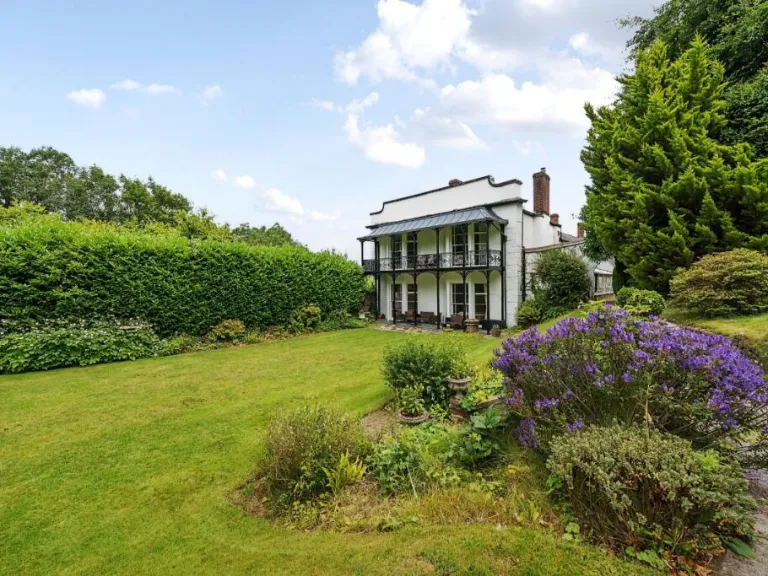
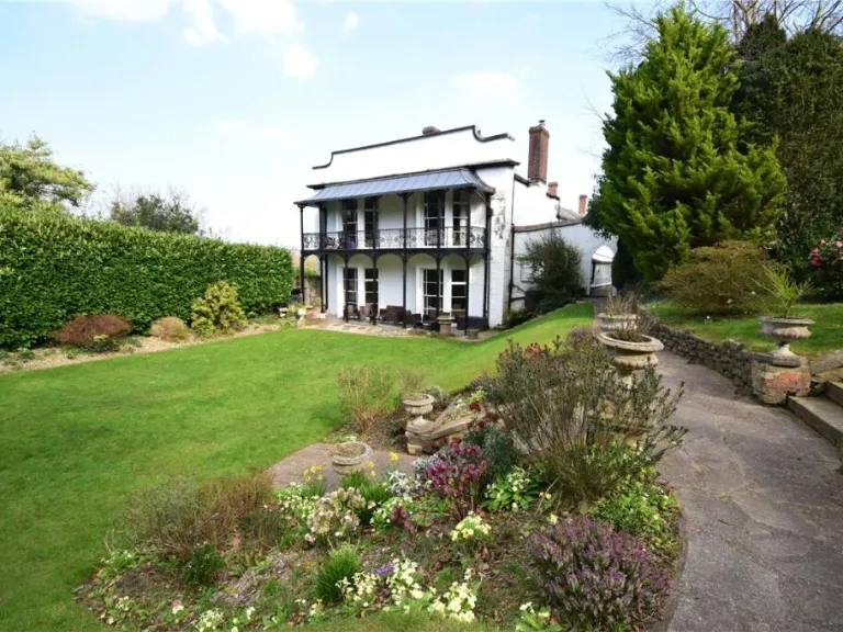
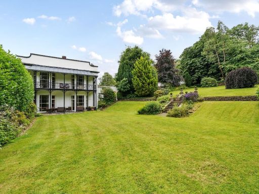
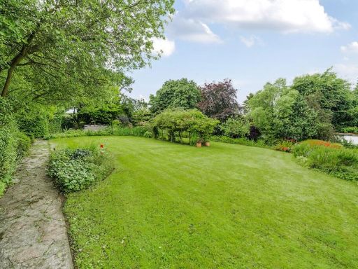
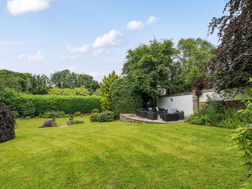
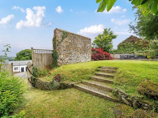
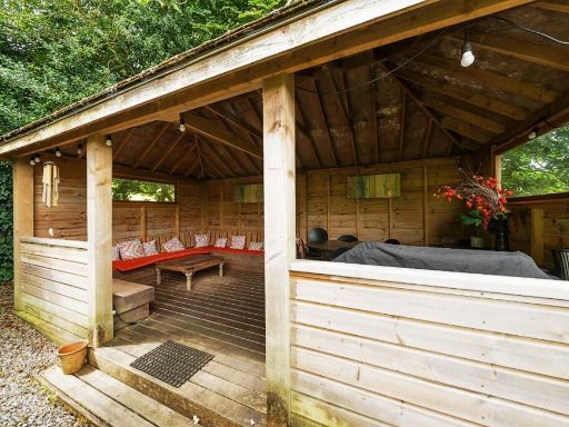
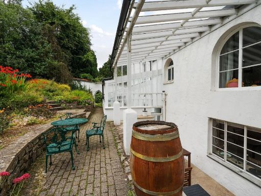
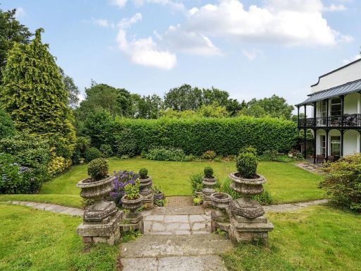
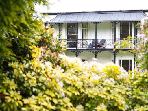
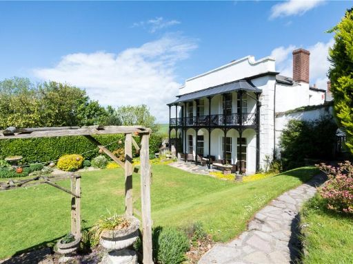
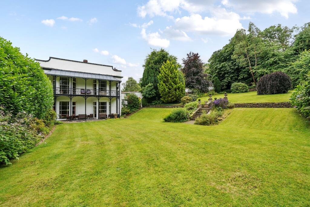
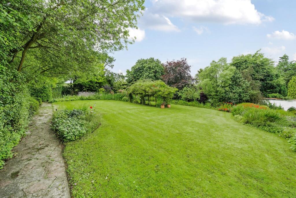
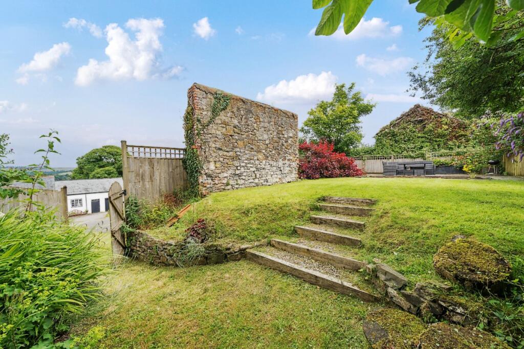
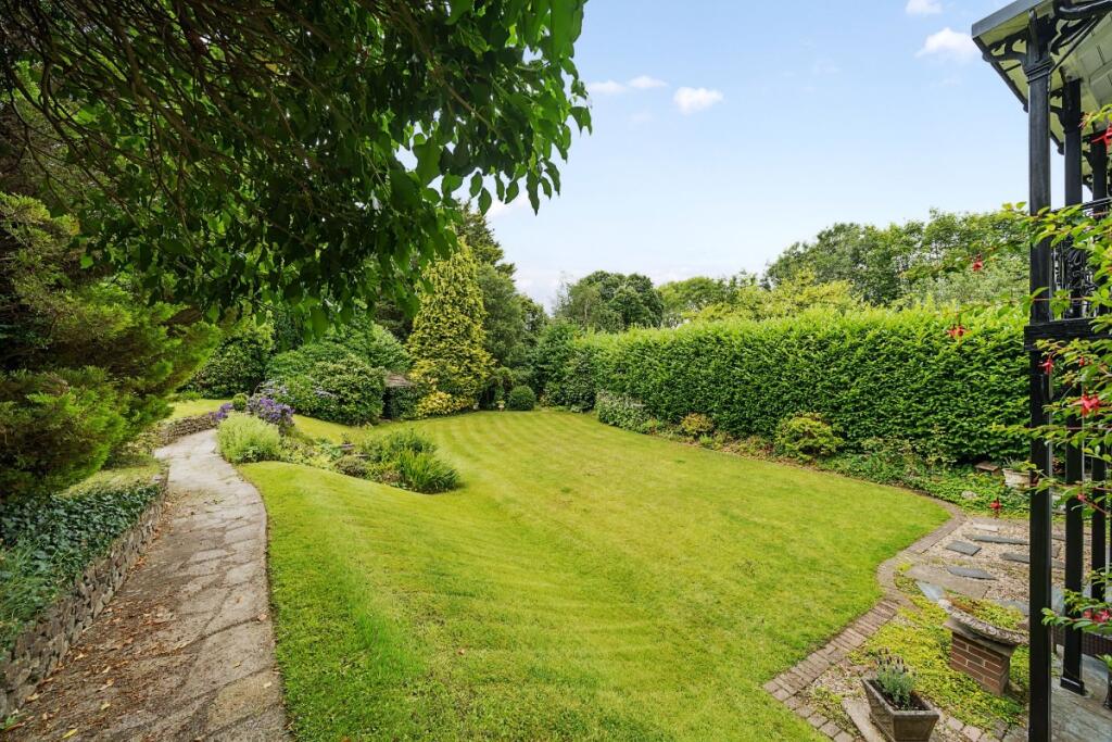
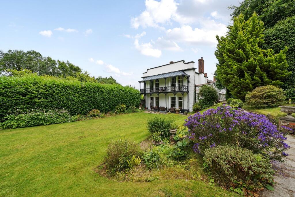
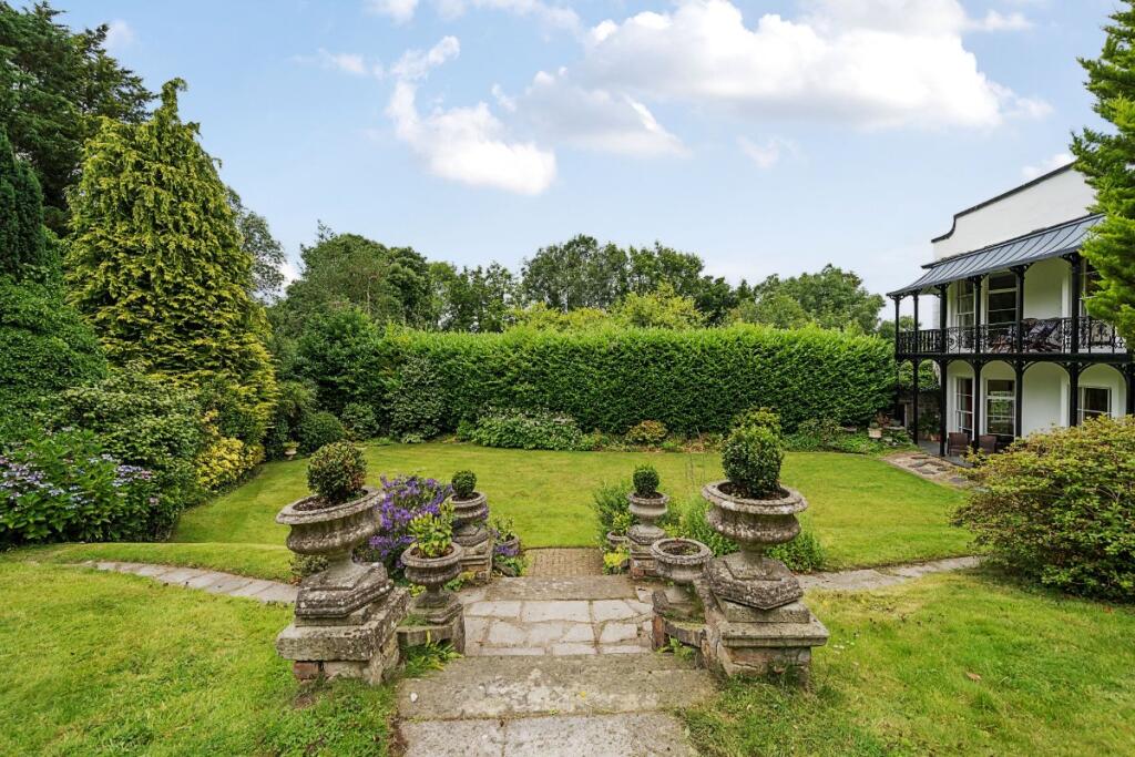
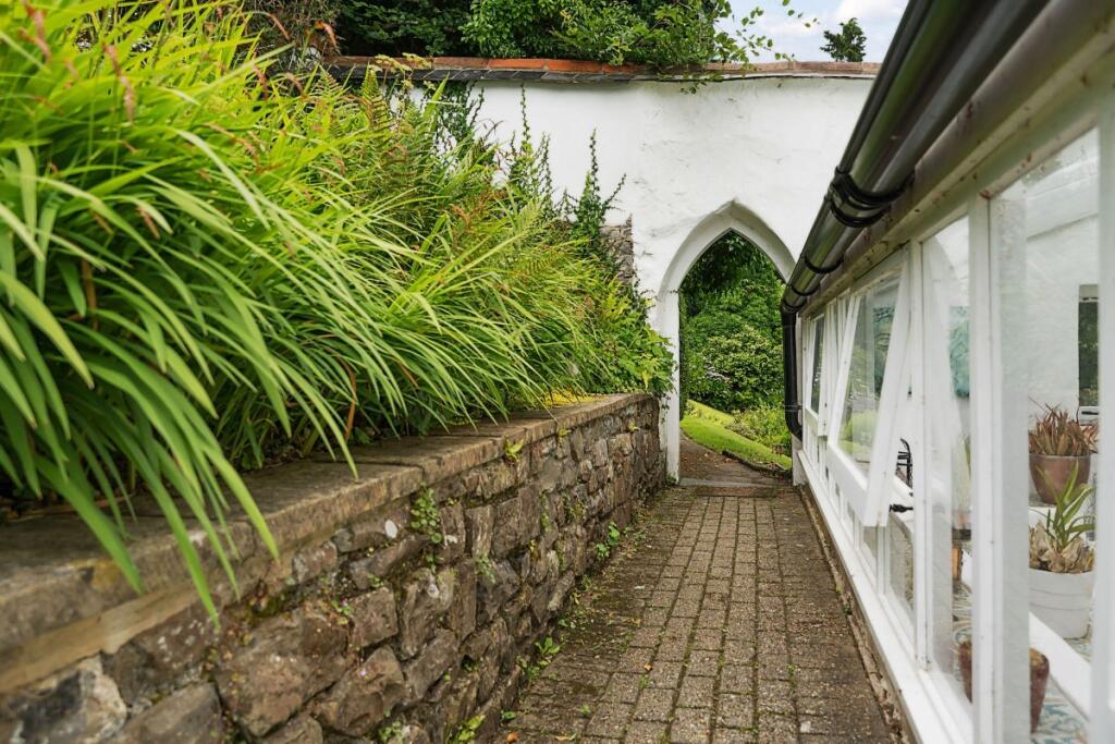
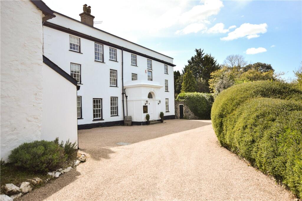
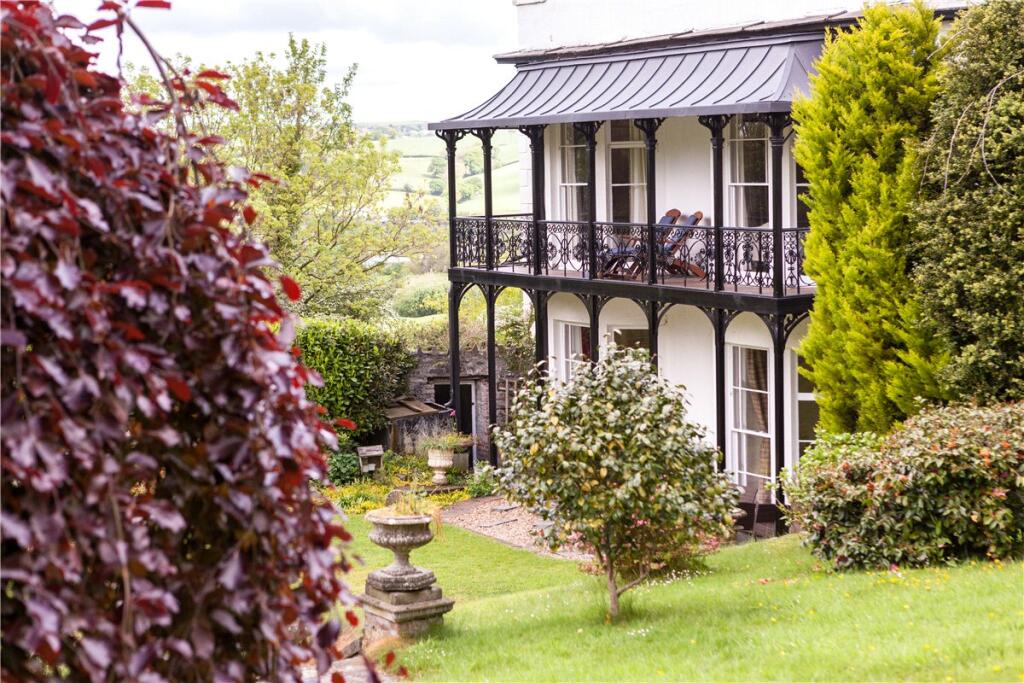
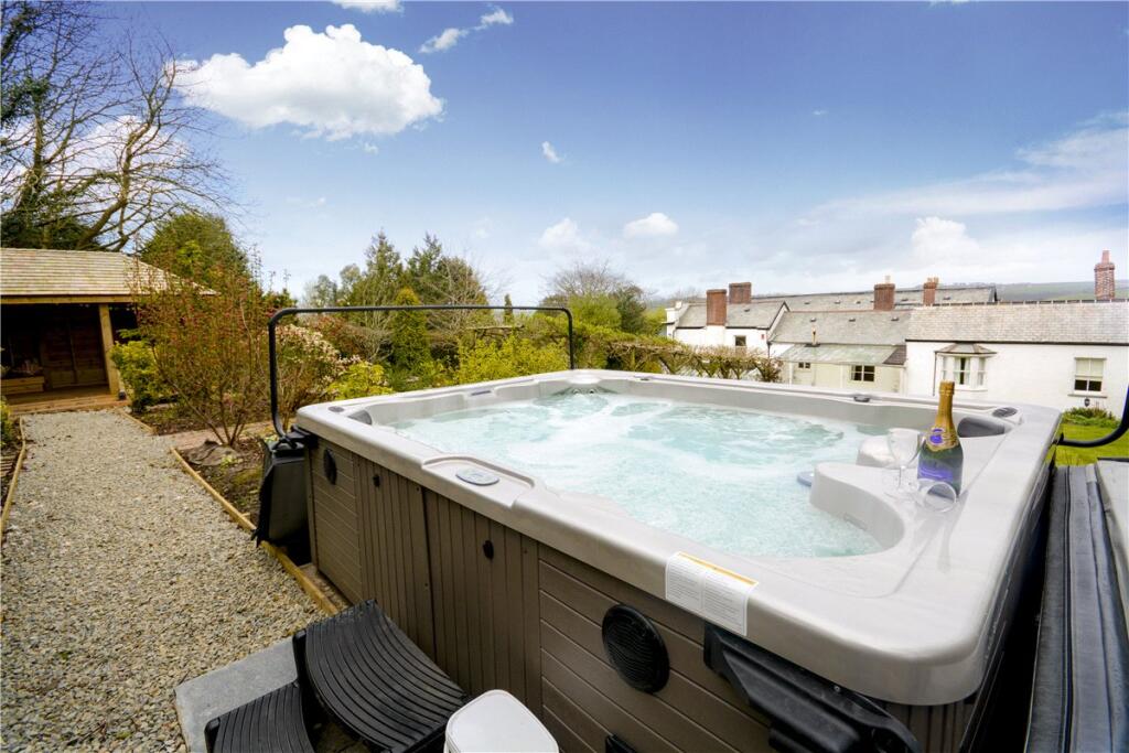
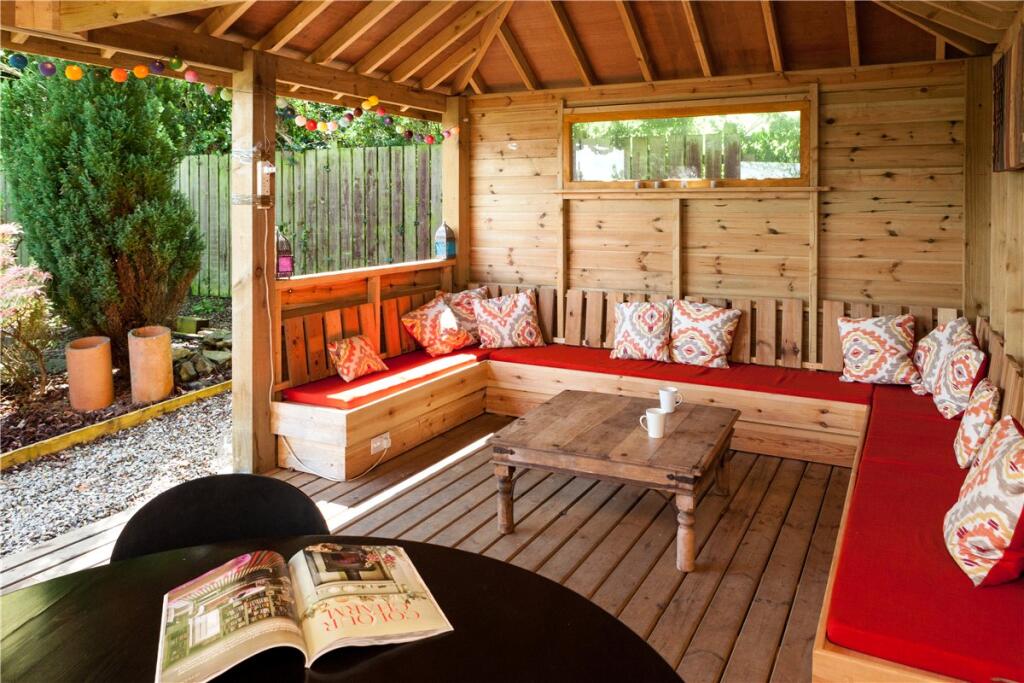
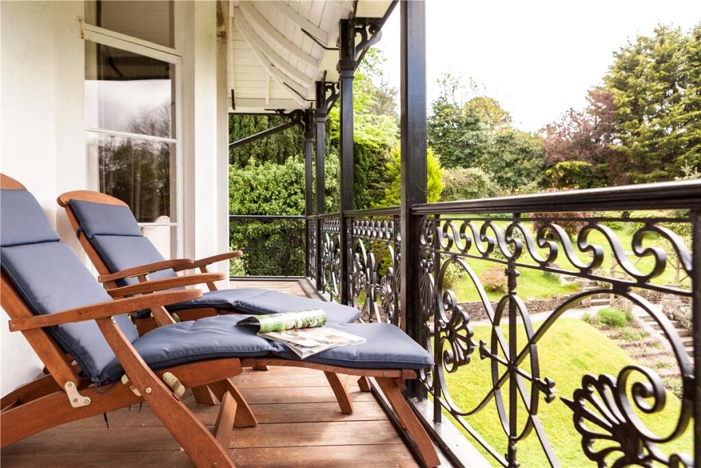
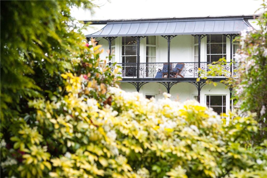
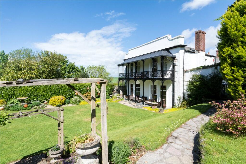
- This exquisite property boasts a large and meticulously landscaped garden, featuring a rolling lawn with terraced sections, bordered by mature trees and shrubs. The property itself is a prominent two-story structure with a stylish veranda, providing scenic views of the lush greenery that surrounds the estate. The garden size is substantial, suggesting a spacious plot that promises both privacy and tranquility.
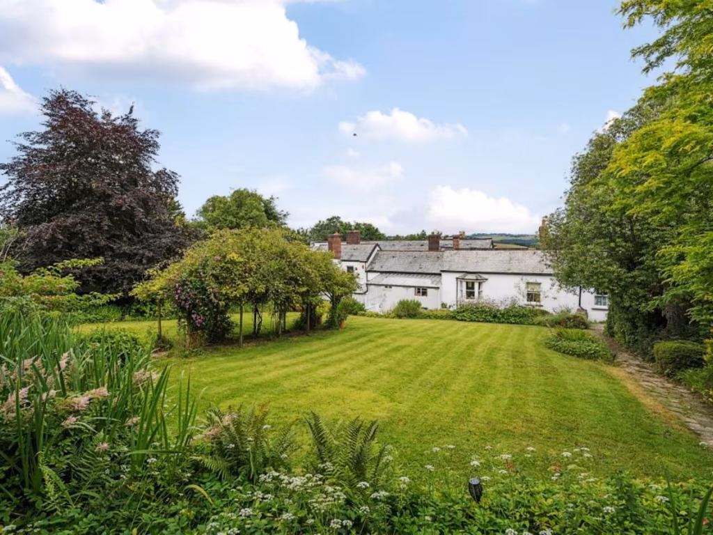
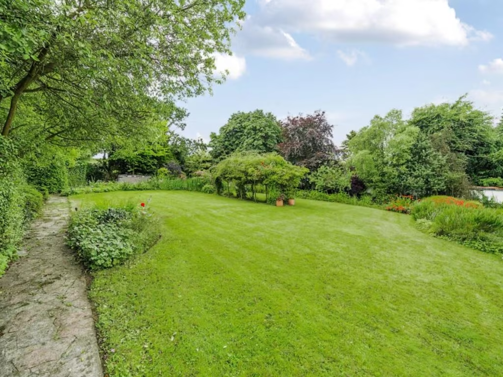
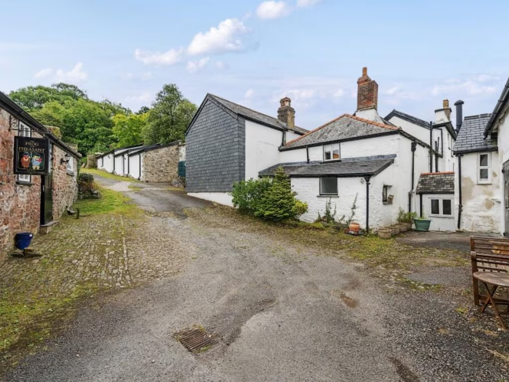
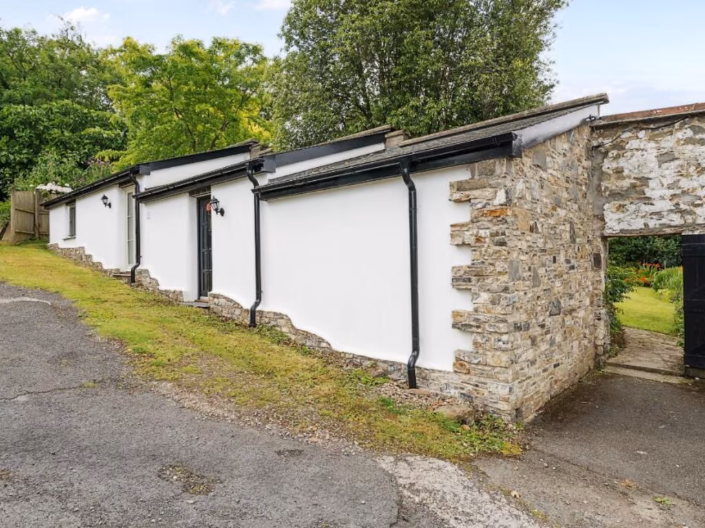
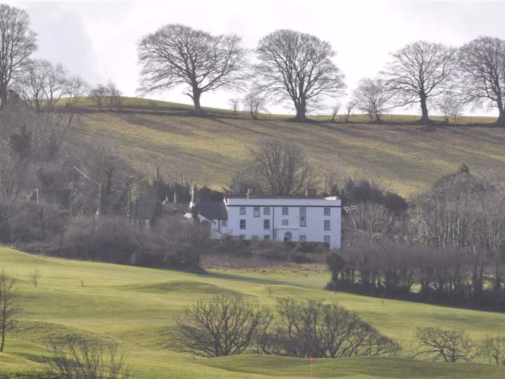
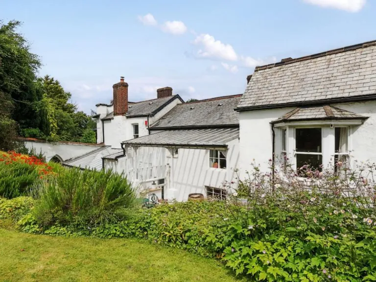
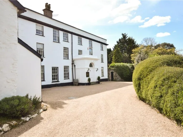
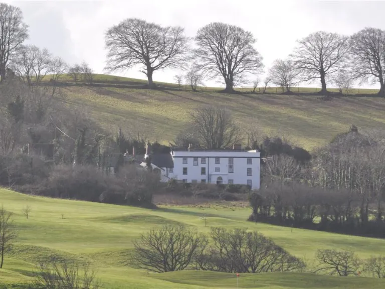
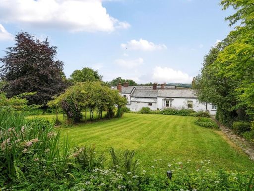
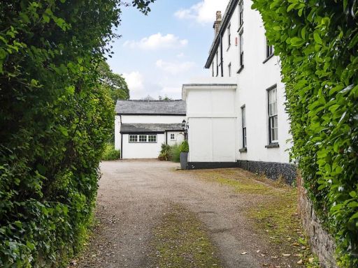
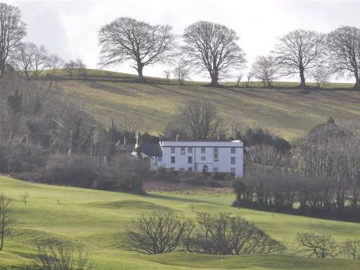
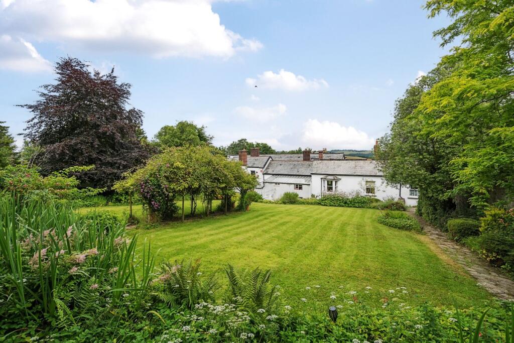
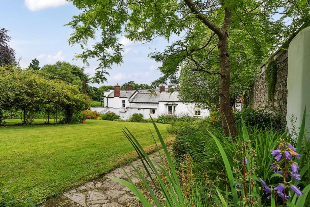
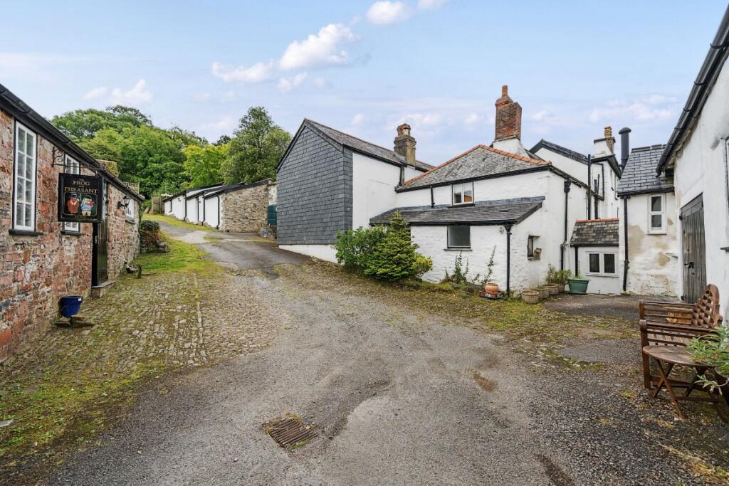
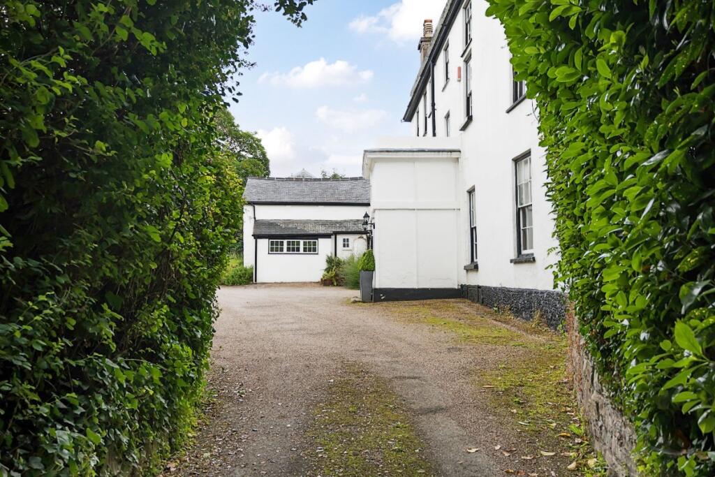
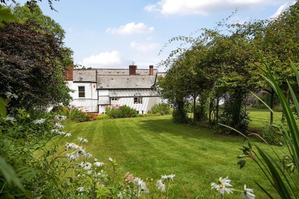
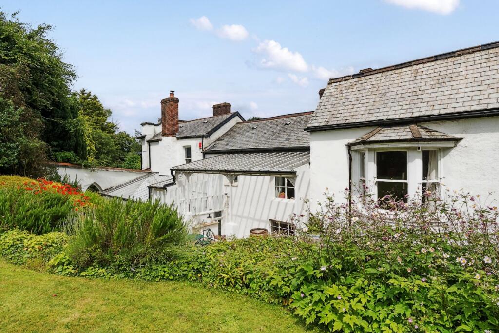
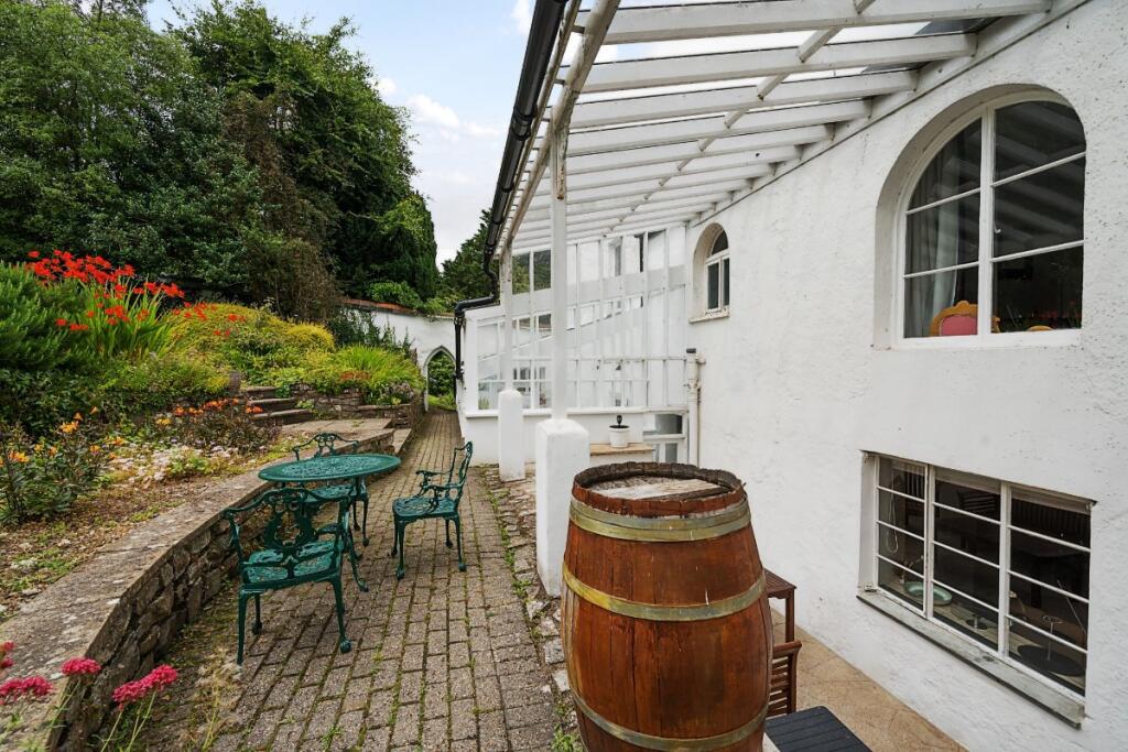
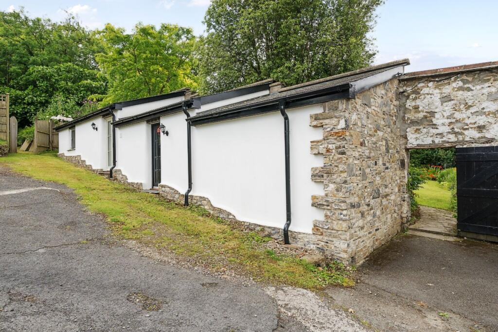
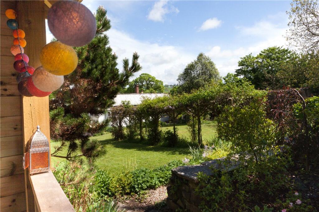
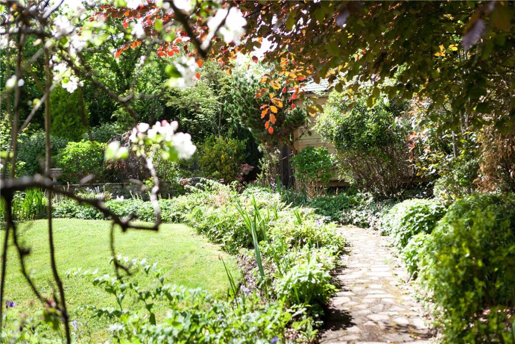
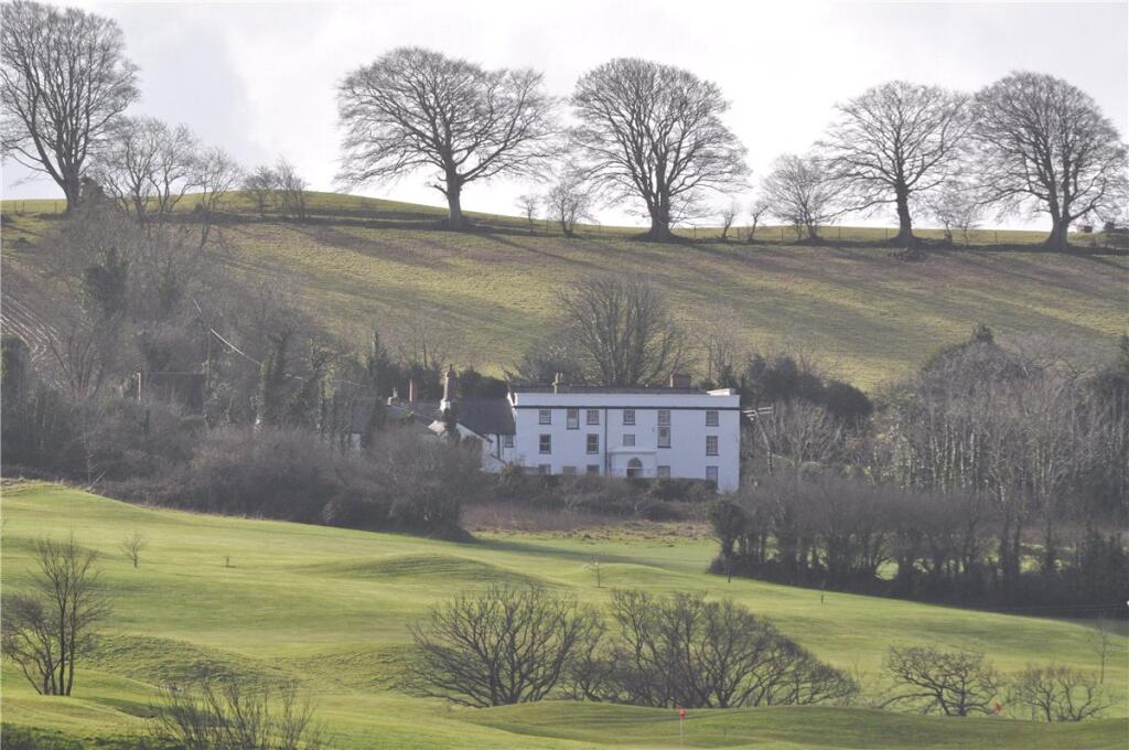
- The property is a charming country cottage set amidst a lush and meticulously maintained large garden with mature trees and verdant hedges, providing a substantial sense of privacy and tranquility. The scenic views extend towards distant rolling hills, offering a picturesque rural vista. The cottage itself appears to be traditional, featuring slate roofing and a white rendered exterior, suggesting typical period architecture. The garden is expansive, likely more than ample for varied outdoor activities, ideal for a family seeking space and seclusion.
Image Descriptions
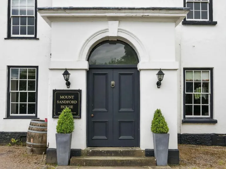
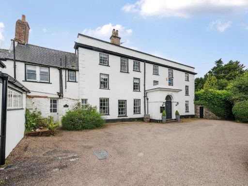
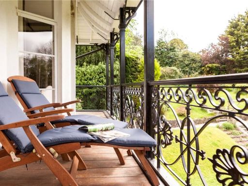
- large house with a garden Georgian
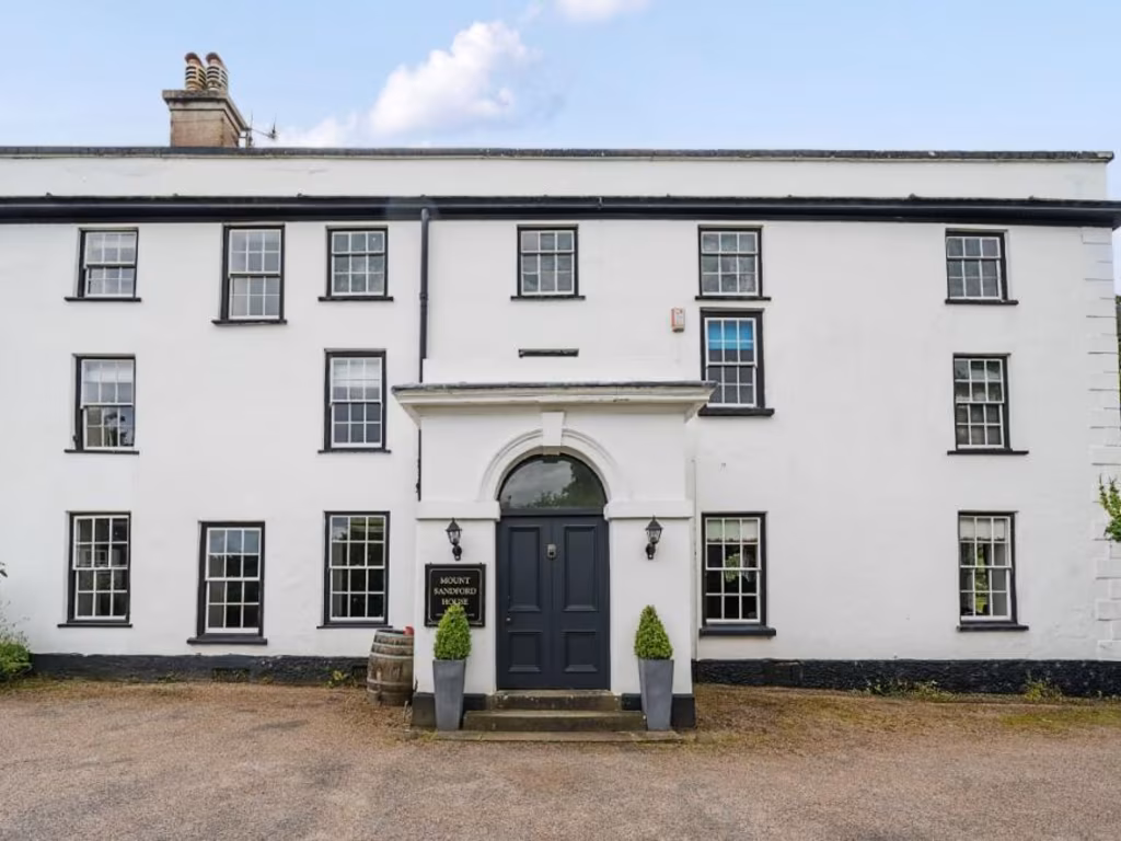
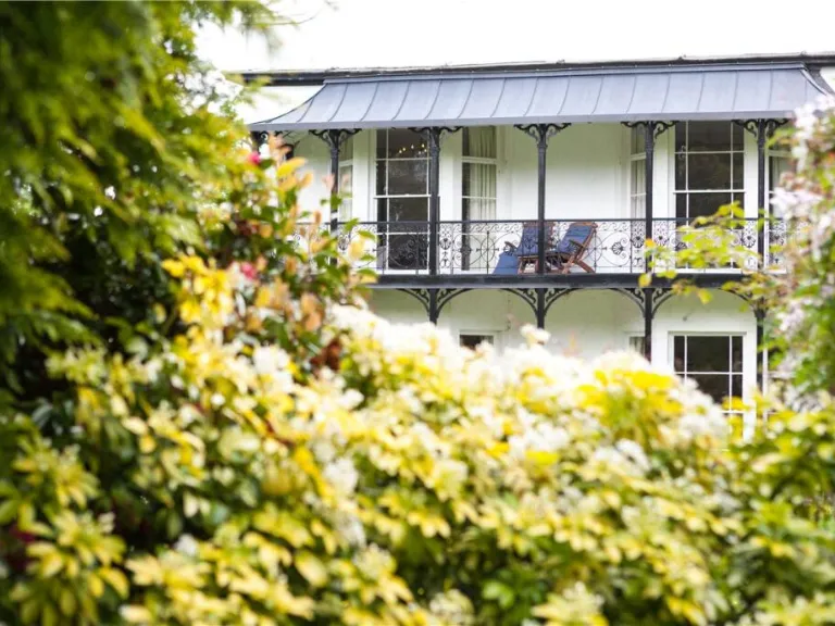
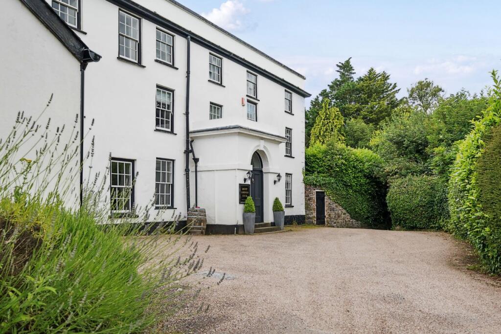
- period building exterior Georgian
Floorplan Description
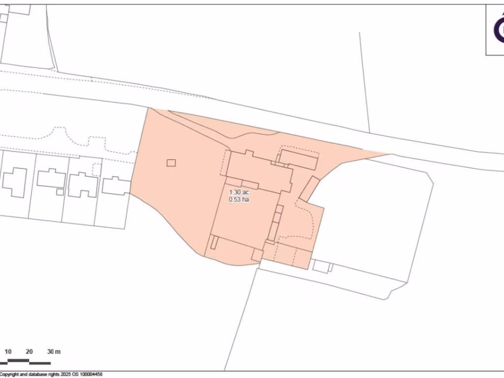
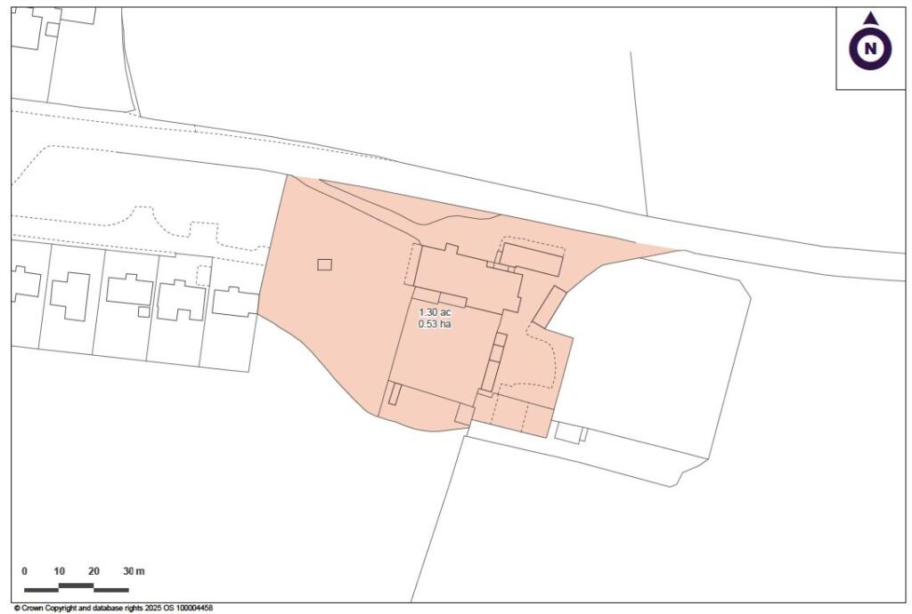
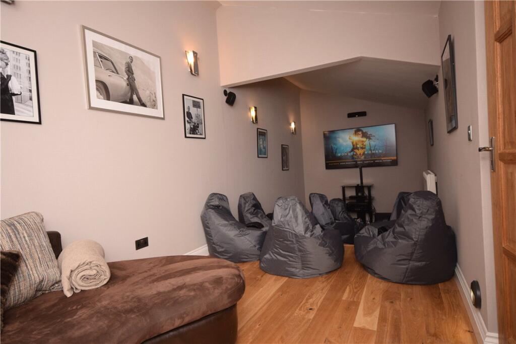
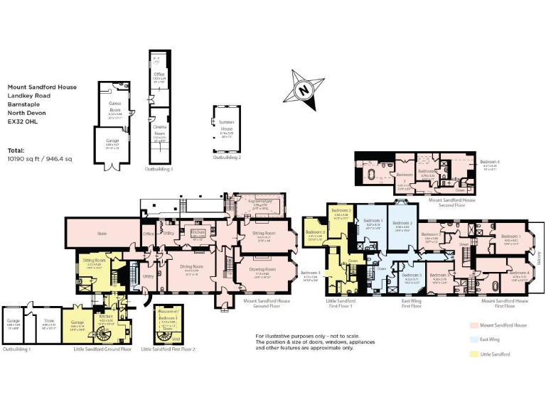
- A multi-functional property with an East Wing and Little Sandford area, offering a variety of rooms and ample space.
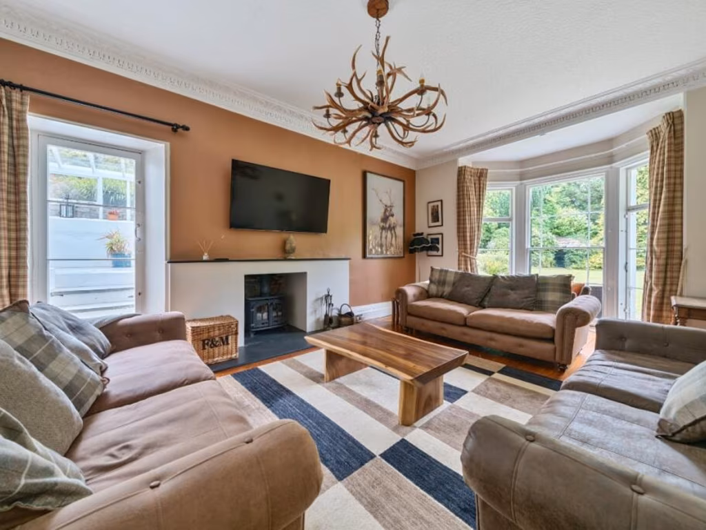
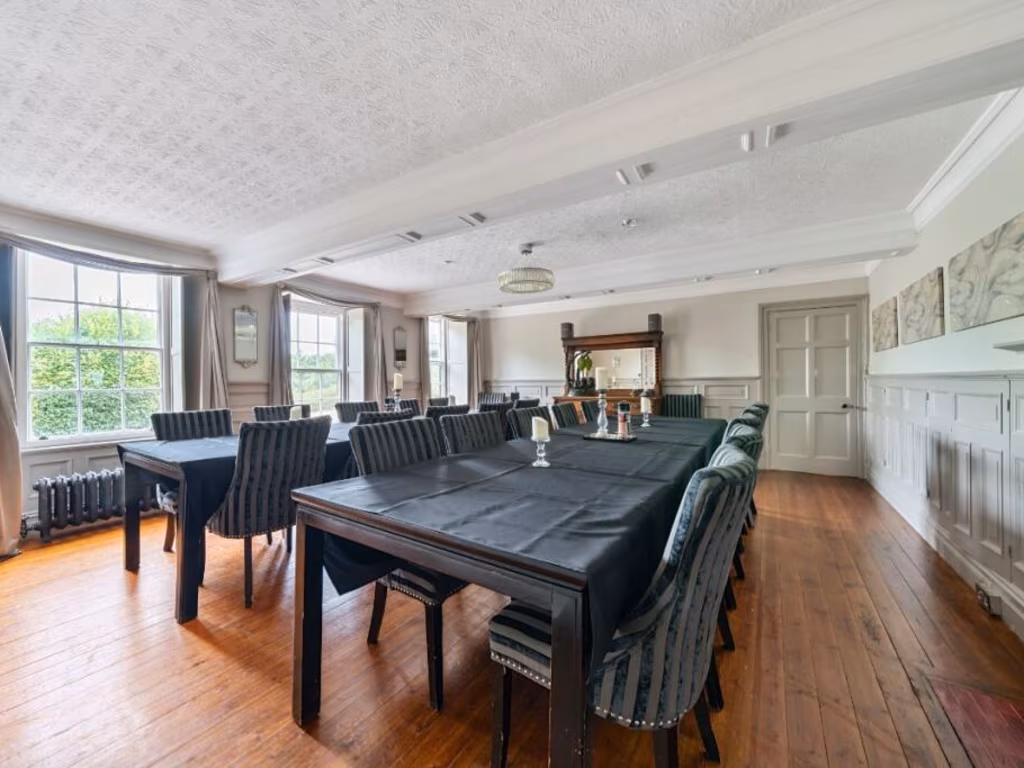
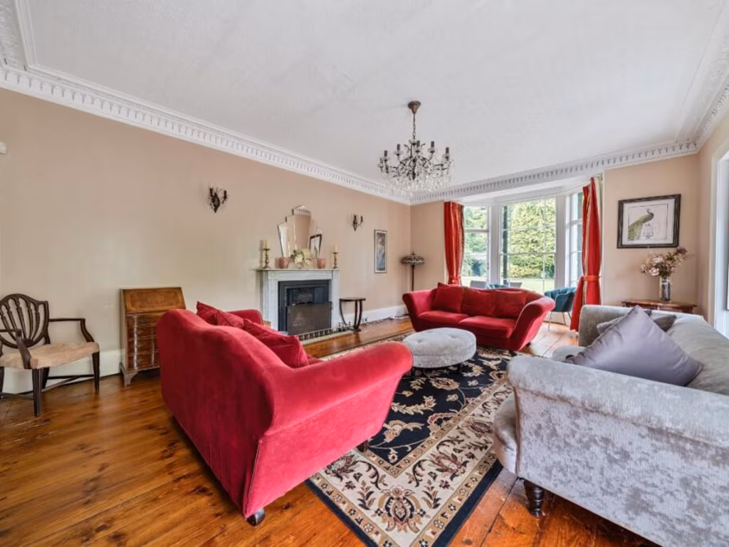
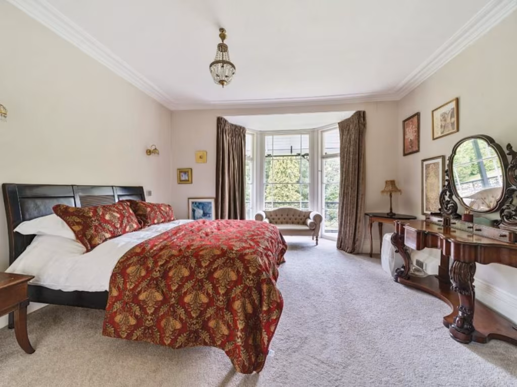
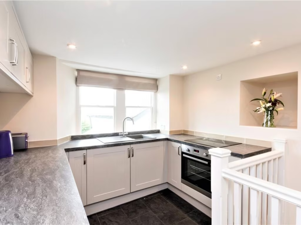
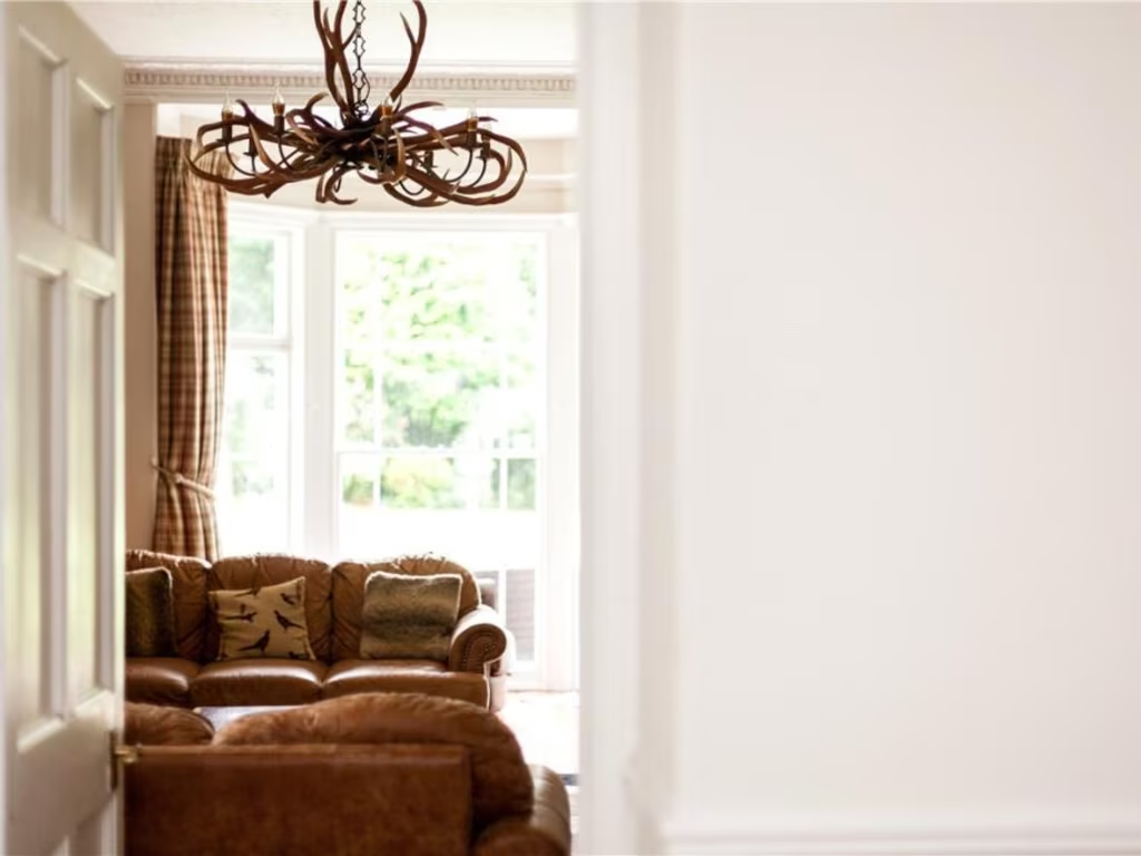
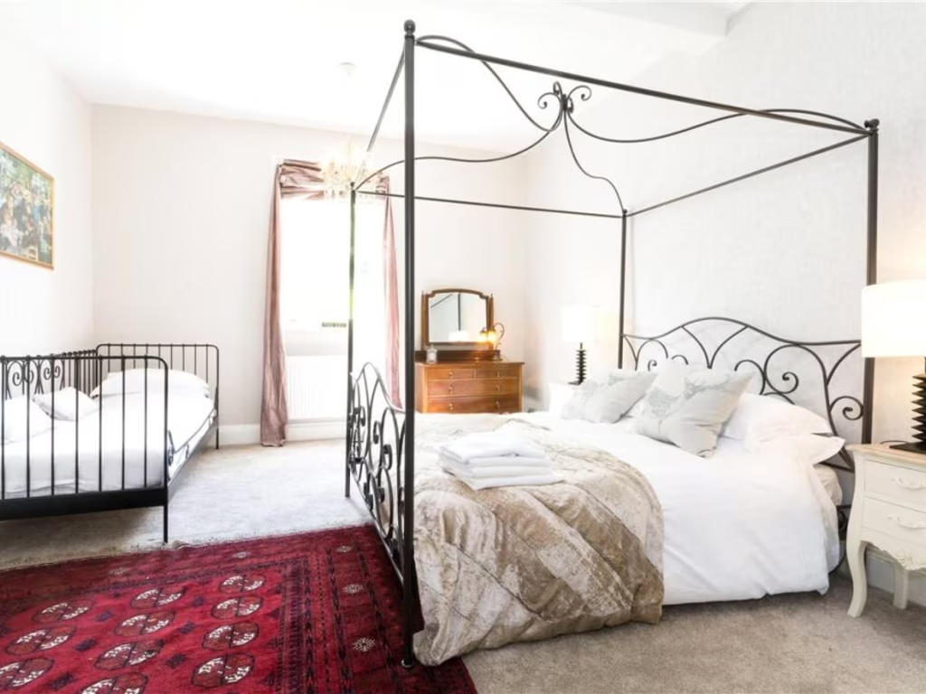
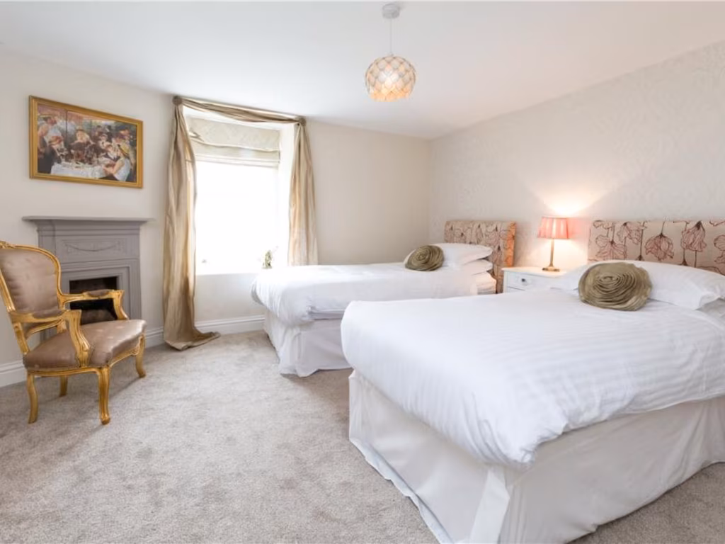
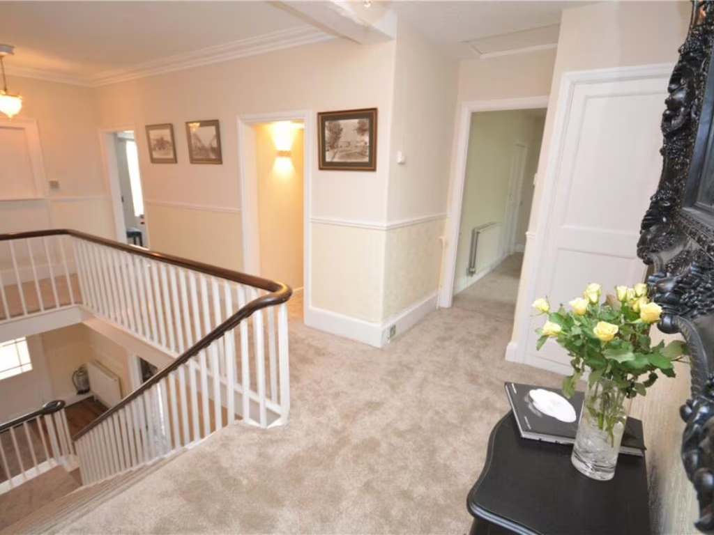
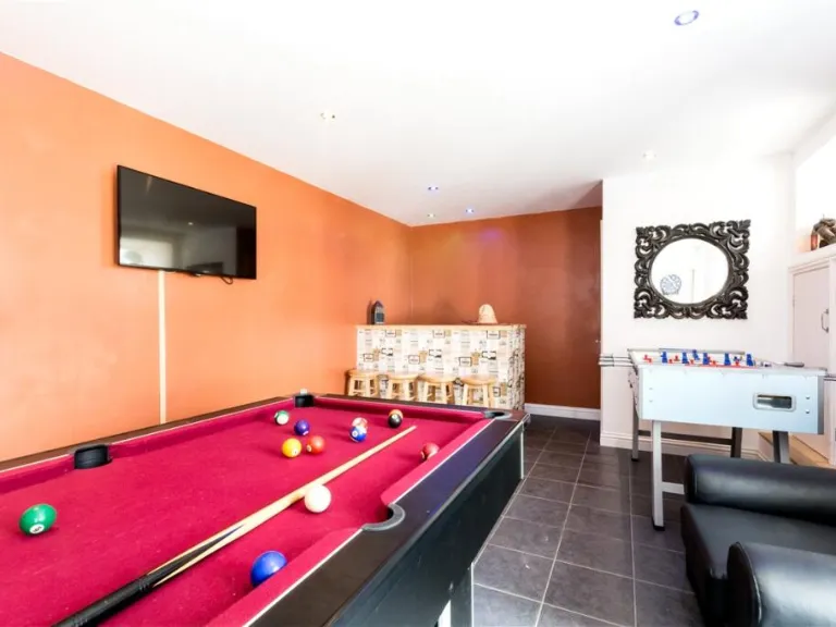
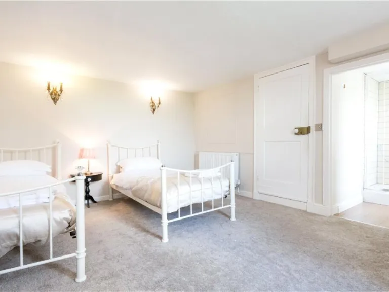
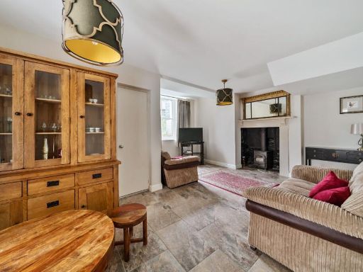
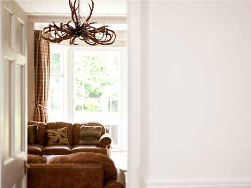
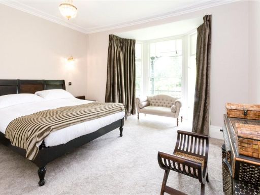
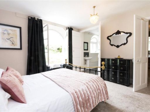
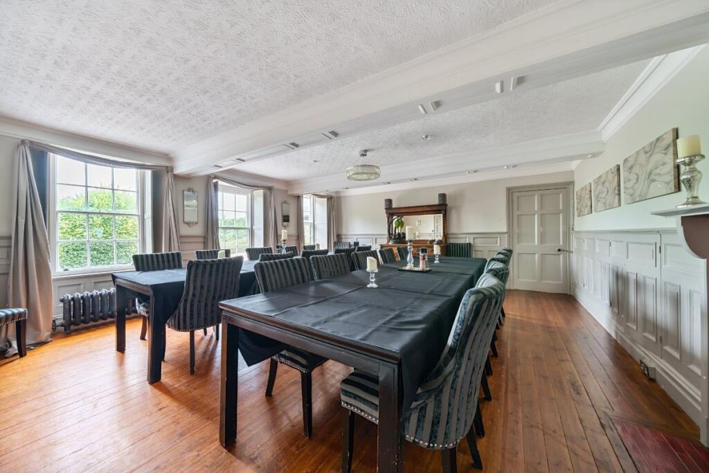
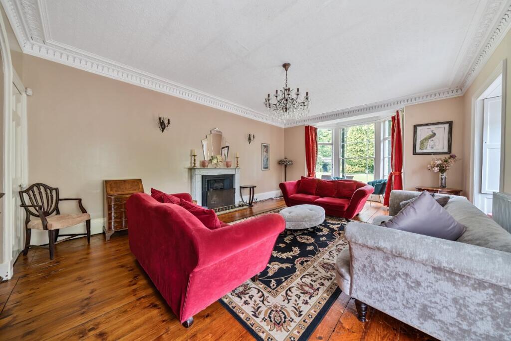
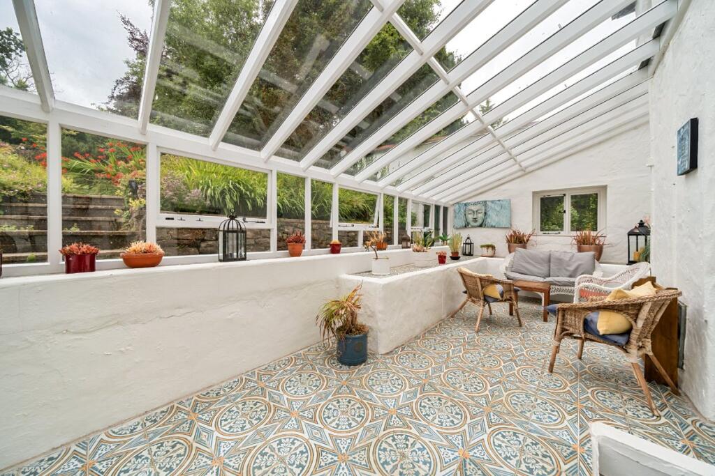
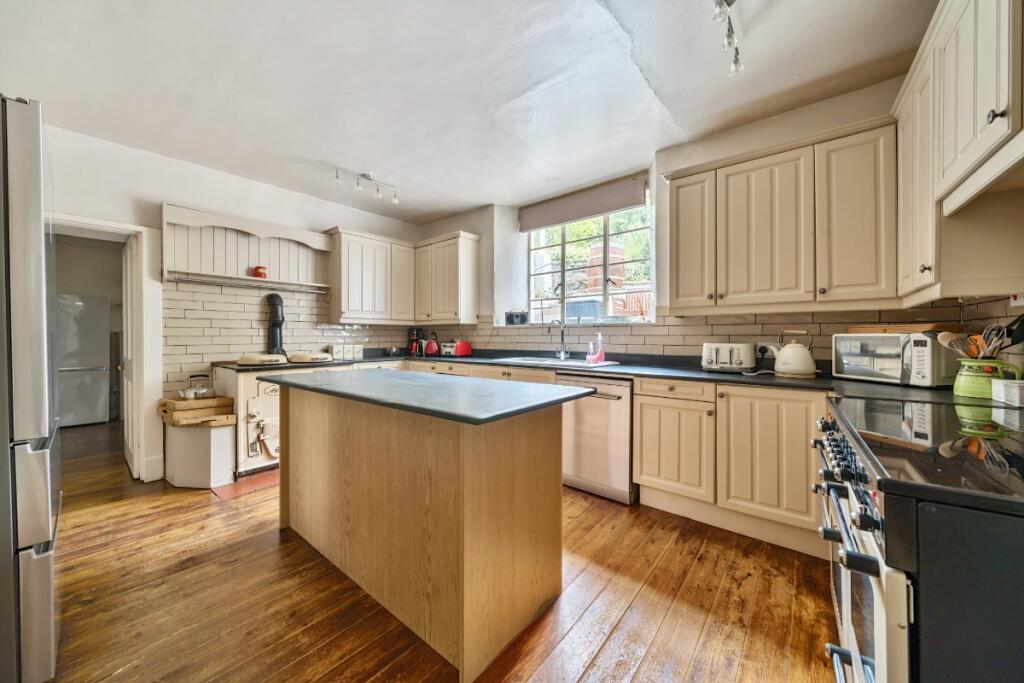
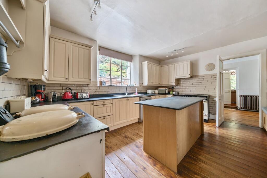
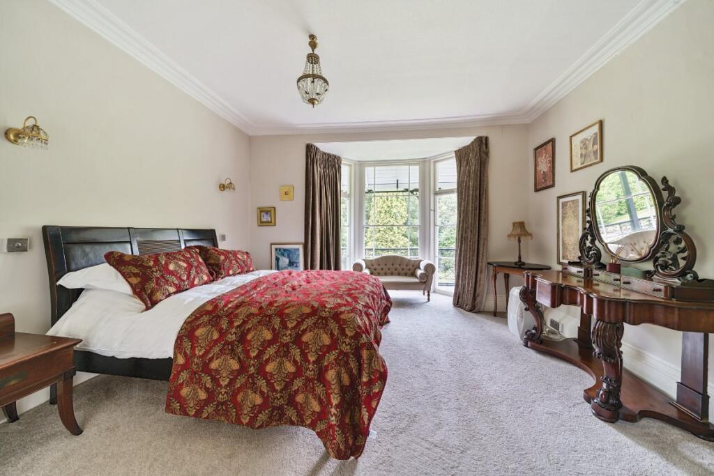
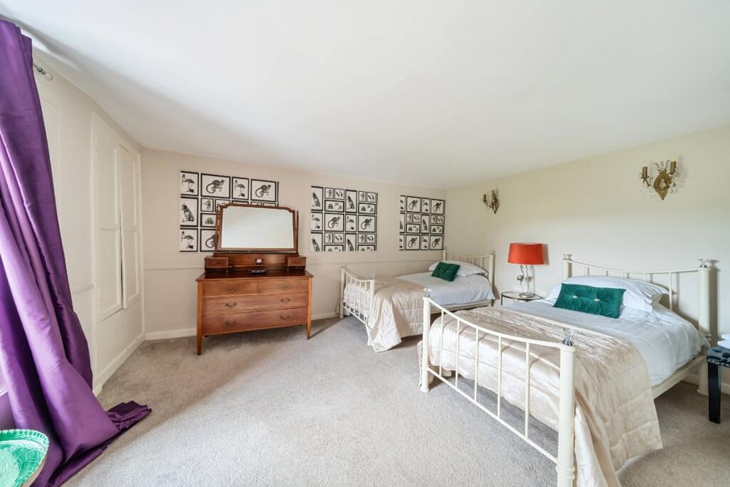
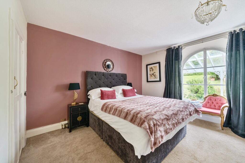
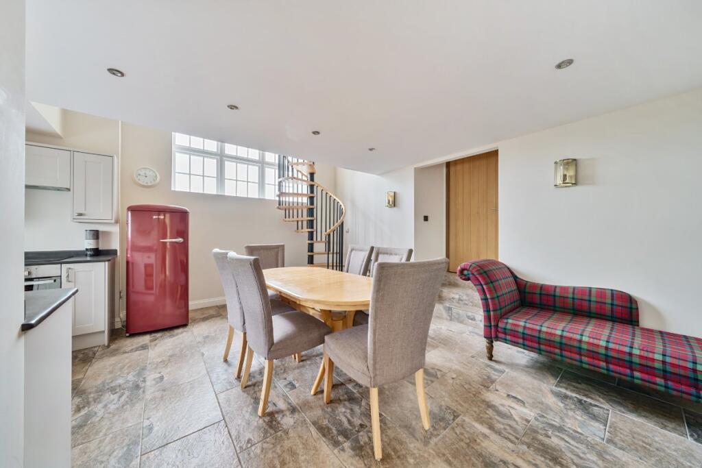
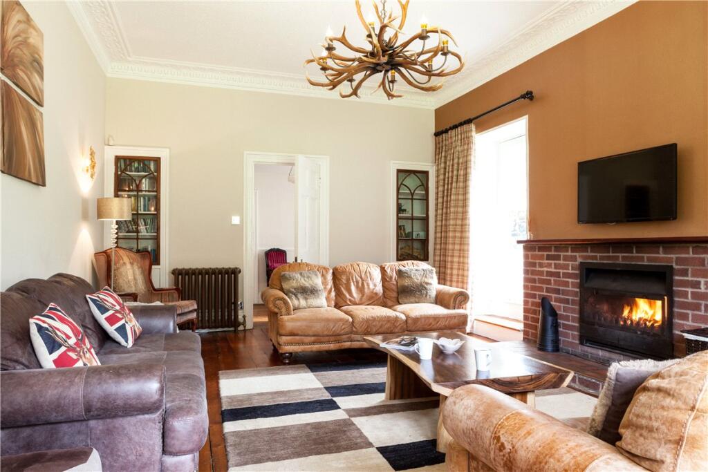
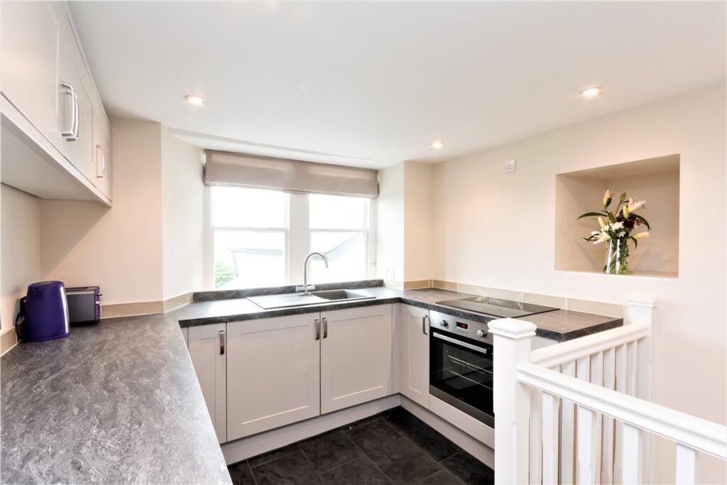
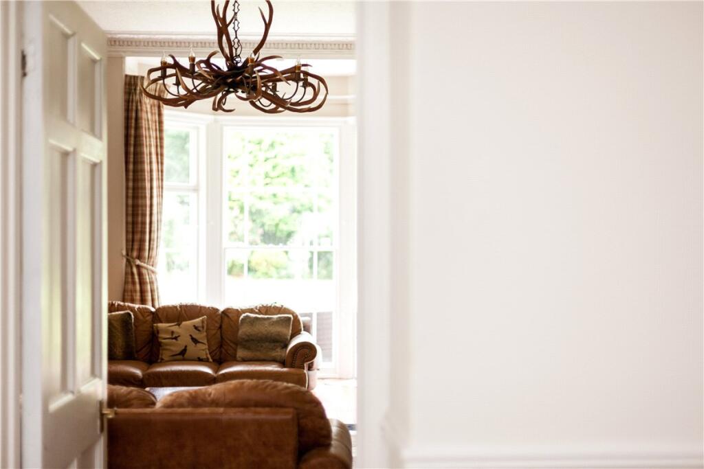
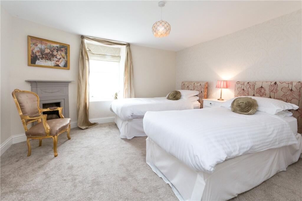
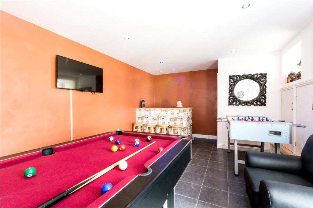
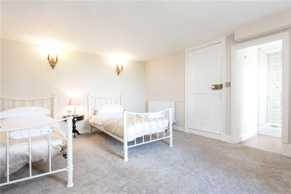
Rooms
- Store:
- Office:
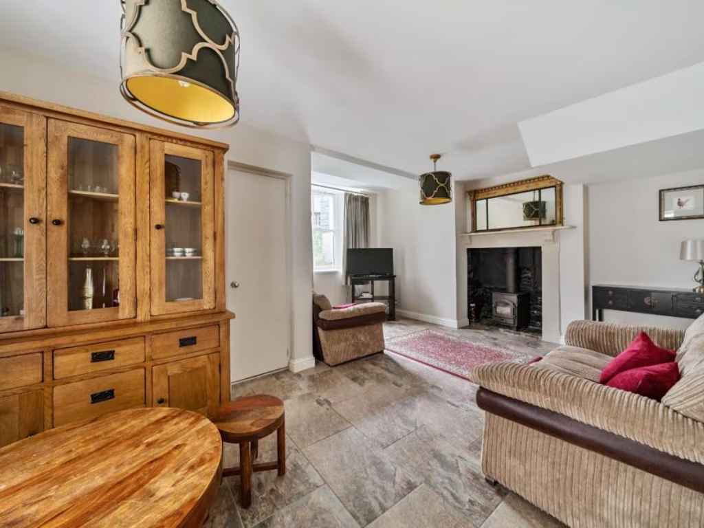
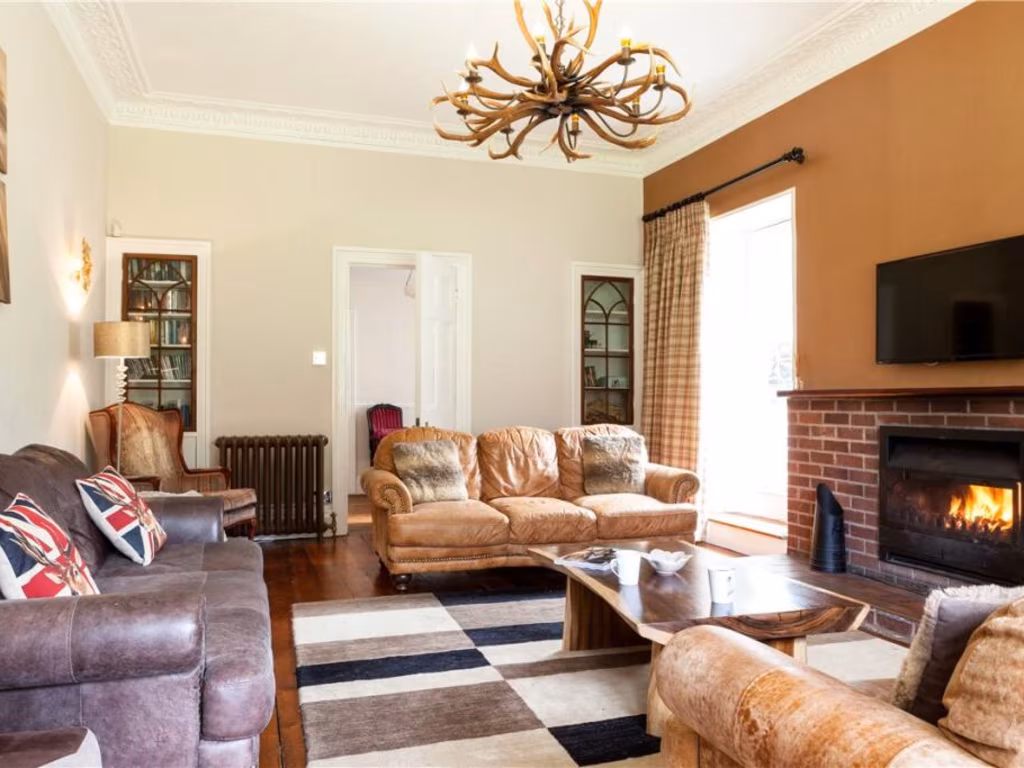
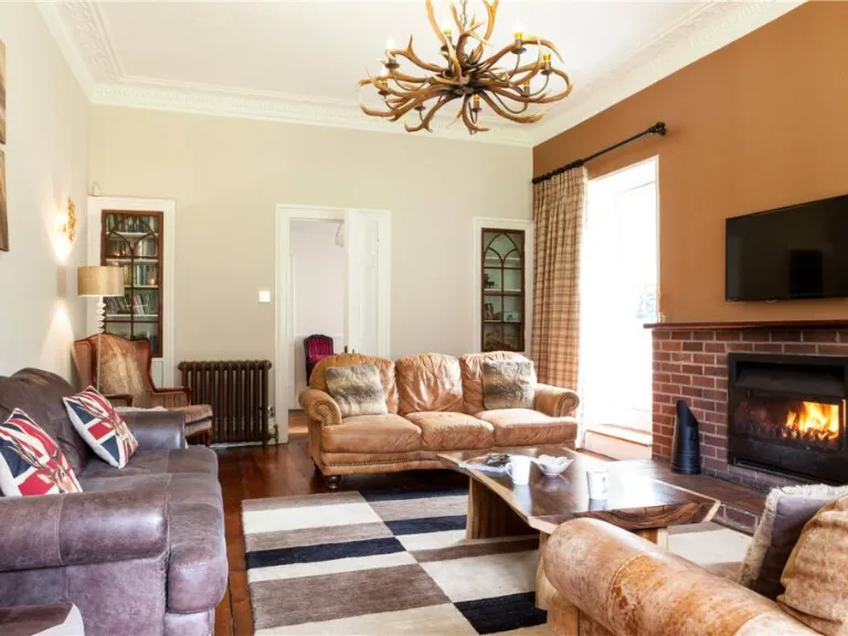
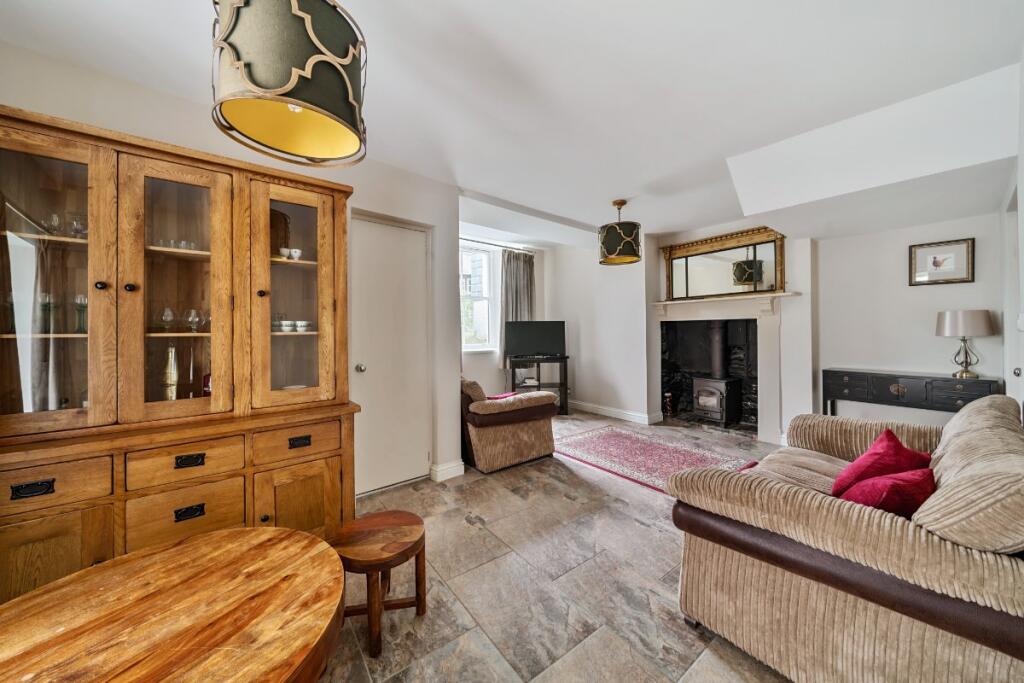
- Sitting Room:
- Reception:
- Sitting Room:
- Dining Room:
- Drawing Room:
- Utility:
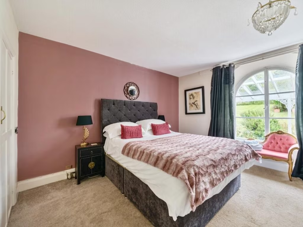
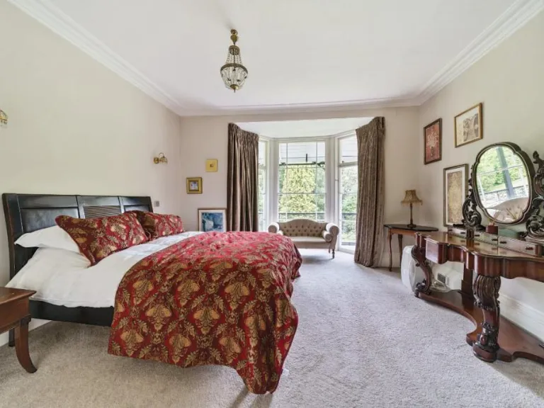
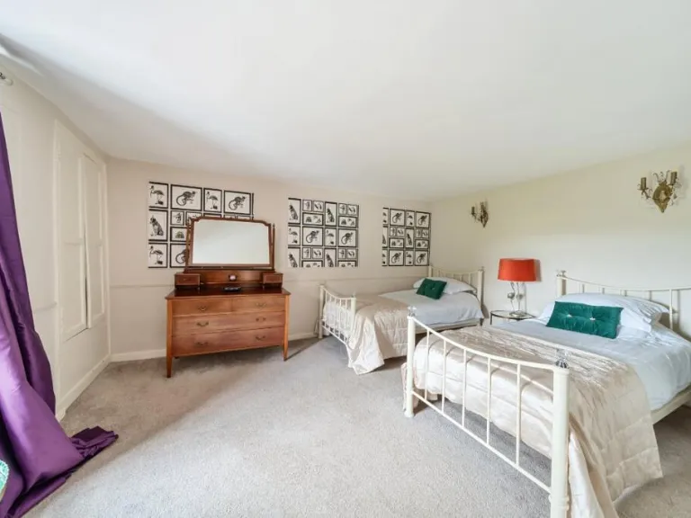
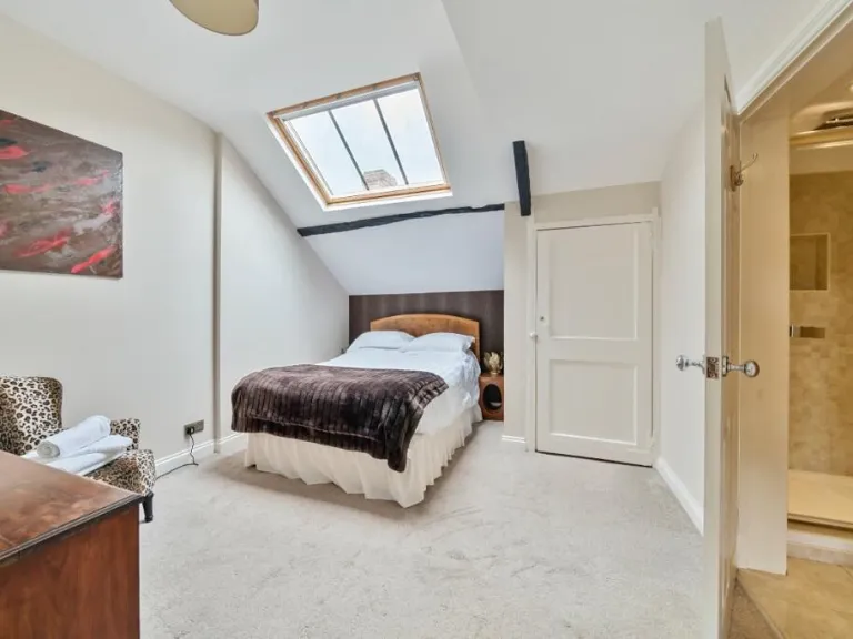
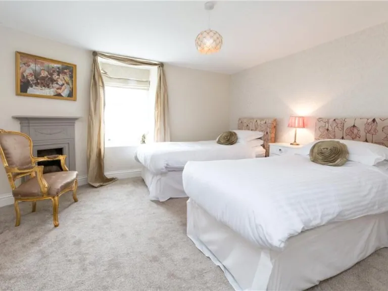
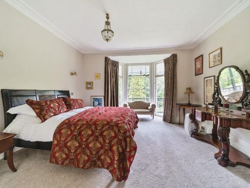
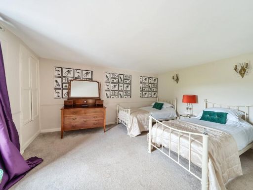
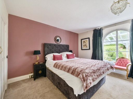
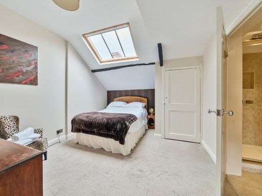
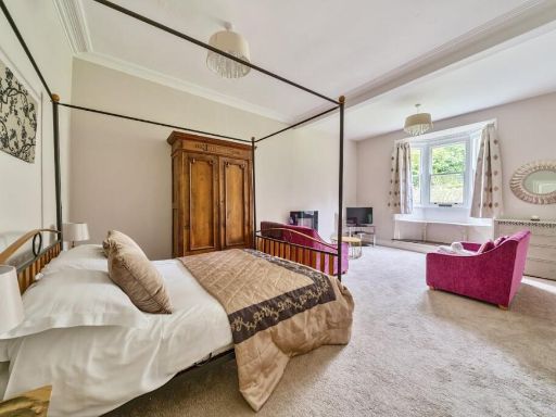
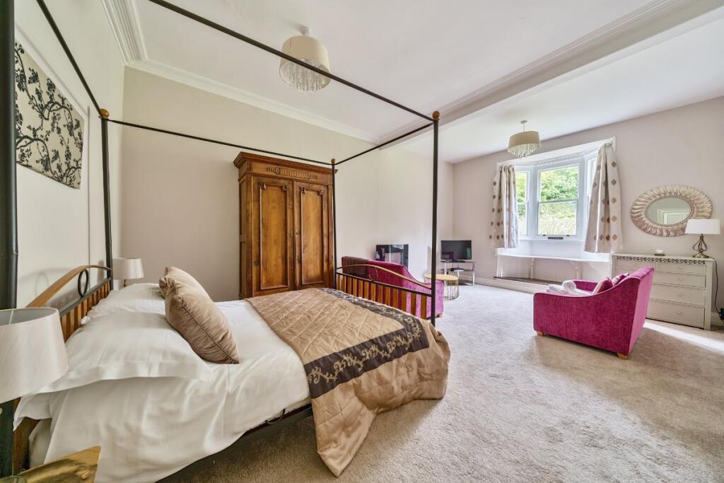
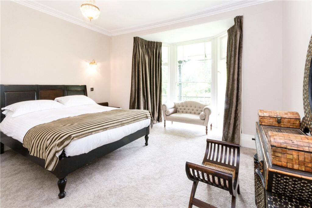
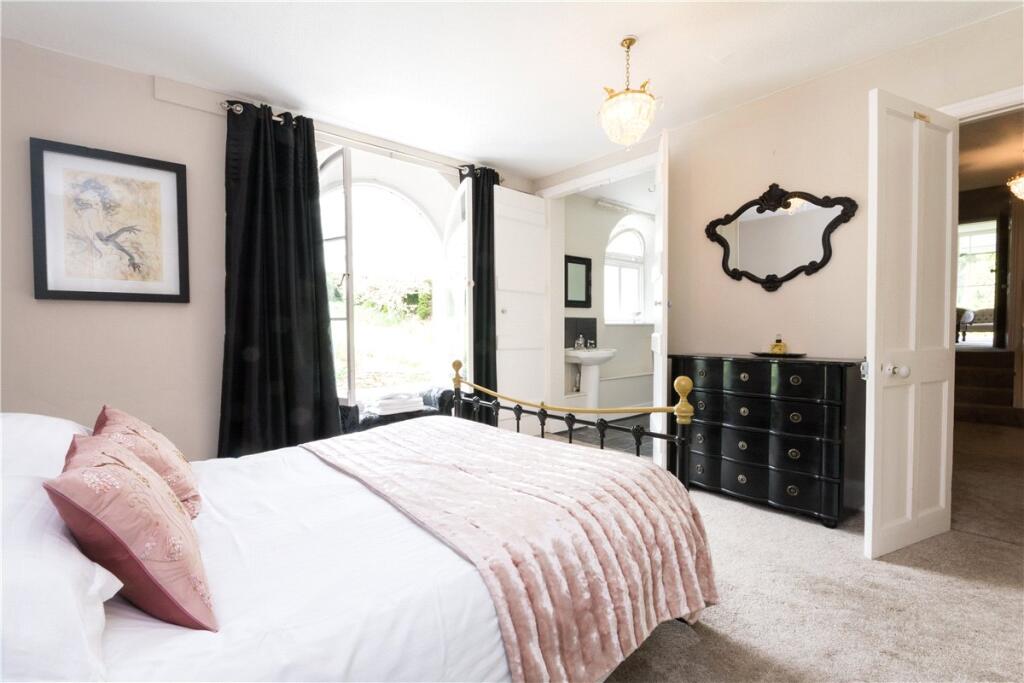
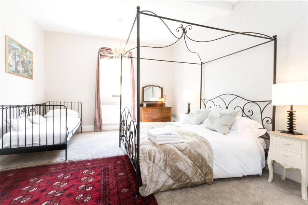
- Bedroom 1:
- Bedroom 2:
- Bedroom 3:
- Bedroom 4:
- Bedroom 5:
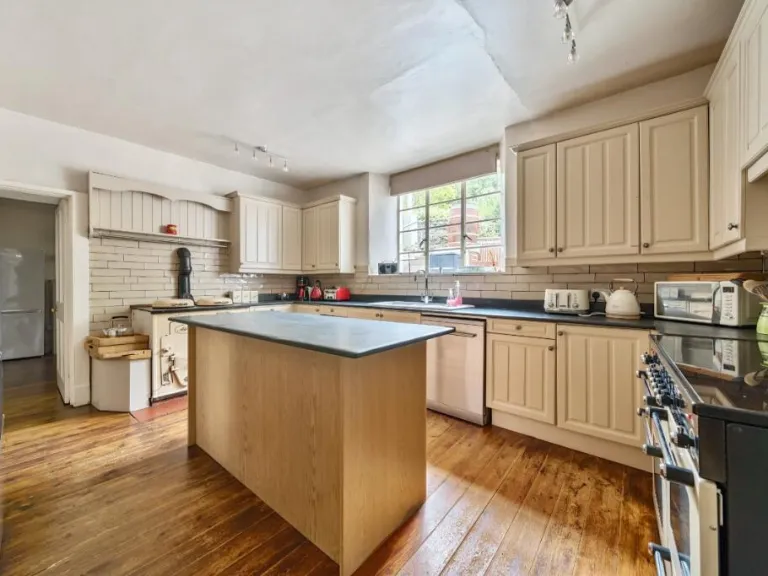
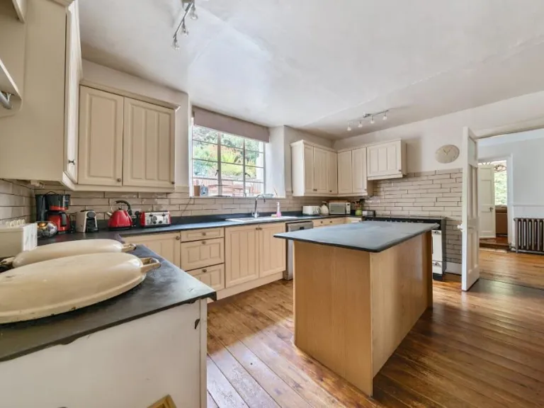
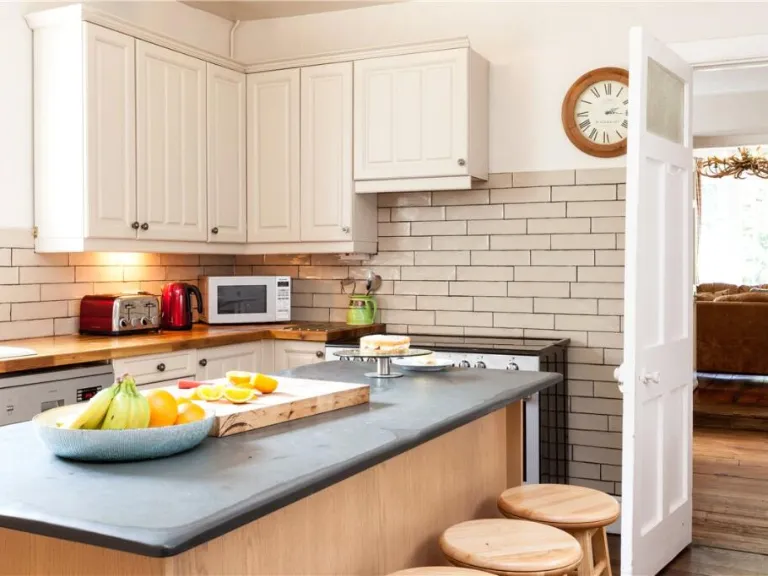
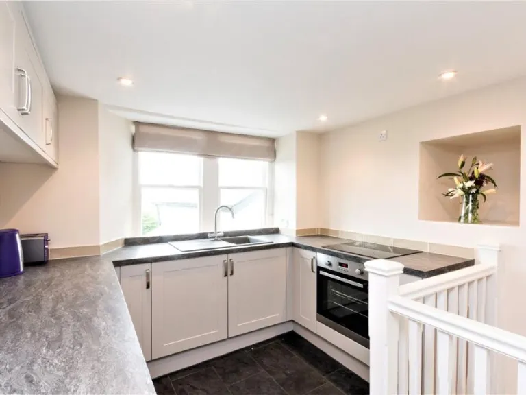
- Kitchen:
- Dining:
- Bedroom:
- Store:
Textual Property Features
- Is Listed Building
- Has Garden
- Success
Detected Visual Features
- Georgian
- large garden
- rural
- historic
- arched windows
- iron balcony
- mature trees
- landscape
- period property
- high ceilings
- large rooms
- symmetrical
- sash windows
- rendered exterior
- landscaped garden
- character property
Nearby Schools
- Bratton Fleming Community Primary School
- The Shoreline Academy
- Ashleigh CofE Primary School
- Goodleigh Church of England Primary School
- Marwood School
- Swimbridge Church of England Primary School
- Bishops Tawton Primary School
- The Park Community School
- Our Lady's Catholic Primary School, Barnstaple
- Pilton Community College
- Horwood and Newton Tracey Community Primary School
- Holywell Church of England School
- Landkey Community Primary Academy
- Fremington Primary School
- Sticklepath Community Primary Academy
- Eden Park Academy
- Pilton Bluecoat Church of England Academy
- Umberleigh Primary Academy
- Roundswell Community Primary Academy
- Newport Community School Primary Academy
- Orchard Vale Community School
- Yeo Valley Primary School
- Pilton Infants' Academy
Nearest General Shops
- Id: 30164272
- Tags:
- Brand: Homebase
- Brand:wikidata: Q9293447
- Brand:wikipedia: en:Homebase
- Building: retail
- Contact:
- Website: https://store.homebase.co.uk/barnstaple/rose-lane
- Name: Homebase
- Shop: doityourself
- TagsNormalized:
- homebase
- retail
- doityourself
- shop
- Lat: 51.072248
- Lon: -4.0338359
- FullGeoHash: gcj4s1qtkv1f
- PartitionGeoHash: gcj4
- Images:
- FoodStandards: null
- Distance: 839.5
,- Id: 993529010
- Tags:
- Name: Jon Beer Auto Services
- Shop: car_repair
- TagsNormalized:
- service
- car repair
- repair
- shop
- Lat: 51.0650858
- Lon: -4.0261135
- FullGeoHash: gcj4s2h78vbn
- PartitionGeoHash: gcj4
- Images:
- FoodStandards: null
- Distance: 354.1
,- Id: 993532233
- Tags:
- TagsNormalized:
- Lat: 51.0650622
- Lon: -4.0267036
- FullGeoHash: gcj4s25ge181
- PartitionGeoHash: gcj4
- Images:
- FoodStandards: null
- Distance: 312.7
}
Nearest Grocery shops
- Id: 1830276288
- Tags:
- Brand: Spar
- Brand:wikidata: Q610492
- Brand:wikipedia: en:Spar (retailer)
- Name: Spar
- Shop: convenience
- TagsNormalized:
- Lat: 51.0765062
- Lon: -4.0496533
- FullGeoHash: gcj4ef5nhnze
- PartitionGeoHash: gcj4
- Images:
- FoodStandards: null
- Distance: 1826.8
,- Id: 9556879512
- Tags:
- Name: SPAR
- Shop: convenience
- TagsNormalized:
- Lat: 51.0723095
- Lon: -4.0484163
- FullGeoHash: gcj4eckjc0d1
- PartitionGeoHash: gcj4
- Images:
- FoodStandards: null
- Distance: 1460.6
,- Id: 465201204
- Tags:
- Name: Best One
- Shop: convenience
- TagsNormalized:
- Lat: 51.0736649
- Lon: -4.027941
- FullGeoHash: gcj4s3dvwjjw
- PartitionGeoHash: gcj4
- Images:
- FoodStandards: null
- Distance: 1001.8
}
Nearest Supermarkets
- Id: 182192524
- Tags:
- Addr:
- City: Barnstaple
- Housename: Barnstaple Retail Park
- Postcode: EX31 2AS
- Alt_name: Tesco Barnstaple Taw View Extra
- Brand: Tesco Extra
- Brand:wikidata: Q25172225
- Brand:wikipedia: en:Tesco Extra
- Building: yes
- Name: Tesco Extra
- Shop: supermarket
- Website: https://www.tesco.com/store-locator/devon/barnstaple-retail-park
- Wheelchair: yes
- TagsNormalized:
- tesco
- tesco extra
- supermarket
- shop
- Lat: 51.0729808
- Lon: -4.0604758
- FullGeoHash: gcj4e9e38j9v
- PartitionGeoHash: gcj4
- Images:
- FoodStandards: null
- Distance: 2236.7
,- Id: 53158340
- Tags:
- Addr:
- City: Barnstaple
- Postcode: EX32 8PB
- Street: Old Station Road
- Alt_name: LIDL Newport
- Brand: Lidl
- Brand:wikidata: Q151954
- Building: yes
- Fhrs:
- Name: Lidl
- Shop: supermarket
- TagsNormalized:
- Lat: 51.0746418
- Lon: -4.0449273
- FullGeoHash: gcj4ecye6779
- PartitionGeoHash: gcj4
- Images:
- FoodStandards:
- Id: 177957
- FHRSID: 177957
- LocalAuthorityBusinessID: PI/000044507
- BusinessName: Lidl
- BusinessType: Retailers - supermarkets/hypermarkets
- BusinessTypeID: 7840
- AddressLine1: Old Station Road
- AddressLine2: Barnstaple
- AddressLine3: Devon
- AddressLine4: null
- PostCode: EX32 8PB
- RatingValue: 5
- RatingKey: fhrs_5_en-GB
- RatingDate: 2015-10-15
- LocalAuthorityCode: 075
- LocalAuthorityName: North Devon
- LocalAuthorityWebSite: http://www.northdevon.gov.uk
- LocalAuthorityEmailAddress: customerservices@northdevon.gov.uk
- Scores:
- Hygiene: 0
- Structural: 0
- ConfidenceInManagement: 0
- NewRatingPending: false
- Geocode:
- Longitude: -4.04597400000000
- Latitude: 51.07568900000000
- Distance: 1449.3
,- Id: 30164105
- Tags:
- Addr:
- City: Barnstaple
- Postcode: EX32 8PG
- Street: Rose Lane
- Alt_name: Tesco Barnstaple Superstore
- Branch: Barnstaple
- Brand: Tesco
- Brand:wikidata: Q487494
- Brand:wikipedia: en:Tesco
- Building: yes
- Contact:
- Website: https://www.tesco.com/store-locator/barnstaple/rose-lane
- Name: Tesco
- Shop: supermarket
- TagsNormalized:
- Lat: 51.0730159
- Lon: -4.0361908
- FullGeoHash: gcj4s1scvunn
- PartitionGeoHash: gcj4
- Images:
- FoodStandards: null
- Distance: 969.6
}
Nearest Religious buildings
- Id: 359847868
- Tags:
- Amenity: place_of_worship
- Building: church
- Denomination: anglican
- Name: St Paul
- Religion: christian
- Wheelchair: no
- Wikidata: Q17526635
- TagsNormalized:
- place of worship
- church
- anglican
- paul
- christian
- Lat: 51.0622492
- Lon: -4.0126491
- FullGeoHash: gcj4kxw54mpv
- PartitionGeoHash: gcj4
- Images:
- FoodStandards: null
- Distance: 1327.1
,- Id: 860972080
- Tags:
- Amenity: place_of_worship
- Building: church
- Denomination: anglican
- Name: St John The Baptist
- Religion: christian
- Wikidata: Q54817584
- TagsNormalized:
- place of worship
- church
- anglican
- baptist
- christian
- Lat: 51.0709493
- Lon: -4.0468781
- FullGeoHash: gcj4ecjjufuz
- PartitionGeoHash: gcj4
- Images:
- FoodStandards: null
- Distance: 1288.1
,- Id: 4050079739
- Tags:
- Addr:
- City: Barnstaple
- Postcode: EX32 8PT
- Street: Stoat Park
- Amenity: place_of_worship
- Denomination: evangelical
- Name: Whiddon Valley Evangelical Church
- Religion: christian
- TagsNormalized:
- place of worship
- evangelical
- church
- christian
- Lat: 51.0741298
- Lon: -4.0318713
- FullGeoHash: gcj4s3b06efg
- PartitionGeoHash: gcj4
- Images:
- FoodStandards: null
- Distance: 1029
}
Nearest Medical buildings
- Id: 412082835
- Tags:
- Amenity: dentist
- Healthcare: dentist
- TagsNormalized:
- Lat: 51.0733407
- Lon: -4.0367411
- FullGeoHash: gcj4s1sec0g8
- PartitionGeoHash: gcj4
- Images:
- FoodStandards: null
- Distance: 1017.4
,- Id: 412083547
- Tags:
- Amenity: pharmacy
- Brand: Lloyds Pharmacy
- Brand:wikidata: Q6662870
- Brand:wikipedia: en:LloydsPharmacy
- Dispensing: yes
- Healthcare: pharmacy
- Name: Lloyds Pharmacy
- Wheelchair: yes
- TagsNormalized:
- pharmacy
- lloyds pharmacy
- health
- healthcare
- Lat: 51.0727476
- Lon: -4.036784
- FullGeoHash: gcj4s1s8245w
- PartitionGeoHash: gcj4
- Images:
- FoodStandards: null
- Distance: 958.1
,- Id: 387735016
- Tags:
- Amenity: pharmacy
- Dispensing: yes
- Name: Lloyds Pharmacy
- Operator: Lloyds
- TagsNormalized:
- Lat: 51.0698745
- Lon: -4.0420391
- FullGeoHash: gcj4s0bxtdt5
- PartitionGeoHash: gcj4
- Images:
- FoodStandards: null
- Distance: 940.4
,- Id: 387733981
- Tags:
- Amenity: doctors
- Name: Litchdon Medical Centre
- TagsNormalized:
- Lat: 51.069701
- Lon: -4.0418681
- FullGeoHash: gcj4s0by9dk8
- PartitionGeoHash: gcj4
- Images:
- FoodStandards: null
- Distance: 919.4
}
Nearest Leisure Facilities
- Id: 446850407
- Tags:
- TagsNormalized:
- Lat: 51.0743605
- Lon: -4.0225334
- FullGeoHash: gcj4s3ycsnve
- PartitionGeoHash: gcj4
- Images:
- FoodStandards: null
- Distance: 1214.1
,- Id: 388702157
- Tags:
- TagsNormalized:
- Lat: 51.0726848
- Lon: -4.0402634
- FullGeoHash: gcj4s13zzn3r
- PartitionGeoHash: gcj4
- Images:
- FoodStandards: null
- Distance: 1075
,- Id: 830008821
- Tags:
- Addr:
- City: Barnstaple
- Country: GB
- County: Devon
- Parentstreet: Whiddon Drive
- Postcode: EX32 8QD
- Street: Barum Gate Retail Park
- Suburb: Whiddon Valley
- Unit: 4
- Building: yes
- Leisure: trampoline_park
- Name: Junglaroo
- TagsNormalized:
- Lat: 51.0727813
- Lon: -4.032445
- FullGeoHash: gcj4s1x8t0rp
- PartitionGeoHash: gcj4
- Images:
- FoodStandards: null
- Distance: 882.3
,- Id: 361034870
- Tags:
- Leisure: golf_course
- Name: Portmore Golf Park
- TagsNormalized:
- Lat: 51.0682624
- Lon: -4.022214
- FullGeoHash: gcj4s2xn5w5g
- PartitionGeoHash: gcj4
- Images:
- FoodStandards: null
- Distance: 729.8
,- Id: 2556867175
- Tags:
- Leisure: playground
- Source: survey
- TagsNormalized:
- Lat: 51.0658084
- Lon: -4.0411271
- FullGeoHash: gcj4s01rfuth
- PartitionGeoHash: gcj4
- Images:
- FoodStandards: null
- Distance: 703.3
}
Nearest Tourist attractions
- Id: 2562184305
- Tags:
- Source: local_knowledge
- Tourism: camp_site
- TagsNormalized:
- Lat: 51.0566034
- Lon: -3.9980379
- FullGeoHash: gcj4mn8dqbwy
- PartitionGeoHash: gcj4
- Images:
- FoodStandards: null
- Distance: 2492
,- Id: 48369626
- Tags:
- Building: yes
- Name: Museum of Barnstaple & North Devon
- Tourism: museum
- Wikidata: Q40889239
- Wikipedia: en:Museum of Barnstaple and North Devon
- TagsNormalized:
- Lat: 51.0778844
- Lon: -4.0589772
- FullGeoHash: gcj4edkq4zz0
- PartitionGeoHash: gcj4
- Images:
- FoodStandards: null
- Distance: 2421.5
,- Id: 3586375900
- Tags:
- Addr:
- City: Barnstaple
- Housename: Weirholme
- Postcode: EX32 9BW
- Street: Burlington Grove
- Description: Weirholme Annex is an annex to Weirholme « historically referred to it as Burlington Villa » a late Regency villa in leafy area deep rooted in time. It is a fine Grade II listed building which has retained a lot of its original features.
- Guest_house: bed_and_breakfast
- Internet_access: yes
- Name: Weirholme Annex
- Phone: +44 1271 828398
- Reservation: required
- Rooms: 1
- Smoking: outside
- Tourism: guest_house
- Website: https://www.weirholme-annex.co.uk
- Wheelchair: no
- TagsNormalized:
- Lat: 51.069864
- Lon: -4.0432005
- FullGeoHash: gcj4ebzzd8ej
- PartitionGeoHash: gcj4
- Images:
- FoodStandards: null
- Distance: 1006.4
}
Nearest Train stations
- Id: 152203117
- Tags:
- Amenity: pub
- Building: train_station
- Name: The Puffing Billy
- Wikidata: Q79684460
- TagsNormalized:
- bar
- pub
- station
- train
- train station
- Lat: 50.9571627
- Lon: -4.1655966
- FullGeoHash: gcj1chqwyxd5
- PartitionGeoHash: gcj1
- Images:
- FoodStandards: null
- Distance: 15229.1
,- Id: 9079211824
- Tags:
- Public_transport: station
- Railway: station
- Usage: tourism
- TagsNormalized:
- Lat: 51.1886258
- Lon: -4.0042878
- FullGeoHash: gcj5hys5m76w
- PartitionGeoHash: gcj5
- Images:
- FoodStandards: null
- Distance: 13886.5
,- Id: 1961614771
- Tags:
- Name: Portsmouth Arms
- Naptan:
- Network: National Rail
- Public_transport: station
- Railway: station
- Ref:
- Request_stop: yes
- Wikidata: Q2659294
- Wikipedia: en:Portsmouth Arms railway station
- TagsNormalized:
- Lat: 50.9570164
- Lon: -3.951232
- FullGeoHash: gcj1yh6y1s7f
- PartitionGeoHash: gcj1
- Images:
- FoodStandards: null
- Distance: 13234.3
,- Id: 32037600
- Tags:
- Name: Chapelton
- Naptan:
- Network: National Rail
- Public_transport: station
- Railway: station
- Ref:
- Request_stop: yes
- Wikidata: Q2291762
- Wikipedia: en:Chapelton railway station
- TagsNormalized:
- Lat: 51.016229
- Lon: -4.0245509
- FullGeoHash: gcj4hrjrj4m7
- PartitionGeoHash: gcj4
- Images:
- FoodStandards: null
- Distance: 5430.2
,- Id: 6900362324
- Tags:
- Addr:
- City: Barnstaple
- Postcode: EX31 2AU
- Street: Station Road
- Internet_access: yes
- Internet_access:fee: yes
- Name: Barnstaple
- Name:lt: Barnstaplas
- Naptan:
- Network: National Rail
- Old_name: Barnstaple Junction
- Operator: Great Western Railway
- Public_transport: station
- Railway: station
- Ref:
- Wheelchair: yes
- Wikidata: Q800448
- Wikipedia: en:Barnstaple railway station
- TagsNormalized:
- Lat: 51.0737586
- Lon: -4.0632151
- FullGeoHash: gcj4e99q0nxj
- PartitionGeoHash: gcj4
- Images:
- FoodStandards: null
- Distance: 2446.7
}
Nearest Bus stations and stops
- Id: 1742818611
- Tags:
- Bus: yes
- Highway: bus_stop
- Name: Barnstaple Bus Station
- Public_transport: platform
- Wheelchair: yes
- TagsNormalized:
- Lat: 51.0787289
- Lon: -4.0563554
- FullGeoHash: gcj4edw70j4n
- PartitionGeoHash: gcj4
- Images:
- FoodStandards: null
- Distance: 2337.8
,- Id: 1742818587
- Tags:
- Bus: yes
- Highway: bus_stop
- Name: Barnstaple Bus Station
- Public_transport: platform
- Ref: K
- Wheelchair: yes
- TagsNormalized:
- Lat: 51.0787761
- Lon: -4.0562588
- FullGeoHash: gcj4edw76mfp
- PartitionGeoHash: gcj4
- Images:
- FoodStandards: null
- Distance: 2336.2
,- Id: 691465084
- Tags:
- Bus: yes
- Highway: bus_stop
- Public_transport: platform
- TagsNormalized:
- Lat: 51.0790018
- Lon: -4.0235728
- FullGeoHash: gcj4s6whgbnd
- PartitionGeoHash: gcj4
- Images:
- FoodStandards: null
- Distance: 1656.9
,- Id: 5805773172
- Tags:
- Bench: yes
- Bin: no
- Bus: yes
- Highway: bus_stop
- Lit: yes
- Public_transport: platform
- Shelter: yes
- Tactile_paving: no
- TagsNormalized:
- Lat: 51.0623102
- Lon: -4.0078182
- FullGeoHash: gcj4kz9ee0d0
- PartitionGeoHash: gcj4
- Images:
- FoodStandards: null
- Distance: 1656.8
,- Id: 5805773171
- Tags:
- Bench: yes
- Bin: no
- Bus: yes
- Highway: bus_stop
- Name: Bakery Way
- Public_transport: platform
- Shelter: yes
- Tactile_paving: yes
- TagsNormalized:
- Lat: 51.0634329
- Lon: -4.009855
- FullGeoHash: gcj4kzb459g6
- PartitionGeoHash: gcj4
- Images:
- FoodStandards: null
- Distance: 1498.3
}
Nearest Hotels
- Id: 417976227
- Tags:
- Alt_name: The Tower
- Building: yes
- Castle_type: stately
- Historic: castle
- Name: Tawstock Castle
- Start_date: C18
- Tourism: hotel
- Wikidata: Q26545384
- TagsNormalized:
- Lat: 51.058441
- Lon: -4.0637838
- FullGeoHash: gcj47wbufzr0
- PartitionGeoHash: gcj4
- Images:
- FoodStandards: null
- Distance: 2389.2
,- Id: 9387330499
- Tags:
- Name: Imperial Hotel
- Tourism: hotel
- Wikidata: Q26665137
- TagsNormalized:
- Lat: 51.0772065
- Lon: -4.0574403
- FullGeoHash: gcj4edm6qc3h
- PartitionGeoHash: gcj4
- Images:
- FoodStandards: null
- Distance: 2290.3
,- Id: 12869359
- Tags:
- Addr:
- City: Barnstaple
- Postcode: EX32 8RY
- Brand: Premier Inn
- Brand:wikidata: Q2108626
- Brand:wikipedia: en:Premier Inn
- Internet_access: wlan
- Internet_access:fee: customers
- Internet_access:operator: Virgin Media
- Internet_access:ssid: Premier Inn Free Wi-Fi
- Name: Premier Inn
- Operator: Premier Inn
- Tourism: hotel
- Type: multipolygon
- TagsNormalized:
- Lat: 51.0735192
- Lon: -4.0333461
- FullGeoHash: gcj4s1xhb4p1
- PartitionGeoHash: gcj4
- Images:
- FoodStandards: null
- Distance: 971.9
}
Tags
- Georgian
- large garden
- rural
- historic
- arched windows
- iron balcony
- mature trees
- landscape
- Georgian
- period property
- high ceilings
- large rooms
- symmetrical
- sash windows
- rendered exterior
- landscaped garden
- character property
Local Market Stats
- Average Price/sqft: £259
- Avg Income: £40500
- Social Housing: 5%
- Planning Success Rate: 94%
Similar Properties
 Leisure facility for sale in Landkey Road, Barnstaple, Devon, EX32 — £1,500,000 • 14 bed • 1 bath • 10190 ft²
 7 bedroom detached house for sale in Lydacott, Barnstaple, EX31 — £1,500,000 • 7 bed • 5 bath • 15129 ft²
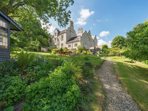 5 bedroom semi-detached house for sale in Bishops Tawton, Barnstaple, EX32 — £650,000 • 5 bed • 2 bath • 3411 ft²
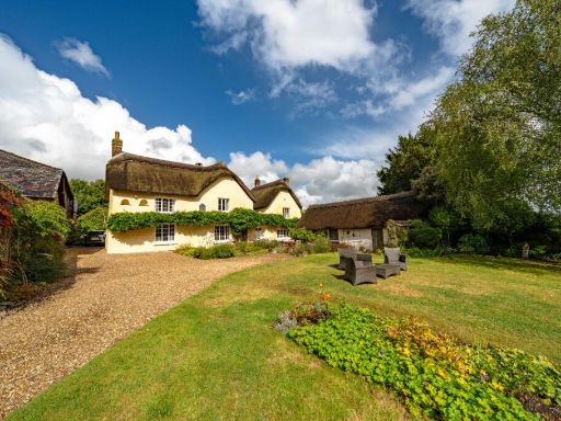 7 bedroom detached house for sale in Landkey, North Devon EX32 — £1,150,000 • 7 bed • 4 bath • 3059 ft²
 House for sale in Gammaton, Bideford, Devon, EX39 — £1,100,000 • 1 bed • 1 bath • 3012 ft²
 3 bedroom detached house for sale in Landkey, Barnstaple, EX32 — £835,000 • 3 bed • 1 bath • 3738 ft²
Meta
- {
"@context": "https://schema.org",
"@type": "Residence",
"name": "14 bedroom house for sale in Landkey Road, Barnstaple, Devo…",
"description": "",
"url": "https://propertypiper.co.uk/property/249b89bc-182b-41e6-8bc7-7a98022e22ff",
"image": "https://image-a.propertypiper.co.uk/fc1dc414-63f5-46c9-a0b8-92a9b8dfeb9a-1024.jpeg",
"address": {
"@type": "PostalAddress",
"streetAddress": "MOUNT SANDFORD HOUSE, LANDKEY ROAD",
"postalCode": "EX32 0HL",
"addressLocality": "North Devon",
"addressRegion": "North Devon",
"addressCountry": "England"
},
"geo": {
"@type": "GeoCoordinates",
"latitude": 51.06488670274918,
"longitude": -4.031170442101198
},
"numberOfRooms": 14,
"numberOfBathroomsTotal": 1,
"floorSize": {
"@type": "QuantitativeValue",
"value": 10190,
"unitCode": "FTK"
},
"offers": {
"@type": "Offer",
"price": 1495000,
"priceCurrency": "GBP",
"availability": "https://schema.org/InStock"
},
"additionalProperty": [
{
"@type": "PropertyValue",
"name": "Feature",
"value": "Georgian"
},
{
"@type": "PropertyValue",
"name": "Feature",
"value": "large garden"
},
{
"@type": "PropertyValue",
"name": "Feature",
"value": "rural"
},
{
"@type": "PropertyValue",
"name": "Feature",
"value": "historic"
},
{
"@type": "PropertyValue",
"name": "Feature",
"value": "arched windows"
},
{
"@type": "PropertyValue",
"name": "Feature",
"value": "iron balcony"
},
{
"@type": "PropertyValue",
"name": "Feature",
"value": "mature trees"
},
{
"@type": "PropertyValue",
"name": "Feature",
"value": "landscape"
},
{
"@type": "PropertyValue",
"name": "Feature",
"value": "Georgian"
},
{
"@type": "PropertyValue",
"name": "Feature",
"value": "period property"
},
{
"@type": "PropertyValue",
"name": "Feature",
"value": "high ceilings"
},
{
"@type": "PropertyValue",
"name": "Feature",
"value": "large rooms"
},
{
"@type": "PropertyValue",
"name": "Feature",
"value": "symmetrical"
},
{
"@type": "PropertyValue",
"name": "Feature",
"value": "sash windows"
},
{
"@type": "PropertyValue",
"name": "Feature",
"value": "rendered exterior"
},
{
"@type": "PropertyValue",
"name": "Feature",
"value": "landscaped garden"
},
{
"@type": "PropertyValue",
"name": "Feature",
"value": "character property"
}
]
}
High Res Floorplan Images
Compatible Floorplan Images
FloorplanImages Thumbnail