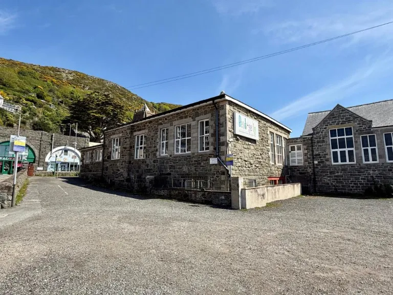
LL42 1AD - Leisure facility for sale in Bendigedig, King Edward Street…
View on Property Piper
Leisure facility for sale in Bendigedig, King Edward Street, Barmouth, LL42 1AD, LL42
Property Details
- Price: £495000
- Bedrooms: 1
- Bathrooms: 1
- Property Type: undefined
- Property SubType: undefined
Brochure Descriptions
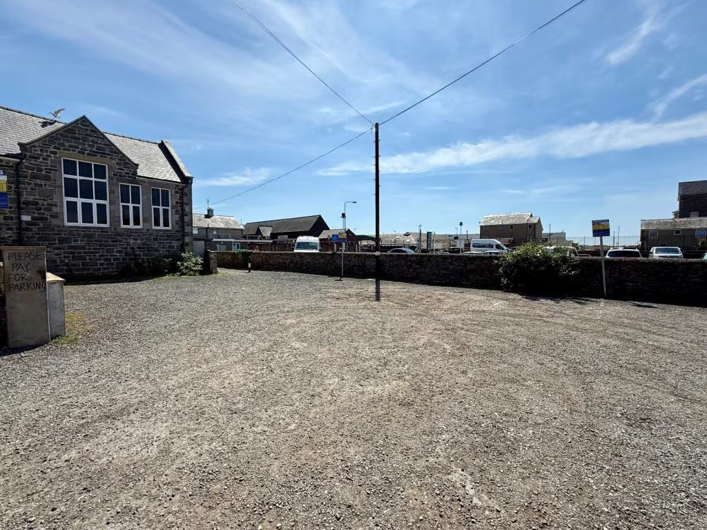
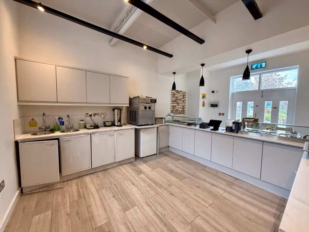
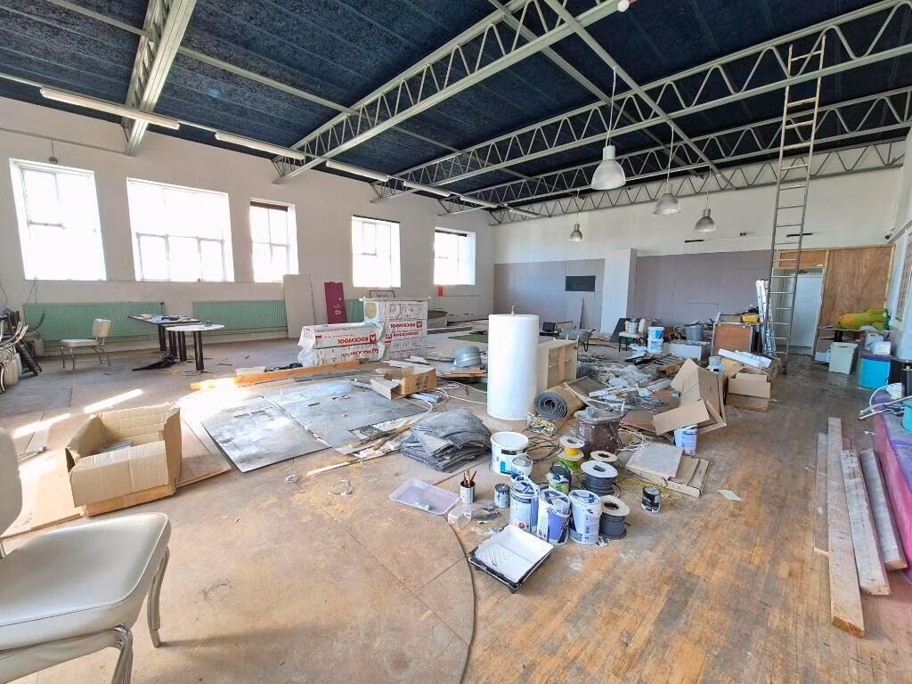
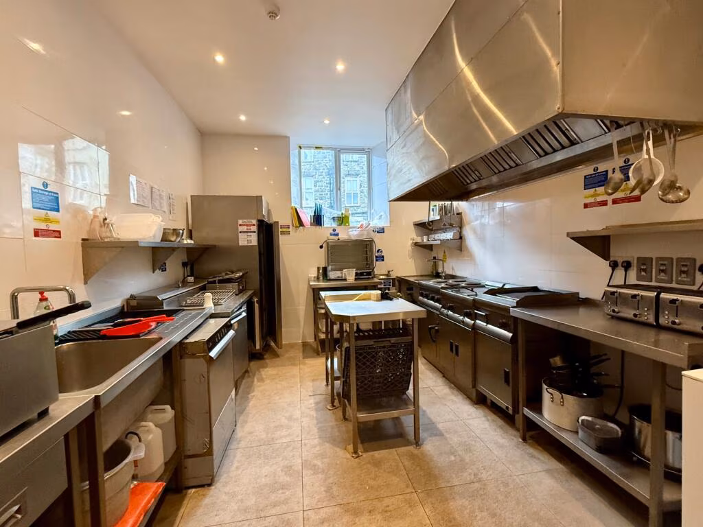
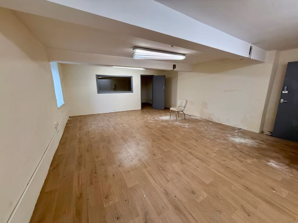
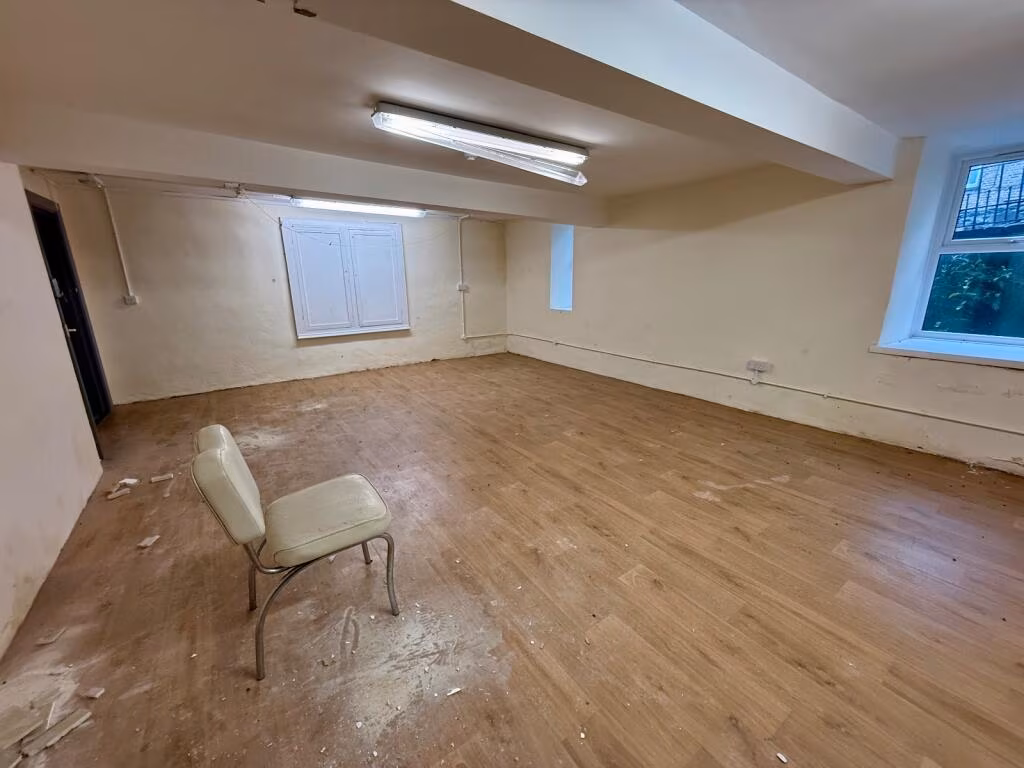
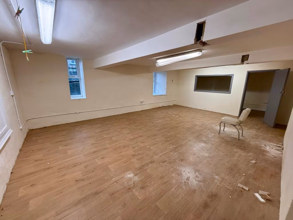
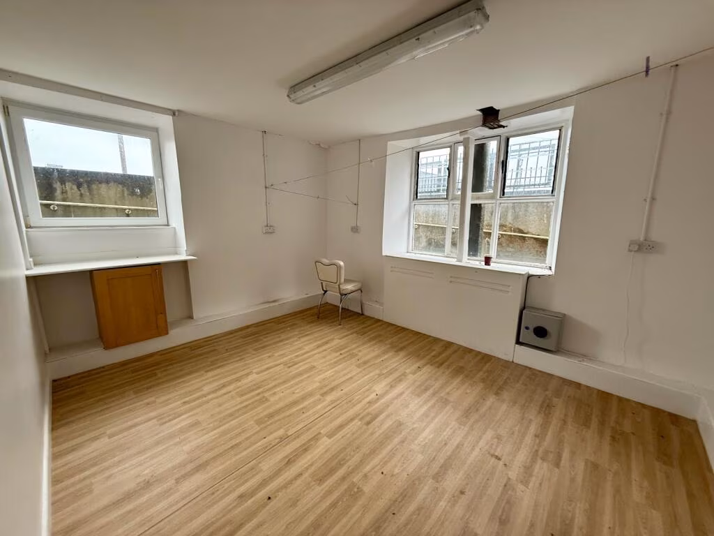
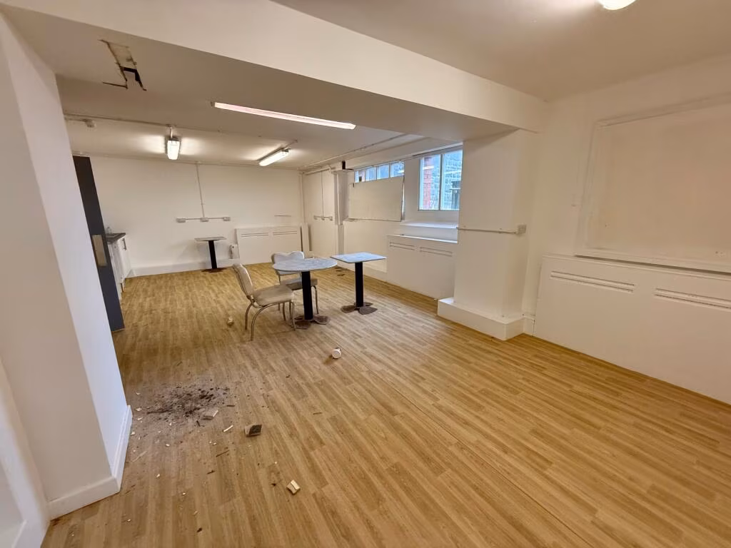
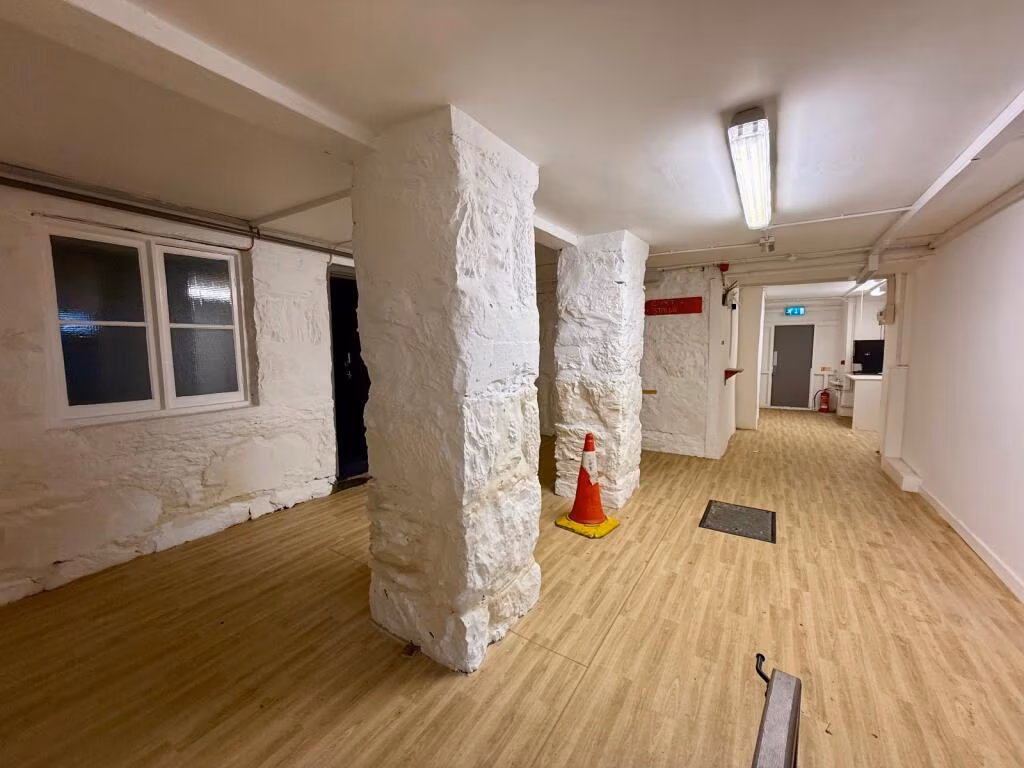
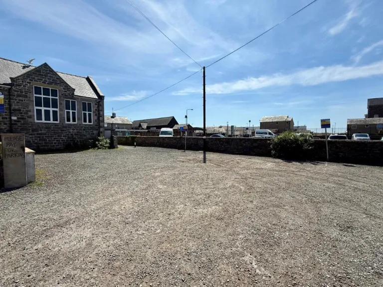
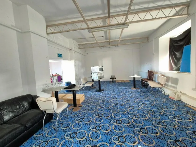
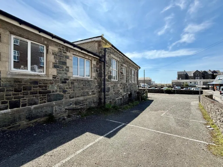
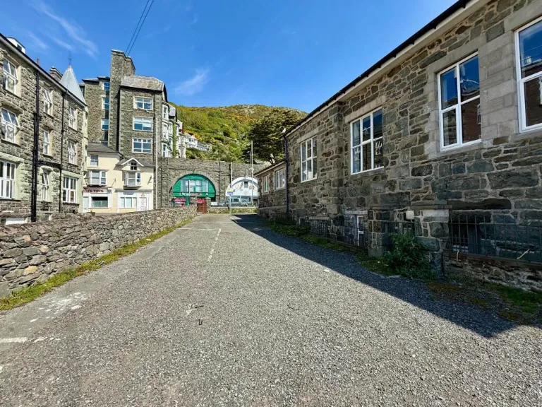
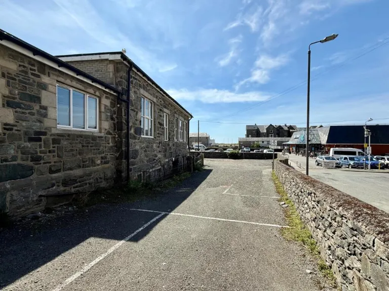
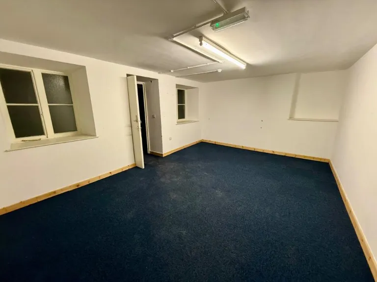
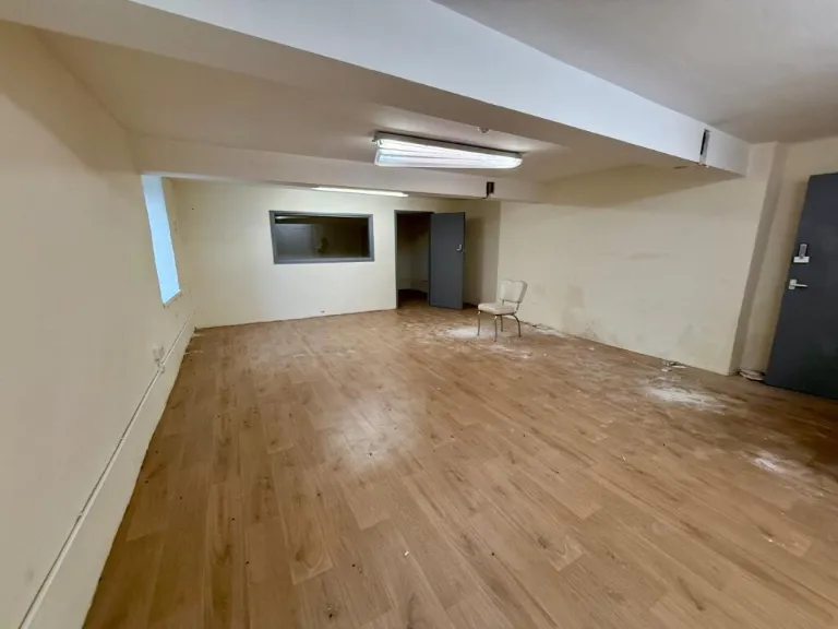
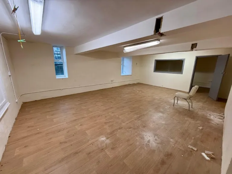
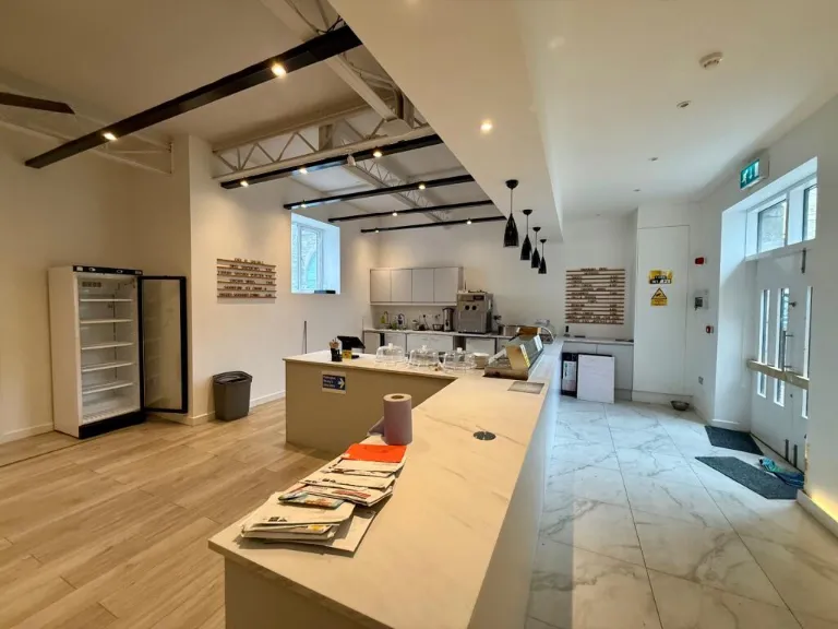
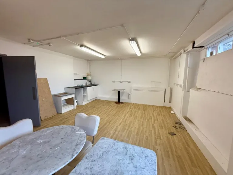
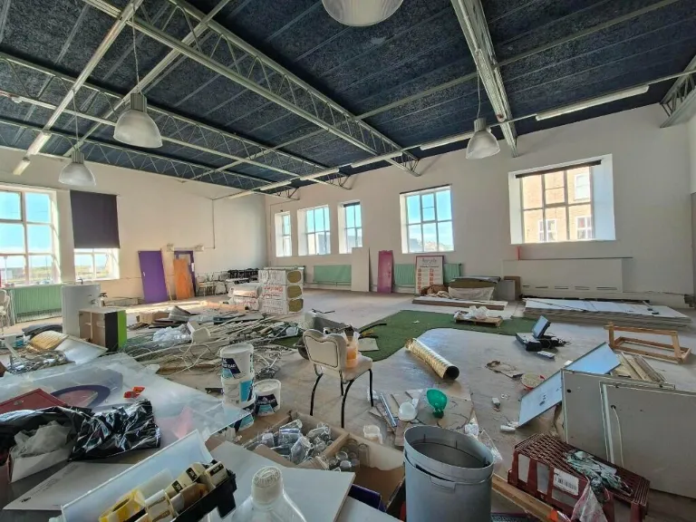
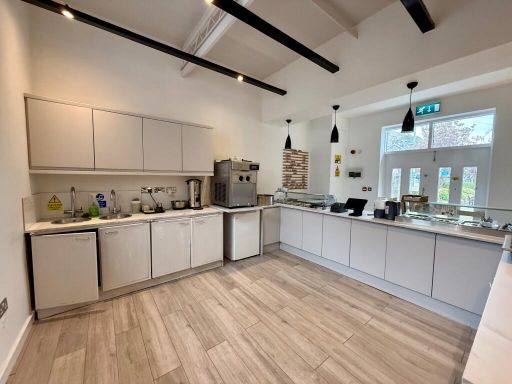
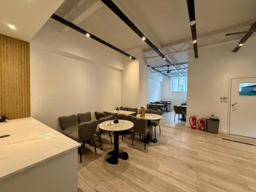
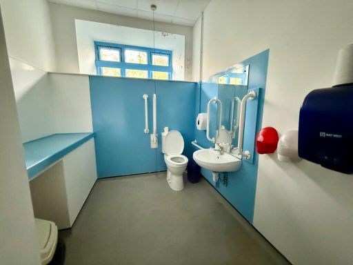
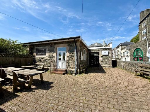
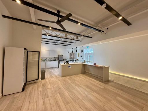
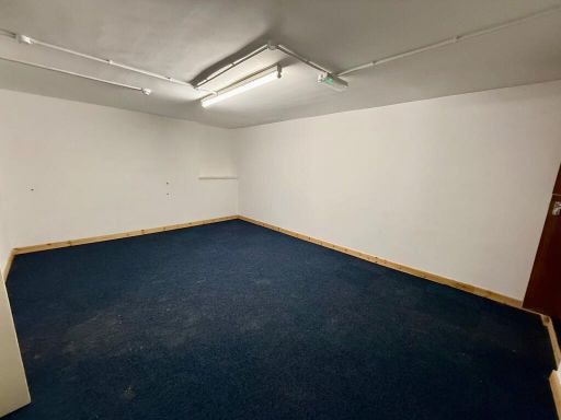
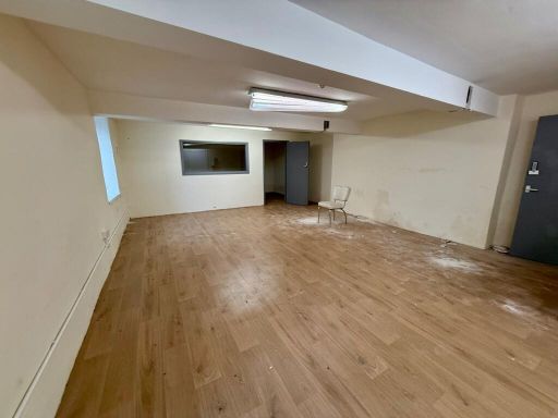
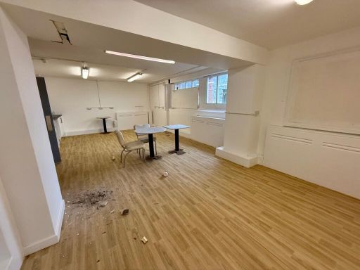
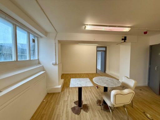
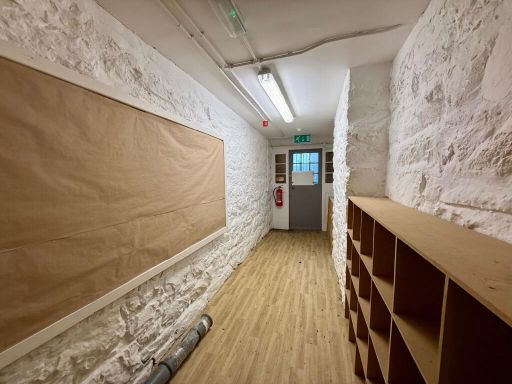
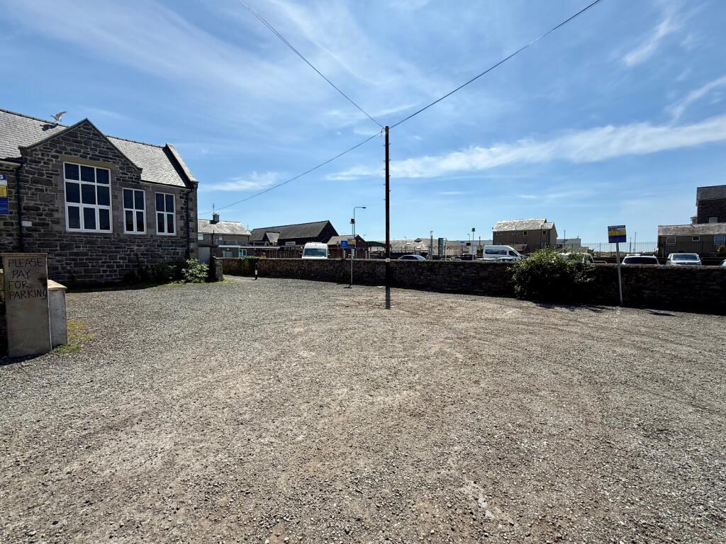
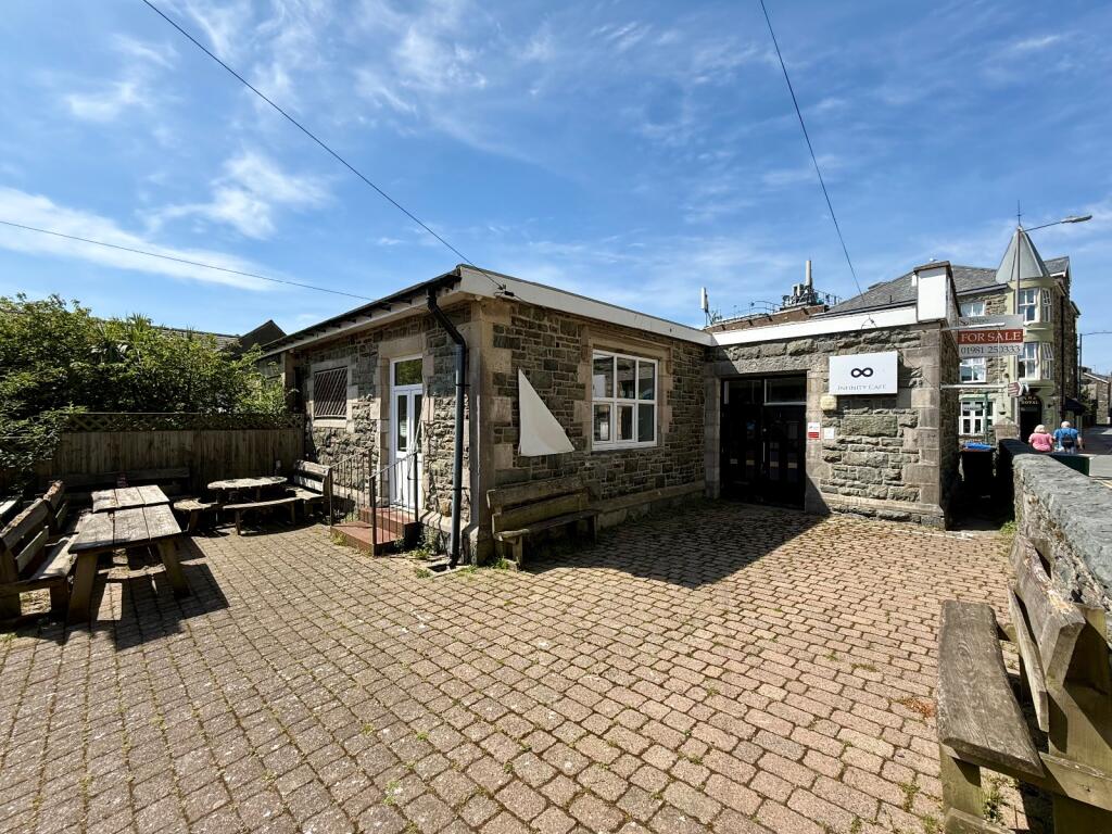
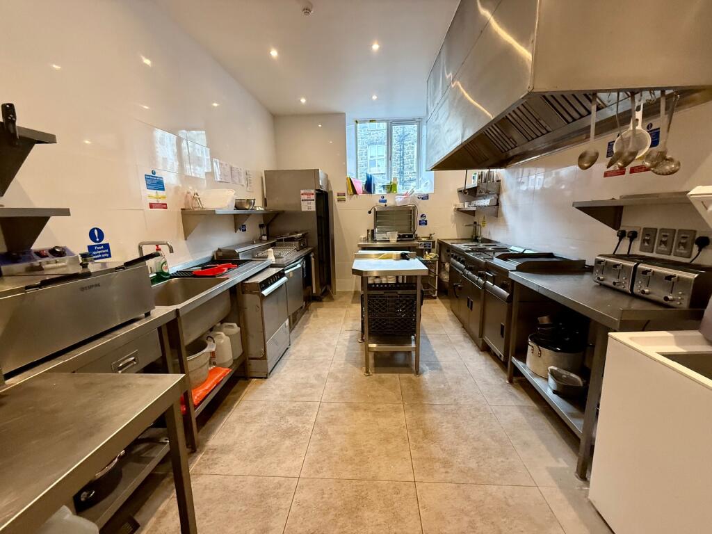
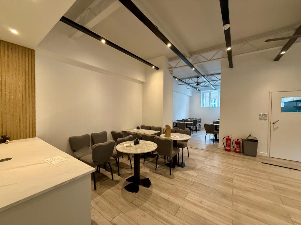
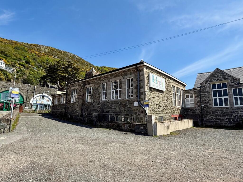
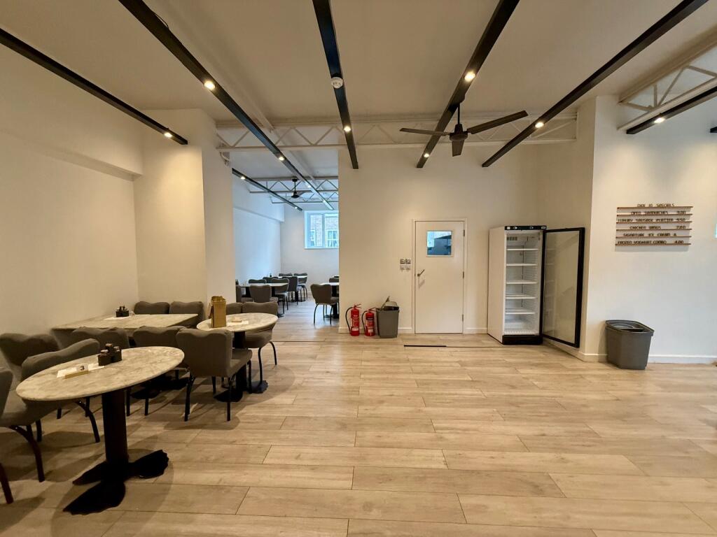
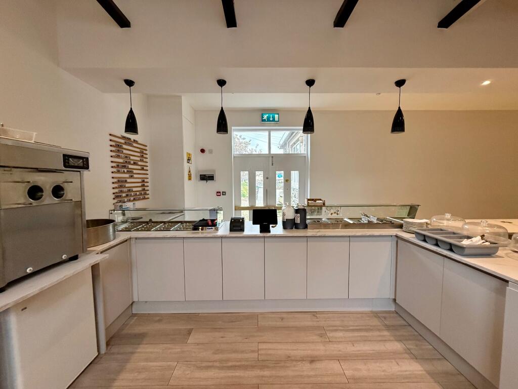
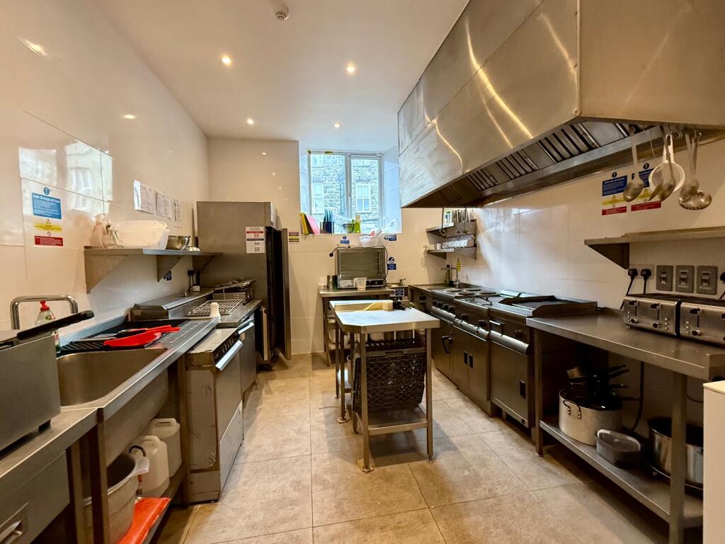
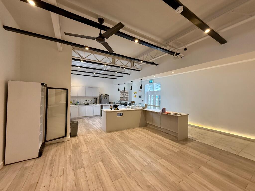
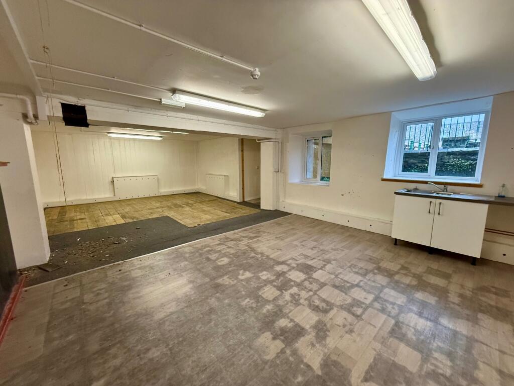
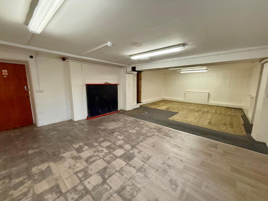
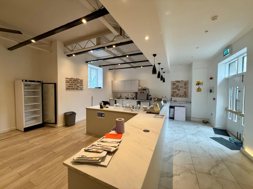
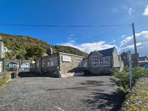
- This is a single-story building with a stone brick facade located in a partially secluded area at King Edward Street, Barmouth, visible from the surrounding valley hills. The property has a traditional, rustic architectural style, with a courtyard that features a paved and gravel area of average size suitable for parking and outdoor activities. The structure appears to be substantial, indicating moderate interior space, optimal perhaps for commercial use considering its robust exterior and structural form.
Image Descriptions
- building exterior Traditional stone building
- stone building and yard area Victorian
Textual Property Features
Detected Visual Features
- traditional
- stone
- solid structure
- historical
- commercial potential
- community building
- former school
- rustic
- stone walls
- industrial
- Victorian
- brickwork
- windows
- stone building
- parking area
- yard
- potential
- development opportunity
Nearest Bars And Restaurants
- Id: 5024704521
- Tags:
- Amenity: cafe
- Name: Bellevue Cafe
- Name:en: Bellevue Cafe
- TagsNormalized:
- Lat: 52.7226934
- Lon: -4.0549785
- FullGeoHash: gcm5gtz7bnku
- PartitionGeoHash: gcm5
- Images:
- FoodStandards: null
- Distance: 97
,- Id: 5024704322
- Tags:
- Amenity: cafe
- Name: Murray's
- Name:en: Murray's
- TagsNormalized:
- Lat: 52.7228033
- Lon: -4.0551812
- FullGeoHash: gcm5gtzhe6vs
- PartitionGeoHash: gcm5
- Images:
- FoodStandards: null
- Distance: 78.7
,- Id: 357207848
- Tags:
- Addr:
- Amenity: pub
- Area: yes
- Name: The Royal
- Outdoor_seating: yes
- TagsNormalized:
- Lat: 52.7233009
- Lon: -4.056488
- FullGeoHash: gcm5gtypkzxk
- PartitionGeoHash: gcm5
- Images:
- FoodStandards: null
- Distance: 30.4
,- Id: 4978282284
- Tags:
- TagsNormalized:
- Lat: 52.7231192
- Lon: -4.0560887
- FullGeoHash: gcm5gtyqqmc0
- PartitionGeoHash: gcm5
- Images:
- FoodStandards: null
- Distance: 18.8
,- Id: 544961650
- Tags:
- Addr:
- Amenity: fast_food
- Cuisine: fish_and_chips
- Drive_through: no
- Name: The Dolphin
- Outdoor_seating: no
- TagsNormalized:
- Lat: 52.723251
- Lon: -4.0559602
- FullGeoHash: gcm5gtyx1q2f
- PartitionGeoHash: gcm5
- Images:
- FoodStandards: null
- Distance: 6.4
}
Nearest General Shops
- Id: 544961655
- Tags:
- TagsNormalized:
- Lat: 52.7229742
- Lon: -4.0555223
- FullGeoHash: gcm5gtyve6xr
- PartitionGeoHash: gcm5
- Images:
- FoodStandards: null
- Distance: 49
,- Id: 71762131
- Tags:
- Addr:
- City: Barmouth
- Street: King Edward's Street
- Building: yes
- Building:colour: white
- Building:levels: 2
- Building:material: plaster
- Name: Full of Big Boys Toys
- Roof:
- Shop: toys
- Source: os_opendata_streetview
- TagsNormalized:
- Lat: 52.723519
- Lon: -4.0563277
- FullGeoHash: gcm5gwn2b8qc
- PartitionGeoHash: gcm5
- Images:
- FoodStandards: null
- Distance: 32.5
,- Id: 544961652
- Tags:
- Name: Ink Transmission
- Shop: tattoo
- TagsNormalized:
- Lat: 52.7231374
- Lon: -4.0557677
- FullGeoHash: gcm5gtywtc0m
- PartitionGeoHash: gcm5
- Images:
- FoodStandards: null
- Distance: 24.5
}
Nearest Grocery shops
- Id: 2473545773
- Tags:
- Amenity: fast_food
- Name: Plaice & pizza
- Shop: greengrocer
- Source: survey
- TagsNormalized:
- fast food
- food
- pizza
- greengrocer
- grocer
- shop
- Lat: 52.6959701
- Lon: -4.049732
- FullGeoHash: gcm5gc5062uc
- PartitionGeoHash: gcm5
- Images:
- FoodStandards: null
- Distance: 3066.9
,- Id: 544961738
- Tags:
- Name: Weigh Out
- Shop: food
- TagsNormalized:
- Lat: 52.7201768
- Lon: -4.0521418
- FullGeoHash: gcm5gv3m6320
- PartitionGeoHash: gcm5
- Images:
- FoodStandards: null
- Distance: 433.9
,- Id: 508532795
- Tags:
- Addr:
- City: Barmouth
- Housenumber: 1a
- Postcode: LL42 1LU
- Street: Station Road
- Brand: Iceland
- Brand:wikidata: Q721810
- Brand:wikipedia: en:Iceland (supermarket)
- Building: yes
- Fhrs:
- Name: Iceland
- Not:
- Shop: frozen_food
- Source:
- Source:addr:postcode: code-point_open
- Website: https://www.iceland.co.uk/store-finder/store?StoreID=404&StoreName=BARMOUTH
- TagsNormalized:
- iceland
- frozen food
- food
- shop
- Lat: 52.7223724
- Lon: -4.0557325
- FullGeoHash: gcm5gtydndd9
- PartitionGeoHash: gcm5
- Images:
- FoodStandards:
- Id: 115437
- FHRSID: 115437
- LocalAuthorityBusinessID: 4464
- BusinessName: Iceland Foods Ltd
- BusinessType: Retailers - supermarkets/hypermarkets
- BusinessTypeID: 7840
- AddressLine1: Iceland Ffordd Yr Orsaf
- AddressLine2: null
- AddressLine3: Abermaw
- AddressLine4: Gwynedd
- PostCode: LL42 1LU
- RatingValue: 5
- RatingKey: fhrs_5_en-GB
- RatingDate: 2019-03-28
- LocalAuthorityCode: 554
- LocalAuthorityName: Gwynedd
- LocalAuthorityWebSite: http://www.gwynedd.llyw.cymru
- LocalAuthorityEmailAddress: BwydaIechydaDiogelwch@gwynedd.llyw.cymru
- Scores:
- Hygiene: 0
- Structural: 5
- ConfidenceInManagement: 0
- NewRatingPending: false
- Geocode:
- Longitude: -4.05633401870728
- Latitude: 52.72266769409180
- Distance: 103.6
}
Nearest Supermarkets
- Id: 209879369
- Tags:
- Addr:
- Country: GB
- Postcode: LL53 5NF
- Street: Lower Cardiff Road
- Alt_name: LIDL Pwllheli
- Brand: Lidl
- Brand:wikidata: Q151954
- Building: yes
- Fhrs:
- Name: Lidl
- Shop: supermarket
- TagsNormalized:
- Lat: 52.8872669
- Lon: -4.420695
- FullGeoHash: gckug7ufwm4g
- PartitionGeoHash: gcku
- Images:
- FoodStandards:
- Id: 74677
- FHRSID: 74677
- LocalAuthorityBusinessID: 17264
- BusinessName: Lidl
- BusinessType: Retailers - supermarkets/hypermarkets
- BusinessTypeID: 7840
- AddressLine1: Lidl Ffordd Caerdydd Isaf
- AddressLine2: null
- AddressLine3: Pwllheli
- AddressLine4: Gwynedd
- PostCode: LL53 5NF
- RatingValue: 5
- RatingKey: fhrs_5_en-GB
- RatingDate: 2019-06-07
- LocalAuthorityCode: 554
- LocalAuthorityName: Gwynedd
- LocalAuthorityWebSite: http://www.gwynedd.llyw.cymru
- LocalAuthorityEmailAddress: BwydaIechydaDiogelwch@gwynedd.llyw.cymru
- Scores:
- Hygiene: 0
- Structural: 5
- ConfidenceInManagement: 0
- NewRatingPending: false
- Geocode:
- Longitude: -4.42088413238525
- Latitude: 52.88679504394530
- Distance: 30550.4
,- Id: 89900298
- Tags:
- Addr:
- Country: GB
- Postcode: LL53 5HY
- Street: Sand Street
- Alt_name: ASDA Pwllheli Supermarket
- Brand: Asda
- Brand:wikidata: Q297410
- Brand:wikipedia: en:Asda
- Building: yes
- Contact:
- Facebook: https://www.facebook.com/asda/
- Phone: +44 1758 701318
- Twitter: @asda
- Website: https://storelocator.asda.com/wales/pwllheli/sand-street
- Name: Asda
- Operator: Asda Stores Ltd
- Shop: supermarket
- TagsNormalized:
- Lat: 52.8905862
- Lon: -4.4157101
- FullGeoHash: gckugs2tfrzu
- PartitionGeoHash: gcku
- Images:
- FoodStandards: null
- Distance: 30505.2
,- Id: 138942503
- Tags:
- Addr:
- Housenumber: 80-88
- Postcode: SY20 8EE
- Street: Meangwyn Street
- Alt_name: The Co-operative Food
- Building: yes
- Name: Co-op
- Shop: supermarket
- TagsNormalized:
- Lat: 52.5905422
- Lon: -3.8478541
- FullGeoHash: gcm70my44e85
- PartitionGeoHash: gcm7
- Images:
- FoodStandards: null
- Distance: 20372.5
}
Nearest Religious buildings
- Id: 71760936
- Tags:
- Amenity: place_of_worship
- Building: yes
- Denomination: anglican
- Name: St John the Evangelist
- Religion: christian
- Source: os_opendata_streetview
- Wikidata: Q7593536
- Wikipedia: en:St John's Church, Barmouth
- TagsNormalized:
- place of worship
- anglican
- evangelist
- christian
- church
- Lat: 52.7233156
- Lon: -4.0547301
- FullGeoHash: gcm5gtzrtfqh
- PartitionGeoHash: gcm5
- Images:
- FoodStandards: null
- Distance: 88.1
,- Id: 508534114
- Tags:
- Amenity: place_of_worship
- Building: yes
- Name: Barmouth Elim Church
- Religion: christian
- TagsNormalized:
- place of worship
- church
- christian
- Lat: 52.7235377
- Lon: -4.0569669
- FullGeoHash: gcm5gwjbcgf0
- PartitionGeoHash: gcm5
- Images:
- FoodStandards: null
- Distance: 68.6
,- Id: 71760912
- Tags:
- Amenity: community_centre
- Building: yes
- Name: Church Hall
- Source: os_opendata_streetview
- TagsNormalized:
- community centre
- church
- church hall
- Lat: 52.7233275
- Lon: -4.0554165
- FullGeoHash: gcm5gtyztuw7
- PartitionGeoHash: gcm5
- Images:
- FoodStandards: null
- Distance: 42
}
Nearest Medical buildings
- Id: 4008173559
- Tags:
- Amenity: dentist
- Healthcare: dentist
- Name: Mervinian House
- TagsNormalized:
- Lat: 52.7420362
- Lon: -3.8847997
- FullGeoHash: gcmhp97hts5k
- PartitionGeoHash: gcmh
- Images:
- FoodStandards: null
- Distance: 11716.8
,- Id: 2901741427
- Tags:
- Amenity: pharmacy
- Brand: Rowlands Pharmacy
- Brand:wikidata: Q62663235
- Healthcare: pharmacy
- Name: Rowlands Pharmacy
- TagsNormalized:
- pharmacy
- rowlands pharmacy
- health
- healthcare
- Lat: 52.7426163
- Lon: -3.8858402
- FullGeoHash: gcmhp9d2j279
- PartitionGeoHash: gcmh
- Images:
- FoodStandards: null
- Distance: 11659.5
,- Id: 4008060503
- Tags:
- Amenity: dentist
- Healthcare: dentist
- Name: Cader Dental Practice
- TagsNormalized:
- dentist
- health
- healthcare
- dental
- Lat: 52.7418836
- Lon: -3.8876428
- FullGeoHash: gcmhp935ereq
- PartitionGeoHash: gcmh
- Images:
- FoodStandards: null
- Distance: 11525.4
,- Id: 434568876
- Tags:
- Amenity: pharmacy
- Name: Rowlands Pharmacy
- TagsNormalized:
- pharmacy
- rowlands pharmacy
- Lat: 52.7220495
- Lon: -4.0541032
- FullGeoHash: gcm5gtzbhw3e
- PartitionGeoHash: gcm5
- Images:
- FoodStandards: null
- Distance: 189.3
}
Nearest Leisure Facilities
- Id: 508532762
- Tags:
- TagsNormalized:
- Lat: 52.7231214
- Lon: -4.0543097
- FullGeoHash: gcm5gtzwrwpt
- PartitionGeoHash: gcm5
- Images:
- FoodStandards: null
- Distance: 117.7
,- Id: 508532778
- Tags:
- TagsNormalized:
- Lat: 52.722605
- Lon: -4.0562069
- FullGeoHash: gcm5gty77tbv
- PartitionGeoHash: gcm5
- Images:
- FoodStandards: null
- Distance: 76.5
,- Id: 508532765
- Tags:
- TagsNormalized:
- Lat: 52.7227865
- Lon: -4.0557188
- FullGeoHash: gcm5gtysqzsz
- PartitionGeoHash: gcm5
- Images:
- FoodStandards: null
- Distance: 59.4
,- Id: 508532766
- Tags:
- TagsNormalized:
- Lat: 52.7229462
- Lon: -4.0557817
- FullGeoHash: gcm5gtytmmtb
- PartitionGeoHash: gcm5
- Images:
- FoodStandards: null
- Distance: 41.4
,- Id: 508532770
- Tags:
- Building: yes
- Leisure: playground
- Name: Bendi-geddig Soft Play
- TagsNormalized:
- Lat: 52.7230412
- Lon: -4.056235
- FullGeoHash: gcm5gtymfz5z
- PartitionGeoHash: gcm5
- Images:
- FoodStandards: null
- Distance: 30.2
}
Nearest Tourist attractions
- Id: 332951043
- Tags:
- Building: yes
- Internet_access: yes
- Internet_access:fee: no
- Name: Aber House B&B
- Smoking: no
- Tourism: guest_house
- TagsNormalized:
- Lat: 52.7207192
- Lon: -4.0528753
- FullGeoHash: gcm5gv8b3nm5
- PartitionGeoHash: gcm5
- Images:
- FoodStandards: null
- Distance: 356
,- Id: 5024311521
- Tags:
- Name: Mor Wyn
- Name:en: Mor Wyn
- Tourism: guest_house
- TagsNormalized:
- Lat: 52.7235317
- Lon: -4.0608528
- FullGeoHash: gcm5gw4bz68t
- PartitionGeoHash: gcm5
- Images:
- FoodStandards: null
- Distance: 325.5
,- Id: 5024316721
- Tags:
- Name: Endeavour House
- Name:en: Endeavour House
- Tourism: guest_house
- TagsNormalized:
- Lat: 52.7226562
- Lon: -4.0582819
- FullGeoHash: gcm5gtugepmw
- PartitionGeoHash: gcm5
- Images:
- FoodStandards: null
- Distance: 166.6
}
Nearest Bus stations and stops
- Id: 5231577793
- Tags:
- Bench: no
- Bus: yes
- Highway: bus_stop
- Public_transport: platform
- Shelter: no
- TagsNormalized:
- Lat: 52.7513431
- Lon: -3.9673447
- FullGeoHash: gcmhjep4f5j6
- PartitionGeoHash: gcmh
- Images:
- FoodStandards: null
- Distance: 6737.1
,- Id: 2298787908
- Tags:
- Bus: yes
- Highway: bus_stop
- Kerb: raised
- Public_transport: platform
- Shelter: yes
- TagsNormalized:
- Lat: 52.7495802
- Lon: -3.9724715
- FullGeoHash: gcmhjdg2ddqw
- PartitionGeoHash: gcmh
- Images:
- FoodStandards: null
- Distance: 6340.6
,- Id: 5231407974
- Tags:
- Bus: yes
- Highway: bus_stop
- Public_transport: platform
- TagsNormalized:
- Lat: 52.7487115
- Lon: -3.9736869
- FullGeoHash: gcmhjdd7w2s2
- PartitionGeoHash: gcmh
- Images:
- FoodStandards: null
- Distance: 6223.6
,- Id: 2670047985
- Tags:
- Bench: yes
- Bin: yes
- Highway: bus_stop
- Lit: no
- Name: Station House
- Public_transport: platform
- Shelter: no
- Tactile_paving: no
- TagsNormalized:
- Lat: 52.6958988
- Lon: -4.0494974
- FullGeoHash: gcm5gbgpzgeb
- PartitionGeoHash: gcm5
- Images:
- FoodStandards: null
- Distance: 3076.9
,- Id: 2344729054
- Tags:
- Bench: no
- Bin: no
- Bus: yes
- Check_date:
- Highway: bus_stop
- Kerb: raised
- Public_transport: platform
- Shelter: no
- Timetable: yes
- TagsNormalized:
- Lat: 52.7305415
- Lon: -4.0630846
- FullGeoHash: gcm5gx33em2s
- PartitionGeoHash: gcm5
- Images:
- FoodStandards: null
- Distance: 936.1
}
Nearest Hotels
- Id: 508540638
- Tags:
- Addr:
- Building: yes
- Name: The Lion Hotel
- Tourism: hotel
- TagsNormalized:
- Lat: 52.7210943
- Lon: -4.0527103
- FullGeoHash: gcm5gv8fth21
- PartitionGeoHash: gcm5
- Images:
- FoodStandards: null
- Distance: 331
,- Id: 332979068
- Tags:
- Addr:
- Building: yes
- Building:levels: 3
- Building:material: stone
- Name: Tal-y-don Hotel
- Tourism: hotel
- Wikidata: Q80577979
- TagsNormalized:
- Lat: 52.7224039
- Lon: -4.0544247
- FullGeoHash: gcm5gtzdm03v
- PartitionGeoHash: gcm5
- Images:
- FoodStandards: null
- Distance: 146.3
,- Id: 332922539
- Tags:
- Addr:
- Building: yes
- Name: The Royal Hotel
- Tourism: hotel
- Wikidata: Q80857606
- TagsNormalized:
- Lat: 52.7233009
- Lon: -4.0564523
- FullGeoHash: gcm5gtypmz9u
- PartitionGeoHash: gcm5
- Images:
- FoodStandards: null
- Distance: 28
}
Tags
- traditional
- stone
- solid structure
- historical
- commercial potential
- community building
- former school
- rustic
- stone walls
- industrial
- Victorian
- brickwork
- windows
- stone building
- parking area
- yard
- potential
- development opportunity
Local Market Stats
- Average Price/sqft: £213
- Avg Income: £33800
- Social Housing: 4%
- Planning Success Rate: 79%
AirBnB Data
- 1km average: £100/night
- Listings in 1km: 20
Similar Properties
 Commercial development for sale in Bendi-gedig, King Edward Street, Barmouth, Gwynedd, LL42 — £495,000 • 1 bed • 1 bath • 9583 ft²
 13 bedroom detached house for sale in Bryn Teg Hotel, Kings Crescent, Barmouth, LL42 1RB, LL42 — £400,000 • 13 bed • 10 bath • 4190 ft²
 17 bedroom hotel for sale in Bae Abermaw, Panorama Road, Barmouth, Gwynedd, LL42 1DQ, LL42 — £1,150,000 • 17 bed • 1 bath
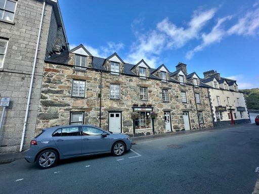 6 bedroom terraced house for sale in 2-3 Heol y Bont, Dolgellau LL40 1AU, LL40 — £499,995 • 6 bed • 4 bath • 3021 ft²
 Studio flat for sale in Aber Avon Shop, High Street, Barmouth, LL42 — £75,000 • 1 bed • 1 bath
 1 bedroom terraced house for sale in Water Street, Barmouth, LL42 — £115,000 • 1 bed • 1 bath • 678 ft²
Meta
- {
"@context": "https://schema.org",
"@type": "Residence",
"name": "Leisure facility for sale in Bendigedig, King Edward Street…",
"description": "",
"url": "https://propertypiper.co.uk/property/0923b041-36b7-4535-88a0-63dd0626c537",
"image": "https://image-a.propertypiper.co.uk/15a9c681-dd7e-49ff-a0b4-6ac02ea52f41-1024.jpeg",
"address": {
"@type": "PostalAddress",
"streetAddress": "Bendigedig,Barmouth,Gwynedd,LL42 1AD",
"postalCode": "LL42 1AD",
"addressLocality": "Gwynedd",
"addressRegion": "Dwyfor Meirionnydd",
"addressCountry": "Wales"
},
"geo": {
"@type": "GeoCoordinates",
"latitude": 52.7232852307604,
"longitude": -4.05603680271424
},
"numberOfRooms": 1,
"numberOfBathroomsTotal": 1,
"floorSize": {
"@type": "QuantitativeValue",
"value": 9683,
"unitCode": "FTK"
},
"offers": {
"@type": "Offer",
"price": 495000,
"priceCurrency": "GBP",
"availability": "https://schema.org/InStock"
},
"additionalProperty": [
{
"@type": "PropertyValue",
"name": "Feature",
"value": "traditional"
},
{
"@type": "PropertyValue",
"name": "Feature",
"value": "stone"
},
{
"@type": "PropertyValue",
"name": "Feature",
"value": "solid structure"
},
{
"@type": "PropertyValue",
"name": "Feature",
"value": "historical"
},
{
"@type": "PropertyValue",
"name": "Feature",
"value": "commercial potential"
},
{
"@type": "PropertyValue",
"name": "Feature",
"value": "community building"
},
{
"@type": "PropertyValue",
"name": "Feature",
"value": "former school"
},
{
"@type": "PropertyValue",
"name": "Feature",
"value": "rustic"
},
{
"@type": "PropertyValue",
"name": "Feature",
"value": "stone walls"
},
{
"@type": "PropertyValue",
"name": "Feature",
"value": "industrial"
},
{
"@type": "PropertyValue",
"name": "Feature",
"value": "Victorian"
},
{
"@type": "PropertyValue",
"name": "Feature",
"value": "brickwork"
},
{
"@type": "PropertyValue",
"name": "Feature",
"value": "windows"
},
{
"@type": "PropertyValue",
"name": "Feature",
"value": "stone building"
},
{
"@type": "PropertyValue",
"name": "Feature",
"value": "parking area"
},
{
"@type": "PropertyValue",
"name": "Feature",
"value": "yard"
},
{
"@type": "PropertyValue",
"name": "Feature",
"value": "potential"
},
{
"@type": "PropertyValue",
"name": "Feature",
"value": "development opportunity"
}
]
}