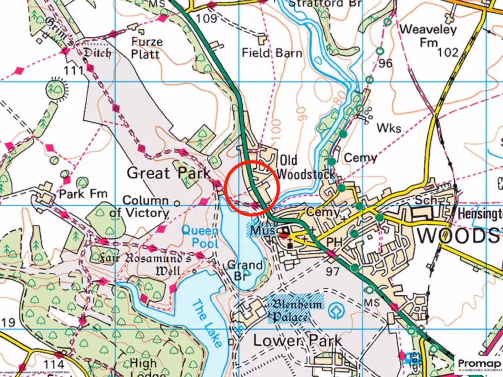
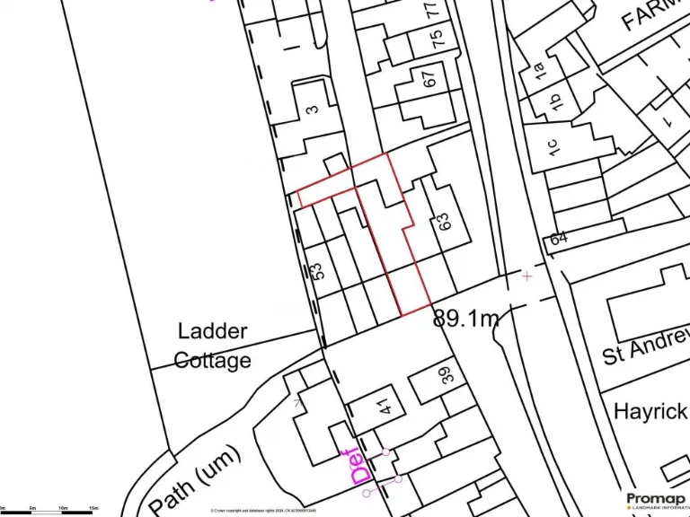
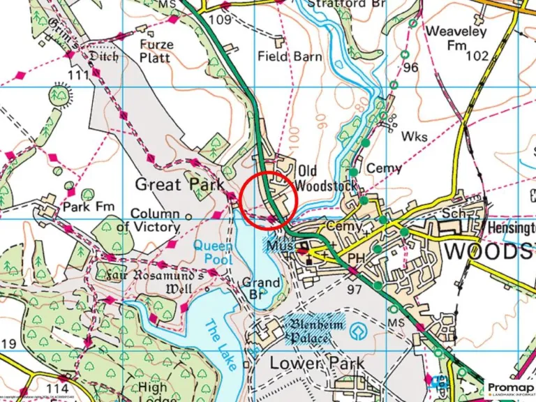
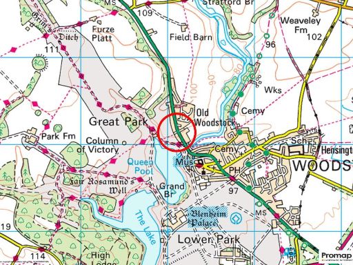
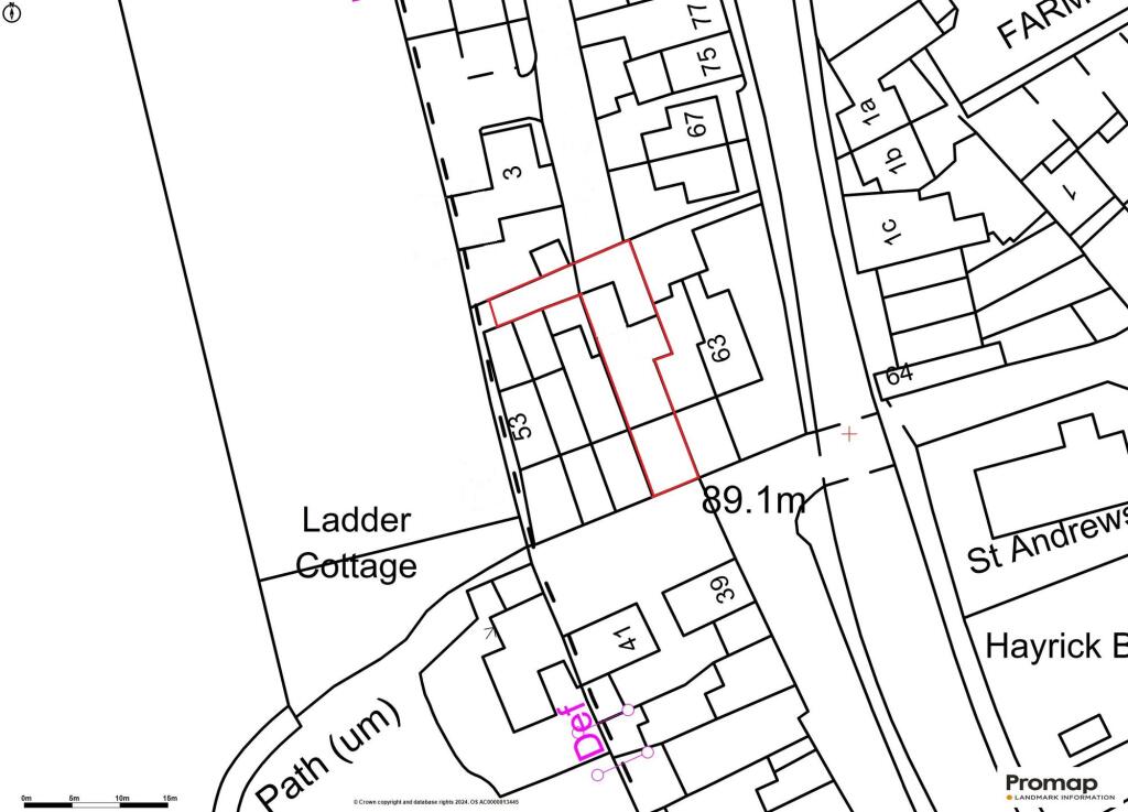
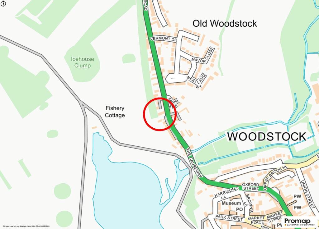
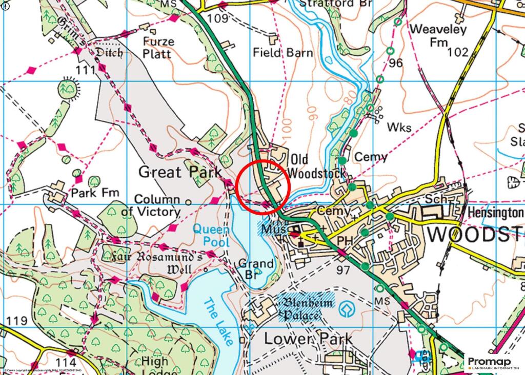
OX20 1XR - 2 bedroom terraced house for sale in Manor Road, Woodstock,…
View on Property Piper
2 bedroom terraced house for sale in Manor Road, Woodstock, OX20
Property Details
- Price: £525000
- Bedrooms: 2
- Bathrooms: 2
- Property Type: undefined
- Property SubType: undefined
Image Descriptions
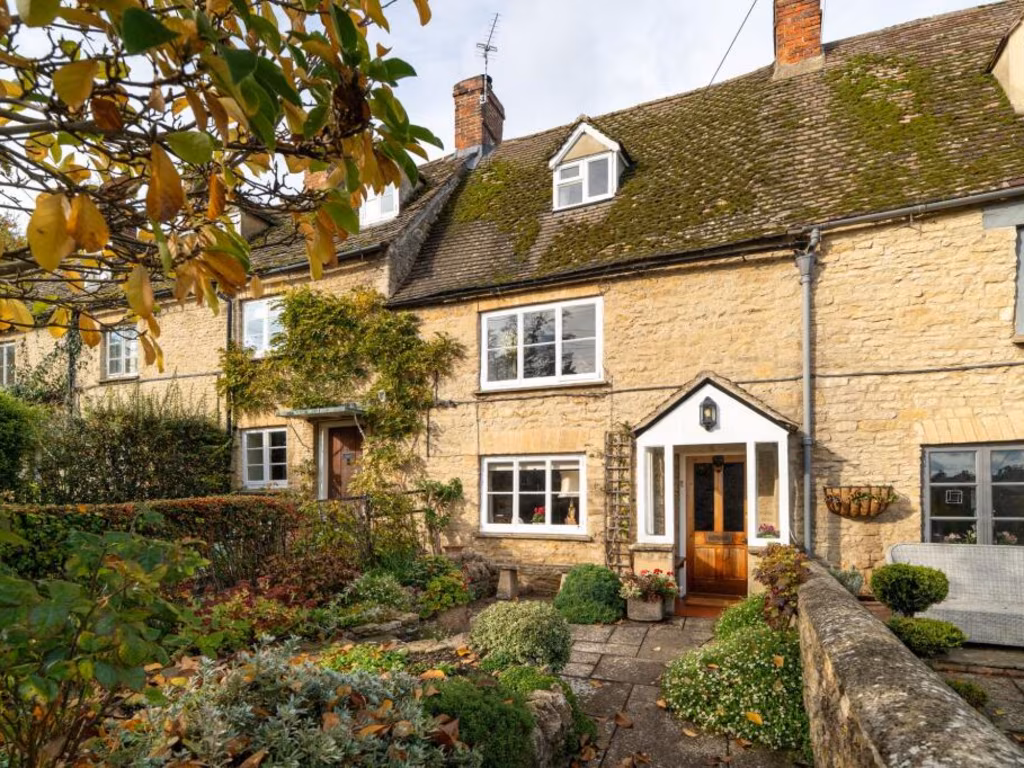
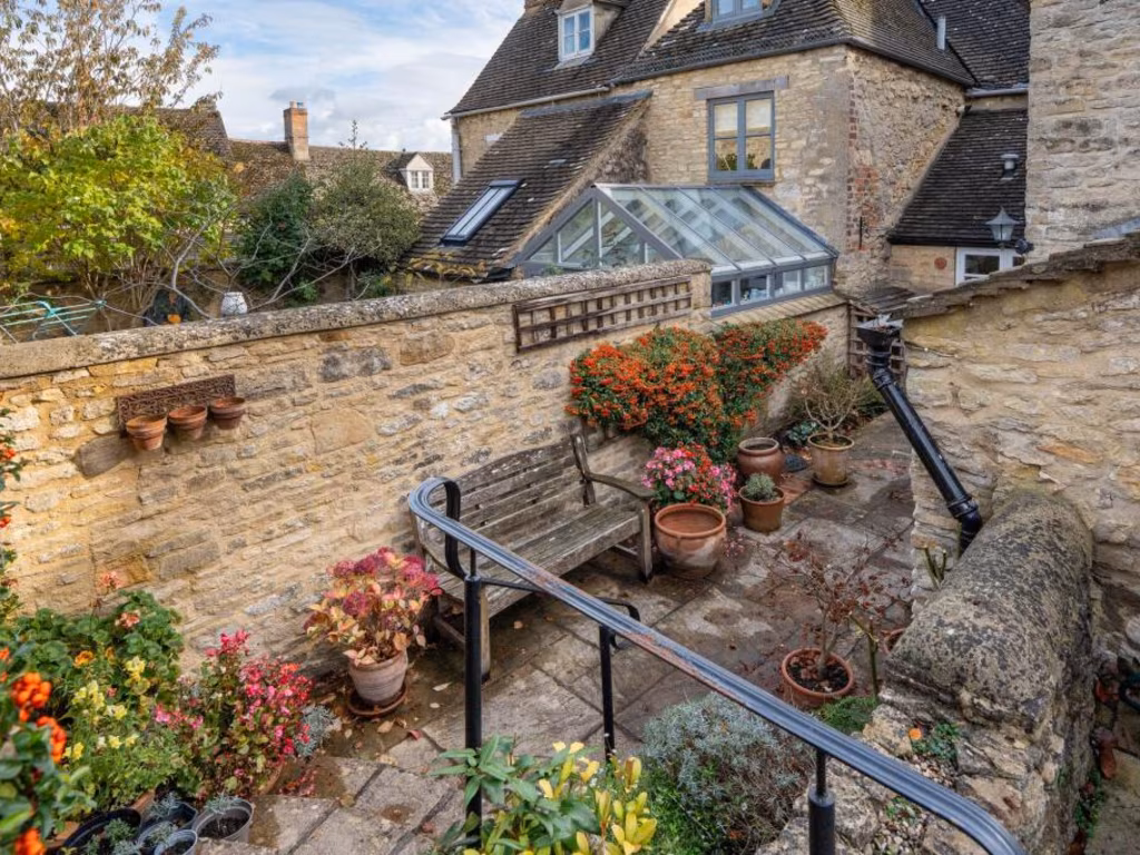
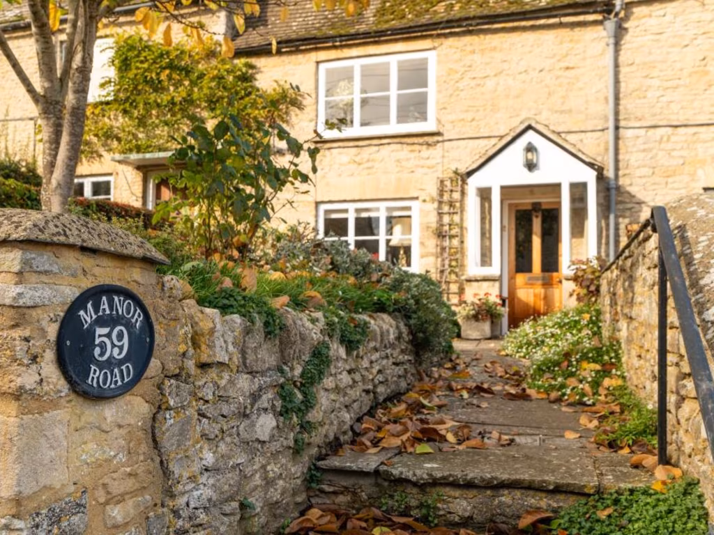
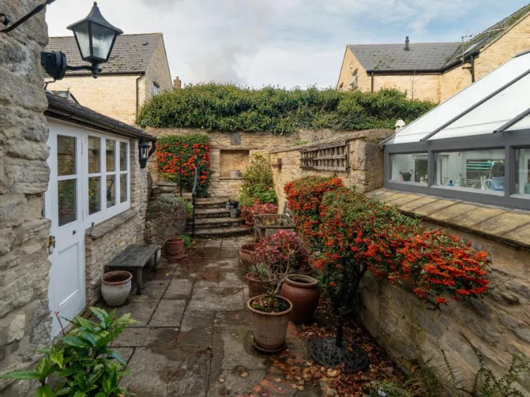
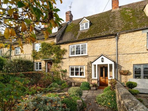
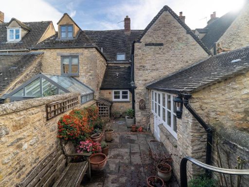
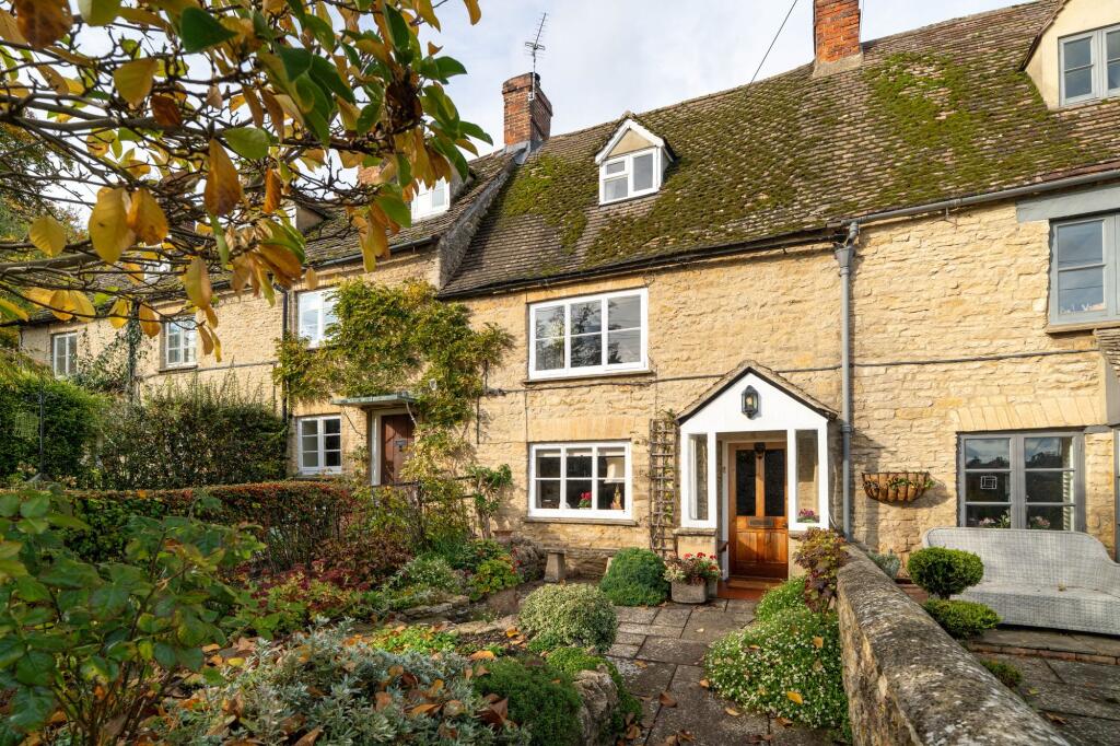
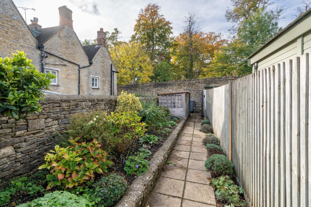
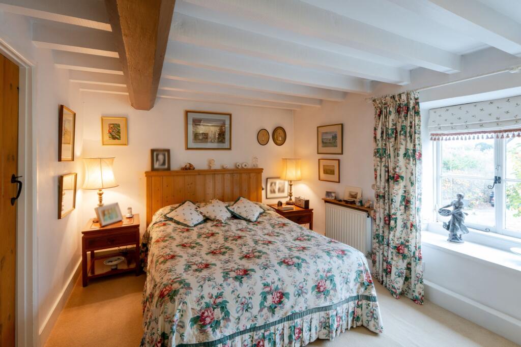
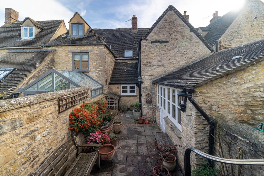
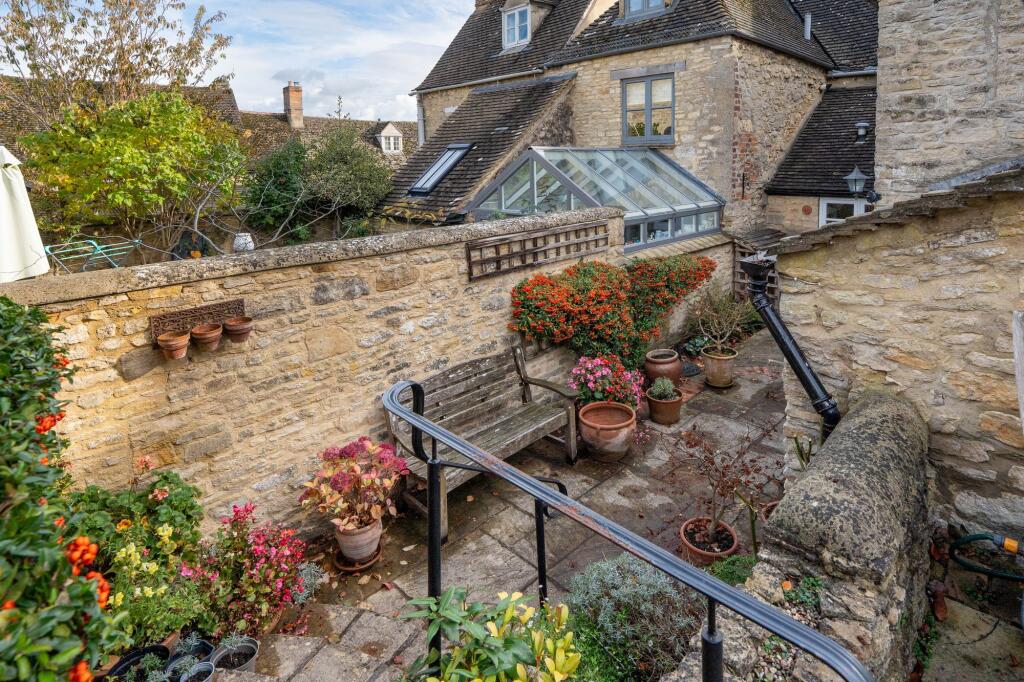
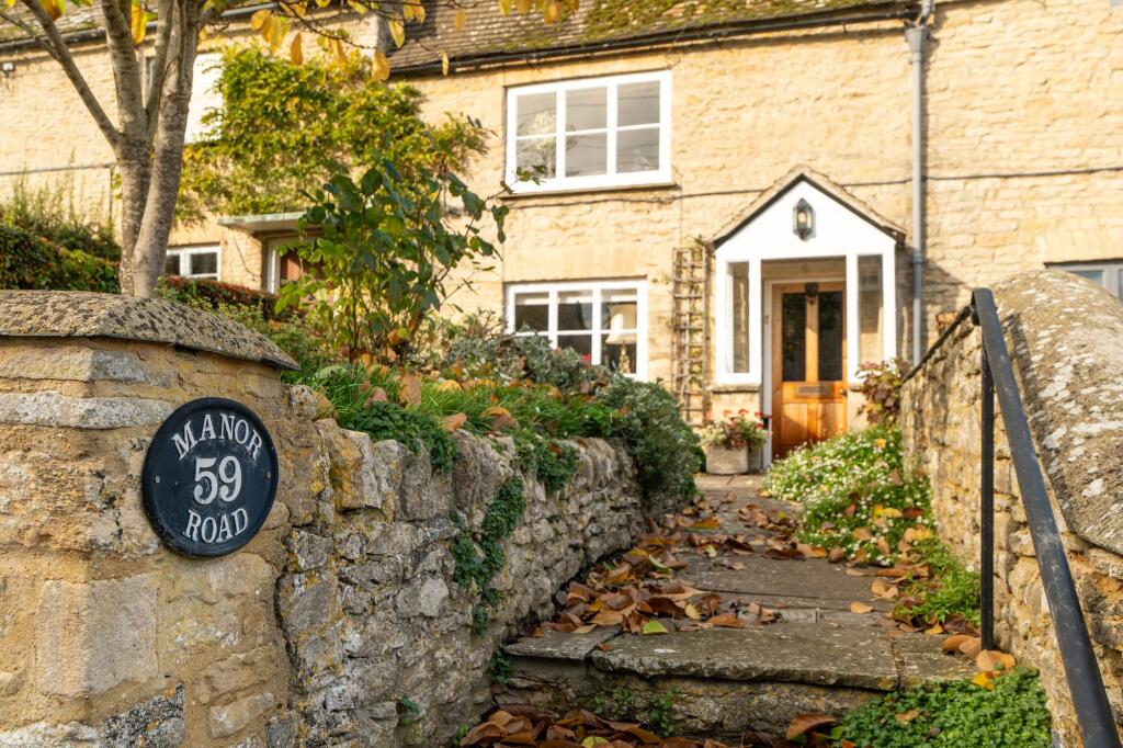
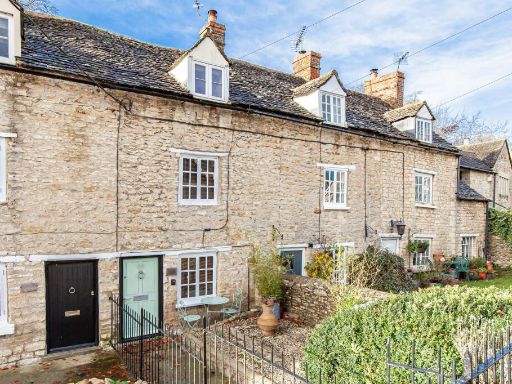
- stone cottage exterior Cottage
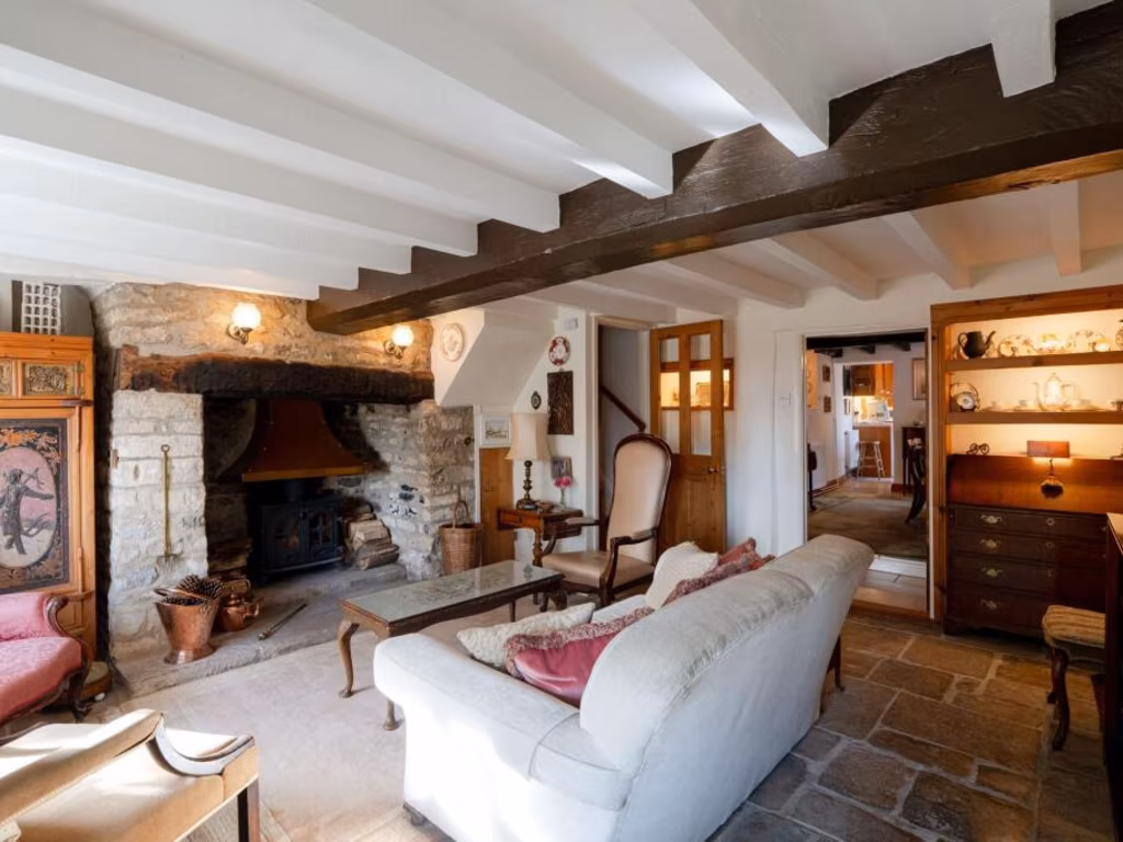
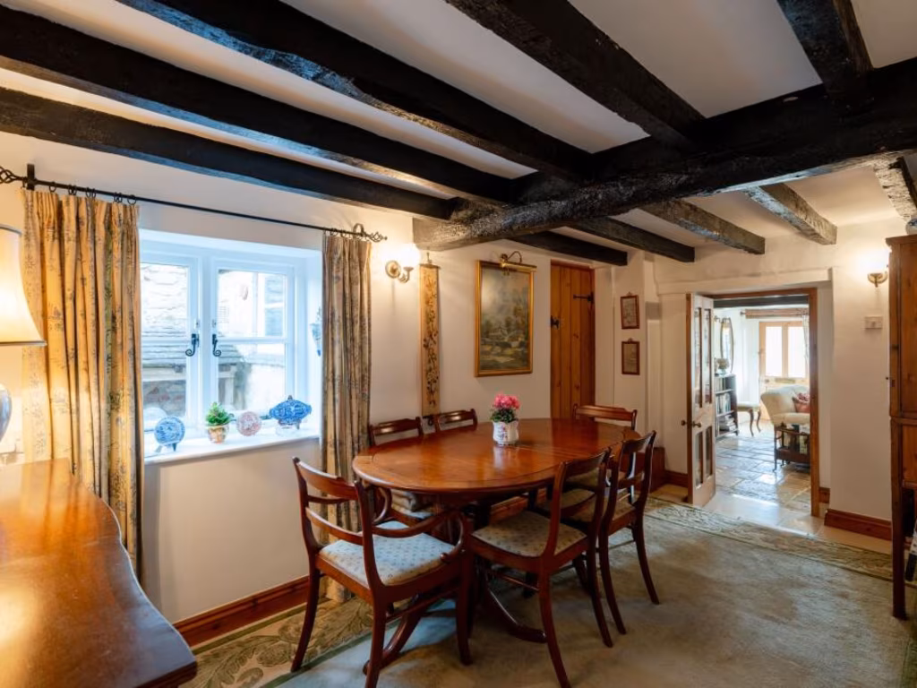
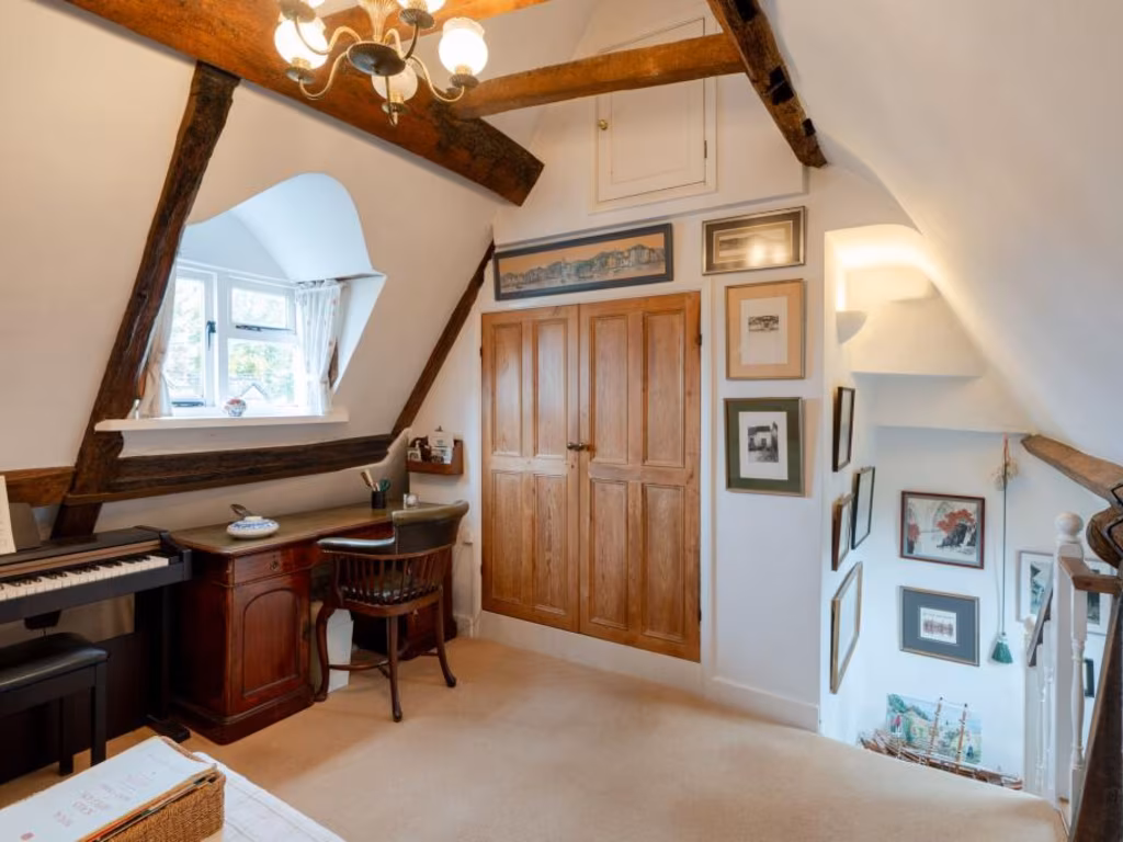
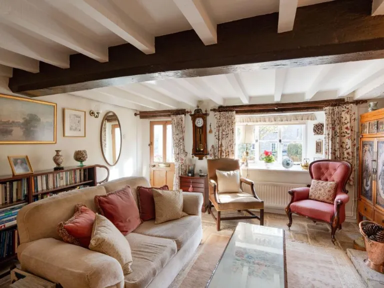
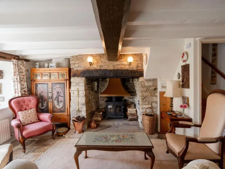
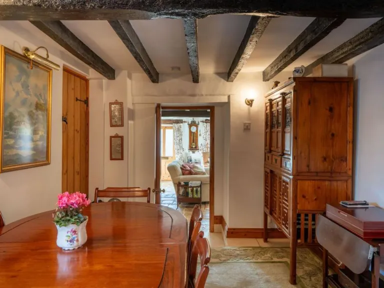
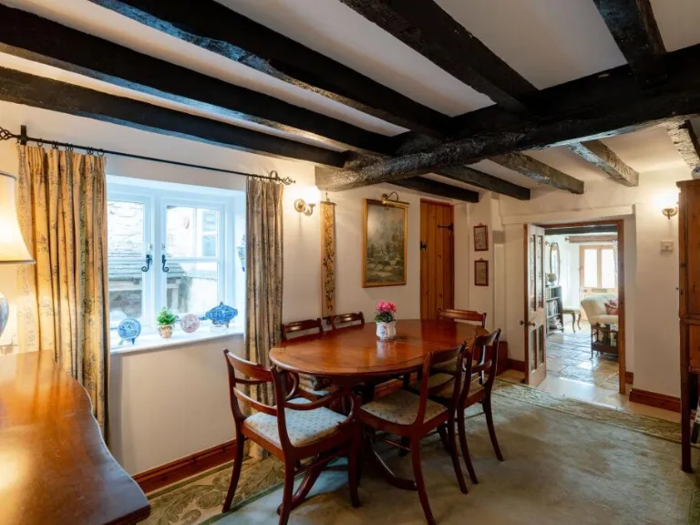
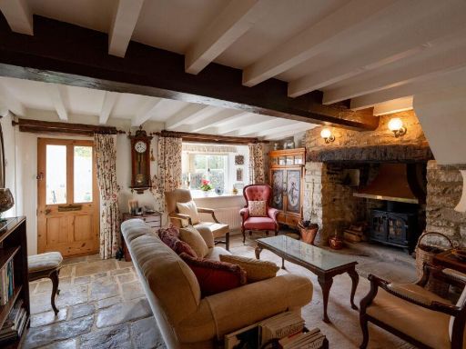
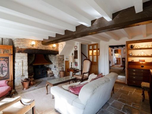
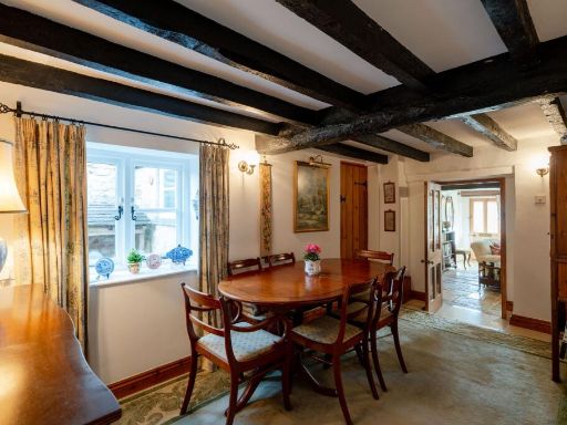
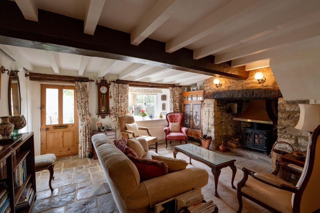
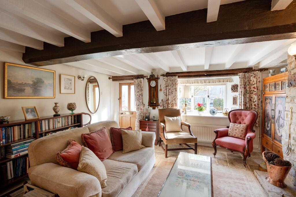
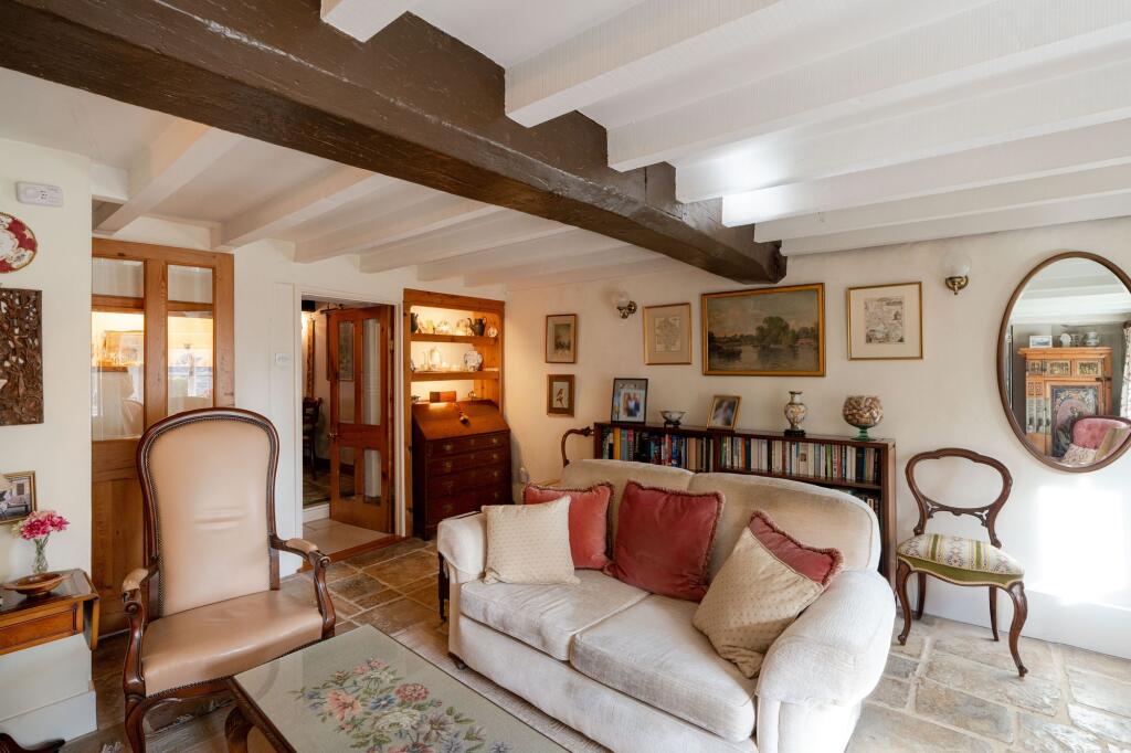
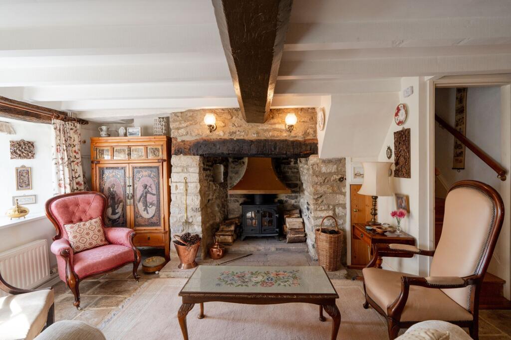
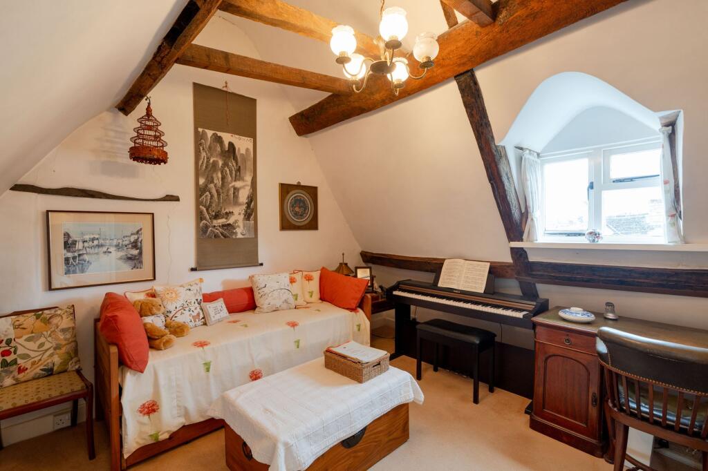
- living room Rustic
Floorplan Description
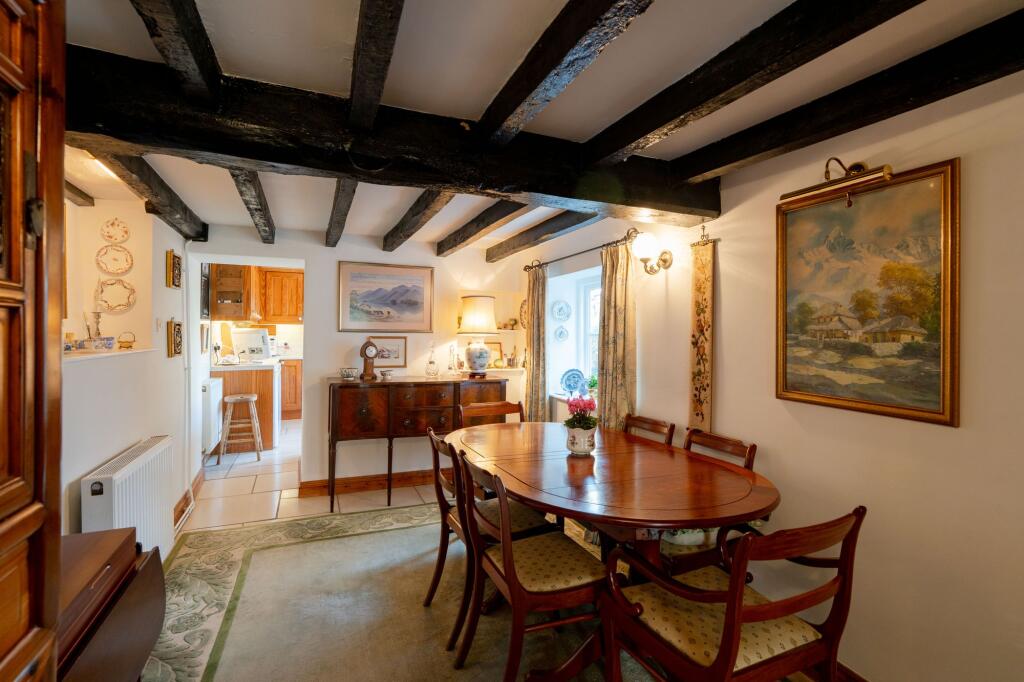
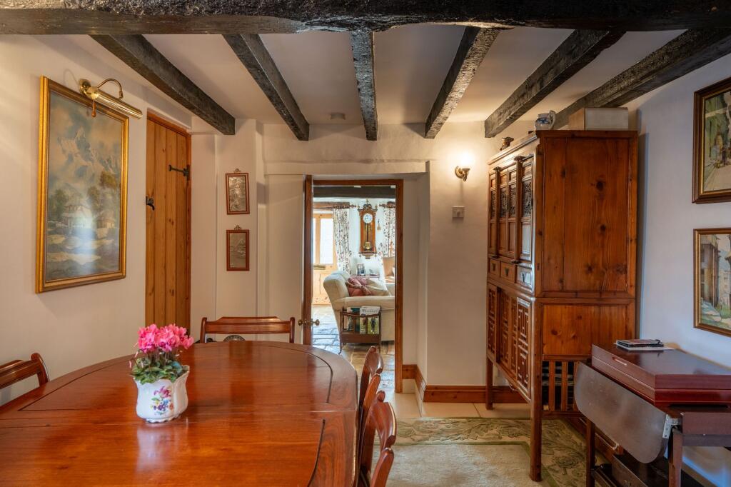
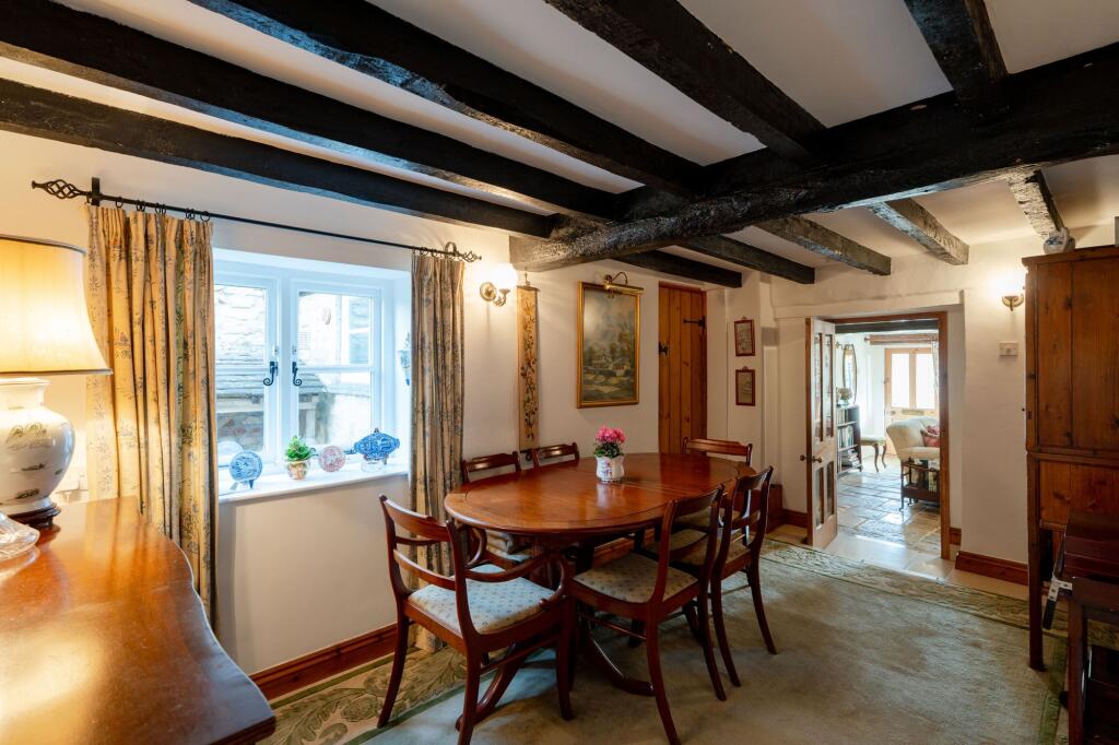
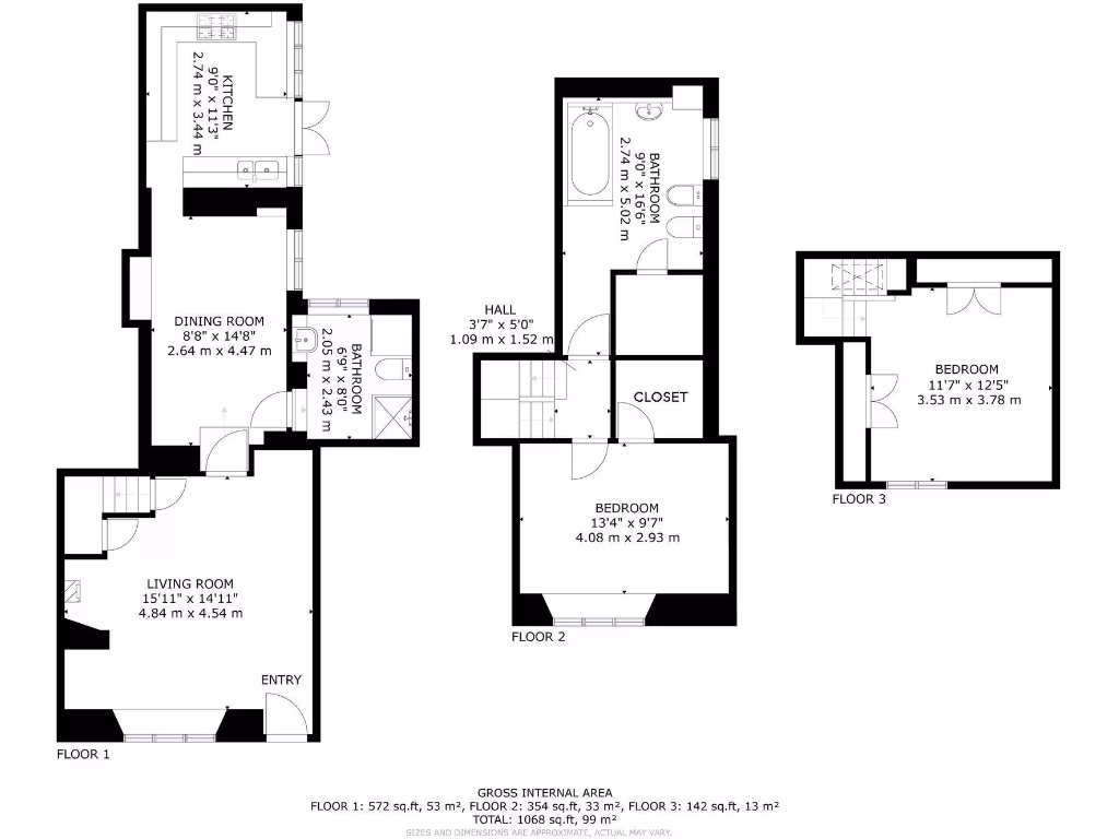
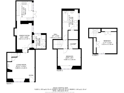
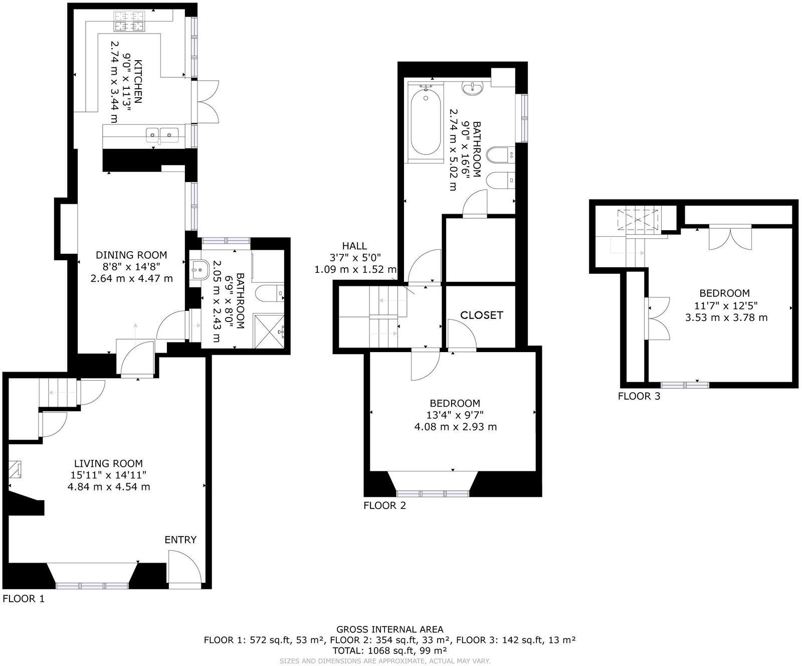
- Three-floor residence with living, dining, kitchen and bathrooms; bedrooms on upper floors.
Rooms
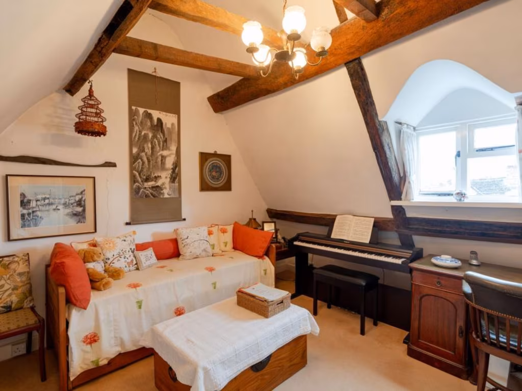
- LIVING ROOM:
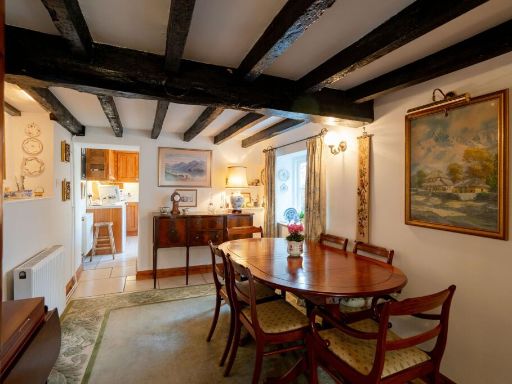
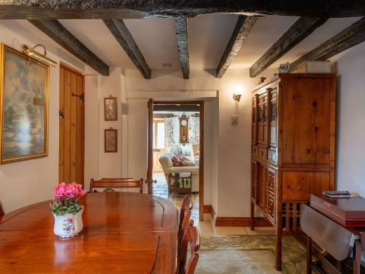
- DINING ROOM:
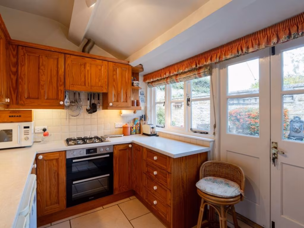
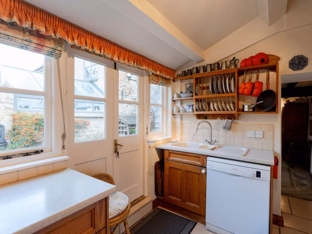
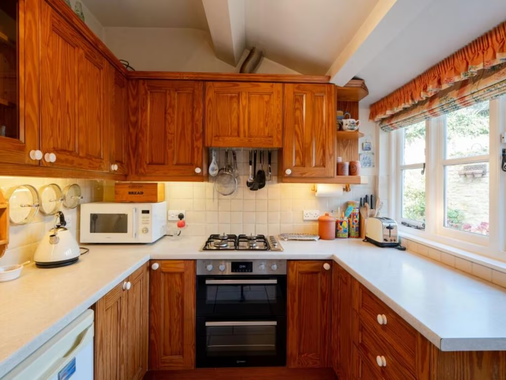
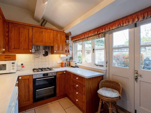
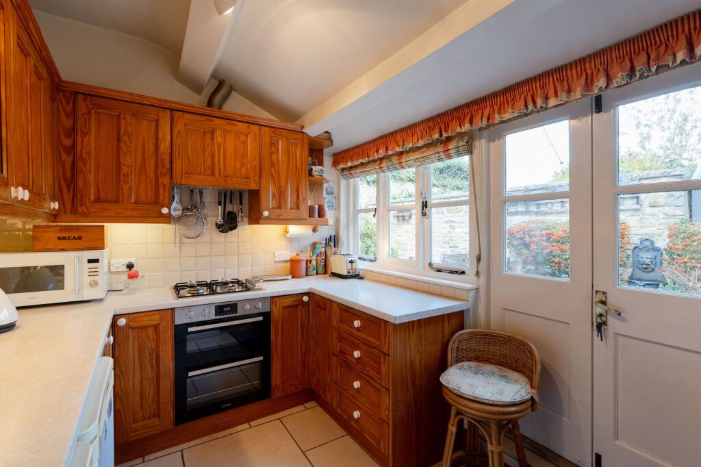
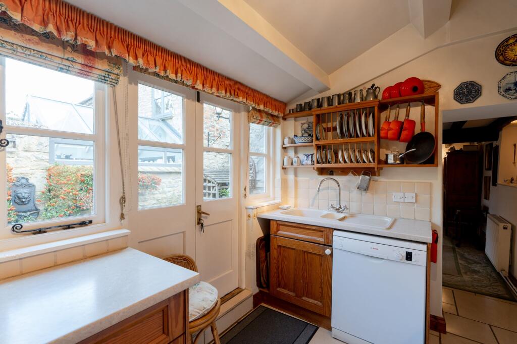
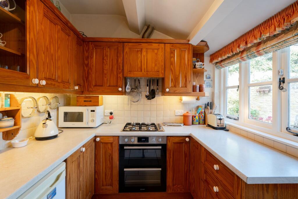
- KITCHEN:
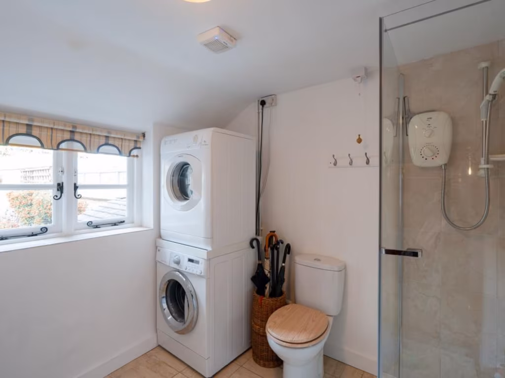
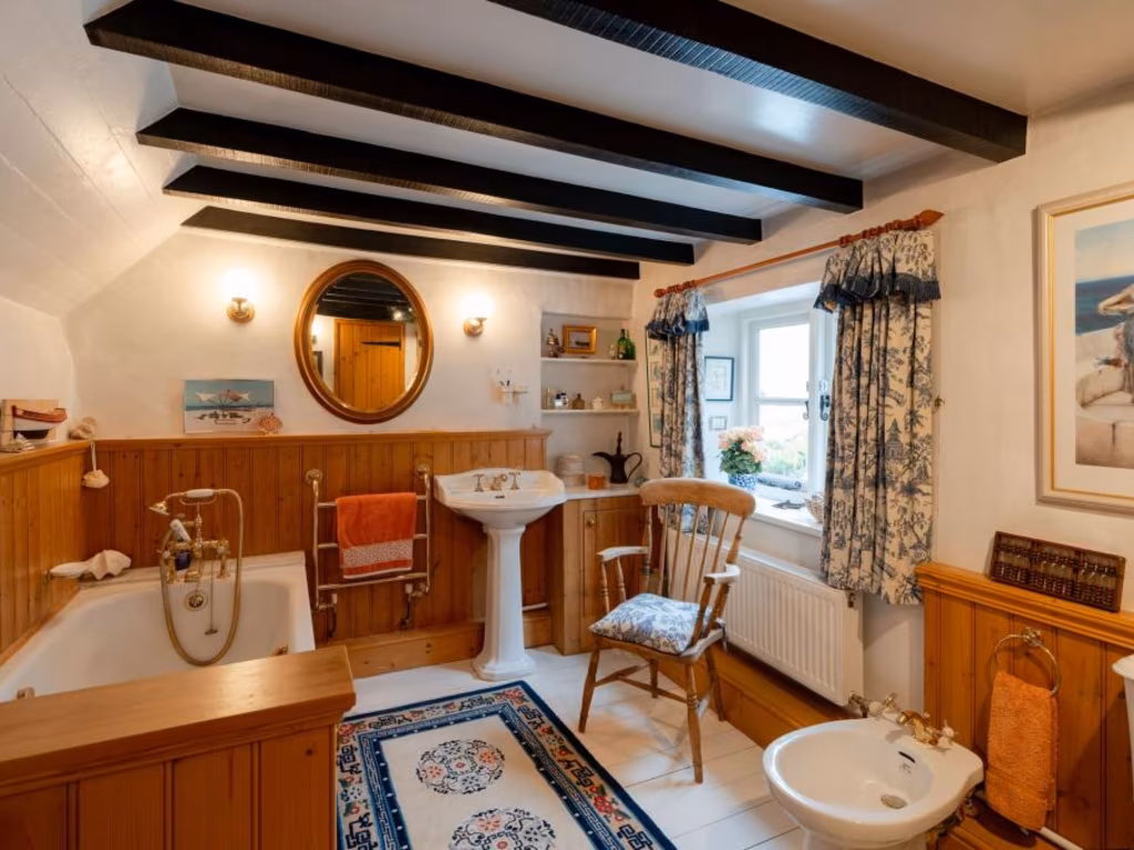
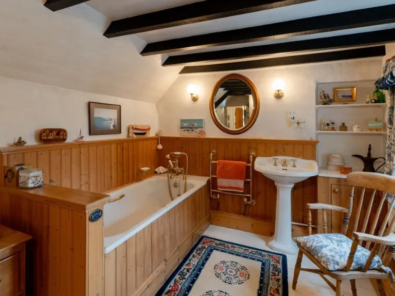
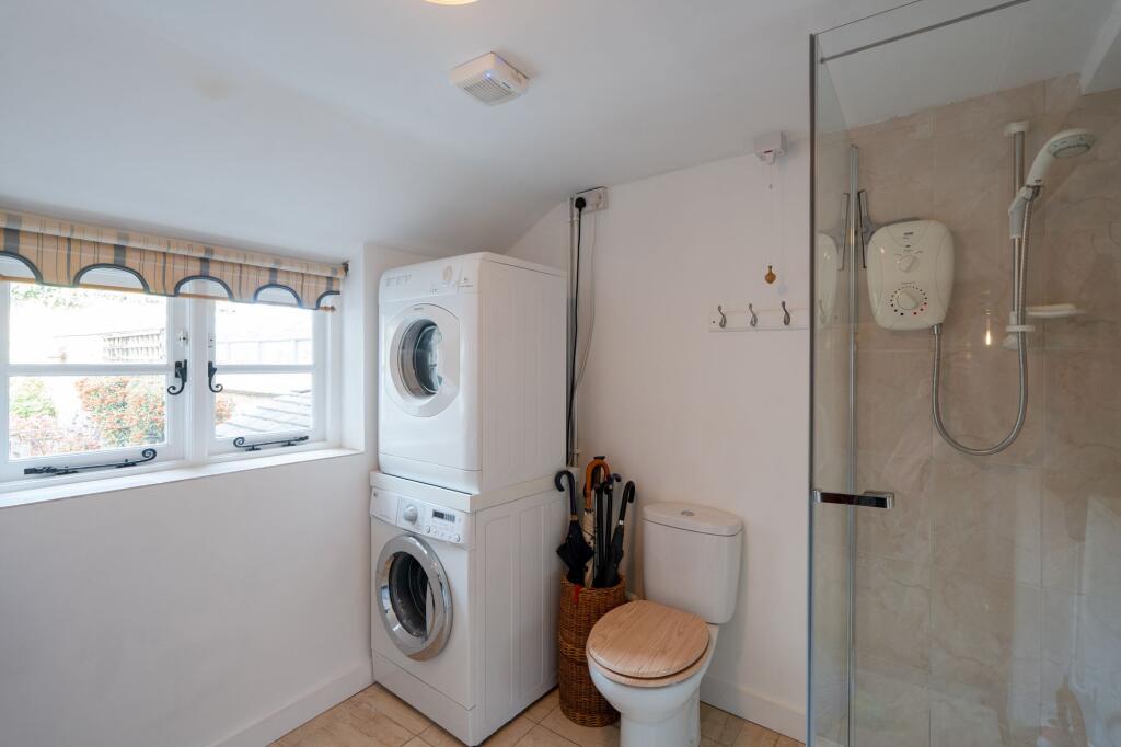
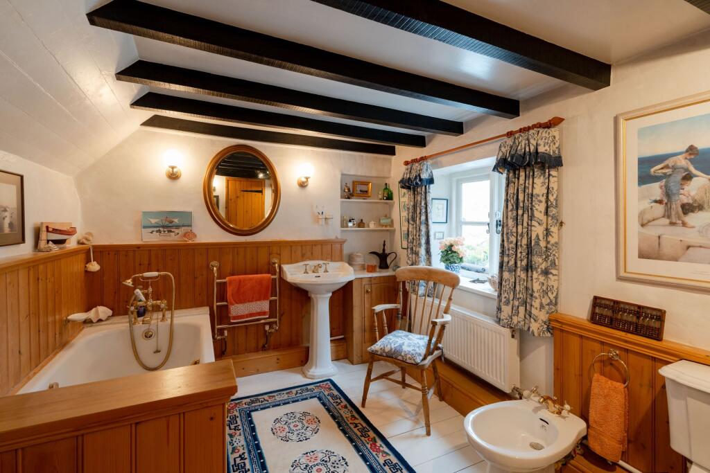
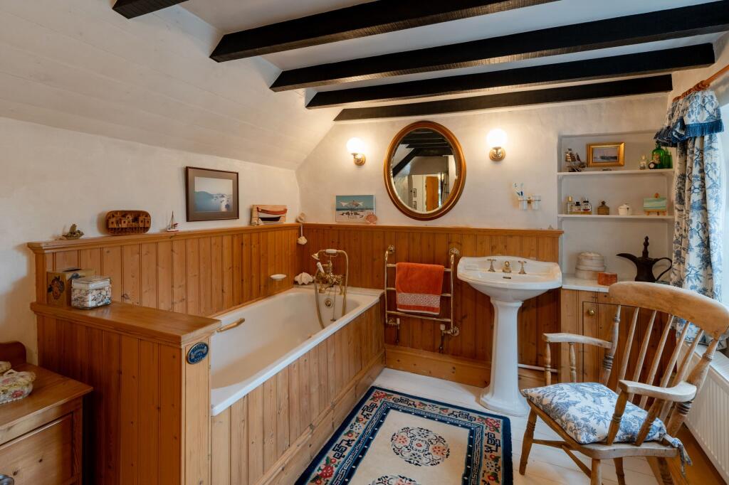
- BATHROOM:
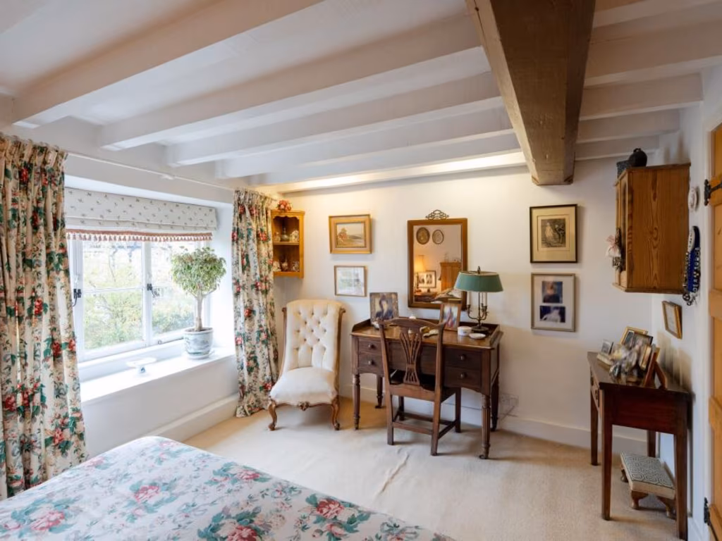
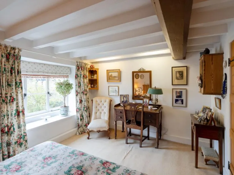
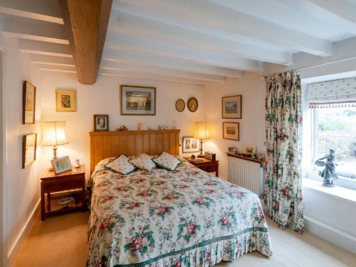
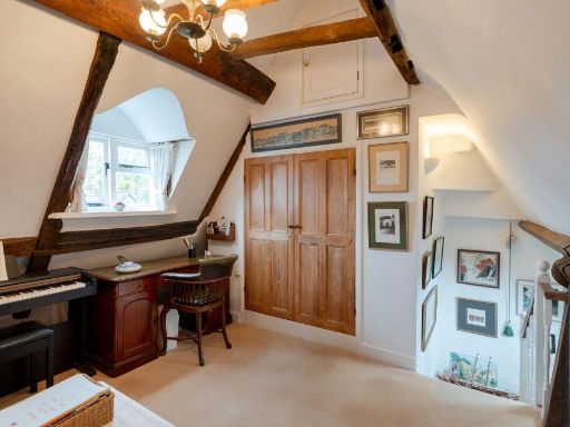
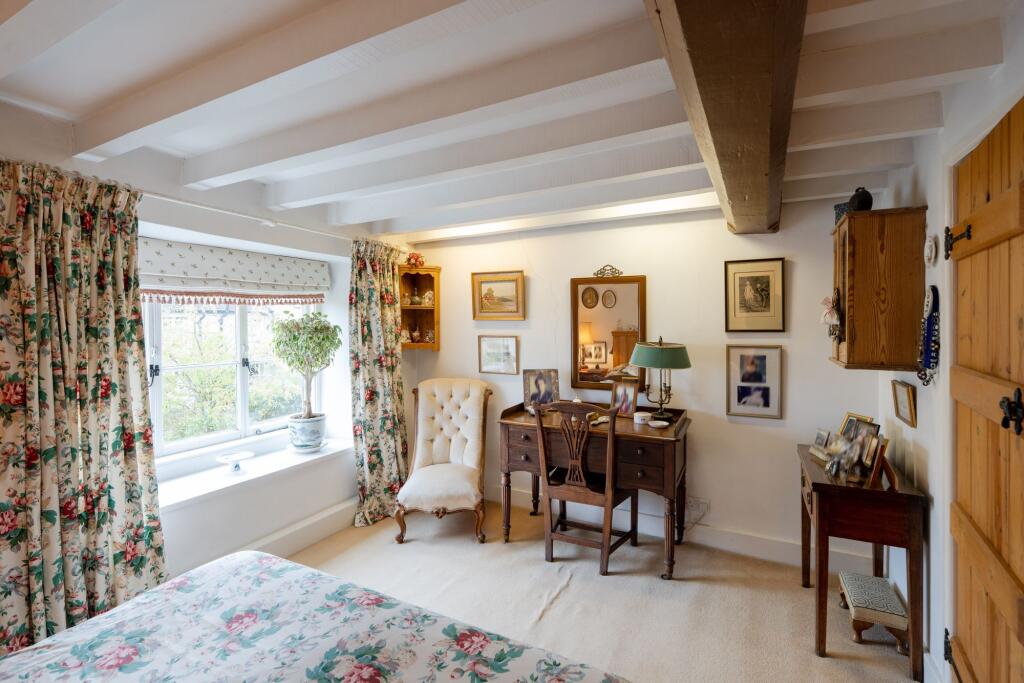
- BEDROOM:
- HALL:
- BATHROOM:
- CLOSET:
- BEDROOM:
Textual Property Features
Detected Visual Features
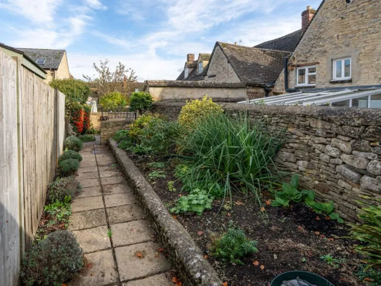
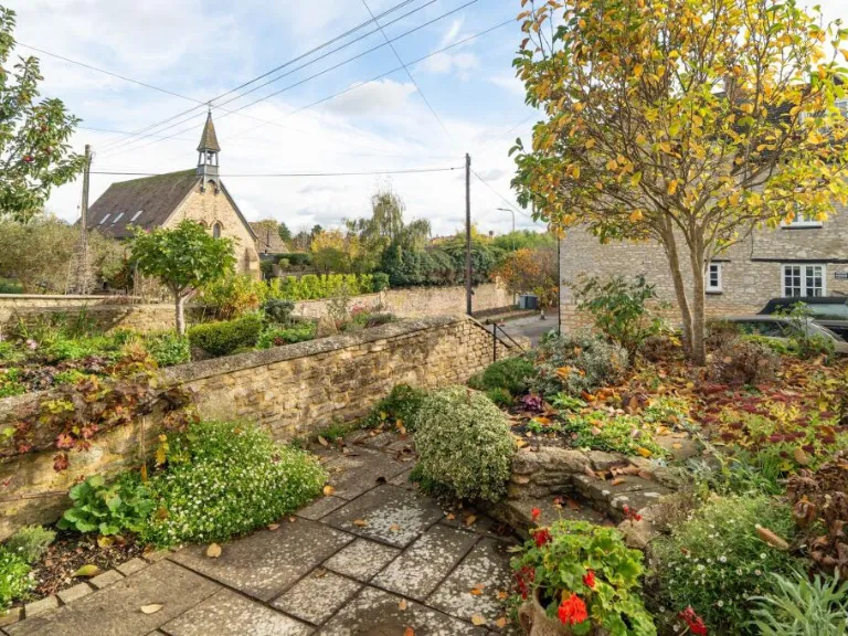
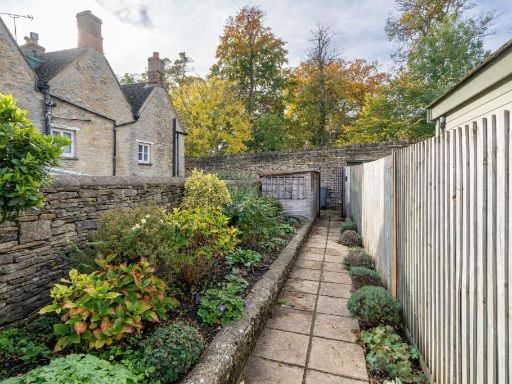
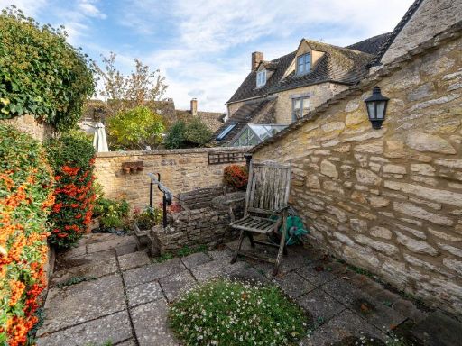
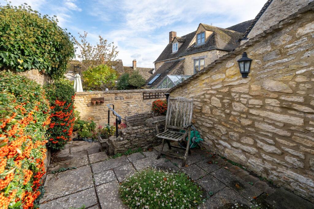
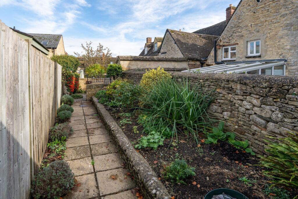
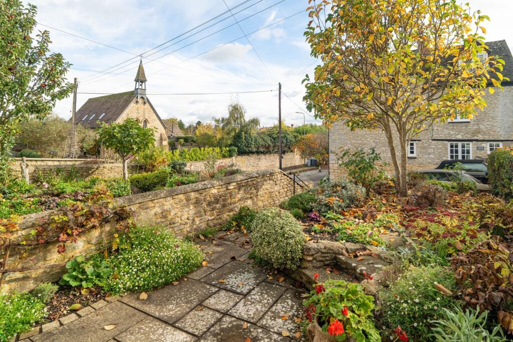
- cottage
- stone exterior
- roof moss
- sloped roof
- dormer windows
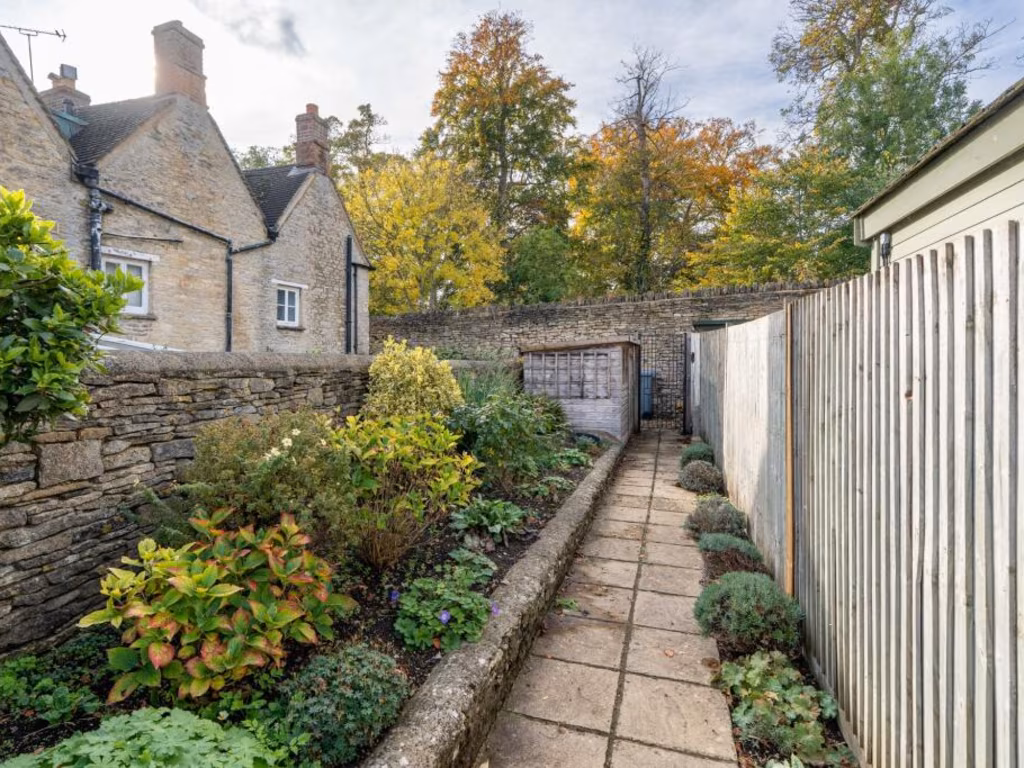
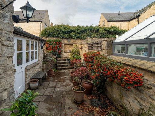
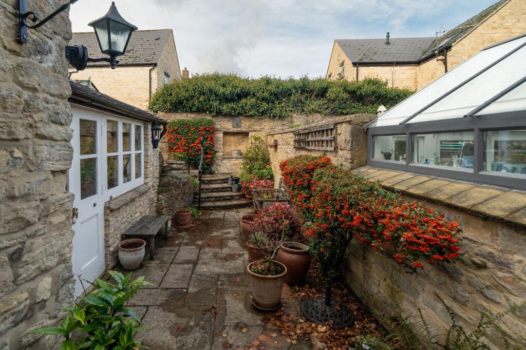
- garden
- character
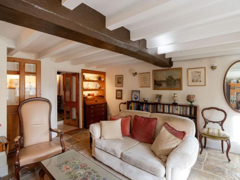
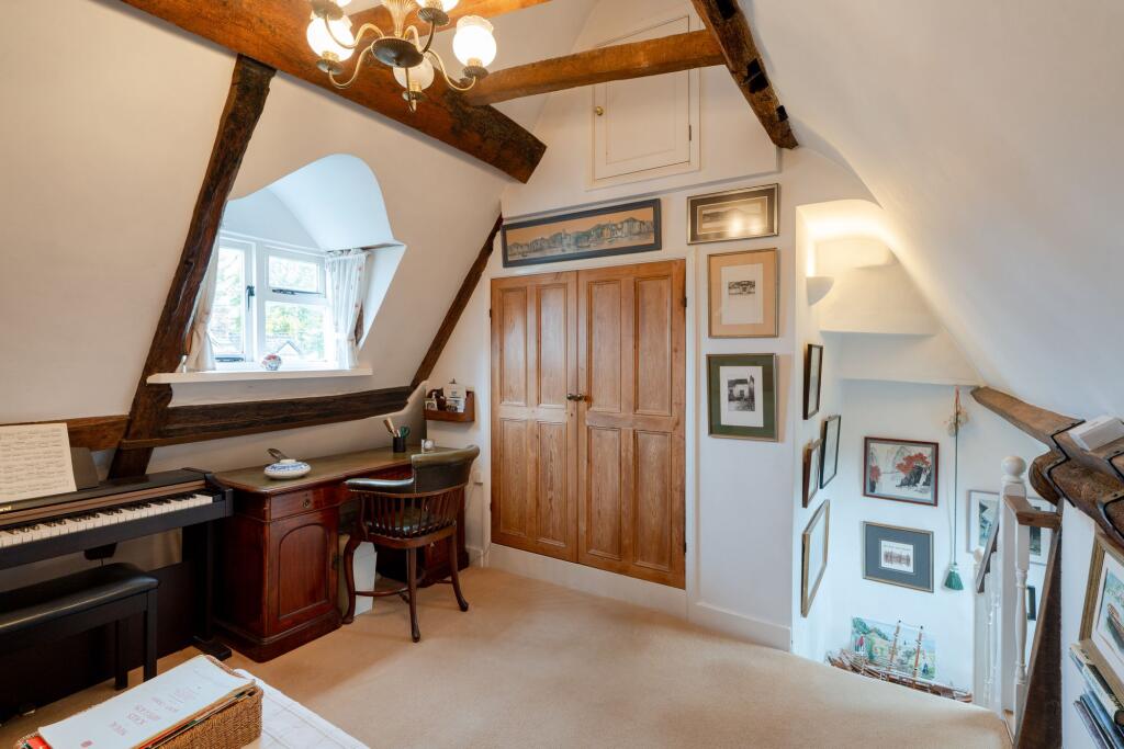
- Rustic
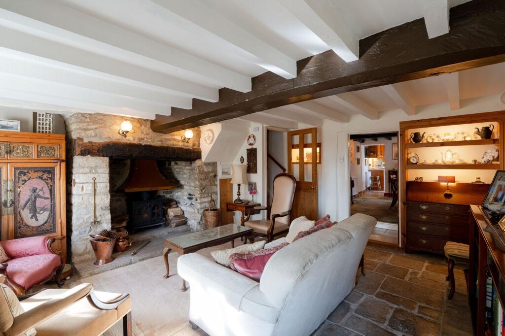
- Exposed beams
- Stone flooring
- Stone fireplace
- Wood-burning stove
- Cottage style
- Countryside
- Character property
Nearby Schools
- Wolvercote Primary School
- North Leigh Church of England School
- Hanborough Manor CofE School
- Tackley Church of England Primary School
- West Kidlington Primary and Nursery School
- St Thomas More Catholic Primary School, Kidlington
- Freeland Church of England Primary School
- Bladon Church of England Primary School
- Stonesfield Primary School
- Bletchingdon Parochial Church of England Primary School
- Eynsham Community Primary School
- Edward Feild Primary School
- North Kidlington Primary School
- Woodstock Church of England Primary School
- Kirtlington Church of England Primary School
- Enstone Primary School
- Bartholomew School
- St Peter's Church of England Primary School, Cassington
- William Fletcher Primary School
- Gosford Hill School
- Combe CofE Primary School
- The Marlborough Church of England School
Nearest Bars And Restaurants
- Id: 34043327
- Tags:
- Addr:
- City: Woodstock
- Housenumber: 8
- Postcode: OX20 1SX
- Street: Market Street
- Amenity: pub
- Name: Woodstock Arms
- Wikidata: Q26570487
- TagsNormalized:
- Lat: 51.8475345
- Lon: -1.3552098
- FullGeoHash: gcpncnt1v2fq
- PartitionGeoHash: gcpn
- Images:
- FoodStandards: null
- Distance: 563.4
,- Id: 35832233
- Tags:
- Addr:
- Housenumber: 1
- Postcode: OX20 1TE
- Street: High Street
- Amenity: restaurant
- Cuisine: italian;pizza
- Name: Brothertons Brasserie
- Website: https://www.brothertonsbrasserie.co.uk/
- Wikidata: Q26499171
- TagsNormalized:
- Lat: 51.8474365
- Lon: -1.3554324
- FullGeoHash: gcpncnt10nsm
- PartitionGeoHash: gcpn
- Images:
- FoodStandards: null
- Distance: 560.7
,- Id: 34042197
- Tags:
- Amenity: restaurant
- Created_by: JOSM
- Cuisine: fish_and_chips
- Name: Smarts
- TagsNormalized:
- Lat: 51.8481351
- Lon: -1.354752
- FullGeoHash: gcpncntmrbzt
- PartitionGeoHash: gcpn
- Images:
- FoodStandards: null
- Distance: 542.1
,- Id: 34043322
- Tags:
- Addr:
- City: Woodstock
- Postcode: OX20 1TA
- Street: Market Place
- Amenity: pub
- Name: The Star Inn
- Wikidata: Q26304609
- TagsNormalized:
- Lat: 51.8477494
- Lon: -1.3562975
- FullGeoHash: gcpncns75cp2
- PartitionGeoHash: gcpn
- Images:
- FoodStandards: null
- Distance: 495.3
,- Id: 34042203
- Tags:
- Addr:
- City: Woodstock
- Housenumber: 2
- Postcode: OX20 1XJ
- Street: Manor Road
- Amenity: pub
- Name: The Black Prince
- Wheelchair: limited
- Wikidata: Q26304599
- TagsNormalized:
- Lat: 51.8499909
- Lon: -1.3595055
- FullGeoHash: gcpncp4014z5
- PartitionGeoHash: gcpn
- Images:
- FoodStandards: null
- Distance: 162.9
}
Nearest General Shops
- Id: 9626493563
- Tags:
- TagsNormalized:
- Lat: 51.842684
- Lon: -1.3607736
- FullGeoHash: gcpncj9je8tx
- PartitionGeoHash: gcpn
- Images:
- FoodStandards: null
- Distance: 941.7
,- Id: 9626493557
- Tags:
- TagsNormalized:
- Lat: 51.8451073
- Lon: -1.3536803
- FullGeoHash: gcpncnn78uqz
- PartitionGeoHash: gcpn
- Images:
- FoodStandards: null
- Distance: 837.4
,- Id: 2833578801
- Tags:
- Name: Hampers Deli
- Shop: deli
- TagsNormalized:
- Lat: 51.847564
- Lon: -1.354171
- FullGeoHash: gcpncntcvw2y
- PartitionGeoHash: gcpn
- Images:
- FoodStandards: null
- Distance: 613.3
}
Nearest Grocery shops
- Id: 4499475319
- Tags:
- Addr:
- City: Wootton
- Postcode: OX20 1DH
- Street: Church Street
- Name: Wootton Stores
- Shop: convenience
- TagsNormalized:
- Lat: 51.8749314
- Lon: -1.3638182
- FullGeoHash: gcpp0gwcksp7
- PartitionGeoHash: gcpp
- Images:
- FoodStandards: null
- Distance: 2651.5
,- Id: 1848428329
- Tags:
- Brand: Premier
- Brand:wikidata: Q7240340
- Brand:wikipedia: en:Premier Stores
- Name: Box of Delights
- Operator: Premier
- Shop: convenience
- TagsNormalized:
- Lat: 51.8488758
- Lon: -1.3460469
- FullGeoHash: gcpncqgcdffx
- PartitionGeoHash: gcpn
- Images:
- FoodStandards: null
- Distance: 1054.6
,- Id: 433077167
- Tags:
- Addr:
- City: Woodstock
- Housenumber: 38-40
- Postcode: OX20 1TG
- Street: High Street
- Building: yes
- Name: The Co-operative Food
- Opening_hours: Mo-Su 08:00-22:00
- Operator: The Midcounties Co-operative Society
- Shop: supermarket
- TagsNormalized:
- the co-operative food
- food
- shop
- Lat: 51.8467214
- Lon: -1.3535747
- FullGeoHash: gcpncnqm53ms
- PartitionGeoHash: gcpn
- Images:
- FoodStandards: null
- Distance: 706.8
}
Nearest Religious buildings
- Id: 942241255
- Tags:
- Amenity: place_of_worship
- Building: church
- Denomination: baptist
- Name: Woodstock Baptist Church
- Religion: christian
- Wikidata: Q26499168
- TagsNormalized:
- place of worship
- church
- baptist
- christian
- Lat: 51.8472976
- Lon: -1.355019
- FullGeoHash: gcpncnt23ub9
- PartitionGeoHash: gcpn
- Images:
- FoodStandards: null
- Distance: 591.4
,- Id: 34042196
- Tags:
- Amenity: place_of_worship
- Building: church
- Denomination: methodist
- Name: Woodstock Methodist Church
- Religion: christian
- Website: woodstockmethodists.org.uk
- TagsNormalized:
- place of worship
- church
- methodist
- christian
- Lat: 51.8480206
- Lon: -1.3541668
- FullGeoHash: gcpncntutes4
- PartitionGeoHash: gcpn
- Images:
- FoodStandards: null
- Distance: 581.8
,- Id: 165763209
- Tags:
- Amenity: place_of_worship
- Building: church
- Denomination: anglican
- Name: Saint Mary Magdalene
- Religion: christian
- Source:
- Wikidata: Q17532663
- TagsNormalized:
- place of worship
- church
- anglican
- christian
- Lat: 51.8472981
- Lon: -1.3570098
- FullGeoHash: gcpncneb7kuh
- PartitionGeoHash: gcpn
- Images:
- FoodStandards: null
- Distance: 506.9
}
Nearest Medical buildings
- Id: 1641597582
- Tags:
- Amenity: pharmacy
- Healthcare: pharmacy
- TagsNormalized:
- Lat: 51.8245034
- Lon: -1.395708
- FullGeoHash: gcpnb4retess
- PartitionGeoHash: gcpn
- Images:
- FoodStandards: null
- Distance: 3805.6
,- Id: 4182150890
- Tags:
- Amenity: dentist
- Healthcare: dentist
- Name: Long Hanborough Dental Practice
- Source: gps_survey
- TagsNormalized:
- dentist
- health
- healthcare
- dental
- Lat: 51.8242991
- Lon: -1.3906876
- FullGeoHash: gcpnb6766ts1
- PartitionGeoHash: gcpn
- Images:
- FoodStandards: null
- Distance: 3617.9
,- Id: 60763897
- Tags:
- Amenity: doctors
- Healthcare: doctor
- Name: Woodstock Surgery
- TagsNormalized:
- doctor
- doctors
- health
- healthcare
- surgery
- Lat: 51.8467335
- Lon: -1.3544077
- FullGeoHash: gcpncnmv058k
- PartitionGeoHash: gcpn
- Images:
- FoodStandards: null
- Distance: 665.9
,- Id: 35832237
- Tags:
- Amenity: pharmacy
- Healthcare: pharmacy
- Name: Woodstock Pharmacy
- TagsNormalized:
- Lat: 51.8469339
- Lon: -1.3544502
- FullGeoHash: gcpncnmwr0bx
- PartitionGeoHash: gcpn
- Images:
- FoodStandards: null
- Distance: 647.7
}
Nearest Leisure Facilities
- Id: 150210676
- Tags:
- Leisure: pitch
- Source:
- Sport: bowls
- TagsNormalized:
- Lat: 51.8466944
- Lon: -1.350102
- FullGeoHash: gcpncq2uuk6f
- PartitionGeoHash: gcpn
- Images:
- FoodStandards: null
- Distance: 895.1
,- Id: 7770933
- Tags:
- Leisure: park
- Name: Woodstock Town Watermeadows
- TagsNormalized:
- Lat: 51.852861
- Lon: -1.3540885
- FullGeoHash: gcpncptbz3yk
- PartitionGeoHash: gcpn
- Images:
- FoodStandards: null
- Distance: 508.3
,- Id: 34042682
- Tags:
- Leisure: playground
- Name: Old Woodstock Playground
- TagsNormalized:
- Lat: 51.8542319
- Lon: -1.3601024
- FullGeoHash: gcpncpc8g36j
- PartitionGeoHash: gcpn
- Images:
- FoodStandards: null
- Distance: 347.4
,- Id: 1006734237
- Tags:
- Leisure: pitch
- Sport: tennis
- TagsNormalized:
- Lat: 51.8503872
- Lon: -1.3587166
- FullGeoHash: gcpncp4d7ser
- PartitionGeoHash: gcpn
- Images:
- FoodStandards: null
- Distance: 175.5
,- Id: 1006734235
- Tags:
- TagsNormalized:
- swimming
- swimming pool
- pool
- leisure
- Lat: 51.8506068
- Lon: -1.358581
- FullGeoHash: gcpncp4ewv8t
- PartitionGeoHash: gcpn
- Images:
- FoodStandards: null
- Distance: 173.8
}
Nearest Tourist attractions
- Id: 10151663807
- Tags:
- Name: Harry Potter Tree
- Natural: tree
- Tourism: attraction
- TagsNormalized:
- Lat: 51.8452853
- Lon: -1.3668678
- FullGeoHash: gcpnbyhstttm
- PartitionGeoHash: gcpn
- Images:
- FoodStandards: null
- Distance: 768.5
,- Id: 35832230
- Tags:
- Created_by: JOSM
- Name: Woodstock's Own
- Tourism: guest_house
- TagsNormalized:
- Lat: 51.8484361
- Lon: -1.3553448
- FullGeoHash: gcpncntp41j8
- PartitionGeoHash: gcpn
- Images:
- FoodStandards: null
- Distance: 489.4
,- Id: 34043311
- Tags:
- Fee: no
- Name: Oxfordshire Museum
- Opening_hours: Tu-Sa 10:00-17:00; Su 14:00-17:00
- Tourism: museum
- Wikidata: Q7755816
- TagsNormalized:
- Lat: 51.8477574
- Lon: -1.3570792
- FullGeoHash: gcpncneg1f82
- PartitionGeoHash: gcpn
- Images:
- FoodStandards: null
- Distance: 461.8
}
Nearest Train stations
- Id: 4490148480
- Tags:
- Name: Tackley
- Naptan:
- Network: National Rail
- Public_transport: station
- Railway: station
- Ref:
- Wikidata: Q2457327
- Wikipedia: en:Tackley railway station
- TagsNormalized:
- Lat: 51.8814551
- Lon: -1.297508
- FullGeoHash: gcpp4kxpmu5y
- PartitionGeoHash: gcpp
- Images:
- FoodStandards: null
- Distance: 5507.4
,- Id: 10455863
- Tags:
- Name: Combe
- Naptan:
- Network: National Rail
- Public_transport: station
- Railway: station
- Ref:
- Wikidata: Q2751535
- Wikipedia: en:Combe railway station
- TagsNormalized:
- Lat: 51.8326251
- Lon: -1.3939977
- FullGeoHash: gcpnb7bfvmxu
- PartitionGeoHash: gcpn
- Images:
- FoodStandards: null
- Distance: 3065.6
,- Id: 6609023835
- Tags:
- Name: Hanborough
- Naptan:
- Network: National Rail
- Public_transport: station
- Railway: station
- Ref:
- Toilets:
- Website: http://www.nationalrail.co.uk/stations-and-destinations/stations-made-easy/hanborough-station-plan
- Wheelchair: limited
- Wheelchair:description: Single platform for Both directions. 2x3 Dedicated Blue Badge spaces and drop-off zone near entrances to platform, others nearby. Step-free to museum and bus stops.
- Wikidata: Q2582643
- Wikipedia: en:Hanborough railway station
- TagsNormalized:
- Lat: 51.8247081
- Lon: -1.3726319
- FullGeoHash: gcpnbf2kz3g3
- PartitionGeoHash: gcpn
- Images:
- FoodStandards: null
- Distance: 3047.9
,- Id: 528195965
- Tags:
- Name: Pleasure Gardens
- Public_transport: station
- Railway: station
- Usage: tourism
- TagsNormalized:
- Lat: 51.8387889
- Lon: -1.3502102
- FullGeoHash: gcpnckbycfdk
- PartitionGeoHash: gcpn
- Images:
- FoodStandards: null
- Distance: 1560.2
,- Id: 527972074
- Tags:
- Name: Palace Station
- Public_transport: station
- Railway: station
- Usage: tourism
- TagsNormalized:
- Lat: 51.8428763
- Lon: -1.3584675
- FullGeoHash: gcpncjdy9kt5
- PartitionGeoHash: gcpn
- Images:
- FoodStandards: null
- Distance: 935.9
}
Nearest Hotels
- Id: 34043330
- Tags:
- Addr:
- City: Woodstock
- Housenumber: 16-20
- Postcode: OX20 1SX
- Street: Market Street
- Name: The Feathers
- Tourism: hotel
- Wikidata: Q26304613
- TagsNormalized:
- Lat: 51.8476784
- Lon: -1.3549408
- FullGeoHash: gcpncnt6eefb
- PartitionGeoHash: gcpn
- Images:
- FoodStandards: null
- Distance: 565.4
,- Id: 35832232
- Tags:
- Created_by: JOSM
- Name: Vicker's
- Tourism: hotel
- TagsNormalized:
- Lat: 51.8473595
- Lon: -1.3559384
- FullGeoHash: gcpncns8u274
- PartitionGeoHash: gcpn
- Images:
- FoodStandards: null
- Distance: 544.5
,- Id: 34043318
- Tags:
- Addr:
- City: Woodstock
- Postcode: OX20 1SZ
- Street: Park Street
- Name: The Bear Hotel
- Tourism: hotel
- Wikidata: Q4876447
- TagsNormalized:
- Lat: 51.8474524
- Lon: -1.3564634
- FullGeoHash: gcpncns321es
- PartitionGeoHash: gcpn
- Images:
- FoodStandards: null
- Distance: 514.1
}
Tags
- cottage
- stone exterior
- roof moss
- sloped roof
- dormer windows
- garden
- character
- Rustic
- Exposed beams
- Stone flooring
- Stone fireplace
- Wood-burning stove
- Cottage style
- Countryside
- Character property
Local Market Stats
- Average Price/sqft: £462
- Avg Income: £61400
- Social Housing: 8%
- Planning Success Rate: 86%
AirBnB Data
- 1km average: £114/night
- Listings in 1km: 2
Similar Properties
 2 bedroom terraced house for sale in Manor Road, Woodstock, OX20 — £375,000 • 2 bed • 1 bath • 664 ft²
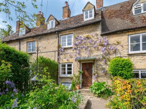 3 bedroom house for sale in Woodstock, OX20 — £450,000 • 3 bed • 1 bath • 1151 ft²
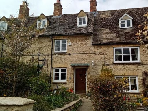 3 bedroom terraced house for sale in Woodstock, Oxfordshire, OX20 — £450,000 • 3 bed • 1 bath • 914 ft²
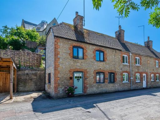 3 bedroom cottage for sale in Brook Hill, Woodstock, OX20 — £525,000 • 3 bed • 1 bath • 848 ft²
 5 bedroom house for sale in Manor Road, Woodstock, OX20 — £900,000 • 5 bed • 2 bath • 496 ft²
 3 bedroom detached house for sale in Harrisons Lane, Woodstock, OX20 — £1,200,000 • 3 bed • 2 bath • 1632 ft²
Meta
- {
"@context": "https://schema.org",
"@type": "Residence",
"name": "2 bedroom terraced house for sale in Manor Road, Woodstock,…",
"description": "",
"url": "https://propertypiper.co.uk/property/06bdf796-c609-4bdb-b7d8-e978eaae1fc7",
"image": "https://image-a.propertypiper.co.uk/d795b0cb-d57e-416a-becd-64477f71eaf7-1024.jpeg",
"address": {
"@type": "PostalAddress",
"streetAddress": "59 MANOR ROAD WOODSTOCK ",
"postalCode": "OX20 1XR",
"addressLocality": "West Oxfordshire",
"addressRegion": "Witney",
"addressCountry": "England"
},
"geo": {
"@type": "GeoCoordinates",
"latitude": 51.8511519,
"longitude": -1.3609523
},
"numberOfRooms": 2,
"numberOfBathroomsTotal": 2,
"floorSize": {
"@type": "QuantitativeValue",
"value": 1068,
"unitCode": "FTK"
},
"offers": {
"@type": "Offer",
"price": 525000,
"priceCurrency": "GBP",
"availability": "https://schema.org/InStock"
},
"additionalProperty": [
{
"@type": "PropertyValue",
"name": "Feature",
"value": "cottage"
},
{
"@type": "PropertyValue",
"name": "Feature",
"value": "stone exterior"
},
{
"@type": "PropertyValue",
"name": "Feature",
"value": "roof moss"
},
{
"@type": "PropertyValue",
"name": "Feature",
"value": "sloped roof"
},
{
"@type": "PropertyValue",
"name": "Feature",
"value": "dormer windows"
},
{
"@type": "PropertyValue",
"name": "Feature",
"value": "garden"
},
{
"@type": "PropertyValue",
"name": "Feature",
"value": "character"
},
{
"@type": "PropertyValue",
"name": "Feature",
"value": "Rustic"
},
{
"@type": "PropertyValue",
"name": "Feature",
"value": "Exposed beams"
},
{
"@type": "PropertyValue",
"name": "Feature",
"value": "Stone flooring"
},
{
"@type": "PropertyValue",
"name": "Feature",
"value": "Stone fireplace"
},
{
"@type": "PropertyValue",
"name": "Feature",
"value": "Wood-burning stove"
},
{
"@type": "PropertyValue",
"name": "Feature",
"value": "Cottage style"
},
{
"@type": "PropertyValue",
"name": "Feature",
"value": "Countryside"
},
{
"@type": "PropertyValue",
"name": "Feature",
"value": "Character property"
}
]
}
High Res Floorplan Images
Compatible Floorplan Images
FloorplanImages Thumbnail