WN7 1EP - 3 bedroom town house for sale in Runfield Close, Leigh WN7…
View on Property Piper
3 bedroom town house for sale in Runfield Close, Leigh WN7 1EP, WN7
Property Details
- Price: £215000
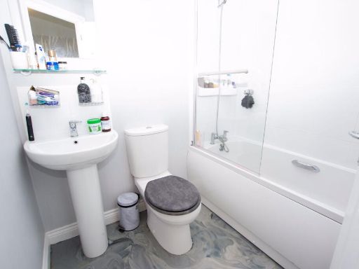
- Bedrooms: 3
- Bathrooms: 3
- Property Type: undefined
- Property SubType: undefined
Brochure Descriptions
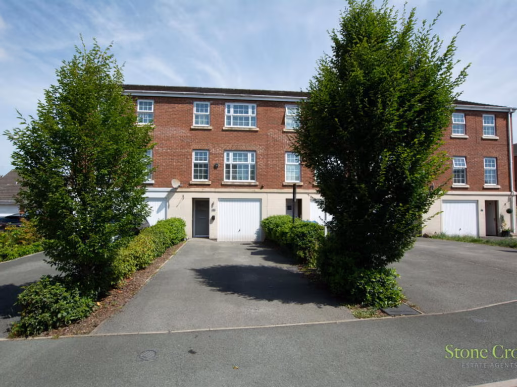
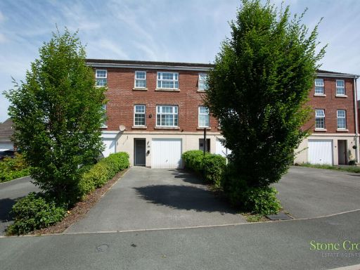
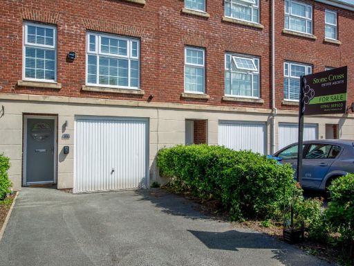
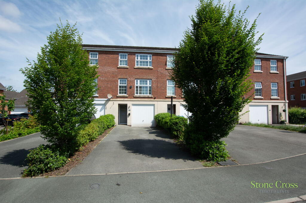
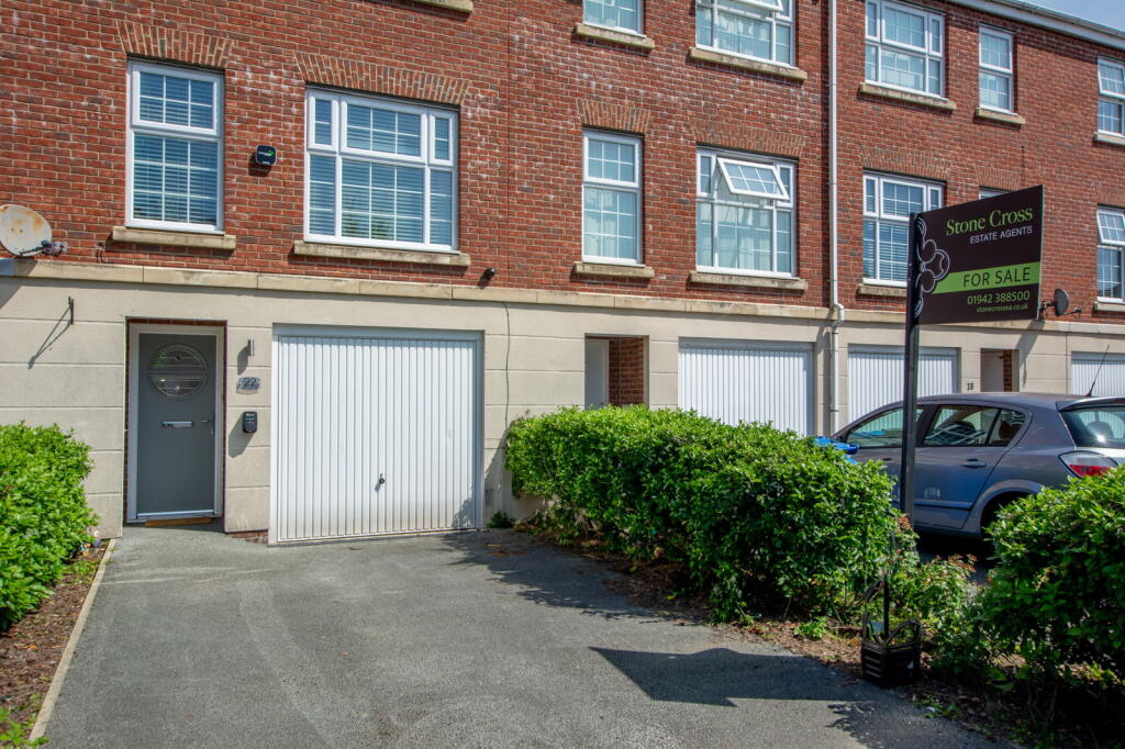
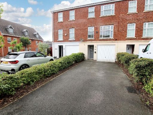
- Three-storey modern townhouse constructed in red brick, set within a planned residential development. The property has an integral single garage at ground level with an adjacent driveway providing off-street parking for at least one vehicle. The front plot is low-maintenance with paved surfaces and planted beds, including two established trees flanking the driveway. The building is a mid/ end-terrace style block with regular, contemporary fenestration and appears well maintained externally. Overall impression (valuator style): a compact family townhouse offering efficient use of space across three floors, practical off-street parking and low-maintenance external areas — likely to appeal to commuters or small families seeking a modern, low-upkeep home in a residential neighbourhood.
- Based on the provided location map, the property appears to be a mid-terraced residential dwelling in a dense urban neighbourhood close to Holden Road in Leigh. The surrounding area is comprised predominantly of terraced and semi‑detached houses on a grid of narrow residential streets. The site likely has a small to average sized rear garden and footprint typical of Victorian/early 20th century terraced housing. Immediate amenities are nearby (local shops, places of worship and main roads such as Holden Road), and transport links appear accessible. Overall the property would be described as a small-to-average sized urban residential property suitable for owner-occupation or lettings; condition and internal layout cannot be determined from the map alone.
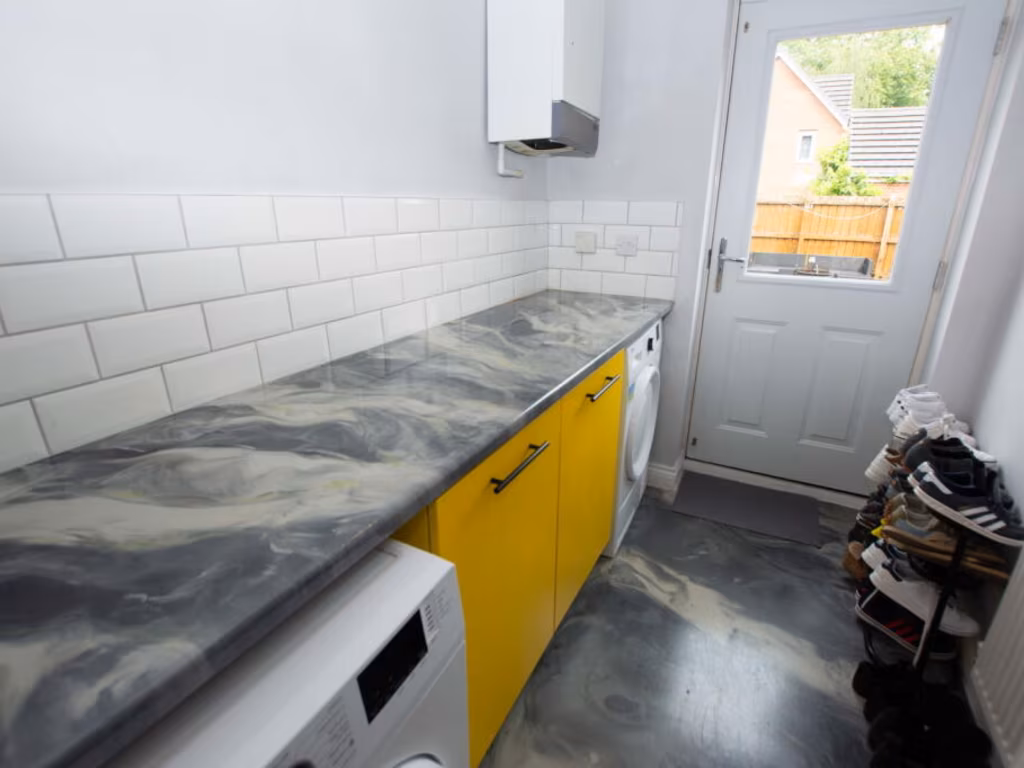
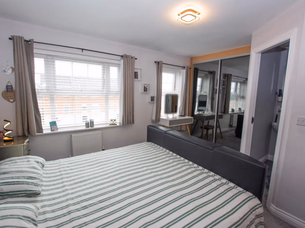
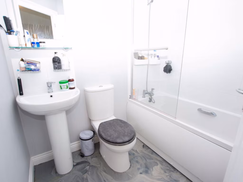
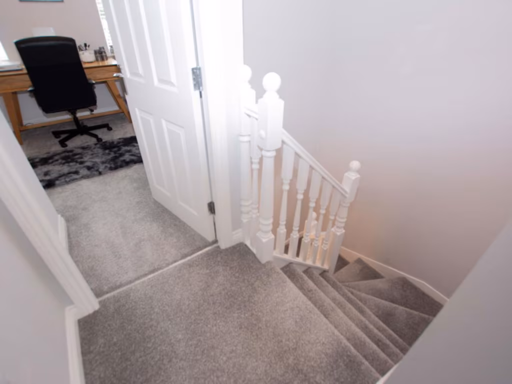
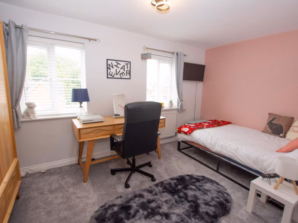
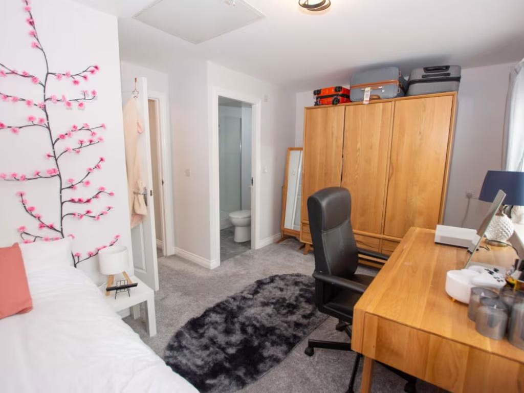
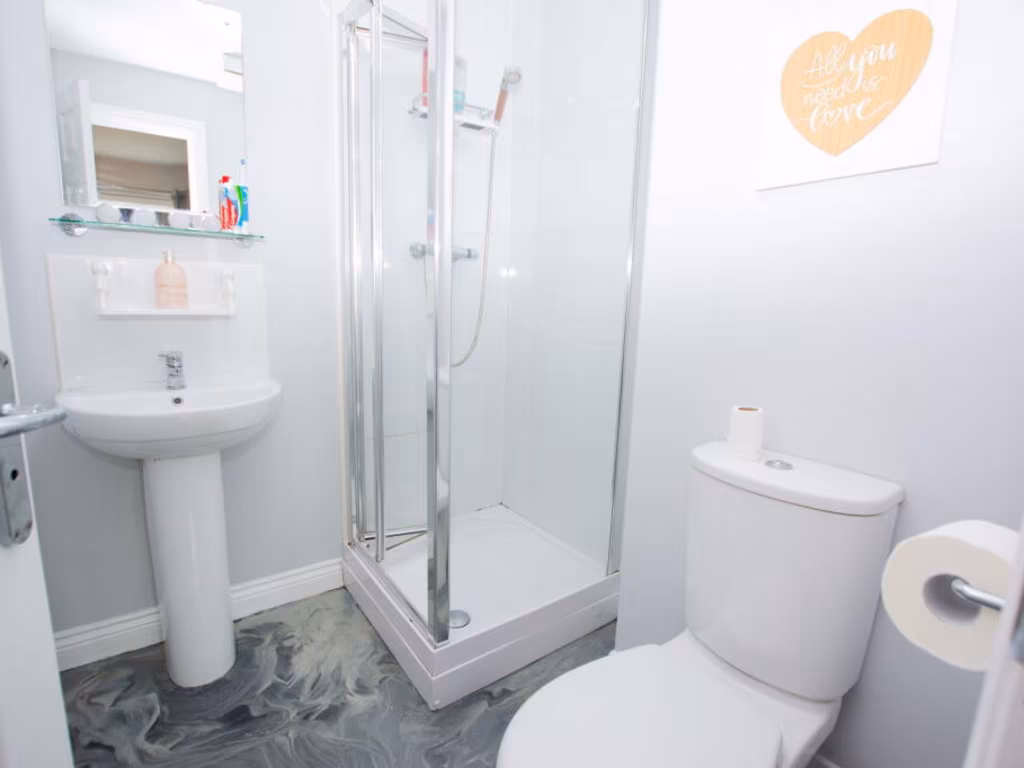
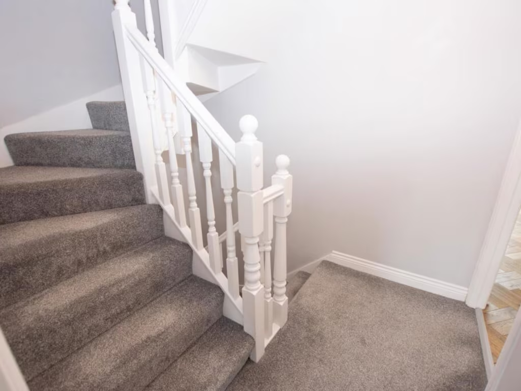
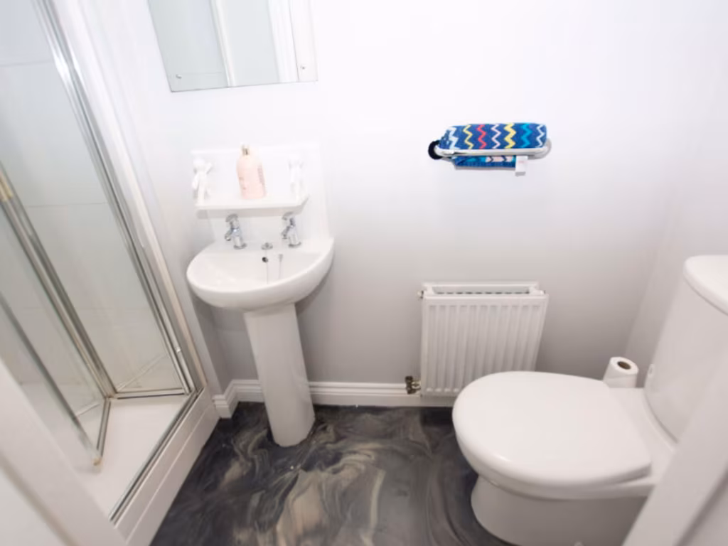
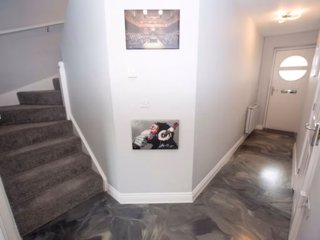
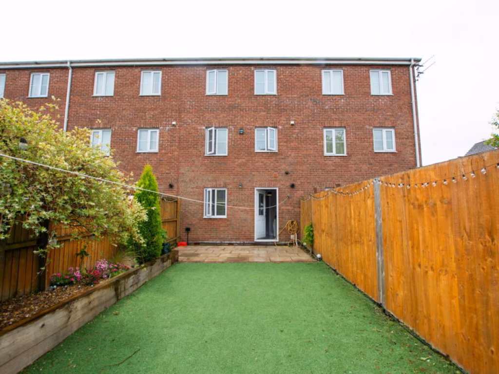
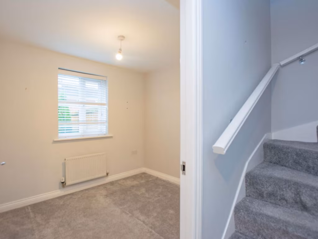
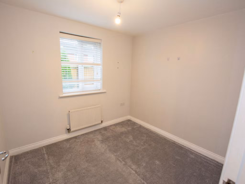
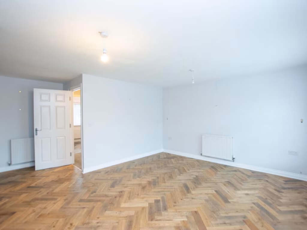
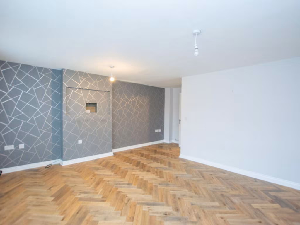
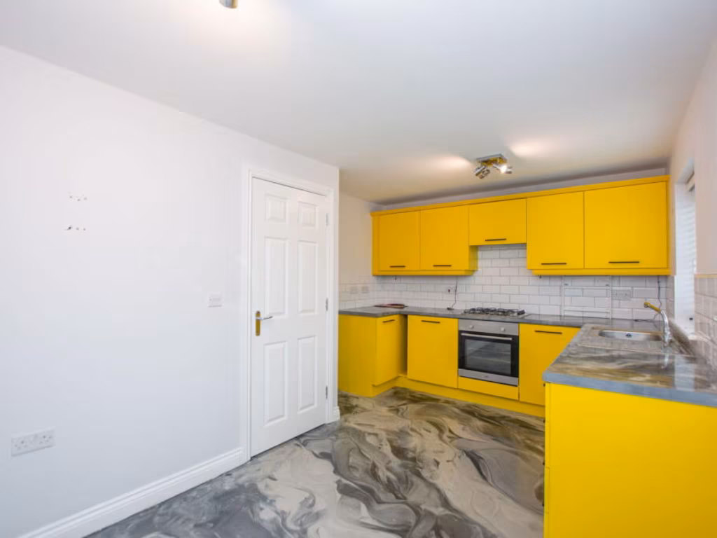
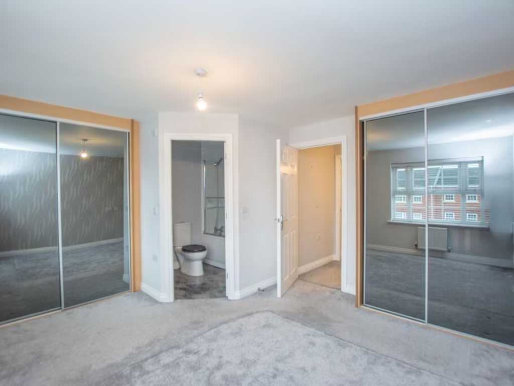
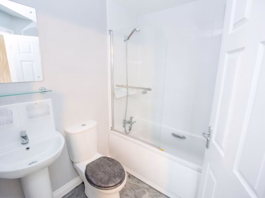
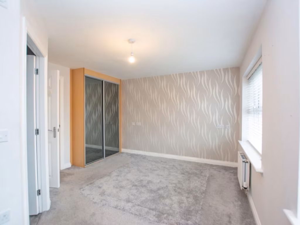
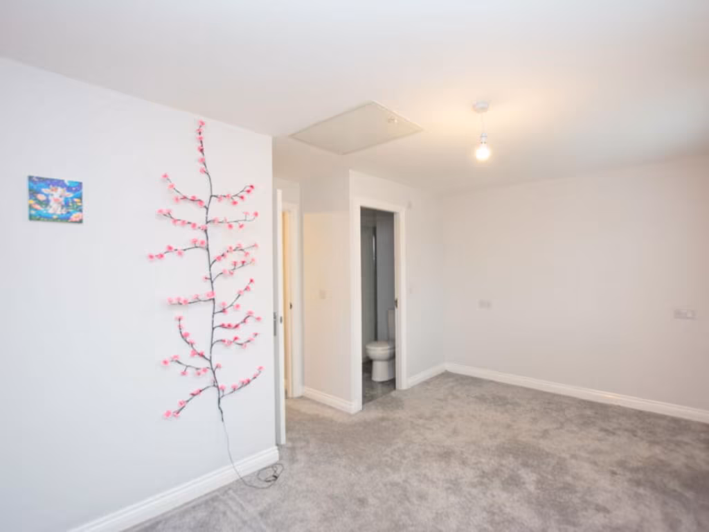
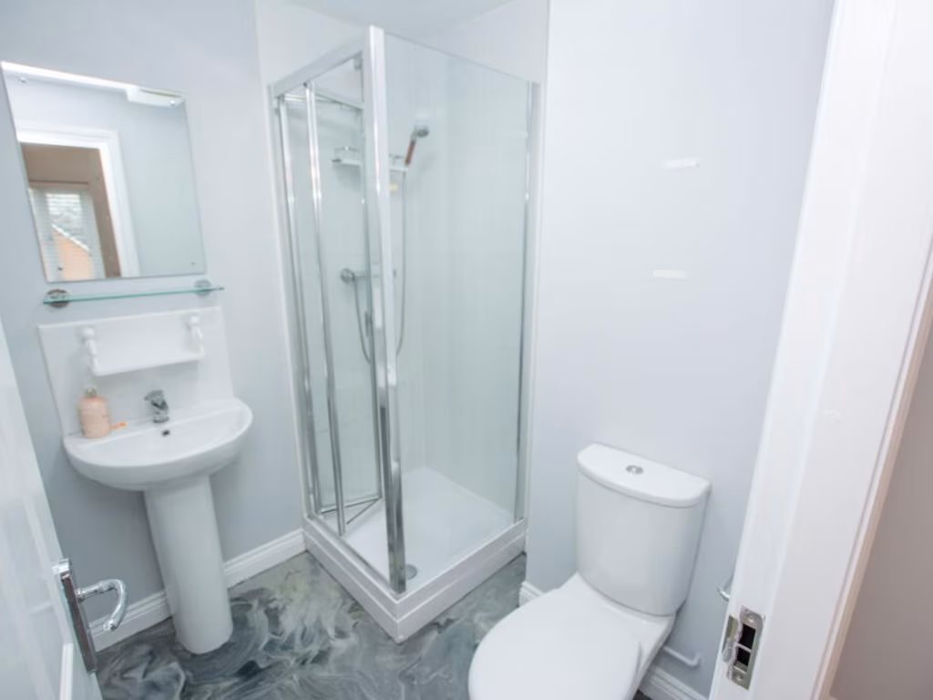
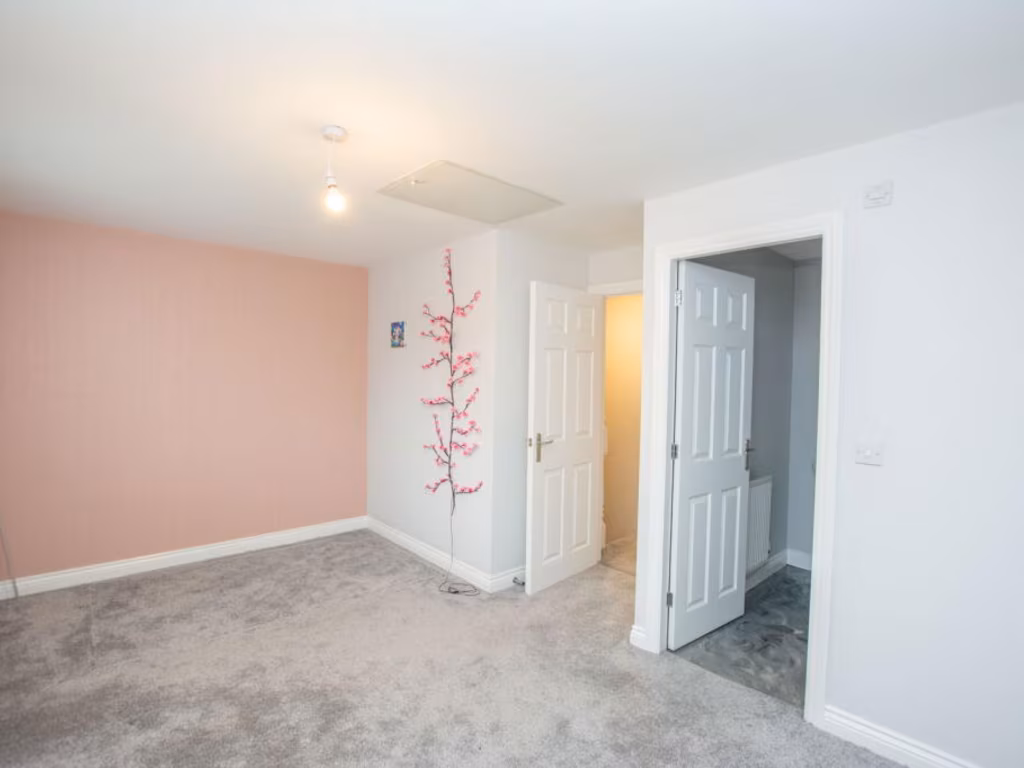
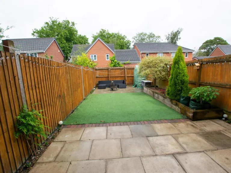
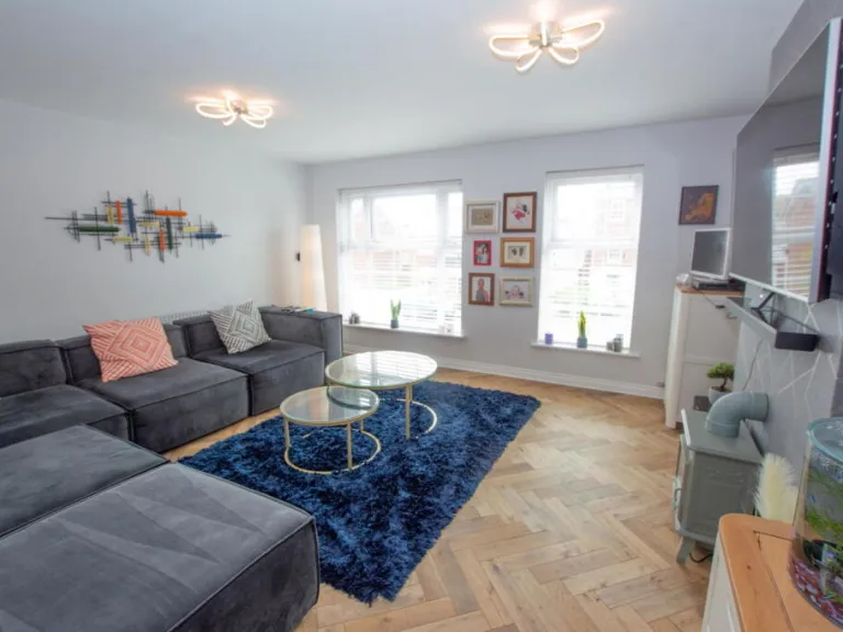
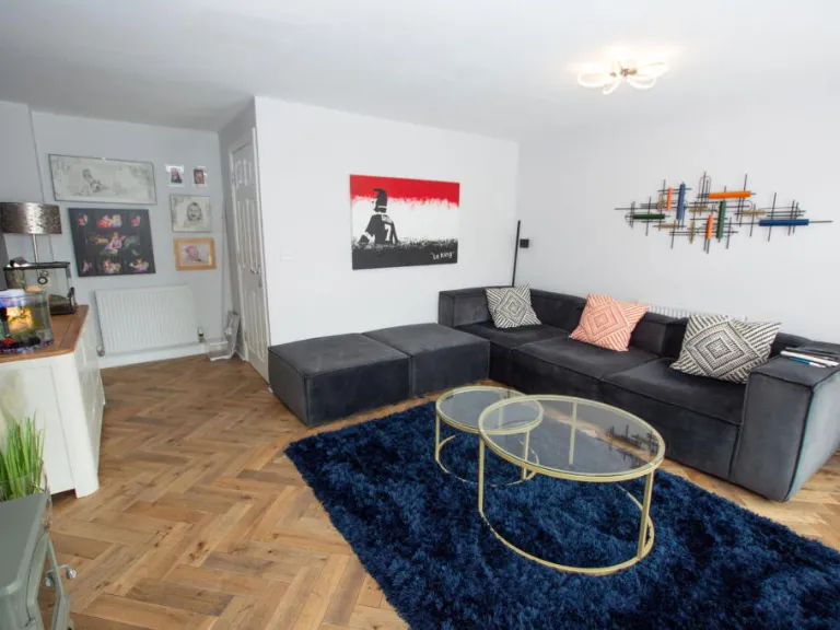
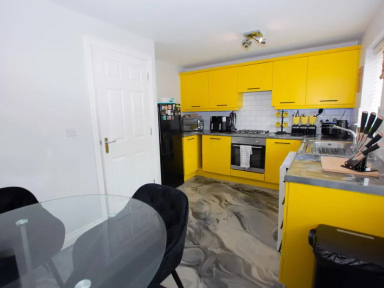
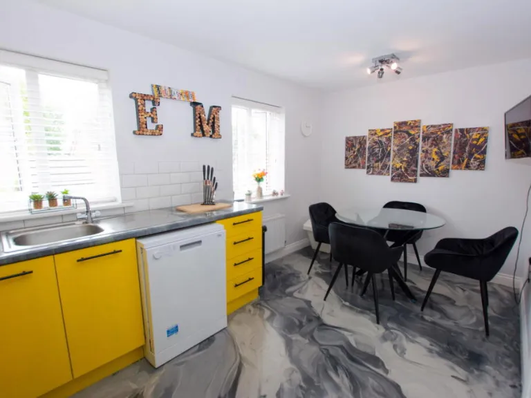
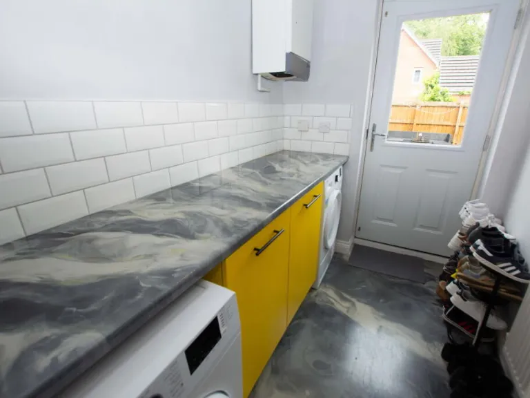
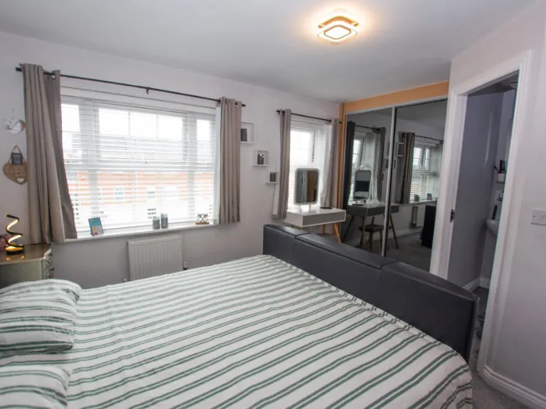
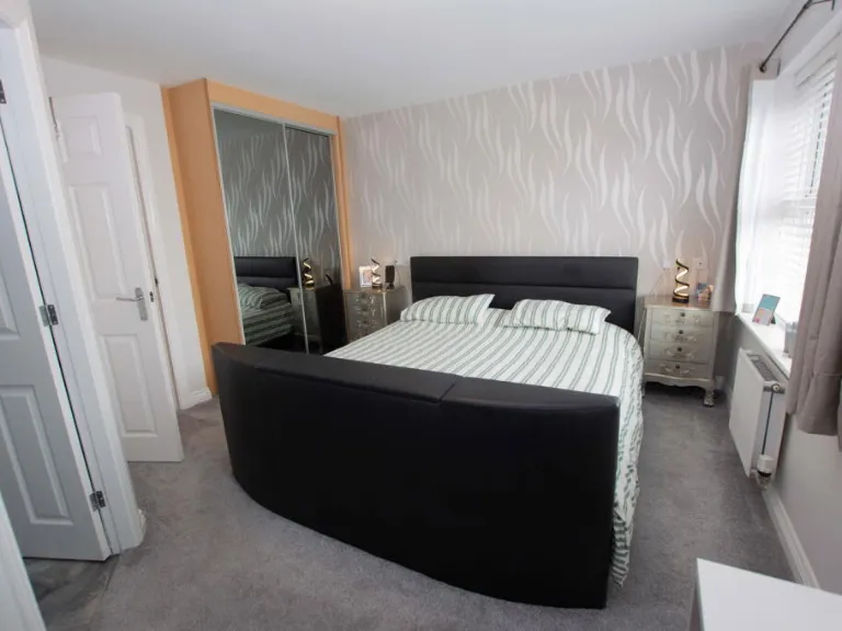
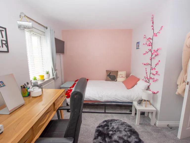
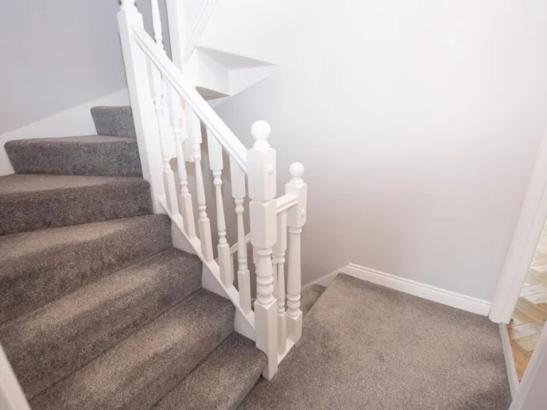
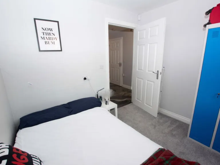
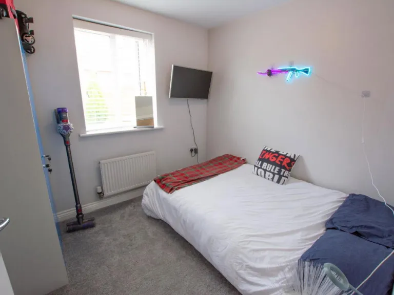
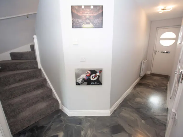
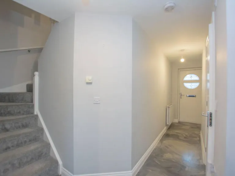
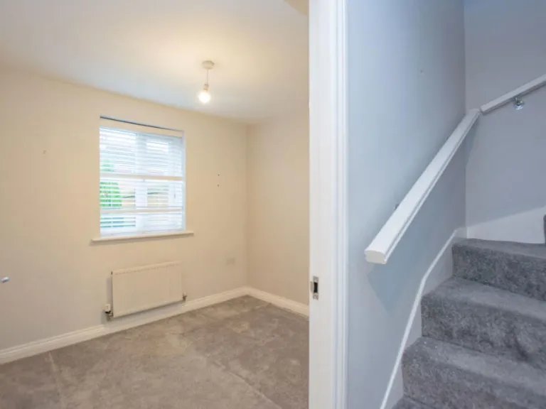
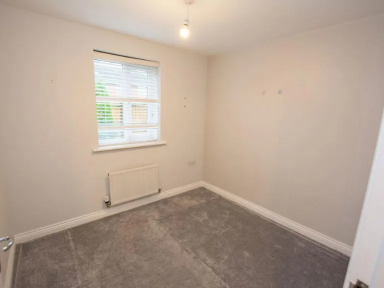
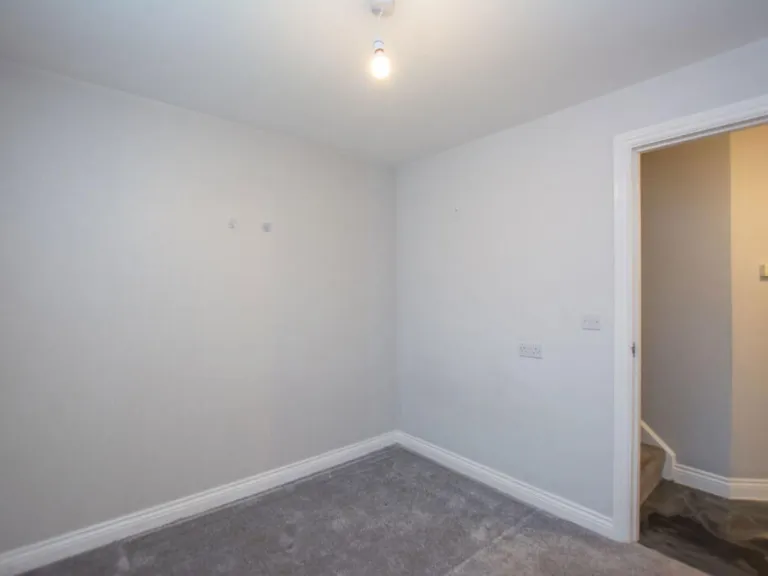
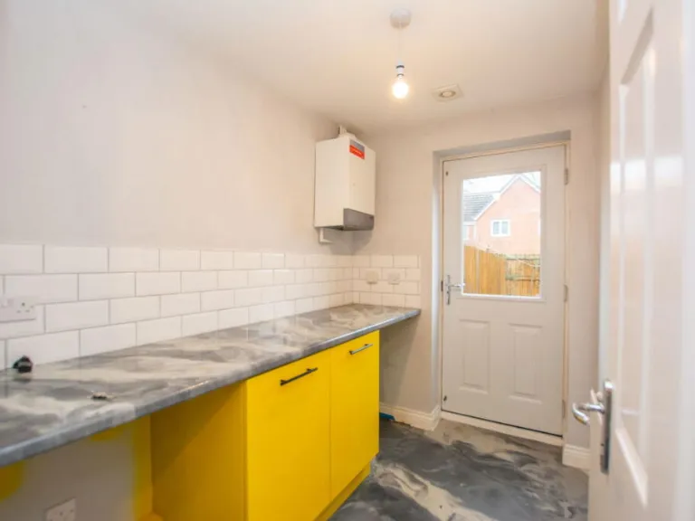
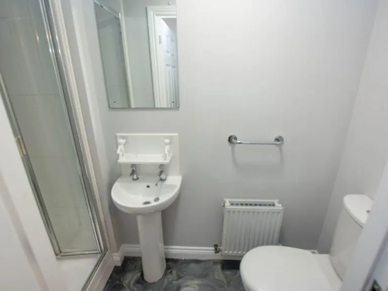
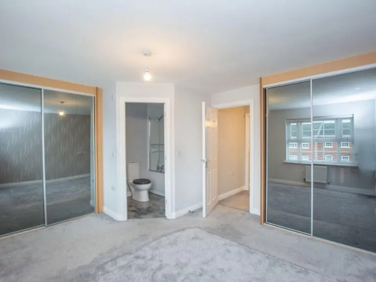
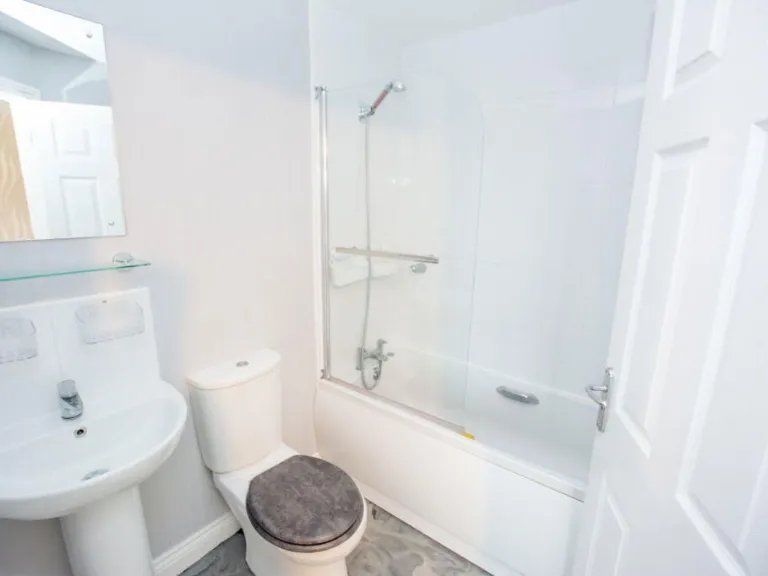
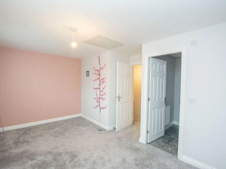
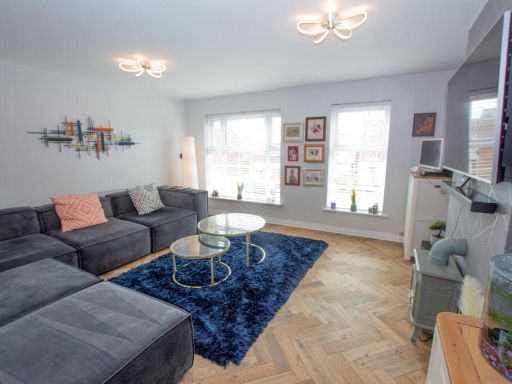
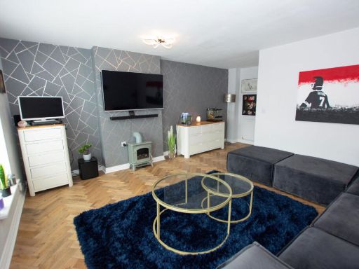
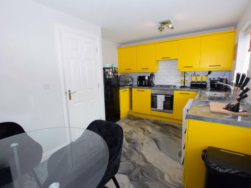
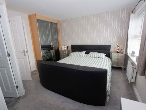
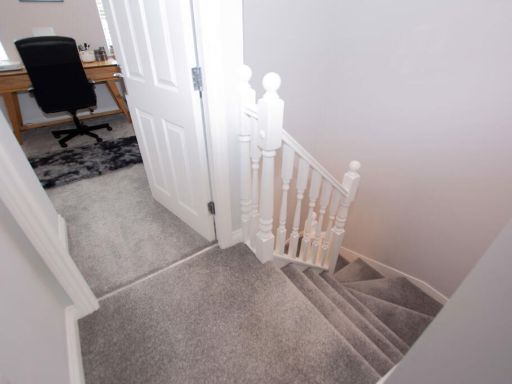
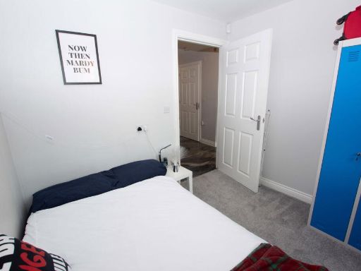
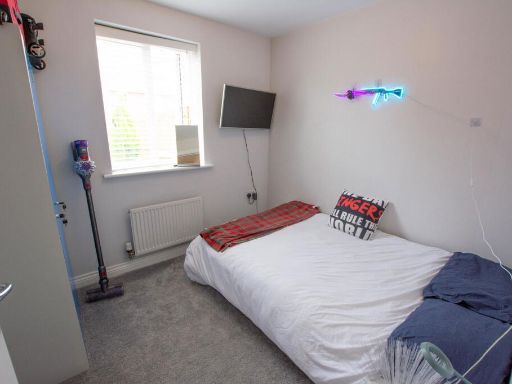
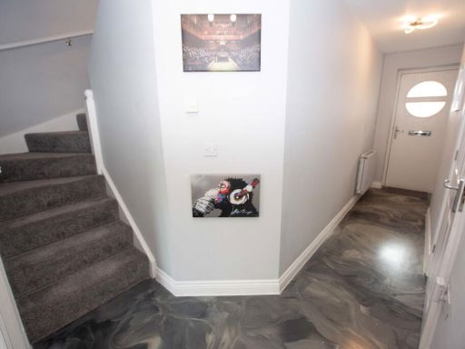
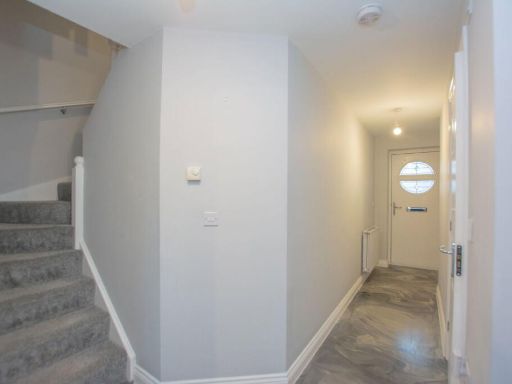
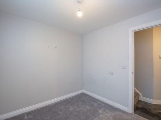
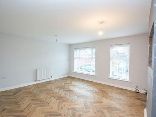
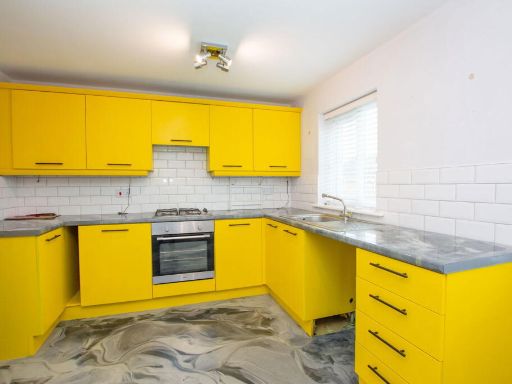
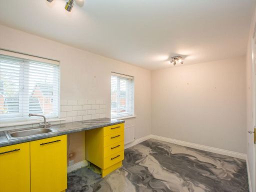
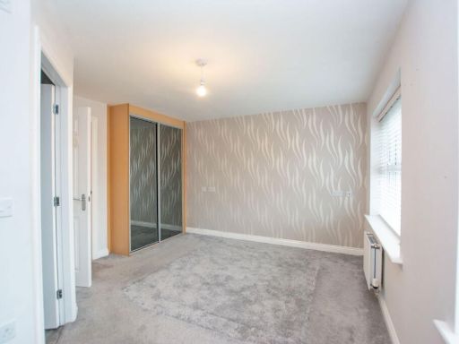
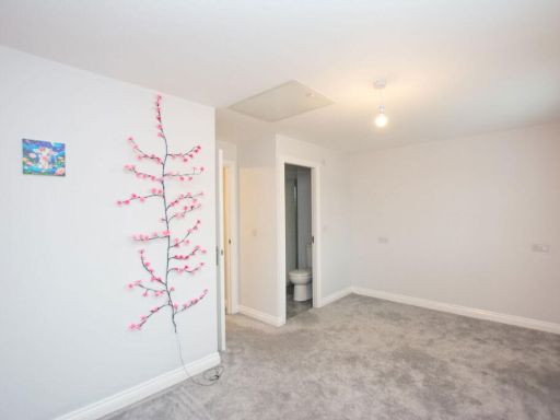
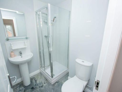
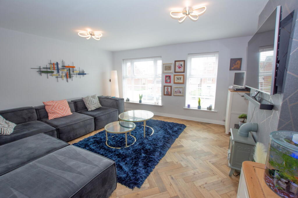
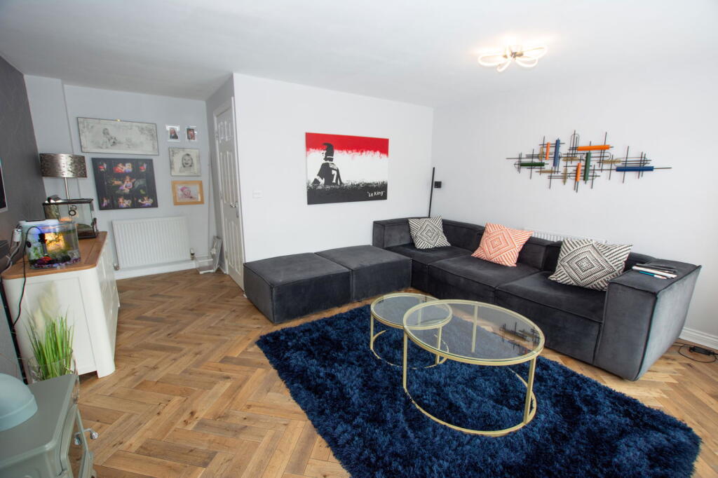
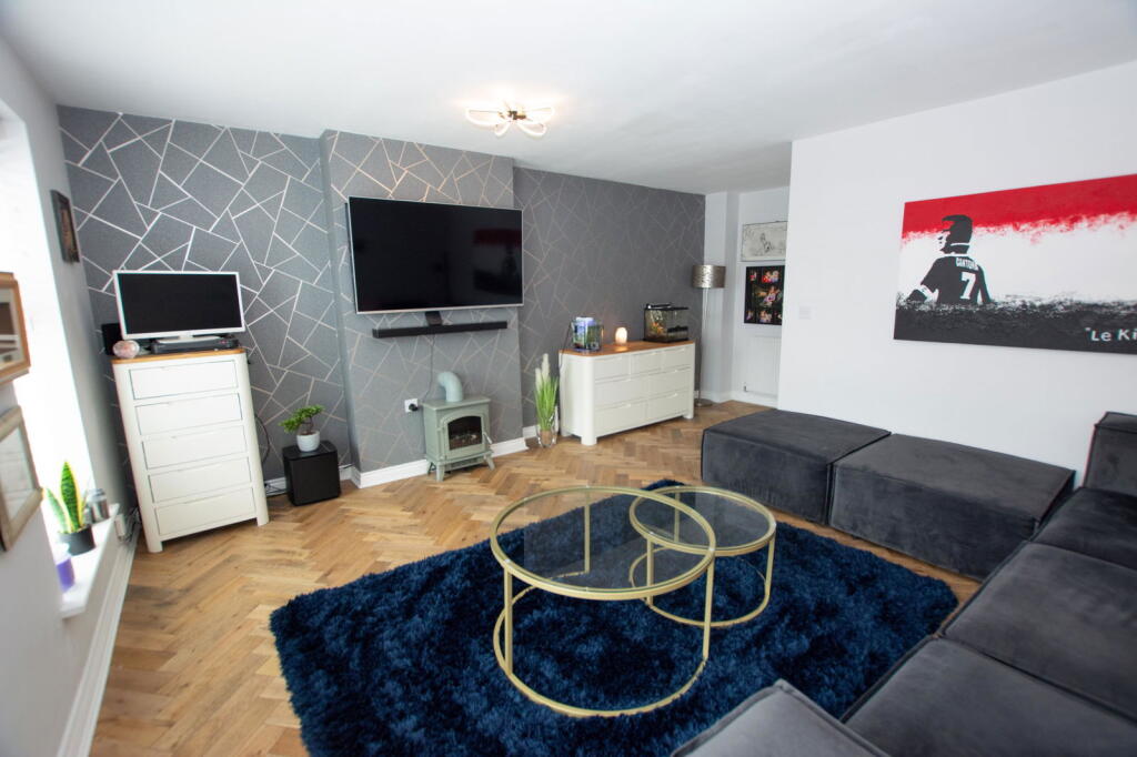
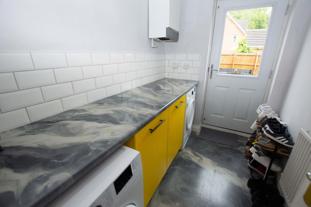
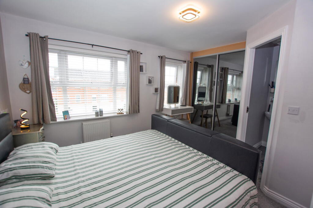
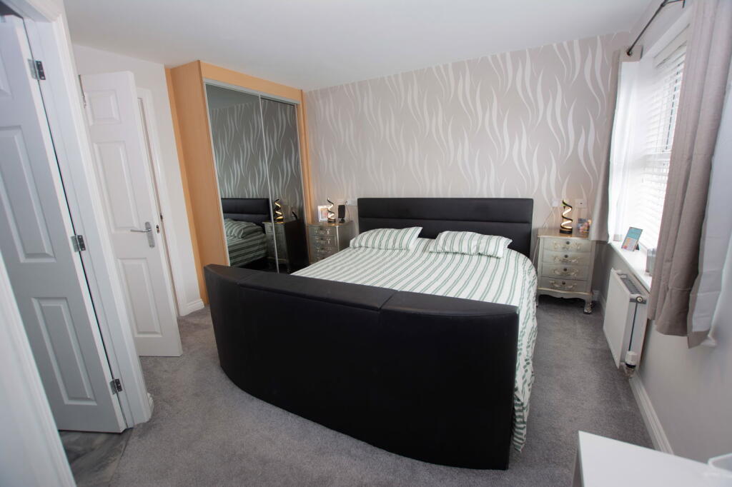
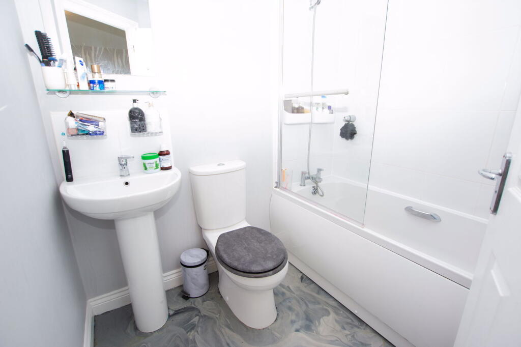
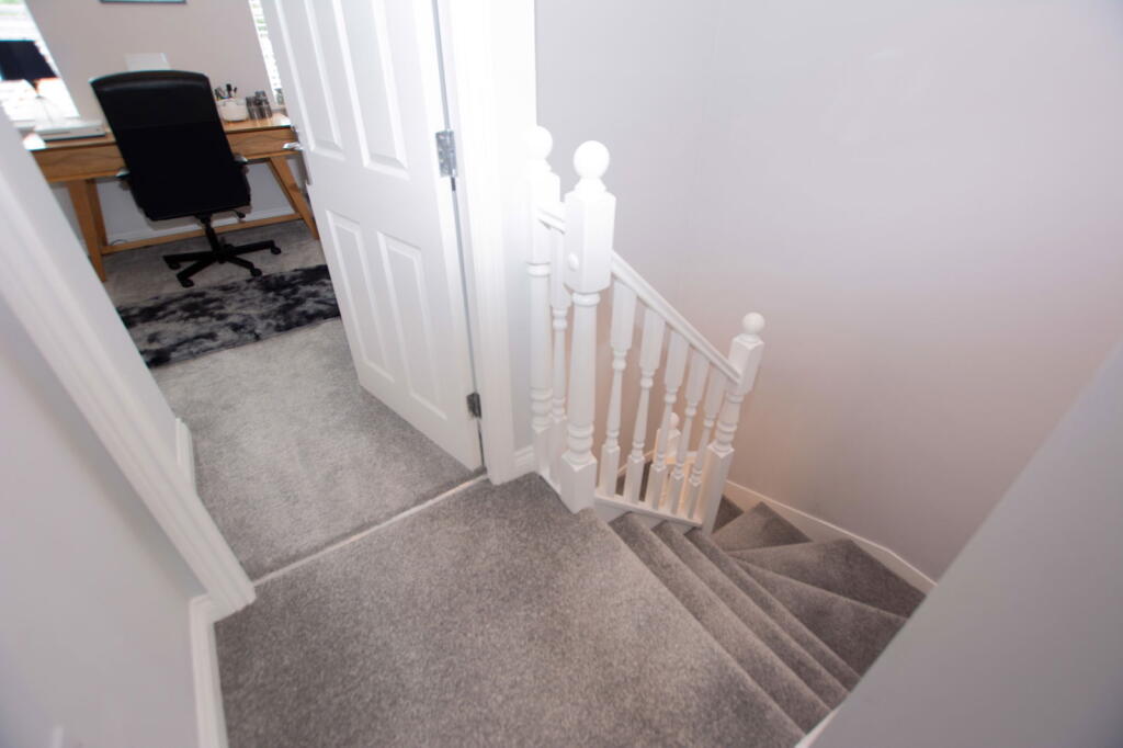
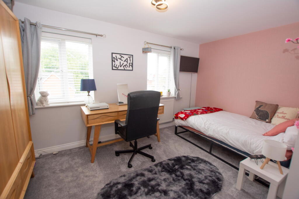
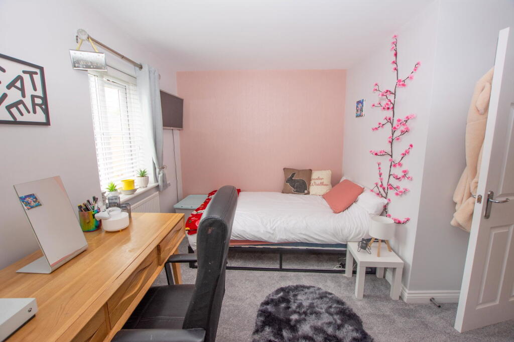
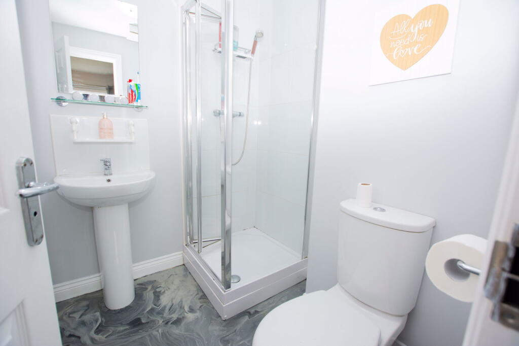
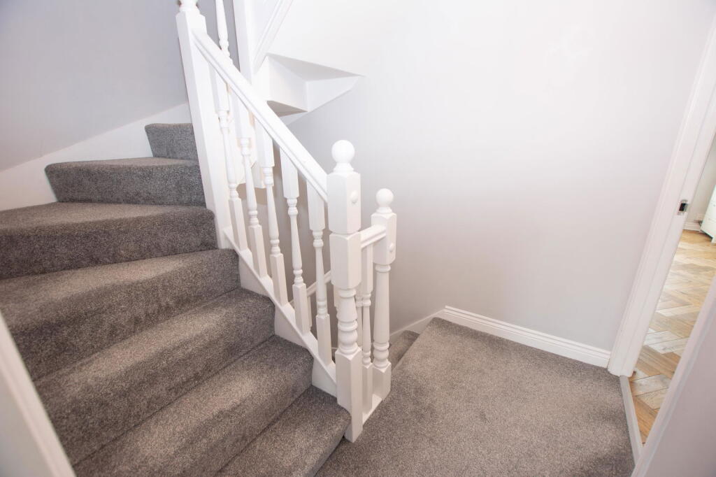
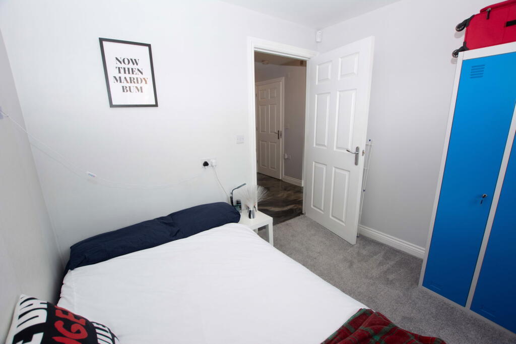
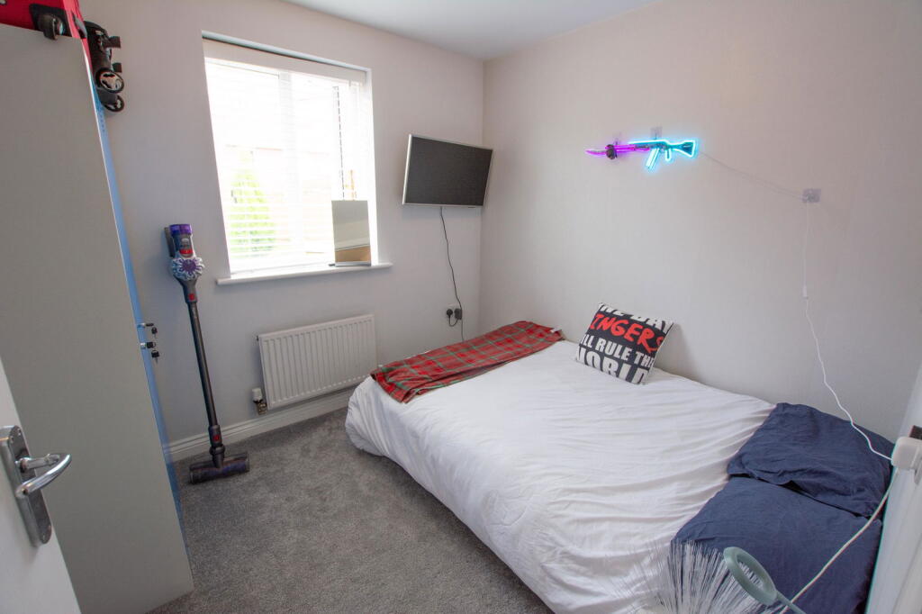
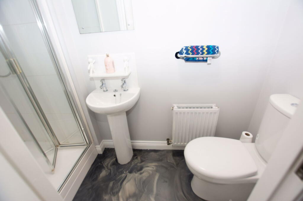
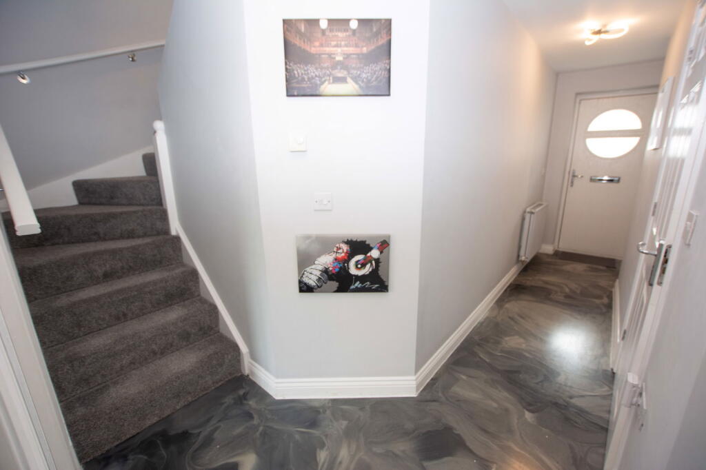
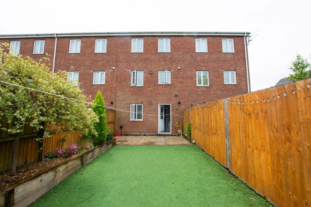
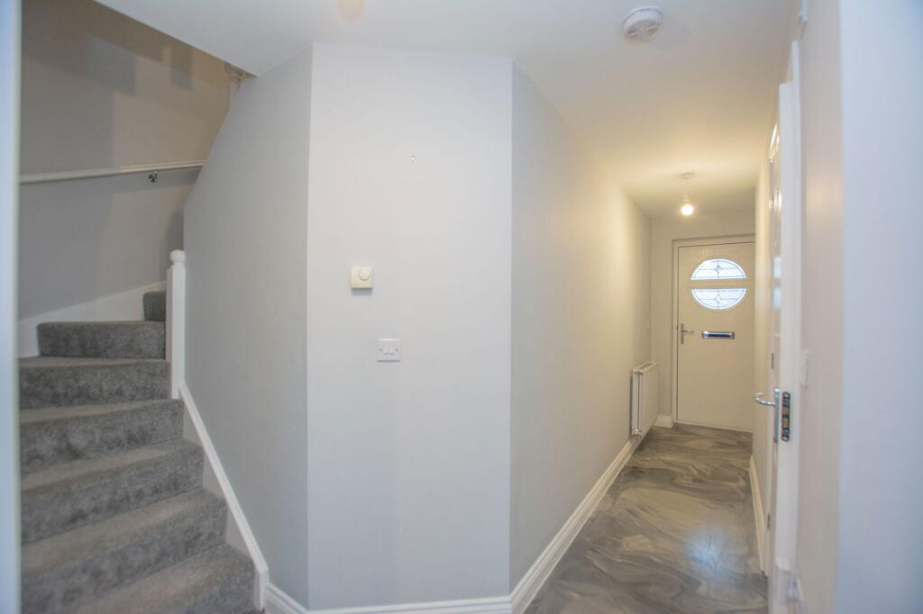
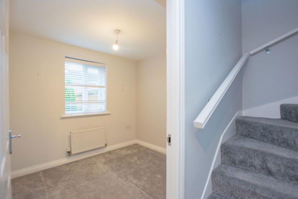
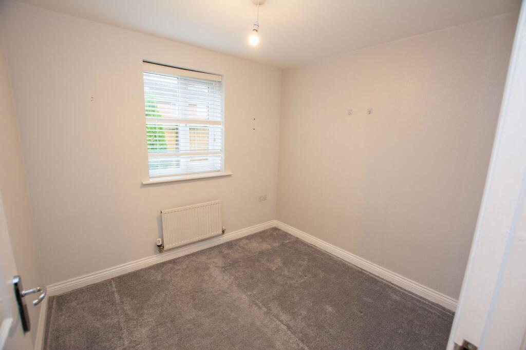
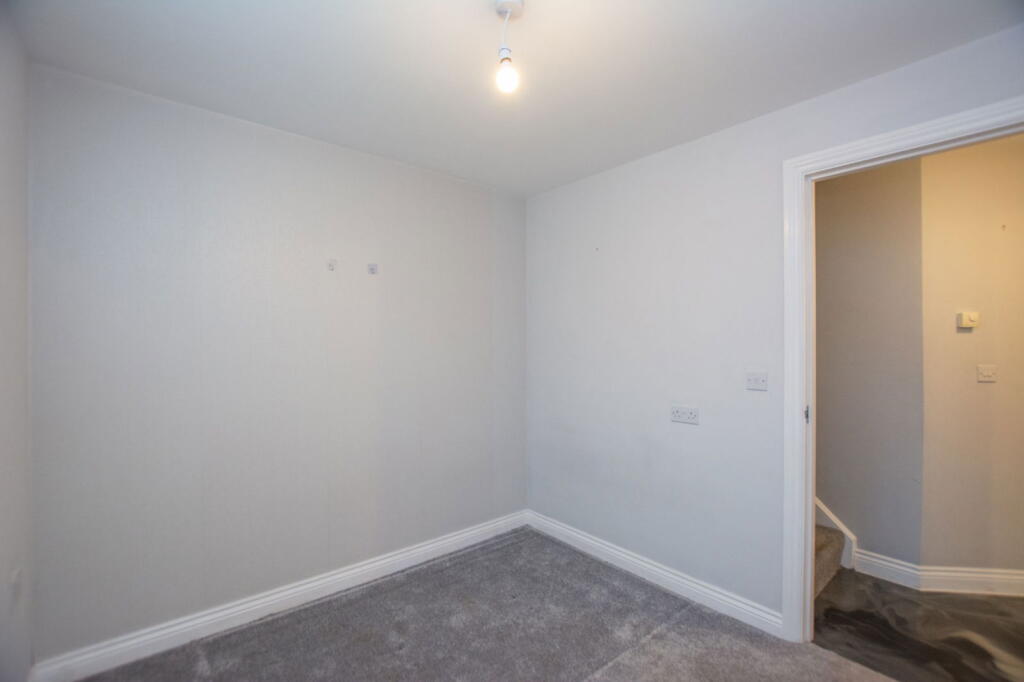
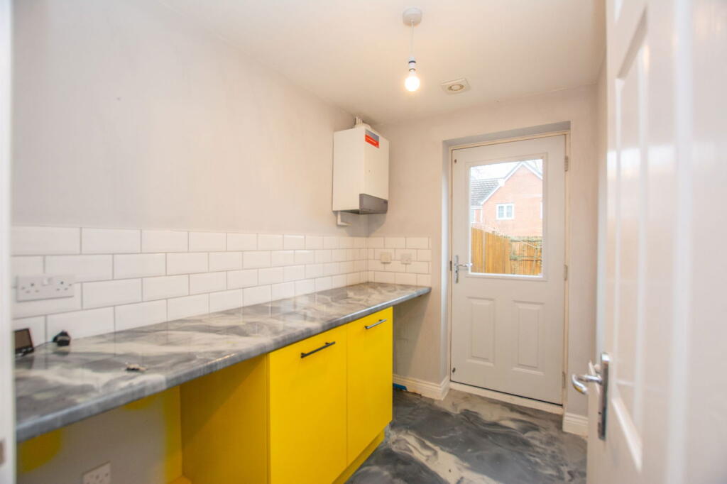
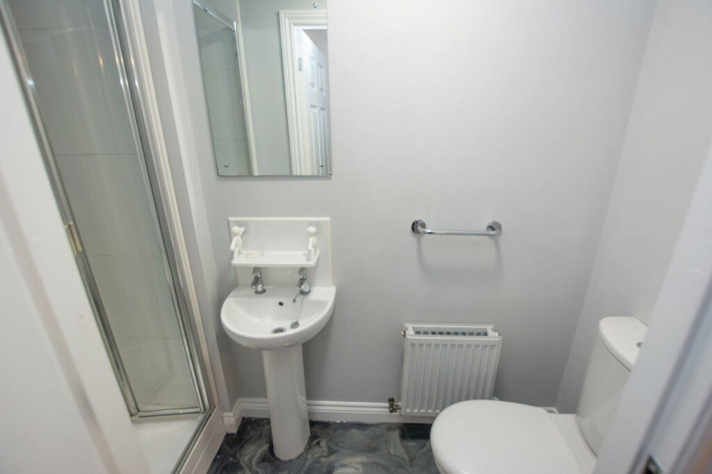
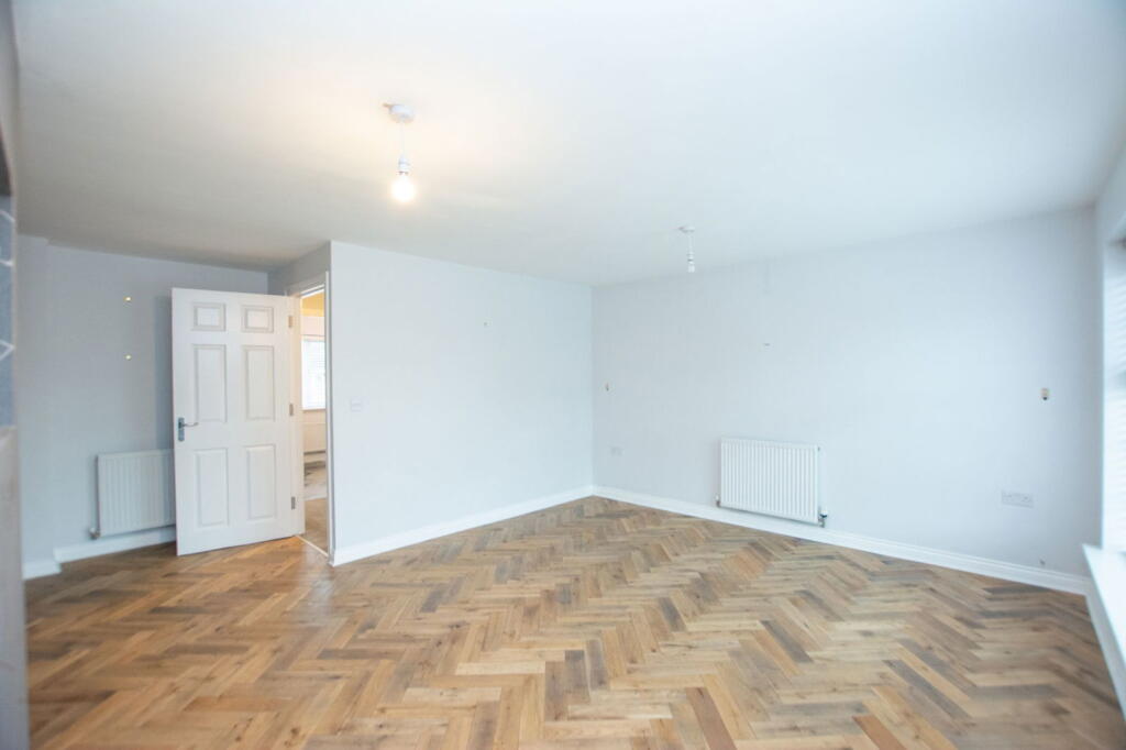
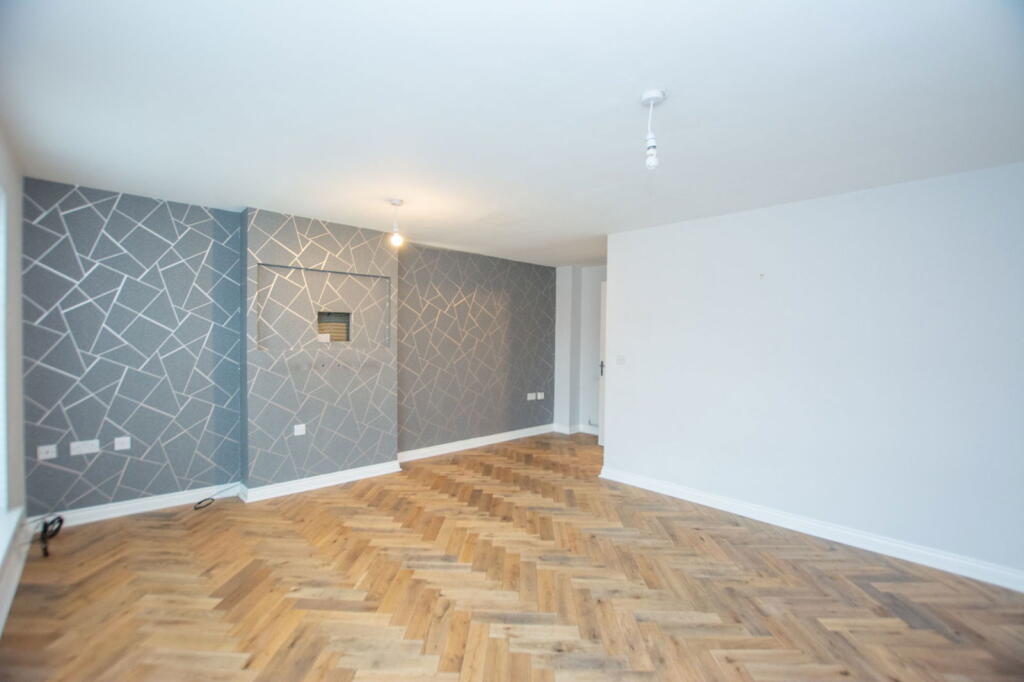
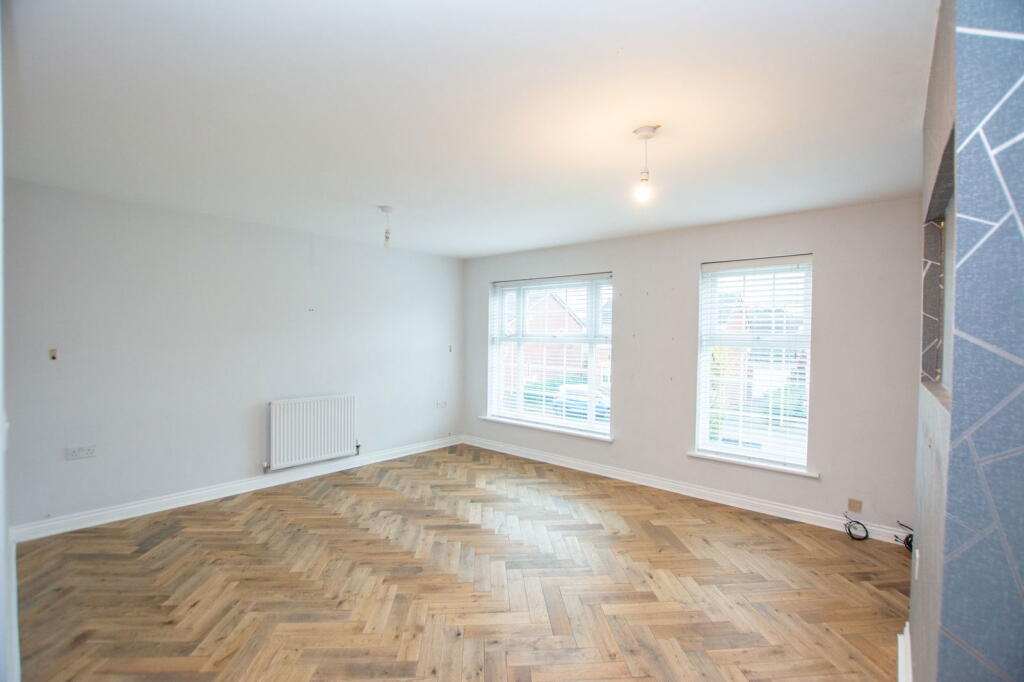
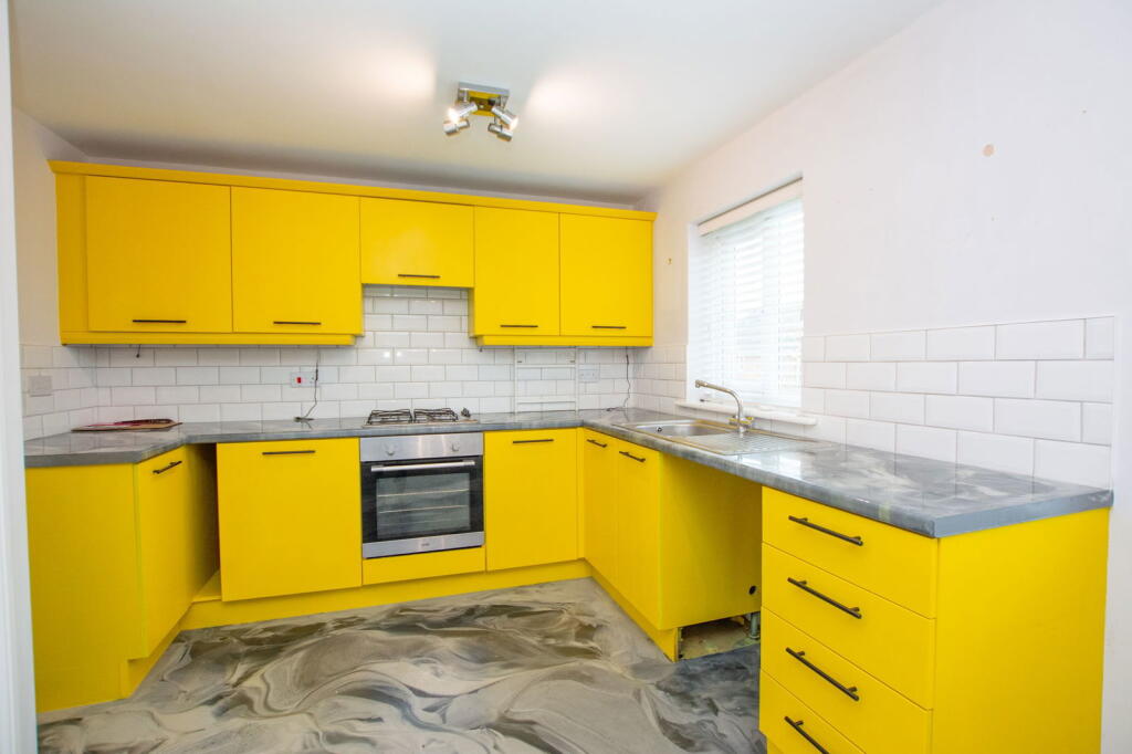
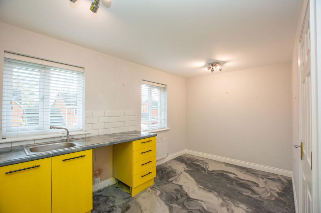
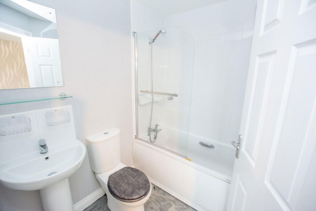
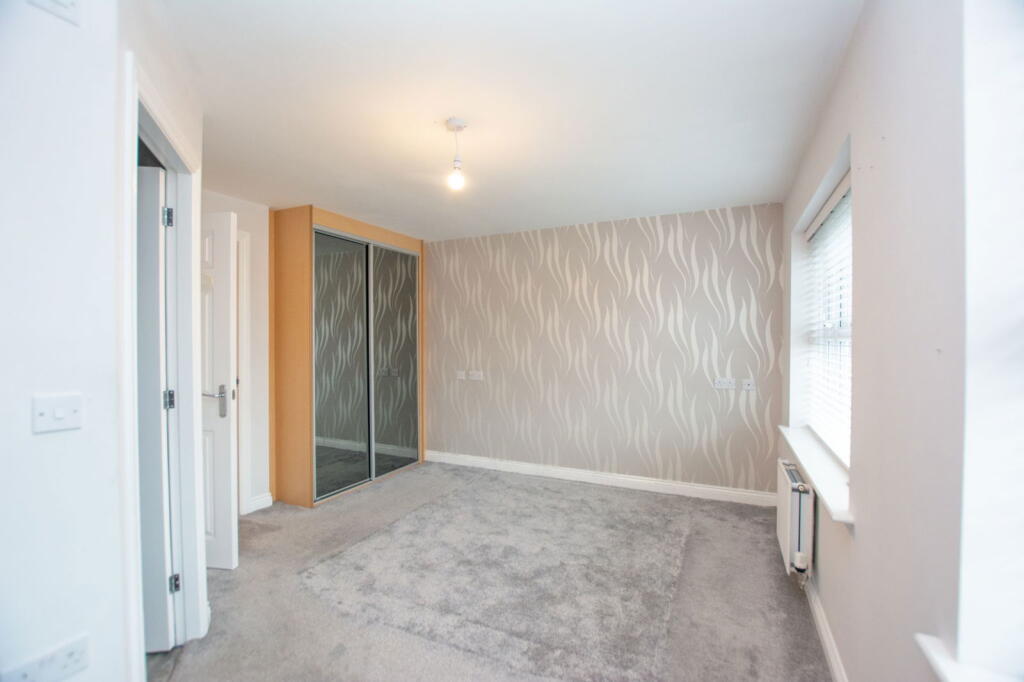
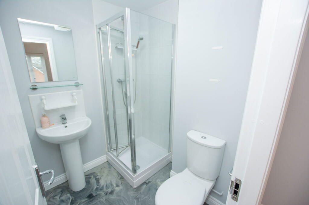
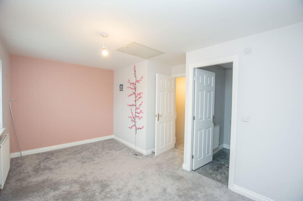
- Mid-terraced, three-storey townhouse presented in good decorative order. Accommodation shown and described on images and text comprises: ground-floor utility and bedroom three, lounge and kitchen to the first floor and main bedroom with en-suite to the upper level (exact room layout to be confirmed on inspection). Interiors feature UPVC double glazing, wall-mounted radiators, fitted kitchen units with electric oven and gas hob, and contemporary finishes (herringbone-style wood flooring in lounge pictured). The property benefits from a small but well-maintained rear garden with paved patio and artificial lawn and enclosed timber fencing — suitable for low-maintenance outdoor space. The frontage includes a parking space or small driveway and an integral or adjacent garage/store door visible from the street photograph. Overall plot and garden are small to average in size for a townhouse; internal living space appears to be average for a 2-3 bedroom urban property. No exceptional views are visible (urban/residential surroundings).
- Three-storey mews townhouse (3 bedrooms) set within a small cul-de-sac. Red-brick construction with integral garage at ground floor and off-street driveway parking. Mid-terraced arrangement with uniform neighbouring properties. Interior likely arranged over three levels given external fenestration. Rear garden is small to average in size, private and low-maintenance with a paved patio area and artificial lawn; enclosed by timber fencing. Frontage provides parking and planted beds/hedging. Overall property footprint is modest — typical of modern mews townhouses — suitable for a small family or as a rental investment. No notable long-distance views visible; setting is residential and sheltered.
Image Descriptions
- house front contemporary townhouse
- townhouse exterior contemporary
Textual Property Features
- Has Garden
- Chain Free
- Success
Detected Visual Features
- contemporary
- townhouse
- garage
- driveway
- three-story
- brick exterior
- low maintenance
- cul-de-sac
- brick facade
- well-kept
- residential area
EPC Details
- Fully double glazed
- Cavity wall, as built, insulated (assumed)
- Boiler and radiators, mains gas
- Low energy lighting in 73% of fixed outlets
- Solid, insulated (assumed)
Nearby Schools
- St Gabriel's Catholic Primary School
- Sacred Heart RC Primary School
- St Richard's Roman Catholic Primary School Atherton
- Glazebury Church of England Primary School
- Bedford Hall Methodist Primary School
- Christ Church CofE Primary School, Pennington
- St Joseph's Catholic Primary School Leigh
- Leigh CofE Primary School
- Leigh St Peter's CofE Primary School
- Fred Longworth High School
- Hindsford CofE Primary School
- Atherton St George's CofE Primary School
- St Thomas' CofE Primary School, Leigh
- Bedford High School
- Leigh St John's CofE Primary
- Westleigh St Paul's CofE Primary School
- St Michael's CofE Primary School, Howe Bridge
- St James CofE Primary School, Daisy Hill
- Gilded Hollins Community School
- Parklee Community School
- Meadowbank Primary School & Children's Centre
- Leigh St Mary's CofE Primary School
- Atherton High School
- Leigh Central Primary School
- Sacred Heart Catholic Primary School Leigh
- Newton Westpark Primary School
- Twelve Apostles Catholic Primary School
- Leigh Westleigh Methodist Primary School
- The Westleigh School
Nearest Bars And Restaurants
- Id: 672223078
- Tags:
- Amenity: pub
- Name: The Boar's Head
- TagsNormalized:
- Lat: 53.4982252
- Lon: -2.518767
- FullGeoHash: gcw0qejcsrzp
- PartitionGeoHash: gcw0
- Images:
- FoodStandards: null
- Distance: 398.1
,- Id: 3524259245
- Tags:
- Amenity: pub
- Name: White Lion
- TagsNormalized:
- Lat: 53.498624
- Lon: -2.5188218
- FullGeoHash: gcw0qeju54q6
- PartitionGeoHash: gcw0
- Images:
- FoodStandards: null
- Distance: 384.4
,- Id: 672223081
- Tags:
- Amenity: pub
- Name: Bar None
- Wheelchair: limited
- TagsNormalized:
- Lat: 53.4990315
- Lon: -2.5189078
- FullGeoHash: gcw0qejy3nq1
- PartitionGeoHash: gcw0
- Images:
- FoodStandards: null
- Distance: 377.3
,- Id: 676311891
- Tags:
- Amenity: pub
- Name: The Courts
- TagsNormalized:
- Lat: 53.4976121
- Lon: -2.5145466
- FullGeoHash: gcw0qfbynvdn
- PartitionGeoHash: gcw0
- Images:
- FoodStandards: null
- Distance: 253.6
,- Id: 676307078
- Tags:
- Amenity: fast_food
- Cuisine: fish_and_chips
- Name: Smiths Fish Bar
- TagsNormalized:
- Lat: 53.4989146
- Lon: -2.5164365
- FullGeoHash: gcw0qeptfb8b
- PartitionGeoHash: gcw0
- Images:
- FoodStandards: null
- Distance: 226
}
Nearest General Shops
- Id: 448048826
- Tags:
- Brand: Travis Perkins
- Brand:wikidata: Q2450664
- Name: Travis Perkins
- Shop: doityourself
- TagsNormalized:
- travis perkins
- doityourself
- shop
- Lat: 53.4964341
- Lon: -2.5118661
- FullGeoHash: gcw0qfdzm60g
- PartitionGeoHash: gcw0
- Images:
- FoodStandards: null
- Distance: 384.5
,- Id: 190294438
- Tags:
- Brand: Wilko
- Brand:wikidata: Q8002536
- Brand:wikipedia: en:Wilko (retailer)
- Building: yes
- Contact:
- Website: https://stores.wilko.com/gb/leigh/lord-street
- Name: Wilko
- Shop: variety_store
- TagsNormalized:
- Lat: 53.4967337
- Lon: -2.5159443
- FullGeoHash: gcw0qdzcn1zy
- PartitionGeoHash: gcw0
- Images:
- FoodStandards: null
- Distance: 379.7
,- Id: 605637251
- Tags:
- Landuse: industrial
- Name: Travis Perkins
- Shop: builders_merchant
- Source: survey
- TagsNormalized:
- industrial
- travis perkins
- builders merchant
- shop
- Lat: 53.496469
- Lon: -2.512061
- FullGeoHash: gcw0qfdz88xe
- PartitionGeoHash: gcw0
- Images:
- FoodStandards: null
- Distance: 377.6
}
Nearest Grocery shops
- Id: 589660360
- Tags:
- Brand: Tesco
- Brand:wikidata: Q487494
- Brand:wikipedia: en:Tesco
- Building: yes
- Name: Tesco
- Shop: convenience
- Website: https://www.tesco.com/store-locator/leigh/the-loom
- TagsNormalized:
- Lat: 53.4939562
- Lon: -2.5131097
- FullGeoHash: gcw0qf60bk1w
- PartitionGeoHash: gcw0
- Images:
- FoodStandards: null
- Distance: 647.5
,- Id: 2004753213
- Tags:
- Brand: Farmfoods
- Brand:wikidata: Q5435841
- Brand:wikipedia: en:Farmfoods
- Contact:
- Website: https://www.farmfoods.co.uk/store-finder.php?branch_code=360
- Name: Farmfoods
- Opening_hours:
- Url: https://www.farmfoods.co.uk/store-finder.php?branch_code=360
- Shop: frozen_food
- TagsNormalized:
- farmfoods
- frozen food
- food
- shop
- Lat: 53.4954478
- Lon: -2.5166315
- FullGeoHash: gcw0qdx3w4r8
- PartitionGeoHash: gcw0
- Images:
- FoodStandards: null
- Distance: 528.3
,- Id: 2004770125
- Tags:
- Brand: Iceland
- Brand:wikidata: Q721810
- Brand:wikipedia: en:Iceland (supermarket)
- Contact:
- Website: https://www.iceland.co.uk/store-finder/store?StoreID=268&StoreName=LEIGH
- Name: Iceland
- Shop: frozen_food
- TagsNormalized:
- iceland
- frozen food
- food
- shop
- Lat: 53.4959201
- Lon: -2.5140512
- FullGeoHash: gcw0qf9k6679
- PartitionGeoHash: gcw0
- Images:
- FoodStandards: null
- Distance: 431.5
}
Nearest Supermarkets
- Id: 186654220
- Tags:
- Addr:
- City: LEIGH
- Postcode: WN7 4BA
- Street: Derby Street
- Brand: Tesco Extra
- Brand:wikidata: Q25172225
- Brand:wikipedia: en:Tesco Extra
- Building: yes
- Name: Tesco Extra
- Shop: supermarket
- Website: https://www.tesco.com/store-locator/leigh/the-loom
- TagsNormalized:
- tesco
- tesco extra
- supermarket
- shop
- Lat: 53.4940766
- Lon: -2.5160015
- FullGeoHash: gcw0qdrcsftk
- PartitionGeoHash: gcw0
- Images:
- FoodStandards: null
- Distance: 657.9
,- Id: 554825686
- Tags:
- Addr:
- Country: GB
- Housenumber: 2
- Postcode: WN7 4PF
- Street: Derby Street
- Brand: Lidl
- Brand:wikidata: Q151954
- Brand:wikipedia: en:Lidl
- Building: yes
- Fhrs:
- Name: Lidl
- Shop: supermarket
- TagsNormalized:
- Lat: 53.4947431
- Lon: -2.5123447
- FullGeoHash: gcw0qf6t6nuh
- PartitionGeoHash: gcw0
- Images:
- FoodStandards:
- Id: 1200627
- FHRSID: 1200627
- LocalAuthorityBusinessID: 360087
- BusinessName: Lidl Great Britain Ltd
- BusinessType: Retailers - other
- BusinessTypeID: 4613
- AddressLine1: 2 Derby Street
- AddressLine2: Leigh
- AddressLine3: null
- AddressLine4: null
- PostCode: WN7 4PF
- RatingValue: 3
- RatingKey: fhrs_3_en-GB
- RatingDate: 2022-04-25
- LocalAuthorityCode: 434
- LocalAuthorityName: Wigan
- LocalAuthorityWebSite: http://www.wigan.gov.uk/
- LocalAuthorityEmailAddress: comm@wigan.gov.uk
- Scores:
- Hygiene: 10
- Structural: 5
- ConfidenceInManagement: 10
- NewRatingPending: false
- Geocode:
- Longitude: -2.51230230000000
- Latitude: 53.49476480000000
- Distance: 563.7
,- Id: 796480853
- Tags:
- Brand: Asda
- Brand:wikidata: Q297410
- Brand:wikipedia: en:Asda
- Building: yes
- Contact:
- Website: https://storelocator.asda.com/north-west/leigh/windermere-road
- Name: Asda
- Shop: supermarket
- TagsNormalized:
- Lat: 53.4987218
- Lon: -2.5195595
- FullGeoHash: gcw0qejkdh86
- PartitionGeoHash: gcw0
- Images:
- FoodStandards: null
- Distance: 427.6
}
Nearest Religious buildings
- Id: 1002167268
- Tags:
- Addr:
- City: Leigh
- Postcode: WN7 2DB
- Street: Chapel Street
- Amenity: place_of_worship
- Building: yes
- Name: Church of St Thomas
- Religion: christian
- Wikidata: Q66478146
- TagsNormalized:
- place of worship
- church
- christian
- Lat: 53.4950441
- Lon: -2.5074791
- FullGeoHash: gcw0qfqp5wbp
- PartitionGeoHash: gcw0
- Images:
- FoodStandards: null
- Distance: 653.9
,- Id: 837534012
- Tags:
- Amenity: place_of_worship
- Building: church
- Denomination: anglican
- Name: St Mary the Virgin
- Religion: christian
- Wikidata: Q7594644
- TagsNormalized:
- place of worship
- church
- anglican
- christian
- Lat: 53.4982825
- Lon: -2.5197398
- FullGeoHash: gcw0qej4jf9v
- PartitionGeoHash: gcw0
- Images:
- FoodStandards: null
- Distance: 454.6
,- Id: 449284640
- Tags:
- Amenity: place_of_worship
- Denomination: churches_of_god
- Description: Church building moved to correct location in response to a 'fix me' request.
- Name: Oxford Hall
- Religion: christian
- Source: local knowledge
- Website: https://churchofgodinleigh.org.uk/
- TagsNormalized:
- place of worship
- church
- christian
- Lat: 53.5018245
- Lon: -2.5168979
- FullGeoHash: gcw0qexq8nby
- PartitionGeoHash: gcw0
- Images:
- FoodStandards: null
- Distance: 327.2
}
Nearest Medical buildings
- Id: 4788957094
- Tags:
- Addr:
- City: Leigh
- Postcode: WN7 2PD
- Street: Derby Street
- Amenity: pharmacy
- Healthcare: pharmacy
- Name: Tims & Parker Pharmacy
- Phone: +44 1942 673436
- Website: https://leigh-wigan.cylex-uk.co.uk/company/tims---parker-pharmacy-25797856.html
- TagsNormalized:
- Lat: 53.4942197
- Lon: -2.5120639
- FullGeoHash: gcw0qf6f2tm6
- PartitionGeoHash: gcw0
- Images:
- FoodStandards: null
- Distance: 623.8
,- Id: 674723857
- Tags:
- Amenity: hospital
- Healthcare: hospital
- Name: Leigh Infirmary
- TagsNormalized:
- Lat: 53.5042831
- Lon: -2.5118786
- FullGeoHash: gcw0qu4vhcr8
- PartitionGeoHash: gcw0
- Images:
- FoodStandards: null
- Distance: 510.2
,- Id: 1004350064
- Tags:
- Amenity: clinic
- Building: yes
- Healthcare: clinic
- Name: Brook Mill Medical Centre
- TagsNormalized:
- Lat: 53.4964565
- Lon: -2.5096112
- FullGeoHash: gcw0qfsx3y63
- PartitionGeoHash: gcw0
- Images:
- FoodStandards: null
- Distance: 444.3
,- Id: 190294715
- Tags:
- Access: yes
- Amenity: parking
- Capacity: 89
- Fee: Up to £5.00 (over 6 hours)
- Name: Doctor's Nook
- Parking: surface
- TagsNormalized:
- Lat: 53.4977363
- Lon: -2.5180966
- FullGeoHash: gcw0qdyquhg5
- PartitionGeoHash: gcw0
- Images:
- FoodStandards: null
- Distance: 387.8
}
Nearest Airports
- Id: 116737532
- Tags:
- Addr:
- City: Liverpool
- Country: GB
- Postcode: L24 1YD
- Street: Speke Hall Avenue
- Aerodrome: international
- Aerodrome:type: public
- Aeroway: aerodrome
- Iata: LPL
- Icao: EGGP
- Is_in: Liverpool,England,UK
- Name: Liverpool John Lennon Airport
- Old_name: Speke Airport
- Operator: Liverpool Airport plc
- Source: wikipedia
- Website: https://www.liverpoolairport.com/
- Wikidata: Q8727
- Wikipedia: en:Liverpool John Lennon Airport
- TagsNormalized:
- airport
- international airport
- Lat: 53.3357677
- Lon: -2.8518179
- FullGeoHash: gcmzrj7r7gdr
- PartitionGeoHash: gcmz
- Images:
- FoodStandards: null
- Distance: 28908.8
,- Id: 1224469
- Tags:
- Addr:
- City: Manchester
- Country: GB
- Postcode: M90 1QX
- Aerodrome: international
- Aeroway: aerodrome
- Arp: yes
- Atis: 128.175
- Iata: MAN
- Icao: EGCC
- Name: Manchester Airport
- Note: rough sketched outline referring to Yahoo imagery - true boundary is where?
- Old_name: Ringway
- Operator: Manchester Airport PLC
- Size: 18720000
- Source:
- Tower_frequency: 118.625,119.400
- Type: multipolygon
- Website: https://www.manchesterairport.co.uk/
- Wikidata: Q8694
- Wikipedia: en:Manchester Airport
- TagsNormalized:
- airport
- international airport
- Lat: 53.3503197
- Lon: -2.2798822
- FullGeoHash: gcqrs05u4ukt
- PartitionGeoHash: gcqr
- Images:
- FoodStandards: null
- Distance: 22704
}
Nearest Leisure Facilities
- Id: 1091808979
- Tags:
- TagsNormalized:
- Lat: 53.5015322
- Lon: -2.5214116
- FullGeoHash: gcw0qeevnb7n
- PartitionGeoHash: gcw0
- Images:
- FoodStandards: null
- Distance: 568.1
,- Id: 1091808982
- Tags:
- TagsNormalized:
- Lat: 53.5017337
- Lon: -2.521275
- FullGeoHash: gcw0qesn4n10
- PartitionGeoHash: gcw0
- Images:
- FoodStandards: null
- Distance: 567.9
,- Id: 1091808981
- Tags:
- TagsNormalized:
- Lat: 53.5016733
- Lon: -2.5212798
- FullGeoHash: gcw0qesjcfv8
- PartitionGeoHash: gcw0
- Images:
- FoodStandards: null
- Distance: 565.6
,- Id: 1091808980
- Tags:
- TagsNormalized:
- Lat: 53.5016271
- Lon: -2.5212917
- FullGeoHash: gcw0qesj9dht
- PartitionGeoHash: gcw0
- Images:
- FoodStandards: null
- Distance: 564.4
,- Id: 727339682
- Tags:
- Leisure: pitch
- Name: Leigh Crown Green Bowls Club
- Sport: bowls
- TagsNormalized:
- pitch
- leisure
- bowls
- club
- sports
- Lat: 53.4980143
- Lon: -2.507352
- FullGeoHash: gcw0qgn0w2wv
- PartitionGeoHash: gcw0
- Images:
- FoodStandards: null
- Distance: 442.2
}
Nearest Tourist attractions
- Id: 938615700
- Tags:
- Addr:
- City: Tyldesley
- Housenumber: 138
- Postcode: M29 8FJ
- Street: Elliott Street
- Building: yes
- Listed_status: Grade II
- Tourism: guest_house
- TagsNormalized:
- Lat: 53.5139108
- Lon: -2.468605
- FullGeoHash: gcw0rvfmjk48
- PartitionGeoHash: gcw0
- Images:
- FoodStandards: null
- Distance: 3350.1
,- Id: 1131962212
- Tags:
- Addr:
- City: Leigh
- Housenumber: 63
- Street: Findlay Street
- Building: yes
- Description: Homeless hostel service
- Name: Riverside Project
- Operator: Springboard
- Source: survey;local knowledge
- Tourism: hostel
- Website: https://homeless.org.uk/homeless-england/service/riverside-railway-road-project/
- TagsNormalized:
- Lat: 53.4983577
- Lon: -2.5264561
- FullGeoHash: gcw0qe06929y
- PartitionGeoHash: gcw0
- Images:
- FoodStandards: null
- Distance: 881.5
,- Id: 2004753208
- Tags:
- Name: Leigh Town Hall Archives
- Operator: Wigan Council
- Tourism: museum
- Website: https://archives.wigan.gov.uk/
- TagsNormalized:
- Lat: 53.4973242
- Lon: -2.5192064
- FullGeoHash: gcw0qdvsd0p9
- PartitionGeoHash: gcw0
- Images:
- FoodStandards: null
- Distance: 474.1
}
Nearest Train stations
- Id: 9068669816
- Tags:
- Name: Whitehead Lane
- Public_transport: station
- Railway: station
- Usage: tourism
- TagsNormalized:
- Lat: 53.4945115
- Lon: -2.4435015
- FullGeoHash: gcw226ksn79n
- PartitionGeoHash: gcw2
- Images:
- FoodStandards: null
- Distance: 4656.7
,- Id: 9068690946
- Tags:
- Name: Trencherbone Platform
- Public_transport: station
- Railway: station
- Usage: tourism
- TagsNormalized:
- Lat: 53.4954145
- Lon: -2.4458362
- FullGeoHash: gcw226dcruh3
- PartitionGeoHash: gcw2
- Images:
- FoodStandards: null
- Distance: 4491.6
,- Id: 6569339484
- Tags:
- Name: Daisy Hill
- Naptan:
- Network: National Rail
- Public_transport: station
- Railway: station
- Ref:
- Train: yes
- Uic_ref: 7000641
- Wheelchair: no
- Wikidata: Q1822126
- Wikipedia: en:Daisy Hill railway station
- TagsNormalized:
- Lat: 53.539359
- Lon: -2.5151778
- FullGeoHash: gcw0wf8925gs
- PartitionGeoHash: gcw0
- Images:
- FoodStandards: null
- Distance: 4402.9
,- Id: 6581364399
- Tags:
- Name: Atherton
- Naptan:
- Network: National Rail
- Old_name: Atherton Central
- Public_transport: station
- Railway: station
- Ref:
- Source: NPE
- Train: yes
- Wheelchair: yes
- Wikidata: Q2474672
- Wikipedia: en:Atherton railway station
- TagsNormalized:
- Lat: 53.5290757
- Lon: -2.4778339
- FullGeoHash: gcw0x8etqqcn
- PartitionGeoHash: gcw0
- Images:
- FoodStandards: null
- Distance: 4015.7
,- Id: 8257336106
- Tags:
- Name: Hag Fold
- Naptan:
- Network: National Rail
- Public_transport: station
- Railway: station
- Ref:
- Wikidata: Q2022284
- Wikipedia: en:Hag Fold railway station
- TagsNormalized:
- Lat: 53.5335276
- Lon: -2.4938302
- FullGeoHash: gcw0x32p3sc6
- PartitionGeoHash: gcw0
- Images:
- FoodStandards: null
- Distance: 3968.4
}
Nearest Hotels
- Id: 267439228
- Tags:
- Addr:
- City: Lane Head
- Housenumber: 322
- Postcode: WA3 1HD
- Street: Newton Road
- Brand: Travelodge
- Brand:wikidata: Q9361374
- Brand:wikipedia: en:Travelodge UK
- Building: yes
- Internet_access: wlan
- Internet_access:fee: customers
- Internet_access:ssid: Travelodge WiFi
- Name: Travelodge
- Phone: 0871 559 1851
- Tourism: hotel
- Wheelchair: limited
- TagsNormalized:
- Lat: 53.4668019
- Lon: -2.5694911
- FullGeoHash: gcw0jt2fww28
- PartitionGeoHash: gcw0
- Images:
- FoodStandards: null
- Distance: 5219.9
,- Id: 285940680
- Tags:
- Addr:
- City: Leigh
- Postcode: WN7 3XQ
- Street: Warrington Road
- Building: yes
- Name: The Greyhound Hotel
- Tourism: hotel
- TagsNormalized:
- Lat: 53.4807412
- Lon: -2.5014014
- FullGeoHash: gcw0ppfechez
- PartitionGeoHash: gcw0
- Images:
- FoodStandards: null
- Distance: 2259.4
,- Id: 37921978
- Tags:
- Brand: Holiday Inn Express
- Brand:wikidata: Q5880423
- Brand:wikipedia: en:Holiday Inn Express
- Building: yes
- Name: Holiday Inn Express
- Tourism: hotel
- TagsNormalized:
- Lat: 53.4884963
- Lon: -2.5325794
- FullGeoHash: gcw0q37c4d7u
- PartitionGeoHash: gcw0
- Images:
- FoodStandards: null
- Distance: 1786.8
}
Tags
- contemporary
- townhouse
- garage
- driveway
- three-story
- brick exterior
- low maintenance
- cul-de-sac
- townhouse
- contemporary
- brick facade
- garage
- well-kept
- three-story
- residential area
Local Market Stats
- Average Price/sqft: £175
- Avg Income: £36600
- Rental Yield: 5.1%
- Social Housing: 14%
- Planning Success Rate: 87%
Similar Properties
 3 bedroom terraced house for sale in Runfield Close, Leigh, WN7 — £225,000 • 3 bed • 3 bath • 1166 ft²
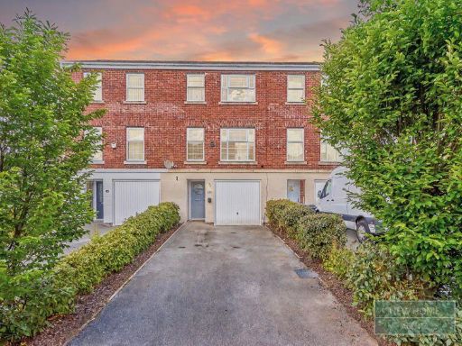 3 bedroom terraced house for sale in Runfield Close, Leigh WN7 1EP , WN7 — £225,000 • 3 bed • 3 bath • 1076 ft²
 3 bedroom detached house for sale in Hulme Gardens, Leigh, WN7 — £299,995 • 3 bed • 2 bath • 876 ft²
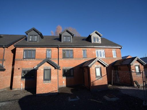 3 bedroom town house for sale in Newton Gardens, WA3 — £289,950 • 3 bed • 2 bath • 1217 ft²
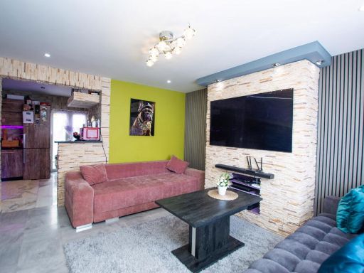 3 bedroom semi-detached house for sale in Douglas Road Leigh WN7 5HG, WN7 — £165,000 • 3 bed • 1 bath • 703 ft²
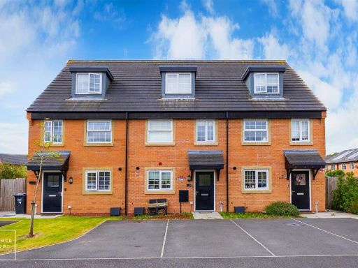 3 bedroom town house for sale in Brady Nook, Leigh, WN7 — £240,000 • 3 bed • 3 bath • 1085 ft²
Meta
- {
"@context": "https://schema.org",
"@type": "Residence",
"name": "3 bedroom town house for sale in Runfield Close, Leigh WN7…",
"description": "",
"url": "https://propertypiper.co.uk/property/f893e452-5717-477e-b57b-b4ad3879312a",
"image": "https://image-a.propertypiper.co.uk/4d0f419e-664b-4044-87b2-87932bb28864-1024.jpeg",
"address": {
"@type": "PostalAddress",
"streetAddress": "1, Runfield Close, LEIGH",
"postalCode": "WN7 1EP",
"addressLocality": "Wigan",
"addressRegion": "Leigh",
"addressCountry": "England"
},
"geo": {
"@type": "GeoCoordinates",
"latitude": 53.499777999190236,
"longitude": -2.5133439004422495
},
"numberOfRooms": 3,
"numberOfBathroomsTotal": 3,
"floorSize": {
"@type": "QuantitativeValue",
"value": 1141,
"unitCode": "FTK"
},
"offers": {
"@type": "Offer",
"price": 215000,
"priceCurrency": "GBP",
"availability": "https://schema.org/InStock"
},
"additionalProperty": [
{
"@type": "PropertyValue",
"name": "Feature",
"value": "contemporary"
},
{
"@type": "PropertyValue",
"name": "Feature",
"value": "townhouse"
},
{
"@type": "PropertyValue",
"name": "Feature",
"value": "garage"
},
{
"@type": "PropertyValue",
"name": "Feature",
"value": "driveway"
},
{
"@type": "PropertyValue",
"name": "Feature",
"value": "three-story"
},
{
"@type": "PropertyValue",
"name": "Feature",
"value": "brick exterior"
},
{
"@type": "PropertyValue",
"name": "Feature",
"value": "low maintenance"
},
{
"@type": "PropertyValue",
"name": "Feature",
"value": "cul-de-sac"
},
{
"@type": "PropertyValue",
"name": "Feature",
"value": "townhouse"
},
{
"@type": "PropertyValue",
"name": "Feature",
"value": "contemporary"
},
{
"@type": "PropertyValue",
"name": "Feature",
"value": "brick facade"
},
{
"@type": "PropertyValue",
"name": "Feature",
"value": "garage"
},
{
"@type": "PropertyValue",
"name": "Feature",
"value": "well-kept"
},
{
"@type": "PropertyValue",
"name": "Feature",
"value": "three-story"
},
{
"@type": "PropertyValue",
"name": "Feature",
"value": "residential area"
}
]
}