DA13 0TX - 5 bedroom detached house for sale in Beechwood Drive, Meoph…
View on Property Piper
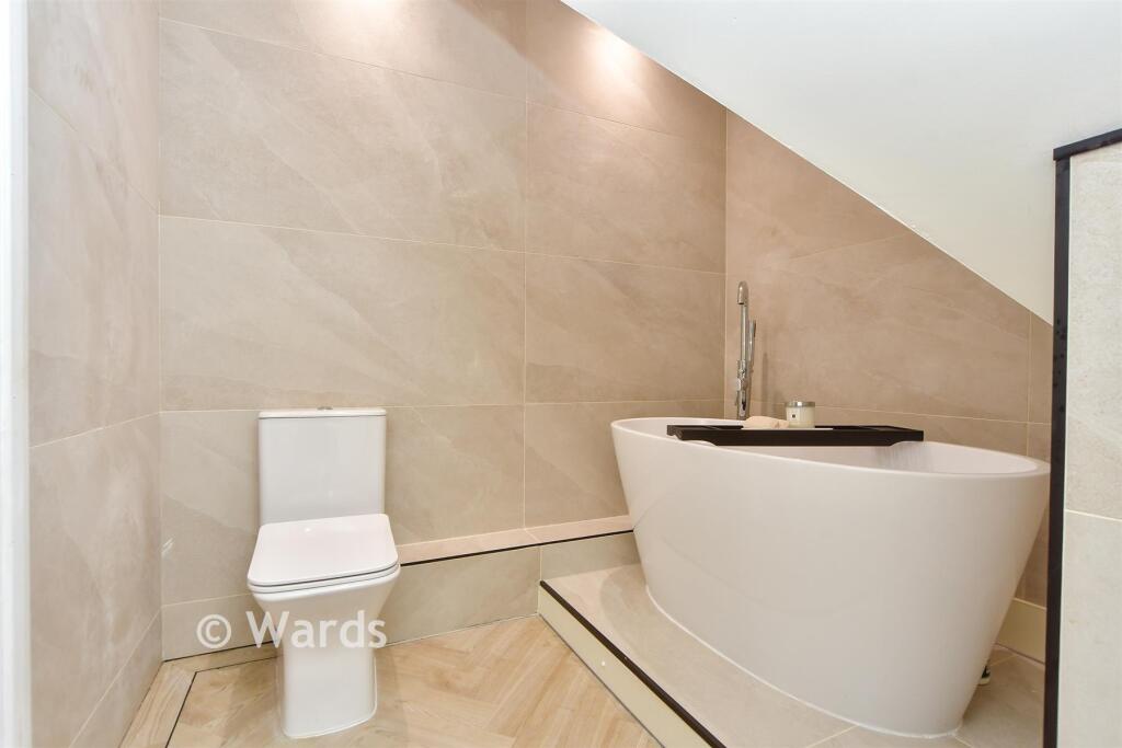
5 bedroom detached house for sale in Beechwood Drive, Meopham, Kent, DA13
Property Details
- Price: £528500
- Bedrooms: 5
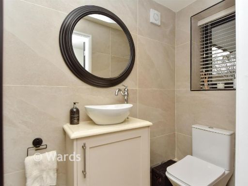
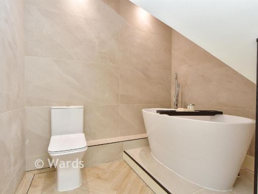
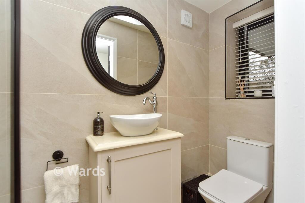
- Bathrooms: 3
- Property Type: undefined
- Property SubType: undefined
Image Descriptions
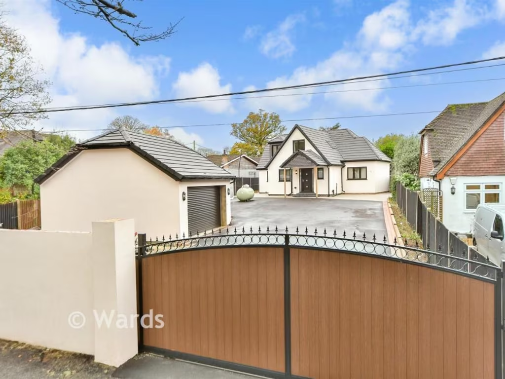
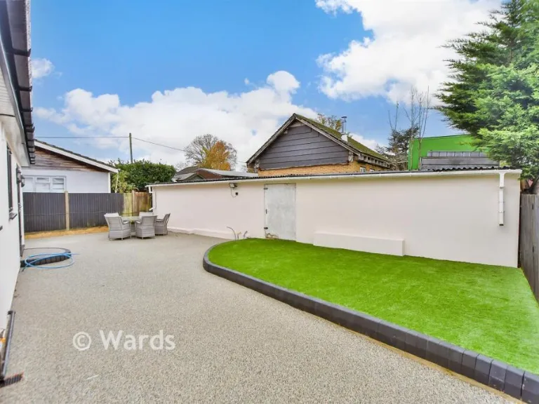
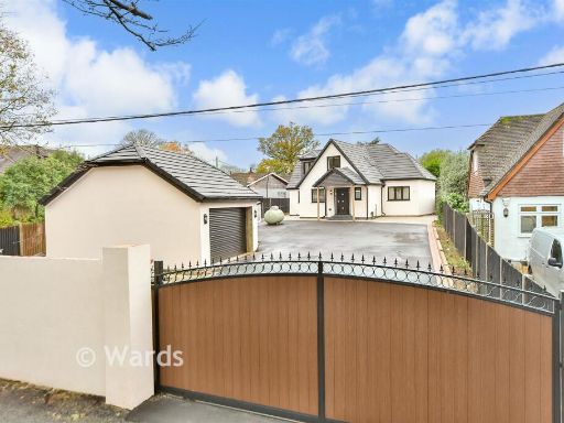
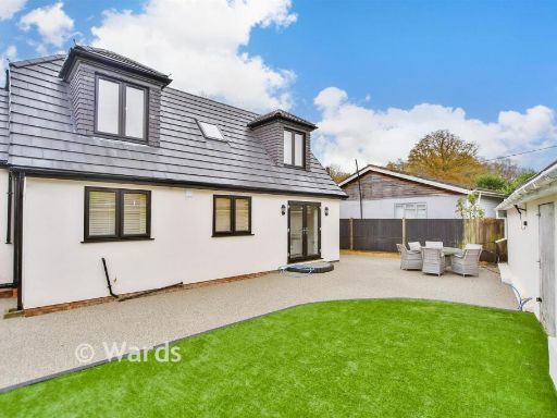
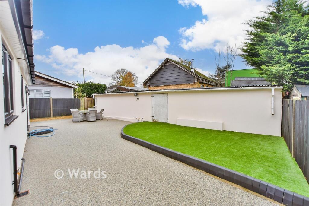
- residential property Modern
- semi-detached house contemporary
Floorplan Description
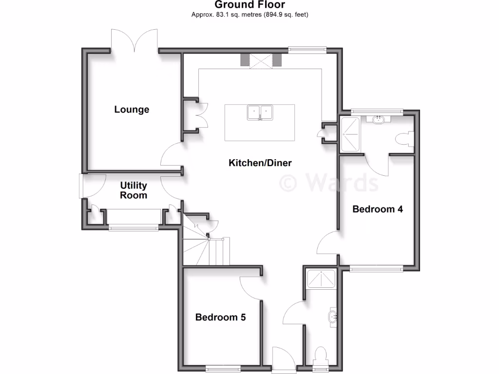
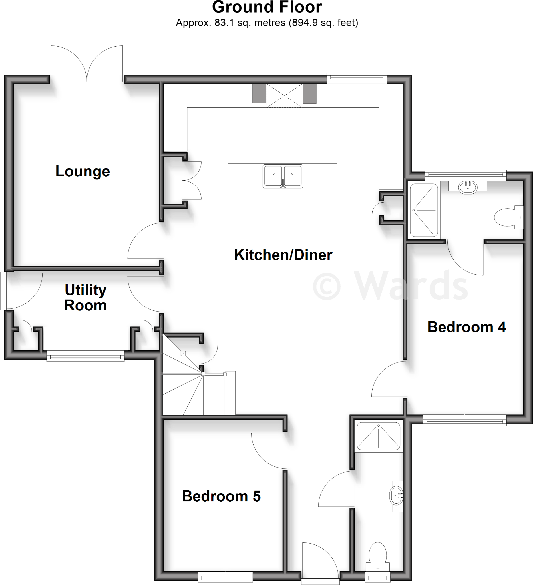
- Ground-floor plan showing Lounge, Kitchen/Diner, Utility Room, Bedroom 4 and Bedroom 5.
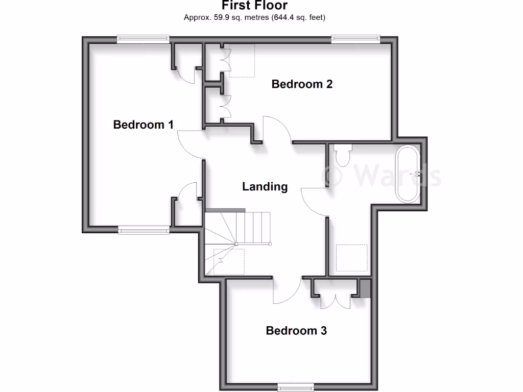
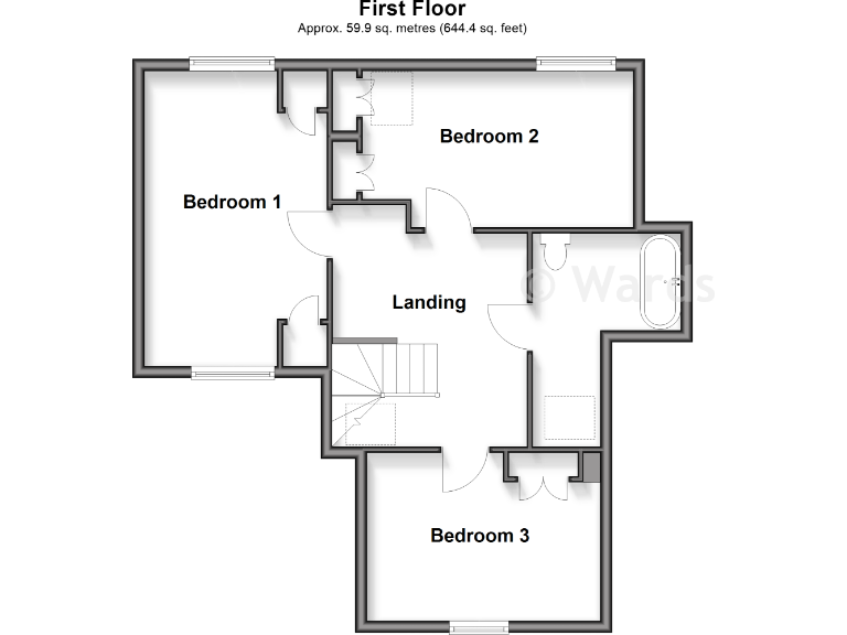
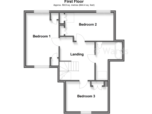
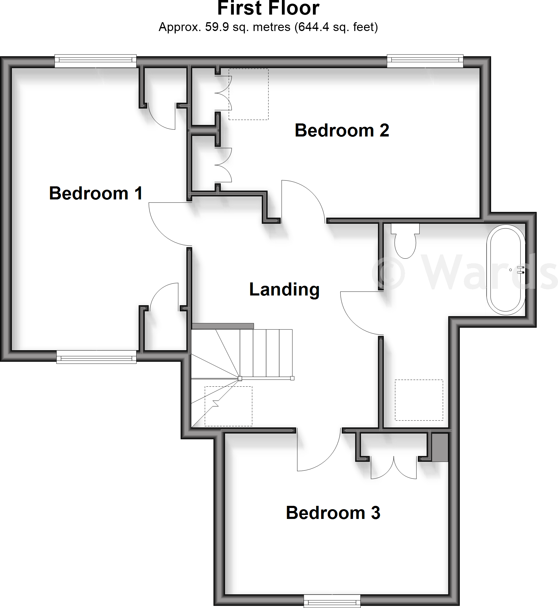
- Floor plan showing Bedroom 1, Bedroom 2, Bedroom 3 and a Landing.
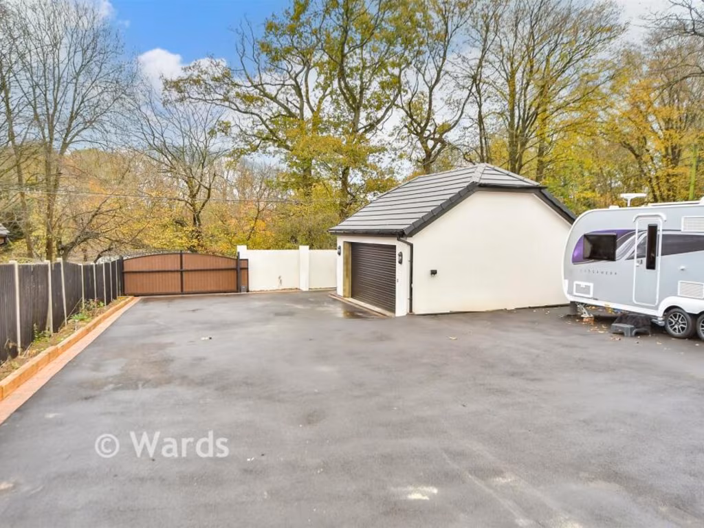
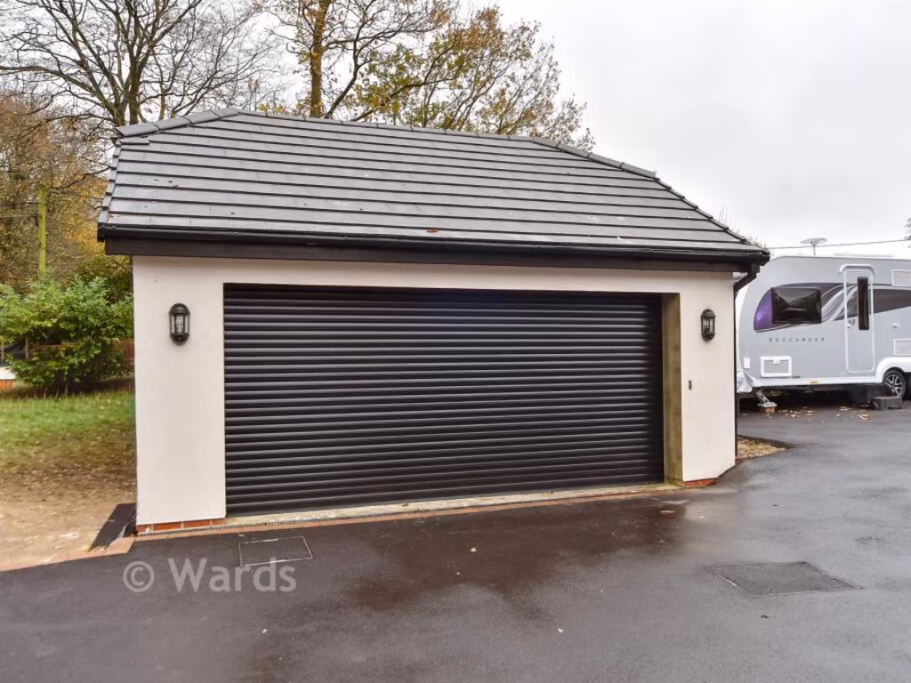
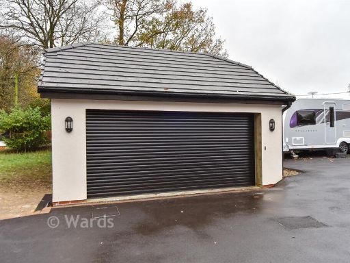
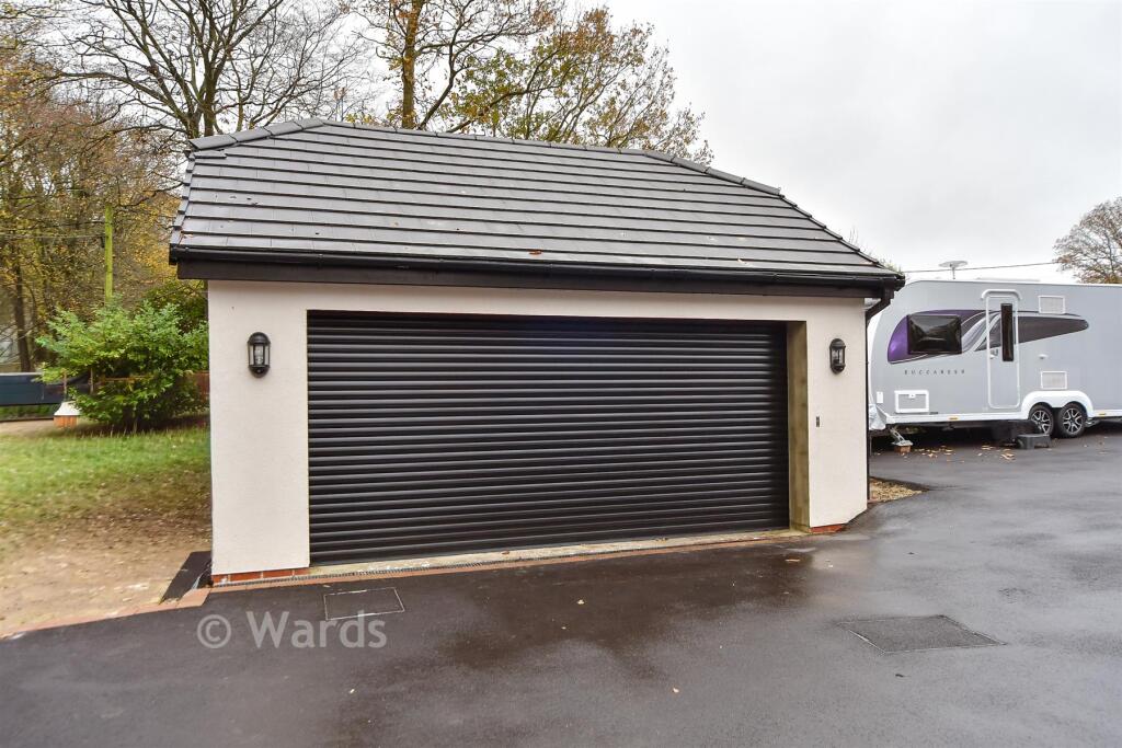
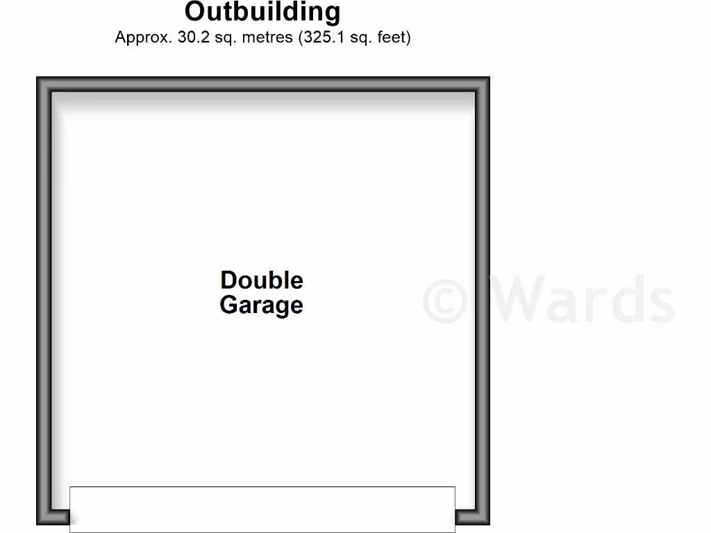
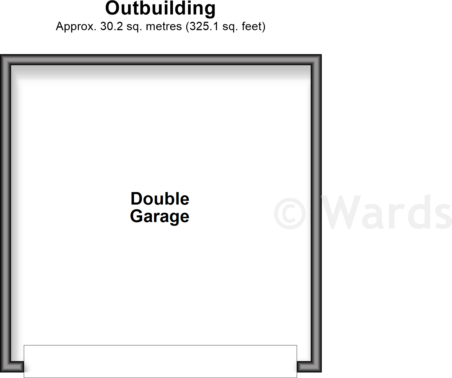
- Double Garage (label visible)
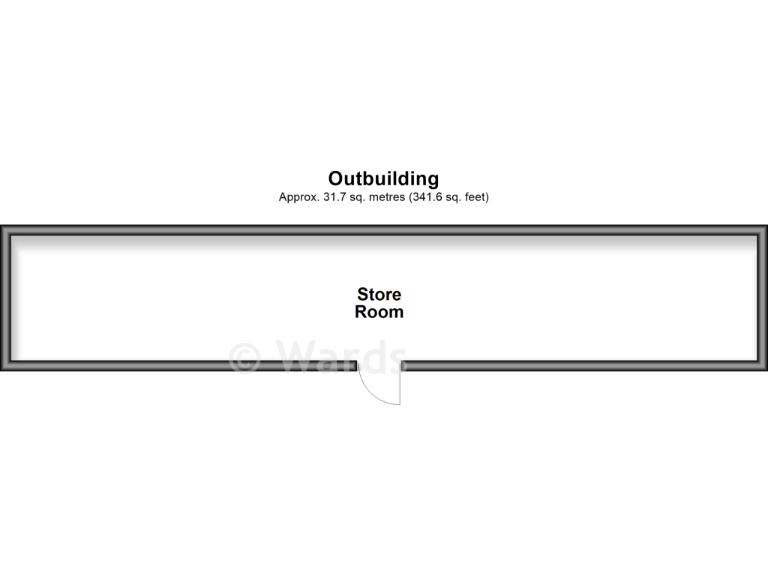
- Store Room
Rooms
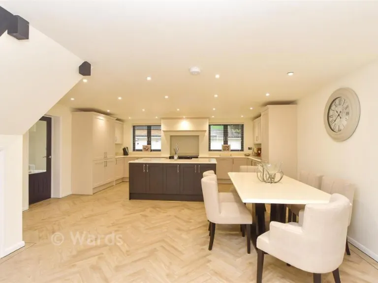
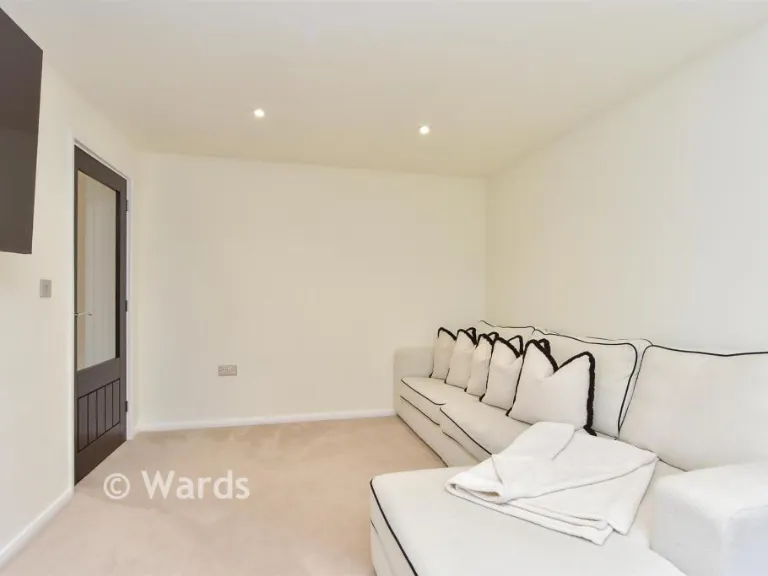
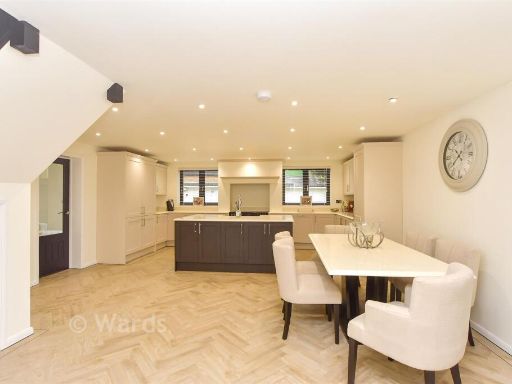
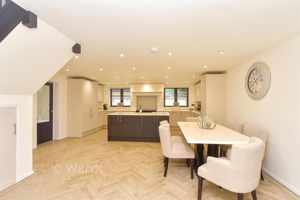
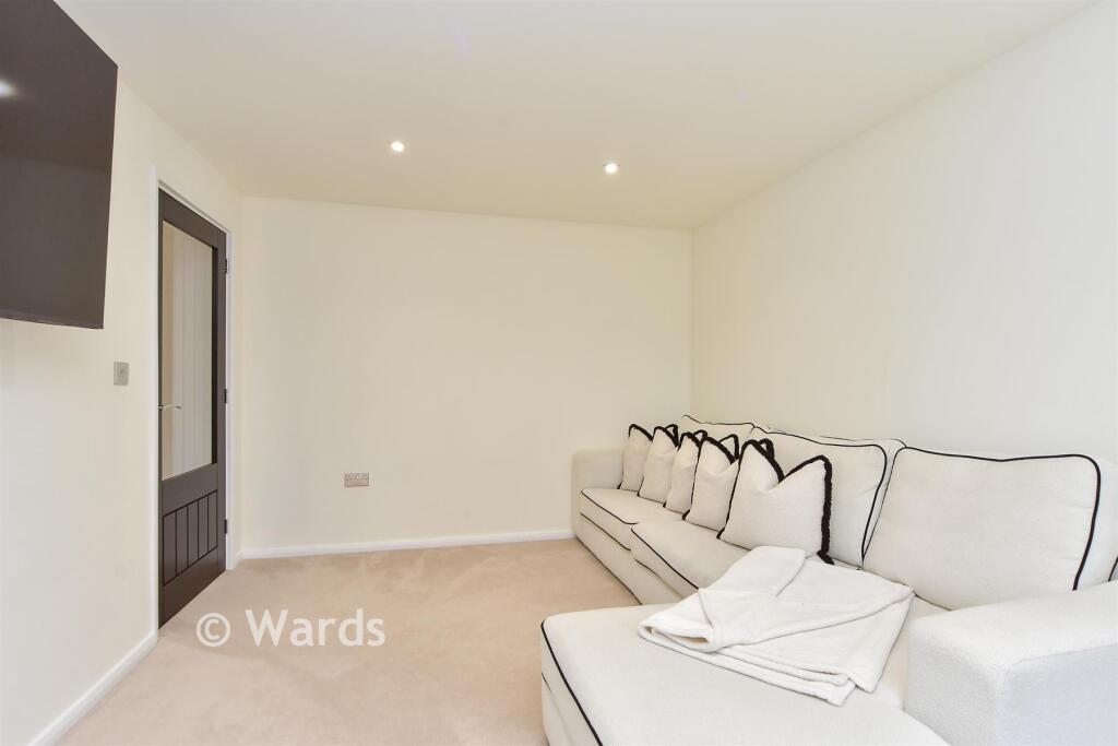
- Lounge:
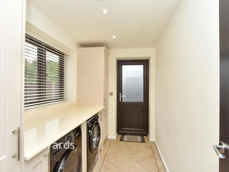
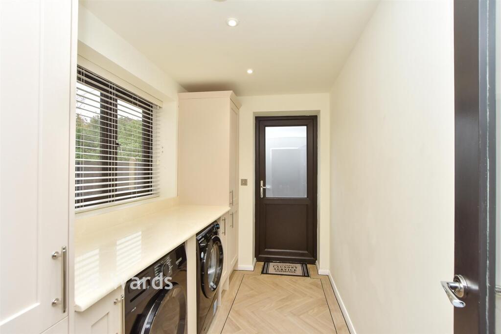
- Utility Room:
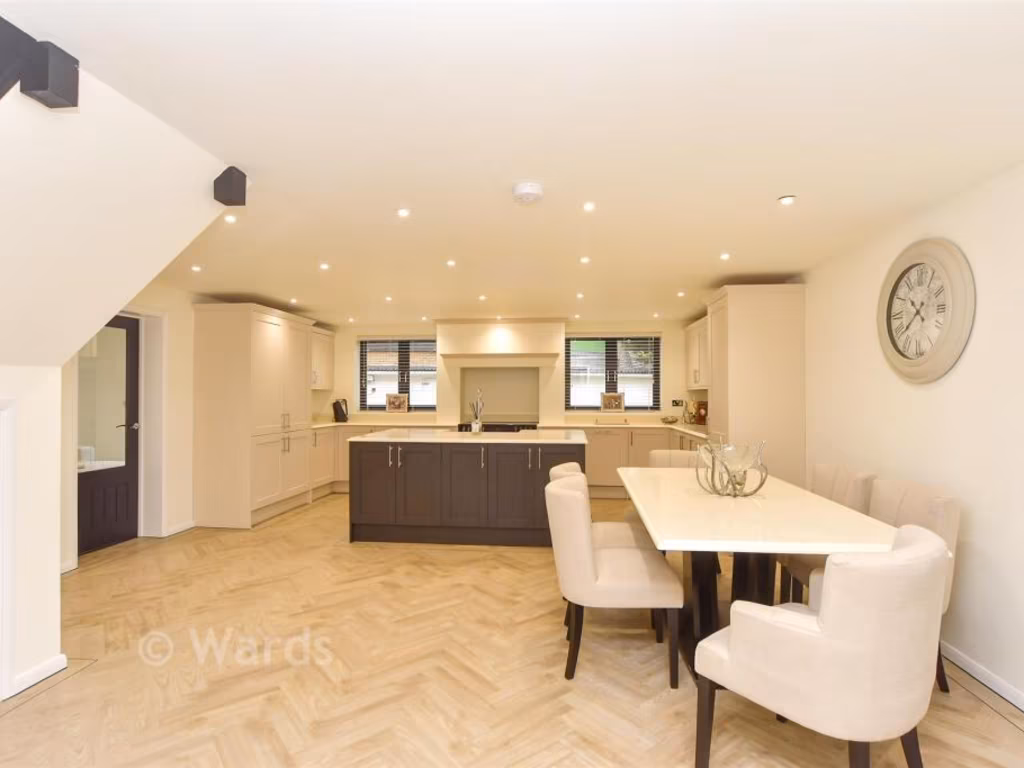
- Kitchen/Diner:
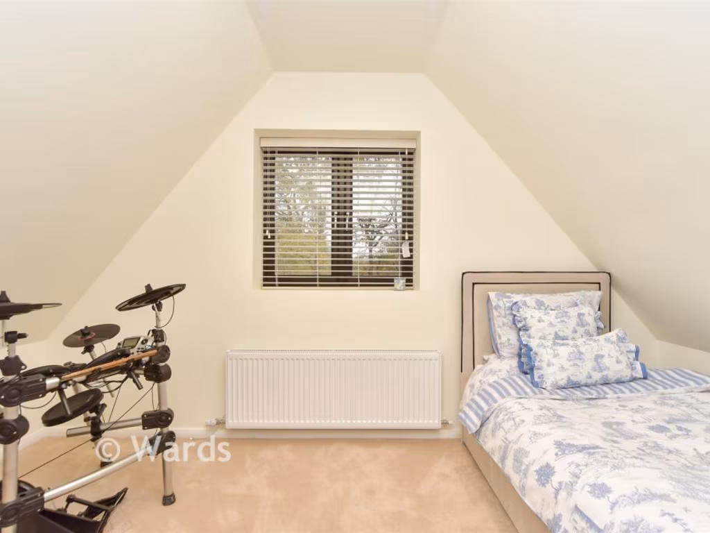
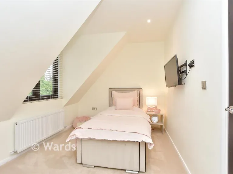
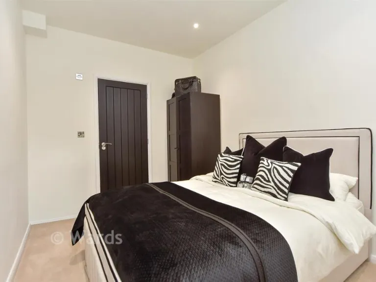
- Bedroom 4:
- Bedroom 5:
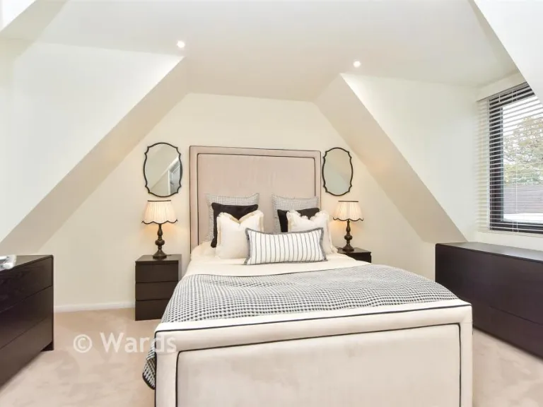
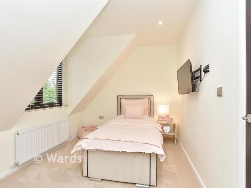
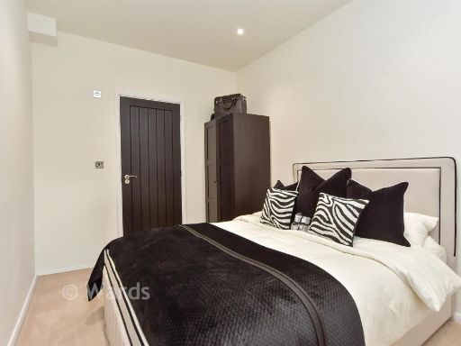
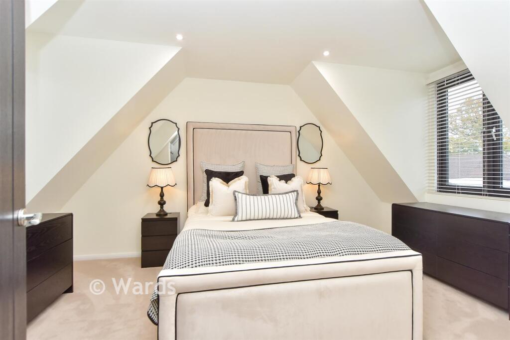
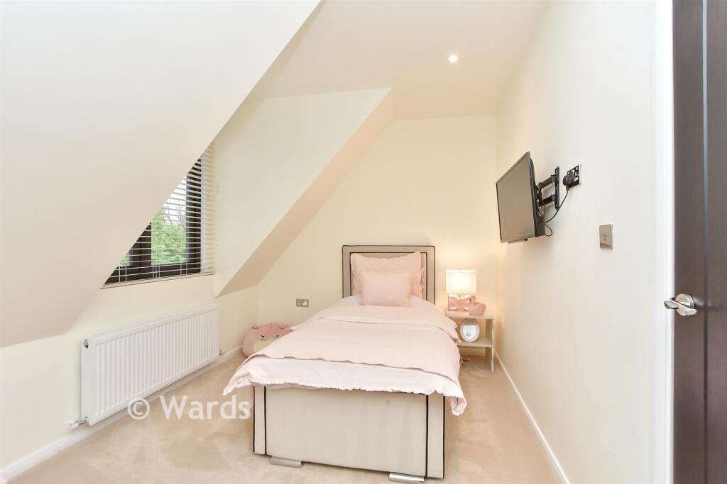
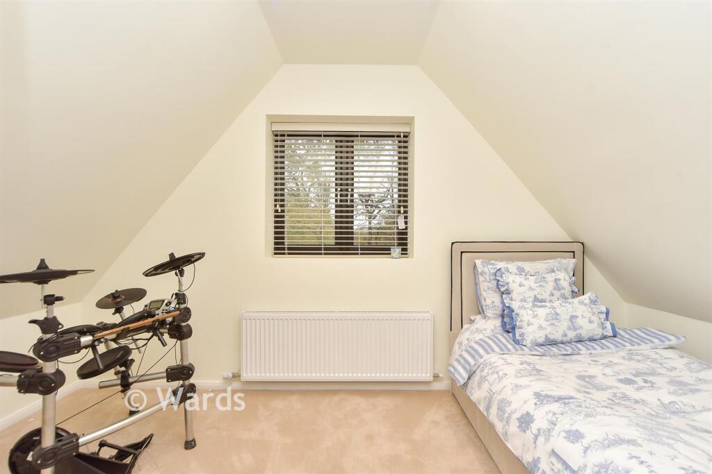
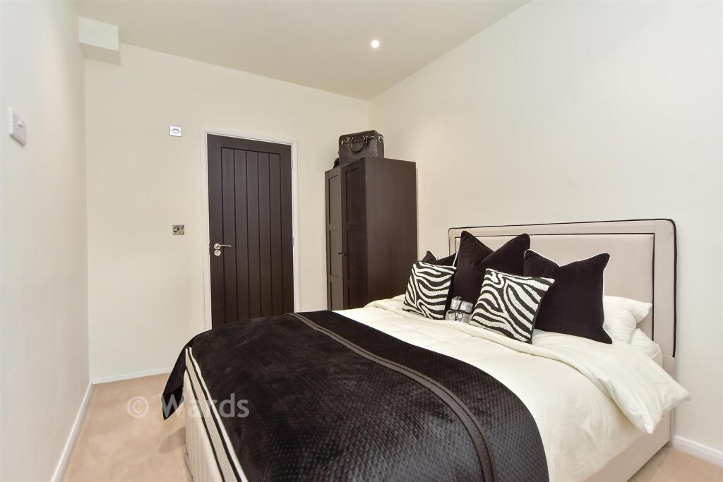
- Bedroom 1:
- Bedroom 2:
- Landing:
- Bedroom 3:
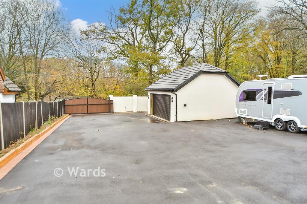
- Double Garage:
- Store Room:
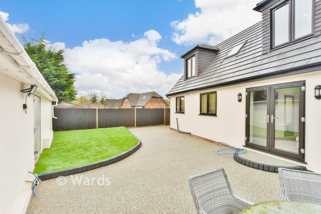
Textual Property Features
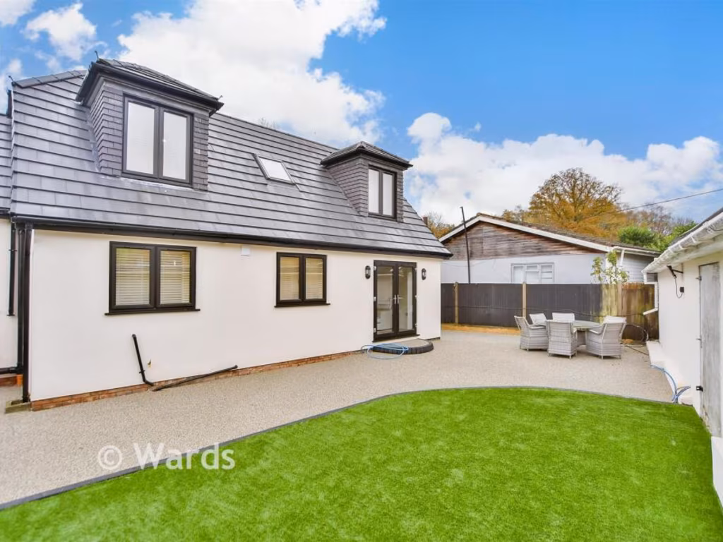
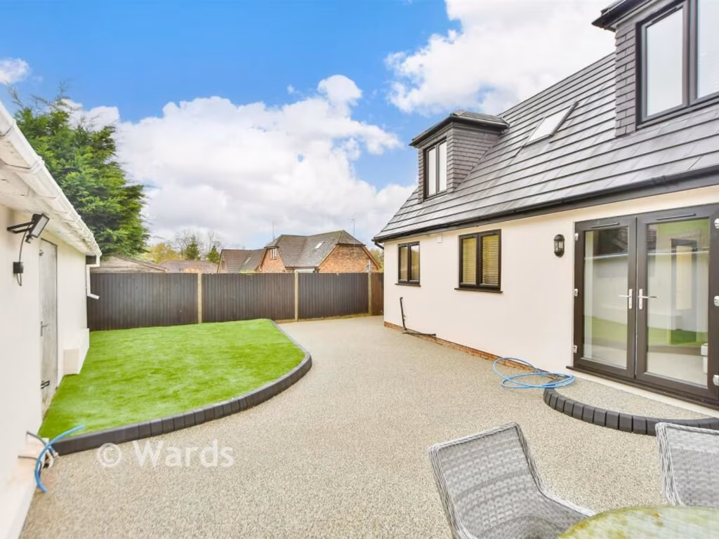
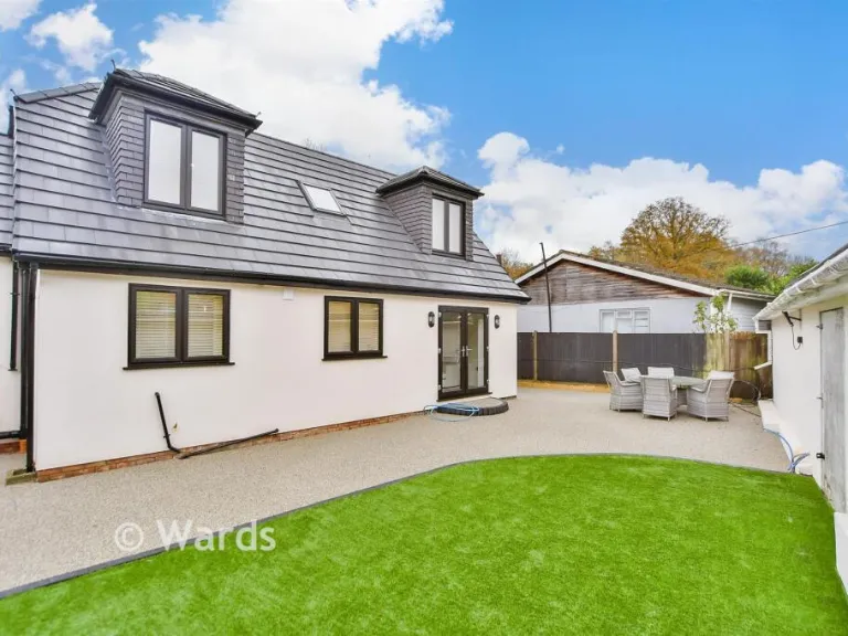
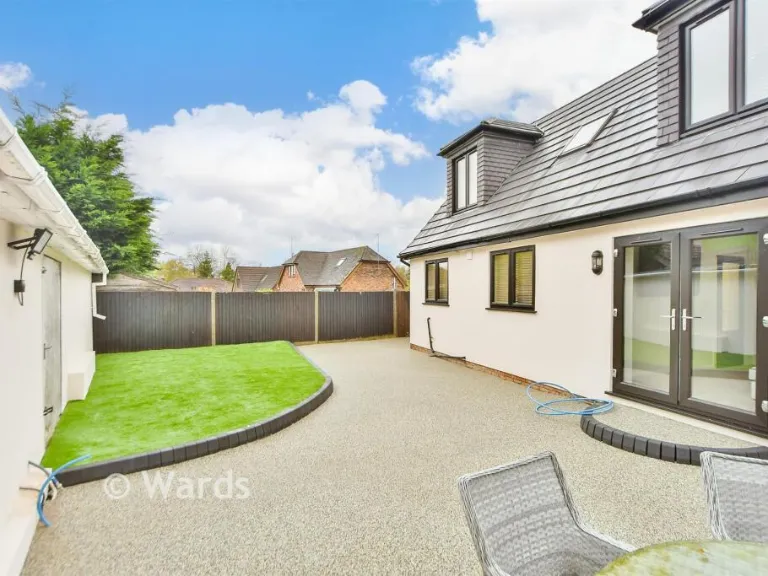
- Has Garden
- Is Retirement
- Success
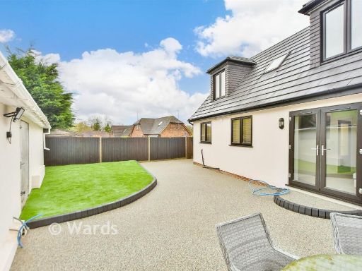
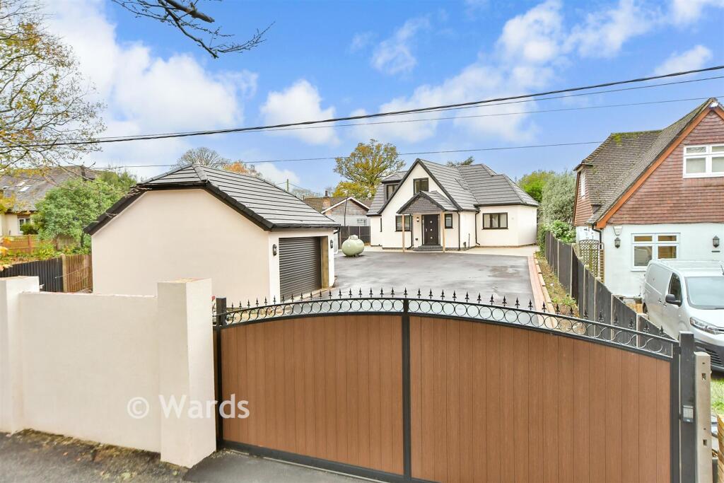
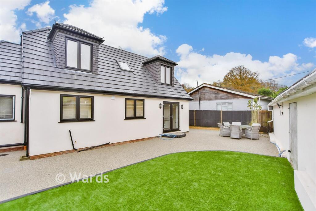
Detected Visual Features
- modern design
- bungalow
- paved driveway
- garage
- gated entrance
- residential property
- contemporary
- semi-detached
- modern
- garden
- outdoor patio
- dormer windows
- well-maintained
- family home
- cul-de-sac
- roof
- exterior
- driveway
EPC Details
- Fully double glazed
- Cavity wall, as built, insulated (assumed)
- Boiler and radiators, dual fuel (mineral and wood)
- Low energy lighting in 11% of fixed outlets
- Solid, no insulation (assumed)
Nearby Schools
- More Park Catholic Primary School
- Wrotham School
- Culverstone Green Primary School
- Meopham Community Academy
- Longfield Academy
- Kings Hill School Primary and Nursery
- Offham Primary School
- Leybourne, St Peter and St Paul Church of England Primary Academy
- Valley Invicta Primary School At Leybourne Chase
- Hartley Primary Academy
- Our Lady of Hartley Catholic Primary School, Hartley, Longfield
- Cobham Primary School
- Istead Rise Primary School
- Platt Church of England Voluntary Aided Primary School
- St George's Church of England Voluntary Controlled Primary School
- Trottiscliffe Church of England Primary School
- Vigo Village School
- Meopham School
- New Ash Green Primary School
- Valley Invicta Primary School At Kings Hill
- Borough Green Primary School
- West Malling Church of England Primary School and McGinty Speech and Language Srp
- Ryarsh Primary School
- Snodland CofE Primary School
- Langafel Church of England Voluntary Controlled Primary School
Nearest Religious buildings
- Id: 404196082
- Tags:
- Addr:
- City: West Malling
- Country: GB
- County: Kent
- Place: Trottiscliffe
- Postcode: ME19 5EB
- Street: Church Lane
- Amenity: school
- Contact:
- Denomination: anglican
- Isced:
- Name: Trottiscliffe Church of England Primary School
- Ref:
- Religion: christian
- Wikidata: Q66226398
- TagsNormalized:
- school
- anglican
- church
- christian
- Lat: 51.3171421
- Lon: 0.3563288
- FullGeoHash: u107bn52p0dh
- PartitionGeoHash: u107
- Images:
- FoodStandards: null
- Distance: 2085.6
,- Id: 1110581526
- Tags:
- Amenity: place_of_worship
- Denomination: baptist
- Name: South Street Baptist Church
- Node_id: 1110581526
- Religion: christian
- Source: OS OpenData StreetView
- Source:name: OS Open Local Important Buildings Layer
- TagsNormalized:
- place of worship
- baptist
- church
- christian
- Lat: 51.3525708
- Lon: 0.3500806
- FullGeoHash: u10hpuqymmp0
- PartitionGeoHash: u10h
- Images:
- FoodStandards: null
- Distance: 1958
,- Id: 863160669
- Tags:
- Amenity: place_of_worship
- Building: church
- Denomination: anglican
- Name: St Peter & St Paul Trottiscliffe
- Religion: christian
- Wikidata: Q17530266
- TagsNormalized:
- place of worship
- church
- anglican
- paul
- christian
- Lat: 51.3201685
- Lon: 0.3612255
- FullGeoHash: u107bnx19hv3
- PartitionGeoHash: u107
- Images:
- FoodStandards: null
- Distance: 1749.7
}
Nearest Medical buildings
- Id: 142542142
- Tags:
- Amenity: dentist
- Building: yes
- Healthcare: dentist
- Name: New Ash Green Dental Centre
- Source: Bing
- Website: https://www.nagdentalcentre.com/
- TagsNormalized:
- dentist
- health
- healthcare
- dental
- Lat: 51.3668376
- Lon: 0.3057033
- FullGeoHash: u10hnzn9e2sc
- PartitionGeoHash: u10h
- Images:
- FoodStandards: null
- Distance: 5049.8
,- Id: 142542144
- Tags:
- Amenity: clinic
- Building: yes
- Healthcare: clinic
- Name: New Ash Green Clinic
- Source: Bing
- TagsNormalized:
- Lat: 51.3666315
- Lon: 0.3056655
- FullGeoHash: u10hnzn86d0s
- PartitionGeoHash: u10h
- Images:
- FoodStandards: null
- Distance: 5036.1
,- Id: 151123115
- Tags:
- Amenity: doctors
- Building: yes
- Name: Meopham Medical Centre
- TagsNormalized:
- Lat: 51.3669545
- Lon: 0.3578844
- FullGeoHash: u10k0phd5q3f
- PartitionGeoHash: u10k
- Images:
- FoodStandards: null
- Distance: 3461.2
,- Id: 4264446596
- Tags:
- Amenity: pharmacy
- Healthcare: pharmacy
- Name: Vigo Pharmacy
- TagsNormalized:
- Lat: 51.3303825
- Lon: 0.3591001
- FullGeoHash: u10k00mmpsu6
- PartitionGeoHash: u10k
- Images:
- FoodStandards: null
- Distance: 606.3
}
Nearest Airports
- Id: 121158889
- Tags:
- Aerodrome: continental
- Aeroway: aerodrome
- Fhrs:
- Authority: City of London Corporation
- Iata: LCY
- Icao: EGLC
- Name: London City Airport
- Operator: London City Airport Limited
- Ref: LCY
- Website: https://www.londoncityairport.com/
- Wikidata: Q8982
- Wikipedia: en:London City Airport
- TagsNormalized:
- airport
- continental airport
- Lat: 51.5042658
- Lon: 0.0539987
- FullGeoHash: u10j10p64702
- PartitionGeoHash: u10j
- Images:
- FoodStandards: null
- Distance: 28241.5
,- Id: 103894219
- Tags:
- Aerodrome: international
- Aeroway: aerodrome
- Iata: SEN
- Icao: EGMC
- Name: London Southend Airport
- Old_name: Southend Municipal Airport
- Ref: SEN
- Wikidata: Q1415441
- TagsNormalized:
- airport
- international airport
- Lat: 51.5701749
- Lon: 0.6924624
- FullGeoHash: u10mru04p937
- PartitionGeoHash: u10m
- Images:
- FoodStandards: null
- Distance: 34834.2
}
Nearest Leisure Facilities
- Id: 330154008
- Tags:
- Leisure: nature_reserve
- Name: Trosley Country Park
- TagsNormalized:
- Lat: 51.3270018
- Lon: 0.355152
- FullGeoHash: u107bpf97wse
- PartitionGeoHash: u107
- Images:
- FoodStandards: null
- Distance: 1014.7
,- Id: 917801657
- Tags:
- Leisure: pitch
- Sport: equestrian
- TagsNormalized:
- pitch
- leisure
- equestrian
- sports
- Lat: 51.3378733
- Lon: 0.3713562
- FullGeoHash: u10k03y2v1pq
- PartitionGeoHash: u10k
- Images:
- FoodStandards: null
- Distance: 898.9
,- Id: 693547559
- Tags:
- TagsNormalized:
- Lat: 51.3295444
- Lon: 0.3590569
- FullGeoHash: u10k00m2q8s5
- PartitionGeoHash: u10k
- Images:
- FoodStandards: null
- Distance: 699.4
,- Id: 461937460
- Tags:
- Addr:
- City: Gravesend
- Postcode: DA13 0UA
- Street: Harvel Road
- Subdistrict: Meopham
- Building: yes
- Fhrs:
- Leisure: sports_centre
- Name: Vigo RFC
- Source: ratings.food.gov.uk
- TagsNormalized:
- sports
- sports centre
- leisure
- Lat: 51.3342952
- Lon: 0.3677552
- FullGeoHash: u10k035gcq4n
- PartitionGeoHash: u10k
- Images:
- FoodStandards: null
- Distance: 642.9
,- Id: 1058005882
- Tags:
- Leisure: pitch
- Sport: soccer;basketball
- TagsNormalized:
- pitch
- leisure
- soccer
- basketball
- sports
- Lat: 51.3313006
- Lon: 0.3590063
- FullGeoHash: u10k00t6mryr
- PartitionGeoHash: u10k
- Images:
- FoodStandards: null
- Distance: 504.1
}
Nearest Tourist attractions
- Id: 974049182
- Tags:
- Addr:
- City: Sevenoaks
- Postcode: TN15 7JL
- Street: Crabtree Close
- Town: Wrotham
- Name: Hemsley Conservation Centre
- Opening_hours: Mo-Su 10:00-17:00
- Tourism: zoo
- Website: https://www.hemsleyconservationcentre.co.uk
- TagsNormalized:
- Lat: 51.3280604
- Lon: 0.3379096
- FullGeoHash: u105zxyp9ggw
- PartitionGeoHash: u105
- Images:
- FoodStandards: null
- Distance: 1691.3
,- Id: 4347019689
- Tags:
- TagsNormalized:
- Lat: 51.3248386
- Lon: 0.3425136
- FullGeoHash: u105zz3kv5ke
- PartitionGeoHash: u105
- Images:
- FoodStandards: null
- Distance: 1667.4
,- Id: 1208671865
- Tags:
- Addr:
- City: Gravesend
- Postcode: DA13 0DE
- Street: Harvel Street
- Subdistrict: Meopham
- Fhrs:
- Name: Amazon and Tiger (Now Closed)
- Source:
- Addr: ratings.food.gov.uk
- Status: closed
- Tourism: guest_house
- TagsNormalized:
- Lat: 51.3446302
- Lon: 0.3687178
- FullGeoHash: u10k07h2pszc
- PartitionGeoHash: u10k
- Images:
- FoodStandards: null
- Distance: 1195.1
}
Nearest Train stations
- Id: 6688385685
- Tags:
- Name: Halling
- Naptan:
- Network: National Rail
- Public_transport: station
- Railway: station
- Ref:
- Wikidata: Q2122913
- Wikipedia: en:Halling railway station
- TagsNormalized:
- Lat: 51.3523741
- Lon: 0.4451218
- FullGeoHash: u10k4hkjk06g
- PartitionGeoHash: u10k
- Images:
- FoodStandards: null
- Distance: 6269.1
,- Id: 6688355484
- Tags:
- Name: Snodland
- Naptan:
- Network: National Rail
- Public_transport: station
- Railway: station
- Ref:
- Train: yes
- Wikipedia: en:Snodland railway station
- TagsNormalized:
- Lat: 51.3302228
- Lon: 0.4484399
- FullGeoHash: u10k40qs1rj1
- PartitionGeoHash: u10k
- Images:
- FoodStandards: null
- Distance: 6256.4
,- Id: 6692612524
- Tags:
- Name: Borough Green & Wrotham
- Naptan:
- Network: National Rail
- Public_transport: station
- Railway: station
- Ref:
- Wikidata: Q4946312
- Wikipedia: en:Borough Green & Wrotham railway station
- TagsNormalized:
- Lat: 51.2931422
- Lon: 0.3061936
- FullGeoHash: u105ycwunydr
- PartitionGeoHash: u105
- Images:
- FoodStandards: null
- Distance: 5993.3
,- Id: 6689773484
- Tags:
- Name: Meopham
- Naptan:
- Network: National Rail
- Public_transport: station
- Railway: station
- Ref:
- Source: NPE
- Wikidata: Q2119853
- Wikipedia: en:Meopham railway station
- TagsNormalized:
- Lat: 51.3864534
- Lon: 0.3566218
- FullGeoHash: u10k24eevchq
- PartitionGeoHash: u10k
- Images:
- FoodStandards: null
- Distance: 5630.9
,- Id: 6689773483
- Tags:
- Name: Sole Street
- Naptan:
- Network: National Rail
- Public_transport: station
- Railway: station
- Ref:
- Source: NPE
- Wikidata: Q2434718
- Wikipedia: en:Sole Street railway station
- TagsNormalized:
- Lat: 51.383247
- Lon: 0.3781687
- FullGeoHash: u10k2d535grp
- PartitionGeoHash: u10k
- Images:
- FoodStandards: null
- Distance: 5440.5
}
Nearest Hotels
- Id: 684362815
- Tags:
- Addr:
- City: Wrotham
- Country: GB
- Postcode: TN15 7RF
- Street: Bull Lane
- Building: hotel
- Name: The Bull Hotel
- Tourism: hotel
- Wikidata: Q26555326
- TagsNormalized:
- Lat: 51.3084194
- Lon: 0.3115894
- FullGeoHash: u105zh6vhw9g
- PartitionGeoHash: u105
- Images:
- FoodStandards: null
- Distance: 4480
,- Id: 1579557194
- Tags:
- Brand: Premier Inn
- Brand:wikidata: Q2108626
- Name: Premier Inn
- Tourism: hotel
- TagsNormalized:
- Lat: 51.2975789
- Lon: 0.3430027
- FullGeoHash: u105zf3y09c3
- PartitionGeoHash: u105
- Images:
- FoodStandards: null
- Distance: 4393.6
,- Id: 195459784
- Tags:
- Brand: Holiday Inn
- Brand:wikidata: Q2717882
- Building: hotel
- Name: Holiday Inn Maidstone
- Tourism: hotel
- TagsNormalized:
- Lat: 51.3003647
- Lon: 0.3386443
- FullGeoHash: u105zdyw6cp7
- PartitionGeoHash: u105
- Images:
- FoodStandards: null
- Distance: 4186
}
Tags
- modern design
- bungalow
- paved driveway
- garage
- gated entrance
- residential property
- contemporary
- semi-detached
- modern
- garden
- outdoor patio
- dormer windows
- well-maintained
- family home
- cul-de-sac
- roof
- exterior
- driveway
Local Market Stats
- Average Price/sqft: £430
- Avg Income: £57300
- Social Housing: 4%
- Planning Success Rate: 71%
AirBnB Data
- 1km average: £82/night
- Listings in 1km: 2
Similar Properties
 3 bedroom detached bungalow for sale in New Road, Meopham, Kent, DA13 — £396,000 • 3 bed • 1 bath • 1292 ft²
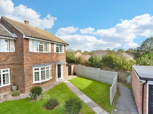 2 bedroom end of terrace house for sale in Edmund Close, Meopham, Gravesend, Kent, DA13 — £314,000 • 2 bed • 1 bath • 1131 ft²
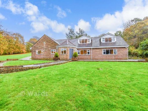 5 bedroom detached bungalow for sale in Maidstone Road, Borden, Sittingbourne, Kent, ME9 — £924,500 • 5 bed • 3 bath • 3725 ft²
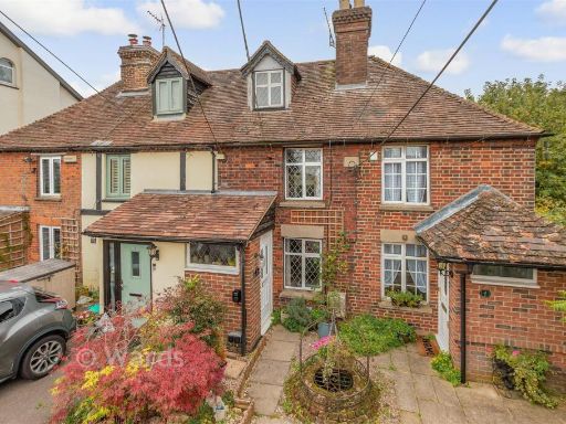 2 bedroom terraced house for sale in School Lane, West Kingsdown, Kent, TN15 — £271,000 • 2 bed • 1 bath • 625 ft²
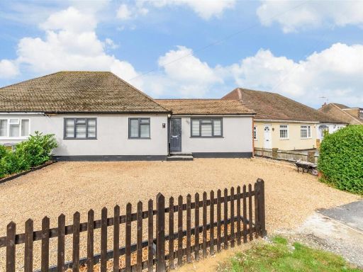 3 bedroom semi-detached bungalow for sale in Hever Avenue, West Kingsdown, Sevenoaks, Kent, TN15 — £330,000 • 3 bed • 2 bath • 582 ft²
 3 bedroom semi-detached bungalow for sale in Longfield Place, Maidstone, Kent, ME15 — £248,000 • 3 bed • 2 bath • 900 ft²
Meta
- {
"@context": "https://schema.org",
"@type": "Residence",
"name": "5 bedroom detached house for sale in Beechwood Drive, Meoph…",
"description": "",
"url": "https://propertypiper.co.uk/property/f3210fd5-e7f8-47df-92a3-d6e91dbcb15a",
"image": "https://image-a.propertypiper.co.uk/2a5c07f6-2a45-4ed9-9293-d0f5b4af1899-1024.jpeg",
"address": {
"@type": "PostalAddress",
"streetAddress": "42 Beechwood Drive, Meopham",
"postalCode": "DA13 0TX",
"addressLocality": "Gravesham",
"addressRegion": "Gravesham",
"addressCountry": "England"
},
"geo": {
"@type": "GeoCoordinates",
"latitude": 51.33583257835839,
"longitude": 0.3588347763393054
},
"numberOfRooms": 5,
"numberOfBathroomsTotal": 3,
"floorSize": {
"@type": "QuantitativeValue",
"value": 593,
"unitCode": "FTK"
},
"offers": {
"@type": "Offer",
"price": 528500,
"priceCurrency": "GBP",
"availability": "https://schema.org/InStock"
},
"additionalProperty": [
{
"@type": "PropertyValue",
"name": "Feature",
"value": "modern design"
},
{
"@type": "PropertyValue",
"name": "Feature",
"value": "bungalow"
},
{
"@type": "PropertyValue",
"name": "Feature",
"value": "paved driveway"
},
{
"@type": "PropertyValue",
"name": "Feature",
"value": "garage"
},
{
"@type": "PropertyValue",
"name": "Feature",
"value": "gated entrance"
},
{
"@type": "PropertyValue",
"name": "Feature",
"value": "residential property"
},
{
"@type": "PropertyValue",
"name": "Feature",
"value": "contemporary"
},
{
"@type": "PropertyValue",
"name": "Feature",
"value": "semi-detached"
},
{
"@type": "PropertyValue",
"name": "Feature",
"value": "modern"
},
{
"@type": "PropertyValue",
"name": "Feature",
"value": "garden"
},
{
"@type": "PropertyValue",
"name": "Feature",
"value": "outdoor patio"
},
{
"@type": "PropertyValue",
"name": "Feature",
"value": "dormer windows"
},
{
"@type": "PropertyValue",
"name": "Feature",
"value": "well-maintained"
},
{
"@type": "PropertyValue",
"name": "Feature",
"value": "family home"
},
{
"@type": "PropertyValue",
"name": "Feature",
"value": "cul-de-sac"
},
{
"@type": "PropertyValue",
"name": "Feature",
"value": "roof"
},
{
"@type": "PropertyValue",
"name": "Feature",
"value": "exterior"
},
{
"@type": "PropertyValue",
"name": "Feature",
"value": "driveway"
}
]
}
High Res Floorplan Images
Compatible Floorplan Images
FloorplanImages Thumbnail