HP22 5EQ - 4 bedroom detached house for sale in Cosy Corner, Aston Cli…
View on Property Piper
4 bedroom detached house for sale in Cosy Corner, Aston Clinton, Aylesbury, Buckinghamshire, HP22
Property Details
- Price: £500000
- Bedrooms: 4
- Bathrooms: 1
- Property Type: undefined
- Property SubType: undefined
Brochure Descriptions
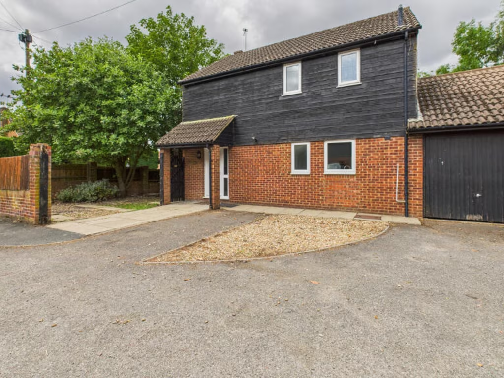
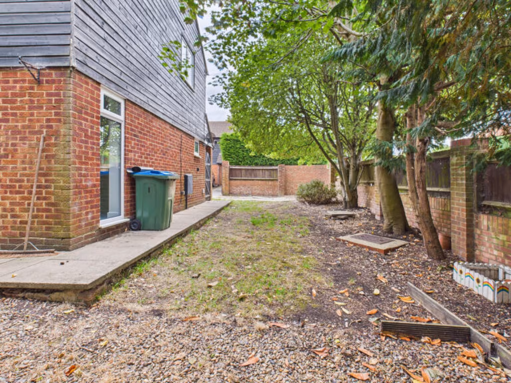
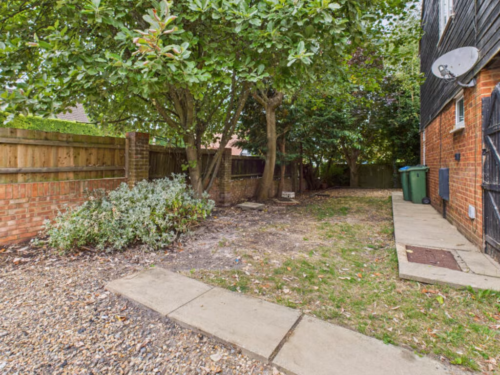
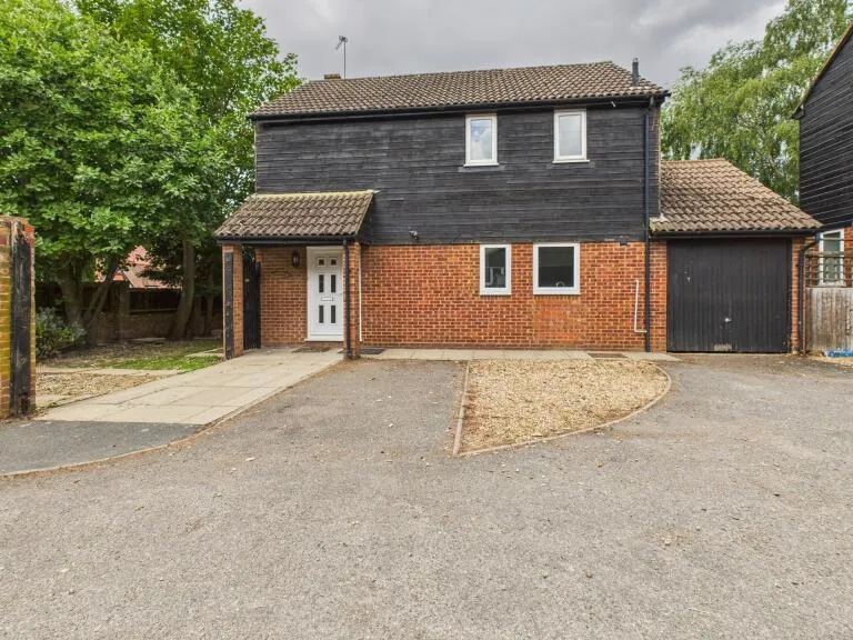
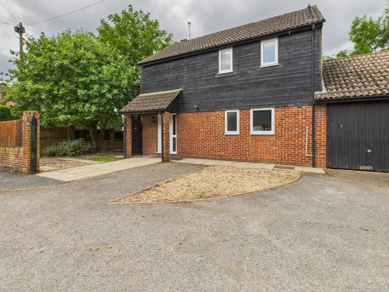
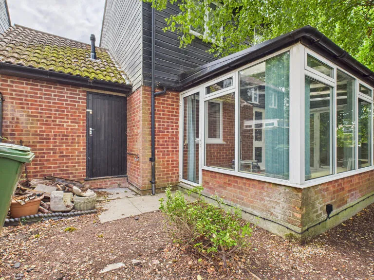
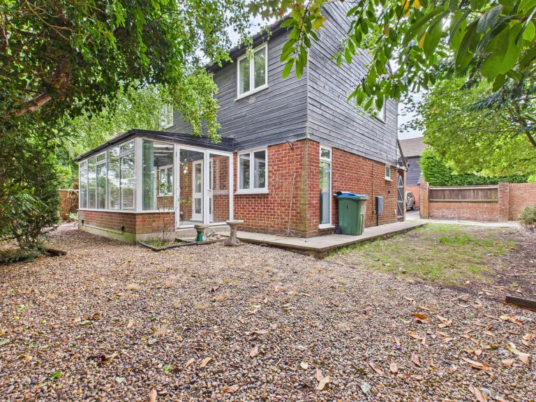
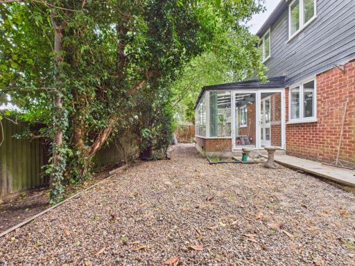
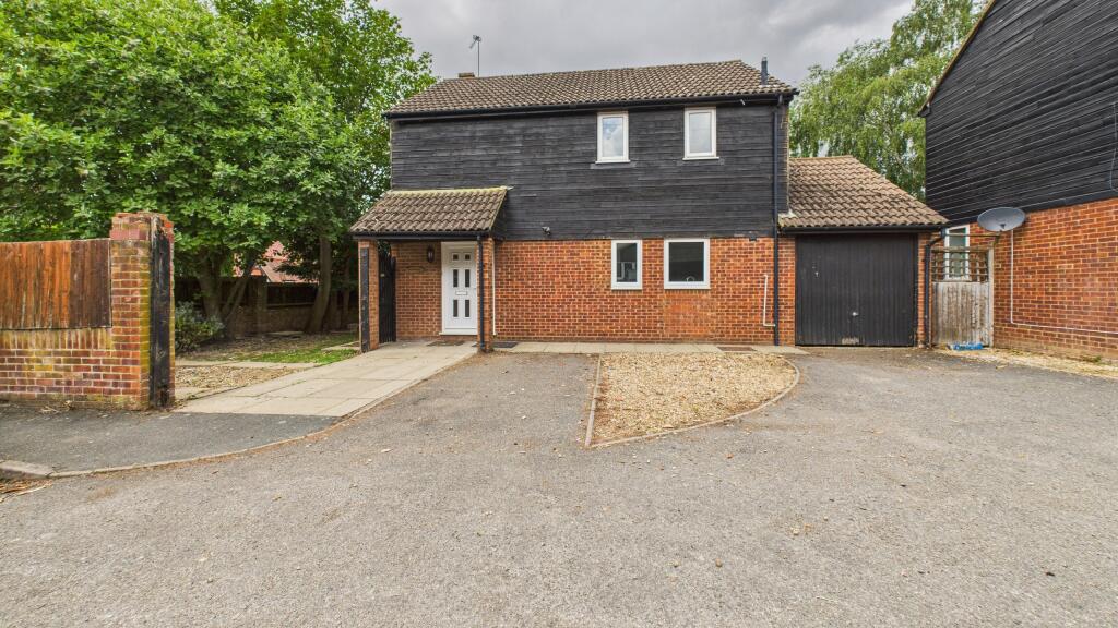
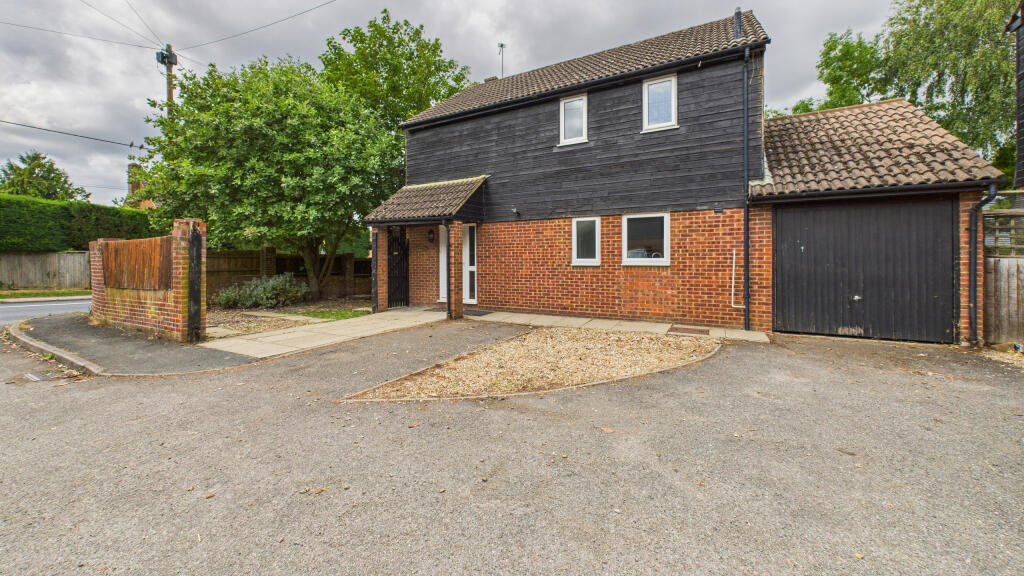
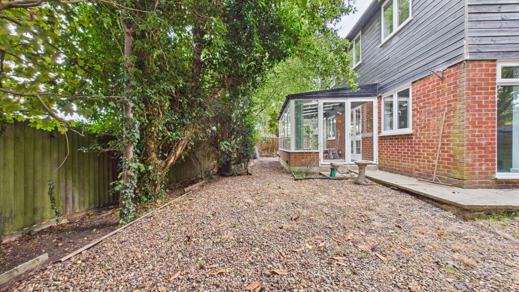
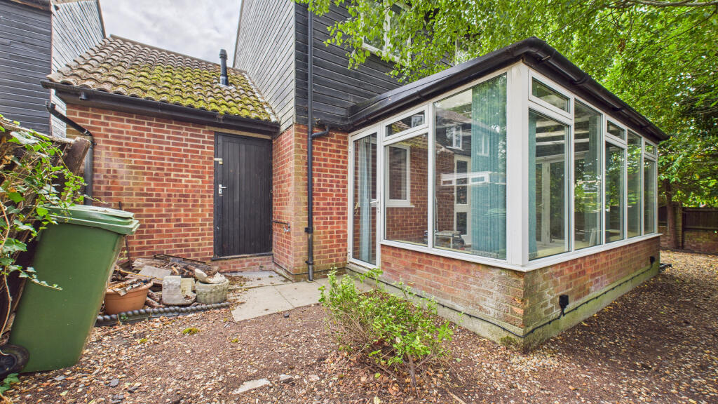
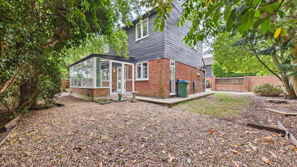
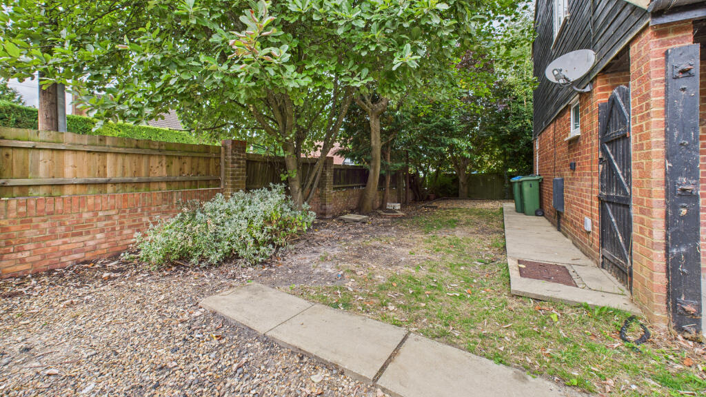
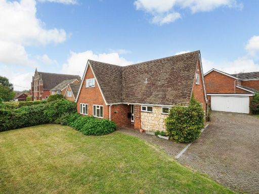
- This is a detached, fully refurbished four-bedroom house. The property has a substantial driveway with space for multiple vehicles, a mixture of brick and wood exterior, and is set in a quiet residential area with mature trees. The plot size is generous, suitable for a family, and the garden appears to be average to large in size. No neighbouring buildings are visible in the shot, indicating privacy and a quiet setting. The property likely has a garage based on the visible doors.
Image Descriptions
- residential house modern
- exterior modern
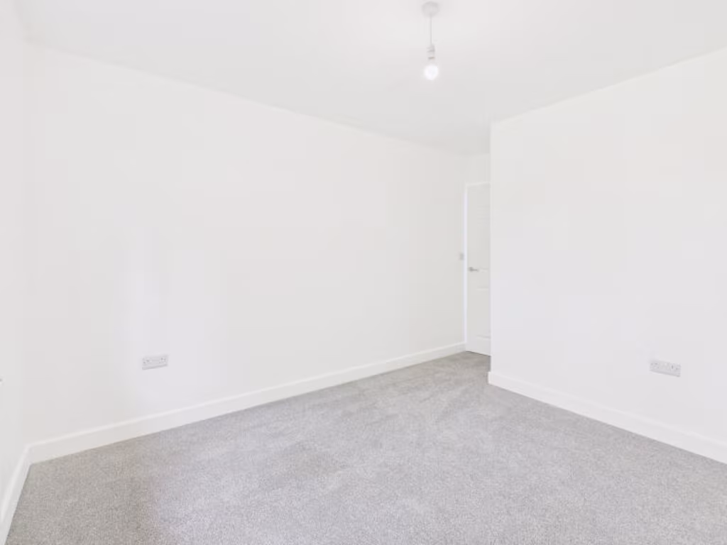
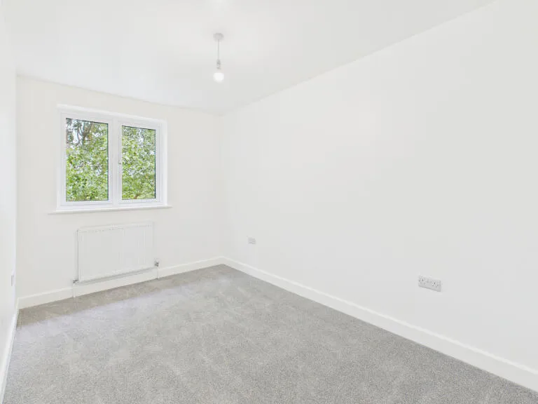
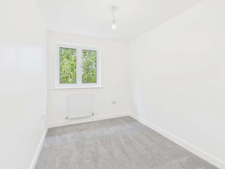
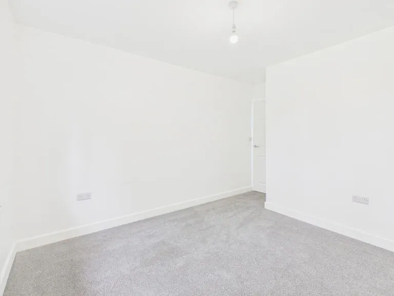
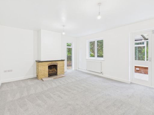
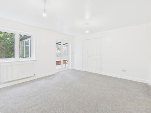
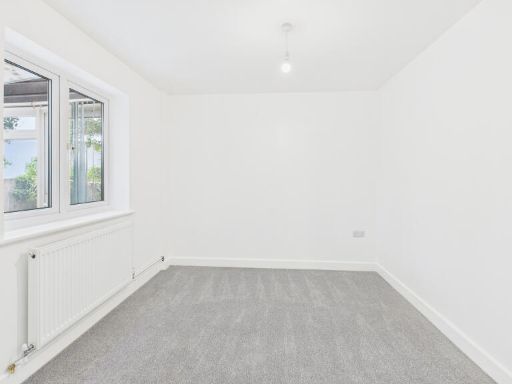
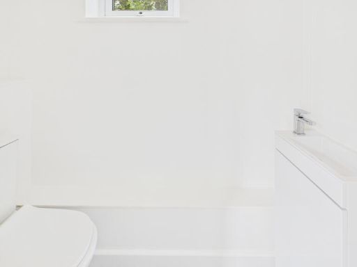
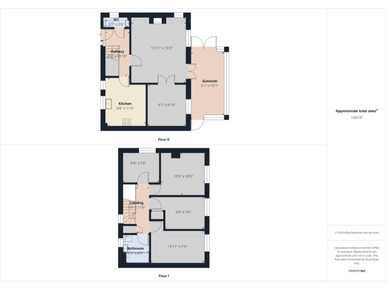
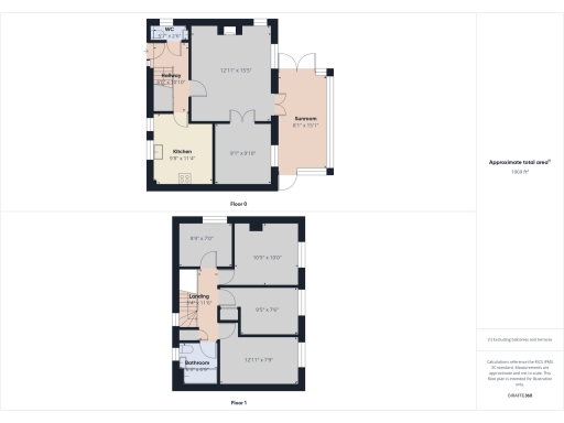
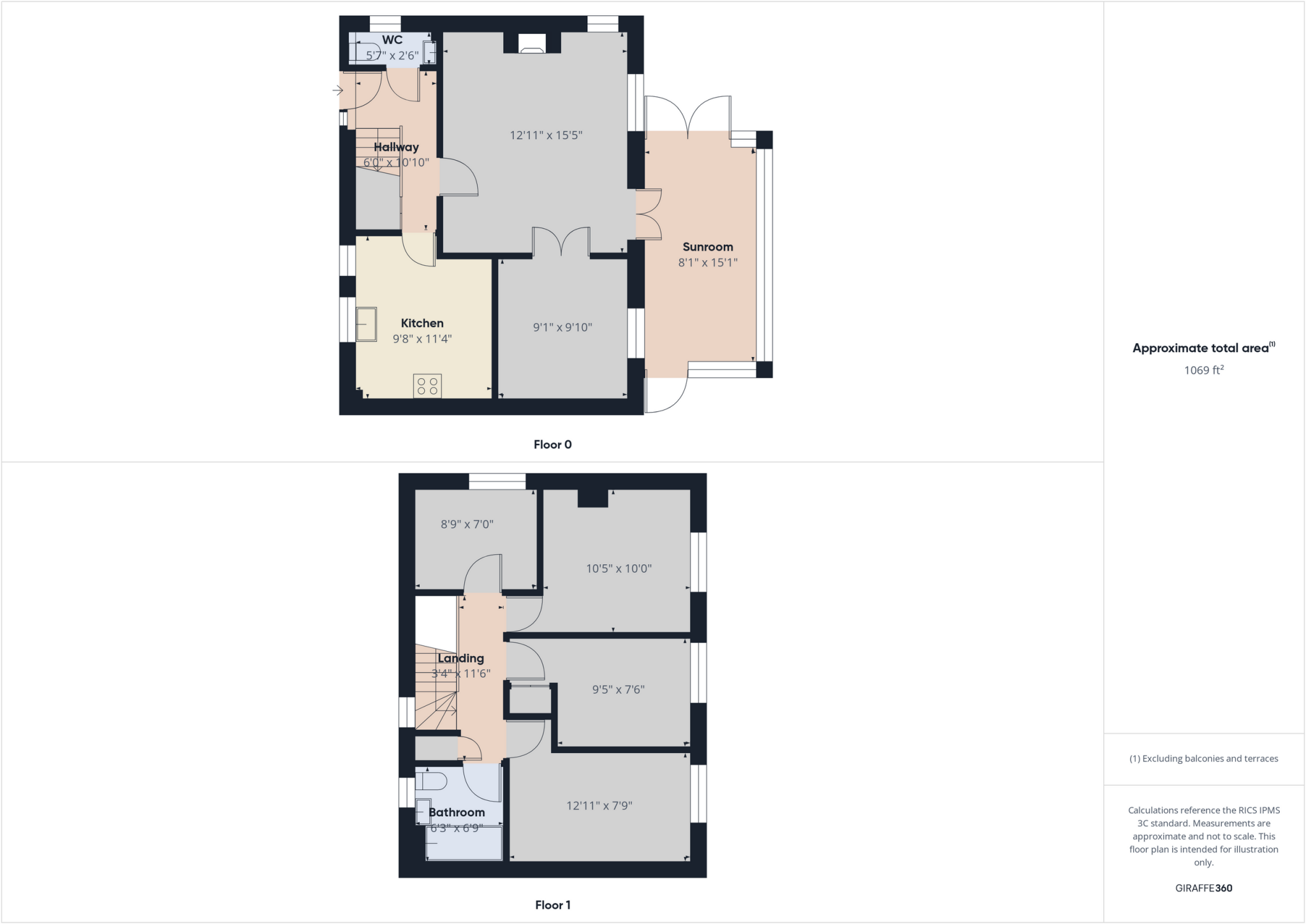
Rooms
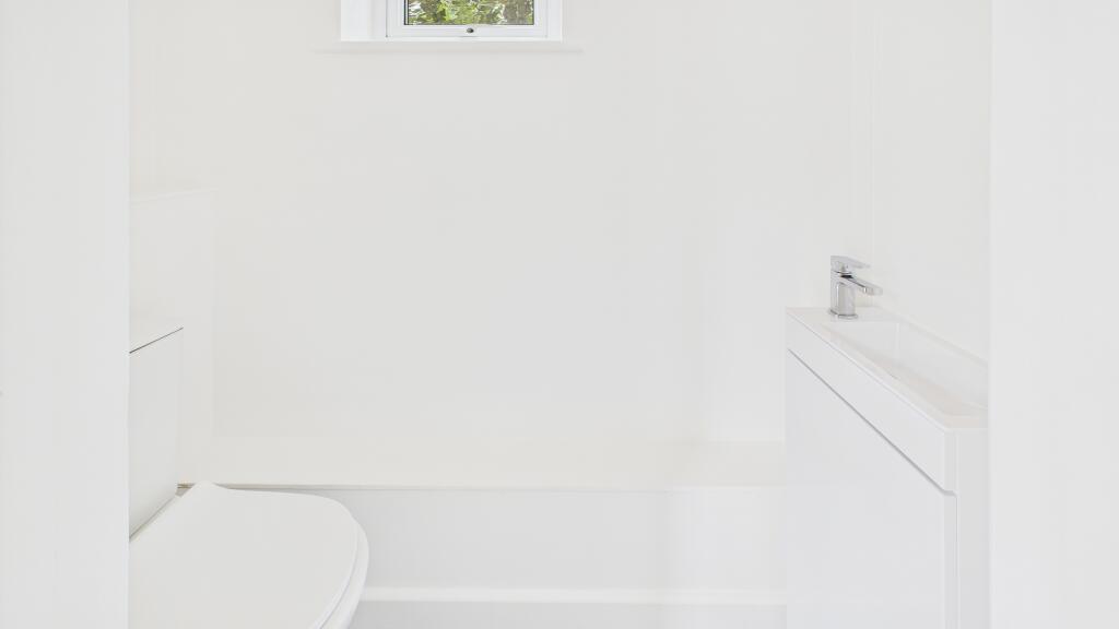
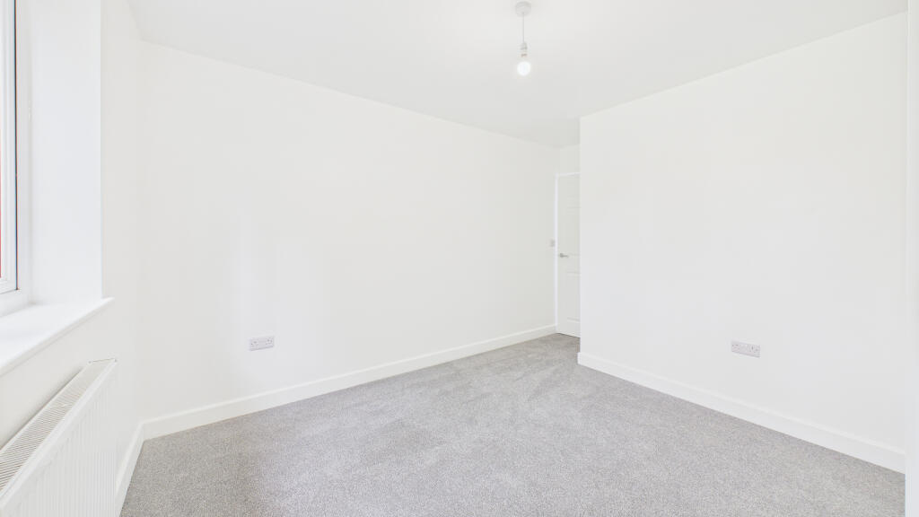
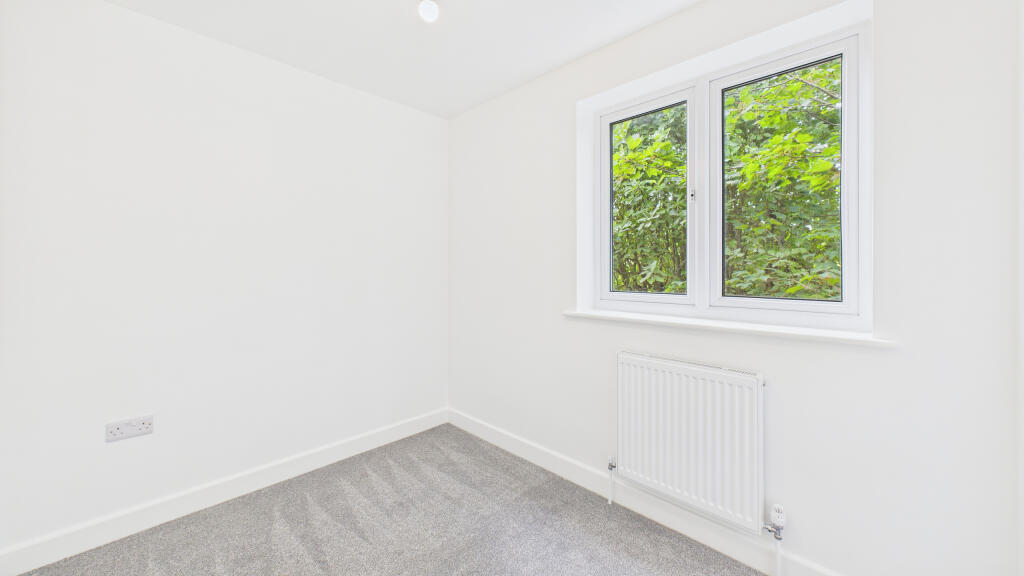
- WC: small
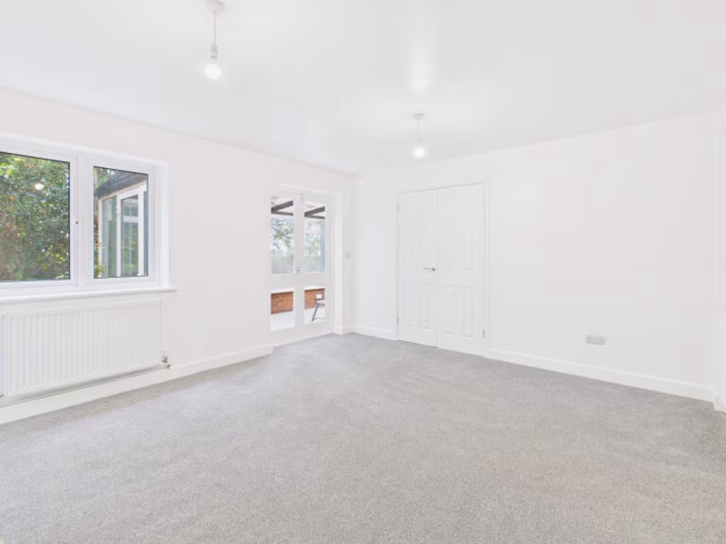
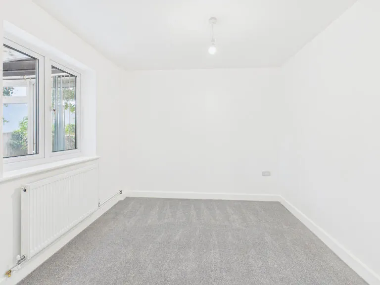
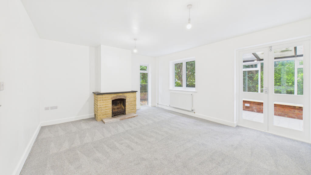
- Hallway: average
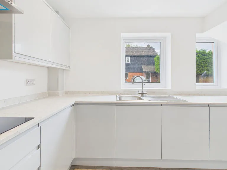
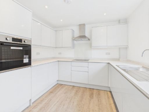
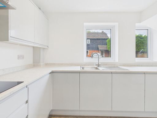
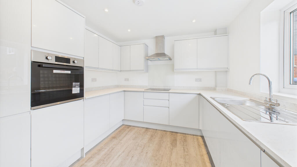
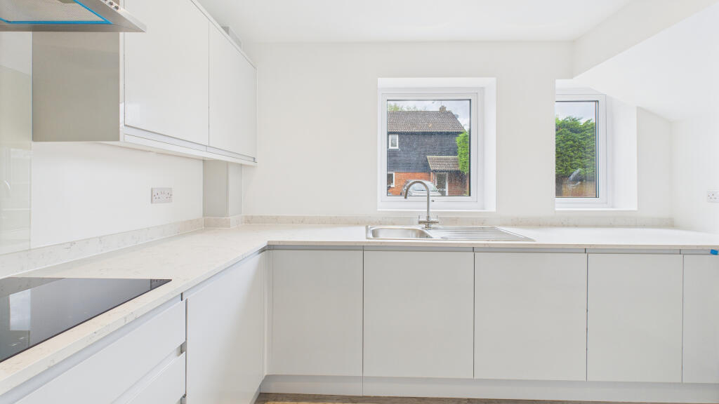
- Kitchen: average
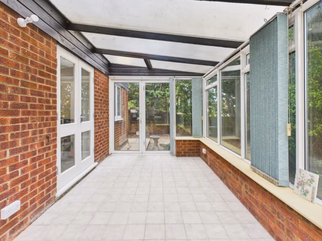
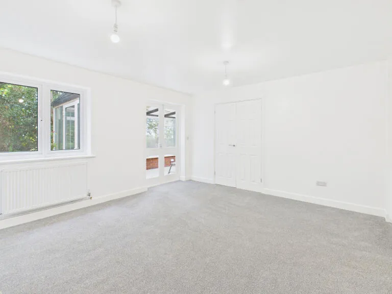
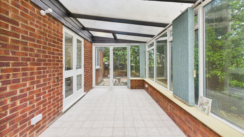
- Sunroom: average
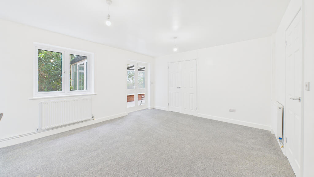
- Landing: average
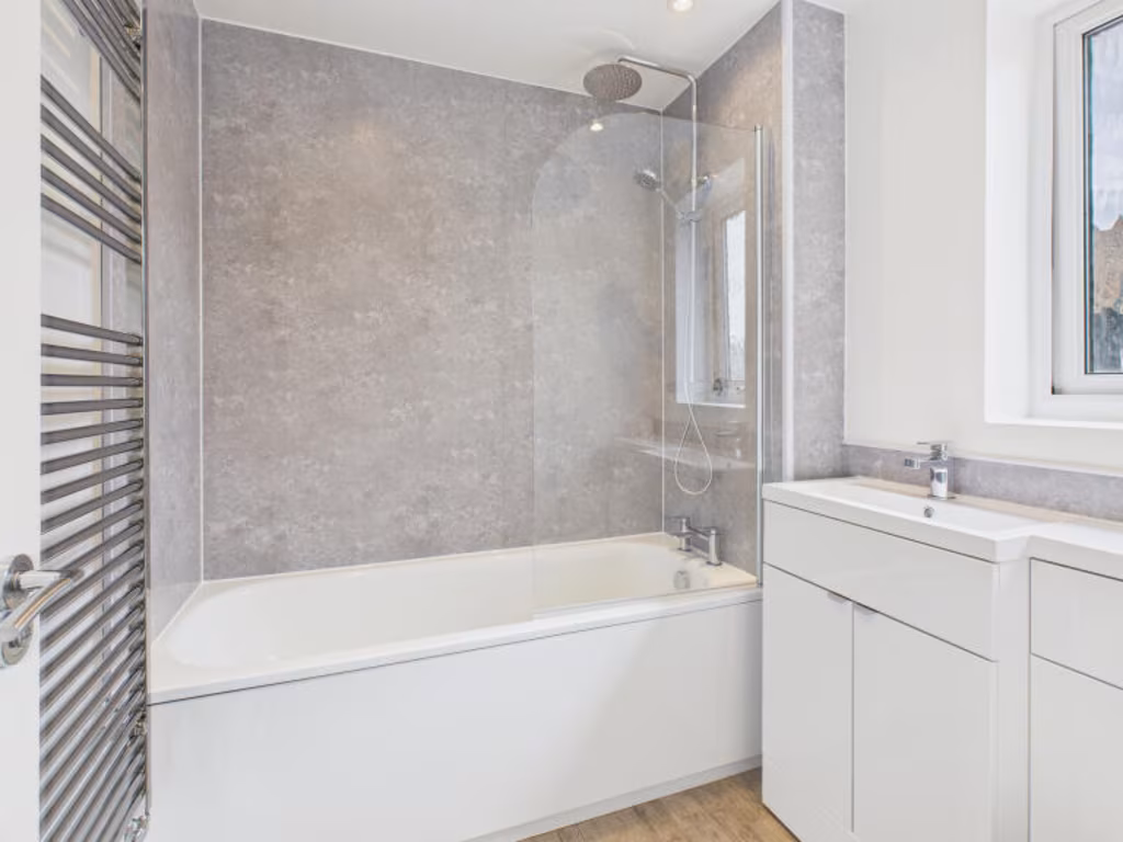
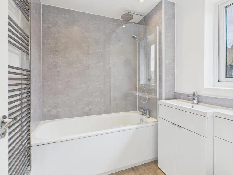
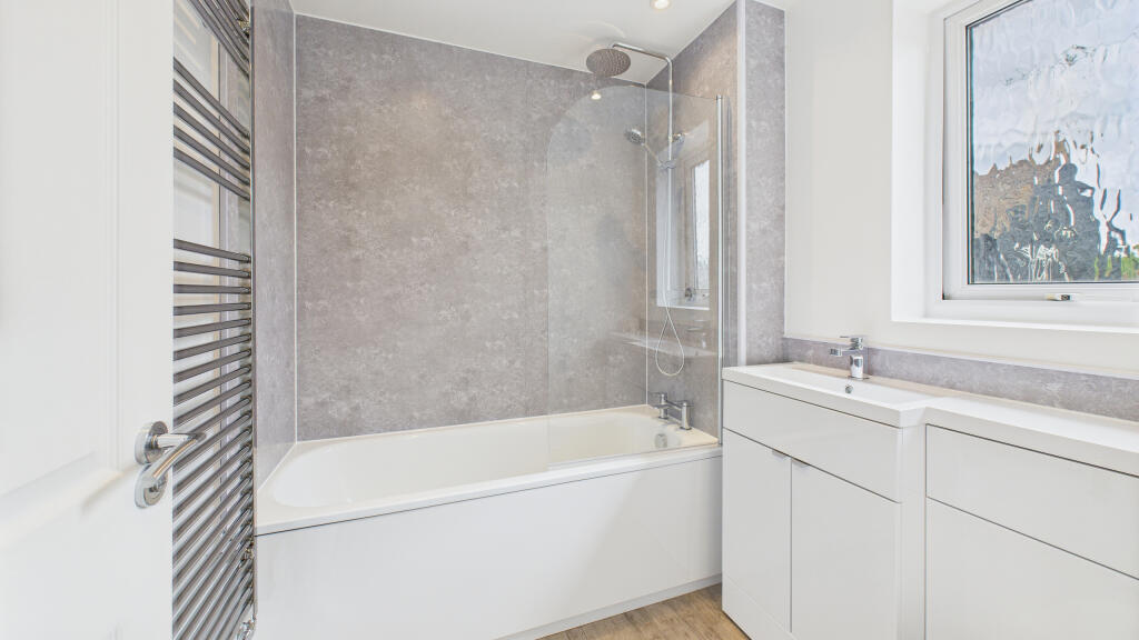
- Bathroom: small
- : small
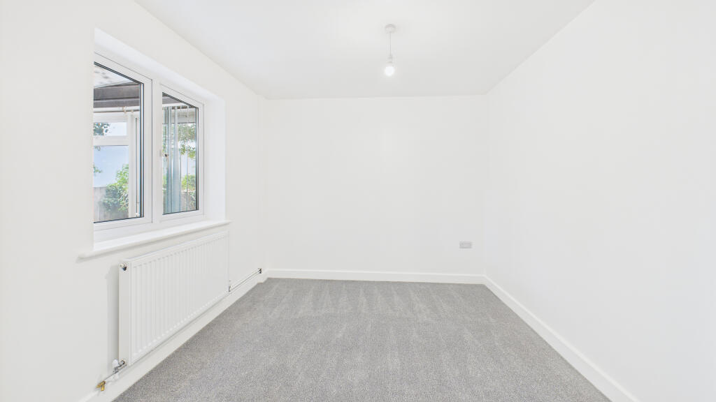
- : average
- : average
- : average
- : small
- : average
Textual Property Features
- Has Garden
- Chain Free
- Success
Detected Visual Features
- modern design
- dual-tone brick and cladding exterior
- two-story
- suburban
- detached
- garage
- driveway
- mixed materials
- modern
- brick facade
- residential
- family home
EPC Details
- Fully double glazed
- Cavity wall, as built, insulated (assumed)
- Boiler and radiators, mains gas
- Low energy lighting in 29% of fixed outlets
- Solid, limited insulation (assumed)
Nearby Schools
- John Colet School
- Wendover Church of England Junior School
- Halton Community Combined School
- Turnfurlong Junior School
- Broughton Junior School
- Bierton Church of England Combined School
- Wingrave Church of England Combined School
- Stoke Mandeville Combined School
- Weston Turville Church of England School
- Goldfield Infants' and Nursery School
- Tring School
- Aston Clinton School
- Bedgrove Junior School
- The Grange School
- The John Hampden School
- Tring Park School for the Performing Arts
- Bishop Wood Church of England Junior School, Tring
- William Harding School
- St Joseph's Catholic Infant School
- Broughton Community Schools (Infants)
- Marsworth Church of England Infant School
- Kingsbrook View Primary Academy
- Dundale Primary School and Nursery
- Bedgrove Infant School
- Turnfurlong Infant School
- St Edward's Catholic Junior School
- The Kingsbrook School
- Long Marston VA Church of England Primary School
Nearest General Shops
- Id: 833474338
- Tags:
- Leisure: park
- Name: Weston Turville Shop Park
- TagsNormalized:
- Lat: 51.7915832
- Lon: -0.7580845
- FullGeoHash: gcpqwsrgz6g5
- PartitionGeoHash: gcpq
- Images:
- FoodStandards: null
- Distance: 2386.3
,- Id: 497498393
- Tags:
- Addr:
- Postcode: HP22 5EZ
- Street: College Road North
- Building: yes
- Contact:
- Email: astonclintonreuse@sbhospice.org.uk
- Phone: +441296632766
- Website: https://www.sbh.org.uk/shop-with-us
- Fixme: Check opening hours! Their website says "We are open 9am - 4pm in the winter, and 9am - 6pm in the summer."
- Opening_hours: Mo-Su 09:00-18:00
- Operator: South Bucks Hospice
- Shop: reuse
- TagsNormalized:
- Lat: 51.8125875
- Lon: -0.7323359
- FullGeoHash: gcpqz24wpq6g
- PartitionGeoHash: gcpq
- Images:
- FoodStandards: null
- Distance: 1378
,- Id: 203878522
- Tags:
- Addr:
- Postcode: HP22 5HQ
- Street: London Road
- Email: sales@acar2go.co.uk
- Name: acar2go
- Opening_hours: Mo-Fr 08:30-18:00; Sa 09:00-18:00; Su 10:00-16:00
- Shop: car
- Website: https://www.acar2go.co.uk/
- TagsNormalized:
- Lat: 51.8009536
- Lon: -0.7269274
- FullGeoHash: gcpqxqndmmes
- PartitionGeoHash: gcpq
- Images:
- FoodStandards: null
- Distance: 33.2
}
Nearest Grocery shops
- Id: 836468263
- Tags:
- Name: Wilstone Village Shop
- Shop: convenience
- TagsNormalized:
- Lat: 51.8178732
- Lon: -0.6887539
- FullGeoHash: gcpwb34kyzev
- PartitionGeoHash: gcpw
- Images:
- FoodStandards: null
- Distance: 3231.4
,- Id: 1260668478
- Tags:
- Name: Weston Turville Store
- Shop: convenience
- TagsNormalized:
- Lat: 51.7916974
- Lon: -0.7582277
- FullGeoHash: gcpqwsrus00m
- PartitionGeoHash: gcpq
- Images:
- FoodStandards: null
- Distance: 2389.9
,- Id: 4022769413
- Tags:
- Brand: Premier
- Brand:wikidata: Q7240340
- Name: Premier
- Shop: convenience
- Website: https://www.premier-stores.co.uk/our-stores/aston-clinton-stores-post-office
- TagsNormalized:
- Lat: 51.7990343
- Lon: -0.7193229
- FullGeoHash: gcpqxtspnxcg
- PartitionGeoHash: gcpq
- Images:
- FoodStandards: null
- Distance: 538.2
}
Nearest Religious buildings
- Id: 360910070
- Tags:
- Amenity: place_of_worship
- Building: church
- Denomination: anglican
- Name: All Saints
- Religion: christian
- Source: npe
- Wikidata: Q17535754
- TagsNormalized:
- place of worship
- church
- anglican
- christian
- Lat: 51.8036525
- Lon: -0.7137389
- FullGeoHash: gcpqxy860sv8
- PartitionGeoHash: gcpq
- Images:
- FoodStandards: null
- Distance: 947.9
,- Id: 1131706163
- Tags:
- Amenity: place_of_worship
- Denomination: baptist
- Name: Aston Clinton Baptist Church
- Religion: christian
- TagsNormalized:
- place of worship
- baptist
- church
- christian
- Lat: 51.8034077
- Lon: -0.7250272
- FullGeoHash: gcpqxw809xhe
- PartitionGeoHash: gcpq
- Images:
- FoodStandards: null
- Distance: 321.6
,- Id: 97172593
- Tags:
- Amenity: place_of_worship
- Building: church
- Denomination: anglican
- Name: St Michael & All Angels
- Religion: christian
- Wikidata: Q7594850
- Wikipedia: en:St Michael and All Angels Church, Aston Clinton
- TagsNormalized:
- place of worship
- church
- anglican
- christian
- Lat: 51.7993332
- Lon: -0.7262217
- FullGeoHash: gcpqxmz0vz9f
- PartitionGeoHash: gcpq
- Images:
- FoodStandards: null
- Distance: 155.1
}
Nearest Medical buildings
- Id: 26407406
- Tags:
- Amenity: doctors
- Healthcare: doctor
- Name: Wendover Health Centre
- Website: https://www.westongrove.com/
- TagsNormalized:
- doctor
- doctors
- health
- healthcare
- health centre
- Lat: 51.765664
- Lon: -0.743456
- FullGeoHash: gcpqrpdsu5pj
- PartitionGeoHash: gcpq
- Images:
- FoodStandards: null
- Distance: 4063.4
,- Id: 967455491
- Tags:
- Amenity: pharmacy
- Brand: Lloyds Pharmacy
- Brand:wikidata: Q6662870
- Brand:wikipedia: en:LloydsPharmacy
- Healthcare: pharmacy
- Name: Lloyds Pharmacy
- TagsNormalized:
- pharmacy
- lloyds pharmacy
- health
- healthcare
- Lat: 51.8064438
- Lon: -0.7847259
- FullGeoHash: gcpqwphd6t1f
- PartitionGeoHash: gcpq
- Images:
- FoodStandards: null
- Distance: 4042.5
,- Id: 288830647
- Tags:
- Amenity: surgery
- Name: The Camborne Centre
- TagsNormalized:
- Lat: 51.8067258
- Lon: -0.7835794
- FullGeoHash: gcpqwpjkj38u
- PartitionGeoHash: gcpq
- Images:
- FoodStandards: null
- Distance: 3969.8
,- Id: 288830646
- Tags:
- Amenity: surgery
- Name: Bedgrove
- TagsNormalized:
- Lat: 51.8065997
- Lon: -0.7834399
- FullGeoHash: gcpqwpje2d0u
- PartitionGeoHash: gcpq
- Images:
- FoodStandards: null
- Distance: 3958
}
Nearest Airports
- Id: 110273499
- Tags:
- Addr:
- Country: GB
- Postcode: LU2 9LY
- Aerodrome: international
- Aerodrome:type: public
- Aeroway: aerodrome
- Alt_name: London Luton
- Iata: LTN
- Icao: EGGW
- Name: London Luton Airport
- Website: https://www.london-luton.co.uk/
- Wikidata: Q8712
- Wikipedia: en:Luton Airport
- TagsNormalized:
- airport
- international airport
- Lat: 51.8780363
- Lon: -0.3701408
- FullGeoHash: gcpxps47rngh
- PartitionGeoHash: gcpx
- Images:
- FoodStandards: null
- Distance: 25960.6
}
Nearest Leisure Facilities
- Id: 97174160
- Tags:
- Leisure: playground
- Name: Aston Clinton Park Playground
- TagsNormalized:
- Lat: 51.7974059
- Lon: -0.7221665
- FullGeoHash: gcpqxt6ju239
- PartitionGeoHash: gcpq
- Images:
- FoodStandards: null
- Distance: 479.8
,- Id: 97174156
- Tags:
- Leisure: park
- Name: Aston Clinton Park
- TagsNormalized:
- Lat: 51.7978045
- Lon: -0.7215069
- FullGeoHash: gcpqxtd85dt7
- PartitionGeoHash: gcpq
- Images:
- FoodStandards: null
- Distance: 479.4
,- Id: 97776119
- Tags:
- Leisure: pitch
- Name: Aston Clinton Bowls Club
- Sport: bowls
- TagsNormalized:
- pitch
- leisure
- bowls
- club
- sports
- Lat: 51.7980932
- Lon: -0.7217093
- FullGeoHash: gcpqxtd3ybqt
- PartitionGeoHash: gcpq
- Images:
- FoodStandards: null
- Distance: 447.7
,- Id: 1131706175
- Tags:
- Amenity: community_centre
- Name: Aston Clinton Sports and Social Club
- TagsNormalized:
- community centre
- social club
- sports
- club
- Lat: 51.7982205
- Lon: -0.7224514
- FullGeoHash: gcpqxt9ft8jh
- PartitionGeoHash: gcpq
- Images:
- FoodStandards: null
- Distance: 400.3
,- Id: 97174159
- Tags:
- Leisure: pitch
- Name: Aston Clinton School Playing Field
- Sport: multi
- TagsNormalized:
- Lat: 51.8023412
- Lon: -0.7260163
- FullGeoHash: gcpqxqr6d871
- PartitionGeoHash: gcpq
- Images:
- FoodStandards: null
- Distance: 187.9
}
Nearest Tourist attractions
- Id: 11153338
- Tags:
- Name: Wildlife Walk
- Network: lwn
- Roundtrip: yes
- Route: foot
- Tourism: yes
- Type: route
- TagsNormalized:
- Lat: 51.7771865
- Lon: -0.6968084
- FullGeoHash: gcpw81sxgpju
- PartitionGeoHash: gcpw
- Images:
- FoodStandards: null
- Distance: 3324.9
,- Id: 614306707
- Tags:
- TagsNormalized:
- Lat: 51.7723888
- Lon: -0.7129352
- FullGeoHash: gcpqxbbu52ub
- PartitionGeoHash: gcpq
- Images:
- FoodStandards: null
- Distance: 3286.8
,- Id: 1430010075
- Tags:
- Description: Highest Point of the Chiltern Hills
- Ele: 267
- Name: Haddington Hill
- Natural: peak
- Tourism: minor_attraction
- Wikidata: Q5637668
- Wikipedia: en:Haddington Hill
- TagsNormalized:
- Lat: 51.7733745
- Lon: -0.7104923
- FullGeoHash: gcpqxc49u2d8
- PartitionGeoHash: gcpq
- Images:
- FoodStandards: null
- Distance: 3235.9
}
Nearest Train stations
- Id: 5777593692
- Tags:
- Name: Little Kimble
- Naptan:
- Network: National Rail
- Operator: Chiltern Railways
- Public_transport: station
- Railway: station
- Ref:
- Wikidata: Q2116125
- Wikipedia: en:Little Kimble railway station
- TagsNormalized:
- Lat: 51.7523306
- Lon: -0.8085573
- FullGeoHash: gcpqmt5ppjxu
- PartitionGeoHash: gcpq
- Images:
- FoodStandards: null
- Distance: 7788.9
,- Id: 4375290005
- Tags:
- Name: Tring
- Naptan:
- Network: National Rail
- Public_transport: station
- Railway: station
- Ref:
- Wikidata: Q2620068
- Wikipedia: en:Tring railway station
- TagsNormalized:
- Lat: 51.800672
- Lon: -0.6224578
- FullGeoHash: gcpw9y48z9ju
- PartitionGeoHash: gcpw
- Images:
- FoodStandards: null
- Distance: 7166
,- Id: 7153884935
- Tags:
- Name: Aylesbury
- Naptan:
- Network: National Rail
- Operator: Chiltern Railways
- Public_transport: station
- Railway: station
- Ref:
- Website: http://www.nationalrail.co.uk/stations_destinations/AYS.aspx
- Wikidata: Q2338815
- Wikipedia: en:Aylesbury railway station
- TagsNormalized:
- Lat: 51.8134286
- Lon: -0.8143149
- FullGeoHash: gcpqv2r5154u
- PartitionGeoHash: gcpq
- Images:
- FoodStandards: null
- Distance: 6189.7
,- Id: 21137939
- Tags:
- Name: Wendover
- Naptan:
- Network: National Rail
- Public_transport: station
- Railway: station
- Ref:
- Source: NPE
- Wikidata: Q2751439
- Wikipedia: en:Wendover railway station
- TagsNormalized:
- Lat: 51.7618168
- Lon: -0.7476905
- FullGeoHash: gcpqqyzw3w18
- PartitionGeoHash: gcpq
- Images:
- FoodStandards: null
- Distance: 4559
,- Id: 3724898182
- Tags:
- Name: Stoke Mandeville
- Naptan:
- Network: National Rail
- Public_transport: station
- Railway: station
- Ref:
- Source: NPE
- Wikidata: Q2244698
- Wikipedia: en:Stoke Mandeville railway station
- TagsNormalized:
- Lat: 51.7878849
- Lon: -0.7843417
- FullGeoHash: gcpqw5sy792q
- PartitionGeoHash: gcpq
- Images:
- FoodStandards: null
- Distance: 4214.4
}
Nearest Bus stations and stops
- Id: 502544041
- Tags:
- Bus: yes
- Highway: bus_stop
- Name: Chapel End Lane
- Naptan:
- AtcoCode: 210021426065
- Bearing: S
- CommonName: Chapel End Lane
- Indicator: opp
- Landmark: Unknown
- NaptanCode: hrtgtdwp
- ShortCommonName: NA
- Street: Tring Road
- Verified: no
- Public_transport: platform
- Source: naptan_import
- TagsNormalized:
- Lat: 51.8164501
- Lon: -0.6880824
- FullGeoHash: gcpwb2fuww2s
- PartitionGeoHash: gcpw
- Images:
- FoodStandards: null
- Distance: 3178.9
,- Id: 502544017
- Tags:
- Bus: yes
- Highway: bus_stop
- Name: Reservoir
- Naptan:
- AtcoCode: 210021426040
- Bearing: SW
- CommonName: Reservoir
- Crossing: Wilstone Car Park
- Indicator: adj
- Landmark: Wilstone Car Park
- NaptanCode: hrtdatmw
- ShortCommonName: NA
- Street: Lower Icknield Way
- Verified: no
- Public_transport: platform
- Source: naptan_import
- TagsNormalized:
- Lat: 51.8124696
- Lon: -0.6899534
- FullGeoHash: gcpwb21tdbmk
- PartitionGeoHash: gcpw
- Images:
- FoodStandards: null
- Distance: 2843.5
,- Id: 10225559896
- Tags:
- Bus: yes
- Departures_board: timetable
- Highway: bus_stop
- Name: Halton, Main Point
- Public_transport: platform
- Shelter: yes
- TagsNormalized:
- Lat: 51.7760535
- Lon: -0.7271246
- FullGeoHash: gcpqx3w92gbt
- PartitionGeoHash: gcpq
- Images:
- FoodStandards: null
- Distance: 2740.8
,- Id: 8375758844
- Tags:
- Bus: yes
- Highway: bus_stop
- Public_transport: platform
- TagsNormalized:
- Lat: 51.8072614
- Lon: -0.7567751
- FullGeoHash: gcpqwz0zjv7x
- PartitionGeoHash: gcpq
- Images:
- FoodStandards: null
- Distance: 2194.7
,- Id: 9166096846
- Tags:
- Bus: yes
- Highway: bus_stop
- Public_transport: platform
- Shelter: yes
- TagsNormalized:
- Lat: 51.7977043
- Lon: -0.7141384
- FullGeoHash: gcpqxtrzrrgv
- PartitionGeoHash: gcpq
- Images:
- FoodStandards: null
- Distance: 924
}
Nearest Hotels
- Id: 6741275
- Tags:
- Addr:
- Postcode: HP22 5QT
- Street: New Road
- Building: hotel
- Name: Holiday Inn Aylesbury
- Tourism: hotel
- Type: multipolygon
- Website: https://www.ihg.com/holidayinn/hotels/gb/en/aylesbury/aylbk/hoteldetail
- TagsNormalized:
- Lat: 51.8088805
- Lon: -0.7682672
- FullGeoHash: gcpqwx88d566
- PartitionGeoHash: gcpq
- Images:
- FoodStandards: null
- Distance: 3001.1
,- Id: 587591780
- Tags:
- Brand: Premier Inn
- Brand:wikidata: Q2108626
- Building: yes
- Internet_access: wlan
- Internet_access:fee: customers
- Internet_access:operator: Virgin Media
- Internet_access:ssid: Premier Inn Free Wi-Fi
- Name: Premier Inn
- Tourism: hotel
- Website: https://www.premierinn.com/gb/en/hotels/england/hertfordshire/tring/tring.html
- TagsNormalized:
- Lat: 51.7935976
- Lon: -0.6934002
- FullGeoHash: gcpw8hxpdd7k
- PartitionGeoHash: gcpw
- Images:
- FoodStandards: null
- Distance: 2420.5
,- Id: 1074242586
- Tags:
- Addr:
- County: Buckinghamshire
- Housenumber: 45
- Postcode: HP22 5HL
- Street: London Road
- Village: Aston Clinton
- Fhrs:
- Name: West Lodge Hotel
- Source:
- Tourism: hotel
- TagsNormalized:
- Lat: 51.7997898
- Lon: -0.7239952
- FullGeoHash: gcpqxtbg9swn
- PartitionGeoHash: gcpq
- Images:
- FoodStandards: null
- Distance: 210
}
Tags
- modern design
- dual-tone brick and cladding exterior
- two-story
- suburban
- detached
- garage
- driveway
- mixed materials
- modern
- brick facade
- two-story
- driveway
- residential
- detached
- family home
- suburban
Local Market Stats
- Average Price/sqft: £417
- Avg Income: £61200
- Rental Yield: 3.4%
- Social Housing: 8%
- Planning Success Rate: 83%
AirBnB Data
- 1km average: £135/night
- Listings in 1km: 1
Similar Properties
 5 bedroom detached house for sale in Chapel Drive, HP22 — £800,000 • 5 bed • 2 bath • 1825 ft²
 4 bedroom detached house for sale in Bishops Field, Aston Clinton, HP22 — £875,000 • 4 bed • 2 bath • 1779 ft²
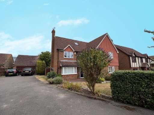 5 bedroom detached house for sale in Aston Clinton, HP22 — £850,000 • 5 bed • 3 bath • 1661 ft²
 3 bedroom detached house for sale in Aston Clinton, HP22 — £475,000 • 3 bed • 2 bath • 937 ft²
 4 bedroom detached house for sale in Chapel Drive, Aston Clinton, HP22 — £650,000 • 4 bed • 2 bath • 1500 ft²
 4 bedroom detached house for sale in Sawdy Drive, Aston Clinton, HP22 — £700,000 • 4 bed • 3 bath • 1808 ft²
Meta
- {
"@context": "https://schema.org",
"@type": "Residence",
"name": "4 bedroom detached house for sale in Cosy Corner, Aston Cli…",
"description": "",
"url": "https://propertypiper.co.uk/property/ee2c40e2-766a-46bf-99f5-96c9e238fcb4",
"image": "https://image-a.propertypiper.co.uk/1e869817-acbf-467a-b84b-971d3a19ba99-1024.jpeg",
"address": {
"@type": "PostalAddress",
"streetAddress": "1 Cosy Corner, Aston Clinton",
"postalCode": "HP22 5EQ",
"addressLocality": "Buckinghamshire",
"addressRegion": "Aylesbury",
"addressCountry": "England"
},
"geo": {
"@type": "GeoCoordinates",
"latitude": 51.800700410176454,
"longitude": -0.7266714499065717
},
"numberOfRooms": 4,
"numberOfBathroomsTotal": 1,
"floorSize": {
"@type": "QuantitativeValue",
"value": 1069,
"unitCode": "FTK"
},
"offers": {
"@type": "Offer",
"price": 500000,
"priceCurrency": "GBP",
"availability": "https://schema.org/InStock"
},
"additionalProperty": [
{
"@type": "PropertyValue",
"name": "Feature",
"value": "modern design"
},
{
"@type": "PropertyValue",
"name": "Feature",
"value": "dual-tone brick and cladding exterior"
},
{
"@type": "PropertyValue",
"name": "Feature",
"value": "two-story"
},
{
"@type": "PropertyValue",
"name": "Feature",
"value": "suburban"
},
{
"@type": "PropertyValue",
"name": "Feature",
"value": "detached"
},
{
"@type": "PropertyValue",
"name": "Feature",
"value": "garage"
},
{
"@type": "PropertyValue",
"name": "Feature",
"value": "driveway"
},
{
"@type": "PropertyValue",
"name": "Feature",
"value": "mixed materials"
},
{
"@type": "PropertyValue",
"name": "Feature",
"value": "modern"
},
{
"@type": "PropertyValue",
"name": "Feature",
"value": "brick facade"
},
{
"@type": "PropertyValue",
"name": "Feature",
"value": "two-story"
},
{
"@type": "PropertyValue",
"name": "Feature",
"value": "driveway"
},
{
"@type": "PropertyValue",
"name": "Feature",
"value": "residential"
},
{
"@type": "PropertyValue",
"name": "Feature",
"value": "detached"
},
{
"@type": "PropertyValue",
"name": "Feature",
"value": "family home"
},
{
"@type": "PropertyValue",
"name": "Feature",
"value": "suburban"
}
]
}
High Res Floorplan Images
Compatible Floorplan Images
FloorplanImages Thumbnail