Summary - BARN SOUTH EAST OF STONE HOUSE, KIRTON ROAD NG22 0HF
1 bed 1 bath Land
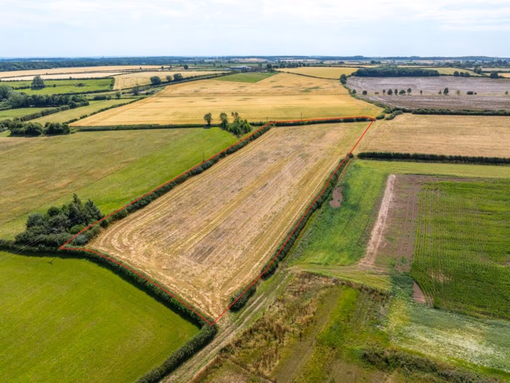
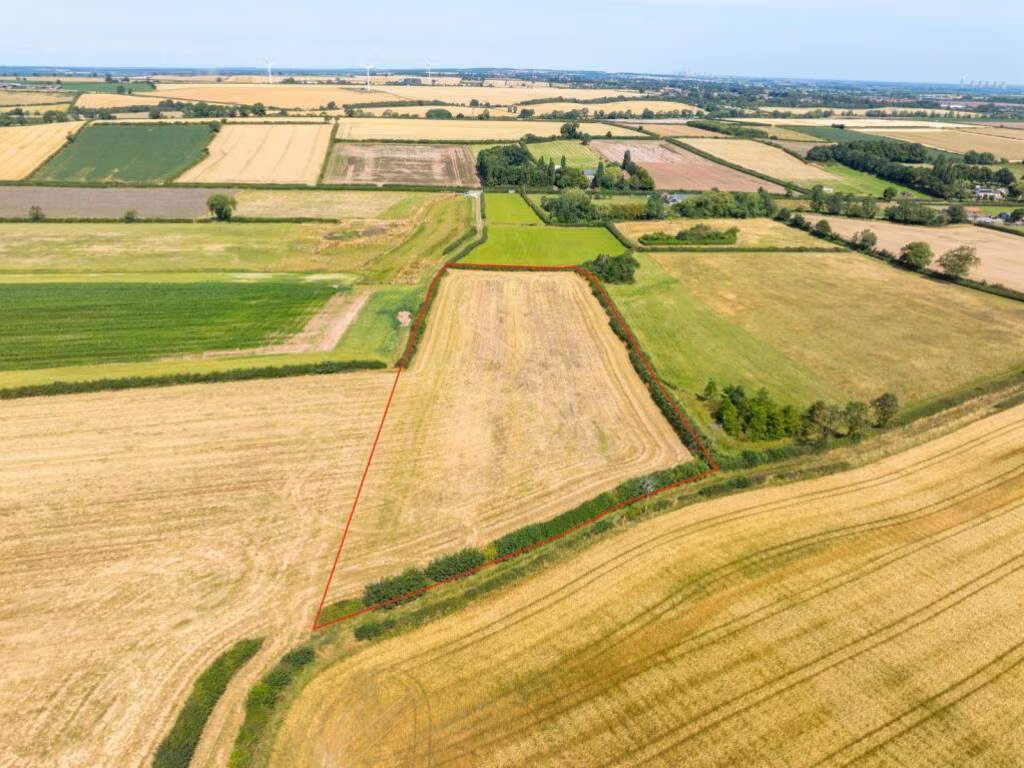
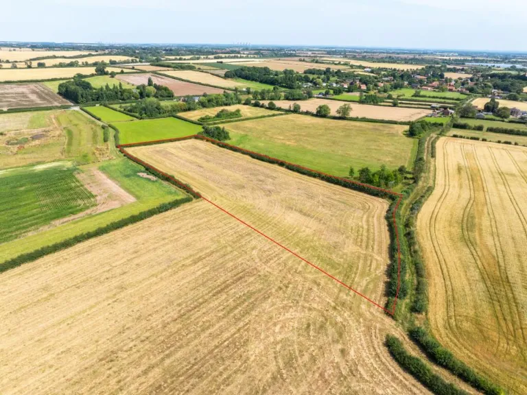
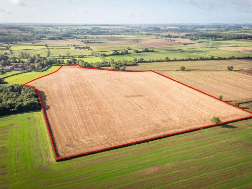
Grade 2 arable parcel near Egmanton — practical farmland with development constraints.
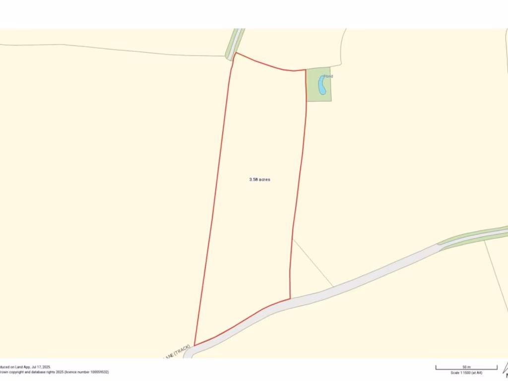
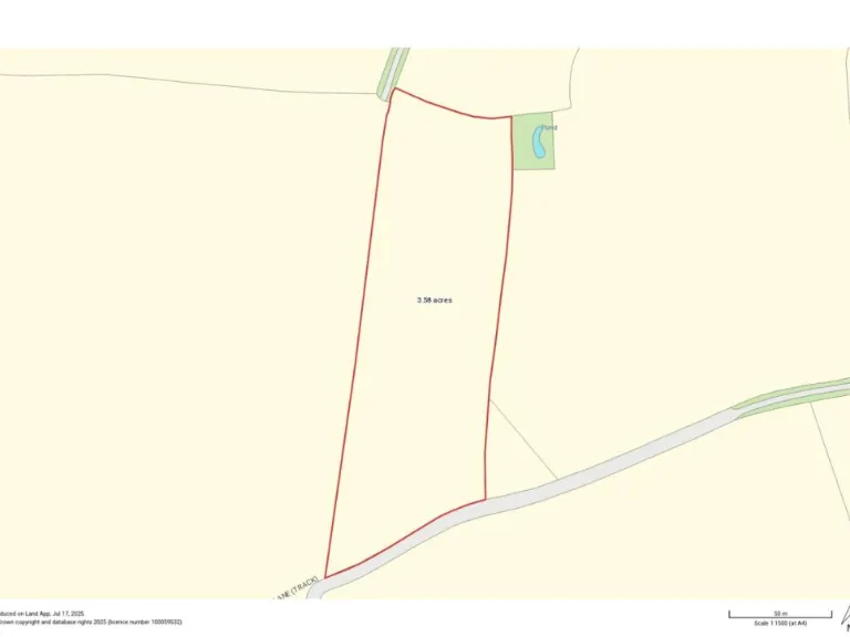
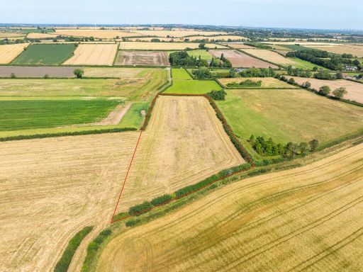
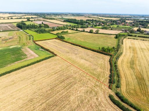
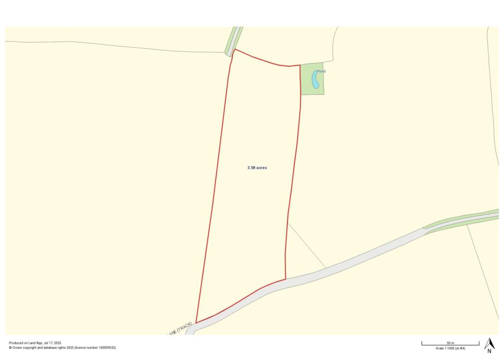
3.58 acres (1.45 ha) Grade 2 arable land suitable for autumn-sown crops
Currently fallow; historically part of an arable rotation
Access via formal shared trackway off Kirton Road; vacant possession
Mostly enclosed by mature hedgerows; western boundary partly undefined
Situated in a Nitrate Vulnerable Zone (NVZ)
High flood risk—affects cropping, drainage and insurance considerations
Buyer to contribute to specified fencing costs shown on plan
No services connected; not enrolled in environmental schemes
A useful block of arable land extending to about 3.58 acres (1.45 ha), offered freehold with vacant possession. Classified Grade 2, the gently sloping soil is described as slightly acid loamy and clayey, suitable for autumn-sown crops or grassland. The parcel is currently in fallow and has historically formed part of an arable rotation.
The plot sits at the edge of Egmanton village, set back from Kirton Road and accessed via a formal shared trackway. It benefits from mature hedgerow boundaries for the most part, attractive countryside views and good road links — Tuxford and the A1 are a short drive away. Sporting, timber and mineral rights (in so far as owned) are included in the freehold.
Buyers should note several material considerations: the land lies within a Nitrate Vulnerable Zone (NVZ) and is flagged as high flood risk, which will influence cropping options, insurance and any future development potential. A section of the western boundary is undefined and purchasers will be required to contribute to fencing works shown on the sale plan. No services are connected and the land is not enrolled in environmental schemes. Prospective purchasers should satisfy themselves on all matters, including services, boundaries and planning or agricultural permissions.
 Farm land for sale in 27.11 Ac Arable Land, Norwell, Newark, Nottinghamshire, NG23 6JX, NG23 — £235,000 • 1 bed • 1 bath
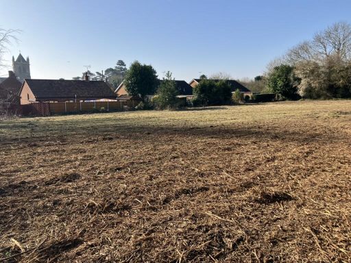 Land for sale in Land On The East Side Of Hall Lane, Laxton, Newark, Nottinghamshire, NG22 — £50,000 • 1 bed • 1 bath • 27443 ft²
 Land for sale in Grassthorpe, Newark, Nottinghamshire, NG23 — £175,000 • 1 bed • 1 bath
 Land for sale in Main Street, Kirton, NG22 — £350,000 • 1 bed • 1 bath • 9600 ft²
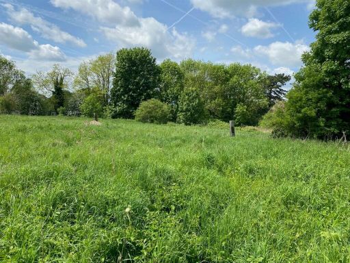 Land for sale in Bishops Drive, Southwell, NG25 — £100,000 • 1 bed • 1 bath
 Land for sale in Land At Moorhouse, Newark, Nottinghamshire, NG23 — £430,000 • 1 bed • 1 bath