CT19 5AR - 1 bedroom ground floor flat for sale in Broadmead Road, Fol…
View on Property Piper
1 bedroom ground floor flat for sale in Broadmead Road, Folkestone, Kent, CT19
Property Details
- Price: £165500
- Bedrooms: 1
- Bathrooms: 1
- Property Type: undefined
- Property SubType: undefined
Image Descriptions
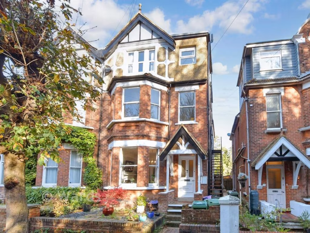
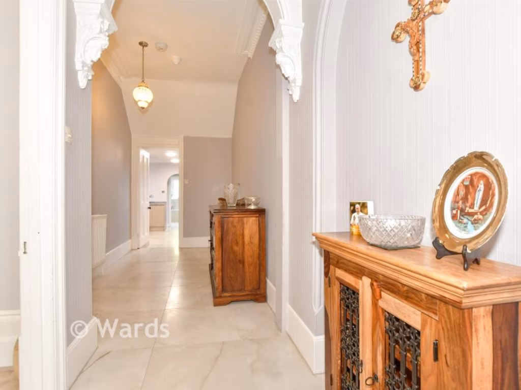
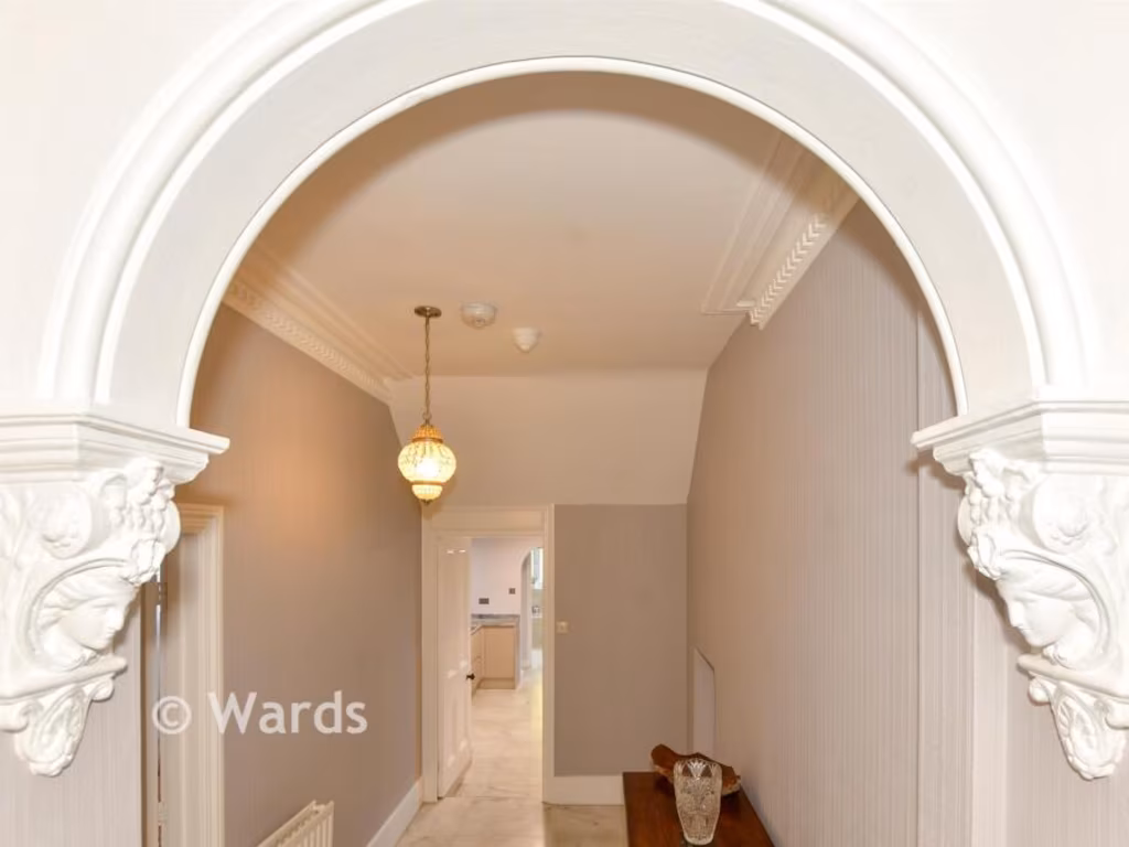
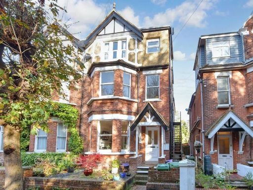
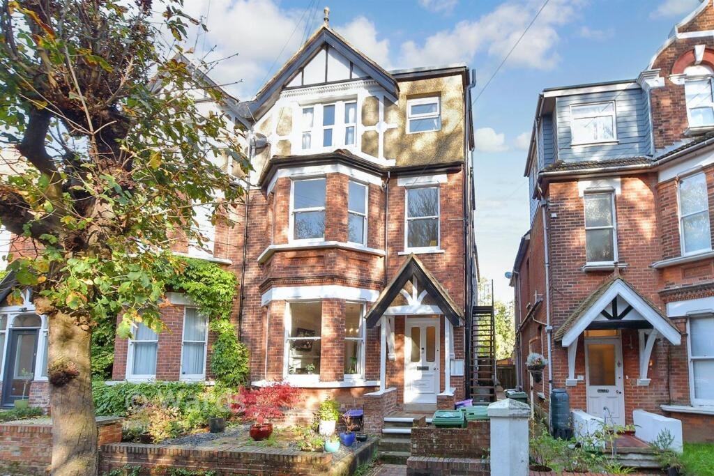
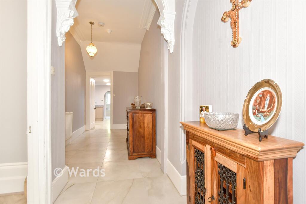
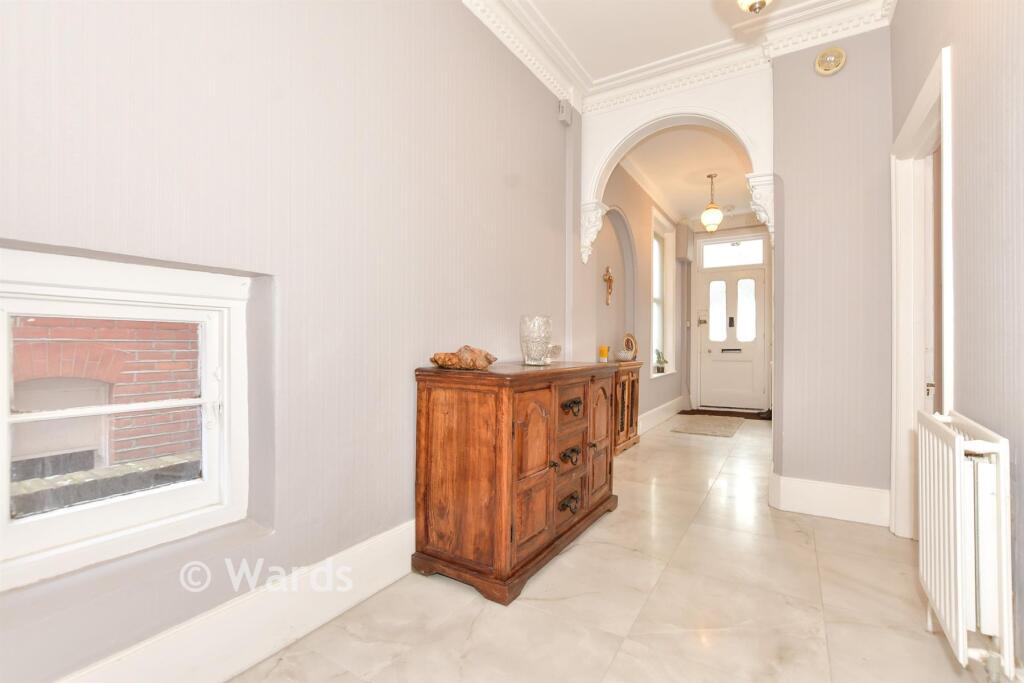
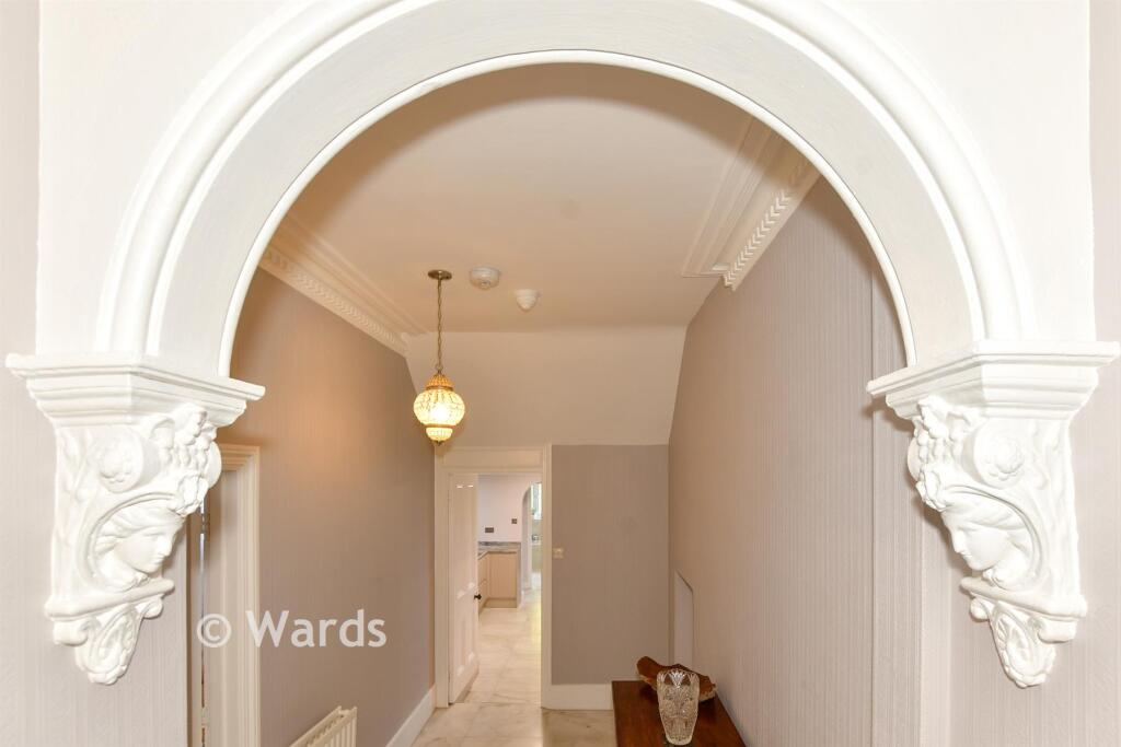
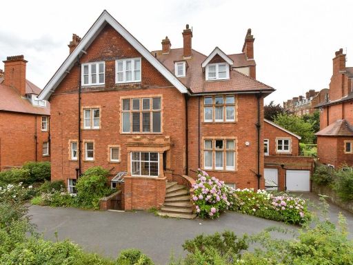
- Three-story residential building Victorian
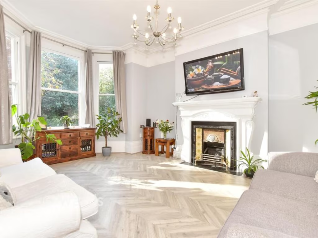
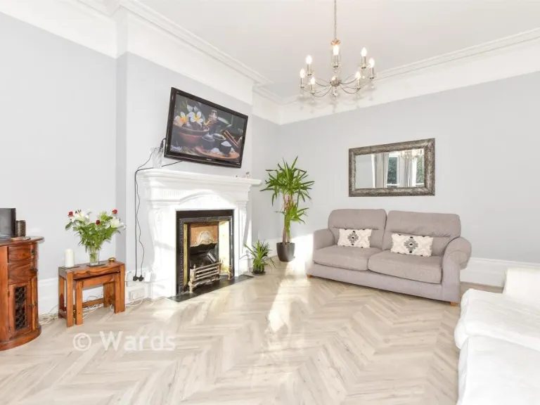
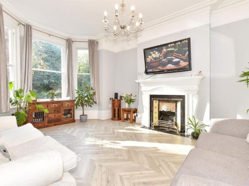
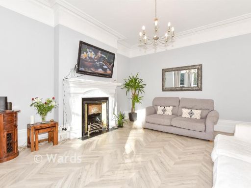
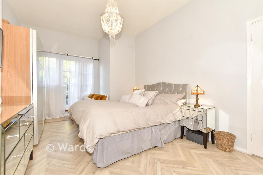
- living room Victorian
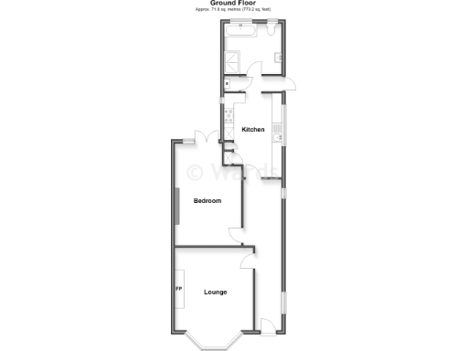
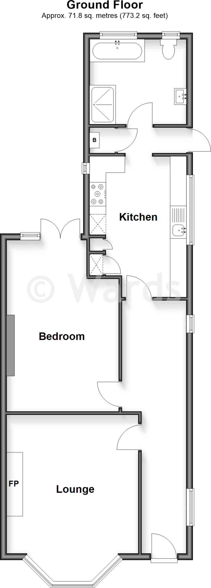
Rooms
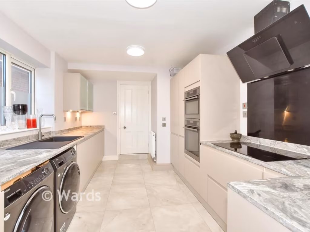
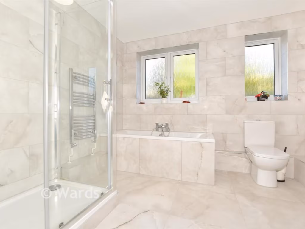
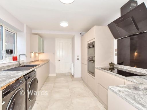
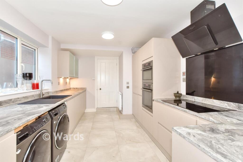
- Kitchen:
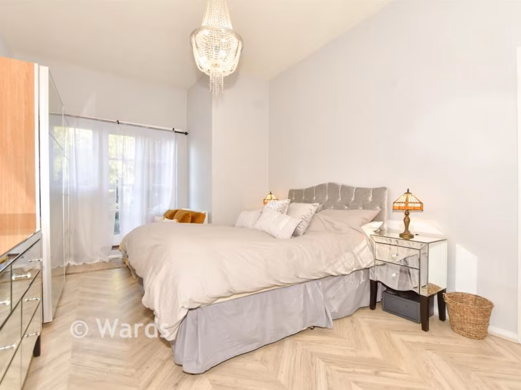
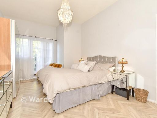
- Bedroom:
- Lounge:
Textual Property Features
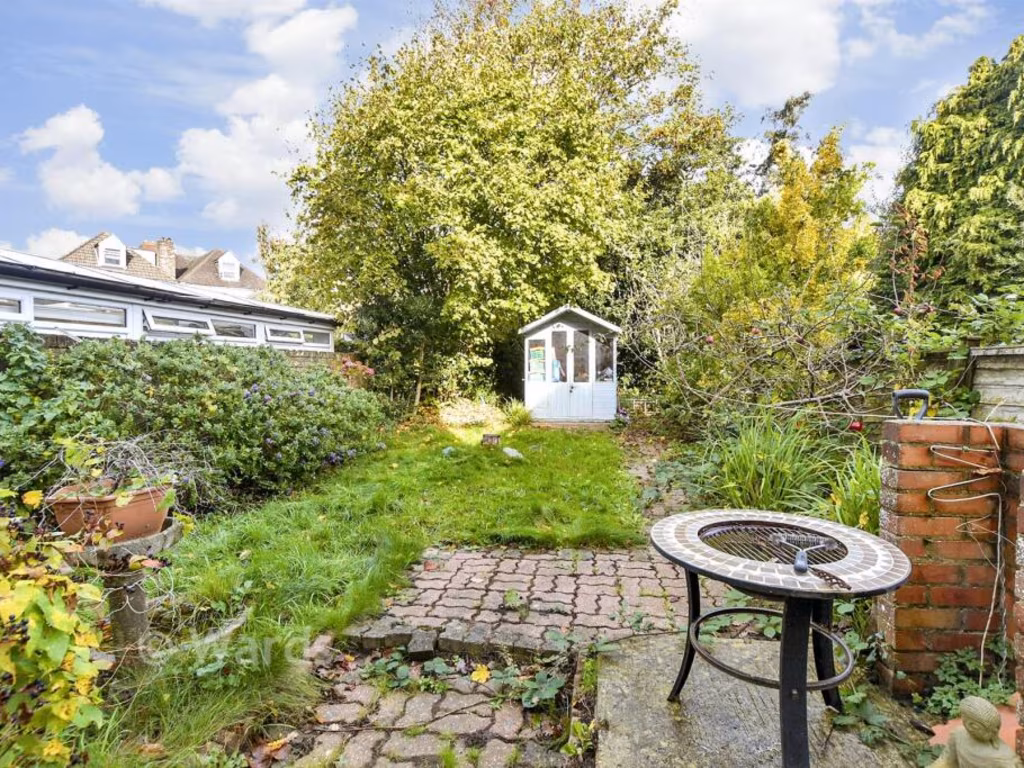
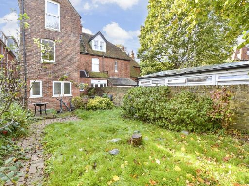
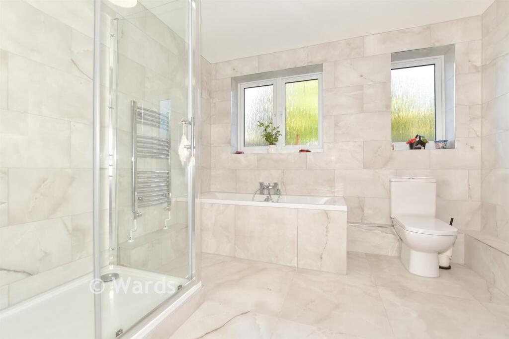
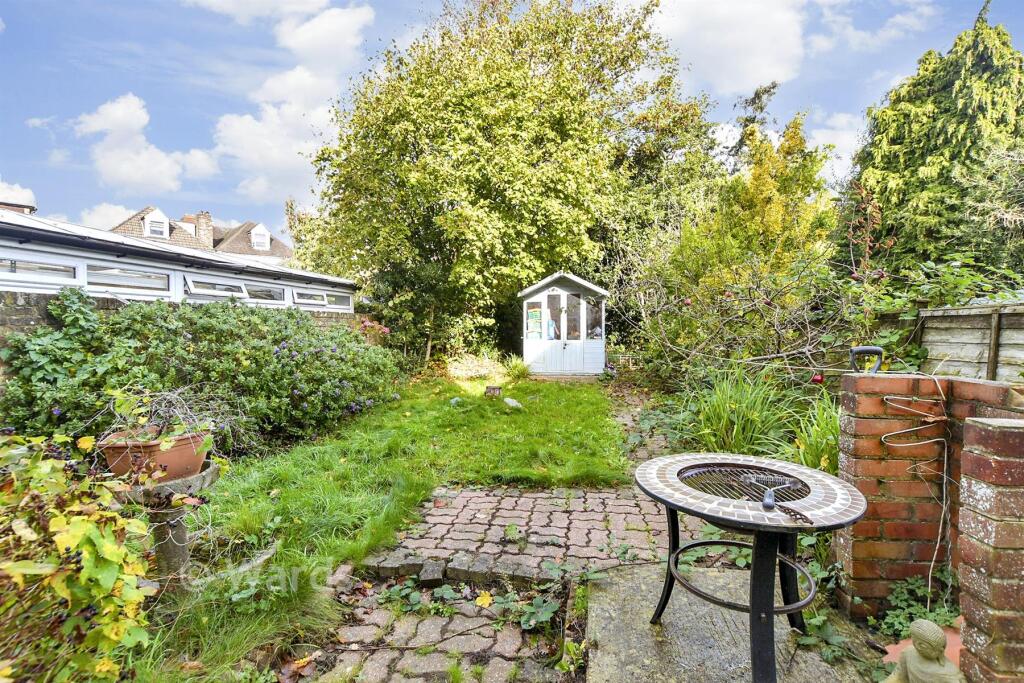
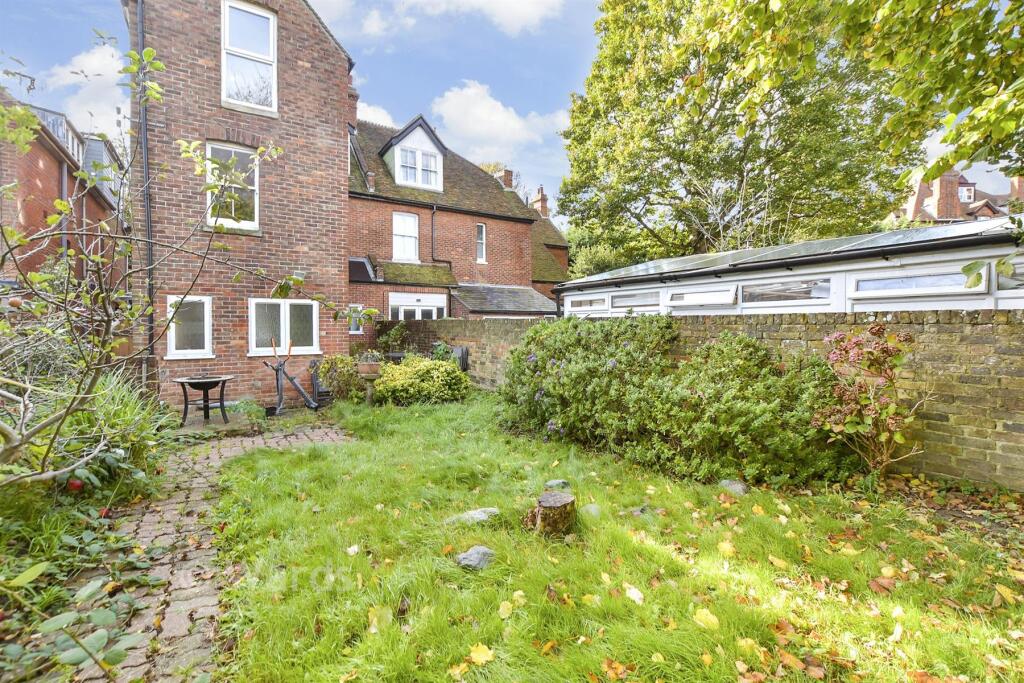
- Has Garden
- Is Retirement
- Success
Detected Visual Features
- Victorian
- three-story
- red brick facade
- bay windows
- period property
- high ceilings
- semi-detached
- residential
- traditional architecture
- gabled roof
- original features
- fireplace
- wood flooring
- large windows
- natural light
- decorative molding
- chandelier
- bright
- elegant
- period features
- spacious
EPC Details
- Partial double glazing
- Cavity wall, as built, no insulation (assumed)
- Boiler and radiators, mains gas
- Low energy lighting in all fixed outlets
- Suspended, no insulation (assumed)
Nearby Schools
- St Eanswythe's Church of England Primary School
- Folkestone, St Peter's Church of England Primary School
- Earlscliffe (Sussex Summer Schools Ltd)
- Folkestone St. Mary's Church of England Primary Academy
- The Harvey Grammar School
- Cheriton Primary School
- All Soul's Church of England Primary School
- Mundella Primary School
- Morehall Primary School and Nursery
- Folkestone Primary
- Capel-le-Ferne Primary School
- Seabrook Church of England Primary School
- Saltwood CofE Primary School
- Folkestone, St Martin's Church of England Primary School
- Stella Maris Catholic Primary School
- Martello Primary
- Castle Hill Community Primary School
- Harcourt Primary School
- Sandgate Primary School
- Turner Free School
- The Folkestone School for Girls
- Christ Church Cep Academy, Folkestone
- Folkestone Academy
- The Churchill School
- Hawkinge Primary School
- Lyminge Church of England Primary School
- Elham Church of England Primary School
Nearest Bars And Restaurants
- Id: 444384447
- Tags:
- Amenity: cafe
- Name: Emma's Cafe
- TagsNormalized:
- Lat: 51.0850496
- Lon: 1.1772866
- FullGeoHash: u10fdg9rbz2w
- PartitionGeoHash: u10f
- Images:
- FoodStandards: null
- Distance: 432.8
,- Id: 4307398124
- Tags:
- Amenity: cafe
- Name: Caféxpresshop
- Opening_hours: Mo-Fr 05:30-18:30; Sa 07:00-18:30; Su 08:00-17:00
- TagsNormalized:
- Lat: 51.0828209
- Lon: 1.1680389
- FullGeoHash: u10fde6e120b
- PartitionGeoHash: u10f
- Images:
- FoodStandards: null
- Distance: 269.6
,- Id: 963656692
- Tags:
- Addr:
- City: Folkestone
- Housenumber: 83
- Postcode: CT20 1DG
- Street: Cheriton Road
- Amenity: cafe
- Building: apartments
- Building:levels: 4
- Check_date: 2022-07-23
- Contact:
- Cuisine: coffee_shop
- Diet:
- Vegan: yes
- Vegetarian: yes
- Indoor_seating: yes
- Internet_access: wlan
- Internet_access:fee: no
- Level: 0
- Name: Brew
- Opening_hours: Mo-Fr 09:00-17:00; Sa,Su 09:00-16:00
- Outdoor_seating: yes
- Payment:
- Credit_cards: yes
- Debit_cards: yes
- Smoking: outside
- Toilets:
- TagsNormalized:
- cafe
- apartments
- coffee
- vegan
- vegetarian
- Lat: 51.0810556
- Lon: 1.1732202
- FullGeoHash: u10fden2dnbm
- PartitionGeoHash: u10f
- Images:
- FoodStandards: null
- Distance: 253.8
,- Id: 9004798120
- Tags:
- Amenity: fast_food
- Cuisine: kebab;fish_and_chips
- Name: Central Fish Bar
- Phone: +44 1303 220367
- TagsNormalized:
- Lat: 51.0819988
- Lon: 1.1719846
- FullGeoHash: u10fdejqjnz0
- PartitionGeoHash: u10f
- Images:
- FoodStandards: null
- Distance: 130.8
,- Id: 9004794615
- Tags:
- Amenity: cafe
- Name: Bridge Coffee House
- TagsNormalized:
- Lat: 51.0825446
- Lon: 1.171227
- FullGeoHash: u10fdekc7s6p
- PartitionGeoHash: u10f
- Images:
- FoodStandards: null
- Distance: 82.5
}
Nearest General Shops
- Id: 6928064785
- Tags:
- Addr:
- Country: GB
- Housenumber: 140
- Postcode: CT19 5AB
- Street: Foord Road
- Email: sales@williamscomputers.co.uk
- Internet_access: wlan
- Name: Williams Computers & Electrical Ltd
- Opening_hours: Mo-Tu,Th-Fr 09:00-17:00; We,Sa 09:00-14:00; PH closed
- Phone: +44 1303 253397
- Shop: computer
- Website: http://williamscomputers.co.uk
- TagsNormalized:
- Lat: 51.0853846
- Lon: 1.1773899
- FullGeoHash: u10fdgc3gjvt
- PartitionGeoHash: u10f
- Images:
- FoodStandards: null
- Distance: 458.1
,- Id: 9004798119
- Tags:
- Name: Skevi & Co
- Shop: hairdresser
- TagsNormalized:
- Lat: 51.0822372
- Lon: 1.1718126
- FullGeoHash: u10fdejr95ny
- PartitionGeoHash: u10f
- Images:
- FoodStandards: null
- Distance: 104
,- Id: 9004794614
- Tags:
- Name: Central Barbers
- Shop: hairdresser
- TagsNormalized:
- Lat: 51.0827934
- Lon: 1.171001
- FullGeoHash: u10fdekdy6cs
- PartitionGeoHash: u10f
- Images:
- FoodStandards: null
- Distance: 73.2
}
Nearest Grocery shops
- Id: 5204687825
- Tags:
- Brand: Tesco Express
- Brand:wikidata: Q98456772
- Brand:wikipedia: en:Tesco
- Contact:
- Website: https://www.tesco.com/store-locator/folkestone/100-foord-rd
- Name: Tesco Express
- Shop: convenience
- TagsNormalized:
- tesco
- tesco express
- convenience
- shop
- Lat: 51.0844818
- Lon: 1.1781358
- FullGeoHash: u10fdg9ust9e
- PartitionGeoHash: u10f
- Images:
- FoodStandards: null
- Distance: 462
,- Id: 679922834
- Tags:
- Brand: The Co-operative Food
- Brand:wikidata: Q107617274
- Name: The Co-operative Food
- Shop: convenience
- TagsNormalized:
- the co-operative food
- food
- convenience
- shop
- Lat: 51.0822272
- Lon: 1.1716795
- FullGeoHash: u10fdejpw17d
- PartitionGeoHash: u10f
- Images:
- FoodStandards: null
- Distance: 105.8
,- Id: 9004798117
- Tags:
- Brand: Premier
- Brand:wikidata: Q7240340
- Brand:wikipedia: en:Premier Stores
- Name: Premier Store
- Shop: convenience
- TagsNormalized:
- Lat: 51.082394
- Lon: 1.1714207
- FullGeoHash: u10fdem0806t
- PartitionGeoHash: u10f
- Images:
- FoodStandards: null
- Distance: 91.8
}
Nearest Religious buildings
- Id: 878673304
- Tags:
- Addr:
- City: Folkestone
- Postcode: CT19 5BQ
- Street: St John's Church Road
- Amenity: place_of_worship
- Building: church
- Denomination: anglican
- Name: St John's Church
- Religion: christian
- Website: http://www.stjohnsfolkestone.org
- Wikidata: Q105092481
- TagsNormalized:
- place of worship
- church
- anglican
- christian
- Lat: 51.0858537
- Lon: 1.1761444
- FullGeoHash: u10fdgbkwjkg
- PartitionGeoHash: u10f
- Images:
- FoodStandards: null
- Distance: 422.5
,- Id: 149124629
- Tags:
- Addr:
- City: Folkestone
- Country: GB
- Postcode: CT20 1DJ
- Street: Brockman Road
- Alt_name: Christ Church Church of England Primary Academy
- Amenity: school
- Contact:
- Phone: +44 1303 253645
- Website: http://www.christchurchfolkestone.com/
- Isced:
- Name: Christ Church CEP Academy
- Ref:
- Source: Bing
- Wikidata: Q66229864
- TagsNormalized:
- Lat: 51.0824106
- Lon: 1.1757306
- FullGeoHash: u10fdg20se82
- PartitionGeoHash: u10f
- Images:
- FoodStandards: null
- Distance: 283.4
,- Id: 766302634
- Tags:
- Amenity: place_of_worship
- Building: church
- Denomination: united_reformed
- Name: United Reformed Church
- Religion: christian
- Wikidata: Q26314358
- TagsNormalized:
- place of worship
- church
- united reformed
- christian
- Lat: 51.081916
- Lon: 1.1712551
- FullGeoHash: u10fdehvspr4
- PartitionGeoHash: u10f
- Images:
- FoodStandards: null
- Distance: 145.9
}
Nearest Medical buildings
- Id: 158039206
- Tags:
- Amenity: hospital
- Emergency: no
- Healthcare: hospital
- Name: Royal Victoria Hospital and Folkestone Minor Injury Unit
- Operator: NHS
- Wikidata: Q20047280
- Wikipedia: en:Royal Victoria Hospital, Folkestone
- TagsNormalized:
- hospital
- health
- healthcare
- unit
- Lat: 51.0860706
- Lon: 1.1714716
- FullGeoHash: u10fdevjcmb9
- PartitionGeoHash: u10f
- Images:
- FoodStandards: null
- Distance: 323.4
,- Id: 10567227132
- Tags:
- Amenity: dentist
- Brand: Bupa
- Brand:wikidata: Q931628
- Healthcare: dentist
- Name: Bupa Dental Care
- TagsNormalized:
- dentist
- bupa
- health
- healthcare
- dental
- Lat: 51.081401
- Lon: 1.17145
- FullGeoHash: u10fdej48z26
- PartitionGeoHash: u10f
- Images:
- FoodStandards: null
- Distance: 199
,- Id: 9004798122
- Tags:
- Amenity: dentist
- Healthcare: dentist
- Name: Central Surgery
- Phone: +44 1303 248899
- TagsNormalized:
- dentist
- health
- healthcare
- surgery
- Lat: 51.0814844
- Lon: 1.1726514
- FullGeoHash: u10fdejghyb7
- PartitionGeoHash: u10f
- Images:
- FoodStandards: null
- Distance: 195.7
,- Id: 9004798118
- Tags:
- Amenity: pharmacy
- Dispensing: yes
- Healthcare: pharmacy
- Name: Central Pharmacy
- TagsNormalized:
- Lat: 51.0822834
- Lon: 1.1715867
- FullGeoHash: u10fdejpggy3
- PartitionGeoHash: u10f
- Images:
- FoodStandards: null
- Distance: 100.6
}
Nearest Leisure Facilities
- Id: 7969279939
- Tags:
- TagsNormalized:
- picnic
- picnic table
- leisure
- Lat: 51.0835652
- Lon: 1.1704173
- FullGeoHash: u10fdekr2dwr
- PartitionGeoHash: u10f
- Images:
- FoodStandards: null
- Distance: 109.7
,- Id: 816234612
- Tags:
- Access: yes
- Leisure: playground
- TagsNormalized:
- Lat: 51.0839142
- Lon: 1.1708311
- FullGeoHash: u10fdes967fc
- PartitionGeoHash: u10f
- Images:
- FoodStandards: null
- Distance: 109.3
,- Id: 7969279935
- Tags:
- TagsNormalized:
- picnic
- picnic table
- leisure
- Lat: 51.0835475
- Lon: 1.1705024
- FullGeoHash: u10fdekr4xmy
- PartitionGeoHash: u10f
- Images:
- FoodStandards: null
- Distance: 103.5
,- Id: 7969279940
- Tags:
- TagsNormalized:
- picnic
- picnic table
- leisure
- Lat: 51.0835744
- Lon: 1.1705865
- FullGeoHash: u10fdekrkskw
- PartitionGeoHash: u10f
- Images:
- FoodStandards: null
- Distance: 99.5
,- Id: 7969279938
- Tags:
- TagsNormalized:
- picnic
- picnic table
- leisure
- Lat: 51.0835469
- Lon: 1.1706025
- FullGeoHash: u10fdekrjp26
- PartitionGeoHash: u10f
- Images:
- FoodStandards: null
- Distance: 97.1
}
Nearest Tourist attractions
- Id: 832391298
- Tags:
- Addr:
- Housenumber: 13
- Street: Clifton Crescent
- Building: yes
- Building:levels: 3
- Fhrs:
- Guest_house: bed_and_breakfast
- Name: Westward Ho!
- Roof:
- Tourism: guest_house
- TagsNormalized:
- Lat: 51.0754207
- Lon: 1.1682868
- FullGeoHash: u10fd9fxzh9b
- PartitionGeoHash: u10f
- Images:
- FoodStandards:
- Id: 426758
- FHRSID: 426758
- LocalAuthorityBusinessID: PI/000036968
- BusinessName: Westward Ho Hotel
- BusinessType: Hotel/bed & breakfast/guest house
- BusinessTypeID: 7842
- AddressLine1: 13 Clifton Crescent
- AddressLine2: Folkestone
- AddressLine3: Kent
- AddressLine4: null
- PostCode: CT20 2EL
- RatingValue: 5
- RatingKey: fhrs_5_en-GB
- RatingDate: 2012-07-02
- LocalAuthorityCode: 188
- LocalAuthorityName: Folkestone and Hythe
- LocalAuthorityWebSite: http://www.folkestone-hythe.gov.uk
- LocalAuthorityEmailAddress: foodteam@folkestone-hythe.gov.uk
- Scores:
- Hygiene: 5
- Structural: 5
- ConfidenceInManagement: 5
- NewRatingPending: false
- Geocode:
- Longitude: 1.16851600000000
- Latitude: 51.07540300000000
- Distance: 897.3
,- Id: 8004045450
- Tags:
- Amenity: clock
- Artist_name: Ruth Ewan
- Artwork_type: installation
- Display: analog
- Name: We Could Have Been Anything That We Wanted To Be
- Start_date: 2011
- Support: pole
- Tourism: artwork
- Visibility: area
- Website: https://www.creativefolkestone.org.uk/artists/ruth-ewan-artworks/
- TagsNormalized:
- Lat: 51.0752677
- Lon: 1.1711359
- FullGeoHash: u10fd9uycryp
- PartitionGeoHash: u10f
- Images:
- FoodStandards: null
- Distance: 880.4
,- Id: 1019176260
- Tags:
- Addr:
- Housenumber: 87
- Street: Cheriton Road
- Name: Sunny Lodge
- Phone: +44 1303 251498
- Tourism: guest_house
- TagsNormalized:
- Lat: 51.0816431
- Lon: 1.171911
- FullGeoHash: u10fdejk5s2n
- PartitionGeoHash: u10f
- Images:
- FoodStandards: null
- Distance: 170.1
}
Nearest Train stations
- Id: 6688385690
- Tags:
- Addr:
- Name: Dover Priory
- Naptan:
- Network: National Rail
- Public_transport: station
- Railway: station
- Ref:
- Source: survey
- Toilets:
- Uic_ref: 7000004
- Wheelchair: limited
- Wikidata: Q2666521
- Wikipedia: en:Dover Priory railway station
- TagsNormalized:
- Lat: 51.1259357
- Lon: 1.3048692
- FullGeoHash: u10fvennjthv
- PartitionGeoHash: u10f
- Images:
- FoodStandards: null
- Distance: 10433.3
,- Id: 151469731
- Tags:
- Building: train_station
- Name: Hythe
- Tourism: light_railway
- TagsNormalized:
- station
- train
- train station
- railway
- tourism
- Lat: 51.0712901
- Lon: 1.0720337
- FullGeoHash: u10f83hxu4w2
- PartitionGeoHash: u10f
- Images:
- FoodStandards: null
- Distance: 7097.9
,- Id: 29673520
- Tags:
- Name: Hythe
- Naptan:
- Public_transport: station
- Railway: station
- Source: npe
- Usage: tourism
- TagsNormalized:
- Lat: 51.0713264
- Lon: 1.0724072
- FullGeoHash: u10f83kbhckb
- PartitionGeoHash: u10f
- Images:
- FoodStandards: null
- Distance: 7071.5
,- Id: 6688385709
- Tags:
- Name: Folkestone West
- Naptan:
- Network: National Rail
- Public_transport: station
- Railway: station
- Ref:
- Wikidata: Q2313864
- Wikipedia: en:Folkestone West railway station
- TagsNormalized:
- Lat: 51.0847184
- Lon: 1.1537821
- FullGeoHash: u10fd78nj1dr
- PartitionGeoHash: u10f
- Images:
- FoodStandards: null
- Distance: 1274.3
,- Id: 6688385708
- Tags:
- Name: Folkestone Central
- Naptan:
- Network: National Rail
- Public_transport: station
- Railway: station
- Ref:
- Source: naptan_import;survey
- Train: yes
- Uic_ref: 7000005
- Wikidata: Q2081146
- Wikipedia: en:Folkestone Central railway station
- TagsNormalized:
- Lat: 51.0828121
- Lon: 1.1683853
- FullGeoHash: u10fde6fcq75
- PartitionGeoHash: u10f
- Images:
- FoodStandards: null
- Distance: 245.9
}
Nearest Hotels
- Id: 97574467
- Tags:
- Name: Wycliffe Hotel
- Source: Bing
- Source:name: survey
- Tourism: hotel
- TagsNormalized:
- Lat: 51.0777087
- Lon: 1.1672261
- FullGeoHash: u10fdd3vnr4b
- PartitionGeoHash: u10f
- Images:
- FoodStandards: null
- Distance: 688.3
,- Id: 4349503061
- Tags:
- Contact:
- Website: http://www.stay2a.com
- Name: Stay2a
- Tourism: hotel
- TagsNormalized:
- Lat: 51.0789732
- Lon: 1.1747807
- FullGeoHash: u10fddxkw6ez
- PartitionGeoHash: u10f
- Images:
- FoodStandards: null
- Distance: 509.6
,- Id: 237276652
- Tags:
- Amenity: pub
- Created_by: JOSM
- Name: Park Inn Hotel
- TagsNormalized:
- Lat: 51.0832075
- Lon: 1.170975
- FullGeoHash: u10fdektm8n4
- PartitionGeoHash: u10f
- Images:
- FoodStandards: null
- Distance: 61.8
}
Tags
- Victorian
- three-story
- red brick facade
- bay windows
- period property
- high ceilings
- semi-detached
- residential
- traditional architecture
- gabled roof
- original features
- Victorian
- fireplace
- high ceilings
- wood flooring
- large windows
- natural light
- bay windows
- decorative molding
- chandelier
- bright
- elegant
- period features
- spacious
Local Market Stats
- Average Price/sqft: £277
- Avg Income: £42600
- Rental Yield: 4.6%
- Social Housing: 16%
- Planning Success Rate: 79%
AirBnB Data
- 1km average: £95/night
- Listings in 1km: 21
Similar Properties
 2 bedroom ground floor flat for sale in Sandgate Road, Folkestone, Kent, CT20 — £281,000 • 2 bed • 1 bath • 1443 ft²
 2 bedroom apartment for sale in Augusta Gardens, Folkestone, Kent, CT20 — £198,500 • 2 bed • 1 bath • 862 ft²
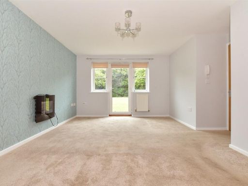 2 bedroom ground floor flat for sale in Ardent Road, Whitfield, Dover, Kent, CT16 — £112,500 • 2 bed • 1 bath • 448 ft²
 2 bedroom apartment for sale in High Street, Hythe, Kent, CT21 — £155,500 • 2 bed • 1 bath • 797 ft²
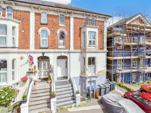 3 bedroom ground floor maisonette for sale in Maison Dieu Road, Dover, Kent, CT16 — £115,500 • 3 bed • 1 bath • 631 ft²
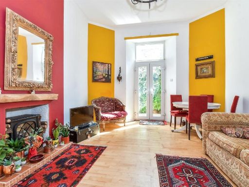 2 bedroom ground floor flat for sale in Marine Parade, Hythe, Kent, CT21 — £192,000 • 2 bed • 1 bath • 700 ft²
Meta
- {
"@context": "https://schema.org",
"@type": "Residence",
"name": "1 bedroom ground floor flat for sale in Broadmead Road, Fol…",
"description": "",
"url": "https://propertypiper.co.uk/property/e74be14e-94df-41e6-b068-43c1837b1c42",
"image": "https://image-a.propertypiper.co.uk/4c0beab8-8641-48ad-88a9-85ede2ed02d8-1024.jpeg",
"address": {
"@type": "PostalAddress",
"streetAddress": "Flat 1, 80, Broadmead Road",
"postalCode": "CT19 5AR",
"addressLocality": "Folkestone and Hythe",
"addressRegion": "Folkestone and Hythe",
"addressCountry": "England"
},
"geo": {
"@type": "GeoCoordinates",
"latitude": 51.08317212580814,
"longitude": 1.1718582812668439
},
"numberOfRooms": 1,
"numberOfBathroomsTotal": 1,
"floorSize": {
"@type": "QuantitativeValue",
"value": 872,
"unitCode": "FTK"
},
"offers": {
"@type": "Offer",
"price": 165500,
"priceCurrency": "GBP",
"availability": "https://schema.org/InStock"
},
"additionalProperty": [
{
"@type": "PropertyValue",
"name": "Feature",
"value": "Victorian"
},
{
"@type": "PropertyValue",
"name": "Feature",
"value": "three-story"
},
{
"@type": "PropertyValue",
"name": "Feature",
"value": "red brick facade"
},
{
"@type": "PropertyValue",
"name": "Feature",
"value": "bay windows"
},
{
"@type": "PropertyValue",
"name": "Feature",
"value": "period property"
},
{
"@type": "PropertyValue",
"name": "Feature",
"value": "high ceilings"
},
{
"@type": "PropertyValue",
"name": "Feature",
"value": "semi-detached"
},
{
"@type": "PropertyValue",
"name": "Feature",
"value": "residential"
},
{
"@type": "PropertyValue",
"name": "Feature",
"value": "traditional architecture"
},
{
"@type": "PropertyValue",
"name": "Feature",
"value": "gabled roof"
},
{
"@type": "PropertyValue",
"name": "Feature",
"value": "original features"
},
{
"@type": "PropertyValue",
"name": "Feature",
"value": "Victorian"
},
{
"@type": "PropertyValue",
"name": "Feature",
"value": "fireplace"
},
{
"@type": "PropertyValue",
"name": "Feature",
"value": "high ceilings"
},
{
"@type": "PropertyValue",
"name": "Feature",
"value": "wood flooring"
},
{
"@type": "PropertyValue",
"name": "Feature",
"value": "large windows"
},
{
"@type": "PropertyValue",
"name": "Feature",
"value": "natural light"
},
{
"@type": "PropertyValue",
"name": "Feature",
"value": "bay windows"
},
{
"@type": "PropertyValue",
"name": "Feature",
"value": "decorative molding"
},
{
"@type": "PropertyValue",
"name": "Feature",
"value": "chandelier"
},
{
"@type": "PropertyValue",
"name": "Feature",
"value": "bright"
},
{
"@type": "PropertyValue",
"name": "Feature",
"value": "elegant"
},
{
"@type": "PropertyValue",
"name": "Feature",
"value": "period features"
},
{
"@type": "PropertyValue",
"name": "Feature",
"value": "spacious"
}
]
}
High Res Floorplan Images
Compatible Floorplan Images
FloorplanImages Thumbnail