B90 8BE - 2 bedroom apartment for sale in Lotus House, Elm Road, Blyt…
View on Property Piper
2 bedroom apartment for sale in Lotus House, Elm Road, Blythe Valley, B90
Property Details
- Price: £125000
- Bedrooms: 2
- Bathrooms: 2
- Property Type: undefined
- Property SubType: undefined
Brochure Descriptions
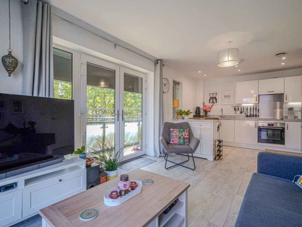
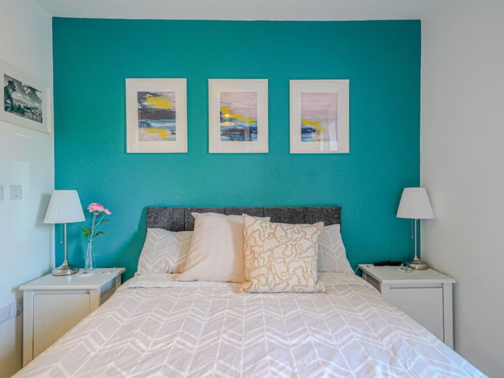
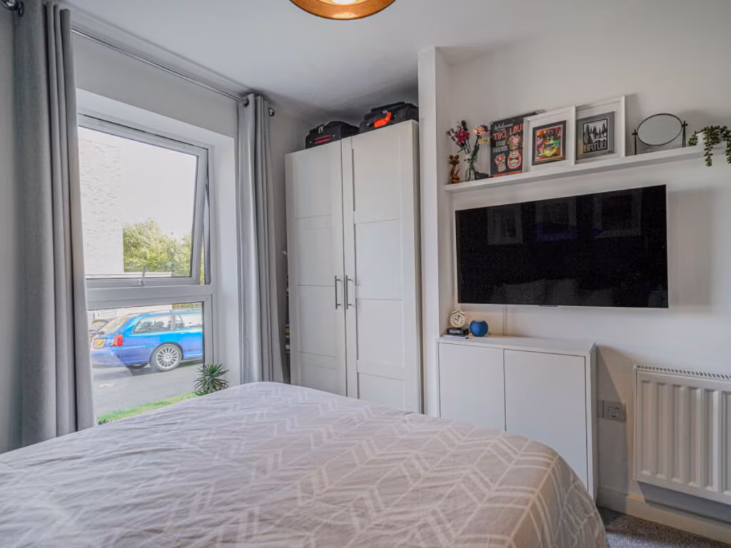
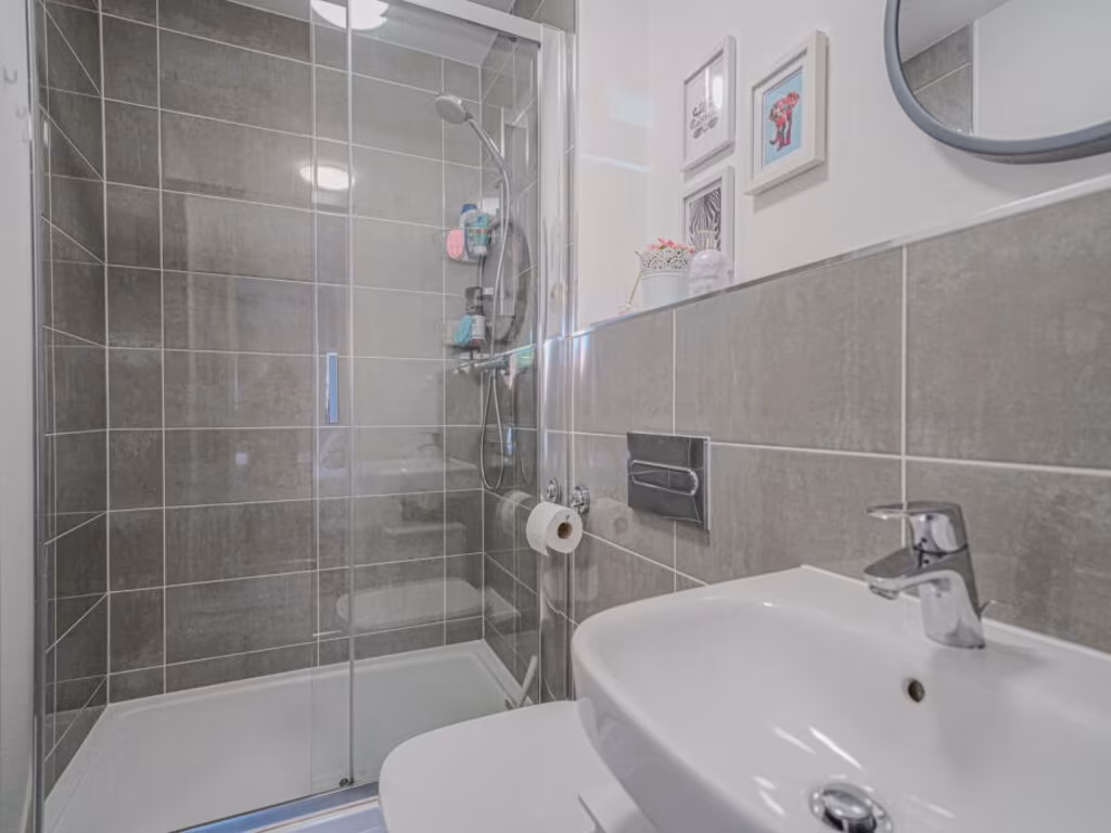
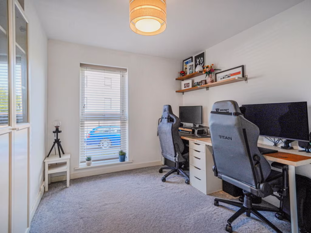
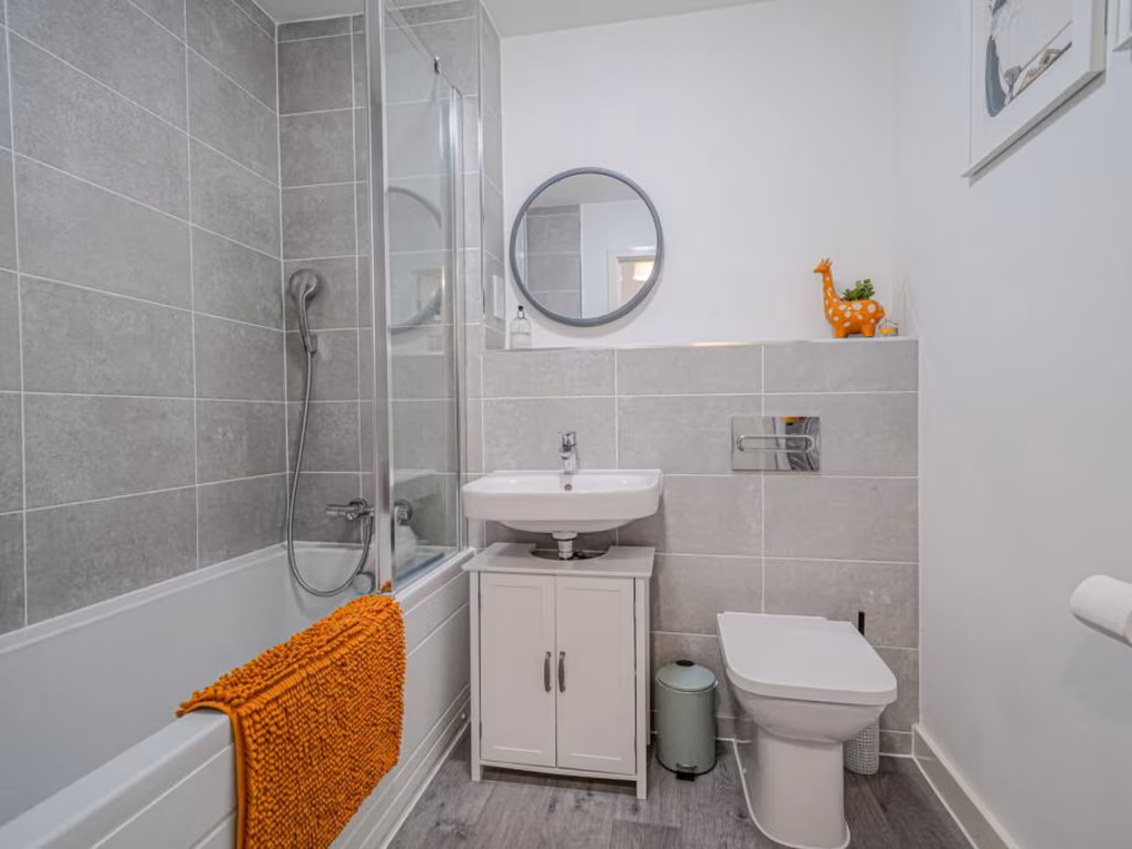
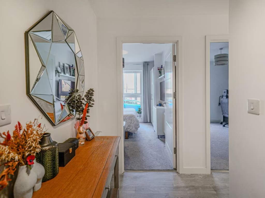
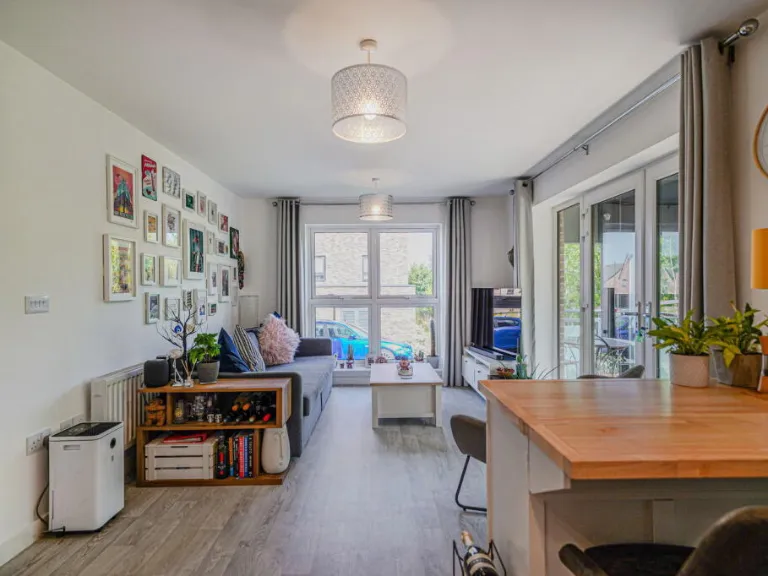
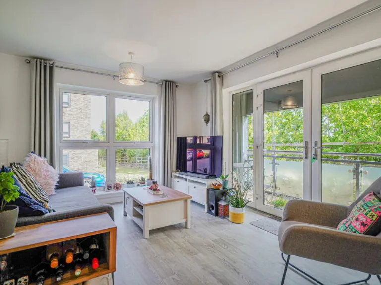
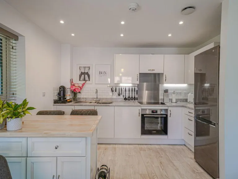
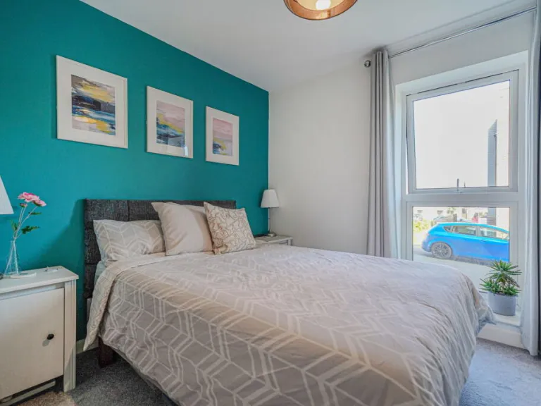
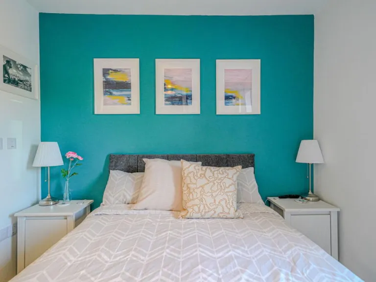
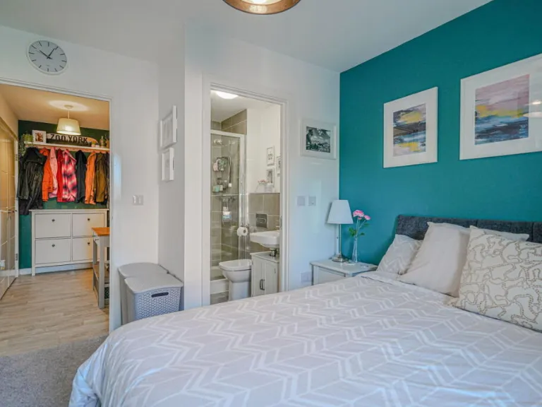
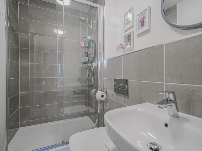
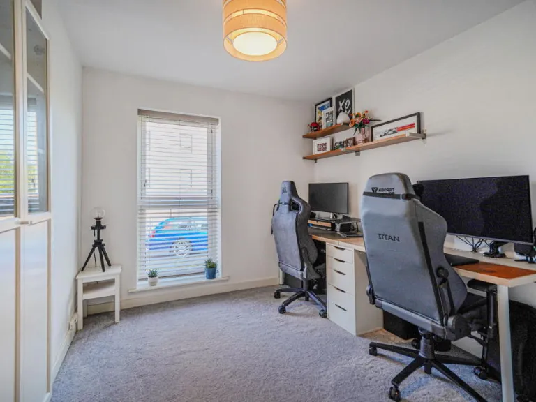
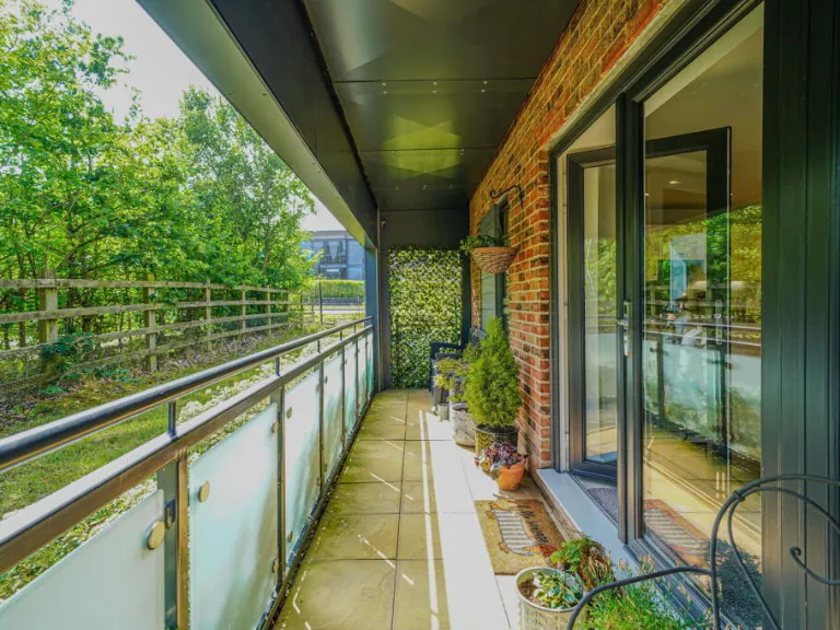
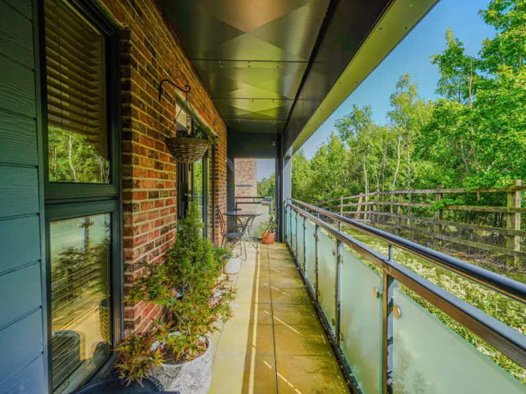
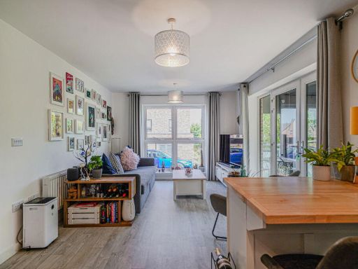
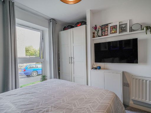
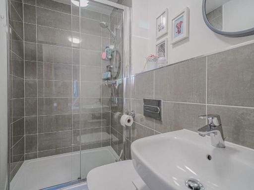
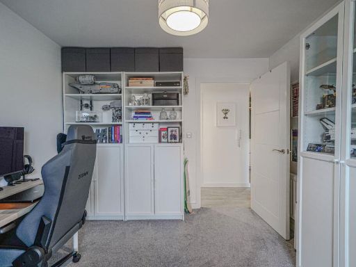
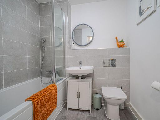
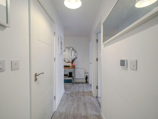
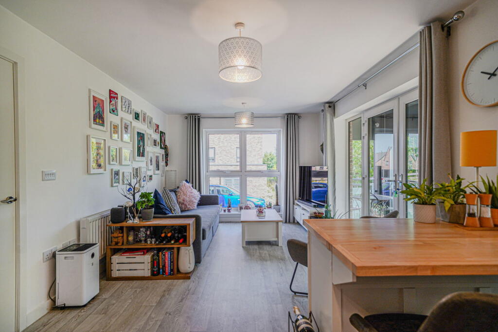
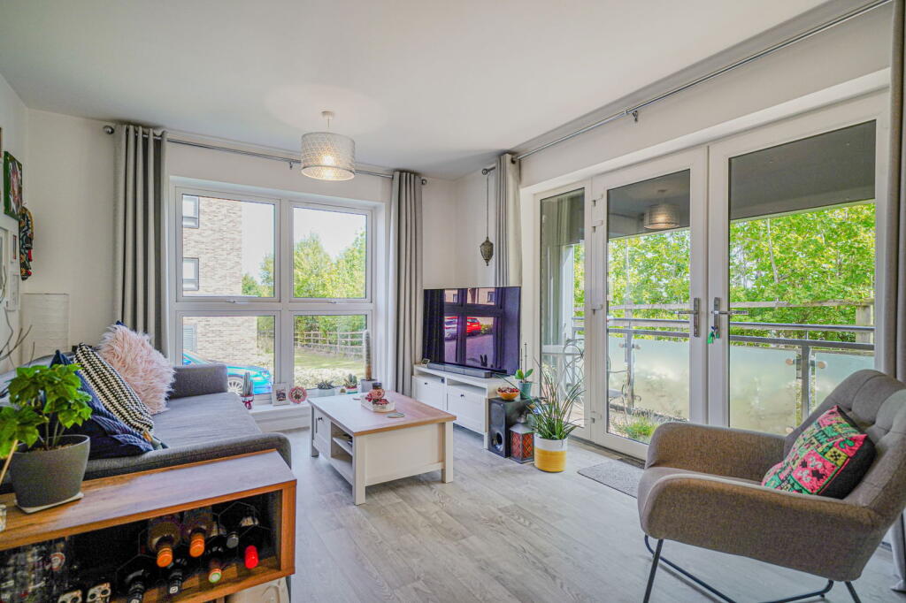
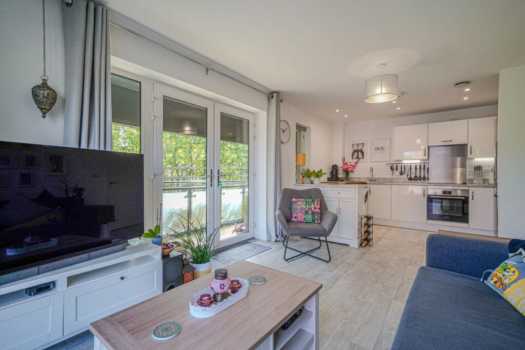
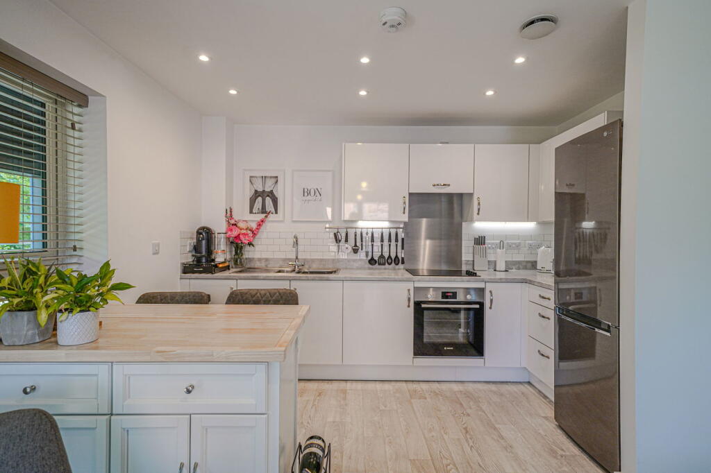
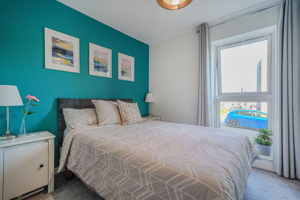
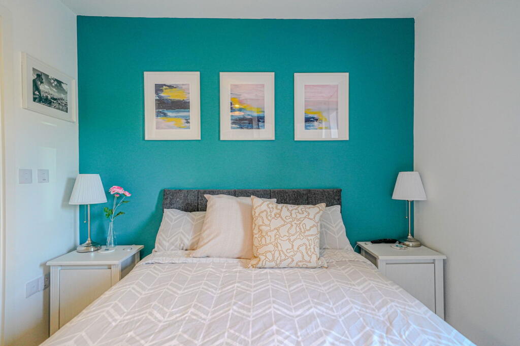
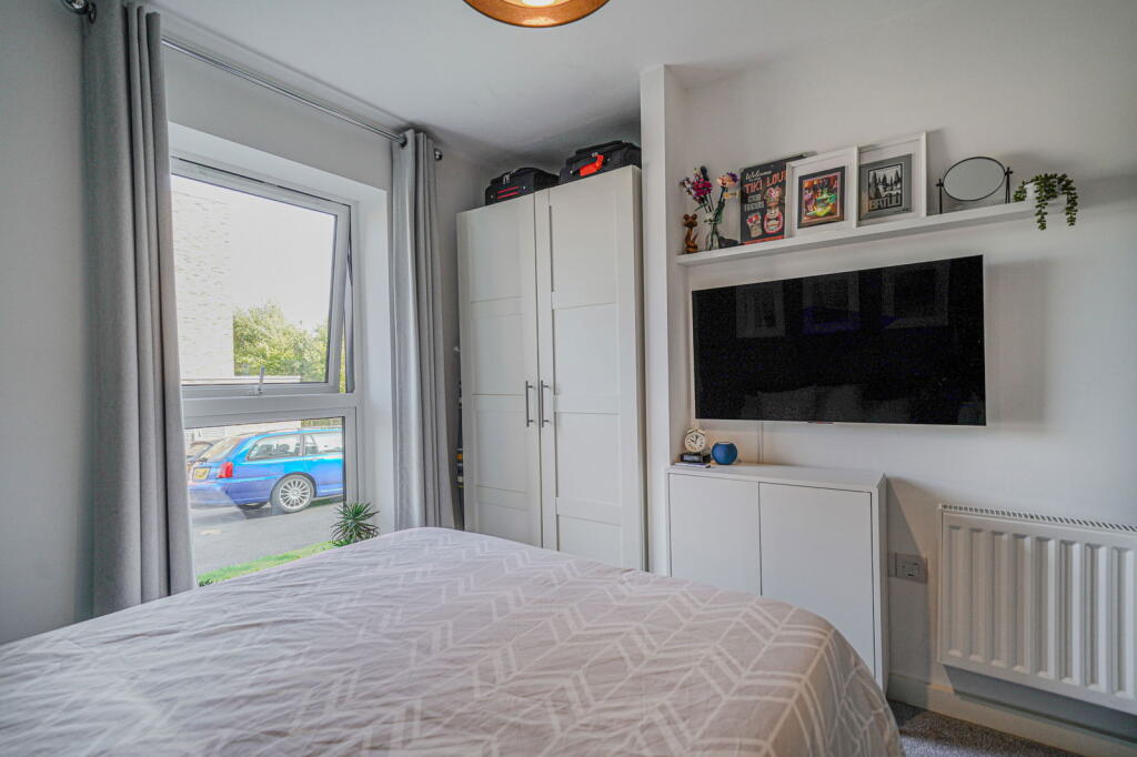
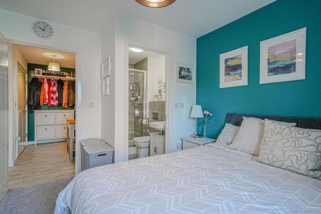
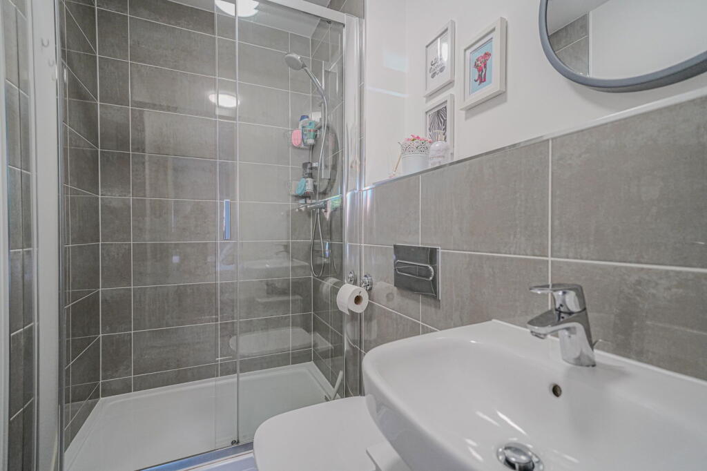
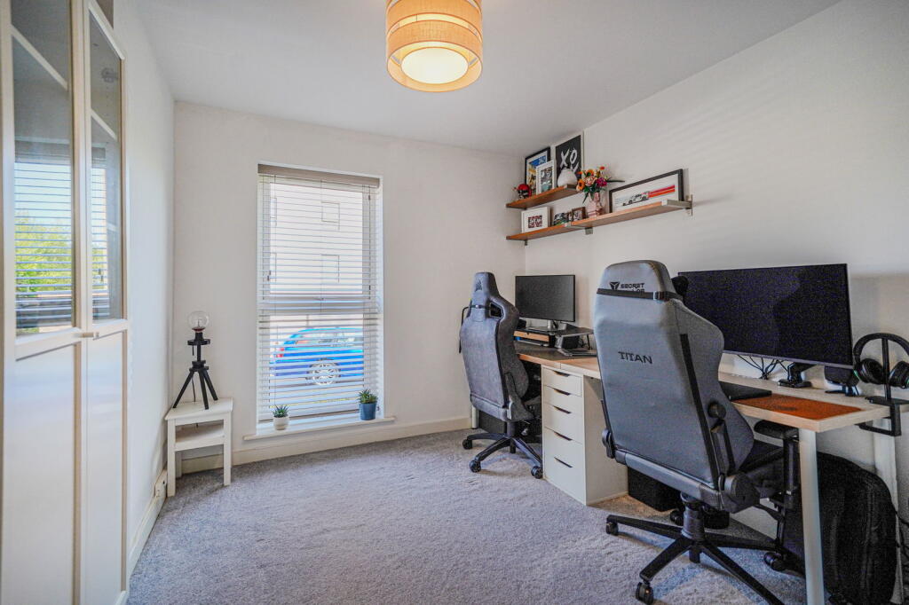
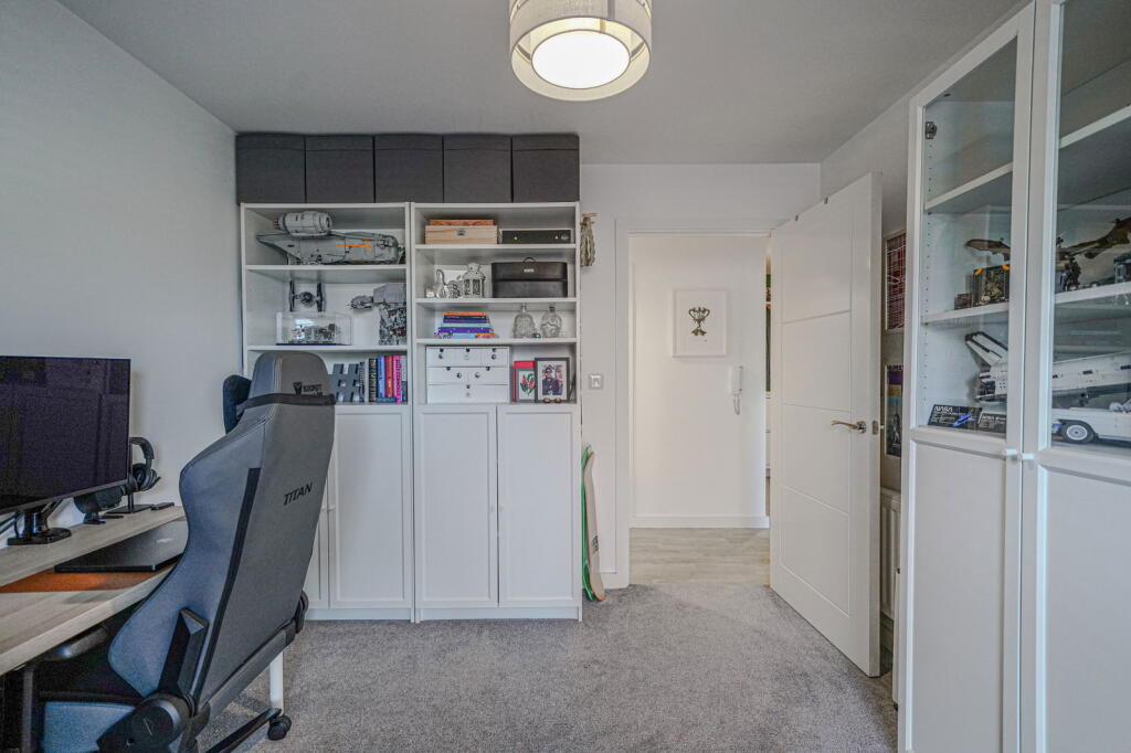
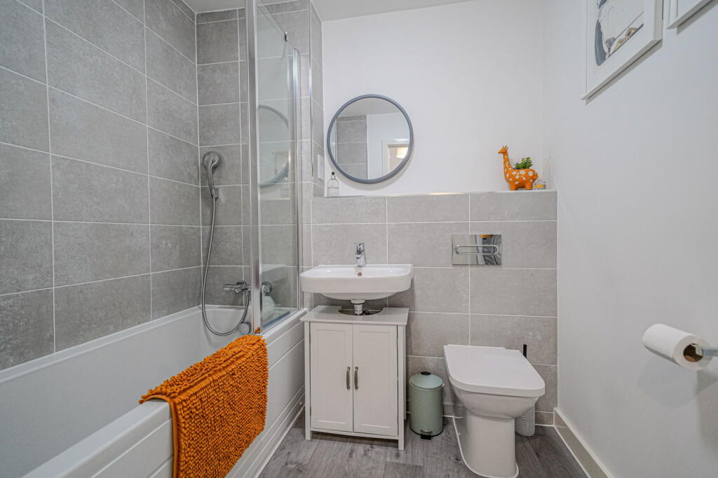
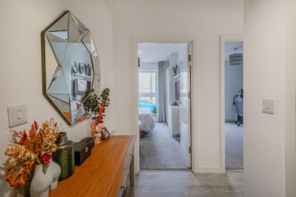
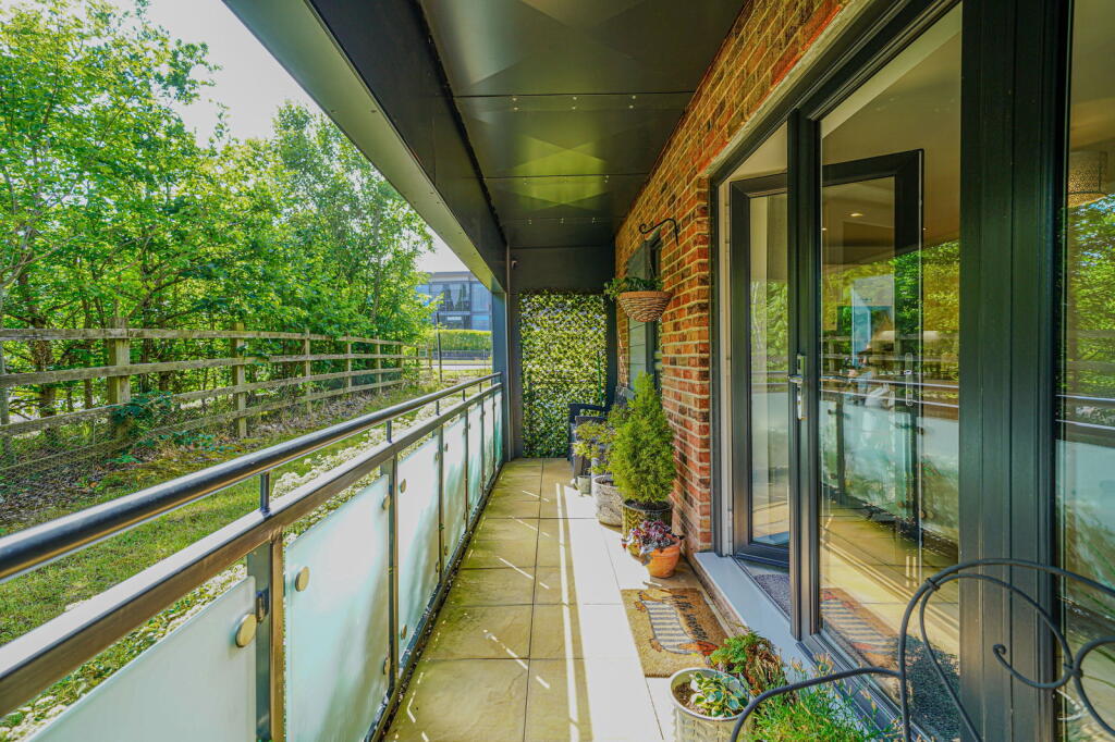
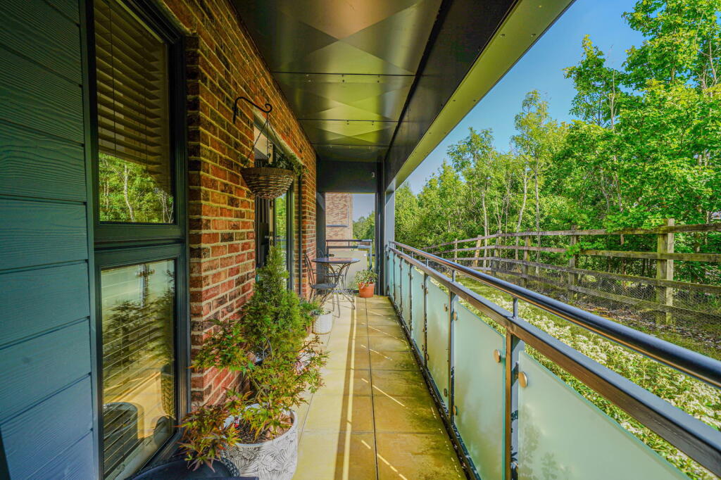
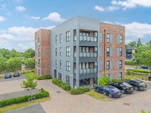
- This is a modern apartment with a balcony and views of greenery. The property consists of two bedrooms, one of which has an en-suite bathroom. The main living area is open plan, combining the living room, dining area, and kitchen, which opens onto a balcony. Both the bedrooms and living area appear to be of average size for a modern apartment. The overall property size is average and well-suited for a couple or small family seeking a contemporary lifestyle with some outdoor space provided by the balcony. The bathroom and en-suite are both modern. No significant garden is visible, but the balcony provides pleasant outdoor space with an attractive tree-lined view.
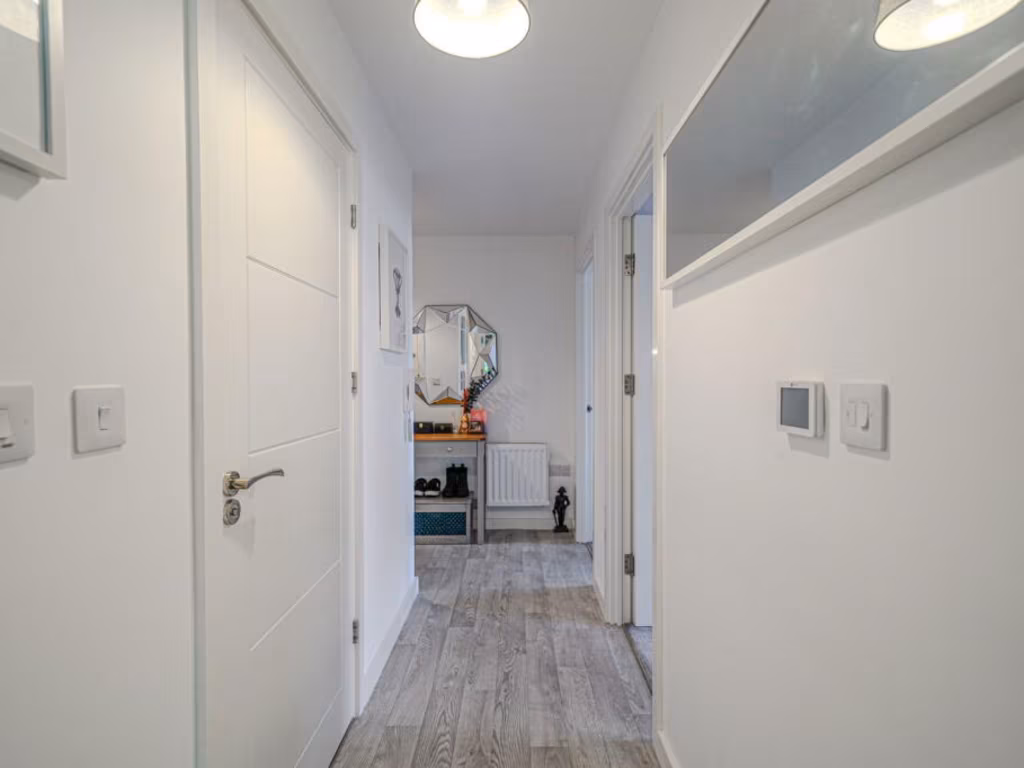
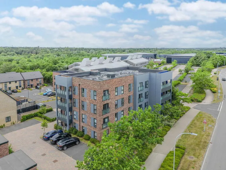
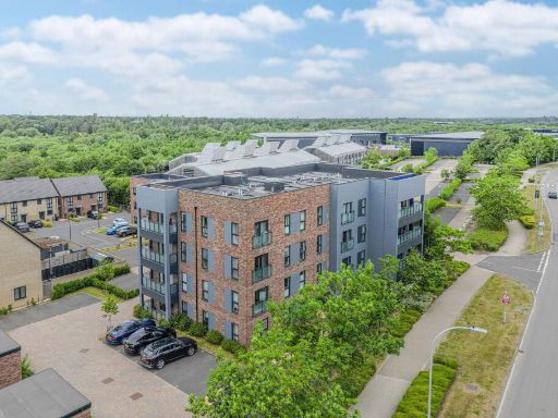
- The property is a modern, ground floor apartment, recently constructed and well presented. It features a spacious open plan kitchen/lounge/diner with modern fittings, integrated appliances, and contemporary décor. Double patio doors lead from the living space to a wide private balcony with pleasant outside views, likely of a landscaped communal or garden area. The apartment includes two double bedrooms, one with en-suite shower, a separate guest bathroom, and allocated parking. Overall, the property size is average for a two-bedroom apartment, with generously sized living areas and bedrooms.
Image Descriptions
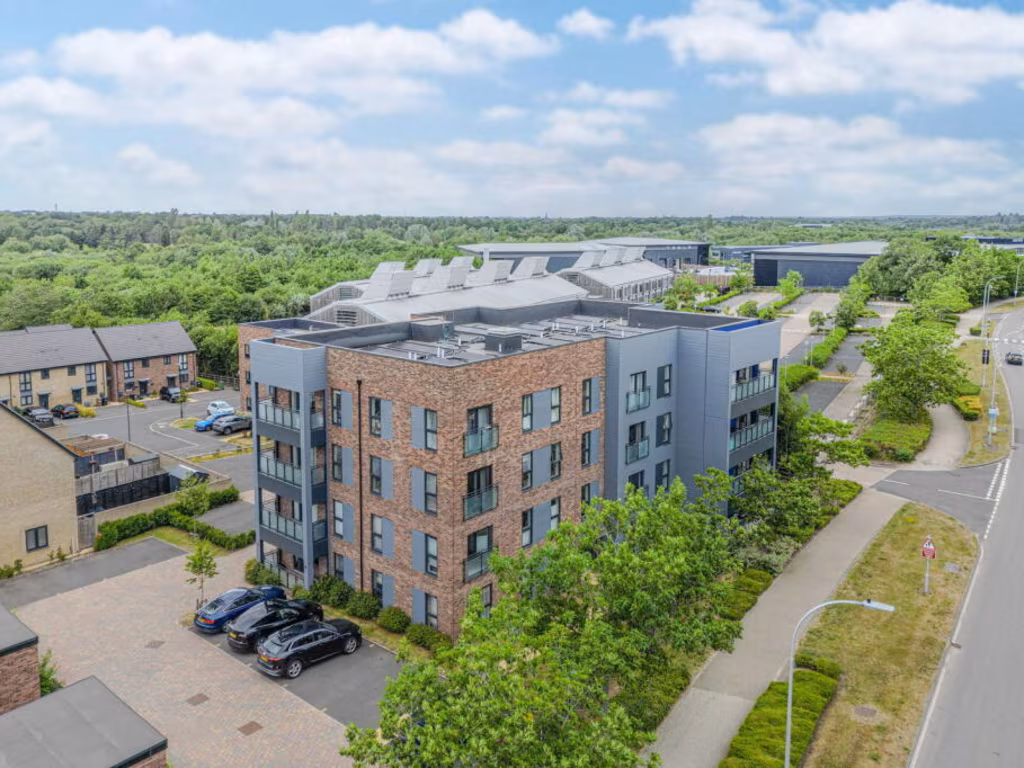
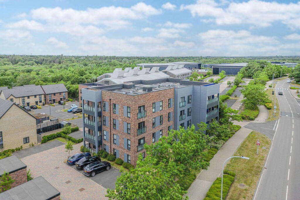
- apartment block contemporary
- living area contemporary
Floorplan Description
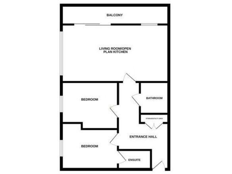
- A single-floor apartment with open plan living area and two bedrooms.
Rooms
- Living Room/Open Plan Kitchen: large
- Balcony: average
- Bedroom (first): average
- Bedroom (second): average
- Bathroom: small
- Ensuite: small
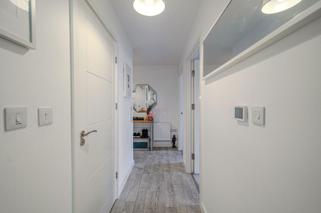
- Entrance Hall: small
Textual Property Features
- Is Shared Ownership
- Success
Detected Visual Features
- apartment
- contemporary style
- modern construction
- urban living
- apartment block
- balcony
- residential complex
- brick facade
- contemporary
- open-plan
- natural light
- modern windows
- laminate flooring
- modern lighting
EPC Details
- High performance glazing
- Average thermal transmittance 0.21 W/m-¦K
- Room heaters, electric
- Low energy lighting in all fixed outlets
- Average thermal transmittance 0.15 W/m-¦K
Nearby Schools
- Tudor Grange Primary Academy Hockley Heath
- Cheswick Green Primary School
- Solihull Alternative Provision Academy
- Shirley Heath Junior School
- Alderbrook School
- Eversfield Preparatory School
- Our Lady of the Wayside Catholic Primary School
- Bentley Heath Church of England Primary School
- Dickens Heath Community Primary School
- Monkspath Junior and Infant School
- Woodlands Infant School
- Light Hall School
- Cranmore Infant School
- Tudor Grange Academy, Solihull
- St Peter's Catholic School
- St Alphege Church of England Junior School
- Kingswood School
- Tudor Grange Primary Academy, St James
- Blossomfield Infant and Nursery School
- St Alphege Church of England Infant and Nursery School
- Streetsbrook Infant and Early Years Academy
- Ruckleigh School
- St Patricks Church of England Primary Academy
- Dorridge Primary School
- Widney Junior School
- St Augustine's Catholic Primary School
- Sharmans Cross Junior School
- Solihull School
Nearest Bars And Restaurants
- Id: 9250466183
- Tags:
- Amenity: restaurant
- Name: The Kitchen
- TagsNormalized:
- Lat: 52.3828426
- Lon: -1.7898515
- FullGeoHash: gcqdp208jmtg
- PartitionGeoHash: gcqd
- Images:
- FoodStandards: null
- Distance: 1146.3
,- Id: 55352216
- Tags:
- Addr:
- City: Solihull
- Housename: McDonald's
- Postcode: B90 4EL
- Street: Stratford Road
- Amenity: fast_food
- Brand: McDonald's
- Brand:wikidata: Q38076
- Brand:wikipedia: en:McDonald's
- Building: retail
- Contact:
- Website: https://www.mcdonalds.com/gb/en-gb/location/solihull/shirley/stratford-road-monks-path/8260426.html
- Cuisine: burger
- Fhrs:
- Name: McDonald's
- Source: visual survey;OS_OpenData_StreetView
- Takeaway: yes
- TagsNormalized:
- fast food
- food
- mcdonalds
- retail
- burgers
- takeaway
- Lat: 52.3830174
- Lon: -1.7925419
- FullGeoHash: gcqdp0n9nwpy
- PartitionGeoHash: gcqd
- Images:
- FoodStandards: null
- Distance: 1072.7
,- Id: 187437079
- Tags:
- Amenity: cafe
- Building: cafe
- Source: visual survey; bing
- TagsNormalized:
- Lat: 52.3687455
- Lon: -1.8091561
- FullGeoHash: gcq9yv6w59er
- PartitionGeoHash: gcq9
- Images:
- FoodStandards: null
- Distance: 910.6
,- Id: 3113467087
- Tags:
- Addr:
- City: Solihull
- Housename: Cottage Farm Stables
- Housenumber: 100
- Postcode: B94 6DL
- Street: Illshaw Heath Road
- Amenity: cafe
- Name: Stables Cafe
- Website: https://www.facebook.com/CottageFarmStablesSolihull
- TagsNormalized:
- Lat: 52.3688212
- Lon: -1.80906
- FullGeoHash: gcq9yv6wmzg4
- PartitionGeoHash: gcq9
- Images:
- FoodStandards: null
- Distance: 900.1
,- Id: 810410970
- Tags:
- Amenity: cafe
- Building: yes
- Name: Java Lounge
- TagsNormalized:
- Lat: 52.3744988
- Lon: -1.7979678
- FullGeoHash: gcq9zn6z864n
- PartitionGeoHash: gcq9
- Images:
- FoodStandards: null
- Distance: 92.6
}
Nearest General Shops
- Id: 9250466182
- Tags:
- Name: Edinburgh Woollen Mill
- Shop: clothes
- Source: survey
- TagsNormalized:
- Lat: 52.383044
- Lon: -1.789586
- FullGeoHash: gcqdp20c7e5u
- PartitionGeoHash: gcqd
- Images:
- FoodStandards: null
- Distance: 1174.9
,- Id: 224198871
- Tags:
- Addr:
- City: Solihull
- Housenumber: 495
- Postcode: B94 6RP
- Street: School Road
- Building: retail
- Name: Wedge's Bakers and Veg Shop
- Shop: bakery
- Source: bing
- Url: http://www.wedgesbakery.co.uk/
- TagsNormalized:
- Lat: 52.3644991
- Lon: -1.8054061
- FullGeoHash: gcq9yutm6fps
- PartitionGeoHash: gcq9
- Images:
- FoodStandards: null
- Distance: 1165.6
,- Id: 55352219
- Tags:
- Addr:
- City: Solihull
- Housename: Stratstone Land Rover
- Postcode: B90 4EL
- Street: Stratford Road
- Brand: Land Rover
- Building: retail
- Name: Listers
- Shop: car
- Source: visual survey;OS_OpenData_StreetView
- TagsNormalized:
- Lat: 52.3834507
- Lon: -1.7931786
- FullGeoHash: gcqdp0n5xyvp
- PartitionGeoHash: gcqd
- Images:
- FoodStandards: null
- Distance: 1099.4
}
Nearest Grocery shops
- Id: 76760814
- Tags:
- Addr:
- City: Solihull
- Housenumber: 4
- Postcode: B90 4EH
- Street: Farmhouse Way
- Brand: The Co-operative Food
- Brand:wikidata: Q107617274
- Fhrs:
- Name: The Co-operative Food
- Operator: Central England Co-operative
- Operator:wikidata: Q16986583
- Shop: supermarket
- Source: visual survey;estimate
- TagsNormalized:
- the co-operative food
- food
- shop
- Lat: 52.3916567
- Lon: -1.7855055
- FullGeoHash: gcqdp3egd8wt
- PartitionGeoHash: gcqd
- Images:
- FoodStandards: null
- Distance: 2145.4
,- Id: 104040510
- Tags:
- Addr:
- City: Solihull
- Postcode: B90 4JA
- Street: Cheswick Way
- Suburb: Cheswick Green
- Brand: Lifestyle Express
- Brand:wikidata: Q61994869
- Building: retail
- Name: Lifestyle Express
- Shop: convenience
- Source: Warwickshire CC Aerial Imagery 2013
- TagsNormalized:
- lifestyle express
- retail
- convenience
- shop
- Lat: 52.3782697
- Lon: -1.8153434
- FullGeoHash: gcq9yxnje3jv
- PartitionGeoHash: gcq9
- Images:
- FoodStandards: null
- Distance: 1176
,- Id: 9545720459
- Tags:
- Brand: Your Coop Food
- Name: Your Coop Food
- Operator: Midcounties Co-operative
- Shop: convenience
- TagsNormalized:
- Lat: 52.3728624
- Lon: -1.8019347
- FullGeoHash: gcq9yypy5chj
- PartitionGeoHash: gcq9
- Images:
- FoodStandards: null
- Distance: 239.9
}
Nearest Supermarkets
- Id: 376829252
- Tags:
- Addr:
- City: Solihull
- Postcode: B90 4QY
- Street: Oakenshaw Road
- Brand: M&S Foodhall
- Brand:wikidata: Q714491
- Brand:wikipedia: en:Marks & Spencer
- Building: retail
- Contact:
- Website: https://www.marksandspencer.com/stores/solihull-sears-5357
- Name: M&S Foodhall
- Shop: supermarket
- TagsNormalized:
- m&s foodhall
- retail
- supermarket
- shop
- Lat: 52.4008336
- Lon: -1.8160604
- FullGeoHash: gcqdnem8fxrh
- PartitionGeoHash: gcqd
- Images:
- FoodStandards: null
- Distance: 3162.9
,- Id: 904318796
- Tags:
- Addr:
- City: Solihull
- Housenumber: 14
- Postcode: B90 4EH
- Street: Farmhouse Way
- Brand: Co-op Food
- Brand:wikidata: Q3277439
- Brand:wikipedia: en:Co-op Food
- Fhrs:
- Name: Co-op Food
- Operator: The Co-operative Group
- Operator:wikidata: Q117202
- Shop: supermarket
- Source: survey
- TagsNormalized:
- co-op
- co-op food
- food
- supermarket
- shop
- Lat: 52.3915153
- Lon: -1.7860104
- FullGeoHash: gcqdp3e6wyq4
- PartitionGeoHash: gcqd
- Images:
- FoodStandards: null
- Distance: 2116.4
,- Id: 55351458
- Tags:
- Addr:
- City: Solihull
- Housename: Tesco Extra
- Housenumber: 1505
- Postcode: B90 4EN
- Street: Stratford Road
- Alt_name: Tesco Solihull Extra
- Brand: Tesco Extra
- Brand:wikidata: Q25172225
- Brand:wikipedia: en:Tesco Extra
- Building: retail
- Contact:
- Website: https://www.tesco.com/store-locator/solihull/1505-stratford-rd
- Fhrs:
- Name: Tesco Extra
- Shop: supermarket
- Source: visual survey;OS_OpenData_StreetView
- TagsNormalized:
- tesco
- tesco extra
- retail
- supermarket
- shop
- Lat: 52.3844546
- Lon: -1.7891438
- FullGeoHash: gcqdp231tfje
- PartitionGeoHash: gcqd
- Images:
- FoodStandards: null
- Distance: 1323.2
}
Nearest Religious buildings
- Id: 223411047
- Tags:
- Amenity: place_of_worship
- Building: church
- Denomination: baptist
- Name: Umberslade Baptist Church
- Religion: christian
- Wikidata: Q7881253
- Wikipedia: en:Umberslade Baptist Church
- TagsNormalized:
- place of worship
- church
- baptist
- christian
- Lat: 52.3497009
- Lon: -1.7823111
- FullGeoHash: gcq9z3ypj5s9
- PartitionGeoHash: gcq9
- Images:
- FoodStandards: null
- Distance: 2967.8
,- Id: 188929322
- Tags:
- Amenity: place_of_worship
- Building: church
- Denomination: methodist
- Name: Dorridge Methodist Church
- Religion: christian
- TagsNormalized:
- place of worship
- church
- methodist
- christian
- Lat: 52.3793594
- Lon: -1.7568824
- FullGeoHash: gcqcbp2evsm9
- PartitionGeoHash: gcqc
- Images:
- FoodStandards: null
- Distance: 2933.3
,- Id: 161570297
- Tags:
- Amenity: place_of_worship
- Building: yes
- Denomination: anglican
- Heritage: 2
- Heritage:operator: Historic England
- Listed_status: Grade II*
- Name: St Patrick's
- Religion: christian
- Source: visual survey; bing;English Heritage
- Wikidata: Q17551918
- TagsNormalized:
- place of worship
- anglican
- christian
- church
- Lat: 52.3719208
- Lon: -1.8211264
- FullGeoHash: gcq9yw1bs9ts
- PartitionGeoHash: gcq9
- Images:
- FoodStandards: null
- Distance: 1505.7
}
Nearest Medical buildings
- Id: 1616969
- Tags:
- Amenity: doctors
- Building: yes
- Healthcare: doctor
- Name: Monkspath Surgery
- Type: multipolygon
- TagsNormalized:
- doctor
- doctors
- health
- healthcare
- surgery
- Lat: 52.3908929
- Lon: -1.7838977
- FullGeoHash: gcqdp3mp04m3
- PartitionGeoHash: gcqd
- Images:
- FoodStandards: null
- Distance: 2120.9
,- Id: 6022890631
- Tags:
- Amenity: pharmacy
- Healthcare: pharmacy
- Name: Tesco
- TagsNormalized:
- pharmacy
- health
- healthcare
- tesco
- Lat: 52.3846042
- Lon: -1.7891192
- FullGeoHash: gcqdp234qtbp
- PartitionGeoHash: gcqd
- Images:
- FoodStandards: null
- Distance: 1338.2
,- Id: 104040477
- Tags:
- Addr:
- City: Solihull
- Postcode: B90 4JA
- Street: Cheswick Way
- Suburb: Cheswick Green
- Amenity: doctors
- Building: yes
- Healthcare: doctor
- Name: The Village Surgery
- Source: Warwickshire CC Aerial Imagery 2013
- TagsNormalized:
- doctor
- doctors
- health
- healthcare
- surgery
- Lat: 52.3781478
- Lon: -1.8156066
- FullGeoHash: gcq9yxjuv63t
- PartitionGeoHash: gcq9
- Images:
- FoodStandards: null
- Distance: 1187.6
,- Id: 104040537
- Tags:
- Addr:
- City: Solihull
- Postcode: B90 4JA
- Street: Cheswick Way
- Suburb: Cheswick Green
- Amenity: pharmacy
- Building: retail
- Healthcare: pharmacy
- Name: Cheswick Green Pharmacy
- Source: Warwickshire CC Aerial Imagery 2013
- TagsNormalized:
- pharmacy
- retail
- health
- healthcare
- Lat: 52.3782155
- Lon: -1.8155431
- FullGeoHash: gcq9yxjvnz0c
- PartitionGeoHash: gcq9
- Images:
- FoodStandards: null
- Distance: 1186.3
}
Nearest Airports
- Id: 2437117
- Tags:
- Aerodrome: international
- Aerodrome:type: public
- Aeroway: aerodrome
- Ele: 104
- Iata: BHX
- Icao: EGBB
- Internet_access: wlan
- Is_in: Birmingham,England,UK
- Name: Birmingham Airport
- Ref: BHX
- Type: multipolygon
- Website: https://www.birminghamairport.co.uk/
- Wikidata: Q8719
- Wikipedia: en:Birmingham Airport
- TagsNormalized:
- airport
- international airport
- Lat: 52.4543817
- Lon: -1.7468974
- FullGeoHash: gcqf2jpbym6y
- PartitionGeoHash: gcqf
- Images:
- FoodStandards: null
- Distance: 9588.1
}
Nearest Leisure Facilities
- Id: 810410979
- Tags:
- Leisure: park
- Source: visual survey; estimate
- TagsNormalized:
- Lat: 52.3700257
- Lon: -1.8001166
- FullGeoHash: gcq9zj9jw0rg
- PartitionGeoHash: gcq9
- Images:
- FoodStandards: null
- Distance: 477.9
,- Id: 810410980
- Tags:
- Leisure: park
- Name: Blythe Valley Park
- Source: visual survey; estimate
- TagsNormalized:
- Lat: 52.3728168
- Lon: -1.79464
- FullGeoHash: gcq9znjjvbem
- PartitionGeoHash: gcq9
- Images:
- FoodStandards: null
- Distance: 355.9
,- Id: 105617762
- Tags:
- Leisure: swimming_pool
- Source: visual survey;bing
- TagsNormalized:
- swimming
- swimming pool
- pool
- leisure
- Lat: 52.3725051
- Lon: -1.8006426
- FullGeoHash: gcq9zn0gcyx9
- PartitionGeoHash: gcq9
- Images:
- FoodStandards: null
- Distance: 219.1
,- Id: 810410978
- Tags:
- Leisure: park
- Name: Blythe Valley Park
- Source: visual survey; estimate
- TagsNormalized:
- Lat: 52.3759312
- Lon: -1.7979804
- FullGeoHash: gcq9zndzbj0x
- PartitionGeoHash: gcq9
- Images:
- FoodStandards: null
- Distance: 202.6
,- Id: 59136430
- Tags:
- Addr:
- City: Solihull
- Housename: Virgin Active
- Place: Blythe Valley Park
- Postcode: B90 8AT
- Street: Blythe Gate
- Brand: Virgin Active
- Brand:wikidata: Q4013942
- Brand:wikipedia: en:Virgin Active
- Building: gym
- Leisure: fitness_centre
- Name: Virgin Active
- Source: bing
- TagsNormalized:
- gym
- fitness
- fitness centre
- leisure
- Lat: 52.3728507
- Lon: -1.8004549
- FullGeoHash: gcq9zn0vyqgx
- PartitionGeoHash: gcq9
- Images:
- FoodStandards: null
- Distance: 178.9
}
Nearest Tourist attractions
- Id: 9095232807
- Tags:
- Addr:
- City: Solihull
- Housename: Box Trees Farm
- Postcode: B94 6EA
- Street: Stratford Road
- Fhrs:
- Name: Boxtrees Farm Guest House
- Tourism: guest_house
- TagsNormalized:
- Lat: 52.3657276
- Lon: -1.7815769
- FullGeoHash: gcq9zkysqppu
- PartitionGeoHash: gcq9
- Images:
- FoodStandards: null
- Distance: 1534.1
,- Id: 9095232797
- Tags:
- Addr:
- City: Solihull
- Housenumber: 27
- Postcode: B90 4EG
- Street: Hay Lane
- Fhrs:
- Name: Hay Lane Lodge
- Tourism: guest_house
- TagsNormalized:
- Lat: 52.3875885
- Lon: -1.7983152
- FullGeoHash: gcqdp0feb4qc
- PartitionGeoHash: gcqd
- Images:
- FoodStandards: null
- Distance: 1479.7
,- Id: 9095232787
- Tags:
- Addr:
- City: Solihull
- Housenumber: 92
- Postcode: B90 4HG
- Street: Cheswick Way
- Fhrs:
- Name: The Oaks
- Tourism: guest_house
- TagsNormalized:
- Lat: 52.3810646
- Lon: -1.8091419
- FullGeoHash: gcq9yzdtgfnj
- PartitionGeoHash: gcq9
- Images:
- FoodStandards: null
- Distance: 1007
}
Nearest Train stations
- Id: 7805862401
- Tags:
- Name: Earlswood
- Naptan:
- Network: National Rail
- Public_transport: station
- Railway: station
- Ref:
- Source: NPE
- West_midlands_fare_zone: 5
- Wikidata: Q2243841
- Wikipedia: en:Earlswood railway station (West Midlands)
- TagsNormalized:
- Lat: 52.3665989
- Lon: -1.8614034
- FullGeoHash: gcq9vth9d1t4
- PartitionGeoHash: gcq9
- Images:
- FoodStandards: null
- Distance: 4302.8
,- Id: 31554745
- Tags:
- Name: Whitlocks End
- Naptan:
- Network: National Rail
- Public_transport: station
- Railway: station
- Ref:
- Source: NPE
- West_midlands_fare_zone: 4
- Wikidata: Q2133242
- Wikipedia: en:Whitlocks End railway station
- TagsNormalized:
- Lat: 52.3918816
- Lon: -1.8514322
- FullGeoHash: gcqdjceufd85
- PartitionGeoHash: gcqd
- Images:
- FoodStandards: null
- Distance: 4043.3
,- Id: 7805862446
- Tags:
- Name: The Lakes
- Naptan:
- Network: National Rail
- Public_transport: station
- Railway: station
- Ref:
- Request_stop: yes
- Source: NPE
- Wikidata: Q2683977
- Wikipedia: en:The Lakes railway station
- TagsNormalized:
- Lat: 52.3590972
- Lon: -1.8446544
- FullGeoHash: gcq9y58vb7ju
- PartitionGeoHash: gcq9
- Images:
- FoodStandards: null
- Distance: 3513.2
,- Id: 20983011
- Tags:
- Name: Dorridge
- Naptan:
- Network: National Rail
- Public_transport: station
- Railway: station
- Ref:
- Source: NPE
- West_midlands_fare_zone: 5
- Wikidata: Q2512506
- Wikipedia: en:Dorridge railway station
- TagsNormalized:
- Lat: 52.3718817
- Lon: -1.7527829
- FullGeoHash: gcqcbn58m4q7
- PartitionGeoHash: gcqc
- Images:
- FoodStandards: null
- Distance: 3168.6
,- Id: 20983015
- Tags:
- Name: Widney Manor
- Naptan:
- Network: National Rail
- Public_transport: station
- Railway: station
- Ref:
- West_midlands_fare_zone: 4
- Wikidata: Q2079928
- Wikipedia: en:Widney Manor railway station
- TagsNormalized:
- Lat: 52.3962802
- Lon: -1.7743426
- FullGeoHash: gcqdpd7yqyd3
- PartitionGeoHash: gcqd
- Images:
- FoodStandards: null
- Distance: 2973.8
}
Nearest Hotels
- Id: 86380785
- Tags:
- Addr:
- City: Solihull
- Postcode: B93 8QE
- Street: Four Ashes Road
- Suburb: Dorridge
- Building: yes
- Fhrs:
- Name: Hogarth's Hotel
- Operator: Hogarths Hotel Ltd
- Source: OS_Opendata_Streetview
- Stars: 4
- Tourism: hotel
- Website: https://www.hogarths.co.uk/
- TagsNormalized:
- Lat: 52.380245
- Lon: -1.7757268
- FullGeoHash: gcq9zxdcn96h
- PartitionGeoHash: gcq9
- Images:
- FoodStandards: null
- Distance: 1731
,- Id: 211747396
- Tags:
- Amenity: parking
- Name: Hogarths Hotel & Restaurant
- Parking: surface
- TagsNormalized:
- Lat: 52.3806699
- Lon: -1.776122
- FullGeoHash: gcq9zxdet2e6
- PartitionGeoHash: gcq9
- Images:
- FoodStandards: null
- Distance: 1725.1
,- Id: 104040505
- Tags:
- Addr:
- City: Solihull
- Housename: Premier Inn
- Postcode: B90 4EP
- Street: Stratford Road
- Brand: Premier Inn
- Brand:wikidata: Q2108626
- Brand:wikipedia: en:Premier Inn
- Building: yes
- Internet_access: wlan
- Internet_access:fee: customers
- Internet_access:operator: Virgin Media
- Internet_access:ssid: Premier Inn Free Wi-Fi
- Name: Premier Inn
- Source: bing
- Tourism: hotel
- TagsNormalized:
- Lat: 52.3855518
- Lon: -1.7999091
- FullGeoHash: gcqdp03rgndk
- PartitionGeoHash: gcqd
- Images:
- FoodStandards: null
- Distance: 1252.5
}
Tags
- apartment
- contemporary style
- modern construction
- urban living
- apartment block
- balcony
- residential complex
- brick facade
- contemporary
- open-plan
- natural light
- modern windows
- laminate flooring
- modern lighting
Local Market Stats
- Average Price/sqft: £349
- Avg Income: £51800
- Rental Yield: 4.3%
- Social Housing: 7%
- Planning Success Rate: 95%
Similar Properties
 2 bedroom apartment for sale in Elm Road, Blythe Valley, Solihull, B90 8BE, B90 — £240,000 • 2 bed • 2 bath • 696 ft²
 2 bedroom apartment for sale in Newman Square, Shirley, Solihull, B90 — £110,000 • 2 bed • 2 bath • 462 ft²
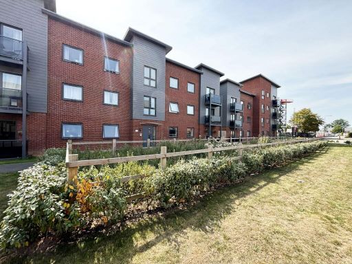 2 bedroom flat for sale in Newman Square, Shirley, B90 — £110,250 • 2 bed • 2 bath • 474 ft²
 2 bedroom apartment for sale in Foxglove House, Elm Road, Blythe Valley Park, Shirley, B90 8AZ, B90 — £230,000 • 2 bed • 2 bath • 642 ft²
 2 bedroom ground floor flat for sale in Newman Square, Shirley, Solihull, B90 — £255,000 • 2 bed • 2 bath • 462 ft²
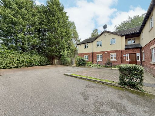 2 bedroom flat for sale in The Links, Westley Close, Hall Green, B28 — £200,000 • 2 bed • 2 bath • 732 ft²
Meta
- {
"@context": "https://schema.org",
"@type": "Residence",
"name": "2 bedroom apartment for sale in Lotus House, Elm Road, Blyt…",
"description": "",
"url": "https://propertypiper.co.uk/property/e6b888b6-7407-4463-8648-623423c5cba2",
"image": "https://image-a.propertypiper.co.uk/319c940a-4006-4fa9-b006-9ea42404fc2e-1024.jpeg",
"address": {
"@type": "PostalAddress",
"streetAddress": "Lotus House, Elm Road, Blythe Valley",
"postalCode": "B90 8BE",
"addressLocality": "Solihull",
"addressRegion": "Meriden",
"addressCountry": "England"
},
"geo": {
"@type": "GeoCoordinates",
"latitude": 52.374294178499596,
"longitude": -1.7992902376341007
},
"numberOfRooms": 2,
"numberOfBathroomsTotal": 2,
"floorSize": {
"@type": "QuantitativeValue",
"value": 645,
"unitCode": "FTK"
},
"offers": {
"@type": "Offer",
"price": 125000,
"priceCurrency": "GBP",
"availability": "https://schema.org/InStock"
},
"additionalProperty": [
{
"@type": "PropertyValue",
"name": "Feature",
"value": "apartment"
},
{
"@type": "PropertyValue",
"name": "Feature",
"value": "contemporary style"
},
{
"@type": "PropertyValue",
"name": "Feature",
"value": "modern construction"
},
{
"@type": "PropertyValue",
"name": "Feature",
"value": "urban living"
},
{
"@type": "PropertyValue",
"name": "Feature",
"value": "apartment block"
},
{
"@type": "PropertyValue",
"name": "Feature",
"value": "balcony"
},
{
"@type": "PropertyValue",
"name": "Feature",
"value": "residential complex"
},
{
"@type": "PropertyValue",
"name": "Feature",
"value": "brick facade"
},
{
"@type": "PropertyValue",
"name": "Feature",
"value": "contemporary"
},
{
"@type": "PropertyValue",
"name": "Feature",
"value": "open-plan"
},
{
"@type": "PropertyValue",
"name": "Feature",
"value": "natural light"
},
{
"@type": "PropertyValue",
"name": "Feature",
"value": "modern windows"
},
{
"@type": "PropertyValue",
"name": "Feature",
"value": "laminate flooring"
},
{
"@type": "PropertyValue",
"name": "Feature",
"value": "modern lighting"
}
]
}
High Res Floorplan Images
Compatible Floorplan Images
FloorplanImages Thumbnail