TR2 4RT - 2 bedroom cottage for sale in Fore Street, Grampound, Truro…
View on Property Piper
2 bedroom cottage for sale in Fore Street, Grampound, Truro, TR2
Property Details
- Price: £195000
- Bedrooms: 2
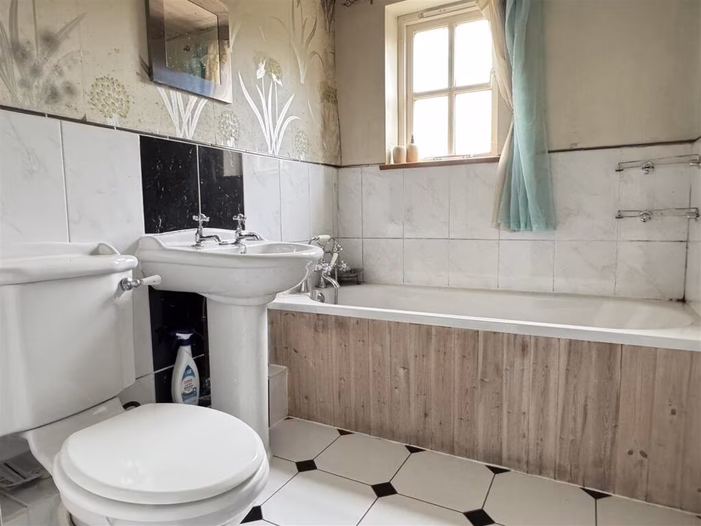
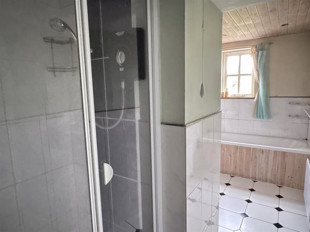
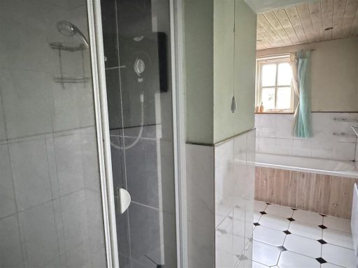
- Bathrooms: 1
- Property Type: undefined
- Property SubType: undefined
Brochure Descriptions
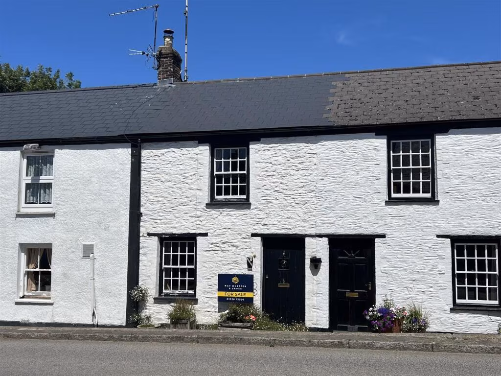
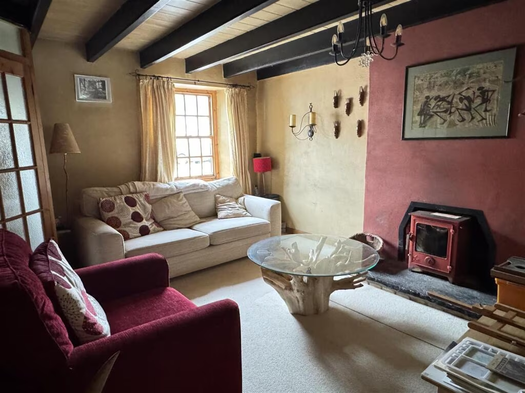
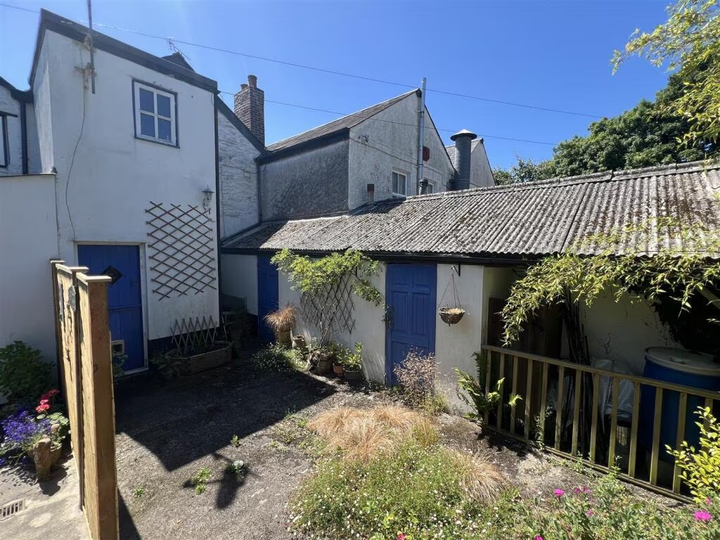
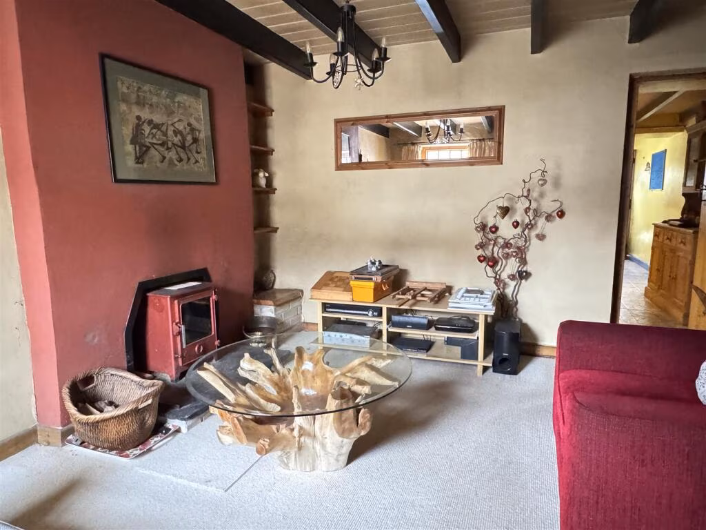
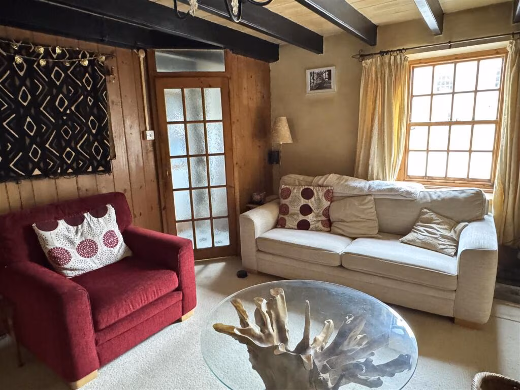
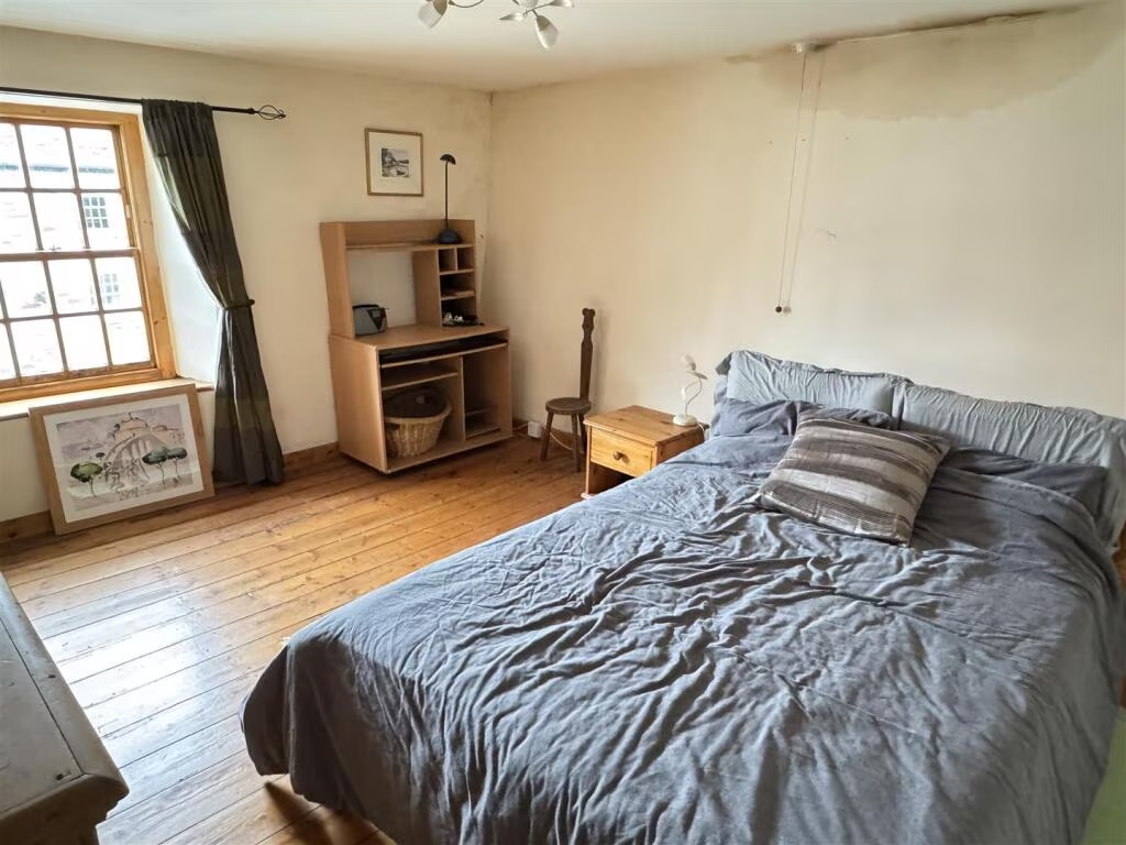
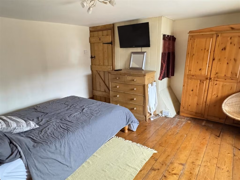
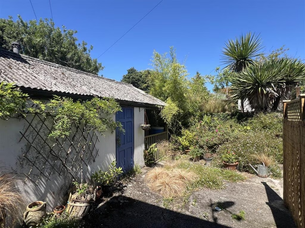
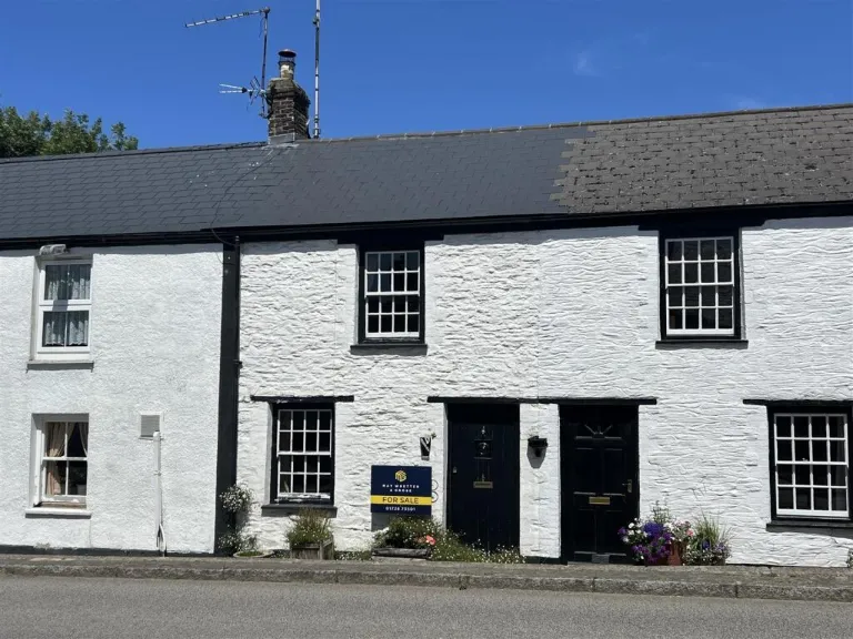
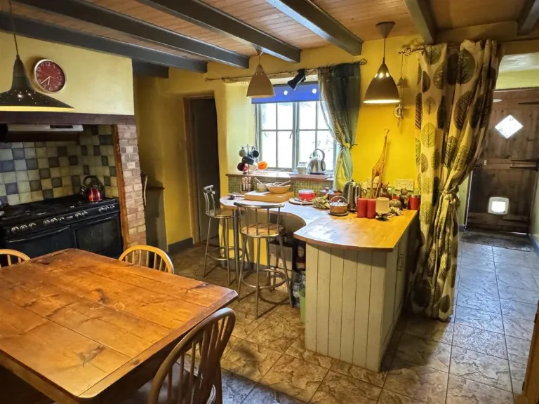
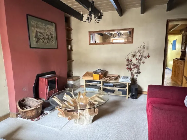
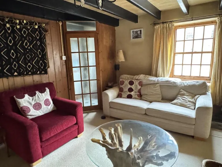
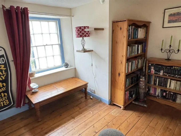
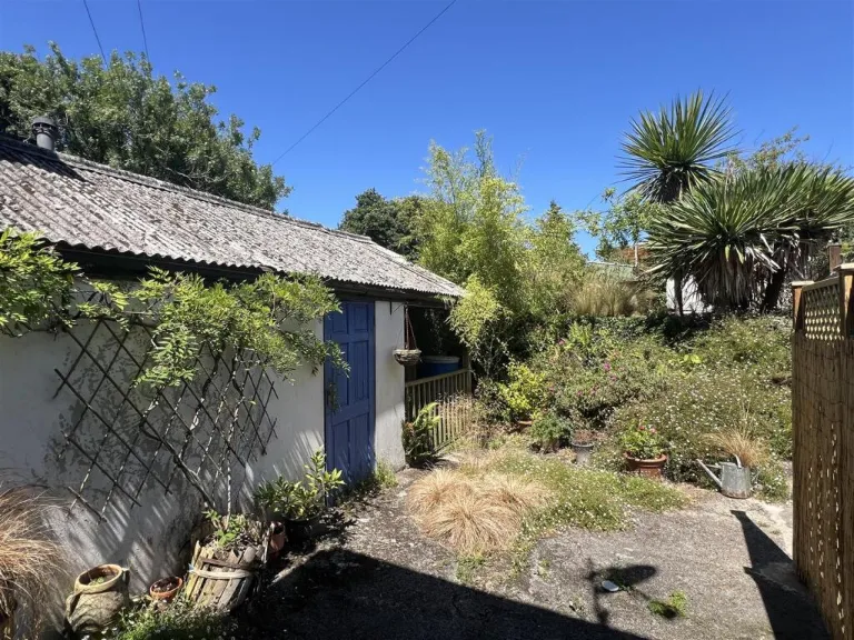
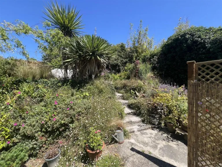
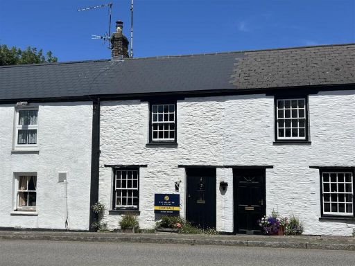
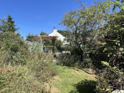
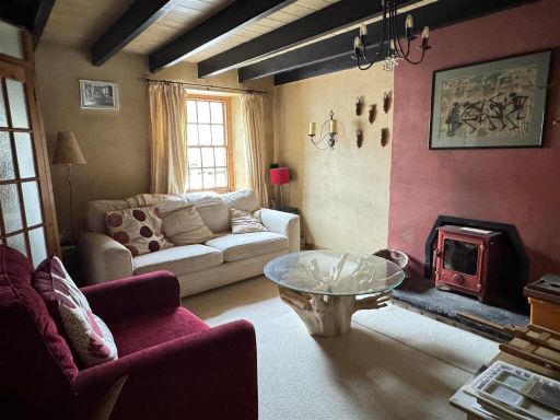
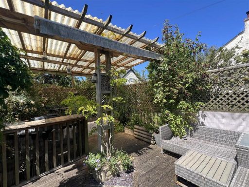
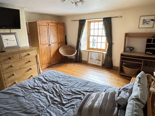
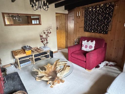
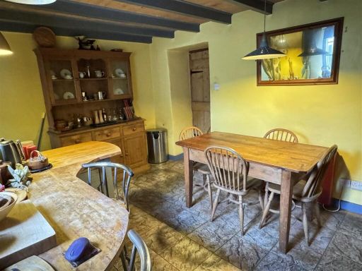
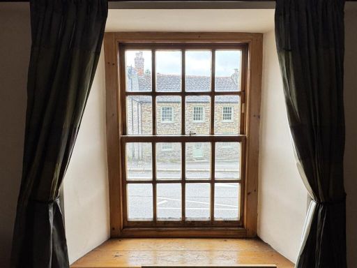
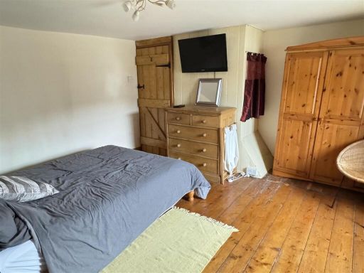
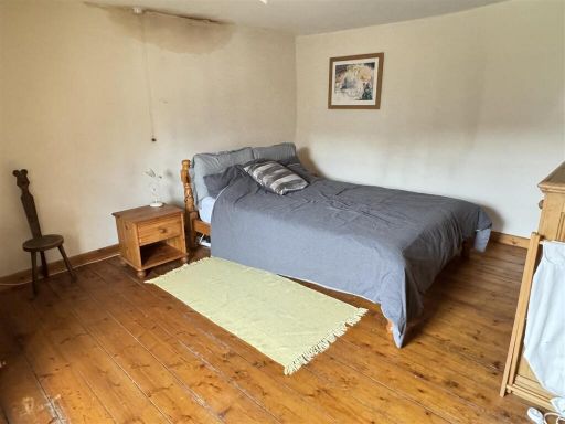
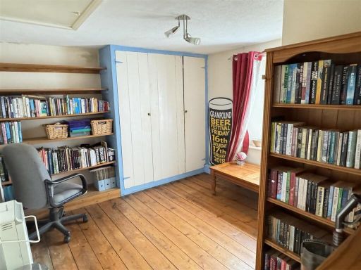
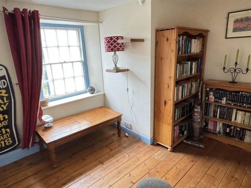
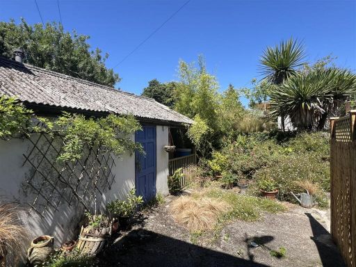
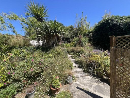
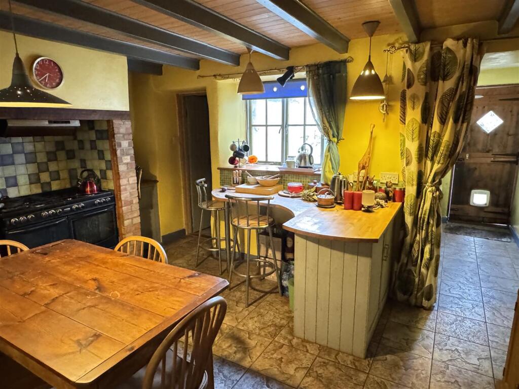
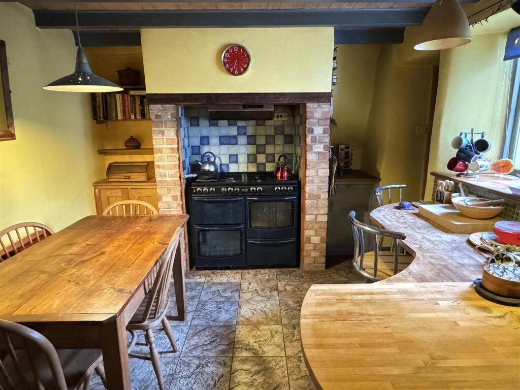
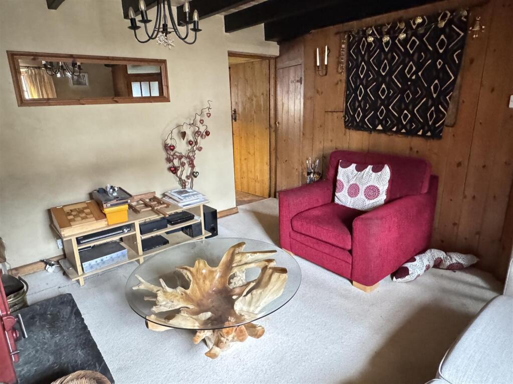
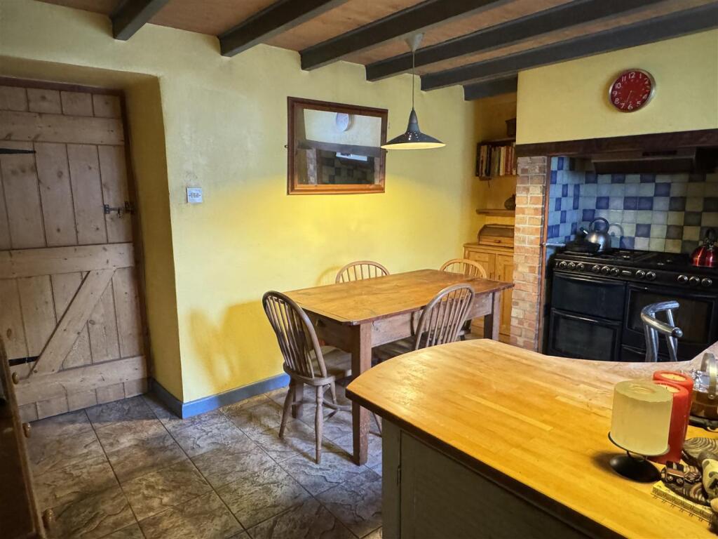
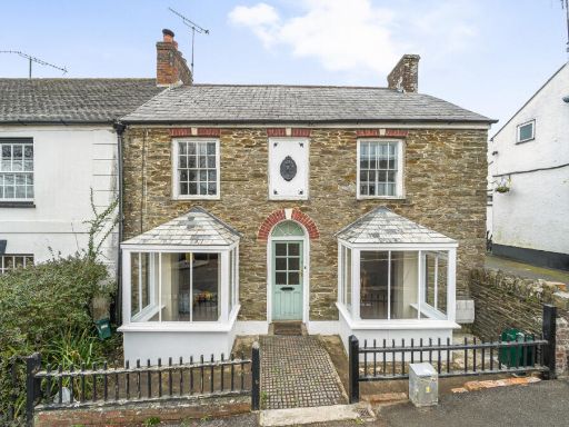
- This charming Grade II listed mid-terrace cottage in Grampound offers two double bedrooms in a delightful conservation area. The exterior showcases classic architectural features typical of a period property, with a stone facade and symmetrical design. The rear garden is well-stocked, offering a tranquil setting with views of mature trees, providing a private and peaceful outdoor retreat that enhances the cottage's appeal. Inside, the rooms feature exposed beams and traditional decor that accentuates the property's character, with an average-sized living area that is both cozy and welcoming.
Image Descriptions
- cottage traditional country cottage
- garden Traditional
Floorplan Description
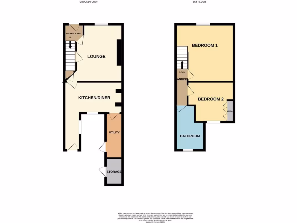
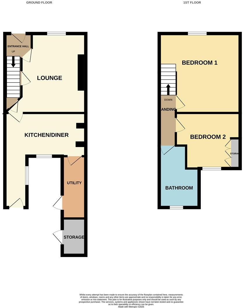
- A two-story property with a mix of living, dining, and utility spaces on the ground floor, and bedrooms on the first floor.
Rooms
- Lounge:
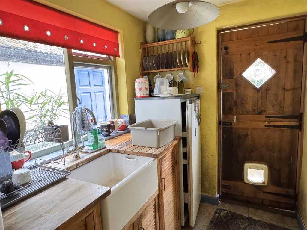
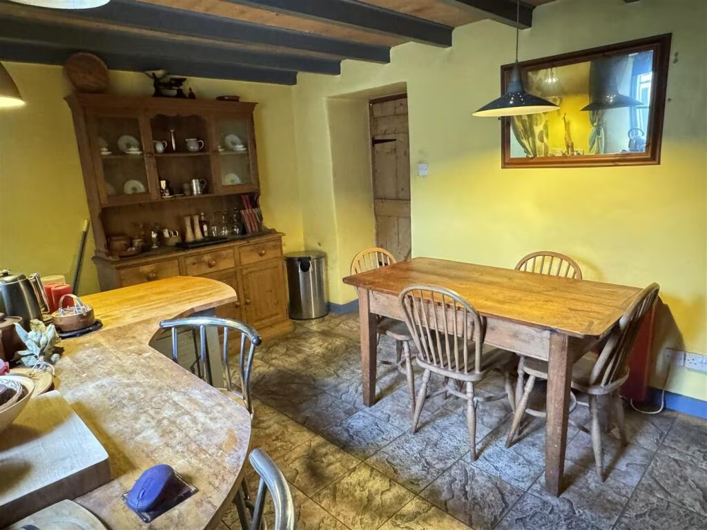
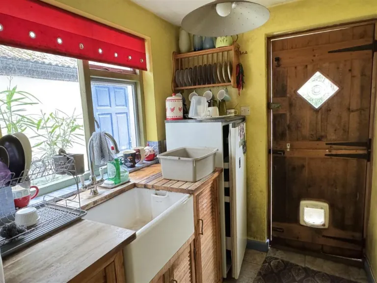
- Kitchen/Diner:
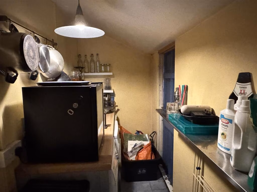
- Utility:
- Storage (Ground Floor):
- Bedroom 1:
- Bedroom 2:
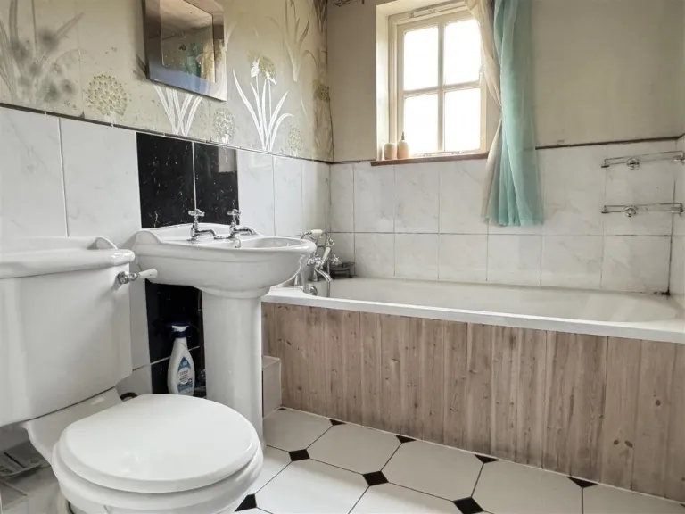
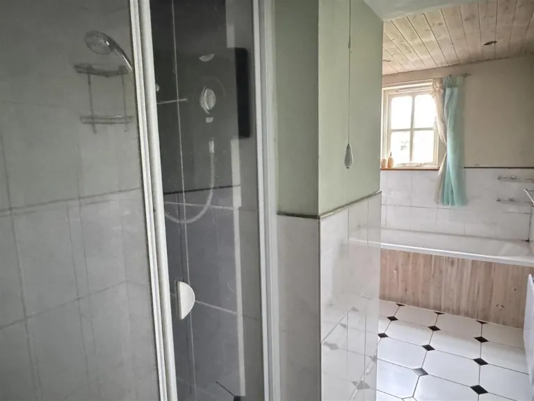
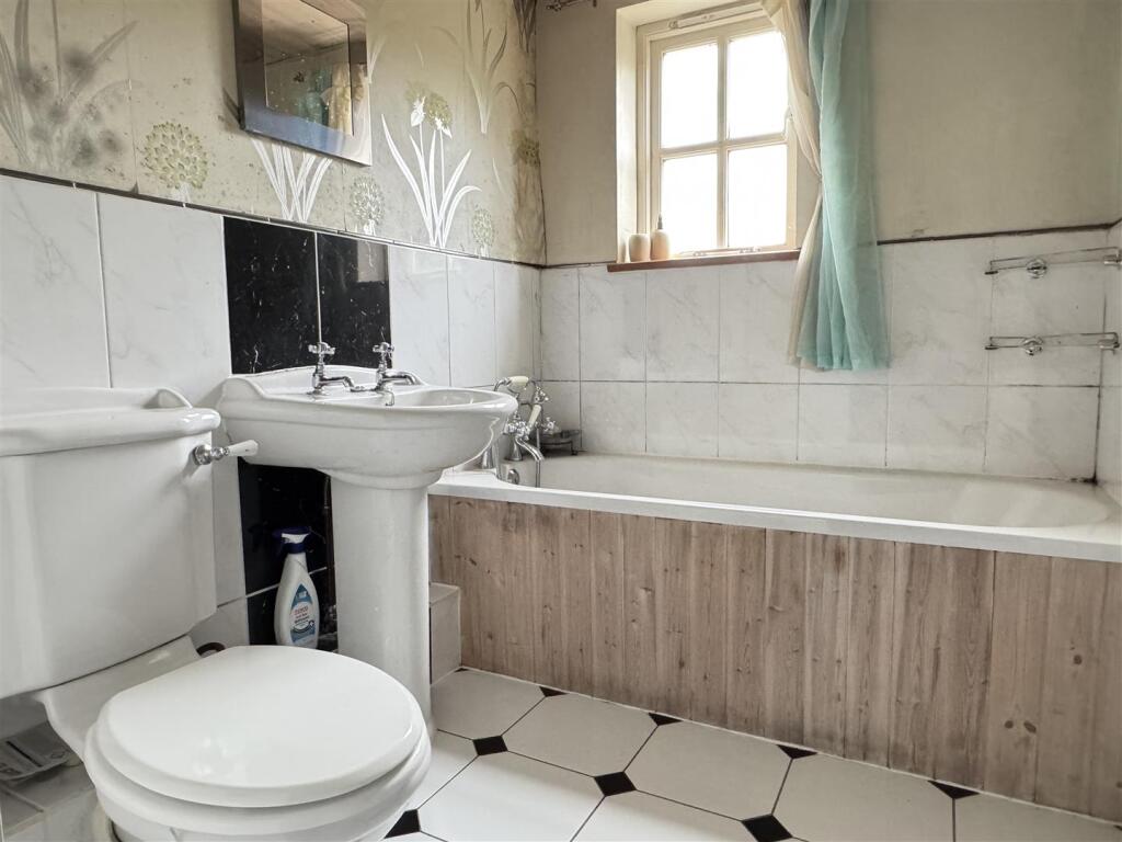
- Bathroom:
- Landing:
- Storage (1st Floor):
- Entrance Hall:
Textual Property Features
- Is Listed Building
- Has Garden
- Chain Free
- Success
Detected Visual Features
- traditional
- country cottage
- stone exterior
- slate roof
- historic
- garden
- outdoor space
- greenery
- vegetation
- trees
- shrubbery
- private garden
- backyard
EPC Details
- Some double glazing
- Cob, as built
- Boiler and radiators, mains gas
- Low energy lighting in all fixed outlets
- Solid, no insulation (assumed)
Nearby Schools
- Mevagissey Community Primary School
- St Mewan Community Primary School
- Gorran School
- Probus Primary School
- Ladock C of E School
- Nanpean Community Primary School
- Tregony Community Primary School
- Grampound-With-Creed CofE Primary School
- Grampound Road Village CofE School
- Pondhu Primary School
- The Roseland Academy
- Brannel School
- St Stephen Churchtown Academy
- Foxhole Learning Academy
- Summercourt Academy
Nearest Bars And Restaurants
- Id: 469286842
- Tags:
- Addr:
- City: Truro
- Postcode: TR2 4JL
- Street: Fore Street
- Amenity: pub
- Building: yes
- Name: The Hawkings Arms
- Opening_hours: 12:00 - 23:00
- Outdoor_seating: yes
- Smoking: isolated
- TagsNormalized:
- Lat: 50.2923503
- Lon: -4.9525122
- FullGeoHash: gbuqp73wnje5
- PartitionGeoHash: gbuq
- Images:
- FoodStandards: null
- Distance: 3665.9
,- Id: 469284311
- Tags:
- Amenity: cafe
- Building: yes
- Cuisine: cake
- Internet_access: wlan
- Internet_access:ssid: Zannah's Time
- Name: The Time Cafe
- Opening_hours: 09:30 - 16:00
- Outdoor_seating: yes
- Smoking: outside
- TagsNormalized:
- Lat: 50.2931545
- Lon: -4.951091
- FullGeoHash: gbuqp7ddz5wb
- PartitionGeoHash: gbuq
- Images:
- FoodStandards: null
- Distance: 3549.2
,- Id: 2428652356
- Tags:
- Amenity: pub
- Food: yes
- Name: The King's Arms
- Wikidata: Q26513657
- TagsNormalized:
- Lat: 50.268087
- Lon: -4.9121803
- FullGeoHash: gbutbpp0cfsg
- PartitionGeoHash: gbut
- Images:
- FoodStandards: null
- Distance: 3534.7
,- Id: 919223873
- Tags:
- Amenity: pub
- Building: yes
- Name: The Dophin Inn
- TagsNormalized:
- Lat: 50.2988082
- Lon: -4.9006501
- FullGeoHash: gbuw0kx7y96q
- PartitionGeoHash: gbuw
- Images:
- FoodStandards: null
- Distance: 107.7
,- Id: 7879893185
- Tags:
- Amenity: pub
- Name: Dolphin Inn
- TagsNormalized:
- Lat: 50.2987919
- Lon: -4.900681
- FullGeoHash: gbuw0kx7ty7k
- PartitionGeoHash: gbuw
- Images:
- FoodStandards: null
- Distance: 106.5
}
Nearest General Shops
- Id: 7879728382
- Tags:
- Name: Andrew Toms Car Sales
- Shop: car
- TagsNormalized:
- Lat: 50.3132958
- Lon: -4.8576736
- FullGeoHash: gbuw1rqb0n0h
- PartitionGeoHash: gbuw
- Images:
- FoodStandards: null
- Distance: 3518.3
,- Id: 923078890
- Tags:
- Building: yes
- Name: Pengelly's Garden Centre
- Shop: garden_centre
- TagsNormalized:
- Lat: 50.3120211
- Lon: -4.8594927
- FullGeoHash: gbuw1rj2v8e8
- PartitionGeoHash: gbuw
- Images:
- FoodStandards: null
- Distance: 3340.3
,- Id: 8669068638
- Tags:
- Air_conditioning: no
- Currency:
- Internet_access: no
- Name: Chainsaw Art
- Operator: Local artist
- Second_hand: no
- Shop: art
- Stroller: limited
- Wheelchair: limited
- TagsNormalized:
- Lat: 50.3105128
- Lon: -4.8663387
- FullGeoHash: gbuw1q8ryp6f
- PartitionGeoHash: gbuw
- Images:
- FoodStandards: null
- Distance: 2829.6
}
Nearest Grocery shops
- Id: 9739943067
- Tags:
- TagsNormalized:
- Lat: 50.2924579
- Lon: -4.9517216
- FullGeoHash: gbuqp76qb98v
- PartitionGeoHash: gbuq
- Images:
- FoodStandards: null
- Distance: 3608.5
,- Id: 8894172317
- Tags:
- Addr:
- Housenumber: 61
- Postcode: TR2 5RW
- Street: Fore Street
- Brand: Londis
- Brand:wikidata: Q21008564
- Brand:wikipedia: en:Londis (United Kingdom)
- Name: Londis
- Opening_hours: Mo-Sa 07:30-21:00; Su 08:00-21:00
- Phone: +44 1872 530633
- Shop: convenience
- Website: https://www.londis.co.uk/our-stores/londis-tregony
- TagsNormalized:
- Lat: 50.2677096
- Lon: -4.9129613
- FullGeoHash: gbutbnyqxsnx
- PartitionGeoHash: gbut
- Images:
- FoodStandards: null
- Distance: 3587.3
,- Id: 1078733611
- Tags:
- Building: yes
- Name: Grampound Village Store
- Shop: convenience
- TagsNormalized:
- Lat: 50.2985673
- Lon: -4.9033781
- FullGeoHash: gbuw0kt6rh83
- PartitionGeoHash: gbuw
- Images:
- FoodStandards: null
- Distance: 119.1
}
Nearest Religious buildings
- Id: 776819457
- Tags:
- Amenity: place_of_worship
- Building: church
- Denomination: methodist
- Name: Grampound Road Village Church
- Religion: christian
- TagsNormalized:
- place of worship
- church
- methodist
- christian
- Lat: 50.3169518
- Lon: -4.929913
- FullGeoHash: gbuqpzfjkxwk
- PartitionGeoHash: gbuq
- Images:
- FoodStandards: null
- Distance: 2795.3
,- Id: 871156659
- Tags:
- Amenity: place_of_worship
- Building: church
- Denomination: anglican
- Name: St Crida
- Religion: christian
- Wikidata: Q17528999
- Wikipedia: en:St Crida's Church, Creed
- TagsNormalized:
- place of worship
- church
- anglican
- christian
- Lat: 50.2887339
- Lon: -4.900377
- FullGeoHash: gbuw06z9hgqn
- PartitionGeoHash: gbuw
- Images:
- FoodStandards: null
- Distance: 1170.4
,- Id: 776820416
- Tags:
- Amenity: place_of_worship
- Building: church
- Denomination: anglican
- Name: St Nun
- Religion: christian
- Wikidata: Q26436923
- TagsNormalized:
- place of worship
- church
- anglican
- christian
- Lat: 50.2985483
- Lon: -4.8995852
- FullGeoHash: gbuw0s84r2ur
- PartitionGeoHash: gbuw
- Images:
- FoodStandards: null
- Distance: 188.6
}
Nearest Medical buildings
- Id: 1006300296
- Tags:
- Amenity: pharmacy
- Brand: Boots
- Brand:wikidata: Q6123139
- Brand:wikipedia: en:Boots UK
- Building: retail
- Building:colour: grey
- Building:levels: 2
- Dispensing: yes
- Healthcare: pharmacy
- Image: https://archive.org/details/mevagissey2020-8-23/Mevagissey%202020-08-23%20and%2024/DSCN1121.JPG
- Name: Boots
- Opening_hours: Mo-Fr 09:00-18:00; Sa 09:00-17:00; Su 10:00-16:00
- Roof:
- TagsNormalized:
- pharmacy
- boots
- retail
- health
- healthcare
- Lat: 50.2700962
- Lon: -4.7877151
- FullGeoHash: gbutgp3sw1hu
- PartitionGeoHash: gbut
- Images:
- FoodStandards: null
- Distance: 8743.6
,- Id: 117336523
- Tags:
- Amenity: doctors
- Building: yes
- Building:colour: white
- Building:levels: 1
- Healthcare: doctor
- Name: The Mevagissey Surgery
- Roof:
- Source: Bing
- TagsNormalized:
- doctor
- doctors
- health
- healthcare
- surgery
- Lat: 50.2707986
- Lon: -4.7879954
- FullGeoHash: gbutgp92xs5f
- PartitionGeoHash: gbut
- Images:
- FoodStandards: null
- Distance: 8696.3
,- Id: 8892234823
- Tags:
- Amenity: hospital
- Emergency: yes
- Healthcare: hospital
- Name: WW2 Emergency Hospital
- TagsNormalized:
- hospital
- health
- healthcare
- emergency
- Lat: 50.2686322
- Lon: -5.0086656
- FullGeoHash: gbumyp0u18hp
- PartitionGeoHash: gbum
- Images:
- FoodStandards: null
- Distance: 8304.3
,- Id: 469290633
- Tags:
- Addr:
- City: Truro
- Postcode: TR2 4JZ
- Street: Tregony Road
- Amenity: doctors
- Building: yes
- Healthcare: doctor
- Name: Probus Surgical Centre
- Opening_hours: 09:00 - 18:00
- Phone: +44 1726 885104
- Website: http://probussurgicalcentre.co.uk
- TagsNormalized:
- doctor
- doctors
- health
- healthcare
- Lat: 50.2900193
- Lon: -4.9485253
- FullGeoHash: gbuqp7h8e504
- PartitionGeoHash: gbuq
- Images:
- FoodStandards: null
- Distance: 3457
}
Nearest Leisure Facilities
- Id: 377376203
- Tags:
- Building: yes
- Leisure: sports_centre
- Name: Grampound Road Cricket Pavillion
- Source: DigitalGlobe-Standard
- Sport: cricket
- TagsNormalized:
- sports
- sports centre
- leisure
- cricket
- Lat: 50.3152805
- Lon: -4.929882
- FullGeoHash: gbuqpzd5v2je
- PartitionGeoHash: gbuq
- Images:
- FoodStandards: null
- Distance: 2665.8
,- Id: 377375687
- Tags:
- Leisure: pitch
- Name: Grampound Road Cricket Pitch
- Sport: cricket
- TagsNormalized:
- pitch
- leisure
- cricket
- sports
- Lat: 50.314545
- Lon: -4.9302979
- FullGeoHash: gbuqpz3z7wzr
- PartitionGeoHash: gbuq
- Images:
- FoodStandards: null
- Distance: 2634.1
,- Id: 844637928
- Tags:
- Leisure: garden
- Name: Trewithen Gardens
- TagsNormalized:
- Lat: 50.2898174
- Lon: -4.9321827
- FullGeoHash: gbuqpfbrrv6j
- PartitionGeoHash: gbuq
- Images:
- FoodStandards: null
- Distance: 2382.7
,- Id: 1146953291
- Tags:
- Leisure: pitch
- Sport: soccer
- TagsNormalized:
- Lat: 50.2977556
- Lon: -4.9041081
- FullGeoHash: gbuw0kkvtvpz
- PartitionGeoHash: gbuw
- Images:
- FoodStandards: null
- Distance: 218.6
,- Id: 776820418
- Tags:
- Leisure: pitch
- Sport: bowls
- TagsNormalized:
- Lat: 50.2983387
- Lon: -4.903424
- FullGeoHash: gbuw0kt3jcyj
- PartitionGeoHash: gbuw
- Images:
- FoodStandards: null
- Distance: 138.1
}
Nearest Tourist attractions
- Id: 471556259
- Tags:
- TagsNormalized:
- Lat: 50.3010285
- Lon: -4.8570032
- FullGeoHash: gbuw1mp0xx7f
- PartitionGeoHash: gbuw
- Images:
- FoodStandards: null
- Distance: 3204.7
,- Id: 1789140070
- Tags:
- Name: Acorn Parks Meadow Lakes
- Source: ACSI
- Tourism: camp_site
- TagsNormalized:
- Lat: 50.3009
- Lon: -4.85781
- FullGeoHash: gbuw1kyxuz6k
- PartitionGeoHash: gbuw
- Images:
- FoodStandards: null
- Distance: 3146.7
,- Id: 435533645
- Tags:
- Guest_house: bed_and_breakfast
- Name: Perran House
- Postal_code: TR2 4RS
- Tourism: guest_house
- TagsNormalized:
- Lat: 50.2990148
- Lon: -4.9014489
- FullGeoHash: gbuw0kwugzyy
- PartitionGeoHash: gbuw
- Images:
- FoodStandards: null
- Distance: 46.6
}
Nearest Train stations
- Id: 1397298187
- Tags:
- Name: East Wheal Rose
- Public_transport: station
- Railway: station
- Train: yes
- Usage: tourism
- Wheelchair: yes
- TagsNormalized:
- Lat: 50.3622999
- Lon: -5.0414814
- FullGeoHash: gbuqt20vsvph
- PartitionGeoHash: gbuq
- Images:
- FoodStandards: null
- Distance: 12132.5
,- Id: 1397298210
- Tags:
- Name: Newlyn Halt
- Public_transport: station
- Railway: station
- Train: yes
- Usage: tourism
- TagsNormalized:
- Lat: 50.3576343
- Lon: -5.0460553
- FullGeoHash: gbuqmpmd6rkm
- PartitionGeoHash: gbuq
- Images:
- FoodStandards: null
- Distance: 12113.2
,- Id: 1397298225
- Tags:
- Name: Groggly Halt
- Public_transport: station
- Railway: station
- Train: yes
- Usage: tourism
- Wheelchair: yes
- TagsNormalized:
- Lat: 50.3621161
- Lon: -5.0411698
- FullGeoHash: gbuqt21hs4zk
- PartitionGeoHash: gbuq
- Images:
- FoodStandards: null
- Distance: 12102.6
,- Id: 84494872
- Tags:
- Name: St. Columb Road
- Naptan:
- Network: National Rail
- Public_transport: station
- Railway: station
- Ref:
- Request_stop: yes
- Source: NPE
- Wikidata: Q2117314
- Wikipedia: en:St Columb Road railway station
- TagsNormalized:
- Lat: 50.3987461
- Lon: -4.941332
- FullGeoHash: gbuqxwccfx5y
- PartitionGeoHash: gbuq
- Images:
- FoodStandards: null
- Distance: 11414.2
,- Id: 6605728689
- Tags:
- Name: St Austell
- Naptan:
- Network: National Rail
- Public_transport: station
- Railway: station
- Ref:
- Wikidata: Q2743990
- Wikipedia: en:St Austell railway station
- TagsNormalized:
- Lat: 50.3395984
- Lon: -4.7893307
- FullGeoHash: gbuw7h092t21
- PartitionGeoHash: gbuw
- Images:
- FoodStandards: null
- Distance: 9176
}
Nearest Hotels
- Id: 631634394
- Tags:
- Access: customers
- Amenity: parking
- Name: Hotel Guest Parking
- Source: survey
- Surface: paved
- TagsNormalized:
- Lat: 50.3278654
- Lon: -4.7958075
- FullGeoHash: gbuw6cgv1d4e
- PartitionGeoHash: gbuw
- Images:
- FoodStandards: null
- Distance: 8188.3
,- Id: 4321597492
- Tags:
- Addr:
- City: St Austell
- Place: Tregorrick
- Postcode: PL26 7AB
- Fhrs:
- Name: The Cornwall Hotel
- Source:
- Tourism: hotel
- Website: https://thecornwall.com
- TagsNormalized:
- Lat: 50.3278043
- Lon: -4.7967442
- FullGeoHash: gbuw6cghey8q
- PartitionGeoHash: gbuw
- Images:
- FoodStandards: null
- Distance: 8124.4
,- Id: 1311750652
- Tags:
- Name: Bosinver Farm Cottages
- Tourism: hotel
- TagsNormalized:
- Lat: 50.3263631
- Lon: -4.8195969
- FullGeoHash: gbuw63dkr601
- PartitionGeoHash: gbuw
- Images:
- FoodStandards: null
- Distance: 6586.6
}
Tags
- traditional
- country cottage
- stone exterior
- slate roof
- historic
- garden
- outdoor space
- greenery
- vegetation
- trees
- shrubbery
- private garden
- backyard
Local Market Stats
- Average Price/sqft: £353
- Avg Income: £45500
- Social Housing: 8%
- Planning Success Rate: 52%
AirBnB Data
- 1km average: £77/night
- Listings in 1km: 3
Similar Properties
 3 bedroom semi-detached house for sale in Fore Street, Grampound, Truro, Cornwall, TR2 — £295,000 • 3 bed • 1 bath • 1248 ft²
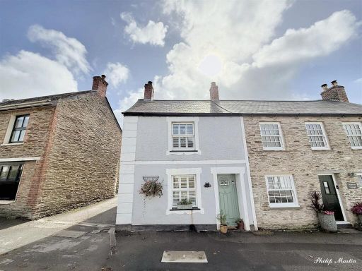 2 bedroom end of terrace house for sale in Fore Street, Grampound, TR2 — £265,000 • 2 bed • 1 bath • 649 ft²
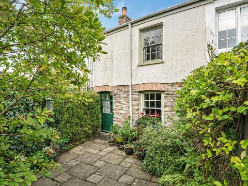 2 bedroom cottage for sale in South Street, Grampound Road, TR2 — £200,000 • 2 bed • 1 bath • 620 ft²
 5 bedroom semi-detached house for sale in Fore Street, Grampound, Truro, Cornwall, TR2 — £450,000 • 5 bed • 2 bath
 3 bedroom terraced house for sale in Union Hill, St. Columb, Cornwall, TR9 — £220,000 • 3 bed • 1 bath • 2509 ft²
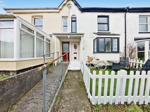 2 bedroom terraced house for sale in Headland Terrace, Truro, Cornwall, TR2 — £220,000 • 2 bed • 2 bath • 736 ft²
Meta
- {
"@context": "https://schema.org",
"@type": "Residence",
"name": "2 bedroom cottage for sale in Fore Street, Grampound, Truro…",
"description": "",
"url": "https://propertypiper.co.uk/property/e492293f-5806-4a59-aa5a-4c4e0d5d274a",
"image": "https://image-a.propertypiper.co.uk/2510421f-7897-4c9b-bc57-742d91c665e2-1024.jpeg",
"address": {
"@type": "PostalAddress",
"streetAddress": "MOOR VIEW 2 FORE STREET GRAMPOUND TRURO",
"postalCode": "TR2 4RT",
"addressLocality": "Cornwall",
"addressRegion": "St Austell and Newquay",
"addressCountry": "England"
},
"geo": {
"@type": "GeoCoordinates",
"latitude": 50.2992065,
"longitude": -4.9020324
},
"numberOfRooms": 2,
"numberOfBathroomsTotal": 1,
"floorSize": {
"@type": "QuantitativeValue",
"value": 732,
"unitCode": "FTK"
},
"offers": {
"@type": "Offer",
"price": 195000,
"priceCurrency": "GBP",
"availability": "https://schema.org/InStock"
},
"additionalProperty": [
{
"@type": "PropertyValue",
"name": "Feature",
"value": "traditional"
},
{
"@type": "PropertyValue",
"name": "Feature",
"value": "country cottage"
},
{
"@type": "PropertyValue",
"name": "Feature",
"value": "stone exterior"
},
{
"@type": "PropertyValue",
"name": "Feature",
"value": "slate roof"
},
{
"@type": "PropertyValue",
"name": "Feature",
"value": "historic"
},
{
"@type": "PropertyValue",
"name": "Feature",
"value": "garden"
},
{
"@type": "PropertyValue",
"name": "Feature",
"value": "outdoor space"
},
{
"@type": "PropertyValue",
"name": "Feature",
"value": "greenery"
},
{
"@type": "PropertyValue",
"name": "Feature",
"value": "vegetation"
},
{
"@type": "PropertyValue",
"name": "Feature",
"value": "trees"
},
{
"@type": "PropertyValue",
"name": "Feature",
"value": "shrubbery"
},
{
"@type": "PropertyValue",
"name": "Feature",
"value": "private garden"
},
{
"@type": "PropertyValue",
"name": "Feature",
"value": "backyard"
}
]
}
High Res Floorplan Images
Compatible Floorplan Images
FloorplanImages Thumbnail