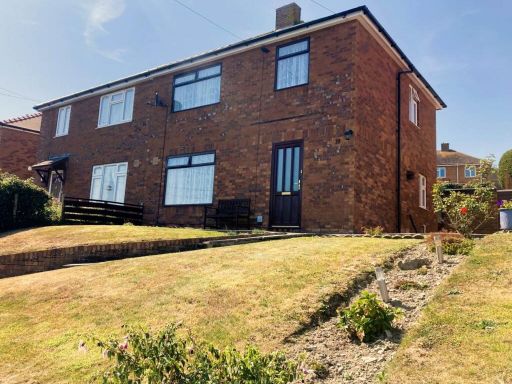
SY23 1TG - 3 bedroom semidetached house for sale in Heol Y Wern, Penpa…
View on Property Piper
3 bedroom semi-detached house for sale in Heol Y Wern, Penparcau, SY23
Property Details
- Price: £238000
- Bedrooms: 3
- Bathrooms: 1
- Property Type: undefined
- Property SubType: undefined
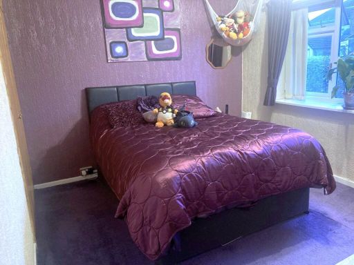
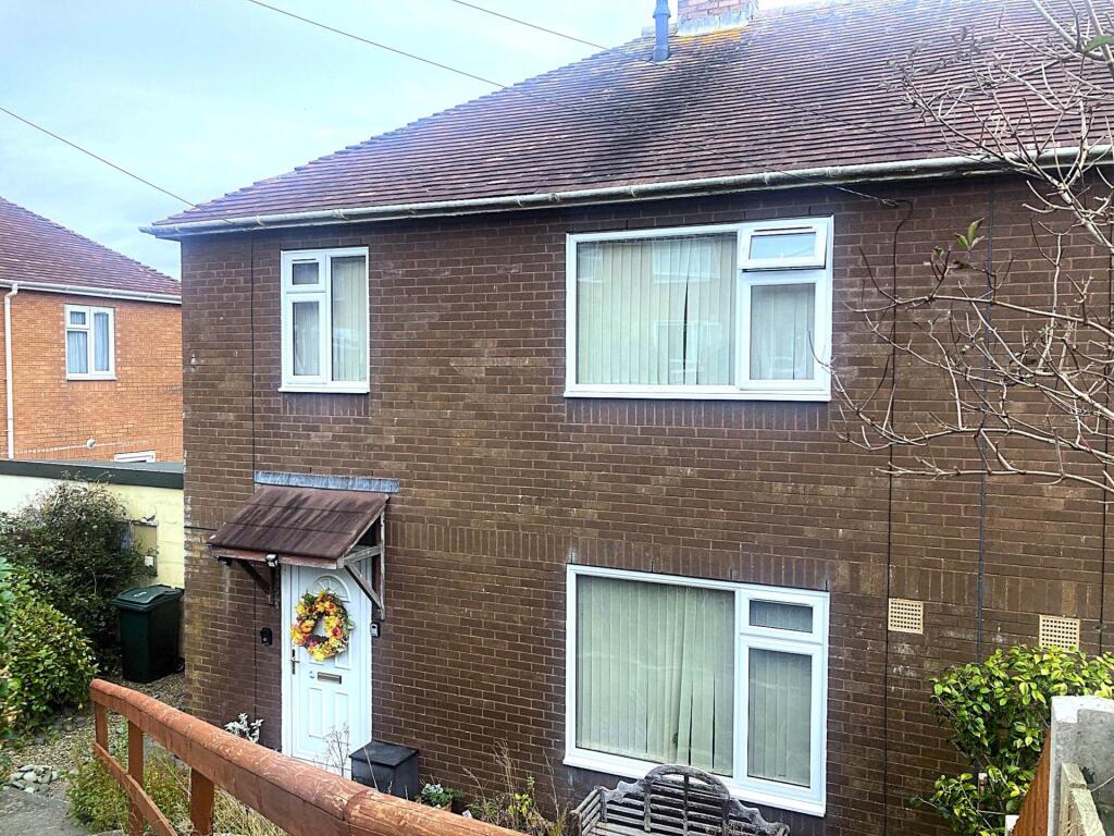
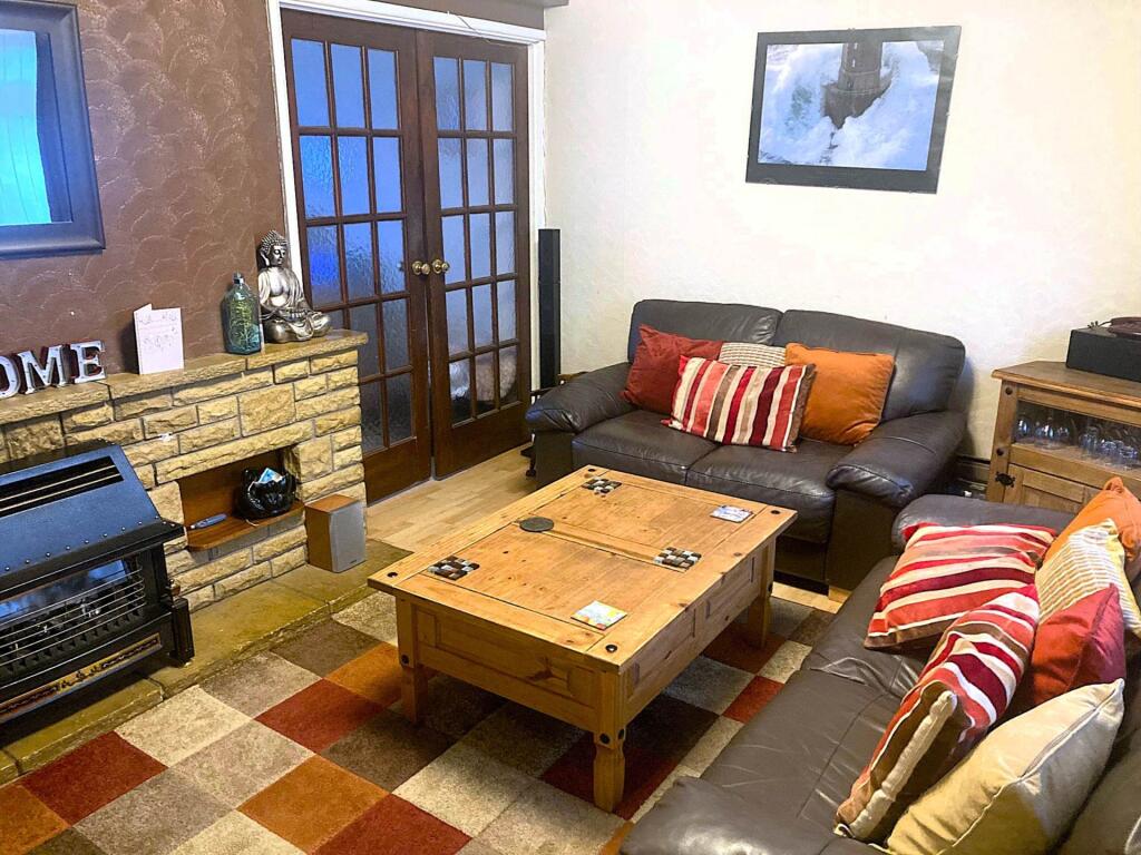
Image Descriptions
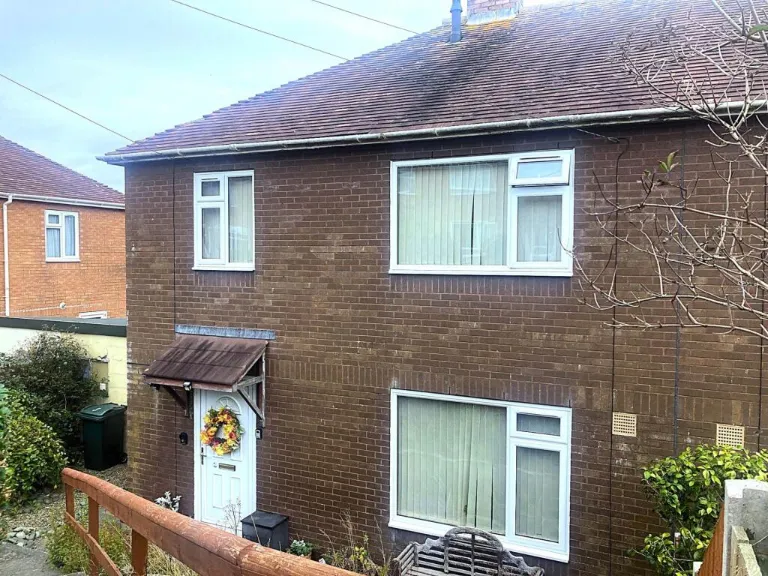
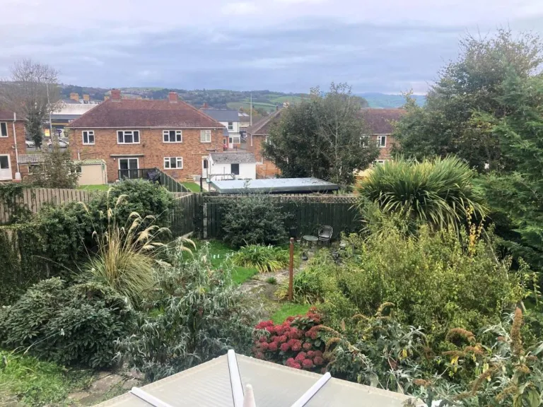
- exterior post-war
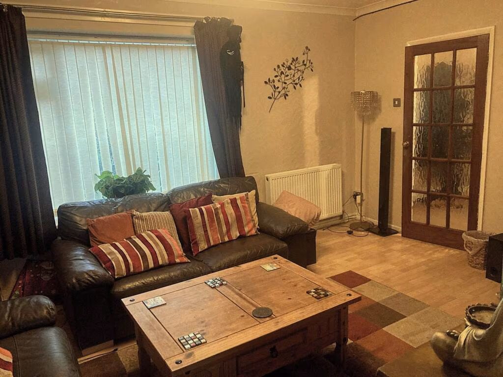
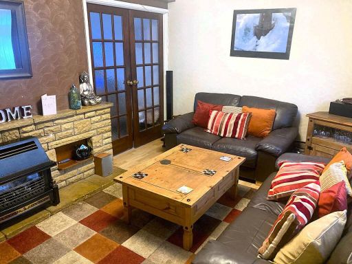
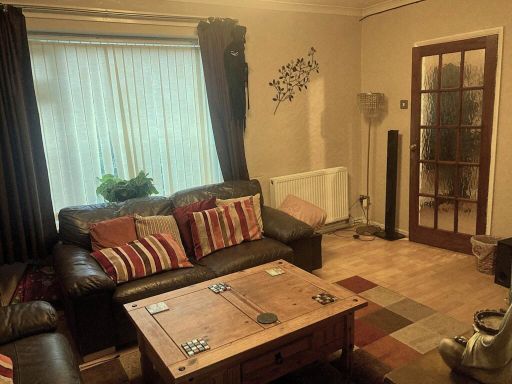
- living room mid-century
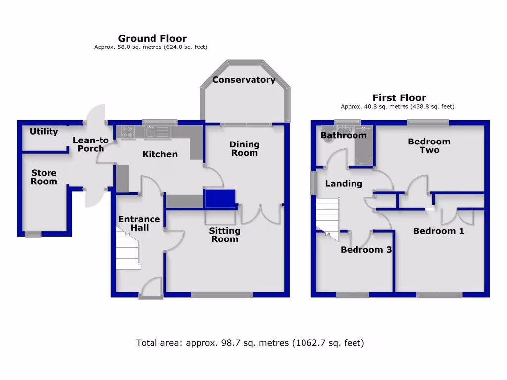
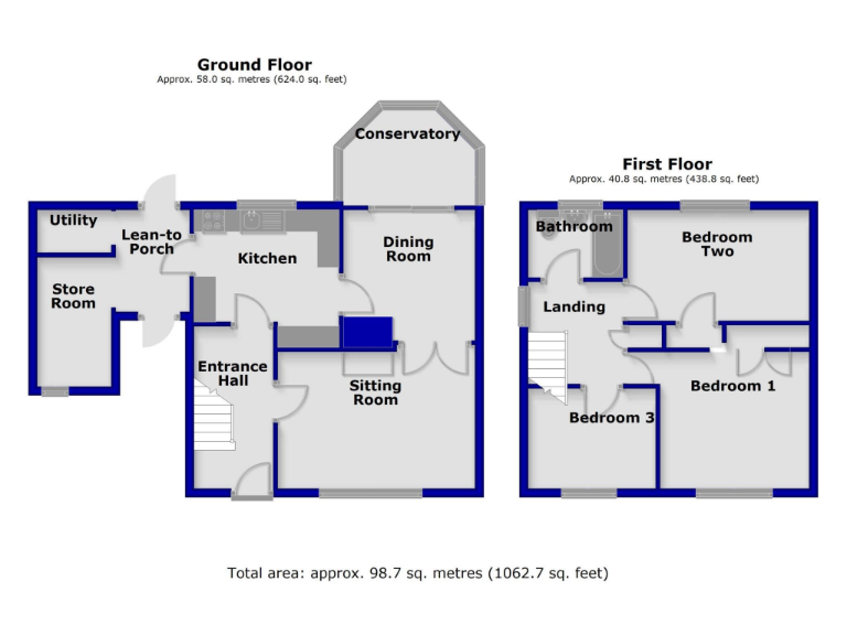
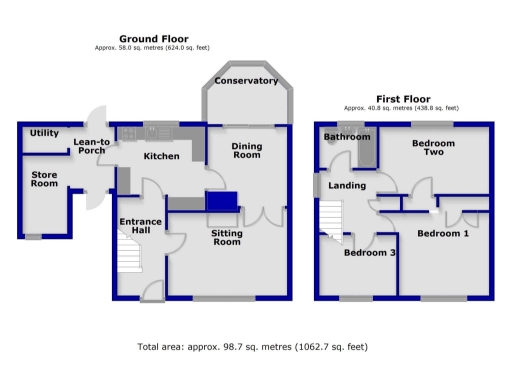
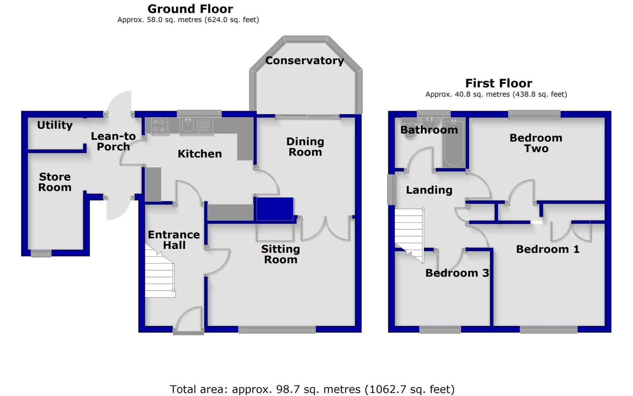
Floorplan Description
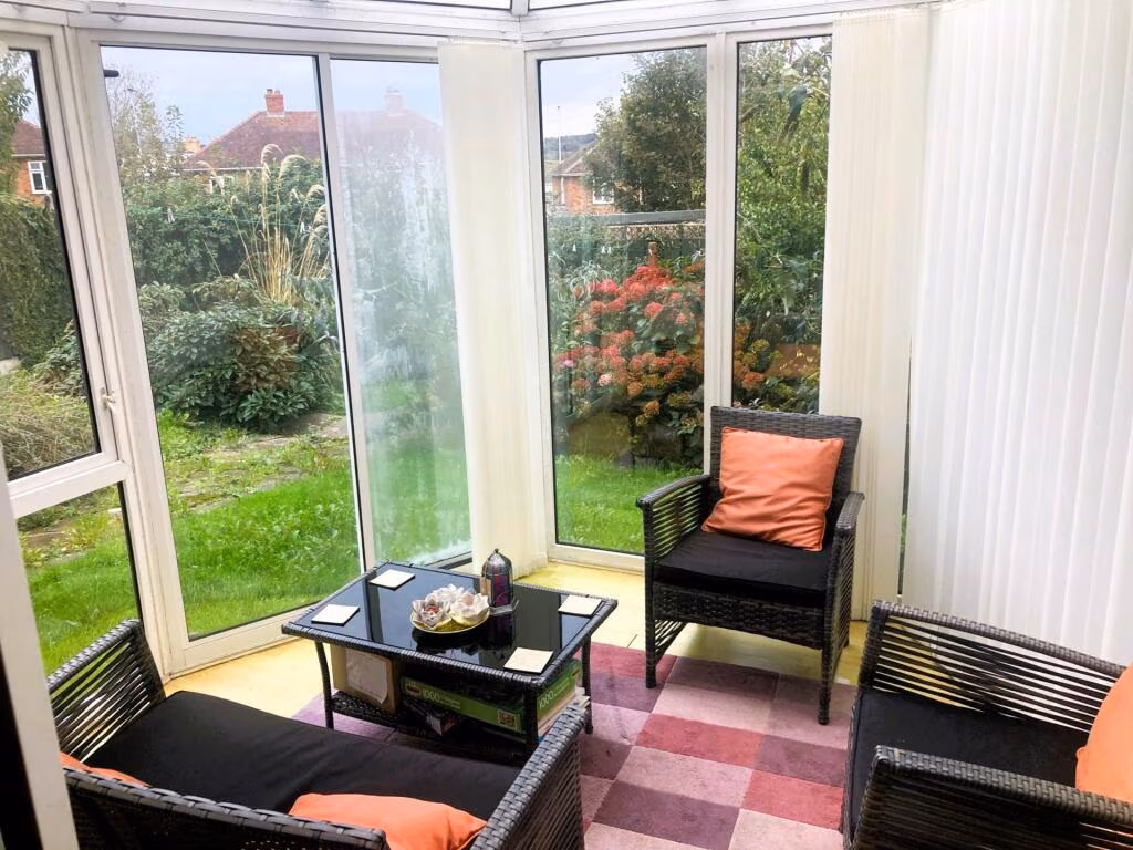
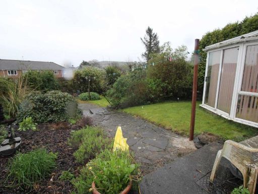
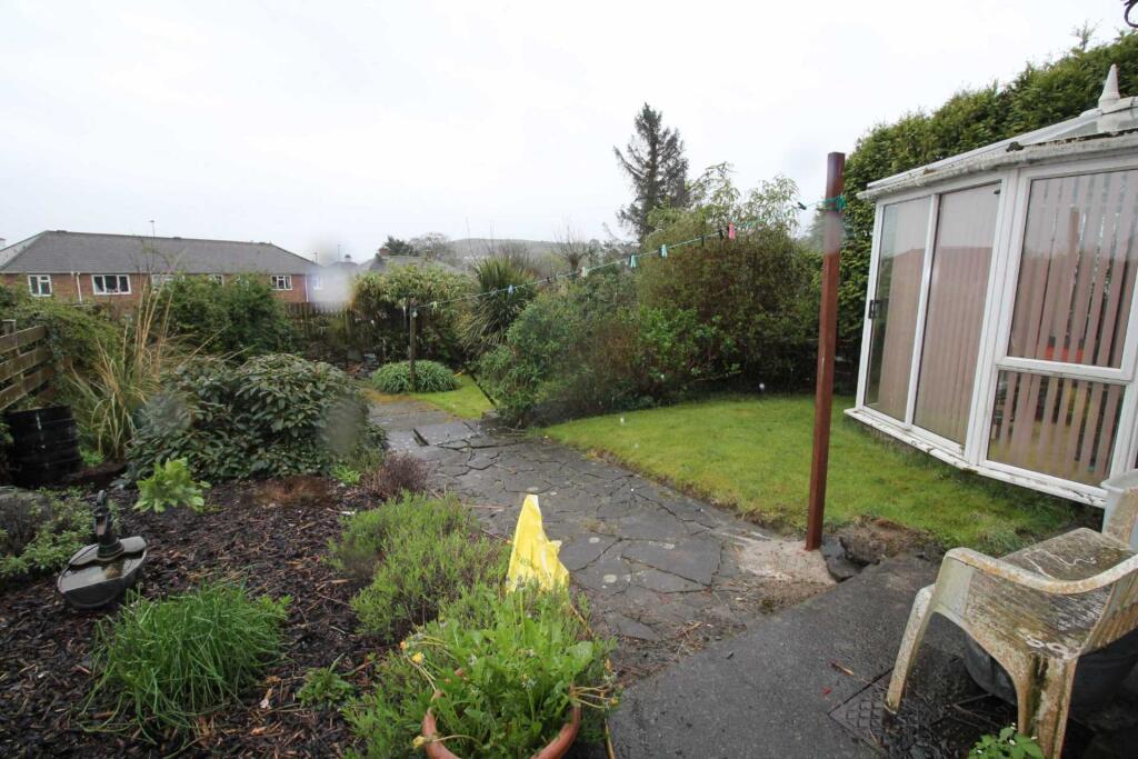
- Two-storey residential property with conservatory and ancillary outrooms
Rooms
- Utility:
- Lean-to Porch:
- Store Room:
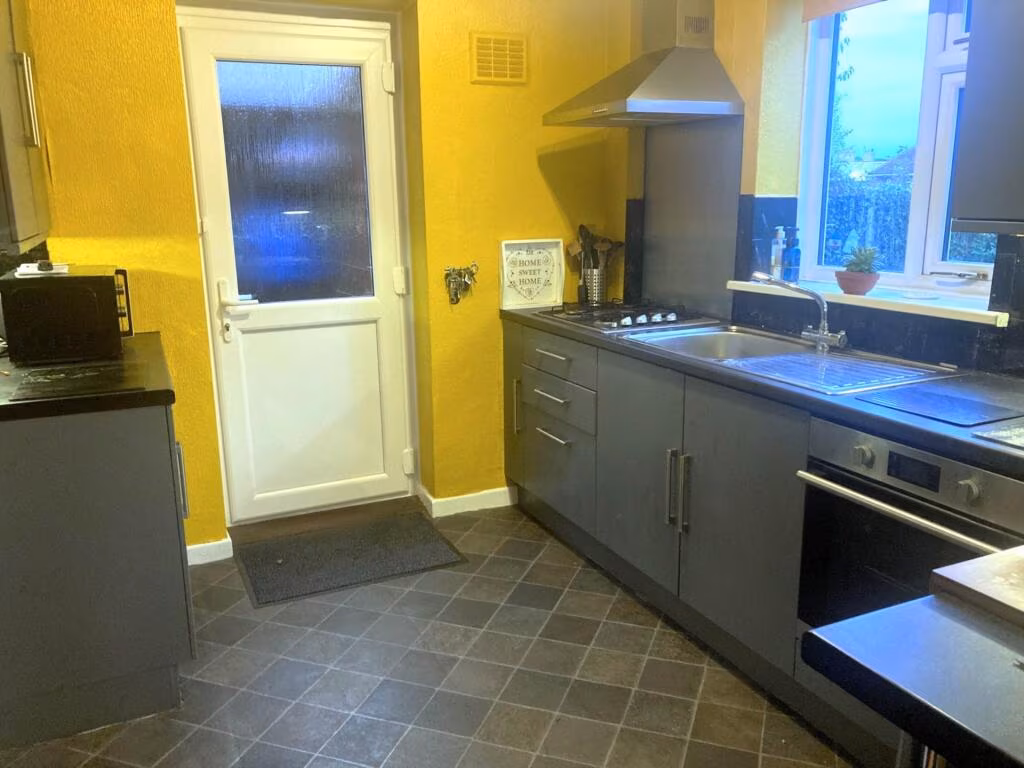
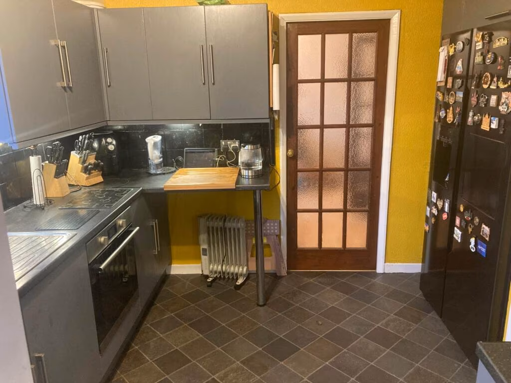
- Kitchen:
- Conservatory:
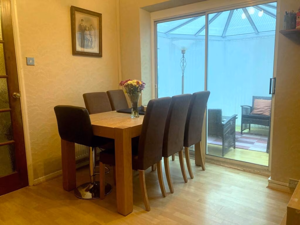
- Dining Room:
- Entrance Hall:
- Sitting Room:
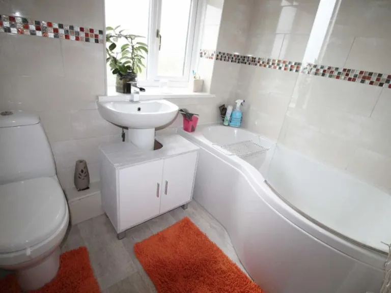
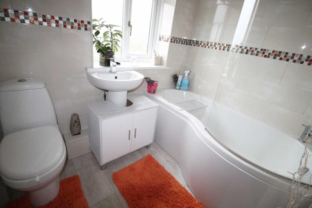
- Bathroom:
- Landing:
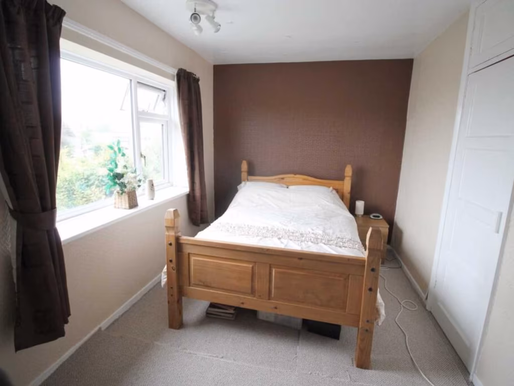
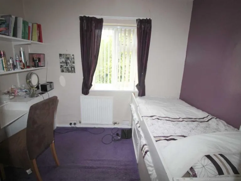
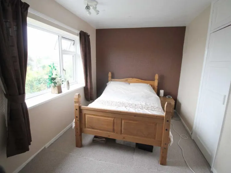
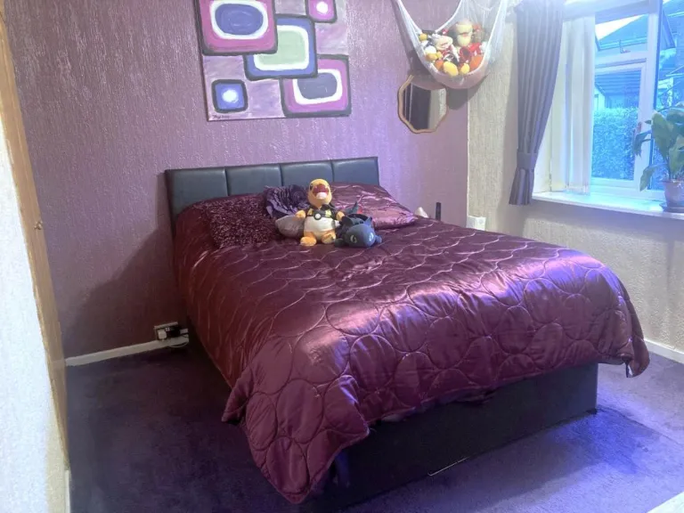
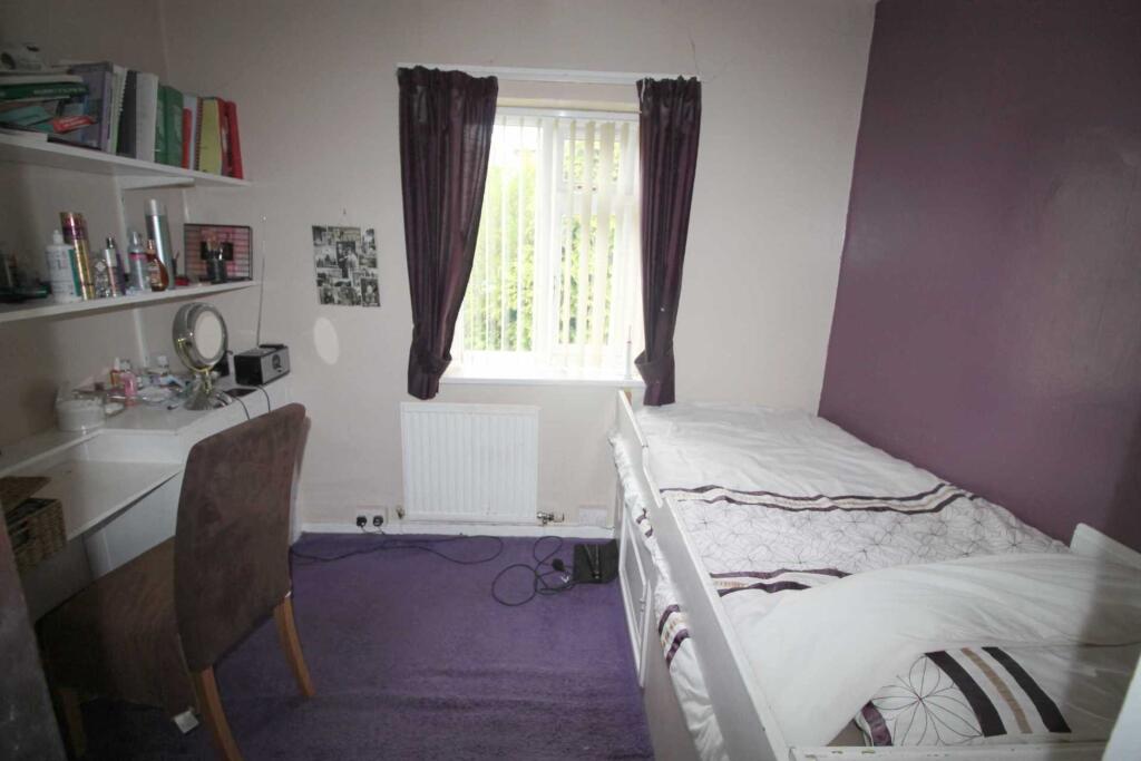
- Bedroom Two:
- Bedroom 3:
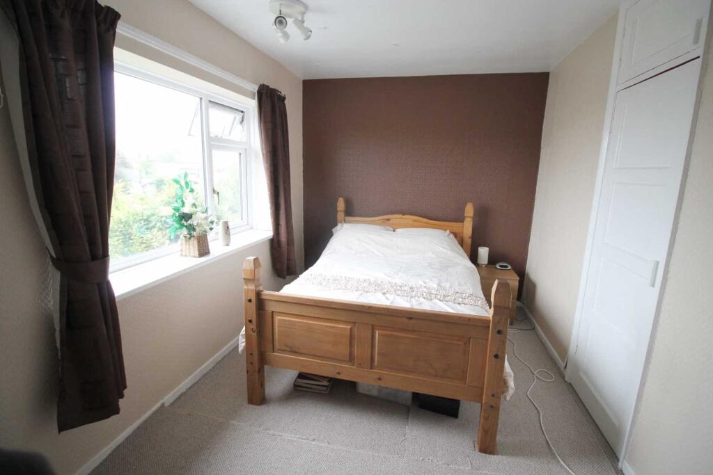
- Bedroom 1:
Textual Property Features
Detected Visual Features
- post-war
- brick facade
- semi-detached
- two-story
- residential
- traditional design
- Mid-century style
- stone fireplace
- wooden furniture
- French doors
- frosted glass
- living room
- dated decor
- renovation potential
EPC Details
- Fully double glazed
- Cavity wall, as built, partial insulation (assumed)
- Boiler and radiators, mains gas
- Low energy lighting in 78% of fixed outlets
- Solid, no insulation (assumed)
Nearest General Shops
- Id: 925072774
- Tags:
- Building: yes
- Name: Moduron Delfryn Owens Renault
- Shop: car
- Source: Bing
- TagsNormalized:
- Lat: 52.399218
- Lon: -4.0694151
- FullGeoHash: gcm456uxxf0n
- PartitionGeoHash: gcm4
- Images:
- FoodStandards: null
- Distance: 318.5
,- Id: 6683945228
- Tags:
- Name: Quaker meeting house Aberystwyth
- Shop: religion
- TagsNormalized:
- Lat: 52.4026414
- Lon: -4.0752189
- FullGeoHash: gcm4578e882e
- PartitionGeoHash: gcm4
- Images:
- FoodStandards: null
- Distance: 250.3
,- Id: 1965622729
- Tags:
- TagsNormalized:
- Lat: 52.4017505
- Lon: -4.073411
- FullGeoHash: gcm4573y6dk9
- PartitionGeoHash: gcm4
- Images:
- FoodStandards: null
- Distance: 121.4
}
Nearest Grocery shops
- Id: 5525195591
- Tags:
- Brand: Costcutter
- Brand:wikidata: Q5175072
- Brand:wikipedia: en:Costcutter
- Contact:
- Website: https://store-locator.costcutter.co.uk/costcutter-2f073bb68cf2
- Name: Costcutter
- Shop: convenience
- TagsNormalized:
- costcutter
- convenience
- shop
- Lat: 52.4074082
- Lon: -4.0587869
- FullGeoHash: gcm45skrr2vp
- PartitionGeoHash: gcm4
- Images:
- FoodStandards: null
- Distance: 1247.3
,- Id: 520892843
- Tags:
- Brand: Londis
- Brand:wikidata: Q21008564
- Brand:wikipedia: en:Londis (United Kingdom)
- Name: Londis
- Shop: convenience
- TagsNormalized:
- Lat: 52.4091375
- Lon: -4.0846908
- FullGeoHash: gcm45hc97g3f
- PartitionGeoHash: gcm4
- Images:
- FoodStandards: null
- Distance: 1211.6
,- Id: 520896482
- Tags:
- Brand: Spar
- Brand:wikidata: Q610492
- Brand:wikipedia: en:SPAR (retailer)
- Lottery: yes
- Name: Spar
- Shop: convenience
- TagsNormalized:
- Lat: 52.4014447
- Lon: -4.0729538
- FullGeoHash: gcm4576ht339
- PartitionGeoHash: gcm4
- Images:
- FoodStandards: null
- Distance: 94.2
}
Nearest Supermarkets
- Id: 14088711
- Tags:
- Brand: Lidl
- Brand:wikidata: Q151954
- Building: yes
- Building:levels: 1
- Name: Lidl
- Shop: supermarket
- Type: multipolygon
- Wheelchair: yes
- TagsNormalized:
- Lat: 52.4129264
- Lon: -4.0797033
- FullGeoHash: gcm45jmr2j8s
- PartitionGeoHash: gcm4
- Images:
- FoodStandards: null
- Distance: 1428.1
,- Id: 55215103
- Tags:
- Addr:
- Brand: Morrisons
- Brand:wikidata: Q922344
- Brand:wikipedia: en:Morrisons
- Building: yes
- Contact:
- Website: https://my.morrisons.com/storefinder/240
- Fhrs:
- Layer: 1
- Name: Morrisons
- Shop: supermarket
- Source: OS_OpenData_StreetView (for building outline)
- Source:addr:postcode: FHRS Open Data
- Wheelchair: yes
- TagsNormalized:
- Lat: 52.4044785
- Lon: -4.0682166
- FullGeoHash: gcm457vw5wvf
- PartitionGeoHash: gcm4
- Images:
- FoodStandards:
- Id: 864029
- FHRSID: 864029
- LocalAuthorityBusinessID: 9829
- BusinessName: Morrisons Supermarket
- BusinessType: Retailers - supermarkets/hypermarkets
- BusinessTypeID: 7840
- AddressLine1: Morrisons Supermarket Parc Y Llyn Retail Park
- AddressLine2: Llanbadarn Fawr
- AddressLine3: Aberystwyth
- AddressLine4: Ceredigion
- PostCode: SY23 3TL
- RatingValue: 5
- RatingKey: fhrs_5_en-GB
- RatingDate: 2021-07-05
- LocalAuthorityCode: 557
- LocalAuthorityName: Ceredigion
- LocalAuthorityWebSite: http://www.ceredigion.gov.uk/
- LocalAuthorityEmailAddress: envhealth@ceredigion.gov.uk
- Scores:
- Hygiene: 5
- Structural: 5
- ConfidenceInManagement: 0
- NewRatingPending: false
- Geocode:
- Longitude: -4.06898200000000
- Latitude: 52.40589700000000
- Distance: 554.5
,- Id: 520896611
- Tags:
- Addr:
- City: Aberystwyth
- Postcode: SY23 1RU
- Street: Penparcau Road
- Brand: Co-op Food
- Brand:wikidata: Q3277439
- Brand:wikipedia: en:Co-op Food
- Fhrs:
- Name: Co-op Food
- Official_name: The co-operative food
- Operator: Co-operative Group Ltd
- Phone: +44 1970 611181
- Shop: supermarket
- Source:
- Website: https://www.coop.co.uk
- TagsNormalized:
- co-op
- co-op food
- food
- supermarket
- shop
- Lat: 52.4012717
- Lon: -4.0727032
- FullGeoHash: gcm45767e1h3
- PartitionGeoHash: gcm4
- Images:
- FoodStandards: null
- Distance: 85.8
}
Nearest Religious buildings
- Id: 123596409
- Tags:
- Addr:
- City: Aberystwyth
- Housename: Tanycae
- Postcode: SY23 1JF
- Street: South Road
- Amenity: place_of_worship
- Building: yes
- Denomination: pentecostal
- Name: Elim Christian Fellowship Church
- Phone: +441970 611095
- Religion: christian
- Website: http://www.elimaberystwyth.com/
- Wikidata: Q99453528
- TagsNormalized:
- place of worship
- pentecostal
- christian
- church
- Lat: 52.4120366
- Lon: -4.0868231
- FullGeoHash: gcm45j244pgb
- PartitionGeoHash: gcm4
- Images:
- FoodStandards: null
- Distance: 1555.9
,- Id: 206255283
- Tags:
- Amenity: place_of_worship
- Building: yes
- Name: Aberystwyth Masjid
- Religion: muslim
- TagsNormalized:
- place of worship
- muslim
- mosque
- Lat: 52.412773
- Lon: -4.0747863
- FullGeoHash: gcm45m2yd951
- PartitionGeoHash: gcm4
- Images:
- FoodStandards: null
- Distance: 1350
,- Id: 55215116
- Tags:
- Amenity: place_of_worship
- Building: church
- Name: St Padarn's Church
- Religion: christian
- Source: OS_OpenData_StreetView
- Wikidata: Q7595030
- TagsNormalized:
- place of worship
- church
- christian
- Lat: 52.4091118
- Lon: -4.0610161
- FullGeoHash: gcm45sfc5qwc
- PartitionGeoHash: gcm4
- Images:
- FoodStandards: null
- Distance: 1263.9
}
Nearest Leisure Facilities
- Id: 945276820
- Tags:
- Leisure: pitch
- Sport: soccer
- TagsNormalized:
- Lat: 52.4033296
- Lon: -4.0703981
- FullGeoHash: gcm457sp8bej
- PartitionGeoHash: gcm4
- Images:
- FoodStandards: null
- Distance: 362.9
,- Id: 879766483
- Tags:
- Leisure: playground
- Name: Cae Job Play Area
- Playground:
- TagsNormalized:
- Lat: 52.3985331
- Lon: -4.0755444
- FullGeoHash: gcm456b78ftc
- PartitionGeoHash: gcm4
- Images:
- FoodStandards: null
- Distance: 275
,- Id: 879774734
- Tags:
- Leisure: playground
- Name: Parc Dinas Play Area
- Playground:
- TagsNormalized:
- Lat: 52.3989988
- Lon: -4.0764202
- FullGeoHash: gcm454zwk92g
- PartitionGeoHash: gcm4
- Images:
- FoodStandards: null
- Distance: 272.2
,- Id: 879775247
- Tags:
- Leisure: playground
- Name: Penparcau Roundabout Play Area
- Playground:
- TagsNormalized:
- Lat: 52.4009604
- Lon: -4.0699061
- FullGeoHash: gcm457k3sr40
- PartitionGeoHash: gcm4
- Images:
- FoodStandards: null
- Distance: 244.2
,- Id: 1123629443
- Tags:
- TagsNormalized:
- Lat: 52.4008612
- Lon: -4.0704272
- FullGeoHash: gcm457k10ht2
- PartitionGeoHash: gcm4
- Images:
- FoodStandards: null
- Distance: 207.8
}
Nearest Tourist attractions
- Id: 107692803
- Tags:
- Name: Aberystwyth Holiday Village
- Tents: no
- Tourism: caravan_site
- TagsNormalized:
- Lat: 52.4082849
- Lon: -4.077534
- FullGeoHash: gcm45hwu6s6k
- PartitionGeoHash: gcm4
- Images:
- FoodStandards: null
- Distance: 891.6
,- Id: 107692804
- Tags:
- Name: Aberystwyth Holiday Village
- Tourism: caravan_site
- TagsNormalized:
- Lat: 52.4074517
- Lon: -4.0786723
- FullGeoHash: gcm45hqp811d
- PartitionGeoHash: gcm4
- Images:
- FoodStandards: null
- Distance: 833.6
,- Id: 925072772
- Tags:
- Name: Midfield Caravan Park
- Source: ACSI
- Tourism: camp_site
- TagsNormalized:
- Lat: 52.3976144
- Lon: -4.0648247
- FullGeoHash: gcm45d8n4xr0
- PartitionGeoHash: gcm4
- Images:
- FoodStandards: null
- Distance: 677.4
}
Nearest Bus stations and stops
- Id: 3533359802
- Tags:
- Bus: yes
- Highway: bus_stop
- Name: First Avenue
- Public_transport: platform
- TagsNormalized:
- Lat: 52.4028301
- Lon: -4.0749729
- FullGeoHash: gcm4578sw5xc
- PartitionGeoHash: gcm4
- Images:
- FoodStandards: null
- Distance: 262
,- Id: 6084322412
- Tags:
- Bus: yes
- Highway: bus_stop
- Name: Neaudd Goffa
- Public_transport: platform
- TagsNormalized:
- Lat: 52.3994823
- Lon: -4.0705005
- FullGeoHash: gcm4575cn7qz
- PartitionGeoHash: gcm4
- Images:
- FoodStandards: null
- Distance: 240.3
,- Id: 1194601807
- Tags:
- Bus: yes
- Highway: bus_stop
- Layby: yes
- Name: Southgate
- Public_transport: platform
- Shelter: yes
- TagsNormalized:
- Lat: 52.4002759
- Lon: -4.0703667
- FullGeoHash: gcm457hj9x6t
- PartitionGeoHash: gcm4
- Images:
- FoodStandards: null
- Distance: 214.9
,- Id: 2264971722
- Tags:
- Bus: yes
- Highway: bus_stop
- Name: Third Avenue
- Public_transport: platform
- Shelter: yes
- TagsNormalized:
- Lat: 52.4019181
- Lon: -4.0738974
- FullGeoHash: gcm4573rr39c
- PartitionGeoHash: gcm4
- Images:
- FoodStandards: null
- Distance: 142.9
,- Id: 1248612583
- Tags:
- Bus: yes
- Highway: bus_stop
- Layby: yes
- Name: Southgate
- Public_transport: platform
- Shelter: yes
- TagsNormalized:
- Lat: 52.4003559
- Lon: -4.071614
- FullGeoHash: gcm4575nhw2d
- PartitionGeoHash: gcm4
- Images:
- FoodStandards: null
- Distance: 130.5
}
Nearest Hotels
- Id: 166069073
- Tags:
- Amenity: pub
- Name: Cambrian Hotel
- Wikidata: Q80855965
- TagsNormalized:
- Lat: 52.4142733
- Lon: -4.0823543
- FullGeoHash: gcm45jer628n
- PartitionGeoHash: gcm4
- Images:
- FoodStandards: null
- Distance: 1629.3
,- Id: 270567603
- Tags:
- Addr:
- Postcode: SY23 3TL
- Street: Boulevard St Brieuc
- Building: yes
- Fhrs:
- Name: The Starling Cloud
- Operator: Marston's Inns
- Source:
- Tourism: hotel
- TagsNormalized:
- Lat: 52.4088584
- Lon: -4.073452
- FullGeoHash: gcm45k9z9xq1
- PartitionGeoHash: gcm4
- Images:
- FoodStandards: null
- Distance: 911.7
,- Id: 706722840
- Tags:
- Addr:
- Fhrs:
- Name: Park Lodge
- Name:cy: Llety Parc
- Source:
- Tourism: hotel
- Wheelchair: yes
- TagsNormalized:
- Lat: 52.4049102
- Lon: -4.0645455
- FullGeoHash: gcm45s029pr1
- PartitionGeoHash: gcm4
- Images:
- FoodStandards: null
- Distance: 768.2
}
Tags
- post-war
- brick facade
- semi-detached
- two-story
- residential
- traditional design
- Mid-century style
- stone fireplace
- wooden furniture
- French doors
- frosted glass
- living room
- dated decor
- renovation potential
Local Market Stats
- Average Price/sqft: £216
- Avg Income: £38000
- Rental Yield: 4%
- Social Housing: 3%
- Planning Success Rate: 85%
AirBnB Data
- 1km average: £85/night
- Listings in 1km: 1
Similar Properties
 3 bedroom semi-detached house for sale in Heol Nanteos, Penparcau, SY23 — £245,000 • 3 bed • 1 bath • 893 ft²
 3 bedroom semi-detached house for sale in Plashelyg Avenue, Penparcau, SY23 — £269,950 • 3 bed • 1 bath • 1023 ft²
 3 bedroom end of terrace house for sale in Brook Terrace, Llanbadarn Fawr, SY23 — £210,000 • 3 bed • 1 bath • 980 ft²
 3 bedroom semi-detached house for sale in Rhydybont, Penparcau, SY23 — £189,950 • 3 bed • 1 bath • 937 ft²
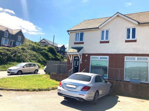 3 bedroom semi-detached house for sale in Pen Y Cei, Felin Y Mor Road, SY23 — £250,000 • 3 bed • 2 bath • 753 ft²
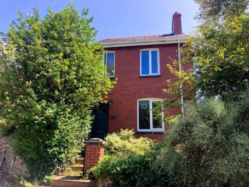 3 bedroom detached house for sale in Brynilar, Llanbadarn Fawr, SY23 — £320,000 • 3 bed • 1 bath • 990 ft²
Meta
- {
"@context": "https://schema.org",
"@type": "Residence",
"name": "3 bedroom semidetached house for sale in Heol Y Wern, Penpa…",
"description": "",
"url": "https://propertypiper.co.uk/property/e3e10a7c-80ba-4de7-84a4-4a0f3c191369",
"image": "https://image-a.propertypiper.co.uk/2018a05c-cd45-473d-8237-6669372295b7-1024.jpeg",
"address": {
"@type": "PostalAddress",
"streetAddress": "8 Heol Y Wern, Penparcau",
"postalCode": "SY23 1TG",
"addressLocality": "Ceredigion",
"addressRegion": "Ceredigion",
"addressCountry": "Wales"
},
"geo": {
"@type": "GeoCoordinates",
"latitude": 52.40065902724079,
"longitude": -4.0734720203014785
},
"numberOfRooms": 3,
"numberOfBathroomsTotal": 1,
"floorSize": {
"@type": "QuantitativeValue",
"value": 893,
"unitCode": "FTK"
},
"offers": {
"@type": "Offer",
"price": 238000,
"priceCurrency": "GBP",
"availability": "https://schema.org/InStock"
},
"additionalProperty": [
{
"@type": "PropertyValue",
"name": "Feature",
"value": "post-war"
},
{
"@type": "PropertyValue",
"name": "Feature",
"value": "brick facade"
},
{
"@type": "PropertyValue",
"name": "Feature",
"value": "semi-detached"
},
{
"@type": "PropertyValue",
"name": "Feature",
"value": "two-story"
},
{
"@type": "PropertyValue",
"name": "Feature",
"value": "residential"
},
{
"@type": "PropertyValue",
"name": "Feature",
"value": "traditional design"
},
{
"@type": "PropertyValue",
"name": "Feature",
"value": "Mid-century style"
},
{
"@type": "PropertyValue",
"name": "Feature",
"value": "stone fireplace"
},
{
"@type": "PropertyValue",
"name": "Feature",
"value": "wooden furniture"
},
{
"@type": "PropertyValue",
"name": "Feature",
"value": "French doors"
},
{
"@type": "PropertyValue",
"name": "Feature",
"value": "frosted glass"
},
{
"@type": "PropertyValue",
"name": "Feature",
"value": "living room"
},
{
"@type": "PropertyValue",
"name": "Feature",
"value": "dated decor"
},
{
"@type": "PropertyValue",
"name": "Feature",
"value": "renovation potential"
}
]
}
High Res Floorplan Images
Compatible Floorplan Images
FloorplanImages Thumbnail