TN37 7NE - 4 bedroom detached house for sale in Westfield Lane, St. Le…
View on Property Piper
4 bedroom detached house for sale in Westfield Lane, St. Leonards-On-Sea, TN37
Property Details
- Price: £700000
- Bedrooms: 4
- Bathrooms: 3
- Property Type: undefined
- Property SubType: undefined
Brochure Descriptions
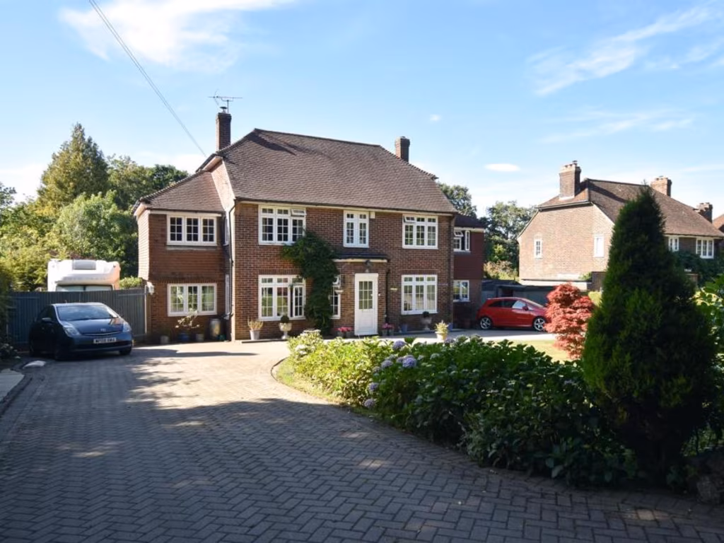
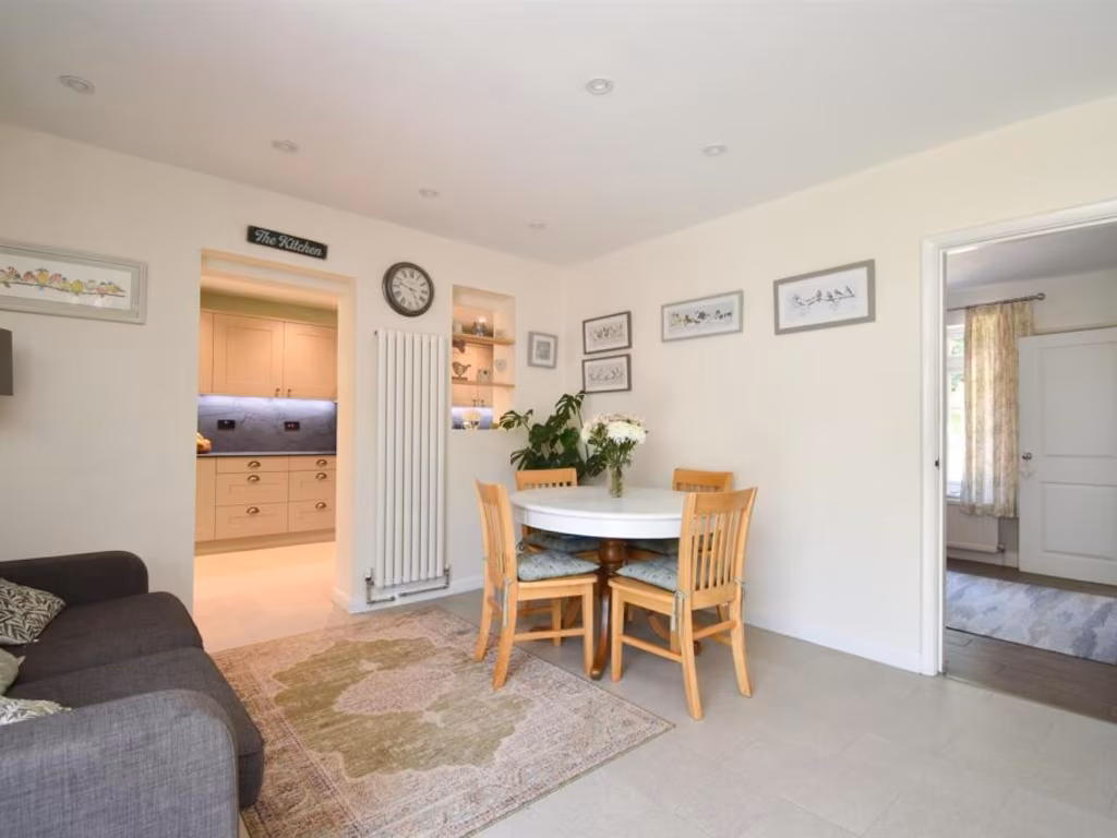
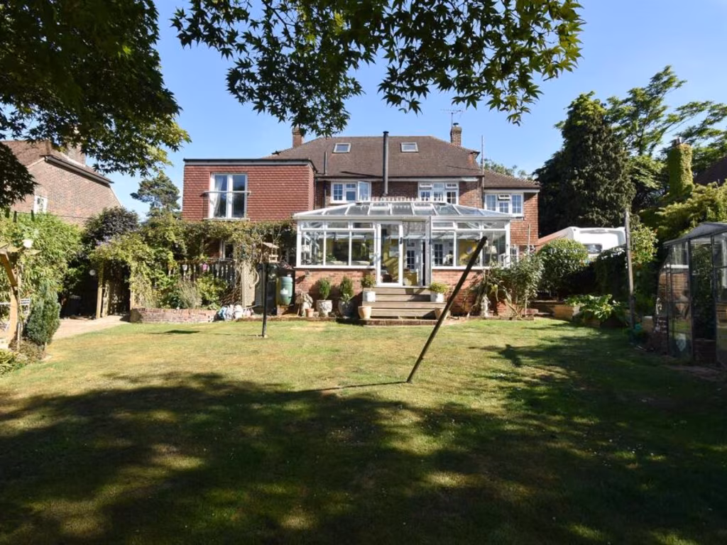
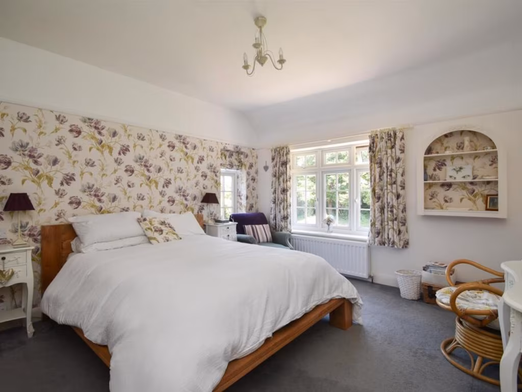
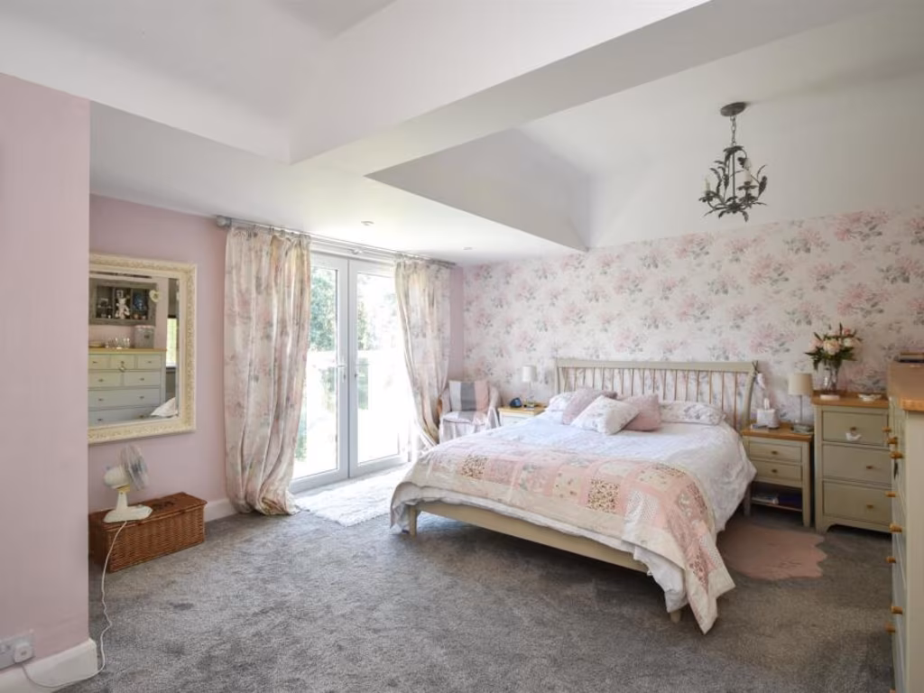
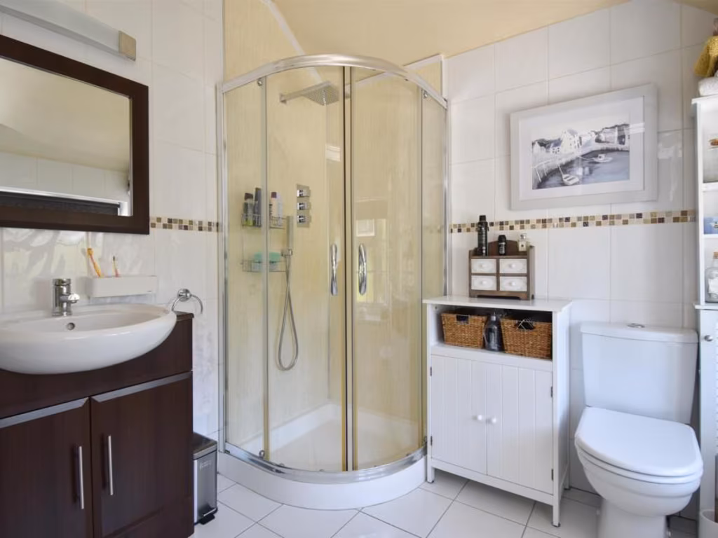
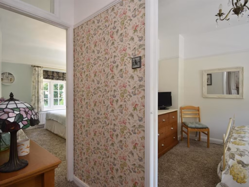
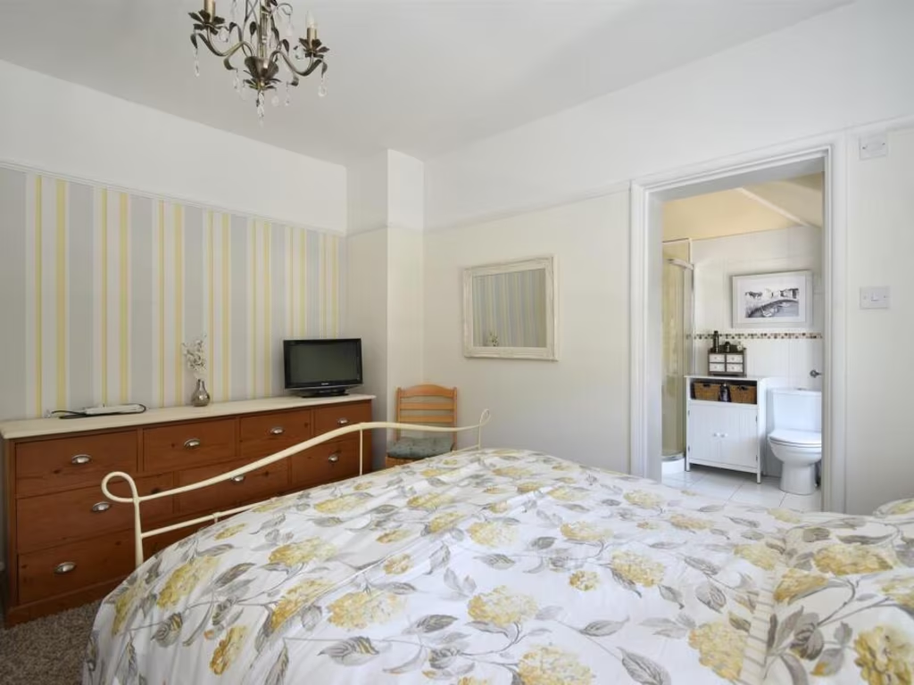
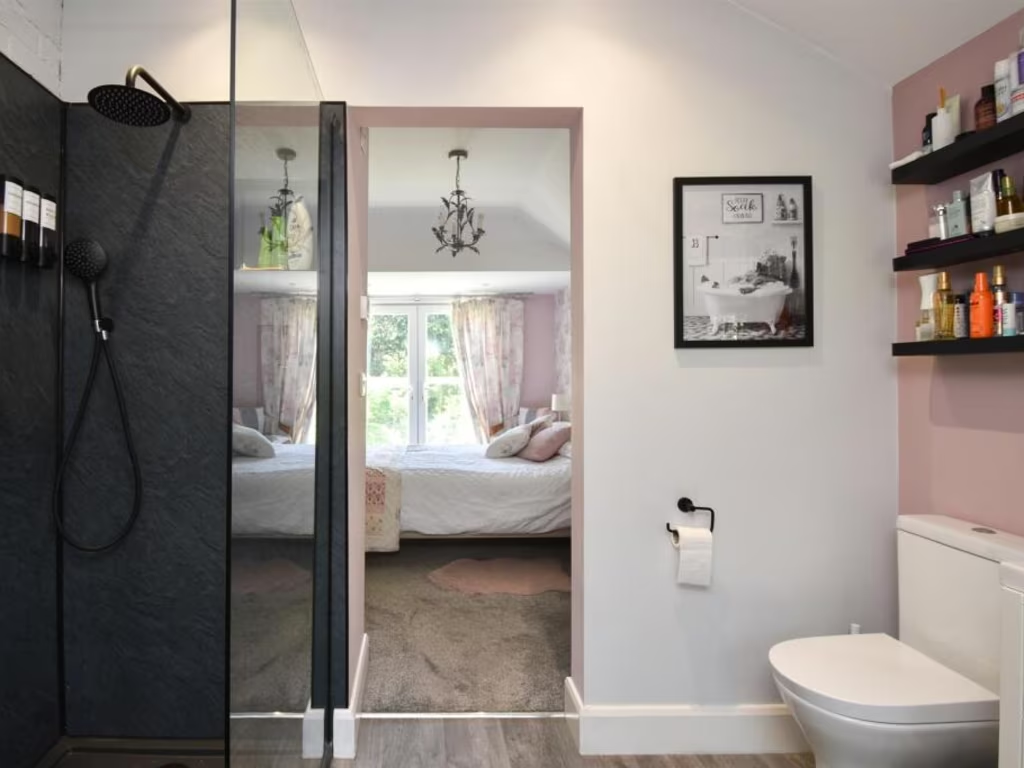
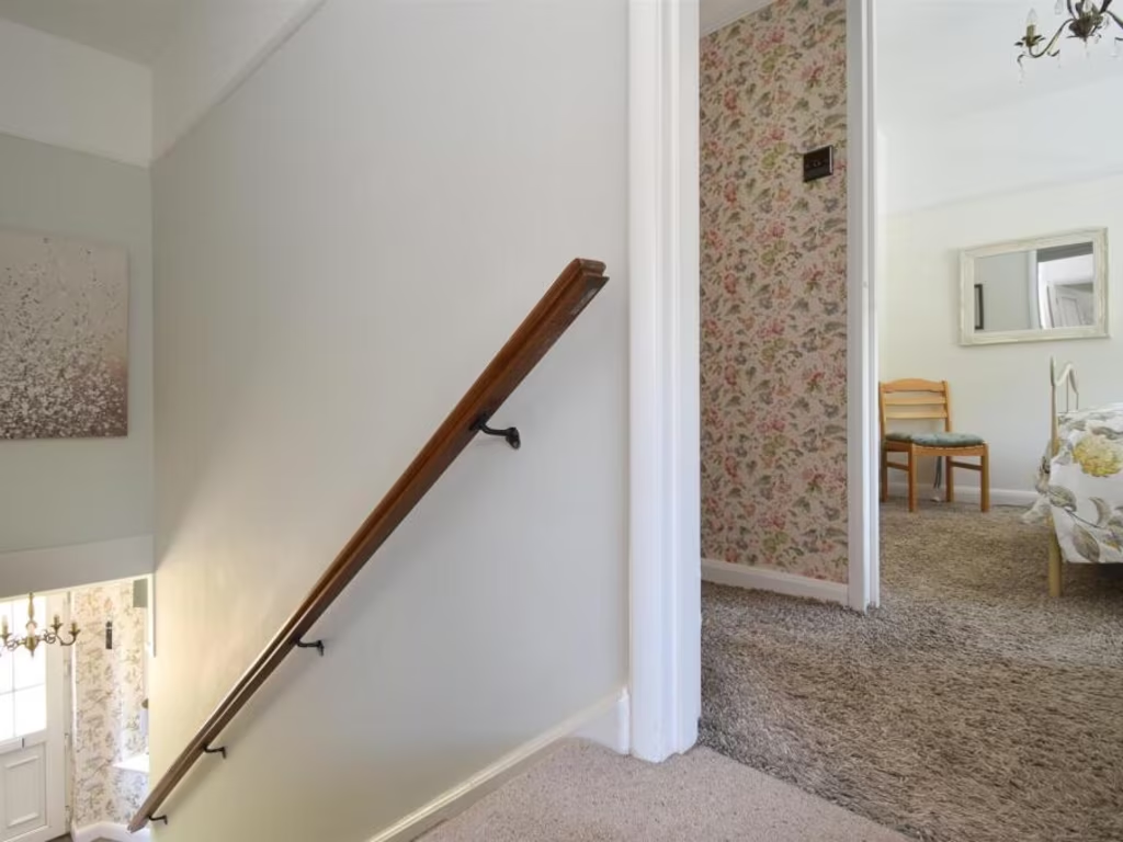
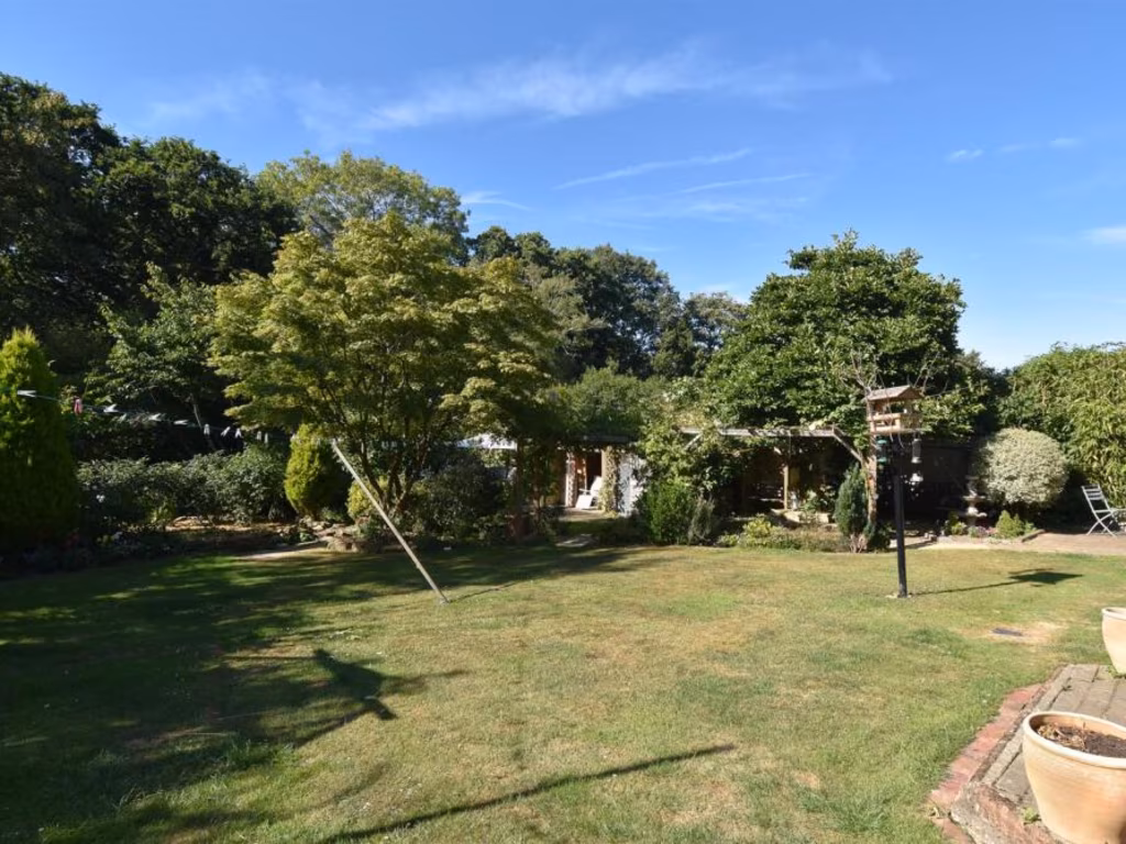
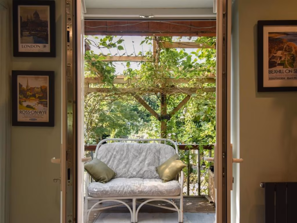
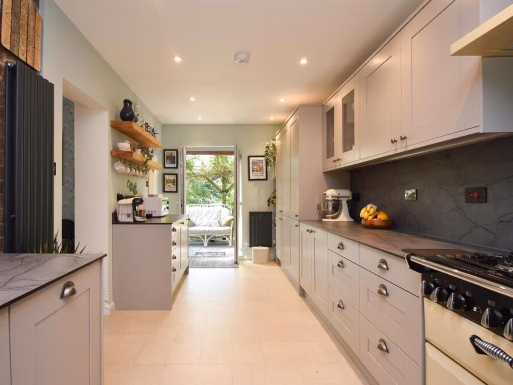
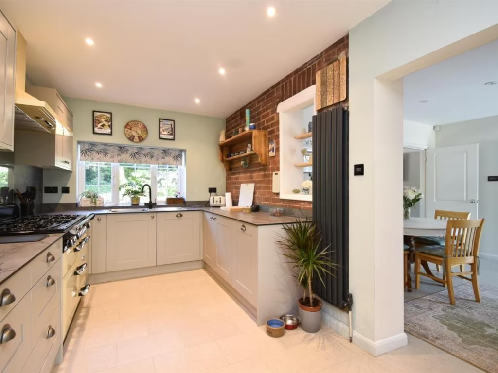
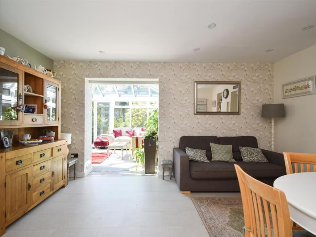
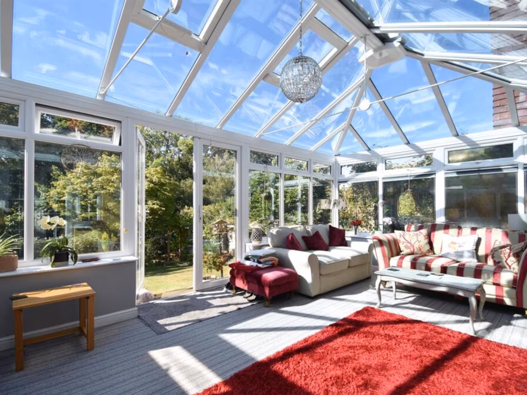
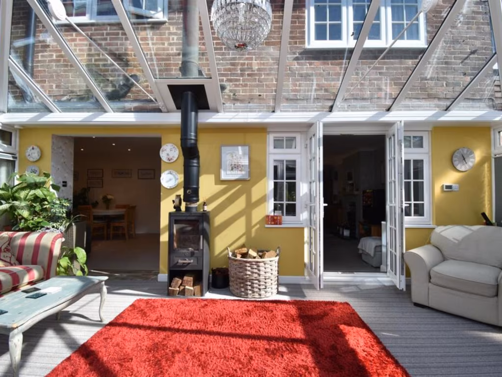
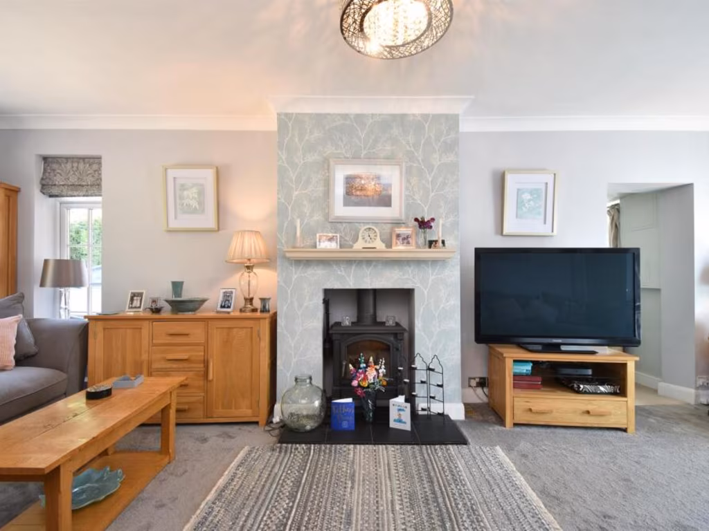
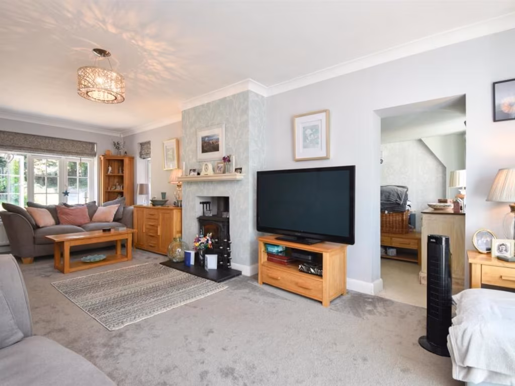
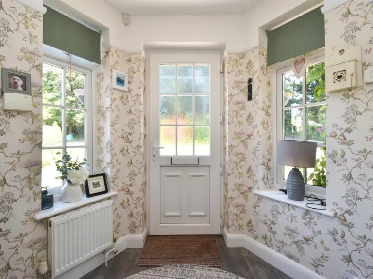
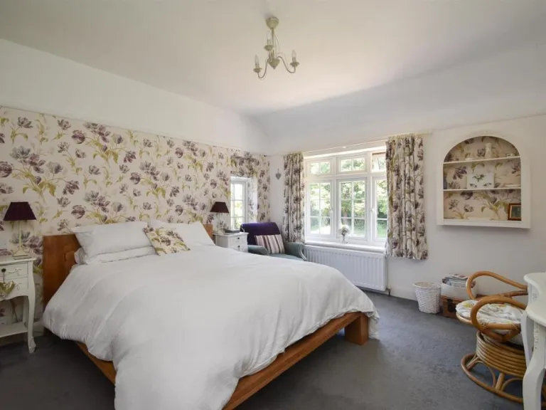
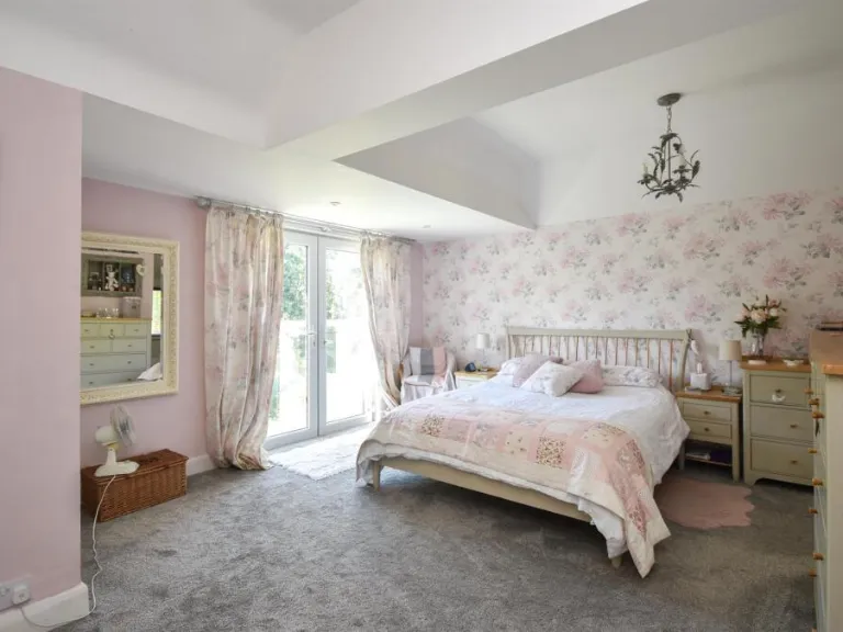
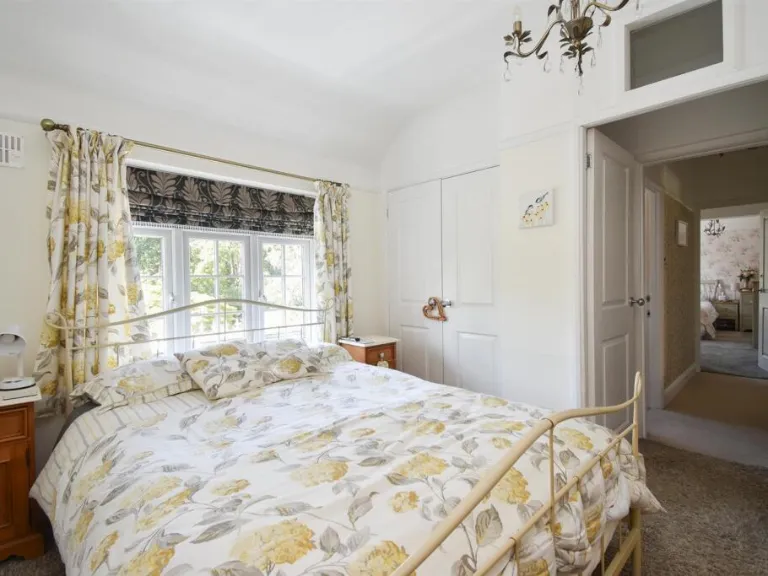
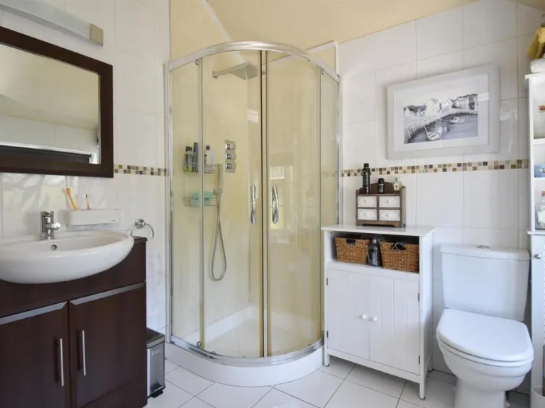
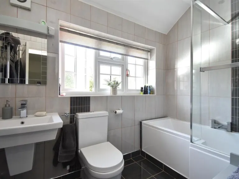
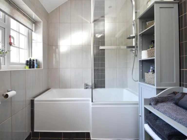
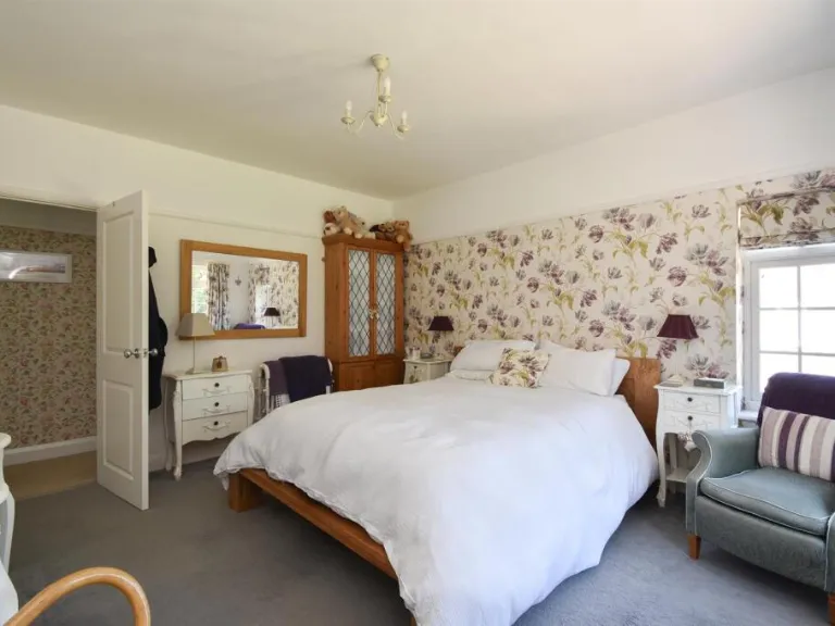
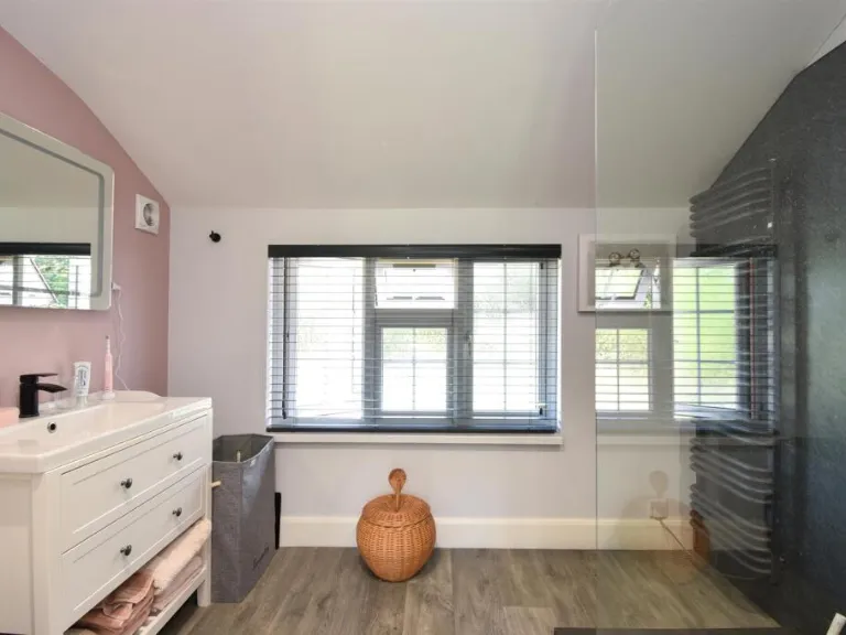
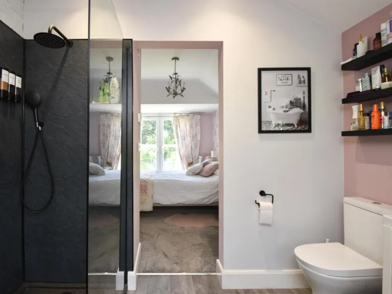
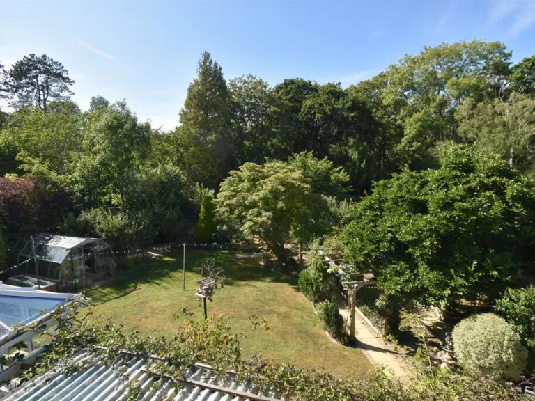
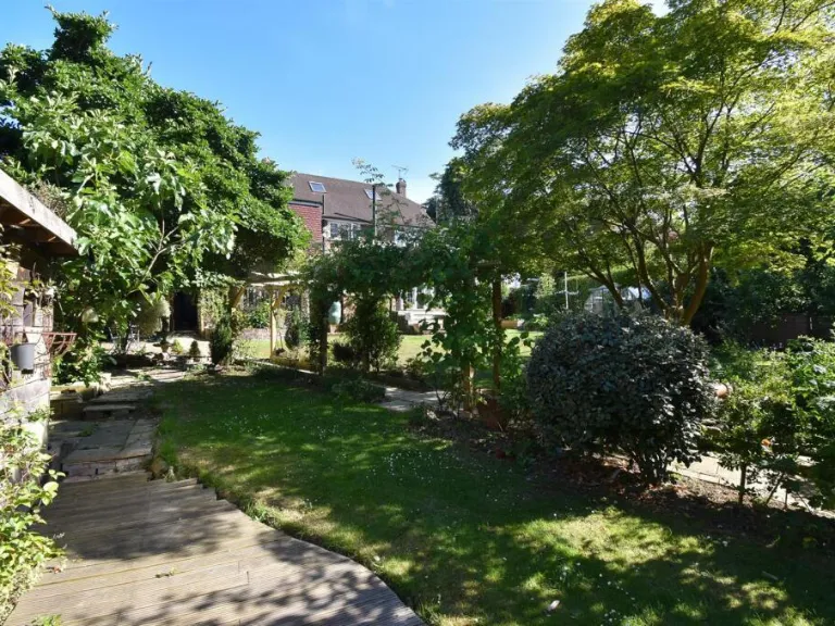
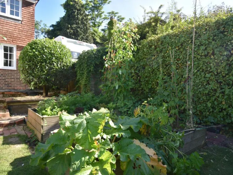
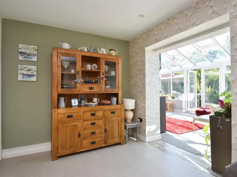
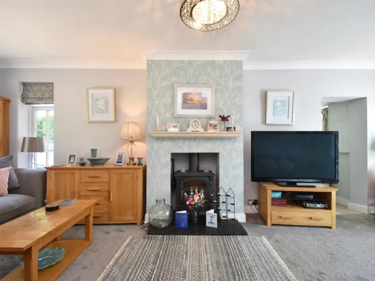
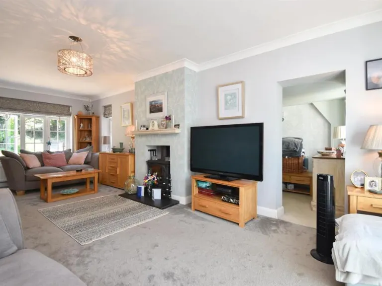
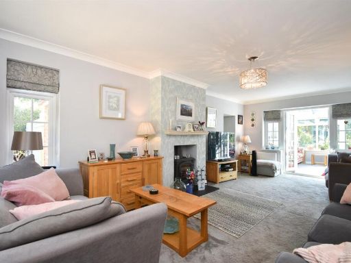
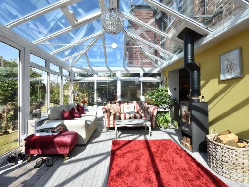
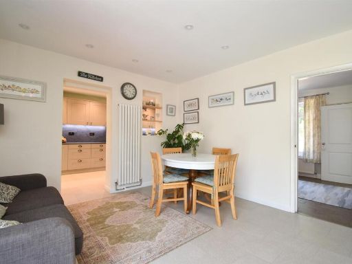
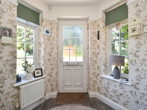
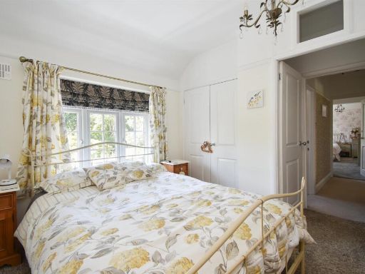
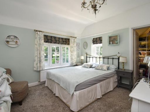
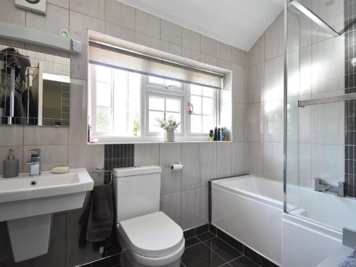
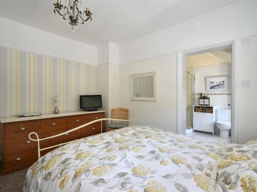
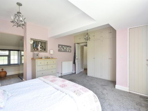
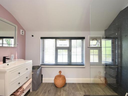
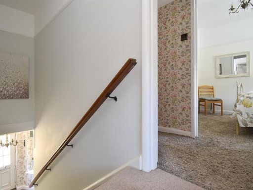
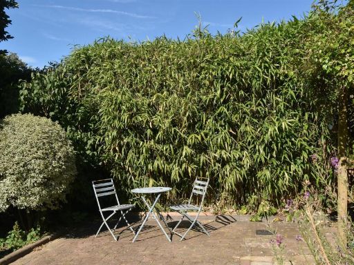
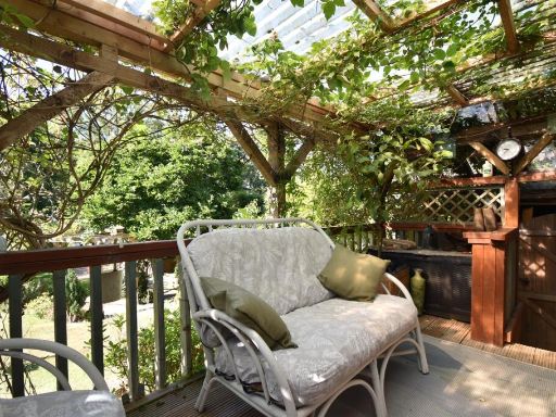
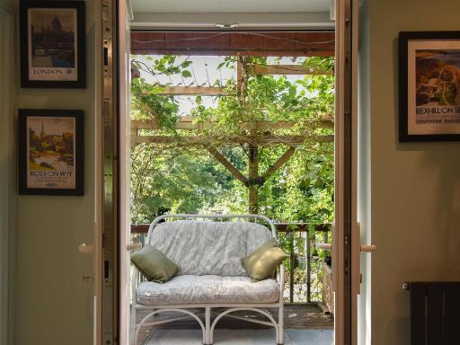
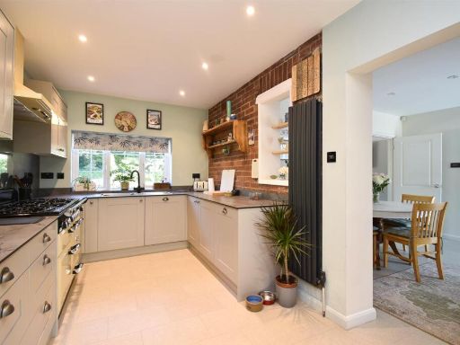
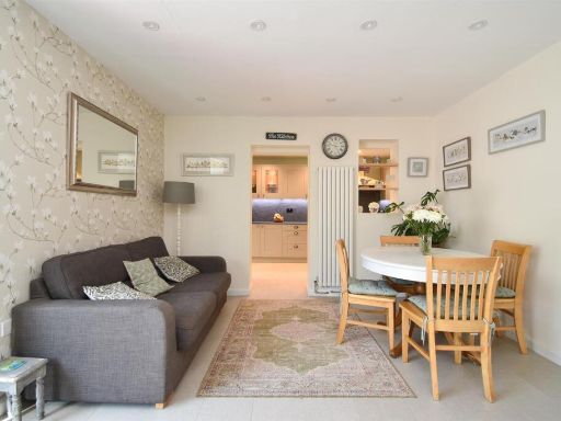
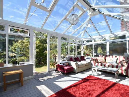
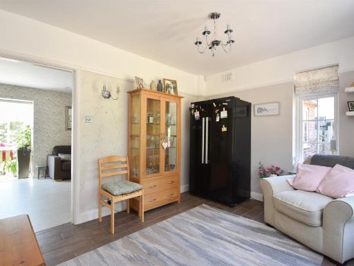
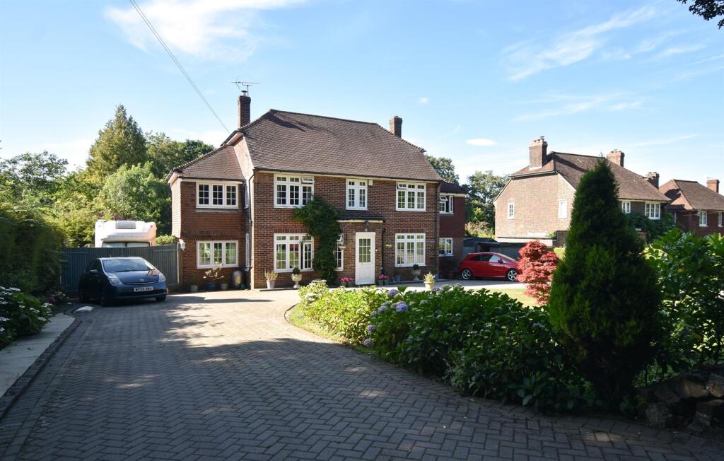
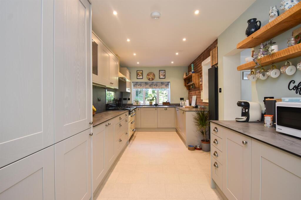
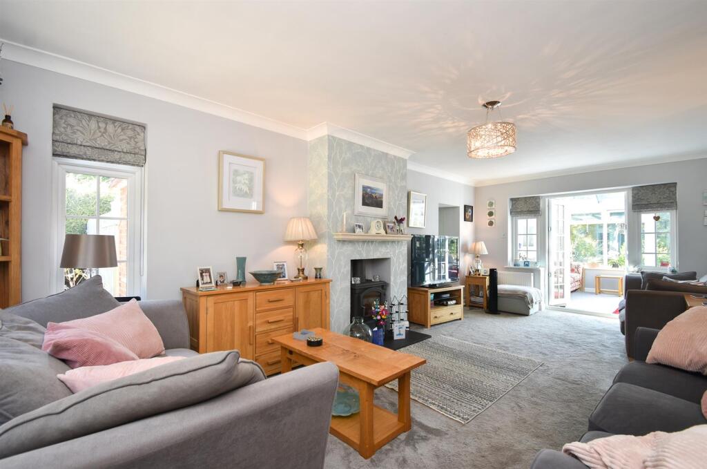
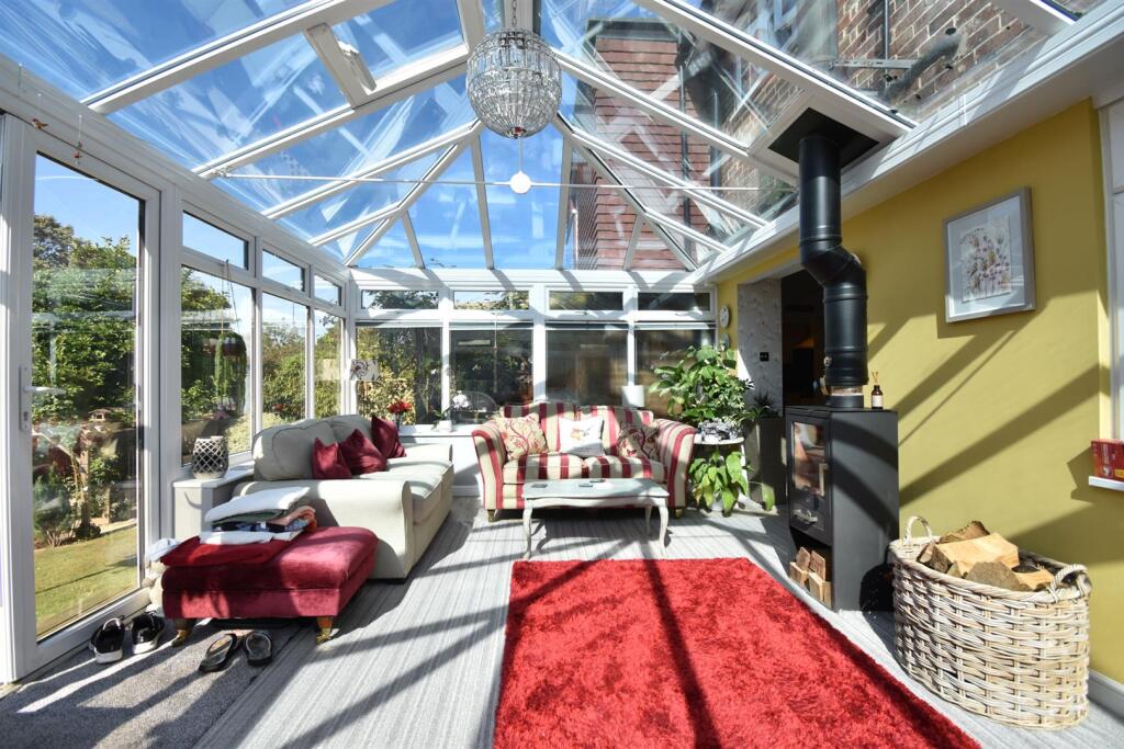
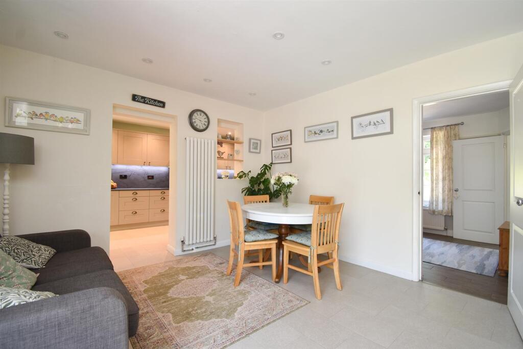
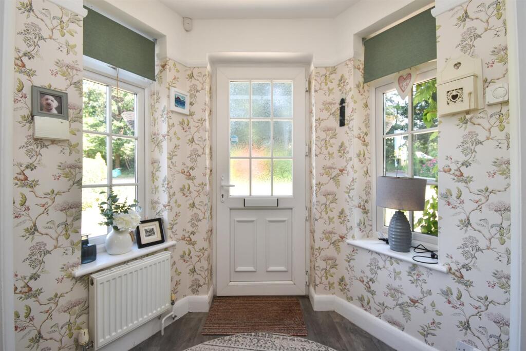
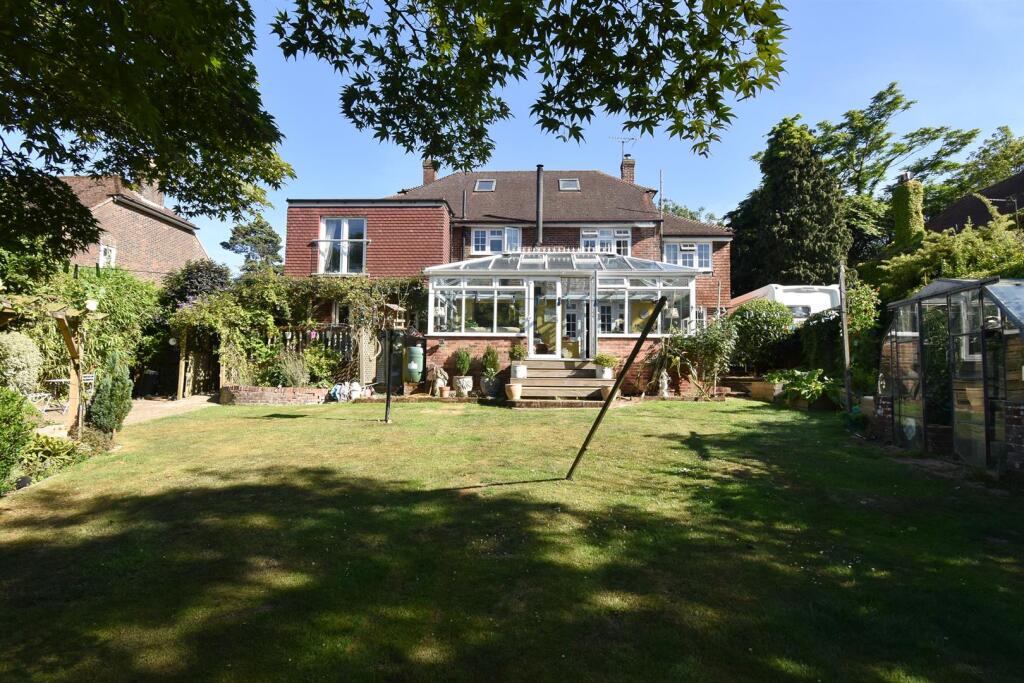
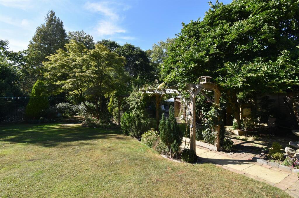
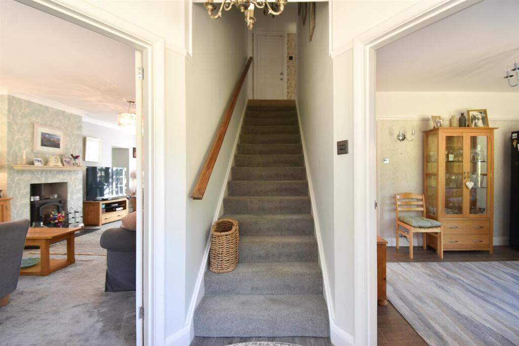
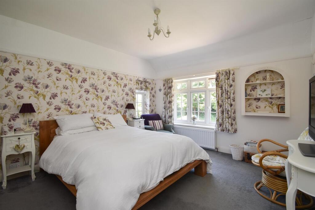
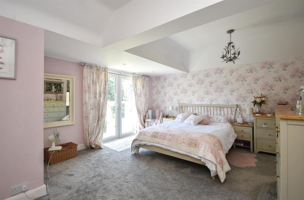
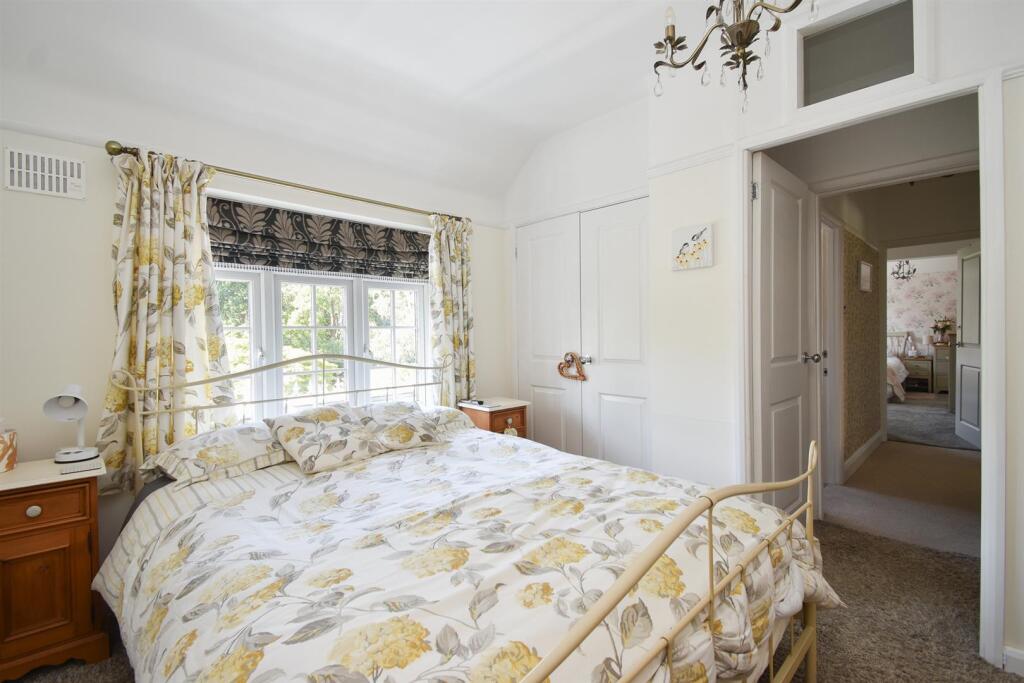
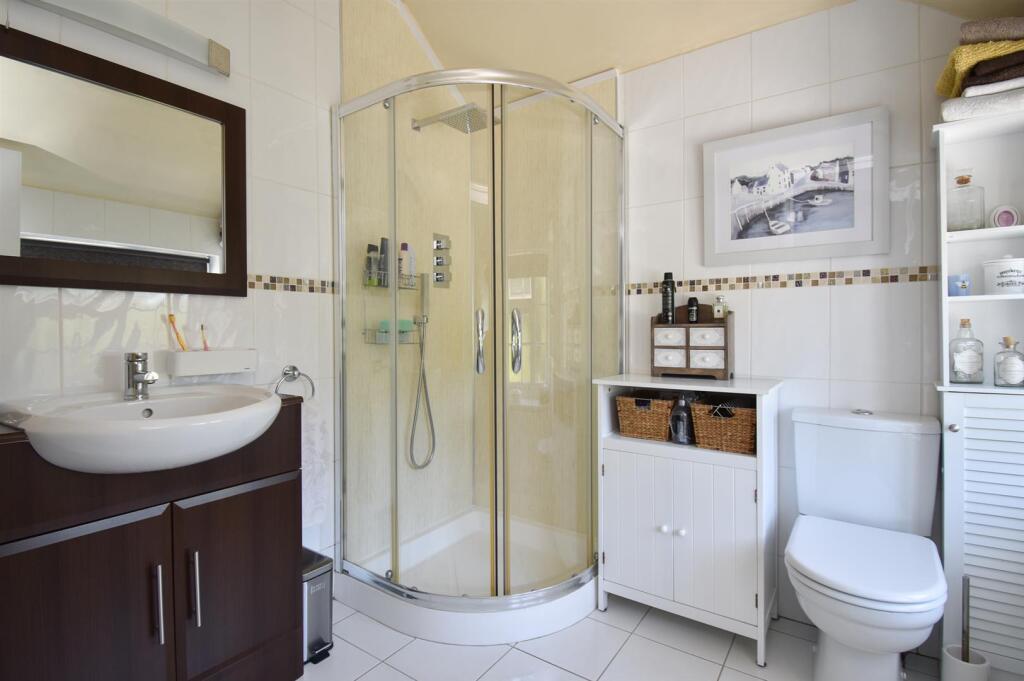
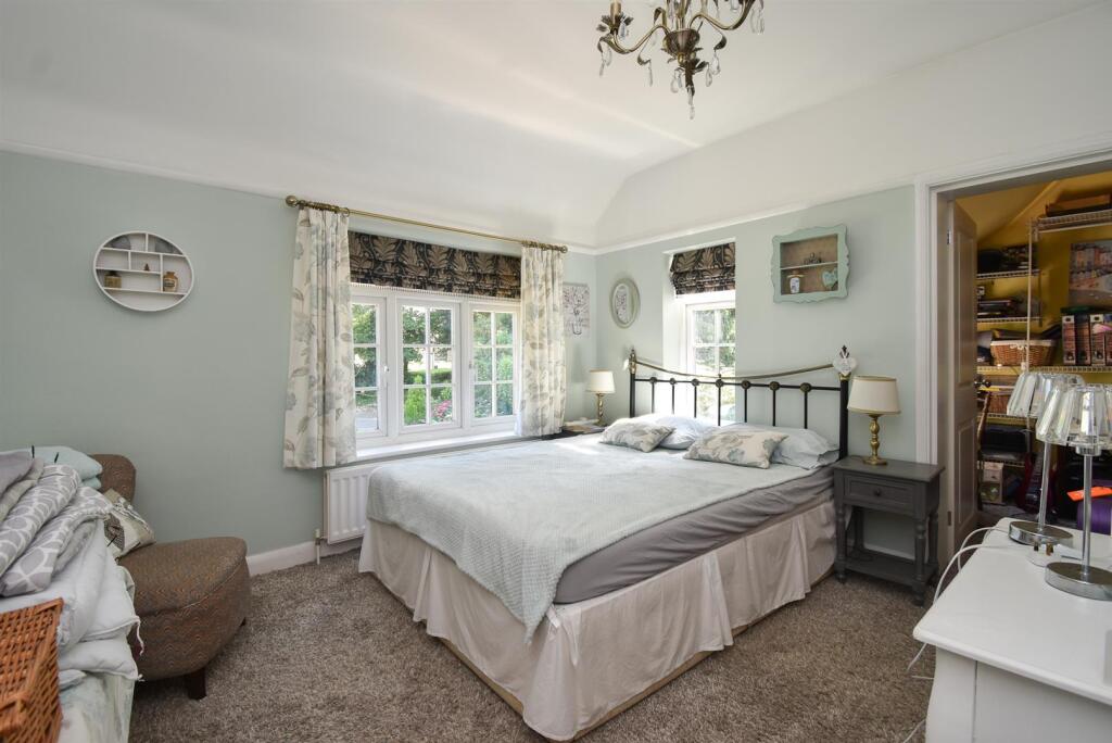
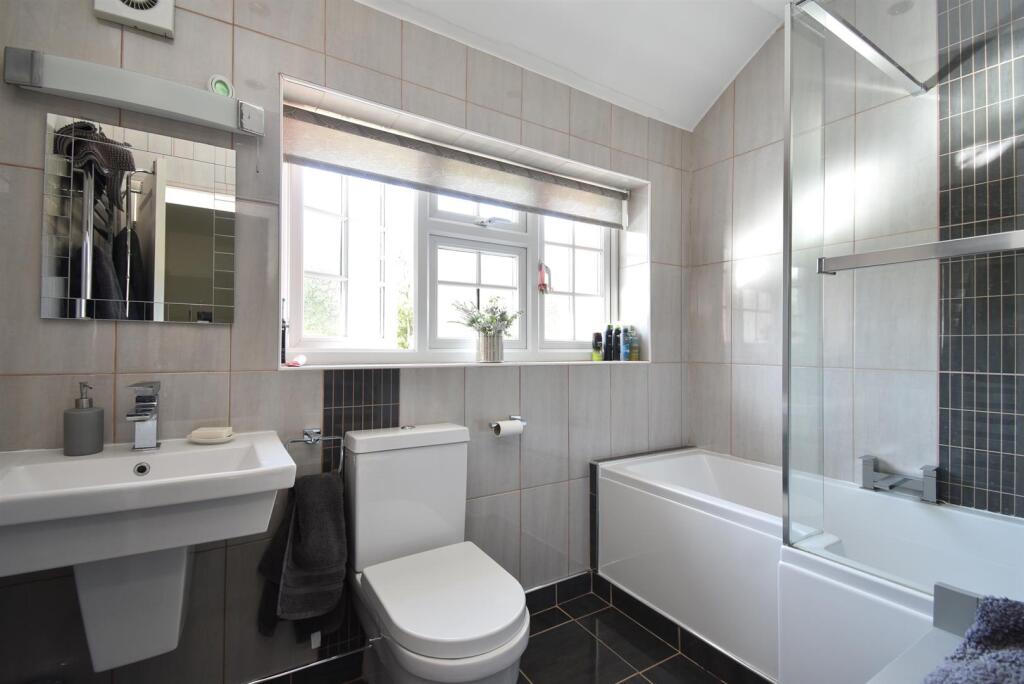
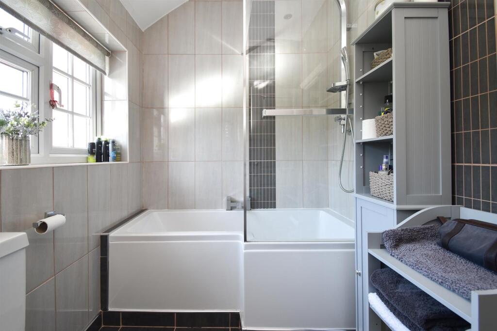
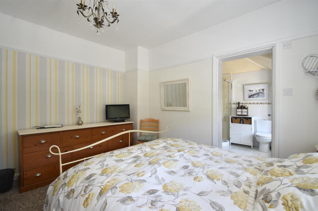
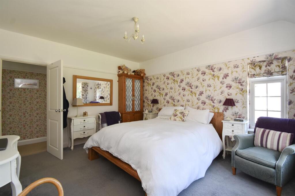
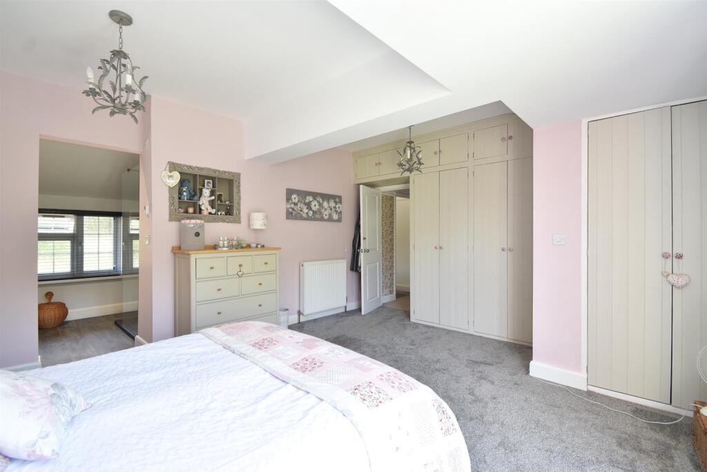
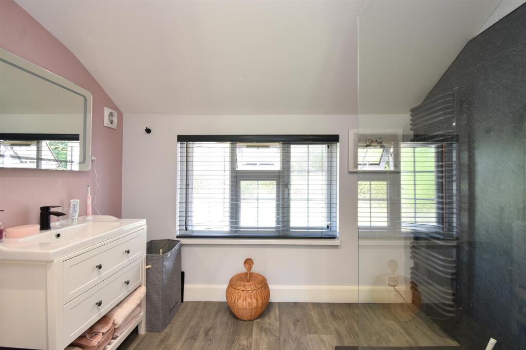
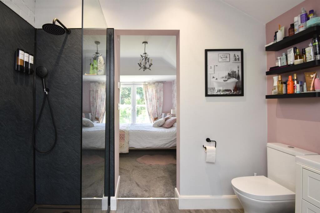
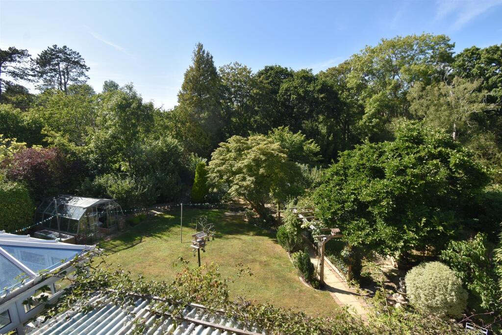
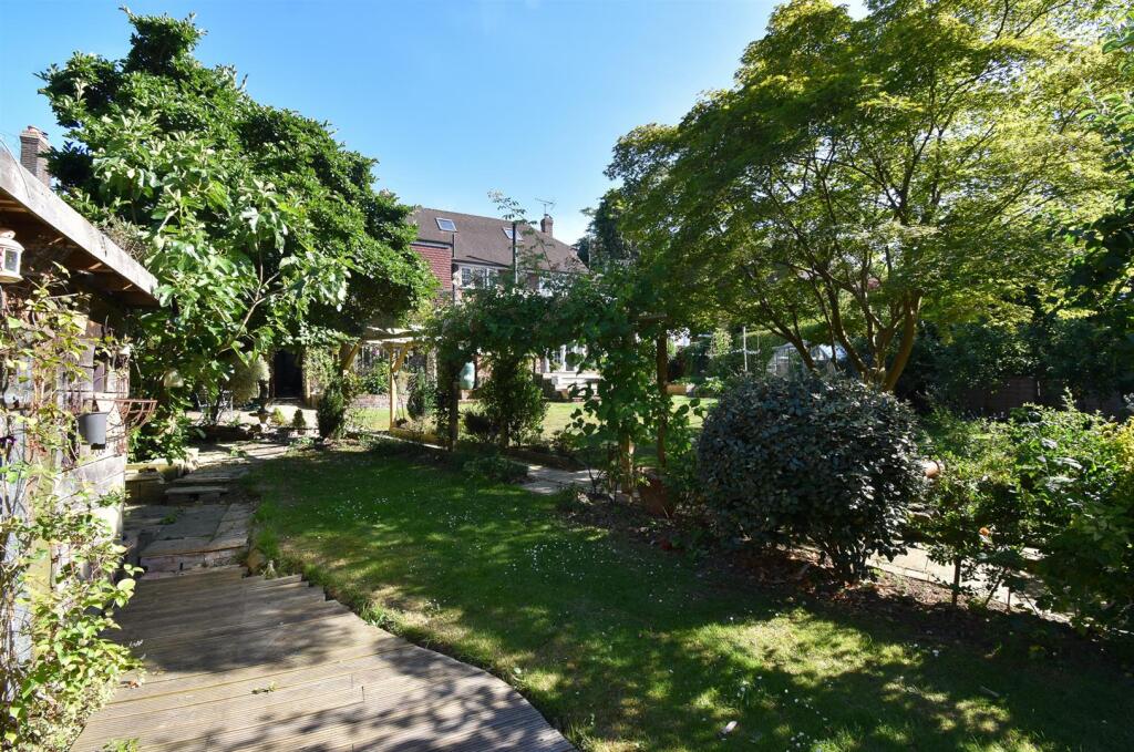
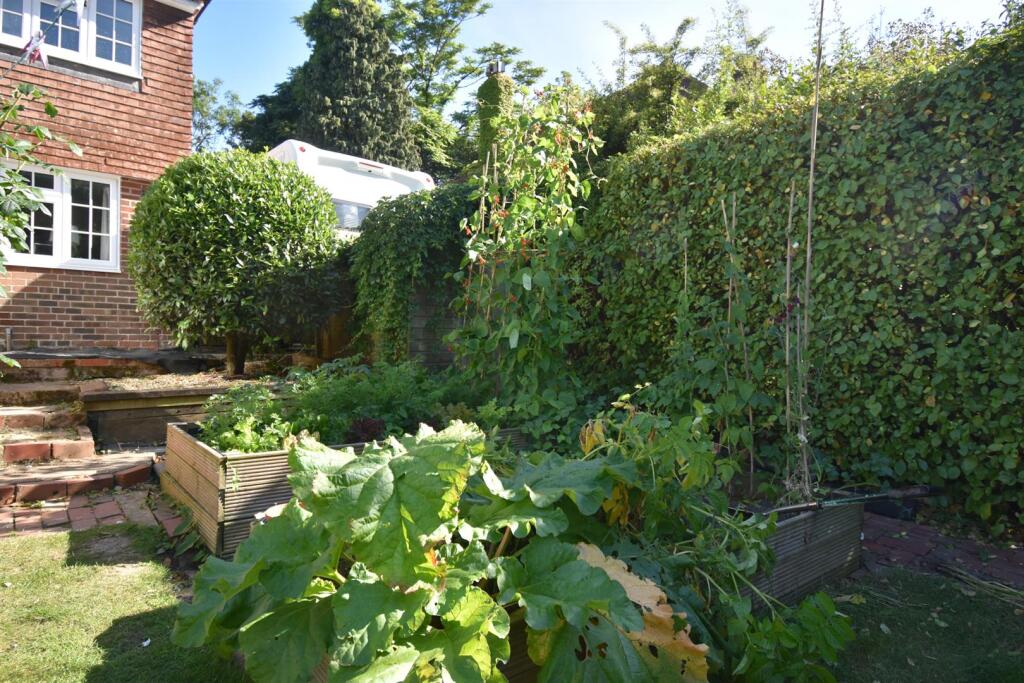
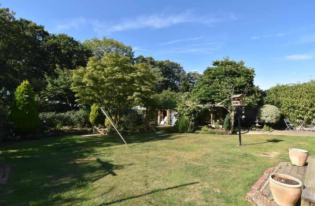
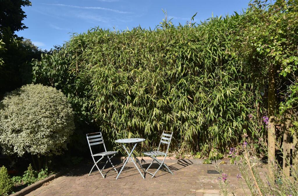
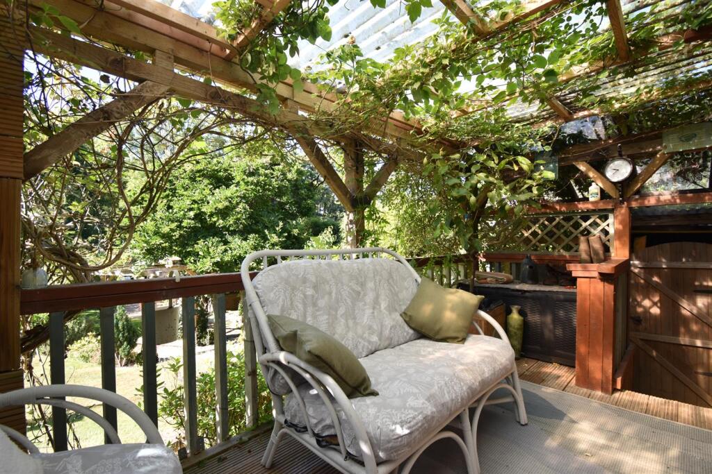
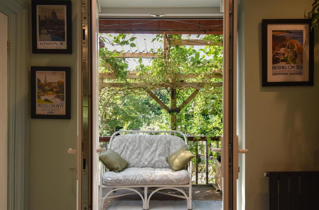
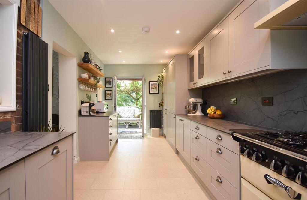
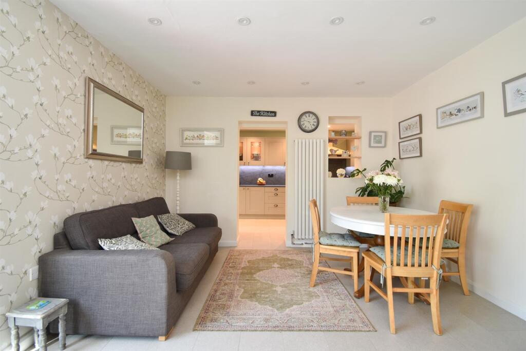
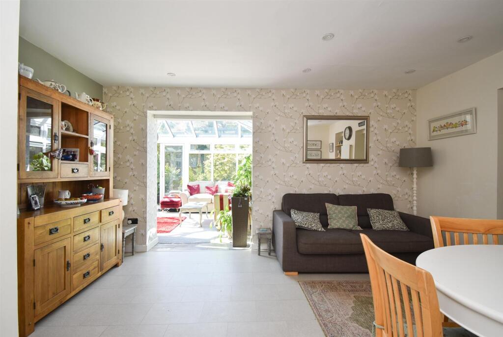
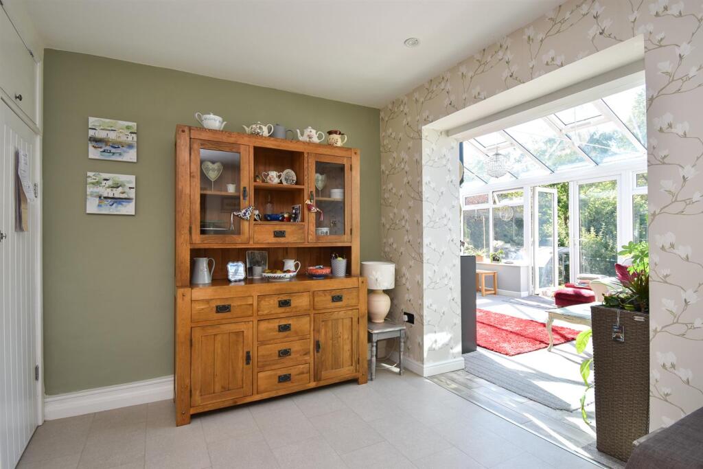
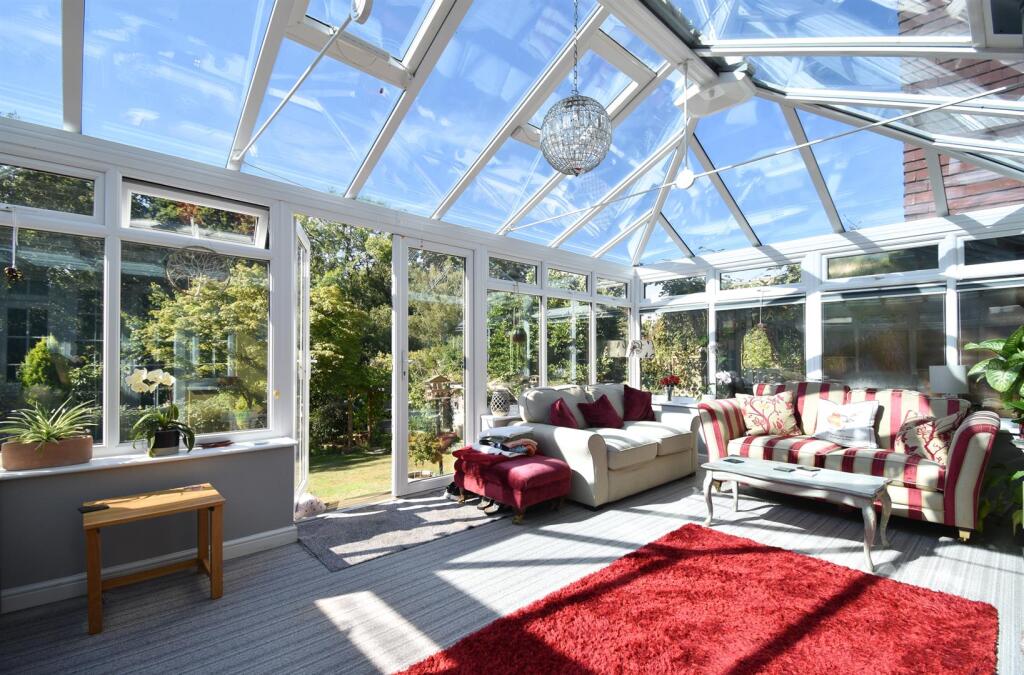
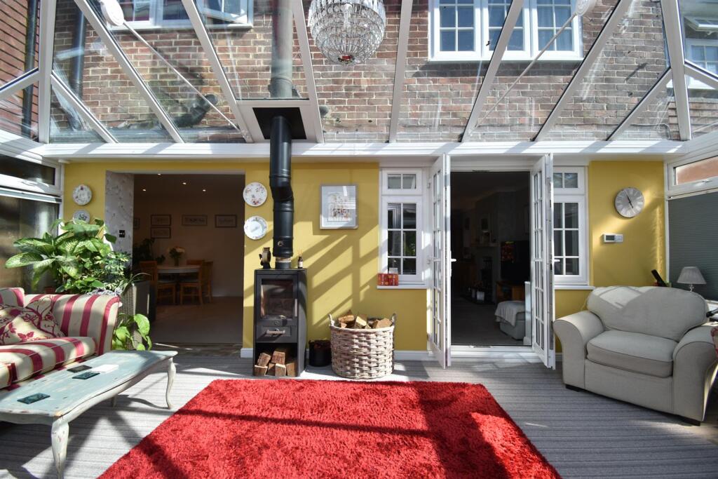
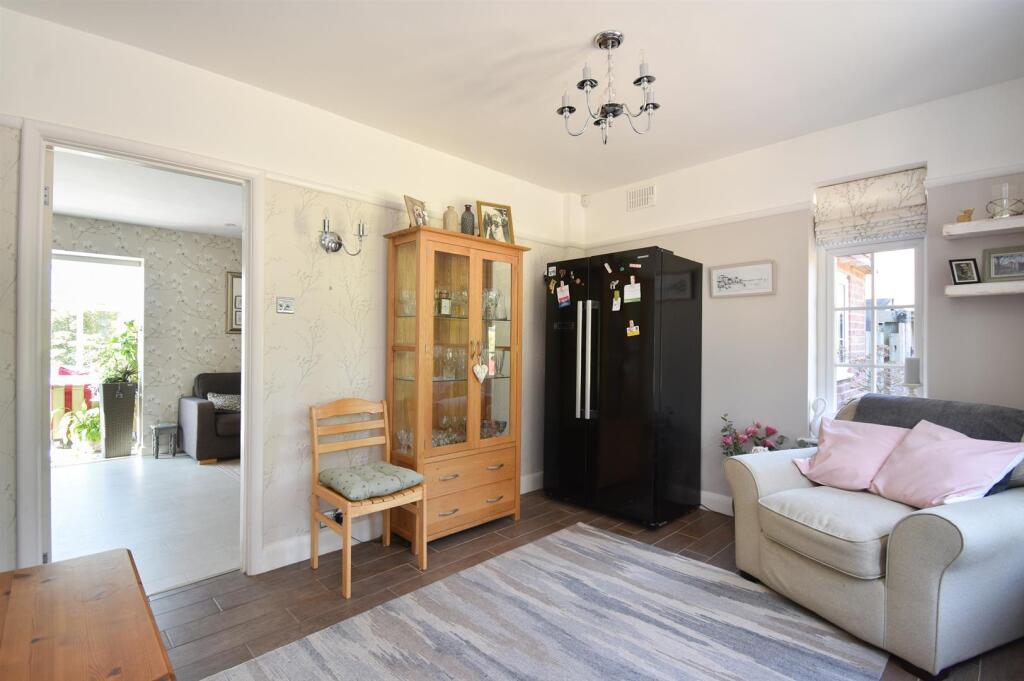
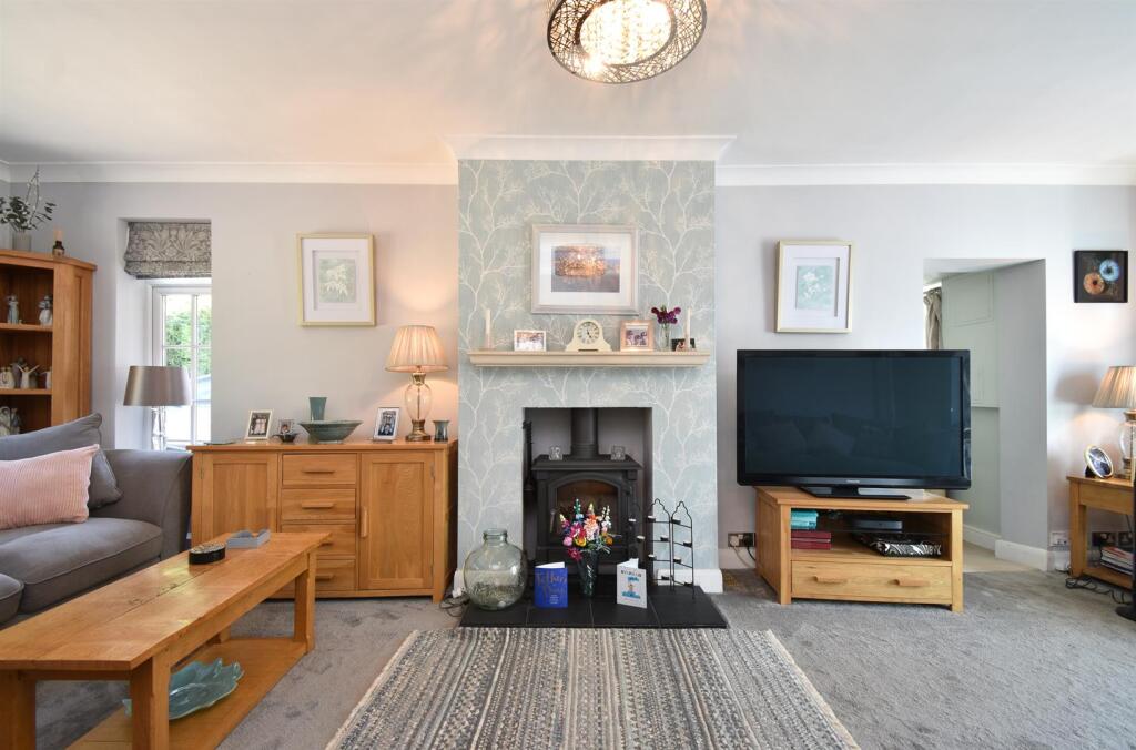
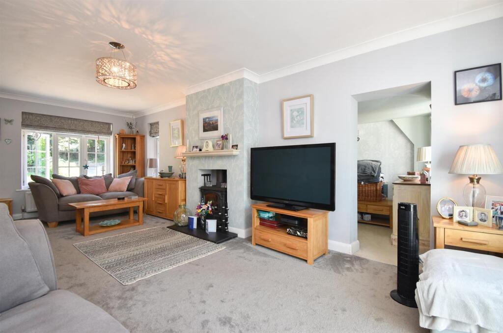
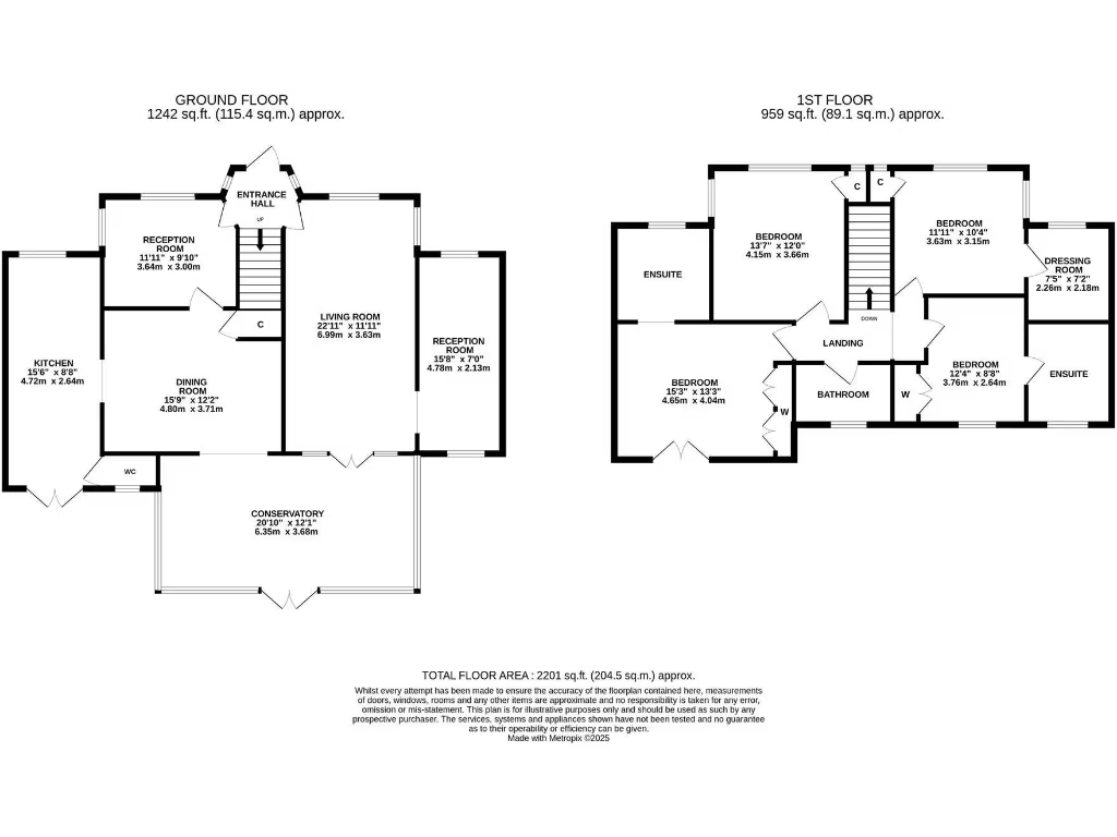
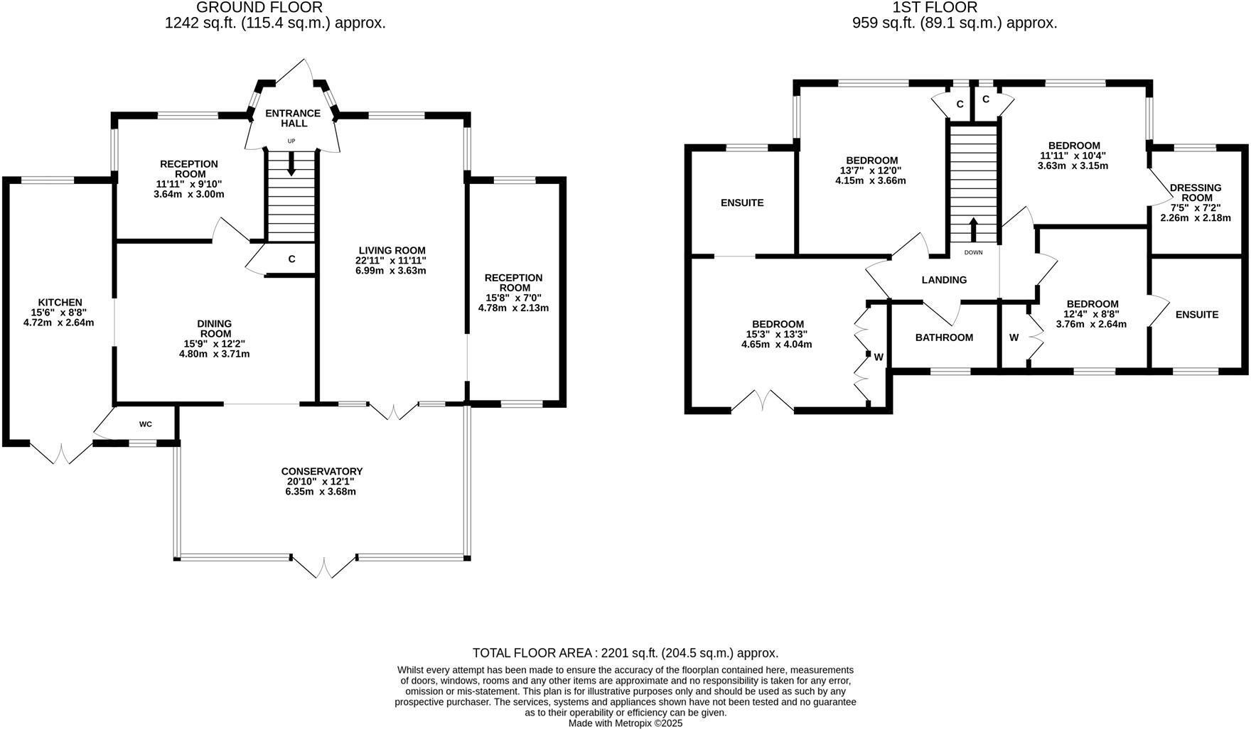
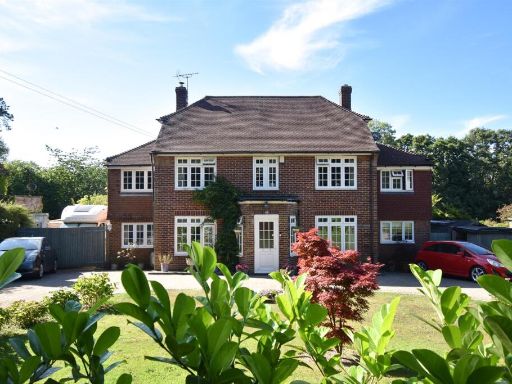
- Detached, double‑fronted family house set well back from the road with a large in/out paved driveway and mature, leafy front and side gardens. Substantial footprint with five reception rooms including a large conservatory/sunroom, a well‑fitted kitchen, three bathrooms and four double bedrooms — versatile layout that will suit multi‑generational living or home office use. The plot is generous for the area with extensive private gardens and mature planting providing good screening and privacy; overall the property reads as a large family home in a sought‑after, leafy residential location. Views are private/garden-facing rather than panoramic or coastal. Overall size: large family house (exact square footage not shown).
Image Descriptions
- detached house 1930s traditional
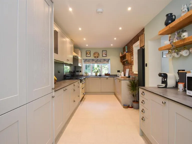
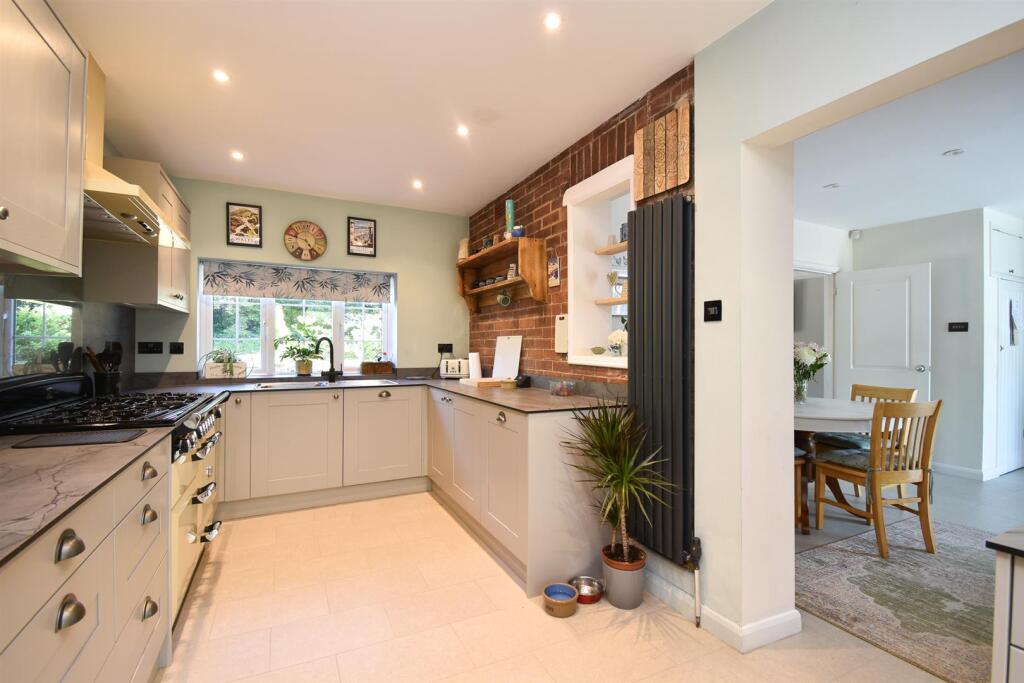
- kitchen modern
Rooms
- RECEPTION ROOM:
- KITCHEN:
- DINING ROOM:
- LIVING ROOM:
- RECEPTION ROOM:
- CONSERVATORY:
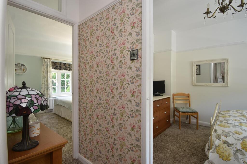
- BEDROOM:
- BEDROOM:
- BEDROOM:
- DRESSING ROOM:
- BEDROOM:
Textual Property Features
Detected Visual Features
- detached house
- 1930s
- traditional style
- brick exterior
- driveway
- garden
- English rural setting
- modern kitchen
- neutral colors
- built-in appliances
- spot lighting
- wood accents
- tile flooring
EPC Details
- Fully double glazed
- Cavity wall, filled cavity
- Boiler and radiators, mains gas
- Low energy lighting in 89% of fixed outlets
- Suspended, no insulation (assumed)
Nearby Schools
- St Leonards Church of England Primary Academy
- Christ Church CofE Primary and Nursery Academy
- St Paul's Church of England Academy
- The Baird Primary Academy
- Sandown Primary School and Nursery
- Westfield School
- Sedlescombe Church of England Primary School
- The St Leonards Academy
- West St Leonards Primary Academy
- All Saints CofE Junior Academy
- Hollington Primary School
- Crowhurst CofE Primary School
- St Mary Star of the Sea Catholic Primary School
- Dudley Infant Academy
- Ark Blacklands Primary Academy
- Silverdale Primary Academy
- Churchwood Primary Academy
- Ore Village Primary Academy
- Ark Alexandra Academy
- Claremont School
- Ark Castledown Primary Academy
- Sacred Heart Catholic Primary School, Hastings
- Robsack Wood Primary Academy
- The Hastings Academy
- Ark Little Ridge Primary Academy
Nearest General Shops
- Id: 28612740
- Tags:
- Addr:
- Building: yes
- Name: Ridge West Garage
- Shop: car_repair
- TagsNormalized:
- garage
- car repair
- repair
- shop
- Lat: 50.890194
- Lon: 0.5528153
- FullGeoHash: u103s868ce8z
- PartitionGeoHash: u103
- Images:
- FoodStandards: null
- Distance: 432.9
,- Id: 8483436818
- Tags:
- Addr:
- City: St Leonards-on-Sea
- Housenumber: 599
- Street: Sedlescombe Road North
- Brand: Dunelm
- Brand:wikidata: Q5315020
- Brand:wikipedia: en:Dunelm Group
- Contact:
- Website: https://www.dunelm.com/stores/hastings
- Name: Dunelm
- Shop: furniture
- TagsNormalized:
- Lat: 50.889303
- Lon: 0.554947
- FullGeoHash: u103s8h5ejwk
- PartitionGeoHash: u103
- Images:
- FoodStandards: null
- Distance: 431.2
,- Id: 28612727
- Tags:
- Addr:
- Brand: Booker Wholesale
- Brand:wikidata: Q4943180
- Brand:wikipedia: en:Booker Group
- Building: yes
- Name: Booker Wholesale
- Shop: wholesale
- TagsNormalized:
- Lat: 50.8901259
- Lon: 0.5533778
- FullGeoHash: u103s86bqxh3
- PartitionGeoHash: u103
- Images:
- FoodStandards: null
- Distance: 411.1
}
Nearest Grocery shops
- Id: 1964990351
- Tags:
- Brand: McColl's
- Brand:wikidata: Q16997477
- Brand:wikipedia: en:McColl's
- Name: McColl's
- Shop: convenience
- TagsNormalized:
- Lat: 50.8680268
- Lon: 0.5560063
- FullGeoHash: u103kshzezkr
- PartitionGeoHash: u103
- Images:
- FoodStandards: null
- Distance: 2766.8
,- Id: 912866402
- Tags:
- Addr:
- City: St Leonards-on-Sea
- Street: Sedlescombe Road North
- Brand: Londis
- Brand:wikidata: Q21008564
- Brand:wikipedia: en:Londis (United Kingdom)
- Building: yes
- Name: Londis
- Opening_hours: 24/7
- Shop: convenience
- TagsNormalized:
- Lat: 50.8688094
- Lon: 0.555984
- FullGeoHash: u103ksku737e
- PartitionGeoHash: u103
- Images:
- FoodStandards: null
- Distance: 2679.9
,- Id: 1692420850
- Tags:
- Brand: Tesco Express
- Brand:wikidata: Q98456772
- Brand:wikipedia: en:Tesco
- Contact:
- Website: https://www.tesco.com/store-locator/hastings/little-ridge-ave
- Name: Tesco Express
- Shop: convenience
- TagsNormalized:
- tesco
- tesco express
- convenience
- shop
- Lat: 50.8827422
- Lon: 0.5621963
- FullGeoHash: u103kycmkneu
- PartitionGeoHash: u103
- Images:
- FoodStandards: null
- Distance: 1181.1
}
Nearest Religious buildings
- Id: 878675146
- Tags:
- Amenity: place_of_worship
- Building: church
- Denomination: anglican
- Name: St Peter & St Paul
- Religion: christian
- Source: OS_OpenData_StreetView
- Wikidata: Q105082479
- TagsNormalized:
- place of worship
- church
- anglican
- paul
- christian
- Lat: 50.8790654
- Lon: 0.5691302
- FullGeoHash: u103kyq2j9np
- PartitionGeoHash: u103
- Images:
- FoodStandards: null
- Distance: 1749
,- Id: 793518533
- Tags:
- Amenity: place_of_worship
- Building: church
- Denomination: roman_catholic
- Name: Holy Redeemer
- Religion: christian
- TagsNormalized:
- place of worship
- church
- catholic
- roman catholic
- christian
- Lat: 50.8782065
- Lon: 0.5539131
- FullGeoHash: u103kw57515e
- PartitionGeoHash: u103
- Images:
- FoodStandards: null
- Distance: 1650.2
,- Id: 793518534
- Tags:
- Amenity: place_of_worship
- Building: church
- Denomination: anglican
- Name: St John the Evangelist
- Religion: christian
- Wikidata: Q105082475
- TagsNormalized:
- place of worship
- church
- anglican
- evangelist
- christian
- Lat: 50.8788142
- Lon: 0.5513514
- FullGeoHash: u103kw1qx6mk
- PartitionGeoHash: u103
- Images:
- FoodStandards: null
- Distance: 1619.8
}
Nearest Medical buildings
- Id: 292738549
- Tags:
- Addr:
- City: Hastings
- Postcode: TN37 7RD
- Street: The Ridge
- Amenity: hospital
- Contact:
- Phone: +44 01424 755255
- Website: https://www.nhs.uk/Services/hospitals/Overview/DefaultView.aspx?id=RXC01
- Healthcare: hospital
- Name: Conquest Hospital
- Wikidata: Q5162425
- TagsNormalized:
- Lat: 50.885077
- Lon: 0.567871
- FullGeoHash: u103kzme03g7
- PartitionGeoHash: u103
- Images:
- FoodStandards: null
- Distance: 1144.7
,- Id: 676227380
- Tags:
- Addr:
- City: St. Leonards-on-Sea
- Postcode: TN38 8EZ
- Street: Battle Road
- Brand: Bannatyne Health Club
- Brand:wikidata: Q24993691
- Building: yes
- Leisure: fitness_centre
- Name: Bannatyne Health Club
- Phone: +44 1424 855110
- TagsNormalized:
- health
- club
- fitness
- fitness centre
- leisure
- Lat: 50.8928619
- Lon: 0.5417664
- FullGeoHash: u103s2f82j46
- PartitionGeoHash: u103
- Images:
- FoodStandards: null
- Distance: 1086.5
,- Id: 5825182160
- Tags:
- Amenity: pharmacy
- Brand: Lloyds Pharmacy
- Brand:wikidata: Q6662870
- Brand:wikipedia: en:LloydsPharmacy
- Healthcare: pharmacy
- Indoor: yes
- Name: Lloyds Pharmacy
- TagsNormalized:
- pharmacy
- lloyds pharmacy
- health
- healthcare
- Lat: 50.8881216
- Lon: 0.5501828
- FullGeoHash: u103kxbsu1qj
- PartitionGeoHash: u103
- Images:
- FoodStandards: null
- Distance: 726.7
,- Id: 9217088438
- Tags:
- Addr:
- City: Hastings
- Housenumber: 729
- Postcode: TN37 7PT
- Street: The Ridge
- Amenity: hospital
- Contact:
- Healthcare: hospital
- Name: Acute Mental Health Unit for Elderly
- TagsNormalized:
- hospital
- health
- healthcare
- unit
- Lat: 50.8882967
- Lon: 0.5615019
- FullGeoHash: u103kzbvgfn1
- PartitionGeoHash: u103
- Images:
- FoodStandards: null
- Distance: 591.9
}
Nearest Leisure Facilities
- Id: 942670552
- Tags:
- Leisure: pitch
- Sport: tennis
- TagsNormalized:
- Lat: 50.8871812
- Lon: 0.5669534
- FullGeoHash: u103kzsz6fp5
- PartitionGeoHash: u103
- Images:
- FoodStandards: null
- Distance: 930.9
,- Id: 913244455
- Tags:
- Addr:
- Building: yes
- Leisure: fitness_centre
- Name: Helenswood Sports Centre
- Sport: gymnastics;fitness
- TagsNormalized:
- fitness
- fitness centre
- leisure
- sports
- sports centre
- gymnastics
- Lat: 50.8881035
- Lon: 0.5679539
- FullGeoHash: u103kzvsdq11
- PartitionGeoHash: u103
- Images:
- FoodStandards: null
- Distance: 920.4
,- Id: 185829612
- Tags:
- TagsNormalized:
- Lat: 50.8988787
- Lon: 0.5569556
- FullGeoHash: u103s9ve6n8n
- PartitionGeoHash: u103
- Images:
- FoodStandards: null
- Distance: 665.5
,- Id: 185829278
- Tags:
- Leisure: swimming_pool
- Sport: swimming
- TagsNormalized:
- swimming
- swimming pool
- pool
- leisure
- sports
- Lat: 50.8981199
- Lon: 0.5561225
- FullGeoHash: u103s9szn94z
- PartitionGeoHash: u103
- Images:
- FoodStandards: null
- Distance: 586.2
,- Id: 185829306
- Tags:
- TagsNormalized:
- Lat: 50.8978834
- Lon: 0.556206
- FullGeoHash: u103s9tj8t1k
- PartitionGeoHash: u103
- Images:
- FoodStandards: null
- Distance: 559.4
}
Nearest Tourist attractions
- Id: 30830297
- Tags:
- Addr:
- City: Hastings
- Postcode: TN35 4NP
- Street: Ivyhouse Lane
- Capacity: 550
- Internet_access: wlan
- Internet_access:fee: yes
- Name: Coghurst Hall
- Tourism: caravan_site
- TagsNormalized:
- Lat: 50.8937562
- Lon: 0.6013896
- FullGeoHash: u103t8vvt7u9
- PartitionGeoHash: u103
- Images:
- FoodStandards: null
- Distance: 3096.8
,- Id: 527860378
- Tags:
- Addr:
- Contact:
- Email: info@crowhurstpark.co.uk
- Phone: +44 1424 773344
- Name: Crowhurst Park
- Tourism: caravan_site
- Website: http://www.crowhurstpark.co.uk/
- TagsNormalized:
- Lat: 50.8959356
- Lon: 0.5202514
- FullGeoHash: u103ec6f6dp9
- PartitionGeoHash: u103
- Images:
- FoodStandards: null
- Distance: 2617.3
,- Id: 874218835
- Tags:
- TagsNormalized:
- Lat: 50.9012958
- Lon: 0.5676597
- FullGeoHash: u103sfm3e3mb
- PartitionGeoHash: u103
- Images:
- FoodStandards: null
- Distance: 1185.1
}
Nearest Train stations
- Id: 745279619
- Tags:
- Public_transport: station
- Railway: station
- Source: OS_OpenData_StreetView
- Usage: tourism
- TagsNormalized:
- Lat: 50.8570022
- Lon: 0.5870103
- FullGeoHash: u103m65rw26e
- PartitionGeoHash: u103
- Images:
- FoodStandards: null
- Distance: 4504.3
,- Id: 6745645278
- Tags:
- Name: St Leonards Warrior Square
- Naptan:
- Network: National Rail
- Public_transport: station
- Railway: station
- Ref:
- Wheelchair: limited
- Wikidata: Q3047264
- Wikipedia: en:St Leonards Warrior Square railway station
- TagsNormalized:
- Lat: 50.8557579
- Lon: 0.5605979
- FullGeoHash: u103kf00qbkh
- PartitionGeoHash: u103
- Images:
- FoodStandards: null
- Distance: 4136.3
,- Id: 21275502
- Tags:
- Addr:
- Name: Hastings
- Naptan:
- Network: National Rail
- Public_transport: station
- Railway: station
- Ref:
- Wikidata: Q2556633
- Wikimedia_commons: Category:Hastings railway station
- Wikipedia: en:Hastings railway station
- TagsNormalized:
- Lat: 50.8583028
- Lon: 0.5768255
- FullGeoHash: u103m4kp14b3
- PartitionGeoHash: u103
- Images:
- FoodStandards: null
- Distance: 4084.4
,- Id: 6745645276
- Tags:
- Name: Three Oaks
- Naptan:
- Network: National Rail
- Public_transport: station
- Railway: station
- Ref:
- Train: yes
- Wheelchair: yes
- Wikidata: Q2798366
- Wikimedia_commons: Category:Three Oaks railway station
- Wikipedia: en:Three Oaks railway station
- TagsNormalized:
- Lat: 50.9009344
- Lon: 0.6133315
- FullGeoHash: u103tfnx7tvh
- PartitionGeoHash: u103
- Images:
- FoodStandards: null
- Distance: 4032.9
,- Id: 6745645277
- Tags:
- Name: Ore
- Naptan:
- Network: National Rail
- Public_transport: station
- Railway: station
- Ref:
- Source: NPE
- Wikidata: Q1818015
- Wikimedia_commons: Category:Ore railway station
- Wikipedia: en:Ore railway station
- TagsNormalized:
- Lat: 50.8669622
- Lon: 0.5919722
- FullGeoHash: u103mkp19cn2
- PartitionGeoHash: u103
- Images:
- FoodStandards: null
- Distance: 3774.7
}
Nearest Bus stations and stops
- Id: 8483367260
- Tags:
- Bus: yes
- Highway: bus_stop
- Name: Recreation Ground
- Public_transport: platform
- Ref: esuagwpw
- TagsNormalized:
- Lat: 50.8872829
- Lon: 0.555031
- FullGeoHash: u103kxspvjj4
- PartitionGeoHash: u103
- Images:
- FoodStandards: null
- Distance: 643.5
,- Id: 1726187373
- Tags:
- Bus: yes
- Highway: bus_stop
- Public_transport: platform
- TagsNormalized:
- Lat: 50.8944724
- Lon: 0.5631175
- FullGeoHash: u103sc41c96c
- PartitionGeoHash: u103
- Images:
- FoodStandards: null
- Distance: 446.8
,- Id: 1726187380
- Tags:
- Bus: yes
- Highway: bus_stop
- Public_transport: platform
- TagsNormalized:
- Lat: 50.894557
- Lon: 0.563002
- FullGeoHash: u103sc1fqchd
- PartitionGeoHash: u103
- Images:
- FoodStandards: null
- Distance: 443.2
,- Id: 8483367258
- Tags:
- Bus: yes
- Highway: bus_stop
- Name: Baldslow Post Office
- Public_transport: platform
- Ref: esuagwta
- TagsNormalized:
- Lat: 50.8891077
- Lon: 0.5564271
- FullGeoHash: u103s8j4t9np
- PartitionGeoHash: u103
- Images:
- FoodStandards: null
- Distance: 425.3
,- Id: 8483367259
- Tags:
- Bus: yes
- Highway: bus_stop
- Name: Baldslow Post Office
- Public_transport: platform
- Ref: esuagwtd
- TagsNormalized:
- Lat: 50.8891424
- Lon: 0.5563037
- FullGeoHash: u103s8j4dzdn
- PartitionGeoHash: u103
- Images:
- FoodStandards: null
- Distance: 422.8
}
Nearest Hotels
- Id: 1523202223
- Tags:
- Name: High Beech Hotel
- Tourism: hotel
- TagsNormalized:
- Lat: 50.8854565
- Lon: 0.5381175
- FullGeoHash: u103kprv7097
- PartitionGeoHash: u103
- Images:
- FoodStandards: null
- Distance: 1577
,- Id: 894974604
- Tags:
- Building: yes
- Name: Beauport Park Hotel
- Tourism: hotel
- Wikidata: Q4877608
- Wikipedia: en:Beauport Park
- TagsNormalized:
- Lat: 50.8940354
- Lon: 0.542182
- FullGeoHash: u103s2fz1zb4
- PartitionGeoHash: u103
- Images:
- FoodStandards: null
- Distance: 1064.9
,- Id: 603293635
- Tags:
- Brand: Premier Inn
- Brand:wikidata: Q2108626
- Brand:wikipedia: en:Premier Inn
- Internet_access: wlan
- Internet_access:fee: customers
- Internet_access:operator: Virgin Media
- Internet_access:ssid: Premier Inn Free Wi-Fi
- Name: Premier Inn
- Tourism: hotel
- Wheelchair: yes
- TagsNormalized:
- Lat: 50.8868374
- Lon: 0.5505244
- FullGeoHash: u103kx8vk4h8
- PartitionGeoHash: u103
- Images:
- FoodStandards: null
- Distance: 822.8
}
Tags
- detached house
- 1930s
- traditional style
- brick exterior
- driveway
- garden
- English rural setting
- modern kitchen
- neutral colors
- built-in appliances
- spot lighting
- wood accents
- tile flooring
Local Market Stats
- Average Price/sqft: £296
- Avg Income: £39200
- Rental Yield: 4.2%
- Social Housing: 10%
- Planning Success Rate: 77%
Similar Properties
 4 bedroom detached house for sale in Westfield Lane, St. Leonards-On-Sea, TN37 — £700,000 • 4 bed • 3 bath • 2201 ft²
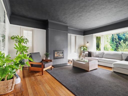 5 bedroom detached house for sale in Westfield Lane, St. Leonards-On-Sea, TN37 — £750,000 • 5 bed • 3 bath • 2218 ft²
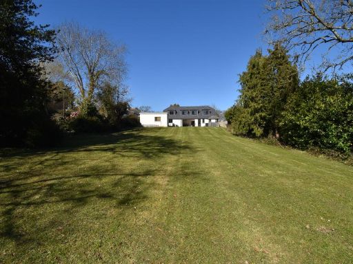 5 bedroom detached house for sale in Westfield Lane, St. Leonards-On-Sea, TN37 — £825,000 • 5 bed • 3 bath • 2503 ft²
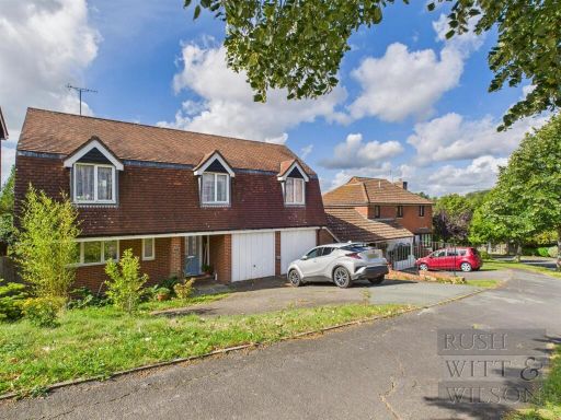 4 bedroom detached house for sale in Fairfax Avenue, St. Leonards-On-Sea, TN37 — £550,000 • 4 bed • 2 bath • 1987 ft²
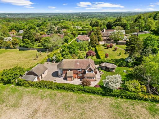 4 bedroom detached house for sale in 172 Hastings Road, Battle, TN33 — £925,000 • 4 bed • 3 bath • 2196 ft²
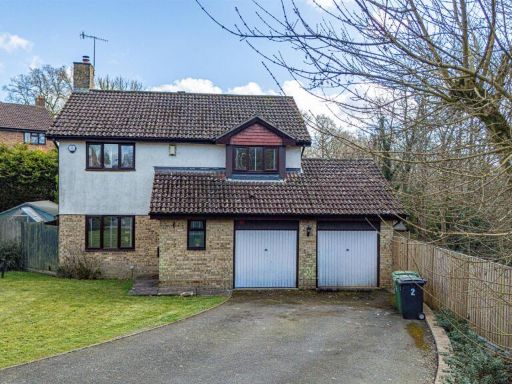 4 bedroom detached house for sale in Trafalgar Close, St. Leonards-On-Sea, TN37 — £499,950 • 4 bed • 1 bath • 1141 ft²
Meta
- {
"@context": "https://schema.org",
"@type": "Residence",
"name": "4 bedroom detached house for sale in Westfield Lane, St. Le…",
"description": "",
"url": "https://propertypiper.co.uk/property/e2813c0f-3ad5-4f7d-b07d-2511b2f7583a",
"image": "https://image-a.propertypiper.co.uk/d1f30452-f048-4bf1-b9cb-71f94f4cffd0-1024.jpeg",
"address": {
"@type": "PostalAddress",
"streetAddress": "5 WESTFIELD LANE ST LEONARDS-ON-SEA",
"postalCode": "TN37 7NE",
"addressLocality": "Hastings",
"addressRegion": "Hastings and Rye",
"addressCountry": "England"
},
"geo": {
"@type": "GeoCoordinates",
"latitude": 50.892896859857494,
"longitude": 0.5572569642843307
},
"numberOfRooms": 4,
"numberOfBathroomsTotal": 3,
"floorSize": {
"@type": "QuantitativeValue",
"value": 2201,
"unitCode": "FTK"
},
"offers": {
"@type": "Offer",
"price": 700000,
"priceCurrency": "GBP",
"availability": "https://schema.org/InStock"
},
"additionalProperty": [
{
"@type": "PropertyValue",
"name": "Feature",
"value": "detached house"
},
{
"@type": "PropertyValue",
"name": "Feature",
"value": "1930s"
},
{
"@type": "PropertyValue",
"name": "Feature",
"value": "traditional style"
},
{
"@type": "PropertyValue",
"name": "Feature",
"value": "brick exterior"
},
{
"@type": "PropertyValue",
"name": "Feature",
"value": "driveway"
},
{
"@type": "PropertyValue",
"name": "Feature",
"value": "garden"
},
{
"@type": "PropertyValue",
"name": "Feature",
"value": "English rural setting"
},
{
"@type": "PropertyValue",
"name": "Feature",
"value": "modern kitchen"
},
{
"@type": "PropertyValue",
"name": "Feature",
"value": "neutral colors"
},
{
"@type": "PropertyValue",
"name": "Feature",
"value": "built-in appliances"
},
{
"@type": "PropertyValue",
"name": "Feature",
"value": "spot lighting"
},
{
"@type": "PropertyValue",
"name": "Feature",
"value": "wood accents"
},
{
"@type": "PropertyValue",
"name": "Feature",
"value": "tile flooring"
}
]
}
High Res Floorplan Images
Compatible Floorplan Images
FloorplanImages Thumbnail