E5 0EN - 1 bedroom flat for sale in Flat 1003 Landmark Heights, 172…
View on Property Piper
1 bedroom flat for sale in Flat 1003 Landmark Heights, 172 Daubeney Road, Hackney, London, E5 0EN, E5
Property Details
- Price: £140000
- Bedrooms: 1
- Bathrooms: 1
- Property Type: undefined
- Property SubType: undefined
Image Descriptions
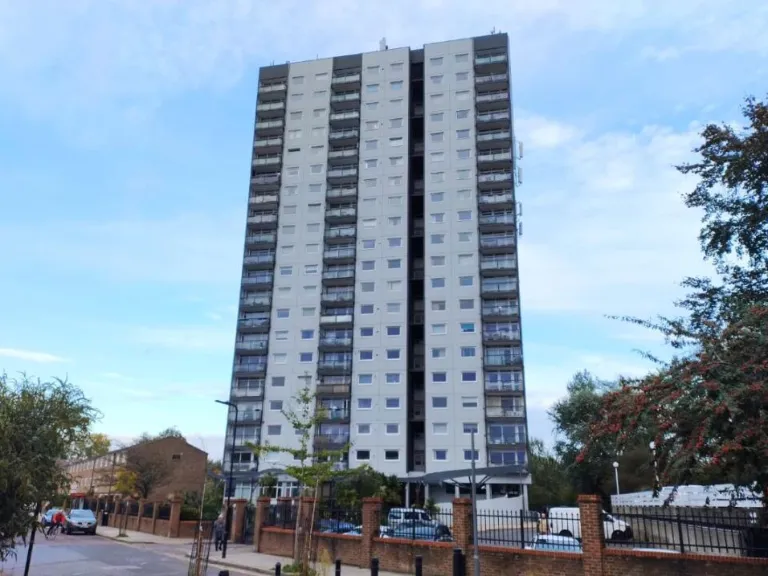
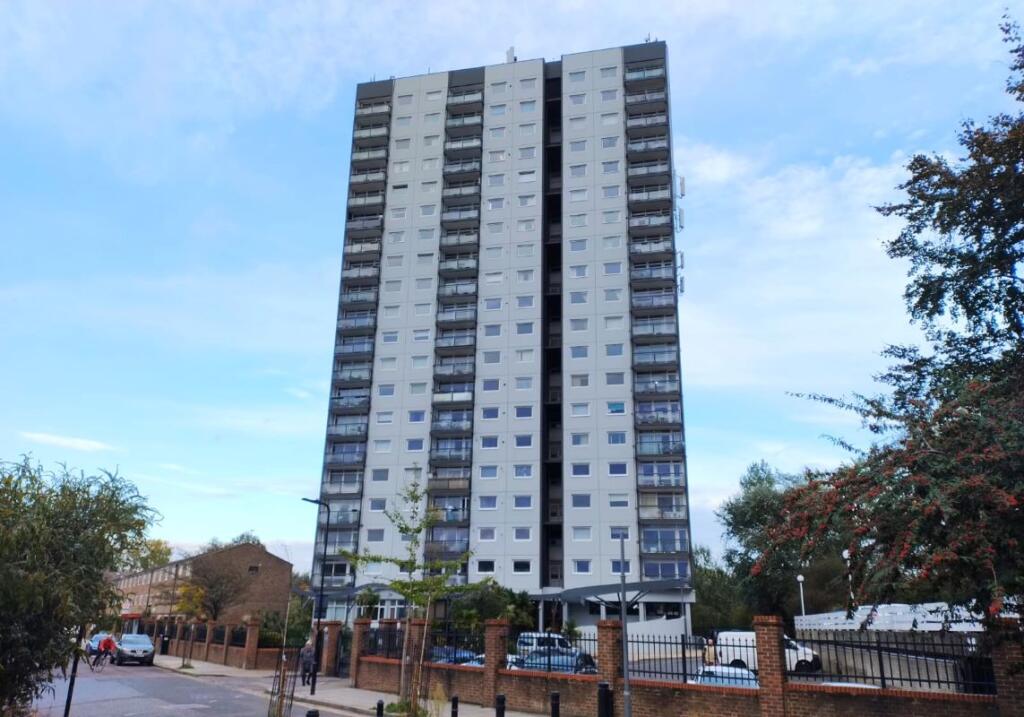
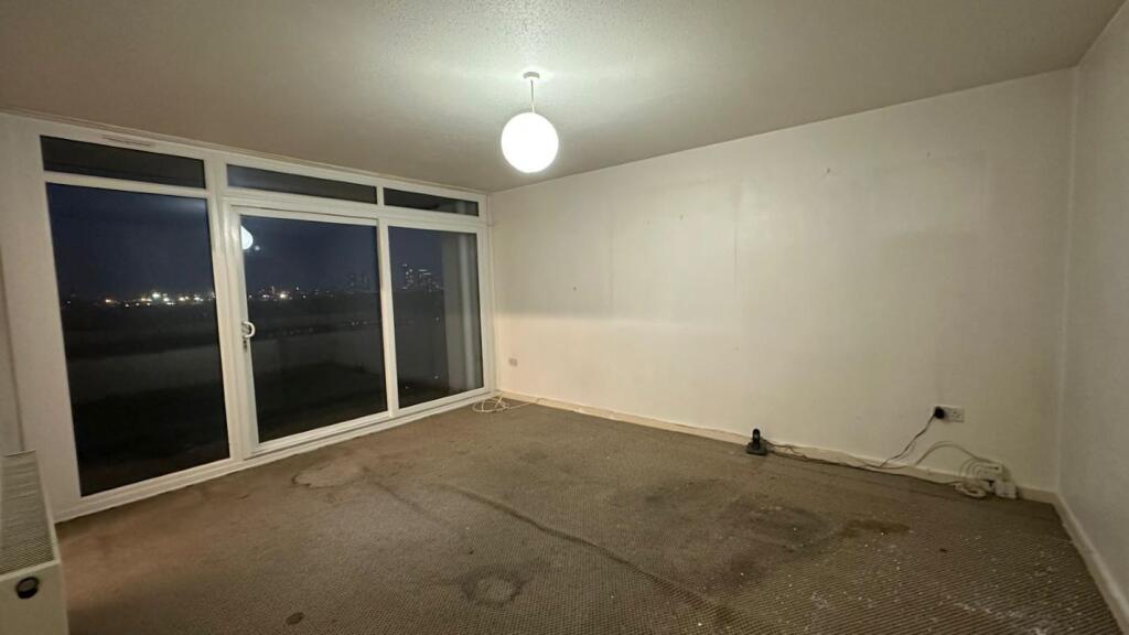
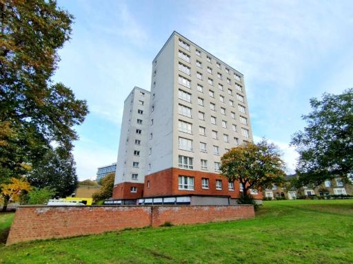
- apartment building Brutalist Commercial
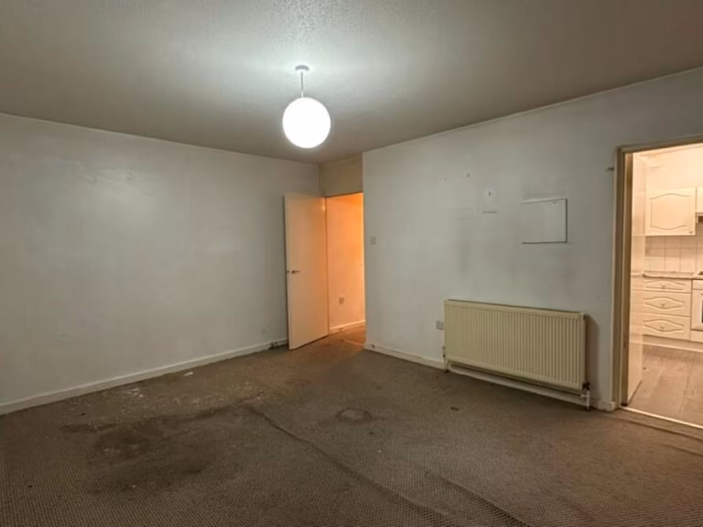
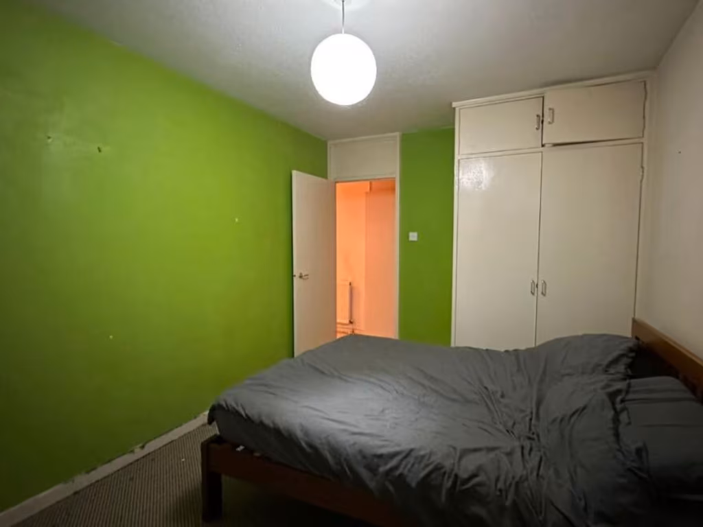
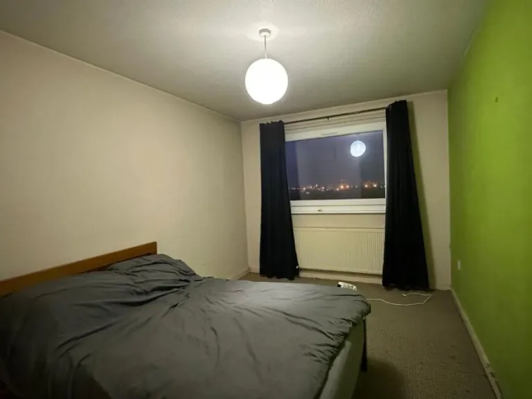
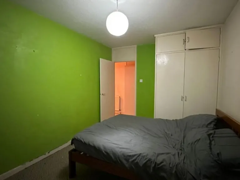
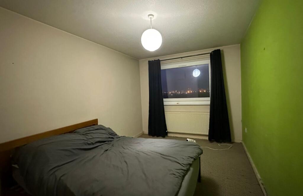
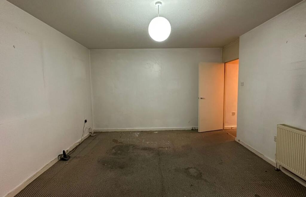
- bedroom Post-war
Floorplan Description
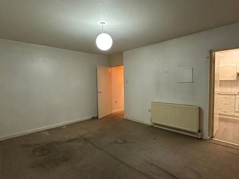
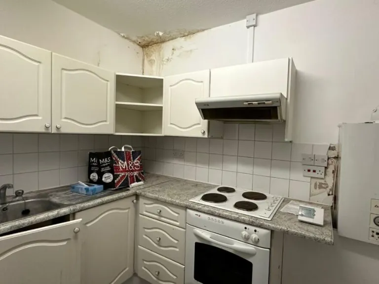
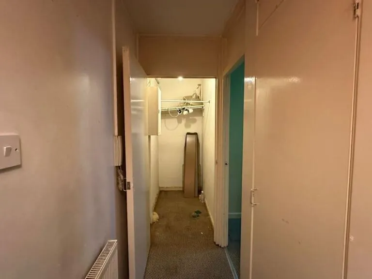
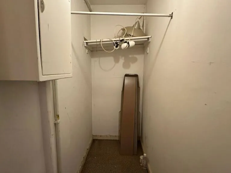
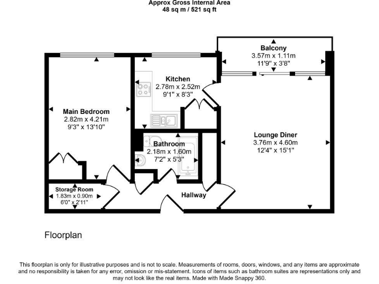
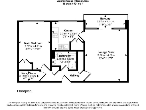
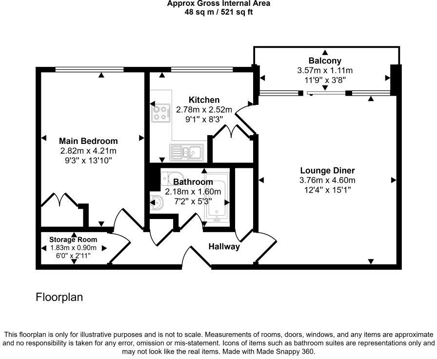
- Apartment with one bedroom, lounge/diner, kitchen, bathroom, storage and balcony (balcony excluded from internal area).
Rooms
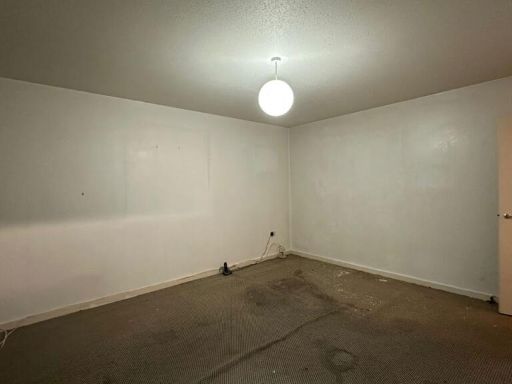
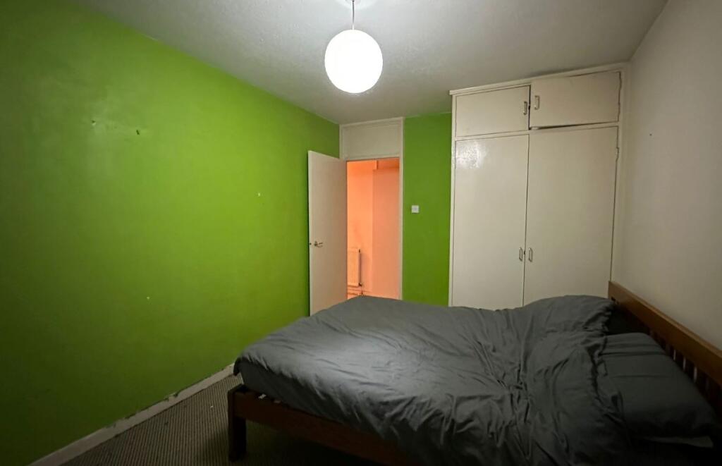
- Main Bedroom:
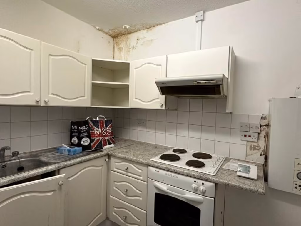
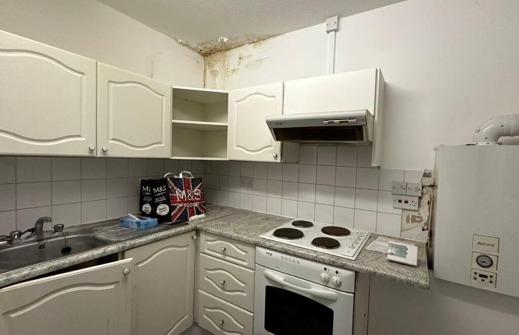
- Kitchen:
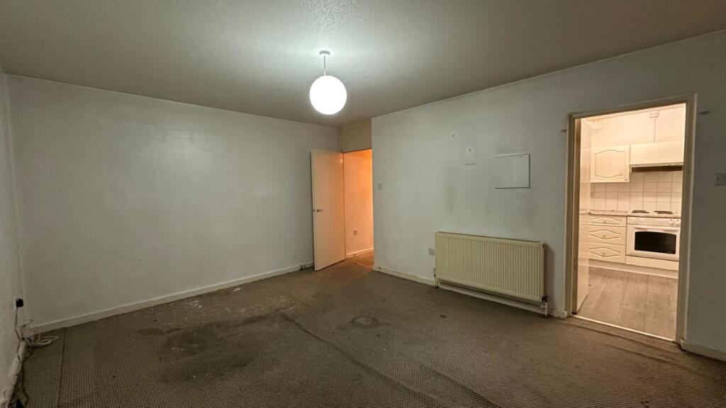
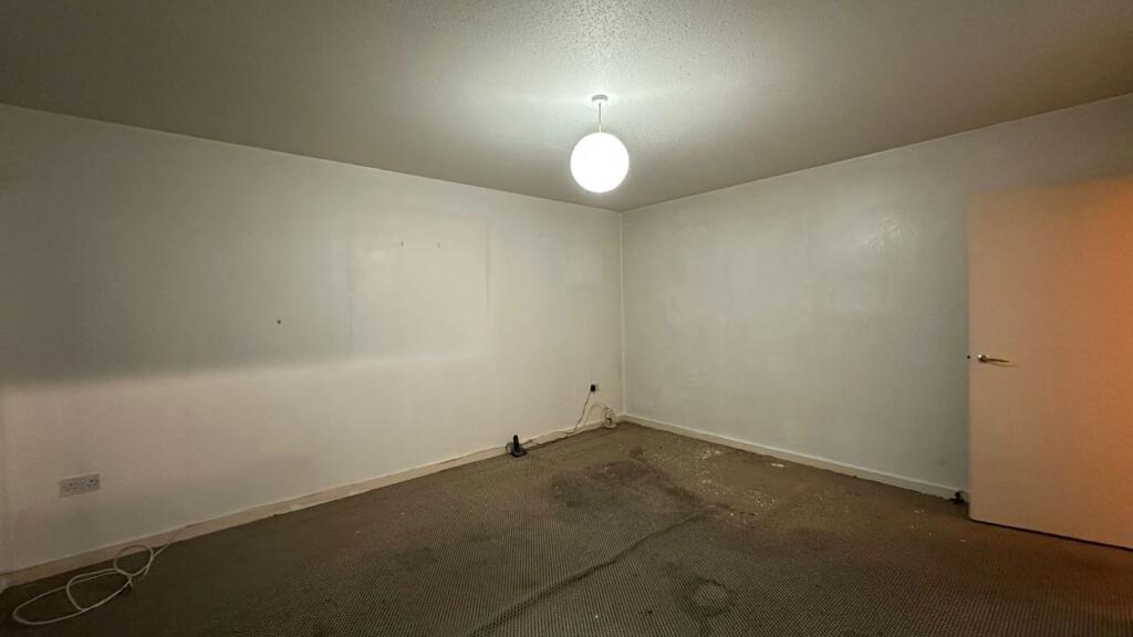
- Lounge Diner:
- Bathroom:
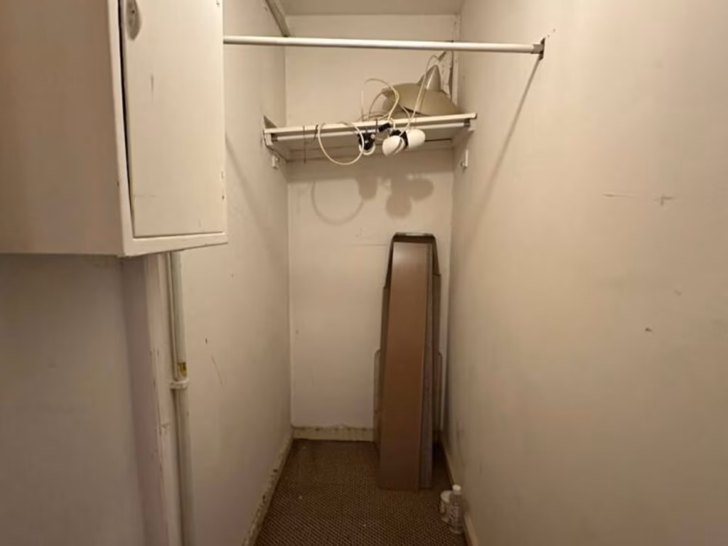
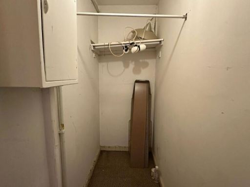
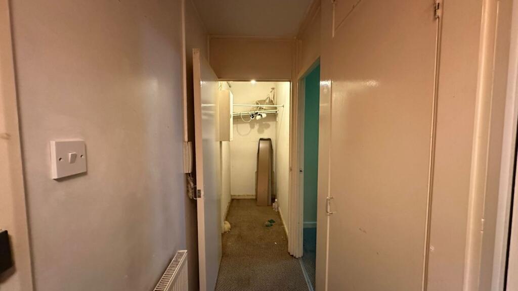
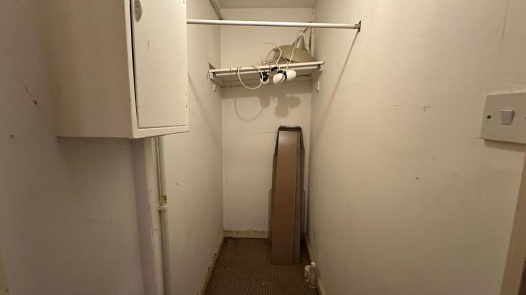
- Storage Room:
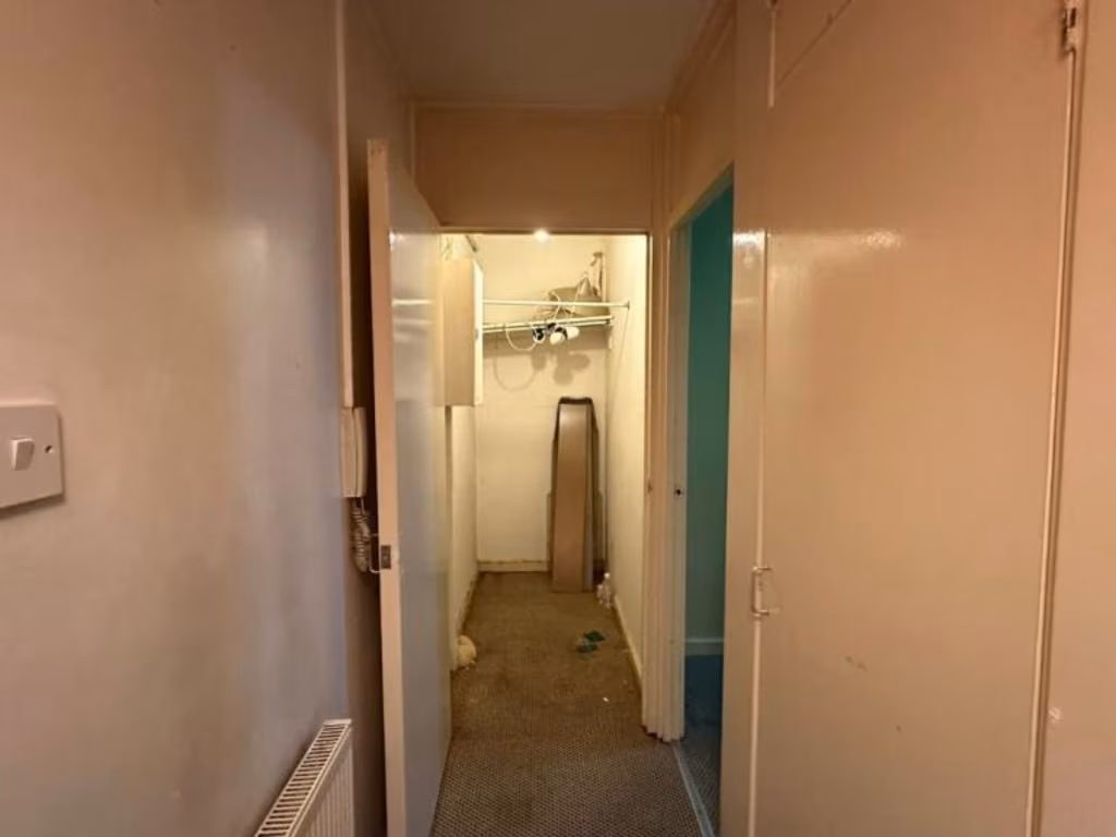
- Hallway:
Textual Property Features
- Is Public Notice
- Is Auction
- Success
Detected Visual Features
- high-rise
- apartment complex
- Brutalist architecture
- urban living
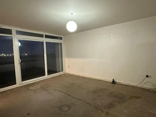
- city views
- balcony
- multi-story
- condominium
- concrete structure
- renovated exterior
- mass housing
- Post-war
- bedroom
- low ceiling
- single window
- neutral walls
- feature wall
- urban view
- carpeted floor
EPC Details
- Fully double glazed
- System built, as built, partial insulation (assumed)
- Boiler and radiators, mains gas
- Low energy lighting in all fixed outlets
- (another dwelling below)
Nearby Schools
- Lauriston School
- The Urswick School - A Church of England Secondary School
- Mossbourne Riverside Academy
- Berger Primary School
- Millfields Community School
- Harrington Hill Primary School
- St John of Jerusalem Church of England Primary School
- Orchard Primary School
- Gainsborough Primary School
- The City Academy, Hackney
- Daubeney Primary School
- Kingsmead Primary School
- Clapton Girls' Academy
- Southwold Primary School
- Willow Brook Primary School Academy
- Rushmore Primary School
- Lammas School and Sixth Form
- Chisenhale Primary School
- Mossbourne Victoria Park Academy
- St. Dominic's Catholic Primary School
- Morningside Primary School
- St John and St James CofE Primary School
- The Olive School Hackney
- Mandeville Primary School
- St Joseph's Catholic Infant School
- Sybourn Primary School
- St Saviour's Church of England Primary School
Nearest General Shops
- Id: 1926874287
- Tags:
- Addr:
- City: London
- Housenumber: 33
- Postcode: E9 5QA
- Street: Marsh Hill
- Suburb: Hackney
- Level: 0
- Name: Annie Dan Salon
- Shop: hairdresser
- TagsNormalized:
- Lat: 51.5496518
- Lon: -0.0362893
- FullGeoHash: gcpvr0md6rsd
- PartitionGeoHash: gcpv
- Images:
- FoodStandards: null
- Distance: 511.9
,- Id: 9500905154
- Tags:
- Name: Riverside Supermarket
- Shop: supermarket
- TagsNormalized:
- Lat: 51.5517998
- Lon: -0.0315302
- FullGeoHash: gcpvr29p1212
- PartitionGeoHash: gcpv
- Images:
- FoodStandards: null
- Distance: 466.6
,- Id: 849198095
- Tags:
- Addr:
- Housenumber: 75
- Street: Glyn Road
- Building: residential
- Building:colour: brown
- Building:levels: 3
- Building:material: brick
- Roof:
- Shop: dry_cleaning
- TagsNormalized:
- residential
- dry cleaning
- shop
- Lat: 51.5507523
- Lon: -0.0407604
- FullGeoHash: gcpvr0d2fhwz
- PartitionGeoHash: gcpv
- Images:
- FoodStandards: null
- Distance: 465
}
Nearest Religious buildings
- Id: 184492680
- Tags:
- Addr:
- City: London
- Housenumber: 171
- Postcode: E5 0HA
- Street: Rushmore Road
- Amenity: place_of_worship
- Building: yes
- Denomination: evangelical
- Name: Grace Chapel for all Nations
- Religion: christian
- Website: https://www.facebook.com/GraceChapelLondon/
- TagsNormalized:
- place of worship
- evangelical
- chapel
- christian
- church
- Lat: 51.5550819
- Lon: -0.0427934
- FullGeoHash: gcpvr12f4gff
- PartitionGeoHash: gcpv
- Images:
- FoodStandards: null
- Distance: 409.5
,- Id: 50738701
- Tags:
- Addr:
- City: London
- Postcode: E9 6AY
- Street: Chelmer Road
- Amenity: place_of_worship
- Building: church
- Building:material: brick
- Denomination: seventh_day_adventist
- Name: Clapton Community Seventh-day Adventist Church
- Religion: christian
- Roof:
- Wikidata: Q26520407
- TagsNormalized:
- place of worship
- church
- adventist
- seventh day adventist
- christian
- Lat: 51.5516683
- Lon: -0.0412278
- FullGeoHash: gcpvr09ypr6r
- PartitionGeoHash: gcpv
- Images:
- FoodStandards: null
- Distance: 406.8
,- Id: 516163794
- Tags:
- Amenity: place_of_worship
- Building: church
- Denomination: anglican
- Name: The Risen Christ and All Souls
- Religion: christian
- Wikidata: Q105099813
- TagsNormalized:
- place of worship
- church
- anglican
- christian
- Lat: 51.5557899
- Lon: -0.0413009
- FullGeoHash: gcpvr13yjxgf
- PartitionGeoHash: gcpv
- Images:
- FoodStandards: null
- Distance: 342.3
}
Nearest Airports
- Id: 121158889
- Tags:
- Aerodrome: continental
- Aeroway: aerodrome
- Fhrs:
- Authority: City of London Corporation
- Iata: LCY
- Icao: EGLC
- Name: London City Airport
- Operator: London City Airport Limited
- Ref: LCY
- Website: https://www.londoncityairport.com/
- Wikidata: Q8982
- Wikipedia: en:London City Airport
- TagsNormalized:
- airport
- continental airport
- Lat: 51.5042658
- Lon: 0.0539987
- FullGeoHash: u10j10p64702
- PartitionGeoHash: u10j
- Images:
- FoodStandards: null
- Distance: 8397.7
,- Id: 14001268
- Tags:
- Access: yes
- Aerodrome: international
- Aerodrome:type: public
- Aeroway: aerodrome
- Alt_name: London Heathrow
- Alt_name_2: London Heathrow Airport
- Ele: 25
- Iata: LHR
- Icao: EGLL
- Int_name: Heathrow Airport
- Name: London Heathrow Airport
- Note: area still approx
- Old_name: London Airport
- Operator: Heathrow Airport Limited
- Rank_aci:
- Ref: LHR
- Short_name: Heathrow
- Type: multipolygon
- Website: https://www.heathrow.com/
- Wikidata: Q8691
- Wikipedia: en:Heathrow Airport
- TagsNormalized:
- airport
- international airport
- Lat: 51.4677522
- Lon: -0.4547736
- FullGeoHash: gcpsv9kv7h2h
- PartitionGeoHash: gcps
- Images:
- FoodStandards: null
- Distance: 30466.8
}
Nearest Leisure Facilities
- Id: 49940870
- Tags:
- Access: permissive
- Leisure: park
- Surface: grass
- TagsNormalized:
- Lat: 51.5547691
- Lon: -0.0381549
- FullGeoHash: gcpvr1k0qct8
- PartitionGeoHash: gcpv
- Images:
- FoodStandards: null
- Distance: 98.1
,- Id: 25800420
- Tags:
- Access: yes
- Leisure: park
- Loc_name: Daubeney Green
- Name: Daubeney Fields
- Opening_hours: 24/7
- Operator: Hackney Council
- Operator:type: government
- Operator:wikidata: Q5637369
- Website: https://hackney.gov.uk/daubeney-fields
- TagsNormalized:
- Lat: 51.5538792
- Lon: -0.0358031
- FullGeoHash: gcpvr1jgjexk
- PartitionGeoHash: gcpv
- Images:
- FoodStandards: null
- Distance: 93.5
,- Id: 294261716
- Tags:
- Leisure: pitch
- Lit: no
- Source: Bing
- Sport: soccer
- Surface: grass
- TagsNormalized:
- Lat: 51.5543851
- Lon: -0.0358002
- FullGeoHash: gcpvr1jyjccq
- PartitionGeoHash: gcpv
- Images:
- FoodStandards: null
- Distance: 86.7
,- Id: 923400724
- Tags:
- Fee: no
- Garden:
- Leisure: garden
- TagsNormalized:
- Lat: 51.5540864
- Lon: -0.0380382
- FullGeoHash: gcpvr1hk3dk8
- PartitionGeoHash: gcpv
- Images:
- FoodStandards: null
- Distance: 71.6
,- Id: 927827631
- Tags:
- Fee: no
- Garden:
- Leisure: garden
- TagsNormalized:
- Lat: 51.5541247
- Lon: -0.0379789
- FullGeoHash: gcpvr1hke12u
- PartitionGeoHash: gcpv
- Images:
- FoodStandards: null
- Distance: 66.7
}
Nearest Tourist attractions
- Id: 854498662
- Tags:
- Addr:
- City: London
- Housenumber: 2 & 4
- Postcode: E9 6JQ
- Street: Homerton High Street
- Historic: house
- Name: Sutton House
- Name:en: Sutton House
- Name:he: בית סאטון
- Old_name: Brick Place
- Operator: National Trust
- Tourism: attraction
- Website: https://www.nationaltrust.org.uk/sutton-house
- Wheelchair: limited
- Wikidata: Q7650284
- Wikipedia: en:Sutton House, London
- TagsNormalized:
- Lat: 51.5484761
- Lon: -0.0504604
- FullGeoHash: gcpvqb578hmv
- PartitionGeoHash: gcpv
- Images:
- FoodStandards: null
- Distance: 1127.8
,- Id: 2357767090
- Tags:
- TagsNormalized:
- Lat: 51.5641442
- Lon: -0.036496
- FullGeoHash: gcpvr4vqvt4t
- PartitionGeoHash: gcpv
- Images:
- FoodStandards: null
- Distance: 1102.8
,- Id: 8764023889
- Tags:
- Addr:
- Housenumber: 26
- Street: Lower Clapton Road
- Contact:
- Facebook: https://www.facebook.com/elementsgallery1london/
- Twitter: @ElementsGallery
- Email: elements@angus-hughes.com
- Name: Elements Gallery London
- Tourism: gallery
- Website: http://angus-hughes.org/ELEMENTS-GALLERY
- TagsNormalized:
- Lat: 51.5507177
- Lon: -0.0516446
- FullGeoHash: gcpvqbd2sw6c
- PartitionGeoHash: gcpv
- Images:
- FoodStandards: null
- Distance: 1083.4
}
Nearest Hotels
- Id: 589699814
- Tags:
- Accommodation: yes
- Addr:
- City: London
- Housenumber: 2
- Postcode: E8 1EN
- Street: Sylvester Path
- Amenity: pub
- Building: hotel
- Fhrs:
- Food: yes
- Indoor_seating: yes
- Name: Old Ship
- Outdoor_seating: yes
- Phone: +44 20 8986 2732
- Website: https://www.oldshiphackney.com/
- TagsNormalized:
- Lat: 51.5459055
- Lon: -0.0556389
- FullGeoHash: gcpvnxxkxt0x
- PartitionGeoHash: gcpv
- Images:
- FoodStandards: null
- Distance: 1585.2
,- Id: 9252854626
- Tags:
- Addr:
- City: London
- Housenumber: 2
- Postcode: E8 1JW
- Street: Amhurst Road
- Alt_name: Kip Hotel
- Email: hello@getsomekip.com
- Name: .Kip
- Phone: +44 20 8629 7884
- Tourism: hotel
- Website: https://getsomekip.com/
- Wikidata: Q111119403
- TagsNormalized:
- Lat: 51.5474517
- Lon: -0.0563545
- FullGeoHash: gcpvnxyvwv7n
- PartitionGeoHash: gcpv
- Images:
- FoodStandards: null
- Distance: 1534.2
,- Id: 240442391
- Tags:
- Addr:
- City: London
- Housenumber: 7-19
- Postcode: E8 1LL
- Street: Amhurst Road
- Suburb: Hackney
- Alt_name: Travelodge London Hackney
- Branch: London Hackney
- Brand: Travelodge
- Brand:wikidata: Q9361374
- Brand:wikipedia: en:Travelodge UK
- Building: hotel
- Building:levels: 7
- Fhrs:
- Id: 1000239
- Local_authority_id: 185394
- Internet_access: wlan
- Internet_access:fee: customers
- Internet_access:ssid: Travelodge WiFi
- Name: Travelodge
- Ref: 597
- Roof:
- Tourism: hotel
- Website: https://www.travelodge.co.uk/hotels/597/London-Hackney-hotel
- TagsNormalized:
- Lat: 51.5473886
- Lon: -0.0560732
- FullGeoHash: gcpvnxzjm3sy
- PartitionGeoHash: gcpv
- Images:
- FoodStandards: null
- Distance: 1520.8
}
Tags
- high-rise
- apartment complex
- Brutalist architecture
- urban living
- city views
- balcony
- multi-story
- condominium
- concrete structure
- renovated exterior
- mass housing
- Post-war
- bedroom
- low ceiling
- single window
- neutral walls
- feature wall
- urban view
- carpeted floor
Local Market Stats
- Average Price/sqft: £710
- Avg Income: £51200
- Rental Yield: 4.8%
- Social Housing: 32%
- Planning Success Rate: 77%
AirBnB Data
- 1km average: £131/night
- Listings in 1km: 26
Similar Properties
 1 bedroom flat for sale in Flat 22 Hensley Point, 41 Bradstock Road, Hackney, London, E9 5BE, E9 — £115,000 • 1 bed • 1 bath • 571 ft²
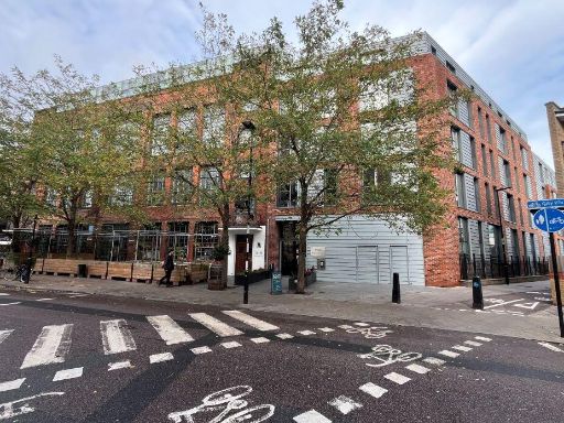 1 bedroom flat for sale in Flat 4 Arthaus Apartments, 205 Richmond Road, Hackney, London, E8 3FF, E8 — £295,000 • 1 bed • 1 bath • 648 ft²
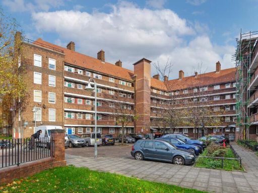 2 bedroom flat for sale in Flat 11 Marden House, Pembury Estate, Hackney, London, E8 1AZ, E8 — £240,000 • 2 bed • 1 bath
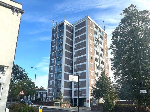 1 bedroom flat for sale in Flat 12 The Beckers, Rectory Road, Stoke Newington, N16 7QX, N16 — £100,000 • 1 bed • 1 bath • 420 ft²
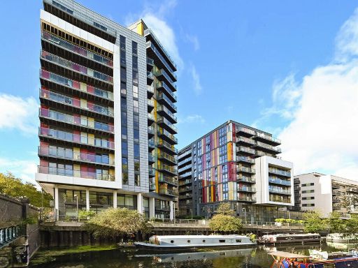 1 bedroom apartment for sale in Homerton Road, London, London, E9 5FA, E9 — £315,000 • 1 bed • 1 bath • 517 ft²
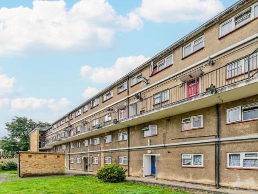 1 bedroom flat for sale in Crosbie House, Prospect Hill, London, E17 — £180,000 • 1 bed • 1 bath • 479 ft²
Meta
- {
"@context": "https://schema.org",
"@type": "Residence",
"name": "1 bedroom flat for sale in Flat 1003 Landmark Heights, 172…",
"description": "",
"url": "https://propertypiper.co.uk/property/df2ba3c8-7255-4c5b-98e9-64a054a783bd",
"image": "https://image-a.propertypiper.co.uk/18e955e8-1317-4d0a-b605-2ba5cf6c38b6-1024.jpeg",
"address": {
"@type": "PostalAddress",
"streetAddress": "LANDMARK HEIGHTS, 172 FLAT 102 DAUBENEY ROAD LONDON",
"postalCode": "E5 0EN",
"addressLocality": "Hackney",
"addressRegion": "Hackney South and Shoreditch",
"addressCountry": "England"
},
"geo": {
"@type": "GeoCoordinates",
"latitude": 51.55423226467768,
"longitude": -0.03702979994481175
},
"numberOfRooms": 1,
"numberOfBathroomsTotal": 1,
"floorSize": {
"@type": "QuantitativeValue",
"value": 521,
"unitCode": "FTK"
},
"offers": {
"@type": "Offer",
"price": 140000,
"priceCurrency": "GBP",
"availability": "https://schema.org/InStock"
},
"additionalProperty": [
{
"@type": "PropertyValue",
"name": "Feature",
"value": "high-rise"
},
{
"@type": "PropertyValue",
"name": "Feature",
"value": "apartment complex"
},
{
"@type": "PropertyValue",
"name": "Feature",
"value": "Brutalist architecture"
},
{
"@type": "PropertyValue",
"name": "Feature",
"value": "urban living"
},
{
"@type": "PropertyValue",
"name": "Feature",
"value": "city views"
},
{
"@type": "PropertyValue",
"name": "Feature",
"value": "balcony"
},
{
"@type": "PropertyValue",
"name": "Feature",
"value": "multi-story"
},
{
"@type": "PropertyValue",
"name": "Feature",
"value": "condominium"
},
{
"@type": "PropertyValue",
"name": "Feature",
"value": "concrete structure"
},
{
"@type": "PropertyValue",
"name": "Feature",
"value": "renovated exterior"
},
{
"@type": "PropertyValue",
"name": "Feature",
"value": "mass housing"
},
{
"@type": "PropertyValue",
"name": "Feature",
"value": "Post-war"
},
{
"@type": "PropertyValue",
"name": "Feature",
"value": "bedroom"
},
{
"@type": "PropertyValue",
"name": "Feature",
"value": "low ceiling"
},
{
"@type": "PropertyValue",
"name": "Feature",
"value": "single window"
},
{
"@type": "PropertyValue",
"name": "Feature",
"value": "neutral walls"
},
{
"@type": "PropertyValue",
"name": "Feature",
"value": "feature wall"
},
{
"@type": "PropertyValue",
"name": "Feature",
"value": "urban view"
},
{
"@type": "PropertyValue",
"name": "Feature",
"value": "carpeted floor"
}
]
}
High Res Floorplan Images
Compatible Floorplan Images
FloorplanImages Thumbnail