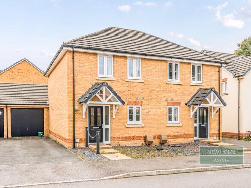
RG23 7FD - 2 bedroom semidetached house for sale in Longwood Copse Lan…
View on Property Piper
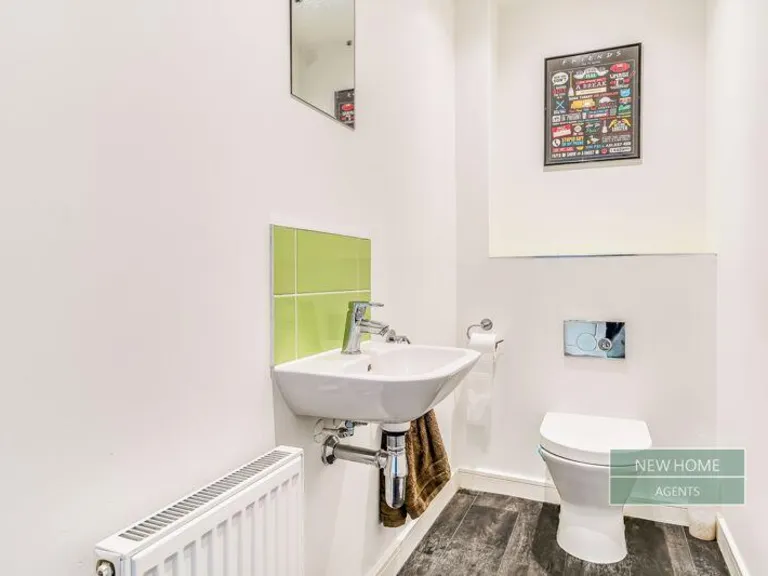
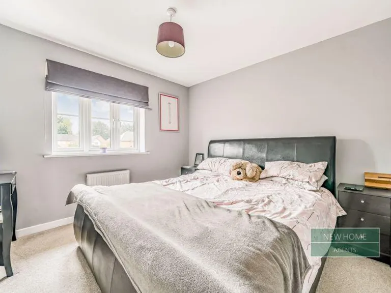
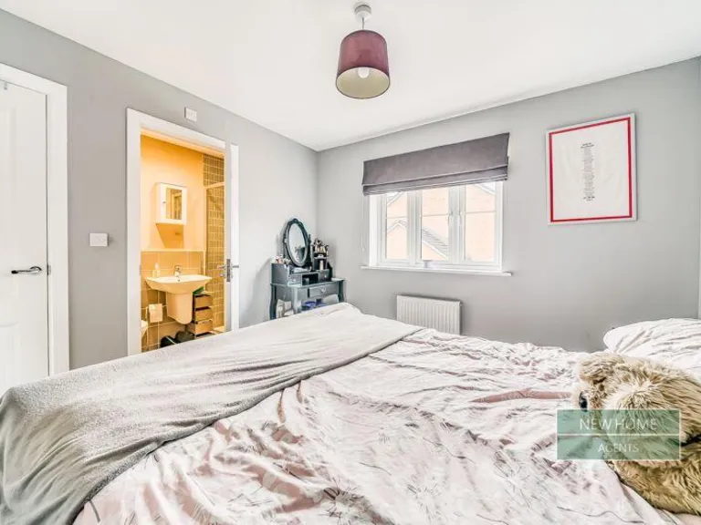
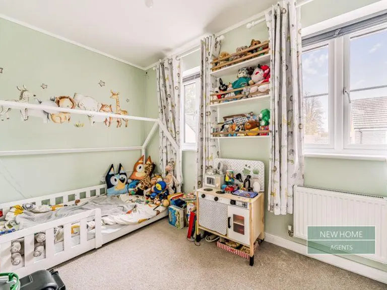
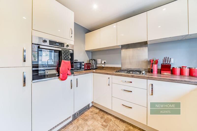
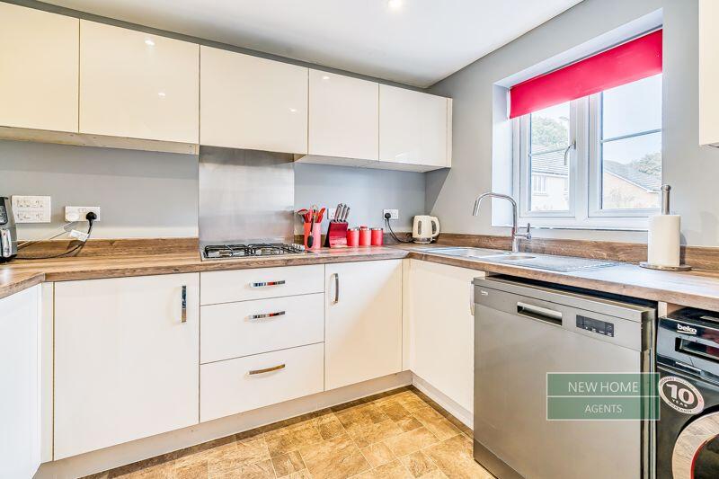
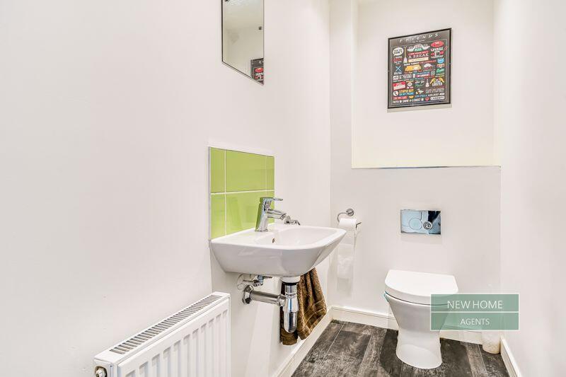
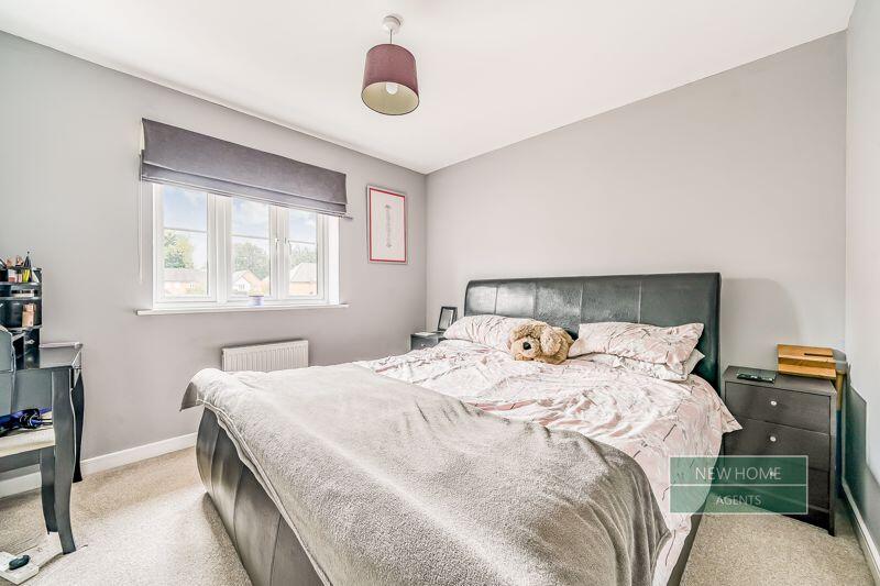
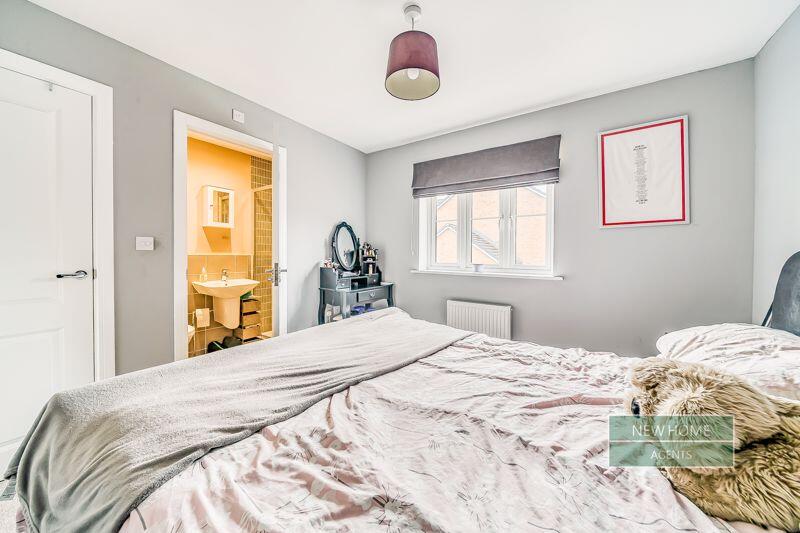
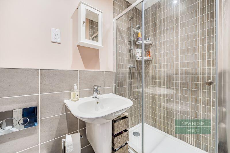
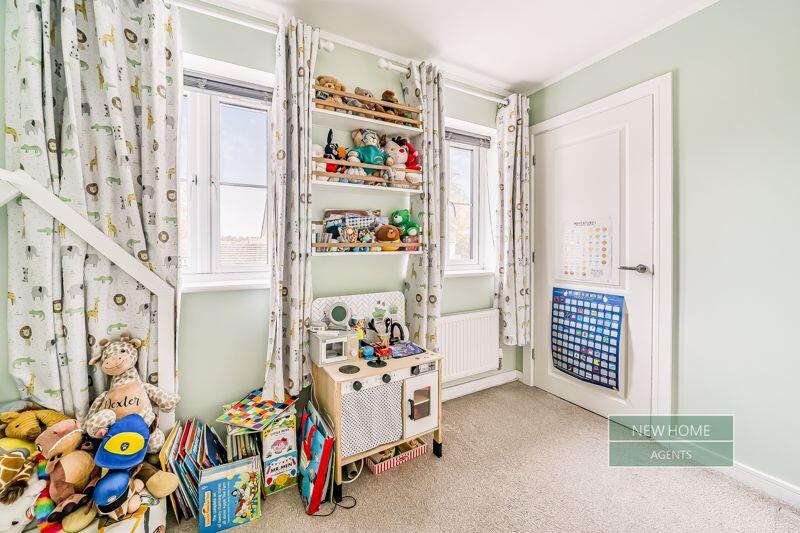
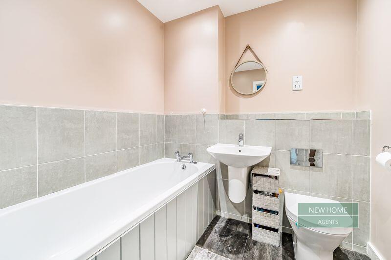
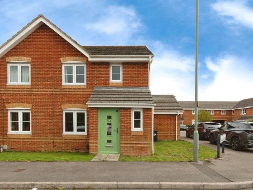
2 bedroom semi-detached house for sale in Longwood Copse Lane Beggarwood, Basingstoke, RG23 7FD, RG23
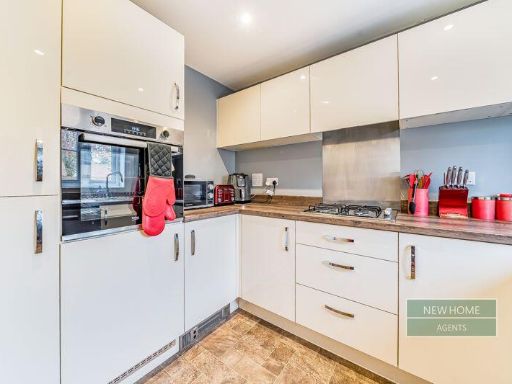
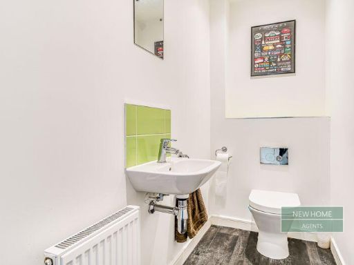
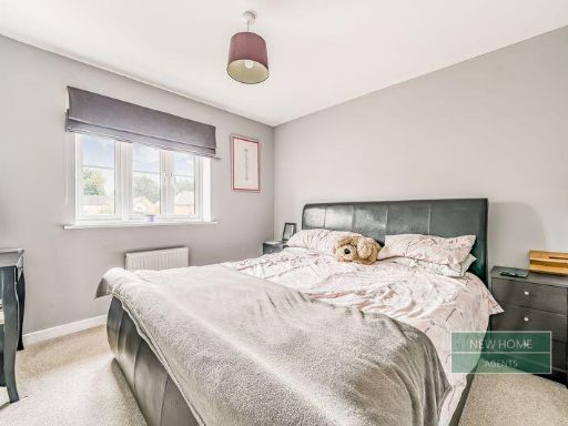
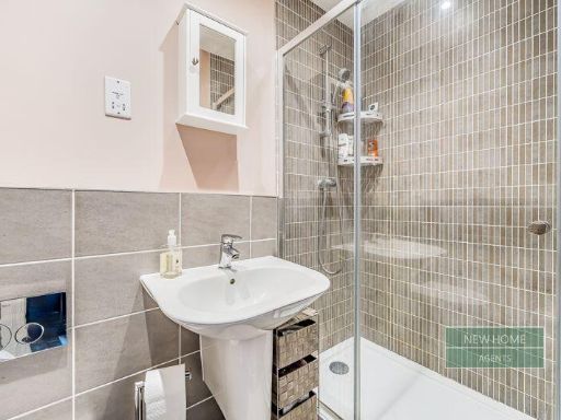
Property Details
- Price: £350000
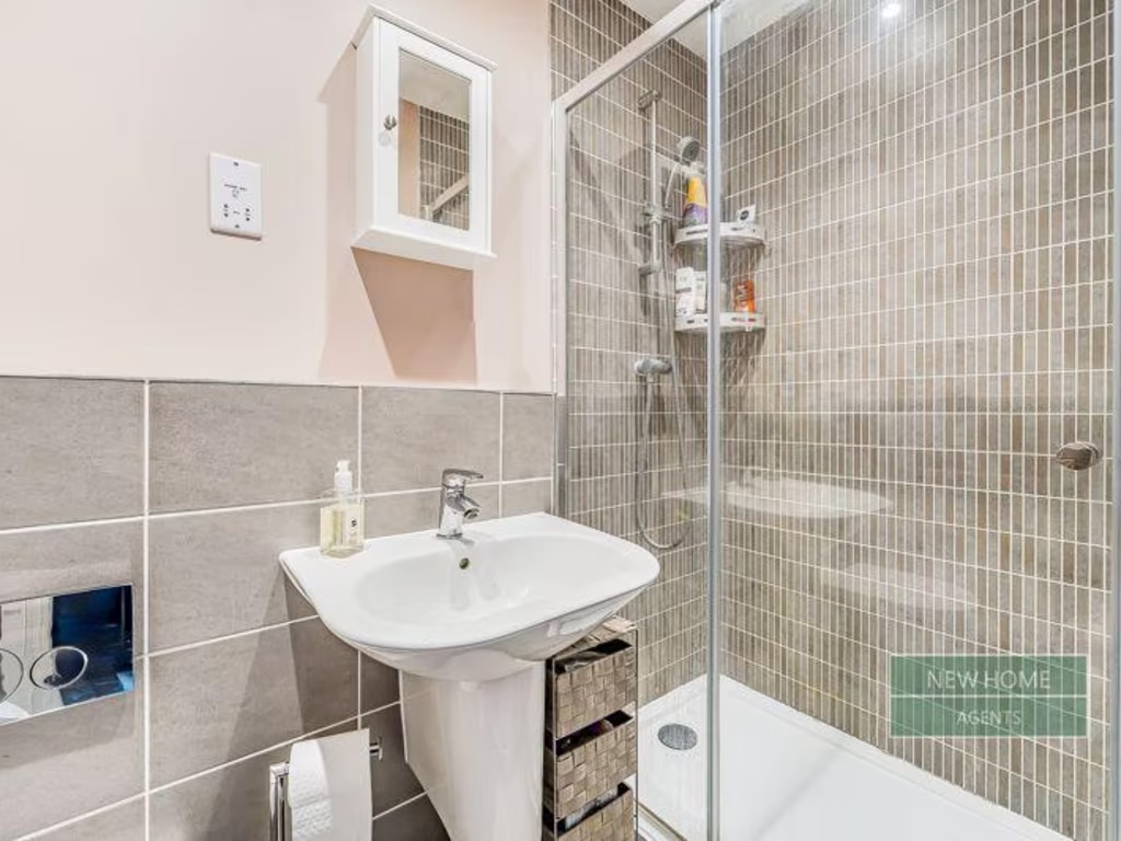
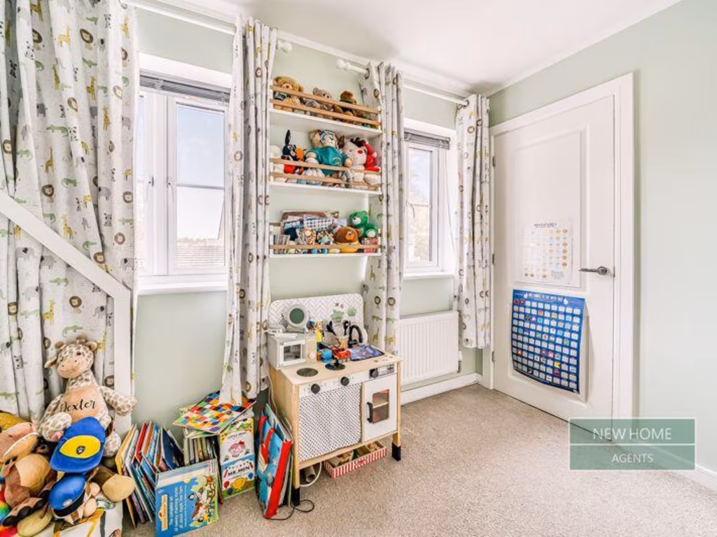
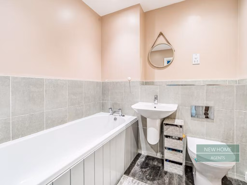
- Bedrooms: 2
- Bathrooms: 2
- Property Type: undefined
- Property SubType: undefined
Image Descriptions
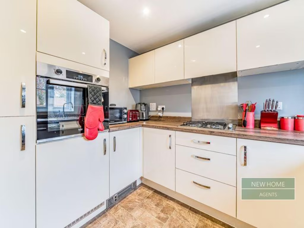
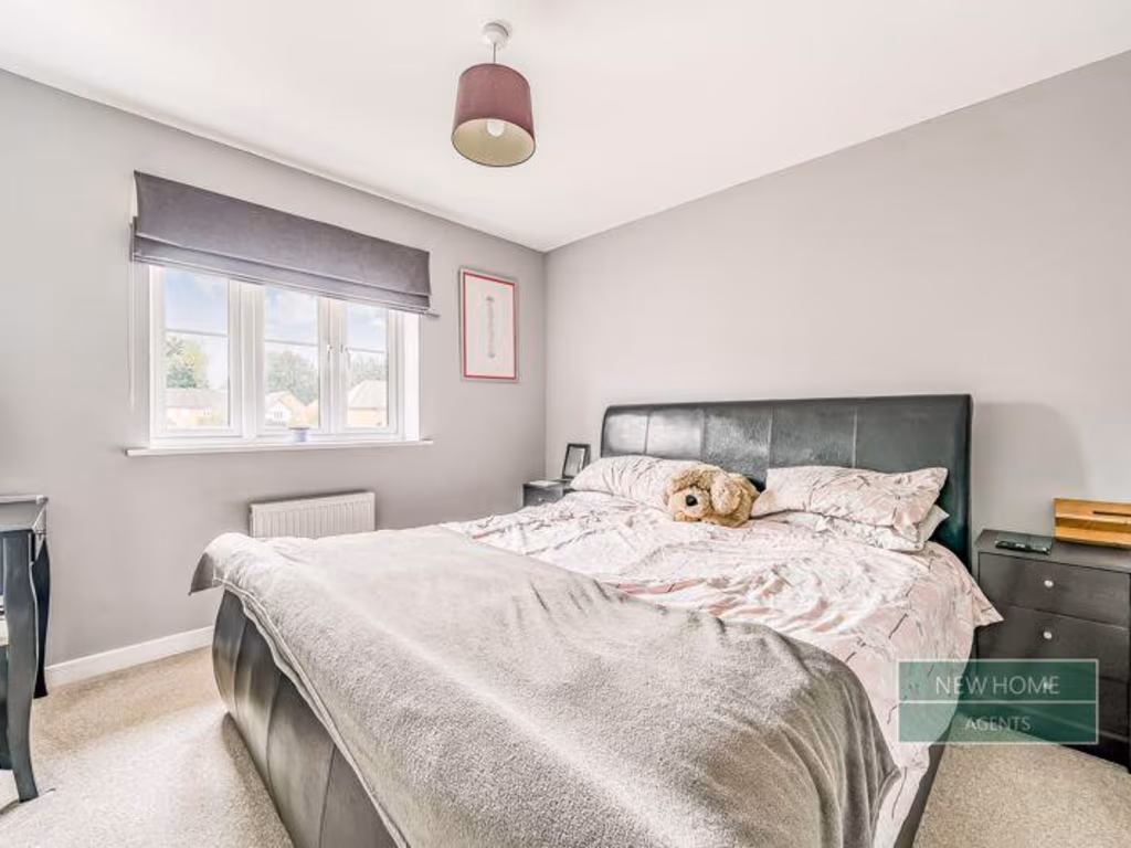
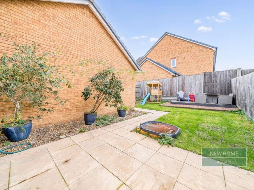
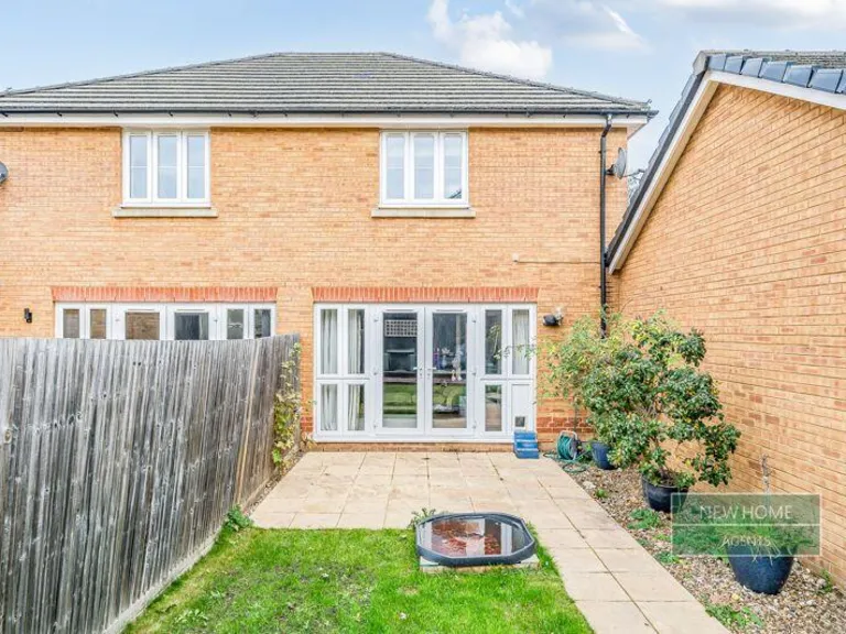
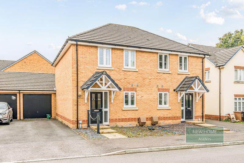
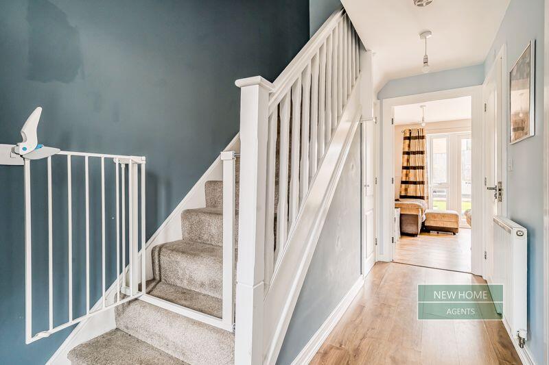
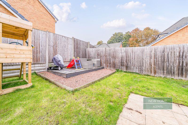
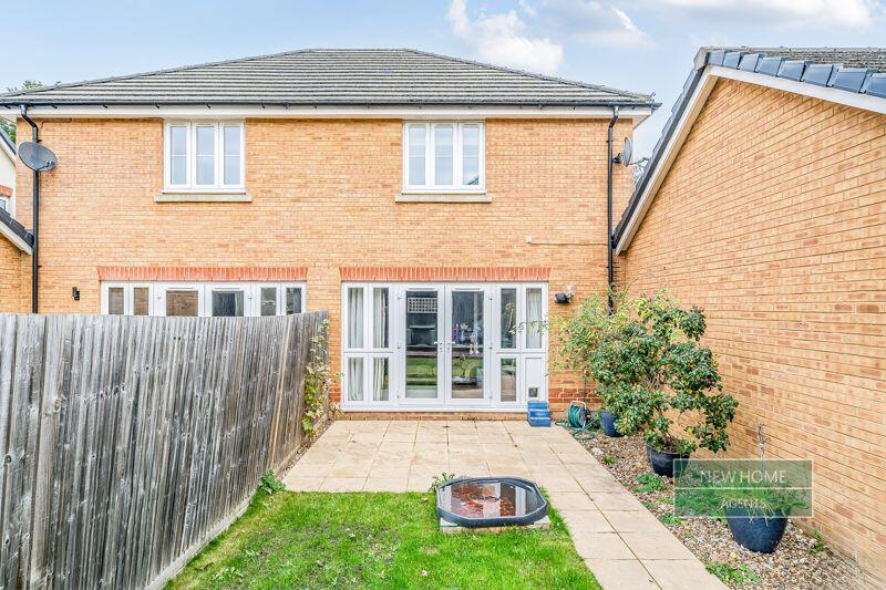
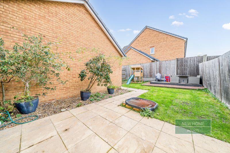
- modern semi-detached house modern
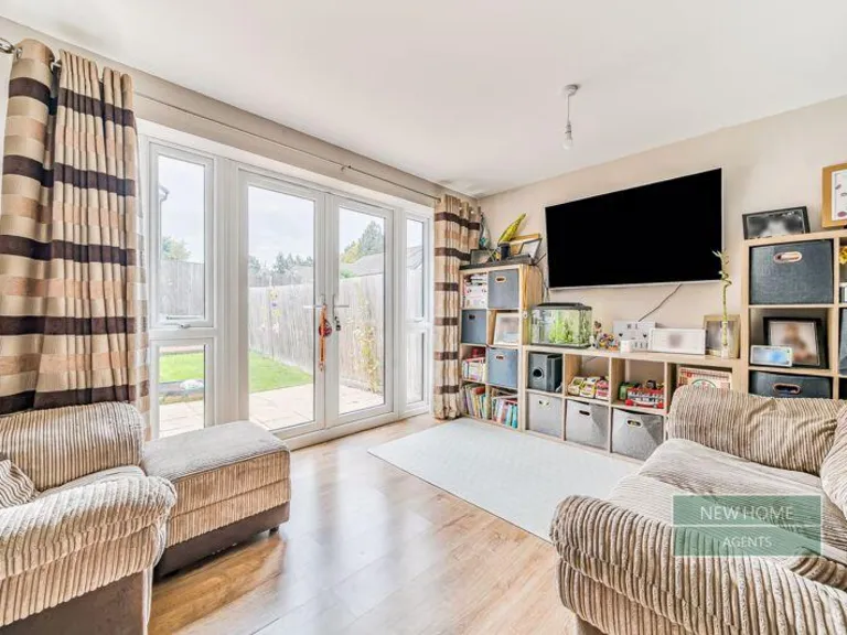
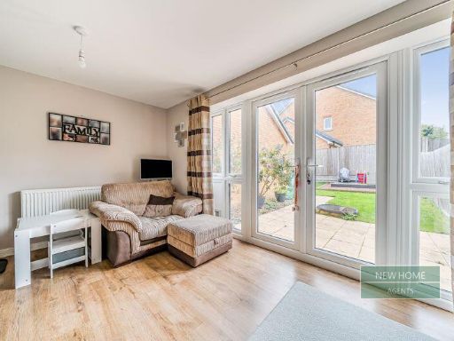
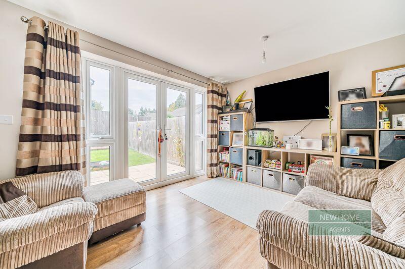
- living room contemporary
Textual Property Features
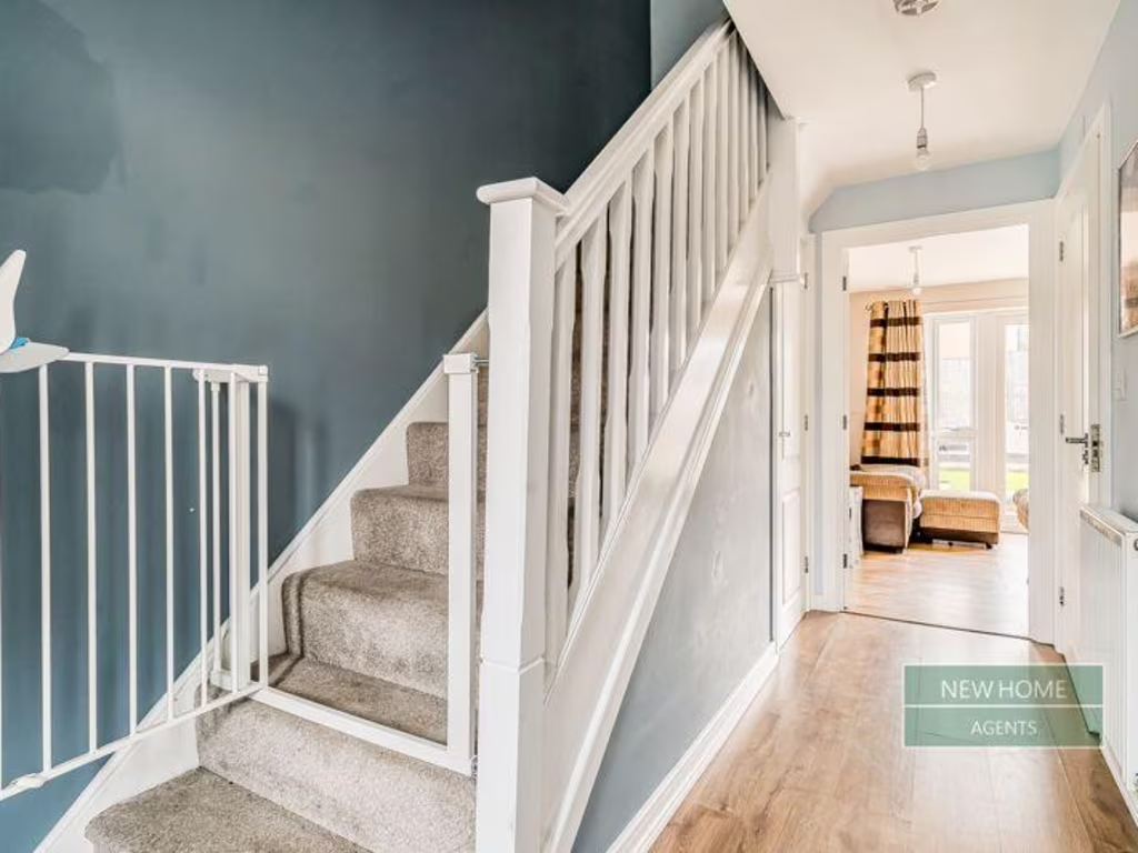
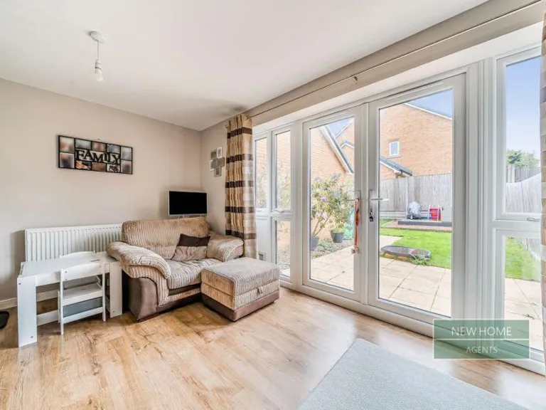
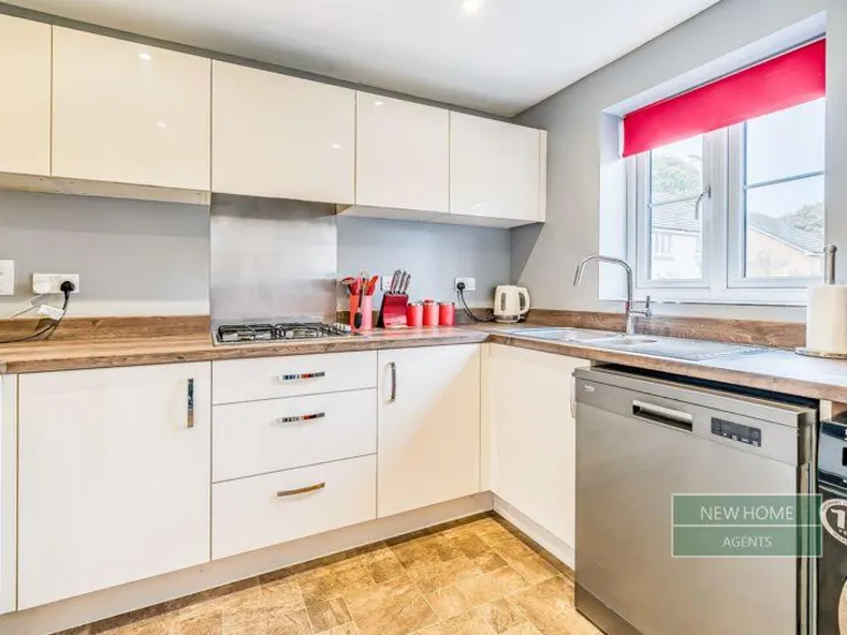
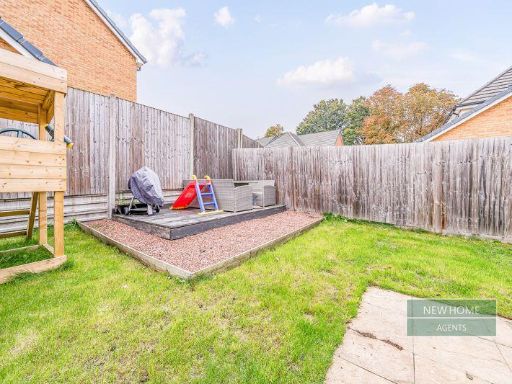
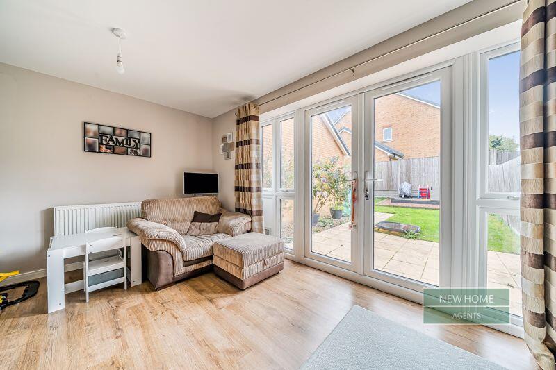
Detected Visual Features
- modern
- semi-detached
- two-storey
- garage
- front garden
- driveway
- brick exterior
- contemporary
- large windows
- patio doors
- laminate flooring
- ample natural light
- garden access
- family-friendly
EPC Details
- High performance glazing
- Average thermal transmittance 0.23 W/m-¦K
- Boiler and radiators, mains gas
- Low energy lighting in all fixed outlets
- Average thermal transmittance 0.11 W/m-¦K
Nearby Schools
- Preston Candover Church of England Primary School
- North Waltham Primary School
- Kempshott Junior School
- Kempshott Infant School
- Chalk Ridge Primary School
- Brighton Hill Community School
- St Anne's Catholic Primary School
- Kings Furlong Junior School
- Castle Hill Primary School
- Hatch Warren Infant School
- Oakley Infant School
- Winklebury Junior School
- Cliddesden Primary School
- Hatch Warren Junior School
- Manor Field Junior School
- Oakley Church of England Junior School
- Park View Primary School
- Castle Hill Infant School
- Winklebury Infant School
- St Mark's Church of England Primary School
- Manor Field Infant School
- Cranbourne
- Bishop Challoner Catholic Secondary School
- Chiltern Primary School
Nearest Bars And Restaurants
- Id: 505880743
- Tags:
- Amenity: pub
- Name: The Sun Inn
- TagsNormalized:
- Lat: 51.2149439
- Lon: -1.1730674
- FullGeoHash: gcp5m73u9t98
- PartitionGeoHash: gcp5
- Images:
- FoodStandards: null
- Distance: 2220.6
,- Id: 281544646
- Tags:
- Addr:
- City: Dummer
- Housename: The Queen Inn
- Postcode: RG25 2AD
- Street: Down Street
- Amenity: pub
- Name: The Queen Inn
- Url: http://thequeeninndummer.com
- TagsNormalized:
- Lat: 51.2113556
- Lon: -1.15987
- FullGeoHash: gcp5mderv0d5
- PartitionGeoHash: gcp5
- Images:
- FoodStandards: null
- Distance: 1770.9
,- Id: 4991801722
- Tags:
- Amenity: cafe
- Brand: Starbucks
- Brand:wikidata: Q37158
- Cuisine: coffee_shop
- Internet_access: wlan
- Internet_access:fee: no
- Name: Starbucks
- Official_name: Starbucks Coffee
- Operator: Sainsbury's
- Outdoor_seating: yes
- Takeaway: yes
- TagsNormalized:
- cafe
- starbucks
- coffee
- takeaway
- Lat: 51.2347531
- Lon: -1.1395218
- FullGeoHash: gcp5qp40p4ny
- PartitionGeoHash: gcp5
- Images:
- FoodStandards: null
- Distance: 1231.4
,- Id: 13365148
- Tags:
- Amenity: pub
- Building: yes
- Building:levels: 2
- Name: The Holly Blue
- Type: multipolygon
- TagsNormalized:
- Lat: 51.2327012
- Lon: -1.1438326
- FullGeoHash: gcp5myxh4g8w
- PartitionGeoHash: gcp5
- Images:
- FoodStandards: null
- Distance: 949.4
,- Id: 8010522189
- Tags:
- Addr:
- City: Basingstoke
- Country: GB
- Housename: The Holly Blue
- Place: Beggarwood
- Postcode: RG23 7GF
- Street: Bradley Way
- Amenity: pub
- Brand: Hall & Woodhouse
- Brand:wikidata: Q5642555
- Brand:wikipedia: en:Hall & Woodhouse
- Internet_access: wlan
- Name: The Holly Blue
- Source:
- Internet_access: available from other side of Beggarwood Lane
- Website: https://www.thehollyblue.co.uk/
- TagsNormalized:
- Lat: 51.2327034
- Lon: -1.1439393
- FullGeoHash: gcp5myxh0k15
- PartitionGeoHash: gcp5
- Images:
- FoodStandards: null
- Distance: 949.2
}
Nearest General Shops
- Id: 499523048
- Tags:
- Name: Dummer Conifers
- Shop: garden_centre
- TagsNormalized:
- Lat: 51.2227144
- Lon: -1.160197
- FullGeoHash: gcp5msg1vqn3
- PartitionGeoHash: gcp5
- Images:
- FoodStandards: null
- Distance: 1084.5
,- Id: 172124307
- Tags:
- Brand: Pets at Home
- Brand:wikidata: Q7179258
- Brand:wikipedia: en:Pets at Home
- Building: yes
- Name: Pets at Home
- Shop: pet
- Source: bing
- TagsNormalized:
- Lat: 51.2336109
- Lon: -1.1409763
- FullGeoHash: gcp5qnc1mm63
- PartitionGeoHash: gcp5
- Images:
- FoodStandards: null
- Distance: 1081.5
,- Id: 381693706
- Tags:
- Addr:
- City: Basingstoke
- Place: Kempshott
- Postcode: RG23 7LL
- Street: Kempshott Hill
- Name: Mott Motorcycles
- Opening_hours: Mo-Sa 09:00-17:00
- Shop: motorcycle
- Website: http://www.mottmotorcycles.co.uk/
- TagsNormalized:
- Lat: 51.2307068
- Lon: -1.1453531
- FullGeoHash: gcp5mymbrrfv
- PartitionGeoHash: gcp5
- Images:
- FoodStandards: null
- Distance: 726.3
}
Nearest Grocery shops
- Id: 246209356
- Tags:
- Created_by: JOSM
- Name: One-Stop
- Shop: convenience
- TagsNormalized:
- Lat: 51.2431807
- Lon: -1.1223238
- FullGeoHash: gcp5w2w9pvnx
- PartitionGeoHash: gcp5
- Images:
- FoodStandards: null
- Distance: 2628.9
,- Id: 703188662
- Tags:
- Building: yes
- Shop: convenience
- TagsNormalized:
- Lat: 51.2339939
- Lon: -1.1391498
- FullGeoHash: gcp5qnf7xusq
- PartitionGeoHash: gcp5
- Images:
- FoodStandards: null
- Distance: 1159.6
,- Id: 9868013687
- Tags:
- Addr:
- City: Basingstoke
- Housenumber: 57-58
- Postcode: RG22 4AQ
- Street: Broadmere Road
- Village: Beggarwood
- Alt_name: Southern Co-Operative
- Brand: The Co-operative Food
- Brand:wikidata: Q107617274
- Loc_name: The Co-Op
- Name: The Co-operative Food
- Shop: supermarket
- Website: http://www.southern.coop/
- TagsNormalized:
- the co-operative food
- food
- shop
- Lat: 51.2296108
- Lon: -1.142347
- FullGeoHash: gcp5qn04j7s7
- PartitionGeoHash: gcp5
- Images:
- FoodStandards: null
- Distance: 627.1
}
Nearest Supermarkets
- Id: 292613087
- Tags:
- Brand: Tesco Express
- Brand:wikidata: Q98456772
- Contact:
- Website: https://www.tesco.com/store-locator/basingstoke/3-4-buckingham-parade
- Name: Tesco Express
- Shop: supermarket
- TagsNormalized:
- tesco
- tesco express
- supermarket
- shop
- Lat: 51.2465883
- Lon: -1.1384034
- FullGeoHash: gcp5w15j122y
- PartitionGeoHash: gcp5
- Images:
- FoodStandards: null
- Distance: 2530.7
,- Id: 196412678
- Tags:
- Addr:
- Housenumber: 3
- Postcode: RG22 4TW
- Street: Wallop Drive
- Brand: Sainsbury's
- Brand:wikidata: Q152096
- Brand:wikipedia: en:Sainsbury's
- Building: yes
- Name: Sainsbury's
- Shop: supermarket
- TagsNormalized:
- sainsburys
- supermarket
- shop
- Lat: 51.2352968
- Lon: -1.1392448
- FullGeoHash: gcp5qp47jxtd
- PartitionGeoHash: gcp5
- Images:
- FoodStandards: null
- Distance: 1294.8
,- Id: 8195368146
- Tags:
- Addr:
- Country: GB
- Housename: Hatch Warren Retail Park
- Postcode: RG22 4TT
- Street: Wallop Drive
- Unit: 1,2
- Brand: Lidl
- Brand:wikidata: Q151954
- Brand:wikipedia: en:Lidl
- Fhrs:
- Name: Lidl
- Shop: supermarket
- TagsNormalized:
- Lat: 51.2344067
- Lon: -1.1416991
- FullGeoHash: gcp5qnbwh3xk
- PartitionGeoHash: gcp5
- Images:
- FoodStandards:
- Id: 1316965
- FHRSID: 1316965
- LocalAuthorityBusinessID: 20/00263/CP
- BusinessName: Lidl
- BusinessType: Retailers - supermarkets/hypermarkets
- BusinessTypeID: 7840
- AddressLine1: Units 1 And 2
- AddressLine2: Hatch Warren Retail Park
- AddressLine3: Wallop Drive
- AddressLine4: Basingstoke
- PostCode: RG22 4TT
- RatingValue: 5
- RatingKey: fhrs_5_en-GB
- RatingDate: 2021-04-21
- LocalAuthorityCode: 131
- LocalAuthorityName: Basingstoke and Deane
- LocalAuthorityWebSite: http://www.basingstoke.gov.uk
- LocalAuthorityEmailAddress: ehteam@basingstoke.gov.uk
- Scores:
- Hygiene: 0
- Structural: 0
- ConfidenceInManagement: 5
- NewRatingPending: false
- Geocode:
- Longitude: -1.14162120000000
- Latitude: 51.23416460000000
- Distance: 1157
}
Nearest Religious buildings
- Id: 884300834
- Tags:
- Amenity: place_of_worship
- Building: church
- Denomination: anglican
- Name: Saint Mark's Church
- Religion: christian
- Wikidata: Q105104531
- TagsNormalized:
- place of worship
- church
- anglican
- christian
- Lat: 51.2440452
- Lon: -1.1332553
- FullGeoHash: gcp5w0wy1nrs
- PartitionGeoHash: gcp5
- Images:
- FoodStandards: null
- Distance: 2350.2
,- Id: 652354318
- Tags:
- Amenity: place_of_worship
- Building: yes
- Denomination: anglican
- Name: The Church Of All Saints Dummer
- Religion: christian
- Wikidata: Q17528240
- TagsNormalized:
- place of worship
- anglican
- church
- christian
- Lat: 51.2103216
- Lon: -1.1587867
- FullGeoHash: gcp5mds1wrf5
- PartitionGeoHash: gcp5
- Images:
- FoodStandards: null
- Distance: 1823.4
,- Id: 169682584
- Tags:
- Addr:
- Postcode: RG22 4US
- Street: Danebury Road
- Amenity: school
- Denomination: anglican
- Name: Saint Mark's Church of England Primary School
- Ref:
- Religion: christian
- Source: Bing
- Website: http://www.st-marksschool.co.uk/
- Wikidata: Q67149311
- TagsNormalized:
- school
- anglican
- church
- christian
- Lat: 51.2340116
- Lon: -1.1301691
- FullGeoHash: gcp5qqc59puz
- PartitionGeoHash: gcp5
- Images:
- FoodStandards: null
- Distance: 1494.1
}
Nearest Medical buildings
- Id: 268691016
- Tags:
- Amenity: pharmacy
- Brand: Lloyds Pharmacy
- Brand:wikidata: Q6662870
- Brand:wikipedia: en:LloydsPharmacy
- Dispensing: yes
- Healthcare: pharmacy
- Name: Lloyds Pharmacy
- TagsNormalized:
- pharmacy
- lloyds pharmacy
- health
- healthcare
- Lat: 51.2354814
- Lon: -1.1392368
- FullGeoHash: gcp5qp4kmcgr
- PartitionGeoHash: gcp5
- Images:
- FoodStandards: null
- Distance: 1314.6
,- Id: 317845348
- Tags:
- Addr:
- City: Basingstoke
- Housename: The Beggarwood Surgery
- Postcode: RG22 4AQ
- Street: Broadmere Road
- Amenity: doctors
- Fax: +44 1256 396505
- Name: Beggarwood Surgery
- Phone: +44 1256 396500
- Website: http://www.beggarwoodsurgery.co.uk/
- TagsNormalized:
- Lat: 51.2295526
- Lon: -1.1414886
- FullGeoHash: gcp5qn0cc2u2
- PartitionGeoHash: gcp5
- Images:
- FoodStandards: null
- Distance: 640
,- Id: 317846713
- Tags:
- Amenity: pharmacy
- Brand:
- Dispensing: yes
- Name: Boots
- TagsNormalized:
- Lat: 51.2295516
- Lon: -1.1417544
- FullGeoHash: gcp5qn09g0w4
- PartitionGeoHash: gcp5
- Images:
- FoodStandards: null
- Distance: 633.4
,- Id: 317845346
- Tags:
- Addr:
- City: Basingstoke
- Postcode: RG22 4AQ
- Street: Broadmere Road
- Amenity: dentist
- Name: Beggarwood Dental Surgery
- Opening_hours: Mo-Fr 08:30-17:30
- Phone: +44 1256 391391
- Website: http://www.beggarwooddental.com/
- TagsNormalized:
- Lat: 51.2294372
- Lon: -1.1414263
- FullGeoHash: gcp5qn0c4g6b
- PartitionGeoHash: gcp5
- Images:
- FoodStandards: null
- Distance: 629.6
}
Nearest Leisure Facilities
- Id: 29059898
- Tags:
- Leisure: playground
- Name: Breadels Field Play Area
- TagsNormalized:
- Lat: 51.2275951
- Lon: -1.13371
- FullGeoHash: gcp5qjwqqeue
- PartitionGeoHash: gcp5
- Images:
- FoodStandards: null
- Distance: 860.5
,- Id: 187959986
- Tags:
- Leisure: pitch
- Source: Bing
- Sport: skateboard
- TagsNormalized:
- pitch
- leisure
- skateboard
- sports
- Lat: 51.2307836
- Lon: -1.1389442
- FullGeoHash: gcp5qn68uwjx
- PartitionGeoHash: gcp5
- Images:
- FoodStandards: null
- Distance: 839.6
,- Id: 187959987
- Tags:
- Leisure: playground
- Source: Bing
- TagsNormalized:
- Lat: 51.2303654
- Lon: -1.1382387
- FullGeoHash: gcp5qn5nt079
- PartitionGeoHash: gcp5
- Images:
- FoodStandards: null
- Distance: 825.4
,- Id: 26467514
- Tags:
- Leisure: playground
- Name: Arcadia Close Play Area
- TagsNormalized:
- Lat: 51.2262835
- Lon: -1.1397211
- FullGeoHash: gcp5qj6ndx67
- PartitionGeoHash: gcp5
- Images:
- FoodStandards: null
- Distance: 423.9
,- Id: 26504637
- Tags:
- Leisure: playground
- Name: Oceania Crescent Play Area
- Source:
- TagsNormalized:
- Lat: 51.2252321
- Lon: -1.1434389
- FullGeoHash: gcp5mvr2egq5
- PartitionGeoHash: gcp5
- Images:
- FoodStandards: null
- Distance: 150.3
}
Nearest Tourist attractions
- Id: 700413766
- Tags:
- Addr:
- City: Basingstoke
- Postcode: RG22 4BJ
- Street: The Harrow Way
- Name: Viables Craft Centre
- Tourism: attraction
- Website: http://www.viablescraftcentre.co.uk/
- TagsNormalized:
- Lat: 51.2477119
- Lon: -1.0969866
- FullGeoHash: gcp5x135w3gt
- PartitionGeoHash: gcp5
- Images:
- FoodStandards: null
- Distance: 4233.9
,- Id: 9094352468
- Tags:
- Addr:
- Country: GB
- Housename: Sylven Lea
- Postcode: RG25 2QW
- Street: Green Lane
- Fhrs:
- Guest_house: bed_and_breakfast
- Name: Sylven Lea Bed And Breakfast
- Tourism: guest_house
- TagsNormalized:
- Lat: 51.2039888
- Lon: -1.0966869
- FullGeoHash: gcp5r13kv76f
- PartitionGeoHash: gcp5
- Images:
- FoodStandards:
- Id: 840754
- FHRSID: 840754
- LocalAuthorityBusinessID: 06/00024/CP
- BusinessName: Sylven Lea Bed And Breakfast
- BusinessType: Hotel/bed & breakfast/guest house
- BusinessTypeID: 7842
- AddressLine1: Sylven Lea
- AddressLine2: Green Lane
- AddressLine3: Ellisfield
- AddressLine4: Basingstoke
- PostCode: RG25 2QW
- RatingValue: 5
- RatingKey: fhrs_5_en-GB
- RatingDate: 2020-07-14
- LocalAuthorityCode: 131
- LocalAuthorityName: Basingstoke and Deane
- LocalAuthorityWebSite: http://www.basingstoke.gov.uk
- LocalAuthorityEmailAddress: ehteam@basingstoke.gov.uk
- Scores:
- Hygiene: 0
- Structural: 0
- ConfidenceInManagement: 0
- NewRatingPending: false
- Geocode:
- Longitude: -1.09672000000000
- Latitude: 51.20405400000000
- Distance: 4034.2
,- Id: 298033270
- Tags:
- Name: Travelodge
- Tourism: motel
- TagsNormalized:
- Lat: 51.2491615
- Lon: -1.1140693
- FullGeoHash: gcp5w9su021s
- PartitionGeoHash: gcp5
- Images:
- FoodStandards: null
- Distance: 3505.9
}
Nearest Train stations
- Id: 5863634184
- Tags:
- Name: Hook
- Naptan:
- Network: National Rail
- Public_transport: station
- Railway: station
- Ref:
- Wikidata: Q2717068
- Wikipedia: en:Hook railway station
- TagsNormalized:
- Lat: 51.2798793
- Lon: -0.9614163
- FullGeoHash: gcp7dp5yvqk5
- PartitionGeoHash: gcp7
- Images:
- FoodStandards: null
- Distance: 14186.2
,- Id: 47008811
- Tags:
- Name: Medstead and Four Marks
- Naptan:
- Operator: Watercress Line
- Public_transport: station
- Railway: station
- Usage: tourism
- Wheelchair: yes
- Wikidata: Q6807304
- TagsNormalized:
- Lat: 51.1134108
- Lon: -1.0457926
- FullGeoHash: gcp6b0ympq2e
- PartitionGeoHash: gcp6
- Images:
- FoodStandards: null
- Distance: 14120
,- Id: 1136502525
- Tags:
- Name: Whitchurch
- Naptan:
- Network: National Rail
- Operator: South West Trains
- Public_transport: station
- Railway: station
- Ref:
- Source: NPE
- Wikidata: Q1865326
- Wikipedia: en:Whitchurch railway station (Hampshire)
- TagsNormalized:
- Lat: 51.2376461
- Lon: -1.3387418
- FullGeoHash: gcp53x90vj9b
- PartitionGeoHash: gcp5
- Images:
- FoodStandards: null
- Distance: 13586.4
,- Id: 113419698
- Tags:
- Name: Overton
- Naptan:
- Network: National Rail
- Operator: South West Trains
- Public_transport: station
- Railway: station
- Ref:
- Source: NPE
- Wheelchair: yes
- Wikidata: Q2197986
- Wikipedia: en:Overton railway station
- TagsNormalized:
- Lat: 51.2541369
- Lon: -1.2599752
- FullGeoHash: gcp5e6d8brw7
- PartitionGeoHash: gcp5
- Images:
- FoodStandards: null
- Distance: 8682.1
,- Id: 344525373
- Tags:
- Internet_access: wlan
- Name: Basingstoke
- Name:lt: Beizingstokas
- Naptan:
- Network: National Rail
- Operator: South West Trains
- Platforms: 5
- Public_transport: station
- Railway: station
- Ref:
- Wikidata: Q2421375
- Wikipedia: en:Basingstoke railway station
- TagsNormalized:
- Lat: 51.2684238
- Lon: -1.0885594
- FullGeoHash: gcp5xjpk4wzk
- PartitionGeoHash: gcp5
- Images:
- FoodStandards: null
- Distance: 6286.8
}
Nearest Hotels
- Id: 370626642
- Tags:
- Addr:
- Country: GB
- Postcode: RG25 2BB
- Street: Popham Lane
- Amenity: pub
- Brand: Good Night Inns
- Building: yes
- Fhrs:
- Name: The Wheatsheaf Hotel
- Tourism: motel
- Wikidata: Q26474361
- TagsNormalized:
- Lat: 51.2057971
- Lon: -1.1865896
- FullGeoHash: gcp5kcxzqkqt
- PartitionGeoHash: gcp5
- Images:
- FoodStandards: null
- Distance: 3556.9
,- Id: 921114500
- Tags:
- Brand: Travelodge
- Brand:wikidata: Q9361374
- Brand:wikipedia: en:Travelodge UK
- Building: yes
- Name: Travelodge
- Tourism: hotel
- TagsNormalized:
- Lat: 51.2492179
- Lon: -1.1139172
- FullGeoHash: gcp5w9su7feh
- PartitionGeoHash: gcp5
- Images:
- FoodStandards: null
- Distance: 3517.4
,- Id: 921114501
- Tags:
- Brand: Travelodge
- Brand:wikidata: Q9361374
- Brand:wikipedia: en:Travelodge UK
- Building: yes
- Name: Travelodge
- Tourism: hotel
- TagsNormalized:
- Lat: 51.248977
- Lon: -1.1140514
- FullGeoHash: gcp5w9sfbtxp
- PartitionGeoHash: gcp5
- Images:
- FoodStandards: null
- Distance: 3490.5
}
Tags
- modern
- semi-detached
- two-storey
- garage
- front garden
- driveway
- brick exterior
- contemporary
- large windows
- patio doors
- laminate flooring
- ample natural light
- garden access
- family-friendly
- modern
Local Market Stats
- Average Price/sqft: £380
- Avg Income: £60600
- Rental Yield: 3.4%
- Social Housing: 7%
- Planning Success Rate: 93%
Similar Properties
 3 bedroom semi-detached house for sale in Broadmere Road, Beggarwood, Basingstoke, Hampshire, RG22 — £400,000 • 3 bed • 2 bath • 991 ft²
 3 bedroom end of terrace house for sale in Breadels Field, Beggarwood, Basingstoke, RG22 — £375,000 • 3 bed • 2 bath • 648 ft²
 4 bedroom semi-detached house for sale in Longwood Copse Lane, Beggarwood, Basingstoke, RG23 — £475,000 • 4 bed • 2 bath • 1234 ft²
 4 bedroom detached house for sale in Blue Hut Way, Basingstoke, RG23 — £535,000 • 4 bed • 2 bath • 1770 ft²
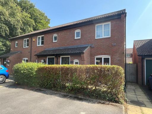 3 bedroom end of terrace house for sale in Breadels Field, Beggarwood, Basingstoke, RG22 — £365,000 • 3 bed • 2 bath • 543 ft²
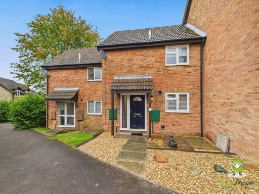 2 bedroom terraced house for sale in Paterson Close, Basingstoke, Hampshire, RG22 — £300,000 • 2 bed • 1 bath • 688 ft²
Meta
- {
"@context": "https://schema.org",
"@type": "Residence",
"name": "2 bedroom semidetached house for sale in Longwood Copse Lan…",
"description": "",
"url": "https://propertypiper.co.uk/property/dedeeae8-606a-45a7-ba5b-2ad9d1466b2a",
"image": "https://image-a.propertypiper.co.uk/44244664-ae28-4af5-884f-01e2bb8194d4-1024.jpeg",
"address": {
"@type": "PostalAddress",
"streetAddress": "Longwood Copse Lane Beggarwood, Basingstoke, RG23 7FD",
"postalCode": "RG23 7FD",
"addressLocality": "Basingstoke and Deane",
"addressRegion": "Basingstoke",
"addressCountry": "England"
},
"geo": {
"@type": "GeoCoordinates",
"latitude": 51.2241845,
"longitude": -1.1448025
},
"numberOfRooms": 2,
"numberOfBathroomsTotal": 2,
"floorSize": {
"@type": "QuantitativeValue",
"value": 721,
"unitCode": "FTK"
},
"offers": {
"@type": "Offer",
"price": 350000,
"priceCurrency": "GBP",
"availability": "https://schema.org/InStock"
},
"additionalProperty": [
{
"@type": "PropertyValue",
"name": "Feature",
"value": "modern"
},
{
"@type": "PropertyValue",
"name": "Feature",
"value": "semi-detached"
},
{
"@type": "PropertyValue",
"name": "Feature",
"value": "two-storey"
},
{
"@type": "PropertyValue",
"name": "Feature",
"value": "garage"
},
{
"@type": "PropertyValue",
"name": "Feature",
"value": "front garden"
},
{
"@type": "PropertyValue",
"name": "Feature",
"value": "driveway"
},
{
"@type": "PropertyValue",
"name": "Feature",
"value": "brick exterior"
},
{
"@type": "PropertyValue",
"name": "Feature",
"value": "contemporary"
},
{
"@type": "PropertyValue",
"name": "Feature",
"value": "large windows"
},
{
"@type": "PropertyValue",
"name": "Feature",
"value": "patio doors"
},
{
"@type": "PropertyValue",
"name": "Feature",
"value": "laminate flooring"
},
{
"@type": "PropertyValue",
"name": "Feature",
"value": "ample natural light"
},
{
"@type": "PropertyValue",
"name": "Feature",
"value": "garden access"
},
{
"@type": "PropertyValue",
"name": "Feature",
"value": "family-friendly"
},
{
"@type": "PropertyValue",
"name": "Feature",
"value": "modern"
}
]
}