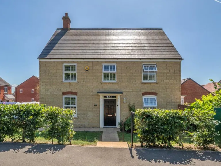
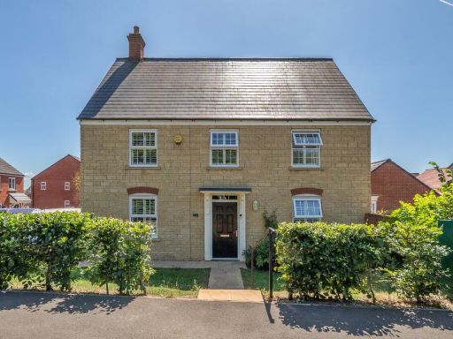
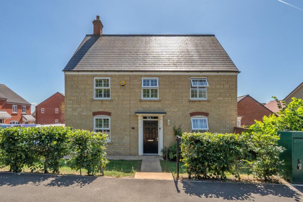
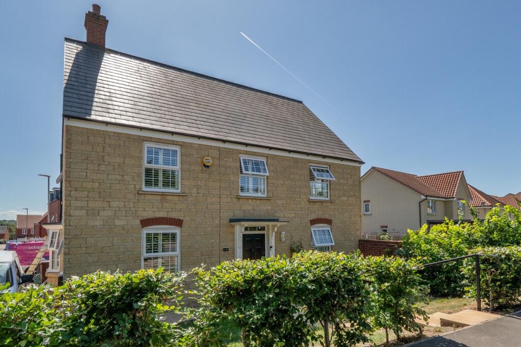
BA5 2NG - 4 bedroom detached house for sale in Wookey Hole Road, Well…
View on Property Piper
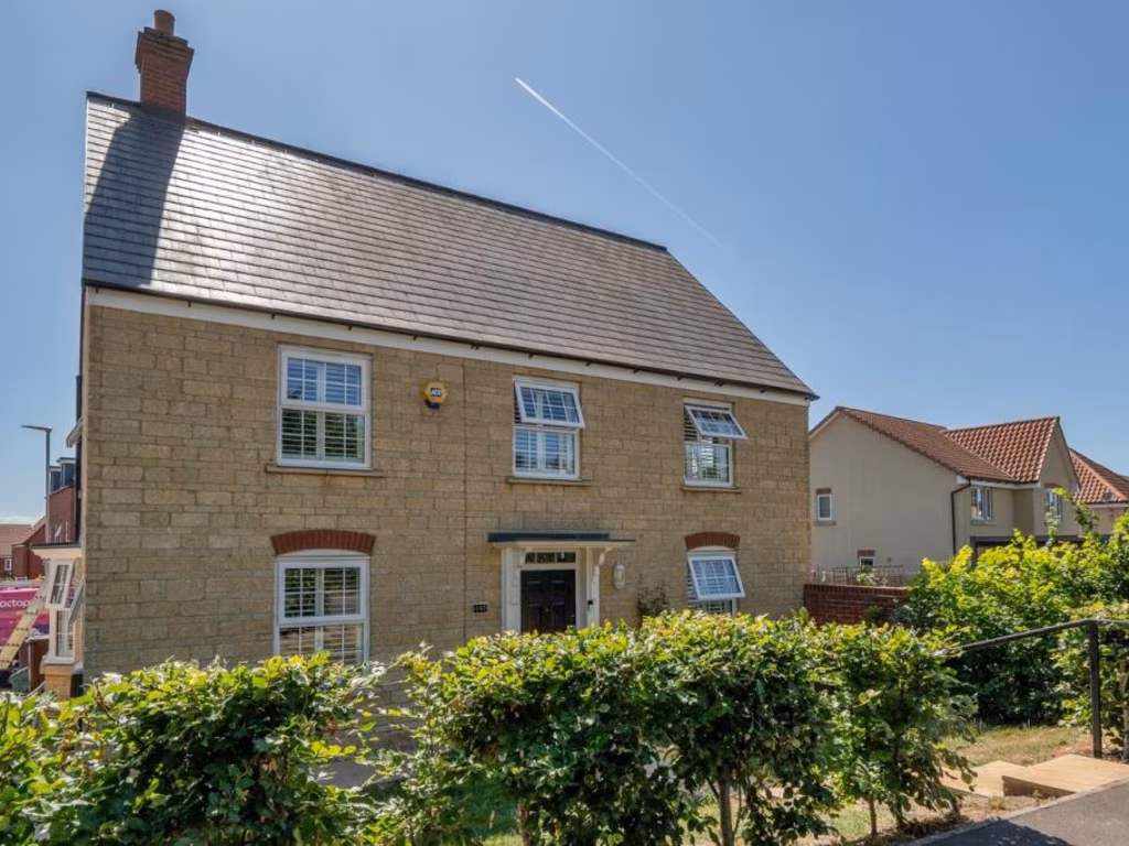
4 bedroom detached house for sale in Wookey Hole Road, Wells, BA5
Property Details
- Price: £520000
- Bedrooms: 4
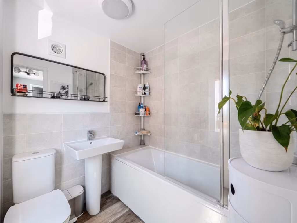
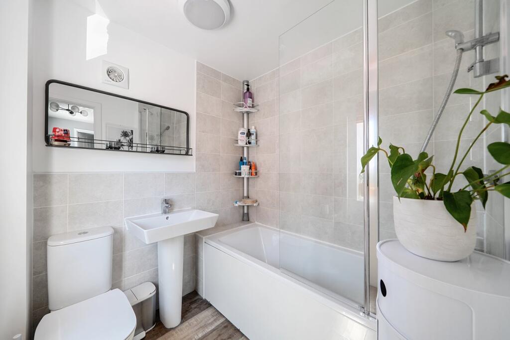
- Bathrooms: 2
- Property Type: undefined
- Property SubType: undefined
Image Descriptions
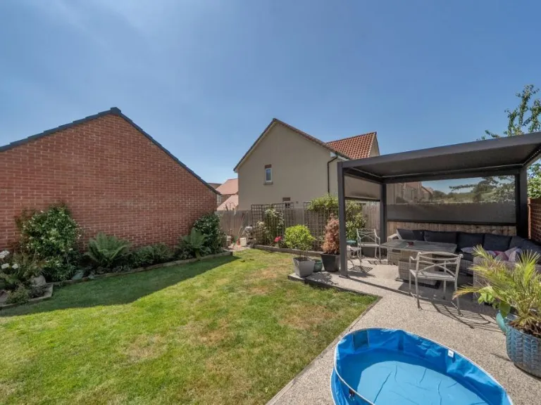
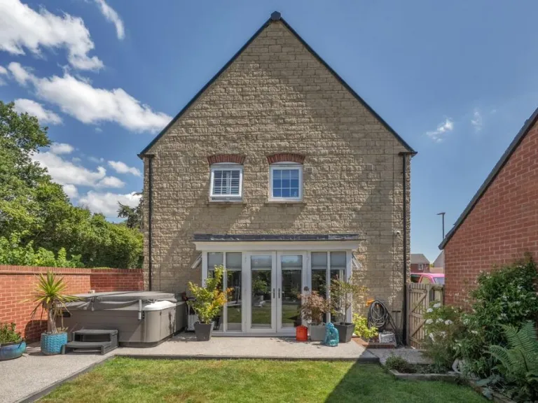
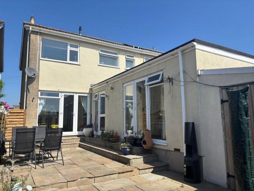
- residential house modern detached
- semi-detached house Modern
Floorplan Description
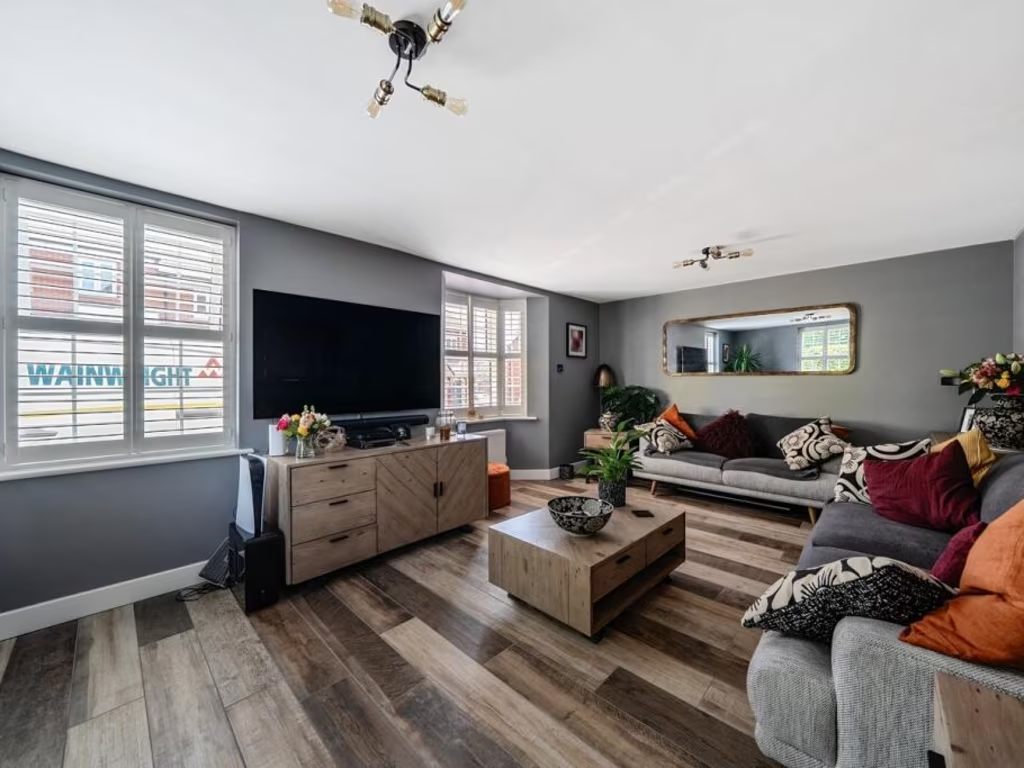
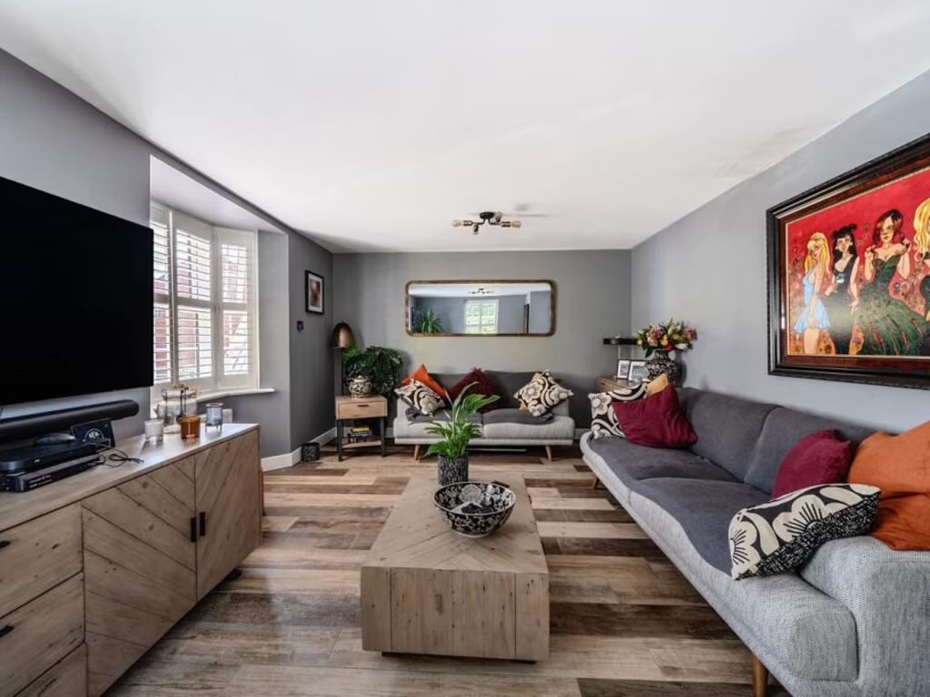
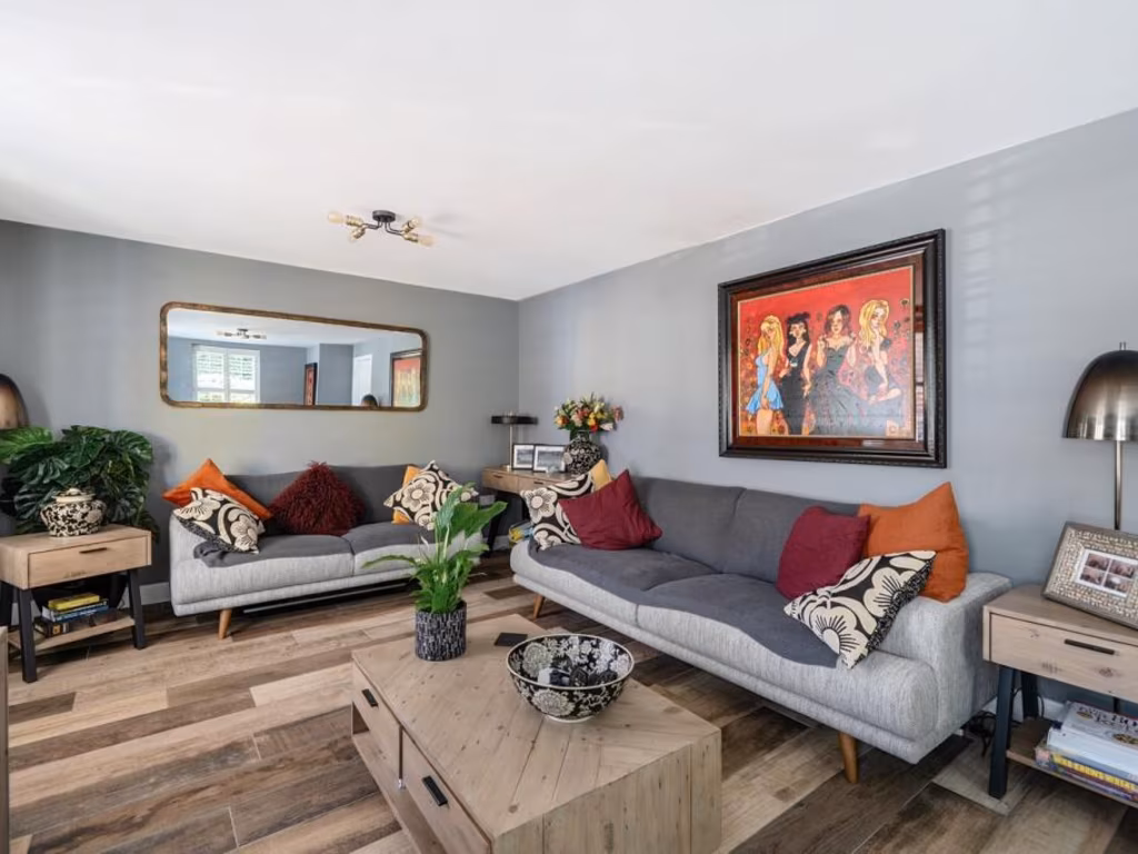
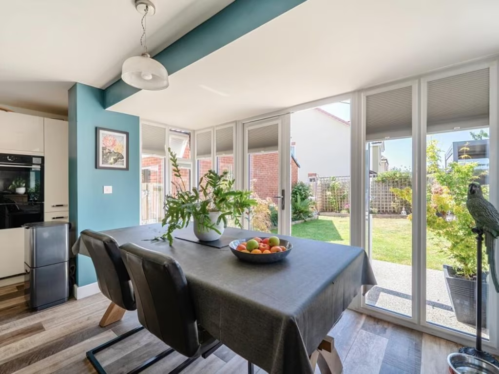
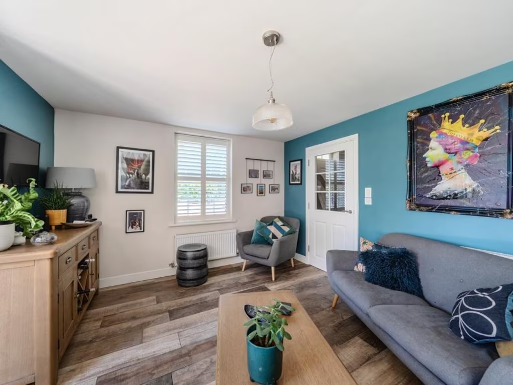
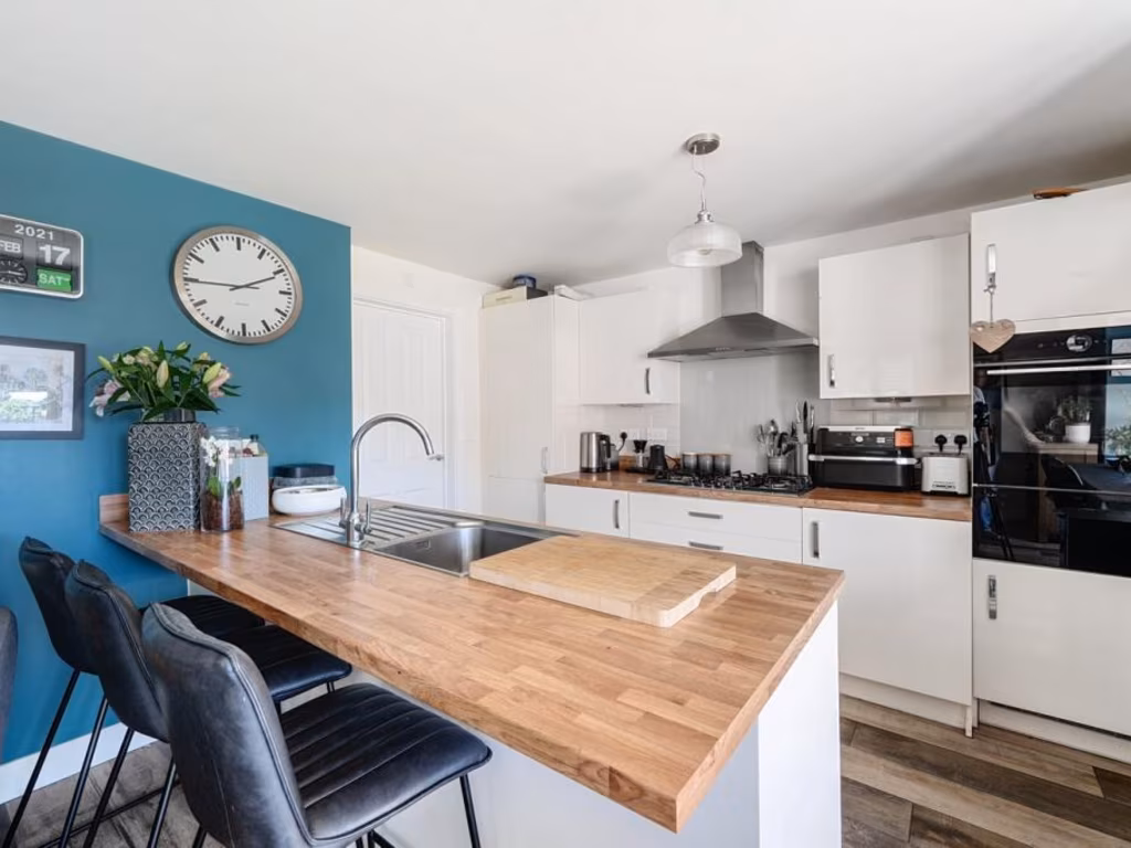
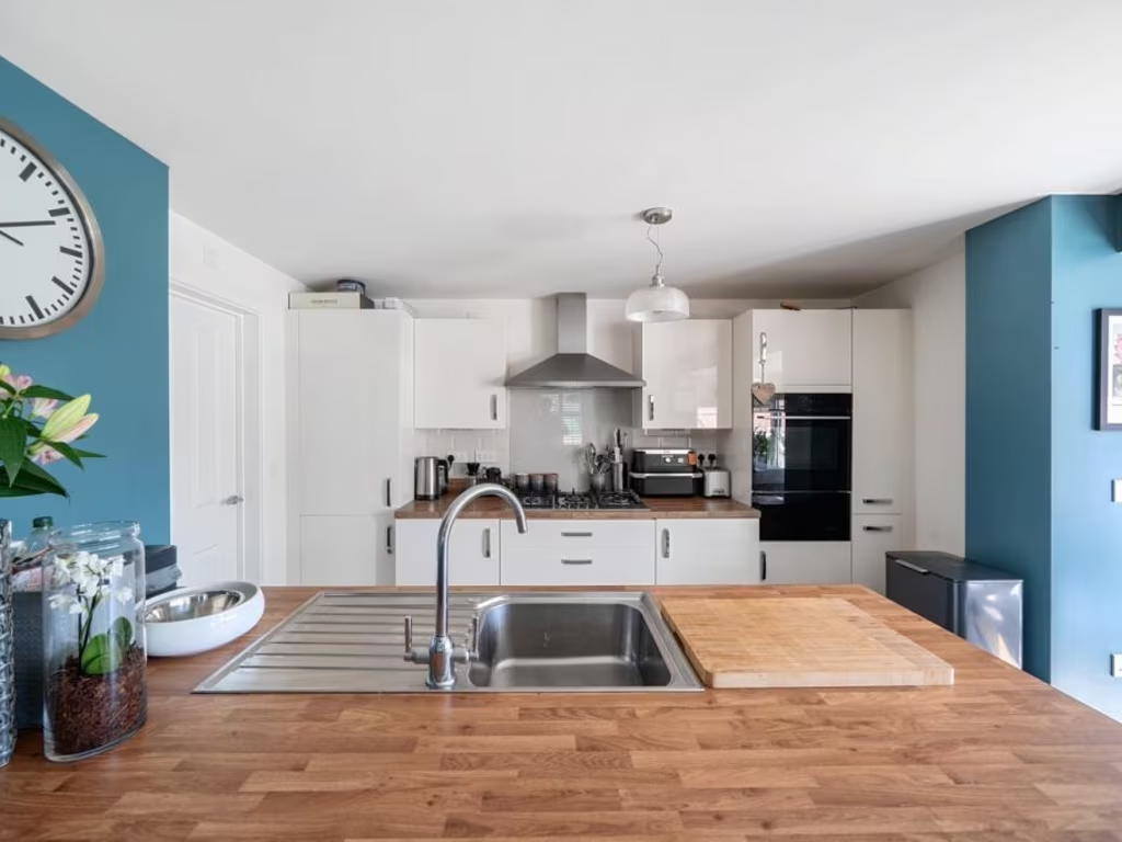
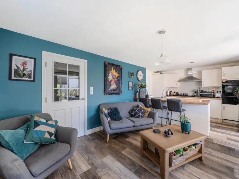
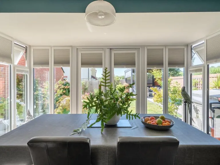
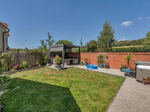
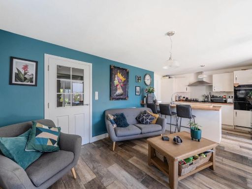
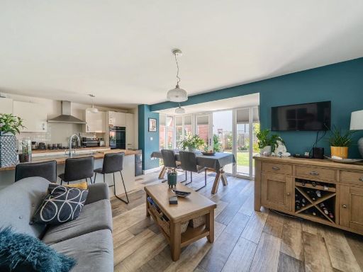
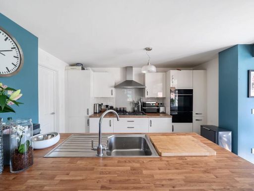
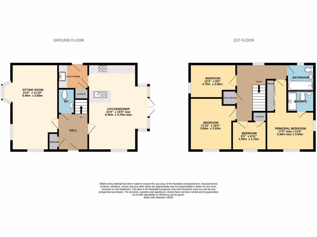
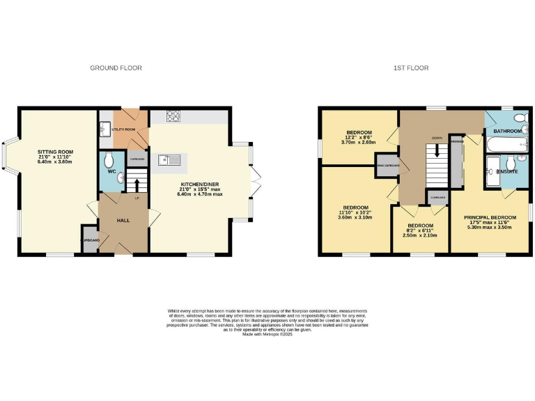
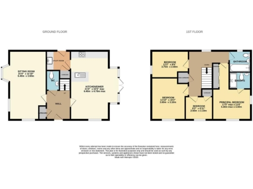
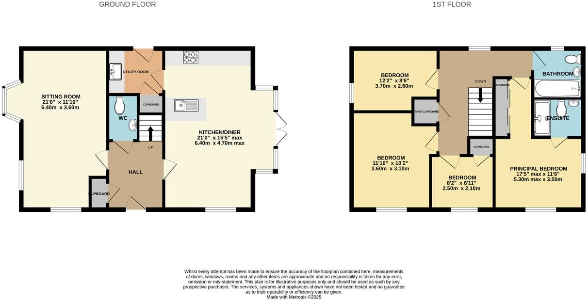
- Two-storey house with sitting room and kitchen/diner on ground floor and four bedrooms on first floor.
Rooms
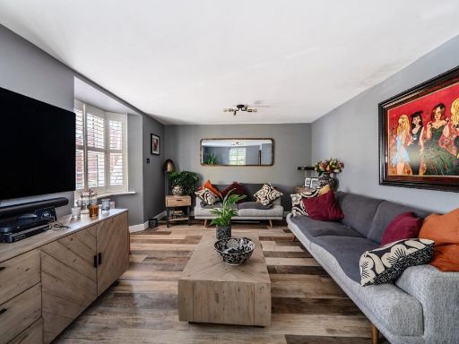
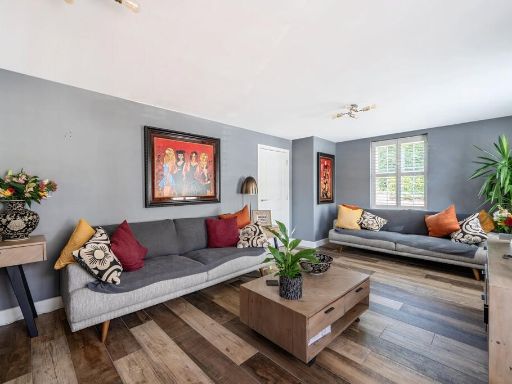
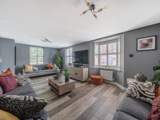
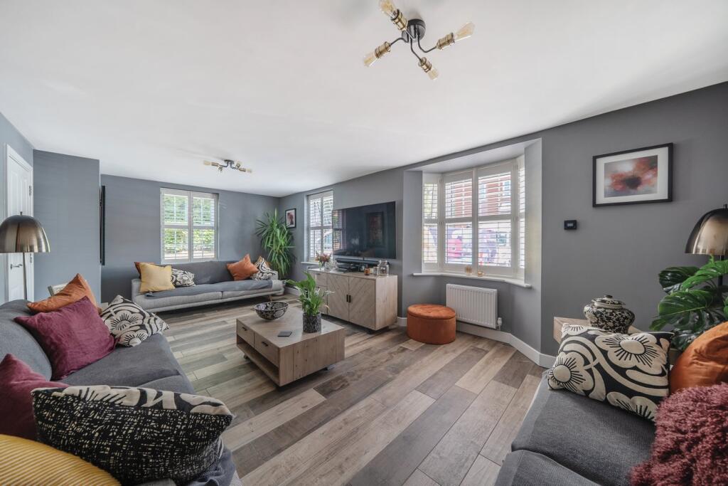
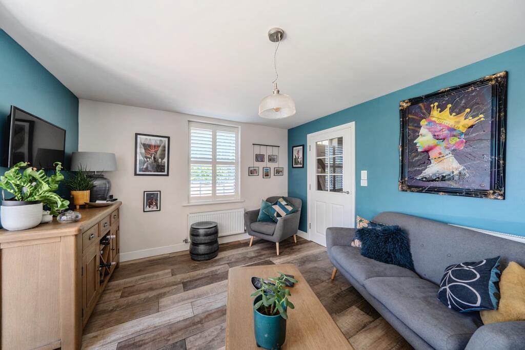
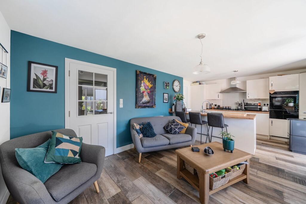
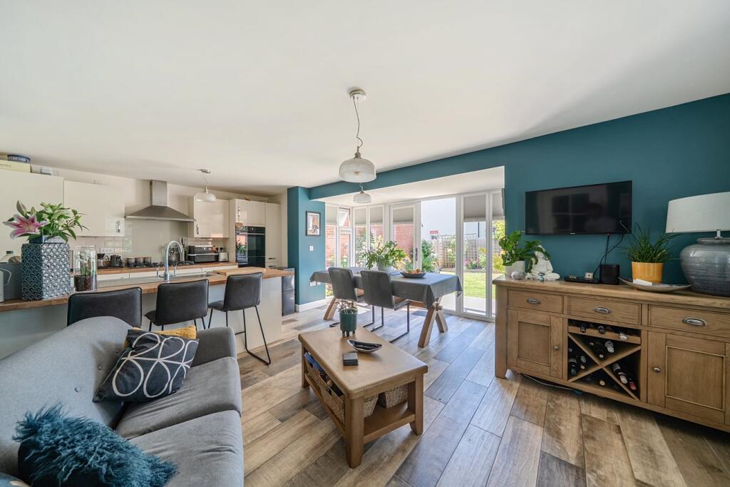
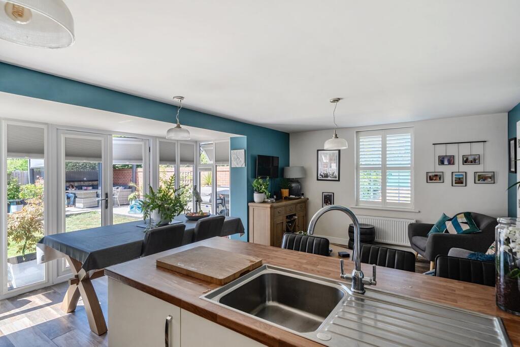
- SITTING ROOM:
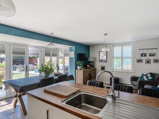
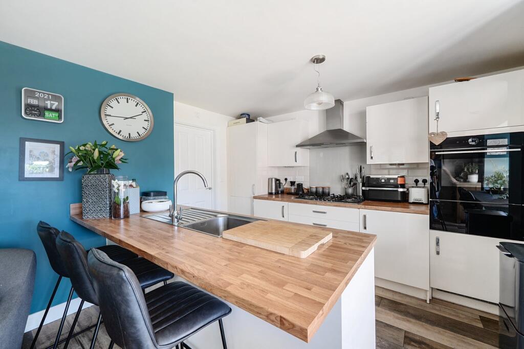
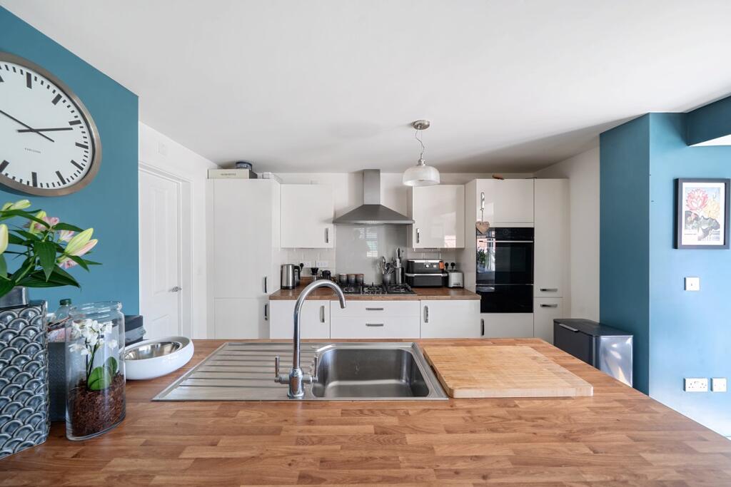
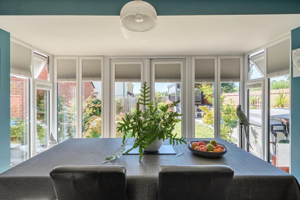
- KITCHEN/DINER:
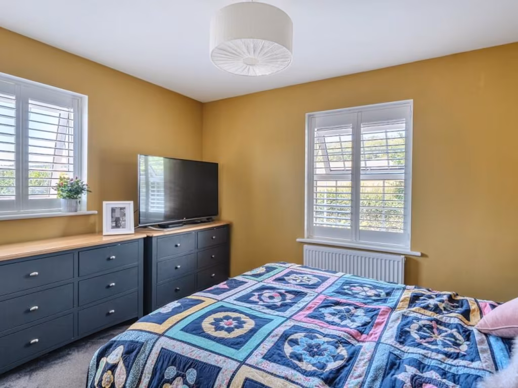
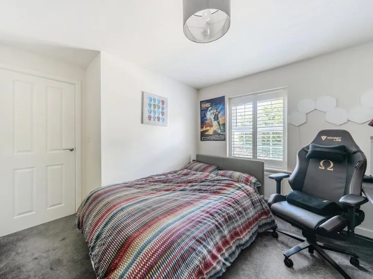
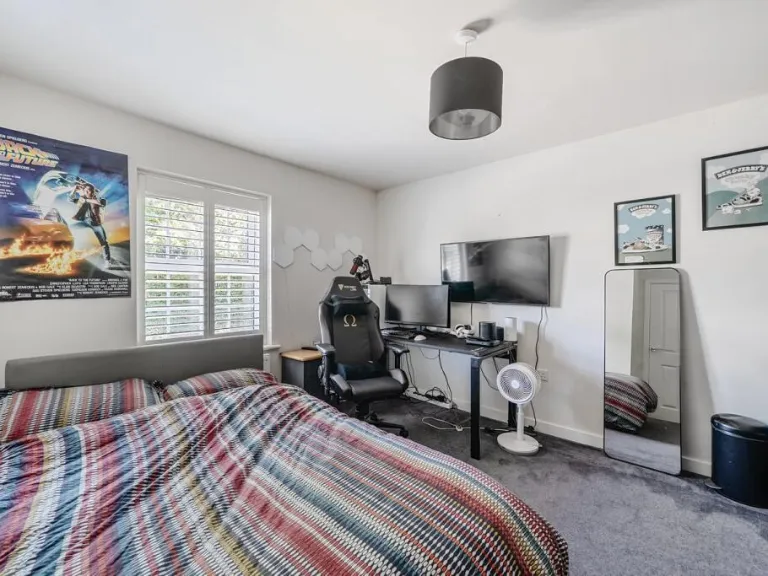
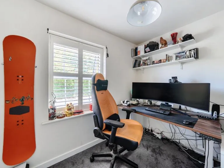
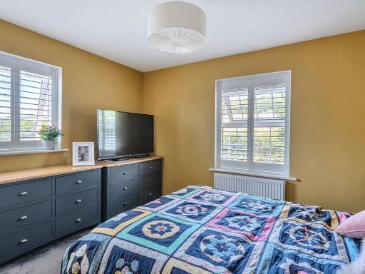
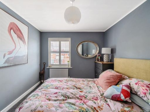
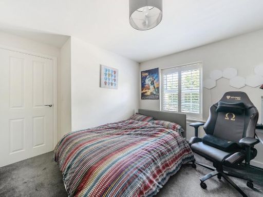
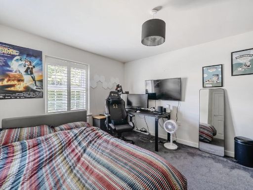
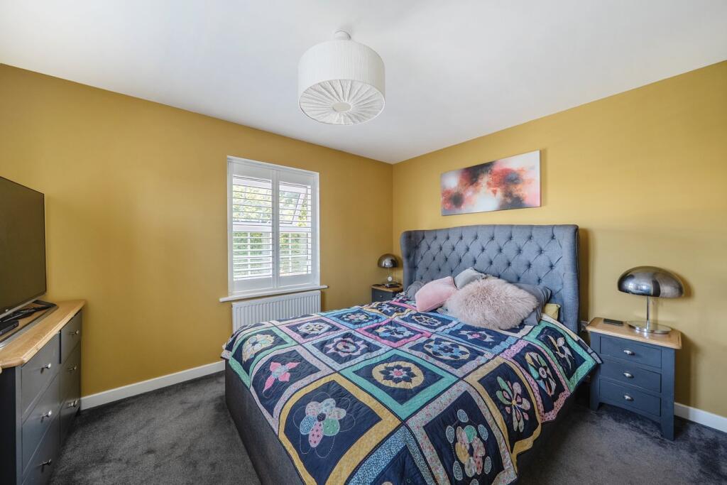
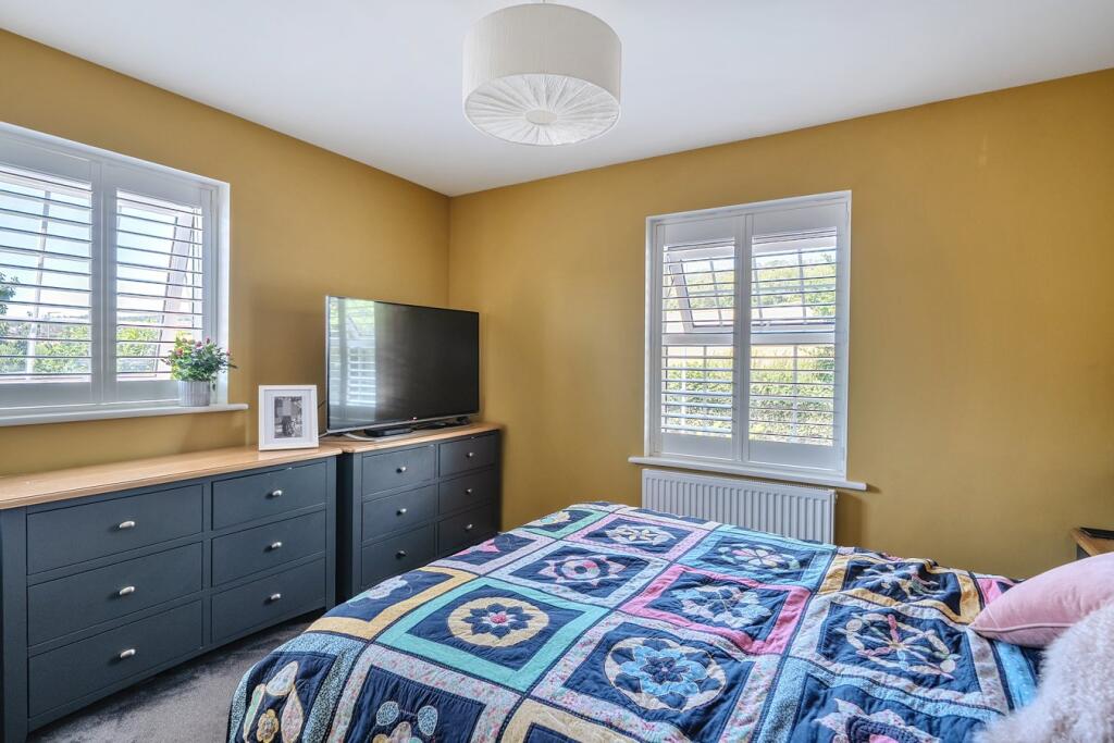
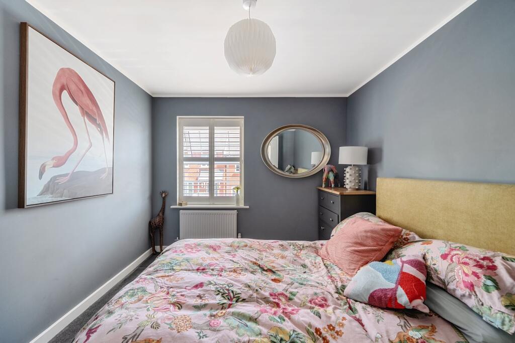
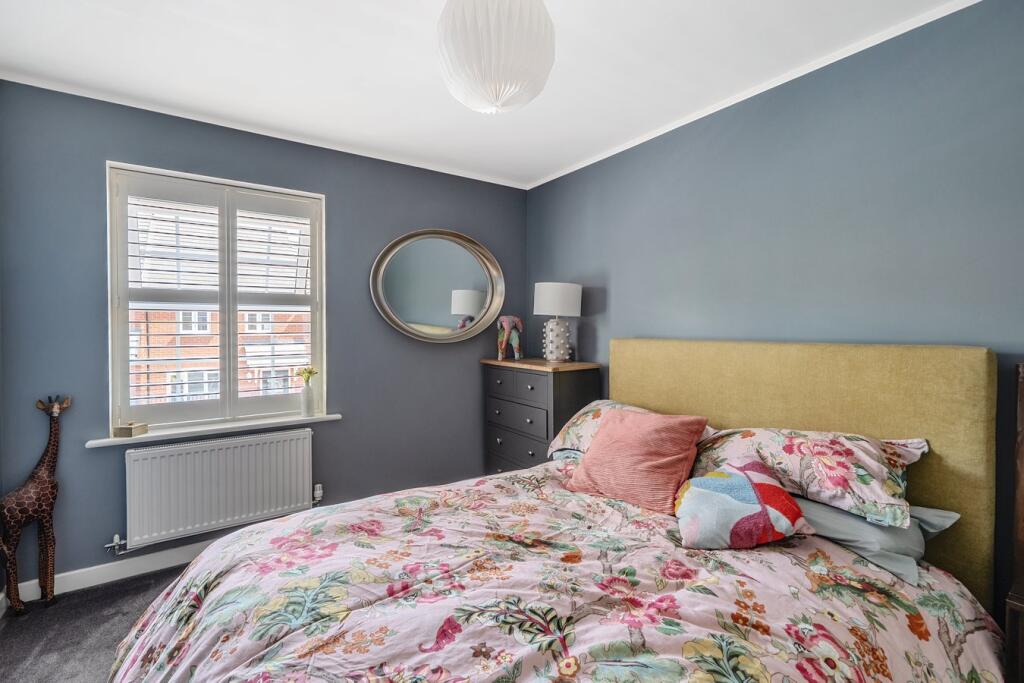
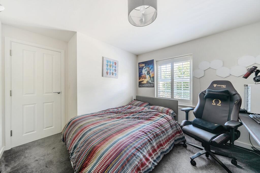
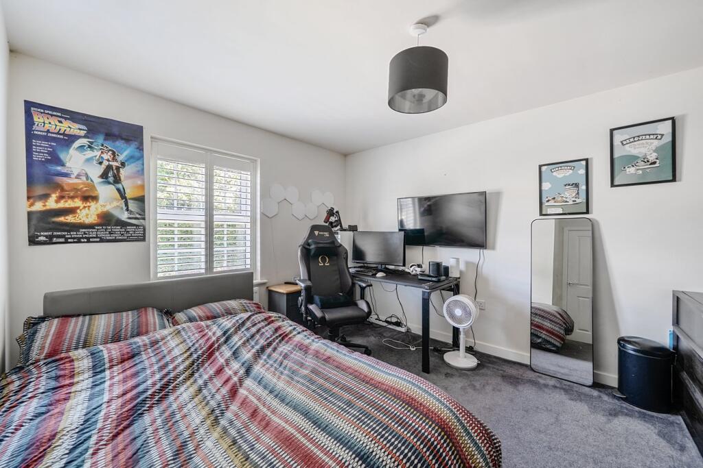
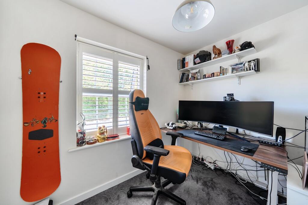
- BEDROOM:
- BEDROOM:
- BEDROOM:
- PRINCIPAL BEDROOM:
Textual Property Features
Detected Visual Features
- modern
- detached
- brick
- two-story
- symmetrical
- sash windows
- pitched roof
- chimney
- semi-detached
- brick exterior
- front garden
- residential area
EPC Details
- High performance glazing
- Average thermal transmittance 0.27 W/m-¦K
- Boiler and radiators, mains gas
- Low energy lighting in all fixed outlets
- Average thermal transmittance 0.14 W/m-¦K
Nearby Schools
- St Dunstan's School
- Bowlish Infant School
- Wookey Primary School
- Chewton Mendip Church of England VA Primary School
- St Joseph and St Teresa Catholic Primary School
- Stoberry Park School
- St Lawrence's CofE Primary School
- Draycott & Rodney Stoke Church of England First School
- Priddy Primary School
- St Benedict's Church of England Voluntary Aided Junior School
- St John's Church of England Voluntary Controlled Infants School
- Coxley Primary School
- St Cuthbert's Church of England Academy Infants and Pre-School
- Wells Cathedral School
- Horrington Primary School
- St Cuthbert's CofE Junior School
- The Blue School
Nearest Bars And Restaurants
- Id: 4997325291
- Tags:
- Amenity: restaurant
- Name: Captain Jacks Restaurant
- TagsNormalized:
- Lat: 51.2268956
- Lon: -2.6719492
- FullGeoHash: gcn57jw6716r
- PartitionGeoHash: gcn5
- Images:
- FoodStandards: null
- Distance: 1242.8
,- Id: 263388985
- Tags:
- Amenity: cafe
- Building: yes
- Source: Bing
- TagsNormalized:
- Lat: 51.2263032
- Lon: -2.6725858
- FullGeoHash: gcn57jmyu5p9
- PartitionGeoHash: gcn5
- Images:
- FoodStandards: null
- Distance: 1200.7
,- Id: 263389842
- Tags:
- Amenity: pub
- Building: yes
- Name: The Wookey Hole Inn
- Source: Bing
- TagsNormalized:
- Lat: 51.2251687
- Lon: -2.6711979
- FullGeoHash: gcn57jqbhxd3
- PartitionGeoHash: gcn5
- Images:
- FoodStandards: null
- Distance: 1045.7
,- Id: 1460484588
- Tags:
- Amenity: pub
- Name: Wookey Hole Club
- TagsNormalized:
- Lat: 51.2244663
- Lon: -2.6708508
- FullGeoHash: gcn57jphhst7
- PartitionGeoHash: gcn5
- Images:
- FoodStandards: null
- Distance: 964.5
,- Id: 693742268
- Tags:
- TagsNormalized:
- Lat: 51.2113572
- Lon: -2.6719188
- FullGeoHash: gcn574wrgbbu
- PartitionGeoHash: gcn5
- Images:
- FoodStandards: null
- Distance: 746.7
}
Nearest General Shops
- Id: 5264748521
- Tags:
- Addr:
- Housenumber: 41
- Postcode: BA5 2AW
- Street: St Cuthbert Street
- Name: Laundrette
- Shop: laundry
- TagsNormalized:
- Lat: 51.2078973
- Lon: -2.6511519
- FullGeoHash: gcn57dj7xevv
- PartitionGeoHash: gcn5
- Images:
- FoodStandards: null
- Distance: 1370.6
,- Id: 358517934
- Tags:
- Brand: Halfords
- Brand:wikidata: Q3398786
- Brand:wikipedia: en:Halfords
- Name: Halfords
- Service:
- Shop: car_parts
- TagsNormalized:
- Lat: 51.2071983
- Lon: -2.6550092
- FullGeoHash: gcn579fxtc9s
- PartitionGeoHash: gcn5
- Images:
- FoodStandards: null
- Distance: 1258.1
,- Id: 4920545996
- Tags:
- Name: Wookey Hole Gift Shop
- Shop: gift
- TagsNormalized:
- Lat: 51.2269224
- Lon: -2.6723506
- FullGeoHash: gcn57jw43wqy
- PartitionGeoHash: gcn5
- Images:
- FoodStandards: null
- Distance: 1256.5
}
Nearest Supermarkets
- Id: 245486066
- Tags:
- Addr:
- City: Wells
- Country: GB
- County: Somerset
- Postcode: BA5 2AZ
- Street: Strawberry Way South
- Alt_name: LIDL Wells
- Brand: Lidl
- Brand:wikidata: Q151954
- Brand:wikipedia: en:Lidl
- Building: yes
- Fhrs:
- Name: Lidl
- Opening_hours: Mo-Sa 08:00-21:00; Su 10:00-16:00; PH 08:00-20:00
- Shop: supermarket
- TagsNormalized:
- Lat: 51.205242
- Lon: -2.6531461
- FullGeoHash: gcn579sh1hyy
- PartitionGeoHash: gcn5
- Images:
- FoodStandards:
- Id: 170688
- FHRSID: 170688
- LocalAuthorityBusinessID: PI/000018281
- BusinessName: Lidl
- BusinessType: Retailers - supermarkets/hypermarkets
- BusinessTypeID: 7840
- AddressLine1: Lidl Great Britain Ltd
- AddressLine2: Strawberry Way South
- AddressLine3: null
- AddressLine4: Wells
- PostCode: BA5 2AZ
- RatingValue: 5
- RatingKey: fhrs_5_en-GB
- RatingDate: 2011-07-06
- LocalAuthorityCode: 281
- LocalAuthorityName: Mendip
- LocalAuthorityWebSite: http://www.mendip.gov.uk
- LocalAuthorityEmailAddress: env-health@mendip.gov.uk
- Scores:
- Hygiene: 0
- Structural: 0
- ConfidenceInManagement: 0
- NewRatingPending: false
- Geocode:
- Longitude: -2.65311408042908
- Latitude: 51.20528030395510
- Distance: 1511
,- Id: 22887825
- Tags:
- Addr:
- City: Wells
- Country: GB
- County: Somerset
- Postcode: BA5 2DZ
- Street: Tucker Street
- Alt_name: Tesco Wells Superstore
- Brand: Tesco
- Brand:wikidata: Q487494
- Brand:wikipedia: en:Tesco
- Building: yes
- Contact:
- Website: https://www.tesco.com/store-locator/wells/tucker-st
- Name: Tesco
- Opening_hours: Mo-Sa 06:00-23:00; Sa 10:00-16:00
- Shop: supermarket
- TagsNormalized:
- Lat: 51.2062501
- Lon: -2.6520941
- FullGeoHash: gcn579uf18z7
- PartitionGeoHash: gcn5
- Images:
- FoodStandards: null
- Distance: 1463.4
,- Id: 85960983
- Tags:
- Addr:
- City: Wells
- Postcode: BA5 2PJ
- Street: Whiting Way
- Alt_name: Waitrose Wells
- Brand: Waitrose
- Brand:wikidata: Q771734
- Brand:wikipedia: en:Waitrose & Partners
- Building: yes
- Name: Waitrose
- Official_name: Waitrose & Partners
- Operator: Waitrose & Partners
- Shop: supermarket
- TagsNormalized:
- Lat: 51.2097548
- Lon: -2.6506749
- FullGeoHash: gcn57dmy6y1w
- PartitionGeoHash: gcn5
- Images:
- FoodStandards: null
- Distance: 1260.6
}
Nearest Religious buildings
- Id: 813631987
- Tags:
- Amenity: place_of_worship
- Building: church
- Denomination: anglican
- Name: St Mary Magdalene
- Religion: christian
- Wikidata: Q26670348
- TagsNormalized:
- place of worship
- church
- anglican
- christian
- Lat: 51.2255339
- Lon: -2.6710931
- FullGeoHash: gcn57jqfr58s
- PartitionGeoHash: gcn5
- Images:
- FoodStandards: null
- Distance: 1080.1
,- Id: 123122129
- Tags:
- Amenity: place_of_worship
- Building: yes
- TagsNormalized:
- Lat: 51.2083933
- Lon: -2.6645687
- FullGeoHash: gcn5765wx03s
- PartitionGeoHash: gcn5
- Images:
- FoodStandards: null
- Distance: 909.3
,- Id: 123122128
- Tags:
- Amenity: place_of_worship
- Building: yes
- TagsNormalized:
- Lat: 51.2084969
- Lon: -2.6634272
- FullGeoHash: gcn576hx1esw
- PartitionGeoHash: gcn5
- Images:
- FoodStandards: null
- Distance: 904.8
}
Nearest Medical buildings
- Id: 1686400
- Tags:
- Amenity: hospital
- Building: yes
- Healthcare: hospital
- Name: Wells Health Centre
- Type: multipolygon
- TagsNormalized:
- hospital
- health
- healthcare
- health centre
- Lat: 51.2037746
- Lon: -2.6554136
- FullGeoHash: gcn57967s7kh
- PartitionGeoHash: gcn5
- Images:
- FoodStandards: null
- Distance: 1575.3
,- Id: 5621597920
- Tags:
- Addr:
- City: Wells
- Housename: Priory Medical Centre
- Postcode: BA5 1XJ
- Amenity: doctors
- Healthcare: doctor
- Name: Wells City Practice
- Website: https://www.wellscitypractice.nhs.uk/
- TagsNormalized:
- doctor
- doctors
- health
- healthcare
- Lat: 51.2039124
- Lon: -2.6553902
- FullGeoHash: gcn5796kkvjd
- PartitionGeoHash: gcn5
- Images:
- FoodStandards: null
- Distance: 1562.2
,- Id: 1449110019
- Tags:
- Amenity: pharmacy
- Brand: Boots
- Brand:wikidata: Q6123139
- Brand:wikipedia: en:Boots (company)
- Dispensing: yes
- Healthcare: pharmacy
- Name: Boots
- TagsNormalized:
- pharmacy
- boots
- health
- healthcare
- Lat: 51.203969
- Lon: -2.6552206
- FullGeoHash: gcn5796s8zsh
- PartitionGeoHash: gcn5
- Images:
- FoodStandards: null
- Distance: 1561.7
,- Id: 23119598
- Tags:
- Amenity: hospital
- Healthcare: hospital
- Name: Priory Health Park
- TagsNormalized:
- Lat: 51.203898
- Lon: -2.6556584
- FullGeoHash: gcn5796hqdmt
- PartitionGeoHash: gcn5
- Images:
- FoodStandards: null
- Distance: 1555.6
}
Nearest Airports
- Id: 47483196
- Tags:
- Aerodrome: international
- Aeroway: aerodrome
- Iata: BRS
- Icao: EGGD
- Internet_access: wlan
- Internet_access:fee: no
- Name: Bristol Airport
- Type: public
- Website: https://www.bristolairport.co.uk/
- Wikidata: Q8725
- Wikipedia: en:Bristol Airport
- TagsNormalized:
- airport
- international airport
- Lat: 51.3830799
- Lon: -2.7186615
- FullGeoHash: gcnh64h24s74
- PartitionGeoHash: gcnh
- Images:
- FoodStandards: null
- Distance: 18886
}
Nearest Leisure Facilities
- Id: 501668748
- Tags:
- Leisure: pitch
- Sport: rugby_union
- TagsNormalized:
- pitch
- leisure
- rugby
- rugby union
- sports
- Lat: 51.2115985
- Lon: -2.6618154
- FullGeoHash: gcn576v9pjys
- PartitionGeoHash: gcn5
- Images:
- FoodStandards: null
- Distance: 598.7
,- Id: 150194805
- Tags:
- Leisure: stadium
- Name: Wells Rugby Club
- Sport: rugby_union
- TagsNormalized:
- stadium
- leisure
- rugby
- club
- rugby union
- sports
- Lat: 51.2116932
- Lon: -2.6624139
- FullGeoHash: gcn576v39r83
- PartitionGeoHash: gcn5
- Images:
- FoodStandards: null
- Distance: 573.9
,- Id: 501668717
- Tags:
- Leisure: pitch
- Sport: soccer
- TagsNormalized:
- Lat: 51.214929
- Lon: -2.6729065
- FullGeoHash: gcn575mssf8r
- PartitionGeoHash: gcn5
- Images:
- FoodStandards: null
- Distance: 570.3
,- Id: 501668749
- Tags:
- Leisure: pitch
- Sport: rugby_union
- TagsNormalized:
- pitch
- leisure
- rugby
- rugby union
- sports
- Lat: 51.2117627
- Lon: -2.6627885
- FullGeoHash: gcn576v40s2z
- PartitionGeoHash: gcn5
- Images:
- FoodStandards: null
- Distance: 558.4
,- Id: 123124350
- Tags:
- Leisure: sports_centre
- Name: Wells Leisure Centre
- Sport: multi
- TagsNormalized:
- sports
- sports centre
- leisure
- Lat: 51.2120592
- Lon: -2.6645797
- FullGeoHash: gcn576geygc2
- PartitionGeoHash: gcn5
- Images:
- FoodStandards: null
- Distance: 502.3
}
Nearest Tourist attractions
- Id: 1405078383
- Tags:
- TagsNormalized:
- Lat: 51.2247825
- Lon: -2.6720506
- FullGeoHash: gcn57jnmbxw9
- PartitionGeoHash: gcn5
- Images:
- FoodStandards: null
- Distance: 1032.8
,- Id: 280839555
- Tags:
- TagsNormalized:
- Lat: 51.2254418
- Lon: -2.6609046
- FullGeoHash: gcn57mq3u6mw
- PartitionGeoHash: gcn5
- Images:
- FoodStandards: null
- Distance: 1030.5
,- Id: 992349842
- Tags:
- Caravans: yes
- Name: Wells Holiday Park
- Tents: yes
- Tourism: caravan_site
- TagsNormalized:
- Lat: 51.2102788
- Lon: -2.6729518
- FullGeoHash: gcn574t97xys
- PartitionGeoHash: gcn5
- Images:
- FoodStandards: null
- Distance: 885.4
}
Nearest Train stations
- Id: 390262750
- Tags:
- Addr:
- City: Midsomer Norton
- Housename: Midsomer Norton Station
- Postcode: BA3 2EY
- Street: Silver Street
- Name: Midsomer Norton
- Operator: S&D Preserved Line
- Public_transport: station
- Railway: station
- Tourism: attraction
- Usage: tourism
- Wikidata: Q6843017
- Wikipedia: en:Midsomer Norton railway station
- TagsNormalized:
- station
- railway
- attraction
- tourism
- Lat: 51.2809511
- Lon: -2.483138
- FullGeoHash: gcn5xrrv4wnh
- PartitionGeoHash: gcn5
- Images:
- FoodStandards: null
- Distance: 14551.2
,- Id: 1395204496
- Tags:
- Name: Cranmore
- Public_transport: station
- Railway: station
- Usage: tourism
- Wikidata: Q5182230
- TagsNormalized:
- Lat: 51.1851655
- Lon: -2.4774061
- FullGeoHash: gcn5ptup0q2j
- PartitionGeoHash: gcn5
- Images:
- FoodStandards: null
- Distance: 13538.4
,- Id: 247996633
- Tags:
- Disused:
- Internet_access: no
- Name: Cranmore West
- Operator: East Somerset Railway
- Public_transport: station
- Railway: site
- Usage: tourism
- Wikidata: Q5182228
- Wikipedia: en:Cranmore West railway station
- TagsNormalized:
- Lat: 51.183799
- Lon: -2.4839412
- FullGeoHash: gcn5pmxppzxj
- PartitionGeoHash: gcn5
- Images:
- FoodStandards: null
- Distance: 13140.5
,- Id: 247999402
- Tags:
- Name: Merryfield Lane
- Public_transport: station
- Railway: station
- Usage: tourism
- Wikidata: Q6820490
- TagsNormalized:
- Lat: 51.1807671
- Lon: -2.4983835
- FullGeoHash: gcn5pjhtx6qp
- PartitionGeoHash: gcn5
- Images:
- FoodStandards: null
- Distance: 12282.3
,- Id: 1396450451
- Tags:
- Name: Mendip Vale
- Public_transport: station
- Railway: station
- Usage: tourism
- Wikidata: Q6816650
- TagsNormalized:
- Lat: 51.1801021
- Lon: -2.5174746
- FullGeoHash: gcn5ntncdwdc
- PartitionGeoHash: gcn5
- Images:
- FoodStandards: null
- Distance: 11059.3
}
Nearest Bus stations and stops
- Id: 6750230797
- Tags:
- Bus: yes
- Highway: bus_stop
- Public_transport: platform
- TagsNormalized:
- Lat: 51.2127155
- Lon: -2.6227019
- FullGeoHash: gcn5k6fpww5e
- PartitionGeoHash: gcn5
- Images:
- FoodStandards: null
- Distance: 2987.1
,- Id: 8864345438
- Tags:
- Bus: yes
- Highway: bus_stop
- Public_transport: platform
- Shelter: yes
- TagsNormalized:
- Lat: 51.2129596
- Lon: -2.6305516
- FullGeoHash: gcn5k5h3pewe
- PartitionGeoHash: gcn5
- Images:
- FoodStandards: null
- Distance: 2442.6
,- Id: 7106958576
- Tags:
- Bench: yes
- Bus: yes
- Highway: bus_stop
- Lit: no
- Name: Sadler Street
- Public_transport: platform
- Shelter: no
- Tactile_paving: no
- TagsNormalized:
- Lat: 51.209376
- Lon: -2.6458651
- FullGeoHash: gcn57f3k4zef
- PartitionGeoHash: gcn5
- Images:
- FoodStandards: null
- Distance: 1562.8
,- Id: 7990358497
- Tags:
- Bus: yes
- Highway: bus_stop
- Name: Wells Bus Station
- Public_transport: platform
- TagsNormalized:
- Lat: 51.2074875
- Lon: -2.6507601
- FullGeoHash: gcn57djc0zd1
- PartitionGeoHash: gcn5
- Images:
- FoodStandards: null
- Distance: 1422.1
,- Id: 2849805403
- Tags:
- Bus: yes
- Highway: bus_stop
- Local_ref: 670
- Public_transport: platform
- TagsNormalized:
- Lat: 51.2258735
- Lon: -2.6720678
- FullGeoHash: gcn57jqk26cy
- PartitionGeoHash: gcn5
- Images:
- FoodStandards: null
- Distance: 1142.1
}
Nearest Hotels
- Id: 248471095
- Tags:
- Addr:
- City: Wells
- Housenumber: 20
- Postcode: BA5 2RR
- Street: Sadler Street
- Fhrs:
- Name: Ancient Gate House Hotel
- Tourism: hotel
- Wikidata: Q17553135
- TagsNormalized:
- Lat: 51.209994
- Lon: -2.6463257
- FullGeoHash: gcn57f3pb4u9
- PartitionGeoHash: gcn5
- Images:
- FoodStandards: null
- Distance: 1500.6
,- Id: 544481506
- Tags:
- Addr:
- City: Wells
- Housenumber: 19-21
- Postcode: BA5 2RR
- Street: Sadler Street
- Building: yes
- Fhrs:
- Name: White Hart Hotel
- Tourism: hotel
- TagsNormalized:
- Lat: 51.2099681
- Lon: -2.6467051
- FullGeoHash: gcn57f2xxmcw
- PartitionGeoHash: gcn5
- Images:
- FoodStandards: null
- Distance: 1479
,- Id: 263388982
- Tags:
- Building: yes
- Name: Wookey Hole Hotel
- Source: Bing
- Tourism: hotel
- Website: http://www.wookey.co.uk/wookey-hotel/
- TagsNormalized:
- Lat: 51.2257814
- Lon: -2.6731156
- FullGeoHash: gcn57jm7zcu8
- PartitionGeoHash: gcn5
- Images:
- FoodStandards: null
- Distance: 1165.7
}
Tags
- modern
- detached
- brick
- two-story
- symmetrical
- sash windows
- pitched roof
- chimney
- semi-detached
- modern
- brick exterior
- two-story
- front garden
- residential area
Local Market Stats
- Average Price/sqft: £323
- Avg Income: £45700
- Rental Yield: 3.5%
- Social Housing: 2%
- Planning Success Rate: 86%
AirBnB Data
- 1km average: £65/night
- Listings in 1km: 1
Similar Properties
 3 bedroom semi-detached house for sale in Harewell Walk, Wells, BA5 — £330,000 • 3 bed • 2 bath • 1041 ft²
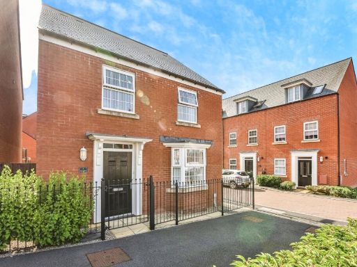 4 bedroom detached house for sale in Hayes Drive, WELLS, Somerset, BA5 — £475,000 • 4 bed • 2 bath • 1488 ft²
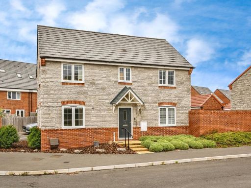 4 bedroom detached house for sale in Horrington Hill Close, Haybridge, Wells, Somerset, BA5 — £500,000 • 4 bed • 2 bath • 1208 ft²
 3 bedroom semi-detached house for sale in Wookey Hole Road, Wells, BA5 — £375,000 • 3 bed • 2 bath • 925 ft²
 3 bedroom semi-detached house for sale in Feltham Close, Wells, BA5 — £350,000 • 3 bed • 2 bath • 1110 ft²
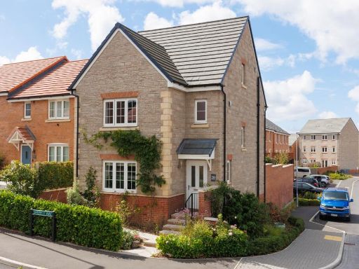 4 bedroom detached house for sale in Ebbor Gorge Road, Wells, BA5 — £400,000 • 4 bed • 3 bath • 1215 ft²
Meta
- {
"@context": "https://schema.org",
"@type": "Residence",
"name": "4 bedroom detached house for sale in Wookey Hole Road, Well…",
"description": "",
"url": "https://propertypiper.co.uk/property/d91ea36b-85bb-4c2b-923f-aec9100f4c47",
"image": "https://image-a.propertypiper.co.uk/fe55f787-1f09-4468-bebb-3e4708ecbd38-1024.jpeg",
"address": {
"@type": "PostalAddress",
"streetAddress": "141, WOOKEY HOLE ROAD",
"postalCode": "BA5 2NG",
"addressLocality": "Mendip",
"addressRegion": "Wells",
"addressCountry": "England"
},
"geo": {
"@type": "GeoCoordinates",
"latitude": 51.21656268569126,
"longitude": -2.665145376827277
},
"numberOfRooms": 4,
"numberOfBathroomsTotal": 2,
"floorSize": {
"@type": "QuantitativeValue",
"value": 1051,
"unitCode": "FTK"
},
"offers": {
"@type": "Offer",
"price": 520000,
"priceCurrency": "GBP",
"availability": "https://schema.org/InStock"
},
"additionalProperty": [
{
"@type": "PropertyValue",
"name": "Feature",
"value": "modern"
},
{
"@type": "PropertyValue",
"name": "Feature",
"value": "detached"
},
{
"@type": "PropertyValue",
"name": "Feature",
"value": "brick"
},
{
"@type": "PropertyValue",
"name": "Feature",
"value": "two-story"
},
{
"@type": "PropertyValue",
"name": "Feature",
"value": "symmetrical"
},
{
"@type": "PropertyValue",
"name": "Feature",
"value": "sash windows"
},
{
"@type": "PropertyValue",
"name": "Feature",
"value": "pitched roof"
},
{
"@type": "PropertyValue",
"name": "Feature",
"value": "chimney"
},
{
"@type": "PropertyValue",
"name": "Feature",
"value": "semi-detached"
},
{
"@type": "PropertyValue",
"name": "Feature",
"value": "modern"
},
{
"@type": "PropertyValue",
"name": "Feature",
"value": "brick exterior"
},
{
"@type": "PropertyValue",
"name": "Feature",
"value": "two-story"
},
{
"@type": "PropertyValue",
"name": "Feature",
"value": "front garden"
},
{
"@type": "PropertyValue",
"name": "Feature",
"value": "residential area"
}
]
}
High Res Floorplan Images
Compatible Floorplan Images
FloorplanImages Thumbnail