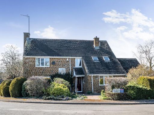
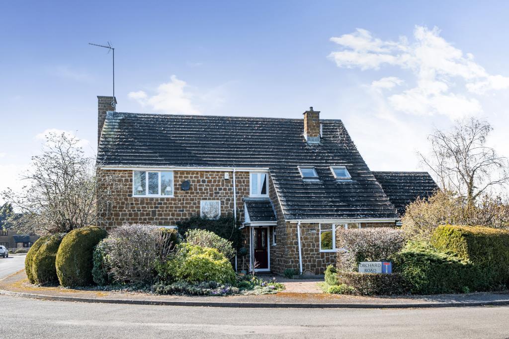
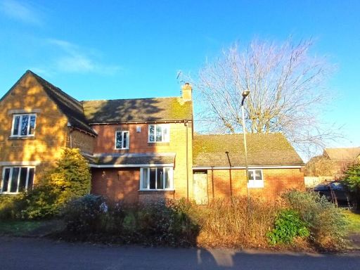
OX15 5LX - 4 bedroom detached house for sale in Hook Norton, Oxfordshi…
View on Property Piper
4 bedroom detached house for sale in Hook Norton, Oxfordshire, OX15
Property Details
- Price: £750000
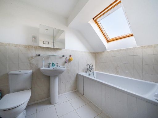
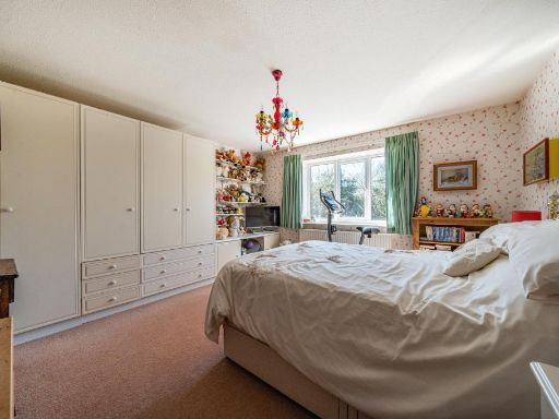
- Bedrooms: 4
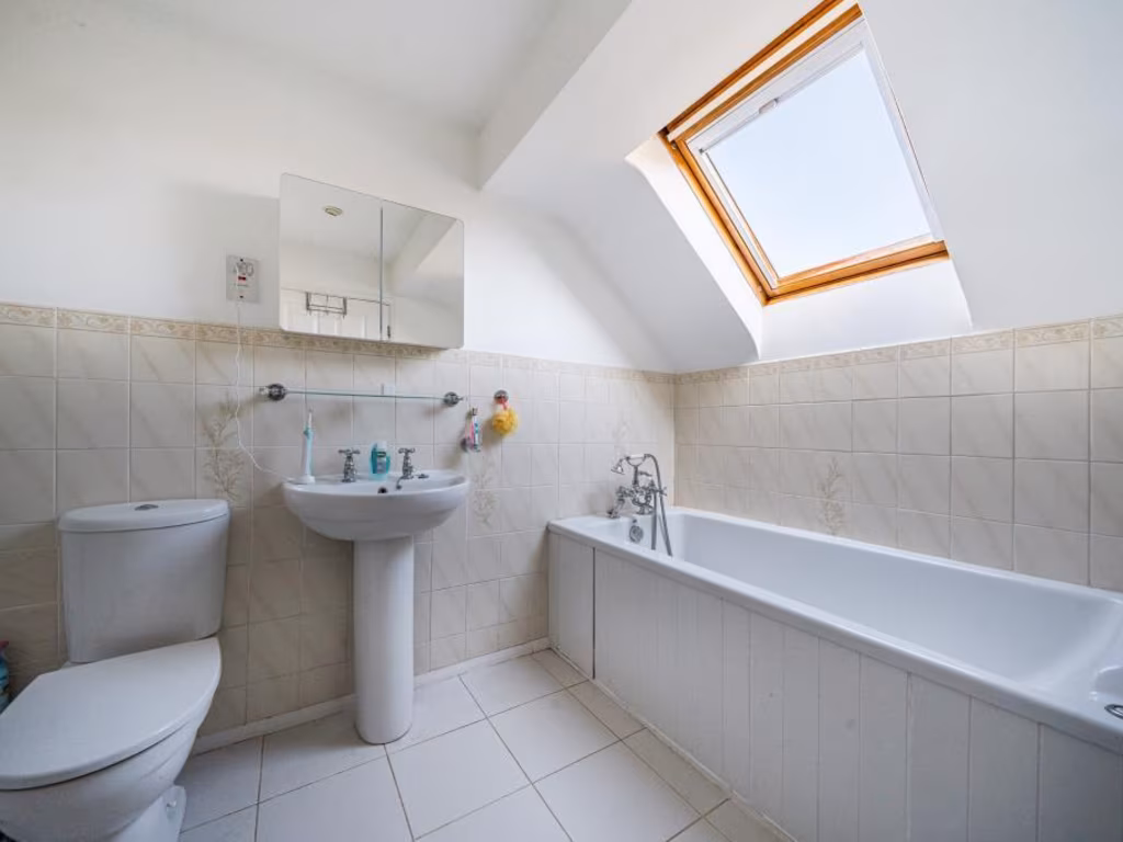
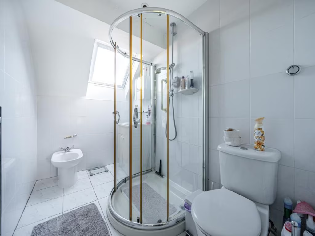
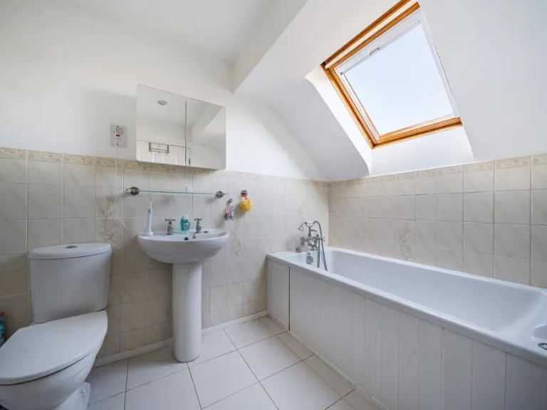
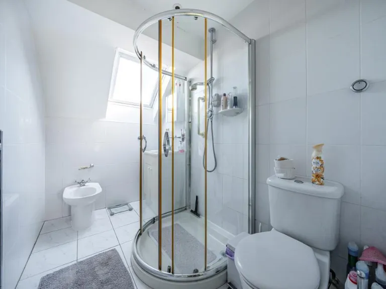
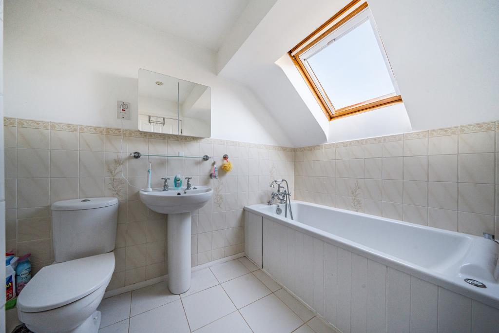
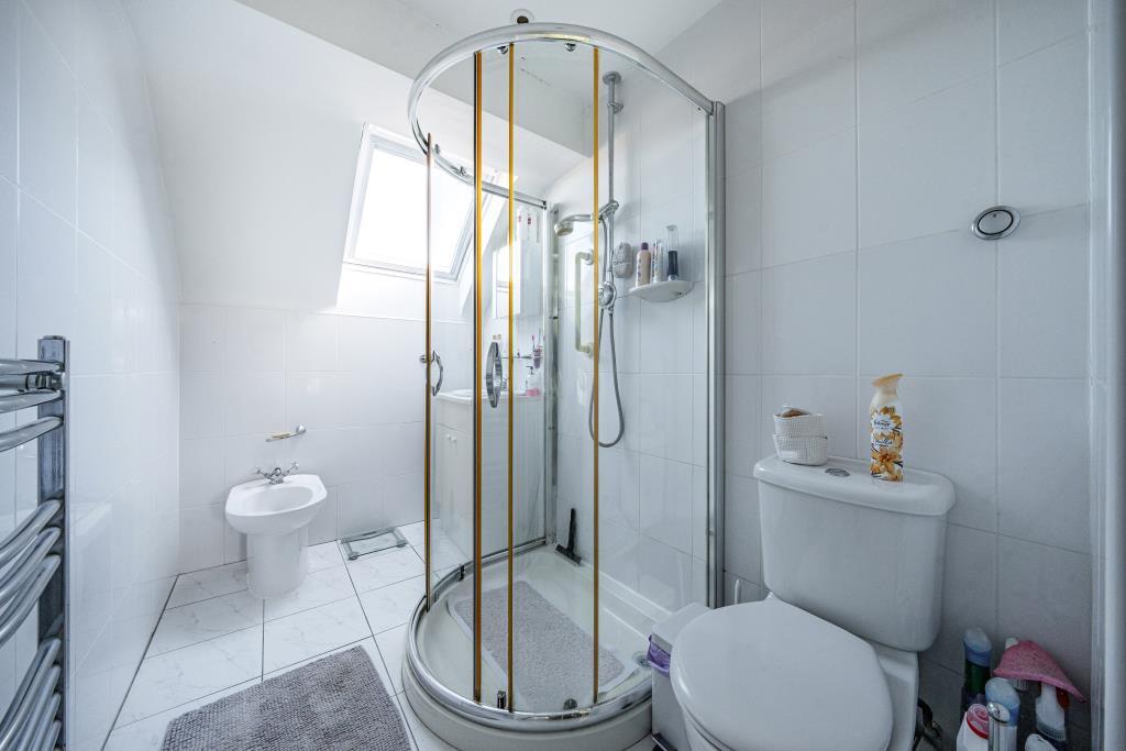
- Bathrooms: 2
- Property Type: undefined
- Property SubType: undefined
Image Descriptions
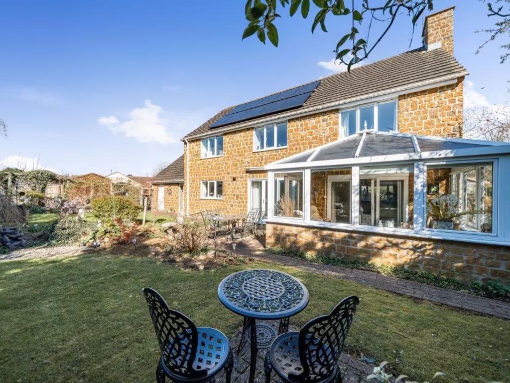
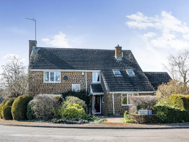
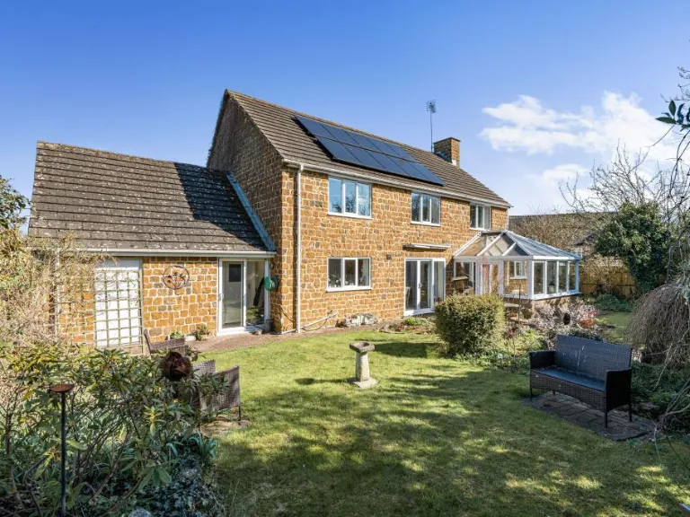
- detached house Post-war
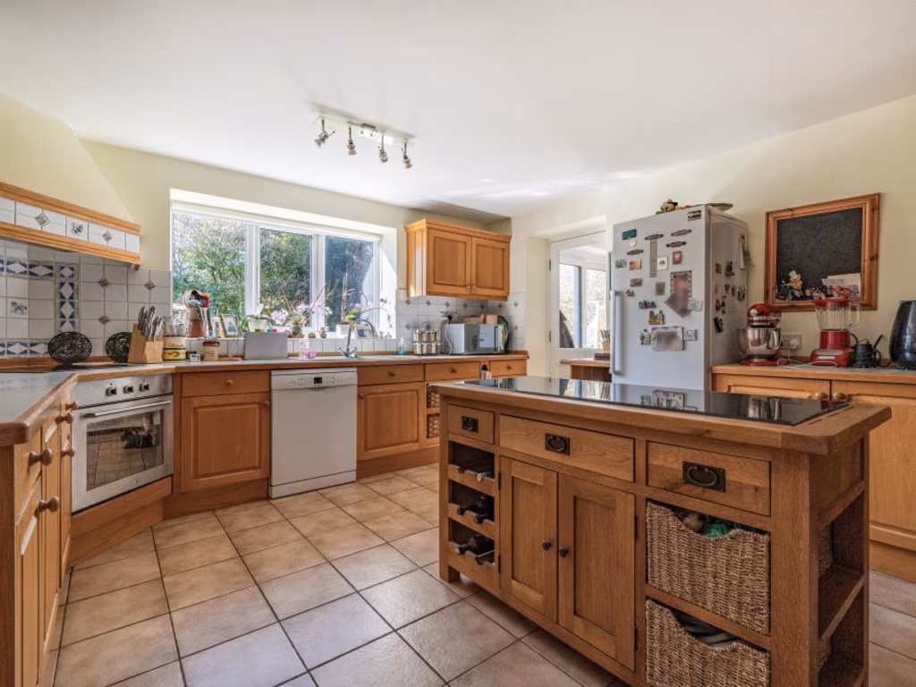
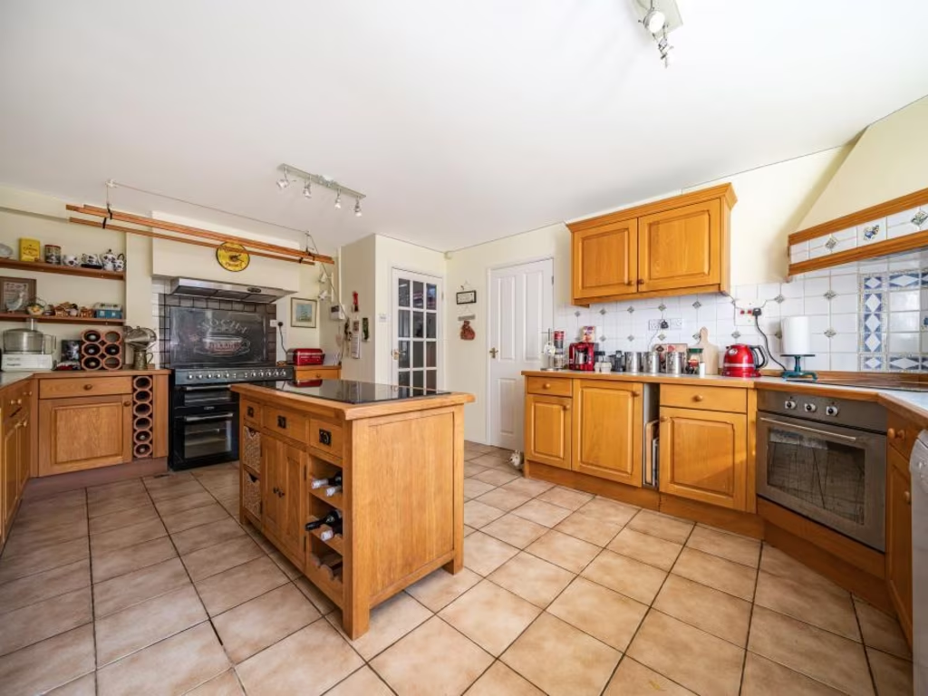
- kitchen traditional
Floorplan Description
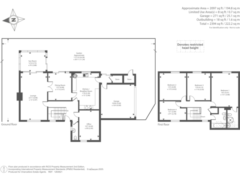
- Two-storey house with ground-floor living and first-floor bedrooms
Rooms
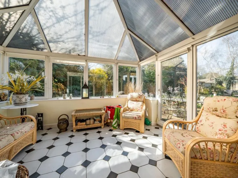
- Sun Room:
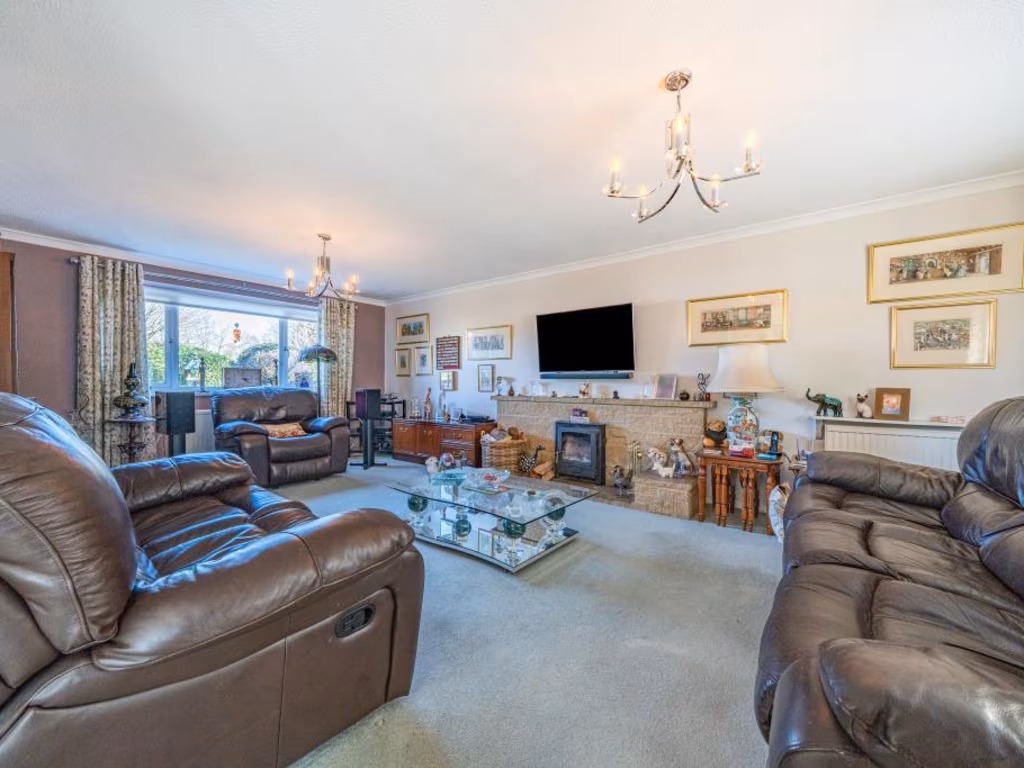
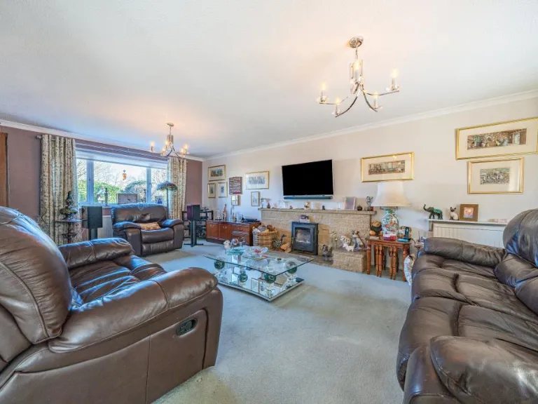
- Lounge:
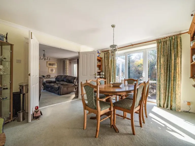
- Dining Room:
- Kitchen / Breakfast Room:
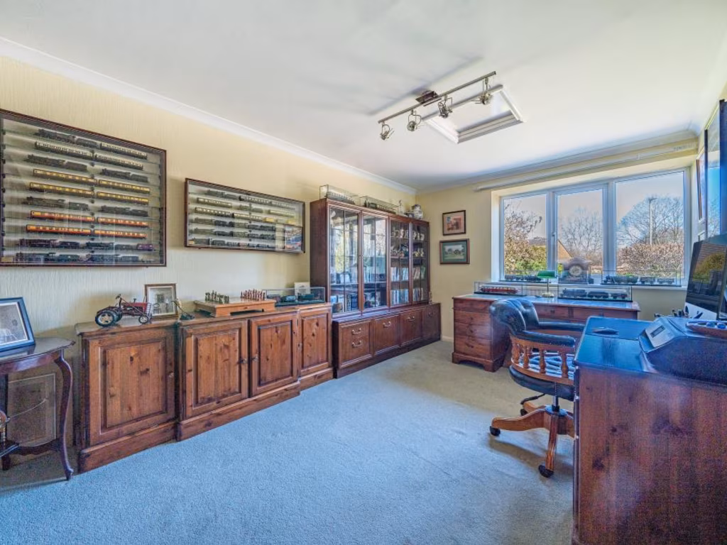
- Office:
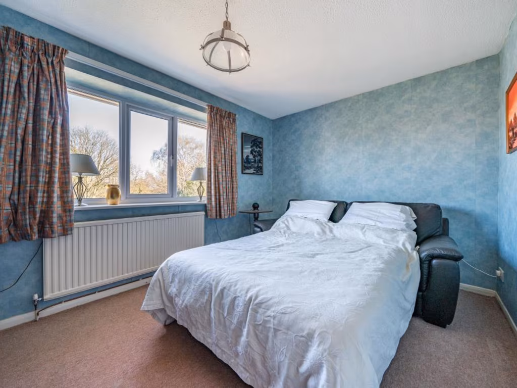
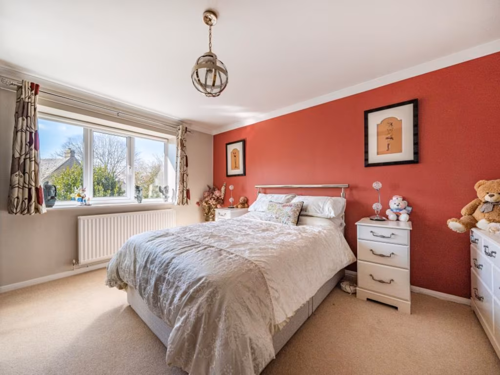
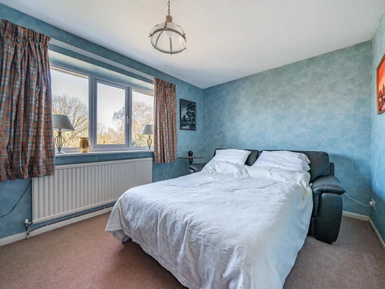
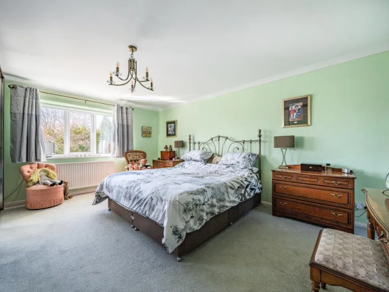
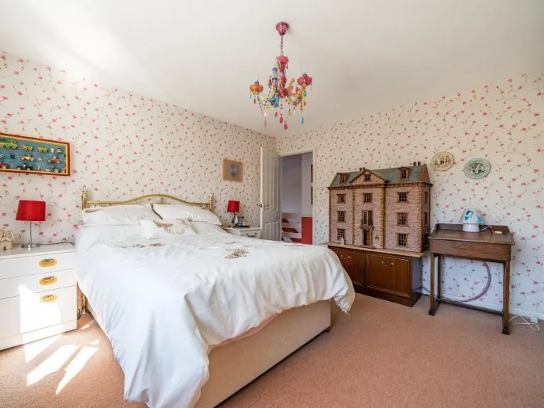
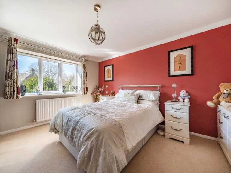
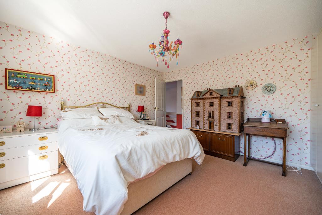
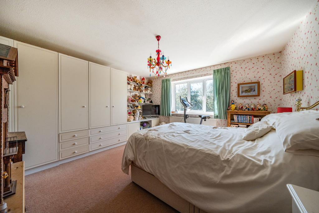
- Bedroom 1:
- Bedroom 2:
- Bedroom 3:
- Bedroom 4:
Textual Property Features
Detected Visual Features
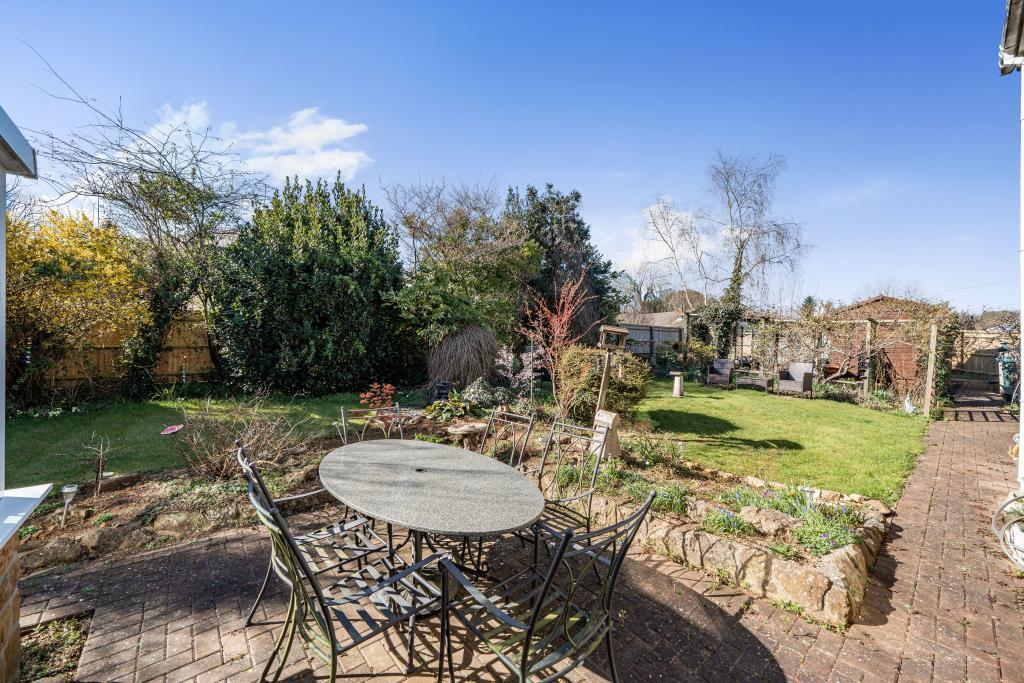
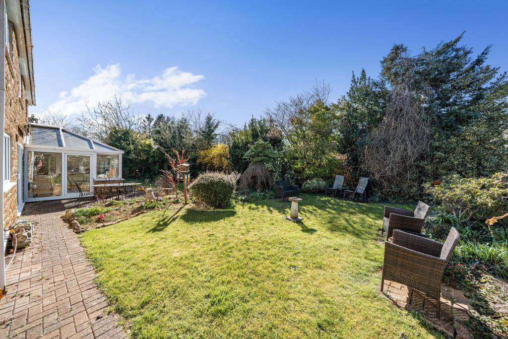
- detached
- Post-war
- sloped roof
- gable roof
- skylights
- brickwork
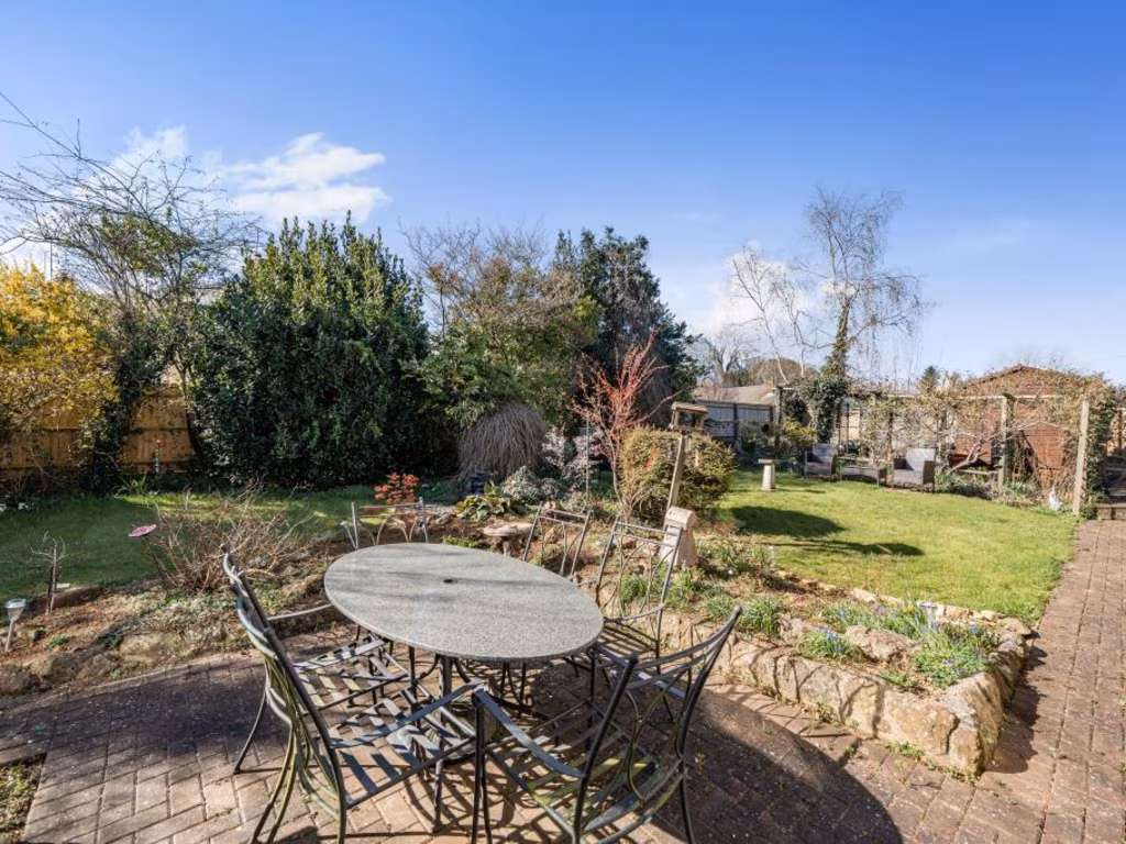
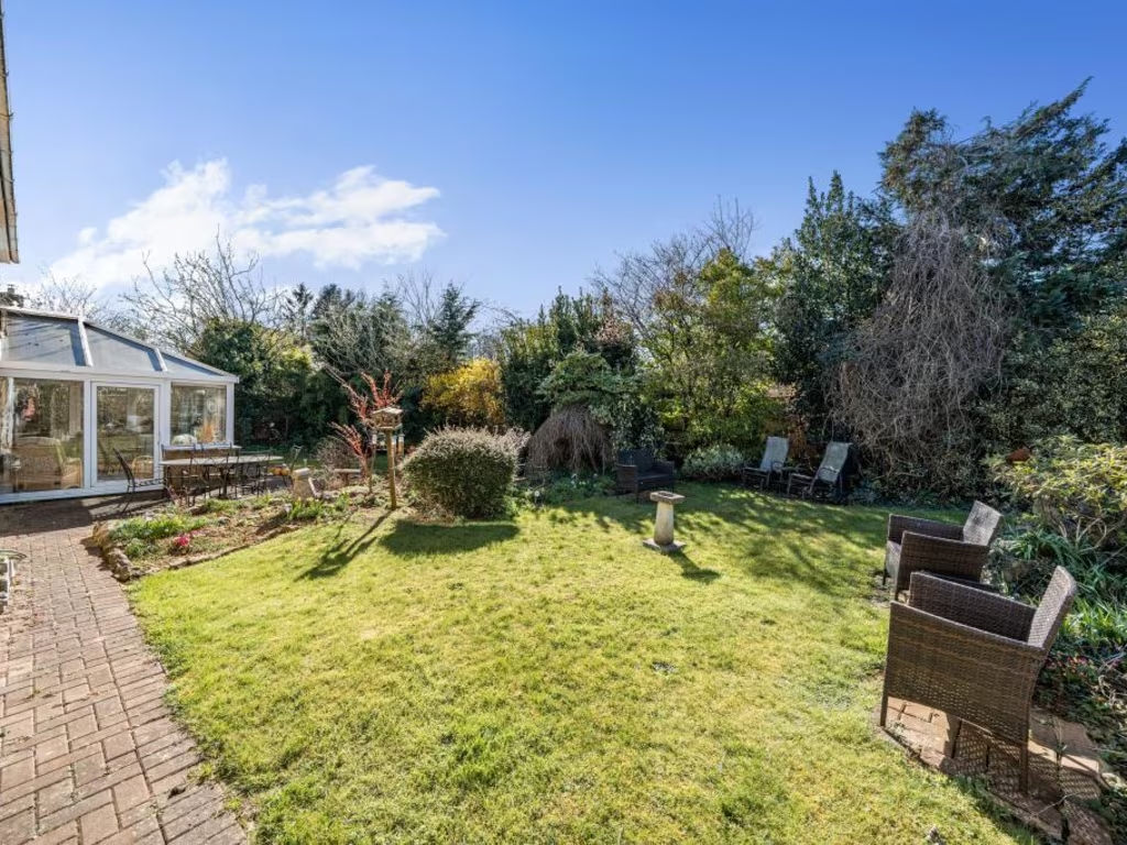
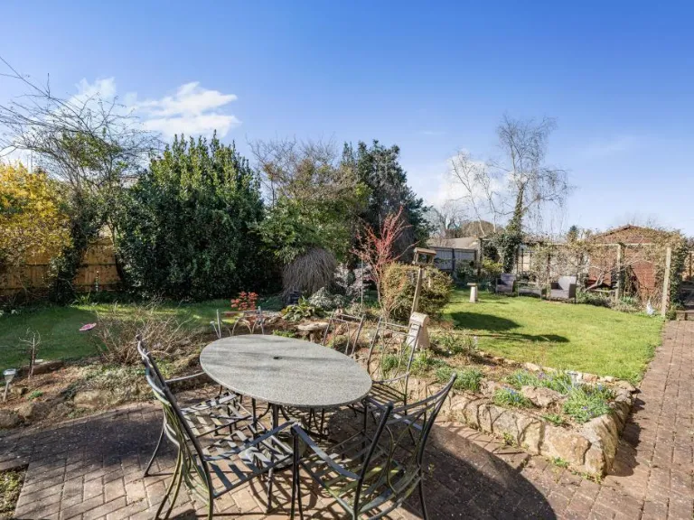
- garden
- chimney
- modernized
- family home
- suburban
- kitchen
- wooden cabinetry
- tile flooring
- traditional style
- natural light
EPC Details
- Fully double glazed
- Cavity wall, as built, partial insulation (assumed)
- Boiler and radiators, oil
- Low energy lighting in 26% of fixed outlets
- Solid, no insulation (assumed)
Nearby Schools
- The Warriner School
- Wroxton Church of England Primary School
- Brailes Church of England Primary School
- Chipping Norton School
- Holy Trinity Catholic School, Chipping Norton
- Great Rollright Church of England (Aided) Primary School
- Acorns Primary School
- Bloxham School
- St Mary's Church of England (Aided) Primary School, Chipping Norton
- Hook Norton Church of England Primary School
- Sibford Gower Endowed Primary School
- Bishop Carpenter Church of England Primary School
- Bloxham Church of England Primary School
- Sibford School
- Great Tew County Primary School
Nearest Bars And Restaurants
- Id: 2290485598
- Tags:
- Amenity: pub
- Name: The Boxing Hare
- TagsNormalized:
- Lat: 51.9752918
- Lon: -1.4421074
- FullGeoHash: gcnzxjvfh2wu
- PartitionGeoHash: gcnz
- Images:
- FoodStandards: null
- Distance: 3674.1
,- Id: 752901285
- Tags:
- Amenity: pub
- Name: The White Swan
- Source: OS_OpenData_StreetView
- Source:name: NaPTAN
- TagsNormalized:
- Lat: 51.9982829
- Lon: -1.4373806
- FullGeoHash: gcnzz3crfw7r
- PartitionGeoHash: gcnz
- Images:
- FoodStandards: null
- Distance: 2740.7
,- Id: 767478255
- Tags:
- Amenity: pub
- Name: The Gate Hangs High
- Operator: Hook Norton Brewery
- Source: local_knowledge
- TagsNormalized:
- Lat: 52.011464
- Lon: -1.4844107
- FullGeoHash: gcnzyhrhdxx5
- PartitionGeoHash: gcnz
- Images:
- FoodStandards: null
- Distance: 1339.9
,- Id: 767478269
- Tags:
- Amenity: pub
- Name: The Pear Tree
- Operator: Hook Norton Brewery
- Source: local_knowledge
- TagsNormalized:
- Lat: 51.9963504
- Lon: -1.4906252
- FullGeoHash: gcnzy1ds9yjr
- PartitionGeoHash: gcnz
- Images:
- FoodStandards: null
- Distance: 1010.3
,- Id: 204921261
- Tags:
- Amenity: pub
- Building: yes
- Name: The Sun Inn
- Operator: Hook Norton Brewery
- Source: local_knowledge
- TagsNormalized:
- Lat: 51.9949948
- Lon: -1.4838361
- FullGeoHash: gcnzy1rsb1e9
- PartitionGeoHash: gcnz
- Images:
- FoodStandards: null
- Distance: 735.6
}
Nearest General Shops
- Id: 3105758683
- Tags:
- Name: Firs Garage
- Shop: car
- TagsNormalized:
- Lat: 52.0103076
- Lon: -1.491945
- FullGeoHash: gcnzyh1w50j1
- PartitionGeoHash: gcnz
- Images:
- FoodStandards: null
- Distance: 1503.2
,- Id: 204921767
- Tags:
- Addr:
- Housename: Visitor Centre
- Postcode: OX15 5NY
- Street: Brewery Lane
- Building: yes
- Name: Hook Norton Brewery Shop
- Shop: alcohol
- Tourism: attraction
- Website: https://www.hooky.co.uk/
- TagsNormalized:
- brewery
- shop
- alcohol
- attraction
- tourism
- Lat: 51.9966196
- Lon: -1.493575
- FullGeoHash: gcnzy18qm0mv
- PartitionGeoHash: gcnz
- Images:
- FoodStandards: null
- Distance: 1185.4
,- Id: 1119328974
- Tags:
- Addr:
- City: Banbury
- Postcode: OX15 5NQ
- Amenity: post_office
- Brand: Post Office
- Brand:wikidata: Q1783168
- Building: yes
- Name: The Village Shop
- Source: survey
- Website: https://www.postoffice.co.uk/branch-finder/3981371/hook-norton
- TagsNormalized:
- Lat: 51.9957406
- Lon: -1.4830005
- FullGeoHash: gcnzy3815sdd
- PartitionGeoHash: gcnz
- Images:
- FoodStandards: null
- Distance: 635
}
Nearest Grocery shops
- Id: 891007986
- Tags:
- TagsNormalized:
- Lat: 52.0154449
- Lon: -1.37718
- FullGeoHash: gcppbtj5vmsn
- PartitionGeoHash: gcpp
- Images:
- FoodStandards: null
- Distance: 7057.6
,- Id: 887291014
- Tags:
- Brand: Waitrose
- Brand:wikidata: Q771734
- Brand:wikipedia: en:Waitrose
- Building: yes
- Name: Waitrose
- Shop: convenience
- Source:
- TagsNormalized:
- Lat: 51.9514398
- Lon: -1.5250047
- FullGeoHash: gcnzt33x0f61
- PartitionGeoHash: gcnz
- Images:
- FoodStandards: null
- Distance: 6334.6
,- Id: 993468925
- Tags:
- Addr:
- City: Sibford Ferris
- Housenumber: 1
- Postcode: OX15 5RG
- Street: Main Street
- Brand: Londis
- Brand:wikidata: Q21008564
- Brand:wikipedia: en:Londis (United Kingdom)
- Building: yes
- Name: Londis
- Shop: convenience
- Website: https://www.londis.co.uk/our-stores/londis-banbury
- TagsNormalized:
- Lat: 52.0340942
- Lon: -1.4778453
- FullGeoHash: gcqbn2ebednw
- PartitionGeoHash: gcqb
- Images:
- FoodStandards: null
- Distance: 3764.6
}
Nearest Religious buildings
- Id: 136287464
- Tags:
- Amenity: community_centre
- Building: hall
- Name: Church Hall
- TagsNormalized:
- community centre
- church
- church hall
- Lat: 51.9952109
- Lon: -1.4864035
- FullGeoHash: gcnzy1mwh3c4
- PartitionGeoHash: gcnz
- Images:
- FoodStandards: null
- Distance: 837.9
,- Id: 136287480
- Tags:
- Amenity: place_of_worship
- Building: church
- Denomination: anglican
- Name: Saint Peter
- Religion: christian
- Source:
- Geometry: Bing
- Name: wikipedia
- Wikidata: Q17528242
- TagsNormalized:
- place of worship
- church
- anglican
- christian
- Lat: 51.9954434
- Lon: -1.4842175
- FullGeoHash: gcnzy1rprjpj
- PartitionGeoHash: gcnz
- Images:
- FoodStandards: null
- Distance: 713.8
,- Id: 136287468
- Tags:
- Addr:
- Postcode: OX15 5JS
- Street: Sibford Road
- Amenity: school
- Capacity: 315
- Denomination: anglican
- Diocese: Diocese of Oxford
- Isced:
- Max_age: 11
- Min_age: 3
- Name: Hook Norton Church of England Primary School
- Phone: +44 1608 737379
- Ref:
- Religion: christian
- School:
- Boarding: no
- Gender: mixed
- Selective: no
- Trust: no
- Type: voluntary_controlled
- Website: https://www.hook-norton.oxon.sch.uk/
- Wikidata: Q66226970
- TagsNormalized:
- school
- anglican
- church
- christian
- Lat: 52.0005348
- Lon: -1.481514
- FullGeoHash: gcnzy63jn4r0
- PartitionGeoHash: gcnz
- Images:
- FoodStandards: null
- Distance: 291.1
}
Nearest Medical buildings
- Id: 415081498
- Tags:
- Amenity: hospital
- Emergency: no
- Healthcare: hospital
- Name: Chipping Norton War Memorial Community Hospital
- Operator: Oxford Health NHS Trust
- TagsNormalized:
- Lat: 51.9447793
- Lon: -1.5365102
- FullGeoHash: gcnzt030k8wy
- PartitionGeoHash: gcnz
- Images:
- FoodStandards: null
- Distance: 7381.6
,- Id: 4161522285
- Tags:
- Access: customers
- Amenity: parking
- Fee: no
- Name: Chipping Norton Health Centre
- Parking: surface
- TagsNormalized:
- Lat: 51.945348
- Lon: -1.5357468
- FullGeoHash: gcnzt03ewd8n
- PartitionGeoHash: gcnz
- Images:
- FoodStandards: null
- Distance: 7300
,- Id: 885885177
- Tags:
- Addr:
- City: Chipping Norton
- Postcode: OX7 5FA
- Street: Russell Way
- Amenity: doctors
- Healthcare: doctor
- Name: Chipping Norton Health Centre
- TagsNormalized:
- doctor
- doctors
- health
- healthcare
- health centre
- Lat: 51.9455917
- Lon: -1.5353265
- FullGeoHash: gcnzt06j021s
- PartitionGeoHash: gcnz
- Images:
- FoodStandards: null
- Distance: 7261.6
,- Id: 3105742709
- Tags:
- Amenity: dentist
- Healthcare: dentist
- Name: Lion House Dental Practise
- TagsNormalized:
- dentist
- health
- healthcare
- dental
- Lat: 51.9960147
- Lon: -1.4822676
- FullGeoHash: gcnzy38dsxtj
- PartitionGeoHash: gcnz
- Images:
- FoodStandards: null
- Distance: 580.4
}
Nearest Leisure Facilities
- Id: 736239712
- Tags:
- Leisure: pitch
- Sport: soccer
- TagsNormalized:
- Lat: 51.9987109
- Lon: -1.4883454
- FullGeoHash: gcnzy4h4rn30
- PartitionGeoHash: gcnz
- Images:
- FoodStandards: null
- Distance: 775.8
,- Id: 796285212
- Tags:
- TagsNormalized:
- Lat: 51.9963521
- Lon: -1.4858219
- FullGeoHash: gcnzy1wh9ydc
- PartitionGeoHash: gcnz
- Images:
- FoodStandards: null
- Distance: 726.7
,- Id: 736239710
- Tags:
- Leisure: pitch
- Sport: cricket
- TagsNormalized:
- pitch
- leisure
- cricket
- sports
- Lat: 51.9986428
- Lon: -1.4875708
- FullGeoHash: gcnzy4hf11df
- PartitionGeoHash: gcnz
- Images:
- FoodStandards: null
- Distance: 726
,- Id: 736239709
- Tags:
- Leisure: pitch
- Sport: soccer
- TagsNormalized:
- Lat: 52.0001519
- Lon: -1.486846
- FullGeoHash: gcnzy4m6cfzk
- PartitionGeoHash: gcnz
- Images:
- FoodStandards: null
- Distance: 654.4
,- Id: 736239705
- Tags:
- Leisure: pitch
- Sport: tennis
- TagsNormalized:
- Lat: 51.9994019
- Lon: -1.4866434
- FullGeoHash: gcnzy4jqqxn6
- PartitionGeoHash: gcnz
- Images:
- FoodStandards: null
- Distance: 647.2
}
Nearest Tourist attractions
- Id: 3350463939
- Tags:
- Addr:
- City: Swerford, Chipping Norton
- Postcode: OX7 4BN
- Name: Heath Farm Holiday Cottages
- Tourism: apartment
- Website: http://heathfarm.com/
- TagsNormalized:
- farm
- heath
- apartments
- tourism
- Lat: 51.9846483
- Lon: -1.4304363
- FullGeoHash: gcnzxrw2s2v6
- PartitionGeoHash: gcnz
- Images:
- FoodStandards: null
- Distance: 3646.5
,- Id: 752901531
- Tags:
- Name: Wigginton Waterfowl Sanctuary
- Source: OS_OpenData_StreetView
- Tourism: attraction
- TagsNormalized:
- Lat: 52.0052712
- Lon: -1.4416481
- FullGeoHash: gcnzz5q0xjjq
- PartitionGeoHash: gcnz
- Images:
- FoodStandards: null
- Distance: 2503.1
,- Id: 752063401
- Tags:
- Building: brewery
- Craft: brewery
- Landuse: industrial
- Name: Hook Norton Brewery
- Source: survey
- Tourism: attraction
- Website: http://www.hooknortonbrewery.co.uk
- Wikidata: Q26298422
- TagsNormalized:
- brewery
- industrial
- attraction
- tourism
- Lat: 51.9968959
- Lon: -1.4942152
- FullGeoHash: gcnzvcxzy7bm
- PartitionGeoHash: gcnz
- Images:
- FoodStandards: null
- Distance: 1217
}
Nearest Train stations
- Id: 1494376631
- Tags:
- Name: Heyford
- Naptan:
- Network: National Rail
- Public_transport: station
- Railway: station
- Ref:
- Wikidata: Q2075758
- Wikipedia: en:Heyford railway station
- TagsNormalized:
- Lat: 51.9185846
- Lon: -1.2994468
- FullGeoHash: gcpp67mz8twh
- PartitionGeoHash: gcpp
- Images:
- FoodStandards: null
- Distance: 15196.5
,- Id: 6609023834
- Tags:
- Name: Kingham
- Naptan:
- Network: National Rail
- Operator: GWR
- Public_transport: station
- Railway: station
- Ref:
- Wikidata: Q2183686
- Wikipedia: en:Kingham railway station
- TagsNormalized:
- Lat: 51.9024116
- Lon: -1.628532
- FullGeoHash: gcnz6bw1kqy9
- PartitionGeoHash: gcnz
- Images:
- FoodStandards: null
- Distance: 15025.5
,- Id: 6609023827
- Tags:
- Name: Charlbury
- Naptan:
- Network: National Rail
- Operator: Great Western Railway
- Platforms: 2
- Public_transport: station
- Railway: station
- Ref:
- Wheelchair: yes
- Wikidata: Q2779541
- Wikipedia: en:Charlbury railway station
- TagsNormalized:
- Lat: 51.8723271
- Lon: -1.4897686
- FullGeoHash: gcnzn554jys5
- PartitionGeoHash: gcnz
- Images:
- FoodStandards: null
- Distance: 14248.9
,- Id: 1766559047
- Tags:
- Name: King's Sutton
- Naptan:
- Network: National Rail
- Operator: Chiltern Railways
- Public_transport: station
- Railway: station
- Ref:
- Wheelchair: limited
- Wikidata: Q1956571
- Wikipedia: en:Kings Sutton railway station
- TagsNormalized:
- Lat: 52.0210915
- Lon: -1.2809729
- FullGeoHash: gcppfy5hz4m6
- PartitionGeoHash: gcpp
- Images:
- FoodStandards: null
- Distance: 13634.8
,- Id: 6634463841
- Tags:
- Name: Banbury
- Naptan:
- Network: National Rail
- Public_transport: station
- Railway: station
- Ref:
- Source: NPE
- Wheelchair: yes
- Wikidata: Q2092204
- Wikipedia: en:Banbury railway station
- TagsNormalized:
- Lat: 52.0605712
- Lon: -1.3277563
- FullGeoHash: gcr01v34v1c5
- PartitionGeoHash: gcr0
- Images:
- FoodStandards: null
- Distance: 12233.3
}
Nearest Hotels
- Id: 349320682
- Tags:
- Building: yes
- Name: Crowne Plaza Heythrop Park
- Tourism: hotel
- TagsNormalized:
- Lat: 51.9346721
- Lon: -1.4736877
- FullGeoHash: gcnzqqqvksdf
- PartitionGeoHash: gcnz
- Images:
- FoodStandards: null
- Distance: 7295
,- Id: 349300433
- Tags:
- Building: yes
- Name: Heythrop Park Resort
- Tourism: hotel
- Wikidata: Q5749809
- Wikipedia: en:Heythrop Park
- TagsNormalized:
- Lat: 51.9352631
- Lon: -1.4720923
- FullGeoHash: gcnzqw80cf8r
- PartitionGeoHash: gcnz
- Images:
- FoodStandards: null
- Distance: 7233.8
,- Id: 4530301231
- Tags:
- Addr:
- City: Chipping Norton
- Housename: Cotswolds Hotel & Spa Southcombe Chipping Norton Oxon OX7 5QH
- Postcode: OX7 5QH
- Name: Cotswold Hotel & Spa
- Tourism: hotel
- TagsNormalized:
- Lat: 51.9411183
- Lon: -1.5131317
- FullGeoHash: gcnzmxd4vqpp
- PartitionGeoHash: gcnz
- Images:
- FoodStandards: null
- Distance: 7017.6
}
Tags
- detached
- Post-war
- sloped roof
- gable roof
- skylights
- brickwork
- garden
- chimney
- modernized
- family home
- suburban
- kitchen
- wooden cabinetry
- tile flooring
- traditional style
- natural light
Local Market Stats
- Average Price/sqft: £352
- Avg Income: £56100
- Rental Yield: 3.7%
- Social Housing: 7%
- Planning Success Rate: 85%
AirBnB Data
- 1km average: £110/night
- Listings in 1km: 3
Similar Properties
 4 bedroom detached house for sale in Old School End, Hook Norton, OX15 — £595,000 • 4 bed • 2 bath • 1716 ft²
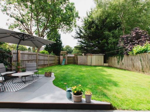 4 bedroom detached house for sale in Orchard Road, Hook Norton, OX15 — £540,000 • 4 bed • 2 bath • 1265 ft²
 4 bedroom detached house for sale in Goldings Road, Hook Norton, Banbury, Oxfordshire, OX15 — £525,000 • 4 bed • 2 bath • 1363 ft²
 4 bedroom detached house for sale in Ironstone Hollow, Hook Norton, Banbury, OX15 — £650,000 • 4 bed • 2 bath • 1265 ft²
 4 bedroom semi-detached house for sale in Hook Norton, Oxfordshire, OX15 — £450,000 • 4 bed • 2 bath • 1535 ft²
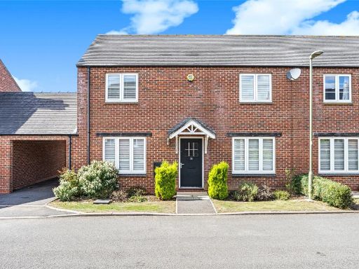 3 bedroom semi-detached house for sale in Goldings Road, Hook Norton, Banbury, Oxfordshire, OX15 — £385,000 • 3 bed • 1 bath • 1012 ft²
Meta
- {
"@context": "https://schema.org",
"@type": "Residence",
"name": "4 bedroom detached house for sale in Hook Norton, Oxfordshi…",
"description": "",
"url": "https://propertypiper.co.uk/property/d3058bfd-8c4e-4f30-9316-438c4a33051b",
"image": "https://image-a.propertypiper.co.uk/5315e075-caa9-494d-b637-2b0dc0688da8-1024.jpeg",
"address": {
"@type": "PostalAddress",
"streetAddress": "10 ORCHARD ROAD HOOK NORTON BANBURY",
"postalCode": "OX15 5LX",
"addressLocality": "Cherwell",
"addressRegion": "Banbury",
"addressCountry": "England"
},
"geo": {
"@type": "GeoCoordinates",
"latitude": 52.00023973260969,
"longitude": -1.4772885768943143
},
"numberOfRooms": 4,
"numberOfBathroomsTotal": 2,
"floorSize": {
"@type": "QuantitativeValue",
"value": 2394,
"unitCode": "FTK"
},
"offers": {
"@type": "Offer",
"price": 750000,
"priceCurrency": "GBP",
"availability": "https://schema.org/InStock"
},
"additionalProperty": [
{
"@type": "PropertyValue",
"name": "Feature",
"value": "detached"
},
{
"@type": "PropertyValue",
"name": "Feature",
"value": "Post-war"
},
{
"@type": "PropertyValue",
"name": "Feature",
"value": "sloped roof"
},
{
"@type": "PropertyValue",
"name": "Feature",
"value": "gable roof"
},
{
"@type": "PropertyValue",
"name": "Feature",
"value": "skylights"
},
{
"@type": "PropertyValue",
"name": "Feature",
"value": "brickwork"
},
{
"@type": "PropertyValue",
"name": "Feature",
"value": "garden"
},
{
"@type": "PropertyValue",
"name": "Feature",
"value": "chimney"
},
{
"@type": "PropertyValue",
"name": "Feature",
"value": "modernized"
},
{
"@type": "PropertyValue",
"name": "Feature",
"value": "family home"
},
{
"@type": "PropertyValue",
"name": "Feature",
"value": "suburban"
},
{
"@type": "PropertyValue",
"name": "Feature",
"value": "kitchen"
},
{
"@type": "PropertyValue",
"name": "Feature",
"value": "wooden cabinetry"
},
{
"@type": "PropertyValue",
"name": "Feature",
"value": "tile flooring"
},
{
"@type": "PropertyValue",
"name": "Feature",
"value": "traditional style"
},
{
"@type": "PropertyValue",
"name": "Feature",
"value": "natural light"
}
]
}
High Res Floorplan Images
Compatible Floorplan Images
FloorplanImages Thumbnail